Search Results : “York Moors”

Oct 072023


First published in: The Times Click here to view a map for this walk in a new window
Helmsley Moor track through the forest on Helmsley Moor track on Helmsley Moor Heather, bilberry and lone pine on Helmsley Moor sombre colours of Rievaulx Moor North York Moors near Rievaulx views to Cold Moor and Cringle Bank from the rim of Rievaulx Bank

Who’d have guessed it? – another in a succession of beautiful sunny days over the North York Moors, a breeze to cool our brows, and the prospect of sensational views from the edge of the moors.

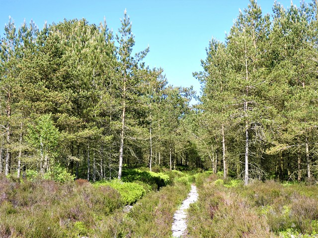
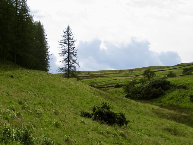
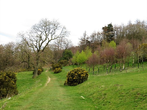
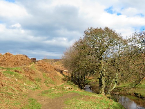
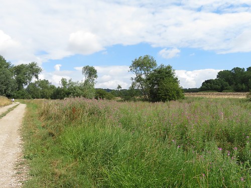
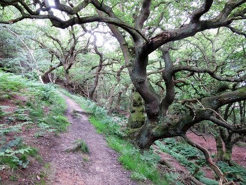
In Newgate Bank forest the larches drooped in the sunshine and the silver birch leaves shivered in their millions. Forget-me-nots and speedwell dotted the grassy verges of this track with blue. Clover and yellow rattle showed where old hay meadows had been before the conifer plantations gobbled them up.

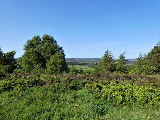
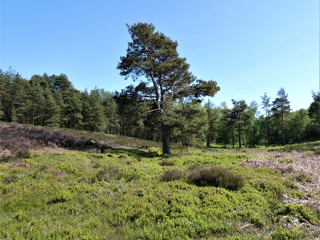
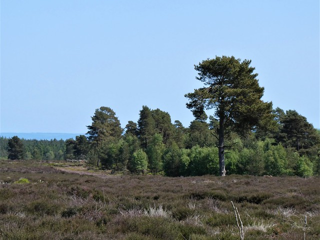
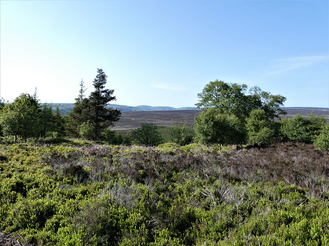
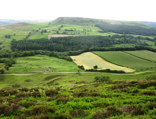
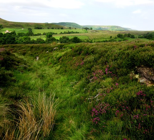
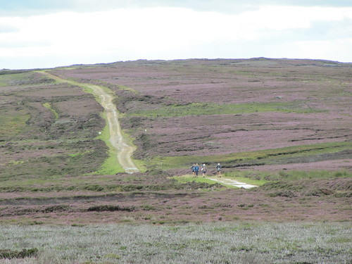
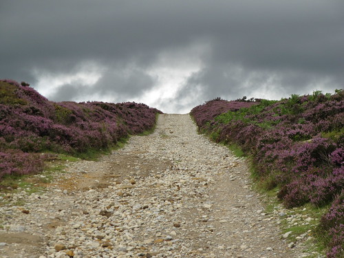
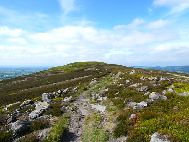
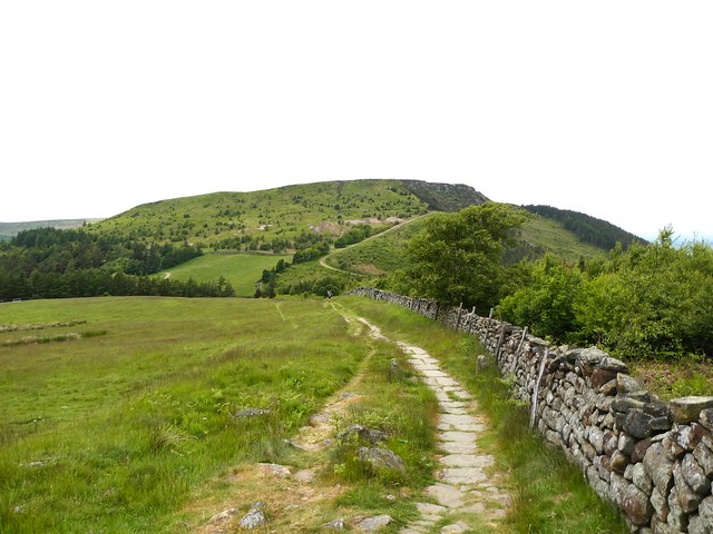
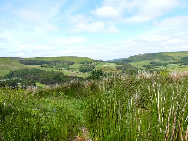
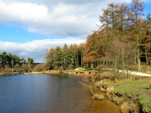
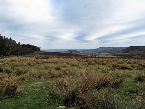
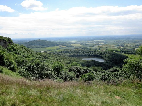
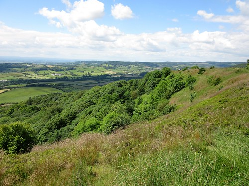
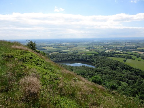
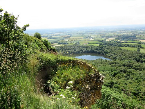
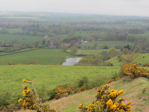
A gate led onto open moorland, a wide spread of heather whose sombre brown was just beginning to blush with purple. The unbroken blue of the sky fitted over Rievaulx Moor like a lid, the moor itself rimmed by the dark green of dense plantations.

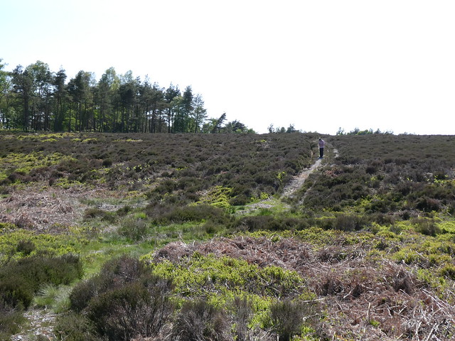
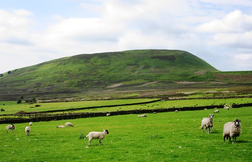
Grouse butts stood in orderly ranks in the heather. A red grouse sprang up under our feet and clattered off with a panicky shriek, while her chick, an impossibly sweet-looking ball of fluff, went scuttling away into the shelter of the tough old heather sprigs.

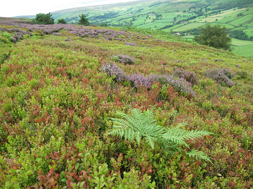
Patches of heather had been burned to black wires, but in among the muted hues of the moor and its dark brown peat soil, bright green patches of bilberry and the nodding white heads of bog cotton made a cheerful contrast.

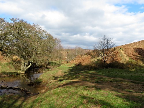
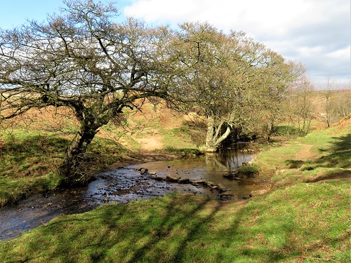
We turned aside across a shallow ravine at the edge of Helmsley Moor, where water scouring had unearthed the burnt orange colour of the iron-rich sandstone underlying peat and heather. Black wood ants went scurrying across the stony track, intent on unfathomable projects in their inscrutable way.

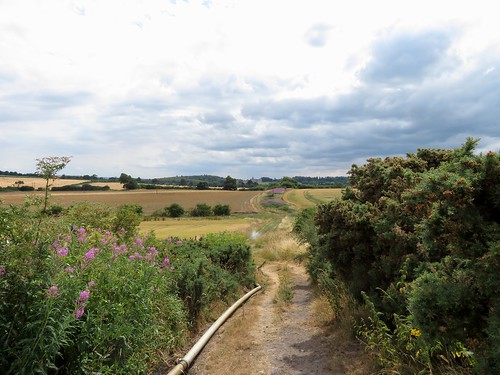
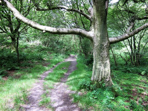
Now the path ran through more forest, its sandy surface glinting with mica between the banks of bracken and bilberry. Wrens gave out their whirring songs and goldcrests squeaked in the pine tops. There was a seductive humming of flies among the trees, soporific and redolent of a warm summer afternoon. Figwort with dark green leaves and solid purple stems of square section grew beside the forest track.

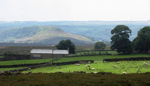
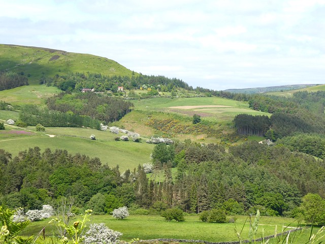
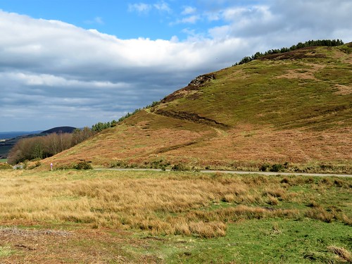
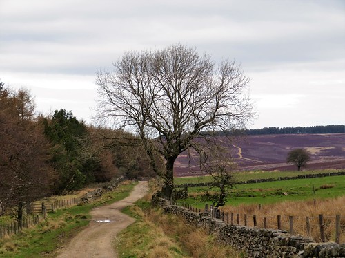
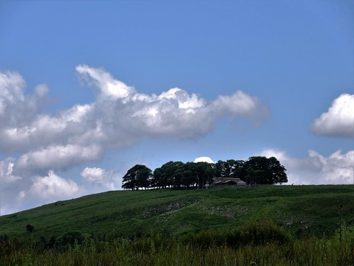
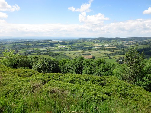
A moor road led north into open country again, with brown cattle grazing the pasture. Broom in full flower flecked the roadside with gold. At the crest of the road the land suddenly dropped and a view opened northwards to humpy hills lining the far horizon.

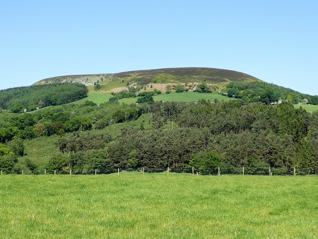
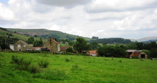
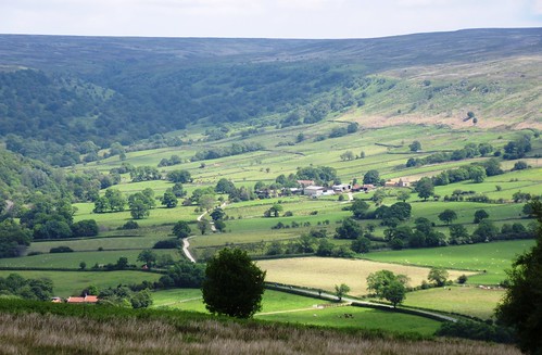
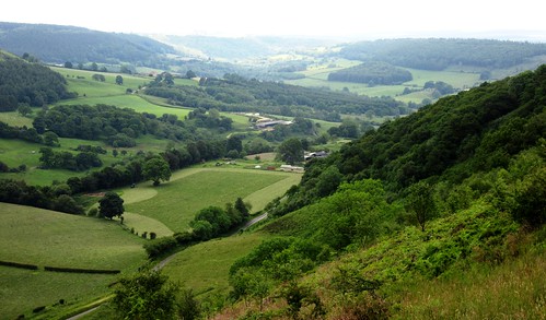
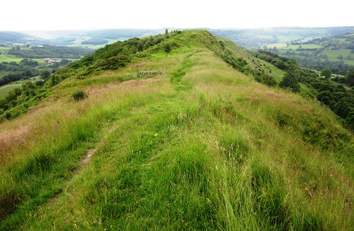
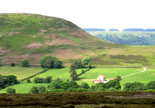
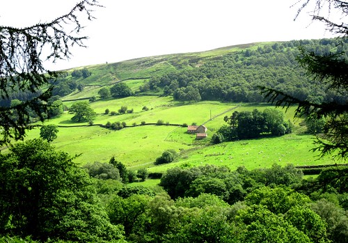
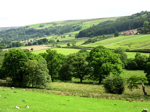
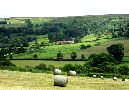
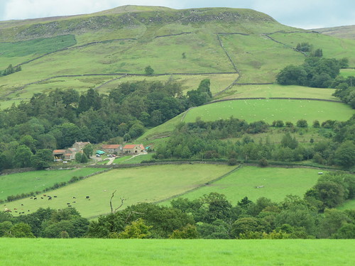
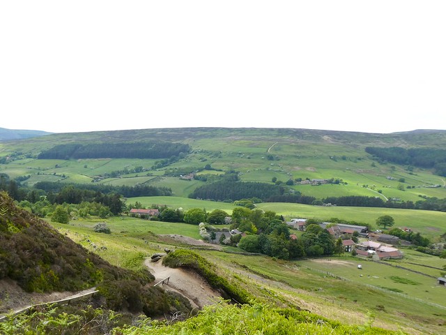
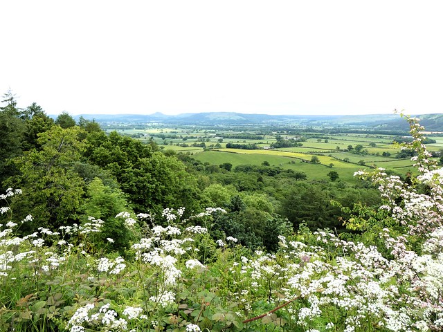
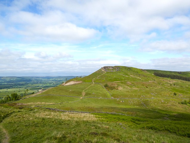
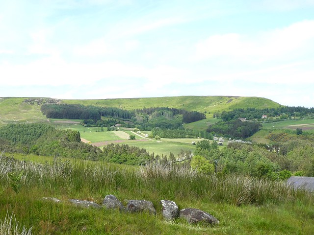
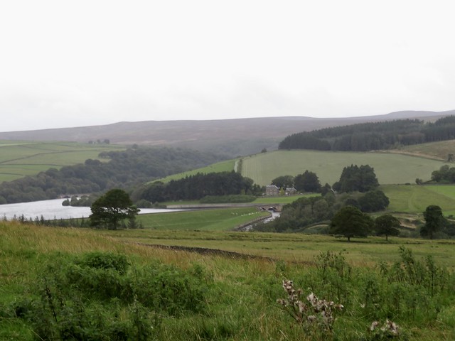
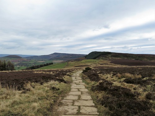
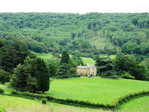
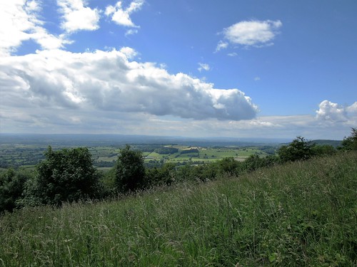
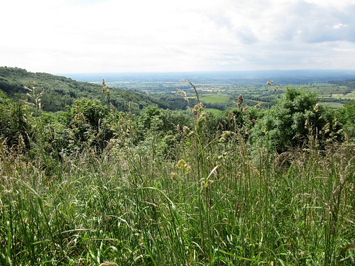
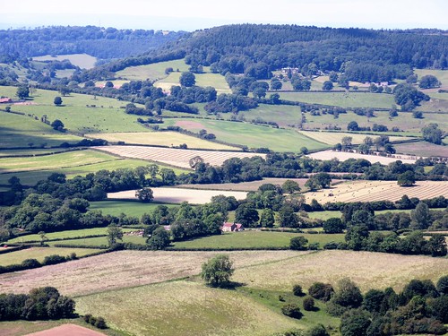
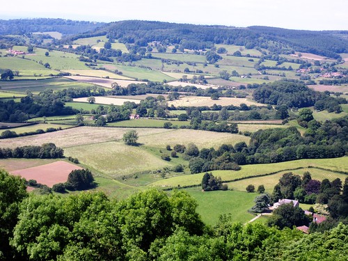
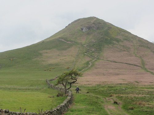
The homeward path took us along the northern brow of the moor, with a wide vista over farms and green farmland far below. Hasty Bank, Cringle Moor and Cold Moor stood out on the northern horizon in long whalebacks.

A big bird of prey went sailing out across the valley, its wingtips uptilted. A hen harrier, rarest raptor of the moors, turning and flashing in the afternoon sunlight.

How hard is it? 6¼ miles; easy; moorland tracks

Start: Newgate Bank forest car park, near Helmsley YO62 5LZ (OS ref SE 565889)

Getting there: Newgate Bank is signed off B1257 (Helmsley–Stokesley)

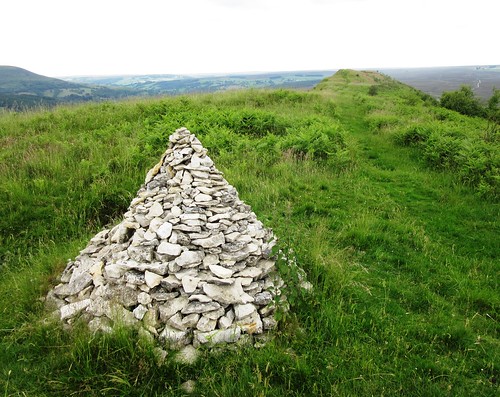
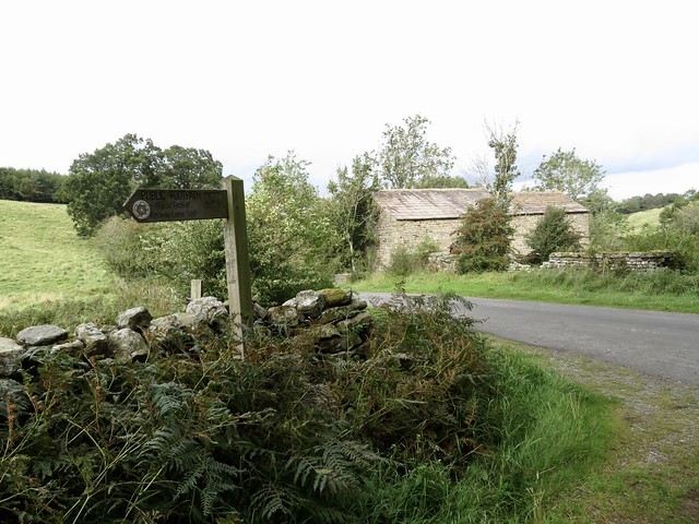
Walk (OS Explorer OL26): From parking space turn back towards road. Near entrance, left past barrier (fingerpost) up forest track. In ½ mile, through gate (570892); in 50m right on moorland track. In ¾ mile, just before track enters trees at wooden gateposts, left (580887) on track across valley, through plantation, out across moor and on into forest (586889). Left on forest road just inside trees. In a little over a mile, left along road (597891). In ¾ mile at summit (594903, benches), left on track past trig pillar (589905) and around moor edge for 2 miles to gate (570892) where you rejoin outward route to car park.

Lunch/Accommodation: TBC – The Owl at Hawnby, near Helmsley YO62 5QS (01904-208000, theowlhawnby.co.uk) is the preferred option, but may still not have its new landlord in place. Re-opening contact: tom@mexboroughestates.co.uk.

Info: northyorkmoors.org.uk; yorkshire.com

 Posted by at 01:15
Oct 042014


First published in: The Times Click here to view a map for this walk in a new window
picture picture picture picture picture picture picture picture picture picture picture picture picture picture picture picture
Facebook Link:
The Inn at Hawnby stands perched high on a saddle of ground, even though it lies at the foot of steep lanes. That’s the nature of this southern corner of the North York Moors where every summit seems only to lead you to another higher crest, each dale bottom to precipitate you into one even lower. It’s steep green country, thickly wooded in the depths, bare heather moors forming the heights that separate one dale from the next. Within five minutes of leaving the inn I looked up to see Hawnby high above me; in another ten minutes the hamlet was gone, not to be seen again till the last few steps of this beautiful walk.

The land hereabouts, bitter in winters, is hard on its sheep and cattle farmers. The farms of Little and Low Banniscue had vanished as though they had never existed. At Crow Nest I found a roofless ruin in a zigzag tumble of yard walls. A boulder-strewn moor loud with the complaint of curlews and lapwings led me over a broad crest and down into the inbye fields of Bilsdale, startlingly green in the sunshine. Across the dale lambs cried and scampered in the fields around Carr Cote, where they were gathering the sheep for shearing. ‘Good weather for it,’ said the farmer at Helm House as he hauled hay bales from the field to be wrapped in netting and sealed for silage in a plastic skin. A golden labrador at Fangdale Beck thought so, too – he cavorted under his master’s hosepipe, shaking the water into rainbows and barking like a maniac.

I climbed up through bracken, then away across the purpling moor where red grouse chicks scuttered off, their mothers whirring short distances low over the heather as they shrieked, ‘Back! Back! Back!’ Up on the crest a broad yellow sand road led south past the lonely moorland farm of Low Thwaites towards the twin rise of Easterside Hill and Hawnby Hill.

Up on the thyme-scented summit of Hawnby Hill I sat by the conical cairn, looking down the precipitous slopes into Ryedale and picturing the Hawnby Dreamers. Three modest local men, Chapman, Cornforth and Hugill by name, fell asleep upon these moors one day in the 1740s, and dreamed identical dreams of repentance and salvation. They sacrificed their reputations, their livelihoods and the tied cottages they lived in to set out immediately and walk a hundred miles to hear John Wesley preach. To borrow Thomas Hughes’s words from Tom Brown’s Schooldays, Hawnby Hill is ‘altogether a place to open a man’s soul, and make him prophesy.’

Start: Inn at Hawnby, North Yorks YO62 5QS (OS ref SE 542898)

Getting there: Hawnby is signposted from Osmotherley (A19/A172, Thirsk to Middlesbrough).

Walk (10 miles, moderate, OS Explorer OL26): From Inn at Hawnby, follow ‘Osmotherley’. Round left bend, bear right (‘Laskill’). Cross stream; in 100m, left/north up track (547899, ‘Bridleway’, occasional blue arrows/BAs). In ½ mile, through wood; emerge through gate (546912); right up wall into next field; left by erosion scar to Crow Nest ruin (547914). Right through gate by ruin; follow sunken track, curving left away from ruin, east across moor for ⅔ mile to descend to gate (557919, waymark arrow). Follow wall down to Low Ewe Cote (561918).

Through farmyard and gate beyond; follow farm lane to cross road (564921). Through gate opposite (‘bridleway’) and on. In 250m, through wood; emerge (567924) and aim for gate with BA (567926). Follow BAs through fields, past Helm House farm (569934) and on along green lane (BAs) for ¾ mile. At Malkin Bower (570944) join road to Fangdale Beck. Opposite old chapel (570946, ‘Chapel Garth’), left down laneway, over footbridge; left through garden gate (BA). Bear right between buildings and through gate. Up laneway; through another gate (BA); follow wall on left, uphill through gate and up damp sunken lane. Through gate (566948) and on up, following track through bracken as it curves right, up to gate near skyline (563949).

Aim slightly left of communications mast across moor, keeping Fangdale Beck’s gully on your left. There is a faint, roughly cairned track, if you can find it! (If in doubt, make for communications mast and turn left (south) along moor road from there.) In ¾ mile reach line of wooden grouse butts (552954); follow them to left (west); where they end, continue same direction past prominent standing stone to meet broad, sandy moor road (548954). Left along this.

In ⅔ mile pass Low Thwaites farm house (543944); in 200m take right fork in track (543942), keeping ahead (south) for 1½ miles to road at Moor Gate (540917). Cross cattle grid, and turn right onto bridleway; bear immediately left up path past notice. At foot of steep upper slope of Hawnby Hill (539913), bear left up path to ridge (540910). Left (south) along ridge past cairn. Down slope; in bracken, path forks (542900); bear right here. In 50m, left over stile (542899, yellow arrow); follow fence on left down to Inn at Hawnby car park.

Refreshments: Picnic

Accommodation: Inn at Hawnby (01439-798202; innathawnby.co.uk); classy and characterful

Information: Thirsk TIC (01845-522755)

visitengland.com; www.satmap.com; ramblers.org.uk; www.LogMyTrip.co.uk

 Posted by at 02:00
Sep 102011
 

Brilliant sun on the high ridges of the North York Moors, a flush of purple heather up the heights of Farndale, and Low Mill’s handful of houses slumbering in a Saturday morning hush.
First published in: The Times Click here to view a map for this walk in a new window
picture picture picture picture picture picture picture picture
Facebook Link:
The River Dove, shallow and copper-brown, went sparkling in a tunnel of alders through the meadows I followed upstream to High Mill. These fields, cropped close and green by blackface sheep, will be a riot of wild daffodils in spring.

‘You are only 3 fields away from the Daffy Caffy,’ said the notice on a gate. ‘Can you smell the bacon? We have the kettle on.’ A very hard sell; one I couldn’t resist. A tiny curly terrier stood sentinel on the Daffy’s doorstop. He was an interested spectator as I made short work of the world’s best bacon sandwich and a cup of tea. Care to lick my greasy fingers? Well – don’t mind if I do.

I climbed grassy fields full of eyebright, then on up through black hummocks of coal mining spoil. It’s always an astonishment, looking down one of these quiet and seemingly utterly rural dales, to remember what smoky and clangourous hives of industry they once were, their lead, iron and coal prised out and processed by men who lived as a tribe apart.

Up on the moor’s rolling back, distant walkers appeared to be wading shin-deep in a purple sea. ‘Never seen the heather bloom like this,’ said a man in very short shorts. ‘Every year it’s like a miracle, and this one in particular.’

The old moor track called Westside Road rides the spine of the long north-south upland of Rudland Rigg, a broad stony upland way just made for a good step-out. I rattled along, watching slate-grey clouds rolling along the wide horizons, blotting up the colours from the adjacent dales and stretching their shadow west across the Vale of York.

Bright sunshine had cracked out of hiding and bathed the moors in rich gold and purple by the time I’d got down off Rudland Rigg into the fields of Lower Farndale. Black thunderflies reeled above the grass, amorously clasped two by two to claim membership of the Yard-High Club, and the silly sheep stopped and stared like shocked spinsters, as they’ve always done and will do until Farndale is under the sea once more.

Start: Low Mill car park, near Kirkbymoorside, N. Yorks YO62 7UY (OS ref SE 673952)

Getting there: From Kirkbymoorside (on A170 Pickering-Helmsley), follow ‘Gillamoor’ and ‘Farndale’. In Gillamoor, right at T-junction; in 1 mile, left (‘Farndale’) to Low Mill.

WALK (9½ miles, moderate, OS Explorer OL26):
Take footpath next to car park (‘High Mill’). Cross River Dove, left along river (yellow arrows/YAs) to High Mill and Daffy Caffy (668971). Up lane to Church Houses and Feversham Arms PH; or to continue walk, left over stile (YA). Along river for 100 m, left over footbridge, right up 2 fields (‘Low Bank’) to road (664970). Right; ahead at junction (‘Dale End’). Just past Monket House, left through gate (660972; ‘Bransdale’), up track through spoil heaps. Ignore left fork (655971); continue for nearly 1 mile to crossing of wide tracks with motorcycle prohibition notices (641974). Left (south) along Rudland Rigg for 3¼ miles to road (659927).

Ahead across cattle grid; in ¼ mile on right bend, left (662920; ‘footpath’) through wood to gate (665923, YA). Aim ahead to angle of tumbledown walls; right along path, which bends left to cross Harland Beck (667925). Through gateway; bear left along wall parallel to beck. At gate (666927), don’t go through; bear right up wall and through fence gap (YA). Follow wall up through gate, on up through another gate (YA) to stony lane (668930). Left to Harland Farm. By farm gate, right up wall through successive gates (YAs). Left over ladder stile (668933), right beside wall (YA). At wall end, forward through heather (aim for post); continue along clear path, bending left to run parallel with Farndale. In ¾ mile, pass YA on pole (667944); in 150 m pass tall cairn; then fork right downhill. At bottom of slope, right through gate (666946, YA). Down through wood, then gate (667947, YA). Down through next gate to cross road (668948). Down 3 fields (fingerpost) to road; forward to Low Mill.

Click on Facebook “Like” link to share this walk with Facebook friends.

LUNCH: Daffy Caffy, High Mill (01751-430363; 9-5, Fri-Sun, May-Sep; daily, March-April); or Feversham Arms PH, Church Houses (01751-433206; www.fevershamarmsinn.co.uk).

ACCOMMODATION: King’s Head, Kirkbymoorside, N. Yorks YO62 6AT (01751-431340; www.kingsheadkirkbymoorside.co.uk) – very friendly and helpful.

MORE INFO: Pickering TIC (01751-473791); www.discovernorthyorkshire.co.uk

Coast Along for WaterAid, 10 September: 250 sponsored UK coast path walks! www.coastalongforwateraid.org www.LogMyTrip.co.uk
www.ramblers.org.uk www.satmap.com

 Posted by at 01:06
Apr 102010
 

First published in: The Times Click here to view a map for this walk in a new window
picture picture picture picture picture picture picture
Facebook Link:

It was blowing fit to take the tiles off when I finally ventured out up Levisham’s single street in the early afternoon. But the last of the morning’s torrential downpours was already marching off northwards across the North York Moors, and the neat red-tiled roofs of the stone cottages that faced each other across the green looked safe enough for now. The rain had given Levisham’s resident diminutive pony a make-over, though – its coat was matted with balled fur like a poodle’s.

Out in the fields west of the village, the southern sky was a bubble-bath of silver and blue, shot with brilliant shafts of wintry sun. Power lines howled in the wind, hawthorn hedges whistled, the grass hissed and gunsmoke clouds raced overhead. It was fantastically exhilarating being blown about, especially once I had got into the raving and gesticulatory woods of Newton Dale. Yellow catkins whipped across my line of sight, and the uncannily melancholy and evocative owl-hoot of a steam locomotive came up on the wind from Levisham station on the North York Moors Railway far below.

They were waiting for Sir Nigel Gresley, an oily-handed man in a boiler suit told me at the level crossing – not the great steam locomotive designer, but his namesake engine and the rake of enthusiasts’ coaches she’d be pulling. With the short spring afternoon half gone already I couldn’t wait around, even for a glimpse of that sleekly streamlined and magisterially beautiful machine. Instead I raised steam and tackled the bank up to the sun-streaked summit of Levisham Moor, where the wind took me in the small of the back and shoved with brutal strength.

I bowled along like a runaway Pullman, past Dundale Pond and its concertina ripples, through seething clumps of sedge, by moorland streams blown into charging torrents. Down under stiffly bobbing thorn trees where last autumn’s scarlet berries lay across the path like beads, down to where the clefts of Dundale Griff and Pigtrough Griff ran together. A rollercoaster path south through dancing larch and hazel woods, and then a last mile west into a china pink sunset, with the owl hoots of Sir Nigel Gresley blowing faintly to me down the still rising gale.


Start & finish: Horseshoe Inn, Levisham, N. Yorks YO18 7NL (OS ref SE 833907)

Getting there: Rail – North York Moors Railway (01751-472508; www.nymr.co.uk) to Levisham station (on walk route). Road – Lockton, then Levisham, signed off A169 between Whitby and Pickering.

Walk (4½ miles, moderate, OS Explorer OL27): From Horseshoe Inn, right down ‘No Through Road’ with chapel on left. In 400 yards at left bend, ahead over stile (831906); follow wall for 2 fields; stile into woods (824905); right on path for 1/3rd mile to foot of incline. Left over stile (822911); down hedge (yellow arrows); through gate into woods (821911). Through woods to road beside Levisham NYMR station (819911). NB Starting point if coming by train. Right up road for ¼ mile; at top of climb, right (819914; ‘footpath’ post) to transect hairpin bend. Recross road; left up bank path. Forward at top (822918), following wall. At corner, ahead (yellow arrow) on green track to 5-finger post at Dundale Pond (829919). Follow ‘Dundale Griff to Hole of Horcum’ for 2/3rd mile to path junction (839918). ‘Hole of Horcum’ points left; but go right (‘Levisham), following woodland path for 1½ miles to road (833903). Right into Levisham.

NB – online maps, more walks: www.christophersomerville.co.uk.

Lunch: Horseshoe Inn, Levisham (01751-460240; www.horseshoelevisham.co.uk).

Accommodation: Moorlands Country House Hotel, Levisham (01751-460229; www.moorlandslevisham.co.uk).

More info: Pickering TIC (01751-473791); www.visityorkshire.com

www.ramblers.co.uk

 Posted by at 00:00
Mar 232024


First published in: The Times Click here to view a map for this walk in a new window
on Cold Moor Urra Farm old mine tips above Urra Farm paved course of Cleveland Way from Carr Ridge looking across Vale of Mowbray to Roseberry Topping Wain Stones Looking towards Wain Stones from Garfit Gap looking towards Cold Moor from Urra 4 looking towards Cold Moor from Urra 3 looking towards Cold Moor from Urra 2 looking towards Cold Moor from Urra 1

Bikers were out for a burn-up on the bendy road to Stokesley. We soon left them behind as we climbed to Carr Ridge up the Cleveland Way. This long-distance path, paved and pitched with stone, loops round the outlying hills of the North York Moors with grandstand views all the way.

Up on top it was cold and cloudy over the moors. The sharp shark-fin of Roseberry Topping stood out to the north, its western face a concave scoop showing where half the hill had once slid away in a massive landslip.

The flat flagstones of the Cleveland Way carried us dry-shod over bog and slutch. The stone slabs had once floored textile mills, and were brought here after the factories closed – a fine example of recycling. Blackfaced sheep dashed away and drew up to swivel round and stare madly at us before resuming their precise, selective nibbling among the bracken and sedge.

A side path left the Cleveland Way and headed across the moor to where pale heaps of spoil marked the sites of long-abandoned jet and alum mines. We picked our way between them, dropping down the hillside towards the red roofs of the farming hamlet of Urra in broad green Bilsdale below.

Here the landscape changed to cattle pastures and plentiful trees. We followed field paths down and up again, heading out of the sheltered valley and up a gritty track towards the aptly named Cold Moor. It was exhilarating to stride the northward ridge with a sharp wind in the face and a good firm track underfoot.

Down in the pass of Garfit Gap we met the Cleveland Way again and turned east for the stepped climb up to the sandstone outcrop of the Wain Stones. Blackened and sculpted by weathering, they stood proud of the ridge end, their Easter Island profiles and tall faces packed tight in a jumble of rocks.

We sat on a fallen boulder and took in the view under a clearing sky. Skeletal cranes and smoking chimneys of Teesside, the great patchwork lowland of Mowbray Vale, a distant suggestion of the Pennine hills against the clouds in the southwest. And sailing high in the north the outline of Roseberry Topping once more, less of a shark fin from this perspective and more like a giant ploughshare abandoned on the ridge by some mythical tiller of the moors, perhaps one of the giants of the Wain Stones themselves.

How hard is it? 7 miles; moderate/strenuous; cobbled/paved moorland paths; a little scrambling at Wain Stones.

Start: Clay Bank car park, near Great Broughton (NZ 573035)

Getting there:
Road: Car park on B1257 between Great Broughton and Chop Gate

Walk (OS Explorer OL26): Left up road. In 200m pass ‘Bilsdale’ sign; left up stone flagged path (‘Cleveland Way’). Follow CW; at top of climb, fork right (579030, ‘Bridleway’). In ⅓ mile (occasional posts), path bears right across slab bridge (583021). In ½ mile right (576018, ‘Bridleway’) to road in Urra (572018). Right; in 100m, left (‘Urra Farm’); then stile (yellow arrow/YA), gate, stile; field path down to footbridge and road (564018). Dogleg right/left (stile); up bank to gate at Broadfield Farm (562019). Left (fingerpost, gate); right (fingerpost, wall gap); up field to gate (560019); up to track. Right; in 100m, left up steep path. Follow it for ⅔ mile to meet Cleveland Way at Garfit Gap (554034). Right up to Wain Stones (559035); round them or scramble up through them to flagged path; CW to road (513033). Left to car park.

Lunch/Accommodation: Wainstones Hotel, Great Broughton TS9 7EW (01642-712268, wainstoneshotel.co.uk)

Info: nationaltrail.co.uk; northyorkmoors.org.uk

 Posted by at 01:09
Sep 252021


First published in: The Times Click here to view a map for this walk in a new window
picture picture picture picture picture picture picture picture picture picture picture picture picture picture picture picture

When Squire William Danby of Swinton Park saw his tenants go hungry during a farming slump in the early 19th century, he did something about it – namely, he paid them a shilling a day to construct a scaled-down Stonehenge in the wilds of his North Yorkshire estate.

In the woods above the yurts, treehouses and tepees of Swinton Bivouac’s glamping grounds we found the henge, an oval of massive blocky stones enclosing a ring of trilithons or stone portals. If there’s something conscience-tweaking about the back story of the Druid’s Temple, there’s also something laughable about the structure in a Spinal Tap sort of way. Squire Danby tried to recruit a hermit to live on site, speak to no-one and let hair and beard grow free – but none of the candidates, however hungry, proved willing to tackle that job.

A cold wind blew from the sombre moors to the west as we followed the Ripon Rowel long distance path down into the valley of Pott Beck. Behind in the east the long ridge of the North York Moors, twenty miles off, lay pink and grey under a cloudy sky.

The path ran round a rim of forestry above Low Knowle Farm house, barns and byres all stone-built, old and tight-knit against the weather in their hollow.

With the spillway from the dam at Leighton Reservoir twinkling near at hand, we turned away along a path through rough pastures of rushes and clumps of harebells where blunt-faced rams stared us out as we passed. Healey village lay along its hillside beyond the River Burn, the coffee-coloured stone houses running east to the church’s tall spire.

At Broadmires Farm the house stood all of a piece with the byre, a tradition of architecture hereabouts stretching back to the longhouses that the Norse settlers built in these dales a thousand years ago.

By the chattering Sole Beck a grey wagtail bobbed on a stone, its yellow belly catching a glint of sun through the leaves. Climbing the homeward path through the birch woods above the chattering Sole Beck, we came to Lobley Hall, a grand name for a ruinous house three hundred years old. Elders choked the living room, buddleia reached out of the chimneys.

‘KW 1698’ was carved into the lintel above the doorway. Whoever KW was, the builder of Lobley Hall certainly commanded a beautiful view of beck, hillside and woodland in this lonely daleside cleft.

How hard is it? 5 miles; field and woodland paths, muddy in places

Start: Swinton Bivouac car park, High Knowle Farm, Knowle Lane, Ripon HG4 4JZ (OS ref SE 180787) – £3

Getting there: From Masham (A6108) follow ‘Fearby’. On far side of village, sharp left to cross River Burn. Right, and follow ‘Swinton Bivouac, Druid’s Temple’ to car park.

Walk (OS Explorers 298, 302): Walk to Druid’s Temple (175787, signed), and return to top of Bivouac drive. Left (‘Burgess Bank’, ‘Ripon Rowel’/RR); follow well waymarked RR clockwise for 2 miles via Knowle Plantation (175791), Burgess Bank (168793), Broadmires Farm (178798) to road (183798). Ahead; in ¼ mile RR turns left (187801, ‘Healey’), but keep ahead (‘Swinton’). In 500m ford Sole beck (192799); in 150m, right (kissing gate, yellow arrow/YA). Follow YAs for ½ mile to pass Lobley Hall ruin (191793). In another 150m ignore YA on right; continue on left bank of Sole Beck to cross road (186787). From here follow RR waymarks back to car park.

Lunch/Accommodation: Swinton Bivouac café and lodges (closed January) – 01765-680900; swintonestate.com)

Info: Harrogate TIC (01423-537300): yorkshire.com

@somerville_c

 Posted by at 01:57
May 042019


First published in: The Times Click here to view a map for this walk in a new window
picture picture picture picture picture picture picture picture picture picture picture picture picture picture picture picture
Facebook Link:

This year is the 50th anniversary of the Cleveland Way, the National Trail that runs round the rim of the North York Moors with vast, spectacular views from the great escarpment.

Early on a cold morning I followed the Cleveland Way north out of Osmotherley. Vague shapes of Pennine ranges lay out to the west on the edge of sight, under a sky ribbed with cloud that stretched in parallel bars from horizon to horizon, a remarkable sight.

A short detour through the trees of fetchingly named Summer Game Hill, on a path lined with simple wooden Stations of the Cross. This rustic via dolorosa led up to a lonely Lady Chapel, object of pilgrimage and still used for worship.

Back on the Cleveland Way I took another sidetrack down through the trees of Mount Grace wood among bluebells and wild garlic, to where the remarkably well-preserved Mount Grace Priory lay sheltered below the escarpment. In these two-storey cells the Carthusian monks of the priory led lives of prayer and contemplation, solitary and utterly silent.

I climbed back up to the Cleveland Way and resumed the walk, up through South Wood to where larch and firs gave way to silver birch and young green bilberries. The upland sheep pastures were divided by beautifully maintained stone walls. On the eastern skyline ran the hummocky dark spine of Osmotherley Moor, the sombre-coloured escarpment edge trending north to where the sharp breaking-wave profile of Roseberry Topping stood up against the sky.

Out on Scarth Wood Moor a paved path wound palely over the heather. Suddenly an intent dark shape scuttled across – a handsome male black grouse, his bright scarlet crest erect, his legs strutting like clockwork.

Here I left the Cleveland Way, cutting back south by way of Cod Beck Reservoir, as cold and still as a sheet of tin among its trees. Above the lake I found High Lane, a track perhaps dating back to Neolithic times, down which Scottish drovers in former days would drive trains of up to 300 cattle to markets in Thirsk and York. It was a great way to head towards Osmotherley, staring out over 50 miles of lowland country, picturing those hardy men and their charges slowly plodding south across these moody northern moors.
Start: North End, Osmotherley, N. Yorks DL6 3AA (OS ref SE 456972). More car parking at Cod Beck Reservoir, 1½ miles north.

Getting there: Bus 80, 89 (Stokesley-Northallerton); X89 (Northallerton-Middlesbrough)
Road – Osmotherley is signed off A19 (Thirsk-Middlesbrough)

Walk (6¾ miles; 8 miles including Mount Grace Priory detour; moderate, OS Explorer OL26): Cleveland Way (CW, white acorn & fingerpost waymarks) north out of Osmotherley. After ½ mile, at 453977, signposted detour loop on right to Lady Chapel (454982. Returning to CW at Chapel Wood Farm (452980), right along CW.

NB For Mount Grace Priory detour, cross CW at Chapel Wood Farm, left past farm buildings, through gate (yellow arrow/YA); follow YAs down field edges, to corner of wood (448980) then through wood to Priory (448985) and return.

Main walk: from Chapel Wood Farm, north on CW via South Wood and Scarth Wood Moor for 1¾ miles to road (473003). Right on path beside road for nearly 1 mile to 2nd of 2 car parks at head of Cod Beck Reservoir (468992). Left (kissing gate, footbridge) into trees. In 50m, left up left bank of stream; at edge of trees, left (470990, ladder stile, YA). Ahead on grass path curving right; in 200m, right along High Lane trackway (472991).

In nearly 1 mile, trees end (472978); in another 400m, right across chain (473974) on grassy track. In ½ mile cross horse gallop (465973); left down path; in 300m, right (465970, CW) on CW to Osmotherley.

Lunch/dinner: Golden Lion, Osmotherley (01609-883526, goldenlionosmotherley.co.uk) – superb cooking in pub setting

Accommodation: Woodlands Farm, Thimbleby DL6 3PY (01609-883524, woodlandsfarmthimbleby.com) – really delightful B&B; pickups and drop-offs part of the service.

Info: Cleveland Way 50th Anniversary, May 24th – many events planned all year.
(northyorkmoors.org.uk/clevelandway)
Mount Grace Priory: nationaltrust.org.uk/mount-grace-priory

satmap.com; ramblers.org.uk

 Posted by at 09:45
Jan 052019


First published in: The Times Click here to view a map for this walk in a new window
picture picture picture picture picture picture picture picture picture picture picture
Facebook Link:

On a cool bright morning we followed Water Lane out of Welburn and headed for the Howardian Hills. The jewel of the landscape hereabouts is the stately pile of Castle Howard, but from the cobbled field path leading north towards the hills we could only glimpse the tip of its crowning dome.

There were plenty of follies and architectural fancies to admire as we walked the parkland tracks – pyramids and obelisks, a wonderfully ornate Temple of the Four Winds high on an aeolian ridge, and peeping over the trees of Kirk Hill the tall colonnaded mausoleum of the Howards, Earls of Carlisle.

In an overgrown paddock beside the rusty barns of Low Gaterly a grey mare and her tiny companion horse, only as big as a dog, were browsing their thistle patch, delicately nipping off the remnant flower heads with lips curled back out of the way of the prickles.

Up on the ridge of the Howardian Hills an ancient earthwork shadowed the escarpment, a bank and ditch perhaps 4,000 years old. From here there were great open views to the smoothly flowing outline of the North York Moors, sombre and dark under a lively silver sky.

A mile along the ancient bank under quietly whispering larch and sycamores, and we descended a holloway into the parkland of Castle Howard. The great house stood on its ridge, a dream realised by the talented and bold amateur architect Sir John Vanbrugh at the turn of the 18th century. We found the parkland turf still corrugated by what underlay it – the ridge-and-furrow fields of the medieval village of Henderskelfe, swept away by command of the 3rd Earl of Carlisle in favour of the artful curves of his landscaped park.

The homeward path led across a steeply arched Palladian bridge over the New River lake. I glanced down as I crossed, to see a stone carving of a bearded river god, reeds in his hair, staring with bulging eyes and mouth agape along the artificial waterway at the giant house on the hill – whether in awe or horror was hard to say.
Start: Crown & Cushion PH, Welburn YO60 7DZ (OS ref SE 721680)

Getting there: Bus 183 (Malton-Castle Howard)
Road – Welburn is signed from A64 (York-Malton) at Whitwell on the Hill

Walk (9 miles, easy, OS Explorer 300): Left from Crown & Cushion; left down Water Lane. ‘Public Bridleway’ north for ¾ mile to turn right along Centenary Way/CW beyond East Moor Banks wood (723693). In ⅔ mile, left (732694, ‘Coneysthorpe, yellow arrow/YA); in 150m, left opposite Low Gaterly barn (YA). At Bog Hall dogleg left/right, then right on track (725709, ‘Easthorpe’). In 900m keep ahead (734713, ‘Park House’), zigzagging up to cross road (733715). Up Park House drive; in 50m left (gate, BA); follow wooded escarpment edge and ‘Slingsby Bank’ (BA). In 1¼ mile, left (714729, ‘Coneysthorpe’), for 1 mile to Coneysthorpe. Left along road; in 100m, right through wall (713713); follow drive (‘Welburn’). In ½ mile, at corner of Great Lake, fork left by gates; in 100m, right (719706, ‘Welburn’) through scrub to track (722705). Right into parkland; right (‘Welburn’) to Temple of Four Winds, New River Bridge (724698) and return path to Welburn.

Lunch: Crown & Cushion PH (01653-618777, thecrownandcushionwelburn.com); Leaf & Loaf Café (01653-618352), Welburn.

Accommodation: Talbot Hotel, Malton, N Yorks YO17 7AJ (01653-639096, talbotmalton.co.uk). Friendly, comfortable, long-established hotel.

Info: castlehoward.co.uk; howardianhills.org.uk; yorkshire.com
Ramblers Festival of Winter Walks, 21 December – 6 January:
ramblers.org.uk/winterwalks
visitengland.com; satmap.com; ramblers.org.uk

 Posted by at 01:51
Jun 182016


First published in: The Times Click here to view a map for this walk in a new window
picture picture picture picture picture picture picture picture picture picture picture picture picture picture picture
Facebook Link:

A glider was circling perilously near the cliffs on Sutton Bank, but no-one on the Cleveland Way had eyes for it – not with the signposts proclaiming ‘The Finest View in England – 50 metres’. That might be a bit of an eyebrow raiser as a claim, but the prospect over the Vale of York from the sharply-cut crags of Sutton Brow is certainly a stunning one. I looked out south and west over a giant plain, patched with cloud and sun, green and pale gold, rolling away to splendid blue hills on the edge of sight.

‘The Yorkshire Dales, them are,’ said a man at my side. ‘See Great Whernside there?’ He pointed out a diminutive hump on the skyline. ‘Thirty mile off, that is. Entrance to Wensleydale’s that great dark cliff you see there. Damned if it isn’t a hundred mile or more, this view.’ He inhaled as though he were drawing the scene inside to hold it deep down.

The Cleveland Way National Trail shadows Sutton Brow and the long south-north escarpment of the Hambleton Hills, so walkers get the full effect of the sensational view for mile after mile. I chose a side turning, and plunged down a path edged with pale pink dog roses through the ancient woodland of Garbutt Wood. Bluebell pods as fat as peas stood among the star-like flowers of yellow pimpernel. Gaps in the silver birch and oaks gave snatches of the view over the plain.

Young coots and moorhens were squeaking in the reeds of Gormire Lake when I got down to it at the foot of the bluff. At the pretty cottage of Southwoods Lodge I found a north-running bridleway between hedges thick with lacy umbellifers. A bee landed on one of the flat plant heads and slid its hair-thin proboscis into each tiny white flower in turn, drawing out sweetness and carrying pollen away to fertilize the next host in its round of feeding.

At Midge Holm I walked fields of coarse grass round a lake, remnants of a landscaped park now subsiding back into the landscape. On through uncut hayfields, the ripe grass heads hazing the meadows with a wash of pale purple as they released steamy warmth I could feel on my cheeks and arms.

‘I’m 82 tomorrow,’ said a slim and upright gentleman in walking boots whom I met on the homeward track to Sutton Bank, ‘and I’m lucky. Nothing ever ails me.’ He indicated the wonderful view to the distant hills. ‘Take a hold of this and put it away in the memory banks for a dark winter day. You can’t beat it, eh? Summer with its best coat on.’

Start: Sutton Bank car park, YO7 2EH (OS ref SE 517831)

Getting there: Car park is at top of Sutton Bank on A170 (Thirsk-Helmsley)

Walk (6 miles, moderate, OS Explorer OL26): Follow tarmac path up left side of Sutton Bank Bikes shop. At ‘White Horse 1¼” fingerpost, ahead through car park; follow gravel path on right of A170 to cross side road (515830); ahead along Cleveland Way/CW (‘Sneck Yate’). In 400m, left off CW (511833; ‘Footpath, Nature Trail’) steeply down through Garbutt Wood, passing numbered posts. At Post 9 (505833) ignore ‘Southwoods’ sign to right; bear left downhill to Gormire Lake. Right (504833, ‘Bridleway, Southwoods’). At Southwoods Lodge cottage (502838), right along bridleway (blue arrow/BA).

At Midge Holm Gate (502843), cross road; through gate to left of Southwoods Hall gates (‘Tang Hall, Southwoods’ fingerpost); curve anti-clockwise round field edge and on (bridleway fingerposts, BAs) to road at Tang Hall (496851). Right over cattle grid; track to Greendale farm. Through gate to left of farmyard (499854, BA); up field, through gate; left (‘bridleway’) through skirts of wood. In 350m, at 3-finger post, right (499857; ‘Bridleway, Little Moor’) up woodland track, across Little Moor, up forestry track (BAs) for ⅔ mile. At top (507853), right along CW (‘Sutton Bank’) for 2 miles to car park.

Refreshments: Sutton Bank visitor centre café (01845-597962)

Info: North York Moors Visitor Centre, Sutton Bank (01845-597426; northyorkmoors.org.uk)

Yorkshire Wolds Walking & Outdoor Festival 2016 (10-18 September) – theyorkshirewolds.com

visitengland.com; satmap.com; ramblers.org.uk

 Posted by at 02:24
Oct 132012
 

A pale grey, windy sky streamed south over the North York Moors. Well wrapped against foul weather, Jane and I followed a bowed but sprightly old lady up the lane to Aireyholme Farm.
First published in: The Times Click here to view a map for this walk in a new window
picture picture picture picture picture picture picture picture
Facebook Link:
Cows lowed, a spade scraped on a stone floor and barn doors banged. Captain James Cook would have recognised the sounds that echoed round the buildings; it was here that the farm foreman’s son spent his boyhood in the 1740s, dreaming of the sea and faraway places.

Roseberry Topping was a whalehead of a hill above Aireyholme Farm back then. Now it takes the shape of a tsunami wave in a classical Japanese painting, a convex green back rising to tip suddenly over at the summit in a great vertical cliff face of rugged broken rock. It was a giant landslip in 1912 that sent the western half of the hill crashing and sliding into ruin.

A yellowhammer in the hedge broke out with a wheezy request for ’a-little-bit-of-bread-and-no…. cheese!’ We followed a zigzag path, well patched with stones, steeply up to the crest of Roseberry Topping and one of the best views in the north of England – the long escarpment of the Cleveland Hills pushing out their ship-prow profiles one behind the other into the great wide vale of the River Tees. A mess of chimneys lazily emitting coils of smoke showed where Teesside lay, still a heartbeat of industry in the north-east.

We followed the Cleveland Way down off the hill and up again to skirt the edge of sombre dark Great Ayton Moor, all the way south to where the thick sandstone needle of the Captain Cook monument rose on its ridge. ‘A man in nautical knowledge inferior to none, in zeal, prudence and energy superior to most,’ eulogised the inscription. ‘Long will the name of Capt. Cook stand out among the most celebrated and most admired benefactors of the human race.’

We drank to that in bottled water as we sheltered under the obelisk and watched the moors and hills smoking under a rolling sea of cloud.

Start & finish: Great Ayton Station, TS9 6HR (OS ref NZ 574108)

Getting there: Rail (thetrainline.co.uk) to Great Ayton
Road: Great Ayton is on A172 between Gainsborough and Stokesley. Follow High Street, then Station Road for 1 mile to station.

Walk (5½ miles, hard, OS Explorer OL26. NB: online map, more walks – www.christophersomerville.co.uk): From station, cross bridge; on up road. Left at White House Farm down lane (577110); in ⅓ mile, nearing Aireyholme Farm, left over stile (578115; ‘footpath’); over next stile; ahead with wood on left. Ignore stile on left; over stile in corner of field (576115); right on path towards, then up Roseberry Topping. From summit (579126) follow Cleveland Way/CW pitched path east, down and up to gate at edge of plantation (588127); right (blue, yellow arrows) on CW for 1¾ miles to Captain Cook monument (590101).

Face back the way you came up CW, and take next path to left, aiming to go between 2 prominent gateposts. Follow path (yellow arrows) down through Ayton Banks Wood; cross track near bottom (585104); continue down out of trees to angle of wall on right (584104). Right along sunken lane. In ½ mile, nearing Dikes Lane, left down stony track (578108; ‘Fir-Brook’); in 200 m, right through gate; cross field to farm track (576107); left to station.

Conditions: Steep climbs up to Roseberry Topping and Captain Cook monument. Steep descent through Ayton Banks Wood.

Lunch: Picnic

Accommodation: Chapters Hotel, Stokesley, N Yorks TS9 5AD (01642-711888; chaptershotel.co.uk) – welcoming place with good food.

Information: Gainsborough TIC (01287-633801); yorkshire.com
www.ramblers.org.uk www.satmap.com www.LogMyTrip.co.uk

 Posted by at 02:22