Search Results : “south downs”

Jan 272018


First published in: The Times Click here to view a map for this walk in a new window
picture picture picture picture picture picture picture picture
Facebook Link:

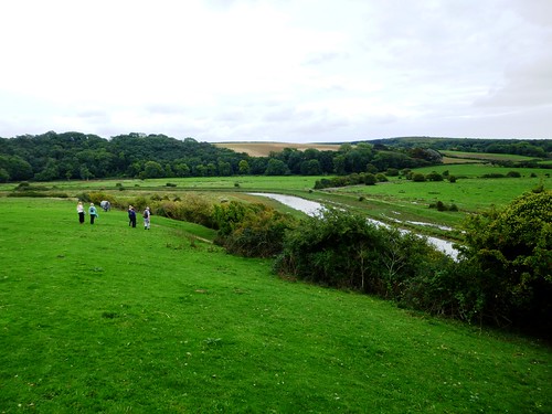
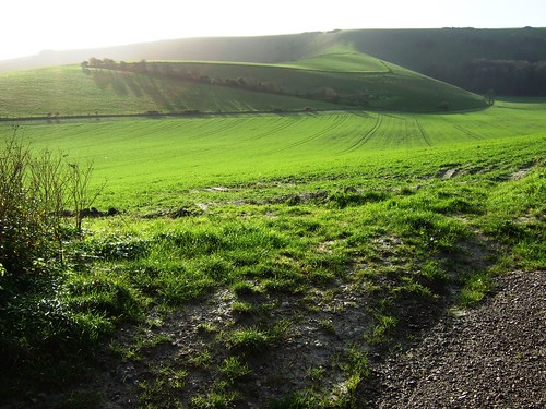
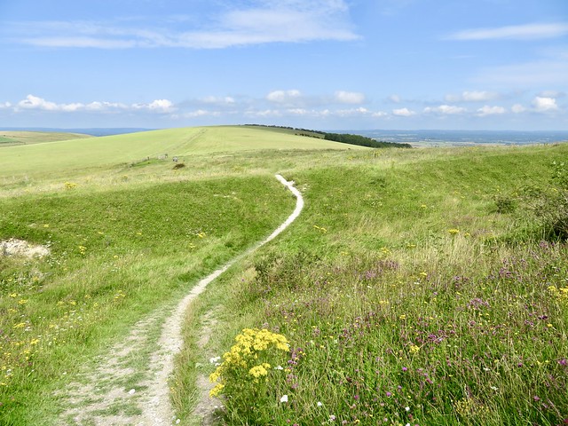
It’s hard to haul yourself out of bed on a chilly morning at sunrise, no matter what the weatherman has prophesied for that day. But there were rewards for our early-birdery. The commuters of West Sussex were still scowling their way to work as we set out from Kithurst Hill along the nape of the South Downs, under a blue sky and with a view that stopped our yawns in their tracks.

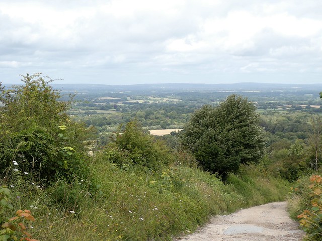
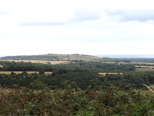
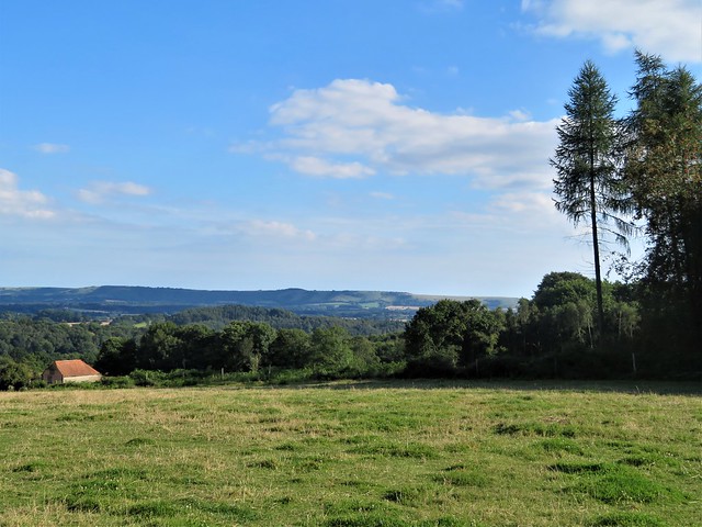
To the south-west the slender walls of Arundel Castle rose sunlit above their encircling trees, like a stronghold in a fairy tale. The plastic pavilions of Bognor Regis caught the sun, too, and beyond them a bright white ferry crawled past the grey snout of the Isle of Wight over a pale blue sea.

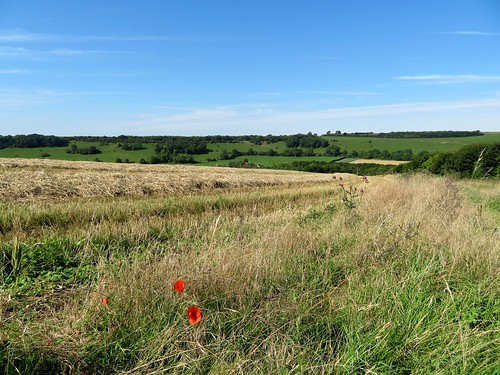
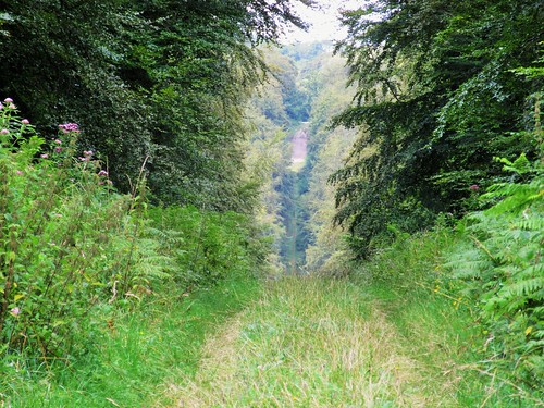
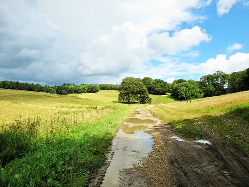
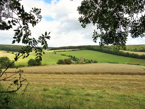
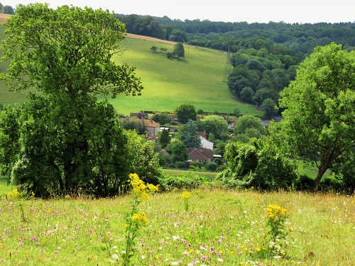
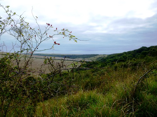
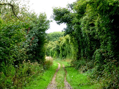
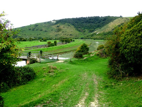
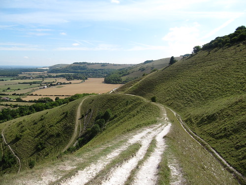
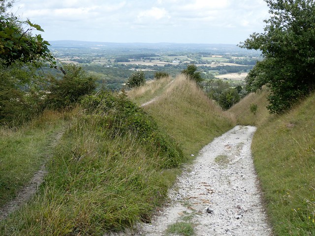
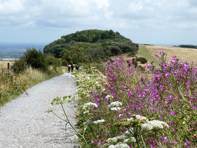
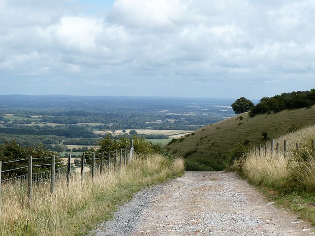
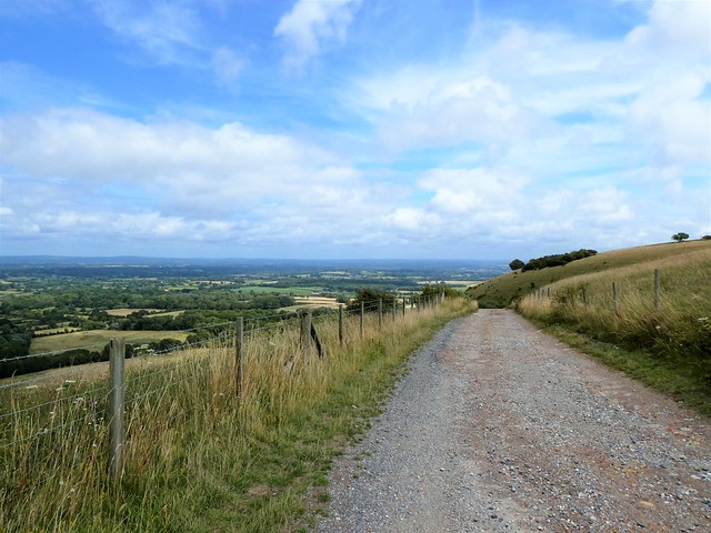
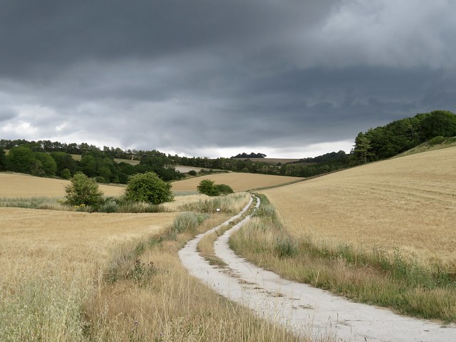
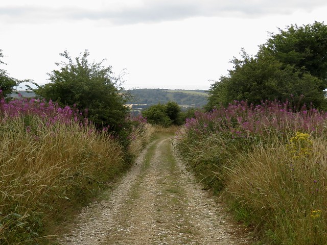
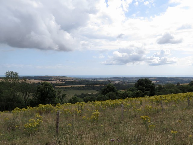
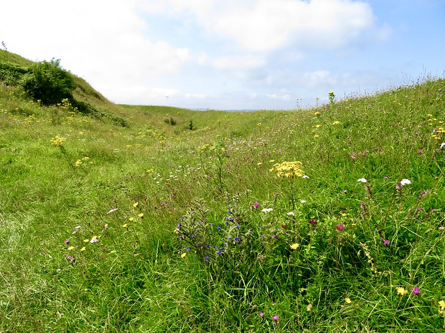
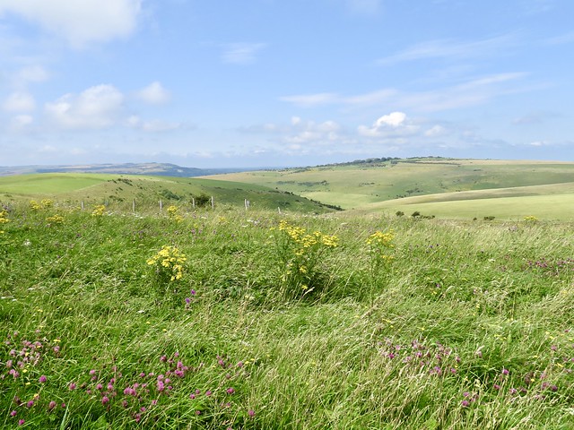
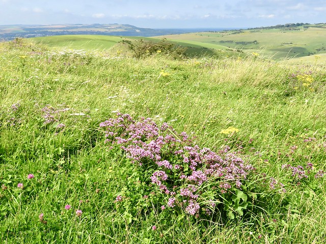
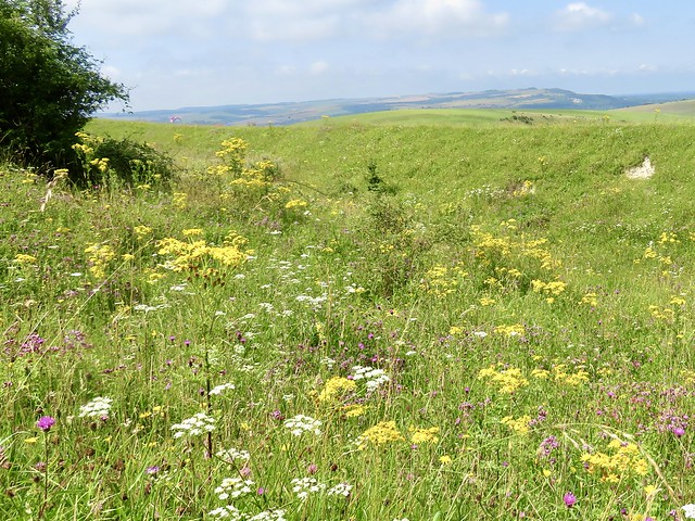
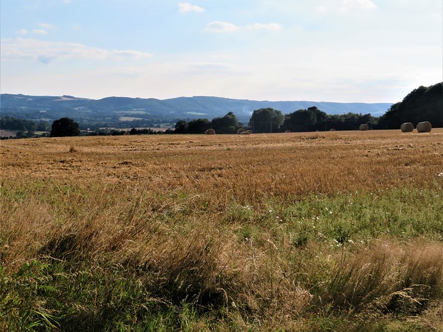
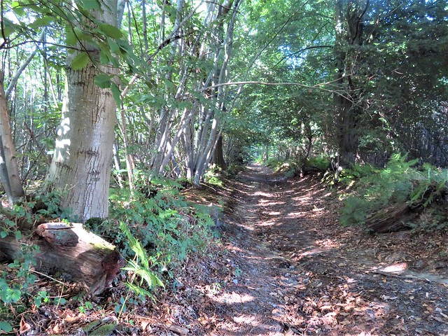
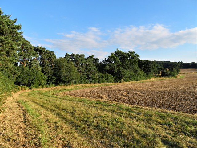
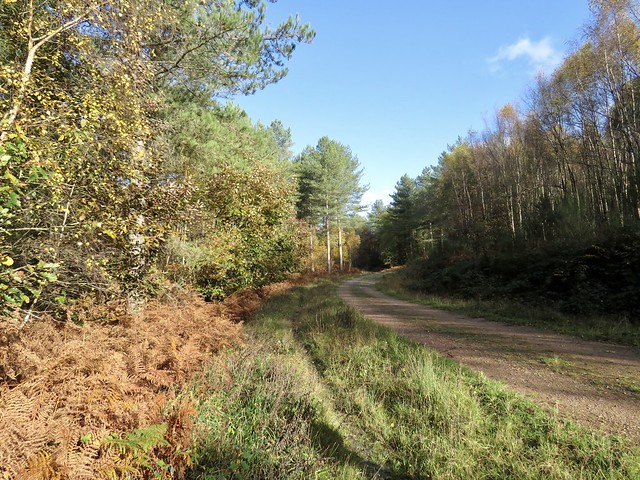
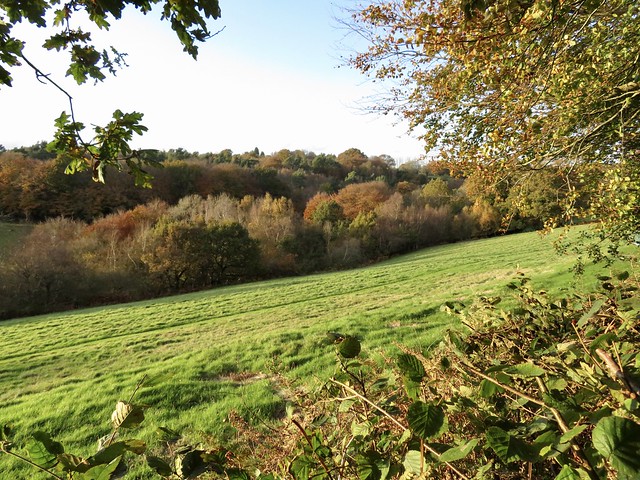
Nearer at hand, the chalk billows of the downs pitched and rolled. Old trackways and bridlepaths drew green seams through the pale ploughlands and stubble. We picked one running south past a windwhistle copse of beech and sycamore towards Harrow Hill’s green hummocky profile.

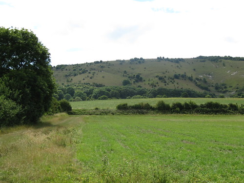
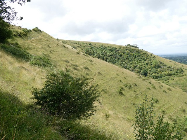
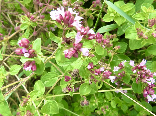
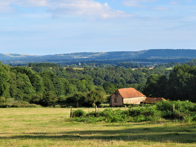
Harrow Hill might be, as some local stories say, the last place in England the fairies were seen dancing. It’s certainly a remarkable piece of chalk downland, pierced and riddled with the deep shafts and subterranean galleries of Neolithic flint mines. The northern flank is hollowed by a giant chalk pit, its sides as cleanly cut as though they’d been cored out with a scalpel.

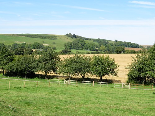
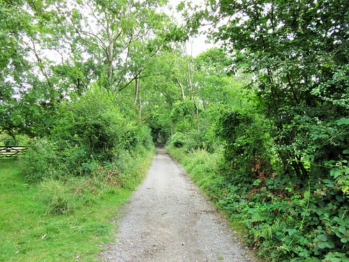
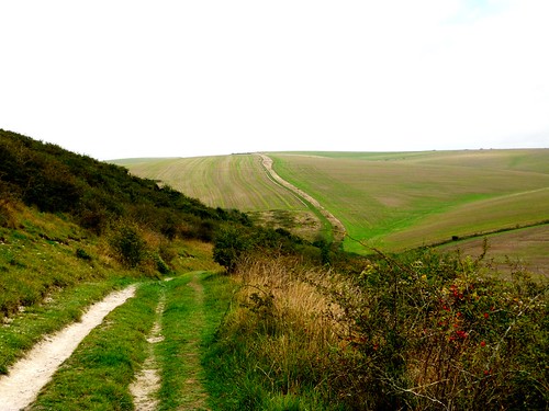
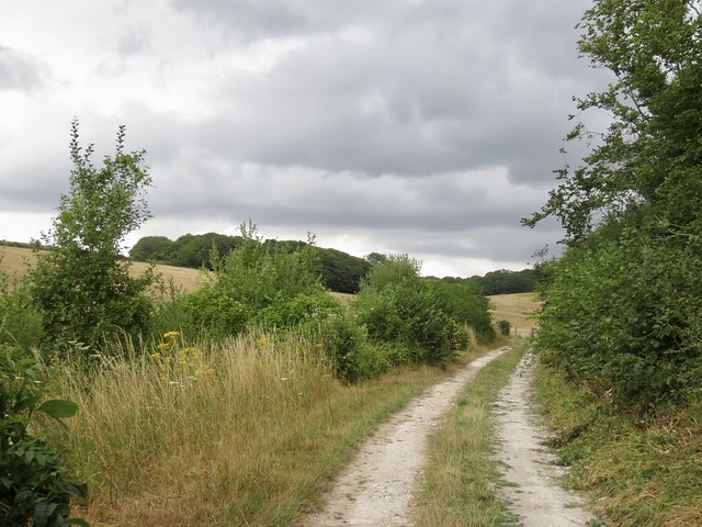
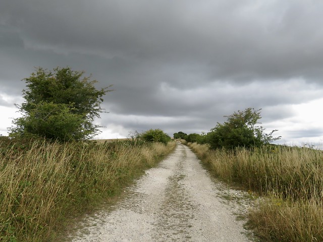
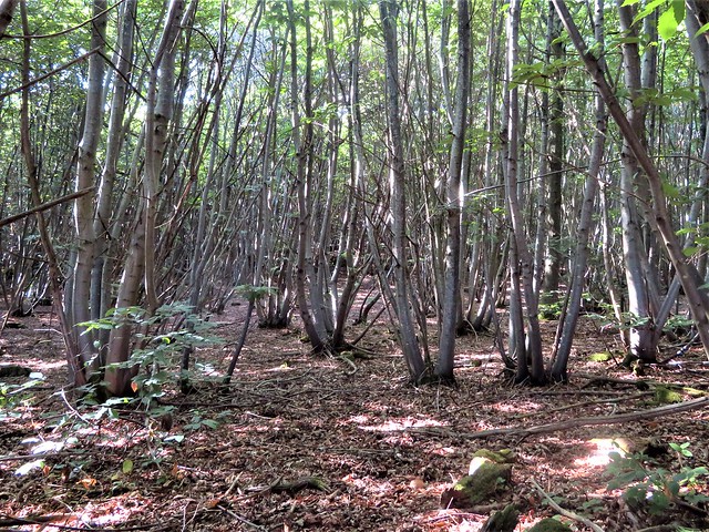
We followed a grassy bridleway that skirted Harrow Hill and ran north beside a hedge of handsomely pollarded old beeches. As so often when walking these Sussex downs, we were struck by the immaculate fettle of the land.

A red kit quartered the roadless valley that opened below us, the sun catching the burnt orange of its wings as it swung this way and that on the wind. Incredible to think that these lovely creatures were all but extinct in Britain only 30 years ago.

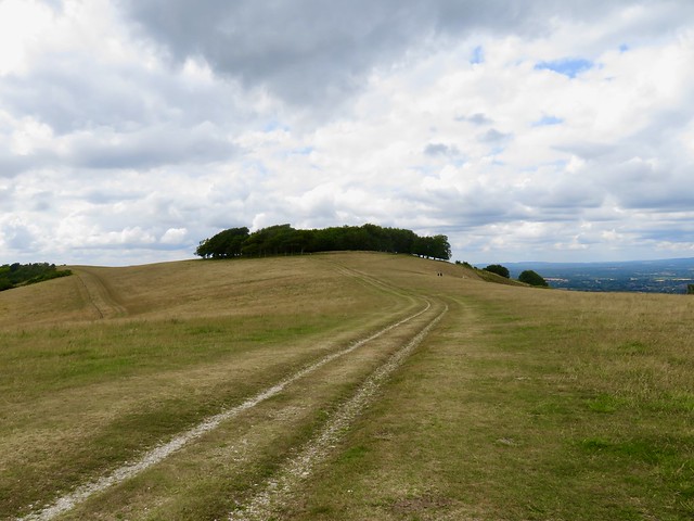
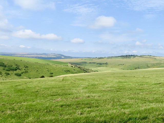
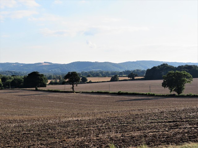
A long straight climb to the South Downs Way at the crest, and time before the homeward trudge to lean on a gate and study the view, fifty miles in sunshine, from the wooded weald of Sussex in the north to the glinting sea far down in the south.

Start: Kithurst Hill car park, RH20 4HW approx (OS ref TQ 070125)

Getting there: Kithurst Hill car park is signed at entrance to lane on B2139, 2 miles east of Amberley towards Storrington.

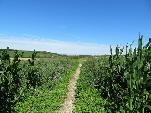
Walk (6½ miles, easy, OS Explorer 121): Beside ‘Kithurst Hill Car Park’ sign by car park entrance, go through metal gate, and wooden gate opposite (‘Public Bridleway’, blue arrow/BA). Half left across field; aim right of water tank to fingerpost/FP (073121). Cross path; follow FPs and BAs for 1 mile to Lee Farm (076104). Left; where drive swings right, ahead through gate (078103, BA). Right across field, through gateway (078099), up rising track. Gate (BA); grass track; in 150m fork left across field for ½ mile to gate (082093). Ahead down drive; in 250m, left through gate (084090, BA). Half right across pasture; at KG and FP, left (086090) on gravel track. In 400m fork left (087092) on fenced grass bridleway. In 500m fork right through gateway (089098); ahead across pastures. In ⅔ mile, through gate (090105); in 100m, right (gate, FP) on bridleway. In 300m, left (093109, BA) for ½ mile to SDW (093117); left to car park.

Lunch/Accommodation: Sportsman Inn, Amberley BN18 9NR (01798-831787, thesportsmanamberley.co.uk)

Info: Chichester TIC (01243-775888)
visitengland.com; satmap.com; ramblers.org.uk

 Posted by at 01:27
Feb 072015


First published in: The Times Click here to view a map for this walk in a new window
picture picture picture picture picture picture picture picture picture picture
Facebook Link:
A blustery, breezy sky over West Sussex, with marching rain clouds and brilliant blue intervals. The village of East Dean in a crook of the South Downs is all you want on such a day – as pretty as a picture, flint-built, with its simple cruciform Norman church, the snug little Star & Garter Inn, and a tree-hung pond from whose modest waters whelms the River Lavant.

In between spits of rain and windows of sunshine I climbed an old holloway sunk deep into chalk and flint, heading north for the dark ridge of the downs. A bench perfectly placed to look over the village carried a plaque inscribed:

‘Field, Coppice, Cottage & all I see
Vivified, hallowed by Memory.’
– A.E. West, Copseman and Countryman.

Who was A.E. West, with his dignified title of ‘Copseman’ and his nostalgic little couplet? No more than a shadow and a name to passers-by; but more than that to someone in East Dean, for certain.

Enormous clouds advanced over the ridge, heavy with rain, so purposeful and weighty that I found myself marvelling that clouds make no sound as they travel. As the thought came, so did an ogreish growl from the sky, and a blast of wind that beat at the beech trees and made their boughs twist and rattle.

From Pond Barn a flinty track took me up past green-roofed Postles Barn, its flint walls pierced with arrow-slit windows. I turned up the grassy slope of Brockhurst Bottom into Eastdean Woods where gleams of sun made silver pillars of the birch and pine trunks. The sky muttered again, a sulky rumble like a dyspeptic giant turning over in bed, and a squall of rain blotted out the light among the trees.

Up at the crest of the downs I bowled east along the South Downs Way, through ancient cross dykes or boundary banks, with a long prospect ahead of Bignor Hill curving into a blur of milky grey. There was something so vigorous and uplifting in this rainy stride along the old ridgeway that I felt I could have followed it for ever. Soon enough, though, it was time to turn aside and find the forest road through the beech woods that would carry me down to East Dean and the Star & Garter.

Start: Star & Garter Inn, East Dean, West Sussex, PO18 0JG (OS ref SU 904129)

Getting there: Bus service 99, Chichester-Petworth (pre-booking essential – 01903-264776, compass-travel.co.uk).
Road – East Dean is signposted off A285 (Chichester-Petworth).

Walk (7½ miles, easy, OS Explorer 121): Up road from Star & Garter to church (905132); through gate in NE corner of churchyard; left up sunken lane. In 100m leave trees; in 50m, bear right (904133, blue arrow/BA) up grassy holloway. In 200m, at top of section among trees (905135) footpath bears left, but keep ahead. In another 300m, bridleway bears left (904137, BA); fork right here (yellow arrow/YA, fingerpost) through wood for 400m to Pond Barn (904142).

Right over stile in bottom right corner of field; left at lane, then fork immediately right along gravel track. In 700m pass Postles Barn (911145); in 500m, bear left (917149) at fingerpost. ‘Restricted Byway/RB’ forks right, but fork left here (BA), trending slightly away from fence on left as you climb Brockhurst Bottom’s field slope to gate at edge of wood (916154). Ahead through wood (BAs), keeping same direction for ½ mile to reach South Downs Way (921163).

Right along SDW. In 1 mile pass first Cross Dyke shown on map (937159); in another ¼ mile pass second Cross Dyke (940158; resembles a hedge-bank on your left). In another 350m, where SDW re-enters trees (943155), turn right (‘RB, East Dean’) at fingerpost inscribed ‘Tegleaze’. Follow track south-west through woods (RB, purple arrows; then ‘Public Bridleway’ fingerposts). In 1¾ miles, just before ‘Shepherd’s Croft’ on map, main gravel track curves left at clearing (919144); but keep ahead on lesser track for 1½ miles back to East Dean.

Lunch/Accommodation: Star & Garter, East Dean (01243-811318, thestarandgarter.co.uk) – beautifully kept, welcoming village inn.

Info: Chichester TIC (01243-775888)
visitengland.com; www.satmap.com; ramblers.org.uk; LogMyTrip.co.uk

 Posted by at 01:14
Dec 072013
 

A brisk and cloudy morning over East Sussex, with the sun running its fingers capriciously along the spine of the South Downs where they made their final eastward roll before smoothing out into the coastal plains beyond Eastbourne.
First published in: The Times Click here to view a map for this walk in a new window
picture picture picture picture picture picture picture picture picture picture picture picture picture picture picture picture
Facebook Link:
Here Alfriston sits in a gap carved by the snaking Cuckmere River in the chalk wall of the downs, a natural gathering place for travellers going east-west along the ridge, or north-south between the fertile lowlands of the Sussex Weald and the pebbly coastline with its mighty white cliffs.

We gathered on the outskirts of Alfriston, a mixed bag of siblings, cousins and friends, and set off through the streets of the postcard-pretty village, all brick and flint, cheery red tiles and half-timbered houses. Not that everything hereabouts has always been this cosy. Back in the 18th century the Collins gang ran a ferocious and ruthless smuggling ring in Alfriston, and woe betide anyone who dared cross the ‘night-walking gentlemen’ or peach on them to the excise officers.

We passed the extravagantly carved and painted old Star Inn (a secret tunnel connects it to the beach at Cuckmere Haven, local stories say), and followed the wide chalk-and-flint trackway of the South Downs Way north-west, steeply up and out of Alfriston between thick hedges. Up on the back of the downs we had the wind in our faces and a broad track unrolling ahead, sheer exhilaration and a great stimulus for chatter.

Gilbert White, the naturalist curate of Selborne, speculated in the late 18th century as to whether the downs might have risen like bread from some yeast-like primordial dough. On a day like this you could see what he was getting at, with sun and cloud accentuating the soft elastic curves of the chalk, so that the whole range appeared to be straining skyward like a wind-bulged sail. Even under the bruise-coloured clouds the clefts of the downs held their characteristic allure, an invitation to explore enhanced by their status as Access Land open to all comers.

A great inner curve of south-facing downland shields Alfriston from the coast. We rounded its ridge and came down towards the meanders of the Cuckmere River through meadows where black and cream cattle grazed contentedly, scarcely troubling to lift their noses from the grass as we passed by. Glancing back, I saw the white chalk horse on High and Over Down, its muzzle sharpened by perspective to a crocodile profile, overseeing our homeward stroll by the olive-green and chalk-thickened waters of the Cuckmere River.

Start: The Willows car park, Alfriston, East Sussex, BN26 5UQ (OS ref TQ 521033)

Getting there: Bus service 126 (cuckmerebuses.org.uk), Seaford-Eastbourne
Road – Alfriston is signposted off A27 between Lewes and Eastbourne.

Walk (7½ miles, moderate, OS Explorer 123. NB: online map, more walks at christophersomerville.co.uk): Left into Alfriston; right up Star Lane beside Star Inn (‘South Downs Way’/SDW). Follow SDW for 2 miles. At 4-finger post (499045, blue arrow/BA), left on Green Way track for 1½ miles. At top of steep path, 5 ways meet (489024); take first left (bridleway). In 50m, keep ahead (not left downhill). In almost 1 mile, left through gate (498014, BA), following bridleway to cross road (512014). Descend fields to river; cross New Bridge (517014); left along east bank of Cuckmere River for 1¾ miles. Just past Alfriston Church, left across river (521031) to car park.

Lunch: Star Inn, Alfriston (01323-870495; thestaralfriston.co.uk)

Accommodation: Beachy Head Cottages, East Dean (01323-423878; beachyhead.org.uk) – immaculately run and very comfortable

Info: Eastbourne TIC (01323-415450); visitsussex.org
www.ramblers.org.uk www.satmap.com www.LogMyTrip.co.uk

 Posted by at 11:15
Mar 032012
 

Some walks just grab you so hard that you know you’ll be back to enjoy them again, if not sooner then later.
First published in: The Times Click here to view a map for this walk in a new window
picture picture picture picture picture picture picture picture
Facebook Link:
It was a good five years since I’d last set off from Alfriston, but nothing had changed in this lovely corner of East Sussex. The same clear-cut line of the South Downs above the village, running down to their final embrace of the coastal flatland; the same eccentric old carvings in the Star Inn’s frontage; even identical late winter weather, a cold blue sky arched over Alfriston, calling me up to the hills.

A covey of partridges burst whirring out of the root crops as I went up the flinty, half-frozen path onto the roof of the downs. Views were wide and wonderful – the North Downs a grey-blue line 30 miles to the north, the green billows of the South Downs riding up and away into the west, Alfriston lying with its stumpy church spire and tiled roofs like a village in a Brian Cook book jacket, all flat angles in bright brick reds, acid greens and indigos. The cold air stung my nostrils and smoked my breath. Descending to pass below the Long Man of Wilmington, I saw that spiders had strewn the ancient chalk-cut giant with a maze of cobwebs, so that the 200-ft figure sparkled as though encased in diamonds on its steep hillside.

Frost clung in tight curls to the muddy ruts of the path that led through the woods to Folkington. Elizabeth David lies in the churchyard under a gravestone carved with aubergines, peppers and cloves of garlic. Celebrity chefs are twenty to the teaspoonful nowadays, but she was the first, a post-war culinary pioneer who introduced beige British tastebuds to snazzy foreign flavours, a shock from which we’ve never recovered.

A snaking old track brought me south to Jevington with its cheerful Eight Bells pub and thousand-year-old church tower built like a fortress against Viking marauders. A Saxon Christ adorns the wall, victorious over a puny, wriggling serpent. Crossing the downs on the homeward stretch, I marvelled at how a corner of countryside with such a vigorous and bloody history – Viking and French raids, coastguard battles with the smuggling gangs, Second World War bombs and doodlebugs – has settled to a tranquillity as smooth as the applewood smoke rising from Alfriston’s chimneys into the blue Sussex sky.

Start & finish: The Willows car park, Alfriston, East Sussex BN26 5UQ (OS ref TQ 521033)
Getting there: Train (www.thetrainline.com; www.railcard.co.uk) to Eastbourne; bus 126 to Alfriston. Road: Alfriston signed off A27 (Brighton-Eastbourne), 5½ miles after A26 Newhaven roundabout.

PLEASE NOTE: The Wealdway Path between Folkington and Jevington will be closed for six months from 1 April 2012 for work by the Water Authority

Walk (8½ miles, moderate, OS Explorer 123):
From The Willows car park (521033), follow footpath by wall on right of coach park. Cross stile; right to cross another; right along river bank; left across White Bridge (522031) to road. Cross road; take footpath on right of house. In 20 yards up steps; on up hedged path. In 100 yards, left through hedge (525031 – South Downs Way/SDW marker post); diagonally right on path across field; through hedge; across next field to cross stile onto SDW (532033).

Right to cross road; follow SDW uphill past Windover Reservoir to go through gate into Access Land (538035). SDW continues ahead, but turn left along fence over ridge; in 30 yards, right along track, through gate and on for a mile, passing Long Man of Wilmington (542034) where you join the Wealdway path. At The Holt, through gate into wood (551040); right along track for ½ mile to St Peter’s Church, Folkington (559038). Bear right (as you approach church) along Wealdway for just over a mile to T-junction of track; left (561021 – ‘Wealdway’ arrow) to road; right through Jevington, passing Eight Bells pub (563017).

Continue for 100 yards to left bend; take path on right of road to St Andrew’s Church (562015). On up SDW for 2/3 of a mile to Holt Brow (553019). SDW turns right here, but keep ahead for one and a quarter miles through Lullington Heath NNR, passing Winchester’s Pond (540020), to fork (533020). Keep ahead (‘Litlington’), down to road (523021). Left past Litlington church. Just before Plough & Harrow pub, right (523017 – ‘Vanguard Way’) to Cuckmere River; right along bank for 1 mile to Alfriston.

Click on Facebook “Like” link to share this walk with Facebook friends.
Lunch: Eight Bells, Jevington (01323-484442; 8bellsonline.co.uk); Plough & Harrow, Litlington (01323-870632; www.ploughandharrowlitlington.co.uk)
More info: Eastbourne TIC (01323-415450); www.visitsussex.org
Family Support Work sponsored walk: Alfriston-Wilmington-Alfriston (7 miles), Easter Monday, 9 April – info 01273-425699; www.familysupportwork.org.uk
www.ramblers.org.uk www.satmap.com www.LogMyTrip.co.uk

 Posted by at 02:59
Aug 132011
 

A dip in the sea not long after dawn, an early morning drive into the South Downs, and I was away from Fulking as the newly risen sun cast an oblique light along the downland escarpment behind the village.
First published in: The Times Click here to view a map for this walk in a new window
picture picture picture picture picture picture picture picture
Facebook Link:
Beans rattled dry and black on their stalks, and the soil lay pale and cracked in this drought summer. To the north rose the downs, a 300-ft rampart of turf facing the agricultural lowlands, dull olive patched with white chalk scrapes and dark green scrub. Near at hand a yellowhammer in the hedge wheedled for ‘a-little-bit-of-bread-and-no-cheeeese!’

The fields stretched breathless and still in an early morning already gathering heat. Up on the downs, though, something was in motion. I stopped and stared as a crowd of bullocks went thundering down the slope, kicking up clouds of powdery chalk dust, mad with delight at the headlong sensation.

In Longlands Wood, a green wilderness of beech and oak, the swearing of a discontented jay broke the stillness. The pastures around Tottington Manor were full of dark chocolate cattle, cows and bull calves slowly grazing together, every muzzle a quivering maze of flies. I leaned over the gate, scratching a couple of handy backs, and then made for the downs. Steeply up through the trees on Tottington Mount, until at the crest I could stop and look back across the flatlands 300 feet below – downland slopes and woods leading out to the matt steel eyes of gravel pits and the great flood plain of the River Adur. A few more minutes and I was at the crest of the downs, looking south through beautiful curving valleys to the hazy grey vee of the sea.

Three young sparrowhawks hung in the air in line abreast, hunting the downs under the tutelage of their parent birds. I turned east along the ancient track of the South Downs Way, a white chalk thread drawn snaking through the turf. What fantastic elation, heading into the penumbra of the sun in this high place among drifts of scrambled-egg toadflax and white campion, passing broad headlands full of poppies and moon daisies left by the farmer around the margins of his barley fields. By the time I got to Perching Hill the sky ahead over Devil’s Dyke was already dotted with hang gliders, and before I dropped back down the escarpment to Fulking I stood and watched them circling like mythical heroes near the sun.

Start & finish: Shepherd & Dog PH, Fulking BN5 9LU (OS ref TQ 247113)
Getting there: Fulking signposted from A281 (Henfield-Brighton) and A2037 (Henfield-Upper Beeding)
Walk (6 miles, moderate/hard grade, OS Explorer 122): Leaving Shepherd & Dog, right along road; in 50 m, by fountain, left through gate (fingerpost); right along hedge. Through kissing gate; diagonally left across 2 fields by stiles. At gate, over stile (245116); left along stony lane. In 20m at left bend, bear right (fingerpost) diagonally over field, under power lines. Cross track to Perching Manor (yellow arrow/YA) and on. At far corner, cross footbridge (241120, YA post); left along edge of woodland. Cross footbridge, stile; on over 2 fields with hedge on left. At end of 2nd field, over stile and footbridge, and on. At track junction (234121, fingerpost), dogleg left, then right; follow field edge with hedge on left. At field end, left across footbridge (fingerpost). Through thicket; emerge to skirt house (231119). At end of trees, left across footplank (fingerpost); right along hedge. Cross track (225120); over stile (fingerpost) and follow hedge to stile into Longlands Wood (fingerpost). Follow path for 400m to path crossroads at 4-way fingerpost (219122). Left for 250m to leave trees (gate); follow track to Tottington Manor. Just before barn, left through gate (fingerpost). Right to cross road (215115). Right for 30m; left up track into trees (‘bridleway’; blue arrow/BA). Up path between fences to gate; continue uphill, curving right round Tottington Mount. At top of climb, aim for post on skyline; left here (217106, BA) to road. Left on South Downs Way (SDW) for 1½ miles, passing Youth Hostel and communications masts and continuing to pass under power lines (242109). In another ¼ mile, in a dip, through a gate (246109); left down cleft (YA post). In 250m, sharp left (249111, YA post); steeply down to Fulking.

Lunch: Shepherd & Dog PH, Fulking (01273-857382; www.shepherdanddogpub.co.uk) – lovely old walker-friendly pub
More info: Brighton TIC (01273-290337); www.visitsussex.org
www.ramblers.org.uk www.satmap.com www.LogMyTrip.co.uk
Click on Facebook “Like” link to share this walk with Facebook friends.

 Posted by at 01:54
Sep 162023


First published in: The Times Click here to view a map for this walk in a new window
view north from top of Warningore Bostal 1 the ridgeway track 1 the ridgeway track 2 looking back from the top of Plumpton Bostal 1 looking back from the top of Plumpton Bostal 2 curves of the downs from Warningore Bostal looking back from the top of Plumpton Bostal 3 near Warningore Farm scene near Warningore Farm

The white rails of Plumpton Racecourse curved away, pointing southward like skeletal fingers towards the olive-coloured rampart of the South Downs. A brisk cold wind blew from those hills, with a hint of silver underbelly on the clouds beyond from the gleam of the invisible sea.

A long straight path led between pasture and crops, crossing rain-swollen brooks in tangled dells, drawing ever nearer to the downs. This is horse country. A white mare poked her nose over a fence to have it stroked by a couple of passing girls. Suddenly she took a sly nip, provoking shrieks and cascades of giggles.

Cheerful chatter and tempting cooking smells came wafting from the Half Moon Inn as I crossed the Ditchling road and started up the steep downland track called Plumpton Bostal – a name reminiscent of fictional correspondents to Private Eye. The rubbly old track curved and climbed to the ridgeway along the crest of the hills. Wonderful views opened out, northwards across the wooded Sussex Weald toward the loom of the far-off North Downs, south across deep chalk valleys to the snub-nosed Seven Sisters cliffs and the ice-blue sea.

A kestrel rode the wind, head down, eyes fixed, sideslipping along above the almost imperceptible hummocks of Bronze Age bowl barrows. Soon another old holloway, Warningore Bostal, left the ridge track and slalomed down the hillside. The steady push of the south wind, now blocked by the wall of downland at my back, vanished as though a fan had been clicked off. I skittered down the rain-glazed chalk that floored the bostal, and set out north across pasture and arable ground once more.

At Warningore Farm the farmer was digging silage out of the clamp for his cattle. I passed the shed where they stood patiently in an emanation of sweet breath and a gentle rustle of movement.

On across the fields where horses in heavy tarpaulin raincoats were cropping the grass. A pint of delicious dark Bluebell Best in the Jolly Sportsman at East Chiltington, and then the homeward stretch by the hamlet’s ancient flint church, beautiful in its simplicity, too obscure even to have a dedication to its name.

How hard is it? 7¾ miles starting at station, 6½ miles starting at Plumpton; moderate.

Start: Train – Plumpton Station (NB no parking)
Road: Half Moon PH, Ditchling Road, Plumpton BN7 3AF (364132). Please ask permission, and give pub your custom! In addition, parking for 6-7 cars in lane above car park.

Getting there: Bus: 166 (Lewes-Haywards Heath)
Road: Plumpton is on B2116

Walk (OS Explorer 122): From station, path south besides racecourse. At south end, right (362153); in 40m, left down lane. In 1¼ miles, pass Agricultural College; 150m past last buildings, left (360133, gates); half right over field into trees. At B2116, left past Half Moon PH (364132). (NB Directions starting from PH begin here). Cross B2116; Plumpton Bostal (‘Bridleway’), steeply up. At top (357126), left; in 1 mile, through gate (370125); left down holloway. In ½ mile at path crossing, left (376127, arrow post). Cross B2116 (374130); bridleway opposite. Keep right of Warningore Farm Cottages (376137); on (north) along bridleway. In ¾ mile, gate into green lane (381147); in 50m, left (fingerpost, yellow arrow/YA) across 2 fields to lane (378150). Left; cross road by postbox (375150, stile, YA). Fork right across field to lane (373152). Left past Jolly Sportsman. At church, right down stony bridleway (371151). Cross Plumpton Lane (364153); in 150m, at racecourse entrance, right (362153) to Plumpton station.

Lunch: Half Moon, Plumpton (01273-890253, thehalfmoonplumpton.co.uk)

Accommodation: Jolly Sportsman, East Chiltington BN7 3BA (01273-890400, thejollysportsman.com)

Info: visitsoutheastengland.com

Walking the Bones of Britain – a 3 Billion Year Journey by Christopher Somerville is published by Doubleday.

 Posted by at 04:27
Jul 152023


First published in: The Times Click here to view a map for this walk in a new window
in Buddington Bottom looking seaward from the track to Buddington Bottom in Buddington Bottom 2 Chanctonbury Chanctonbury Ring looking across wild parsnip to Cissbury Ring and the sea Chanctonbury Ring 2 upland track near Chanctonbury Ring chalk hill blue butterfly view to Cissbury Ring hill fort round-headed rampion

The blackcap that scribbled out its song from an ash tree by the South Downs Way was singing for a perfect summer’s day. I couldn’t believe the profusion of wild flowers and blue butterflies that bordered the ancient ridgeway as it climbed towards the roof of the West Sussex downs.

Wild marjoram, thyme and spearmint scented my fingers. Kidney vetch and knapweed vied for the attention of common and chalkhill blue butterflies that had congregated after a spectacular hatch. Yellow froth of lady’s bedstraw, nail-polish pink of centaury, harebells and hawkbit, St John’s Wort and yellowwort, and the rich blue globular flowerheads of round-headed rampion, the ‘Pride of Sussex’, a nationally scarce flower of this chalk grassland habitat.

The South Downs Way rose as the view opened northwards across a patchwork of pale gold, unharvested cornfields and dark summer woods, south to where the bird’s beak of the Isle of Wight dipped to the sea. Soon another flinty track swung off southwest, a long and gradual descent between fields of wheat and barley, flanked by brilliant yellow sprigs of wild parsnip. Out of the crop fields ahead rose the multiple ramparts of Cissbury Ring, one of the Iron Age hill forts that command this countryside.

Down in the valley bottom I passed the Pest House, a modest cottage of brick and flint with an ominous name. In this lonely place in medieval times stood an isolation house where sufferers from plague, cholera, smallpox and other deadly communicable diseases were banged up to recover or die, one or the other.

A grassy track led up the wooded valley of Buddington Bottom, to reach the South Downs Way. Just west the early Iron Age hill fort of Chanctonbury Ring topped the hill, the circular rampart reinforced with a fine double circle of beech trees. The space under them is as dark as night. This is a place with enormous atmosphere, the world spread out at your feet from the sea to the Sussex Weald.

The Ring was made by the Devil, local stories say, and he will appear to you if you run thrice widdershins around the rampart. There’s a fiendish bargain on offer, of course: a bowl of demonic soup in exchange for your soul. Don’t run round the Ring when you’re feeling hungry, is my advice.

How hard is it? 5½ miles, easy, downland tracks.

Start: Chanctonbury car park, near Washington BN44 3DR (OS ref TQ 125121)

Getting there: Bus 23 (Worthing – Crawley)
Road: At Washington Roundabout on A24 (Worthing-Horsham), take A283. Right down Washington Bostal past Frankland Arms. In ¾ mile, just before A24, sharp left up rough road to car park.

Walk (OS Explorer 121): Uphill on South Downs Way/SDW. In ¾ mile at large grass triangle, right (130117, ‘Restricted Byway’) downhill. In 1 mile at cross-tracks, left (121104, 4-finger post, ‘Wiston Estate Winery’ notice). In ⅔ mile, opposite barns at New Barn, fork left, then immediately right (130100). In 150 m, where track meets lane, fork left through gate (fingerpost, blue arrow/BA); immediately left (BA). In 400m at far corner of vineyard, through gate (133104); on up path through Buddington Bottom valley for 1 mile. At top of climb, left on SDW (145113) past Chanctonbury Ring (139120). In 500m at cattle grid, fork right (134119, gate, BA) on path past dewpond. In 500m descend to gate (129121); down through old chalk pit (slippery!) to rejoin SDW (125121); right to car park.

Lunch: Frankland Arms, Washington RH20 4AL (01903-891405, thefranklandarms.com)

Accommodation: Village House Coaching Inn, Findon BN14 0TE (01903-873350, villagehousefindon.co.uk)

Info: westsussex.info

 Posted by at 01:43
Jul 302022


First published in: The Times Click here to view a map for this walk in a new window
flowery ditch of The Caburn hill fort 1 chalk track leading to The Caburn hill fort flowery ditch of The Caburn hill fort 2 flowery ditch of The Caburn hill fort 3 at the top of Caburn Bottom flowery ditch of The Caburn hill fort 4 wild marjoram growing in Bible Bottom looking down towards Oxteddle Bottom and Bible Bottom Wall butterfly

On a warm midday the half-moon shapes of paraglider sails – green, pink, yellow and rainbow – were wheeling in cloudy air off Mount Caburn. Looking south from the summit of the Iron Age ceremonial enclosure, we watched the paragliders swooping this way and that against a backdrop of the silvery sinuation of the River Ouse as it carved its way seaward through the chalk rampart of the South Downs.

The diminutive brick-and-flint estate cottages of Glynde lay neatly stretched below. A tufted path, jumping with grasshoppers, had led us up from the village, a straight course between fields of dusty ripe barley, the bearded seed heads hanging low. In a tin cattle trough a meadow pipit was bathing ecstatically, throwing up sparkling showers of water drops.

Wild flowers dotted the chalk grasslands of Mount Caburn – eyebright, tall yellow spikes of agrimony, red bartsia, and masses of wild marjoram where wall butterflies with dark spots and bars on their yellow wings were basking in the sun.

The 2,500-year-old ditch round the hilltop enclosure was spattered with blue flowers – scabious, harebells and viper’s bugloss – among which flitted blue butterflies. The same theme of chalk grassland flowers and butterflies continued all along the path that dropped down a slope of Access Land into a tangle of dry flat-bottomed valleys.

In Oxteddle Bottom faint foundations in the grass showed where winter sheds for plough oxen stood in medieval times. Bible Bottom’s enclosure was too well camouflaged under grass and wild vegetation to make out. We picnicked on a bank of marjoram, the bushy pink flowers exuding an oily pungency.

It was a scene straight out of an Eric Ravilious painting. Sheep were grazing these valleys as they have done for centuries. Although a Sussex shepherd of past times might have blinked at the sight of the farmer puttering up the slope of Bible Bottom on a quad, little else has changed here over the years.

Up on the nape of the downs we turned for home as views opened up to the north over the broad hedged lowlands of the Sussex Weald, a vista in total contrast to the billowing downs to the south. We threaded between Bronze Age burial mounds and old chalk quarries before turning off down the long path to Glynde, with the dimpled green wall of the South Downs beyond.

How hard is it? 5½ miles; easy; downland footpaths

Start: Glynde railway station, Lewes, East Sussex BN8 6RU (SO ref TQ458087)

Getting there: Rail to Glynde; bus 125 (Lewes – Eastbourne)
Road: Glynde is signed off A27 Lewes-Eastbourne

Walk (OS Explorer OL25): From station, left; in 300m left (457090, Ranscombe Lane); in 40m, right (gate, yellow arrow/YA) on field path for ¾ mile to ridge. At gate in ridge fence (445093), left to The Caburn (444089). Return towards gate; 100m past outer ditch of hillfort, left (444091) on path down Caburn Bottom. At bottom, ahead (440097) along Oxteddle Bottom. At pond, right-hand gate (437099, permissive path); in 300m bear left; cross stile (437101). Follow fence on left; in 400m, chalk path (433101) up to gate (431101). Ahead (YA) to post (430100, YA); right. In ¾ mile at Southerham Farm notice, kissing gate (442105); past waymark post, then wood on left. In 200m pass dewpond; before stile, right along fence (447105). In 300m fork left (466103), up to stile; on with fence on right. In ½ mile, left at gate on right (445093); retrace steps to Glynde.

Lunch: Little Cottage Tea Rooms, Ranscombe Lane, Glynde BN8 6ST (01273-858215, littlecottagetearooms.co.uk)

Accommodation: Ram Inn, Firle BN8 6NS (01273-858222, raminn.co.uk)

Info: glynde.co.uk
@somerville_c

 Posted by at 02:40
Nov 062021


First published in: The Times Click here to view a map for this walk in a new window
Sweet chestnut coppice, Fittleworth Wood classic West Sussex countryside near Fittleworth, looking to the South Downs 3 classic West Sussex countryside near Fittleworth, looking to the South Downs 2 classic West Sussex countryside near Fittleworth, looking to the South Downs sweet chestnut, hazel and holly flank the lane to Fittleworth Wood rough grassland near Limbourne Farm ploughed fields near Fittleworth, with South Downs beyond 3 field path between Little Bognor and Fittleworth ploughed fields near Fittleworth, with South Downs beyond harvest fields near Fittleworth, with South Downs beyond 2 harvest fields near Fittleworth, with South Downs beyond

A warm afternoon still gilding the backs of the South Downs, but growing cool in the shade of the trees of Hesworth Common. The downs hung halfway up the southern sky, a long and gradually undulating spine of tar-black woodland and dull gold fields. Baby rabbits were playing ‘statues’ in the verges of the stony lane that led past the back gardens of Fittleworth and on among the sweet chestnuts of Fittleworth Common. 
 
A green lane zigzagged north through the bracken undergrowth of Walters Plantation. Approaching Limbourne Farm the hedges were thick with the white bugle mouths of convolvulus and netted over with hop bines. We squeezed the sticky hop buds as we passed, and carried their pungent oily smell away at our finger ends.
 
Beyond the farm we entered the dense plantation of Fittleworth Wood. Properly maintained coppice of sweet chestnut is rare enough; there’s little call these days for the laths and battens, the hurdles and staves for which country craftsmen once harvested the chestnuts. But here in Fittleworth Wood the path ran between coppiced trees at every stage from tender new growth to mighty poles fifty feet tall – a beautiful sight with the sun filtering in thick bars of watery green light between the saw-edged leaves.
 
Near the edge of the wood a tiny Jack Russell pattered up to press its cold nose against my fingers, savouring the hop aromas as appreciatively as any real ale connoisseur. Beyond the trees lay hay meadows and the mellow red roofs and brick walls of Springs Farm, its peeping windows framed in sprays of buddleia.
 
If chestnut coppices are generally neglected nowadays, the commons where local folk once grazed their pigs and cattle have largely become overgrown with trees. We turned west through the luxuriant ash, oak and holly of Lithersgate Common, and south on a path that edged Bognor Common’s thickets of silver birch and rowan.
 
Down through Little Bognor, another picture-book straggle of beautifully kept old houses along a millpond stream, then on south through open fields. The powdery pink soil smoked in our wake, water-smoothed pebbles from some ancient river rolled under our boots, and the long arm of the downs stretched ahead as though to fence off the valley from the outside world.
 
How hard is it? 5½ miles; easy underfoot; careful navigation needed in woods
 
Start: Hesworth Common car park, Fittleworth, West Sussex RH20 1EW (OS ref TQ 007193)
 
Getting there: Bus Service 1 (Worthing-Midhurst)
Road – Car park signed off B2138 on west outskirts of Fittleworth.
 
Walk (OS Explorers 121, 134): Left/southeast (Serpent Trail/ST), parallel with B2138. In 200m, left to B2138 (009192). Right; in 50m, left past wooden barrier. Fork left on path. In 300m cross road (011191); on to Fittleworth Common. At wooden post bear right (014190), parallel with and then alongside northern boundary fence, to cross A283 (018190 – take care!).  By pond, right (fingerpost/FP); in 50m, left up bank (black arrow/BLA) on path through pinewood. 
 
In 150m bend right; in 150m, left (020191, bridleway fingerpost/BF) on broad bridleway. Pass Limbourne Farm sheds and silo (020193); in ½ mile, enter Fittleworth Wood (022201). In 100m pass footpath turning on left (FP); in another 100m take 2nd turning on right (022203, unmarked fork). Continue uphill. In 300m turn right (024206, blue arrow/BA). In 50m, left (BF); in 150m, right (BF, bench), steeply down bank. At bottom, follow BA uphill and on for 250m to top of wood (027210). Out of wood through gate; on to top left corner of field (027212); left (4-finger post) through gate; half left down across field. Follow lower edge of field below Springs Farm to drive (025213); follow it for 400m to road (021213).
 
Left; pass track to Warren Barn; in 15m, right (FP, stile) on path through trees of Lithersgate Common. Pass 3-finger post; in 200m, at next 3-finger post, right (019211). In 15m fork left down past pond. Follow ST for 550m to enter Mitfords Copse (013211); in 200m, descend to path crossing (011211). ST turns right; you go left/south-west (FP). In 300m, cross road (009209); down road opposite through Little Bognor. At far end of village pass ‘The Potting Shed’ on right; in 100m, left over stile (004204, FP, ‘Dyers Cottage’).
 
Follow YA past Dyer’s Cottage and on. Follow field edge downhill; in 100m, left (BLA, 006202) into wood. At end of trees, keep ahead to 3-finger post (005200); left to corner of hedge; half left across field past lone tree with FP to enter trees (008197). At kissing gate, half right across paddock to gate (BLA). Follow path to road; right to A283 (009194).
 
Right round bend (take care!); cross into Church Lane; right up path (FP) beside A283. At Scout hut, up left side of building; keep ahead to B2138 (008192); right to car park

Lunch/Accommodation: Angel Inn, Petworth GU32 0BG (01798-344445, angelinnpetworth.co.uk)

Information: Arundel TIC (01903-737838)

 Posted by at 01:53
Nov 142020


First published in: The Times Click here to view a map for this walk in a new window
picture picture picture picture picture picture picture
Facebook Link:

If I could just bottle a day like this and sell it, I’d be a millionaire and the lucky purchaser need never fear the onset of winter again. A sky of enamel blue lay over the Sussex Weald, and the views from the hilly lanes around Chelwood Common were twenty-mile prospects, out across the green and gold of the Wealden woods to the soft grey line of the South Downs clamped against the southern horizon.

Cyclamen made delicate pink half moons in the verges at Aggons Farm, and the holly hedges were thick with crimson berries and hung with scarlet necklaces of bryony.

The woods of Chelwood Common were running with water, their paths sodden, their rain-carved dells loud with the chatter of streams. Out in the open we passed Chelwood Farm, all red brick gables and tall chimney stacks, and in the fields beyond disturbed a herd of twenty-five roe deer feeding by Maskett’s Wood. They turned and fled into the trees, each animal’s movements mirrored by its companions as though one hundred-legged creature were scampering away.

Not so long ago Sheffield Forest was a hubbub of rural activities – charcoal burning, clay digging, coppicing, iron smelting in primitive bloomeries. If tree trunks were too heavy for horses to drag away to the sawmill, they’d be cut into planks on the spot in a hand-dug sawpit. A pair of sawyers would work with a great long saw between them, the upper man known as the ‘top dog,’ his colleague down in the sawpit as the ‘underdog.’ Searching for these old sawpits and bloomery hearths, we found only bumps and hollows – the forest had long swallowed them.

A snaking track led us down and across a damp valley, where the Annwood Brook flowed through a string of beautiful lakes.

Before taking the soft and squelchy homeward path we lingered under the trees at Sheffield Mill pond, watching the wind ripple the reflections of beech trees burnished gold and acid green by the declining sun of this perfect day.

Start: Coach & Horses Inn, School Lane, Danehill RH17 7JF (OS ref TQ 411287). Please ask permission to park, and give the pub your custom!

Getting there: Bus 270 (East Grinstead – Brighton)
Road: Coach & Horses is signed from Danehill on A275 (between Sheffield Park and Chelwood Gate)

Walk (7½ miles, woodland and field paths, OS Explorer 135): Up Coach Lane; cross road, on between gateposts. At Willowlands (418285) ahead through trees (yellow arrows/YA). In 400m, nearing Chelwood Farm, left (422286, stile, ‘Public Footpath’) across paddock. Follow YAs to lane (425286). Left; in 250m, just before road, right (electricity pole on left) across footbridge (427287), then through trees. In 200m, leave wood by stile (428286); left to cross stile without footboard. In 450m, opposite Maskett’s Farm, right on green lane (431283, stile, fingerpost). Follow YAs for ¾ mile to Bell Lane (430272).

Right; in 300m, right past barrier and ‘Sheffield Forest’ sign (429269). Follow forest road. In nearly 1 mile cross stream (421265); in 400m, cross another in valley bottom (421262); right at junction. In 250m on left bend, right downhill (419262) on grassy path. In 500m, fork right (416258, 3-finger post) across Sheffield Mill dam; up lane to road (409259). Right; in 250m fork right at Portmansford pond (409262); through gate to right of Rose Cottage. Follow squelchy path (YAs). In 600m pass between lakes (412267, YAs).

In 100m fork left; duckboard across stream; right to cross stile (422268). Keep right (YAs) along fence for 2 fields into wood (414271, stile, YA). Right to stile out of wood; left along field edge (YA) to stile next to gate (417272). At junction, ahead. In 200m at pond, ahead through gate (418274, YA) and on. In 600m pass Allins Farm (419278); in 700m, left over stile (419284, fingerpost, YA, ‘Paths to Progress’). Follow YAs across stream, up to lane (418285); left to Coach & Horses.

Conditions: Wet, muddy walk

Lunch: Coach & Horses (01825-740369, coachandhorses.co). Booking advised. – currently closed due to Covid

Accommodation: Griffin Inn, Fletching TN22 3SS (01825-722890, thegriffininn.co.uk) – fully Covid compliant

Info: Ashdown Forest Centre (01342-823583, ashdownforest.org)
satmap.com; ramblers.org.uk

 Posted by at 01:03