Search Results : Brecon

Feb 032018


First published in: The Times Click here to view a map for this walk in a new window
picture picture picture picture picture picture picture picture picture picture picture picture
Facebook Link:

‘Oh, we have people here all the year round to visit the waterfalls,’ said the landlord of the New Inn at Ystradfellte, ‘and a nice Sunday carvery, and that’s how we keep going.’

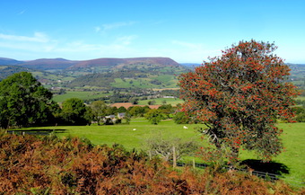
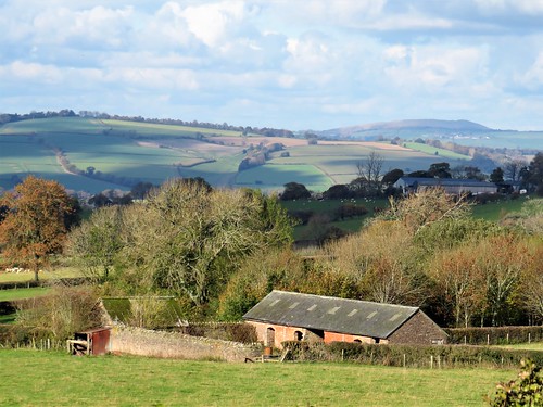
The New Inn, as warm and welcoming as you’d like every village pub to be, is at the heart of tiny but thriving Ystradfellte, in a cleft of the Brecon Beacons country. It takes a good positive community to keep a pub, post office, church and village hall going these days in such a small and out-of-the-way place.

Brooks trickled and field ditches chuckled with water after last night’s rain. Down at Porth-yr-Og, unearthly groans and roars issued from a cave in which the Afon Mellte went churning and twisting invisibly through subterranean narrows. A file of youngsters in hard hats and caving overalls came up the path, grinning their heads off with excitement at what they’d seen down there.

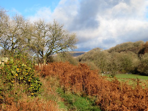
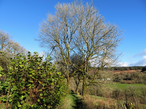
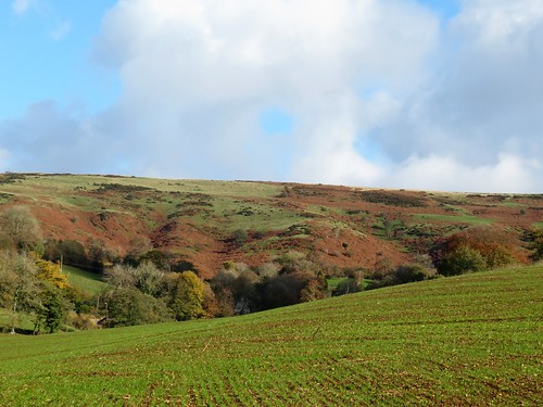
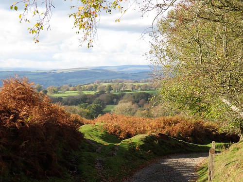
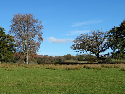
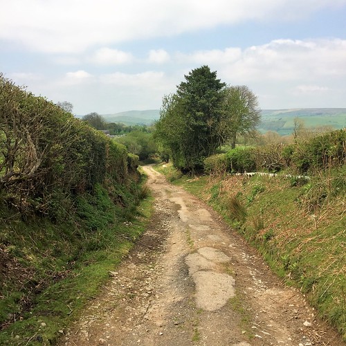
A narrow, stony laneway, all mud and moss, led us over a green hillside and down into a parallel valley where the Nedd Fechan river rushed beneath Pont Rhyd-y-Cnau, ‘bridge at the ford of the nuts’. Hazels still overhung the water, but squirrels had gathered all the nuts for winter.

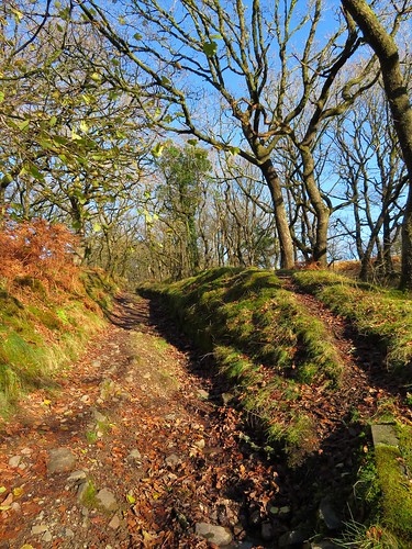
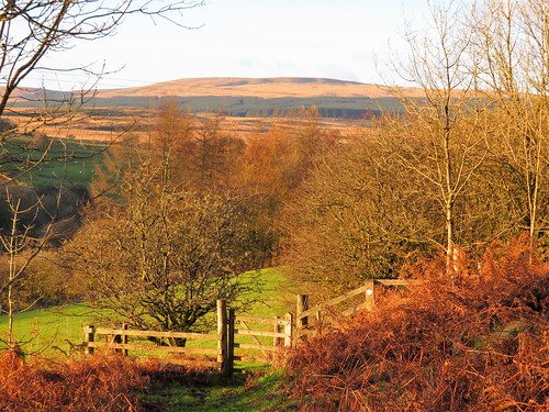
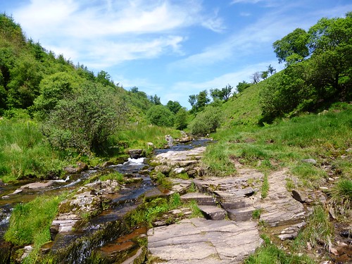
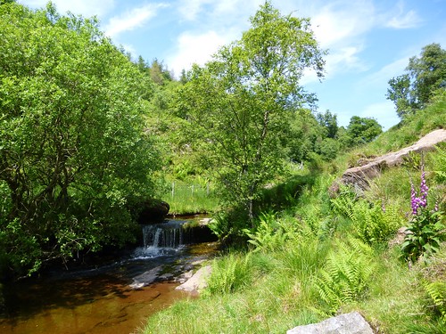
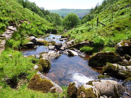
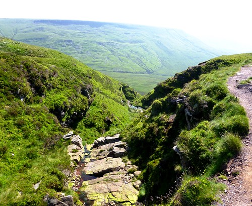
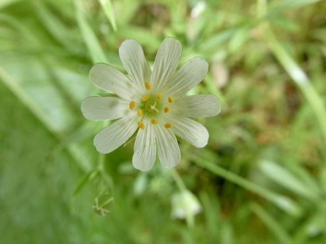
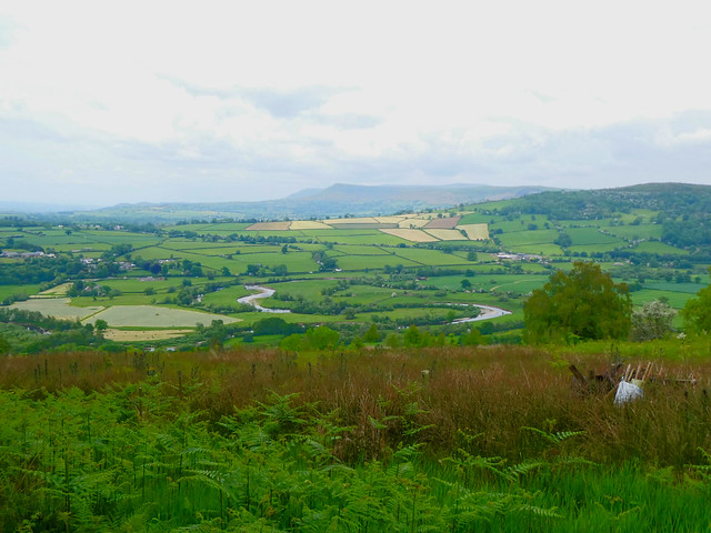
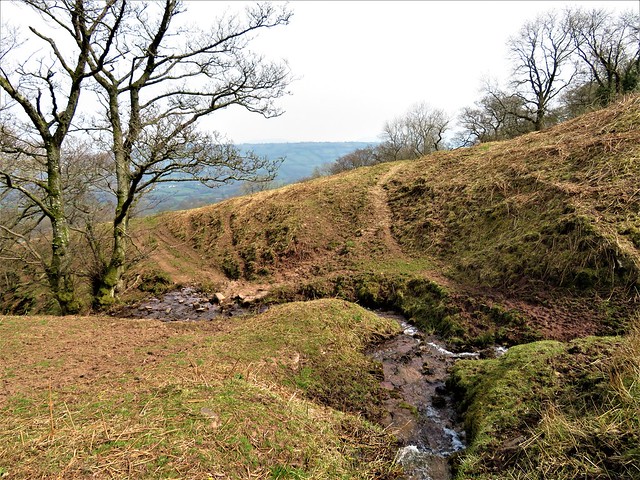
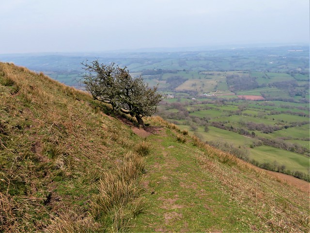
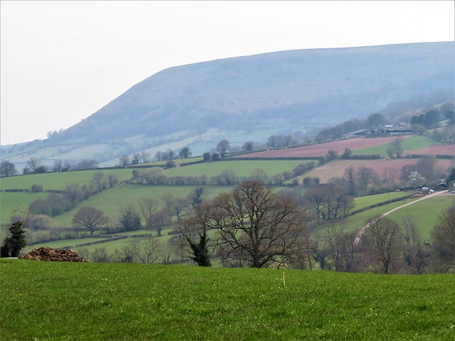
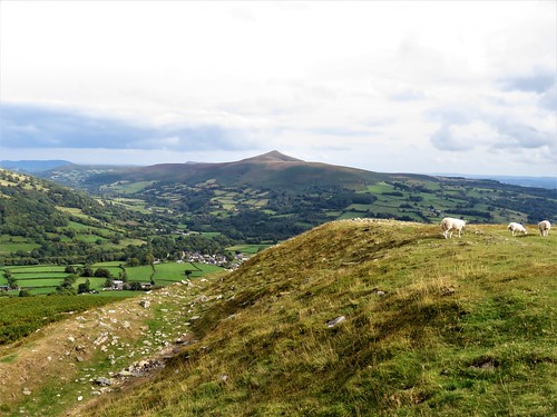
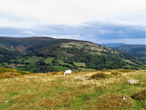
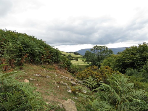
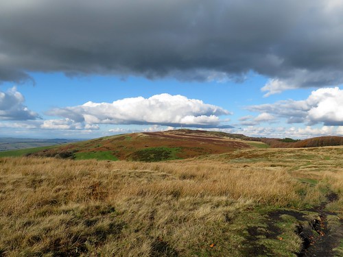
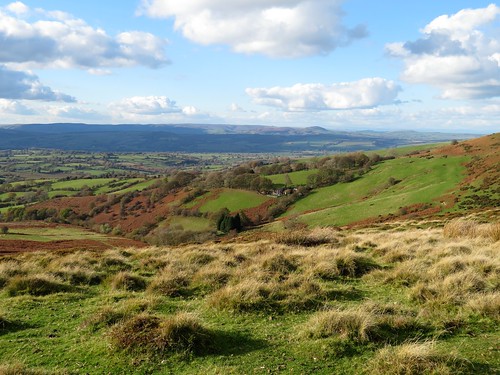
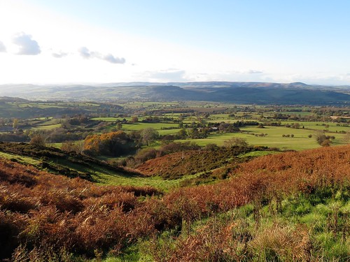
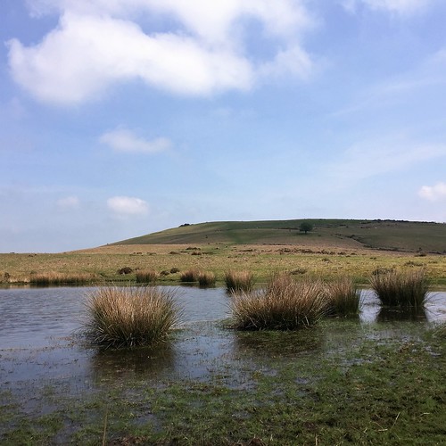
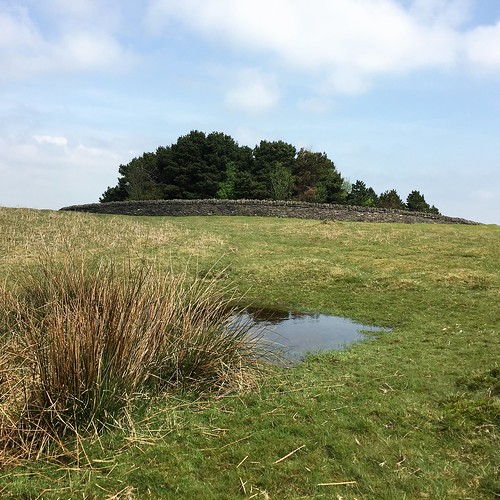
We walked upriver beside the Nedd Fechan, feeling its cold breath on our cheeks. The rain-swollen water hurried over rapids, fed by tributaries that tumbled down through the woods in stepped waterfalls. Pwll Du, the black pool, lay quiet, a dark silver disc in a cave mouth at the foot of a crag. We scrambled up a steep little path and teetered along at the rim of the gorge, ducking under silver birch boughs crusty with white and green lichens.

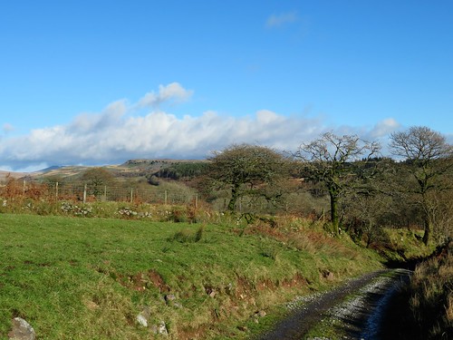
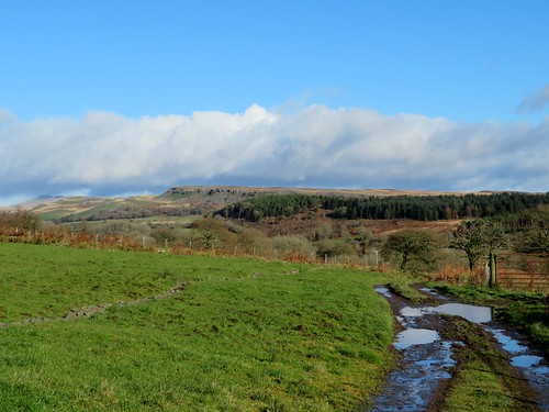
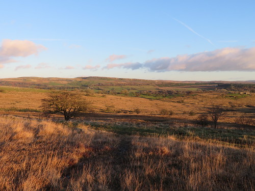
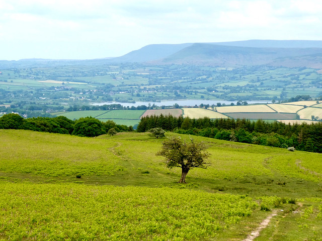
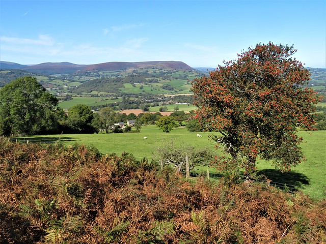
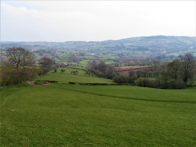
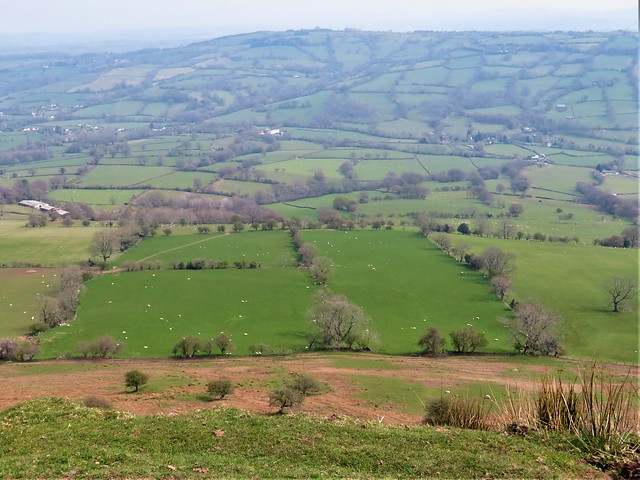
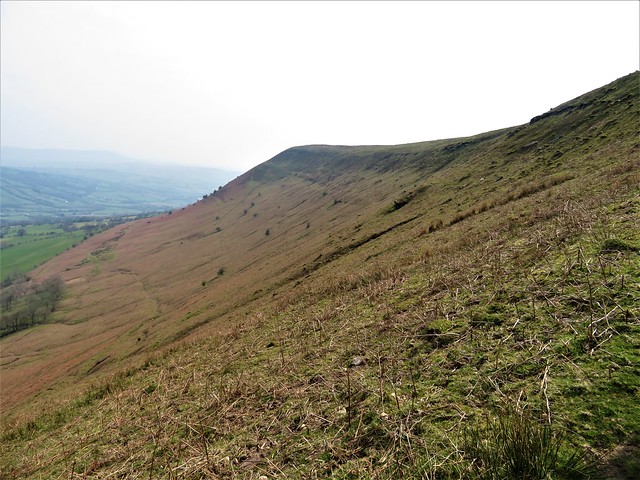
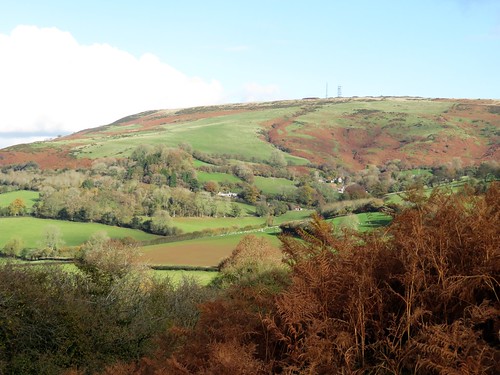
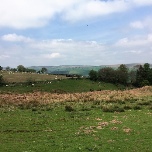
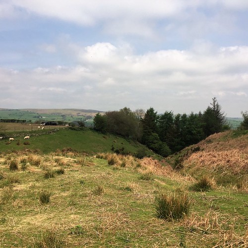
A farm track across the river led up to Cefn-ucheldref, the ‘back homestead’, a lonely clutch of mossy ruins on the hillside. A final crossing of the Nedd Fechan, and we followed an old bridleway eastward over a sedgy upland until the neat white houses of Ystradfellte appeared below in a twinkle of lights through the dusk.

Start: Ystradfellte car park, Brecon Beacons, CF44 9JE (OS ref: SN 930134)

Getting there: Ystradfellte is signed from A4059, 4 miles north of Hirwaun

Walk (6 miles, strenuous in parts, OS Explorer OL12): Right by New Inn, past church; cross river; in 200m, right (932130, stile, yellow arrow/YA). Follow path for 600m to car park (928124). Detour right down zigzag path, then left over stiles to see Porth-yr-ogof cave. At road beyond car park, right; just past ‘Cwmporth’ sign, left (blue arrow, ‘bridleway’) south-west along narrow walled lane.

In 900m at T-junction (921117, blue post), right to road. Left; first right (919117, ‘Nedd Valley’). In 200m, left through gate (unmarked); down steep lane to river at Pont Rhyd-y-Cnau (912116). Don’t cross bridge; turn right (north) on riverbank path. In 500m, at Pwll Du pool and cave (912121), climb narrow path above pool. Follow narrow path, close to fence on right at top of gorge, north for 500m to cross river on bridge below Dyffryn-Nedd (912126).

Up track (YAs) to field (911128); follow track, keeping same height above river. In 500m aim a little left for ruins of Cefn-ucheldref (909135, stile, YA). Right along lane above; in 350m, right on track (908139, unmarked), descending to cross river (911140). Left at road above; in 200m, right (913141, gate, ‘Ystradfellte’ fingerpost).

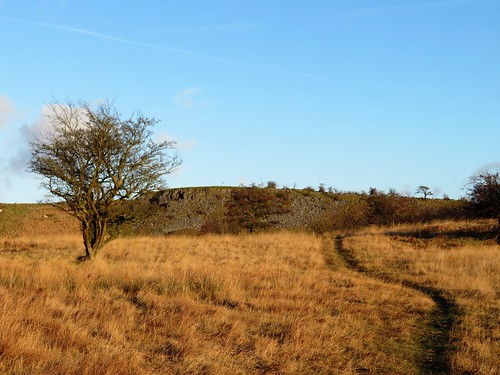
Half right across field, through gate; follow track. From next gate (914140) follow grassy track; in 150m, fork right. Follow path past occasional posts across open ground. In 300m pass rocky outcrops on left (917139); aim east across big open area, passing left of enclosure with poles (920139), then aiming for gate in angle of walls at far left corner of field (924138). Follow green lane south-west for ½ mile to Ystradfellte.

Conditions: muddy bridleways, narrow path on steep slope from Pwll Du northwards. Boots, sticks, mud-proof legwear!

Lunch: New Inn, Ystradfellte (01639-720211; waterfallways.co.uk) – excellent, friendly pub

Accommodation: Nant-Ddu Lodge, Cwm Taf, Merthyr Tydfil CF48 2HY (01685-379111, nant-ddu-lodge.co.uk)

Info: breconbeacons.org; visitwales.com; satmap.com; ramblers.org.uk

 Posted by at 01:38
Aug 232014
 

The Nant Bwrefwr came sparkling down from the heights of Craig y Fan Ddu, chuckling over its gleaming black and red rocks as though at the folly of walkers who’d bust a sweat climbing the Brecon Beacons on a glorious summer morning as hot and sunny as this.
First published in: The Times Click here to view a map for this walk in a new window
picture picture picture picture picture picture picture picture
Facebook Link:
Wild thyme and tiny white flowers of heath bedstraw jewelled the sedgy grass as we went slowly up towards the ridge. Up there a wonderfully welcome breeze was blowing from the precipitous valley of the Afon Caerfanell. We circled the rim to where the infant river tipped over the edge and cascaded down through a clutter of dry boulders. Bog cotton trembled like trapped swansdown over the surface of a pool framed in sphagnum moss as green and cool as a freshly cut lime.

The flat high heads of Fan y Big and Cribyn looked over the moorland to the north-west. We went on along the cliffs, past shaggy hill ponies and newly shorn sheep, to the far side of the valley. Here two jumbles of weather-pitted aluminium and a memorial cairn marked the site of a wartime aeroplane crash. Five Canadian airmen – Sergeants Beatty, Hayes, Mittle and Yuill, and their skipper, Flight-Sergeant JB Kemp – died on 6 July 1942 when their Wellington bomber lost direction on a training flight in low cloud and slammed into this hillside. It couldn’t be a more peaceful place, looking south through the jaws of the cleft to the blue ridges of the South Wales valleys, one behind another till they merge into the sky.

From the cairn at the end of the ridge we dropped steeply off the promontory, making across a grassy upland to descend beside the Afon Caerfanell. Following it down the valley and back to the car in clear hot sunlight we found orchids in the bogs, brilliant blue butterwort under the rocks, and a whole rake of families splashing and swimming and making the most of the cold waterfalls of the hastening, beautiful Caerfanell.

Start: Upper Blaen-y-glyn car park, near Pontstycill, Powys CF48 2UT approx. (OS ref SO 056176)

Getting there: From Merthyr Tydfil (A465, A470), follow ‘Pontstycill’ and ‘Talybont-on-Usk’. After 7 miles, just beyond road summit, left (signed) into car park.

Walk (5½ miles, moderate/hard, OS Explorer OL12. NB: online map, more walks at christophersomerville.co.uk): Return across cattle grid, immediately right on stepped path, steeply up to ridge (054183). Where path flattens, bear right; follow rim of valley clockwise for 1½ miles to saddle at head of valley where Blaen y Glyn cleft descends (057206). Right on path to aeroplane crash memorial (062200). Steep path ascends on left of stream gully; right along top of Cwar y Gigfran crags to cairn (067192) Bear half right, steeply down; on across upland plateau to wall; right down to Afon Caerfanell (062183). Left over stile; follow riverside path. In ½ mile, just before valley bends left (east), turn right by footpath fingerpost across footbridge (061174). On through kissing gate; in 50m, left at junction; in another 50m, just before concrete footbridge, right up steep path between 2 streams. At top, where trees open to left, turn left on wider track, which bends right to car park.

Conditions: Several steep climbs and descents; boggy path by Afon Caerfanell.

Lunch: Red Cow, Pontstycill (01685-384828). Several pubs/tearoom in Talybont-on-Usk. Nearest tearoom (March-Oct): Old Barn, Ystradgynwyn (01685-363358), 1½ miles south of car park on Merthyr Tydfil road.

Info: Brecon Beacons National Park (01874-623366; breconbeacons.org)

visitwales.com; ramblers.org.uk; theaa.com/walks;
www.satmap.com; www.LogMyTrip.co.uk

 Posted by at 01:40
Jul 012023


First published in: The Times Click here to view a map for this walk in a new window
Pecelli Pecelli Pecelli Pecelli Pecelli Pecelli Pecelli

The Brecon Beacons may have changed their name to Bannau Brycheiniog, ‘the peaks of Brychan’s Kingdom’, but the allure of these sharply profiled Welsh mountain remains, as it always was, irresistible to walkers. The wedge-shaped summit of Pen y fan, tallest of the range, was bristling with tiny figures on this warm summer afternoon. Nearer at hand, the gentle green dome of Pen y Bryn, a north-easterly outlier, held only a scattered flock of Welsh mountain ewes and lambs, very wary of intruders onto their hill.

The church of St Meugan stood among trees in a dip of ground above the village of Pencelli. In the cool, musty interior a wall plaque commemorated John Jones (1875-1942), a much-travelled cleric, ‘priest and missionary to the Natives of Australia’. Outside, the windowless north wall of the tower was used in times past as a goal by Pencelli’s handball players. Other locals would gather round the nearby cockpit, nowadays a bushy dingle, to wager and bicker as their game birds battled it out.

Beyond the church we crossed fields where the hazel hedges sheltered lines of sheep as yet unshorn, all panting in the heat. A green lane led away uphill, a grassy track indented in the ground that steepened past twisted thorn trees.

On the southwest skyline the canted top of Pen y fan stood tall and shadowed, lord of steep ridges and valleys. Below the path a stream was flowing underground, its subterranean trickling a guide for our footsteps as we neared the top of Pen y Bryn. A side turning over trackless ground and we were standing by the summit cairn with a magnificent panorama opening north and east, the long snouts of the Black Mountain ridges descending to green patchwork farmlands.

With views like these, who would ever want to take the downward path? Eventually we did, scooting down across a long grass upland towards the oakwoods of Allt Feigan, where cuckoos were calling. A shady track beside a mossy wall; then a long descent on a dusty red cart road under enormous, bulbous old oaks, looking out across newly mown meadows where the River Usk glinted and curved in extravagant bends like a monster eel caught in a trap.

How hard is it? 6 miles; moderate hill walk; some upland paths faintly marked on ground. Avoid in mist.

Start: Pencelli, near Talybont-on-Usk LD3 7LX (OS ref SO 092250)

Getting there: Signed from Talybont-on-Usk (A40, Crickhowell-Brecon). At entrance to village, left (‘Plas Pencelli’) to parking place by canal bridge.

Walk (OS Explorer OL12): Up lane opposite (‘Llanfeigan Church’). In ½ mile at parking place, fork right for church (087245), left to continue walk. Right at Ty’r Eglwys; steps down to footbridge (086245); up under trees, then across 2 fields (yellow arrows/YAs) to road (083246). Left; in 300m, right up green lane (081244, YAs, yellow-topped post). In ½ mile, where ground levels off (074238 approx), fork left off stony path onto grassy one. Continue climb on clear path for ¾ miles till ground levels again at top of climb (070227 approx). Left over open ground to summit cairn of Pen y Bryn (073227). From here descend ENE for 1½ miles on clear path across open grassland, at first aiming for left edge of forestry, then for angle where coniferous and broadleaved woodlands meet. Left here over stile (094237); follow track beside wall. In 500m fork left downhill (099237), following Usk Valley Walk back to Pencelli.

Lunch: Royal Oak, Pencelli (01874-665396, theroyaloakpencelli.com)

Accommodation: Peterstone Court, Llanhamlach, Brecon LD3 7YB (01874-665387, peterstone-court.com) – comfortable, friendly stopover

Info: visitwales.com

 Posted by at 02:43
Dec 112021


First published in: The Times Click here to view a map for this walk in a new window
view north from foot of The Skirrid 1 fabulous barn, Llanvihangel Court view north from foot of The Skirrid 2 view north from foot of The Skirrid 3 view north from foot of The Skirrid 4 Skirrid peak from western side 1 Skirrid peak from western side 2 Skirrid peak from western side 3 path to the peak 1 path to the peak 2 Skirrid peak from northwest 1

The River Severn’s estuary was at a fantastically low tide as we crossed the ‘new’ bridge on a day of no cloud whatsoever. Looking seaward through the stroboscopic flicker of the bracing wires, we could see the tidal outcrop of the English stones fully exposed and slathered in red mud.

Downriver, the little hump of Denny Island off Portishead stood marooned in a huge desert of sand. Other sand and mud banks lay around the widening tideway like beached whales.

We were heading to Llanvihangel Crucorney, a placename whose sound put the immortal walking writer John Hillaby in mind of ‘a toy train scampering over points’. Llanvihangel Crucorney lies in the River Monnow valley that forms the eastern boundary of the Black Mountains and Brecon Beacons. It’s a great jumping off point for walks westward into those mountains, but today we were aiming east to climb The Skirrid (Ysgyryd Fawr, the ‘big split one’), a tall hill that lies north-south with its head cocked and spine raised like an alert old dog.

The Skirrid is made of tough old red sandstone lying in a heavy lump on top of thin layers of weaker mudstone – hence its history of slippage and landslides. We came up to it in cold wind and brilliant sunshine across fields of sheep, skirting its western flank through scrub woods, gorse bushes blooming yellow and holly trees in a blaze of scarlet berries, with the dark purple crags of the northern end hanging over little rugged passes of landslide rocks fallen in a jumble.

The ascent is short, steep and stepped, but it’s the sort of ‘starter mountain’ that families with six-year-olds can manage. Many were out – mums, dads, children, students, ‘maturer’ folk such as us.

Once at the peak in this unbelievably clear weather we gasped to see the landscape laid out in pin-sharp detail a thousand feet below and fifty miles off – Malverns, Black Mountains; farmlands rising and falling towards Gloucestershire and the Midlands; the slanting tabletops of Penyfan and Cribyn over in the Brecon Beacons; Cotswolds, Mendip, Exmoor; and the south Wales coast trending round into far-off Pembrokeshire.

Nearer at hand a grey streak of softly glimmering sea showed the tide rising in the Severn Estuary past Brean Down’s promontory, the slight disc of Flat Holm and the hump of her sister island Steep Holm, their lower edges lost in mist so that they looked like floating islands in some fabulous sea.
How hard is it? 6½ miles; strenuous short climb, some stumbly parts.

Start: Skirrid Mountain Inn, Llanvihangel Crucorney, Abergavenny NP7 8DH (OS ref SO 326206)

Getting there: Bus X3 (Hereford-Abergavenny)
Road – Llanvihangel Crucorney is on A465 (Abergavenny-Hereford)

Walk (OS Explorer OL13): Opposite church, lane (gateposts) to cross A465. Down drive; right at wall (325204); follow Beacons Way/BW arrow waymarks. Pass wood-framed barn; in 100m, right (328202, BW, gate). Follow BW across fields to lane at Pen-y-parc (336192). Right; beyond ‘Steppes’ house, left (332191, stile); follow BW to foot of Skirrid (333186). Right on path along west side of Skirrid to rejoin BW at southern foot of mountain (327169). Follow BW up to Skirrid summit (331183). Return; in 200m, sharp left beside hollow (331181); path descends to north foot (333185). Retrace BW back to lane at Steppes (332191). Left; in ½ mile, opposite Llwyn Franc, right (325190, gate, fingerpost ‘Crossways’). Follow hedge on right to gate/stile (325192). Half left across field, crossing Great Llwyn Franc drive (324193); on down to Crossways House (323200) and Llanvihangel Crucorney.

Lunch/Accommodation: Skirrid Mountain Inn, Llanvihangel Crucorney (01873-890258, skirridmountaininn.co.uk)

Info: Abergavenny TIC (01873-853254, visitwales.com)

 Posted by at 01:32
Oct 022020


The River Severn’s estuary was at a fantastically low tide as we crossed the ‘new’ bridge on a day of no cloud whatsoever. Looking seaward through the stroboscopic flicker of the bracing wires, we could see the tidal outcrop of the English stones fully exposed and slathered in red mud. Downriver, the little hump of Denny Island off Portishead stood marooned in a huge desert of sand. Other sand and mud banks lay around the widening tideway like beached whales. Unwary strangers might even suppose you could cross the five miles from the English to the Welsh bank on foot and do no more than bespatter your spats. And maybe you could, if you were able to walk on water while negotiating quicksand, slow mud, sudden drops, fathomless pools, and the second highest tidal range in the world sneaking round the corners to cut you off.

Over in Wales we hightailed it to Llanfihangel Crucorney, a placename whose sound put the immortal walking writer John Hillaby in mind of ‘a toy train scampering over points’. LC lies in the River Monnow’s valley that forms the eastern boundary of the Black Mountains and Brecon Beacons. It’s a great jumping off point for walks westward into those mountains, but today we were aiming east to climb The Skirrid (Ysgyryd Fawr, the ‘big split one’), a tall hill that lies north-south with its head cocked and spine raised like an alert old dog.

The Skirrid is made of tough old red sandstone lying in a heavy lump on top of thin layers of weaker mudstone – hence its history of slippage and landslides. We came up to it in cold wind and brilliant sunshine across fields of sheep, skirting its western flank through scrub woods, gorse bushes blooming yellow and holly trees in a blaze of scarlet berries, with the dark purple crags of the northern end hanging over little rugged passes of landslide rocks fallen in a jumble.


The ascent is short, steep and stepped, but it’s the sort of ‘starter mountain’ that families with six-year-olds can manage. Many were out – mums, dads, children, students, ‘maturer’ folk such as us, all hurrying to revel in this one-in-a-thousand day before the threatened reintroduction of lockdown in Wales should come into force.


Once at the peak in this unbelievably clear weather we gasped to see the landscape laid out in pin-sharp detail a thousand feet below and fifty miles off – Malverns, Black Mountains; farmlands rising and falling towards Gloucestershire and the Midlands; the slanting tabletops of Penyfan and Cribyn over in the Brecon Beacons; Cotswolds, Mendip, Exmoor; and the south Wales coast trending round into far-off Pembrokeshire.

Nearer at hand a grey streak of softly glimmering sea showed the tide rising in the Severn Estuary past Brean Down’s promontory, the slight disc of Flat Holm and the hump of her sister island Steep Holm, their lower edges lost in mist so that they looked like floating islands in some fabulous sea.


 Posted by at 19:43
Dec 212019


First published in: The Times Click here to view a map for this walk in a new window
picture picture picture picture picture picture picture picture picture picture picture picture
Facebook Link:

The village of Longtown straggles out a mile along its back country road in a quiet corner of western Herefordshire. On this murky morning the Norman castle on its modest mound seemed the most upstanding feature of the Olchon Valley. The great rampart of the Black Mountains, walling in the valley on west, stood all but invisible in thick grey mist.

We walked the round of the circular keep, under the projecting chute of Lord Gilbert de Lacy’s own private garderobe, and on down through the stubby curtain wall. It was hard to credit that the battered and much-quarried little ruin once dominated all this valley and its commerce by road or river.

Strolling out of Longtown and down the pastures towards the winding Olchon Brook, the mountainous scene came gradually into focus ahead. From the river bank the green fields sloped up past Cayo Farm to where they abruptly steepened into the bracken-brown mountainside.

A grassy trod, one of a whole skein of paths criss-crossing these Welsh Border hills, slanted up the slope and deposited us at the top onto the broad saddle of Hatterrall Ridge. Suddenly the view opened for miles westward, down into the long cleft of the Vale of Ewyas, over and across into the wild central massif of the Black Mountains. The great arches and monastery ruins of Llanthony Priory lay screened by trees and the slope of the lane, but we could see the old packhorse track to the abbey falling away into Ewyas as a hillside thread.

Offa, late 8th-century King of Mercia, ordered a mighty earthen wall and dyke or ditch to be built along the borders to keep the warlike Welsh in their place. Here along the high lookout of Hatterrall Ridge run the remnants of Offa’s Dyke. We followed it north with tremendous views on all sides, present-day lords of all we surveyed.

All too soon our homeward path appeared, a steep track sloping down the mountainside into the Olchon Valley and its sheep pastures once more. A familiar landmark beckoned us back across the fields to Longtown – the stumpy castle keep, still standing sentinel over valley, road and river.

Start: Longtown Castle, Longtown, near Abergavenny HR2 0LE (OS ref SO 321292)

Getting there: Longtown is signed off A465 (Abergavenny-Brecon).

Walk (5¾ miles, some steep ascents, OS Explorer OL13): From castle, right along road. Opposite Outdoor Learning Centre, right (322290). Path down to cross stile; down field to road (320288). Through gate, left of ford (‘permissive path’); in 50m, right across brook; left up field to Cayo Farm (317285). Through farmyard; on up 4 fields (fence on right), then bear left to stile (310280) and green lane.

At top of rise cross green track (309279, yellow arrow/YA); bear left along green track, sloping uphill for ½ mile. Near top, path forks; go right uphill to Offa’s Dyke Path (308270). Right along ridge following ODP. In 900m pass trig pillar (305279); in another 600m pass cairn (300283); in 250m, at second cairn at cross-paths, right (299285). Path soon bears left and slants downhill. In 200m ignore green track hairpin to right (300288); in another 350m, hairpin right at cross-tracks (300291). Follow path, keeping same line, downhill for 500m to cross stream at corner of fence (303287). Right downhill to track; left to road (304289); right.

Pass Great Turnant farm (306288). In 300m, at Lower Turnant, right along gravel driveway (308291, fingerpost). Follow white arrows to left, then through gate. Down field to cross holloway at bottom left corner (310292, gates, YA). On down field; through gate by pond (312293); across field, through right-hand of 2 gates (314293). In 100m, left (gate, stone stile); down to cross footbridge (315293). Across fields (gates, stiles), heading for Longtown Castle.

Lunch/Accommodation: Crown Inn, Longtown HR2 0LT (01873-860217, crowninnlongtown.co.uk

Info: Hay-on-Wye TIC (01497-820144); visitengland.com/herefordshire; satmap.com; ramblers.org.uk

 Posted by at 02:36
Feb 162019


First published in: The Times Click here to view a map for this walk in a new window

picture picture picture picture picture picture picture picture picture picture

Facebook Link:

Everyone who comes to Crickhowell for the Walking Festival in March looks out for Table Mountain, the slanted, flat-topped outcrop of old red sandstone that rises some 1,200 feet above the little Welsh Border town.

Distinctive though its shape is, you scarcely notice the hill when you’re down in the streets of Crickhowell. The outer edge of the Black Mountains looms beyond, far higher and grander than modest Table Mountain. But it’s Crickhowell’s guardian hill that everyone must climb, willy-nilly, a tasty starter for the mountain delights in the distance.

Proud householders have landscaped the lower banks of the Cumbeth Brook. We climbed the northward field path beside the wooded dingle whose stream came rushing down over smooth sandstone boulders. A stumbly stretch over the streambed led up to a stone-walled sheepfold where we sat on a fallen bough to absorb the view.

From up here we looked back south over the grey huddle of Crickhowell, across the sunlit valley pastures of the River Usk to high rocky ledges and the dun-coloured moorland of Mynydd Llangatwg rolling away. To the east Table Mountain, hidden by trees until now, poked its flat head into the sky. It looked noble, a proper slab of mountain, with what appeared to be a stout white horse cropping its summit. But perspective plays funny tricks. Once we had climbed up there, the great upthrust resolved itself into a homely little wedge of rock, the grazing stallion into a fat white sheep.

Table Mountain’s Welsh title is Crug Hywel, ‘Hywel’s Fort’. Was it Hywel the Good, King of all Wales, who kept a stronghold here in the 10th century, or a more local King, Hywel ap Rhys of Morgannwg? No-one’s sure – and anyway, the double rampart, the rock-dug ditch and tumbled stone gateway that fortify the knoll were made a thousand years before either Hywel reigned here.

We walked a circuit of the Iron Age fort, spying out the land – the cone of the Sugarloaf in the east, the twin gables of Pen-y-Fan and Corn Du forming the roof of the Brecon Beacons away west, and the Black Mountains rearing back and away to the north.

A memorable prospect – one to savour before dropping back down to Crickhowell and a cup of tea.

Start: Crickhowell car park, Beaufort Street, Crickhowell NP8 1AE (OS ref SO 219184)

Getting there: Bus X43, Abergavenny-Brecon
Road – Crickhowell is on A40 (Abergavenny-Brecon), 6 miles west of Abergavenny.

Walk (5 miles, moderate, OS Explorer OL13): On Beaufort Street (A40), right past TIC and Bear Hotel. Just past garage, right up Llanbedr Road (218186). In 350m, left along Oakfield Drive (220188). In 350m, Oakfield Drive bears left; follow it for 150m; right up alley by No 56 (216191). Cross 2 roads; at double gate, left/right (217192, stile, ‘Beacons Way’/BW). Follow BW north up field edges with Cwm Cumbeth on left for 1¼ miles (stiles, BW) to stone walled sheepfold at top (218209). Right along wall for ¾ mile to climb to Table Mountain summit (225208). At 2nd of 2 cairns, descend through stones of fort gateway (226207); path left, then downhill for 150m; then right (clockwise) on grass path round lower slopes of mountain. Yellow arrows/YA, stiles, field path south for ¾ mile. Just before gate across path just east of The Wern farm, right through another gate (225196) to The Wern (223196); left down farm drive to road (223193). Right downhill; in 250m, right (222191) down Llanbedr Road to A40 and car park.

Conditions: Many stiles, some rubbly paths underfoot.

Lunch: The Bear, Crickhowell (01873-810408, bearhotel.co.uk)

Accommodation: Glan y Dwr, Llanbedr Rd, Crickhowell NP18 1BT (01873-812512, crickhowellbandb.co.uk) – immaculate B&B.

Info: Crickhowell Resource & Information Centre (01873-811970, visitcrickhowell.co.uk)

Crickhowell Walking Festival: 9-17 March 2019 (crickhowellfestival.com)

ramblers.org.uk; satmap.com

 Posted by at 01:46
Feb 022019


First published in: The Times Click here to view a map for this walk in a new window

picture picture picture picture picture picture picture picture picture picture picture picture

Facebook Link:

Abdon’s little red church of St Margaret stands within the bank of a circular graveyard, the sign of a very old, probably pre-Christian site. People have been working and living for many millennia here in remote rural Shropshire below the Clee Hills – and on top of them too, in the steeply ramparted hill forts that crown their basalt peaks.

Looming at the back of Abdon is Brown Clee, at 1,770ft the highest peak in Shropshire, a great weighty whaleback of green, purple and red that rises in the east to blot out half the sky. On this bright winter morning big clouds came bustling across from the sunlit uplands of Wenlock Edge out to the west.

A field path led us from the straggling houses of Abdon down to Cockshutford where the cocks and dogs combined to give us a loud welcome. Clee Liberty Common beyond lay pitted with the hillocks and holes of former coal pits and quarries. Above stood the neat oval ramparts of Nordy Bank, rare among hill enclosures hereabouts in having been left undamaged by the quarrymen.

Twisted old silver birches flanked the sunken track that meandered up across the common to the radio mast at Clee Burf. From this great ringfort we had a fine view south to the stepped profile of much-quarried Titterstone Clee.

We sat in a rushy hollow out of the wind, eating tangerines and listening to the sigh and rustle of a beech hedge. Then we headed north on the Shropshire Way along the spine of Brown Clee, passing the poppy-strewn memorial to flyers, both Allied and German, killed nearby in plane crashes during the Second World War. Weather and conditions can be treacherous up here, and the Clee Hills claimed the lives of more flyers than any other hill range in these islands.

Up at the topograph on Brown Clee’s summit rampart we stood and marvelled at an incomparable prospect, 300 miles all round the circle of the horizon from Cader Idris and the Berwyns to the west and Brecon Beacons to the south, to the Peak District hills in the north-east and Birmingham’s towers in the east. The Wrekin, the Malverns, Cannock Chase and Wenlock Edge. All drenched in sun under a china blue sky, a once-in-a-lifetime view on such a winter’s day.

Start: Abdon Village Hall, Abdon, Craven Arms, Shropshire SY7 9HZ (OS 576868)

Getting there: B4368 (Craven Arms – Much Wenlock); at Beambridge, turn off for Tugford; from here, follow signs to Abdon.

Walk (7½ miles, moderate hill walk, OS Explorer 217) From village hall car park, left down road past church (575866). Left at junction (574863); in 600m, opposite last buildings on right, turn left off right bend (577862), and fork right along level track between hedges (yellow arrow/YA, blank fingerpost). Follow YAs through fields south for ¾ mile to cross lane at Cockshutford (579851).

Up steps opposite, through kissing gate; right (YA) with hedge on right for ½ mile (stiles, gates) to stile into green lane (573852, YA). Left to road, left past Clee Liberty Common notice on right. In another 150m, right through gate at another notice (573850); up gravelly track past Nordy Bank hillfort (577848) for 1½ miles to Clee Burf radio mast 593843).

Left along Shropshire Way/SW with wall on right. In Five Springs Hollow go through right-hand gate (596864, ‘SW main route’) and on past flyers’ memorial (596855). In ¾ mile, with gate on left, bear right (591863) to topograph on Abdon Burf (594866).

Back to go through gate (blue arrow); follow grassy trackway downhill; in 150m it turns right and descends for ½ mile to road (586869). Right to junction; left (‘Abdon Village Hall’). In 100m, left on bridleway (584870, fingerpost). Follow it across fields with hedge on left. In 400m pass Marsh Farm on your right; in another 200m, right to cross stile (578867). Up fence to stile into road beside car park.

Lunch: Tallyho Inn, Bouldon SY7 9DP (01584-841811, thetallyho.co.uk) – 3 miles.

Accommodation: The Crown, Munslow SY7 9ET (01584-841205, crowncountryinn.co.uk) – 5 miles.

Info: Ludlow TIC (01584-875053); shropshiretourism.co.uk; ramblers.org.uk; satmap.com

 Posted by at 02:43
Jun 242017


First published in: The Times Click here to view a map for this walk in a new window
picture picture picture picture picture picture picture picture picture picture picture picture picture
Facebook Link:

There are parts of the Welsh Borders that are neither rugged mountains nor agricultural lowlands, but rather semi-wild uplands where sheep and cattle roam freely and a walker can step out along grassy pathways in every direction. The Begwns are a fine example, a rolling ridge of common land north-west of Hay-on-Wye that separates the Brecon Beacons from the hills of southern Radnorshire.

The National Trust owns the Begwns, and keeps the common beautifully grazed, mown and open of access. We set out west from the hill road south of Painscastle on a midday of brisk wind and hazy blue sky. A woman strode another path parallel with ours, her dark hair blowing out behind her, three dogs scampering around her heels.

Yellow tormentil flowers dotted the slopes. Bees bumbled among the dandelions in a nectarous daze. Our inland track became a pot-holed lane where foxgloves grew among the stone slabs of the walls. We passed the tumbledown farm of Bailey-bedw, the house roof in holes, an elder bush rising from the chimney pot like a puff of green smoke.

Beyond Bailey-bedw, sheep were gobbling turnips in a field beside the track. I watched a ewe make her selection, scrape it open with her incisors, then slide it with an upward jerk of the head to the back of her mouth where she crushed it between her strong yellow molars.

The track swung up and over a shoulder of hill, then bent back on itself to climb to The Roundabout. This conifer plantation perches at the brow of the Begwns inside a circular wall, commanding a really spectacular view. We gazed our full, south to the tumbled heights of the Brecon Beacons and the ship’s prow of Hay Bluff as pale as a lead cut-out in the haze, north across the Painscastle valley to where the green patchwork of pastures rose into dun brown moorland.

A grass track took us down from The Roundabout to Monks’ Pond, flat on its saddle of ground in a golden collar of flowering gorse. The margins of the water were spattered with white blooms of water crowfoot. We walked a circuit of the wind-ruffled lakelet, and headed back home over the grassy shoulders of the Begwns.

Start: Parking bay at cattle grid, Croesfeilliog near Painscastle, Powys, HR3 5JH approx. (OS ref SO 182445)

Getting there: On hill road to Hay-on-Wye, 1 and three quarter miles south-east of Painscastle. Park opposite National Trust ‘Begwns’ sign.

Walk (5½ miles, easy, OS Explorer 188):
Cross road; follow track west along lower, right-hand edge of Access Land with fence on right. In ¼ of a mile cross stony track (177444). Two green tracks diverge here; take left one to ridge (175444). Right here (west) along rutted track, soon becoming tarmac lane. In ¾ of a mile cross road (163447); in ½ a mile, pass track to ‘Top of Lane’ (156448). In 100m fork left onto grassy path, which bends left over shoulder west of The Roundabout. In 600m, at large pond on right, turn left (149443) uphill to Roundabout (155444). From gate, head along spine of Begwns, bearing right across road (161440) to Monks Pond. From north-east corner (166438), head for angle of wall; north, then east on track with fence, then wall on right. In ½ a mile join farm track at Bird’s Nest ruin (176440); ahead to road (183442); left to car.

Lunch: Picnic at The Roundabout

Accommodation: Baskerville Arms, Clyro, Hay-on-Wye HR3 5RZ (01497-820670, baskervillearms.co.uk)

visitwales.co.uk; satmap.com, ramblers.org.uk

The January Man – A Year of Walking Britain by Christopher Somerville (Doubleday, £14.99).

 Posted by at 02:24