Search Results : Denbighshire

Nov 122016


First published in: The Times Click here to view a map for this walk in a new window
picture picture picture picture picture picture picture picture picture picture picture picture picture picture picture picture
Facebook Link:

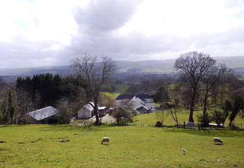
The weatherman had threatened rainstorms over Wales, but enormous clouds of grey and silver were sailing in a patchy blue sky as we set off from Llandrillo up the old drover’s route into the heart of the Berwyn hills. This lonely range of high country sprawls across the borderlands of northern Wales, little walked and seldom ridden these days, but in times past crossed by a network of rough roads and tracks that brought mountain cattle and sheep east to the markets of the Welsh Marches.

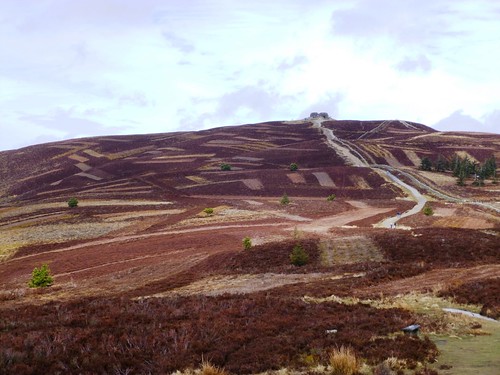
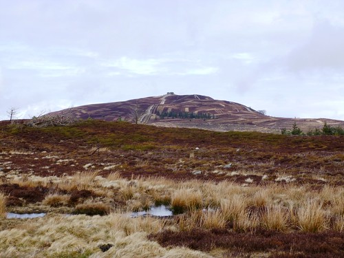
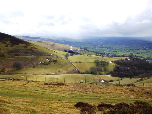
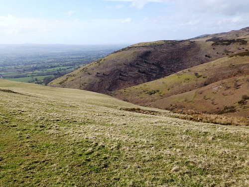
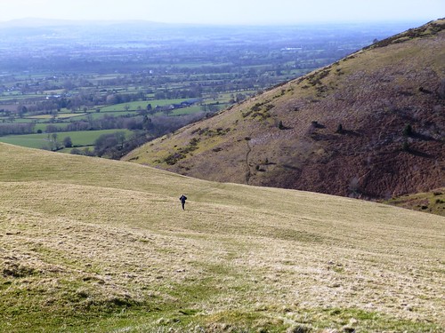
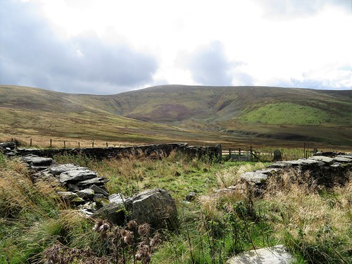
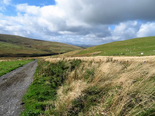
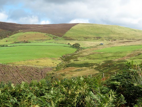
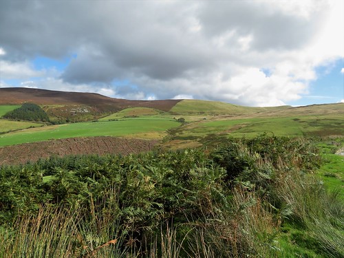
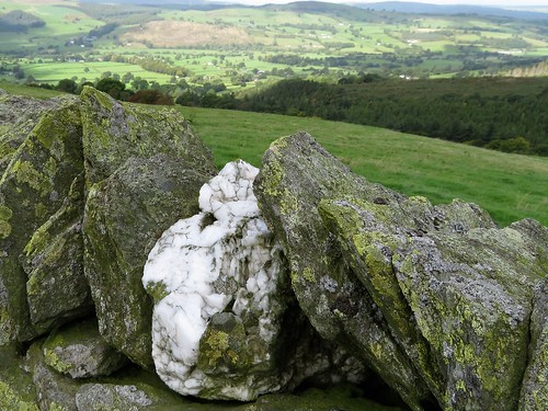
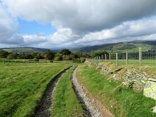
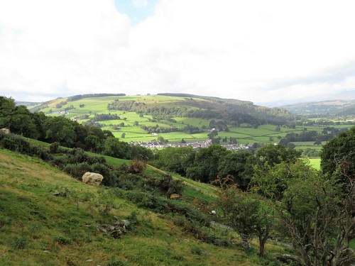
The old drovers’ road from Llandrillo rose steadily eastwards, floored with rock, flanked by walls of slender split stones. Every so often, big lumps of quartz had been positioned among the dull green wall stones, their white glimmer a useful waymark for a benighted drover or late-working shepherd. Gradually the views opened out, north across the lush valley of the River Dee, ahead to where the great olive-coloured shoulders of Moel Pearce and Cadair Bronwen began to loom across the south-east skyline.

The wind rushed in the sycamore leaves and tossed the bright orange rowan berries around. A bunch of jackdaws went skeltering down the wind above the old road, whose numerous sheep gates separated the various flocks along these hillsides. Each barrier had its own ingenious home-made closing mechanism, slung with heavy weights – a cast-iron cylinder head, a baulk of timber, a necklace of heavy old ploughshares that clinked together as the gate swung to behind us.

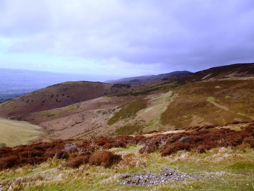
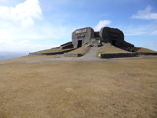
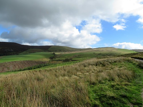
From the little stone bridge of Pont Rhyd-yr-hŷdd the drove road snaked about to wind itself up for the last mile’s climb to the pass of Bwlch Nant Rhyd Wilym, where it tipped up and wriggled away through sombre moorlands towards the valley of the Afon Ceiriog. A shiny metal memorial lay beside the pass, inscribed to the memory of ‘Wayfarer’ – Walter Robinson, a cycling writer of the 1920s who enticed off-roaders in their thousands to explore these wild uplands of Wales.

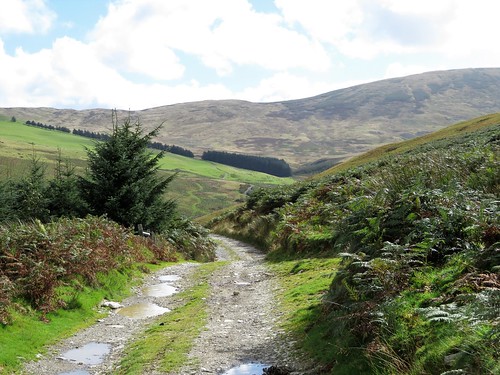
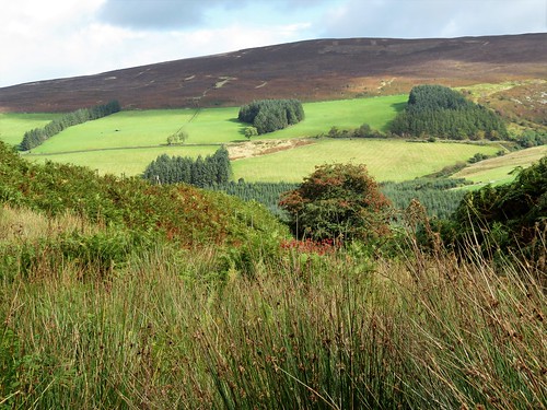
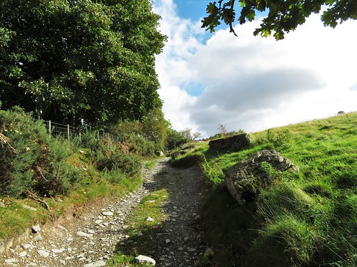
We sat by the cairn, watching sun-splashes chase cloud shadows across the flanks of Cadair Bronwen and telling ourselves we’d come back one day, better equipped and with more time in hand, to tackle the whole glorious ridge. Then we turned back down the old road and along a quiet forest track, wind and rain showers in our faces and a prospect of sunlit mountains far in the west to lift the heart and the weary legs.

Start: Village car park, Llandrillo, near Corwen, Denbighshire LL21 0TG (OS ref SJ 035372)

Getting there: Bus – service T3 (Lloyds Coaches) from Wrexham.
Road: Llandrillo is on B4401 between Corwen and Bala.

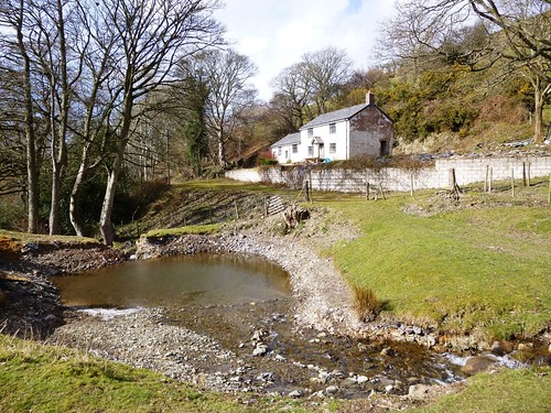
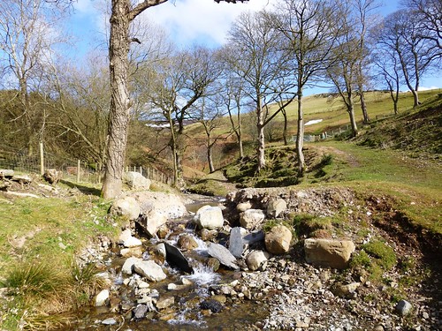
Walk (9 miles; a long, steady climb; OS Explorer 255. Online map, more walks at christophersomerville.co.uk): From car park, left along B4401; right at chapel; climb country lane (‘Tegid Way’/TW’) for 3½ miles. At sheepfold (083366) TW turns left, but keep ahead to Wayfarer’s Memorial at saddle (091366). Return down lane. In 1¼ miles, at TW post just before Pont Rhyd-yr-hŷdd, right (073368) on hillside path, to gate onto forest track (069375). Follow track for 1¾ miles to cross bridge; up to road at Melyn y Glyn (046382). Cross road; down lane to Ty Uchaf. Down left side of barn; stile beyond (yellow arrow/YA); along fence to gate (044378) above Ty-Nant. Cross footbridge and stile beyond. Follow succession of gates, stiles and YAs past Moel-is-y-goedwig-isaf to reach drive at Ty’n-y-cae-mawr (041373). Right to lane; right to Llandrillo.

Lunch: Picnic

Accommodation: Tyddyn Llan, Llandrillo LL21 0ST (01490-440264, tyddynllan.co.uk) – comfortable restaurant-with-rooms.

Info: Llangollen TIC (01978-860828)

Britain’s Best Walks: 200 Classic Walks from The Times by Christopher Somerville (HarperCollins, £30). To receive 30 per cent off plus free p&p visit harpercollins.co.uk and enter code TIMES30, or call 0844 5768122
visitwales.co.uk; satmap.com; ramblers.org.uk

 Posted by at 01:59
May 112013
 

Rain and gales over north-east Wales, with the Clwydian Hills bathed one moment in brilliant sunshine, the next in grey showers chased northwards by the wind. First published in: The Times Click here to view a map for this walk in a new window
picture picture picture picture picture picture picture picture picture picture picture picture picture picture picture picture
Facebook Link:
We watched the squalls marching through the Vale of Clwyd far below as we followed the broad stony track of Offa’s Dyke Path north along the ridge.

The Clwydian Hills make a hugely popular day out for local walkers; and Moel Famau, at 554m the summit of the 20-mile range, is the natural target with the stump of its ruined Jubilee Tower as an aiming point. Hikers, runners, strollers, dog-walkers, all were out striding the path in the buffeting wind, children running and tumbling in the heather, their parents crunching across the snow banks of last month’s unseasonable blizzards.

The Jubilee Tower was erected in 1810 for King George III’s Golden Jubilee and blown down in a storm in 1862. Its blockhouse foundations sit across the peak of Moel Famau like a double-crowned cardinal’s hat. Up on its walls we found we couldn’t keep our feet – the wind literally pushed us off that hilltop, tears in our eyes, the breath rammed back in our throats. There was time for a glimpse of the snow-streaked crests of the Berwyn Hills in the south, and then we had left the Offa’s Dyke Path and the wind-blasted ridge, and were skeltering down a green hillside into the calm airs of the Vale of Clwyd.

A string of small sheep farms runs north to south in the shelter of the Clwydian Hills. Above Tyn-y-celyn we crossed a fast-running hill torrent, ice-cold from snowmelt, and turned back along a path through sheep pastures. Ewes issued their throaty, peremptory calls to the lambs who came in pairs to look us over, their large ears sticking out and filtering the sun into a pink glow. We crossed a patch of unmelted snow, stamping our boots into the icy crust to get a grip, and went on south above the slate-roofed farms that crouched among shelter trees – Tyddyn Norbury, Bron-y-felin, Fron Goch, Fron Ganol, Fron Bellaf, ringing names to a Saesneg ear.

At Fron Bellaf we crossed a stream where daffodils were still in bud, and took the old green road up over the shoulder of the hill, climbing back towards Offa’s Dyke Path once more. The gale came rushing to meet us, the sky raced from peak to peak, and an old crow’s nest rocked in the fork of a weather-skinned thorn tree, seething to itself in the wind.

Start: Bwylch Penbarras car park, Llanbedr-Dyffryn-Clwyd, LL15 1US approx. (OS ref SJ 161606).

Getting there: Bus – Free shuttle bus from Loggerheads (denbighshirecounytryside.co.uk) in summer
Road – A494 from Mold towards Ruthin. In Llanbedr-Dyffryn-Clwyd, just before church, right up Lôn Cae Glas. Bear left along Lôn y Mynydd to Bwylch Penbarras car park at top of road.

WALK (5 miles, moderate, OS Explorer 265):

From car park follow Offa’s Dyke Path/ODP to Moel Famau tower (162626) and on. In ⅓ mile cross side track in dip (156628); in next dip, left off ODP (152630, fingerpost, yellow arrow/YA). Descend slope, looking to left for marker posts on a clear downward track. Follow it down. At bottom, cross stream (143628); in 200m, above Tyn-y-Celyn farm, sharp left (142627, waymark post) back along wall. Recross stream; on beside wall/fence. In ⅓ mile, YA points ahead (144622), but you hairpin right to cross stile; ahead along drive. At entrance to Bron-y-felin farmyard (144620), left through gate; bear right above and round farm; ahead through field gate and on with hedge on right. Keep same contour above Fron Goch (144616, stile, YA). At Fron Bellaf cross stream; left to cross stile (YA); climb bank ahead. Ignore first green track you cross, and YA pointing right; keep climbing to fence (147612). Turn left here, following fence on green track. In 200m cross stile; up slope for 50m, then left on grassy track, climbing for ½ mile. At top, ignore first stile on right (154609); ahead with fence on right for 200m to cross next stile. Ahead to join ODP (157608); right to car park.

Lunch: Griffin Inn, Llanbedr-Dyffryn-Clwyd (1824-702792; griffinllanbedr.co.uk) – cosy and friendly

Moel Famau Country Park: moelfamau.co.uk

Information: Ruthin TIC (01824-703992); visitwales.co.uk;
www.ramblers.org.uk www.satmap.com www.LogMyTrip.co.uk

 Posted by at 01:38