Search Results : Durham

Jun 102023


First published in: The Times Click here to view a map for this walk in a new window
Hisehope Reservoir Cushat Leazes farm Hisehope Reservoir 2 feeder channel between Hisehope and Smiddy Shaw reservoirs Grouse butt between Hisehope and Smiddy Shaw reservoirs faint track of the path above Hisehope Burn path across the moor Waskerley Way old railway path open moor near Hisehope Reservoir grouse butt near Hisehope Reservoir southern marsh orchid along the Waskerley Way red grouse shelters among old heather golden plover near the Waskerley Way Smiddy Shaw Reservoir

Cyclists on the Waskerley Way railway path pedalled into a strong cold blow from the west. The rest of the UK was sweltering in 30º of heat, but not up here on this brisk day of sun and cloud over the Durham moors.

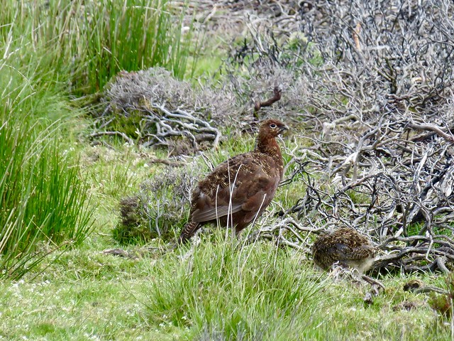
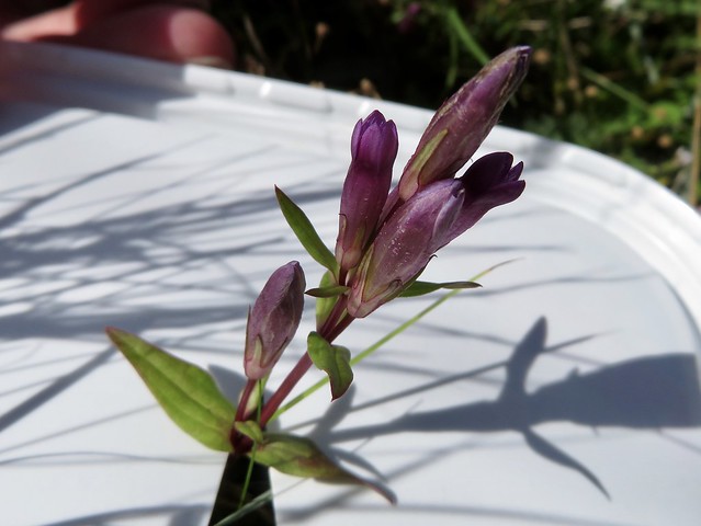
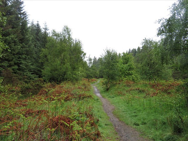
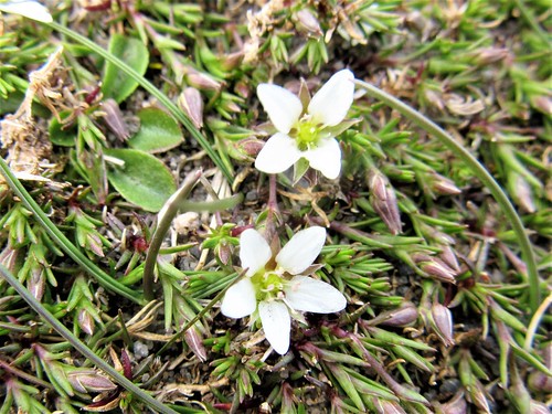
The old railway rose gently to the west between bushes of gorse and young juniper. The wind carried lamb cries and the liquid territorial calls of nesting curlew, cur-leek! cur-leek! I almost trod on a curlew egg, a long olive-green oval camouflaged with tarry scribbles. A lapwing flapped above us, whistling in agitation, then landed to run parallel to us, crested head raised, before taking off for another agitated circuit above the human intruders.

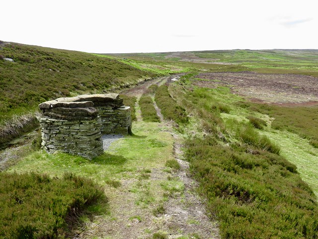
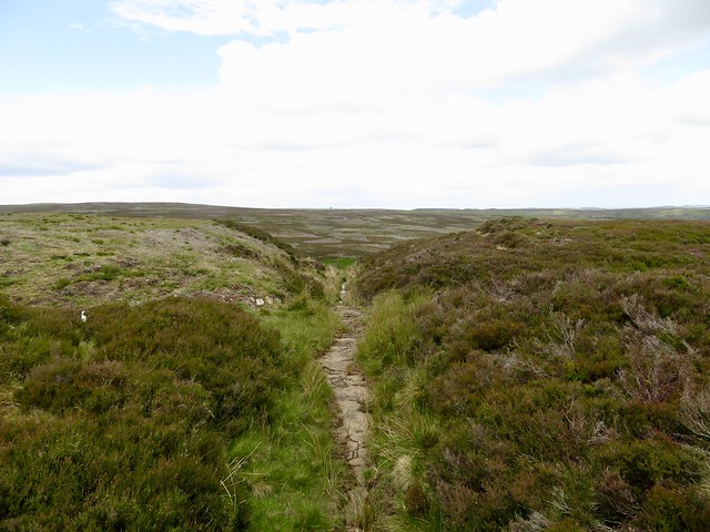
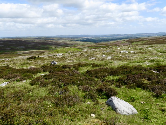
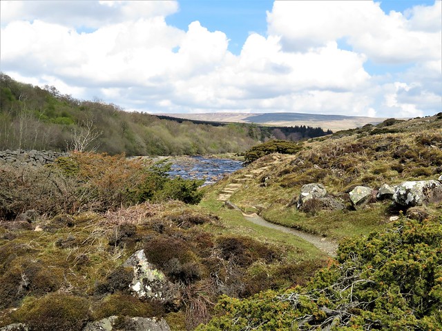
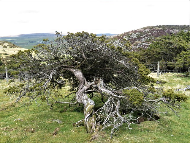
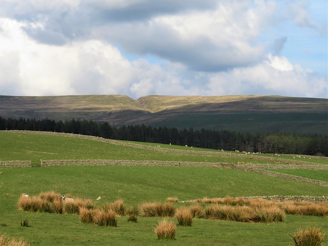
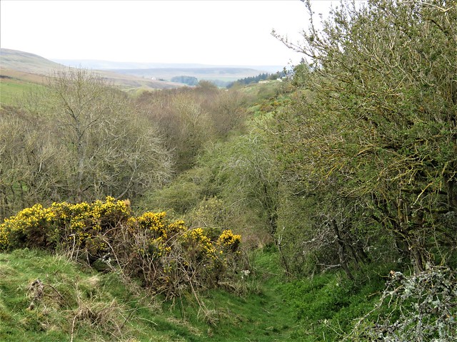
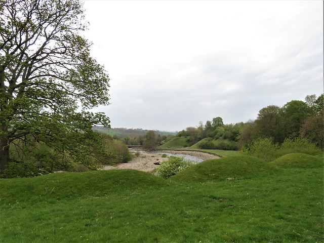
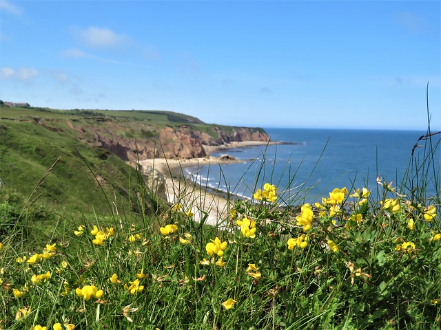
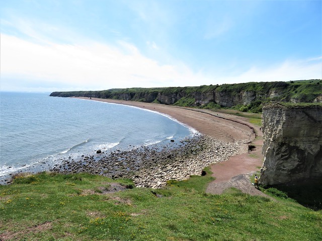
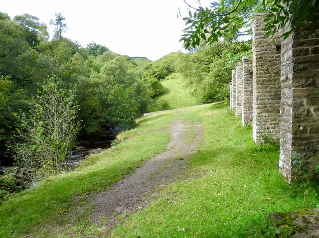
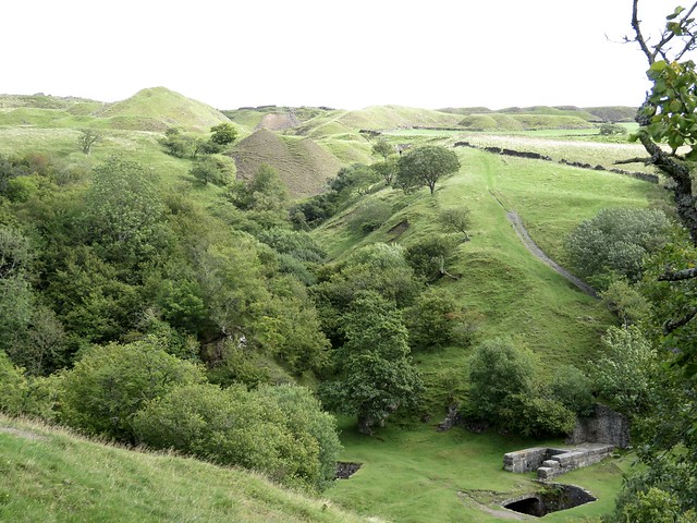
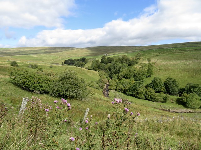
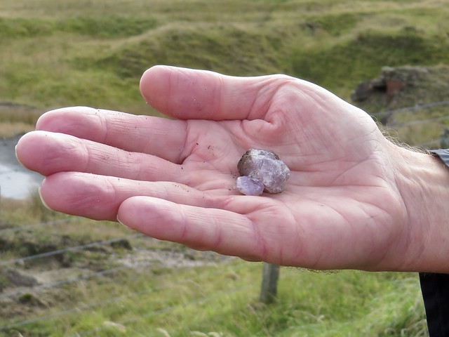
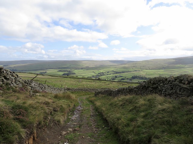
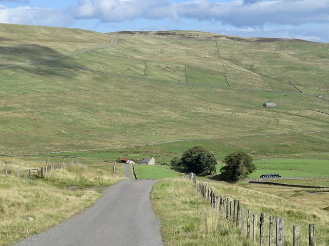
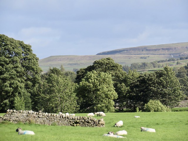
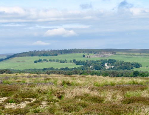
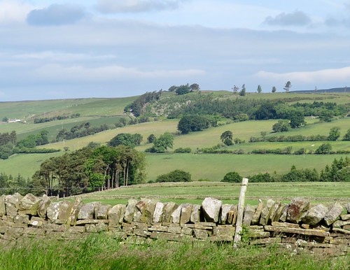
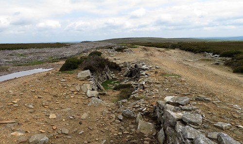
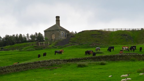
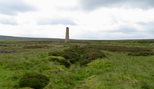
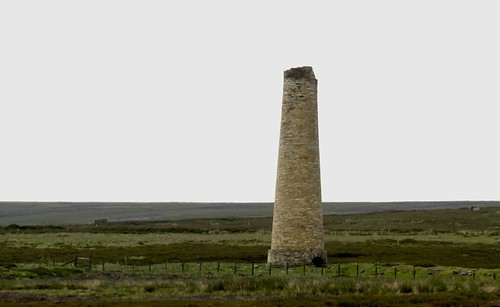
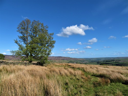
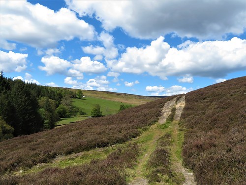
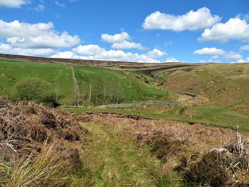
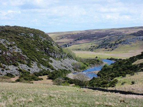
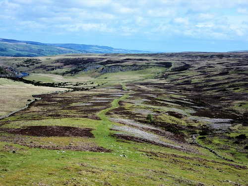
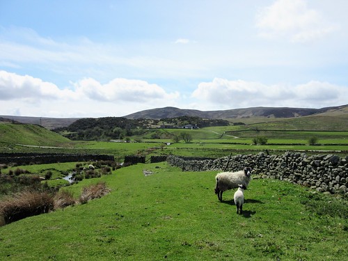
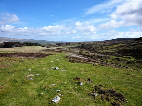
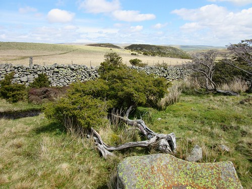
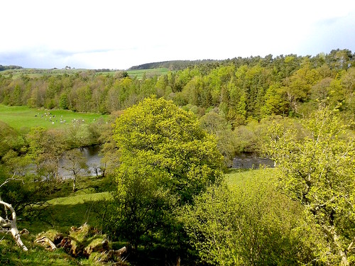
Lumpy mounds of spoil bore witness to lead mining in the not so distant past. Nowadays the moors are managed patchwork-style for grouse, with coarse grey patches of old heather left for shelter and bright green young shoots for food. It was wonderfully exhilarating to be walking these uplands with their long views and sombre colours under a racing sky.

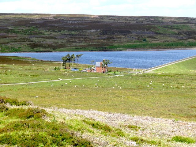
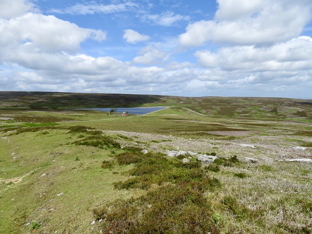
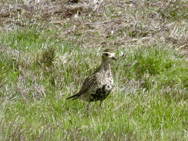
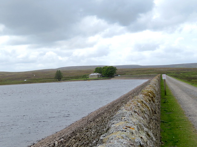
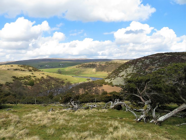
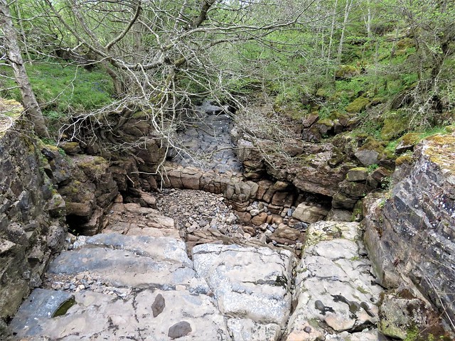
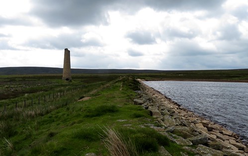
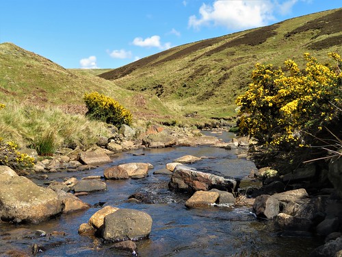
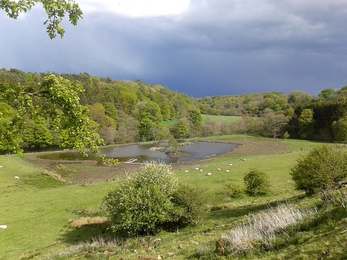
We left the Waskerley Way and followed a stony track down to the long dam wall and wind-rippled water of Hisehope Reservoir. A feeder channel paved with stone led away east across the moor. Fenn traps had been placed on poles that crossed the channel to catch four-legged predators on grouse. Snipe and golden plover flew up with piping cries, then settled to their nesting once more.

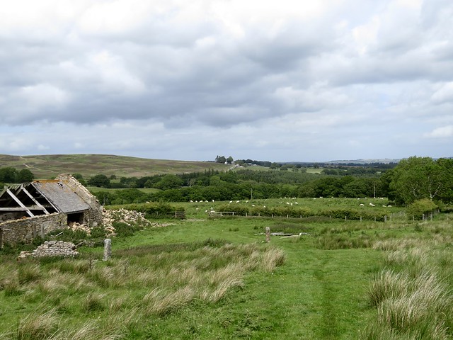
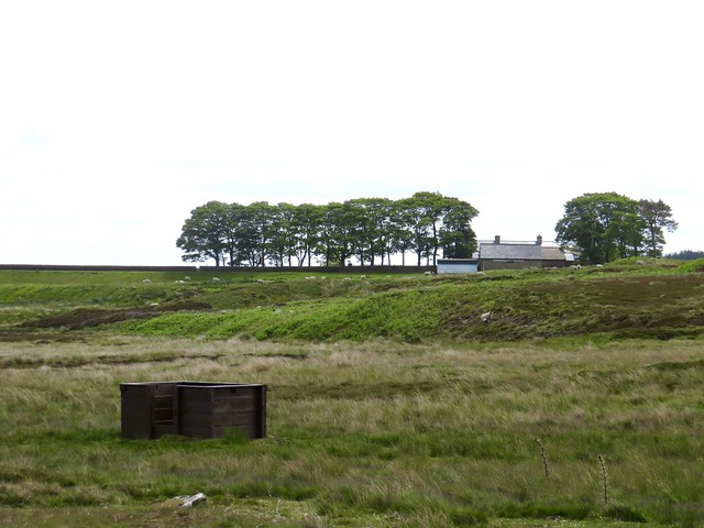
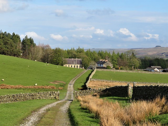
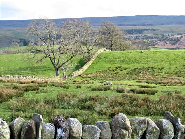
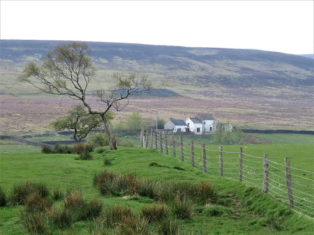
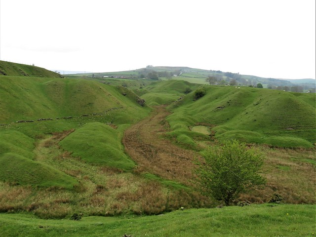
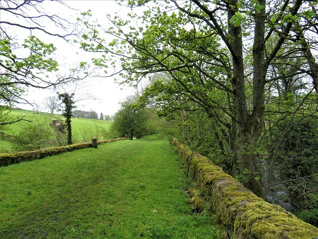
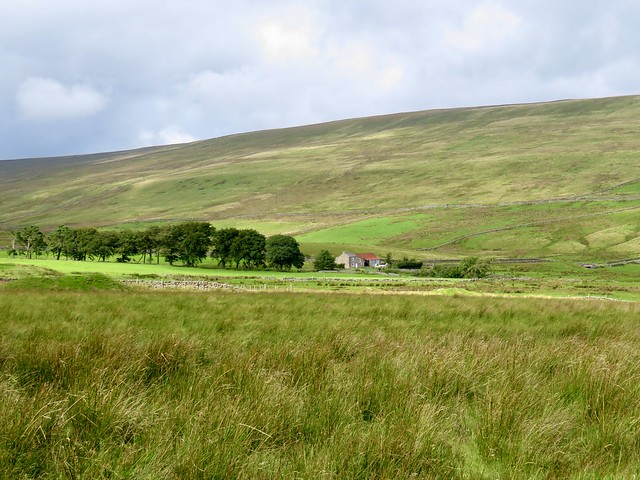
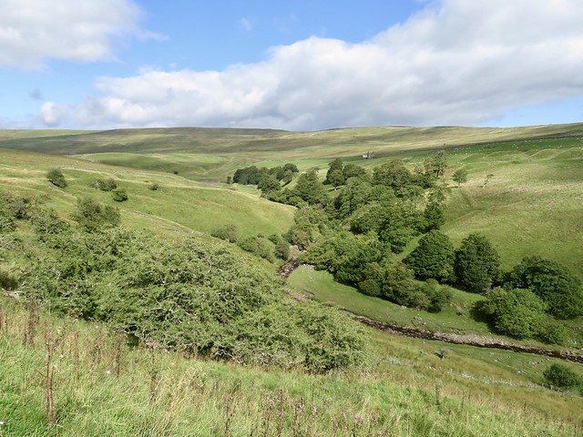
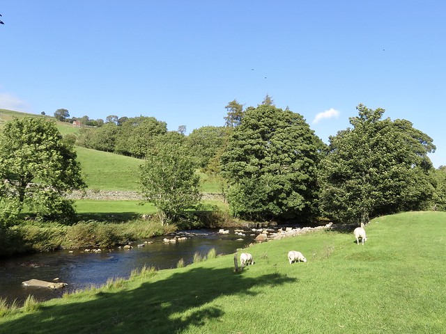
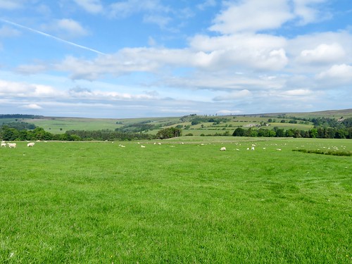
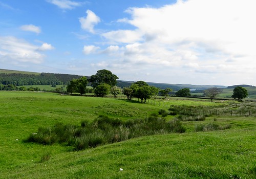
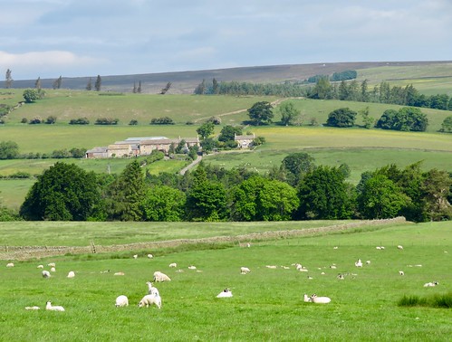
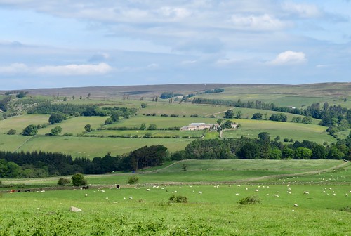
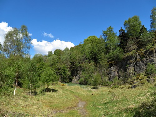
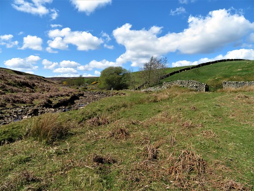
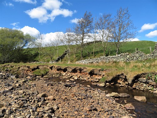
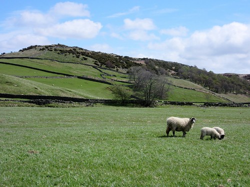
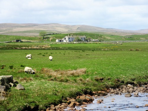
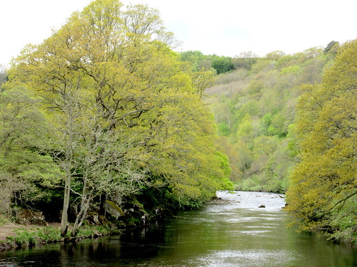
A side path ran off north across the moor, soon descending to cross the deep-sunk Backstone and Hisehope burns in a steep little gully. From here the landscape changed to thistly meadows crossed by the faintest of cart tracks. The lonely farmhouse of Cushat Leazes drooped sadly, slate roof falling in, walls patchy where handily shaped stones had been robbed for wall-mending, a reminder of just how tough life is for the upland sheep farmers.

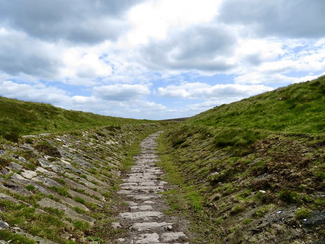
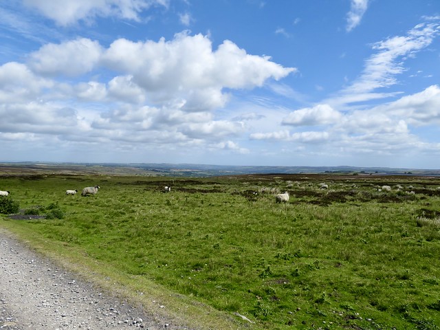
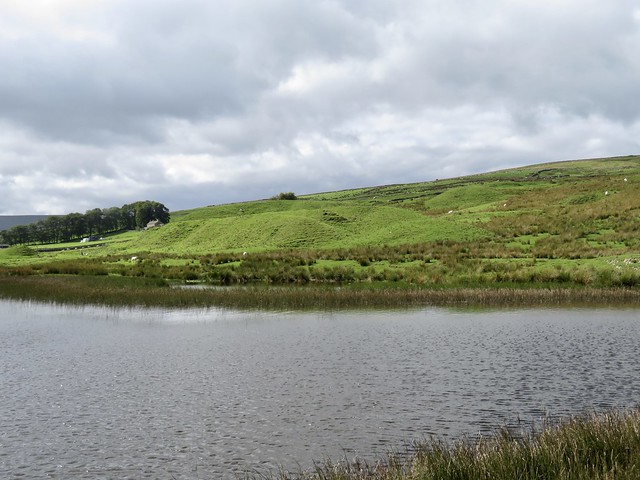
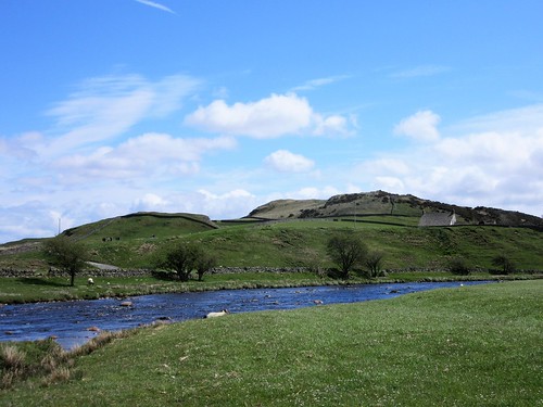
We followed a green path over rough pasture to climb the steps to the brink of Smiddy Shaw Reservoir. The wind drove the water in whitecaps, and the view back across the moors we’d tramped disclosed a big dark marsh harrier sailing close to the heather, a lapwing rising to scold it away with urgent, creaking cries.

How hard is it? 6 miles; easy (but GPS helpful); moorland tracks

Start: Waskerley Farm car park, Consett DH8 9DZ approx (OS ref NZ 051453)

Getting there: A692 Consett to Castleside; cross A68; minor road past Horsleyhope; in 3 miles, left (brown sign ‘Waskerley Station’).

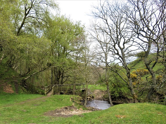
Walk (OS Explorer 307): Right along Waskerley Way/WW. In 1¼ miles at next car park (033453), right; left beside road. In 250m right on track to Hisehope Reservoir. Just beyond house, right (025462) along channel. In ⅔ mile round right bend to footbridge (037464). Left here on moor path for ⅓ mile to Backstone Burn. Follow right bank; cross burn at confluence with Hisehope Burn (040473). Left to cross Hisehope Burn. Up bank; in 150m, right over ladder stile (039474). Ahead across grass on track. In 100m edge left to raised bank; follow it to ford (039476); on to reach wall on left. Follow it to house (041479). In dip, right on grassy drive. Cross footbridge (042477); in 200m pass Cushat Leazes ruin; bear right (044475) on green path. In ⅓ mile through wall gate (043470); ahead on moor track; steps up to Smiddy Shaw Reservoir (044464). Left; at car park (047462) left to road; right to corner (048457); left (‘WW’) to car park.

Lunch: Picnic

Accommodation: Derwent Manor Boutique Hotel, Allensford DH8 9BB (01207-592000; derwentmanorhotel.com)

Info: thisisdurham.com

 Posted by at 01:25
May 072022


First published in: The Times Click here to view a map for this walk in a new window
Juniper bushes along the River Tees Approaching Bowless Visitor Centre at the lip of High Force rocky bed of the Tees above High Force Bleabeck Force beside the Pennine Way rugged dolerite crags or clints along the Tees lousewort in boggy ground on Bracken Rigg looking back down Teesdale from Bracken Rigg juniper tree at the top of Bracken Rigg view from Bracken Rigg north along Upper Teesdale stone-walled pastures of Upper Teesdale rushy pastures of Upper Teesdale

If an alien walker enquired the season and place to catch upland Britain at its very best, I’d direct him to spring in the Durham Dales, here in Upper Teesdale with the Tees blustering down the valley, its waterfalls seething, nesting lapwing and curlew giving their haunting cries in the meadows, and the wild flowers in full glory all along the dale.

The setting of the valley is superb, too, sinuating with the broad river between tall dark crags of volcanic dolerite that give way to green pastures and miles of bleak moorland. Farmhouses and barns are dotted around the hills, but there is something notably wild about Upper Teesdale, lending a sense of freedom and exhilaration to any walk here.

On a cool grey afternoon we gazed from the Swingy Bridge (officially Wynch Bridge, a bouncy span) upriver to where the Tees poured in creamy cascades over its jagged bed and down the rocky steps of Low Force. The grassy banks were spattered thickly with wild flowers, all blooming together in a rush to take advantage of the short spring season – primroses and cowslips, spherical yellow globeflowers, bluebells and wood sorrel, violets and early purple orchids.

As we followed the Pennine Way upriver a muted roar and rumble heralded High Force, a tossing wall of peaty brown water crashing seventy feet down three huge steps of the Whim Sill, the dolerite intrusion that shapes the dale. We stood at the brink, watching the fat lip of water curl downward into space and thunder off its walls into the rocky basin at the foot.

Along the path juniper bushes yielded a savour of gin when pinched. Once past the quarry at Dine Holm Scar the view lifted into an altogether wilder prospect, with long ridges of moorland ahead. On the way up the knobbled knoll of Bracken Rigg the path ran beside a fence excluding the sheep, and there on the other side, safe from the nibbling teeth, was a little clump of bird’s-eye primroses, tiny and deep pink with egg-yolk yellow ‘eyes’ – remnant flora of the post-glacial tundra still thriving up here.

We descended to Cronkley Farm and recrossed the Tees where sandpipers were pattering on the pebbles. The homeward way lay just above the dale road, a path through pastures where brown hares scampered off, lapwings tilted earthward with creaking cries, and young blackfaced lambs ran to the admonitory bleating of ewes in ragged fleeces still stained with winter.

How hard is it? 8 miles; moderate; some rough places underfoot.

Start: Bowlees Visitor Centre, near Middleton-in-Teesdale DL12 9XE (OS ref NY 907282)

Getting there: Bowlees Visitor Centre is signed on B6277 (Middleton-in-Teesdale to Alston)

Walk (OS Explorer OL31): From Visitor Centre cross B6277; path to cross Wynch Bridge (904279). Right on Pennine Way for 4 miles to cross Cronkley Bridge (862294). Pennine Way turns left, but follow track ahead. In 50m ahead up flagstone path. At top, right through gate (864294); through next gate; left past barn. Through wicket gate; past house, follow drive to road (866299). Right; in 100m left through car park; left; in 100m, right (868299) past school and cottages. Wall stile to field path; lane from Dale Cottage (872296); field path from Middle Moor Riggs (877293). Pass ruined East Moor Riggs (880292); in next field, half left to bottom right corner. Gate by corner of house; drive to road (884294)’ right. In ½ mile on right bend, ahead (890289); follow walled lane for 1½ miles to Bowlees.

Lunch/Accommodation: Langdon Beck Hotel, Forest-in-Teesdale DL12 0XP (01833-622267, langdonbeckhotel.com)

Info: Middleton-in-Teesdale TIC (01833-641001)
thisisdurham.com; northpennines.org.uk

 Posted by at 04:20
Jan 082022


First published in: The Times Click here to view a map for this walk in a new window
Moorland farm above Bollihope Burn steep climb up from Bollihope Burn Harehope Quarry crinoids in the car park - Frosterley marble River Wear at Frosterley lane near Bridge End gravelly flood banks of River Wear velvety delvings of the old Frosterley quarries bridge over Bollihope Burn old tramway near Frosterley 'Frosterley marble' in a stream bed

Looking round the Chapel of the Nine Altars in Durham Cathedral, you can’t help but be struck by the beautiful floors and columns of ‘Frosterley marble’, dark polished limestone speckled with white fossils.

Frosterley lies in Weardale, upriver from Durham. The village is proud of its celebrated product. There’s a great unpolished lump of the stuff in the car park, formed 325 million years ago and covered in circular fossils of sea lilies with delicate rays.

From Frosterley we followed the Mineral Valley Walk as it rose to run round the rim of an old quarry. Sunk below the level of the fields were big lumpy spoil heaps, delvings and trackways, their awkward angles all smoothed and softened by the grass that covered them in a green velvet nap. Looking down on this from the striated limestone crags of the former quarry faces, it was hard to imagine the thunderous noise, the dust, the hard labour and raw surroundings of a hundred years ago.

Beyond the quarry we turned down the gorge of the Bollihope Burn on a former railway track. A red grouse scuttled away in a panic. The path squeezed between adjacent rock faces where streaks of dusky red hinted at the presence of iron. Across the burn some hopeful lead miner had driven a speculative adit, a tunnel leading from a crude hole into utter darkness.

A flight of steps led up to open sheep pastures, hillside farms and a glimpse of long ridges of moorland beneath a cloudy sky. Then we dropped back down beside the Bollihope Burn, looping back to Frosterley along the rim of Harehope Quarry, another huge subterranean moonscape now repurposed as an ecological education centre. Field classrooms, wildlife ponds, summerhouses and a wind turbine have taken over from heavy machinery, rubble mountains and polluted pools.

On the way we crossed the dry bed of a stream. There below the footbridge were great slabs of Frosterley marble, dark rock smoothed by water and patterned with an intricate jumble of white fossils. It was remarkable to think of the journey this ancient seabed deposition made in medieval times, cut and shaped to rise in polished glory in the cathedral of the Prince Bishops twenty miles away across the hills.

How hard is it? 5½ miles; easy; field paths, old trackways

Start: Frosterley car park, Frosterley DL13 2QW (OS ref NZ 026370)

Getting there: Bus: 101 (Stanhope – Bishop Auckland)
Road – Frosterley is on A689 between Wolsingham and Stanhope

Walk (OS Explorer OL31; Frosterley Walks leaflet downloadable at durham.gov.uk/media): Right along A689. Left (‘White Kirkley’) across River Wear. In 150m, left (022367) beside chapel (‘Mineral Valleys Walk’/MVW). In ½ mile, right at kissing gate (029365, MVW); keep fence on right round quarry rim. Through gate (027362); down slope; right (MVW) to road (025360). Left (MVW); by bridge, right (026360, stile, MVW) along Weardale Way/WW. In ¾ mile pass (don’t cross) bridge (020354); in 40m, right up steps; right at top to gate. Left up fence; in 150m, right (020356) on field track to road (025360). Right; in 150m, left (026360, stile) on WW. In 700m, by footbridge on right, ahead (033361, stile, ‘Permissive Path’); in 150m, left along WW (035360). In 500m at gate WW turns right (039363); left down road. In ½ mile at level crossing, don’t cross (036368); bear left on path. In 600m, right to cross railway (030368); ahead on lane to Frosterley churchyard (026368) and Front Street.

Lunch/Accommodation: Bonny Moorhen, Frosterley DL13 2TS (01388-526867, facebook.com/thebonnymoorhen)

Info: Durham Dales Centre, Stanhope (01388-527650), thisisdurham.com; northpennines.org.uk
Harehope Quarry: 07807-002032, harehopequarry.org.uk

 Posted by at 01:34
May 292021


First published in: The Times Click here to view a map for this walk in a new window
picture picture picture picture picture picture picture picture picture picture picture picture picture picture picture picture
Facebook Link:

Thirty years ago only fools or psychogeographers would have set out to walk the coast of County Durham. This was ‘Get Carter’ country, a dozen miles of grim coastline massively polluted by coal mining and pit waste tipping.

After the last of Durham’s coastal pits closed in 1993, a remarkable operation named ‘Turning the Tide’ saw a clean-up of the cliffs, the beaches and the steep wooded valleys called ‘denes’. Following the clifftop path south from Seaham Harbour on a fine windy morning, we couldn’t believe this was the same colliery coast that we’d once known.

Down on Blast Beach the sea is slowly eroding the minestone. Blast Beach got its name from the blast furnaces of the adjacent ironworks which covered the beach with a thick layer of grease and sludge. Mixed with coal waste from Dawdon Colliery, this scab of industrial slag was dubbed ‘minestone’ by locals. It’s a remarkable sight, a flat shelf of pale grey and orange that extends seaward from the feet of the pale magnesian limestone cliffs, to form its own miniature cliff at the high water mark.

We walked Blast Beach, marvelling at the contrast between the barren layer of minestone and the rich flora that has developed under the cliffs – buttery yellow bird’s-foot trefoil, intensely purple bloody cranesbill. Fulmars planed along the cliffs, and nesting kittiwakes looked down on us with eyes as soft and black as pandas.

Up on the cliffs again, we strolled the grassy meadows where bee orchids grew in clumps. On the sheltered beach of Hawthorn Hive a man was collecting waste coal into a sack. ‘Sea coalers’ were a common phenomenon hereabouts when the collieries were in full swing, but there’s little sea coal left today.

Easington Colliery’s beach was once a wasteland where a gaunt gantry dropped a continuous stream of mine filth into a blackened sea. Now it’s a beautiful sweep of pale pebbles on which the waves break in white foam.

Horden Beach was a three-mile swathe of stones and sands, its minestone ledge now sea-nibbled halfway back to the cliffs. From here we struck up the path into Castle Eden Dene, and walked up into Peterlee through a green canopied cleft full of ferns and water-sculpted rocks. Goldcrests squeaked in the treetops, and the underworld below the trees was hazed and smoky with bluebells.

Start: Seaham Harbour, Co Durham SR7 7DR (OS ref NZ 431494)

Getting there: Bus X6, X7 (Peterlee-Sunderland)
Road: Seaham is on B1404, signed from A19, just south of Sunderland.
Chevron Taxis (Peterlee-Seaham, about £12): 0191-586-0222/0555.

Walk (10 miles, moderate coastal walk, OS Explorer 308): From Seaham Harbour walk south along coast path beside A182 (occasional brown ‘England Coast Path’ waymark). In 1 mile at Nose’s Point (437478), descend to Blast Beach (steep, slippery descent). Cross beach; steps up to coast path are beside the prominent rock stack near the far end (439469). In ⅔ mile at Hawthorn Dene (440461) either take steep steps down to cross beach, or cross railway line into woods and follow ‘Heritage Coast Footpath’ yellow arrows across dene and on.

In another 4¼ miles at Hartlepool Point, at foot of dene mouth with reedbeds (455407), pass end of path that goes inland past tank traps, and take next path from beach inland up Castle Eden Dene. Under railway (451405) and across A1086 (448405) ; on along footpath. In 1 mile, fork right after Garden of Eden bridge (438399), with Castle Eden Burn on right, up waymarked Yew Tree Trail for nearly 1 mile to Visitor Centre (427393). Ahead up Stanhope Chase to cross Durham Way; path ahead to edge of playing field (426397). Right for 150m, left up right side of playing field, then path ahead through North Blunts woodland to Peterlee bus station (428407).
Conditions: Paths in Castle Eden Dene can be slippery after rain.

Lunch: Picnic on the cliffs or beaches

Info: Castle Eden Dene Visitor Centre, SR8 1NJ (0191-586-0004)
Durham Heritage Coast (0300-026-8131, durhamheritagecoast.org)
satmap.com; ramblers.org.uk

 Posted by at 07:00
Nov 072020


First published in: The Times Click here to view a map for this walk in a new window
picture picture picture picture picture picture picture picture picture picture picture picture picture picture picture picture picture picture picture picture picture
Facebook Link:

A strong cold breeze was blowing off the Durham moors down Weardale, and clouds jostled with blue sky on the skyline to north and south. We peeked in the windows of Westgate’s remarkable Methodist Chapel, its pews massed in a thicket of curlicued and painted ironwork. Primitive Methodism was a strongly held faith here in west Durham, whose lead miners and pack horsemen led rough and uncertain lives.

A footpath led north from the village up a steep-sided cleft where the Middlehope Burn came jumping and sparkling down over rocky steps and ledges. We followed upstream to a wide bend of the burn; here the remnants of Low Slitt* lead mine lay scattered.
*spelt variously Slitt or Slit – Slitt seems to be the most frequently used

A waterwheel pit for pumping out the mine, the great stone base where a hydraulic engine lifted buckets of lead ore from the workings, deadly little culverts you could fall into in a twinkling, and a washing floor on a promontory near the river, where little boys with heavy bucker hammers smashed rocks and sluiced the fragments to release the precious ore.

We scrambled up a steep bank to a round reservoir, and stood there looking across the old mine to the hush or gash in the fellside where great torrents of water were released to tear away the turf and expose the vein of lead beneath. Mine tips lay above at the edge of the moor, a fleet of green whalebacks grown grassy with a nap as sleek as velvet.

Today this is a scene as peaceful and lonely as can be – great sweeps of daleside, empty save for the dotted sheep, a couple of isolated farms, the ruin of a barn or two, all under an enormous sky.

We found a stony lane that led up to the walled fellside track of Springsike Road, boggy with dark mud and patches of rush. Sheep called, the wind blew, hidden streams trickled. Everything seemed simplified and straightforward up here between the dale pastures and the moors.

Wheatears flirted on the wall tops, their white rumps flashing as they flew away. Mountain pansies purple and white, wild thyme tussocks and autumn gentians grew by the way. A long walled bridleway brought us easily down into Weardale again and we sauntered back to Westgate beside the peaty River Wear, as clear and brown as molten toffee.

Start: Hare & Hounds, Westgate, Weardale DU3 1 RX (OS ref NY 908381).

Getting there: Bus 101 (Bishop Auckland)
Road: Westgate is on A689 (Stanhope-Alston).

Walk (6¼ miles, moderate hill walk, OS Explorer OL31): Left along A689; first right; in 200m, left (‘Slitt Wood’). Follow path north beside Middlehope Burn. In ½ mile at Slitt Mine site (906392), left up bank by info boards to dam/pool above (904392). Right around dam; at stile (904393) bear right on path with wall on left. In 250m cross stile (904396); in 300m, right over wall stile (905399). In 150m, left up rough rocky lane (904400). At top, right (901399) along Springsike Road walled lane. At road (893407), left uphill. In ½ mile road bends left (885405); in ¼ mile, left (882401, fingerpost) along walled bridleway. In 1 mile at road, left (886387); in 150m, right (888387, fingerpost), half right down to drive. Right to road (886385); left; in 400m, right between house and shed (889382). Cross River Wear (888381). Left on Weardale Way for 1½ miles; left across river (909380) into Westgate.

Conditions: Springsike Road can be wet/muddy

Lunch: Hare & Hounds, Westgate (01388-517212, hareandhoundswestgate.blogspot.com

Accommodation: Westgate Manor, Westgate DL13 1JT (01388-517371, westgatemanor.co.uk)

Info: Durham Dales Centre, Stanhope (01388-527650); thisisdurham.com; satmap.com; ramblers.org.uk

 Posted by at 02:19
Oct 192019


First published in: The Times Click here to view a map for this walk in a new window
picture picture picture picture picture
Facebook Link:

Today was one of those ‘Shall we?’ days – a morning of chilly winds over County Durham, and a weather forecast of spitting showers followed by proper rain. It wasn’t really conducive, the thought of pulling on all the raingear and setting out through a dank and dripping Hamsterley Forest. But in the end we were glad we did.

‘Oh, it can get a bit clarty up there in the forest,’ said the jolly young ranger in the Visitor Centre. We hadn’t heard that local word meaning ‘mucky’ for many a day. And a bit clarty it turned out to be, once we’d got off the hard-surfaced tracks.

We had a look at the ranger’s map and decided on the Three Becks Walk, thoroughly waymarked and well laid out. The Bedburn Beck, charged with rain, went bouncing down under the trees, a vigorous young stream of water stained toffee-brown with peat from the moors. The forest steamed, a heady whiff of bark, resin and damp pine needles.

Timber climbing frames beside the trail catered for youngsters with energy to burn. In its maturity Hamsterley Forest plays a role as a leisure woodland for walkers, cyclists, runners and riders, but when it was created in the 1930s, it was as a severely commercial softwood forest.

Back then the north-east of England was in the grip of the Great Depression, and local pitmen and shipyard workers who had lost their jobs were only too happy to be paid for planting young trees in their millions. They lived on site in barrack-like wooden huts, still to be seen near the Visitor Centre.

We followed the Three Becks Walk west among the pines and larches, their hard dark presence softened by borders of beech, oak and sycamore. There was a steady trickle of chaffinch song, a background chitter of wrens, and in the treetops the excited thin squeaking of goldcrests foraging high up.

Soon we forked off the surfaced track, up a stony forest path bound together with knotty conifer roots. Clearings opened up, large areas left to grow scrubby where spindly rowans and silver birch swayed to the windy swirls of rain.

A steep descent on a slippery track, across Bedburn Beck and up through Frog Wood on an old drove road to a view over a gate onto open moorland rusty with heather sprigs and bracken. Down past the ruin of Metcalf’s House, once an inn for the drovers, with an apse-shaped bread oven at the house end. And a return along Redford Meadows beside Bedburn Beck, a beautiful lush end to the walk in steady rain, watching for dippers along the stream and breathing in the scent of the wet exhaling forest.

Start: Hamsterley Forest Visitor Centre, Co. Durham DL13 3NL (OS ref NZ 092312). Car park £6/day.

Getting there: Hamsterley Forest is signed from A68 (Darlington-Tow Law) at Witton-le-Wear.

Walk (5½ miles, easy, OS Explorer OL31): Follow the well-waymarked Three Becks Walk (white arrow on orange square) all the way round. NB Hamsterley Forest contains many walking and cycle trails, so look out for the right waymarks! On the return leg, vary the route by following Riverside Walk (blue arrows) from the road at Low Redford Bridge (081310). Turn right along road here to cross Aisford Beck; in 80m, left through car park (080309, ‘public footpath’ fingerpost) and follow Riverside Walk back to Visitor Centre.

Conditions: well surfaced, well waymarked trails. Trail maps available from Visitor Centre.

Lunch: Hamsterley Café, Visitor Centre.

Info: Hamsterley Forest Visitor Centre (01388-488312, forestryengland.uk); satmap.com; ramblers.org.uk

 Posted by at 01:48
Nov 032018


First published in: The Times Click here to view a map for this walk in a new window
picture picture picture picture picture picture picture picture picture picture picture
Facebook Link:

Nathaniel Crewe, Bishop of Durham, laid out Blanchland as an estate village in the early 18th century, basing it around the remnants of a medieval monastery whose lands extended far and wide across these borderlands of Northumberland and Durham.

From the slopes of Buckshott Fell we paused to look back. Blanchland had entirely disappeared. Monastic gatehouse, rambling old Lord Crewe Arms that was once the Abbot’s lodging, immaculate vegetable gardens and neat sandstone cottages – the deep cleft of the Derwent valley had swallowed them all. The northward view swept over the invisible village and on up rough pastures to the wild Northumbrian moorland of Cowbyers Fell.

All round us the sprigs of old burned heather formed silver-grey patches among the dark green of newer ling – essential food and shelter for grouse. We disturbed a female of the species who clattered off in a panicky whirr of stubby wings, calling ‘Go back-back-back!’

It’s not only grouse that benefit from the careful management of these moors and upland pastures. In spring they are favoured nesting sites for curlew and golden plover, whose sweet, haunting whistling is the signature tune of the Durham Dales.

Beyond the moor road from Blanchland rose two tall industrial chimneys, stark reminders of the lead mining industry that once steamed, smoked, roared and clanged across these moors. Beside Sikehead Dam’s wind-ruffled reservoir stood the broken-topped chimney which belched out deadly lead vapour, brought from Jeffrey’s smelting mill far below along a mile of stone-lined flues. Once a year some wretch would be detailed to climb the interior of the chimney and scrape off the ‘fume’ or condensed lead vapour for re-smelting.

Not far away we came to a sister chimney, elaborately capped, standing over disused shafts 400 feet deep. Employees of the Sikehead Mine laboured down there to hew the lead ore that kept the Industrial Revolution towns of Britain in water pipes and the army in bullets.

The homeward path lay among old spoil heaps, stone field walls and the steep rushy pastures of lonely daleside farms. A cold wind blew down the Bolt Burn’s valley, a pair of missel thrushes bounced and bobbed among the sedges, and a flock of fieldfares provided an aerial escort to see us off the Durham moors.
Start: Lord Crewe Arms, Blanchland, nr Consett DH8 9SP (OS ref: NY 967503)

Getting there: Bus 773 from Consett
Road – Blanchland (on B6306) is signed off A68 at Carterway Heads, 3 miles west of Consett.

Walk (6½ miles, rough moorland walking, OS Explorer 307): From Lord Crewe Arms, left along B6306, across bridge, uphill. In 200m, right by Blanchland sign (967502); up road for ⅓ mile; at right bend, ahead through gate (968496). Ahead with wall/fence on left, uphill for 1 mile. Where track begins descent, at gate on left, turn right across moor (970481) on track for ½ mile to road (964475).

Left; in 70m, right (fingerpost, yellow arrow/YA) on track across moor. In ¼ mile, left at T-junction (960473, YA). Just before Jeffrey’s Chimney (the left-hand of two), right over stile (958467, YA); left along dam wall. At far end, right, aiming for Sikehead Chimney (right-hand one). At fence by chimney, right (955464, YA) on grass track beside dry dam, then curving left down to angle of wall (953468).

Right through gate (YA); follow wall along hillside, keeping it on your left, for ½ mile. Cross wide right-angle of wall to a bent YA (958475); left downhill to gate into forestry (957476, YA). Boggy track downhill through trees (ducking under some boughs!) to exit kissing gate at bottom of trees (956477, YA). On down fenced path, over stile into wood (955478, YA). Down forest path to valley road (955479).

Right along road; in 500m on left bend, left off road (958482, YA, ‘Pennine Journey’/PJ) down path. In 150m, right (957483, YA, PJ), north through trees for 1 mile to road (958497). Left downhill; just before Bay Bridge, right (958499, PJ) through trees for 700m to Blanchland.

Lunch/Accommodation: Lord Crewe Arms, Blanchland (01434-677100, lordcrewearmsblanchland.co.uk) – wonderful village hotel, ancient, full of character.

Info: visitnorthumberland.com; satmap.com; ramblers.org.uk

 Posted by at 01:05
Jun 162018


First published in: The Times Click here to view a map for this walk in a new window
picture picture picture picture picture picture picture picture picture picture picture picture
Facebook Link:

Cyclists flocked round the Durham Dales Centre in Stanhope, and curious tourists took photos of the village’s famous 250 million-year-old fossil tree in the churchyard wall. When a beautiful day like this one arrives over the moors and valleys of West Durham, everyone wants to be out and about. The chatter and fuss of the selfie-takers were soon overlaid by the quiet chuckle of Stanhope Burn as we walked up its narrowing dale against the flow.

The hillsides north of the village wore the velvety nap and lumpy complexion that betokens a lead-mining landscape. In the throat of the valley we found the pitch-black levels and abandoned buildings of old workings where local miners earned their crusts through hard and health-shattering labour.

Nowadays Stanhope Burn runs clean and sparkling. Grey wagtails flirted their yellow underbellies on the stones, and a dipper bobbed its white shirtfront mid-stream under a bridge.

Above the mine buildings we left the valley track and followed a narrow path across hillsides where swallows cut low arcs across the heather and sand martins went scooting along a line of nestholes in the crumbling stream bank. We forded and re-forded the shallow burn, and headed south across trackless moorland where agitated grouse scuttled off, scolding us: Back! Back! G’back!

A line of wind-tattered conifers on the skyline formed a handy aiming point. When we had come up with them we found ourselves by Park Plantation with its long encircling wall and swathes of grey and brown stumps of recently harvested trees. The sun blazed and the wind blew fiercely in our faces as we followed the wall south, leaping over boggy sikes or streams that wound through the heather to join Stanhope Burn.

Snipe were displaying over the moors, extending their tail feathers as they dived to produce an eerie, tremulous hooting noise. We turned off along a farm track by Mount Pleasant and Pease Mires, and dropped down to Stanhope through woods where late bluebells and early purple orchids glowed under beech trunks striped with sunlight.

Start: Durham Dales Centre, Stanhope, Co Durham DL13 2FJ (OS ref NY 996393)

Getting there: Bus service 101 (Stanhope-Bishop Auckland).
Road – Stanhope is on A689 (Bishop Auckland – Alston)

Walk (8¼ miles, rugged moorland walking, OS Explorer 307): from Durham Dales Centre, right along A689. In 200m, right up Garden Close. Dogleg right/left to Chapel Street; left; right up path (fingerpost) beside allotments. Through kissing gate/KG at top of lane; on up with hedge on left to a track (995396). Left (KG); follow track to cross B6278 (991400, fingerpost).

In 100m fork left along Stanhope Grange fence. Follow lane for 1¼ miles to derelict mine. After shed on right, and before last one on left, fork right off main lane (987413). Don’t fork immediately left, but keep ahead up stony path which curves left. In 200m through gate; yellow arrow/YA points right, but keep ahead, with Stanhope Burn on left, for ⅔ mile to derelict old cottage. Ford burn near here (987425), and recross just beyond, after left bend in burn. In 500m, at Access Land notice and gate with YA, recross burn (983431).

On south side, grassy track climbs bank. Follow its indented course, then a pathless route SSW across moor, aiming for line of pine trees on skyline. In ⅔ mile, cross stony track (977423), make for right corner of Park Plantation wall (975421). Left along track for 1 mile, keeping parallel with wall, skirting quarry hole (970414) and crossing Reahope Burn, Deep Sike and Isaac Sike to cross Stoneby Sike (966408). 450m beyond Stoneby Sike, left through gate (970404) along farm track past Mount Pleasant (972405) and Pease Mires (979407) to road (982406).

Right; in 450m, left (982402) down drive to Widley Field (984402). Half right here across field to far right corner; over ladder stile (986401). Left; in 50m, left over stile; ahead through trees for 20m, then right along woodland path for ½ mile to A689. Left to car park.

Conditions: For confident walkers with map/compass/GPS. Inadvisable in mist.

Lunch: Durham Dales Centre tearoom.

Accommodation: Stanhope Old Hall, Stanhope DL13 2PF (01388-529036, stanhopeoldhall.co.uk)

Info: Durham Dales Centre (01388-527650, durhamdalescentre.co.uk); thisisdurham.com; satmap.com; ramblers.org.uk

 Posted by at 01:57
May 272017


First published in: The Times Click here to view a map for this walk in a new window
picture picture picture picture picture picture picture picture picture picture picture picture picture picture picture picture
Facebook Link:

If I could wrap up in one package my ideal place for a walk in spring, it would be these few miles beside the River Tees. There’s something complete, something absolutely perfect about the blend of sights and sounds here in this twisting cleft in the Pennine Hills – the rumble and chatter of the young Tees in its rocky bed, the high volcanic cliffs between which it snakes, the poignant cries of curlew and lapwing nesting in the sedgy fields, and above all the brilliant colours of the exquisite little flowers that bloom for a short, unpredictable season across the craggy back of Cronkley Fell.

Setting out on a cold, wind-buffeted morning in mid May, we had no idea whether the flowers would be out or not; their brief blooming depends so greatly on what kind of winter, what kind of spring Upper Teesdale has had. It felt more like a February morning as we crossed the racing Tees near Cronkley Farm. But in a damp bank beside the farm, sunk among masses of marsh marigolds, we spotted the pale yellow orbs of globe flowers, a signal that spring was at least attempting to elbow winter out of the way.

Behind Cronkley Farm we climbed between the juniper thickets of High Crag, up into the grassy uplands where the old droving track called the Green Trod runs up the nape of Cronkley Fell. The wind did its best to push us back, but we put our heads down and fought it to the summit.

A succession of ‘exclosures’ up here, wired off to make them impenetrable to the nibbling sheep and rabbits, harbours the rarest of Upper Teesdale’s spring flowers, delicate survivors of a post-Ice Age flora that has vanished from the rest of upland England. We knelt on the stony ground to take in these miniature beauties at eye level – deep pink bird’s-eye primroses, tiny white stars of spring sandwort, and the intensely, royally blue trumpets of spring gentians.

At last we tore ourselves away, frozen and entranced. We descended to the Tees and returned along the brawling river, where lapwings flew up and curlew skimmed overhead, intent on shepherding these human intruders away from their nests and unhatched eggs.

Start: Forest-in-Teesdale car park, near Langdon Beck, Co. Durham DL12 0HA (OS ref NY 867298)

Getting there: On B6277 (Middleton-in-Teesdale – Alston), 1½ miles beyond High Force car park.

Walk (7 miles, moderate, OS Explorer OL31. NB: online map, more walks at christophersomerville.co.uk): Right along B6277; in 100m, left down farm track. Skirt right of first house (864296); down to wicket gate (yellow arrow/YA); on, keeping right of Wat Garth, to track. Join Pennine Way (PW) and cross River Tees by Cronkley Bridge (862294). Follow PW and YAs past Cronkley Farm, into dip (862288), up rocky slope of High Crag, and on along paved track. In 500m, left across stile (861283). PW bears left here, but continue ahead uphill by fence. Through kissing gate (861281); in 100m, turn right along wide grassy Green Trod trackway. Follow it for 2 miles west across Cronkley Fell (occasional cairns). Descend at Man Gate to River Tees (830283); right along river for 2½ miles. At High House barn (857294) aim half left across pasture for Cronkley Bridge; return to car park.

Lunch: Picnic

Accommodation: Rose & Crown, Romaldkirk, Barnard Castle DL12 9EB (01833-650213, rose-and-crown.co.uk) – wonderful village inn, comfortable and welcoming

Moor House NNR: 01833-622374; northpennines.org.uk

Peak District Boundary Walk (friendsofthepeak.org.uk/boundary-walk): Launch Day, Buxton – Sat 17 June

satmap.com, ramblers.org.uk; thisisdurham.com

The January Man – A Year of Walking Britain by Christopher Somerville (Doubleday, £14.99).

 Posted by at 02:56
Apr 232016


First published in: The Times Click here to view a map for this walk in a new window
picture picture picture picture picture picture picture picture
Facebook Link:

The Teesdale town of Barnard Castle on a busy weekday, bustling, friendly, and packed with local shops. Some of these were not entirely traditional in produce, however; goat curry pasties were wowing the shoppers at the Moody Baker. William Peat, Master Butcher (or one of his representatives) came haring out into the street after a departing customer with: ‘Sausages, Missus! You forgot your sausages!’

We passed the gaunt, broken walls of the castle that overhangs the Tees. Down by the river we stopped beside the rushing white bar of the weir just in time to catch sight of a dipper alighting there. It bobbed its white shirt front energetically up and down before skimming off upriver in flight as straight as an arrow. We followed it along the Teesdale Way, an undulating path now rocky, now muddy, that shadowed the river through beautiful woods of young limes and beeches.

There’s always an element of uncertainty about the wild flowers you might find on a springtime walk in this northern part of England, where the colder and more upland situation squeezes the flowering season into a shorter and more intense timeframe than further south. But on this woodland walk today, everything had popped out and was displaying ensemble – wood anemones white and purple, bluebells and stitchwort, primroses side by side with red campion. Wild garlic and celandine, violets next to wild strawberries, forget-me-not, speedwell and water avens – it was altogether an astonishing display, with drifts of red, white and blue flooding the shadows under the trees.

Opposite Cotherstone we found the most perfect picnic spot in Teesdale, a primrose bank from which we looked down through young ash leaves on the river snaking noisily round a bend. Pied wagtails curtsied on the rocks, swallows skimmed the water, and a fisherman stood knee-deep and cast for a trout.

We descended to cross the Tees, then climbed to the return path along the rim of the dale. The sky turned slate grey behind us in the west. A bolt of rain, a whistle of wind, a crash of thunder and a spatter of hail like buckshot on our backs. Then brilliant spring sunshine spreading like butter across the pastures at Cooper House where plump lambs grazed and a brown hare sat tight in the wet grass, ears flattened along his damp furry back, delicately grooming each paw in turn.

Start: Barnard Castle long-stay car park, DL12 8GB (OS ref NZ 051163)

Getting there: Bus X75, X76, 84, 85, 95, 96 (Darlington),
Road – Barnard Castle is signed off A66, between Greta Bridge and Bowes (A1M, Scotch Corner junction).

Walk (8½ miles, moderate, OS Explorer OL31): Right to Market Cross; right up main street. At right bend, left by Methodist Church (‘Castle’). Follow ‘Riverside Walk and Cotherstone’ down to riverside (047166); bear right and follow ‘Teesdale Way’/TW through woods, close beside river. In 1¾ miles, through gate into field (033183). In 100m right through gate (TW), steeply up to gate at top. Left along upper wood edge.

500m beyond West Holme House, cross stream on footbridge by waterfall (025195); bear half right up bank (yellow arrow/YA) and curve round left to cross wall stile (YA). Cross next field, aiming for corner of wood straight ahead of you. Follow it with wall on left. In ½ mile, left (017201, TW) to descend through trees to cross gorsy meadow. At 2-finger TW post (014202), left across Tees; on far side, left to cross tributary (013201).

To visit Cotherstone, turn right here; to continue walk, climb steep bank opposite; up steps and along top of bank, following TW. In 1 mile pass Cooper House (023192); in 100m, left through kissing gate (TW) and bear right along lower wall. In ½ mile, descend to 2-finger TW post opposite pool (027186); right across stone footbridge and on. In 2 miles meet B6277 (045167); left across Tees footbridge (‘Cycle Route 70’); right to Barnard Castle.

Conditions: Some sections rocky and stumbly; a couple of short sharp climbs

Lunch: Picnic; or Fox & Hounds, Cotherstone (01833-650241, cotherstonefox.co.uk)

Accommodation: Three Horseshoes Inn, 5-7 Galgate, Barnard Castle, Durham (01833-631777; three-horse-shoes.co.uk) – smart, tidy and welcoming.

Info: Barnard Castle TIC (03000-262626), thisisdurham.com

visitengland.com; satmap.com; ramblers.org.uk

 Posted by at 09:15