Search Results : Gloucestershire Glos

Jun 202020


First published in: The Times Click here to view a map for this walk in a new window
picture picture picture picture picture picture picture picture picture picture
Facebook Link:

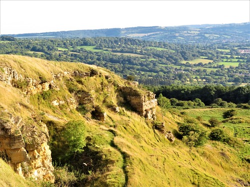
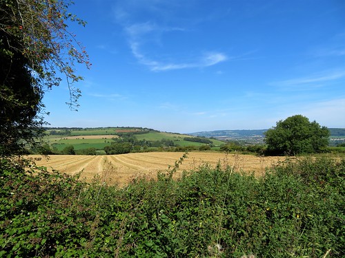
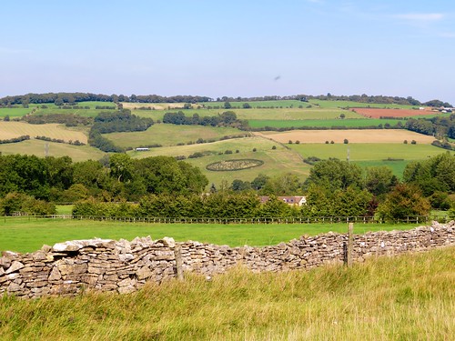
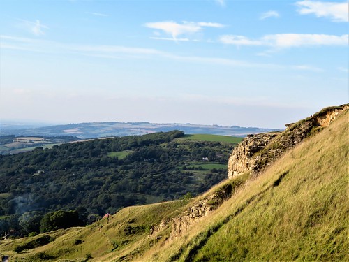
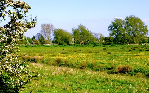
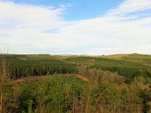
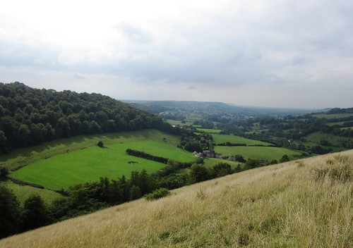
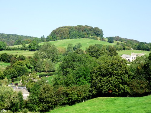
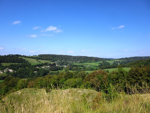
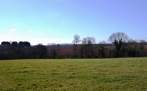
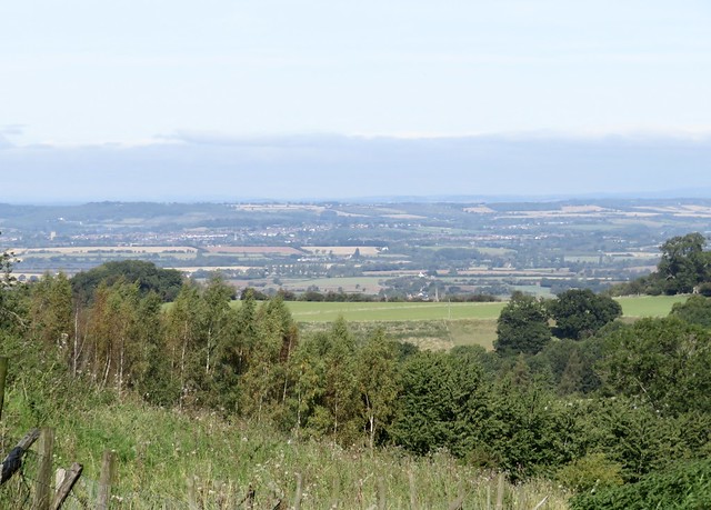
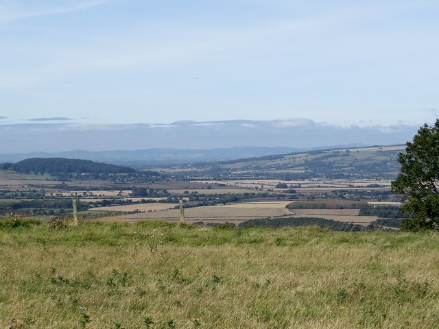
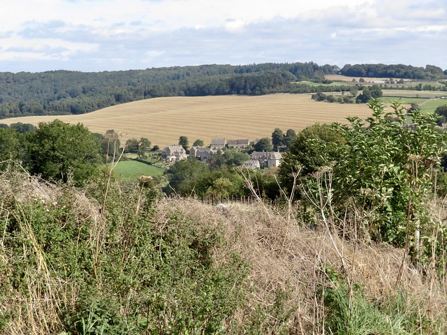
The map of south-east Gloucestershire between Cirencester and Cricklade is spattered all over with blue. It looks as though a flood of biblical proportions has struck this unemphatic, low-lying countryside through which the infant Thames wriggles.

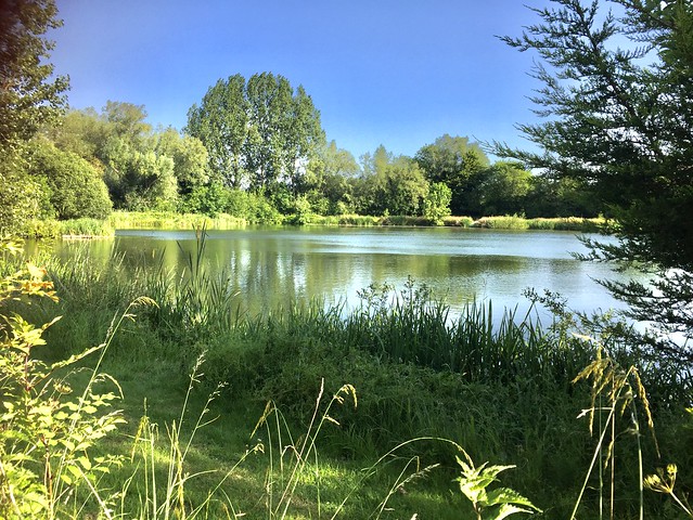
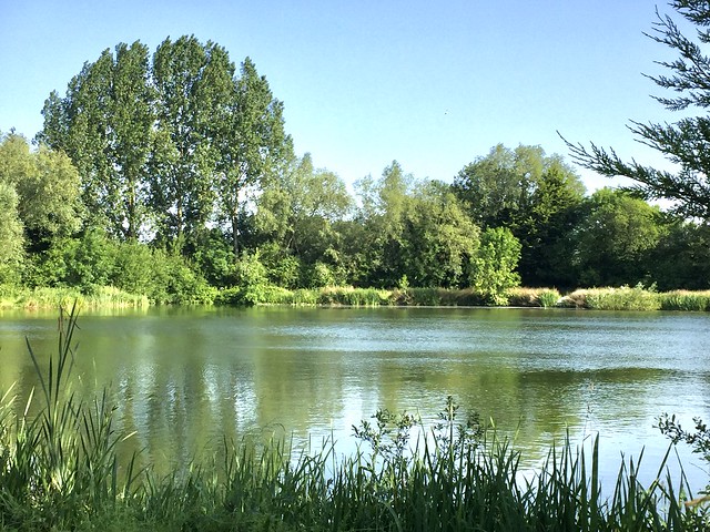
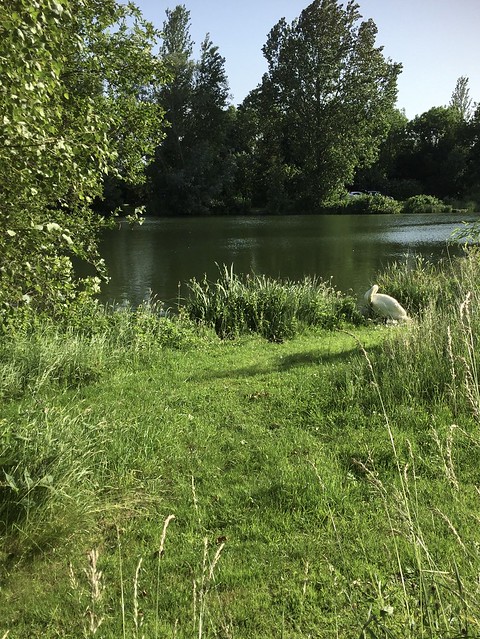
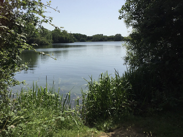
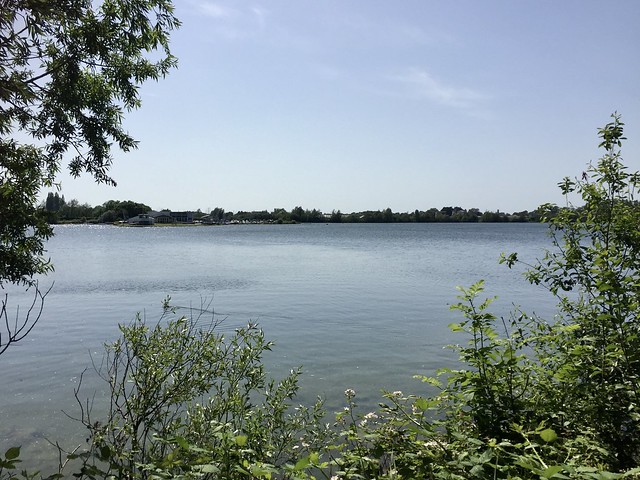
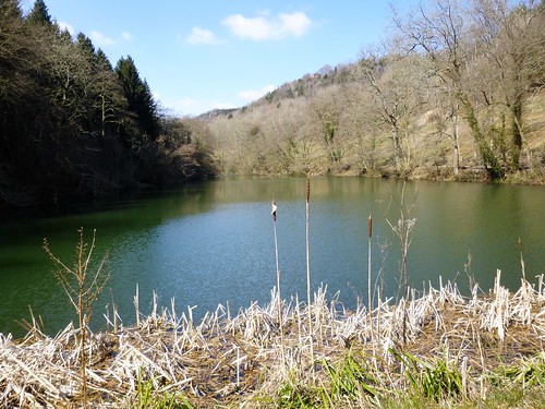
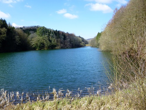
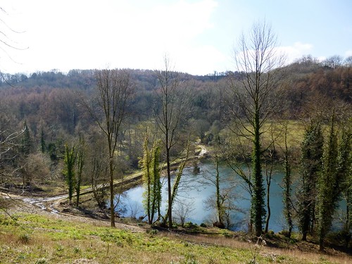
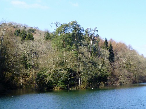
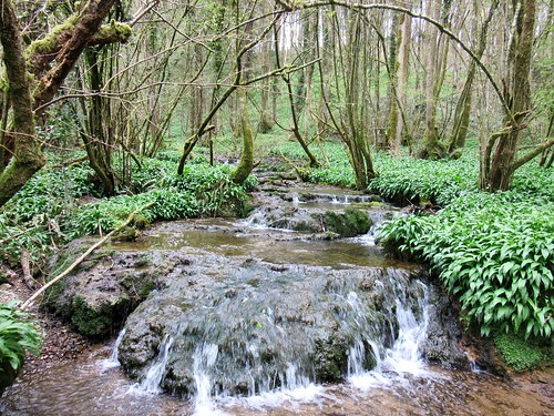
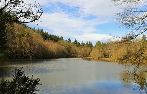
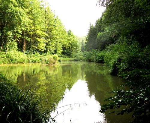
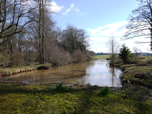
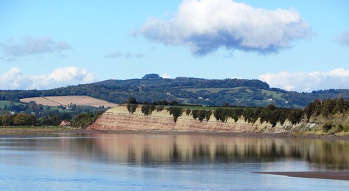
Actually it’s quarrying of sand and gravel that has formed the Cotswold Water Park. As each pit has been abandoned as worked out, underground springs have flooded it. Nature, with a little help from man, has created a patchwork of bird-haunted lakes that are wonderful to walk, binoculars in hand.

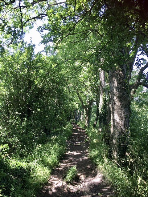
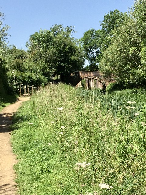
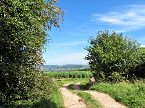
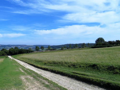
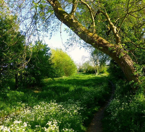
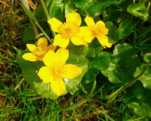
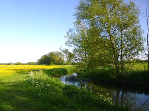
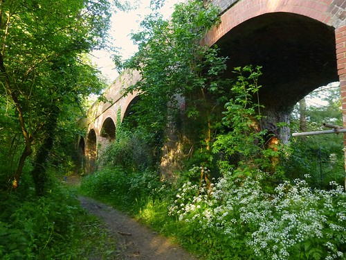
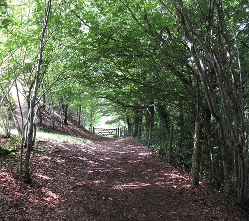
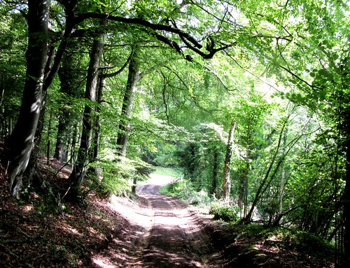
We started our walk through this remarkable landscape along the old Thames & Severn Canal, once a boldly conceived thoroughfare connecting England’s east and west coasts, now a quiet green ditch of a waterway choked with waterlilies, yellow flags and reeds.

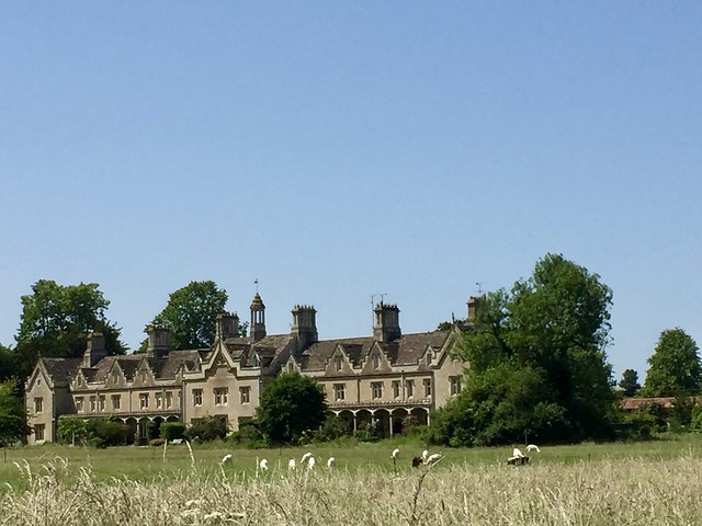
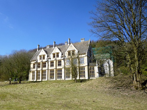
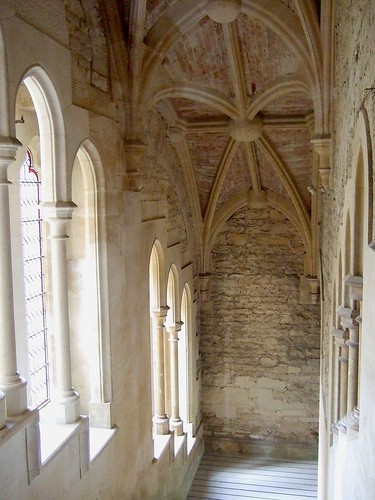
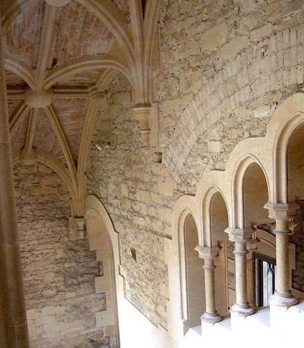
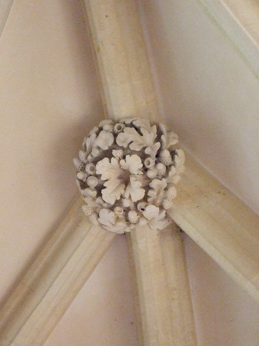
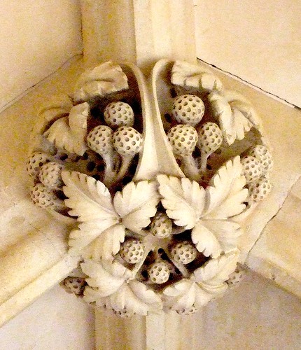
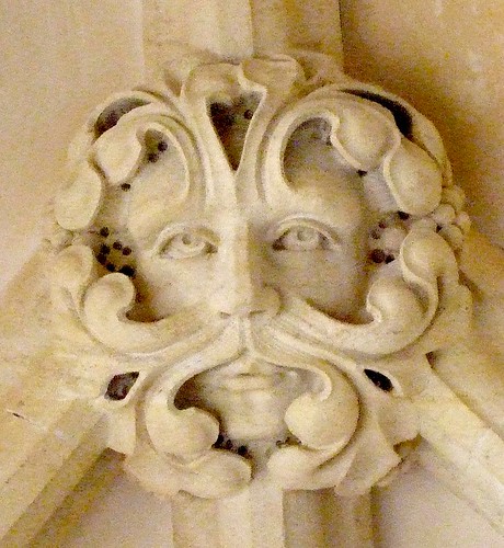
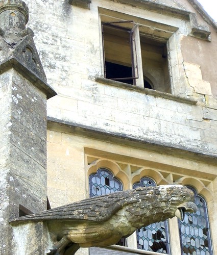
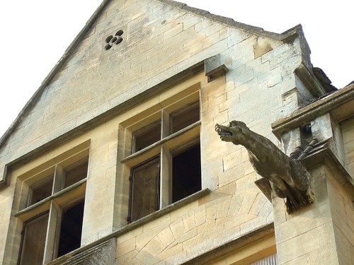
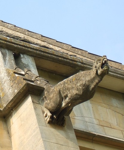
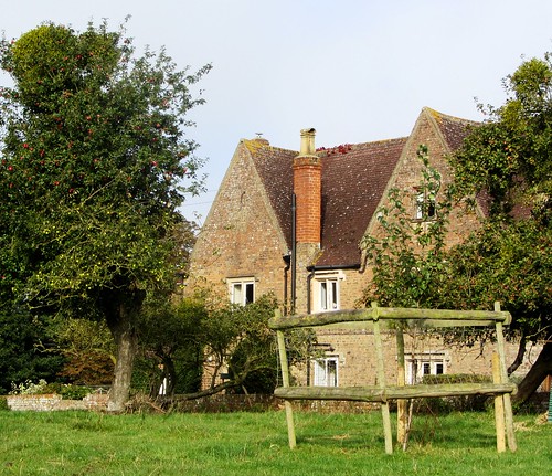
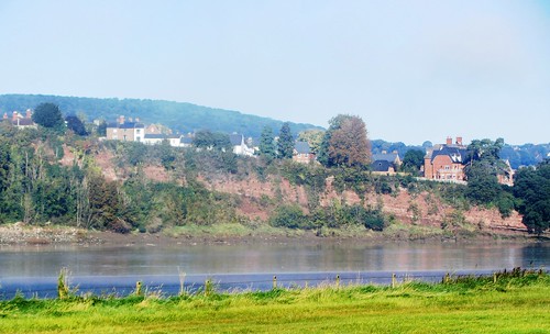
A field path led to the Cotswold stone village of South Cerney and its Church of All Hallows, whose Romanesque south doorway writhed with carvings. In the nave, corbel heads looked calmly down, and a pair of snarling dragons guarded the inner chancel arch.

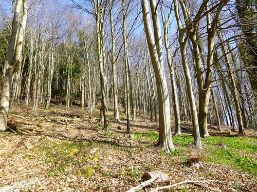
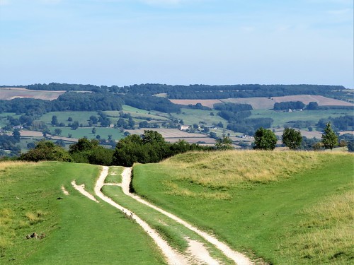
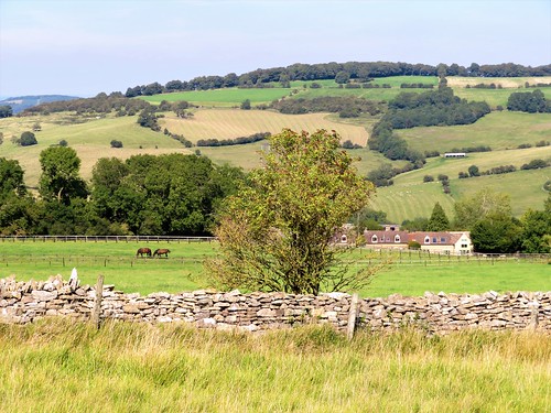
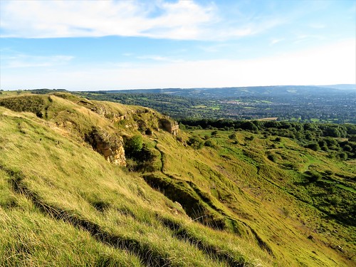
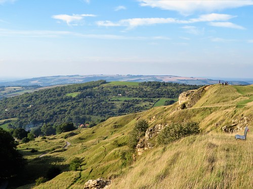
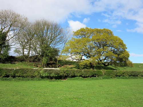
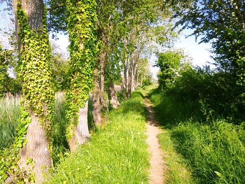
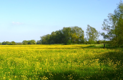
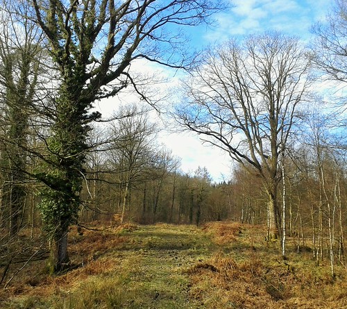
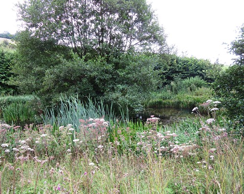
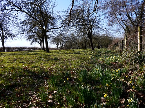
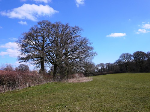
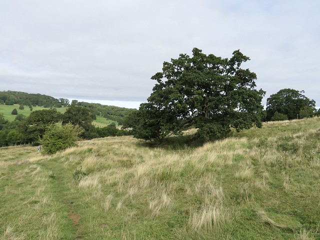
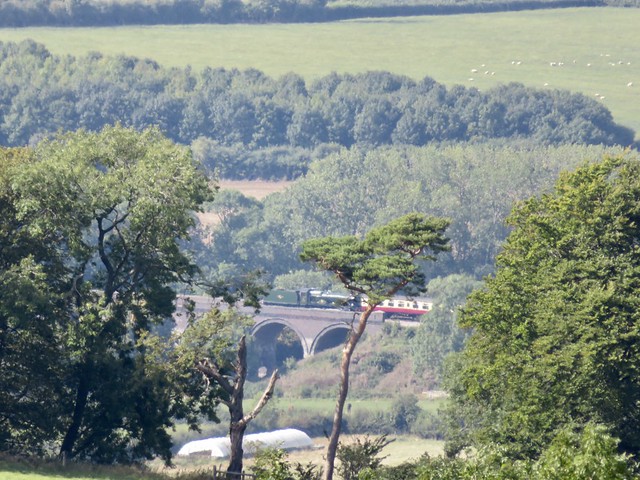
The dog roses were out in Ham Lane where a jay hopped in agitation on a bent branch, trying to spy out a blackbird’s nest and eggs concealed in the hedge below. We followed broad tracks that skirted the gravel pit lakes of the Cotswold Water Park. One quarry was still active, roaring and grinding its industrial purposes behind a screen of trees. Four Egyptian geese with eyes as black as kohl waddles across a strip of ploughland, looking for seeds or a tasty worm.

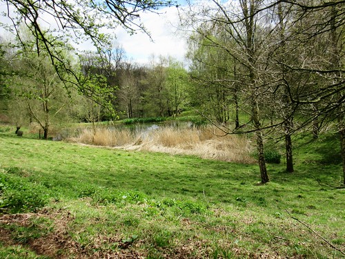
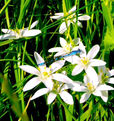
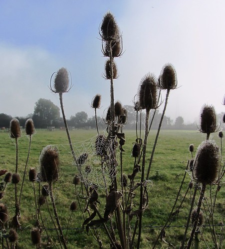
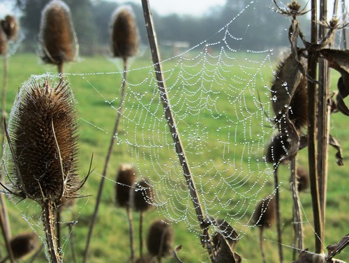
A sudden hatch of damselflies saw the meadow grasses and the pyramidal orchids at the lakeside alive with these electric blue beauties, as slim as needles. Coots were busy reinforcing their floating nests and great crested grebes sailed in pairs, diving every so often with a smooth grace that scarcely raised a ruffle on the water.

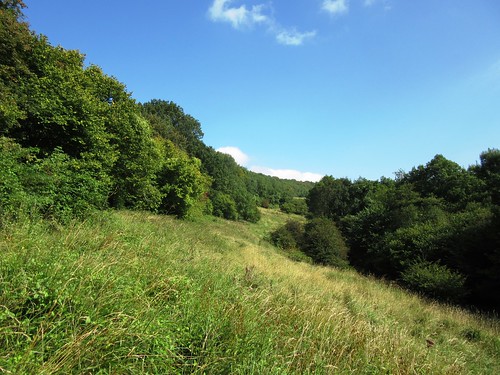
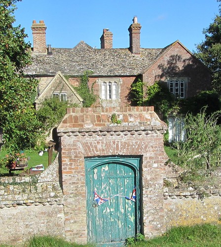
A cake and a cuppa in the shady bower at Jennie’s Kitchen teagarden, and we were on the homeward leg along a meadow path among seas of yellow rattle where meadow brown butterflies spiralled round one another, oblivious to everything except their aerial pas de deux.

Start & finish: Gateway Centre car park, Spine Road, South Cerney, Glos GL7 5TL (OS ref SU 072971)

Getting there: Bus 51 (Swindon-Cirencester). Road: Signposted off A419 between Cirencester and Cricklade.

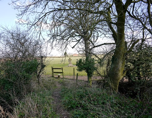
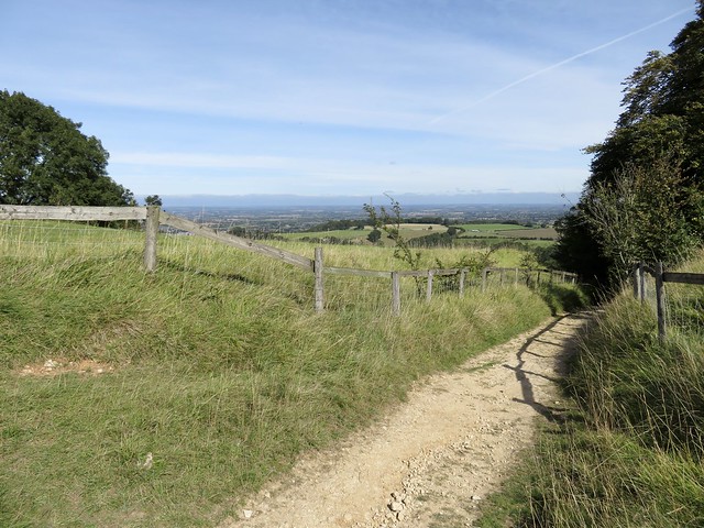
Walk (8 miles, easy, OS Explorer 169): Left along canal path. In 1¼ miles, cross road (056977); in ¼ mile, left (052979) to South Cerney church (050973). From churchyard’s south gate, right; left at road; cross High Street (049970); follow Ham Lane. In 450m, right along railings (051966); follow public footpath across Broadway Lane (049965) and on. In 500m cross bridge (046962); left on path past lakes. In nearly 1 mile on sharp right bend, left (051953) along fencing; cross B4696 and on east (bridleway, blue/yellow arrows). In ½ mile bear right parallel to Fridays Ham Lane (058951); in ¼ mile left across lane by Jennie’s Kitchen (060946). Follow lane opposite for ¾ mile. By Wickwater Farm (069952), left; in ¼ mile right (066954, ‘Cerney Wick’ fingerpost) across fields. Left along railway path (068958, ‘South Cerney’); in 300m, right (067959, ‘Gateway Centre’) to Cerney Wick Lane (069963). Right; in 600m, left (073965, ‘South Cerney); in 100m at post, right to canal (076966); left to car park.

Lunch: Jennie’s Kitchen tearoom, Wheatley’s Barn Farm, Fridays Ham Lane (01285-860048, jennieskitchen.co.uk)

Accommodation: Lower Mill Estate, Somerford Keynes GL7 6BG (01285-869489, lowermillestate.com) – superb lakeside rental properties

Info: Gateway Centre, Cotswold Water Park (01793-752413, waterpark.org) satmap.com; ramblers.org.uk

 Posted by at 01:12
Mar 022019


First published in: The Times Click here to view a map for this walk in a new window
picture picture picture picture picture picture picture picture picture picture picture picture picture picture picture picture picture picture picture picture picture picture picture
Facebook Link:

Our first glimpse of Woodchester Mansion, hunched away behind trees in the depths of its sequestered Gloucestershire valley, seemed to confirm all the rumours – hauntings, murders, madness and ruin. We could have gone straight down to it. But circling the woods and lakes of Woodchester Valley in clockwise fashion allows the full face of the great house to stay hidden until the last moment, providing a satisfyingly strange full stop to the walk.

Woodchester Park is a singular place in itself, a landscaped cleft in the southern Cotswold Hills that had slipped into a state of overgrown wildness until bought by the National Trust in 1994. Good broad tracks led us east through oak and beech woods pungent with the green stink of wild garlic, skirting steep grassy banks and dense conifer plantations. Primroses were struggling out, and the carpet of dog’s mercury showed tiny green flowers, but the mulleins and bluebells of the park were still shut tight against the winter.

A forester was burning trimmings in a dingle below, his crackling fire glowing orange and sending up drifts of blue smoke. We could hear the trees roaring at the rim of the valley, but down here there was no more than a stir of cold breeze. It was a dream-like walk over landscaped banks and planted folds of ground, looking down on the string of lakes – Brick Kiln Pond, Old Pond, Middle Pond, Kennel Pond, Parkmill Pond – dug and dammed two hundred years ago to fulfil the vision of the landowning Ducie family.

At the foot of Parkmill Pond we crossed the grassy dam and set back along the south side of the lakes. A boardwalk trail in a wet mossy wood, an ornate old boathouse colonised by lesser horseshoe bats – and then the great empty house in its damp curve of valley, its blank windows staring from the Cotswold stone walls like so many black eyes in a pale face, Gothic beasts howling in stone above the gutter pipes.

Liverpool ship owner William Leigh bought the estate in 1845. But he never finished the mansion he started in 1850, and it was too damp, dark and menacing for his family to cope with. So it stands with its marvellous carvings, its empty chapel and floorless levels and stairs that go nowhere, the wonder of visitors on open days, collecting legends and gathering mystery, the house that never was.
Start: Woodchester Park car park (National Trust – members free), near Nympsfield, Glos GL10 3TS (OS ref for car park entrance: SO 795014)

Getting there: Bus (Nympsfield, ½ mile) – Service 35 (Cotswold Green, 01453-835153)
Road: Car park signed off B4066 Dursley-Nailsworth road near Nympsfield (M5 Jct 13; A419, A46)

Walk (6½ miles, easy, OS Explorer 168): From car park descend steps; follow trail downhill. Follow red and orange arrows (RA, OA), forking to left of mansion (807013); then follow RA with lakes on right. At end of Parkmill Pond (last lake), cross dam (831008); return on south side of lakes. In ⅔ mile, above Middle Pond dam, bear right downhill (822010, RA). Pass long shed; before dam, left through gate (822011, OA). Along meadow, then woodland duckboard trail. At Boathouse (818014), cross dam; left along north bank of Old Pond, then track (RA, OA), passing to left of mansion; up drive to car park.

Lunch: Rose & Crown, Nympsfield, Glos GL10 3TU (01453-860612; therosecrownnympsfields.com)

Accommodation: Hunters Hall, Kingscote, Glos GL8 8XZ (01453-860393, greenekinginns.co.uk)

Woodchester Park: 01452-814213; nationaltrust.org.uk/woodchester-park

Woodchester Mansion: 01453-861541; woodchestermansion.org.uk

Info: Stroud TIC (01453-760960); cotswolds.com
visitengland.com; satmap.com; ramblers.org.uk

 Posted by at 02:30
Sep 302017


First published in: The Times Click here to view a map for this walk in a new window
picture picture picture picture picture picture picture picture picture picture picture picture picture picture
Facebook Link:

A hot afternoon of streaky blue sky over Cleeve Hill, with Cheltenham spread out 800 feet below like a town in a scale model. The sleek horses of the Wickland Stud champed their grassy paddocks as we followed the Cotswold Way, a powdery white track, along the northern edge of the great swath of common land that caps Cleeve Hill.

Golfers, walkers, joggers and kite flyers disport themselves on Cleeve Common these days, but this dome of flower-rich calcareous grassland has traditionally been a scene of hard work for graziers, arable farmers and quarrymen. Through a tumbled landscape of old quarry scoops and ledges we dropped down to the delectable dell where Postlip Hall raises its Jacobean gables on a wooded slope above a handsome medieval tithe barn.

There was a sleepy Mediterranean feel to Postlip, house and path simmering in the sunshine, only the crowing of a cock behind the high garden wall disturbing the soporific afternoon air. Sheep panted in the pastures, too sun-dazed to get up as we went by.

In a green dingle beyond Postlip a stream tinkled seductively under a footbridge. From here the Cotswold Way rose in stages – some of them pretty steep – through the intriguingly named Breakheart Plantation, with glimpse out north-east across the valley where the huddled houses of Winchcombe and the pale walls of Sudeley Castle lay and baked in the sun.

Out again on the wide Cotswold uplands we came to the sad ruin of Wontley Farm, barn roof in holes, buddleia sprouting from windows and doors, all silent and crumbling in a sea of nettles.

From Wontley a grassy track led back west to Cleeve Common. Along the rim of the escarpment young kestrels were playing chase in the updrafts. The Cotswold Way ran north through the ramparts of an Iron Age hillfort to reach the topograph on Cleeve Hill. We stood and stared out west, over Cheltenham and May Hill, way beyond the Forest of Dean, across the Welsh border to where the Sugar Loaf raised a tiny peak nearly 50 miles away. A breath-taking panorama in the peachy light of evening.

Start: Quarry car park, Cleeve Hill, Cheltenham, Glos GL52 3PW (OS ref SO 989272)

Getting there: Bus service 606 (Cheltenham-Winchcombe) to Rising Sun Hotel (footpath links with walk).
Road: – Quarry car park is just beyond Cleeve Hill Golf Club clubhouse (signed from B4632 Cheltenham-Winchcombe road.

Walk (6½ miles, moderate, OS Explorer 179): From car park, right along stony track. Follow well-waymarked Cotswold Way/CW clockwise for 2¾ miles via Postlip Hall (998267), footbridge below The Paddocks (006265), steep ascent in Breakheart Plantation (007255) and under power lines (009251) to farm track NE of Wontley Farm (011245). CW goes left here; but turn right to ruined Wontley Farm (008247). Right on Winchcombe Way. In ½ mile descend to gate (001247); ahead on grass path to radio masts (994248). Left along road; in 200m, right (993246, fingerpost). Don’t cross stile; fork left down edge of wood to reach CW (991246). Right along CW for 2 miles, following escarpment to Quarry car park.

Conditions: Steep paths in Breakheart Plantation; can be muddy, slippery.

Lunch: Cleeve Hill Golf Club (01242-672025, cleevehillgolfclub.co.uk)

Accommodation: Rising Sun, Cleeve Hill GL52 3PX (01242-676281, oldenglishinns.co.uk)

Info: cleevecommon.org.uk
More directions, maps and walks at christophersomerville.co.uk
visitengland.com; satmap.com; ramblers.org.uk

Walk with Christopher: Christopher is appearing at Cheltenham Literature Festival (cheltenhamfestivals.com/literature) on 10 October, and will be walking on Cleeve Hill that afternoon with audience members. Please book walk places with Ramblers Worldwide Holidays at ramblersholidays.co.uk.

 Posted by at 09:15
May 202017


First published in: The Times Click here to view a map for this walk in a new window
picture picture picture picture picture picture picture picture picture picture picture
Facebook Link:

Take your umbrella if you visit St Briavels on Whitsunday evening, because it’ll be raining bread and cheese. Those humble comestibles are hurled from the top of the Pound Wall opposite St Briavels Castle, while the townsfolk hold upturned brollies aloft to catch as many morsels as they can for good luck.

St Briavels stands on the eastern fringe of the Forest of Dean. Legend, myth and arcane customs hang thickly about this ancient slice of forest where Gloucestershire meets Monmouthshire and England stares at Wales across the beautiful valley of the River Wye.

Below St Briavels Castle we found a field path running along a side cleft of the Wye Valley where ewes with lambs at foot stood staring as we went by. Through the bluebell woods of Slade Bottom ran the Slade Brook, a stream laden with calcium, depositing thick layers of the stuff in miniature dams and pool rims over which the water sparkled.

This is all steep green countryside, heavily wooded and set with scattered farms. At Great Hoggins a chestnut horse and its Shetland pony sidekick came up to look us over. Willsbury Farm sat well down on its slope, all white walls, tall chimneys and tiny windows. Forest of Dean locals have always been inclined to plough their own furrows without so much as a by-your-leave; and when the Reeve of St Briavels decided to build himself a fine house at Willsbury back in 1230, he did so without permission. The Reeve’s illegal farmstead has stood unchallenged for almost 800 years. So much for respect for the law around here.

In Rodmore Grove below the house the brook ran red with mud through clumps of brilliant gold marsh marigolds. A glimpse opened out across the trees of Pickethill Wood to where the grey River Severn broadened between hills to its estuary under a sky of giant white puffed clouds, trampolines for angels.

We left the trees and walk up the long meadow to Highgrove Farm where lambs went kicking the itches out of their heels. A last climb up a hedge of may blossom, and we were cresting the ridge towards St Briavels in the first low sunbursts of a beautiful spring evening.

Start: George Inn, St Briavels, Glos GL15 6TA (OS ref SO 559046)

Getting there: Bus 701 (Coleford), 707 (Coleford-Chepstow)
Road – St Briavels is signposted from A48 (Chepstow-Lydney)

Walk (7½ miles, woodland and field paths, OS Explorer OL14): Opposite St Briavels Castle, down Mork Road beside church (‘Bigsweir’). At left bend, ahead (557049, ‘Mork Lane’). In 40m, right down drive of Tyltham’s Tump (yellow arrow/YA on telegraph pole). Follow YAs down garden to cross stile; ahead, contouring hillside for 500m to enter wood (561053). Follow path above Slade Bottom and through woods for ¾ mile to cross B4228 at Bearse Farm (572051).

Up drive opposite (fingerpost). Fork left along drive (‘Little Hoggins’); over stile; at field end, left (573049) and follow hedge on right. At top corner, right through kissing gate/KG; aim 50m left of gate opposite. Through KG (575046); half right across field to KG; stiles in paddocks to road near Great Hoggins Farm (578045). Left along road; in 300m, fork right off road (581045, fingerpost) along field edge with hedge on left. At far end, over stile; half right over brow of field, aiming right of Willsbury Farm, to cross 2 stiles (585044, YAs). Bear right to skirt pond anticlockwise. Cross south end of pond (586042); right over stile (YA); follow path through Rodmore Grove and other woods for 1 mile to road (588028).

Right along road; pass drive to Clanna Lodge, then footpath crossing road. In another 100m on right bend, fork left downhill on stony lane (582028). In 150m, where lane forks and bends left and downhill, keep ahead on woodland path. In 300m, round sharp left bend (580032), returning southward down west side of valley for 500m to stile out of woods (578028). Keep ahead for ⅔ mile through three long fields to pass below Highgrove Farm. After crossing last stile (570033), bear left in front of rock outcrop with fence/hedge on left. In 150m, left across stile (568035); up field edge; right along top of field. At next corner, left over stile (565034); on with hedge on left. Through gateway (563034); right with hedge on right for ½ mile to stile on right into lane (561041). Left to cross B4228; down roadway opposite; in 50m, right down Pystol Lane to George Inn.

Lunch: George Inn, St Briavels (01594-530228, georgeinnstbriavels.co.uk)

Accommodation: St Briavels Castle YHA (0345-371-9041, yha.org.uk/hostel/st-briavels)

Info: Coleford TIC (01594-837135, wyedeantourism.co.uk)
visitengland.com; satmap.com; ramblers.org.uk

St Briavels Bread & Cheese Scramble: 4 June, 7.30pm (calendarcustoms.com/articles/st-briavels-bread-cheese-scramble)

 Posted by at 02:05
Apr 112015


First published in: The Times Click here to view a map for this walk in a new window
picture picture picture picture picture picture picture picture picture picture picture picture picture picture picture picture
Facebook Link:
The infant River Thames joins Gloucestershire to Wiltshire at the outer edge of the Cotswolds, in low-lying gravelly country. Setting off along the towpath of the reed-choked old Thames & Severn Canal, we marvelled at how dozens of unsightly old gravel pits have been transformed into the wide, tree-hung lakes of the Cotswold Water Park. This is a really fine example of a conservation landscape; and down beyond the hamlet of Cerney Wick there’s another in the lush hundred-acre grassland of North Meadow.

This is a beautiful wide hayfield, fringed with greening willows and filled with flowers; a habitat that comes into its own each springtime. Entering the meadow from the old canal, we walked among spatters of wild flowers – golden buttons of dandelions and buttercups, creamy yellow cowslips, the pale blues and pinks of milkmaids, which some call lady’s smock or cuckoo flower. And everywhere the large drooping heads of snake’s head fritillaries, singly, in pairs or in loose clumps, bobbing and trembling in the wind on their dark red stems.

We got down on our knees, as though in obeisance, to enjoy a close-up look at one of Britain’s rarest and most spectacular plants. Some of the downward-hanging flowers were white with green spots inside; the majority were a dusky, deep rose-pink, speckled within in pale pink and rich purple, like stained-glass bells filtering the sunlight. It was astonishing to see them in such numbers – over a million in this one large meadow.

Snake’s head fritillaries are particularly choosy about where they colonise. They are nationally scarce – but not here. North Meadow, meticulously managed by Natural England, is home to 80% of the entire British population of these remarkable flowers. The Thames, no wider than a stream, dimples through the meadow, its waters slow and thick with nutritious earth particles which are spread across the land by winter floods. The silt-enriched grass is left uncut until midsummer or later, by which time the fritillaries and all the other plants have had time to set the seeds of the next generation.

A slice of lemon and lavender cake (improbable but delicious) in the Fritillary Tea Rooms on the outskirts of Cricklade. And then a slow stroll back through the flowery meadows and along an old railway line where primroses grew thickly and the breeze carried hints of horses, cattle and that indefinable breath of spring in full flow.

Start & finish: Cotswold Gateway Centre car park, Spine Road, South Cerney, Glos GL7 5TL (OS ref SU 072971)
Getting there: Bus service 51 (Swindon-Cirencester). Road: M4 Jct 15; A419 towards Cirencester; B4696 towards South Cerney; in 200m, left into car park (free).
Walk (6½ miles, easy, OS Explorer 169. NB: Detailed directions, online map, more walks: christophersomerville.co.uk): Pass Cotswold Gateway info centre; path to canal (073970); right along towpath. In ¾ miles cross road and on (079960, ‘Cricklade’). At Latton Basin, right (088954) down road (white/green arrow). Bear right on track (yellow arrow/YA) past lock-keeper’s house and on beside old canal bed. In 450m cross bridge (087949); ignore immediate left turn into North Meadow. In 200m, go through gate; left through kissing gate/KG into North Meadow. Fork left and walk clockwise circuit of North Meadow (1¼ miles), returning to same KG (087947)). Through it; right though gate; left (‘Thames Path’/TP) along right bank of River Thames. In 500m, right along old railway (082947). TP leaves it in 350m (080949), but keep ahead along railway for ½ mile to go under viaduct (073954). In another 250m, right through KG (070956, YA) on path through fields. In 700m cross road (076959); over stile (YA); on to road. Ahead past Crown Inn to canal (079960); left for ¾ mile to car park.
Click on Facebook “Like” link to share this walk with Facebook friends.

Lunch: Old Boathouse Inn, Cotswold Gateway (01285-864111); Fritillary Tea Room, Thames Bridge, Cricklade (11-12, 18-19, 25-26 April)
Info: Cotswold Water Park (01793-752413 / 752730)
North Meadow: Natural England (01452-813982; naturalengland.org.uk). Fritillary updates – http://www.crickladeinbloom.co.uk/fritillary_watch.html

Gilbert White 9-day walk, 27 April-5 May: gilbertwhiteshouse.org.uk
satmap.com; ramblers.org.uk; LogMyTrip.co.uk

 Posted by at 01:27
Mar 142015


First published in: The Times Click here to view a map for this walk in a new window
picture picture picture picture picture picture picture picture
Facebook Link:
The Sculpture Trail in the heart of the Forest of Dean was a pioneering project when it first opened in 1986. The artists’ brief was to respond to the Forest, an ancient mineral-rich woodland between Wye and Severn whose atmosphere is full of latency and ‘otherness’.

Some of those initial works have been absorbed organically by the place; twenty remain, with more planned, strung out along a winding path – a giant seatless chair on a hillock, charred boats in an old coal mine drain; a tall staircase to nowhere, then a whole oak tree felled, sawn and reconfigured into a neat jenga-stye pile. These artefacts in such a natural setting could be an intrusive annoyance, but somehow they work together to reinforce the air of secrecy and mystery that the Forest exudes so powerfully.

On a cold winter day under a blue sky netted with the bare limbs of oak, beech and silver birch we walked the circuit as far as the installation named ‘Cathedral’, a big stained glass window suspended between the pine trees and glowing with sunlight. From here we crossed the road that bisects the Forest and headed south past Speech House Lake among the Inclosures – areas where the growing trees were once fenced off against grazing animals. The Forest of Dean has its own laws and customs, enforced by traditional wardens known as Verderers, and Forest-born locals – the ‘Foresters’ – jealously guard their rights to graze their animals and to mine for coal, iron and stone as, when and where they see fit.

We followed forest paths and the trackbeds of old industrial railways between the trees to New Fancy Colliery, where the great spoil tip is now a greened-over hillock with a superb view from its summit across a purple and green ocean of treetops. The goshawks that hunt hereabouts were elsewhere today. But by the side of the homeward path we spotted what looked like a tight coil of rope, patterned with black diamonds – a male adder, still sunk deep in hibernatory half-consciousness as it waited for spring and the mating season.

Start & finish: Beechenhurst Lodge Visitor Centre, Speech House Road (B4226), near Coleford, Glos GL16 7EJ (OS ref SO 614121)
Getting there: Bus service 30 (Cinderford-Coleford). Road: Beechenhurst Lodge is on B4226 between Cinderford (A4151) and Coleford (A4136).
Walk (9 miles, easy, OS Explorer OL14): From Visitor Centre follow Sculpture Trail (leaflet map/guide available from Centre; blue-ringed posts/waymarks). From Sculpture 16, ‘Hanging Fire’ (624126), walk to B4226. Right for 100m; left into car park just east of Speech House Hotel. Ahead through gate (623122) into Cyril Hart Arboretum. Ahead for 150m to next gate; don’t go through, but turn right along path. In 400m, through gate (622118); left (SE) along Spruce Ride. In 300m, over a crossroads; in another 300m, right (627115) on path along left (east) shore of Speech House Lake. At end of lake fork left with ditch, then fence on left for 400m to T-jct (628109); right for 100m, then left for 300m to meet cycleway (628105). Path runs beside it for ½ mile to 6-way junction of tracks (631099). Right here along surfaced track. In 300m, right (630096, ‘New Fancy Picnic Site’); in 200m, fork left into car park. Follow ‘Viewpoint’ to summit lookout (629095).

Back to car park, and to road entrance (627095). Left along road for 150m; right through gate, and on west along trackway. In ½ mile descend to track (619097); left for 30m; at ‘Three Brothers’ sign, right (north) along rising grass track for nearly 1 mile. At junction, take 2nd right (618111) along waymarked ‘Gloucestershire Way’/GW. In 400m it forks left (618114, GW, yellow arrow/YA) off hard-surfaced track onto grassy/muddy ride. Continue north for 400m to cross stile (618119); left on path through trees, down to track; right to cross B4226 (take care!) to car park and Visitor Centre.

Lunch: Speech House Hotel on B4226, half a mile east of Beechenhurst Lodge (01594-822607; thespeechhouse.co.uk)
More info: Beechenhurst Lodge (01594-833057)
www.satmap.com; ramblers.org.uk; LogMyTrip.co.uk

 Posted by at 01:50
Sep 272014


First published in: The Times Click here to view a map for this walk in a new window
picture picture picture picture picture picture picture picture picture picture picture picture picture picture picture picture
Facebook Link:
Back in 1985, a head-over-heels fan of Cider with Rosie, I spent a day exploring Slad with Laurie Lee as my guide. I’ve never forgotten the deep and amused affection that the author showed for the little South Gloucestershire village where he grew up. So it was a thrill to be back there in Lee’s centenary year, walking the recently opened Laurie Lee Wildlife Way which meanders – marked here and there with posts displaying Lee’s locally-inspired poems – through a succession of nature reserves cared for by the Gloucestershire Wildlife Trust. Click here for a map of Cider With Rosie sites

Below the path in ancient Longridge Wood ran the dark dingle of Deadcombe Bottom where lay the haunted house of the Bull’s Cross hangman – or so young Laurie and his friends believed. Up at the crest the poem ‘Landscape’ summoned images of a lover and a countryside melting into one another. But the stolid sheep among the harebells of Slad Slope munched on regardless.

On through Snows Hill wood, and down across a jungly hillside to a brook fragrant with spearmint. ‘My heart’s keel slides to rest among the meadows,’ said ‘Home From Abroad’ on the far bank. Up again to a long view over the roofs of Slad, and a poem about The Three Winds in Catswood. Here a tawny owl got up and flapped briskly away before me.

Through autumn gentians and ladies tresses on the steep flank of Swift’s Hill; and then the approach to Slad itself, past the field where Rosie Burdock and young Laurie exchanged cidrous kisses under that famous hay wagon. Past the tangle of trees in the valley bottom where Laurie’s friend Sixpence Robinson lived – ‘the place past the sheepwash,’ Lee remembered in Cider With Rosie, ‘the hide-out unspoiled by authority, where drowned pigeons flew and cripples ran free; where it was summer, in some ways, always.’

Past the pond where poor crazed Miss Flynn drowned herself, and up the lane to the L-shaped house where Lee and his seven siblings lived, laughed, fought with and finally left their scatter-brained, infinitely loving mother Annie. As her dreamy youngest son put it in his poem ‘Apples’, she too was fated to ‘welcome the ripe, the sweet, the sour, / the hollow and the whole.’
Start & finish: Bull’s Cross car park, near Slad, Glos GL6 7QS (approx.) – OS ref SO 877087)

Getting there: Bull’s Cross is on B4070, 1 mile north of Slad (signed from A419 in Stroud – M5, Jct 13)

Walk (6½ miles, moderate, OS Explorer 179. NB leaflet guide from Woolpack Inn, Slad, or download at gloucestershirewildlifetrust.co.uk):

Heading north from Slad, don’t take first path on right! At ‘Equinox’ poem at northern end of car park, ‘Wildlife Way’ arrow/WW points up B4070. In 100m, right (yellow arrow/YA) down lane. In 400m, through gate (882089); in another 350m, fork right off track (885088, YA on tree) on descending path. Pass end of lake, up across track (886087) and on up steep path rising to left. At top, cross bridleway (887087), through stone wall gap (YA) and on, down through grassland reserve. Stile (YA); cross field to bottom left corner and gate into Snows Farm Nature Reserve (889085).

Ahead down track through wood. At bottom, path bends right (892085, ‘Laurie Lee’/LL post, red arrow). Follow LL and WW southwest across grass slopes and through woods for 500m. Near Snows Farm cross brook (887081); on far bank, through gate; right (LL) along fence and through kissing gate. Don’t cross brook, but bear left over stile (YA, Wysis Way). Fork right in next field to cross stream by plank; fork right up slope and over stile; diagonally up across grassy field and into Catswood (886077). Right on path along lower edge of Catswood, and on into Redding Wood.

In a little over ½ mile, turn right along tarmac lane (880073). In 400m at bottom on right bend, left up steps (880070); follow path through Laurie Lee Wood Nature reserve (‘Trantershill Plantation’ on OS Explorer map). Through gate at top of wood (877068, with road below to right). Turn left past another gate, uphill on stony track. In 200m, pass ‘Field of Autumn’ poetry post on your right; at top of slope, with field gate on left, hairpin back right (879067), heading west over brow of Swift’s Hill Nature Reserve and down to road (875066). Left over cattle grid. Pass Knapp Farm; at left bend, right along drive (872067, ‘Upper Vatch Mill’). In 100m, right over stile (YA), and follow YAs across 3 fields for 600m to hollow lane (878071). Left to road at Furners Farm. Left past farm; on along stony lane.

In 10m, over stile (877072); on along green pathway through 2 fields and woodland corner. Cross stile on left into 3rd field (877076); follow hedge on left down to gate (877077). Pass village pond; left up lane. At top (874078), either left to B4070 (Lee’s childhood home – NB it’s a private house! – is down the bank on the left at junction, 874075) and on to Woolpack Inn, with church and school opposite; or turn right at top of lane to cross B4070 at war memorial (873079). Up lane opposite; at left bend, right (872079, fingerpost) along lower edge of Frith Wood Nature Reserve. In 200m fork left uphill; in 250m at top (874084), bear right to Bull’s Cross car park.

Conditions: Some short steep climbs; sticky/slippery after rain.

Lunch: Woolpack Inn, Slad (01452-813429)

Reading: Laurie Lee’s Selected Poems (Unicorn Press); Cider With Rosie (Vintage Classics)

2014 Centenary events: laurielee.org

Info: Stroud TIC (01453-760960)

visitthecotswolds.org.uk; www.satmap.com; ramblers.org.uk

 Posted by at 01:11
Mar 082014
 

Under a wall-to-wall blue sky, Dymock glowed in its best spring colours – mellow red brick, black-and-white timbering, rosy sandstone of the church, green pastures, and the dusky pink soil so characteristic of this corner of west Gloucestershire. First published in: The Times Click here to view a map for this walk in a new window
picture picture picture picture picture picture picture picture picture picture picture picture picture picture picture
Facebook Link:
A quiet rural landscape, seductive to the clutch of poets who lived hereabouts in the golden summer of 1914 – Lascelles Abercrombie and Wilfred Gibson, half-forgotten talents nowadays, and two iconic names of poetry, Robert Frost and Edward Thomas. It was while walking in these woods and fields that Frost persuaded Thomas to chance his arm at writing verse, and the hundred-odd poems that Thomas produced before his death in the Battle of Arras in 1917 proved some of the 20th century’s greatest.

Apart from poetical connections, Dymock and its sister village of Kempley have another claim to fame – the profusion of wild daffodils that colour the local road verges, field edges and woods in spring. Out in the fields between the two villages we followed the Daffodil Way past old brick farms and through woods and orchards where clumps of daffodils shook in the cold east wind – slender plants with delicate translucent sepals of creamy yellow, and puckered trumpet mouths that shone a rich egg-yolk gold in the sun. The warm weather had not yet melted the snow on the distant Malvern Hills; their peaks glittered white against the intense blue of the sky in the north.

St Mary’s Church stands a little apart from its parent village of Kempley, a modest Norman building in a daffodil-filled churchyard. The church contains the oldest timber roof in England, and some of its most wonderful wall paintings. Shadowy figures form the tableaux of an Easter play, and a Wheel of Life with cameos from birth through childhood and manhood to old age, infirmity and death. Here above the chancel are Christ seated in Judgement among cross-winged angels, while the Twelve Apostles look on with uplifted faces. It’s quite remarkable to think that some 900 years separate this rustic artist and those who admire his work today.

We tore ourselves away at last and followed the winding Kempley Brook down to Kempley Green. Nesting tits and finches sang loud in Dymock Wood, and an elderly farmer at Timber Hill Farm caught his over-eager sheepdog puppy up in his arms and wished us ‘Good afternoon’ as we made for Dymock and the distant white-capped Malverns.

Start: Beauchamp Arms, Dymock, Glos, GL18 2AQ (OS ref SO 701312)

Getting there: Bus: Stagecoach Service 132
(www.fachrs.com/download/132_bustimetable.pdf), Ledbury-Gloucester
Road: Dymock is on B4215 Newent-Ledbury road (M50, Jcts 2 or 3). Park near pub/parish hall.

Walk (10 miles, easy, OS Explorers 190, 189, OL14; map at kempleytardis.org.uk/walks; many ‘Daffodil Way’/DW fingerposts): Through churchyard gate beside Parish Hall; right along east end of church, then left along north side of churchyard. Through kissing gate/KG; bear left past corner of housing estate; cross left-hand of 2 footbridges (698315). On across stile (‘Daffodil Way’/DW); right along layby to cross B4215 (696316). Up lane opposite (DW). Path skirts Allum’s Farm (signs); through gate (689312); on through orchard (yellow arrows/YAs); through gate at far end (688309). Along field edge to road (688307). Right for ⅓ mile; right through KG (683306, DW); aim for right corner of conifer wood ahead. Cross 2 footbridges into wood (684309). Half right on path to follow wood edge. Out through KG; in again through next KG; follow path through Allums Grove (YAs), leaving wood through kissing gate (680313). Keep left of pond; on across footbridge; right through KG (678314); right along hedge and round field edge. Right over footbridge (676315); half left to cross stile (YA) and field to road (673316). Left to St Mary’s Church (670313).

Leaving church, left along road. At T-junction, ahead over stile (668311, DW). Cross field; through gateway with stream on left (666309); follow stream (YAs) for nearly a mile to road (663296). Left to T-junction; right (666293, ‘Upton Bishop’). In 50m, left (DW) over stile. Follow hedge round to right; over stile; follow hedge on right over stiles for 3 fields. Over footbridge (670288, YA); along back of shed at Moor House to farm track. Left over stile (DW); in 100m, right over footbridge (YA); half left, following YAs/footbridge up to road by house in Kempley Green (677289, DW). Right; in 100m, left and immediately right (DW), and follow YAs and ‘3 Choirs Way’ (3CW) waymarks across 4 fields into Dymock Wood (683286). Through wood (YAs, 3CW) for ⅔ mile to road (691286).

Right (DW) over M50. At T-junction, left (694284, DW). In 350m, left (DW) through KG; under M50; right through KG (YA); on beside motorway. At end of 2nd field, left (698289). Cross farm lane (699293, YA); on along field edge, then track past Boyce Court. Between gateposts to T-junction (703299). Right and left (DW); follow canal/stream, then field edges (YAs) to Dymock.

Lunch: Beauchamp Arms, Dymock (01531-890266; beauchamparms.co.uk) – excellent village pub-with-food

Kempley Daffodil Weekend (walks etc): 15-16 March 2014; daffs.org.uk, kempleytardis.org.uk/walks

www.ramblers.org.uk www.satmap.com www.LogMyTrip.co.uk visitengland.com

 Posted by at 01:33
Jan 282014


First published in: The Times Click here to view a map for this walk in a new window
Looking north along the Cotswold Way Snowshill parkland Snowshill parkland 2 Snowshill parkland 3 looking north across the Vale of Evesham looking towards the southerly slope of Bredon Hill Cotswold Way looking north to the Vale of Evesham Snowshill steam train and viaduct Snowshill Arms Snowshill village street Chipping Campden morris aloft outside the Snowshill Arms Snowshill 2

In the early twentieth century Charles Paget Wade created a world for himself in his Cotswold manor and Arts & Crafts garden at Snowshill. His family motto was ‘Let nothing perish’, and he followed that dictum to the hilt as he collected over 200,000 objects – clocks, toys, chairs, musical instruments, craft tools, bicycles, suits of armour.

Snowshill manor, its garden and collection are curated by the National Trust these days. Setting off from Snowshill, we followed the Winchcombe Way down across a slope of coarse pasture into a valley of springs and streams. Sheep grazed among the thistles and scrub bushes where last autumn’s sloes and rosehips still hung. The light chakker of jackdaws made a tenor counterpoint to the harsh baritone cawing of rook in the parkland oaks.

Up on the opposite ridge we paused under a great spreading ash to look back across the valley to the manor and silver-gold cottages of Snowshill crowning their hilltop. A crunchy byway led north, with fine views opening east to the folly of Broadway Tower on its knoll. Then the path swung west, and suddenly we were contemplating thirty or forty miles of countryside laid out in the sunshine, the low-lying Vale of Evesham leading off past the broad dome of Bredon Hill to where a tsunami of bruise-coloured cloud marked the distant Malvern Hills and hazy blue hills beyond.

Now it was south again along the ridge track of the Cotswold Way, hurdling the bumpy slopes on pale oolitic limestone. I very stupidly picked and sampled a blackberry that somehow still clung to its bramble. After spitting out the rank, disgusting mess, I spent the rest of the walk picking seeds from my molars.

The mound and ditch of Shenberrow hill fort lay ahead, preserved from destruction by the plough thanks to the line of sturdy trees along its ramparts. Here at 997ft, the highest point in Gloucestershire, we stood looking across the plain at the outliers of the Cotswold Hills. A tiny steam train crept across the landscape, passing over a viaduct and away out of sight toward Cheltenham, leaving behind a dissolving trail of smoke and a mournful owlish hoot.

The homeward bridleway edged past ploughed fields of dark, iron-rich earth. Snowshill appeared ahead, having apparently shunted itself from its hilltop into a valley we hadn’t even noticed till then. A mystery we failed to unwrap as we spread out the map by the fire in the Snowshill Arms. In that cosy place with a pint of Donnington Best Bitter at our elbow – frankly, my dear, we didn’t give a damn.

How hard is it? 4½ miles; easy; field paths and well-marked trails

Start: Free overflow car park, Snowshill, Broadway WR12 7JU (OS ref SP 097340)

Getting there: Snowshill is signposted off B4632 in Broadway (A44, Evesham – Stow-on-the-Wold).

Walk (OS Explorer OL45): Left down road; at Snowshill Manor entrance, through gate (‘Winchcombe Way’/WW). Follow yellow arrows/YAs for ½ mile into valley, across stream, uphill (YAs) to byway (088345). Right (WW). In ½ mile through gate (089352); left through kissing gate (WW); in 200m, left along Cotswold Way/CW (087354). In 50m, ignore WW on right. Follow CW for 1½ miles to Shenberrow hillfort (080335). CW continues ahead, but turn left here (‘bridleway’). By Shenberrow Buildings barn, left (080333, ‘bridleway’). In 400m dogleg left/right (084331, WW); on across fields to road (091335). Right; in 550m, left at junction (093336) into Snowshill.

Lunch: Snowshill Arms (01386-852653, donnington-brewery.com)

Accommodation: The Lodge at Broadway, Keil Close, 2 High Street, Broadway WR12 7DP (01386-852007, thelodgebroadway.co.uk)

Info: Snowshill Manor (01386-852410, nationaltrust.org.uk)

 Posted by at 01:50
Jan 252014
 

Arlingham lies isolated, out near the tip of a peninsula in a great bend of the Severn south of Gloucester, where the river begins to widen in its sinuations towards Bristol and the Severn Estuary. First published in: The Times Click here to view a map for this walk in a new window
picture picture picture picture picture picture picture picture picture picture picture picture picture picture picture picture
Facebook Link:

When the residents discovered that Arlingham’s much-loved pub, the Red Lion, was to be sold at auction at 48 hours notice, they didn’t sit and mope – they rushed round, raised £350,000 in the space of two days, and bought the place. Everyone pitched in to refurbish it, and they got the place open again PDQ. That’s how much the village pub means to this little community at the end of ‘the longest cul-de-sac in Britain’.

The low countryside lay blanketed in mist when we set out south across the peninsula from Arlingham. There’s always a thrill when you approach the Severn hereabouts, hidden as it is beyond the loom of the river wall. The village lies a good twenty miles upriver of the old Severn Bridge, but the Severn is still tidal this far inland, and there’s no knowing what you’ll find when you climb the bank – a mighty tideway, fast-moving and chocolate-brown, or a hollow plain of mud and sand banks where oystercatchers and black-headed gulls excavate the tidelines. A rush and suck of turbulent water told us it was high tide even before we topped the grassy wall to find the channel full and the river already beginning to ebb seaward.

Friendly horses came up to have their soft faces stroked. The mist shredded away into a china-blue sky, and by the time we’d rounded the bend we could make out the white houses of Newnham riding the crest of their arc of tall red cliffs on the far bank of the Severn. Sand spits in mid-river began to roll clear of the falling water, exposing whole trees stuck fast on their timeless journeys to the sea. On one shoal we saw a man walking his dogs between opposing eddies, and wondered how he’d got out there.

Midday struck from Newham church tower, the bell notes echoing across the water. We turned reluctantly from the river and made our way back to Arlingham across fields corrugated with medieval ridge-and-furrow, the hollows gleaming like silver where the low winter sun caught the clumps of rushes that grew there. Past handsome old Slowwe House (the only name in the world with two adjacent ‘w’s?), and into the Red Lion to celebrate its community-led renaissance with a little smackerel of something.

Start & finish: Village car park, Arlingham, Glos GL2 7JN (OS ref SO 707109)
Getting there: M5, Jct 13; left on A419 to A38; left for ½ mile; right on B4071 to Frampton-on-Severn; minor road to Arlingham.
Walk (6 miles, easy grade, OS Explorer OL14. NB: Online map, more walks: christophersomerville.co.uk): Left to Red Lion PH; right along Church Road. On right bend just past Westend Farm, ahead through gate (707103; ‘Severn Way’/SW). Stony track between fields to river (706099). Right on SW beside river for 4 miles. Two fields before reaching pylon, with grey sluice box on left, go through kissing gate (723115). Right (‘footpath’ pole) up track; in 70m, right through kissing gate (yellow arrow/YA). Follow path west across fields (footbridges, kissing gates, YAs) with hedge on right for ½ mile to road by pond (715113). Fork right for ¼ mile past Slowwe House and Slowwe Cottages to T-junction (712115). Go over; bear left down grassy lane (‘Restricted Byway’) to car park.

Lunch: Red Lion, Arlingham (01452-740700; redlionarlingham.co.uk) – cheerful, cosy village pub

www.ramblers.org.uk www.satmap.com www.LogMyTrip.co.uk visitengland.com

 Posted by at 06:07