Search Results : Hampshire Hants

Dec 102011
 

The ruddy-faced man in Stockbridge High Street (flat cap stuck with fishing flies, Barbour, cord breeches, brogues, black Labrador strictly to heel) might have been posed there by Central Casting this crisp blue winter’s morning.
First published in: The Times Click here to view a map for this walk in a new window
picture picture picture picture picture picture picture picture
Facebook Link:
The long, linear Hampshire village is famous for outdoor pursuits in the surrounding countryside, most especially fishing. Stockbridge straddles the Test, England’s best trout fishing river bar none. Jane and I hung over the bridge watching the olive green fish sinuating with the water weed. Then we struck out across the roof of Houghton Down, following flinty trackways that might well predate the Romans.

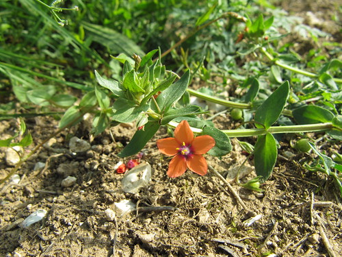
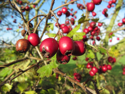
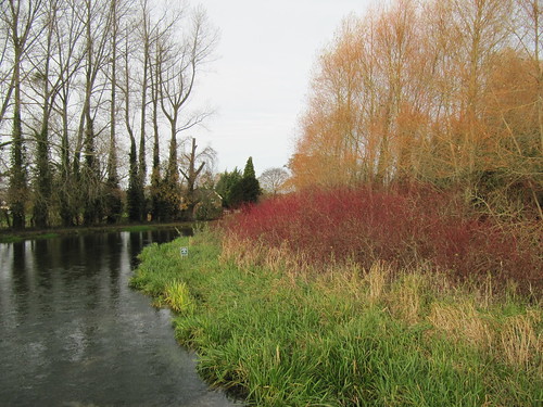
Brilliant scarlet rosehips and bryony berries, blush-pink spindle, the soft bloom of unfrosted sloes, crimson haws – the thick hedges flanking the old green roads of the downs were bursting with fruit. Among the bare branches moved darting flocks of fieldfares, russet-breasted thrush cousins over from Scandinavia for the winter, busy gobbling as many berries as they could get down their handsomely spotted necks.

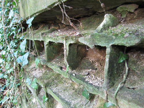
A quick nasty smack of the A30, and we continued our high course along the green lanes. Two horses came cantering towards us, the riders grinning as they passed, their weatherbeaten faces cracking into multiple lines like a brace of kindly sea captains. In a trackside copse a wartime pillbox crumbled silently, its cheap utility bricks scalloped by rain and wind into artistic-looking hollows.

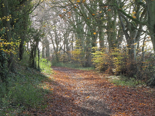
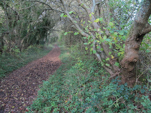
Shuffling through drifts of beech leaves, we followed the snaking track down off the ridge into Houghton, as quiet as a chapel on Sunday. The Test gurgled and chuckled under its footbridges, a mazy system of backwaters and sidestreams spreading a net of water through the shallow valley. The sun struck late colours out of the trees along the river – crimson dogwood, acid green willow, yellow birch, vivid against the smeary pearl of a wintry sky.

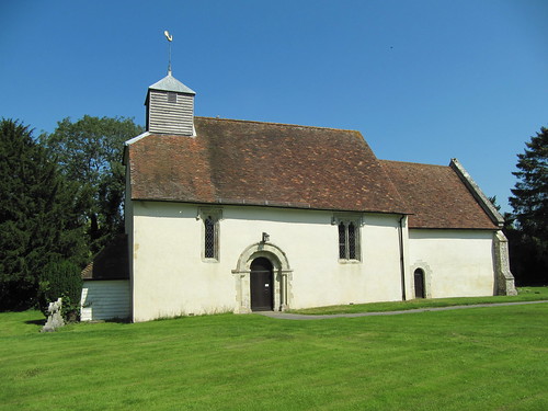
At Blacklake Farm a tiny terrier, trembling with eagerness, pushed his face through the garden fence and begged us unavailingly to take him along. We turned for home along the disused Sprat & Winkle railway line, now the Test Way footpath. A final detour through the rushy acres of Common Marsh, and we were walking the black peaty banks of the Marshcourt River, with Stockbridge church spire and hot buttered teacakes in Lillie’s Bakery as twin aiming points.

Start and finish: High Street, Stockbridge, Hants SO20 6HF (OS ref SU 357351)
Getting there: Bus (www.stagecoachbus.com) – 68 (Winchester) or 78 (Salisbury). Road – A30 from Winchester or Salisbury

Walk: (7½ miles, easy, OS Explorer 131): West (Salisbury direction) along Stockbridge High Street (A30). Cross River Test; up hill; at right bend (350352), left up Roman Road. At turning circle, ahead on paved path, then green lane. In ⅔ mile, rejoin A30 (339354); ahead for 200m (take care), then left (337353, ‘Byway’) on stony roadway for 1 mile. At road (323344), left (‘Byway’) along green lane. In ¾ mile, left at bench (322331) on green lane down to Houghton. (NB To reach Boot Inn, left on path by recycling bins).

At road, right (342321); in 300m, left (341319; fingerpost, ‘Monarch’s Way’). Cross River Test and pass Blacklake Farm. In another ⅓ mile, left (350316) along Test Way. In 1⅓ miles, left through gate (354336; NT sign); bear right across Common Marsh beside Marshcourt River. At north end of Common Marsh, through gate (355347); path to Stockbridge.

Lunch: Boot Inn, Houghton (01794-388310)
Tea: Lillie’s Bakery, Stockbridge (01264-810754)

Accommodation: Three Cups Hotel, Stockbridge, Hants SO20 6HB (01264-810527; www.the3cups.co.uk) – beamy, low-ceilinged, warm, friendly.

Information: Winchester TIC (01962-840500); www.visit-hampshire.co.uk
www.ramblers.org.uk www.satmap.com www.LogMyTrip.co.uk

 Posted by at 01:02
Nov 192011
 

A misty morning over Hampshire, with pigeons throatily cooing in the oaks at Totford. Fine breakfast smells and a cheerful clatter of dishes came from the Woolpack Inn’s steamy kitchen.
First published in: The Times Click here to view a map for this walk in a new window
picture picture picture picture picture picture picture picture
Facebook Link:
A green lane hung with haws and sloes led us away east. The early sun had not yet got a grip on the countryside; the flinty chalk of the track was slippery with dew, and the elder and spindle leaves along the lane trembled with coruscating droplets, winking a million messages from the hedges. Everything lay still, a silence broken by bursts of wren chatter and the swish of our boots through wet grass and docks.

The Three Castles Path, entirely unwaymarked but clear to follow on map and ground, wound through woods of sycamore and yew, then out into a broad landscape full of the kind of flowers – brilliant red pheasant’s eye, dusky purple fumitory, restharrow, corncockle, scarlet pimpernel – that I thought had been long since blasted out of the cornfields by agrichemicals.

By Barton Copse two young girls on ponies came riding by, straight-backed and serious-faced, with a polite ‘Hello’ apiece. What a countryside these lucky children can wander safely through, all ancient wood pastures, pheasant coverts and well signposted bridleways. Someone obviously looks after it all very carefully, as with the lovely little Church of St James at Upper Wield with its Romanesque south door, traces of medieval wall paintings and elaborate marble tomb of Sir William Waloppe Esq (d. 1617), Marshal of the Town of Calais, who ‘served against ye Moores for Ye Kinge of Portingal’.

What place on earth could be calmer or more beautiful than Upper Wield on a sunny morning? Horse paddocks and barley fields took us away, down uncultivated fields where the wild flowers had been left to riot, then onto the great old green highway called the Ox Drove. Hedges of blackthorn and elder thirty feet thick, red admiral and peacock butterflies on the stones, and a green tunnel of trees to funnel us back through the fields to Totford.

Start & finish: Woolpack Inn, Totford, Alresford, Hants SO24 9TJ (OS ref SU571380).

Getting there: M3 Jct 7; A33 ‘Winchester’; in 5 miles, left via East Stratton and past Northington (signed) to Totford on B3046. If parking at Woolpack, please ask permission, and give pub your custom!

Walk: (9 miles, easy, OS Explorer 132): Restricted Byway (RB) beside Woolpack (‘Wayfarers Walk’/WW). In ¾ mile, beside barn, right (581384; WW) up farm road. At top, dogleg right and left round bend; in 20 m, left (582376; RB) through wood. Left at road (591371). In ½ mile, right (595377; ‘Godsfield Farm’). In 250 m, left (597375, RB) for 2¼ miles, passing Godsfield Copse, then Armsworth Hill Farm, Wield Wood and Barton’s Copse. After 1 more field, left beside houses (628387) past church and barn; over 2 stiles (yellow arrows/YA); follow fingerposts, dogleg left and right, then ahead (stile, YA) to road (625390). Left; past Wield Wood Farm drive (621390); in 20 m, left (fingerpost in right hedge) through gate (‘WW’). Down alleyway ahead, on over stile, through windbreak (618391), over field. Through hedge (613392; fingerpost); down narrow field past Bangor Copse, ahead along field edge to YA post (609395). Through hedge; left along Ox Drove (RB). In 1 mile cross 2 roads (595388) and on; in ¾ mile, round right bend (582384) to farm road. Left past barn (RB); return to Totford.

Lunch/accommodation: Woolpack Inn, Totford (01962-734184; www.thewoolpackinn.co.uk)

Info: Winchester TIC, The Guildhall (01962-840500); www.visit-hampshire.co.uk

www.ramblers.org.uk www.satmap.com www.LogMyTrip.co.uk

 Posted by at 01:24