Search Results : Hertfordshire Herts

Feb 292020


First published in: The Times Click here to view a map for this walk in a new window
picture picture picture picture picture picture picture picture picture picture picture picture
Facebook Link:

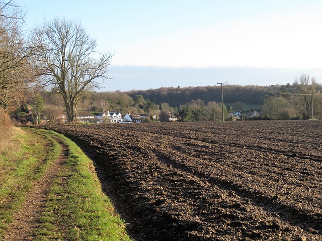
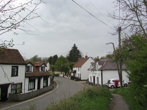
Bonfires crackled in the gardens of Little Berkhamsted, everyone’s dream of an English village. White weather-boarded houses faced the immaculately kept cricket field, and dog walkers greeted each other with the easy manner of people at home and content.

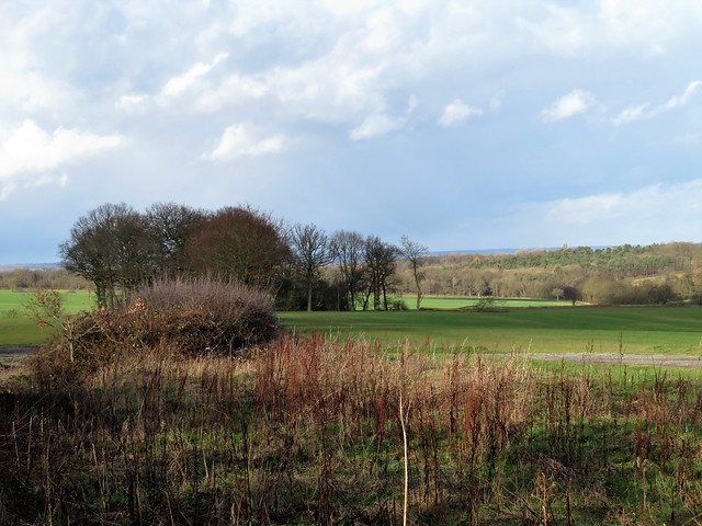
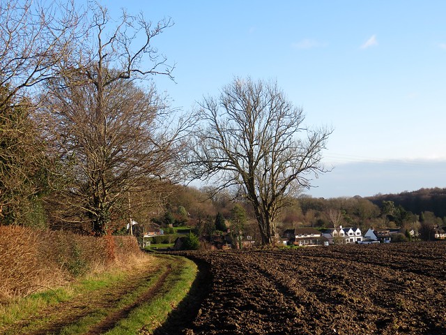
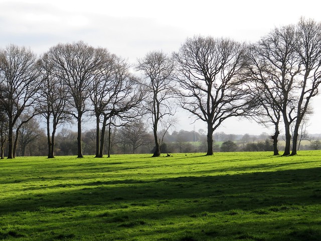
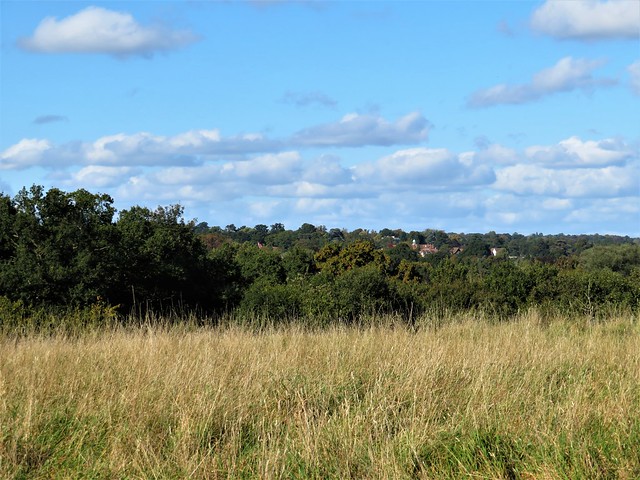
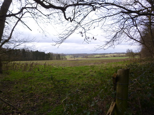
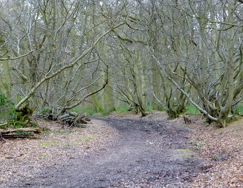
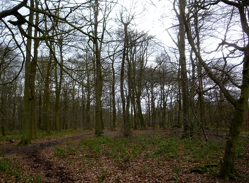
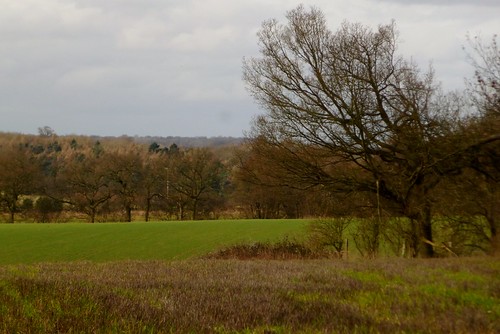
Hertfordshire lays under brisk grey skies, the countryside folded in on itself in the quiet stillness of a long winter. Golf balls clicked and hummed over the greens of Essendon Country Club. In the oak woods the wind lifted last year’s brittle brown leaves and brought a faint whiff of damp bark and rain-softened earth.

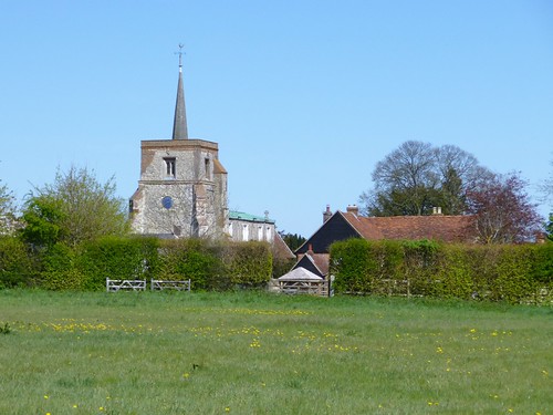
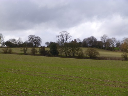
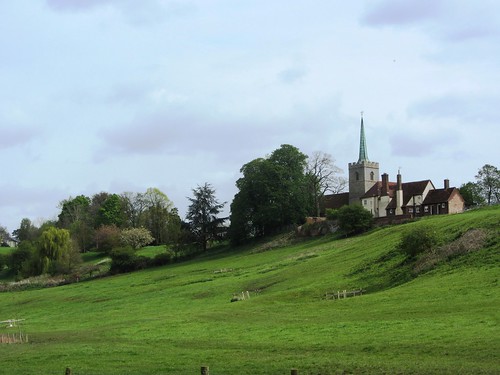
At Essendon the flint-built Church of St Mary carried a wall plaque recording the events of 3 September 1916, when bombs jettisoned from a Zeppelin airship demolished the east end of the church and killed the village blacksmith’s two daughters. Hertfordshire was not as safe as it might have seemed – searchlight batteries ringed the villages, handy targets for enemy bombs.

In the church hall, morning coffee was on the go. We were allowed a glimpse of the church’s singular treasure, kept under lock and key – an 18th-century Wedgwood font of black basaltware, one of only five in existence, rich in decorative swags and flourishes. When Richard Green of Essendon emigrated to Australia in 1880 he asked for the font, by then no longer in use, to be sent to him Down Under. It never reached him; the parishioners of Essendon were too poor to raise the price of freighting such a delicate object to the other side of the world.

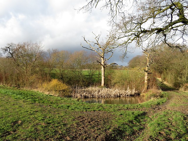
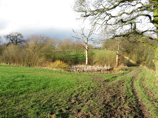
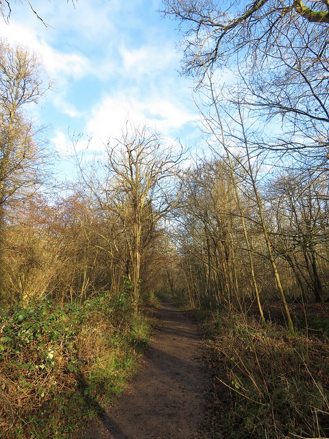
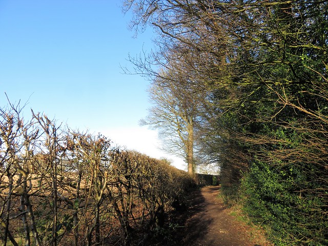
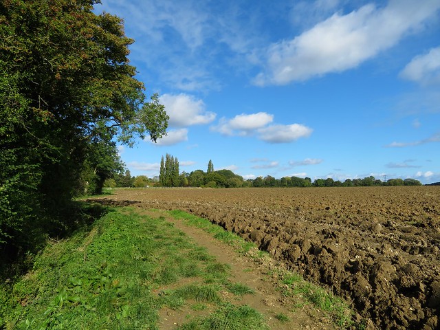
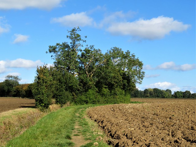
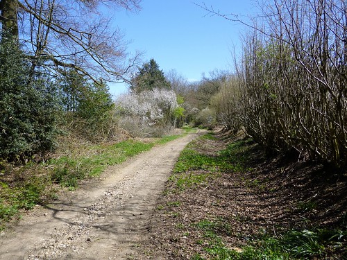
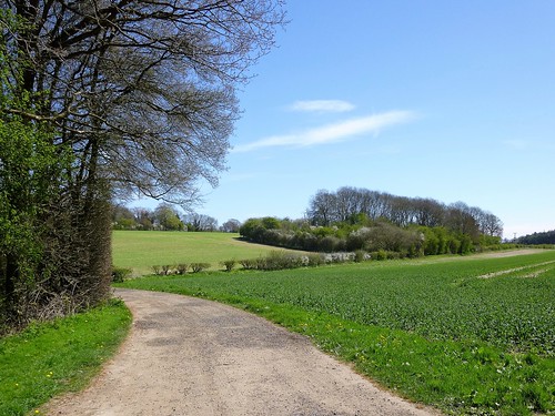
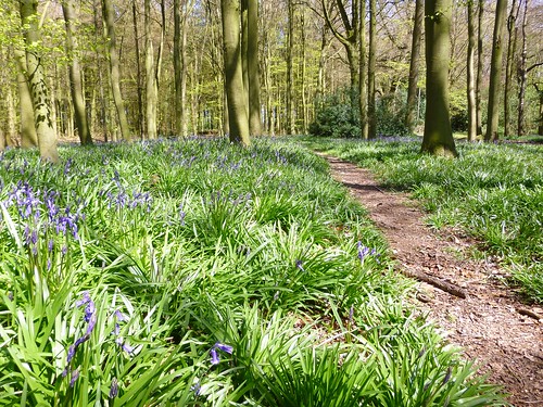
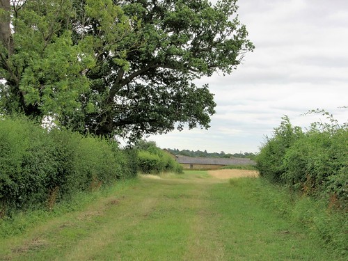
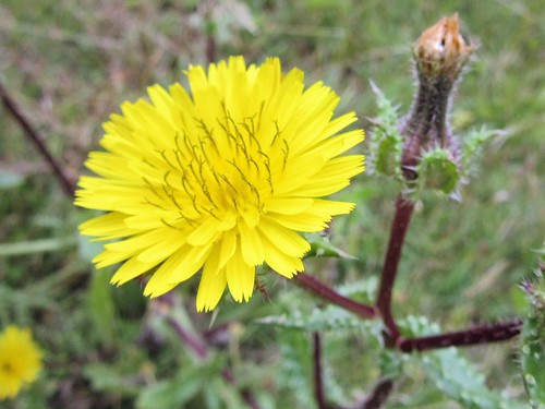
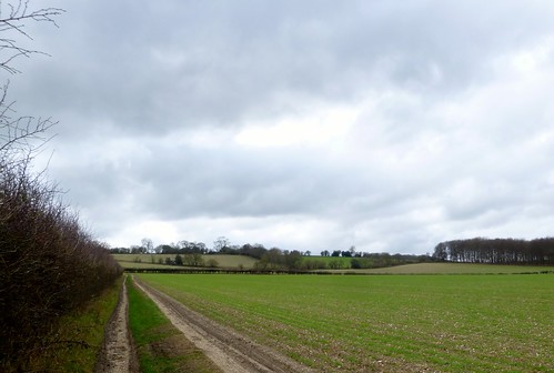
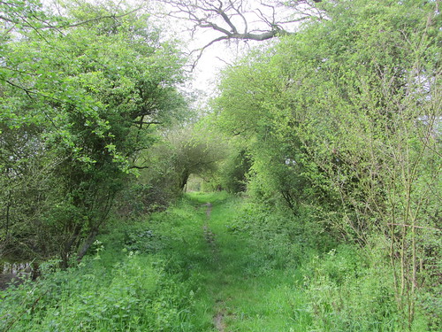
There was blue sky over Backhouse Wood, and a gleam of icy blue in the splashy ruts of the byway that ran south along the valley of the Essendon Brook. Lime green lambs tails danced in the hazel branches along the way. Tiny spear-blades of dog’s mercury were beginning to push up under the trees. Hardly the call of spring, but a whisper of it hung in the air like a tentative promise.

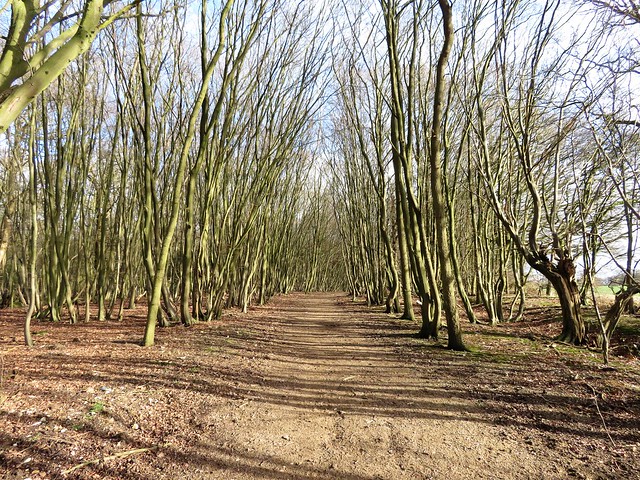
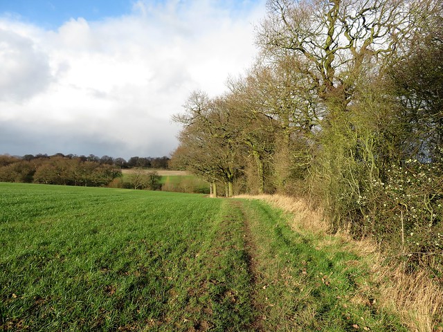
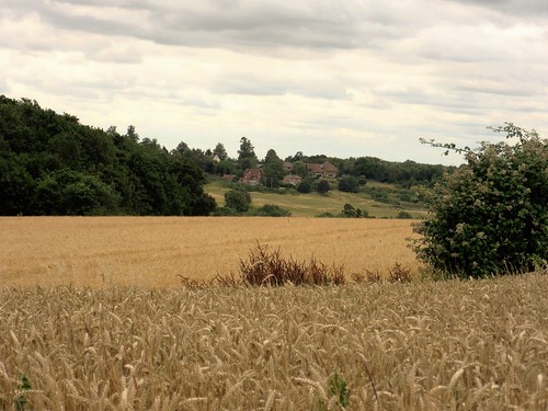
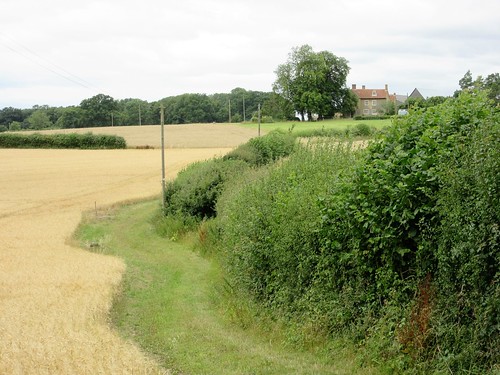
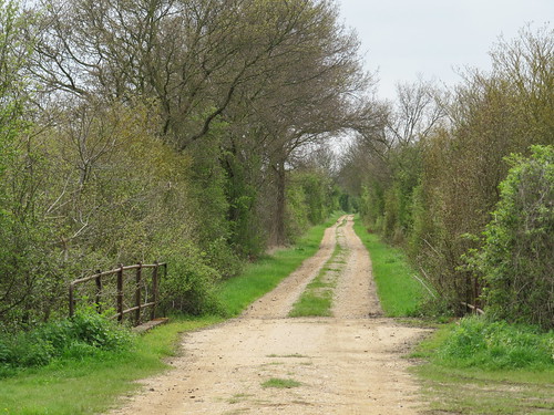
Fieldfares stood tall in the paddocks at Warrenwood Manor, their slate grey heads raised, checking us for menace. The namesake trees of Hornbeam Lane lined its banks, their limbs silver and green in the low afternoon sun. Snowdrops drooped their heads in clumps pearled with raindrops retained from the last shower of the morning.

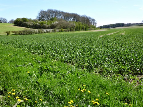
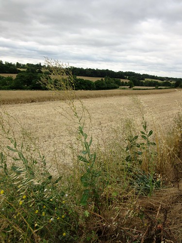
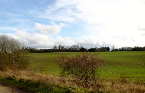
Hornbeam Lane gave way to Cucumber Lane. A partridge went whining off explosively, low over a field of crinkly beet leaves, making us jump and laugh as we turned for home.

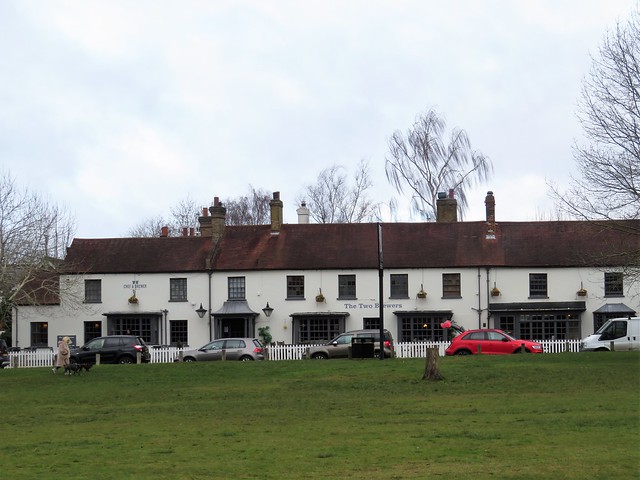
Near Epping Green an ancient Dalmatian limped up and thrust its spotted body against my legs for a pat. At the walk’s end in Little Berkhamsted I found a souvenir of the dog, a clutch of white hairs embedded in the mud that I brushed from my trousers at the door of the Five Horseshoes Inn.

Start: Five Horseshoes, Little Berkhamsted, Herts SG13 8LY (OS ref TL 292078)

Getting there: Bus – 308, 380 (Hertford-Cuffley).
Road – Little Berkhamsted is signed off B158 between Essendon and Brookman’s Park (M25 Jct 24; A1000 towards Hatfield).

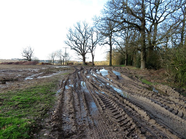
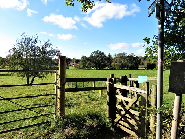
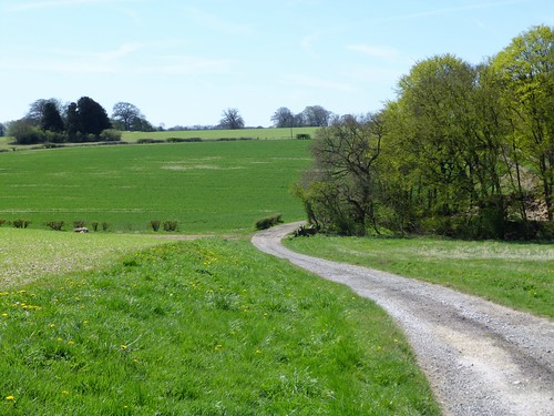
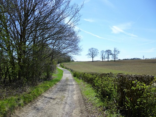
Walk (7¾ miles, easy but muddy, OS Explorer 182): From Five Horseshoes, cross road, down right side of cricket field (‘Epping Green’, ‘Hertfordshire Way/HW). At kissing gate, right to road (290077). Left; in 100m, right (‘Danes farm’); fork right up drive. In ½ mile descend from woods to crossing of drives by two black-and-white houses (283084), left (HW). Dogleg right round golf clubhouse (281084); up path with lake on right. At top of slope fork right by wooden fence; at road, left (276086) up School Lane to cross B158 in Essendon (275086).

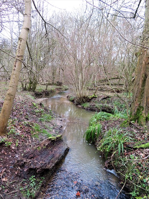
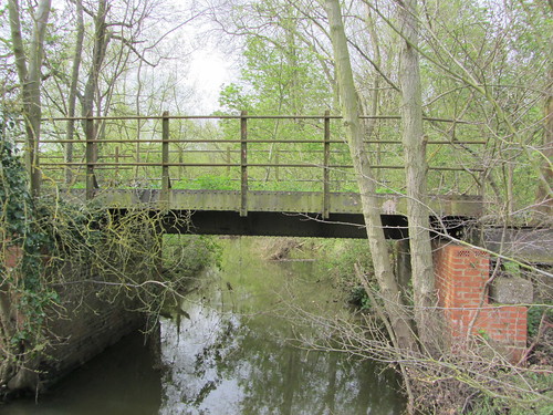
Right; in 75m, fork left; left through churchyard. Path from west end of church to gate into field (273088). Left; follow yellow arrows/YA across fields to turn right along HW (273085). In 400m cross Essendon Brook (269083); on up field edge (HW). At top, at T-junction (267083), left along ‘Byway’ (red arrow), soon marked HW. In 500m fork left off Byway (267078, HW) for nearly 1 mile to cross B158 (270068).

On (‘Warrenwood Farm’) along HW (‘Hornbeam Lane’) for nearly 1 mile. At Cucumber Lane, right (281060), at Tyler’s Causeway road, left (285058). In 100m, right (fingerpost) on HW; in ¾ mile, opposite house no 79 at New Park Farm (295052), left off HW (fingerpost). North for 900m to Tyler’s Causeway (294061).

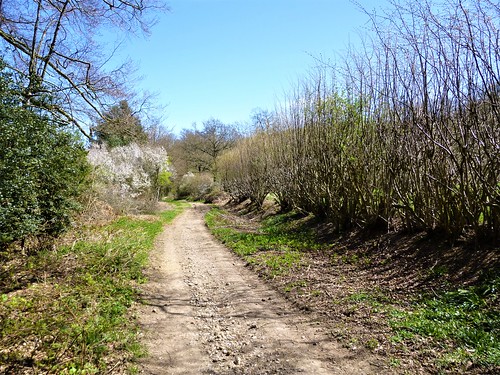
Left along road; in 100m, right up laneway. In 200m, enter 2nd field; in 200m, right through hedge (293065, YA). At road in Epping Green, left (‘Bridleway 22, Berkhamsted Lane’). In 200m, at entrance on left to Woodcock Lodge, ahead along rutted lane. In 150m keep ahead (not right) at fork (292070, blue arrow). In ½ mile, right up cricket field to Five Horseshoes.

Lunch: Five Horseshoes, Little Berkhamsted (01707-875055, chefandbrewer.com)

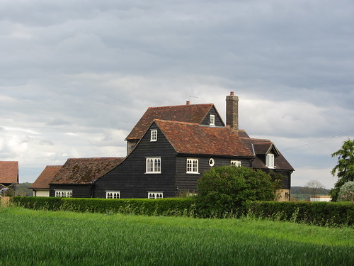
Accommodation: Baker Arms, Bayford SG13 8PX (01992-511235, bakerarmsbayford.co.uk)

Info: Hertford TIC (01992-584322); visitengland.com; satmap.com; ramblers.org.uk

 Posted by at 03:40
Jan 142023


First published in: The Times Click here to view a map for this walk in a new window
wintry plough and hedge, approaching Belsize near Chipperfield 1 Two Brewers Inn, Chipperfield Homeward path through Woodman's Wood near Chipperfield frosty stubble field near Chipperfield green lane approaching Belsize near Chipperfield winter trees near Chipperfield wintry plough and hedge, approaching Belsize near Chipperfield 2 winter trees near Chipperfield 2

A grey, cold and blowy day in south Hertfordshire, with the sky set to clear towards the end of the short winter’s day. We started out across the wide recreation ground at Chipperfield, where the village was going about its business – walls being mended, fences put right, young voices yelling in the school playground and a man mowing the damp green circle of the cricket field.

Chipperfield Common was a tangle of holly and laurel under pine, oak and silver birch. A natural saddle between two stems of an old oak had been polished black and shiny by the feet of countless climbing children.

A track sticky with the characteristic dark mud of winter led south by Hillmeads Farm where a horse snickered and hooves rattled on a hard track somewhere out of sight. This corner of Hertfordshire gives the impression of secret country, where farmhouses and barns lie hidden in clefts between two low ridges or behind a humpbacked wood.

Beyond Commonwood we joined the Chiltern Way path and caught a glimpse of red brick Great Sarratt Hall, surely the model for ‘Sarratt’, the training school and interrogation centre for well-bred spies that John Le Carré nicknames ‘the nursery’ in his George Smiley novels.

Irresistible, the thought of Old Craw the profane Australian lecturing the ‘monsignors’ and ‘your Graces’ in the bowels of the hall, or Jim Prideaux and his sniper’s rifle creeping through Rosehall Wood to take out the mole and traitor Bill Haydon.

In a field among horses in winter coats, we were struck still and silent by the spectacle of two foxes racing past, a vixen pursued by a big dog fox with a white tip to its tail. They crossed the field at an easy canter, the vixen slipping through the hedge and the dog turning away as though entirely satisfied with his entertainment.

Below Rose Hill Farm a tractor was cutting the leafless hedges into a wildlife-friendly A-shaped profile, well before nesting season. A jay gave out its harsh tearing complaint of a call from a copse before swooping away low to the ground with strong quick wing beats and a flash of white rump.

A gleam of weak sun slipped between the clouds, a crack of ice blue broadened across the sky, and instantly the hazels and field maples along the homeward path were a-twitter with goldfinches and long-tailed tits, making the most of the last hour of daylight.

How hard is it? 5½ miles; easy; waymarked trails

Start: Village green car park, Chipperfield, Hemel Hempstead, Herts WD4 9BS (OS ref TL 045015)

Getting there: Bus 352 (Watford-Hemel Hempstead)
Road: Chipperfield is signed from A4251 in Kings Langley (M25, Jct 20)

Walk (OS Explorers 182, 172): Cross recreation ground, keeping left of old chapel. Head south across Chipperfield Common. In 500m at far side, ahead through barrier (042011, ‘Sarratt Parish Footpath’). In 250m at lane, ahead (042008, ‘Commonwood’) past Hillmeads and on. In 150m fork left (042005); at road by Dellfield House dogleg right/left; up steps (043001, ‘Sarratt Green); on to road at Old Forge (040999). Dogleg right/left; follow Moor Lane for 400m, right (037997, ‘Chiltern Way’/CW). Follow well marked CW for 2¼ miles via Rose Hall Farm (031005), road at Bragman’s Farm (027006), right/left dogleg at Newhouse Farm (022007, ‘Flaunden’), road at Flaunden (018009), T-junction at Black Robins Farm (020011) and Lower Plantation. At Holly Hedges Lane (024016), right on Hertfordshire Way/HW for 1½ miles back to Chipperfield.

Lunch/Accommodation: Two Brewers, Chipperfield WD4 9BS (01923-265266, chefandbrewer.com)

Info: visitherts.co.uk

 Posted by at 05:56
Nov 052022


First published in: The Times Click here to view a map for this walk in a new window
Field path to Perry Green 1 Field path to Perry Green 2 Field path to Perry Green 3 Field path to Perry Green 4 Henry Moore sculpture near Hoglands 1 Henry Moore sculpture near Hoglands 2 field path near Hoglands valley of the River Ash field path to Much Hadham GV

St Andrew’s Church stood alone in its green ‘God’s Acre’, well away from the traffic in Much Hadham’s high street. The stone heads of king and queen that guarded the south door were blurred and disfigured by centuries of weathering. But they provided the inspiration for the modernistic, pouting faces under regal crowns on either side of the west doorway, carved by local resident and world-acclaimed monumental sculptor, Henry Moore.

More humours and expressive stone carving enhanced the interior, monarchical and knightly figures crammed up and contorted like playing card royalty. The stained glass of the west tower window, created by Patrick Reyntiens, showed a bleak black winter tree against a sky glowing with exterior light. As we left to start our walk, the text over the door admonished us, ‘Go and Sin no More’.

Our way rose smoothly from the valley of the River Ash, up through meadows still sweating off the morning dew. The distinct rumble of a Stansted-bound jet formed a backdrop to the insistent trilling of a robin from a blackthorn bush. On the path lay lime-green fruit casings like little paper chestnut trees, fallen from a wych elm in the hedge.

Near Green Tye, a big green dome stood in the fields like a Hollywood spacecraft – an anaerobic digester producing eco-electricity for Guy and Wright’s tomato farm. Beyond the hamlet we walked the curvilinear margins of huge fields ploughed a foot deep, the furrows speckled with flints, and with pebbles rounded by an ancient river long vanished.

At Perry Green stood the old white-faced farmhouse of Hoglands, sculptor Henry Moore’s home from 1940 for nearly fifty years, now the centre of the Henry Moore Foundation. The excited chatter of visiting children came from the grounds.

In a sheep pasture beyond the house stood a bronze sculpture, a hollow cloaked figure embracing a child, tall and calm in its stance, beside a lily pond. A mound like a Bronze Age burial barrow in the neighbouring field held a recumbent female form, all curves and arches, its highly polished bronze mirroring the afternoon sun. Echoes of these shapes in nature were reflected in the sinewy limbs of hornbeams in the woods along the homeward path beside the river.

How hard is it? 6¼ miles; easy; well-marked paths

Start: High Street, Much Hadham, SG10 6BU (OS ref TL 428193)

Getting there: Bus 351 (Hertford-Bishop’s Stortford)
Road: Much Hadham is on B1004, signed from A120 (Bishop’s Stortford–Puckeridge)

Walk (OS Explorer 194): Opposite Bull Hotel, down Oudle Lane to church (430197). Back along Oudle Lane; at corner by Two Bridges, through gate (429193, ‘Hertfordshire Way’)/HW, ‘Stansted Hill’); fork left. In 200m left uphill (430191, kissing gates/KG, yellow arrow/YA). Dogleg left/right across Hill Farm drive (433191, YAs) and on. In 600m cross Danebridge Road (437190) and on (‘Green Tye’). In 100m, left (‘footpath’); follow HW black arrows. Before domes, fork right (441188) across footbridge. In 300m at arrow post, left (440185) to road in Green Tye (441184). Left; at Prince of Wales PH, right (444184) down lane. At thatched house, ahead. Follow HW to Perry Green opposite Hoglands (439175). Left along road; in 50m, right (‘footpath 32’); ahead to road (434170). Right (fingerpost) past sculpture; cross field; through hedge (433171). In rough pasture, half right at YA post to fence (432172); then half left across pasture to KG/YA (429170). Down to valley; right on HW to Much Hadham.

Lunch: Hoops Inn, Perry Green SG10 6EF (01279-843568, hoops-inn.co.uk)

Accommodation: Tarras B&B, Ware GH11 2DY (07476-686061)

Info: henry-moore.org

 Posted by at 01:50
May 062017


First published in: The Times Click here to view a map for this walk in a new window
picture picture picture picture picture picture picture picture picture picture picture
Facebook Link:

Flamstead sits in the gently undulating clay-and-flint country where Hertfordshire slips over into Bedfordshire. On this spring morning bright sunlight played on the tile-hung houses, and lit the pleasing jumble of brick, flint and thin old tiles that composes the church of St Leonard at the heart of the village.

It was a day in a thousand, woods and fields all bursting into life under the warm sun. Central London lay less than an hour away – how could that possibly be? Luton-bound aeroplanes passed silently like silver fish across the blue pool of the sky; but down here, walking through the spring wheat with flints jingling under our boots, we felt as remote from them as could be.

Beyond the busy main street of Markyate we came into more rolling ploughlands where beans were beginning to push up dark green leaves in neatly drilled rows. A faint heat ripple shimmered above the sun-warmed clay. In the woods around Roe End the beeches were just coming into leaf, their upper works a froth of tender translucent green, a contrast to the sombre density of the storm-tattered cedars in the former parkland of Beechwood House.

Some of the ancient oaks standing barkless like dry ghosts might be old enough to have sheltered the wicked Lady of Cell Park, Markyate. The legend that attaches to Lady Katherine Ferrers is well known hereabouts – her marriage in 1648 at the age of fourteen to the heir of Beechwood, the robbing expeditions she embarked on with her highwayman lover, their hideout in Beechwood Park, and the bullet that ended her life at twenty-six. Are the youngsters who attend school in the great mansion nowadays taught that racy tale? Let’s hope so.

Beyond Beechwood Park we followed the stony old trackway of Dean Lane, where two blackcaps were conducting a song battle from the hedges. Dean Wood is a magical sort of place, sun-silvered and wren-haunted. We drifted on in a daze of sunlight, past the duck pond at The Lane House, a tumbling old cottage of many corners and nooks, and back toward Flamstead through woods hazed with bluebells, where wild cherry trees lifted a froth of pink blossom against the deep blue sky.
Start: Three Blackbirds PH, Flamstead, Herts, AL3 8BS (OS ref TL 078146).

Getting there: Bus service 34 (St Albans-Dunstable), 46 (Hemel Hempstead-Luton)
Road – Flamstead is signed off A5 Dunstable road, just west of M1 Jct 9.

Walk (8½ miles, easy, OS Explorer 182): Right along Chapel Road, left down Friendless Lane. At fork with Mill Lane, right; in 200m, right (073146, Hertfordshire Way/HW). Follow HW waymarks to Markyate. At road, right to village street (662164). Left for 50m; left along Buckwood Road. By last house on left, left (057164, HW); follow HW waymarks for 3 miles to Jockey End via Roe End (048156), Kennels Lodge (040149), Beechwood House (046145) and Dean Lane (048141 – 042140). In Jockey End, left along road (041137); in 150m, right past allotments. At gate, leave HW and turn left (041134, yellow arrow). Fenced path through paddocks, across road (044131); field, paddocks, white arrow to The Lane House drive (048128).

Left here on Chiltern Way/CW; follow CW waymarks to Flamstead via road at Prior’s Spring (055136), Little Woodend Cottages (058136), Wood End Lane (067137) and Pietley Hill (073142).

Lunch: Three Blackbirds (01582-840330, threeblackbirdsflamstead.co.uk) or Spotted Dog (01582-841004, thespotteddog.co.uk), Flamstead.

Info: St Albans TIC (01727-864511)
Online maps, more walks at christophersomerville.co.uk

Dawn Chorus Walk, 7 May: College Lakes Nature Reserve, Tring, Herts – bbowt.org.uk/events/2017/05/07/dawn-chorus-0

visitengland.com; satmap.com; ramblers.org.uk

 Posted by at 02:21
Jul 302016


First published in: The Times Click here to view a map for this walk in a new window
picture picture picture picture picture picture picture picture picture picture picture
Facebook Link:

A village shop with a café in the back, spick, span and cheerful; a redundant phone box stuffed with leaflets on walks from the local pubs; barbecues, community hall hops, walking clubs – the twin Hertfordshire villages of Thundridge and Wadesmill are in rude good fettle, and proud of it. We stayed at the Feathers in Wadesmill, and set out full of bacon and bonhomie into a cold summer’s morning.

Grey clouds scudding horizontally from the west had persuaded the local farmers to halt the harvest temporarily. We walked the flinty margins of half-gathered fields of barley and oilseed rape. It was the time of year when wayside plants are drying up – docks the colour of rusty iron, mallows hanging limp. A fine patch of dandelion-headed bristly ox-tongue showed pale green leaves peppered with white pimples like a teenager’s morning-after complexion. Great willowherb stood tall and pink in soldierly ranks in the hedges, and bindweed opened white trumpets along the verges.

We came to Bengeo Temple Farm, the name an invitation to speculate. Back in early medieval times the farm belonged to the Knights Templar, and there have been persistent rumours of a great treasure buried there by the order on their dissolution. Today we had the flashing silver of oat seeds and the dull gold of heavy wheat as treasure of another kind to enjoy as we walked on towards Sacombe Park. The big yellow brick house stands among trees in broad parkland where truncated oaks sprout their limbs from tub-shaped trunks.

From Sacombe Green a Roman road under the name of Lowgate Lane runs east, and we followed it through the blackening bean-fields. There’s something irresistible about marching a Roman road, imagining the dusty sandals of the soldiers rising and falling in step. We turned off Lowgate Lane reluctantly, but the southward path to Wadesmill proved an absolute beauty in its own right. It clings to the rim of The Bourne, an extraordinarily deep seasonal stream, dry as a bone at this time of year as a ravine at least forty feet deep in places, with flood-sculpted promontories and the pale skeletons of fallen trees jammed across it like primitive bridges.

The sun came out from behind the clouds, the barley heads drooped and waited for the harvester, and the woods stood along the ridge as thick and black as pitch. It all added up to a perfect picture of a corn-filled land at harvest time.

Start: Feathers Hotel, Wadesmill, Herts SG12 0TN (OS ref TL 360176)

Getting there: Bus 331 (Hertford-Royston).
Road: Wadesmill is on A10, 2 miles north of Ware

Walk (6 miles, easy, OS Explorer 194): Left along A10; right at Anchor PH down B158. In 200m, right (‘Public bridleway 35, Sacombe 2’) up field edge. At top (356177, yellow arrow/YA), left; in 200m, right (YA) up line of telephone posts. Ahead along field edges. Keep left of Chelsing Farm; cross drive (350178, YA); cross field and keep ahead along field edges. Down steps in Bourne Wood; at bottom, right (342178, YAs), then left up gravel track. In 100m, right through hedge (YA); ahead with hedge on left. At end of brick barn at Bengeo Temple Farm, left through kissing gate (340179). In 30m, right (YA) up gravel track (NB not farm drive!), which becomes green lane along field edges.

In ½ mile pass reservoir and turn right along driveway (333184, white arrow). In 500m at cattle grid and lodge house, fork left (336189, ‘Sacombe House’, blue arrow/BA). In 100m, fork right along driveway. In 350m, just past Sacombe House, left at crossing of tracks (339191, BA). In 200m, fork left by The Red House (BA). In 500m, right at road in Sacombe Green (342196); fork immediately right (‘High Cross’). In 100m, left (‘Footpath, Lowgate Lane’); continue with hedge, then tree nursery on right for 300m to road (345198). Right; at next corner, keep ahead along Lowgate Lane. In ½ mile, opposite Lowgate Lodge, right (353202, BA) on bridleway beside The Bourne stream. In just over a mile cross a road (358187); continue (‘Wadesmill ¾’) on path to Wadesmill.

Lunch/Accommodation: Feathers Hotel, Wadesmill (01920-462606, www.oldenglishinns.co.uk/feathers-wadesmill) – very cheerful, friendly and welcoming village inn.

Info: Hertford TIC (01992-584322)

www.hertfordshirelep.com/enjoy/; satmap.com; ramblers.org.uk

 Posted by at 01:23
Nov 292014


First published in: The Times Click here to view a map for this walk in a new window
picture picture picture picture picture picture picture picture picture picture picture picture picture picture picture picture
Facebook Link:
Two skylarks sprang out of the stubble field as we climbed its gentle slope towards Poynders End. They ascended skywards, blithely singing as though it were baking April and not a cold and cloudy winter’s day. Such little incidents inject a welcome shot of joy into these gloomy months when all nature seems to have curled up and pulled the blankets over its head.

The sticky ochreous clay under our boots was studded with flints. We picked up one with a delicately bevelled edge – whether by man or natural process wasn’t easy to decide, but we stood looking out over the wide fields of north Hertfordshire and pictured the men who hunted here when it was all forest. Milo the mad spaniel, meanwhile, went on running in circles and pointing at pheasants flying overhead.

A string of old woodlands lies here on the upland. In the margins of Hitch Wood, twisted green-barked hornbeams pointed their witchy limbs along the trackway that took us south towards Stagenhoe. This lovely Palladian house, now a Sue Ryder care home, has had some notable tenants and owners, among them the 14th Earl of Caithness, a genial Victorian soul who would drink whisky with his tenants and whose Spanish wife, ‘massive and theatrical’, believed she was the reincarnation of Mary, Queen of Scots. Caithness’s son rented Stagenhoe to Sir Arthur Sullivan while he was composing the music for ‘The Mikado’ in 1881.

From the track though Stagenhoe’s grounds we caught a glimpse of St Paul’s Walden Bury at the far end of its long avenue, another splendid 18th-century house, childhood home of the late Queen Mother. We stopped to admire the gurning gargoyles and other stone-carved grotesques at All Saints’ Church, and then turned north again along the well-waymarked Chiltern Way, heading across wide fields and down a tree-hung lane at Langley End where a flock of jaunty yellow-cheeked siskins bounced and twittered in the branches overhead.

Out of bounds in a thicket at the crest of the last hill crouched the broken flint walls of Minsden Chapel. It was built in the 14th century as a staging post for pilgrims on their way to St Albans, but the Reformation swept away its raison d’être. Now it stands forgotten among the trees, a ruin haunted by the wraith of a monk who walks accompanied by a ghost of sweet music. Some claim to have seen the shades of men and women here, hiding in a phantom cart full of spectral barrels. An eerie place. We went quickly on down the hill, with something more substantial in our sights – the Rusty Gun pub, and a damn good lunch.
Start: Rusty Gun Inn, London Rd, St Ippolyts, Herts SG4 7PG (OS ref TL 199253).

Getting there: From A1(M) Jct 8, follow Little Wymondley, Todds Green, St Ippollits and Preston. At B656 cross roads, left for ⅓ mile to Rusty Gun PH.

Walk (5½ miles, easy, OS Explorer 193): From Rusty Gun, left along B656 for 150m. Left (‘Preston’, Chiltern Way/CW) on field track for nearly 1 mile. 300m beyond Poynders End Farm, right through hedge (190245, CW); clockwise round field edge, past reservoir to road (186245). Left (CW); at right bend, ahead down Hitchwood Lane. In 350m, at left bend, bear right on tarmac lane (188242, ‘Whitwell’) past houses, and follow path (yellow arrows/YAs) along right edge of Hitch Wood.

In ½ mile leave wood (187234); bear half right across field and along right edge of Pinfold Wood. Left past house, then right for 400m (186232, YA) along field edge, then left edge of Foxholes Wood. At post with 2 YAs, turn left (184229). Follow YAs with metal fence on right to drive beside Stagenhoe House gateway (186228). Left along drive for 70m; fork right down gravel track past lodge house with tall chimneys. Follow track on left edge of Garden Wood and on (ignore footpath fingerposts) to All Saints Church, St Paul’s Walden.

Go through iron gate on left (192223), through churchyard, past north side of church to gate into lane (CW). Left up lane past White House; right (CW) along path by fence, then field edge to B651 (194227). Left (CW) for 200m – NB nasty double bend; take care! Just past Stagenhoe gates, right (195228, CW) on track through trees. Leaving trees, don’t follow track round to right but keep ahead (YA) across field. Go between fence posts (YA); path across field to road (199234). Ahead (blue arrow/BA) on woodland path. Emerging from trees (200236), left on track (BA, ‘STOOP’). In 300m it swings right (199238); ahead here (BA) on grass path to road. Left (CW) past red brick Langley End; on down path (CW); in 50m, fork right (198239) to cross B651 (198241). Right along field edge; in 100m, left across field; up right side of Minsden Chapel Plantation to pass chapel ruins among trees (198246). Ahead across field over brow of hill; keep left of hedge; follow sunken lane to Rusty Gun.

Lunch: Rusty Gun (01462-432653, therustygun.co.uk) – good food and beer, produce shop
Information: Stevenage TIC (0300-123-4049)
visitengland.com; www.satmap.com; ramblers.org.uk

 Posted by at 01:36
Oct 062012
 

A cool afternoon in East Hertfordshire, cloudy and threatening rain, but that didn’t worry the Saturday regulars in Wareside’s cosy Chequers Inn.
First published in: The Times Click here to view a map for this walk in a new window
picture picture picture picture picture picture picture picture
Facebook Link:
‘The Doom Bar’s beautiful just now,’ they advised me, solicitously ensuring I had the right pint before resuming talk of fishing, the whereabouts of herons’ nests and other local gossip with the easy familiarity of people who’ve known one another for a long time. Hmmm. Stay curled in the old leather sofa reading the paper and testing the bitter, or venture out into the spattery countryside? Well – a short walk, then …

The disused branch railway line to Buntingford crossed the River Ash just east of Wareside, its hazels and horse chestnuts framing a picture-perfect view of a beautiful medieval farmhouse and the thin verdigris-green spire of St John the Baptist’s Church, together on their ridge at Widfordbury. A pair of partridges took off and shot away low to the ground with a characteristic wooden-sounding whirr of stubby wings. Edible snails three times the size and coarseness of other gastropods were out crawling in the rain-wet grass among olive-green pheasant egg shells fractured and raided by greedy magpies. A collie dog in the field ahead ran madly in circles, and a blackcap opened its beak at the end of a willow branch and poured out a sweet scribble of song. This damp afternoon was to everyone’s taste but humans, it seemed.

The green tunnel of Upper Crackney Lane turned away from the broad Ash valley and climbed a shallow slope to lonely Little Blakesware Farm with its weatherboarded barns and big old farmhouse of whitewashed brick. A flicker of movement in a young ash tree, and I stood still to watch a female pied flycatcher dealing with a tangled beakful of wings, legs and insect bodies.

The path led on through flowering beanfields, lent a touch of exoticism by the veined petals with pink streaks and velvet black blotches. This was wide open countryside, low swells of ground half concealing ancient farmsteads under a sky of rolling dark cumulus clouds. The path dipped by steps to cross a dark wooded cleft carved forty feet deep in the chalky soil by the Nimney Bourne stream in its winter rages.

At Baker’s End a young golden Labrador leaped up to give my face a wash with a lolling pink tongue. A mighty ash coppice stool in Buckney Wood sprouted eight poles, each as thick as an individual tree. I passed Legge’s Cottage with weatherboarded walls and ecclesiastically peaked windows, and went down a hedge-banked lane towards Wareside and the Chequers Inn as another spring shower swept across the fields.

START & FINISH: Wareside village hall car park, Ware, Herts SG12 7QY (OS ref TL 396156).

GETTING THERE:
Rail: (thetrainline.com) to Ware, taxi from there (3 miles)
Bus: Centrebus M4 (intalink.org.uk) from Ware.
Road: A10, A1170 to Ware; B1004 Widford road to Wareside; village hall car park near Chequers Inn.

WALK (5 miles, easy, OS Explorer 194. NB: Online maps, more walks at: christophersomerville.co.uk):

From car park cross B1004; left for 50 m; ignore first footpath on right and take next one off road, 20 m further on (‘Public Footpath 32, Hunsdon 2’). Follow Hertfordshire Way/HW across River Ash (399156). Beside next bridge (400155) turn left along old railway footpath (HW); follow it for ½ mile to B1004 (406158). Cross road; right along pavement to next bend; left (408159, HW) through gate. Follow path past horse chestnut trees, on across field. Cross stile at far side (414162); left up shallow valley, keeping trees and ditch close on right. In 200m, bear diagonally left (413164, yellow arrow/YA) up to corner of Upper Crackney green lane (413165). Right along it for ½ mile.

200m past Little Blakesware Farm, turn left at post with 3 arrows (410172) for ⅓ mile to crossing of lanes among trees (404172). Right for 20 m, then left (YA) on path just inside woodland. In 300 m, bear left up steps (YA) and on along field edge. In 150 m, turn right down steps (YA) and cross Nimney Bourne stream by footbridge (400170; purple arrow/PA). Up to bear right through 2 gates (PA) and along green lane for 300 m to road in Bakers End (397171).

Left for 50 m; ignore ‘Public Byway’ sign on right; in another 30 m, turn right up lane with ‘No Through Road’ sign (NB not ‘Public Footpath No 12’!). In 300 m, opposite Castlebury Farm, fork left (393171; ‘public footpath’ fingerpost); in 50 m keep ahead across footbridge (YA) and along field edge for 300 m to reach Buckney Wood (390169). Keep ahead (YA); in 100 m, ahead at YA post for 300 m. Fork left (388166) past Legge’s Cottage; in 300 m cross road (390163); carry on through kissing gates (HW); on with hedge on right. Keep straight ahead, through kissing gates, for ½ mile to road at Reeves Green (393156). Right for 100 m; left (fingerpost) on green lane to Chequers Inn.

LUNCH: Chequers Inn (01920-467010) or White Horse Inn (01920-462582), both in Wareside.

INFORMATION: Hertford TIC (01992-584322)
www.ramblers.org.uk www.satmap.com www.LogMyTrip.co.uk

 Posted by at 04:08
Jun 262010
 

First published in: The Times Click here to view a map for this walk in a new window
picture picture picture picture picture picture picture
Facebook Link:

A cold, cloudy morning had settled over Hertfordshire, but that hadn’t stopped the thrushes fluting their triple phrases in the trees around Aspenden. What a pretty place, all plastered cottages and deep thatched roofs. The bells of St Mary’s Church rang us out of the village, past park-like paddocks and on west between hedges thick with crab apple blossom and dog roses. We stooped to sift flints out of the dark earth of the fields, looking for the bevelled edges that might betray a scraper or arrow-head worked thousands of years ago.

Beyond Tannis Court lay a thicket full of early purple orchids and rain-spotted silverweed fronds. ‘Moat’ said the map, and there it was, a shadowy dip behind the trees, full of mossy boughs and a glint of water. Site of the old manor house? Bruno the black labrador, who came up to inspect us, couldn’t have cared less. Curiosity satisfied, he turned his attention to a rank piece of fox-stinking hedge, while his owner gave us a cheery hello.

We turned down a lane past impossibly pretty Rumbolds under its thatch, and came to Back Lane. The rutted green lane was far too long and unwavering to be anything other than a Roman road – Stane Street, in fact. The cross-country road from St Albans to Colchester had been made two thousand years ago by men who left thick red tile fragments and oyster shells to be kicked out of the earth by today’s walkers.

The Sunday rambling club of the Letchworth Arts and Leisure Group came shouting and laughing along Back Lane. Where were they heading? ‘Haven’t a clue,’ they chortled, ‘we’ve left our leader behind back there, and he hasn’t caught up yet!’

Forget-me-nots, the blue trumpets of self-heal, white stars of stitchwort, drifts of bluebells. This was a really delightful old highway, hedged and ditched, passing in secret through the countryside. We left it near Cherry Green, and followed the muddy path to Button Snap.

In the early 19th century the curiously named little cottage, remote then as now, belonged to poet and essayist Charles Lamb. Poor dutiful Lamb with his crippling stutter and his failed love affairs, claustrophobically entwined with his bipolar sister Mary who had stabbed their mother to death in a fit of mania. Walking on along the lane to Aspenden it was good to think of the twitchy poet striding the garden at Button Snap, liberated from mental strife for a few hours at least among the wide green fields of Hertfordshire.

Start & finish: Fox Inn, Aspenden, Herts SG9 9PD (OS ref TL 361282)

Getting there: Centrebus (www.intalink.org.uk) Service 700 (Stevenage-Stansted) to Buntingford (1 mile). Road: A10 to Buntingford, minor road to Aspenden

Walk (7 miles, easy grade, OS Explorer 194): Leaving Fox Inn, left along road. Ahead at bend near church (‘Bridleway 003’). In 400 yards follow 001/Buttermilk Farm, then 007/Tannis Court. At ‘Private Property’ notice in 2/3 mile, right (yellow arrows/YA) past Tannis Court, over Old Bourne stream (333283) and through thicket with moat. Emerging (319285), cross field to road. Left past Rumbolds to Cottered Warren. Right opposite The Lodge, then left (014/Moor Green) between ex-barn houses, through gate (YA) and on (YA) to Back Lane Roman road (320277). Left (red arrow) for 1 3/4 miles. Cross valley bottom; through gate; in 300 yards, left (blue arrows) to Button Snap (348265). Left, passing Wakeley Farm entrance, on track for 1½ miles to Aspenden.

NB – Detailed directions, online map, more walks: www.christophersomerville.co.uk

Lunch: Fox Inn, Aspenden (01763-271886; www.theferryhouseinn.co.uk) – really good, friendly place

More info: Sittingbourne TIC (01438-737333); www.enjoyhertfordshire.com

www.ramblers.org.uk

 Posted by at 00:00
Apr 242010
 

First published in: The Times Click here to view a map for this walk in a new window
picture picture picture picture
Facebook Link:

An old favourite, this Hertfordshire walk – and, like many such, a delight whatever the season. Last time out, the trees of Berkhamsted Common had been of that rich, juicy gold you only get after a long hot summer. Today I was looking forward to seeing what the long cold winter had done to the woods and hedgerows. Through Berkhamsted snaked the Grand Union Canal, smoking with early mist. Chaffinches were trolling on the broken walls of Berkhamsted Castle, and in the bushes around the site where William the Conqueror accepted the homage of the Saxon nobility of Britain after riding here through the autumn countryside of 1066, flushed with his victory at Hastings.

Picturing the chaos and terror that the Norman invaders brought with them, I headed up the fields from Berkhamsted along hedgerows where the celandines, usually heralds of spring, lay tightly curled in waxy green spearblades. There was something grand and bracing about this uphill march through the sleeping Hertfordshire landscape, from memories of one famous battle to the site of another, all but forgotten, that lovers of access to open country ought to have as an equally red-letter day in history.

Berkhamsted Common occupies the ridge north of the town, a sprawl of open ground where locals had always enjoyed the right to roam. When Lord Brownlow arbitrarily railed off a great chunk and added it to his Ashridge Estate in 1866, he thought he’d encounter little opposition. But an equally autocratic and bloody-minded grandee, Augustus Smith, took exception. Smith paid a gang of tough London navvies to come and tear down the three miles of railings by night – and leave them neatly rolled up for Brownlow to collect in the morning. The locals reclaimed their common land, and Lord Brownlow had to ‘retire hurt’.

Today Berkhamsted Common is a thick wood with a maze of footpaths. I trod its tangled ways as far as Lord Brownlow’s country seat of Ashridge House, a vast Georgian mansion modelled by James Wyatt for the 7th Earl of Bridgewater as a Gothic extravaganza with turrets, battlements and a thousand-foot-wide frontage. From the house it was back into the trees, among the grey old seniors of Frithsden Beeches. These wonderfully gnarled beech trees of the Chiltern slopes were ancient when Ashridge House was built. I stood under their

pale, contorted limbs, looking up. Hardly a bud, not a breaking leaf to be seen. But over the meadow beyond the trees a lark was spilling out song like seed – spring’s favourite doorkeeper.

Start & finish: Berkhamsted station, Herts HP4 2JU (OS ref TR015660)

Getting there: Train (www.thetrainline.com; www.railcard.co.uk) to Berkhamsted; Road – M25 (Jct 20); A41

Walk (6 ½ miles, moderate grade, OS Explorer 181): Left out of station – Berkhamsted Castle (995082) – north up Brownlow Road; path towards Well Farm; in 400 yards, left (996088 – FP fingerpost). NW up hedge paths for 3/4 mile – through hedge, turn right (991097 – post with 3 yellow arrows/YA), heading NNE past pond – into Berkhamsted Common woods (993102). Just before Brickkiln Cottage, left on bridleway (post; blue arrows/BA). Follow south wood edge; right (991107) to north edge. Left (992108; BA) – Coldharbour Farm (989113; BA) – Woodyard Cottage (987117). Just beyond cottage, left over stile (YA) – north through trees to Ashridge Park golf course. Turn right; aim right of Ashridge House (994122) – road for 3/4 mile – 300 yards beyond Crome Hill entrance, right (4-finger post; take left-hand of 2 bridleways) – south through Frithsden Beeches (‘bridleway’, then ‘Grand Union Canal Circular Walk’ arrows) – Well Farm – Berkhamsted.

NB – Online map, more walks: www.christophersomerville.co.uk

Lunch: Picnic

More info: Hemel Hempstead TIC (01442-234222)

www.visiteastofengland.com; www.ramblers.org.uk


 Posted by at 00:00
Mar 212009
 

First published in: The Times Click here to view a map for this walk in a new window
picture picture picture picture picture picture
Facebook Link:

The hedge roots around Hexton were spangled sherbet-yellow with primroses, and the catkin-laden hazels were loud with explosive bursts of chaffinch song, as I set out along Mill Lane from the Raven Inn. Across the north Hertfordshire fields on the southern skyline, sinuous chalk hills looked out towards the great clay plains of Bedfordshire, misty and cool in this fresh March morning.

Hexton’s neighbouring hamlet of Pegsdon lies in a southward-bulging salient of Bedfordshire. The signboard of the Live and Let Live pub showed a dove and a peregrine falcon sitting amicably together by an unloaded shotgun. So there are miracles still in the borderlands, just as the Bedfordshire tinker, fiddler and outlawed nonconformist preacher John Bunyan saw in visions when he roamed these hills in Restoration times – visions that drove him to compose The Pilgrim’s Progress in the prison cells he was so often confined in.

On the southern skyline rose the Pegsdon Hills, the ‘Delectable Mountains’ of John Bunyan’s fable. A winding path and hollow field lanes brought me to where the ancient Icknield Way, deeply sunken in a tunnel of beech and hornbeams studded with green buds, rose along the nape of the hills. The 6,000-year-old highway ran rutted, grassy and sun-splashed past Telegraph Hill where a gaunt semaphore mast was once sited by the Admiralty, one of a chain that passed signals between London and far-off Great Yarmouth. A little further along rose Galley or Gallows Hill, a place of ill-omen in Bunyan’s time, where witches were buried and the tar-soaked bodies of executed criminals hung to terrify passers-by who fervently believed that Gallows Hill was haunted by a dread Black Dog.

I turned off the old track, heading north over the rounded sprawl of Barton Hills. A nature reserve with dry chalk valleys too steep to plough, the hills remain a beautiful stretch of unspoiled chalk grassland. Trees disguised the ramparts of Ravensburgh Castle, the largest hillfort in south-east England. In 54 BC Julius Caesar attacked and stormed a hillfort in this region that was defended by the British warrior leader, Cassivellaunus – it was most likely Ravensburgh.

Beyond lay Bonfirehill Knoll, in former days the scene of the Hocktide Revels shortly after Easter. It doesn’t take much post-Freudian analysis – especially in rampant spring – to work out the symbolism of ‘Pulling the Pole’, a game in which the men of Hexton tried to keep an ash pole erect on the hill, while the women strove to collapse it and drag it down into the village. Strange to relate, the women were always triumphant. I made my way down the hill and over the fields to Hexton, with plenty to ponder.

Start & finish: Raven Inn, Hexton, Hitchin, Herts SG5 3JB (OS ref TL 106307)

Getting there: Train (www.thetrainline.com) to Harlington (5 miles)

Road: M1, Junction 12; A5120, then minor road to Harlington and Barton-le-Clay; B655 to Hexton.

Walk (10 miles, easy grade, OS Explorer 193): Leaving Raven Inn, turn left; on your left; walk up road past ‘No Through Road’ sign and continue for ½ mile (0.8 km), along Mill Lane, past Hexton Mill (blue bridleway waymarks), to pass between Green End and Bury Farm, and on to meet road (120306). Right for 300 yards, then left to pass Live & Let Live Inn (121303). In 100 yards, just before B655, left up Pegsdon Common Farm drive (fingerpost, ‘Private Road’). Rounding a left bend, go right (125305 – fingerpost) up grass path and up steps, then on up right side of conifer plantation. At end of trees, continue along rim of dry valley to waymark post (129304 – Chiltern Way/CW waymark). Left along edge of escarpment for 300 yards; right along sunken lane (CW). Pass entrance to Knocking Hoe NNR and go over stile by gate (133305). Left (CW) for 150 yards, then right along field edge path (blue arrow, ‘Walk on the Wild Side’ waymark) for 500 yards to B655. Right for 250 m along grass verge, then through car park and through gates and stiles to join the Icknield Way (132300).

Icknield Way climbs for nearly 3/4 mile, then levels off. In another 400 m, look on your right for kissing-gate with brown ‘Access Land man’ logo (121291). Continue along Icknield Way; at a fork in 150 m, keep ahead for 3/4 mile to meet a road (109282). Forward along verge for 500 yards; where road bends left under power lines, forward along Icknield Way for 2/3 mile to cross John Bunyan Trail (unmarked on ground) on edge of Maulden Firs (096275). Ahead for another 300 yards, then fork left (093273) to ascend Galley Hill.

From Galley Hill return to Icknield Way; retrace steps for 300 m to edge of Maulden Firs wood; left along John Bunyan Trail, under power lines for 2/3 mile to road (093284). Right for 150 m; left (fingerpost) through trees on path past Barton Hill Farm for 2/3 mile (1 km) to pass gate of Barton Hills National Nature Reserve on your left (092296). Continue along track, noticing on your right the thickly wooded rampart of Ravensburgh Castle, and beyond it the tree-smothered Bonfirehill Knoll.

Follow track down slope for 2/3 mile to T-junction with lane (085303). Right past church to B655 in Barton-le-Clay (085305). Right for 50 yards, left along Manor Road. 100 yards past gates of Ramsey Manor School, right (086310 – fingerpost) down path, over footbridge and follow field edge. In 100 yards, ignore arrow pointing left; keep ahead for 1 mile along field edges, to cross footbridge (104311) and the final field into Hexton. Turn right to Raven Inn.

Lunch: Raven Inn, Hexton (01582-881209; www.theraven.co.uk) or Live & Let Live, Pegsdon (01582-881739; www.theliveandletlive.com)

More info: Letchworth TIC (01462-487868); www.hertfordshire.com


 Posted by at 00:00