Search Results : Tyrone

Dec 152012
 

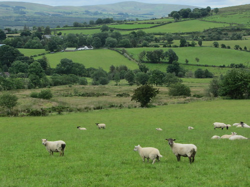
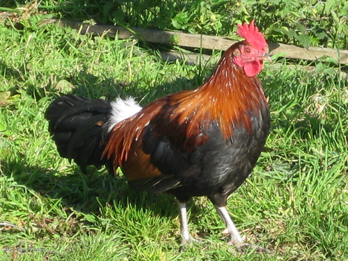
They were getting ready to clip the sheep in Lisnaharney glen, and we had to look sharp to avoid a woolly stampede as we walked through the farmyard at Eskeradooey.First published in: The Times Click here to view a map for this walk in a new window
picture picture picture picture picture picture picture picture
Facebook Link:
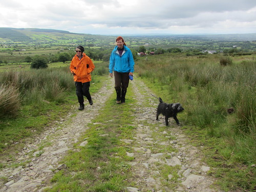
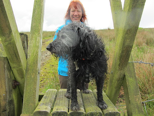
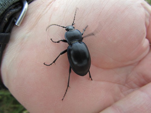
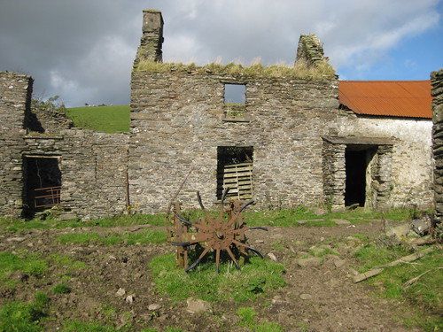
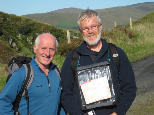
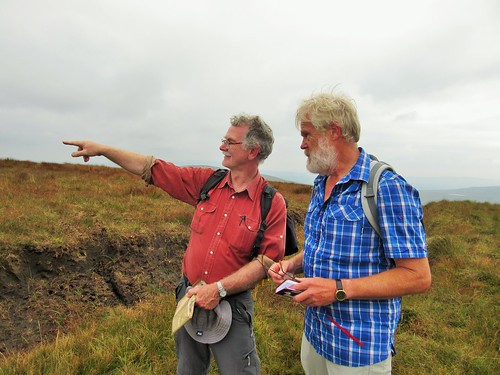
County Tyrone hill farmers work hard for slim rewards, but the man leaning over the gate had spare time and humour enough to invite us to help him with the shearing. It would have been great fun, but Jane and I were headed for the hills along with our friend Inga and her old chum Harry, a crazy-coated and toothless terrier some 20 years young. He scampered and ran all day, fossicking and questing through the rushes and grass, as keen as a puppy. What an example to us all!

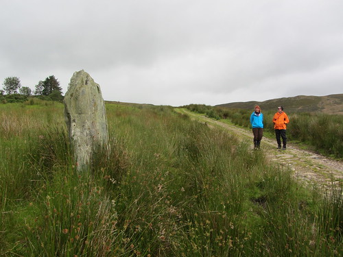
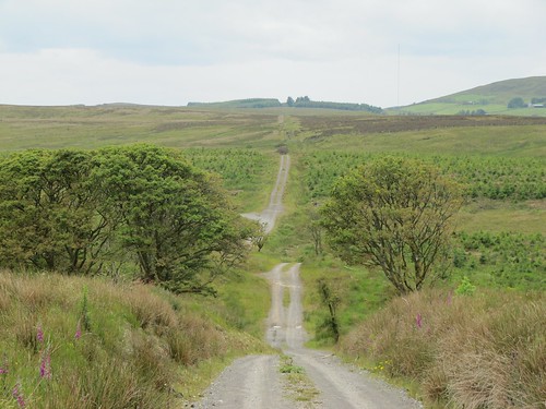
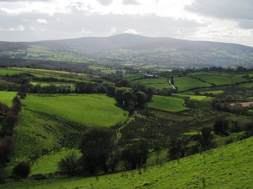
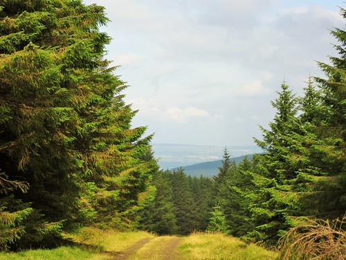
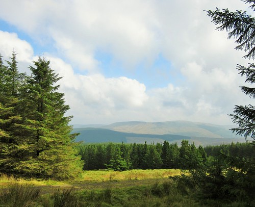
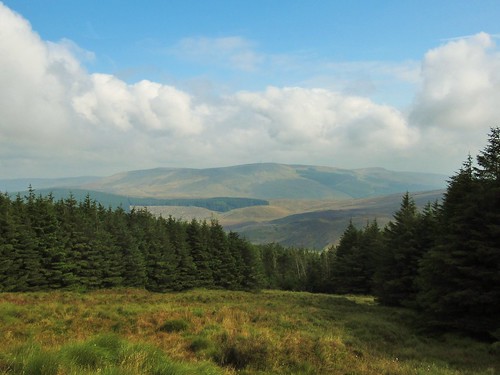
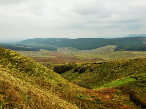
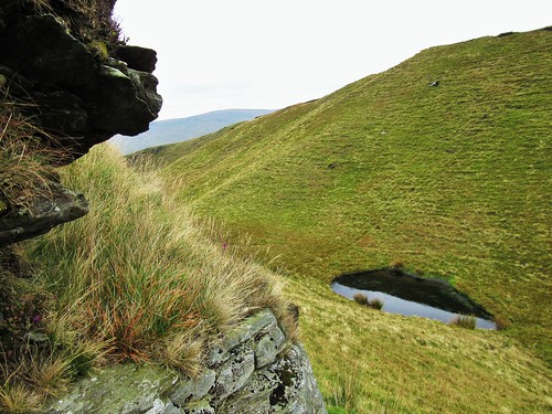
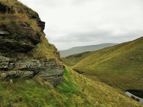
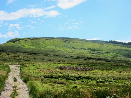
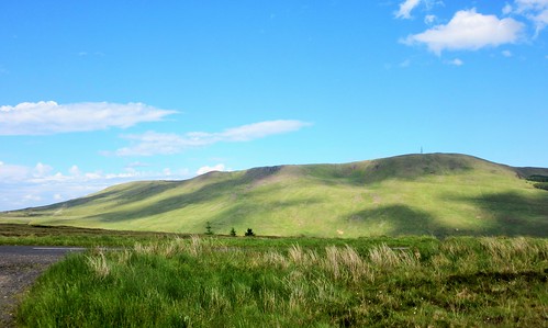
The mountain road over the pass behind Eskeradooey is a stony and ancient highway, coursing south to north against the grain of the east-west Sperrin Hills. The view from the saddle is utterly spectacular – back south to the green lowlands around Omagh, north across the deep cleft of the Owenkillew Valley to the billowing uplands of the central Sperrin range, bulges of hills with gallopingly musical names – Mullaghasturrakeen and Mullaghclogher, Craignamaddy and Mullaghbane. Inga, a resident of County Donegal, was able to point out a tiny cone in the north-west, clear against the sky, and confirm that it was indeed Mount Errigal, the highest peak in Donegal, forty miles away.

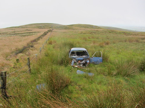
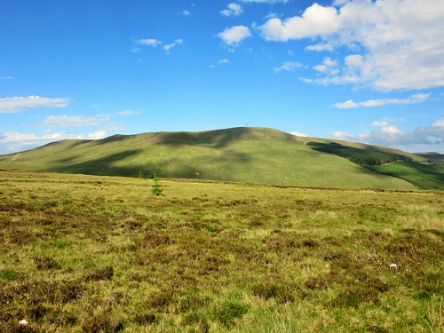
Harry sniffed over the ruins of an ancient Chrysler that some bright sparks had driven up the old mountain road and failed to drive away again. It could have been The Professionals circa 1978, judging by the cut of the old wreck’s jib – flash, chrome-rich and cheap, just the sort of motor that CI5 agents Doyle and Bodie loved to corner in with a squeal of Firestones and a burst of .357 Magnum fire. Other hard men had hung out at the pass in times past, too – the pair of flat-topped domes that rise out of the bog here are dubbed the Robber’s Table, though no-one seems sure of the identity of the ‘rapparee’ or robbing rogue to whom the name refers.

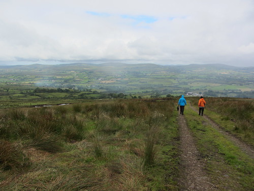
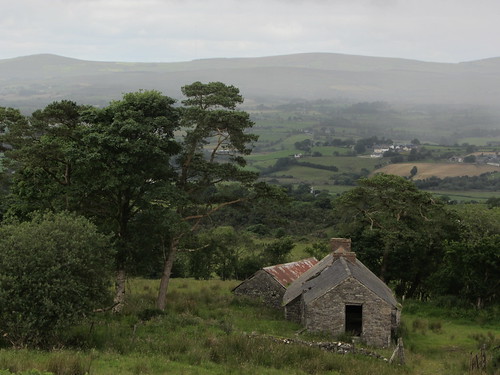
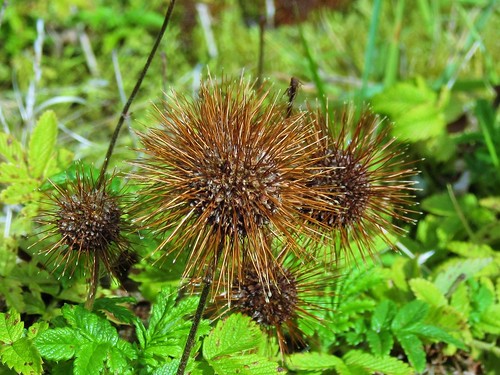
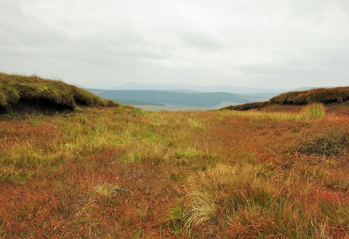
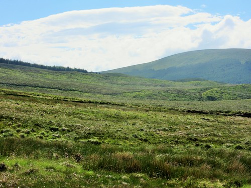
Harry and his consort decided to turn back. We waved them goodbye and went on down into the Owenkillew Valley past farmsteads under orange-rusted tin roofs, abandoned in overgrown gardens – testament to the difficulty of getting a viable living nowadays out of these pared-to-the-bone mountain farms. ‘You can’t eat the scenery,’ say the farmers – but what scenery, the magnificent beauty of the rolling Sperrins that enfolded our path back across Curraghchosaly Mountain and down to the long green glen of Lisnaharney once more.

Start & finish: Gortin Glen Forest Park car park, near Omagh, Co. Tyrone – NB £3.50 cash (OS ref H 485822)
Getting there: Bus: Ulsterbus 403 from Omagh. Road: Signposted off B48 Omagh-Gortin road.
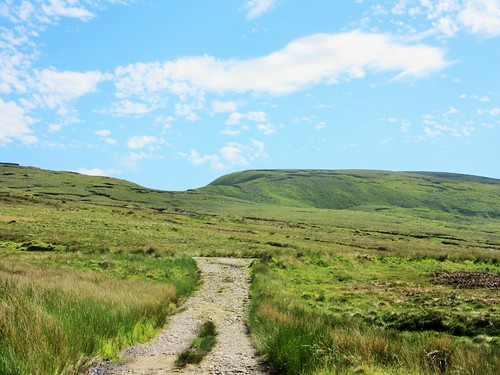
Walk (7½ miles, moderate, OSNI Discoverers 12, 13. NB: Online map, more walks: walkni.com, christophersomerville.co.uk): Return from car park to B48; left for 100m; right up Lisnaharney Road. In 1¼ miles pass side road on right marked ‘Lisnaharney Public Right of Way’/PRW); in another ½ mile, turn right (‘Eskeradooey PRW’). In 200m, right to farmyard at end of lane. Between buildings and farmhouse bear left up stony lane for 1⅓ miles, past Robber’s Table/RT and down to road. Right (‘RT’) for nearly ½ mile; right up track (‘Lisnaharney PRW’, ‘RT’) past Curraghchosaly Mountain and down to road. Left for 1¼ miles to B48 and forest car park.
Lunch: Picnic
Accommodation: Mullaghmore House, Old Mountfield Road, Omagh (028-8224-2314)
More info: Omagh Tourist Office (028-8224-7831); discovernorthernireland.com
www.ramblers.org.uk www.satmap.com www.LogMyTrip.co.uk

 Posted by at 01:08
Jul 162011
 

Up on the border between Co. Tyrone and Co. Donegal we parked the car and set out – Martin Bradley, Jane and I. Martin, Tyrone’s countryside officer and a man who knows his bog myrtle from his sphagnum moss, had told us of an ancient path he thought he’d spotted, unsuspected and little walked, hurdling the high bogland of this western corner of Northern Ireland.
First published in: The Times Click here to view a map for this walk in a new window
picture picture picture picture picture picture picture picture
Facebook Link:
As soon as we’d cleared the plantations and were walking north in open country, there was no mistaking The Causeway – a broad strip of trackway running straight as a die out of the Donegal uplands and into those of Tyrone. There’s nothing quite so enticing as the sight of an ancient track making a bee-line from one horizon to the other. It beckons you to follow where millennia of feet of hooves, cart wheels and sled runners have forged the straight way.

Huge views unfolded as we walked The Causeway, east to the rounded profile of the Sperrin Hills, north-west to the hills of Donegal and the faint and far blue shark-tooth of Mt Errigal, 30 miles off. What was The Causeway, in Martin’s opinion? A pilgrim path or a trade route? ‘Well, I think it could be at least two thousand years old, maybe older – perhaps Iron Age. See how well kept it’s been in the past, with stone culverts and proper ditches? It’s always been well used.’

It certainly has. Stories from the Second World War tell how the ration-hit farming families of West Tyrone were kept supplied with milk, meat, butter and other delights, courtesy of illicit cross-border consignments along The Causeway from the Republic of Ireland. Now the bog is invading the old track, spreading it with bedstraw, orchids and tormentil.

Down in the valley below we turned along a country lane to find a clandestine Mass Altar in Mellon’s Glen, the ancient church and graveyard of St Caireall, and the gently bubbling holy well where St Patrick once stopped to refresh himself. The wild uplands and small valleys of Wet Tyrone hold a secret round every corner; all you need to find them is a good pair of boots and a wealth of curiosity.

Start: Causeway Hill, Shanaghy Road, near Killeter, Co. Tyrone (OS of Northern Ireland ref: H163750)
Finish: St Patrick’s Well, Magherakeeel

Getting there: (2 cars): From Castlederg (B72 or B50) follow Killeter signs. From Killeter, follow ‘St Patrick’s Well, St Caireall’s Church’.
Leave one car opposite holy well; continue in other car to T-junction; left on Shanaghy road for 3 miles (5 km). Opposite small quarry with double gates on right, turn left along rough track past ‘Give Way’ sign. In 150 m park on bend by barrier (‘Causeway Hill’ waymark).

WALK (6 miles/8 km; easy but boggy; OS of N. Ireland 1:50,000 Sheet 12):
Yellow arrow points right, but you go left past barrier. Follow The Causeway for 3 and three quarter miles (6 km). At foot of lane (yellow arrow), left along country road. At ‘Mellon’s Glen’ signboard, detour left through gate. In 50 m, right at cross-inscribed stone to Mass Altar. Return and continue along road. At T-junction, left and left again up Magherakeel Road. Pass lime kiln and St Caireall’s Church to return to St Patrick’s Well.

LUNCH: Picnic

ACCOMMODATION: Marian McHugh, Glen House, 30 Aghalunny Rd, Killeter BT81 7EZ (028-8167-1983) – offers drop-off and pick-up at start and finish of walk.

GUIDED WALKS: Martin Bradley (028-7131-8473; 079-2678-5706; Martin 839@btinternet.com)

MORE INFO: Omagh TIC (028-8224-7831); www.discovernorthernireland.com
www.ramblers.org.uk www.satmap.com www.LogMyTrip.co.uk
Click on Facebook “Like” link to share this walk with Facebook friends.

 Posted by at 04:24
Oct 092010
 

First published in: The Times Click here to view a map for this walk in a new window
picture picture picture picture picture picture picture picture
Facebook Link:
Martin McGuigan is exactly the man you want with you in the Sperrins Hills of Northern Ireland. This wild range of fells, straddling the waist of County Tyrone, is his native ground.

‘We’d never have had this view if it wasn’t for the Ice Age,’ said Martin, pointing out the landscape features of the Sperrins from the heights of the narrow Barnes Gap. ‘The glaciers scraped and shaped all the hills you can see; and then when they were melting they formed a huge lake, and when that overflowed it just burst through a weak spot in the rock and formed the Gap itself.’

A landscape with dynamic origins, and an exceptionally beautiful one. An old stony road, part of the new Vinegar Hill Loop walk that we were following, winds like a scarf around the upper shoulders of Gorticashel glen. We looked down into a silent bowl of fields. Abandoned farmsteads lay dotted across the slopes, each rusted roof of corrugated iron an orange blob among tattered shelter trees – eloquent testimony to the hardships faced by small country farms these days.

On Vinegar Hill stood a tumbledown cottage, its rafters half smothered with fuchsia and Himalayan balsam, its fireplace choked with tendrils of ivy that were feeling their way blindly, like pale tentacles, out into the room among the wrecks of chairs and dresser. Martin fingered the balsam, ruminating. ‘These flowers were a big thing in my childhood. The bees would go crazy for them, and we’d see how many we could catch in a jam jar before we got stung!’

Down where the Gorticashel Burn ran under a bridge, a ferny old mill house stood hard against the bank, with an ancient potato-digging machine on its mossy cobbles. Sparrows went flocking through a cotoneaster bush on a farmhouse wall. At Scotch Town we found the crossroads guarded by a handsome rooster in a tippet of gleaming ginger feathers. Near Garvagh, as we turned for our homeward step, a great roadside shed stood provisioned for the winter with dried sods of turf.

This whole glen speaks eloquently of the life and work of family farms, present and past. Now, with the opening of the Vinegar Hill Loop, cheerful voices will be heard around the abandoned steadings and boots will tread the forgotten green roads of Gorticashel once more.

Start & finish: Barnes Gap car park/toilet/picnic area at foot of Mullaghbane Road (OSNI ref. H 551905)

Getting there: From B74 between Plumbridge and Draperstown, follow brown ‘Barnes Gap’ tourist signs to car park at foot of Mullaghbane Road by ‘Plumbridge 5’ sign.

Walk (7 miles, moderate, OS of Northern Ireland 1:50,000 Discoverer 13; www.walkni.com; purple arrow waymarks): Walk up the higher of the 2 Barnes Gap roads (‘Craignamaddy Circuit/CC, Ulster Way’ sign) past farm (barking dogs!). Right along Magherbrack Road for 1/3mile; left (552896; CC) along dirt road. Follow it round Gorticashel Glen for 2 miles to road near Irish Town (558873). Right for 2/3mile to crossroads in Scotch Town (548875; ‘Gortin’ left, ‘Plumbridge’ right). Straight across here and over next 2 crossroads (544875 and 538880) for 1 mile, to pass turning on left (536883 – tarmac stops here). Ahead for 300 yards; at stand of conifers, right (534885; ‘Vinegar Hill Loop’) on stony lane. Follow it for 1 1/3miles to road (550892). Forward to Barnes Gap road; left to car park.

NB – Online map, more walks: www.christophersomerville.co.uk

Lunch: Picnic

Walk On The Wild Side: walks with Martin McGuigan (024-8075-8452 or 07714-835-977; www.walkwithmarty.com)

More info: Tourist Information Centre, Strule Arts Centre, Omagh (024-8224-7831); www.discovernorthernireland.com

www.ramblers.org.uk; www.satmap.com

 Posted by at 00:00
Sep 052015


First published in: The Times Click here to view a map for this walk in a new window
picture picture picture picture picture picture picture picture picture picture picture picture picture picture picture picture
Facebook Link:

The Sperrin Mountains straddle the long border between Counties Tyrone and Derry. As shapely as a school of porpoises, they entice walkers with their softly rounded summits and gentle-seeming slopes. Meandering lanes and low-level paths curl round their feet. We were delighted to have an old friend, Martin Bradley, walking with us today. Exploring the Sperrins with a local man and expert guide like Martin is the best way to see the hidden corners of these wild uplands.

Under a milky grey sky we climbed the stony road through Altbritain Forest, its spruce and firs footed in the dense blanket bog that has grown to enwrap these hills over the past two thousand years. Waves of lime green sphagnum flowed over the dark peat under the trees, to be replaced by tuffets of green and orange deer grass as we left the cold shadow of the conifers and climbed the long flank of Mullaghaneany.

Up on the summit we paused by the fence that would guide us all way round the mountains today. To every point of the compass a superb prospect of hilly country unrolled, the names chiming in a cumbersome poetry – the Sperrin high points of Sawel and Meenard to the west, Mullaghearn hanging long and mighty over Omagh, the hummocks of Carnanelly and Slieveavaddy rolling in the south, and to the north-west the tilted peak of Benbradagh with a misted Lough Foyle at its foot and the hills of Donegal more imagined than seen in the cloudy haze beyond.

Shiny black fruit of crowberry glinted among bright green leaves against the chocolate-black peat. Twenty years ago, said Martin, over-grazing had reduced this place to a dismal slough. Now the bog is healing over with a haze of beautiful moor grasses, russet, emerald and cream.

We tramped the high tops from Mullaghaneany to Oughtmore and on to Spelhoagh, the hills all round us melting away into infinite shades of grey. A dreamy walk over the squelching turf, descending at last into a steep cleft where dragonflies circled a treacle-black bog pool. A last sharp scramble up the neck of Craigagh Hill, and we were crunching with Martin down a rocky bog road on the homeward path.

Start: Foot of forest road, Altbritain Forest, on B40 Draperstown-Feeny road (OS of Northern Ireland ref C 705003)

Getting there: From Draperstown, B40 (‘Moneyneaney’). 1 mile beyond Moneyneany, fork left (Moneyneany Road). In 3 miles cross bridge; in 100m, at ruined cottage on left, park carefully on right in gateway.

Walk (7 miles, strenuous, 1:25,000 Activity map ‘The Sperrins’. NB: online maps, more walks at christophersomerville.co.uk): Over stile/gate by ruined cottage; up forest road. In ½ mile, at left bend, (H 700997), keep ahead up green track. In ½ mile at T-junction (693993), left. In 200m, right up break in trees; across fence; up open hillside; left along fence at top. Keep to fence, crossing any side fences, for 3 miles over Mullagheany, Oughtmore and Spelhoagh summits. On Craigagh Hill fence descends steeply to turn left by pool (715988); leave fence, steeply up opposite slope to rough track on top; left along track for 1¼ miles down to B40 (719998). Left along road for 1 mile to car.

Conditions: Rough, boggy upland walking, some steep bits; best done in fine dry weather.

Lunch: Picnic; or Market Inn, Draperstown (028-7962-8250).

Accommodation: Laurel Villa, Magherafelt, Co. Derry postcode (028-7930-1459, laurel-villa.com) – immaculate, welcoming, helpful B&B. Dinner at excellent Church Street Restaurant, Magherafelt (028-7932-8083; churchstreetrestaurant.co.uk)

Guided walking: Martin Bradley, 028-7131-8473; mob 079-2678-5706; martin839@binternet.com
satmap.com; ramblers.org.uk;

 Posted by at 01:20