Search Results : Wiltshire Wilts

Sep 232017


First published in: The Times Click here to view a map for this walk in a new window
picture picture picture picture picture picture picture picture picture picture picture picture picture picture
Facebook Link:

The great chalk horse of Hackpen Hill shone out in blinding white under a scudding blue sky. Once we’d left the runners and cyclists on the Ridgeway, and ducked off along the edge of Wick Down, we saw nobody else.

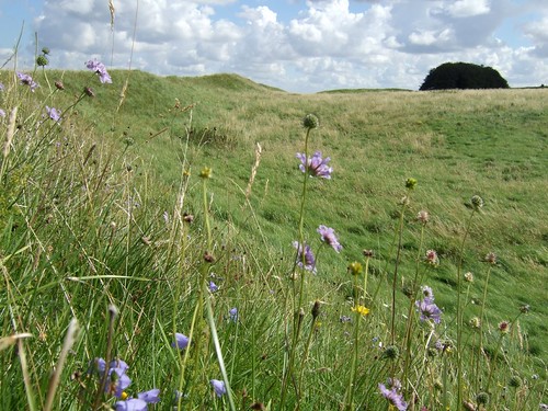
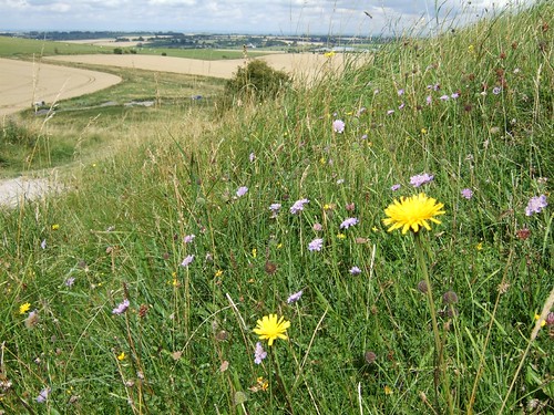
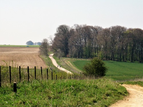
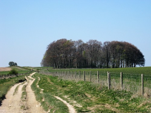
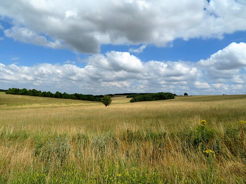
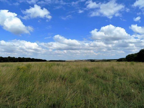
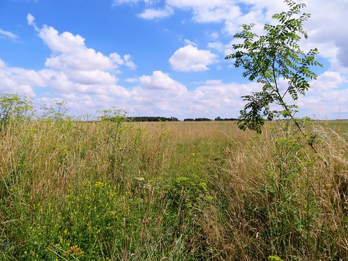
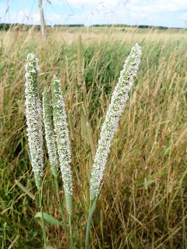
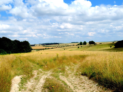
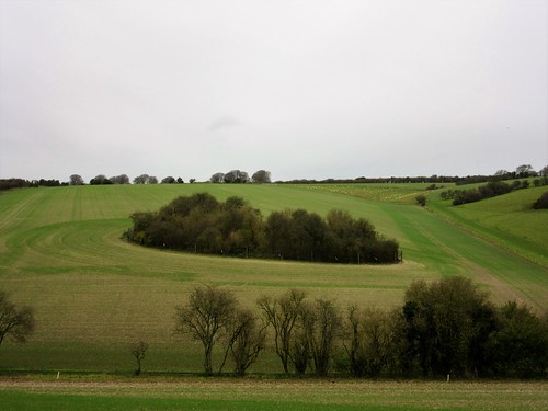
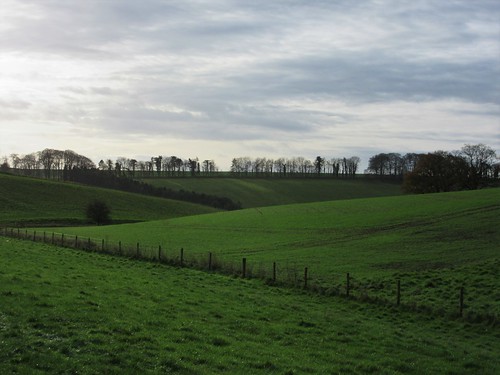
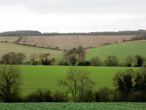
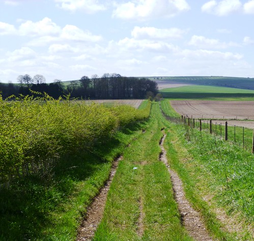
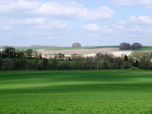
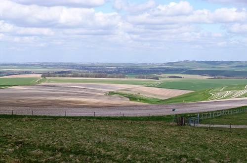
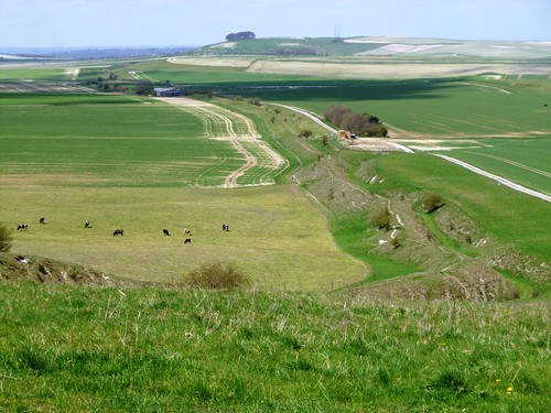
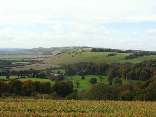
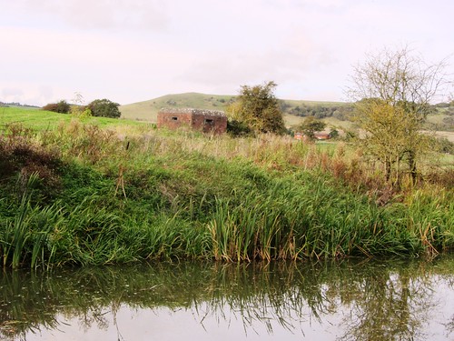
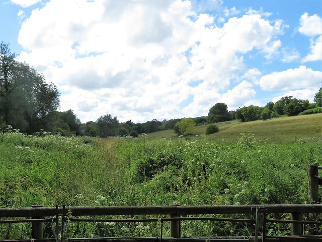
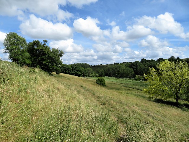
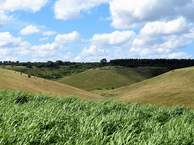
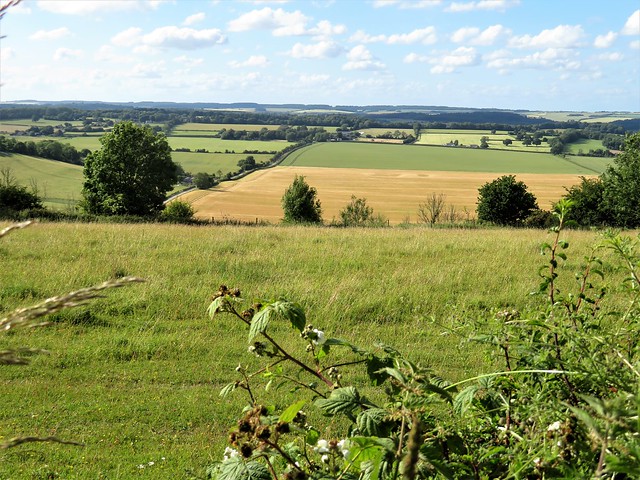
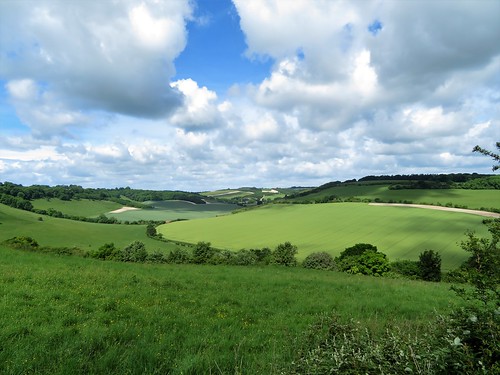
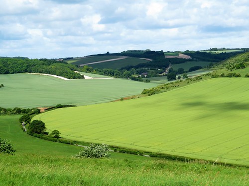
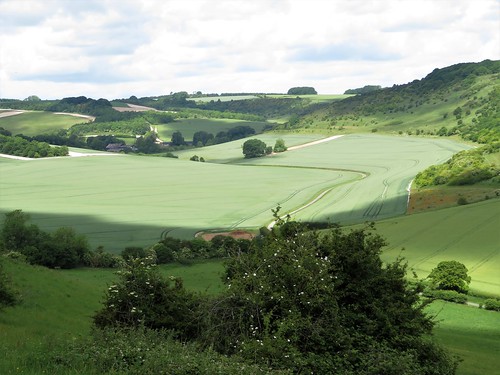
These downlands of northern Wiltshire are exceptionally beautiful. We walked at the lip of the escarpment, looking south over a roadless bowl of a valley, its curves shaped by weathering, its white chalk ploughlands contrasting with the green pastures in a harmonious subtlety of colour that called out for the paintbrush of Paul Nash or Eric Ravilious. Skylarks overhead drew generously on their bottomless wells of song, and a brown hare paused in its skyline lolloping to sit very upright and inspect us for signs of danger.

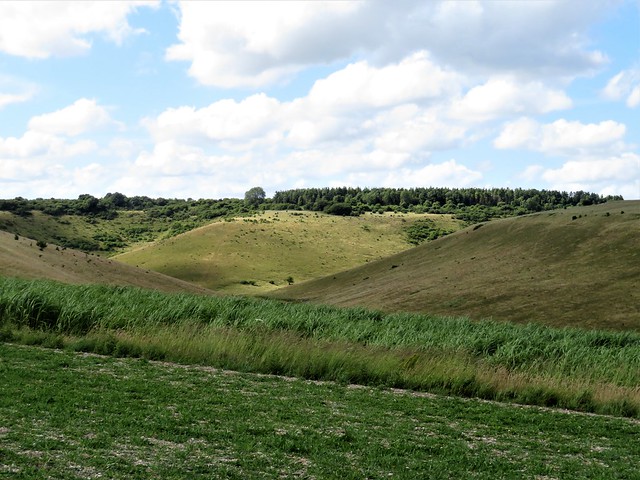
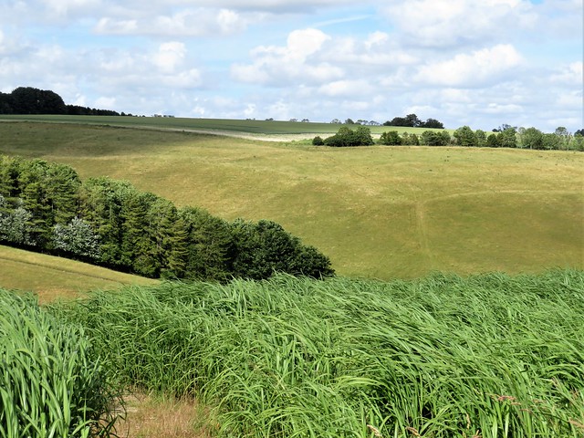
On the slope of Rockley Down we turned north into a great bowl of downland where the horse gallops of a training stable formed a straggling oval along the slopes of Ogbourne Maizey Down. A greedy, panicky screeching broke out among the gallops. Crows were bullying a pack of black-backed gulls, and the gulls were taking it out on the worms that had risen to the surface of the ground after last night’s rain.

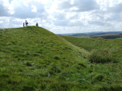
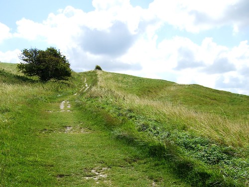
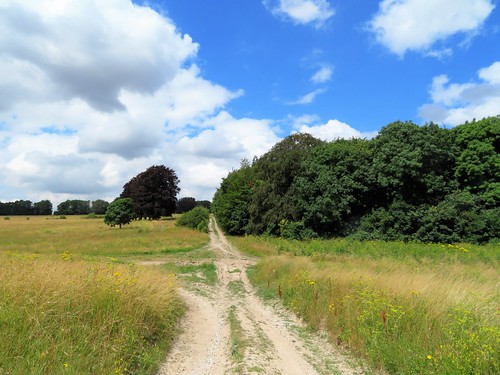
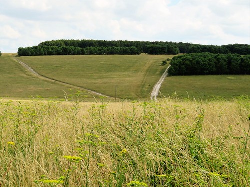
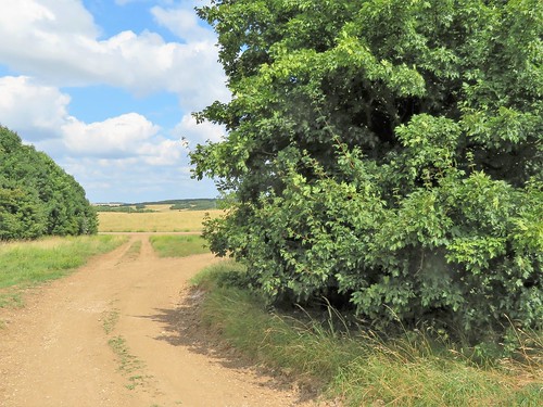
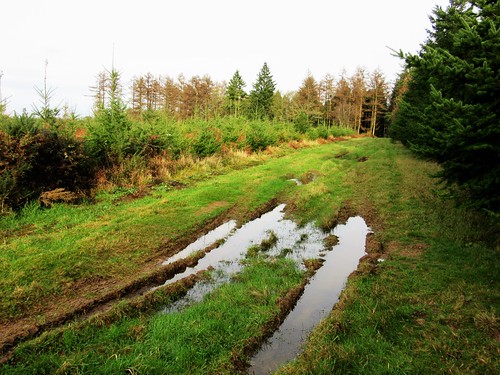
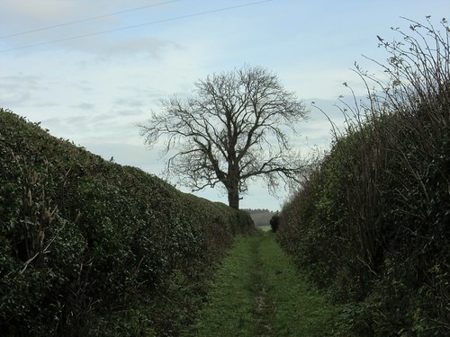
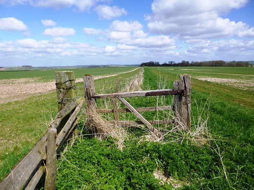
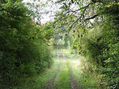
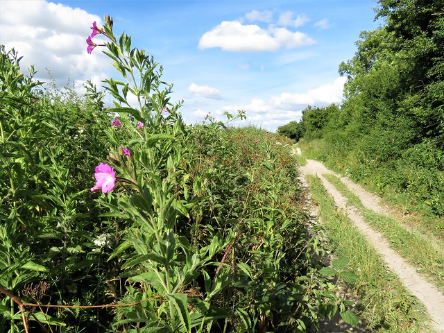
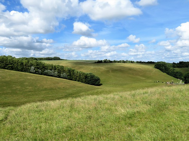
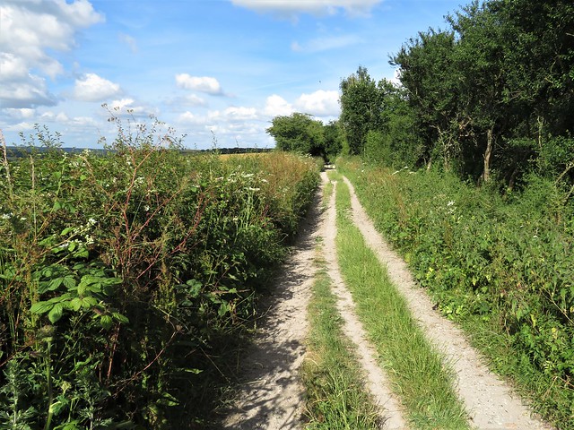
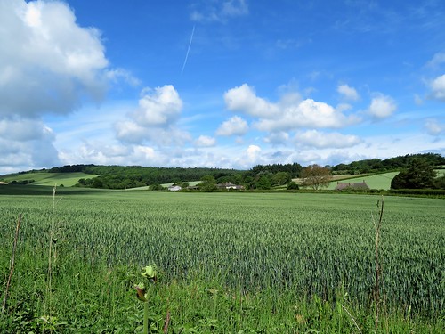
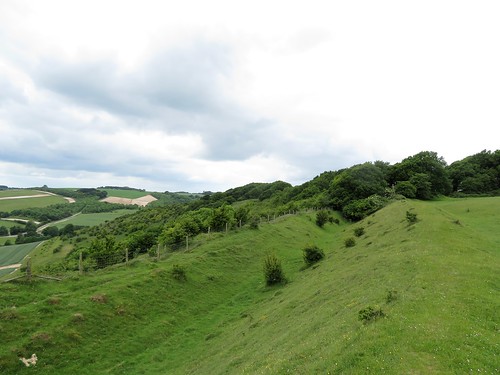
We left the birds to their squabbling and feasting, and headed up the slope of the down. A brief struggle with a patch of nettles and brambles, and we were out again on the roof of the downs, walking the ruts and jumping the puddles of another of Wiltshire’s ancient roadways towards the low hummocks of Barbury Castle hillfort.

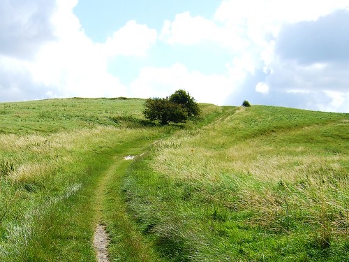
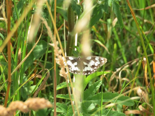
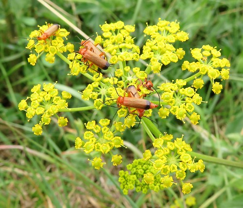
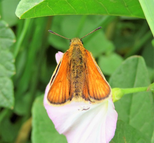
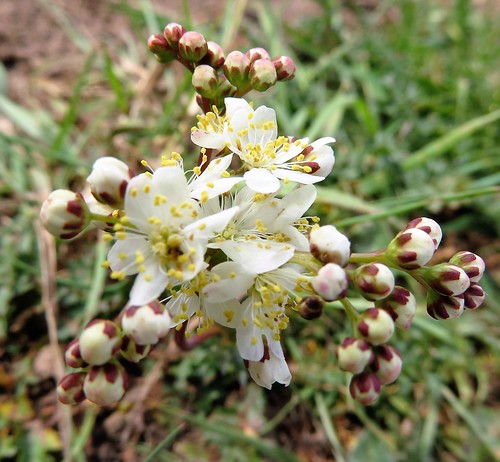
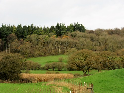
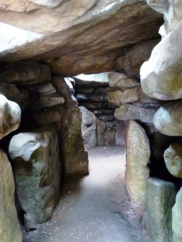
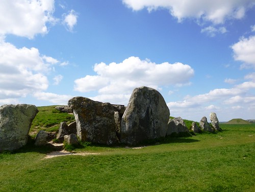
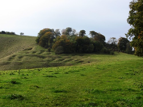
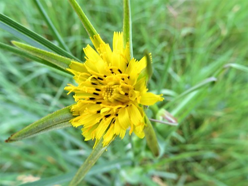
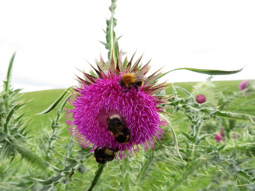
Whatever provoked the attack that marauding Saxons made on Barbury Castle in 550 AD, it was disastrous for the defending Britons. Several were slaughtered, and their fortifications were destroyed. As we strolled a circuit of the double ramparts, it was hard to picture the bloodshed and screams. Common blue butterflies busied themselves among the harebells and scabious, and dogs scampered the earthworks that have crowned Barbury Hill for the best part of 3,000 years.

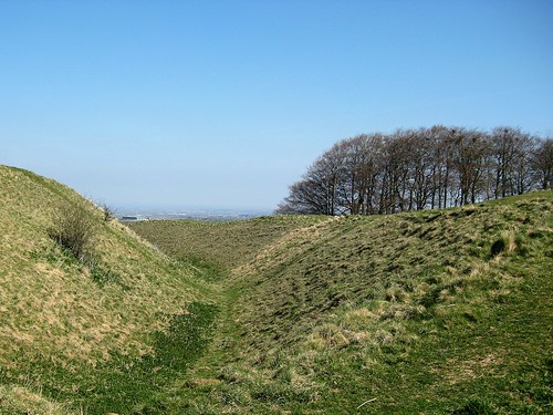
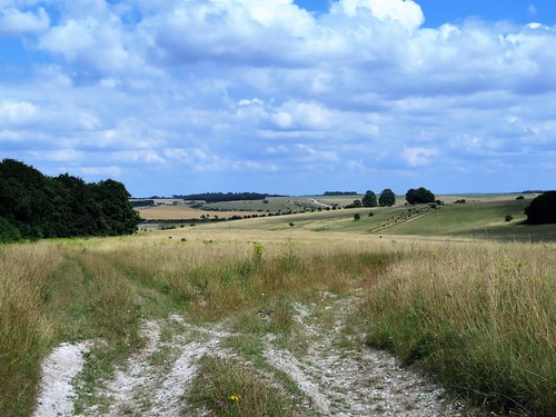
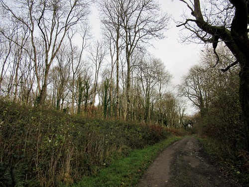
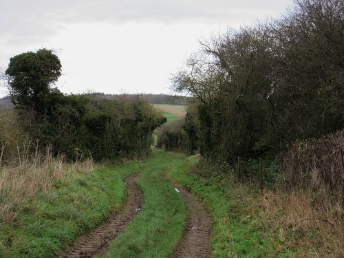
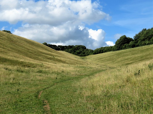
We left the fort by its western gate and descended the rutted track of the Ridgeway, an upland road that was already ancient when Barbury hillfort was built. Flocks of cyclists and coveys of walkers were out along the old trackway, and we followed its white ribbon back to Hackpen Hill under the bluest of skies.
Start: Hackpen Hill car park, near Swindon, SN4 9NR approx. (OS ref SU 129747)

Getting there: On minor road between Broad Hinton (M4 Jct 16, A4361) and Marlborough (M4 Jct 15, A346)

Walk (7¼ miles, easy, OS Explorer 157): Left (Marlborough direction) along road. In 300m, right through gate on left of driveway (132745); right along field edge with fence on right. In 100m bear left along escarpment edge. In 1 mile, on Rockley Down, left up tarmac driveway (147734) to cross road (150738).

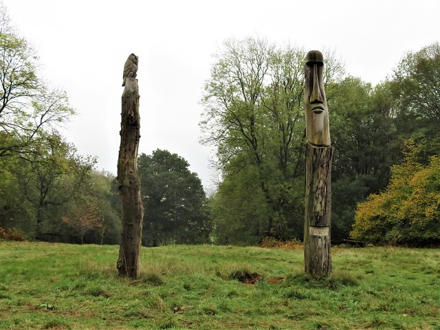
Along broad concrete track. In 300m, ahead (yellow arrow/YA) past ‘Private Road’ notice to T-junction at ‘Barbury International’ notice (153745). Left; in 200m, bear right (152747) and follow clockwise along perimeter of horse gallop. In 300m, bear a little left off stony track (155747; pond shown on map, not really distinguishable on ground), leaving trees on your right (YAs on fence to left). Keep ahead beside grassy ride, passing ‘Stonehenge’ installation, for ½ mile.

150m before a crossing fence, turn left uphill. Cross stile (161742); on uphill for 150m. At top fence post, above square enclosure on right, turn left (162743). In 150m, through deer gate (162744), chained but not locked; on between hedges. In 50m bear half right between hedges; in 100m right again between hedges. In 200m, path bends left (164747) through scrub trees and undergrowth. In 200m, through gate on right (164748); up fence to stile onto broad trackway (165748). Left; in a little over a mile, at ‘Neil King Ridgeway Racing’ sign at Upper Herdswick Farm (157760), left through gate (‘Barbury Country Park’). Follow Ridgeway through Barbury Castle Hill Fort (147763) and on south-west for 1½ miles to Hackpen Hill car park.

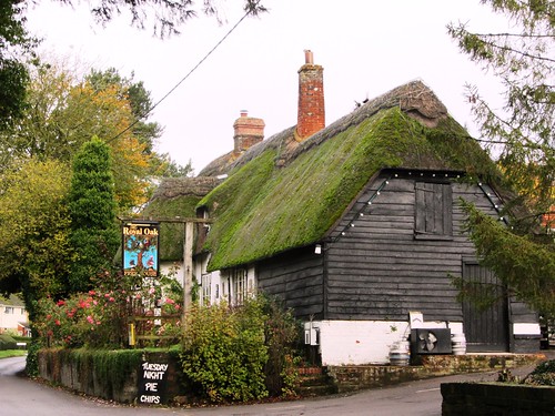
Lunch: Barbury Inn, Broad Hinton, SN4 9PF (01793-731510, thebarburyinn.co.uk), or The Crown, Broad Hinton (see below)

Accommodation: The Crown, Broad Hinton SN4 9PA (01793-731302, the crownatbroadhinton.co.uk)

Info: Swindon TIC (01793-466454); satmap.com; ramblers.org.uk

 Posted by at 01:50
Aug 242016


First published in: The Times Click here to view a map for this walk in a new window
picture picture picture picture picture picture picture picture picture picture picture picture picture picture picture picture picture picture picture picture picture
Facebook Link:

The Royal Geographical Society has just launched its ‘Discovering Britain’ project (discoveringbritain.org), exploring dozens of landscapes through walks great and small. On a gorgeous summer’s afternoon we set out from the Wiltshire village of Tilshead to follow one of the RGS walks through the heart of Salisbury Plain.

Stepping off the road into the vast Ministry of Defence preserve of Salisbury Plain feels like slipping through the screen of time into the pages of a book by Edward Thomas or W.H. Hudson. The past hundred years might never have existed. Here are no motor roads, no housing developments, no industry. These dense, flower-rich, unimproved chalk grasslands, Europe’s most extensive tract, have never known modern ploughing or farm chemicals. They have remained in this pristine, prelapsarian state thanks to the activities of the MoD, which uses the plain for military training to the exclusion of all other activity.

A mile or so down the white-dusted chalk track we passed the enormous Old Ditch long barrow, one of the longest in UK, over 400ft from end to end. These ancient monuments, too, have escaped the plough and the developer’s JCB – though one or two have occasionally collided with a tank.

The richness of the chalk grassland flora had us exclaiming out loud – a palette of colour and variety really astonishing to walkers accustomed to the thin pickings of England’s 21st century landscapes. Vivid royal blue of viper’s bugloss, round lacy powder-puffs of field scabious, buttery sprigs of yellow rattle, sanfoin’s convex pink petals like stripy Shakespearean breeches. Butterflies kettered and zigzagged over the grasses – clouded yellows, small skippers, marbled whites, chalkhill blues. Over all lay the soporific hum of bees and hoverflies busy among the flowers.

There were one or two soldiers, of course – cheerful, courteous men who stopped their bouncing carriers to enquire whether we were having a nice day before roaring off into the ‘German village’. This mock-up of a Bavarian township was built for Cold War practice against imaginary Russian invaders on the plains of Germany, and is still in use for training soldiers in fighting techniques in built-up areas.

We left the eerie, hollow-eyed dummy houses behind and took the homeward track across the flowery grasslands among pink mallows and great purple knapweed blooms. There are hidden hazards for the unwary in this timeless paradise, though. One of us stepped onto an innocuous-looking mud patch, went in up to the hips, and had to be hauled squelchingly out. It wasn’t me, that’s all I have to say on the matter.

Start: Rose & Crown PH, Tilshead, Wilts SP3 4RZ (OS ref SU 033480)

Getting there: Bus service 2, Devizes-Salisbury. Road – Tilshead is on A360 between West Lavington and Shrewton.

Walk (7 miles, easy, OS Explorer 130): From Rose & Crown, left along A360. In 150m, right beside Ash Tree House gateway. Follow this lane (‘Restricted Byway’) for 500m to A360 (030479). Left; in 100m, on right bend, ahead up minor road (‘Chitterne’). At top of hill, left (024476, ‘No access for civilian vehicles’). Pass water tower on right; in 50m, fork right along main track. Into dip; ahead uphill to go through trees. In 100m, right (026469) with beech belt, then Long Barrow on right. In ⅔ mile, left (017465) on gravel road. Into dip; at top of rise beyond, right (019456, ‘Byway’) through trees. At 3-way fork just beyond, take right-hand track, passing mock village on your left.

In ½ mile cross gravel road (012455); in 150m, left up dirt road. In ½ mile at 6-finger post (013448) take 2nd track on left (‘Permissive Byway’), passing to right of mock village. In ½ mile, at crossroads with Byway signs pointing behind and ahead (021452), left between hedges. In 200m at ‘village gates’, right (020455, ‘Byway’). In 300m, ten metres before T-junction, left (023455, green ‘Byway’ sign/GB) up rutted, grassy track.

In ½ mile pass trig pillar on right, then cross gravel road (028462, GB). On along grassy track, with Westdown Camp ahead. In ¼ mile join gravel road (031467, GB) and continue past White Barrow (033469). In another ¼ mile, just short of A360, left (035471, ‘Imber Range Path’) on grassy track. In 700m, right (‘Restricted Byway’) to A360; left to Rose & Crown.

Lunch: Rose & Crown, Tilshead (01980-621062, roseandcrowntilshead.com)

Accommodation: Rollestone Manor, Shrewton SP3 4HF (01980-620216, rollestonemanor.com)

Info: Salisbury TIC (01793-530328 or 466454)

www.visitengland.com; satmap.com; ramblers.org.uk

 Posted by at 13:30
Dec 192015


First published in: The Times Click here to view a map for this walk in a new window
picture picture picture picture picture picture picture picture picture picture picture picture picture picture picture
Facebook Link:

The great rural writer W H Hudson stayed at the Lamb Inn at Hindon in 1909 while he was writing his classic book, A Shepherd’s Life. He watched fledgling throstles, flycatchers and pied wagtails make their maiden flights from their nests in the ivy above his bedroom window, and rejoiced that the village had become ‘sober and purified’ since the bad old days.

The gamekeepers, beaters and shooters who packed the bar of the Lamb the night before our walk were celebrating a good day in the open air with plenty of beer and plenty of talk, their wind-reddened faces growing ever more rosy in front of the log fire. This part of South Wiltshire is pheasant-shooting country, and almost the first thing we heard as we stepped out next morning was the flat ‘pop-pop!’ of shotguns from distant ridges.

The broad track of the Wessex Ridgeway led us through fields where yellow-faced siskins flitted in the hawthorn bushes. Once across the roar and swish of the A303, we followed a quiet green valley up into the skirts of Great Ridge Wood. Hudson came here day after day, revelling in the silence and solitude of the ancient wood. He met no-one – locals had been banned from their traditional right of gathering firesticks in the wood since the introduction of pheasants reared for the shoots.

All was quiet in Great Ridge Wood for us, too, a century later, tracing the route of the Roman road that once brought lead from Somerset’s Mendip Hills to Old Sarum. A cold wind rose, tossing the fir tops and the flame-like leaves of the young larches. At the edge of the wood we saw a line of shooters and dogs in the valley beyond, patiently waiting for the beaters to initiate their morning’s sport.

Another ancient trackway brought us south again off the ridge, walking beside milky green fields of winter wheat. Dusky pink spindle berries hung in thick clusters in the hedges, and the track rose and fell in a beautiful tumble of downland valleys, silent and still under a pearly winter sky.
Start: Lamb Inn, Hindon, Wilts SP3 6DP (OS ref ST 910329).

Getting there: Bus 25, 26 (Salisbury-Gillingham)
Road: Hindon is signed off A303 between Wylye and Mere.

Walk (7¾ miles, easy, OS Explorer 143): From Lamb Inn, right past church. In 150m, just past Fairmead bungalow, right (909330; ‘Bridleway’ fingerpost/BFP in left hedge) along fenced path of Wessex Ridgeway. At road, left (912333); at left bend, ahead (913337, BFP) between hedges, then across fields to A303 (920346). Right alongside road for 300m; left across it (922346); through gate (BFP) and up valley. Keeping fence, then track at bottom on your left, follow grass path for ¾ mile to join track (926358); follow it up to T-junction in woods (928361). Left; in 50m pass grass track on left; in another 150m, left (928362) on grassy ride between tall and short conifers. In 650m, at T-junction, right (921362); in 200m, left along wide forest road.

In 1 mile, at edge of wood, left on track (906362); in 200m, right (BFP) inside trees. In ½ mile, at end of trees at T-junction, left (898364) along track. In ¾ mile, at bottom of valley (898354), keep ahead on right-hand of 2 parallel tracks, rising to pass inside Bockerly Coppice. At top of rise, at gate into open field, 2 tracks fork left into wood (899351). Take right-hand one (BFP) inside top edge of wood. On down to cross A303 (901343, take care!). Uphill in tunnel of trees. At reservoir at top (903339), ahead on track to road (904336); left to Hindon.

Conditions: Take great care at 2 crossings of A303!

Lunch/Accommodation: Lamb Inn, Hindon (01747-820573, lambhindon.com) – lively local inn, scented by log fire.

Ramblers Festival of Winter Walks, 19 Dec – 3 Jan: ramblers.org.uk/winterwalks

Info: Salisbury TIC (01722-342860)
visitengland.com satmap.com; ramblers.org.uk

 Posted by at 01:30
Mar 152014
 

It was a brisk day over Wiltshire, brisker than you’d expect in early spring, with sheepy clouds scudding east and a cold nip under the blue sky. First published in: The Times Click here to view a map for this walk in a new window
picture picture picture picture picture picture picture picture picture picture picture picture picture picture picture picture
Facebook Link:
Avebury’s stones were warm, though, as I walked a circuit among them – rough and warm to the touch, huge and amiable with their rugged, bear-like shapes sparkling in the sunlight. Unfathomable, as always, the motives of those who in 2000 BC mounded the great circular bank and trench that encloses present-day Avebury village, pairing off one hundred sarsen stones in male and female couples, and building two smaller circles to touch each other within the greater ring.

How much labour must such a work have expended? How much organisation of that so-called “primitive” society? Our medieval ancestors feared the stones, toppling some and leaving others to fall. One 14th century surgeon-barber suffered the wrath of the stones for taking part in such vandalism; his skeleton was discovered under one of the largest in 1938, coins in his purse, scissors by his side. He’d been squashed flat as the great boulder slammed to earth before he could get out of the way.

Field paths led me out of Avebury through paddocks where horses grazed, flicking their tails against the early flies. A cock crowed at Durran Farm as I followed a stony track rising for miles to the roof of the downs. The rhythmic crunch of flints under my boots, the sunshine and cold wind and the twitter of sparrows in the hedges combined to give a soporific, trance-like feel to the morning.

Up at the crest of the hills I followed the old ramparted ditch of Wansdyke above the broad flanks of the downs, enormous fields of ploughland and spring wheat all in geometric lines and malleable curves of white and green. Wind in the hair, sun on the cheeks, fantastic exhilaration under a windy blue heaven as I strode out at the hub of a 50-mile view. But the true focus of this walk lay in the valley of the River Kennet below – the flattened thimble of Silbury Hill.

Down there I stood on the boulder-guarded mound of West Kennet Long Barrow and stared north at Silbury Hill. Why men constructed the long barrow around 3,500 BC with its five compartments and its mighty guardian sarsens is clear enough – the dead had to be honoured. But that 130-foot high, flat-topped hillock with its hidden core of concentric chalk-block walls: what was that about? We’ll never know – but we can imagine the feelings of awe that it invoked some 4,750 years ago when it first stood dazzling white and dominant between the rolling downs.

Start: Avebury village car park, Wilts, SN8 1RF (OS ref SU 100697)

Getting there: Bus service 49 (swindonbus.info), Swindon-Devizes
Road – Avebury is on A4361, 12 miles south of Swindon (M4, Jct 16)

Walk (11 miles, easy, OS Explorer 157): From car park, follow signs to stone circle. Walk the circuit of the stones; then follow minor road through village, passing church on right. Opposite Rectory gateway, right (099699) up lane; follow it to the left. Cross 2 footbridges; after second one, left (097698). Through gate (yellow arrow/YA); left along fence. Through gate (096696); immediately right through adjacent gate; up track past thatched cottage to cross road (095696). Pass noticeboard; follow tarred path to road opposite Rose Cottage (094695). Right for ⅓ mile; opposite farmyard, left (089692, ‘bridleway’) to cross A4361 (090691); on to cross A4 by Waggon & Horses Inn, Beckhampton (091689).

Down steps from inn car park; follow road round right bend. Opposite Butler’s Cottage, left (087688, ‘bridleway’) and follow track south for 1¾ miles to join stony track at 084688. In another 750m, just before Manor Farm cattle grid and gate, left (081652). In 150m, bear right and through gate (‘Mid Wilts Way’). Follow Wansdyke ditch and bank east. In 1 mile, a broad track comes in on right; 150m before a complex of gates where track converges with Wansdyke, turn left through makeshift gateway in fence (099647, ‘White Horse Trail’).

Left to fence; right along it, heading NE away from Wansdyke. In 1 mile dogleg right, then left through makeshift gate (109658); on with fence on right. In just over a mile, cross track and keep ahead past ruined barns (114675, ‘bridleway’) on grassy track. In 300m, left along track (114678); in 15m, right on hedged path; cross stile (YA) and follow left-hand hedge to cross road (110682). On (fingerpost) down fenced track. Cross stile, then follow fence. In ⅓ mile, under oak tree (105681, no waymark) left up field to West Kennet Long Barrow (105677) beyond skyline. Return to cross A4 (104684); take field path (‘Avebury’ fingerpost) to east of Silbury Hill. In 350m (103687), ignore stile on right, and go through gate and on beside river. At two-arch bridge, don’t turn right across it (101689), but keep ahead through gates (blue arrows) to cross A4361 to car park.

Lunch: Red Lion Inn, Avebury (01672-539266)

Info: Alexander Keiller Museum, Avebury Manor, shop etc – contact National Trust, 01672-539250; nationaltrust.org.uk/avebury
www.ramblers.org.uk www.satmap.com www.LogMyTrip.co.uk visitengland.com

 Posted by at 01:43
Sep 142013
 

I’m sure Mary Poppins would declare Wootton Rivers ‘practically perfect’. The little Wiltshire village lies snug under the downs on the edge of the Vale of Pewsey, all thatched roofs and red brick.
First published in: The Times Click here to view a map for this walk in a new window
picture picture picture picture picture picture picture picture picture picture picture picture picture picture picture picture
Facebook Link:

Sparrows were chittering in the thatch as we walked out and up along a green lane to the roof of the downs under a milky blue sky.

Up there ran the ancient trackway known as Mud Lane – after all the recent rain we soon discovered why – flanked by old mossy woodbanks and overhung by big beech and ash, and holly trees as substantial as well grown sycamores. I became aware of a staring pair of eyes in the shadows of an oak, and made out the leafy face of the Green Man, venerable spirit of the greenwood, carved with wonderful skill into the stump of a broken-off bough. The artist had resisted the temptation to give the Green Man a jolly grinning countenance, and had instead provided him with an expression appropriate to his status as a woodland god – thoughtful, solemn and crafty.

Mud Lane ran out of the trees and over the nape of Martinsell Hill. The promontory down curled away like the flank of a great beast, dimpled with old pits that might have been medieval rabbit warrens, or maybe the clay delvings of the British potters that lived up here 2000 years ago, making their coarse grey Savernake ware for the Roman army. Nowadays cattle munch the downland grass, and walkers stop to sit with hands around knees and stare across the Vale of Pewsey to the far hills, one of southern England’s most breathtaking views.

Below Martinsell Hill we followed a track across the high ramparts of the Giant’s Grave, an Iron Age hill fort where autumn gentians trembled their glowing purple trumpet flowers in the wind. From here there was a view to challenge the Vale of Pewsey, more intimate but no less stunning, down into the secret cleft of Rainscombe where a fine Georgian house lay among gold, scarlet and green trees like a promise of earthly delights.

A slippery clay path bought us down into the Vale, and we followed the towpath of the Kennet & Avon Canal back to Wootton Rivers in the soft grey light of the autumn evening.

Start: Wootton Rivers village hall car park, near Marlborough, Wilts SN8 4NQ approx. (SU 197631)

Travel: Rail: Pewsey (two thirds of a mile from Pains Bridge on Kennet & Avon Canal)
Bus: Bookable Bus from/to Pewsey (not Sun, BH) from/to Royal Oak PH – 08456-525255, option 1
Road: M5 Jct 15; A346 through Marlborough; Wootton Rivers signposted to right in 3 miles

Walk (8½ miles, moderate, OS Explorer 157):
From car park, left past Royal Oak PH. In 200m pass ‘Tregarthen’; road bends right, but keep ahead (197634) up green lane. At top of rise (200642), left along field edge; right (‘Mid Wilts Way’/MWW) up head to Mud Lane trackway (198646). Turn right for 50m to find Green Man on left (ref SU 19840 64645), then return west along Mud Lane (occasional MWW). In 1 mile cross road by car park (183645); on across neck of Martinsell Hill, aiming between wood on right and spinney on left, to go through gate on skyline (177642). In 200m cross track (174642, ‘Oare Hill’ fingerpost); in another 300m, opposite stile on right, turn left off Mud Lane (171642) through hedge. Cross field, aiming for left-hand of 3 separate tree clumps. Pass to right of it (172637), on downhill with trees on right. At bottom corner of field, follow fence to right (170634, MWW) across Giant’s Grave (166632).

On down beside fence to corner of field (162629). Cross stile (MWW); left along hedge and across end of field. Through gate (161628, MWW), across green lane and on along right-hand field edge. Cross Sunnyhill Lane (161623, fingerpost); across field, through hedge gap (161621); diagonally left across next field to far fence (164618). Right to wired-up gate (164615); right along hedge for 50m, left across stile. Diagonally left across corner of field to cross stile into green lane (164616). Right to cross Pains Bridge (165612); east along canal towpath for 2½ miles. At Bridge 108 (198629), cross canal by lock to return to car park.

Lunch/accommodation: Royal Oak PH, Wootton Rivers, SN8 4NQ (01672-810322; wiltshire-pubs.co.uk) – friendly village local

Information: Devizes TIC (01380-734669)

www.ramblers.org.uk www.satmap.com www.LogMyTrip.co.uk

 Posted by at 01:11
Dec 242011
 

In theory you might find a prettier and cosier spot than Castle Combe as a starting point for a cold winter day’s walk, but in practice? No chance.
First published in: The Times Click here to view a map for this walk in a new window
picture picture picture picture picture picture picture picture
Facebook Link:
So I informed myself, anyway, as sloth fought with sense on the doorstep of the warm and cheery Castle Inn. Once out under the blue Wiltshire sky, wandering among the gables and tall chimneys, mullioned windows and Cotswold stone roofs of medieval cottages and woolmasters’ fine houses, everything was just perfect. The sun struck gleams from the creamy oolitic walls, and sparkled in the ripples of the By Brook as it gurgled under miniature bridges along the village street.

I batted my cold hands together and followed the Macmillan Way down the valley, walking between whitethorn hedges where redwings were stripping the berries. The woods were full of dark brown bracket fungi with white frilly edges, like Belgian chocolates scattered prematurely by a careless Father Christmas. A grove of tall old beeches stood in their own crisp litter, their roots gripping the slope like arthritic fingers, the sun painting the smooth trunks in silver verticals.

Two men were burning tree cuttings in a pall of blue smoke. ‘Just waiting for the fire to die down so we can cook a bit of breakfast,’ one said. ‘Yeah, proper smoky bacon,’ added his mate with dreamy relish.

A snarl of speeding cars on the main road at Ford, and then the green rutted lane of the Old Coach Road where express four-in-hand stagecoaches once jolted from Bath to Chippenham at 8 miles an hour. Today? One girl walking her dog, a couple of rabbits, and a millennium of ghostly travellers at my elbow.

The high-perched stone houses of North Wraxall looked down from their ridge as I followed a lane that crossed the Romans’ Fosse Way high road and slipped over into the valley of the Broadmead Brook. A muddy old bridleway led back east toward Castle Combe beside the twisting brook, past a low clapper bridge whose big decking slabs were supported on sturdy, moss-jacketed piers. Yellow-streaked siskins flocked in the alders, chittering as they picked at the seed cones, and the dipping sun sent a few last bars of silver slanting across the water from which an evening steam was already rising.

Start & finish: Castle Inn, Castle Combe, Wilts SN14 7HN (OS ref ST 842772)
Getting there: Bus 35 (www.wiltshire.gov.uk) from Chippenham. Road: M4 (Jct 18); signed from B4039 to village car park.

Walk (7½ miles, moderate grade, OS Explorer 156): From Castle Inn continue down village street. In 300m pass South Cottage; left over footbridge (841768); right, and follow Macmillan Way (MW arrows) along east bank of By Brook for 1 mile to mill at Long Dean. Here bear right on bridleway (851756; MW, ‘Ford’), ascending for 300m to go through gate. In 200m, left over stile (846754; MW) on hillside path to stile into road (845750). Left to A420 (843748). Right through Ford; past church, right (841749) up Old Coach Road. Where tarmac ends (838751), ahead for 1 mile to road (822747). Right through North Wraxall. Pass church; right up road (818750; ‘Castle Combe’). In ⅓ mile, below power lines, left over stile (817757; fingerpost, yellow arrow/YA)’ follow YAs across 2 roads and over fields for ¾ mile to road by house (812770). Bear right here (fingerpost), along bridleway beside wood, to a road (813771). Right; in 150m fork left (fingerpost) along bridleway through Broadmead Brook valley. In ½ mile, at road (823769), left for 100m, then right (bridleway fingerpost). In nearly ½ mile, beside brook, go through gate (829773); pass (but don’t cross) clapper bridge; in 30m, right over stile (YA); on beside brook for ¼ mile to road at Nettleton Mill (833775). Right through tall iron gate; on to reach golf course. Right along concrete roadway; left across bridge (838776); right, and follow ‘public footpath’ signs, then a wall into Castle Combe.
NB – Online map, more walks: www.christophersomerville.co.uk. Click on Facebook “Like” link to share this walk with Facebook friends.

Lunch: Castle Inn, Castle Combe (rambling old inn of nooks & crannies): 01249-783030; www.castle-inn.info
More info: Chippenham TIC (01249-665970); www.visitwiltshire.co.uk
www.ramblers.org.uk www.satmap.com www.LogMyTrip.co.uk

 Posted by at 01:42
Aug 152009
 

First published in: The Times Click here to view a map for this walk in a new window
picture picture picture picture picture picture picture
Facebook Link:

Squirrels had been harvesting the green hazelnuts along Woodlands Lane; the split shells went crunching under our boots as we set out from Berwick St John on a cloudy morning. Beyond the gabled old house of Woodlands there was a bit of a pull up the breast of the hill, and then the exhilaration of a good old step-out along one of the ancient ridgeways that ride the nape of these south Wiltshire downs. Jane, a South Downs girl born and bred, strode out with a big smile on her face, delighting in the poppies along the cornfield headlands, the nodding harebells and powder-blue buttons of scabious in the trackway verges, and the sense of being high up among the swooping hills of proper chalk-and-flint country.

Steep hill slopes whose sheep-nibbled turf had never been disturbed by any plough plunged away to flat and sinuous valley bottoms, where the pale coffee colour of the newly harrowed earth lay streaked with darker chocolate, sign of watercourses still active under the soil. It was like walking on a relief map, a fabulous one. Full of exultation, we came down through Norrington Farm to reach Alvediston’s little Church of St Mary, where a group of recondite ramblers on a church crawl were discoursing in the churchyard.

Blink and you’ll miss Alvediston. The thatched Crown Inn stood locked up tight, in a state of suspended animation between owners. Walking on, we found sparrowhawks clattering from the ash trees in Elcombe Hollow, fat sheep cropping the vale under Pincombe Down, and wonderful views along the sweep of the north-facing hills.

The Ox Drove is another ancient trackway of the Wiltshire Downs, broad and tree-lined between wide grazing verges, a drove road and pedlar’s highway since time out of mind. We followed it along the crest of the downs as cloud thickened in the north, looking out to the mounded ramparts of Winkelbury hillfort. The golden coffin buried at the summit, the lucky thorn tree that grows there, the devil who grants wishes to those who march round the hill while cursing and swearing … All yarns the drovers swapped and the pedlars spun to drive away the demons of the old hard roads across the downs.

Start & finish: Talbot Inn, Berwick St John, Wiltshire SP7 0HA (OS ref ST 947223)

Getting there: Berwick St John is signed off A30, 3½ miles east of Shaftesbury

Walk (8 miles, moderate grade, OS Explorer 118): Leaving Talbot Inn, round right bend; up Church Street. Round left bend by Old Rectory; in 20 yd, right (946224) along Woodlands Lane. Just past Woodlands House (951232), track splits 3 ways. Ignore yellow arrow; take middle way, diagonally left uphill for 600 yd. Through gate in fence (948237; blue arrow/BA); aim half left across down to gate in far left corner (BA). On through next wooden gate; follow path to turn right along stony trackway (948245). In 1 mile, right (961248) down green path to Norrington Farm. Ahead through farmyard; past last barn, left (967238) over stiles through 4 fields to road (976238 – St Mary’s Church opposite). Right to T-junction in Alvediston (976234 – Crown Inn opposite). Right; in 50 yd, left (‘Elcombe Farm’). Follow road, then track up Elcombe Hollow for 1¼ miles to Bigley Barn (977216). Right along Ox Drove trackway for 1½ miles. 250 yd before road, right (954208) along path for 1¼ miles below Winkelbury hillfort to road (953223); left to Berwick St John,

NB – Online map, more walks: www.christophersomerville.co.uk

Lunch: Talbot Inn, Berwick St John (01747-828222); Crown Inn, Alvediston (NB closed at time of writing).

More info: Salisbury TIC (01722-334956; www.visitwiltshire.co.uk); www.ramblers.org.uk

 Posted by at 00:00
Jun 172023


First published in: The Times Click here to view a map for this walk in a new window
Old Shaftesbury Drove valley north of Ebbesbourne Wake looking back towards Ebbesbourne Wake downs near Church Bottom 1 downs near Church Bottom 2 looking down into Church Bottom path under Prescombe Down Church Bottom 1 Church Bottom 2 View from Old Shaftesbury Drove 1 Old Shaftesbury Drove 2 View from Old Shaftesbury Drove 2

The font in the Church of St John the Baptist at Ebbesbourne Wake has its drain hole stopped with a champagne cork. What fun christenings must be in this little Wiltshire village.

Outside, pyramidal orchids grew in the unmown churchyard. Slowly moving elephantine clouds jostled each other 20,000 feet above the chalk downs that cradle Ebbesbourne Wake.

Skylarks sang at full tilt over the blue-green wheat fields where flints rattled under my boots as I gained height above the village. A young roe deer stared, then turned tail. As she cantered off, two tiny fawns rose from where they had been crouching stock-still and bobbed away after her.

Yellow rattle, lady’s bedstraw and big clumps of wild thyme grew on the slopes of the steep dry chalk valley of Church Bottom. Frisky bullocks were playing follow-my-leader, and I was glad to leave them behind and walk up onto the roof of the downs.

The views were sensational all round the compass: a long procession of folded downland country, the chalk foundations smoothed and sculpted by millennia of weathering, their thin skin of agriculture a patchwork of white plough, yellow mown grass, green corn and dun scrub. The downs looked as elastic and bouncy in their rounded forms as the cumulus clouds piling up overhead.

Two hares sat beside the track, ears erect, on half-alert. One lolloped slowly away, and the other yawned and stayed put. Humans? I can take ’em or leave ’em, quite frankly.

The path led across a field of barley, the bearded heads sinuating in silky waves at every gust of wind. Beyond ran Old Shaftesbury Drove, an ancient ridgeway, once the chief coach road between Salisbury and Shaftesbury, nowadays a fine rutted trackway between hedges as thick and species-rich as linear slices of woodland.

I followed the old drove for a mile or so, then cut back from the ridge along a green lane. Down in the valley, late sunlight lit houses and hill slopes. There was time for one more surprise – a beautiful old traction engine that went clattering and panting up the hill and away, leaving behind the evocative smell of coal smoke to cense the evening lanes.

How hard is it? 5 miles; easy; field and downland tracks.

Start: Church car park, Hay Lane, Ebbesbourne Wake SP5 5JJ approx (OS ref ST 991241)

Getting there: Bus 29 (Shaftesbury – Salisbury)
Road: A30 (Salisbury-Shaftesbury); at Fovant, minor road to Fifield Bavant; Ebbesbourne Wake signed from here.

Walk (OS Explorer 118): From corner of car park follow path past church, and through lych gate. Left on path to road (991242). Right; in 50m left (fingerpost) on path. In 75m left over stile; along valley to cross road (989243). Up bank; left up field edge. In 100m fork right across field (988245) and on. In 400m through gate (991247, ‘Bridleway’), down to valley bottom. Half right to gate by wood (992249). On up Church Bottom. In 800m at water trough, up through gate on right (993257). Woodland path; cross track; on across field. At far side, gate (995259); on (blue arrow) across field. Pass gate, left along drove road (998263). In 1 mile watch for crossing track (982257). Left here, down for 1 mile to valley road at West End. Right at bus shelter (984242); at top of hill, left (983240, ‘Bridleway’) up drive. Pass gate; round left bend; immediately left (983238) on grass path back to car park.

Lunch: Horseshoe Inn, Ebbesbourne Wake SP5 5JF (01722-780474, thehorseshoe-inn.co.uk)

Accommodation: Queen’s Head, Broad Chalke SP5 5EN (01722-780344, queensheadbroadchalke.co.uk)

Info: Chalke Valley History Festival, 26 June-2 July – 01722-781133, cvhf.org.uk

 Posted by at 05:20
Dec 072019


First published in: The Times Click here to view a map for this walk in a new window
picture picture picture picture picture picture picture picture picture picture picture
Facebook Link:

It was cool and misty across the Wiltshire downs. I hung over the twin bridges at Great Bedwyn, first watching the train rattle away towards Newbury, then admiring the slender curves of the Kennet & Avon Canal.

The lacy stonework of the church tower rose among autumn trees – crimson, gold, lemon yellow, scarlet. Beyond the bridge lay narrowboats with cosily smoking chimneys, a wintering community of water gypsies that looked almost as settled as the village itself.

The towpath of the Kennet & Avon led south. The canal lay as still as a pond, its grey-brown water disturbed only by the gentle pat and ripple of falling willow leaves. A milky sheen glinted on chalky fields newly sown with spring wheat. Beside Lock 61 a tremendous grunting came from a pig palace of straw bales, where a massive ginger sow luxuriated in the mud.

The tall chimney of Crofton pumping station loomed ahead, softened by mist. Built in 1812 to pump water to the adjacent summit ponds of the Kennet & Avon, nowadays its preserved Boulton & Watt steam engine, a mighty monster, is the oldest working beam engine in the world.

Here I turned aside along the canal reservoir of Wilton Water, a rushy lake winding under willows. A young heron, disturbed at my approach, took off from its fishing stance and flapped away like an animated umbrella.

Above the brick-and-timber village of Wilton, larks sang over Dodsdown. The path led across a rain-pearled beet field into the neighbouring woods of Wilton Brail and Bedwyn Brail, deer parks in the long ago. An eerie half-light lingered among the enormous storm-shattered carcases of fallen beech trees. Long tailed tits passed in a twittering flock. Sweet chestnut husks littered the path, neatly split into quarters and robbed of their contents by squirrels.

At the summit of Bedwyn Brail I sat on a bench looking across the golden woods. Just southward along the ridge lay the earthworks of a grand mansion planned, but never completed, by Edward Seymour, Duke of Somerset and lord of Wolf Hall. At one time Seymour flew high as Lord Protector to his nephew, young Edward VI. But his flight ended in 1552, crashing Icarus-like to earth at the execution block.

When the foundations of Bedwyn Brail house were excavated a few years ago, the brick-built water system installed in 1549 by the royal Sergeant Plumber was found to be still working perfectly.

Start: Bedwyn railway station, Great Bedwyn, SN8 3PB (OS ref SU 280645)

Getting there: Train to Great Bedwyn; bus 22 (Marlborough-Hungerford)
Road – Great Bedwyn is signed from Froxfield on A4 east of Hungerford (M4, Jct 14).

Walk (6½ miles, easy, OS Explorer 157): South for 1¾ miles along Kennet & Avon Canal towpath. Opposite Crofton Lock pumping station, left (262623, ‘Wilton Windmill’); footpath to road in Wilton (267616). Left past Swan Inn (‘Great Bedwyn’); opposite Tidcombe turning, left (270617), ‘Crofton’ fingerpost). In 100m, right; follow yellow arrows into Wilton Brail wood (271622) and on. In ¾ mile cross road (278627); on into Bedwyn Brail wood. At benches on ridge (284625), left and follow ‘Great Bedwyn’ and ‘footpath’ for nearly 1 mile to north edge of wood (283638). Cross field to far right corner (281641, yellow arrows); right down path to road (281649); left to station.

Lunch: Three Tuns, Great Bedwyn (01672-870289; tunsfreehouse.com); Swan Inn, Wilton SN8 3SS (01672-870274, theswanwilton.com)

Accommodation: Pelican Inn, Bath Road, Froxfield, Marlborough SN8 3JY (01488-682479, pelicaninn.co.uk)

Info: Marlborough TIC (01672-512487); visitwiltshire.co.uk
Crofton Beam Engine opening and steam days: croftonbeamengines.org; satmap.com; ramblers.org.uk

 Posted by at 02:45
Jun 092018


First published in: The Times Click here to view a map for this walk in a new window
picture picture picture picture picture picture picture picture picture picture picture picture
Facebook Link:

The thatched and red-tiled roofs of Vernham Dean lie low in a billowing landscape of green and white, the slopes of the cornfields, pastures and copses chequerboarded with chalky patches of clay soil newly ploughed for seeding with pheasant-friendly plants.

We were heading up and away onto the roof of this hidden corner of the Hampshire/Wiltshire border. If it weren’t such a dreadful cliché, ‘best-kept secret’ would fit this secluded notch of countryside very well. The chalk is cut by dry valleys that swing and curve as though modelled by a sculptor. You rarely see anyone along the flinty old tracks crisscrossing the downs, or on the paths that plunge down slopes too steep ever to have been touched by arable farming.

At the rim of Conholt Hill we paused to look down along the sinuous valley that leads to lonely Hippenscombe Farm. Then we descended the narrow path into Conholt Bottom down a slope spattered with yellow rattle, horseshoe vetch, fat seedheads of cowslip, and the pink busby-shaped flowers of common spotted orchid.

During the ‘Swing Riots’ of 1830, a mob of three hundred poverty-stricken farm labourers, hungry and angry, marched to Hippenscombe Farm on 22 November. They were intent on smashing Farmer Fulbrook’s thrashing machine, one of the new labour-saving agricultural inventions that were putting such men out of work. Twenty of them broke into the barricaded house, and someone stole a tea caddy and a tablecloth.

When they were caught, the ringleaders were sentenced to transportation for life to New South Wales. They were lucky to escape with their necks intact, and some of them made good Down Under, once their crimes had been expiated.

From Hippenscombe and its hoarsely barking dogs we climbed again to the hilltops where the folded landscape wheeled off in green clefts to all quarters. On Fosbury Camp hill fort we saw no-one as we circled round the great Neolithic enclosure inside its Iron Age ramparts. Bumble bees investigated the velvety purple heads of musk thistle, and a kestrel hung dark and intent, head down in the wind.

We passed a giant old beech tree clamped by bulbous roots to the ramparts, and went bowling downhill toward the roofs of Vernham Dean, huddled under a racing grey sky in their hollow under the steep green downs.

Start: George Inn, Vernham Dean, near Andover, Hants SP11 0JY (OS ref SU 341566)

Getting there: A343 north from Andover; at Hurstbourne Tarrant, left to Ibthorpe, Upton and Vernham Dean.

Walk (6¼ miles, field paths, OS Explorer 131): From George Inn, right along road. In 200m, left (fingerpost) up flinty lane. In 150m, right (339564, ‘footpath’) up edge of Boats Copse. In ½ mile at top of slope, right (331558, ‘footpath’) into trees. Follow arrows through trees, out onto hillside; up hedge for 400m to road (327554).

Right; in 100m sharp right; in 100m, left (stile), slanting down hillside to valley bottom (321558). Left along road for ¾ mile to Hippenscombe Farm. Through road gate (311561); in 20m, right by cottage on farmyard road between barns. In 150m fork right beside last shed (breeze block) on flint track. In 100m keep ahead (ignore left fork). In 750m, at crossing at top of slope (309569), right on flint track to Fosbury Farm (314571).

Cross drive in front of gates; onward into woods for 800m to stile onto Knolls Down (320566). Bear right to trees; left (anticlockwise) round ramparts of Fosbury Camp hill fort. Just past giant beech tree, right at rampart gap (322565, pond on left) down field slope with trees on left for ⅔ mile to road at Woodside Cottages (332565). Right; in 30m, left (‘footpath’, kissing gate). At far end of field (kissing gate), right along road. In 300m, at entrance to Vernham Dean, fork left (338566) to George Inn.

Lunch: George Inn, Vernham Dean (01264-737279, thegeorgeatvernhamdean.co.uk) – excellent, unpretentious village pub.

Accommodation: Hatchet Inn, Lower Chute SP11 9DX (01264-730229, thehatchetinn.com) – 4 miles

Info: visitengland.com; satmap.com; ramblers.org.uk
Thanks to Henry Salmon for finding this walk for us!

 Posted by at 00:31