Search Results : bedfordshire

Nov 172018


First published in: The Times Click here to view a map for this walk in a new window
picture picture picture picture picture picture picture
Facebook Link:

Twenty four hours of solid rain over Bedfordshire had given way to a misty, moisty, mizzling day; not exactly raining, but the damp cold air pearled face and hands with gossamer-fine moisture. The thatched eaves of Old Warden’s cottages dripped, the village road rippled with runnels of water.

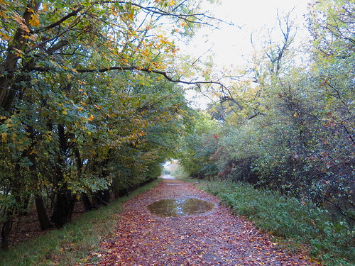
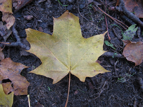
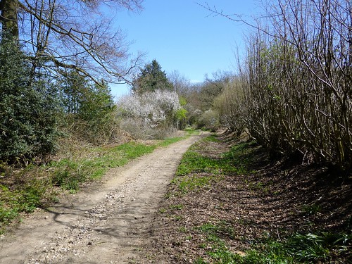
In Warden Wood I turned aside over a carpet of birch leaves as soft and yellow as butter, to find Queen Anne’s Summerhouse in its lonely clearing among the pines. It’s doubtful if the queen even knew of this bold brick folly’s existence, but Sir Samuel Ongley thought it wouldn’t hurt to honour his royal liege on the grand estate he’d bought in the 1690s with his East Indian Company profits.

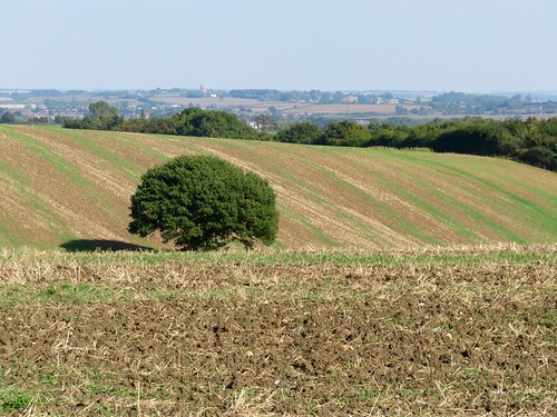
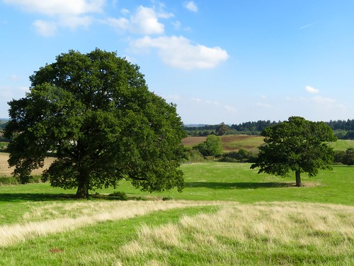
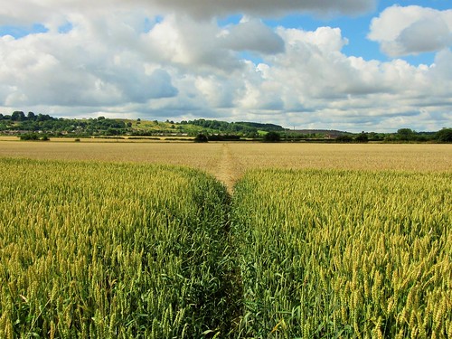
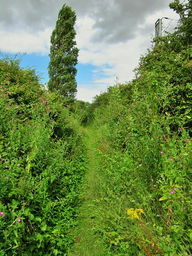
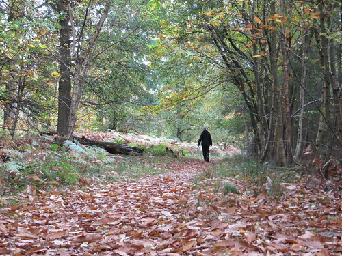
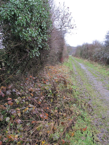
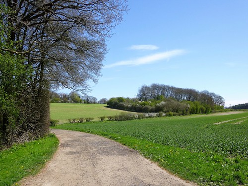
A long green bridleway led north among beet fields, wet and whispering in the misty wind. Pheasant poults went scuttling ahead, then crouched motionless, camouflaged in a ditch. It was their mother who gave way to panic, exploding away right under my boots in a whirr of wings.

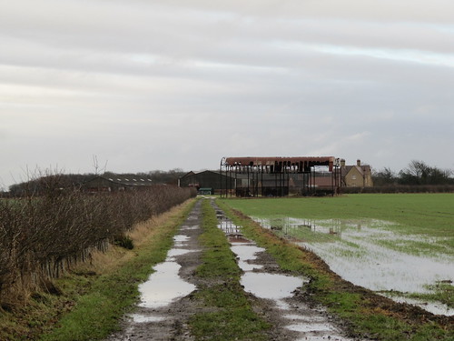
I passed the long hangers at Old Warden’s airfield where the wonderful old stringbags of the Shuttleworth Collection are housed. These historic aircraft and motor cars are not preserved as museum exhibits, but are restored to active life in the air and on the ground, living entities once more.

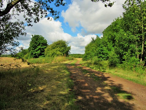
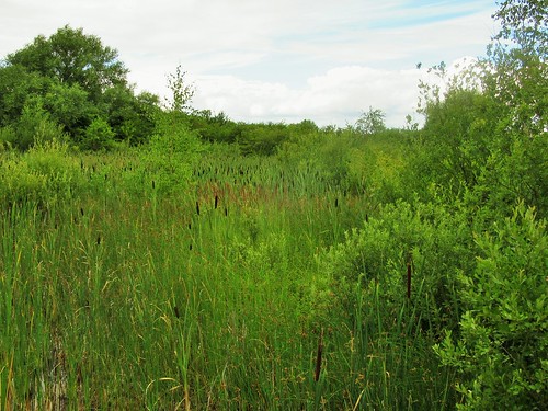
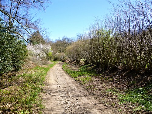
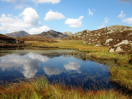
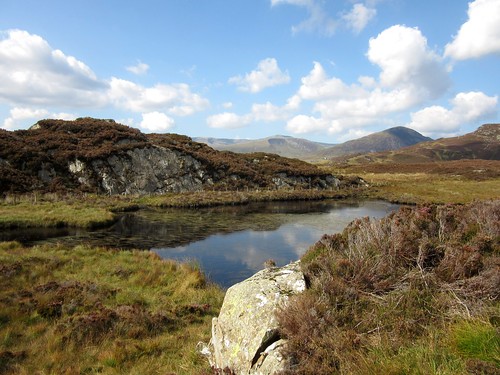
Deep in Home Wood beyond Ickwell Green, a Permissive Path looped round a remarkable monument – a complex of medieval fishponds squeezed inside a warren bank, providing fish and rabbits for the lord of Northill Manor. Bending and curving in and out of one another like a Chinese puzzle, these half-filled ditches, scattered with gold leaves, gave off a powerful atmosphere of mystery among the coppiced hazels along their banks.

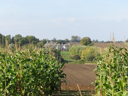
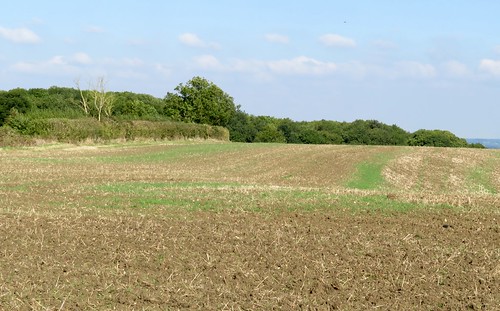
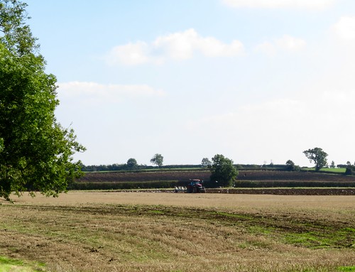
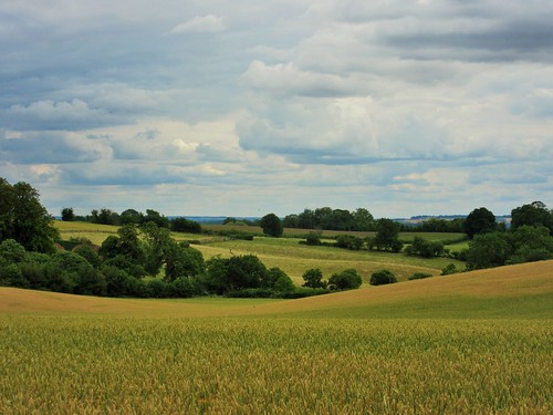
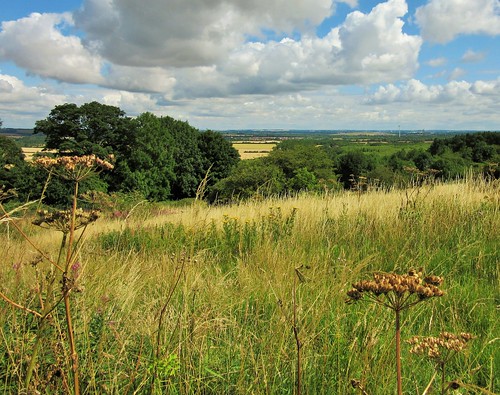
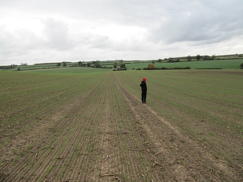
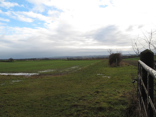
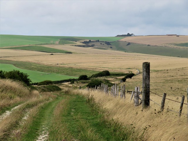
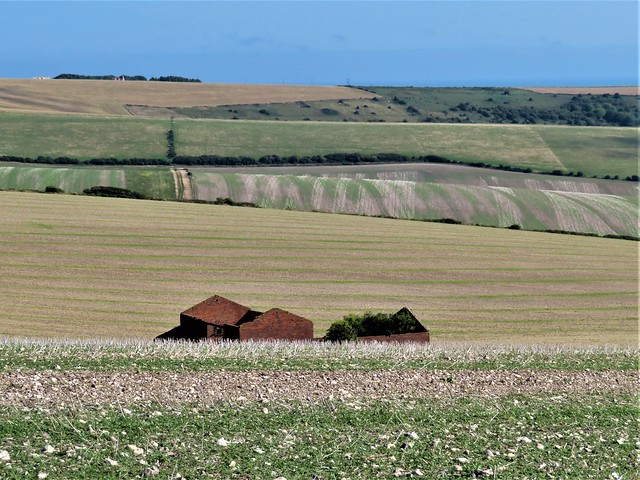
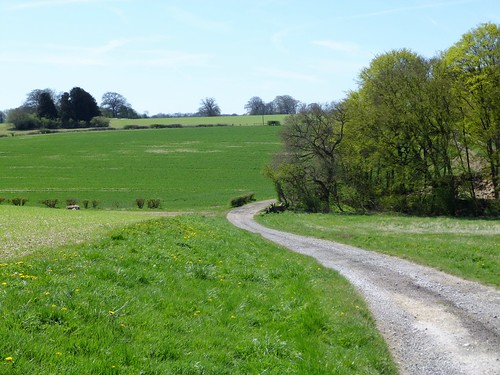
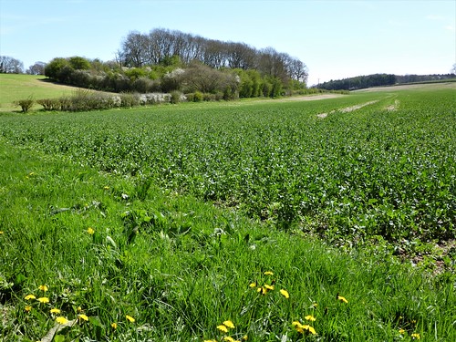
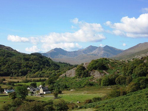
Big open fields surrounded the handsome square brick house at Highlands Farm. Lapwings and starlings picked over the winter wheat fields, and a brown hare streaked for cover.

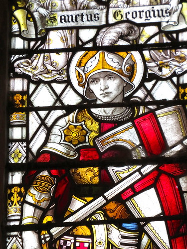
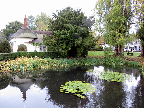
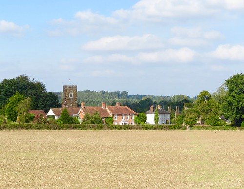
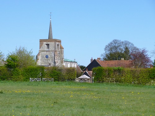
Coming back into Old Warden, the tower of St Lawrence’s Church floated disembodied above the mist. I turned into the church and stood amazed at the riot of fantastic wood carving that embellishes the dark interior – snakes, angels, swags of flowers, and a very tender depiction of the disciples, hooded and sombre, lowering the limp body of Jesus into the tomb.

Start: Hare & Hounds PH, Old Warden, Biggleswade, Beds SG18 9HQ (OS ref TL 138440)

Getting there: Old Warden is signed off B658 (A1 at Biggleswade)

Walk (9 miles, easy, OS Explorer 208): From Hare & Hounds, right along road. On left bend, right (fingerpost/FP, white posts) up path through Warden Warren (in ¼ mile, detour left to Queen Anne’s Summerhouse at 143438). At road, left (144433); in 600m, left (149430, bridleway FP) for nearly a mile to Shuttleworth College drive (157442). Right; in 150m, left (gate, black arrow/BLA, yellow top post/YTP) on bridleway for ½ mile to cross road (155448); on for ½ mile to Ickwell Green beside pre-school (150456).

Cross to continue along Northill Road (pavements). In ⅔ mile pass pond, then church; then left (149466, ‘Cople’) on Bedford Road. In 250m, left (147466, ‘Greensand Ridge Walk’/GRW). In 450m, detour left (143465) on Permissive Path circuit of medieval fishponds. Returning to GRW, left (YTP) through Home Wood. At western edge, left (138462, GRW) round field edges.

In 300m through kissing gate/KG (136462); left, and aim left of Highlands Farm house through KG (GRW). Cross paddock to KG left of sheds (GRW). Cross 2 paddocks (GRW), through trees (131460, YTP) and forward across 2 wide fields. At far side, left (126461, YTP). In ½ mile GRW turns right (123455, YTP), but keep ahead on bridleway (BLAs) through Palmer’s Wood. From Mount Pleasant Farm (136448) follow drive to road (138445). Right; in 200m, right to St Lawrence’s Church (137443), or keep ahead to Hare & Hounds.

Lunch: Hare & Hounds, Old Warden (01767-627225, hareandhoundsoldwarden.co.uk) – excellent village local

Accommodation: Old Warden Guest House, SG18 9HQ (01767-627201, oldwardenguesthouse.co.uk)

Info: Sandy TIC (01767-682728)

Shuttleworth Collection: shuttleworth.org

visitengland.com; satmap.com; ramblers.org.uk

 Posted by at 01:01
Dec 102016


First published in: The Times Click here to view a map for this walk in a new window
picture picture picture picture picture picture picture picture
Facebook Link:

At first acquaintance, Bedfordshire seems a rather nondescript county to walk in. It’s hard to get a grasp on the character of this low-rolling region with its large arable fields. But once you develop a taste for the many old copses and hedgerows, the slow-flowing brooks and sudden, unexpected viewpoints from ridges you hadn’t thought were there, Bedfordshire’s a place you find yourself looking forward to revisiting on foot.

An absolutely glorious afternoon helps, of course. The sun blazed down out of a clear blue sky on the cottages and dark ironstone church at Church End, the southerly node of the scattered village of Eversholt, on the eastern doorstep of Woburn Park. To balance the wintry nip in the air there were pictures of springtime in the village phone box, featuring improbably shaped lambs and unfeasibly yellow daffodils painted by the pupils of Eversholt Lower School.

We set out across a wide field of ploughland where we picked up shards of ancient pottery and a nacreous fragment of Roman glass. At Herne Green Farm a tractor ground along the furrows, turning dark soil like roughly broken chocolate and drawing a long white wake of gulls behind it.

An easterly wind began to rise, thrashing and hissing in the sycamores around Herne Green. A red kite circled the newly cut fields, looking for small creatures exposed by the plough. One of those unforeseen Bedfordshire views opened across a rolling plain to the north-east as we stumbled across crusty ploughlands down to the trees and half glimpsed house of Toddington Park.

Here handsome James Scott, Duke of Monmouth and by-blow of King Charles II, lived with his young lover Henrietta Wentworth, heiress to Toddington estate. Stories say they sold her property and jewels to fund the rebellion in 1685 that attempted to put Monmouth on the throne after the death of his father. It ended badly, with Charles’ brother James installed as King, and Monmouth himself sent ignominiously to the block.

Our homeward path lay across a succession of enormous fields, mostly of thick dark plough. There were old hedges of hips and haws, and a thread of a brook winding under elder bushes. The lichens that scabbed the elders glowed so incredibly yellow in the evening sun that it looked as though the young artists of Eversholt Lower School had been that way with their paint-boxes.

Start: Green Man PH, Church End, Eversholt, Beds, MK17 9DU (OS ref SP 983325)

Getting there: M1 Jct 12; A5120 into Toddington. Opposite church, right to Milton Bryan and Church End.

Walk (5½ miles, easy, OS Explorer): From Green Man, left along road. At crossroads, ahead through kissing gate/KG. Cross field to KG (984320, black arrow/BLA); up slope, to KG in a dip at far top corner of field (986317). Across rushy patch; through KG, then right through another KG into wood.

Bear left (yellow-topped post/YTP). In 100m cross grazing ride; in 100m cross another (BLA); leave wood at YTP (988314). Half left across field to hedge corner; ahead with hedge on left to stile (992309, BLA). Aim left of Herne Green Farm to double KG. Half right to stile; in 20m, left over stile, right along hedge, following ‘Monmouth Way’/MW signs. In ¼ mile, at farm drive (995302), aim across field towards double roof in valley below. Through gate by buildings (997299; YTP, MW); half right to KG (MW); half right across paddock to KG. Half right across drive to railing gap (998297, BLA). Cross large field, aiming between two electricity poles, to road on far side (003293, fingerpost/FP).

Right for 200m; left along track (FP); in 70m, right (BLA) across field, aiming for rails of footbridge (997293). Cross; aim to right of lone oak to cross Herne Grange drive (994295). Through gate (FP); across field to gate (BLA); across next field to gate under trees (989297). Follow right-hand hedge downhill for 2 fields to cross footbridge in valley bottom (984298, YTP). Right through KG; keep brook on right for 3 fields (YTP, BLA) to cross Park Road (984303).

Ahead with hedge on right. In 300m (985306), level with large oak at hedge end on opposite side of field, fork left and aim half right across field to hedge gap (BLA). Across next field to far corner (984310). Through hedge gap (YTP, BLA); follow path through plantation. In 250m fork left across field to post beside Palmer’s Shrubs wood (983313, BLA). Ahead through wood to KG (983317). Ahead across field past oak tree; down to KG (984320); cross field to Church End.

NB: Many arable fields to cross; lots of mud!

Lunch: Green Man, Church End (01525-288111, greenmaneversholt.com) – closed Mondays

Accommodation: Long’s Inn, Bedford St, Woburn MK17 9QB (01525-290219, longsinn.co.uk)

Info: Dunstable TIC (01582-891420); visitengland.com; satmap.com; ramblers.org.uk

Britain’s Best Walks: 200 Classic Walks from The Times by Christopher Somerville (HarperCollins, £30). To receive 30 per cent off plus free p&p visit harpercollins.co.uk and enter code TIMES30, or call 0844 5768122

 Posted by at 01:45
Oct 102015


First published in: The Times Click here to view a map for this walk in a new window
picture picture picture picture picture picture picture picture picture picture picture picture picture picture picture picture
Facebook Link:

In Pilgrim’s Progress, John Bunyan modelled his sinner-snaring ‘Slough of Despond’ on the Bedfordshire morass of Marston Vale. All through the 20th century the Vale was still a waste landscape, though of an industrial nature – its sticky clay expanses encompassed the world’s most active brickfields, and thousands of acres were stripped and dug for the raw material of brickmaking. Since the 2008 closure of the Stewartby brickworks, though, a green transformation has been wrought in these unpromising flatlands.

We set off from Marston Vale Forest Centre, at 9 am already lively with youngsters gathering for a wet and mucky day out. The Centre is the hub of the Forest of Marston Vale, a community forest that has already seen a million trees planted across the old brickmaking wasteland. There are lakes, ponds, trails and woods where the clay was dug, and fantastic enthusiasm for their use among local people.

The 13-mile Marston Vale Timberland Trail leads across enormous cornfields towards the undulating greensand ridge that Bunyan used as the template for his ‘Delectable Hills’. The path switchbacked through the woods on the ridge slope. From behind a leylandii screen rose ominous noises – howls, screeches, rumblings and whinings fit for one of Bunyan’s demons. They came from experimental vehicles speeding up the gradients and round the circuits of Millbrook’s huge proving ground, tucked away from prying eyes among the trees.

Up on the open heights of Ampthill Park stands a memorial cross to Katherine of Aragon, wronged wife of King Henry VIII – she was incarcerated here while Henry wrangled to divorce her. We stood looking out north across many sunlit miles of the Bedfordshire plain, before skirting the tall and haunted ruin of Houghton House – Bunyan’s ‘House Beautiful’. From here the cornfield paths returned us to the model village of Stewartby, flagged by the four mighty chimneys that remain at its redundant brickworks.

In their 1930s heyday the works produced 500 million bricks a year for the London Brick Company. Now the grey brickfields are going back to green once more, and Stewartby’s chimneys stand smokeless and gaunt over a beautiful lake where the giant clay pits once lay in all their desolation.
Start: Marston Vale Forest Centre, Marston Moretaine, Beds MK43 0PR (OS ref TL 004418)

Getting there: Train to Millbrook or Stewartby (1 mile on foot). Bus 68 from Bedford.
Road: M1 Jct 13; A421 towards Bedford. In 5 miles, ‘Marston Moretaine, Sports Centre’ signed to right. At T-junction in Marston, left; right at Co-op and follow ‘Forest Centre.’

Walk (12½ miles, easy but long; OS Explorers 192, 193, 208. NB: Online maps, more walks at christophersomerville.co.uk): Outside Forest Centre, fingerpost points to Marston Vale Timberland Trail (TT). Follow excellently waymarked TT for 5½ miles to Katherine’s Cross, Ampthill Park (025384). To visit Ampthill village, continue on TT. To bypass village – 250m past cross, fork left off TT by dog bin (028385). Follow Greensand Ridge Way through Laurel Wood to B530 (032387). Left for 100m; right (cross with care!) on farm track, passing top of drive to Houghton House ruin (040393). Continue to gates of Houghton Park House; right over stile; footpath down 3 fields to plank footbridge (039401). Don’t cross; turn left on TT and follow it for 4¼ miles back to Forest Centre.

NB sticky clay underfoot – mucky after rain.

Lunch: picnic; café at Forest Centre

Accommodation: Black Horse, Ireland, Shefford, Beds SG17 5QL (01462-811398; blackhorseireland.com) – excellent restaurant with rooms

Info: Forest Centre, Marston Moretaine (01234-767037; marstonvale.org); experiencebedfordshire.co.uk

satmap.com; ramblers.org.uk; visitengland.com

 Posted by at 01:38
Dec 222012
 

The three young horses had been made skittish by this morning’s sharp wind, and they jostled each other and leaped off the ground as we crossed their field on the outskirts of Woburn.First published in: The Times Click here to view a map for this walk in a new window
picture picture picture picture picture picture picture picture picture picture picture picture picture picture picture picture
Facebook Link:
There was a bite in the Bedfordshire air and a nip in our fingers today, with winter stealing in across the wooded countryside on a tide of gold and crimson.

Enormous fungi sprouted in the thick clay of the ploughed fields. Along the way in Little Brickhill Copse and Buttermilk Wood – names redolent of the traditional brick-making and dairying of this low-rolling county – the scarlet caps of fly agaric, spotted white, gleamed in the shadows under the silver birch and pine trees. How many unsuspecting infants must have been tempted by those sweetie-resembling but deadly fungi; likewise the dense crowds of bell-caps called ‘granny’s cakes’ that clustered so invitingly on the cut tree stumps. No wonder our forebears warned their children off the winter woods with tales of gingerbread houses and wicked old witches.

We passed Hundreds Farm and went through woods of sweet chestnut, oak and birch where a golden rain of falling leaves slanted across the path and the iridescence in the pools betrayed the presence of iron in the greensand rock below. Then suddenly we were out of the trees and striding across open fields of grass tussocks. In one prairie-like pasture a crowd of young bullocks frolicked past with the wind in their tails, and we took refuge beside an old thorn tree in the centre of an ancient moated platform until they had cantered away.

The peerage sucked its aristocratic teeth when the 13th Duke of Bedford opened his ancestral house of Woburn Abbey to the public in 1955, but the pioneering stately home proved a roaring success. We strolled the broad acres past the big white-faced pile of the mansion and on through the deer park. Woburn’s famous herd of Père David’s deer, rescued from the brink of extinction by the 11th Duke, cropped the grass unconcernedly; and three magnificent red stags lay in close company, occasionally lifting their great heads to roar in a reminder that the rutting season was well and truly under way.

Start: Woburn High Street, Beds, MK17 9PX (OS ref SP949331)

Travel: Bus Service 10 (babus.org.uk), Leighton Buzzard to Milton Keynes
Road – M1 Jct 12, then follow brown signs via Eversholt.

Walk (7½ miles, easy, OS Explorer 192):

Walk north up High Street (A4012, Bedford direction). Pass A4012’s right turn to Bedford; in another 10 m, left (948334, fingerpost) along fenced path. Across fields through gates (black arrows/BLA, ‘Woburn Walk’/WW, yellow-topped posts/YTP). In 3rd field, go half left to top left corner (941333, YTP). Left for 30 m past pond; right across footbridge (YTP); across field and through hedge gap (940333), on through hedge to left of Horsemoor Farm (937333). Left (WW) for 50 m; right (BLA) up woodland path and ahead for ½ mile to Hundreds Farm (928332).

NB: If diversion round reservoir works is still in place, follow taped path through woods from 935333 to 930333; turn left here (3-finger post) to Hundreds Farm.

Pass Hundreds Farm, following BLAs and YTPs. By notice ‘To 10th Tee, Club House’, keep ahead on sandy path. By notice ‘To 6th Tee’ fork left on woodland path, soon passing BLA post. Cross track (924328) and on to road (925327).

Cross; right along path parallel to road (fingerpost). Ahead for 100 m; then left (‘Circular Walk’/CW, arrows and WW). On along woodland path. In ⅓ mile join Greensand Ridge Walk at junction of tracks (926321); ahead for nearly 1 mile to road (933311). Right along verge for 250 m; left along minor road (933308, ‘Potsgrove’) past house. In 50 m, left through kissing gate (fingerpost), across fields and through gates (BLA). NB There may be frisky bullocks running in these fields! In 2nd field, aim past old moat (939313), to turn left through kissing gate in hedge beyond a line of disused fence posts (942313). North up field edge with fence on left. In 300 m (943316), BA points half right across field, but don’t go too far right! Better to keep ahead up fence/hedge to end of field, then turn right to kissing gate half way along top hedge (944319). Go through; right (BLA) along hedge to YTP (945318); half left (BLA) across field to YTP (948319). Ahead across corner of next field; left across ditch (949320) and walk north over next field, aiming for small treetop on its own in a dip. At YTP (949324), right along hedge. Follow farm track round left bend; in another 20 m, left through holly hedge (952323) and on along raised bank; then follow hedge as it bends right (951324) and descends to A4012 (952326).

Cross road; go left of Ivy Lodge (CW fingerpost); on along fenced path for ⅓ mile to deer gate (957326). Bear left (‘public footpath’ fingerpost); follow track (YTPs) left of Shoulder of Mutton Pond (959330) and Horse Pond (960331). Bear left round Park Farm; ahead through gate (959333; BLA, ‘Camping Centre’). In 150 m drive bends right (957333, ‘Camping Centre’); keep ahead here on path among trees for ⅓ mile, past Upper Drakeloe Pond to road (952333). Left to A4012 (949331); right into Woburn.

NB: Section from Potsgrove lane to A4012 unsuitable for dogs – cattle running free!

Lunch/Accommodation: Longs Inn, Bedford Street, Woburn MK17 9QB (01525-290219; longsinn.co.uk).

Woburn Abbey: 01525-290333; woburn.co.uk/abbey

Info: 01908-614638; destinationmiltonkeynes.co.uk
www.ramblers.org.uk www.satmap.com www.LogMyTrip.co.uk

 Posted by at 09:04
Jun 252011
 

A rainy morning over the Bedfordshire lowlands, with scents of wood smoke on the wind. A flock of bluetits led us south from Houghton Conquest, flitting from one hedge to the next.
First published in: The Times Click here to view a map for this walk in a new window
picture picture picture picture picture picture picture picture
Facebook Link:
We left them for heavy clay fields where every hawthorn spray dangled a row of trembling rain globes. It was hard enough work plodding through the ploughlands, but once up on the green breast of the Delectable Hills we scooted forward with the wind in our sails and House Beautiful in our sights.

It was the local tinker’s son John Bunyan who dreamed up House Beautiful and the Delectable Hills in the 1670s, as he gazed from his native plain to the hills that filled the southern view. The greensand chalk ridge that looks down on Bedford may only be a couple of hundred feet high, but in this low-lying countryside it rears up to dominate the prospect. In between spells of ecstatic non-conformist preaching and dark periods in Bedford Jail for spreading sedition, Bunyan worked the local scene into the backdrops of his Christian polemic masterpiece The Pilgrim’s Progress. The rolling, tree-topped hills stood right on his southern doorstep; and there at their crown rose Houghton House, model for ‘House Beautiful’ with its great red walls and rows of sun-reflecting windows.

We found House Beautiful a haunting, hollow shell. This former hunting lodge of the Countess of Pembroke, embellished by Inigo Jones and visited by kings and courtiers, gazed blank-eyed across the fields, its rooms pooled with rainwater. We lingered in the porch, looking out on the prospect, watching slaty rainclouds and white cumulus chasing from the Midlands towards East Anglia. The heart-aching pull of a grand house in ruin is hard to explain, but it exerts strong magic all right.

Siskins with canary-yellow throats and cross little eyebrows bounced in and out of the bushes as we followed the ridge lane into King’s Wood. Bluebells carpeted the floor of the ancient woodland, a nature reserve these days. Down the slippery track, out across ridge and farrow fields, and back towards Houghton Conquest in gleams of weak sunshine.

In the fields near the village an elderly black Labrador greeted us with a Capstan Full Strength bark of 60-a-day hoarseness. ‘Silly old fool, aren’t you?’ murmured his owner. I think she meant the dog.
Start & finish: Royal Oak PH, Houghton Conquest, MK45 3LL (OS ref TL 047416)

Getting there: Rail (www.thetrainline.com) to Flitwick (5 miles). Bus service 42, Grant Palmer (www.grantpalmer.com). Road: Houghton Conquest signed from A6, 4 miles south of Bedford.

Walk: (4½ miles, easy, OS Explorers 208 and 193): From Royal Oak PH, left along High Street; left along Rectory Lane. Just before Old Rectory, right (045412, ‘Houghton Conquest Meadows, King’s Wood’). Through kissing gate, turn left. Beside 7-barred metal gate, right (045411); follow fenced path, then yellow-topped posts and ‘Marston Vale Timberland Trail’ signs for 1½ miles across fields and up past Houghton Park House to entrance to Houghton House ruin (040392). Visit House; return to drive entrance. Right for 50 m, then left (yellow-topped post, ‘Greensand Ridge Walk’). Follow farm track into King’s Wood (045394); permissive path down to bottom of wood (045405). Through gate; right (arrows); through kissing gate; ahead along bottom edge of coppice. In 200m, left through gate (047406, arrow); follow arrows to right of Old Rectory, back to Houghton Conquest.

Lunch: Royal Oak, Houghton Conquest (01234-740459 – open 4 pm-11, Mon-Fri; 12-11 Sat, Sun); or picnic at Houghton House.

Information: Bedford TIC (01234-221712); www.visitbedford.co.uk

www.ramblers.org.uk www.satmap.com www.LogMyTrip.co.uk

 Posted by at 01:03
Jul 042020


First published in: The Times Click here to view a map for this walk in a new window
picture picture picture picture picture picture picture picture picture picture picture picture
Facebook Link:

A cool, windy morning over the South Downs, with the village of Rodmell dreamlike in muted colours, its flint and weather-boarded houses lining the lane down to the River Ouse.

Looking out on the lane is Monk’s House, a modest building of weatherboard and brick, bought by Leonard and Virginia Woolf in 1911 and loved by them as a country retreat for themselves and their Bloomsbury friends. Virginia composed most of her best-known novels – Mrs Dalloway, To The Lighthouse, Orlando, The Waves – in her writing lodge in the garden.

From Monk’s House we followed a stony lane across a flat floodplain of rough cattle pasture to the banks of the River Ouse. Here Virginia came on 28 March 1941, distraught at a recurrence of her mental illness, to drown herself in the river, having filled her coat pockets with heavy stones to weigh her down.

Melancholy overhangs the spot, but we felt it lift with the clouds and the landscape as we passed the church at Southease with its Saxon round tower and climbed into the higher countryside of the downs.

It’s all Bottoms around here, dry valleys that wriggle into the flanks of the chalk downs. A rushing mighty wind blew through Cricketing Bottom, where a ramshackle farm displayed a hundred and one varieties of ancient cars, buses, tractors, lorries and harvesters. Looking back from the far ridge, it was a pure Eric Ravilious scene – white chalky tracks, a twisted thorn tree, long curves of dark flinty ploughlands and green corn.

Through tiny, tucked-away Telscombe where the hedges were a-twitter with sparrows, then up and away on breezy downland tracks. Up here the lonely marble monument of Harvey’s Cross marks the spot where John Harvey of Bedfordshire was killed in a fall from his horse on a June day in 1819.

A kestrel went flapping over a cornfield, struggling to rise against the wind and the weight of the prey it had pounced on. At last the raptor let go its prize – a partridge poult, one of a trio that had been scuttering along the South Downs Way ahead of us. We stepped out the last blustery mile, under a blue sky scoured of clouds, to Mill Hill and the sloping lane to Rodmell.

Start: Abergavenny Arms, Newhaven Rd, Rodmell, BN7 3EZ (OS ref TQ 418060)

Getting there: Southease station (500m from walk); Bus 123 (Newhaven-Lewes)
Road – Rodmell is signed off A27 at Lewes

Walk (10½ miles, easy, OS Explorer OL11): Left down lane (‘Monk’s House’). Beyond Monk’s House (421063), follow stony lane to River Ouse (432068). Right to Southease Bridge (427053). NB For Southease railway station, left across bridge. To continue walk: Right from Southease bridge past Southease Church to road (422053). Right (‘South Downs Way’/SDW); in 50m, cross road (take care!); up Gorham’s Lane. Immediately right through gate; follow SDW. At foot of slope, left (421055, SDW). In ⅔ mile SDW turns right(413049), but keep ahead past farm. In ⅔ dogleg left/right across Cricketing Bottom (407042); up slope to road (406038); right through Telscombe. Where road ends at cattle grid, right on track (403031, ‘St Michael’s Landour’). At cattle grid by fancy gate posts, right (399033); in 50m, through gate and on. In 1½ miles, pass Harvey’s Cross monument (386052); in 200m fork right for 1¼ miles to SDW (391067). Right for 1½ miles to Mill Hill (413053); left (‘To the Pub’) to Rodmell.

Picnic: Above Cricketing Bottom.

Monk’s House: 01273-474760, nationaltrust.org.uk (phone for opening update)

Info: Lewes TIC (01273-483448), satmap.com; ramblers.org.uk

 Posted by at 01:21
Jun 132020


First published in: The Times Click here to view a map for this walk in a new window
picture picture picture picture picture picture picture picture picture picture
Facebook Link:

Grafham Water lies large and flat in the lowlands of west Cambridgeshire. We found it hard to get a handle on this great reservoir, so low-lying in such a wide landscape, until we were out on the well-surfaced track that circumnavigates the water, peeping between the willows at the private lives of swans and great crested grebes.

The reservoir swallowed 1,500 acres and four whole farms when it was built in the 1960s to bring drinking water to Milton Keynes. The farmers’ loss was the birdwatcher’s gain. The scrub trees beside the path were loud with song this beautiful summer’s afternoon, blackcaps out-singing blackbirds, willow warblers lording it over wrens.

The track led west through clumps of germander speedwell as blue as the bowl of sky stretched over Cambridgeshire. On our left, monoculture wheat-fields of uniform green where tractors dragged sprayers with seventy-foot arms; on our right, birdsong and the rustle of water beyond a screen of shivering poplar leaves.

Fluffy seeds floated in clusters from the poplars, drifting like hanks of fine grey lambs-wool to their settling grounds along the banks. Fishermen sat stem and stern in their little bobbing boats, rods flashing in the sun as they tested skill and luck against the resident trout.

The west side of Grafham Water is managed as nature reserve by the Bedfordshire, Cambridgeshire & Northamptonshire Wildlife Trusts. What a beautiful job they have made of the orchid verges, the bird hides with their privileged platforms over reed beds and creeks, and the ancient woodlands carpeted with bluebells in spring.

‘The nightingales are in great voice,’ beamed the young warden we met. ‘I’ll be out in Littless Wood listening to them at dawn.’ Every robin and warbler chirrup we heard for the next half hour became the slow, expressive flutings of a nightingale – for a few anticipatory seconds at least. In our hearts, though, we knew it was wishful thinking.

A Bombilius bee-fly with her needle-like proboscis went hovering across the dried-up stubs of cowslips, no doubt looking for the burrow of a solitary bee to fire her eggs into. The Bombilius progeny, once hatched, eat the host larvae in a ‘live and let die’ manoeuvre.

Along the northern shore of the reservoir the wind blew a strong, refreshing blast. Hawthorn branches dipped and bowed, weighed down with blossoms so dense it looked as though a flour dredger had been shaken over them. A chiffchaff sang its early summer song: chip-chap, cheeky chap, chippy chap, a-chip-chap.

At Hill Farm we stopped to watch a pair of swans sailing downwind, their wings upheld like sails, to hiss menacingly at a dog swimming after a ball. Then we crossed the great concrete curve of the dam with its 1960s space-age valve tower, and strolled back along the south shore.

From Lagoon Hide in evening sunshine we looked out over reed beds full of bunting chatter and warbler burble, as the birds of Grafham Water bedded down for the night.

Start: Mander car park, West Perry, Grafham Water, Cambs PE28 0BX (OS ref TL 144672)

Getting there: Bus 400 from Huntingdon.
Road – A1, St Neots-Huntingdon; at Buckden, follow B661 towards Great Staughton. Drive through Perry; at far side, Grafham Water is signed on right.

Walk (9¼ miles, easy, OS Explorer 225): Walk clockwise round Grafham Water, using cycle track and waterside paths.

Lunch: Cafés at Marlow Park and Mander Park for takeaway food.

Info: Grafham Water Visitor Centre, Marlow Car Park, Grafham (01480-812154; anglianwaterparks.co.uk/grafham-water-park)
satmap.com; ramblers.org.uk

 Posted by at 01:23
May 062017


First published in: The Times Click here to view a map for this walk in a new window
picture picture picture picture picture picture picture picture picture picture picture
Facebook Link:

Flamstead sits in the gently undulating clay-and-flint country where Hertfordshire slips over into Bedfordshire. On this spring morning bright sunlight played on the tile-hung houses, and lit the pleasing jumble of brick, flint and thin old tiles that composes the church of St Leonard at the heart of the village.

It was a day in a thousand, woods and fields all bursting into life under the warm sun. Central London lay less than an hour away – how could that possibly be? Luton-bound aeroplanes passed silently like silver fish across the blue pool of the sky; but down here, walking through the spring wheat with flints jingling under our boots, we felt as remote from them as could be.

Beyond the busy main street of Markyate we came into more rolling ploughlands where beans were beginning to push up dark green leaves in neatly drilled rows. A faint heat ripple shimmered above the sun-warmed clay. In the woods around Roe End the beeches were just coming into leaf, their upper works a froth of tender translucent green, a contrast to the sombre density of the storm-tattered cedars in the former parkland of Beechwood House.

Some of the ancient oaks standing barkless like dry ghosts might be old enough to have sheltered the wicked Lady of Cell Park, Markyate. The legend that attaches to Lady Katherine Ferrers is well known hereabouts – her marriage in 1648 at the age of fourteen to the heir of Beechwood, the robbing expeditions she embarked on with her highwayman lover, their hideout in Beechwood Park, and the bullet that ended her life at twenty-six. Are the youngsters who attend school in the great mansion nowadays taught that racy tale? Let’s hope so.

Beyond Beechwood Park we followed the stony old trackway of Dean Lane, where two blackcaps were conducting a song battle from the hedges. Dean Wood is a magical sort of place, sun-silvered and wren-haunted. We drifted on in a daze of sunlight, past the duck pond at The Lane House, a tumbling old cottage of many corners and nooks, and back toward Flamstead through woods hazed with bluebells, where wild cherry trees lifted a froth of pink blossom against the deep blue sky.
Start: Three Blackbirds PH, Flamstead, Herts, AL3 8BS (OS ref TL 078146).

Getting there: Bus service 34 (St Albans-Dunstable), 46 (Hemel Hempstead-Luton)
Road – Flamstead is signed off A5 Dunstable road, just west of M1 Jct 9.

Walk (8½ miles, easy, OS Explorer 182): Right along Chapel Road, left down Friendless Lane. At fork with Mill Lane, right; in 200m, right (073146, Hertfordshire Way/HW). Follow HW waymarks to Markyate. At road, right to village street (662164). Left for 50m; left along Buckwood Road. By last house on left, left (057164, HW); follow HW waymarks for 3 miles to Jockey End via Roe End (048156), Kennels Lodge (040149), Beechwood House (046145) and Dean Lane (048141 – 042140). In Jockey End, left along road (041137); in 150m, right past allotments. At gate, leave HW and turn left (041134, yellow arrow). Fenced path through paddocks, across road (044131); field, paddocks, white arrow to The Lane House drive (048128).

Left here on Chiltern Way/CW; follow CW waymarks to Flamstead via road at Prior’s Spring (055136), Little Woodend Cottages (058136), Wood End Lane (067137) and Pietley Hill (073142).

Lunch: Three Blackbirds (01582-840330, threeblackbirdsflamstead.co.uk) or Spotted Dog (01582-841004, thespotteddog.co.uk), Flamstead.

Info: St Albans TIC (01727-864511)
Online maps, more walks at christophersomerville.co.uk

Dawn Chorus Walk, 7 May: College Lakes Nature Reserve, Tring, Herts – bbowt.org.uk/events/2017/05/07/dawn-chorus-0

visitengland.com; satmap.com; ramblers.org.uk

 Posted by at 02:21
Oct 112014


First published in: The Times Click here to view a map for this walk in a new window
picture picture picture picture picture picture picture picture picture picture picture picture picture
Facebook Link:
Capel Curig on a cloudless morning, the sky upturned like a blue porcelain bowl above Snowdonia, the air as fresh as spring water, full of light and clarity. In the west Snowdon thrust up its crown of peaks round a shadowy hollow. Moel Siabod rose like a rocket to the south. What a morning for exploring the rugged uplands that lie north of Capel Curig, the walkers’ and climbers’ mecca in the mountains.

We crossed the stile by the chapel and were away up the fields with tumbled rocks and hillocks rising all round. A well-trodden path led through a mossy oakwood and out into a patch of sun-warmed bog myrtle. We picked a handful of the olive-shaped leaves and sniffed their sweetly spicy fragrance as we climbed on round a great bog in a rocky hollow, northwards towards the pass under the peak of Crimpiau.

‘Go on a bit down the other side, there’s a great view,’ the man in Capel Curig’s Moel Siabod café had urged us. We did so, and were rewarded with a wonderful prospect north-east over the blue waters of Llyn Crafnant framed in a cleft of hills. Back up to the pass, and a meandering climb up to the pale quartz rocks of Crimpiau’s summit. Snowdon stood up dramatically in the west, with Tryfan’s stegosaurus back arched to the sky alongside.

Mountains and uplands were all lit as though by a stage designer granting the dearest wish of every walker out in the hills today. ‘Tryfan,’ said a cheery man as we sat drinking it all in like thirsty travellers in a bar. ‘Up there yesterday, and couldn’t see a thing. Wayfinding was… interesting.’ He smiled. ‘Back to Bedfordshire tomorrow – worst place in the world if you love hills!’

A very rugged and rough path led south off the ridge and down past Llyn y Coryn gleaming in its dark peaty bed like a splash of mercury. A pair of mating dragonflies flew away, banking like biplanes. We descended through heather and gorse, with Snowdon and its cohorts beyond the double lakes of Mymbyr a feast for eyes and soul the whole way down.

Start: Car park behind Pinnacle Stores, Capel Curig, LL24 0EN (OS ref SH 721582)

Getting there: Bus – Snowdon Sherpa S2 (Llanberis to Bettws-y-Coed), S6 (Bangor to Bettws-y-Coed)
Road – Pinnacle Stores is at crossroads of A5 (Bettws-y-Coed to Bangor) and A4086 (Llanberis).

Walk (4½ and a half miles, strenuous, OS Explorer OL17. NB: online maps, more walks at christophersomerville.co.uk): Cross A5; stile beside chapel (‘Crafnant’ fingerpost). In 200m, between trees, ahead on stony path. Gate/stile into wood (725582); out of trees to gate/stile (729581); on to cross wooden footbridge (732581). Left (‘walking man’ waymark); on (stiles) for 1¼ miles, up to pass beside large boulder (738596). On downhill for 200m to Llyn Crafnant viewpoint (738598). Back to pass and boulder; right up path to Crimpiau summit (733596). Path descends south along ridge, aiming for figure-of-eight lakes (Llynnau Mymbyr). Llyn y Coryn soon in sight; keep left of lake (731591) to fence on saddle beyond (731590). Keeping fence on right, down to cross stile (730587). Steeply down to cross stile by stone wall in hollow (729586). Turn right between fence and stone wall; follow fence to cross 2 more stiles (727583). Steeply down to path (727582); right to Capel Curig.

Conditions: steep and rough in places

Lunch: picnic

Accommodation: Tyn-y-Coed Hotel, Capel Curig, LL24 0EE (01690-720331; tyn-y-coed.co.uk) – comfortable, helpful, walker-friendly

Info/maps/walk directions: www.eryri-npa.gov.uk; visitsnowdonia.info/walking-85.aspx

Snowdonia Walking Festival, 25/6 Oct: snowdoniawalkingfestival.co.uk

www.satmap.com; ramblers.org.uk; www.LogMyTrip.co.uk

 Posted by at 00:30
Jan 232010
 

A sad-faced mermaid adorns the sign outside The Juggs at Kingston-near-Lewes. Inside this tile-hung, low-beamed and horse-brassy village inn under the South Downs, a typical Sussex pub, the bars were alive with chatter and rumbling with cheerful laughter.
First published in: The Times Click here to view a map for this walk in a new window
picture picture picture picture picture picture picture
Facebook Link:
I sat finishing my sandwich, watching two near-identical kinsmen entirely absorbed in their conversation opposite one another at the window table. The fire was hot on my cheeks, the beer fruity in the glass. Could I brace myself to shift out into the nipping afternoon air? Hmmm …

Along the lane in the Church of St Pancras, stained glass glowed in two modern windows. One, a joyful memorial to artist Betty Dora Leney, showed her among the local birds and beasts, intently sketching the elastic skyline of the hills. The other, a fiery smear of red and blue, commemorated anti-apartheid priest Michael Scott and his ecstatic poetry:

‘Praise be to Thee O Lord for these mighty mountains …

For these diamonds on the cobwebs in the first light of morning,

For the four winds of heaven and the stars which cannot come down …’

I was too late for the diamonds and too early for the stars. But up on the crest of the downs above Kingston after a steep climb, the four winds blew exhilaration clean through me. The racing sky, the cold air, the downs riding out to sharp prows and the wide view down across billowing ploughlands struck headier than any ale. I followed the ridgetop track of the South Downs Way until my path branched off and plummeted away through Castle Hill National Nature Reserve into the hidden cleft of Falmer Bottom. That was a blissful mile, the air almost still, the sparrowhawks hanging like paper kites over the scrub slopes, and no-one to meet, greet or take cognizance of.

Up on Pickers Hill, striding along in sight of the sea and thinking of nothing high or mighty, I spotted treasure lying in a plough furrow – a roughly-shaped lozenge of flint, some Neolithic hunter’s arrowhead that never made it to the final shaping. What had prevented him completing the deadly little weapon? Disease, distraction, or a pounce by death?

Hidden nearby among elder bushes stood a lonely marble cross commemorating John Harvey, a Bedfordshire man who ‘died suddenly upon this spot on the 20th day of June, 1819’. I weighed the flint diamond of the arrowhead in my palm, picturing ancient hunter and Industrial Revolution man linked by their manner of departure, snatched without warning from the roof of these downs under a windy heaven: a Michael Scott moment.

Start & finish: The Juggs PH, Kingston-near-Lewes BN7 3NT (OS ref TQ 393083)

Getting there: Train (www.thetrainline.com; www.railcard.co.uk) to Lewes (2 miles). Bus: 123 from Lewes, 130 from Brighton. Road: Kingston-near-Lewes is signposted from A27 Brighton-Lewes road.

Walk (7 miles, moderate grade, OS Explorer 122): Leaving The Juggs, right past church. Tarmac becomes stony track. In 100 yards, left up steps (389079; yellow arrow/YA), then path to top of down (387075). Ignore Breach Road descending to left; instead, right for 30 yards, then follow South Downs Way/SDW through gate (blue arrow/BA, SDW acorns). In 50 yards (385076) ignore right fork; ahead along SDW for 1¼ miles. Through gate by Pressure Reading Station (370074); SDW forks right, but keep ahead for 300 yards; left through gate by Castle Hill NNR notice-board (367073). Follow track down for ½ mile into Falmer Bottom; through gate by NNR notice (371068); left along field track with fence on left for ¾ mile to pass barns (379061).

On along valley bottom. In ¼ mile, at 3-way fork (378058), follow main track to left. In ½ mile, where track bends right just before barns, left through gate (378050; ‘South Downs Circular Walks’ BA). Follow bridleway down, then up; through gate; on for 200 yards to BA (383052). Forward for 200 yards to John Harvey’s monument (385052); return to BA; right up path for 1 mile, passing barns (387065), to SDW (392067). Left; in 200 yards, right (391069; BA) down Dencher Road for ¾ mile past West Drove and Coombe Barn into Swanborough. 100 yards before road, hairpin back to left (401077) into farmyard; right along side of brick barn (footpath notice/YA). Pass between Dutch barn and silos (400078); through gate, over following stile (YAs); follow hedged path to road (397082); left to The Juggs.

Lunch: The Juggs, Kingston-near-Lewes (01273-472523) – dark, characterful village pub

More info: Lewes TIC (01273-483448; www.visitsussex.org); www.ramblers.org.uk

 Posted by at 00:00