Search Results : cheshire

Jan 192019


First published in: The Times Click here to view a map for this walk in a new window
picture picture picture picture picture picture picture picture picture picture picture picture picture picture picture picture
Facebook Link:

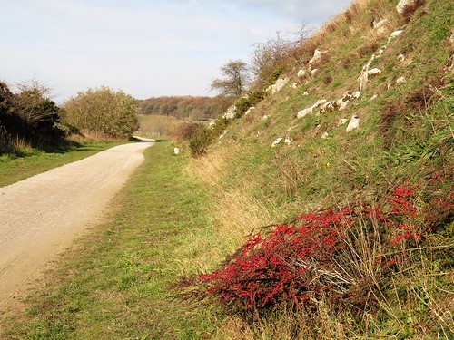
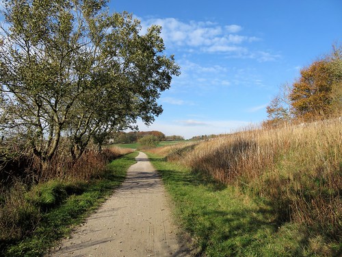
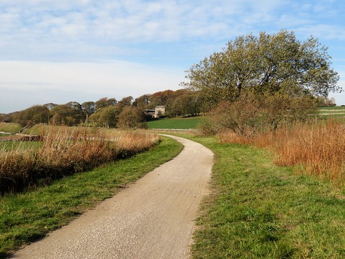
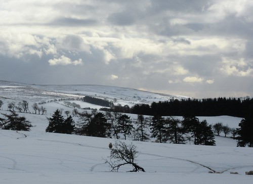
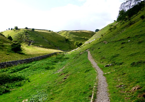
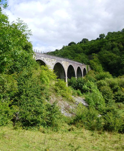
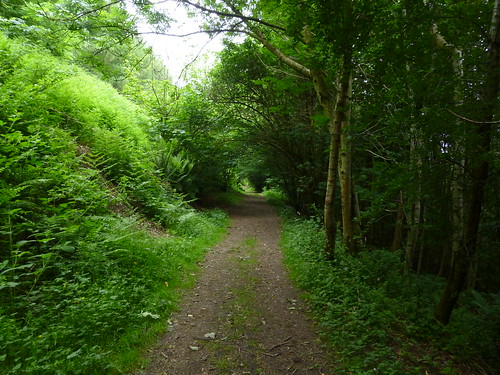
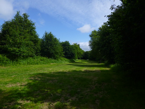
The trains of the Cromford & High Peak Railway – first drawn by horses, then by steam locomotives – ran through some of the most beautiful landscapes in the Derbyshire Peak District. Where horses once plodded with coal and limestone, and tank engines puffed with sparse numbers of passengers, cyclists and walkers now follow the narrow curves of the line, rechristened the High Peak Trail.

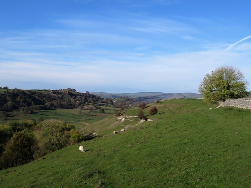
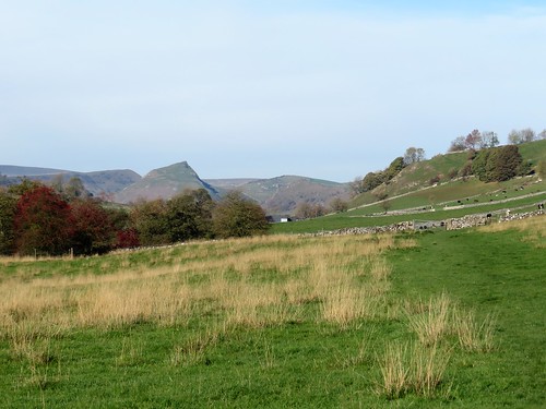
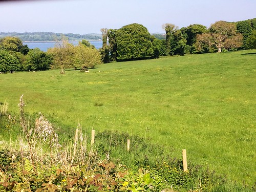
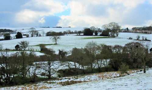
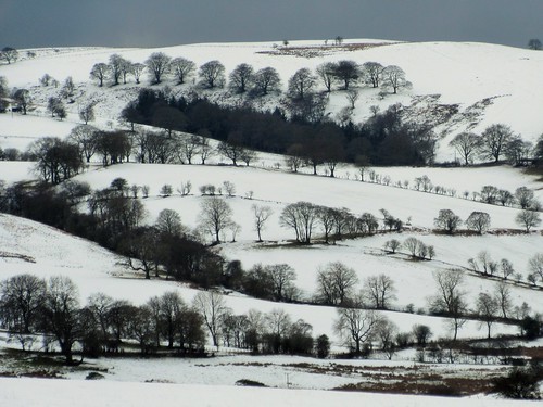
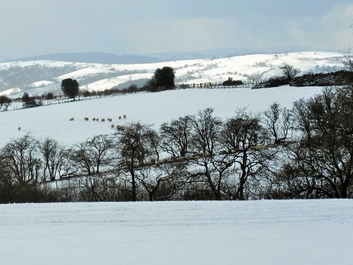
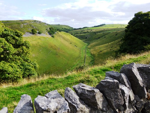
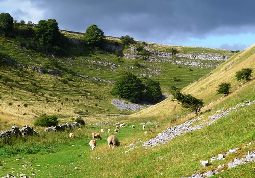
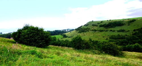
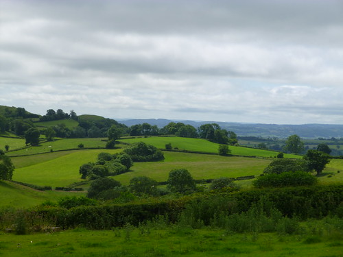
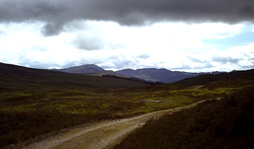
On a superb morning, crisp and cold, we joined the trail at Hurdlow. Either side the limestone landscape rolled away, intensely green under the low sun, an upland broken into sharp peaks and shadowy valleys.

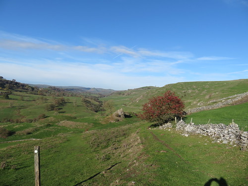
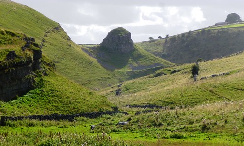
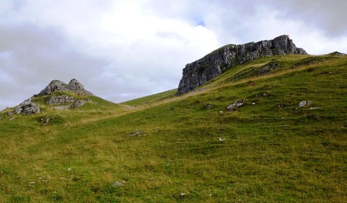
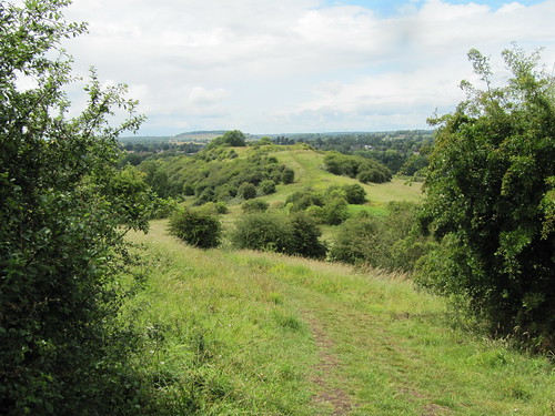
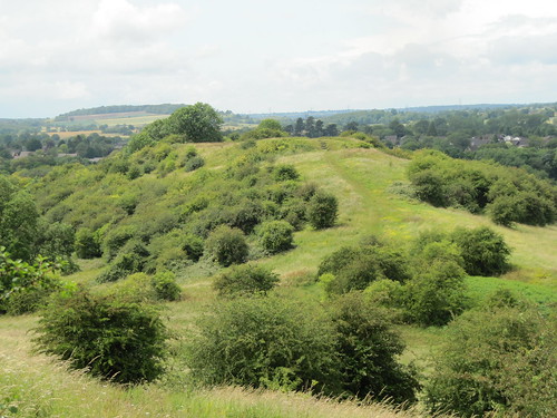
At the vast open chasm of Dowlow Quarry we left the High Peak Trail for stone-walled lanes with wonderful high prospects south into a countryside so fractured it resembled a choppy sea. A knobbly path led us in the shadow of High Wheeldon, a conical knoll presented to the National Trust as a war memorial to men of Staffordshire and Derbyshire killed in World War Two.

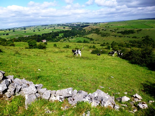
Down in the lane to Crowdecote they were herding cattle between field and farm. Those in the lane bellowed and trumpeted, and those in the adjacent fields returned the compliment. ‘Bit lively,’ grinned the farmer waiting to turn them into the farmyard.

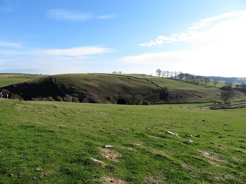
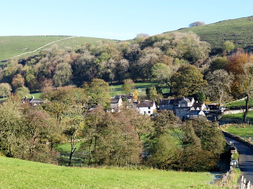
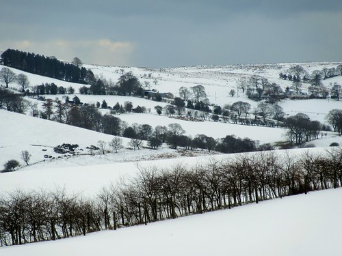
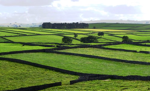
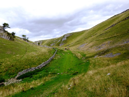
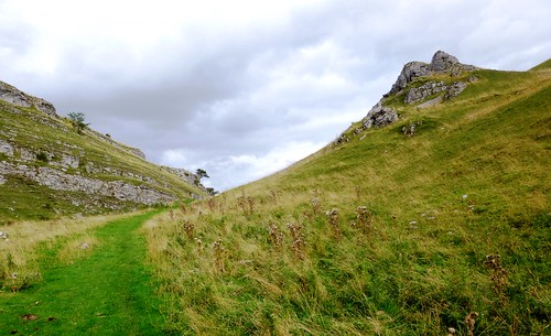
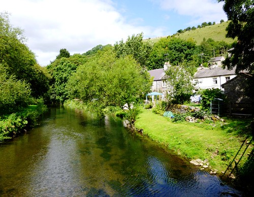
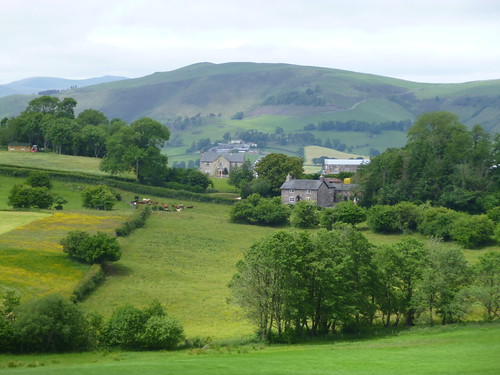
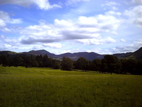
Crowdecote clung like a limpet to its steep, sunny hillside. Beyond the hamlet there was ice in the hoof pocks of the bridleway, and frost blanketing the fields on the shadowed side of the dale. Limestone outcrops scabbed the high slopes. Pale grey field walls striped the pastures, footed in their own black shadows, resembling giant claw scratches in the ground.

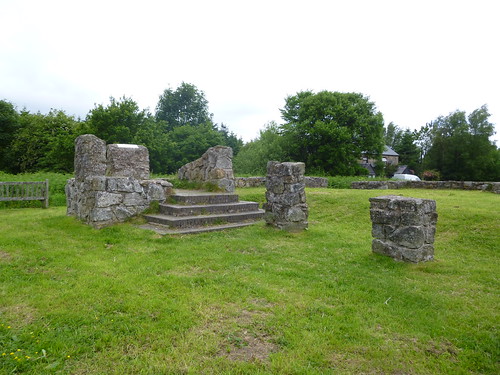
The path led past the crumpled hillocks where Pilsbury Castle once stood – a pair of baileys and a motte, built by the Normans shortly after the Conquest to levy tax on the traders that used the ancient packhorse route through the dale.

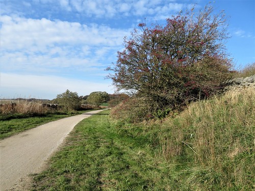
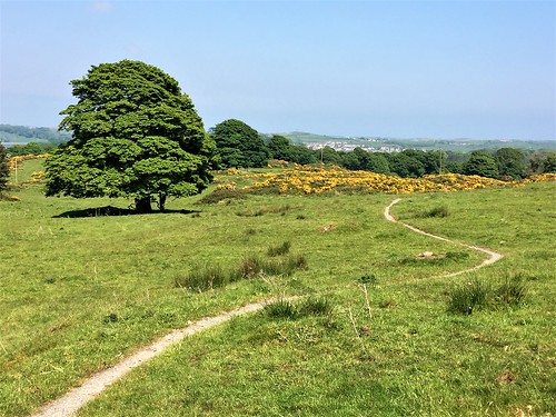
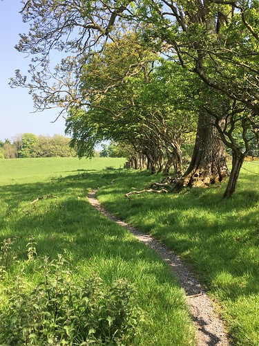
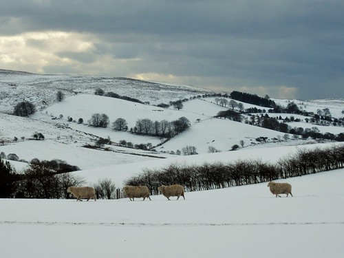
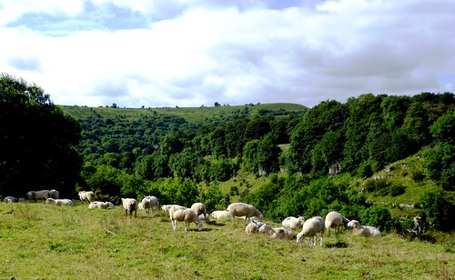
We followed the old way through uplands of sheep fields, past standing stones whose edges had been rubbed shiny by sheep easing their manifold itches. A dip and climb past Vincent House farm, another past the farmyard at Darley, and we were bowling along the High Peak Trail towards Hurdlow with sublime hill scenery unrolling on either hand.

Start: Hurdlow car park, Sparklow, Derbs SK17 9QJ (OS ref SK 128659).

Getting there: Bus 442 (Ashbourne) to Bull-i’-th’-Thorn (½ mile by footpath)
Road – Hurdlow car park is off A515 between Pomeroy and Parsley Hay.

Walk (9½ miles, cyclepath and well marked field paths, OS Explorer OL24): North-west along High Peak Trail for 1½ miles to end (111673); left on Cycleway 68. In ½ mile, right on lane (109665) to cross road at Wheeldon Trees (102662). Through gate (fingerpost) down to NT High Wheeldon notice; right downhill (yellow arrow/YA) to road. Left to Crowdecote. Just past Packhorse Inn, left along lane (101652, ‘South Peak Loop’ bridleway). Follow SPW (blue arrows) through fields. In 1 mile pass Pilsbury Castle mounds (115639); left through gate; fork left up footpath; follow YAs over hill, crossing one road (121634), then another at Vincent House farm (137632). Through farmyard (YAs); up right-hand of two parallel tracks. Follow ‘Parsley Hay’ and YAs to cross road at Darley Farm (142637). YAs through farmyard, up field edge to High Peak Trail (143639); left for 2 miles to Hurdlow car park.

Lunch: Royal Oak, Hurdlow SK17 9QJ (01298-83288, peakpub.co.uk) – busy, friendly pub near car park.

Accommodation: Ye Olde Cheshire Cheese, Longnor SK17 0NS (01298-83218; robinsonsbrewery.com)

Information: Ashbourne TIC (01335-343666); visitpeakdistrict.com; satmap.com; ramblers.org.uk

 Posted by at 01:13
Jun 032017


First published in: The Times Click here to view a map for this walk in a new window
picture picture picture picture picture picture picture picture picture picture picture
Facebook Link:

When the Ward family from Cheshire bought an estate on Strangford Lough in 1570, Ireland was a rough and dangerous place for English settlers. The fortified tower the newcomers built and named after themselves, Castle Ward, was fit for the times. But the house that their descendant Bernard Ward built two centuries later in his beautifully landscaped park was a luxury home, better suited to easier times.

Bernard and his wife Anne could not agree on an architectural style, so they settled for a pragmatic, his-and-hers solution – the south frontage conforming to Bernard’s severely classical design, the north half that faced onto Strangford Lough in Anne’s exuberant Strawberry Hill-inspired Gothic. Inside, the décor carries on the inharmonious theme: Bernard’s rooms are of plain and perfect proportion, Anne’s a riot of onion-dome plasterwork ceilings and Turkish windows.

The National Trust have laid out several colour-coded and waymarked trails through the Castle Ward woods and parkland, and we chose the Boundary Trail that skirts the demesne. There was a bizarre start to the walk, as a silhouette familiar from TV hove in view – the grim stronghold tower of Winterfell, ancestral hall of the Stark clan from Game of Thrones. Remembered as a blackened and smoking ruin full of corpses, there was a curious frisson in finding the real thing standing tall and unblemished – the original fortified tower of the Wards, commanding a really superb prospect of the silky blue waters of Strangford Lough.

Beyond the forbidding old tower the trail led away north along the lough shore, where green and orange seaweed wafted a pungent iodine whiff across the path. An old crowstepped boathouse stood out in the water on a low promontory. Across the inlet the harbour town of Portaferry lay under its hummock of a hill, guarding the narrows where Strangford Lough’s tidal waters meet the sea.

Soon we turned our backs on the lough and followed the path under a clearing sky through sycamore and oak woods carpeted thickly with bluebells. The green parkland of Castle Ward lay in sunshine, gleaming with gorse bushes and buttercup drifts. Coot chicks meandered across a rushy pond, their fuzzy scarlet heads frantically bobbing. Goldcrests twittered sweetly high in the treetops of Mallard Plantation, where bell-like white flowers of wood sorrel still nodded among their trefoil leaves.

From a viewpoint on the demesne wall we looked out west across gold and green lowlands to where Slieve Croob and the neighbouring Mourne Mountains stood veiled in warm grey haze. Then we turned back towards Castle Ward through quiet pastures where the cows and calves gazed stolidly at us before resuming their steady munching.

Start: Castle Ward car park, near Strangford, Co. Down BT30 7LS (OSNI ref J572493) – moderate charge, NT members free

Getting there: Castle Ward is signed off A25, 1½ miles west of Strangford

Walk (8 miles, easy, OSNI 1:50,000 Discoverer 21; Castle Ward Trails map available from Visitor Centre; online map, more walks at christophersomerville.co.uk): From main car park, right towards Visitor Centre. Before archway, take path on left (‘Trails, Winterfell’). Follow ‘Winterfell’ to Old Tower and gateway beyond. Left along shore, and follow ‘Boundary Trail’ and red arrow waymarks for 8 miles, back to car park.

Conditions: Very well waymarked throughout. Path is shared with cyclists. No dogs between March and October (livestock in fields).

Lunch/tea: Castle Ward teashop

Accommodation: The Cuan, Strangford BT30 7ND (028-4488-1222, thecuan.com) – friendly, family-run hotel

Castle Ward (National Trust): 028-4488-1204, nationaltrust.org.uk/castle-ward

Info: Downpatrick TIC (028-4461-2233); discovernorthernireland.com

satmap.com, walkni.com

The January Man – A Year of Walking Britain by Christopher Somerville (Doubleday, £14.99).

 Posted by at 01:56
Mar 072015


First published in: The Times Click here to view a map for this walk in a new window
picture picture picture picture picture picture picture picture
Facebook Link:
It was a cold late winter’s afternoon over the Shropshire hills when I set off from the Bottle & Glass at Picklescott; so cold that the cows were in their sheds, making the air foggy with their soft silage-sweetened breaths. The broad lowlands of the great Shropshire and Cheshire plan stretched out green and sunlit as I climbed the lane from the village. But there was a frosting of white along the upper bulwarks of The Wrekin, fifteen miles off, and when I got out into the high fields I found that the slopes of Cothercott Hill were still blanketed in snow freshly dinted with boot prints.

I followed the bootmarks southwest up the broad nape of the Long Mynd where it rose from the lowlands. This enormous whaleback upland dominates the north Shropshire landscape from afar, a billowing presence full of hidden valleys known as ‘beaches’ which only sheep and walkers know. The sheep were still out in the fields, hardy endurers of the cold, staring incredulously as I trudged by, as though they had never seen a human before. It was wonderfully exhilarating walking, with the Welsh hills in the west white-capped and whirling with localised snowstorms, and a bullying north wind to shove me roughly on and up to the ancient Portway at the crest of Wilderley Hill.

Men have been travelling the ridgeway route know as the Portway for perhaps 5,000 years, traversing the length of the Long Mynd by way of this broad green thoroughfare. The Portway was white this afternoon, its black hedges knee-deep in wind-sculpted snow. My boots creaked and crunched in the drifts as I followed the old way south, with Breughelian vistas of black-and-white winter landscapes on either hand.

At last my homeward path diverged from the Portway, and I went slipping and sliding down through the fields towards Picklescott with the temperature dropping, the afternoon light draining and the cold nipping at my fingers. In the firelit bar of the Bottle & Glass, I found a cheerful party of walkers. It was their boot prints I had been treading in all the way round. A touch of Good King Wenceslas, we all agreed.

Start: Bottle & Glass Inn, Picklescott, near Shrewsbury, Shropshire SY6 6NR (OS ref SO 435994)

Getting there: M54, A5 to Shrewsbury; A49 towards Leominster; minor road to Picklescott from A49 at Dorrington.

Walk (4¾ miles, moderate, OS Explorer 217, 241; download map/guide leaflet at bottleandglass.co.uk): From Bottle & Glass, left to crossroads; right (‘Ratlinghope’); in 30m, keep ahead (not left). In 200m, right down ‘No Through Road’ (433995; ‘Humphrey Kynaston Way’/HKW; blue arrows/BA). In ¾ mile, where lane bends right and descends, left through gate (428005; HKW; ‘Walking With Offa’/WWO; BA). Bear slightly away from hedge on right, into dip, to go through bridleway gate (426007; HKW, WWO, BA). Right up hedge for 100m; diagonally left at hedge corner, across field to hedgebank with thorn trees (426009; Shropshire Way/SW – unmarked here). Left, and follow SW for ¾ mile along hedgebank, climbing up right side of conifer wood to crest (417000). From here aim for wood ahead. In another 400m, through double gate (424997; SW, WWO, BA); half left to road (413995).

Cross, and follow lane opposite (SW, WWO, ‘Darnford Walk’). In just over half a mile, at gate across lane, left through another gate (420985; WWO, HKW). Up to fence corner (BA); follow fence on right to gate at corner of wood (421988, HKW). Right through gate; follow hedge down to next gate (424990); left along farm drive. In 400m, right at road (428995); right again into Picklescott.

Lunch & Accommodation: Bottle & Glass, Picklescott (01694-751252; bottleandglass.co.uk): cosy, lively and friendly place

Info: Shrewsbury TIC (01743-258888)
visitengland.com; www.satmap.com; ramblers.org.uk; LogMyTrip.co.uk

 Posted by at 02:09
Jan 112014
 

Litton lay stretched like a sleepy cat along its lanes; a grey stone village, typical of the Derbyshire uplands, in the embrace of green pastures and loosely knit stone walls. First published in: The Times Click here to view a map for this walk in a new window
picture picture picture picture picture picture picture picture picture picture picture picture picture picture picture picture picture picture picture picture picture picture picture
Facebook Link:
It had been too long since I’d had a good day’s walking with my London-based daughter Ruth. Crossing the fields and dropping south into the curving cleft of Tideswell Dale, we chatted away nineteen to the dozen, catching up on each other’s lives.

It’s small wonder that the Peak District is so tremendously popular with walkers, especially the very beautiful and spectacular dales or water-sculpted canyons that burrow their way through the pale grey limestone of the White Peak district. History doesn’t relate whether these strikingly beautiful surroundings were of any comfort to the 19th-century workers – some of them small children – who slaved away in the textile mills in the dank and cold dale bottoms.

In Miller’s Dale we crossed the River Wye beside the mill-workers’ terrace cottages and climbed the steep bank of Priestcliffe Lees, where young Friesian heifers put their rubbery noses over the wall to sandpaper our fingers with glutinous yellow tongues. At Brushfield the old farm-children’s school stood high among stone cottages with massive lintels, looking down into the tree-choked canyon of Taddington Dale.

Down in Monsal Dale we picnicked on a grassy shelf by the gurgling Wye, and then followed the old Buxton-Matlock railway line – now a superb cycleway – into Miller’s Dale, where Cressbrook Mill stood huge and handsome in the throat of the valley. The Brewstop Café behind the mill is run by three siblings (the oldest is 14), and their tea and cakes are a walker’s dream.

In Cressbrook Dale, up where the cleft opens grey rocky lips to the sky high overhead, a great outcrop of limestone hangs over the path – Peter’s Stone, where the bodies of executed felons were once hung in a gibbet as a terrible warning to all. Today, as we turned back along the rim of the dale towards Litton, the dark stain of the past seemed cleaned away by the low evening sun that washed the rock in a flood of gold.

Start: Red Lion, Litton, near Tideswell, Derbyshire, SK17 8QU (OS ref SK 164752)
Getting there: Bus – 173, 65, 66 (Buxton – Tideswell). Road – Litton is signed off A623 Peak Forest – Baslow road at Wardlow Mires near Tideswell
Walk (12 miles, moderate, OS Explorer OL24): From Red Lion, left along village street. Pass ‘Cressbrook’ turning; in 50m, right, then left over stone stile (166751). To far left corner of field; right along lane to road (165749). Ahead to left bend; over stile (fingerpost); follow field path/stiles to cross road (161748). On down to road (160749); left to B6049 (155748). Left for 20m; left through gate; follow wall beside road, past car park (154742) and on along Tideswell Dale. Left at ‘Quarry’ sign (154740) to quarry (155738); follow ‘Concession Path’ to steps back into dale bottom (155736). Left for ½ mile to road in Miller’s Dale (157731).
Left to cottages at Litton Mill; right (159730, ‘Monsal Trail to Miller’s Dale’) across river and up dale side. Cross Monsal Trail (158730); up steps by bridge, left over stile; up path (‘Priestcliffe Lees’), following yellow arrows/YAs. At top, through lumpy mining ground, following left-hand wall to turn left over stile (154725, YA). Right to stile into stony lane (153723). Left for ¾ mile to Middle Farm. At T-junction, left (159715, ‘Monsal Dale’). In ½ mile pass fingerpost (167717, ‘Upper Dale’), in 100m, right (‘Lees Bottom, White Lodge’) to farm track; follow it to farm (167712). Follow ‘path’ sign/YAs onto stony track beyond barn. In 200m, left (168710; fingerpost) over stile; follow stepped path down into Monsal Dale. At bottom, left (171708, ‘Monsal Head’) for 1¼ miles to viaduct (181716).
Left along Monsal Trail for nearly 1 mile. At mouth of Cressbrook Tunnel, right through gate (172724, ‘Cressbrook’) on path descending to cross river beside weir (172728). Bear right on path past Brewstop Café and Cressbrook Mill. At road, left; fork right (‘Cressbrook, Litton’); in ¼ mile, fork right (171732, ‘Ravensdale’). Pass Ravensdale Cottages (172737); in ¼ mile go through gate marked ‘Cressbrook Dale’ (172741); in 100m fork left and follow dale bottom for 1½ miles past Peter’s Rock to A623 (180756) at Wardlow Mires (NB 3 Stags’ Head PH to right). Left along A623 for 100m; left (stile, ‘public footpath’) up field wall to cross stile (177756); across field to cross stile; right up wall to road (173754); left into Litton.
Lunch: Brewstop Café, Cressbrook (weekends, school holidays); 3 Stags’ Heads, Wardlow Mires (01298-872268); Red Lion, Litton (01298-871458).
Accommodation: Cheshire Cheese Inn, Castleton, S33 8WJ (01433-620330; cheshirecheeseinn.co.uk) – bustling, cheerful place.
Info: Bakewell TIC (01629-816558); visitpeakdistrict.com;
www.ramblers.org.uk www.satmap.com www.LogMyTrip.co.uk visitengland.com

 Posted by at 01:41
Aug 172013
 

Fine old high jinks they had in former days on the hilltop of Cym-y-Bwch, the ‘Horns of the Buck’, just outside Oswestry where Shropshire looks west into Wales.
First published in: The Times Click here to view a map for this walk in a new window
picture picture picture picture picture picture picture picture
Facebook Link:
From Georgian into Victorian times, hotly contested horse races were held up here, competing for purses of golden guineas and the solid silver Sir Watkin Williams Wynn Cup. What with the drinking, gambling, pickpocketing and lewd behaviour that came to plague the occasion, the gentry stopped attending, and in 1848 the last races were run.

These days the old grassy figure-of-eight track is a favourite place to take a breather and walk the dog. The Offa’s Dyke Path National Trail runs through the Old Racecourse, and we followed its straight course along a thickly wooded scarp edge among firs that gave out a resinous, almost buttery smell. Tiny goldcrests flitted in the treetops. A brisk, blowy sky ran overhead, and huge views opened from the blue distances of the Cheshire plain to the Long Mynd and the Breidden Hills further south.

A tangle of steep lanes led out of the trees along the line of Offa’s Dyke. In the fields beyond Pentre-shannel farm we found the old rampart more than man-height, its earthen bank knitted with big oak and ash trees and burrowed to a grey tissue by rabbits that scampered for cover. By a cottage on a green lane we met a couple walking their sheepdogs ‘Oh,’ said the woman, ‘try Hafod Lane if you want lovely flowers and views.’

It proved a great piece of advice. The narrow lane runs round the flank of the knobbly hill of Mynydd Myfyr. We climbed between banks of frothy yellow crosswort, red campion, blue speedwell and little scarlet wild strawberries to a superb view west over green lumpy country towards the higher Welsh hills – a steeply folded landscape nurtured and shaped by sheep and cattle farming, but somehow retaining a smack of wildness.

We found a path skirting the northern slope of Mynydd Myfyr. A lonely farm lay there, so deep in its cleft that only its roof showed until we were right on top of it. We crossed fields of lush grass and descended flower-bordered lanes, then headed back into the woods once more. A stiff climb, a shady tunnel of firs, and we were up at the Old Racecourse, on the Horns of the Buck, with the wind in our faces and a fifty-mile view to savour.

Start: Oswestry Old Racecourse car park, Shropshire, SY10 7HL approx. (OS ref SJ 258305).

Getting there: Signed to left off B4580 Rhydycroesau road, 2 miles west of Oswestry.

Walk (7½ miles, moderate, OS Explorer 240): Turn left along grass track of Old Racecourse to Janus Horse sculpture (257303). Left here along Offa’s Dyke Path/OD (yellow arrows/YA, OD acorn symbols) for 2 miles, passing Pentre-shannel farm (257279) to reach a lane (258274, ‘Trefonen ½ mile’). Leave OD and turn right to T-jct. Over stile (YA, ‘50’ logo), up hedge, through gate (254273). Aim a little right of white cottage opposite, crossing 2 fields (stiles, YAs) to green lane (250273). YA points right, but go left to road by cottage.

Left along lane for ¼ mile to junction just past New Barns (250269). Right here through gateway and up drive. Through gate, on along right side of barns; follow track across 2 fields to cross stile on right of gate (245268). Right up Hafod Lane round Mynydd Myfyr for a little over ½ mile; turn right over stile (243277, ‘footpath’) up hedge to stile (YA). Follow fence on left (YAs, stiles) to Pant-y-ffynon farm. Right into grassy drive (247277, YA), left along it. Through gate, immediately right over stile (YA); half left across field to cross stile to left of gate (249276, YA). In bottom right corner of next field, stile into lane.

Left; in 100m, right over 2 stiles close together (250277); half right across field to go through hedge gap a little to right of tall trees (249279). Keep parallel to the upper hedge, down to cross stile, right along track to road at Croesau Bach (247280). Cross road; bear right along lane opposite for ⅔ mile, down to bear left across bridge (256282). Follow Offa’s Dyke Path for ¼ mile back into Candy Wood. Where OD turns right (254286), go left along woodland track. At first fork after that, go left (YA); at next fork, go right (252288, YA) for 600m along bottom of wood with river on left. Track then rises steeply to rejoin OD (255298); left to Old Racecourse car park

Lunch: Picnic; or Barley Mow, Trefonen (01691-656889; offasdykebrewery.com)

Accommodation: Helen Gilbert, The Pentre, Trefonen, Oswestry, postcode (01691-653952; thepentre.com) – first class, friendly B&B; evening meal by arrangement.

Information: Oswestry TIC (01691-662753/662488)

www.ramblers.org.uk www.satmap.com www.LogMyTrip.co.uk

 Posted by at 01:51
May 262012
 

‘Heavy rain showers’ smiled the weatherman at 7 o’clock in the morning. ‘Some of them prolonged…’
First published in: The Times Click here to view a map for this walk in a new window
picture picture picture picture picture picture picture
Facebook Link:
The sky was freighted with rollers of rain cloud, but I spied intense silver gleams among them. Anyway, a drop of rain never hurt anyone, did it? I waited out a shower that glistened the red roofs and half-timbered walls of Henley-in-Arden, and struck out east into the country of the Forest of Arden.

The Forest that Shakespeare knew and made immortal had shrunk from its former expanse between the rivers Tame and Avon by the time he explored it as a boy. But it was still a wild place. The Romans barred it in with boundary roads, but they never built through the forest or tamed it. Nowadays Arden is a rolling mixture of pasture and cornfields, old hedges, fine solitary trees and thick clumps of woodland, more of a mosaic than a single impenetrable wilderness.

Well-marked paths carried me through this rich farmed Warwickshire landscape, past houses done up and furnished with paddocks, horses and new plantations of broadleaved trees. One reminder of the region’s deep-rooted industrial heritage lay threaded through the countryside – the sinuous, narrow course of the Stratford-upon-Avon Canal. Once the carrier of bricks, blocks, iron and coal to Brummagem, now its cargo consists of white-bearded gentlemen in sailor caps cruising at ease under the alders.

On densely wooded Yarningale Common I lost my way, but it didn’t matter – all paths hereabouts seem to lead to Valley Farm and the fields once more. At Peacock Farm the rain caught me a sharp smack, and I sheltered under a sycamore’s big leaves till the weather had rumbled and rolled off elsewhere. As soon as the sun came out, so did the insects, and the swallows after them, hawking low over the wet hayfields, some dilatory farmer’s regret.

By Lowsonford’s Church of St Luke, a squat ark of red brick stabilised with massive buttresses, I took to the road. Beyond the humpy canal bridge and barrel-roofed lock keeper’s cottage, the Fleur-de-Lys Inn trumpeted its famous pies. Well, you can’t ignore that sort of thing. The pub delights in the tale of a Frenchman who chopped up an English spy and sent him back to England baked in a pie with a pastry fleur-de-lys on top. I heard that after I’d wolfed my own Matador Pie, and had an interesting moment or two.

The homeward path was along the Heart of England Way, beautifully waymarked and clear to follow. A field full of colts staring hard like B-Boys; the enormous Tudorbethan rebuild of Holly Bank Farm; showers in huge blocks tumbling through the sky; the rain-slicked mound of Beaudesert Castle outside Henley. A wonderful walk, in all – nothing dramatic, but everything to do with England on a rainy summer’s day.

Start & finish: Henley-in-Arden station, B95 5JH (OS ref SP 148659).

GETTING THERE: Rail (www.thetrainline.com; www.railcard.co.uk) to Henley-in-Arden. Bus service X20 (Birmingham-Stratford), Flexibus 517 (Wootton Wawen-Redditch).
Road: M40 Jct 16; A3400.

WALK (8 miles, easy/moderate, OS Explorer 220):
From Henley station to High Street, right to church; left down Beaudesert Lane. At end (153660), forward along brick-walled path. Follow yellow arrows/YAs along side of Beaudesert Castle earthworks. Pass school; at path junction turn right down side of school. Cross road; up lane; cross playing field and climb steps. Follow YAs to cross Edge Lane (160658). Take right-hand of 2 gates; halfway across field, don’t turn right, but keep ahead (YA). Over stile and field, to next stile. Right (163658, YA) in tunnel of trees. In 50 m, left over stile (YA). Ahead across fields (YAs) for ⅔ mile to cross road by Church Farm (173660). Up green lane (YA; ‘Church’). Pass to right of church (174660); cross lane and on (YAs) through fields to cross Stratford Canal (179658).

In field beyond, left along hedge next to canal. At end of field, left over stile (182659); aim away from canal for far upper corner of field (183660). At post with arrows, uphill with hedge on left; follow YAs past rugby pitches to stile (186659). Ahead (arrow) through trees along north side of Yarningale Common to road (189658). Left, then left down Yarningale Lane. In 30 m, right (YA) up bank through right-hand of 2 sets of barriers, on up through trees. In 100 m at top of rise, right along grass ride. In 50 m through barrier (YA) and take middle of 3 paths, to left of oak tree, going downhill. In 100 m path bears right to road. Left to Valley Farm (182661). Right past YA on post; don’t fork immediately right, but keep ahead. Ignore stile with YA; ahead into green lane. Follow this for ⅓ mile; just before left bend (196663), left over stile (YA). Along hedge, through kissing gate (YA); follow path over 2 fields to farm drive just right of Peacock Farm (194667).

Left past farmhouse. Follow BA through kissing gate and along green lane. In 350 m cross stream (195670); in another 200 m, through kissing gate (196671, BA). YA and BA are to your right, but keep ahead for 20 m, then left along field edge. Through kissing gate; diagonally across next field to hedge, right along it for 2 fields (YA). In 3rd field follow fence on right over crest, down to road by chapel (190676). Left along road to cross canal; right past Fleur-de-Lys pub (188678) in Lowsonford.

At phone box on crossroads, left (186680; YA; Heart of England Way/HEW) up road. Now follow well-marked HEW for 1 mile to Coppice Corner Farm drive (175677), left across old railway and down to road (174673). Right round bend; left (HEW) to cross Holly Bank Farm drive (173672). Go through hedge gap; diagonally left across field; through kissing gate and up hedge. Follow HEW for 1½ miles by Hungerfield Farm (165669) and Edge Lane (163667) to cross Beaudesert Castle ramparts (155661) and descend to Henley-in-Arden.

LUNCH: Fleur-de-Lys Inn, Lowsonford (01564-782431; www.fleurdelys-lowsonford.com) – try the pies!

ACCOMMODATION: Henley Best Western Hotel (01564-794551; www.bestwestern.co.uk) – very friendly and helpful.

Subscriber Walks: Enjoy a country walk with our experts. Next walk: Tibbie Shiel’s Inn, Selkirkshire, Scotland, 10 June. Email timespluspartners@newsint.co.uk to book. Tickets £10.

Breast Cancer Care’s Pink Ribbon Walks:
0870-145-0101; www.pinkribbonwalk.org.uk. Petworth House, West Sussex, 26 May; Cholmondeley Castle, Cheshire, 9 June; Marble Hill Park, London, 16 June

Info: Warwick TIC (01926-492212); www.visitcoventryandwarwickshire.co.uk
www.ramblers.org.uk www.satmap.com www.LogMyTrip.co.uk

 Posted by at 04:11
May 192012
 

Young men and women in white helmets and blue jumpsuits were throwing themselves over the Falls of Bruar like salmon in reverse.
First published in: The Times Click here to view a map for this walk in a new window
picturepicture picture picture picture picture picture picture
Facebook Link:

I stood on the brink of the flood-sculpted gorge and watched them leap from a ledge under the none-too-tender persuasion of their gung-ho instructor, plummeting down to smack into a pool 30 feet below.

What would the 4th Duke of Atholl, one of the grandest of 18th-century Highland Lairds, have made of such forward behaviour on his estate? He suffered a bit of teasing from Robert Burns after the poet visited the Bruar Water in 1787. Burns was dismayed at the bareness of the moorland that enclosed the famous falls, and composed The Humble Petition of Bruar Water to give His Grace a respectful push in the silvicultural direction:

‘Would then my noble master please
To grant my highest wishes,
He’ll shade my banks wi’ tow’ring trees,
And bonie spreading bushes.
Delighted doubly then, my lord,
You’ll wander on my banks,
And listen mony a grateful bird
Return you tuneful thanks.’

These days, forests of larch, silver birch and Scots pine shade the Falls of Bruar, and a good stretch of mountainside beyond. I crossed the upper of two ornate bridges over the roaring falls, and found a woodland path that climbed steadily up towards the open moor. Roe deer fled away between the pines, and a red squirrel lingered at the end of his branch to watch me out of his territory.

The track left the trees, running for miles on the fringe of the wide moorlands around Glen Banvie. Ahead the rugged blue profiles of Carn Liath and Beinn a’ Ghlo stood tall and seductive on the eastern skyline. Then it was back into the forest, down to Old Blair and the ancient ruined kirk of St Bride. John Graham of Claverhouse, ‘Bonnie Dundee’, was buried here in July 1689 after dying of the wounds he received while leading his Highlanders to victory over Government troops at the Battle of Killiecrankie a few miles away.

A stretch across the beautiful parkland of Blair Castle, a final mile through the forest, and I was crossing the Falls of Bruar once more – the only river in creation to address its owner in prideful verse:

‘Here, foaming down the skelvy rocks,
In twisting strength I rin;
There, high my boiling torrent smokes,
Wild-roaring o’er a linn:
Enjoying each large spring and well
As Nature gave them me,
I am, altho’ I say’t mysel’,
Worth gaun a mile to see.’

Start & finish: Falls of Bruar car park, Bruar, near Blair Atholl, Perthshire PH18 5TW (OS ref NN 820660)

Getting there:
At junction of A9 and B8079, at Bruar, 3 miles west of Blair Atholl

Walk: (11½ miles, moderate, OS Explorers 386, 394): Follow Falls of Bruar Walk (signed behind House of Bruar) to cross Upper Bridge (820669). Path returns down opposite bank. In 350 yards, at seat in clearing, 2 paths fork left (820666). Follow left-hand path to T-junction (826666); left up forest road. In ⅓ mile, fork left on grassy track (824670; post with red arrow). Follow it for 3¾ miles north through Glen Banvie Wood, then south-east down Glen Banvie to enter Whim Plantation (853677); descend to tarmac road (868667). Right past Old Blair; walled road to T-junction on avenue (864665). Left; follow road for 1¼ miles to enter woodland. In 200 yards, at 5-way junction, hairpin back right (843660). In ¼ mile follow track round left bend (846663). Continue for 1¼ miles through forest to pass through gateposts (827666); in 100 yards, left (‘Falls of Bruar’); cross Lower Bridge (819664); return to car park.
NB Steep unguarded drops beside falls!
Click on Facebook “Like” link to share this walk with Facebook friends.

Lunch: Picnic.

Accommodation: Moulin Hotel, Moulin, Pitlochry (01796-472196; www.moulinhotel.co.uk)

More info:
www.athollestates.co.uk; www.visitscotland.com/surprise

Ballater Walking Festival, 19-25 May – 01339-755467; www.royal-deeside.org.uk/RDnews/walkweek
Breast Cancer Care’s Pink Ribbon Walks: 0870-145-0101; www.pinkribbonwalk.org.uk. Next walks: Petworth House, West Sussex, 26 May; Cholmondeley Castle, Cheshire, 9 June
Subscriber Walks: Enjoy a country walk with our experts. Next walk: Tibbie Shiels Inn, Selkirkshire, Scotland, 10 June. Email timespluspartners@newsint.co.uk to book. Tickets £10.
www.ramblers.org.uk www.satmap.com www.LogMyTrip.co.uk

 Posted by at 01:27
May 072011
 

The rolling landscape where Gloucestershire shades into Oxfordshire is thickly woven with footpaths and studded with villages of mellow gold stone.
First published in: The Times Click here to view a map for this walk in a new window
picture picture picture picture picture picture picture picture
Facebook Link:
In this north-east corner of these delectable hills you can walk in classic Cotswold countryside, but without those camera-clicking Cotswold crowds. However, if you would like to hook up with a merry bunch of fellow-walkers … then 21 May is the date for your diary. That’s when thousands will be converging on Blenheim Palace for the Breast Cancer Care charity’s annual Pink Ribbon Walk – 10 or 20 miles (you choose) through gorgeous countryside to raise money and awareness, to hear and share stories, and to have a damn good party into the bargain.

On a brilliant day of blue sky and balmy weather Jane and I set out to explore this overlooked corner of the Cotswolds. From Stonesfield, as pretty as a picture among its trees, the Oxfordshire Way took us up among big yellow fields of oilseed rape where yellowhammers in the hedges wheedled for a-little-bit-of-bread-and-no-cheeeeese. An invisible lark poured out song like the trickle of a brook. Views were big and broad, with a heat haze softening the dark green of spinneys and windbreak woods.

Down in the valley of the River Evenlode, swallows skimmed the stone-tiled roofs of Fawler. Dark Lane led us between hedges carefully tended by the Friends of Wychwood Hedge-laying Group, up a cowslip-spattered valley to Finstock. On through the environmentally-friendly farmland of Wilcote Farm with its generous field headlands and vigorous patches of yellow archangel. All around lay evidence of a countryside loved and cared for, its wildflowers and birds given the elbow-room they’re so often denied in more rapaciously farmed regions.

At North Leigh we went into St Mary’s Church to admire the north chapel with its fan vaulting and richly carved 15th-century alabaster tomb of Sir William Wilcote and his wife Elizabeth. Over the chancel arch hung a splendid medieval Doom painting, the Saved and the Damned all naked and prayerful, with a coal-black Devil and his red-faced acolytes jeering the Damned into eternal fire. Outside, all seemed a dream of peace – horses cropping the meadows near Holly Court Farm, the smooth gurgle of the Evenlode round its meandering bends, and the splashing and laughter of picnicking families by the river as we made our way back up the old cart track to Stonesfield.

These Oxfordshire Cotswolds really are beautiful country. I wish I could be a fly on someone’s trainers on 21 May. The Pink Ribbon walkers are going to have the most amazing day of it.

Start & finish: near St James’s Church, Stonesfield OX29 8PT (OS ref SP 394171)

Getting there: Train (www.thetrainline.com; www.railcard.co.uk) to Charlbury.
Bus (www.stagecoachbus.com) service S3 (Charlbury-Oxford).
Road: Stonesfield is signed off A44 Woodstock-Chipping Norton.

Walk (8½ miles, easy, OS Explorer 180): Park in ‘square’ (actually a triangle!) by St James’s Church, Stonesfield. With your back to church, bear left along High Street. Opposite Methodist chapel, left down walled lane (‘bridleway’). At bottom, cross road and go up stony bridleway (390173; ‘Oxfordshire Way/OW’). In 400m, ahead over crossroads along tarmac lane. In another 400m pass end of woodland belt. Road bends right by Hall Barn Farm Cottages, but keep ahead here (383177; blue arrow/BA) through gate (OW) and on down right side of hedge. In ½ mile, at crossing of bridleways, left off OW (375180) on bridleway (BA) descending to Fawler. Left along road. Opposite bus stop, right down lane (372170; ‘Finstock 1’ fingerpost). Cross under railway and over River Evenlode. Follow path on far bank and through shallow valley. Keep ahead at ‘Right of Way’ arrow among trees (368166); on up Dark Lane to Finstock.
Right past Plough Inn (362161); left up side of Plough (fingerpost) on path on right side of pub car park. On (yellow arrow/YA) through kissing gate, up field edge. At far end, through kissing gate (362159); don’t turn right here, but keep ahead with hedge on left. Path doglegs left and right, then crosses field; through Ramsden Mill Longcut woodland strip (364156); on along wide field paths to road (367151). Left for 20m; right (‘Wychwood Way’/WW fingerpost) through Holly Grove wood. At end of wood (372143), on along hedgeside track (YA) for 2 fields to turn left along North Leigh Lane. In 300m pass footpath diverging to left (374136; fingerpost); on next bend, bear left (‘WW’ YA) along path in tunnel of trees. In 400m, right along End Farm drive (379134); in 20m, left (‘Church ½’ fingerpost) across fields (kissing gates, YAs) to St Mary’s Church, North Leigh. (NB For Woodman Inn or Mason’s Arms, turn right from church to top of hill, then right to pubs).
Continuing walk from church – left along road; in 20m, left (‘bridleway’ fingerpost) along farm drive. In 400m, right over stile and down hedge; cross brook (385140), through gate and up fence to road (386143). Left for 50m; right down Holly Court drive (‘Bridleway, Ashford Bridge 1’). At buildings bear right to T-junction (386147); left and continue, following BAs by brook for ½ mile to road near Ashford Bridge (385154). Right to crossroads by bridge; right (‘East End, Hanborough’), following path on right bank of Evenlode (‘Stonesfield 1½’ fingerpost). Under railway; on to kissing gate; aim across meadow to cross footbridge (383164). Up cart track opposite; at road, forward to Stonesfield ‘square’

Walk as described covers only part of Pink Ribbon Walk.
Lunch: Plough Inn, Finstock (01993-868333; www.theplough-inn.co.uk); Woodman PH (01993-881790) or Mason’s Arms (01993-882005), North Leigh.

Breast Cancer Care (www.breastcancercare.org.uk) Pink Ribbon Walks 2011 at Scone Palace, Perthshire (14 May); Blenheim Palace, Oxfordshire (21 May); Cholmondeley Castle, Cheshire (4 June); Petworth House, West Sussex (11 June). Info: 0870 145 0101 or www.pinkribbonwalk.org.uk

Isle of Man Walking Festival 2011: 15-20 May (01624-664460; www.visitisleofman.com)
Llanelli Festival of Walks, Carmarthenshire: 27–30 May 2011, www.llanelliramblers.org.uk

www.ramblers.org.uk www.satmap.com www.LogMyTrip.co.uk

 Posted by at 02:11