Search Results : cornwall

Jan 212023


First published in: The Times Click here to view a map for this walk in a new window
Higher Tramway through the Luxulyan Valley woods Treffry Viaduct in the woods 1 path to the top beside Treffry Viaduct Treffry Viaduct in the woods 2 old winding gear for the incline in the woods railway through Luxulyan Valley eratic boulder off the Saints Way Treffry Viaduct spans the Luxulyan Valley

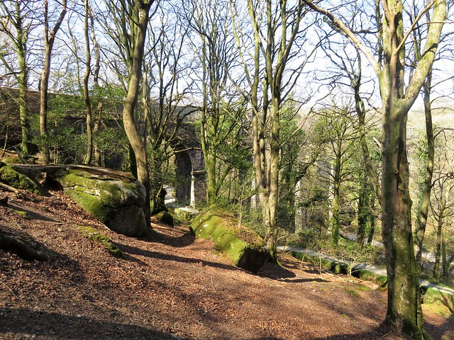
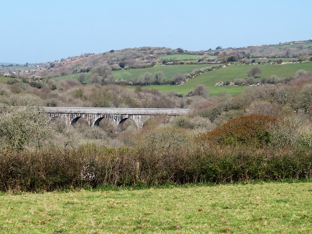
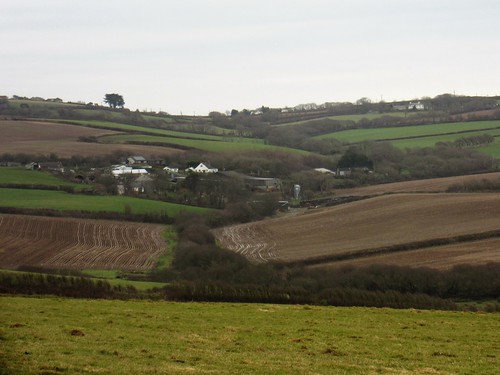
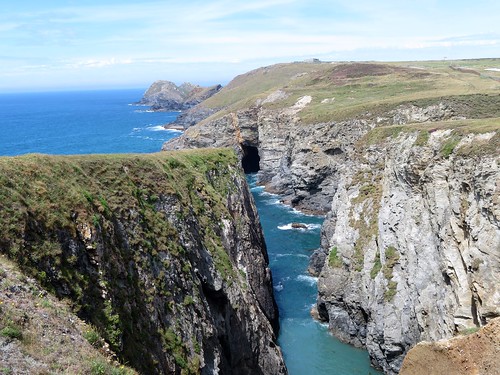
Birdsong was loud in the trees of the Luxulyan Valley on a morning of brilliant sunshine. Among the mossy trunks of oak and beech the giant legs of an aqueduct stepped across the ravine, a scene from a post-apocalyptic dream.

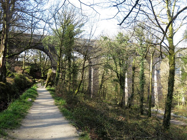
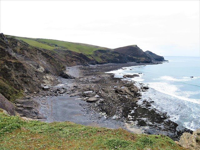
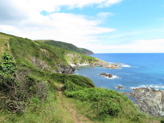
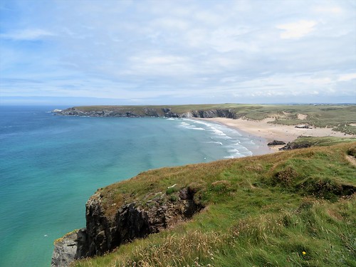
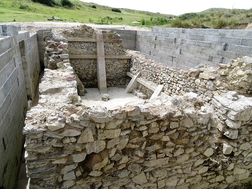
All over Cornwall, the landscape goes hand-in-hand with the architecture of long-dead industries, most notably here in the twisting valley that winds down towards the china clay port of Par. When Joseph Treffry built the structure that served as aqueduct and viaduct across the Luxulyan Valley in 1839-42, it was just one piece in a great jigsaw of tramroads, watercourses and railways this powerful engineer and industrialist created to link up his copper and tin mines and granite quarries with the ships and quays he operated down on the coast.

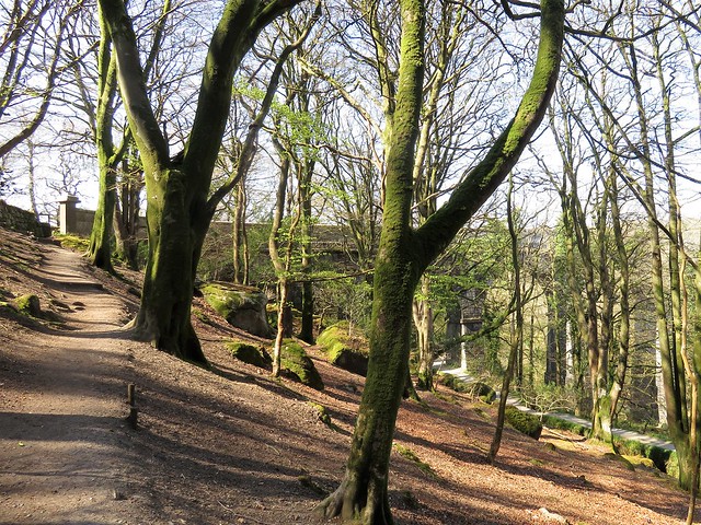
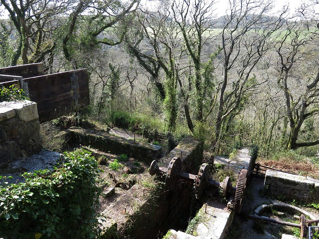
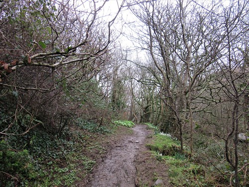
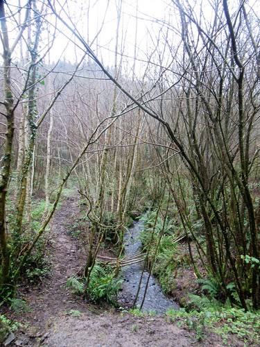
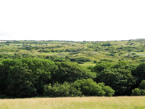
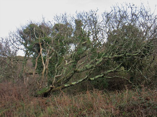
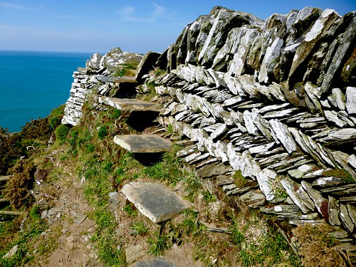
Nowadays the Luxulyan Valley is a showpiece of beautiful woodland where liverworts and mosses thrive in the stonework of Treffry’s redundant tramways and water gurgles seductively along his abandoned leats.

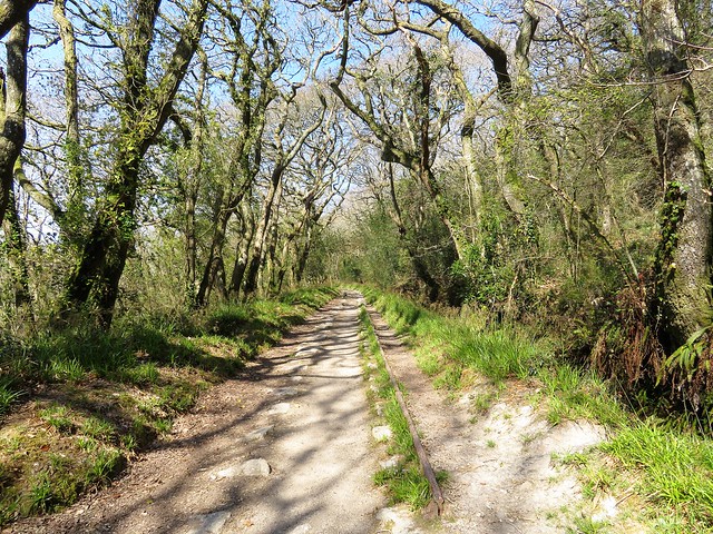
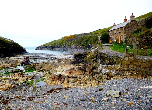
From the eastern end of the viaduct we followed the granite setts and rusted rails of the Higher Tramway beside the ferny channel of Carmears Leat, then down a long steep incline. Wagons of coal for the steam engines that pumped out the mines were drawn up this tremendous slope; tin ore rattled down in the opposite direction, heading for the port.

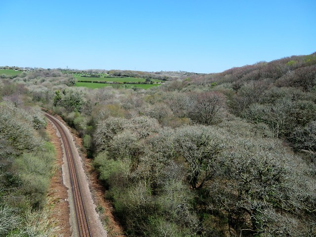
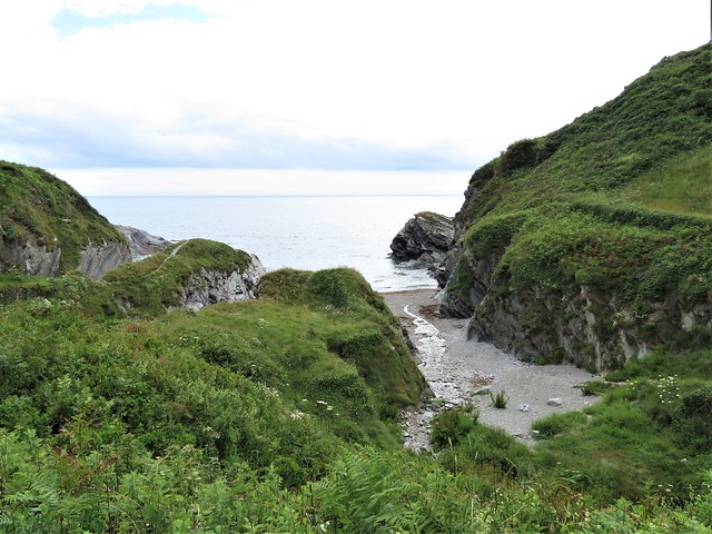
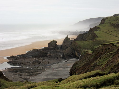
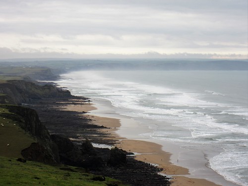
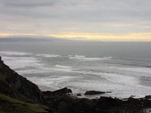
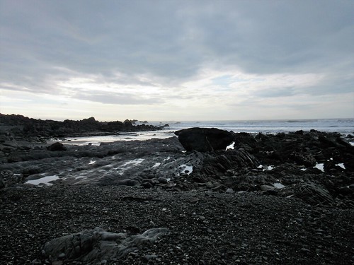
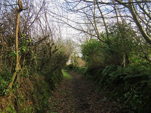
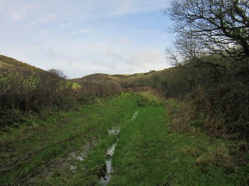
At the foot of the incline a chalky grey lane shadowed a tangle of railway lines along the flat valley bottom where glossy horses grazed and the stream beds sparkled with chips of mica. A swift blast of traffic fumes and noise at the level crossing in St Blazey, and we were heading away and up through quiet beechwoods on the Saints Way path.

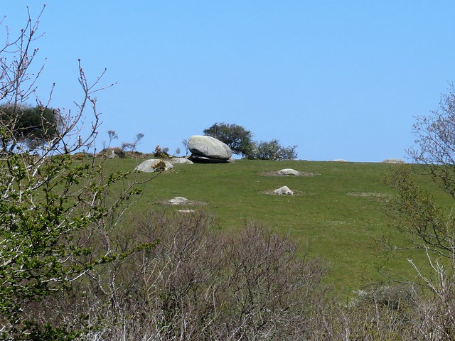
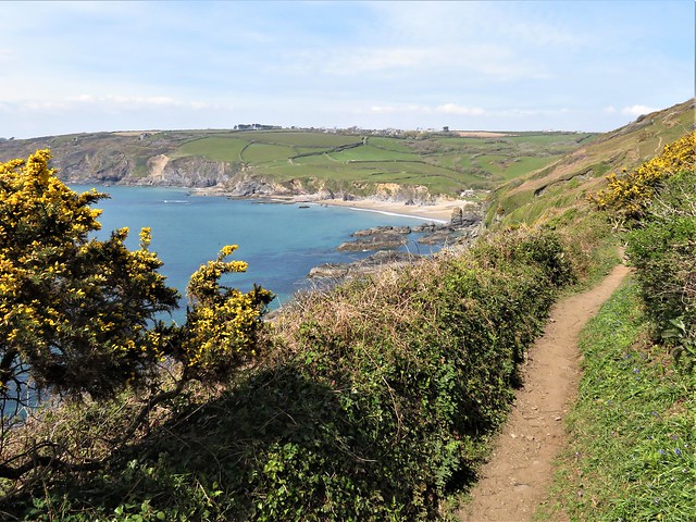
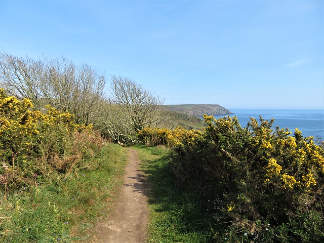
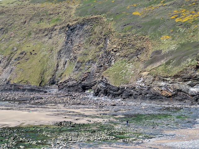
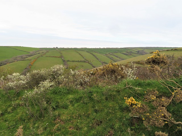
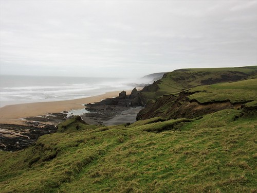
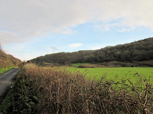
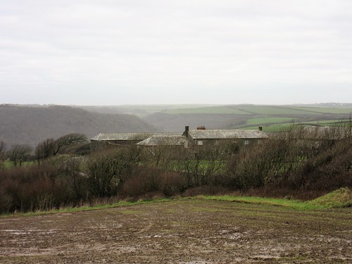
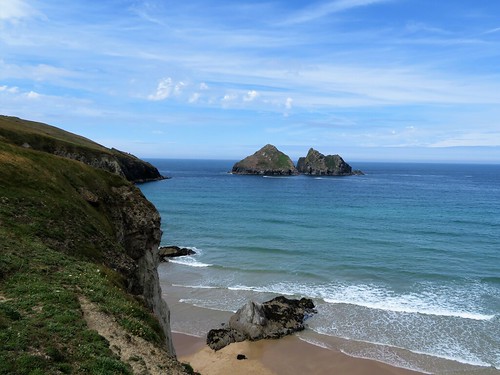
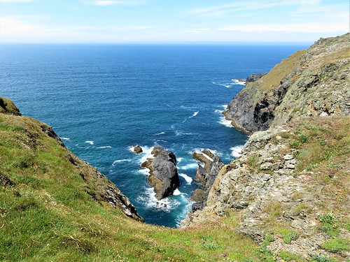
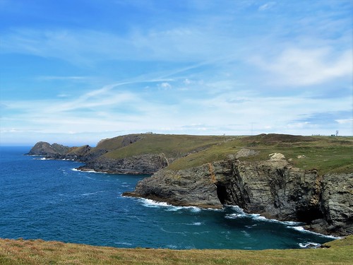
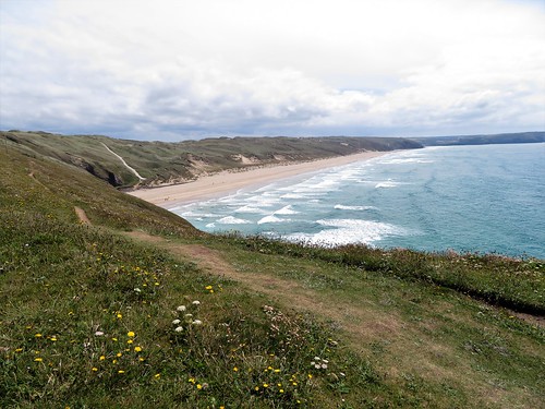
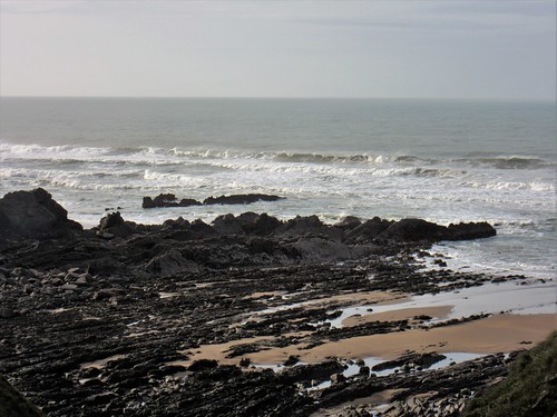
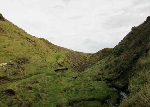
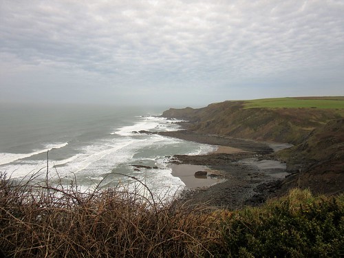
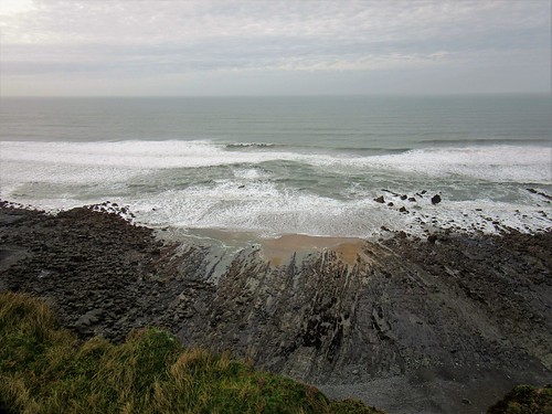
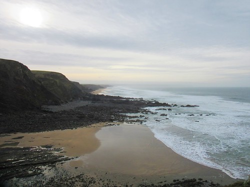
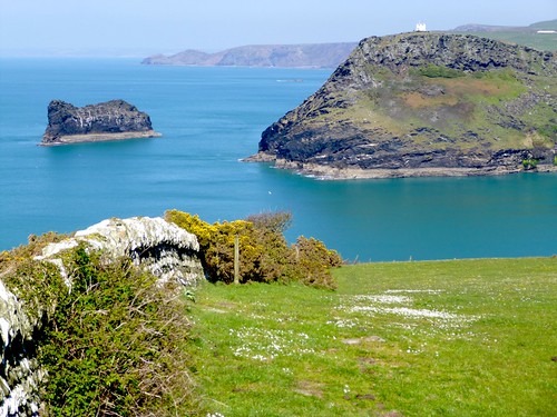
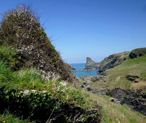
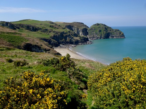
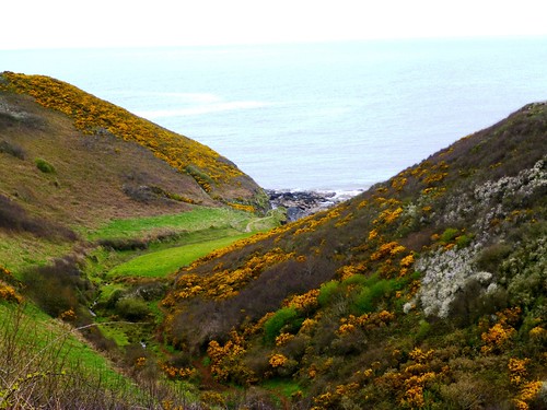
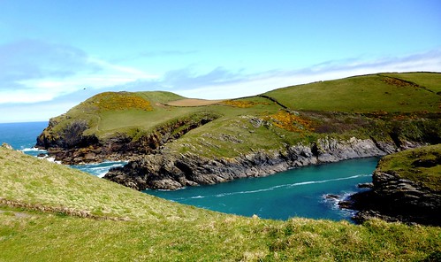
Dark Ages pilgrims and holy wanderers used this ancient route across the Cornish peninsula to shorten the perilous sea journey from Ireland to the Continent. The Way led us north across undulating farmland with glimpses of the sea and of the Cornish Alps, pyramidal china clay tips, once dazzling white, now greening over.

Soon a run of stone arches, pale grey and ghostly, floated into view above the trees of the Luxulyan Valley, and we dropped down to cross the Treffry Viaduct in woodland now hushed with the approach of nightfall.

How hard is it? 5 miles; easy; woodland, farmland tracks; many stiles on homeward leg.

Start: Black Hill car park, Luxulyan PL24 2SS approx (OS ref SX 059572)

Getting there: Luxulyan Valley is signposted from Luxulyan (signed from A390 at St Blazey, A391 at Lockengate).

Walk (OS Explorer 107, interactive map at luxulyanvalley.co.uk): Up steps by info boards; right along leat; in 30m, left up woodland path to Treffry Viaduct (057571). Left; in nearly 1 mile, at foot of incline (070563), ahead along lane. Follow lane; then from Ponts Mill (073561) follow old railway track south to A390 in St Blazey (071551). Right; in 100m, right (‘Luxulyan’). In half a mile, right (062553, ‘Saints Way’/SW) up woodland path. In 100m bend right along edge of woodland. Follow SW (cross logo, yellow arrows/YA) past Nanscawen (060554), Great Prideaux (058558), Trevanney Farm (056566) and on across fields for 1½ miles. Descend into valley. Just before bridges, right off SW (053574, YA). In 50m cross stile into field; in 100m, left at cross-paths to gate onto old tramway (055573). Right across Treffry Viaduct and retrace outward route to car park.

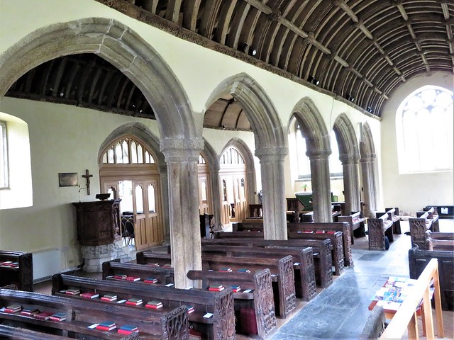
Lunch: King’s Arms, Bridges PL30 5EF (01726-850202, kingsarmsluxulyan.org)

Accommodation: Old Vicarage, Luxulyan PL30 5EE (01726-858753, tovl.co.uk)

Info: Friends of Luxulyan Valley (luxulyanvalley.co.uk)

 Posted by at 05:13
Apr 162022


First published in: The Times Click here to view a map for this walk in a new window
Looking down on Vault Beach Coast path approaches Vault Beach small copper butterfly looking back on Gorran Haven coast path winds towards Vault Beach the lone house on Vault Beach descending to Vault Beach Vault Beach common lizard pretends it's a log looking back to rugged promontory coast path through the gorse Caerhays Castle behind Porthluney Cove

Looking back from the coast path as we climbed out of Gorran Haven, we saw the old pilchard-fishing port as a tumble of solid stone houses, whitewashed under grey slate roofs. A bold swimmer in a red bathing dress was just stepping gingerly into the icy green shallows of the harbour.

A massive L-shaped granite breakwater spoke of the village’s past; the present lay in plain view along the clifftops opposite, a flotilla of modern houses with glass walls looking seaward.

The path ran south to Maenease Point along banks of primroses. An astonishing display of violets, too, thickly carpeting the slopes in shades ranging from deep purple to the palest blue. White elbowed into the colour contest in the shape of stitchwort, fat-bladdered sea campion, and the hanging bells of three-cornered leek.

A flowery coastal spring walk in a thousand, up and down along the cliffs by way of flights of steps that soon had my knees complaining. A catamaran idled past with a faint putter of engines, while further out to sea a little scarlet trawler lay at work under a swirling cloud of herring gulls.

It was a day for walking slowly, stopping often to look at what was happening right under our noses. Congregations of St Mark’s flies had just hatched, the large black males trailing their legs like seaplane skids as they circled the flowering gorse bushes in jerky flight, the females crouched motionless below on the bright yellow petals.

A great black-backed gull, the bully of the coastal skies, emitted harsh barks like an over-excited terrier as it showed an intruding buzzard out of its territory. In the gorse a great outbreak of twittering among the goldfinches feeding there, followed by a deathly silence, gave warning of a kestrel that floated in slow circles over the slopes, head down as it looked for the ultraviolet scent trails left by voles, or the sudden movements of small birds.

The cliff path skirted the long curve of great sand at Vault Beach, a young couple with their dog the only occupants this morning. Just beyond the bay we crossed through the bushy rampart of The Bulwark, an Iron Age earthwork built to seal off the outer extremities of Dodman Point’s blunt-nosed promontory.

From the big granite cross that makes a seamark out at the tip of the headland we looked south to misted lines of cliffs, south as far as the long bar of the Lizard, north to Nare Head and the slanted sea stack of Gull Rock. On the northern skyline marched the Cornish Alps, tall conical spoil-heaps of the declining china clay industry, their dazzling whiteness now greening over.

More steps, more clifftop rambling. An ice-cold paddle in the surf on deserted Hemmick Beach, then on past the jagged rock pinnacles at Lambsowden Cove, and down through the sycamore woods to the broad sands of Porthluney Cove under the battlemented walls of Caerhays Castle.

How hard is it? 5 miles; moderate coast walk; some steps and steep sections

Start: Gorran Haven, near Mevagissey PL26 6JG (SX 013416)

Finish: Caerhays car park, Porthluney Cove PL26 6LY (OS ref SW 974413)

Getting there: Bus 471/23 (St Austell)
Road – Gorran Haven is signposted from Mevagissey (B3273. from A390 at St Austell)

The Walk (OS Explorer 105): At Gorran Haven harbour, turn right and follow South West Coast Path for 5 miles to Porthluney Cove. Return by pre-arranged taxi (Mevagissey Cars, 07513-774529, £16 approx.)

Lunch: Caerhays Beach Café, Porthluney Cove (01872-501115)

Accommodation: Llawnroc Hotel, Chute Lane, Gorran Haven PL26 6NU (01726-843461, thellawnroc.co.uk)

Caerhays Castle: visit.caerhays.co.uk

Info: visitcornwall.com, southwestcoastpath.org.uk

 Posted by at 01:09
Nov 132021


First published in: The Times Click here to view a map for this walk in a new window
mine reservoir, Gonamena, near Minions tin mining landscape at Gonamena, near Minions tin mine ruins near Minions old tramway above the Phoenix mine side track to the old tramway Quarry pond below The Cheesewring The Cheesewring, Stowe's Hill Stowe's Hill and The Cheesewring The Hurlers and the tin mine pumping house, Minions The Pipers, turned to stone for bagpiping on the Sabbath The Hurlers, with Stowe's Hill and The Cheesewring beyond old tin mine pumping house at Minions

On Bodmin Moor stand sixty or so stout lads, all turned to stone for daring to play at hurling on a Sunday. As for an impious pair of music-makers who blew their bagpipes on the sacred day – why, there they are alongside, struck to stone for ever more.

Cornwall is full of Neolithic monuments and hoary legends, but the three conjoined stone circles of The Hurlers and their attendant pair of Pipers are tremendously impressive in their flattish moorland setting at the edge of the old tin mining and granite quarrying village of Minions.

From the Hurlers we made north across the moor to scramble among a clitter of boulders to the top of Stowe’s Hill, an abrupt bump in this wild landscape. Up at the summit, the winds and frosts of millennia have weathered the coarse granite into tors or piles of slabs, tremendously undercut, so smoothed and shaped that they seem more like artistic installations than natural features.

Most photogenic of all is The Cheesewring, a stack of wedges piled up as the result of a boulder-chucking contest between St Tuc and Giant Uther – so some say.

We skeltered down the hillside through a quarry of black cliffs where jackdaws glided in and out of the cracks that held their nests. From the quarry mouth a wriggle of former tramways led away. We followed one past a pair of ominous pit shafts, dark bushy holes chuting straight down and away from the upper world.

Below lay the site of the Phoenix mine, out of which six hundred Victorian workers dug tin, copper and manganese. Ruined sheds lay around the feet of a tremendous black stone engine house, from which a great red chimney pointed like a finger in the sky.

We dropped down into the valley and up a scrubby hillside to join the broad, firm track-bed of another old industrial railway. It was a three-mile walk back to Minions, trudging a circle round the waist of Caradon Hill past massive mine ruins, deep quarry canyons with rain-sculpted flanks, and unexpected corners of green leaves and trickling streams.

You could spend all your time walking the delectable coasts of Cornwall, and never even dream that these extraordinary and historic landscapes lie just inland – the other side of the county’s coin.

How hard is it? 6½ miles; moderate moorland walk; a little rock scrambling at The Cheesewring.

Start: Hurlers car park, Minions, Liskeard PL14 5LE (OS ref SX 260711)

Getting there: Bus 74 (Liskeard)
Road – Minions is signed off B3254, Liskeard (A38) – Launceston (A30)

Walk: From car park follow track to The Pipers twin stones (257713), then The Hurlers stone circles (258714). Head north to climb Stowe’s Hill to The Cheesewring granite tor (258724). Descent right (east) side to track through quarry (259723) and on. Pass two fenced mine shafts (260722); in 50m, left down to old tramway (262722). Right; in ¼ mile, fork left at granite marker post (264719) to cross road (265717). Stiles, yellow arrows (YA) to road (267716). Left; in 100m, right (gate) down to cross stream (268715). Don’t turn left (YA), but climb slope to disused railway (269712); left. In 1¼ miles, just past spoil heap (279701), bear left on track to Tokenbury Corner car park (280697). Right on old railway. In ¾ mile pass engine house and chimney; through arch (269698). In ½ mile, just past reservoir in a dip on right, fork left (264701) into dip. At ‘Private’ gate, left across granite stile (263703); right on green track to Minions.

Lunch/Accommodation: Cheesewring Hotel, Minions (01579-362321, cheesewringhotel.co.uk)

Info: Liskeard TIC (01579-349148)
@somerville_c

 Posted by at 01:56
Jun 052021


First published in: The Times Click here to view a map for this walk in a new window
picture picture picture picture picture picture picture picture
Facebook Link:

An afternoon of milky blue sky and sunshine over the North Cornwall coast. A couple of contented drinkers sipped their pints on the terrace of the Coombe Barton Inn, down in the heart of Crackington Haven. At the foot of the hamlet a stony shore ran down to a fingernail of sand between cliffs of sandstones and shales, contorted in folded layers as though a giant had squeezed them in his fist.

Up on the cliffs the coast path ran between thickets of alexanders with globular green heads, a tasty treat for knowledgeable consumers since the Romans introduced them to these islands. Gorse wafted coconut scents from its heavy gold flowers, and down at ground level the banks were spattered white with stitchwort and fleshy-leaved scurvy grass – all bearing witness of spring’s leap forward into summer.

A farmhouse lay slate-hung and snugged down against any weather the coast could hurl at it. We crossed footbridges over miniature ravines trickling with water, the coastline sagging seaward in the loose folds of landslips. A zigzag path brought us up under skylark song to the summit of Cambeak, a promontory with fantastic views along the coast – north to the harsh sheer cliffs around Morwenstow, south to the misty hump of Trevose Head near Padstow.

The wind-bitten turf of Cambeak was netted with the strap-like leaves and tiny blue flower stars of spring squill, a delicate and beautiful plant that has retreated to western coastal fastnesses. What a pleasure to find it here, thickly carpeting the headland.

Down through a sandy yellow undercliff, an old landslip exposing steeply canted rock strata, with the sea washing and sighing on the lonely beaches of Little Strand and The Strangles. Looking back, we saw a shore wrinkled with rock strata washed down to ridges by countess tides. A wave-cut arch of dark rock, the Northern Door, stood out from the cliffs among sea-smoothed purple boulders.

Above a tumble of cliffs and gullies we turned off the coast path and made inland for Pengold Farm, where lambs on springs leaped around their anxiously bleating mothers. Beyond lay a landscape of steep slopes curving down into hidden valleys, their flanks squared by thick hedgebanks into pastures too small and awkward for modern cultivation.

The field path dropped down into the tree-lined Ludon Valley, hidden until we were almost upon it. We turned for home along a green path under trees full of evening birdsong. Through the cleft rush a stream tangled with fallen trees, bubbling over a grey stony bed and curving through quiet dingles bright with the intense gold yolks of kingcups.

How hard is it? 4½ miles, strenuous, many cliff steps and slopes

Start: Crackington Haven car park, near Bude EX23 0JG (£3 for 4 hours, £5 all day – coins only) – OS ref SX 143968)

Getting there: Bus 95 (Bude)
Road – Crackington Haven is signed off A39 (Bude-Camelford) at Wainhouse Corner.

The Walk (OS Explorer 111): South along Coast Path for 2 miles. At ‘Trevigue’ post (133952), keep ahead; in 200m fork left (yellow arrow/YA) on Coast Path. In 300m at ‘Boscastle’ post (132949), fork let (YA, ‘To Road’). Cross road (134947); across field into dip (YA); up to top gate (136945, YA). Left to barn corner; diagonally across field, down to left of 2 gates (138947, YA). On with hedge bank on right, down into Ludon Valley. Cross stream and stile (140951); follow YAs and ‘Haven’ back to Crackington Haven.

Lunch/Accommodation: Coombe Barton Inn (01840-230345, coombebarton.co.uk). Open 7 days; book ahead for meals

Info: Bude TIC (01288-354240)

 Posted by at 01:24
Aug 032019


First published in: The Times Click here to view a map for this walk in a new window
picture picture picture picture picture picture picture picture picture picture
Facebook Link:

Polruan’s streets and houses fall steeply away to the narrow mouth of the Fowey estuary, mirroring the avalanche-like tumble of the grey and white houses of Fowey directly opposite. It’s an iconic Cornish prospect, and as we climbed the stepways and lanes of the village towards the cliff path we stopped often to look back and savour the view.

A young blackbird as yet uncertain of his flying powers squatted under a sprig of willowherb in Battery Lane, keeping stock still, hoping not to be noticed. We sidled round him and went on to where the village lanes gave way to a skein of narrow paths running east along the cliffs.

A kestrel streaked upriver, displaying its russet back and long slim tail. On the cliffs the wild grasses grew ungrazed, each seed-head darkened and weighted by the morning’s rain. A new shower came drifting through from the southwest in a flurry of milky air, lining every blade of grass with a row of pearls.

No matter how many times you walk these Cornish cliffs, the long views never fail to stun. Looking back into the west the bays curved away to the red and white striped tower on Gribbin Head, to the long dark arm of Dodman Point, and in the far distance a hint of the Lizard Peninsula. To the east the cliffs advanced seaward, lowering long grey arms of rock into lacy cuffs of white foam.

Every few steps we came to a halt, entranced by the wild flowers – yellow petals and crimson fruits of sweet amber, pale flax with a tiny brilliant blue stamen spot, buttery bird’s-foot trefoil, the soft pink of musk mallow’s large clustered flowers, the dusky pink bonnets of tuberous pea and little clumps of pungent-smelling wild thyme. Wrens chattered in the bracken, and stonechats with black caps and apricot chests perched on the highest sprigs of gorse they could find to give out their abrupt little calls: whist-tchik-tchik!

Beyond Sandheap Point we crossed a stream bouncing down the combe from Lansallos, and followed it uphill in a leafy dell to the church of St Ildierna, ‘of whom little is known’. Whomever he or she was, St Ildierna’s Church is as large as a rural cathedral, splendid both inside and out, and furnished with finely carved bench ends – a good place to linger after this lovely walk as you wait for the bus to Polruan.

Start: Polruan Quay, PL23 1PA (SX 126510) or Polruan main car park, St Saviours Hill PL23 1PZ

Getting there: Ferry from Fowey.
Polruan Bus from Looe (01726-870719, looe.org/polruanbus).
Road: Polruan is reached by minor road from A387 at Polperro, or B3359 at Pelynt or Lanreath.

Walk (5 miles, strenuous, OS Explorer 107): From jetty, past Lugger Inn and climb Garrett Steps. Right at top. In 400m, left up Battery Lane (‘Coast Path’). Follow CP signs past main car park, coastguard lookout and Polruan Academy, to reach open cliffs at Furze Park (CP is poorly waymarked here – keep to lower path). Follow CP for 3½ miles. Beyond Sandheap Point, descend to cross stone stile, then stream from Lansallos at West Combe. In 50m, through next gate (pink arrow on reverse); left here (166513) up path. In 150m CP crosses (‘Polruan’, ‘Polperro’); but keep ahead through 2 gates, up woodland path (occasional yellow arrow) to Lansallos Church and bus stop (173516). Return by bus (see above), or taxi (07870-280114).

Lunch: Picnic

Accommodation: Hormond House, 55 Fore Street, Fowey PL23 1PH (01726-870853, hormondhouse.com)

Info: Fowey TIC (01726-833616); visitcornwall.com; satmap.com; ramblers.org.uk

 Posted by at 02:27
Jan 202018


First published in: The Times Click here to view a map for this walk in a new window
picture picture picture picture picture picture picture picture picture picture picture picture picture picture picture picture
Facebook Link:

A slip of tan sand, a jumble of sharp black rocks and a welter of surf at Northcott Mouth. We stood and watched the waves leaping up at the feet of the cliffs and falling back in a hissing collar of spray – a sombre, elemental scene to set the mood for this unforgiving stretch of the North Cornwall coast.

From the cliff path we looked down on dark scars that seamed across the beach under Menachurch Point, each narrow ridge an individual rock layer tilted on end by subterranean upheavals, then ground down level with the beach through the inexorable power of the sea. Sections of the clifftop had cracked and fallen away, leaving grassy bowers hanging over space where sheep grazed as nonchalantly as though in some cosy paddock.

Down into Sandy Mouth where a jet of water spouted out of the cliff; up, over and down again into the tumbled wasteland of Warren Gutter, the path so black and greasy it looked more like coal-mining country than the Cornish shore. A slippery haul up Warren Point and over to Duckpool’s tiny strand, a pause to look back along thirty miles of thundering grey surf, and we turned inland into the peaceful cleft of the Coombe Valley.

Two thatched houses guarded the ford at Coombe. Beyond lay deep woods of sweet chestnut, hazel and oak under a sky mottled in grey and airforce blue. Sedgy strips of meadowland formed the valley floor, where a stream twisted in snake bends as it sought out a way to the sea. This is the most perfect Swallows-and-Amazons setting for children staying in the cottages at Coombe, and we saw them paddling and yelling in the stream as we followed a parallel path back through Stowe Woods and up a lumpy bank to Stowe Barton.

The National Trust looks after this complex of granite buildings, a classic ridge-top farmstead of Cornwall, its roofs low and slated, its lane flanked by extravagantly wind-sculpted trees. Beyond Stowe Barton a good broad bridleway ran south across whaleback fields. This is not cream tea Cornwall – it is hard, stony land to farm and a dangerous coast to fish. Stone walls are built thick and strong, lanes burrow between windbreak hedgebanks and the land slopes westward to plunge off the scalloped cliff edge into the sea.

Start: Northcott Mouth, near Bude EX23 9EL (OS ref SS 203085)

Getting there: From Stratton on A39 (Bideford-Bude) follow ‘Poughill’; from Poughill, follow ‘Northcott Mouth’. Park neatly at end of road.

Walk (6 ¾ miles, strenuous on coastal section, OS Explorer 126): Coastal path north for 2 miles to Duckpool (202117). Road inland; at junction, left; in 100m, right through Coombe to cross ford (210117). Ahead (‘Coombe Valley’) on woodland track. In ⅔ mile fork right (221116, fingerpost) across stream. In 150m, fork right (220114); cross stream; left and follow path westward for ⅔ mile through Stowe Wood and on to cross road at Stowe Barton (212112). Follow lane opposite (‘Northcott Mouth 1.8 miles’, blue arrow/BA). In 350m, left (209110, BA); follow bridleway south. In 700m cross road (209103) and on, following BAs. In ⅔ mile go through gate (206094); bear right (unmarked), and keep to left-hand hedge. Ahead for ⅔ mile to Northcott Mouth.

Lunch: Preston Gate Inn, Poughill (01288-354017, prestongateinn.co.uk) – warm, friendly village pub

Accommodation: Landmark Trust cottages around ford at Coombe (01628-825925; landmarktrust.org.uk) – beautifully kept, classy self-catering

Info: Bude TIC (01288-354240)
visitengland.com; satmap.com; ramblers.org.uk

 Posted by at 01:20
Sep 162017


First published in: The Times Click here to view a map for this walk in a new window
picture picture picture picture picture picture picture picture picture picture picture picture picture picture picture picture picture picture picture picture
Facebook Link:

A glorious day over north Cornwall, and where better to walk than the ‘Poldark Coast’ of rocky cliffs and great smooth sands between Holywell and Perranporth? We saw no bare-chested horsemen galloping through the surf of Holywell Bay (‘Warleggan Beach’ to Poldarkians), but wet-suited surfers were riding the creamy waves. We left them to it, and turned up the coast path that hurdles the neighbouring headlands of Penhale Point and Ligger Point.

From a knife-edge promontory over the sea came a wild, chittering scream. It was a peregrine falcon, slate of back and barred of tail, mantling over her kill, a broken-necked pigeon, while fulmars streaked challengingly close overhead on stiff pointed wings.

The path teetered between cliff and sea before descending to the long two miles of Perran Beach where a mass of round transparent jellyfish had stranded at the top of the tide. We walked among them, avoiding the occasional purple blob of a (mildly) poisonous moon jellyfish, before scrambling steeply up the crumbly face of Penhale Sands.

These enormous sandhills stand 300 feet tall, a billowing inland sea of green and gold dunes. Sandy paths led us inland to the humble stone oratory built some 1500 years ago by the Irish missionary Piran. He was a giant in stature, and a jolly one too, it seems, fond of a drop of the honey-based hooch called metheglin. Adrift in the dunes beyond St Piran’s cell we found an ancient three-holed granite cross and the foundations of a 12th-century church, reminders that this barren spot was once a staging post on the medieval pilgrim route to Compostela.

Under lark song we made our way south by tangled paths across the dunes to a country road. A bend in the lane brought us to the path back to Holywell, a green way over granite stiles. The stream that shadowed the path at the smuggling hamlet of Ellenglaze was formed from a witch’s tears, so legend says. If so, her sins must have been forgiven, for the brook runs as clean and sweet as any innocent water.

Start: NT car park, Holywell, Cornwall TR8 5DD (OS ref SW 767589)

Getting there: Holywell is signposted from A392 between Newquay and Goonhavern.

Walk (8 miles, moderate, OS Explorer 104): From car park follow SW Coast Path south via Penhale Point and Ligger Point to Perran Beach. ¾ mile along beach, pass metal beacon in dunes, then fence and white ‘danger’ notice (762565). In 150m, turn inland up dune path through obvious gap (761563). Aim for rock outcrop, then keep same line up to skyline. Pass post with white panels; ahead on path, through hollow and up left side of far slope. Through gate (766564); ahead (east) with fence close on left (ignoring tall stone cross 200m on right) for 200m to St Piran’s Oratory (769564).

Keep ahead, bearing a little to right away from fence, to bear left (east) along wide track in a hollow. Pass waymark post (771564) to reach ancient stone cross on skyline (772564) and foundations of St Piran’s Church in hollow (600m east of Oratory). From here, keep ahead (east) with fence on left. In 200m, bear right (south) with fence and follow clear grassy path. In 300m (774563) bear half right across a wide open common. In 300m join a footpath marked with white stones; bear a little left with fence on left, following waymark arrow posts. At 2nd ‘acorn’ post, fork left (posts, white stones) to road at junction (775553).

Left along road for 1 mile. Descend to right bend (783566) where 2 adjacent lanes fork left. Take right-hand lane of these two; in 15m, fork right to go through gate (yellow arrow/YA). Path runs north-west along right edge of wide common with trees on right. In 600m, at far right corner of common (781572), path keeps ahead through undergrowth into hedge to pass black arrow on post. Right through kissing gate; boardwalk path through wetland patch, then across footbridge (782573). Uphill to go through gate at hamlet (782574). Left (‘Holywell’, YA); follow YAs across fields for ⅓ mile to Ellenglaze. Ahead along road (776577, YA), round left bend. In 200m, right (YA) on well marked green lane path, then holiday village road, for 1 mile to Holywell.

Conditions: Vertiginous path on Ligger Point; steep climb on loose sand from Perran Beach. Compass/GPS useful among dunes of Penhale Sands.

Lunch: Picnic

Accommodation: Holywell Bay B&B, Inshallah, Rhubarb Hill, Holywell TR8 5PT (01637-830938, holywellbaybandb.co.uk) – immaculate B&B.

Info: visitcornwall.com; satmap.com; ramblers.org.uk

 Posted by at 01:06
Feb 202016


First published in: The Times Click here to view a map for this walk in a new window
picture picture picture picture picture picture picture picture picture picture picture picture picture picture
Facebook Link:

Big waves, driven in by a strong west wind, were smashing on the rocks all along the North Cornwall coast. From Steeple Point high over Duckpool’s sandy scrap of beach we watched thirty jackdaws wheeling in a tight bunch on the buffeting wind, chakking excitedly to one another. White teeth of surf glinted far below in the mouth of the Duckpool valley.

The waves made wrinkled lines in the grey-brown Atlantic as far out as the eye could see. They moved ponderously inshore, topped with quiffs of spray, to crash among the black stumps of rocks and reefs with a dull thunder that made the air quiver. Under a mackerel sky the deep Duckpool valley ran back inland, its massed oaks murmurous with the half-gale. It was all we’d hoped for on a Cornish coast walk in midwinter – sound, fury, drama, and the elation of a stiff wind to beat our cheeks red and shove us along the cliff path.

Down on Wren Beach the sea surged across the shallows in delicate pulses, like a fine lace shawl swept rhythmically to and fro. The stark white dishes and domes of a GCHQ tracking station came peeking up over a rise of ground like an exhibition of Bauhaus architecture. Then they fell away behind as we dipped down into the cleft of Stanbury Mouth. A seat on a tuffet of sea pink leaves gave us a grandstand view of the waves running in, bursting on the rocks of Rane Point and flinging up lazy tails of spray with a hiss you could feel, rather than hear.

A boggy green lane led inland from Stanbury Mouth. If the flowers along here could be believed, spring was already nudging winter out of bed – primroses, campion, tender young nettles, alexanders and a brace of half-emerged dandelions.

Out across sedgy upland fields where starlings flocked fifty strong in a skeleton oak tree. By a lovely old wall of cob and slate at Eastaway Manor a bunch of sheep trotted away like affronted dowagers bundled into fur coats. We followed an old green lane down the slope of the fields and onto the homeward path through Hollygrove Wood. The sense of peace was profound down here – just the low roar of wind in the oak tops, and the throaty chuckle of the stream meandering down to Duckpool.

Start: Duckpool car park, Coombe, near Kilkhampton EX23 9JN approx. (OS ref SS 202117)

Getting there: A39 to Kilkhampton; minor road to Stibb; follow ‘Coombe’; at Coombe, follow ‘Duckpool’ to car park.

Walk (5¼ miles, moderate, OS Explorer 126): Follow South West Coast Path north for 1¾ miles. At Stanbury Mouth (200135) follow path, then green lane, inland (yellow arrows/YA). In 500m lane bends left (206135); ahead through kissing gate/KG (YA). Path across slopes (KG, YA); in 200m, right across footbridge (208136) and stile. Cross 2 fields (stiles, YAs) to cross road (212138). Green lane (YA) past Eastaway Manor; on across field to double stile (215136, YA).

Half left across field; over stile (YA); follow right-hand hedge. In 200m, right through hedge (218136, YA). Don’t go through metal gate ahead, but turn left along path to road in Woodford (219135). Right; in 100m, right down lane. Pass Shears Farm; in 100m, right at top of rise (218133, YA, green dot) down stony lane. In 500m go through gate across track (217129); bear left down grassy track (YA) into wood. In 200m, hairpin right (YA) to bottom of wood (216128); left across footbridge and following stile. Right along track for ¾ mile to road (210118). Ahead downhill across ford; in 200m left, then right (208117, ‘Duckpool’) to car park.

Conditions: Windy on cliffs (unguarded edges); muddy in lanes and fields

Lunch: Picnic

Accommodation: Several Landmark Trust properties at Coombe (01628-825925; landmarktrust.org.uk) – unfussy, beautifully maintained cottages in a quiet dell

Info: Bude TIC (01288-354240)
visitengland.com; satmap.com; ramblers.org.uk

 Posted by at 01:24
May 022015


First published in: The Times Click here to view a map for this walk in a new window
picture picture picture picture picture picture picture picture picture picture picture picture picture picture picture picture
Facebook Link:
There’s no shortage of plumed helmets, dragon-roaring shields, coats of mail, crossbows and swords – some of these real enough to cleave a foe in twain – in English Heritage’s child-friendly shop at the gates of Tintagel Castle.

I crossed the footbridge slung over the chasm that separates the mainland from the castle on its massive, rock-like promontory, known as The Island. Here, protected by sheer cliffs on all sides, a prosperous community traded tin for Mediterranean pottery and glassware in post-Roman times. And here, if the ancient chroniclers and poets can be believed, Arthur the Once and Future King was conceived of an adulterous union (magically facilitated by the wizard Merlin) between the British King Uther Pendragon and the Duke of Cornwall’s wife, beautiful Igraine.

Was Arthur born at Tintagel? Or was he washed up there on a tempest-driven wave, to be raised by Merlin in the cave that still underpins The Island? And what of the ancient stone inscribed with Arthur’s name, unearthed at Tintagel in 1998? I pondered these signs and wonders as I explored the tiny Dark Ages dwellings and the stark castle ruins on the promontory. Then I set out north along the coast path with the sun on my back and the wind in my face.

It was a springtime day in a thousand, under a sky of unbroken blue. The path wound into and out of hidden valleys, swung up flights of steps and slithered down over slaty rocks. Primroses, white sea campion and pink tuffets of thrift trembled in the strong sea breeze. Herring gulls wheeled and wailed above a sea of milky turquoise two hundred feet below. Ahead, the cliffs crinkled around tiny rock coves, leading the eye forward to a great curve of coast where Cornwall ran north into Devon.

In the gorse banks above Smith’s Cliff, tiny Dartmoor ponies galloped skittishly to and fro. I walked out to the spectacular sheer-sided promontory of Willapark, one among dozens of sections of this precious piece of coastline bought by the National Trust with funds raised through their Neptune Coastline Campaign – 50 years old this very month. Beyond Benoath Cove’s perfect fingernail of dull gold sand lay Rocky Valley, where the Trevillet River jumps down towards the sea over a series of rock steps. I crossed a little grassy saddle near Firebeacon Hill, brilliant with violets and shiny yellow stars of celandine.

Under the white tower of a coastguard lookout, the coal-black cliffs of Western Blackapit stood twisted, contorted and streaked with splashes of quartzite as though a painter had flicked his brush across them. Beyond the promontory, the white houses of Boscastle lay hidden in their deep narrow cleft, appearing in sight only at the last moment as I turned the corner by the harbour wall – a magical revelation of which Merlin himself might have been proud

Start: Tintagel Castle, near Camelford, Cornwall, PL34 0HE (OS ref SX 052889)

Getting there: A30, A395, B3266; or A39, B3263 to Boscastle. Park in village car park (PL35 0HE) – about £5 in coins. Then take bus 595, or taxi (£10, Boscars, tel 07790-983911, boscars.co.uk) to Tintagel. Walk down to castle entrance.

Walk (6 miles, strenuous, OS Explorer 111. NB: online maps, more walks at HYPERLINK “http://www.christophersomerville.co.uk” christophersomerville.co.uk): Follow South West Coast Path to Boscastle.

Conditions: Many steps and short steep sections

Lunch/Tea: Harbour Lights Tea Garden, Boscastle (01840-250953)

Accommodation: Mill House, Trebarwith, near Tintagel, PL34 0HD (01840-770200, themillhouseinn.co.uk)

Tintagel Castle (English Heritage): 01840-770328; english-heritage.org.uk

NT South West Coastal Festival 2015: nationaltrust.org.uk/visit/south-west

Info: Boscastle TIC (01840-250010)
satmap.com; ramblers.org.uk; LogMyTrip.co.uk

 Posted by at 02:13
Oct 262013
 

Smoky shreds of mist came drifting in from the sea across the blue Cornish sky.
First published in: The Times Click here to view a map for this walk in a new window
picture picture picture picture picture picture picture picture picture picture picture picture picture picture
Facebook Link:
Herring gulls were circling with steely cries over Port Gaverne’s narrow rocky inlet. The persistent sea has cut the north Cornwall coast into dozens of these havens, where tiny fishing villages lie sheltered on a slip of a beach. Port Gaverne is one of the tiniest, no more than a hamlet, centred round its cheery hotel and a couple of boats.

It was a steep climb out of the valley, a salutary early morning shock to the system. Fat white sheep cropped the wet fields around Trewartha, from where a stony lane lined with royal blue borage and the episcopal purple flowers of honesty dropped away to cross a stream in a boggy dell. I puzzled my way across and up to a viewpoint over Port Isaac’s huddle of houses caught in a downhill stampede between the slopes of the valley.

A high-banked lane headed north towards the sea, then a field path led into another deep dip and on over cattle pastures to Port Quin, a fishing haven even smaller and quieter than Port Gaverne. Suddenly I knew exactly where I was, though I’d not been here for more than 50 years. Oh, the power of childhood holidays! The steep upward lane, high-perched Doyden Hotel where the family had stayed, the castellated folly of Doyden Castle on its tump of headland where we’d walked a dewy circuit every morning! It all came rushing back from wherever such sounds and pictures and smells are stored all the while.

I walked up to the tower and sat with my back to the wind, looking round the long semi-circle of Port Quin Bay to the rock spires of The Rump and the big rugged lump of The Mauls island out in the sea. Yellow gorse, green headlands, black rock, blue sky, turquoise sea – elemental colours in absolute perfection.

Mist began to steal in again, muting those sharp colours. I turned for home along the South West Coast Path, up and down innumerable steps, round rocky bays where the dark shapes of peregrines darted almost too quickly to be seen, and fulmars planed the air currents on stiff wings and glanced incuriously with their round black eyes as they passed me by.

Start: Port Gaverne, Port Isaac, Cornwall PL29 3SQ (OS ref SX 003808).

Getting there: Bus – Service 584 (westerngreyhound.com), Camelford-Wadebridge
Road – Port Gaverne is signposted off B3267 in Port Isaac (B3314 from A39 at Wadebridge)

Walk (8½ miles, moderate/hard, OS Explorer 106): In Port Gaverne follow ‘Port Gaverne Hotel car park’ sign. Pass car park; on over stile by gate (‘Trewetha ½’). In 150m, fork right (005806, yellow arrow/YA) up steep path. At top, right over stile (YA); up to road at Trewetha (005802). Left round bend; right (‘Footpath, Port Isaac’) down green lane to cross stream in boggy dell (000800). Left for 50m, bending right to meet walled lane by stone stile among trees. Right here; in 20m, fork left up walled path; up and through gate; on up lane. In 350m, on 2nd left bend, right over stile (997800, YA); follow hedge, then fence (YAs) right of Homer Park to road (996802).

Left for 50m; right (‘To The Coastpath’) along lane. In ⅓ mile, through gate (992807); left along field edge with wall on left, down to cross stream (991805, ‘Port Quin’). Right up path; at top, right and follow field edge round to left. In 200m, right (988808, YA) along field edge track. In ¾ mile, cross wall stile by gate; track bends right uphill, but keep ahead, down across field, aiming for distant house. Follow track (YAs); in ¼ mile, cross stile by house, down to road in Port Quin (973805). Ahead across bridge; round left bend, then right bend, up road; in 150m, right over stile (970805); follow Coast Path to Doyden Castle (967806).

Return along Coast Path via Port Quin and Port Isaac for 4 miles (steep!) to Port Gaverne.

NB: Boggy and confusing in dell below Trewetha; many hundreds of steep steps on Coast Path between Port Quin and Port Isaac.

Lunch: Picnic. Tea: Cafés in Port Isaac

Accommodation: Port Gaverne Hotel, PL29 3SQ (01208-880244; port-gaverne-hotel.co.uk) – cheerful pub with rooms

Information: Wadebridge TIC (01208-813725; visitcornwall.com)
www.ramblers.org.uk www.satmap.com www.LogMyTrip.co.uk

 Posted by at 01:46