Search Results : cotswold

Aug 252020


I’d just about heard the name of Sezincote, but no more than that. I thought it must be another of those gorgeous Elizabethan manors of golden stone that the Cotswolds are so rich in. Queen Bess probably stayed there; Charles II might have dodged pursuit up an oak tree in the park – that sort of thing. But what we found tucked in below the woods near Moreton-in-Marsh was quite a shock to behold.

A day of grumpy weather – nearly as grumpy as Jimmy Anderson. I kept my phone on constant refresh, trying to keep up with the missed catches, rain delays, Pakistani obduracy and other obstacles falling in the path of England’s Greatest Bowler as he strained to capture his 600th Test wicket at Southampton.


Moreton-in-Marsh is a lovely town with a very wide sheep-straggle of a high street tortured by traffic; Bourton-on-the-Hill a beautiful little sloping village of honey-coloured houses made miserable by 4X4s, fat cars and inexcusably fast and noisy motorbikes pelting down its narrow roadway. Between these two, long fields of harvested barley and wheat with cotton-reel bales of straw regularly spaced, as though giants had temporarily suspended some esoteric game and left all the pieces on the board. Rusty barns, far views across a rolling landscape of green and brown, and church towers and gables of that remarkable golden stone peeping out from trees far and near.

South of Bourton, we came on a slice of the Mughal empire set down in the Cotswolds – the extraordinary house of Sezincote, built in 1805 for Sir Charles Cockerell to the designs of his brother Samuel Pepys Cockerell, who incorporated Georgian, Muslim and Hindu architectural styles in a glorious, jolting mishmash of a building. We walked slowly along the fence at the foot of the slope leading up to the house, marvelling at the minarets, enormous curving orangery, cupolas and great green onion dome capping the whole thing off. George, Prince Regent, visited in 1807, and it’s pretty clear where the inspiration for tarting up his Marine Pavilion in Brighton came from.


Other delights of the walk – huge old oaks with acorns sprouting galls like the tentacles of sea anemones, and a hedge full of large plump bullace, fat as damsons and bitter as sloes, which we picked into a bag. They’ll form a bubble with gin and sugar, and be ready to come out of isolation in a Kilner jar just in time for Christmas.


 Posted by at 14:49
Jun 202020


First published in: The Times Click here to view a map for this walk in a new window
picture picture picture picture picture picture picture picture picture picture
Facebook Link:

The map of south-east Gloucestershire between Cirencester and Cricklade is spattered all over with blue. It looks as though a flood of biblical proportions has struck this unemphatic, low-lying countryside through which the infant Thames wriggles.

Actually it’s quarrying of sand and gravel that has formed the Cotswold Water Park. As each pit has been abandoned as worked out, underground springs have flooded it. Nature, with a little help from man, has created a patchwork of bird-haunted lakes that are wonderful to walk, binoculars in hand.

We started our walk through this remarkable landscape along the old Thames & Severn Canal, once a boldly conceived thoroughfare connecting England’s east and west coasts, now a quiet green ditch of a waterway choked with waterlilies, yellow flags and reeds.

A field path led to the Cotswold stone village of South Cerney and its Church of All Hallows, whose Romanesque south doorway writhed with carvings. In the nave, corbel heads looked calmly down, and a pair of snarling dragons guarded the inner chancel arch.

The dog roses were out in Ham Lane where a jay hopped in agitation on a bent branch, trying to spy out a blackbird’s nest and eggs concealed in the hedge below. We followed broad tracks that skirted the gravel pit lakes of the Cotswold Water Park. One quarry was still active, roaring and grinding its industrial purposes behind a screen of trees. Four Egyptian geese with eyes as black as kohl waddles across a strip of ploughland, looking for seeds or a tasty worm.

A sudden hatch of damselflies saw the meadow grasses and the pyramidal orchids at the lakeside alive with these electric blue beauties, as slim as needles. Coots were busy reinforcing their floating nests and great crested grebes sailed in pairs, diving every so often with a smooth grace that scarcely raised a ruffle on the water.

A cake and a cuppa in the shady bower at Jennie’s Kitchen teagarden, and we were on the homeward leg along a meadow path among seas of yellow rattle where meadow brown butterflies spiralled round one another, oblivious to everything except their aerial pas de deux.

Start & finish: Gateway Centre car park, Spine Road, South Cerney, Glos GL7 5TL (OS ref SU 072971)

Getting there: Bus 51 (Swindon-Cirencester). Road: Signposted off A419 between Cirencester and Cricklade.

Walk (8 miles, easy, OS Explorer 169): Left along canal path. In 1¼ miles, cross road (056977); in ¼ mile, left (052979) to South Cerney church (050973). From churchyard’s south gate, right; left at road; cross High Street (049970); follow Ham Lane. In 450m, right along railings (051966); follow public footpath across Broadway Lane (049965) and on. In 500m cross bridge (046962); left on path past lakes. In nearly 1 mile on sharp right bend, left (051953) along fencing; cross B4696 and on east (bridleway, blue/yellow arrows). In ½ mile bear right parallel to Fridays Ham Lane (058951); in ¼ mile left across lane by Jennie’s Kitchen (060946). Follow lane opposite for ¾ mile. By Wickwater Farm (069952), left; in ¼ mile right (066954, ‘Cerney Wick’ fingerpost) across fields. Left along railway path (068958, ‘South Cerney’); in 300m, right (067959, ‘Gateway Centre’) to Cerney Wick Lane (069963). Right; in 600m, left (073965, ‘South Cerney); in 100m at post, right to canal (076966); left to car park.

Lunch: Jennie’s Kitchen tearoom, Wheatley’s Barn Farm, Fridays Ham Lane (01285-860048, jennieskitchen.co.uk)

Accommodation: Lower Mill Estate, Somerford Keynes GL7 6BG (01285-869489, lowermillestate.com) – superb lakeside rental properties

Info: Gateway Centre, Cotswold Water Park (01793-752413, waterpark.org) satmap.com; ramblers.org.uk

 Posted by at 01:12
Nov 032012
 

The village of Somerford Keynes, all mellow golden walls and handsome old houses, is a south Cotswold nugget set in the limestone uplands of the Gloucestershire/Wiltshire border.
First published in: The Times Click here to view a map for this walk in a new window
picture picture picture picture picture picture picture picture
Facebook Link:
My early knock at the door of the Baker’s Arms found the landlord still at his morning ablutions, but he kindly agreed through a lather of shaving foam to let me park.

There are about 150 worked-out and flooded gravel pits in this flat countryside. Together they form the Cotswold Water Park’s jigsaw of wildlife reserves and water-sporting lakes. Threading its way through the watery maze wriggles the infant Thames, five miles from its source. I found it just outside the village, a hand-span deep and narrow enough to jump over, running as clear as glass over a stony bed between margins of cress leaves, mint and sky-blue brooklime.

The lakes around Neigh Bridge Country Park and Lower Mill estate were full of Canada goose gabble and coot honks. A great crested grebe sailed through the sun dazzle on the water, its ear-like twin crests raised as it stared me out, and a kingfisher shot low over the river in a streak of dragonfly blue. Soon enough I left the Thames to continue its London-bound sinuations, and turned north between the lakes. The gusty west wind flicked at the white poplar leaves in the hedges, a shivering coat of silver against a rushing grey and blue sky.

The path ran through the grounds of the Cotswold Community, once a pioneering centre for the therapeutic treatment of emotionally troubled boys. Recently closed, it’s now occasionally used for the training of police dogs. ‘We’re just about to practise a riot,’ said a laid-back policeman I met among the abandoned houses. How bizarre it was to hear angry shouting and swearing, the barking of dogs and the crack of firearms drifting across the fields. But all soon faded away as I followed the mazy path between busy sand quarries, landscaped lakes and dark ploughlands.

Coming back across the fields into Somerford Keynes the trees and grass glowed against slate-grey clouds with that unearthly emerald light that heralds an autumn rainstorm. By the time it had crept up on the village, though, I was snug by the fire in the Baker’s Arms.

Start & finish: Baker’s Arms, Somerford Keynes GL7 6DN (OS ref SU 018954) – please ask to park, and please give pub your custom! Alternative start: Neigh Bridge Country Park car park, GL7 6DN (just south of Baker’s Arms, ref 018947)
Getting there: Bus 93 (andybus.co.uk/bustimetables), Cirencester-Malmesbury. Road: A429 Malmesbury or A419 Cricklade; B4040, B4696, then minor road.
Walk (6½ miles, easy grade, OS Explorer 169. NB: Online maps, more walks: christophersomerville.co.uk): From Baker’s Arms turn left along village street. In 100m, left on gravel drive past former stables with fox weathervane. Bear right by gates (‘Church, Poole Keynes’); follow wall on left. By church gate, left through kissing gate; follow yellow arrow (YA) across field. Through kissing gate (015954, YA), across footbridge; ahead across field. At far side (013953), left on Thames Path/TP. Follow it to cross Neigh Bridge (015949, TP); continue to car park (018947 – alternative starting place). Left under height barrier; left along road for 200m; right down Mill Lane (020949). Cross Spine Road West at bottom (take great care!); ahead down lane (‘Lower Mill Estate’). Follow TP along lane past estate gates; in ¼ mile bear right across footbridge (027942); on along TP with River Thames on left for nearly a mile. Just before ‘Heavy Plant Crossing’ notice and double kissing gates, leave TP to turn left across Thames (036941; fingerpost, YA).

Ahead on fenced path with field on right. In 400m, path curves right out of trees (039943); cross a track, and keep ahead on gravel road between lakes for ⅔ mile to cross Spine Road West (036952 – take great care!). Pass gate with dog notices (it is a public right of way); on up drive through disused Cotswold Community complex (see below). Beyond complex, path crosses stile by metal gate (033959, YA); ahead along green lane for ⅓ mile, passing lake on left, to reach junction with fenced path (034963) – NB end of green lane is overgrown! Left along fenced path through gravel quarries. In 350m, at T-junction with lake ahead (031963), turn right past banded trail marker post. Continue for ⅔ mile, following lake edge, then on (YAs), through woodland and across fields, to reach road (023965). Cross road, then footbridge; right around field edge and on, keeping a road close on your right, to gate and stile onto road (021964). Left for 75m; right over stile; follow right-hand hedge for ¼ mile to stile, where you cross a road (016962). Follow wide grass path curving through field opposite. Pass ‘Somerford Keynes’ fingerpost; cross stile (015957, YA). Half left across field; over stile (017956, YA); follow right-hand field edge to gate into lane (018956). Left to road; right to Baker’s Arms.

NB – Cotswold Community complex occasionally used for police dog training – look out for notices. Green lane at junction with fenced path through gravel quarries (034963) may be overgrown. Paths can be wet!

Click on Facebook “Like” link to share this walk with Facebook friends.
Lunch: Baker’s Arms, Somerford Keynes (cosy and cheerful) – 01285-861298; thebakersarmssomerford.co.uk.
Accommodation: Lower Mill Estate (01285-869489; lowermillestate.com) – classy lakeside self-catering.

Cotswold Water Park: 01793-752413; waterpark.org
More info: Cirencester TIC (01285-654180); visitcotswolds.co.uk
www.ramblers.org.uk www.satmap.com www.LogMyTrip.co.uk

 Posted by at 03:00
May 072011
 

The rolling landscape where Gloucestershire shades into Oxfordshire is thickly woven with footpaths and studded with villages of mellow gold stone.
First published in: The Times Click here to view a map for this walk in a new window
picture picture picture picture picture picture picture picture
Facebook Link:
In this north-east corner of these delectable hills you can walk in classic Cotswold countryside, but without those camera-clicking Cotswold crowds. However, if you would like to hook up with a merry bunch of fellow-walkers … then 21 May is the date for your diary. That’s when thousands will be converging on Blenheim Palace for the Breast Cancer Care charity’s annual Pink Ribbon Walk – 10 or 20 miles (you choose) through gorgeous countryside to raise money and awareness, to hear and share stories, and to have a damn good party into the bargain.

On a brilliant day of blue sky and balmy weather Jane and I set out to explore this overlooked corner of the Cotswolds. From Stonesfield, as pretty as a picture among its trees, the Oxfordshire Way took us up among big yellow fields of oilseed rape where yellowhammers in the hedges wheedled for a-little-bit-of-bread-and-no-cheeeeese. An invisible lark poured out song like the trickle of a brook. Views were big and broad, with a heat haze softening the dark green of spinneys and windbreak woods.

Down in the valley of the River Evenlode, swallows skimmed the stone-tiled roofs of Fawler. Dark Lane led us between hedges carefully tended by the Friends of Wychwood Hedge-laying Group, up a cowslip-spattered valley to Finstock. On through the environmentally-friendly farmland of Wilcote Farm with its generous field headlands and vigorous patches of yellow archangel. All around lay evidence of a countryside loved and cared for, its wildflowers and birds given the elbow-room they’re so often denied in more rapaciously farmed regions.

At North Leigh we went into St Mary’s Church to admire the north chapel with its fan vaulting and richly carved 15th-century alabaster tomb of Sir William Wilcote and his wife Elizabeth. Over the chancel arch hung a splendid medieval Doom painting, the Saved and the Damned all naked and prayerful, with a coal-black Devil and his red-faced acolytes jeering the Damned into eternal fire. Outside, all seemed a dream of peace – horses cropping the meadows near Holly Court Farm, the smooth gurgle of the Evenlode round its meandering bends, and the splashing and laughter of picnicking families by the river as we made our way back up the old cart track to Stonesfield.

These Oxfordshire Cotswolds really are beautiful country. I wish I could be a fly on someone’s trainers on 21 May. The Pink Ribbon walkers are going to have the most amazing day of it.

Start & finish: near St James’s Church, Stonesfield OX29 8PT (OS ref SP 394171)

Getting there: Train (www.thetrainline.com; www.railcard.co.uk) to Charlbury.
Bus (www.stagecoachbus.com) service S3 (Charlbury-Oxford).
Road: Stonesfield is signed off A44 Woodstock-Chipping Norton.

Walk (8½ miles, easy, OS Explorer 180): Park in ‘square’ (actually a triangle!) by St James’s Church, Stonesfield. With your back to church, bear left along High Street. Opposite Methodist chapel, left down walled lane (‘bridleway’). At bottom, cross road and go up stony bridleway (390173; ‘Oxfordshire Way/OW’). In 400m, ahead over crossroads along tarmac lane. In another 400m pass end of woodland belt. Road bends right by Hall Barn Farm Cottages, but keep ahead here (383177; blue arrow/BA) through gate (OW) and on down right side of hedge. In ½ mile, at crossing of bridleways, left off OW (375180) on bridleway (BA) descending to Fawler. Left along road. Opposite bus stop, right down lane (372170; ‘Finstock 1’ fingerpost). Cross under railway and over River Evenlode. Follow path on far bank and through shallow valley. Keep ahead at ‘Right of Way’ arrow among trees (368166); on up Dark Lane to Finstock.
Right past Plough Inn (362161); left up side of Plough (fingerpost) on path on right side of pub car park. On (yellow arrow/YA) through kissing gate, up field edge. At far end, through kissing gate (362159); don’t turn right here, but keep ahead with hedge on left. Path doglegs left and right, then crosses field; through Ramsden Mill Longcut woodland strip (364156); on along wide field paths to road (367151). Left for 20m; right (‘Wychwood Way’/WW fingerpost) through Holly Grove wood. At end of wood (372143), on along hedgeside track (YA) for 2 fields to turn left along North Leigh Lane. In 300m pass footpath diverging to left (374136; fingerpost); on next bend, bear left (‘WW’ YA) along path in tunnel of trees. In 400m, right along End Farm drive (379134); in 20m, left (‘Church ½’ fingerpost) across fields (kissing gates, YAs) to St Mary’s Church, North Leigh. (NB For Woodman Inn or Mason’s Arms, turn right from church to top of hill, then right to pubs).
Continuing walk from church – left along road; in 20m, left (‘bridleway’ fingerpost) along farm drive. In 400m, right over stile and down hedge; cross brook (385140), through gate and up fence to road (386143). Left for 50m; right down Holly Court drive (‘Bridleway, Ashford Bridge 1’). At buildings bear right to T-junction (386147); left and continue, following BAs by brook for ½ mile to road near Ashford Bridge (385154). Right to crossroads by bridge; right (‘East End, Hanborough’), following path on right bank of Evenlode (‘Stonesfield 1½’ fingerpost). Under railway; on to kissing gate; aim across meadow to cross footbridge (383164). Up cart track opposite; at road, forward to Stonesfield ‘square’

Walk as described covers only part of Pink Ribbon Walk.
Lunch: Plough Inn, Finstock (01993-868333; www.theplough-inn.co.uk); Woodman PH (01993-881790) or Mason’s Arms (01993-882005), North Leigh.

Breast Cancer Care (www.breastcancercare.org.uk) Pink Ribbon Walks 2011 at Scone Palace, Perthshire (14 May); Blenheim Palace, Oxfordshire (21 May); Cholmondeley Castle, Cheshire (4 June); Petworth House, West Sussex (11 June). Info: 0870 145 0101 or www.pinkribbonwalk.org.uk

Isle of Man Walking Festival 2011: 15-20 May (01624-664460; www.visitisleofman.com)
Llanelli Festival of Walks, Carmarthenshire: 27–30 May 2011, www.llanelliramblers.org.uk

www.ramblers.org.uk www.satmap.com www.LogMyTrip.co.uk

 Posted by at 02:11
Jan 152011
 

On a cold dewy morning we set off from the Hunter’s Hall Inn, a cheerfully chattering crowd of friends delighted to be up and away from post-Christmas lethargy. The wide south Cotswold fields were heavy with meltwater, their winter wheat flattened like a giant’s crewcut by weeks of lying under snow. Hereabouts the Gloucestershire landscape revolves around a network of delectable hidden valleys, snaking unseen a hundred feet below the upland fields.
First published in: The Times Click here to view a map for this walk in a new window
picture picture picture picture picture picture picture pictureFacebook Link:
Down in Hay Bottom we met a trio of superbly disdainful llamas being led reluctantly across a footbridge. They dug in their widespread horny front toes, resisting until a coaxing word from their owner melted their intransigence. ‘People just love to go walking with them,’ said the llama leader. ‘They’ve got lovely natures – haven’t you, Two Tone?’ Two Tone fluttered a pair of eyelashes a Fifties starlet would have killed for, and nuzzled our hands with his baby-soft lips.

We climbed through Church Covert to reach the closed and wooden-shuttered Church of St Bartholomew, all alone and lonely on its ridge. Nearby rose a little round tuffet of rough grass surrounded by a ditch – all that remains of some Norman lord’s motte-and-bailey castle, commanding a deep cleft carved through the oolitic limestone by the Little Avon river. Diminutive settlements shelter here, gorgeous in golden stone – the close-clustered farmhouses and barns of Newington Bagpath, the battlemented Georgian mansion of Lasborough House, and between them the sloping gardens of medieval Lasborough Manor, a Jilly Cooper dream of gables and tall chimneys. We stopped at the lip of the escarpment to gaze and speculate – ‘Oh, there’s Rupert Campbell-Black eyeing up the au pair!’ – before dropping down the parkland slopes into the woods along Ozleworth Bottom.

Frozen lakes where we skimmed twigs across the ice; muddy sloshes through half-melted ruts; a zee-zee-zee of long-tailed tits in the fir tops; the sense of winding deeper into secret country. A quick halt for rum-laced hot chocolate and bickies (New Year Resolutions come into force tomorrow, we decided); then a stiff climb up through the trees to reach Scrubbett’s Lane and the gambolling pigs of Scrubbett’s Farm. ‘The black ones are Hampshires,’ explained the farmer when we met her in the lane, ‘and those gingery ones are Durocs from New England. They love dashing about all over the place –must be happy, I suppose!’

Back at the Hunter’s Hall we stripped off scarves and gloves, ditched the muddy boots and sat down to lunch nearly 20 strong. A cheery warm pub, a lowering afternoon outside and a good post-walk glow – ye canna whack that, man.

Start & finish: Hunter’s Hall Inn, Kingscote, near Tetbury GL8 8XZ (OS ref ST 814960)
Getting there: Hunter’s Hall is on A4135 Dursley-Tetbury road (M4 Jct 18/17, M5 Jct 14/13)
Walk (5½ miles, easy/moderate, OS Explorer 168): Leaving Hunter’s Hall front door, right along A4135; cross mouth of side road; right into field; follow left-hand of 2 fingerposts across field. On far side, through hedge (814956; yellow arrow/YA); in 50 m, where fence bears left, continue downhill (YA) with wall on right. At end of wall, bear half left across slope to go through gate (813953; ‘public right of way’); up woodland track to road; left past St Bartholomew’s Church (815948). Immediately right (fingerpost); pass motte (816947); bear left along track by wall. In 200 m, though gate; bear left up to continue along edge of escarpment. In ¼ mile, descend; cross Lasborough House drive (819938); through gate; follow grass track below house, on into wood in valley bottom (816935). Follow valley-bottom path for 1¼ miles, passing ponds (815934) and a flat area with a pond at far end (809930). Continue, soon passing through a gate along Ozleworth Bottom. At next gate/stile, where path slopes downward (798929), don’t go through gate, but bear sharp right up slope to go through gate with waymark (799931). Steeply up woodland path. In 300 m, meet gravelled track on bend; bear right uphill along track for ½ mile to Scrubbett’s Lane (808936). Left to pass Scrubbett’s Farm, then pass left turn to Bagpath (807946). In 200 m, right over stile (807949; fingerpost); cross field (YAs) and road (810952). Descend to cross footbridge (812954); up through gate; follow track to Hunter’s Hall.

NB – Online maps, more walks: www.christophersomerville.co.uk

Lunch: Hunter’s Hall Inn (860393; www.huntershallinn.co.uk) – very friendly staff, good walker’s grub

Cotswold Camelids (walks, picnics with llamas) – 07910-294802; www.cotswoldcamelids.com

More info: Tetbury TIC (01666-503552); www.cotswolds.com

www.ramblers.org.uk; www.satmap.com

 Posted by at 00:00
Feb 072009
 

Clouds were scudding briskly over the wide-rolling South Cotswold fields as I tramped the old hedge track to Chavenage Green. There was a sea-like look to the long waves of dark upland earth, with the surf of last year’s crab apples scattered in the ditches.
First published in: The Times Click here to view a map for this walk in a new window
picture picture picture picture picture picture
Facebook Link:
The ice cold wind nipped fingers and stung cheeks grown pallid with too much computer-watching. It felt good to be striding out through crackling ice in the tractor ruts, following a medieval holloway across fields frozen iron hard by weeks of sub-zero temperatures.

Just beyond Chavenage Green stood the handsome Elizabethan house of Chavenage Manor. I stared in through the gates, thinking of the terrible fate of Nathaniel Stephens, lord of the manor and staunch Parliamentarian during the Civil War. After signing the death warrant of King Charles I, Stephens was cursed by his own daughter for his treachery. Legend says that when Stephens died, the hearse that came to take him to the graveyard was driven by a headless coachman. The traitor’s corpse bowed to the phantom driver and took a seat. As the equipage reached the manor gates, it burst into flames and vanished – but not before the coachman was identified by the horrified onlookers as the beheaded King himself.

I followed a sunken roadway north through the old overshot coppice of Longtree Bottom. Moss lay thick on logs, boulders and toppled stone walls. A pair of buzzards circled mewing overhead. In a tumbledown pump house at the edge of the wood an ancient diesel engine lay in the shadows, redolent of cold dead metal, the air in the shed still faintly spiced with oil. Out in the open fields the silage clamps steamed in the cold air, and clouds of jackdaws rode the wind like acrobats.

From Brandhouse Farm came a barking of dogs and the whinnying of an excited horse. On the ridge above the farm a group of bouncy little girls came bumping along the bridleway on pony-back. ‘I’m going to canter, Jessica!’ the leader called, booting her round-bellied steed to make the mud fly. I went on, huddled against the wind, listening to the conversational cawing of rooks in the leafless ash trees along Shipton’s Grave Lane. This was winter writ hard and bare, the very taste and savour of a walk through the February countryside that would end with tingling hands and reddened cheeks by the fire in Tipputs pub.

Start & finish: Tipputs PH, Bath Road, Nailsworth, Glos GL6 0QE (OS ref ST 845972)

Getting there: 2 miles south of Nailsworth on A46 (M4, Jct 18)

Walk (6½ miles, easy grade, OS Explorer 168): From Tipputs PH, cross A46 (take care!). Follow ‘Restricted Byway’ for 1½ miles to Chavenage Green. Left up Longtree Bottom for ¾ mile. Leave wood by ruined pumphouse; in 350 yards, keep ahead and descend to cross stile (868971). Right along valley bottom to Avening Park (873977). Follow tarmac lane past Vale Farm. In 500 yards (870980), turn right uphill, then left (871983) along bridleway. In ½ mile, opposite barn (863985), left over stile; follow wood edge to Shipton’s Grave Lane (857984). Left for 300 yards to crossroads; ahead over fields to lane (852980) into Upper Barton End. 200 yards past stables, left (848977; fingerpost) across 2 fields to Enoch’s Barn; right to Tipputs PH.

Lunch: Tipputs PH (upmarket, stylish): 01453-832466; www.food-club.com

More info: Nailsworth TIC (01453-839222);www.cotswoldswebsite.com

 Posted by at 00:00
Jan 012009
 

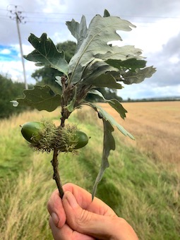
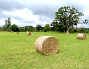
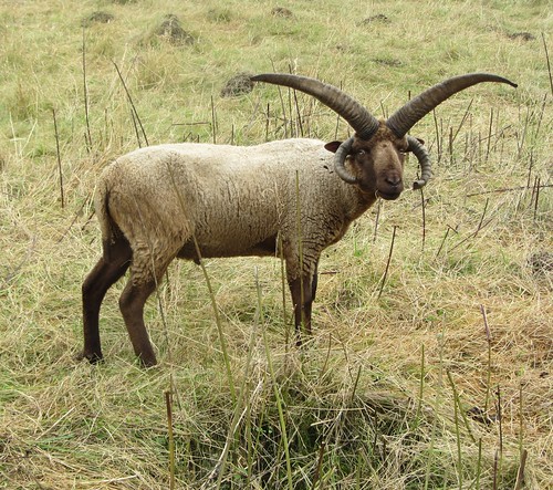
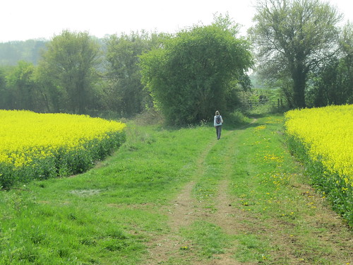
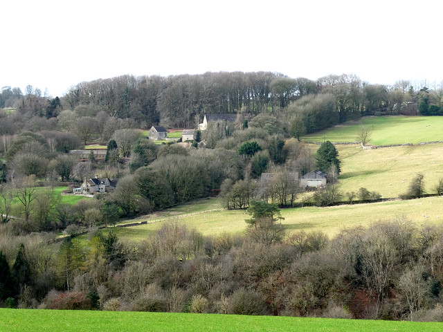
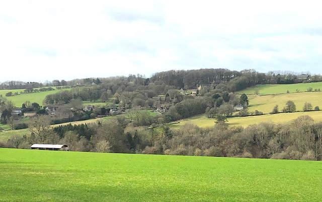
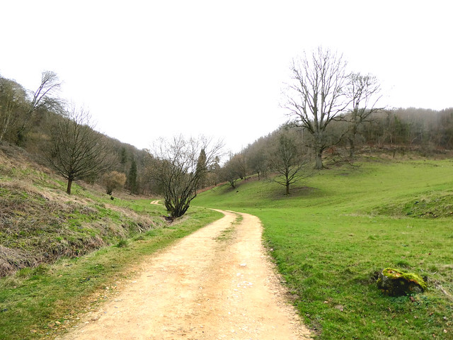
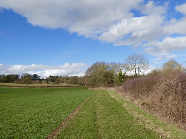
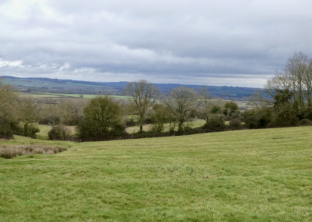
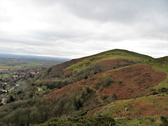
It’s no surprise to discover that the Cotswolds are the favourite destination of foreign visitors to the south of England. Lying as they do across the beautiful county of Gloucestershire, only an hour from London and very handy for Shakespeare Country, Bath and Cheltenham, the Cotswolds would have to be plug-ugly and as dull as ditchwater not to be the focus of a huge amount of tourist interest. And given their manifold attractions – the villages stone-built in hues of honey and silver, the gabled towns with their ancient market houses, upmarket delicatessens and creakily characterful hotels, the footpaths and bridleways through beechwoods and hidden valleys, the seductively undulating landscape, the rich orange soil, the meadows full of race horses and well-scrubbed sheep – one can only marvel that the hills have not been thoroughly, irretrievably spoiled.

Money has played a huge part in the survival of the Cotswolds as a rural, easy-on-the-eye, timeless piece of Old England. The Romans poured out money on building villas like the splendid specimen at Chedworth, and long, straight roads such as the Fosse Way which connected (and still connects) the Roman towns of Bath and Cirencester with the north Cotswolds. It was money in the form of wool wealth, untold millions of it, that built the golden towns and wonderful churches, the market houses and great field barns of the north Cotswolds in late medieval and Elizabethan days, when Cotswold sheep carried the riches of England around on their backs. And the handsome Palladian mansions that grace the south Gloucestershire hills were built for mill owners with money earned from the spinning mills in the steep valleys below, clothing the workers of the Industrial Revolution at home and abroad.

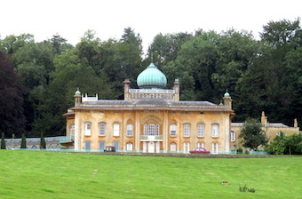
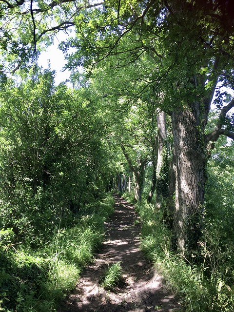
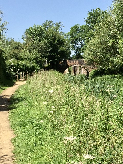
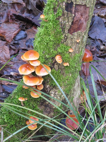
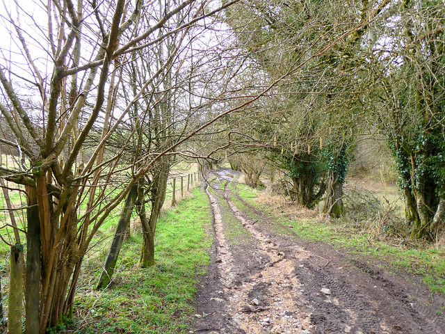
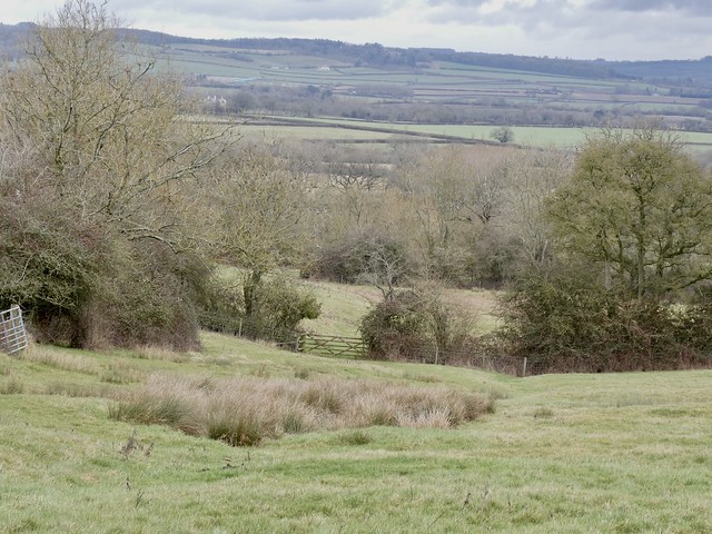
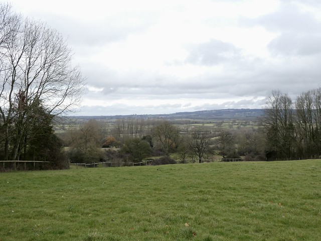
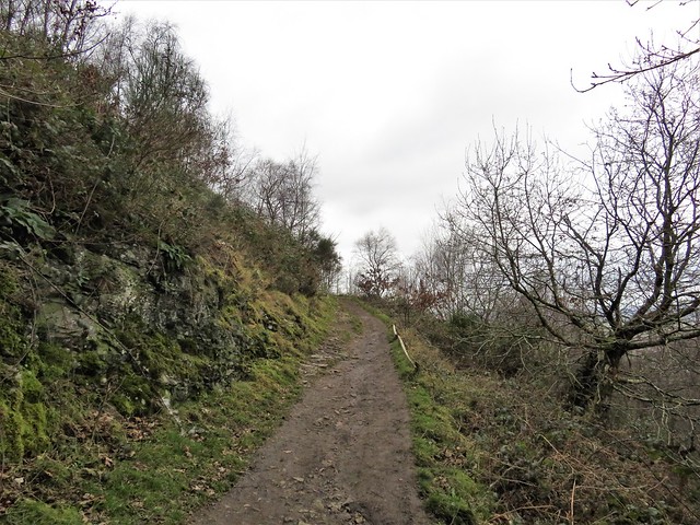
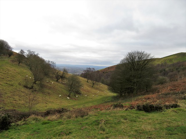
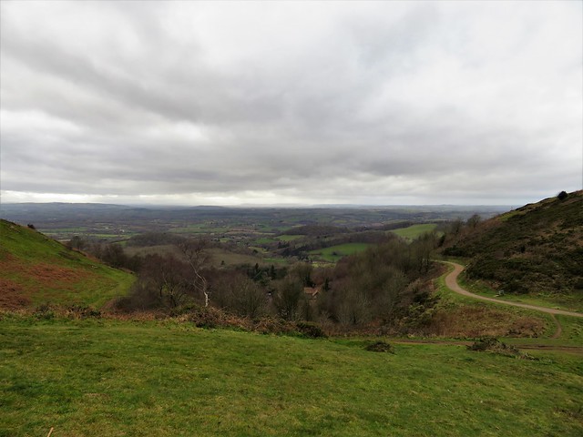
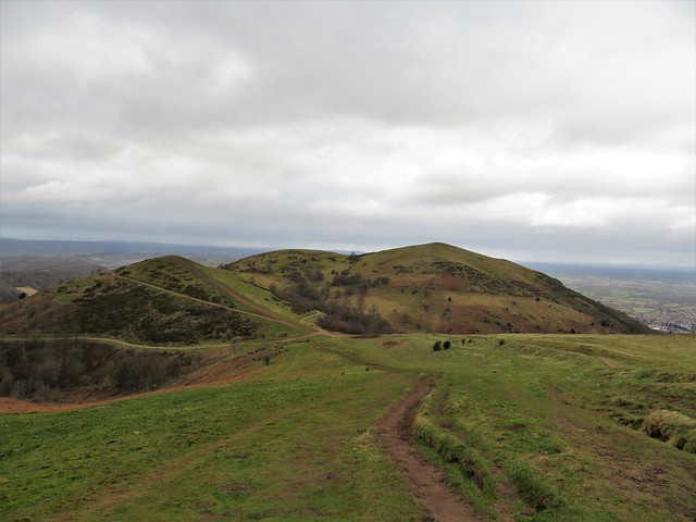
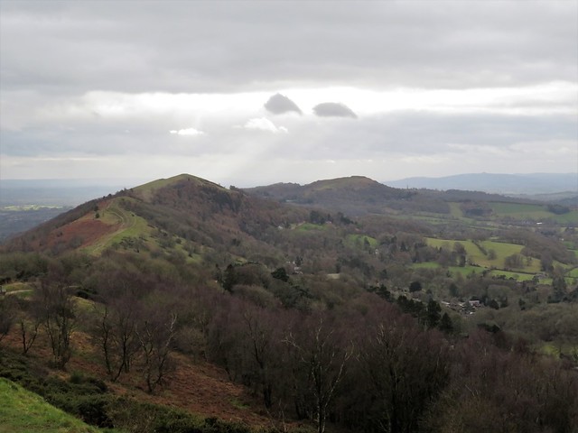
It is the southernmost sector of the Cotswolds that holds most surprises for visitors. There are few golden stone villages here. The limestone is hard and white, the landscape far steeper and deeper than the rolling countryside usually associated with the Cotswolds. Head east from the M5 at Junctions 14 or 13, and you’ll find yourself deep in proper south Cotswold country. Along the nape of the hills runs the Cotswold Way long-distance path, a superb grandstand from which to see and get to know the area. The vast Iron Age hill fort of Uley Bury crowns its hilltop, and nearby you’ll discover secret valleys where wonderful old houses lie – the delectable silver stone Tudor manor house of Owlpen, the eerie abandoned shell of the huge Gothic pile of Woodchester Mansion. Rivers rush through the narrow valleys, and it was the power of these swift streams to turn waterwheels and power looms that saw great mills, palaces of industry, sited in the Golden Valley and other clefts near the industrial centre of Stroud. Some of the mills, such as Longford’s Mill off the Avening-Minchinhampton road, have been converted at vast expense into complexes of houses and flats; others stand magnificent and empty among the ferns and mosses of their damp, dark valleys.

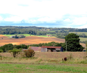
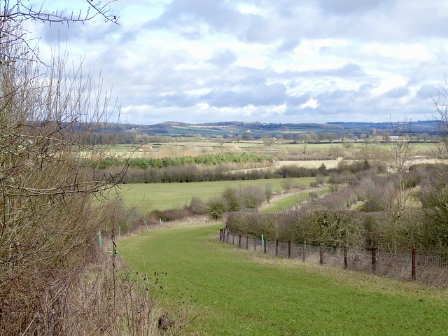
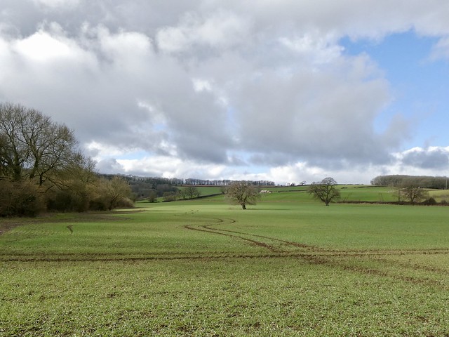
Up above these hidden valleys the rich brown fields of the south Cotswold landscape can appear almost flat. Here stands the market town of Tetbury, one of the true gems of the area, its wheel of streets revolving around the hub of the old Market House. Long Street in particular is a delight, lined with crooked, honey-coloured buildings such as Porch House with its goblin gables and leaning walls. North of Tetbury, the narrow streets of the hilltop village of Minchinhampton lead to a triangular market square and a church with a curious waisted spire. The late 17th-century Market Hall and the dignified old merchants’ houses bear witness to how wool brought prosperity to south Cotswold villages. Social cachet is not the sole preserve of the north Cotswolds: both Prince Charles’s Highgrove House and Princess Anne’s Gatcombe Park lie here in the south of the region.

This area is a celebrated centre for the breeding and training of race horses. Kim Bailey, trainer of Cheltenham Gold Cup, Grand National and Champion Hurdle winners, runs his training stable at Thorndale Farm near Andoversford. ‘I love showing people around here,’ he declares, ‘it’s just so bloody beautiful.’ What is the magical attraction of racing, in a nutshell? ‘Oh, it’s very addictive. You’ve got to have a dream in life, and this is it. The Gold Cup is the pinnacle. Winning it with Master Oats in 1995 was one of the greatest moments of my life, something that no-one can ever take away from me. Quite honestly, if I dropped dead in the winner’s enclosure, I’d die a happy man.’


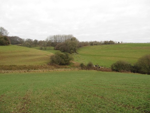
The A40 separates the south Cotswolds neatly from their northern neighbours. The north Cotswold landscape opens out; the land lightens in colour, widens and develops an ocean-like swell. Hundreds of miles of drystone walls divide the Cotswold fields and line the streets of towns and villages, all needing maintenance, too many of them neglected these days. The craft of stone-walling is still alive and well, though. Keep your eyes open and you’ll see wallers at work, craftspeople such as John Nicholson of the ‘Traditional Boundaries’ company. ‘We give the wall a batter,’ says John, ‘an inward slope towards the top, to let the rain slide off. The walls we build might last for hundreds of years – they’ve found Roman ones down at Chedworth Villa, 2,000 years old.’ Another local waller, Chris Ingles, enjoys coming across odd items left in old sections of wall by previous workers. ‘In one wall we kept finding little round snuff tins every metre or so, about as much as a waller would do in a day, and every sixth or seventh tin would be twice the size – pay day!’

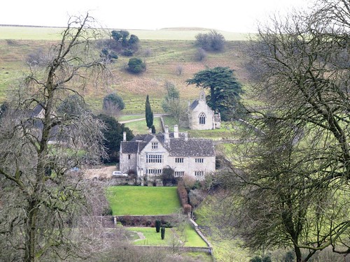
Among the sheep farms and horse paddocks live some of the richest and most famous men and women on earth, secluded among the folded hills and steep little dells of the north Cotswolds. In honeystone villages such as Stanton and Stanway, Snowshill and Broadway, the Guitings and the Slaughters, the lovely old manor houses and the thatched cottages and tithe barns are kept in apple-pie order. Garden trees are topiarised, verges clipped, hedges immaculately laid. Much of the north Cotswold countryside is private park and estate land, very carefully and lovingly maintained. This is the Jilly Cooper face of the Cotswolds (though she, like the Royals, prefers to live in the south Cotswolds), the ‘Rutshire’ region where people are pictured floating in Versace and Aquascutum from one hunt ball and cocktail party to the next, pausing only to ride each other’s horses and partners. Chipping Campden is the archetypal north Cotswolds market town, where deep gold houses crouch under their thatched roofs, dormer windows with stone mullions peeping out like sleepy eyes under straw fringes, the High Street lined with little old shops, steep gables, pillars and porticos.

In the village of Dorn out at the northern edge of the Cotswolds, beyond the town of Moreton-in-Marsh with its wide sheep-straggle street, Sarah and Simon Righton run their exemplary Old Farm, a welcoming place of Gloucester Old Spot pigs and big sleepy Charolais cows, of lambs and dogs, with a thriving B&B business and a farm shop stuffed with their own free-range produce. ‘There’s a satisfaction to doing it the proper way,’ notes Sarah, ‘selling what we’ve produced ourselves to people who like to see where it came from.’ And Simon concurs: ‘My family have had this farm since the 1930s. My children can run about in the open air and socialise with our guests. The Cotswolds may be about tourism, and we benefit from that ourselves. But this area’s not all about tourism. We belong here – and we wouldn’t live and work anywhere else.’

Secret Cotswolds

Woodchester Mansion

Tucked down in a hidden valley south of Stroud, Woodchester Mansion is eerie and magical. This never-completed masterpiece of Victorian extravagance features stairs that go nowhere, doors that lead to nothing, and a wealth of ornamental stone carving. For details of open days, visit www.the-mansion.co.uk.

Rollright Stones

The Rollright Stones lie near Long Compton at the north-east edge of the Cotswolds. Legends say of the 4,500-year-old stone circle and the even more ancient tomb nearby that they are knights enchanted by a witch. Don’t visit at midnight if you value your life and your sanity … !

Source of the Thames

Britain’s most famous river starts life as a trickle, its source marked by an inscribed marble slab in a field near the Thames Head Inn on the Fosse Way between Cirencester and Tetbury. Gazing at the spring, it’s hard to imagine the mighty tideway that surges through London to the North Sea nearly 200 hundred miles away.

Donnington Brewery

‘We’re very old-fashioned,’ twinkles brewery manager Valentine Teal, ‘and we like it that way.’ Donnington Brewery (www.donnington-brewery.com) with its swan-haunted pond is picture-perfect, and its superb bitter is drunk only locally – its 15 pubs are sited where a horse-drawn dray could reach them and return to the brewery in one day.

Three perfect villages

Guiting Power

A tangle of lanes north of the Cheltenham to Stow-on-the-Wold road leads eventually to Guiting (pronounced ‘Gigh-ting’) Power. The houses of Guiting Power are of deep gold stone. The Norman church of St Michael sits on the ridge, while the houses dip to the village square with its post office-cum-teashop and village bakery – a rarity these days. Guiting Power boasts two pubs, the Farmer’s Arms (Donnington’s ales; see Secret Cotswolds) and the Hollow Bottom, a characterful horse-racing mecca.

Snowshill

Three miles south of Broadway lies one of the north Cotswolds’ most beautiful villages, Snowshill. The village street dips steeply downhill beside a stepped wall into the valley bottom, where the Snowshill Arms (another Donnington’s pub) welcomes all comers. In the heart of the village stands Snowshill Manor (www.nationaltrust.org.uk/snowshillmanor), an Elizabethan manor house in lovely gardens laid out in the 1920s. Just east of the village the hilltop is purple and fragrant in summer with lavender, grown in ridge-and-furrow fields.

Bisley

The South Cotswold village of Bisley, hidden away in its valley just north of the A419 Stroud-Cirencester road, forms a tight huddle of beautiful stone houses under the guardian eye of the church of All Saints with its high rocket of a spire. The village school thrives, as do the village’s two pubs – the Stirrup Cup (dogs and walkers welcome), and the cosy Bear Inn with its asymmetrical rooms and log fire. Near the Bear stands the old village lock-up, just in case anyone has one over the eight.

Where to stay

The Ormond at Tetbury

23, Long Street, Tetbury, Glos GL8 8AA

From £69 double B&B

Tel: 01666-505690

www.theormond.co.uk

The Ormond at Tetbury sits snug and discreet in the town’s most charming, be-gabled street, right opposite Prince Charles’s Highgrove shop. A very pleasing sense of quiet, relaxed style pervades the whole hotel. Rooms are done out individually, and range from a four-poster with traditional ruched curtains to a more modern Scandinavian-style simplicity. The Ormond has recently picked up a Cotswold Life Food & Drinks Award 2008, and this seal of approval by local judges tells you all you need to know about the catering standards here. The menu is long on beef from the Prince’s Duchy organic farm via the local butcher, local duck and game, Cotswold cheeses, and bread made with locally ground organic flour. Cream teas await hungry walkers in mid-afternoon. Add pleasant, polite staff and a good range of locally brewed beers, and you’d search in vain to find a better Cotswold bolt-hole.

Budget Break

Camping Field,

Old Farm, Dorn, Moreton-in-Marsh, Glos GL56 9NS

From £7 a night, caravan or tent

Tel: 01608-650394

www.oldfarmdorn.co.uk

Canvas and caravans are both welcome; you can cook up a storm, too, with the Farm Shop’s own home-produced meat and other very local produce.

Blow Out

Lords of the Manor,

Upper Slaughter, near Bourton-on-the-Water, Glos GL54 2JD

From £191 double B&B

Tel: 01451-820243

www.lordsofthemanor.com

No piped music, no sharp edges to life in this former Rectory: just peace, quiet, luxury and escapism.

If you only do one thing …

  • … watch the lambs being born at Cotswold Farm Park (www.cotswoldfarmpark.co.uk) near Stow-on-the-Wold. See the ewes give birth, bottle-feed and cuddle lambs – irresistible!
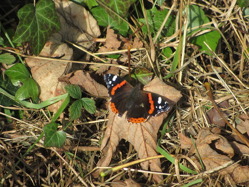
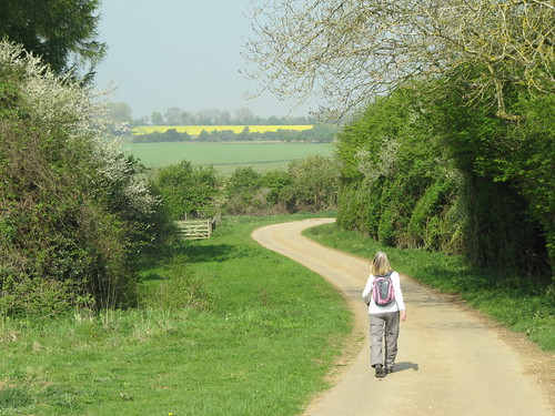
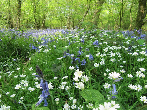
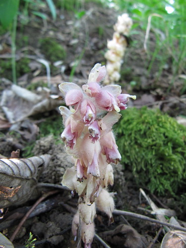
  • … take a stroll along the Cotswold Way in Cranham Wood (off A46, 7 miles south of Cheltenham) – one of the best bluebell woods in the Cotswolds.
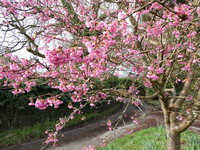
  • … enjoy one of the special Events Days at the National Aboretum, Westonbirt (www.forestry.gov.uk/westonbirt), near Tetbury – a wonderful display of spring flowers and blossom.
  • … buy fresh local produce at Tetbury Farmer’s Market in the 17th-century Market House (9-1, first Friday every month), and local crafts and organic produce at the Highgrove shop in Long Street (www.highgroveshop.com).
  • … go racing. The Cheltenham Festival (www.cheltenhamfestival2009.co.uk; 10-13 March 2009) is the biggest event in the British horse racing calendar, with the Cheltenham Gold Cup the pinnacle of the sport. If you just have to have a race horse yourself, contact Kim Bailey Racing (www.kimbaileyracing.com).
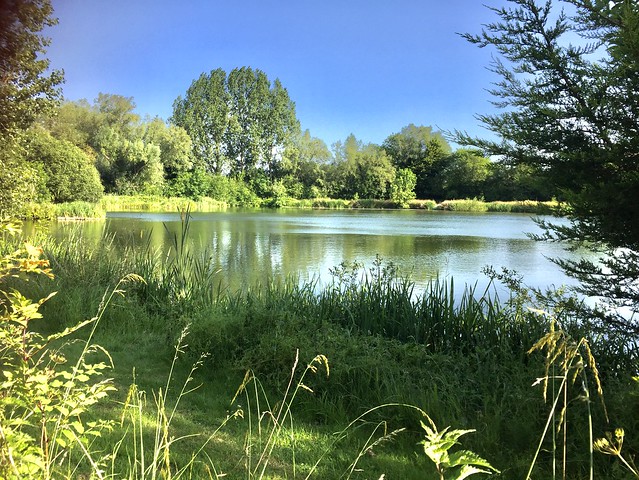
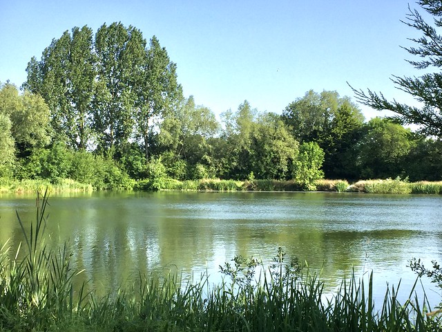
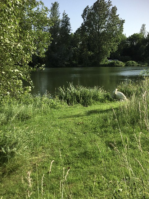
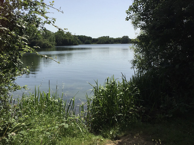
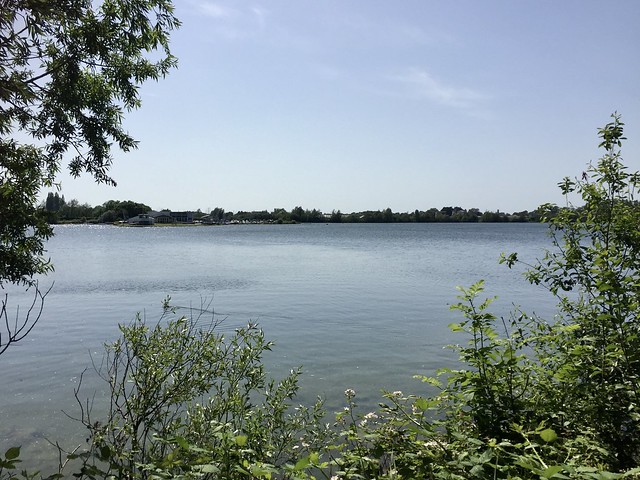
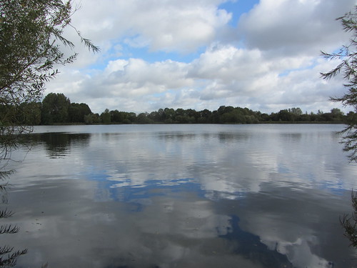
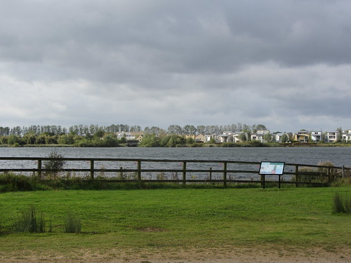
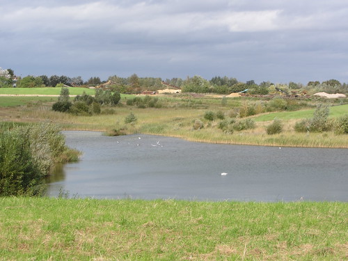
  • … make a splash at the Cotswold Water Park (www.waterpark.org.uk) as you fish, sail, watch birds, canoe, go wakeboarding and water skiing, and much more.


 Posted by at 00:00
Mar 162024


First published in: The Times Click here to view a map for this walk in a new window
bees on the prunus blossom in Througham 1 bees on the prunus blossom in Througham 2 bees on the prunus blossom in Througham 3 Througham Througham 2 roe deer in line astern leaping a fence lane from Miserden to Througham the way through Dillay Brook valley

The south Cotswold village of Miserden seems to have it all – shop, post office, school, dentist, craftspeople, (occasional) bus, and a cosy and welcoming pub. In addition it’s a pretty place of mellow limestone houses, barns and field walls.

Do rural Edens like this harbour serpents? Impossible to believe it as we passed a posse of happily babbling village toddlers on their morning constitutional and set out along an old country lane. Hock-deep mud and a surface abraded to stumbly rubble by winter’s floods soon brought us back to earth.

Two worlds intersected along the route from Miserden to Througham. The byway, evolved to suit man’s objectives, led purposefully between the two settlements, while claw-scraped mudslides in the banks marked the passage of animal highways crossing the man-made track on the way to and from unknowable destinations.

A grey squirrel scampered across the lane in front of me, so intent on its course that it darted right over the toe of my boot. The sunken track, more stream than lane, rose to Througham under hazels festooned with catkins and minuscule female flowers, tufty and scarlet.

We passed the handsome old country house of Througham Court, its gables pierced with dove holes. A high wall concealed a garden laid out by the owner according to mathematical formulae, medical principles and cosmic theory. Less abstruse but just as wonderful, a prunus on a grass triangle by the road stood covered with pink blossom, loudly humming with a smother of bees hard at work.

Another stony lane led to a pasture where seven roe deer ran in line across our path, each creature rising in turn to spring over a fence, easy grace personified.

In High Wood off-roaders had trenched the byway with ruts too deep and flooded to walk in. We teetered along the muddy margins before plunging down a hillside path to the hidden valley of the Dillay Brook. An upward slog, a tangle of storm-toppled trees to negotiate like a giant’s game of spillikins, and a last stretch through sheep pastures under a sky milky with late winter sunlight and jingling with the early spring twittering of skylarks.

How hard is it? 7 miles; moderate; muddy and wet in parts, especially in High Wood.

Start: Carpenter’s Arms, Miserden GL6 7JA (OS ref SO 937088).

Getting there: Off B4070 (Birdlip-Stroud)

Walk (OS Explorer 179); Leaving pub, right; at T-jct, right; in 200m, left (933086, ‘Restricted Byway’). In 400m, fork left (930085); follow lane to Througham. In ¾ mile where tarmac begins, left (921081). 50m past Througham Court, ahead off right bend (921078) along lane. In 300m fork right at sheds (921075). Green lane, then field paths to road (914074). Left; fork right; at T-jct, right (912073). In 450m cross road (908076), then 3 fields to lane (905079). Left (very muddy!). In ½ mile lane bends sharp right (899081); descend on side path with wall on right. In 150m fork downhill. At bottom, cross track (899085); up path opposite. In 350m at top of rise fork right past house (901087). In 200m, ahead (blue arrow) for ⅔ mile (some fallen trees to negotiate) to gate into field (912086). Path to cross 2 roads (914087, 916087); on down to Honeycombe Farm. Path (left side of silage clamp) to road; right (ignore ‘Private’ sign). At gate, left-hand of 2 stiles (923090); path uphill (gate, yellow arrow) across 3 fields to road (931090). On across field to road (933089); right into Miserden.

Lunch: Carpenter’s Arms, Miserden (01285-821283, thecarps-miserden.co.uk)

Accommodation: Falcon Inn, Painswick GL6 6UN (01452-222820, thefalconpainswick.com)

Info: Nailsworth TIC (01453-839222)

 Posted by at 01:19
Mar 112023


First published in: The Times Click here to view a map for this walk in a new window
field path approaching Icomb view from Icomb over the Evenlode valley Bledington view over Evenlode valley from fields near Church Westcote medieval ridge-and-furrow near Church Westcote fields near Church Westcote broad vale of Evenlode near Icomb Church of St Mary, Icomb muddy lane near Bledington Bledington's church in winter sun bird kneeler in Icomb Church field path approaching Bledington young oak plantation between Church Westcote and Icomb

If you were looking for a clutch of Cotswold villages that typified everything enticing about this part of the world, you could hardly do better than those that look into the Evenlode Valley between Stow-on-the-Wold and Chipping Norton.

Bledington is the perfect place to start, a collection of fine large houses and thatched cottages in the beautiful local stone that weathers to a rich creamy gold. From here our path ran across the wide fields of the vale, ribboning across the corrugations of medieval ridge-and-furrow.

We passed Gawcombe Farm’s scrubby preserves and followed a muddy green lane up to the neighbouring villages of Nether and Church Westcote. A blackbird sang for nesting time in the hedge at Church Westcote, then gave a chakker of alarm and fell silent as we passed.

Dark slaty blocks of cloud were slashed across great pillows of white on a pure blue field of sky. We passed through a plantation of young oak and silver birch, where stacks of abandoned logs gave off a fruity savour of damp moss and rot. Dogwood twigs glowed a brilliant crimson as the low afternoon sun glanced across them.

The mellow walls and gables of ancient Icomb Place stood ahead on the ridge. Beyond them we came to St Mary’s Church at Icomb, its tower topped with a little pitched roof of stone, as though a tiny house had been plonked on top. Inside, exquisitely worked hassocks lay ready for the knees of worshippers. One was embellished with birds we’d seen or heard today – chaffinch, tree creeper, nuthatch, goldfinch and wren.

Sir John Blaket lay recumbent in effigy, stone sollerets pointed like winklepickers, moustaches overflowing his helm, a martial hero of Agincourt. Less honourable residents of Icomb were the Dunsden brothers, the original Tom, Dick and Harry, highwaymen of the 18th century who ended their careers behind bars and dancing the hangman’s jig.

Out in the open air we descended from the ridge into the vale once more. The first skylark of the year poured out a silvery song high and invisible over a turnip field, and a black horse cantered neighing around its sunlit paddock as though injected with pure essence of the oncoming spring.

How hard is it? 7¼ miles; easy; field paths

Start: The Green, Bledington, Oxon OX7 6XQ (OS ref SP244227)

Getting there: Bus 802 (Kingham to Bourton)
Road: Bledington is on B4450 between Stow and Chipping Norton

Walk (OS Explorer OL45): Follow Church Street. Right beside church; follow ‘Oxfordshire Way’/OW signs. In 1 mile, left across footbridge (235221, yellow arrow/YA). Follow path (‘Diamond Way/DW on map) across fields. In ½ mile meet green lane (230214); left for ¾ mile to road at Nether Westcote (227203). Right; in 100m fork right down path (226203, fingerpost). In 50m fork left on path to Church Westcote. Right at road (221204) past post-box. At ‘Middlemarch’, right down track (220207); in 100m, left over stile (YA). Follow DW. In 200m into plantation (218209); keep ahead at fork (YA) and on. In ½ mile cross OW (216216); in ½ mile pass reservoir on right; in 50m fork left uphill (215223). In 30m, right (gate, YA) to Icomb Church (214226). Return along path and on. Approaching Middle Farm, left (217226, fingerpost) on path across fields. In ½ mile cross Lower Farm drive (225227) and on; in ½ mile, right down driveway (233229). In ½ mile at right bend, left (234221, kissing gate) on OW/DW to Bledington.

Lunch/Accommodation: King’s Head, Bledington OX7 6XQ (01608-658365, kingsheadinn.net); Feathered Nest, Nether Westcote OX7 6SD (01993-833030, thefeatherednestinn.co.uk)

Info: Stow-on-the-Wold TIC (01451-870998)

 Posted by at 05:11
Nov 192022


First published in: The Times Click here to view a map for this walk in a new window
Looking south along the Malverns path up to Lady Howard de Walden's Drive Lady Howard de Walden's Drive cuts a nick in the hillside Looking east down Green Valley from Lady Howard de Walden's Drive Lady Howard de Walden's Drive the view south to Worcestershire Beacon Looking along the spine of the Malverns view west into lumpy country from the return path

‘Some term them the English Alps,’ wrote the traveller Celia Fiennes in her journal for 1696 after viewing the Malvern Hills for the first time. ‘They are at least 2 or 3 miles up and are a Pirramiddy fashion on the top.’

The dust of enchantment may have been in Celia’s eyes when it came to estimating the height of the Malverns – the summit, Worcestershire Beacon, is only 1,395 ft. But there’s no doubt that this dragon-backed, seven-mile chain of miniature mountains dominates both the South Worcestershire plain to the east and the more undulating country towards the Welsh Borders in the west.

The Malverns are less demanding to climb than they seem. A skein of good paths criss-crosses them, and it’s hard to get lost on the hills because they stand up above everything far and near.

We set out from the northern end of the range on a cold, breezy winter’s day. A stony track led steadily uphill through yew, Douglas fir and larch, then further up into gorse and broom.

As we climbed the view opened out east over the red roofs of Great Malvern toward the Cotswolds, a long dark bar in the south. At the top of the track Lady Howard de Walden’s Drive curled away south towards the craggy peak of Worcestershire Beacon. The fabulously rich Lady Howard de Walden had this mountain carriageway built in the 19th century to give employment to local people.

Up on the summit the wind blew like blue blazes out of the valley. We clung to the quartzite crags which have been a thousand million years in existence, a concept bound to make your head spin if the view doesn’t. Black Mountains in the Welsh Borders to the west, Edge Hill nearly forty miles off in the east, the Clee Hills a jagged lump in the north, the Severn Estuary a salmon-pink gleam in the south.

Below Worcestershire Beacon we found the homeward way, a knobbly path along precipitous slopes stained rusty red with last summer’s bracken. Gorse flowers made brilliant golden specks against the dour colours of the winter hills, and the declining sun shot Blakean shafts of silver out of the clouds.

How hard is it? 4¾ miles; moderate/strenuous hill walk; good paths, with some easy ascents

Start: North Quarry car park, North Malvern Road, Malvern WR14 4LT (OS ref SO 771469) – £4.60

Getting there: Rail to Great Malvern station (1 mile). Bus 675/676, Ledbury-Great Malvern
Road: M5, Jct 8; follow signs to Malvern

Walk: Follow uphill track to left of ticket machine. In 600m at post with green, red and blue arrows pointing forward, sharp right (774463) up embanked path. At top, left along Lady Howard de Walden Drive (772464). In 1 mile bear right (769453) up path to summit of Worcestershire Beacon (769452). Continue south round west side of Summer Hill. In ⅔ mile at track crossroads with circular stone marker (769442), sharp left back up stony track. In 750m, at saddle before Worcestershire Beacon by covered bin, fork right (769448) on rutted track. In 300m fork right downhill (771451). In 200m, in low saddle, fork right (771453) across rock outcrop and on. In 300m by bench fork right (772455). Follow track downhill. Just past St Ann’s Well, roadway bends sharp right downhill (771459); cross it here (‘North Quarry’); right along upper track. In 300m, fork left uphill; continue to car park.

Lunch: Picnic, or St Ann’s Well café (01684-560285, stannswell.co.uk)
Open Fri, Sat, Sun 11:30 – 3:30

Accommodation: Mount Pleasant Hotel, 50 Bellevue Terrace, Malvern WR14 4PZ (01684-561837, mountpleasanthotel.co.uk)

Info: malvernhills.org.uk

 Posted by at 02:00