Search Results : cumbria

Feb 172024


First published in: The Times Click here to view a map for this walk in a new window
Dufton village green sandstone quarry face in Dufton Ghyll Wood Quarryman's 'Cockdick' graffito in Dufton Ghyll Wood Quarryman Dan McPhee's 1874 graffito in Dufton Ghyll Wood Brampton Beck Haw berries in Wood Lane split ash tree, Wood Lane houses of Brampton on their ridge Wood Lane approaching Dufton Ghyll Wood Wood Lane approaching Dufton Ghyll Wood, with Dufton Pike beyond waymark on the sandstone wall of Wood Lane golden evening light on North Pennine hills

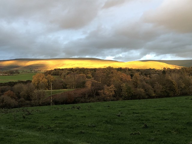
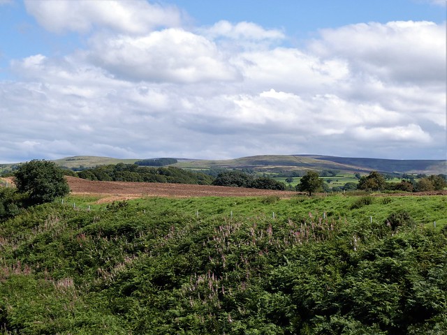
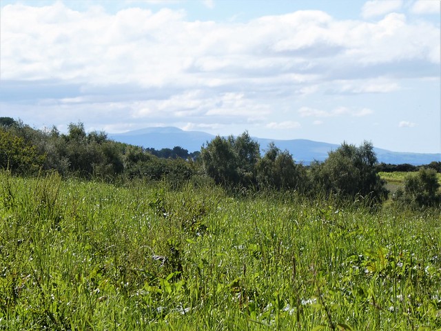
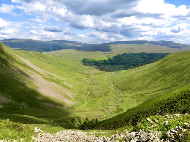
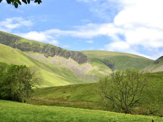
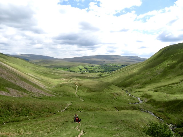
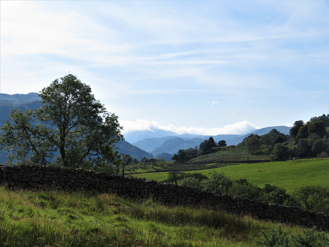
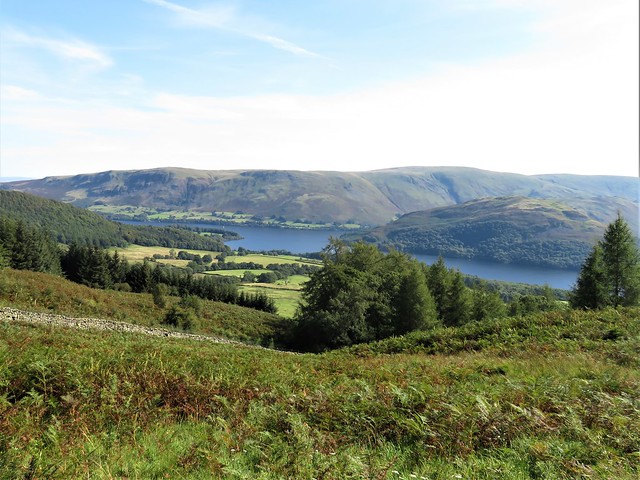
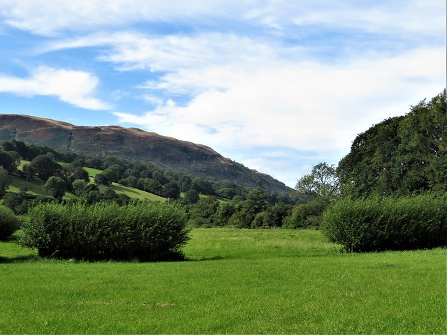
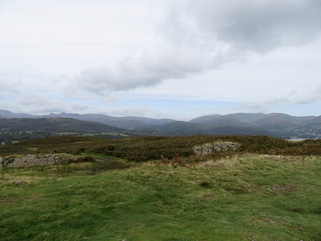
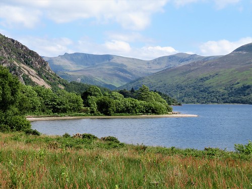
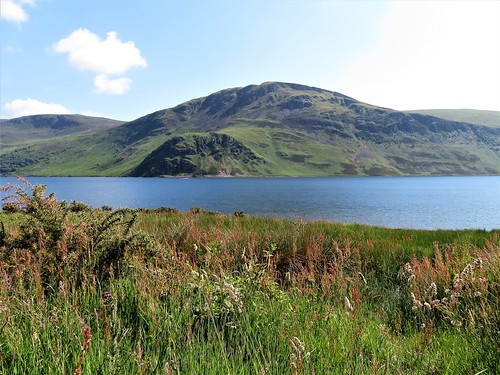
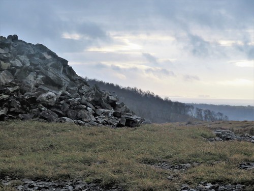
The sky over eastern Cumbria was sliced in two: a great smoking curl of mist obscuring the tops of the North Pennine Hills standing east of Dufton, and away to the west beyond the green Vale of Eden a field of brilliant blue above the sunlit fells of the Lake District.

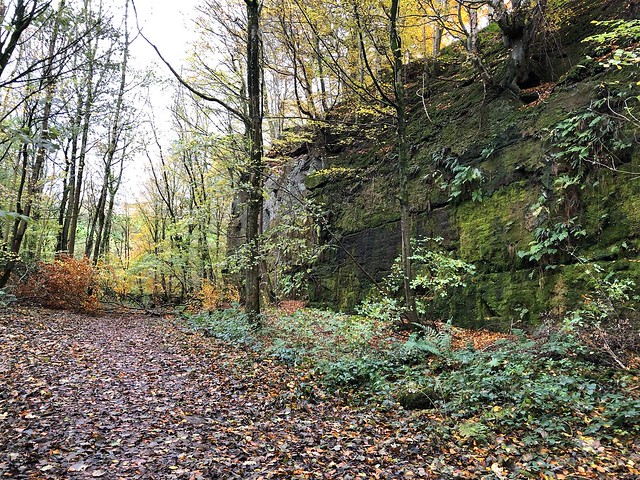
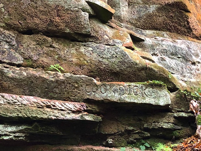
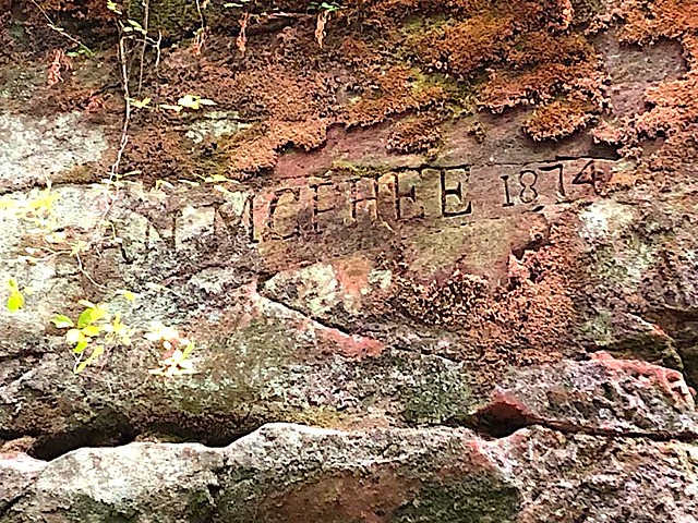
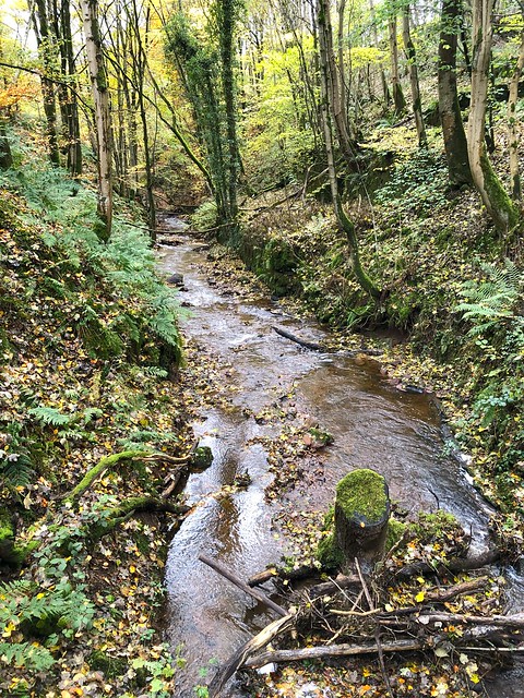
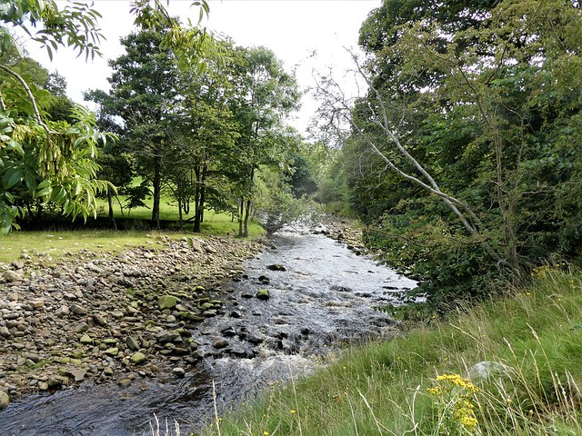
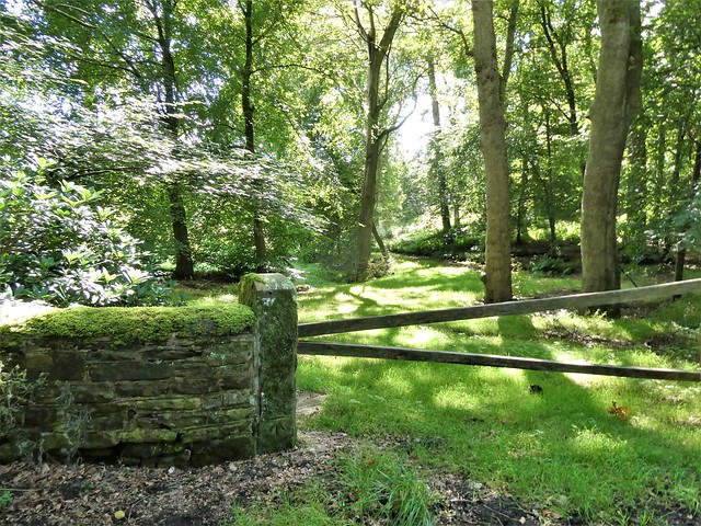
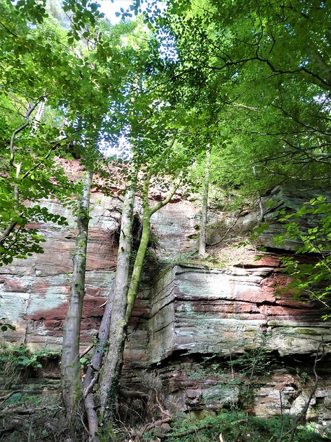
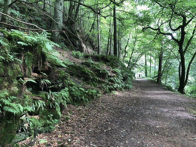
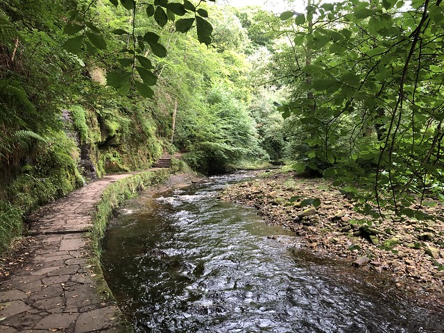
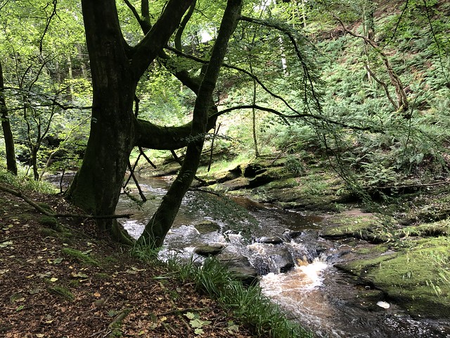
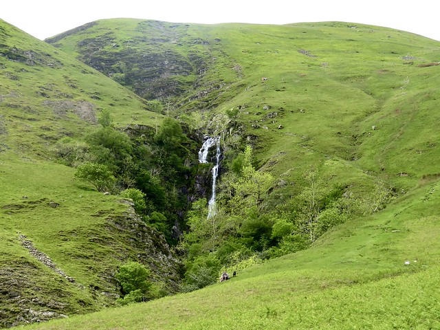
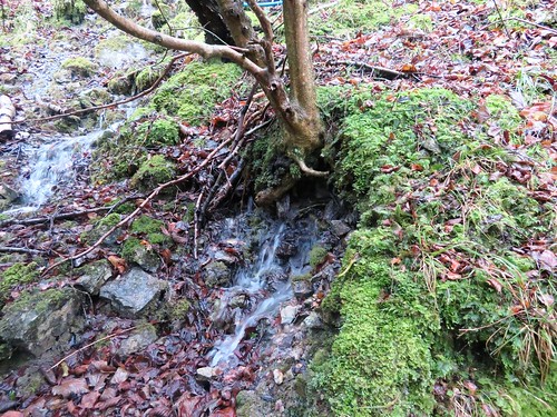
Down below the village Dufton Ghyll rushed in curls of bubbles between the sandstone walls of its miniature gorge. ‘Dan McPhee, 1874’ read a graffito scored in square letters into the dusky red rock, legacy of some long-forgotten quarryman. ‘Cockdick’, said another – maybe a nickname, maybe an insult.

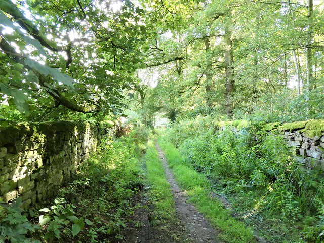
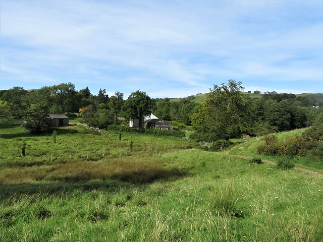
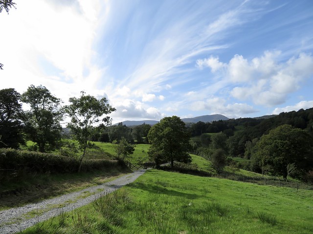
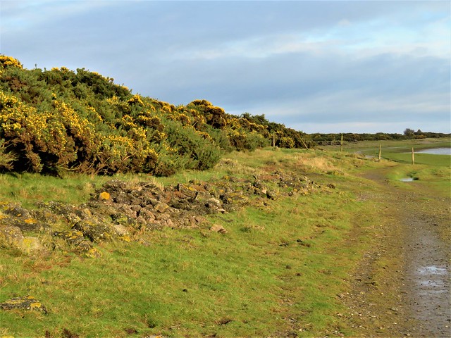
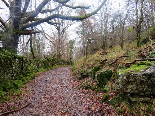
Below the mossy quarry faces the path twisted among fallen fragments of beech and birch, then climbed to green pastures by way of stone steps hewn and placed by the quarrymen. In the yard at Greenhow Farm a collie crouched on guard on the tray of a quad bike; he never budged a muscle, only swivelling his narrowed eyes to track my progress out of his domain.

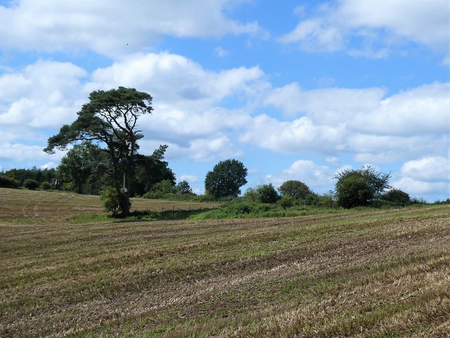
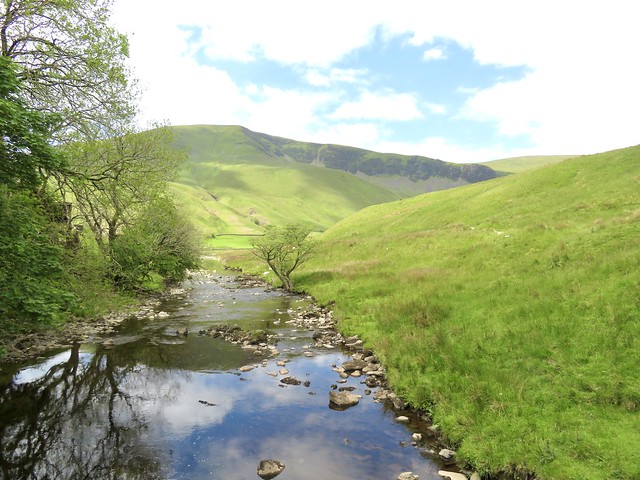
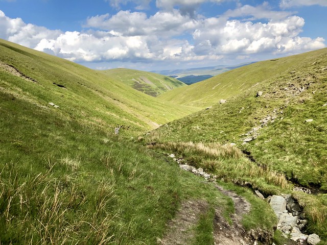
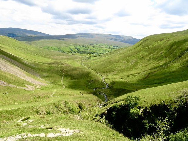
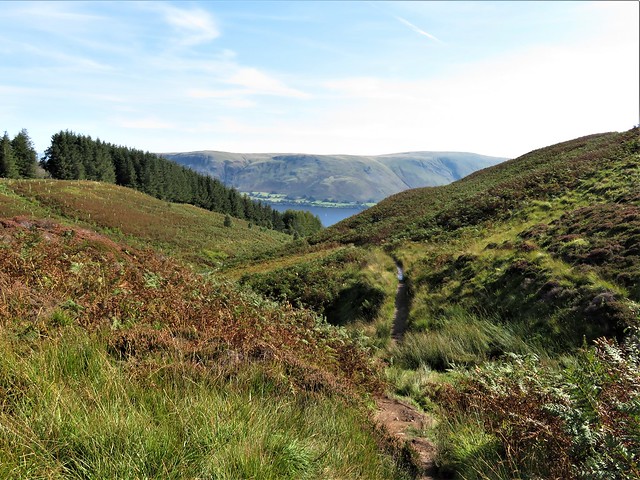
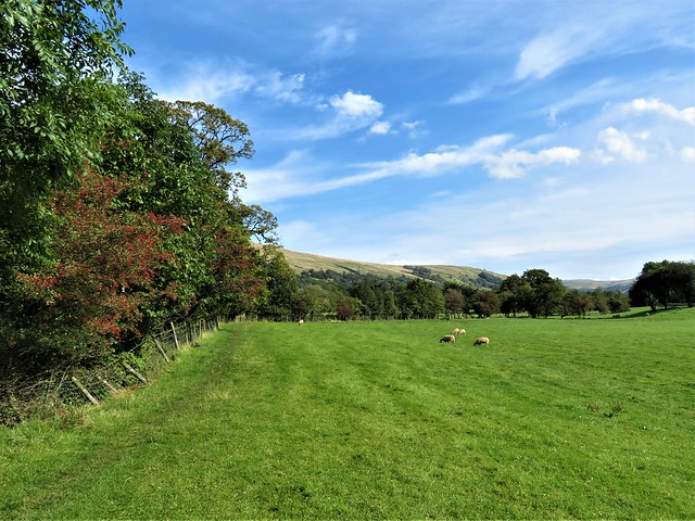
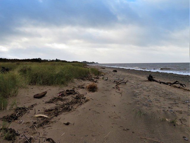
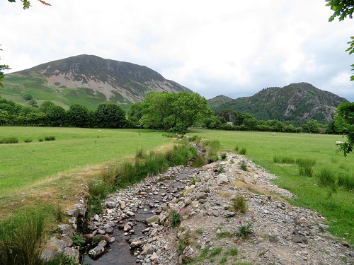
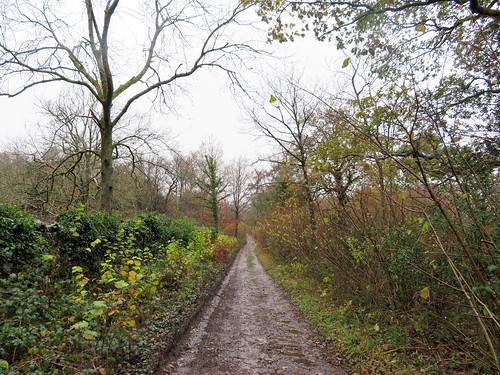
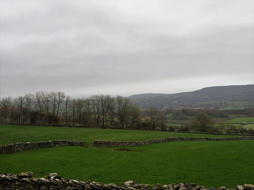
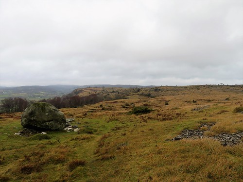
In the fields beyond, a gang of rams, muddy-coated and curly-horned, stood stolidly and stared me out. The sodden path squelched and slithered underfoot as I crossed Keisley Beck and came down into Flakebridge Wood.

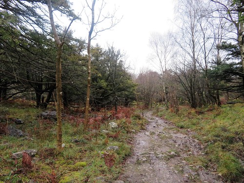
From the sunless cottages at Flakebridge a rough path traced the lower edge of the wood, passing under beech boughs as yet leafless. Wild geese flew clamouring overhead, shadowy presences beyond the treetops – pinkfeet, I guessed, en route to their night roost.

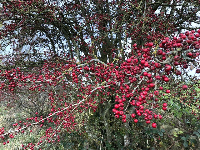
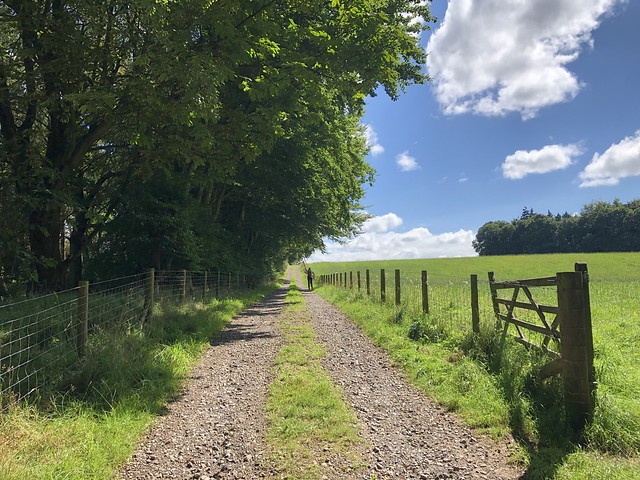
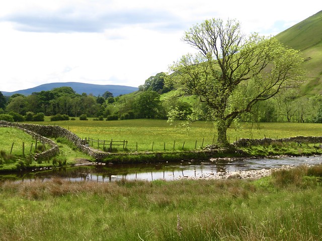
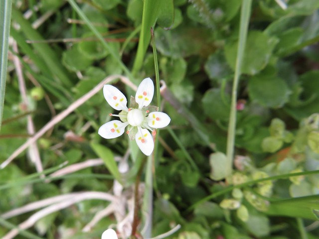
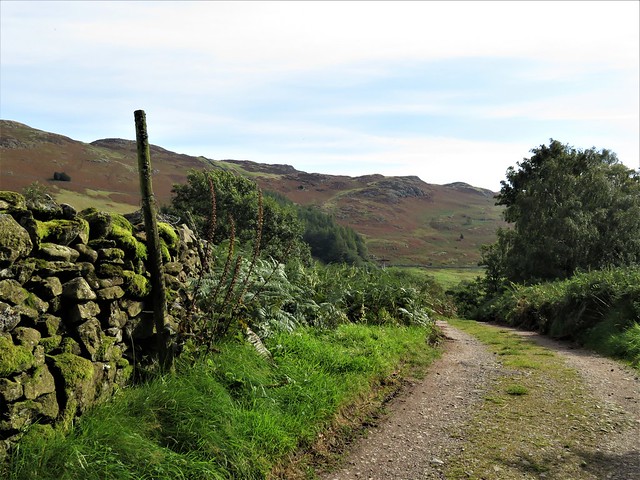
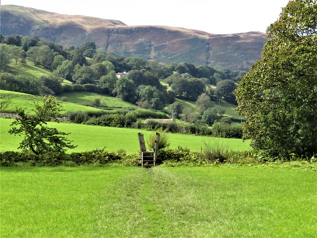
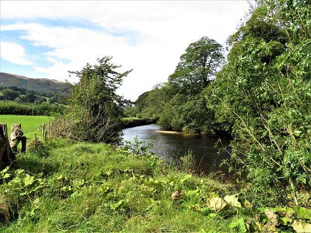
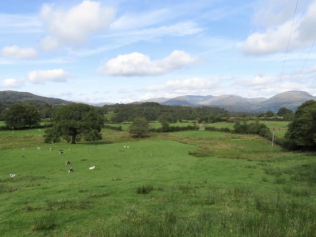
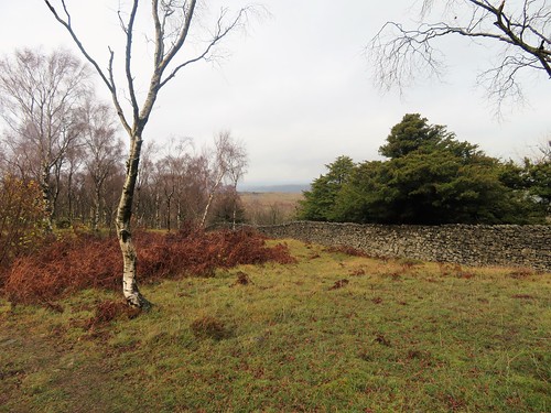
The rutted farm road of Frith Lane led on to Esplandhill where a range of superb old sandstone barns stood tall. Tiny spears of bluebells were already pushing up in the hedge roots beyond, and a wren sang its chittering song in the alders along Brampton Beck where I crossed the racing water swollen with recent rainfall.

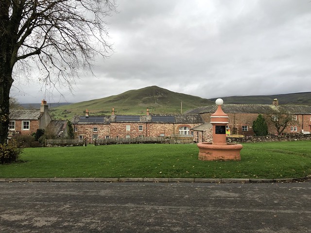
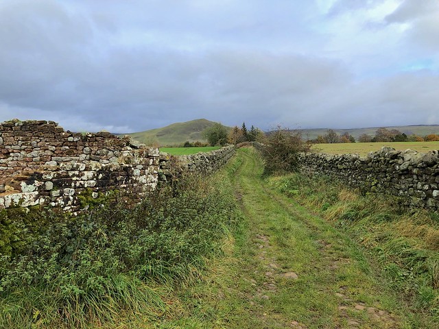
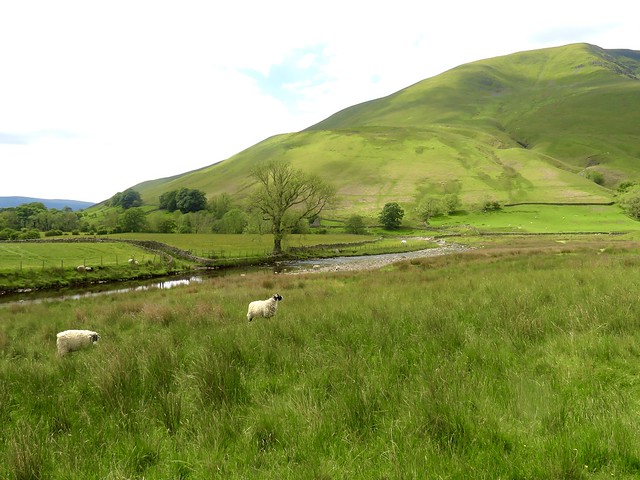
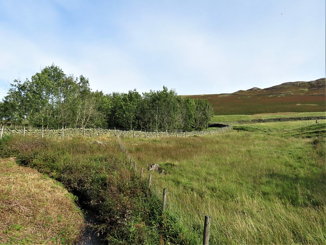
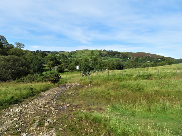
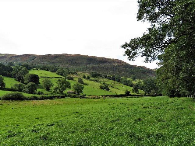
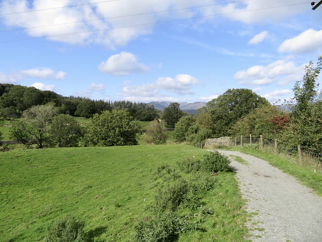
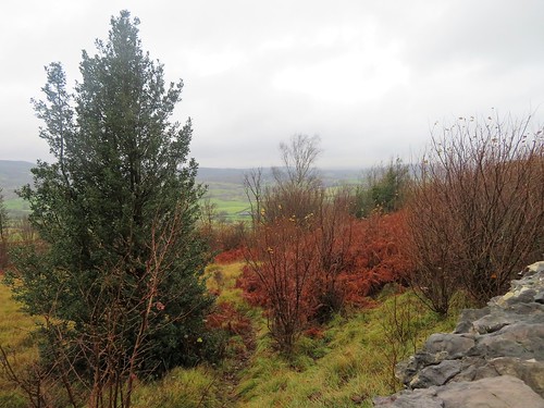
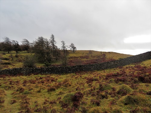
A final stretch northwards ran between wet rushy fields along Wood Lane. Moles had been driven up from underground by the flooding; their castles of finely dug earth stood tall, temporary refuge until their tunnels dried out under spring sunshine and became habitable once more. Ahead beckoned the cone of Dufton Pike, gilded by late afternoon sunshine, as my internal compass set course for the cheerful taproom of the Stag Inn on Dufton’s village green.

How hard is it? 5½ miles; easy; field paths. NB: Some fallen trees to negotiate around Dufton Ghyll.

Start: Dufton car park, Dufton, CA16 6DB (OS ref NY 690250)

Getting there: Dufton is signed from B6542 in Appleby (A66 Brough-Penrith)

Walk (OS Explorer OL19): Right along road; immediately right (‘Dufton Ghyll’); descend to cross ghyll (wooden footbridge, NOT stone bridge!). Left along bank (yellow arrow/YA). In ⅓ mile at Redbanks Bridge dogleg left/right over road (694245; ‘Keisley, Flakebridge’). On through Greenhow farmyard; follow ‘A Pennine Journey’ across fields (YAs, stiles). In 1¼ miles cross footbridge and stile opposite (706231, YA). Right up bank to wall stile beyond (705230, YA). Down to stile at corner of wood (704229); half left to ladder stile (703226). Cross stream; into Flakebridge Wood. In 150m join track (703225); in 100m, left at junction, down to Flakebridge (704220). Bear right on track, keeping to edge of wood. In 1 mile leave wood (693229, stile); follow Frith Lane to road at Esplandhill (685230). Right; in 100m left past Brampton Watermill. In 400m right over footbridge (683234); left to join Wood Lane. In 1 mile enter Dufton Ghyll Wood (688249); down to cross ghyll (footbridge); up into Dufton.

Lunch: Stag Inn, Dufton (01768-351608, thestagdufton.co.uk)

Accommodation: Crown & Cushion, Appleby CA16 6XB (01768-351595, robinsonsbrewery.com)

Info: Appleby TIC (01768-351177)

 Posted by at 01:14
Sep 232023


First published in: The Times Click here to view a map for this walk in a new window
path by the River Gelt in Gelt Woods 1 River Gelt with flood stones near Greenwell view near Greenwell leafy lane near railway cutting 1 leafy lane near railway cutting 2 view to NE Lake District fells field path near Greenwell ancient sandstone quarry face above River Gelt path by the River Gelt in Gelt Woods 2 path by the River Gelt in Gelt Woods 3 path by the River Gelt in Gelt Woods 4 field path across Watch Hill skew viaduct across river at Middle Gelt sandstone quarry near Low Gelt Bridge

If the River Gelt got its name from the old Irish geilt, meaning ‘madman’, that wouldn’t be surprising. When swollen with rain, the Gelt roars and dashes itself against the confining rocks of its sandstone gorge like a wild thing as it hurtles down to meet the River Irthing near Brampton. Today, in a spell of settled weather, it went bubbling and twisting under Low Gelt Bridge.

The path skirted the edge of an enormous quarry, screened away behind gorse and broom. The air was full of the rich scent of sun-warmed bracken and the snap of broom pods releasing their seeds. Suddenly the trees thinned and the view opened westward across the peachy-orange sand diggings to a line of far-off low hills along the Scottish border.

A lovely afternoon was unfolding as we climbed the flank of Watch Hill, with sunlight striking down through the beech leaves. More westward prospects shaped themselves in the distance – a gleaming finger of water that was the Solway Firth with the blue hump of Criffel mountain beyond, and then a crumple of high country, the north-easternmost fells of the Lake District.

Two labradoodles came bounding up, grimy and ecstatic after a plunge in the stickiest, blackest bog they could find. Beyond Tow Top we crossed a railway in a deep cutting; then, reaching Greenwell, we reunited with the Gelt and turned back to follow it home.

On the steep grassy river bank we paused to munch green apples and look for dippers on the stones that the Gelt had mounded up in vigorous floods. Alder, rowan with scarlet berries and huge old crack willows grew along the banks. Once more we crossed the river at Middle Gelt in the shadow of a tall railway viaduct, built as long ago as 1835, one of the first skew or slanted bridges ever constructed. The contractor, John McKay, assembled a model made out of pieces of turnip, which he whittled and reshaped until he was certain the design would actually stand up.

We walked homeward at the river’s brink under cliffs of sandstone where ancient quarry faces stood a hundred feet tall. Roman soldiers excavating stone in 207 AD for repairs to nearby Hadrian’s Wall had left graffiti in the rocks, we’d been told – cartoon faces, and the name of their overseers, Agricola and Mercatius. We failed to find these imprints from the past, but enjoyed marvelling at the patterned incisions made by the saws and chisels of two millennia of sandstone quarrying above the ‘mad river’.

How hard is it? 6 miles; moderate; riverside paths. NB some slippery steps and stumbly tree roots in Gelt Woods, muddy in parts.

Start: Low Gelt Bridge car park, near Brampton, Cumbria CA8 1SZ approx. (OS ref NY 520591)

Getting there:
Road: From A69/A689 roundabout just south of Brampton, head south on A69. In ½ mile cross River Gelt; in 100m sharp left to Low Gelt Bridge. Right across river; right into car park.

Walk (OS Explorer 315): Back across bridge; left; in 150m left (521589, fingerpost ‘Tow Top’). Follow path and ‘Tow Top’ signs for 1½ miles to road at Tow Top (528571). Left; in 100m, right (‘bridleway, Greenwell’) across railway (530570). At road junction, ahead (532569, ‘No Through Road’). In ½ mile at Greenwell, left (536565, step stile/gate) on riverside path. In ½ mile at road (533572), right; under viaduct. Right across river; left (533573) on path beside river (fingerpost ‘Gelt Woods’) for 1⅔ miles back to car park.

Lunch: Picnic

Accommodation: Howard Arms Hotel, Front Street, Brampton CA8 1NG (01697-742758, howardarms.co.uk)

Info: edenriverstrust.org.uk

 Posted by at 05:18
Apr 012023


First published in: The Times Click here to view a map for this walk in a new window
Looking back from the climb beside Cautley Spout 1 path to Cautley Spout 1 River Rawthey, looking to Cautley Spout path to Cautley Spout 2 Howgill Fells, looking back down Gill Beck on the path to Cautley Spout 3 Looking back from the climb beside Cautley Spout 2 looking to the cleft of Cautley Spout Looking back from the climb beside Cautley Spout 3 Cautley Spout starry saxifrage by Cautley Spout

At noon under a blue sky, hens were clucking and sparrows chirping at the Cross Keys at Cautley. This old temperance inn is a pub with no beer (you’re welcome to bring your own), but it’s got just about everything else, including home cooking, enough books to stock an extremely erudite library, and that indefinable air of welcome and comfort that a weary walker dreams of finding.

But first we had to earn our ease. The Cross Keys backs onto a wonderful view of Cautley Spout, a waterfall that tumbles some 700 feet down a dark rock cleft in the eastern flank of the Howgill Fells. A track led through sheep pastures to the foot of the fall, and from here on it was a steep puff up a path of rocky steps. It was the first time I’d ever used a stick on a walk, and I certainly was glad of it.

Halfway up we sat to admire the eastward view, the white fall sluicing down beside us, the glacier-sculpted valley opening symmetrical scree slopes. Sun splashes and cloud shadows slid across the fells. The twisting stream of Cautley Holme Beck wriggled away far below towards the green valley of the River Rawthey, with the humps of Bluecaster and West Baugh Fell as an eastern wall.

At the top we crossed the fall, suddenly diminished to a trickle hardly wide enough to wet the boots. A stony track led off west beside Force Gill Beck into a silent upland, the heart of the Howgills. Green and gold carpets of opposite-leaved saxifrage grew close to the chattering beck. A lonely sheepfold had been nicely restored, and sheep had congregated there as though the shepherd might return at any moment.

Up on the skyline a tremendous westward view suddenly burst out, fold upon fold of east Cumbrian hills towards the Lake District. We turned along the ridge on the broad track of the Dales High Way, followed by a long descent to the secret valley of Bowderdale and the homeward path.

Few walkers come through Bowderdale. Few suspect its existence – a beautiful, wild valley between high fellsides, haunted by ravens, a fitting place to set the seal on this stunning hike into the Howgill Fells.

How hard is it? Moderate with one steep climb; 6 miles, ascent 500 m/1,650 ft; upland paths. Path beside waterfall very steep with rocky steps.

Start: Car parking bay on A683 at Cross Keys Inn, Cautley, near Sedbergh LA10 5NE (OS ref SD 698969)

Getting there: Bus 54, Sedbergh – Kirkby Stephen (Tues, Thurs, Fri)
Road: M6 Jct 37, A684 to Sedbergh; A683 towards Kirby Stephen.

Walk (OS Explorer OL19): Down steps; cross River Rawthey; left on path to Cautley Spout. Steeply up beside waterfall. At top, left across Swere Gill (680975); follow path on right bank of Red Gill Beck. In 600m, just beyond sheep fold ruin (676971), fork right up path beside Force Gill Beck, then up to meet Dales High Way/DHW on skyline (669967). Right; follow DHW to The Calf trig pillar (667970) and on. In 600m at tarn (671964), follow path as it bends right and descends into Bowderdale. Either follow it to bottom of dale, or in ⅔ mile turn right at small cairn (677980 approx) on grassy path short-cut to dale bottom (680982 approx). Right on path to foot of Cautley Spout (683975); return to Cross Keys.

Lunch: Picnic, or Cross Keys (check opening times)

Accommodation: Cross Keys, Cautley (01539-620284, cautleyspout.co.uk) – delightful, welcoming inn. Check opening times before visiting. Accommodation any time by prior arrangement. NB Temperance inn – no alcohol served – BYO!

Info: cautleyspout.co.uk

 Posted by at 01:42
Sep 102022


First published in: The Times Click here to view a map for this walk in a new window
Arnside from the Kent Estuary view north from Arnside Knott west over Kent Estuary towards Grange-over-Sands 2 view north from Arnside Knott west over Kent Estuary towards Grange-over-Sands view north from Arnside Knott over Kent Viaduct towards south Lakeland fells 3 view north from Arnside Knott over Kent Estuary towards south Lakeland fells view north from Arnside Knott over Kent Viaduct towards south Lakeland fells 2 view north from Arnside Knott over Kent Viaduct towards south Lakeland fells Arnside from the Kent Estuary 2 looking west along Kent estuary from Grubbins Wood towards Blackstone Point looking west along Kent estuary from Grubbins Wood towards Blackstone Point 2 looking west along Kent estuary from Grubbins Wood towards Blackstone Point 3

A rich scent hung over Arnside, the smell of the sea and of new mown hay. They were raking the fields on one side of the station, while on the other the tide was going out along the Kent Estuary towards the sandy immensities of Morecambe Bay.

We climbed up a walled lane away from the little resort town, peaceful green paths leading into Red Hills Wood. ‘Beautiful bluebells here in spring,’ confided the dog-walking lady we met on the path, ‘and you should just see the wild daffodils down at Far Arnside.’

From the crest of Arnside Knott we got a most sensational view. Huge sprawling sands were uncovering themselves as they slid free of the sea’s grey blanket, the River Kent a sinuous coil of silver, its seaward movement seen as a writhing snake among the tan and mauve sandbanks. To the north and west, beyond a green apron of marshland fringing the estuary, stood the rugged profiles of the Furness Fells and the outlying fells of south Lakeland. The fingers of other peninsulas reached their long tips out into the margin of the great sands.

We crossed the grassy top of Arnside Knott among juniper, yew, gorse and brambles. A solitary walker inched like an ant far below, dwarfed by the sands he was striding on. A topograph gave further clues about the distant peaks and ridges to the north – Helvellyn and Striding Edge, Skiddaw and Bowfell, Coniston Old Man and the westward hump of Black Combe – all these in view from the Knott’s modest elevation of 770 ft.

Down at Park Point we found a slanting ledge of rock from which to scramble down onto the shore. Jane went barefoot on the ribbed sand while I clambered over the limestone rubble in boots, looking for fossils. Rounding Blackstone Point we found the outgoing Kent’s channel suddenly near at hand, with a fine view up the estuary to the centipede legs of Arnside’s railway viaduct.

We reached the resort in time for an ice cream with the tide still ebbing. Arnside was a busy port till the 1850s, when the building of the viaduct caused the harbour to silt up. Then tourism took over, a new source prosperity for the little town with the mighty views.

How hard is it? 6½ miles; moderate; woodland and shore paths

Start: Arnside railway station, Cumbria LA5 OHJ (OS ref SD 461788)

Getting there: Rail to Arnside. Bus 551 (Kirkby Lonsdale).
Road: Arnside (B5282) is signed from Milnthorpe on A6 (M6, Jct 36)

Walk (OS Explorer OL7): From station, left along road. Pass Milnthorpe turn; in 100m, right (‘Silverdale Road’ fingerpost). Right at Silverdale Road (459783). In 200m left (457784, ‘Arnside Knott’). In 150m, left (456784, ‘High Knott Road’); bend left by ‘Windrush’; in 250m, right (457783, ‘The Knott’) through Red Hills Wood. Through kissing gate onto open ground (456780); head uphill to bench and gate (456776). Follow main path to another bench and on, soon descending. Round sharp left bend (452772); down through gate in wall (452770). Ahead on path outside trees. At Hollins Farm, right (451766, ‘Far Arnside’). At road, right (450764, ‘Park Point’); ahead through holiday park. At Shore Close fork right (‘Bridleway); at Knott Drive fork left. Follow woodland path back to Arnside.
Low tide option: Descend to shore just north of Park Point (437769); shore path back to Arnside.

Conditions: Woodland path from holiday park is stony and stumbly; shore option is for low or falling tide.

Lunch/Accommodation: Fighting Cocks, The Promenade, Arnside LA5 0HD (01524-761203, fightingcocksarnside.co.uk)

Info: Arnside AONB Centre (01524-761034)

 Posted by at 01:27
Jan 302021


First published in: The Times Click here to view a map for this walk in a new window
picture picture picture picture picture picture picture picture picture picture picture picture
Facebook Link:

A beautiful day was promised over the eastern fells of the Lake District, with light easterly winds and plenty of blue sky. So it turned out, as we set off from the tiny village of Dockray to make a circuit of the craggy outlier of Gowbarrow Fell.

In the pastures around Parkgate Farm they were training an excitable young sheepdog in the business of gathering his charges. The flock swerved and fled across the field like a shower of white iron filings impelled by the black-and-white magnet of the dog. He yapped shrilly, they bleated high and low, the farmer shouted and whistled. Gradually the noise faded as we crossed Riddings Beck and turned up Gowbarrow’s steep rocky slope.

The fell rises in a graceless lump of green-grey rocks and fox-brown bracken to the east of Dockray. Norsemen named it ‘Windy Hill’, but all was still today under the winter sun. ‘More deer than trees’ was a late 17th century description of this private hunting ground for the lords of the Greystoke estate. Gowbarrow is still a wild place today, a hummock of moorland, rock, heather and boggy ground.

Views as much Alpine as Cumbrian opened to the south as we gained height on the steep stony path, a view of Ullswater’s lake and wooded shores. Beyond rose the long hummocky ridge of High Street, where the sun was causing the last curls of early mist to shred away in the clear air.

Up we went, a stony ascent by rocky steps and tree roots. Sparkling streamlets descended beside the path with a tinkling sound like distant sheep bells. A meadow pipit, disturbed from a mossy bog pool, darted up and away with snipe-like jinkings and a sharp chip! chip! of complaint. Near the top of the fell the gradient eased and the path ran over a wide heather moor to reach the trig pillar on Airy Crag at 1,579 feet.

The view from here was superb in unbroken sunshine, Ullswater trending northeast towards the flat plain of the Eden Valley and the rise of the North Pennine fells beyond, Great and Little Mell lumping in the northern foreground and a big crumple of high fells towards Helvellyn in the south west.

Down a well-trodden path, clockwise round the hump of Gowbarrow, to reach the lake shore level and a woodland path to Aira Force.* The waterfall that Wordsworth and countless other poets admired came bouncing and sluicing in white water down a black rock chute slick with mosses and liverworts. A fine spectacle to mark the homeward path through woods of alder and silver birch, along the fellside and back to Dockray in the last of the afternoon sunlight.
*NB spelling = Airy Crag; Aira Force

How hard is it? 5 miles; strenuous; steep climb to Airy Crag; many trip hazards on paths; many steps at Aira Force.

Start: Royal Hotel, Dockray, Penrith CA11 0JY (OS ref NY 393216)

Getting there: Dockray is on A5091 (Glenridding-Troutbeck)

Walk (OS Explorer OL5): Cross A5091; follow lane beside Dockray House (‘Aira Force’). Cross Riddings Beck at Millses (397217); in 200m through gate; left (399216, ‘Airy Crag’) through gate. Steeply up beside stone wall to Airy Crag trig pillar (408218). Keep ahead clockwise on clear path for 2¼ miles to footbridge over Aira Beck (401203). Don’t cross; turn right up right bank to Aira Force (399205). Cross lower footbridge; up steps; right to recross upper bridge. Path north on right bank to Millses and Dockray.

Lunch/Accommodation: Royal Hotel, Dockray (01768-482356, the-royal-dockray.co.uk) – friendly, characterful village inn.

Info: Penrith TIC (01768-867466); visitlakedistrict.com; satmap.com; ramblers.org.uk

 Posted by at 01:33
Oct 102020


First published in: The Times Click here to view a map for this walk in a new window
picture picture picture picture picture picture picture picture
Facebook Link:

The village of Dent is wholly charming, all cobbled streets, narrow ways, stone-built houses and cosy, welcoming pubs. Sunk in its green dale below the Cumbrian fells, it’s a natural magnet for walkers on the long-distance Dales Way and the field paths and walled lanes that swoop up and down the hillsides.

A road past whitewashed cottages led us to the village green and the foot of Flinter Gill. A stony lane rose steeply under trees, its stream bouncing down to sluice across the Dancing Flags. This pavement of square flagstones was set in the streambed by the village weavers of times past; they would lay out their cloth here and stamp it to thicken the fabric.

Just above stood the twisted hollow trunk of a wishing tree – three times ‘deiseal’ or clockwise through the hole and you would gain your heart’s desire, but woe betide anyone foolish enough to pass through ‘widdershins’, the other way about.

Higher up, the lane passed High Ground Barn. Here in the cool and quiet of the old barn we found a collection of venerable farm and household implements – chaff cutter, horse rake, tilt cart, mangold slicer. Alongside hung black and white photos of the backbreaking work of the old-time farms – forking hay, washing and shearing sheep, stone walling, peat cutting.

Up at the crest of the fell we joined Occupation Lane, a perfect example of a Pennine walled lane, its rutted course ribboning up and down across the fellsides. From here we had a majestic view – across Dentdale to the great dun-coloured whaleback of Aye Gill Pike, the valley rising gently in beautiful lowland green pasture to the flattened pyramid of Great Knoutberry closing the eastern sky line.

Ahead rose the long back of Middleton Fell. A thousand feet higher than us, a shepherd on a quad bike steered for the ridge. As we neared the Barbondale road we could hear him yelping commands to his dog, high and clear on the windy air.

We descended a field track past Combe House with its carefully tended garden, then on down to the Dales Way in the dale bottom. Following it back to Dent, we saw a kingfisher streak along the water, a momentary scintillation of blue and orange above the peat-brown river.

Start: St Andrew’s Church, Dent LA10 5QL (OS ref SD 705870)

Getting there: Bus S1, S3, S4, S5 (Dent-Sedburgh); westerndalesbus.co.uk
Road: Dent is signed from Sedbergh, on A684 (M6, Jct 37)

Walk (7 miles, field paths and hill tracks, OS Explorer OL2): From south door of church, ahead down alley. Pass George & Dragon on your left; opposite Mill Cottage, right to village green. Left (704869, ‘Flinter Gill’) up lane. In ¾ mile pass bench; right (698859, ‘Keldishaw’) along Occupation Lane walled lane. In 1½ miles, right along road (680862); in ¼ mile, left (683864, ‘Underwood’) on green track across fields (occasional yellow arrows/YA). In 2nd field, path swings left to run below trees. On past Combe House (681875); follow YAs across beck to Tofts farm (682879). Down drive. In 200m, where concrete gives way to stone, sharp left (685879, YA below). Diagonally down field past ruin; down track to field bottom and road at Raw Bank (684883). Left; in ¼ mile, right (681885, ‘Dales Way’); right along river on Dales Way for 2¼ miles to Church Bridge (707872); right into Dent.

Conditions: Dales Way slippery and stumbly with tree roots in places.

Lunch/Accommodation: George & Dragon, Dent LA10 5QL (01539-625256, georgeanddragondent.co.uk) – cosy, friendly village inn.

Info: Kendal TIC (01539-735891); visitcumbria.com
satmap.com; ramblers.org.uk

 Posted by at 02:00
Mar 212020


First published in: The Times Click here to view a map for this walk in a new window

Facebook Link:

Clouds clearing over South Lakeland, a fresh nip in the air, and Wray Castle looking endearingly preposterous, all turrets and bulges, a rich Victorian neo-gothic fantasy.

Below the castle we followed a path through the beechwoods along the shores of Windermere. The lake steamer Swan came past, humming gently and trailing a long silver wake. All was quiet, still and peaceful. No wonder Beatrix Potter, holidaying at Wray Castle and exploring the lakeside woods as a romantic 16-year-old, fell so passionately in love with the Lake District.

A hillside path led up through stone stiles to High Wray, and higher among the birches and alders of Waterson Intake woods where mosses and grasses twinkled with last night’s raindrops.

On up the brackeny flank of Latterbarrow with a breathtaking view opening across Windermere to Ambleside, huddled in white and grey under the green elephantine back of Wansfell. To the northwest, more fells, with the crumpled dark crags of the Langdale Pikes dominating the skyline.

A young family came up to Latterbarrow’s summit obelisk, the little girl racing to be first to touch it, her younger brother bobbing and grinning in Dad’s backpack. Two young walkers in the making, said Mum – they just loved being outside and exploring.

We descended a wide grassy path from the summit and skirted round the foot of Latterbarrow. There were wide views out westward to whitewashed farms on green velvet slopes where belted Galloway cattle grazed, their white belly bands marking them out.

Loanthwaite Lane was edged with hazel and strung with necklaces of dry and wrinkled bryony berries. It led us to the Outgate Inn, a seat in the sunny beer garden and a plate of home-made hotpot.

It was hard to uproot ourselves for the homeward stretch, but we had our reward along the banks of Blelham Tarn. Blackthorns were beginning to powder themselves with white blossom, and a buzzard mewed like a hungry kitten as it circled over the tarn.

Ahead stood the eastern fells, drenched in afternoon sun, every hollow and crag picked out in shadow – a prospect that had us dipping in our Wainwrights in hopes of a walk up there tomorrow.
Start: Wray Castle car park, Ambleside, Cumbria LA22 0JA (OS ref NY 375010)

Getting there: Bus 505 (Ambleside-Coniston) to Outgate.
Road: Wray Castle is signed off B5286 (Ambleside-Hawkshead)

Walk (6¼ miles, moderate, OS Explorer OL7): From car park follow ‘Ferry from Windermere’ to and along lake shore. In ⅔ mile through gate at High Wray Bay (375005); left (‘Bark Barn’). In 100m, right (376004, ‘High Wray’, yellow arrow/YA). At road, left (374000); follow ‘Hawkshead’; in 50m, left (‘High Wray Basecamp’). In ¼ mile right through gate (372995, ‘Chaife’); in 100m, right (YA) on woodland path up to Latterbarrow summit (367991). Grassy path beyond, down to bottom; right (367988, ‘Hawkshead’) for 700m to road (362992). Left, then right along Loanthwaite Lane. In 700m pass farm buildings (357991); right (gate) into walled lane; left (‘Outgate’) across fields (YAs) into wood. Track to road at Outgate (355998). Right past Outgate Inn; in 50m, right (‘Stevney’); on through gate, down bank (YAs) to cross footbridge (358999). Uphill, to stile on right (359998, YA) and driveway beyond. Left; in 250m, left (362999); follow ‘Wray Castle’. In 1¼ miles, cross road (371010); follow signs to Wray Castle.

Lunch/Accommodation: Outgate Inn, Outgate, near Hawkshead LA22 0NQ (01539-436413, robinsonsbrewery.com) – NB closed Sunday evenings, all Monday.

Info: Ambleside TIC (01539-468135); golakes.co.uk; satmap.com; ramblers.org.uk

Wray Castle: nationaltrust.org.uk/wray-castle

 Posted by at 04:46
Nov 022019


First published in: The Times Click here to view a map for this walk in a new window
picture picture picture picture picture picture picture picture picture picture
Facebook Link:

The handsome old Cumbrian coastal town of Silloth has re-invented itself a few times down the years – busy port, seaside resort, genteel retirement haven, nice quiet place to bring up young families.

Vestiges of all those incarnations were on display as we set out along the promenade – big boxy silos around the still-working port area, a Victorian pagoda-style pavilion perched high for the view across the Solway Firth to the Scottish mountains, and people out for exercise pushing into the strong sea breeze with hair and scarves a-stream.

The Solway shore was a bracing, blusterous place to be walking today. Too much rain and wind in the forecast for the Lake District mountains, we’d felt, but this was perfect for a thorough blow-through. Across the firth the low-lying hills of Dumfriesshire gleamed as though oiled and burnished by short-lived sun splashes, then dulled under sweeping rainclouds.

The wind moaned and drummed in the cast-iron bracing of Cote lighthouse, causing the tall white skeleton shape on the shore to tremble like a frightened giraffe. Gulls blew overhead. A squadron of oystercatchers went by on downcurved wings like little fighter planes, making their characteristic sharp pic! pic! calls.

At Skinburness a row of houses faced the sea behind a protective barrier of rough-hewn rock. It must be wonderfully exhilarating to live here on such a day, and frightening too, as you watch the hungry sea in the knowledge that its levels are rising year by year.

Beyond Skinburness the houses fell away along with the concrete steps of the promenade. Now the path followed a shore of multicoloured pebbles of sandstone and quartz with little scatterings of coarse-grained, dark pink sand. An oak leaf, blackened and weightless, raced us along the beach, pattering and bouncing across the sand, drawing gradually away until the wind flicked it head over heels into the waves.

Out at Grune Point, turnstones pattered busily on the tideline. A spread of brackish marsh pools showed where the sea was encroaching on the heathy terrain of the peninsula.

A circular pillbox lay among gorse bushes, its walls built of concrete sandbags, topped by a pyramidal seamark of stone. Inside a central pillar held up the roof, like some Neolithic tomb abandoned and forgotten. Built during the Second World War to ward off the German invasion that never came, the pillbox gloried in a most exalted title – the ‘Cumberland Machine-Gun and Anti-Tank Rifle Emplacement’.

We turned for home along the wide channel of Skinburness Creek, whose waters were already ebbing seaward. From the rain-darkened prairie of Skinburness marsh across the creek came curlew bubbles, wigeon whistles and the excited piping of many waders as the receding tide uncovered the mud flats once more, a well-stocked larder for all these wintering birds.

Start: Sea View car park, Silloth, Cumbria CA7 4AW (OS ref NY 106537)

Getting there:
Bus 400 from Carlisle; 60E (Skinburness-Maryport)
Road – from Carlisle, A595, A596 to Wigton; B5302 to Silloth

Walk (7¼ miles, easy, OS Explorer 314): Follow Promenade, then sea wall path north-east for 3½ miles to Grune Point (144569). Clockwise round tip of peninsula; follow path/track back along south side. At first houses of Skinburnessbank, right (129560, fingerpost) up green lane to north side of peninsula; turn left for 2¼ miles back to Silloth.

Lunch: Fairydust Emporium, Eden Street, Silloth (01697-331787, facebook.com/fairydusthq) – truly delightful café/restaurant

Accommodation: Golf Hotel, 4 Criffel Street, Silloth CQ7 4AB (01697-331438, golfhotelsilloth.co.uk)

Info: Silloth TIC, Solway Discovery Centre, Liddle Street CA7 4DD (01697-331944), golakes.co.uk; satmap.com; ramblers.org.uk

 Posted by at 00:15
Oct 132018


First published in: The Times Click here to view a map for this walk in a new window
picture picture picture picture picture picture picture picture picture picture picture picture picture picture picture
Facebook Link:

Waking at Beckfoot Retreat, everything was absolutely quiet and still. With the nearest main road over the hills and far away, and the glittering wavelets of Ennerdale Lake at the feet of the fells for a view, we were drawn irresistibly outdoors.

Ennerdale Water is the most westerly lake in the Lake District, and the quietest of all those easily accessible. The only road beside it is the crunchy forestry track that we followed along the north shore.

Big tranches of forest clothe the lower slopes of Great Borne and Starling Dodd on the north side. We moved from shadow to sun splashes under silver birch, rowan, ash and larch, looking up and beyond the trees to see the pink splotchy shoulders of Red Pike and High Stile, two thousand feet above us against the cloudy sky.

Ennerdale is a shapely valley, scoured out by a glacier high on Great Gable to the east. The glacier pushed its moraine or rubbly foot down the valley towards the sea, piling up a long tongue of rocks where the River Liza runs into the lake. We turned down across this rough grassy hinterland, before setting back westwards along the steeper and stonier southern shore of Ennerdale Water.

It seems quiet incredible that a scheme should be currently afoot to bury nuclear waste in the granite rock below this lake. But that’s the situation. The lake is deep, dark and cold, a broad trench of water full of life – salmon and trout, and the rare Arctic char, a race of fish sealed into the valley when the glacier retreated. We teetered along the rocky path, watching our footing among the loose stones and tree roots, as white-faced Herdwick sheep watched us suspiciously from the bracken.

A sandpiper bobbed on a shoreline rock before uttering a silvery pipe of a warning, then taking off and flying low over the water. The white bar across its tail flashed in the sun as it turned and scooted for safety elsewhere.

A scramble up and down the slippery rocks of Angler’s Crag, polished to a shine of red and green by millions of boot soles. And a last section round the west end of Ennerdale Water, looking east to Pillar and the Pillar Rock, guarding the mountain approaches to Ennerdale as they have done for the past 400 million years.

Start: Bowness Knoll car park, Croasdale, Ennerdale Water LA23 3AU (OS ref NY 110153)

Getting there: A5086 from Cockermouth to Cleator Moor; left to Ennerdale Bridge; fork right at school to Croasdale, right to Bowness Knoll car park.

Walk (7½ miles, tricky underfoot, OS Explorer OL4): Left along track, clockwise round lake. In 1½ miles, pass modern bridge on right (131143); in another 350m, fork right (134142) down to cross 2 footbridges. Bear left through ruined wall; head across pasture for gate in plantation wall (131138). Go through; right along track; in 100m, right through gate. Left on the outside of plantation wall, and on along south lake shore. In 2 miles, scramble over outcrop of Angler’s Crag (103149); on clockwise round lake. In 2½ miles, path turns inland at Bowness to car park

Conditions: A mild rock scramble at Angler’s Crag; watch your footing! Stumbly path along south side of lake

Lunch: The Gather Café (01946-862453, thegatherennerdale.com); Fox & Hounds (01946-861373, foxandhoundsinn.org) or Shepherds Arms (01946-861249, shepherdsarms.com), all at Ennerdale Bridge.

Accommodation/evening meal: Beckfoot Retreat, Ennerdale (01946-748144, beckfootretreatennerdale.com) – peaceful, secluded and welcoming.

Info: The Gather Café (see above); golakes.co.uk; nationaltrust.org.uk/ennerdale; satmap.com; ramblers.org.uk

 Posted by at 08:20
Jan 062018


First published in: The Times Click here to view a map for this walk in a new window
picture picture picture picture picture picture picture picture picture picture picture picture picture picture picture picture
Facebook Link:

The Lyth Valley was seething with moisture, in the air and on the meadows. The River Lyth ran within the confines of its banks, but only just. The hills were wet and misted. There had been rain over South Cumbria – a lot of it – and there was going to be a lot more.

It wasn’t really the morning to leave the light and warmth of the Lyth Valley Inn, if any morning ever is. But we thought we saw a chink of better weather in the offing, and plunged out waterproofed to the nines.

The upland of Whitbarrow, walled with ramparts of pale grey crags, rises between the valleys of Lyth and Winster. You can get up there from the cart road that curves round the northern snout of Whitbarrow. The limestone cobbles of the old track were skiddy this morning, and carpeted with black and gold hazel leaves. The view over the stone walls was of lumpy green sheep pastures patched with bracken the colour of damp fox fur.

Past Fell Edge Farm the track began to rise, snaking to and fro among the outcrops until it slipped over the top by way of a wall stile. Up here the wind blew strong and cold from the north-west. A patch of sea in Morecambe Bay gleamed like tarnished silver under a momentary smear of sunlight.

Whitbarrow’s broad back was dotted with clumps of low-growing juniper. A pinch of the hard green berries released savours of gin that clung to the fingers. We sniffed the damp wind and the harsh chalky smell of wet limestone. There was a sense of freedom and exhilaration up here on our own, the landscape veiled, the Lakeland mountains shut away from sight in the north but rising like waves in the mind’s eye.

At the cairn on Lord’s Seat we had a wind-whipped moment or two, watching the rain draw a milky sheet across the sea. Off the crags and down a slippery path into the stone-walled pastures at Row, where the ewes all stared as though they had never seen a human being before.

It was just beginning to freckle with rain as we descended the path to the Lyth Valley Inn. That chink of opportunity for a walk had proved just exactly wide enough.

Start: Lyth Valley Inn, Lyth, Kendal, Cumbria LA8 8DB (OS ref SD 453896)

Getting there: M6, Jct 36; A6 towards Kendal; A590 towards Barrow; in 2½ miles, left on A5074 for 3 miles to Lyth Valley Inn. Please park opposite.

Walk (5½ miles, moderate, OS Explorer OL7): Up track opposite Lyth Valley Inn. In 150m fork right; in 250m, right at junction (449895, ‘Whitbarrow’). Follow byway for 1 mile to gate (436895) where byway turns right; keep ahead here (blue arrow). Past Fell Edge Farm path begins to climb, zigzagging up crags to wall at top.

Cross step stile (438886, yellow arrow/YA) onto Whitbarrow upland. Follow discernible path south past silver birch trees, aiming for large round boulder on skyline (437883), then for three conical cairns. Path bears left here (SE) to reach plantation wall (440879). Left along wall for 100m; right over ladder stile; ahead with wall on left for 450m to wall stile (443875; don’t cross yet!), where path trends away right past notice board to reach cairn on Lord’s Seat (442870).

Return to cross wall stile; follow path through trees. In 150m, left (YA) for 700m to gate (448880, YA). Left to go through small wall gate; on for 400m through Township Plantation to go over path crossing (450885, YA). Follow main track through wood, ignoring side turnings, curving gradually left for 300m to meet wall (449888). Follow it left to gate into fields (448888). Follow wall on right down to Row. Through gate (450893); lane down to road; turn right. In 150m, left (452892) up lane to return to Lyth Valley Inn.

Conditions: Paths can be slippery after rain

Lunch/Accommodation: Lyth Valley Inn (01539-568295; lythvalley.com) – really comfortable and friendly; lovely food

Info: Kendal TIC (01539-735891); golakes.co.uk.

visitengland.com; satmap.com; ramblers.org.uk

 Posted by at 14:46