Search Results : derbyshire

Dec 182021


First published in: The Times Click here to view a map for this walk in a new window
Wintry landscape of the Derwent Valley Cromford Canal 1 Leawood pump house 1 Leawood pump house and Cromford Canal bridge on the Cromford Canal Cromford Canal 2 cast iron bridge on Cromford Canal Cromford Canal 3 Cromford Canal towpath Cromford Canal 5 Derwent Valley landscape beech leaves smother the incline on the Cromford & High Peak Railway dark mouth of the catch pit on the Cromford & High Peak Railway

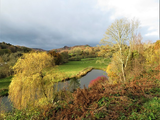
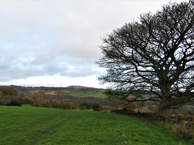
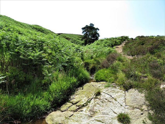
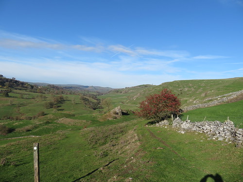
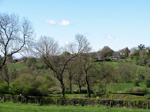
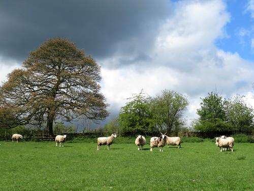
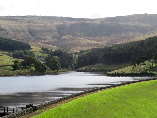
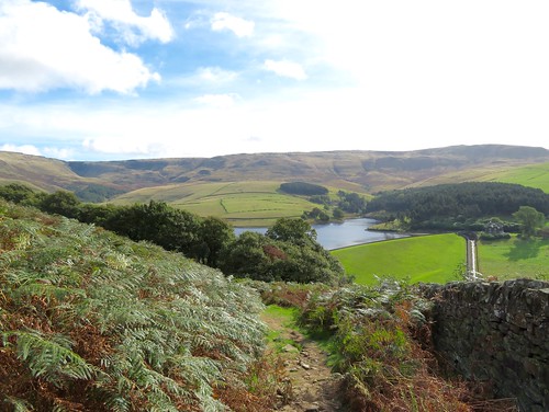
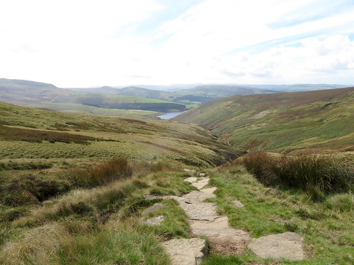
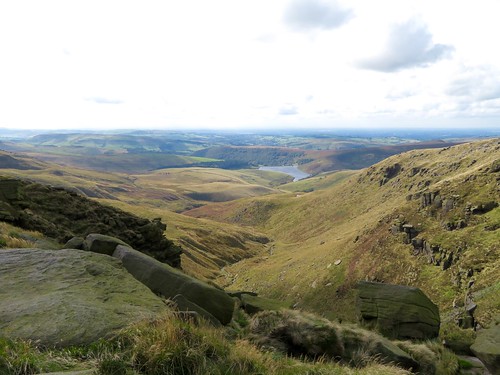
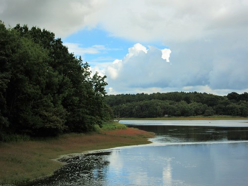
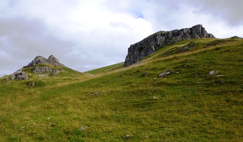
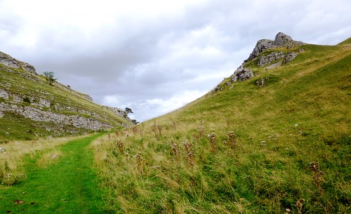
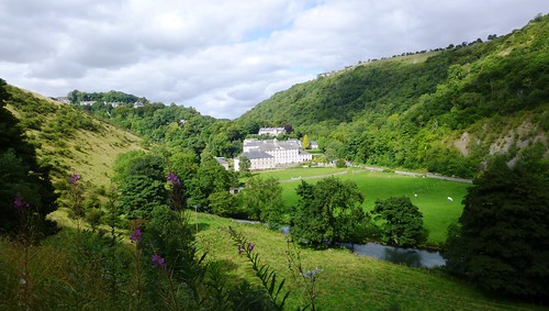
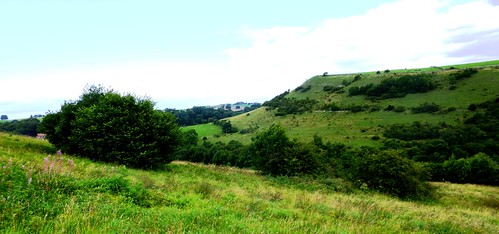
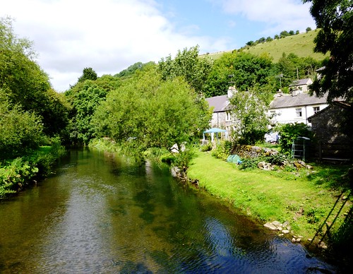
A mix of bruise-coloured cloud and patches of wintry blue sky roofed in the High Peak of Derbyshire. Here in the Derwent Valley the A6 road, the Cromford Canal, the Midland Railway and the Cromford & High Peak Railway all crowd together along the shallow-sided gorge cut through the limestone and sandstone by the snaking Derwent.

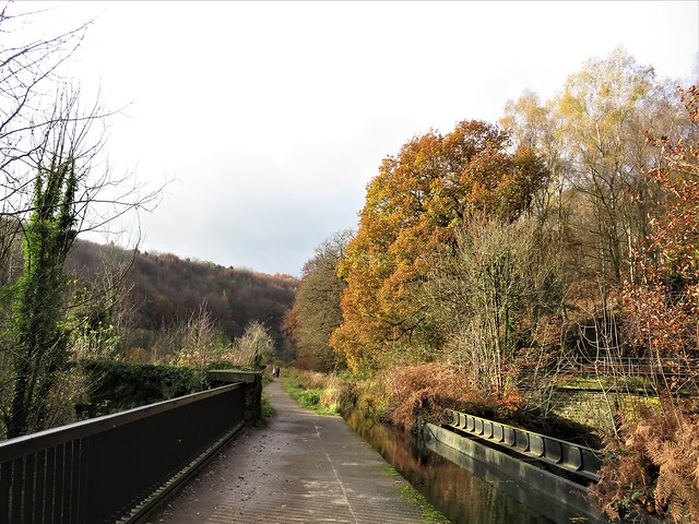
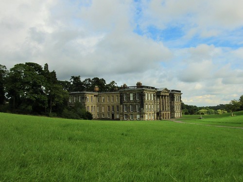
We crossed the Midland line and the fast-flowing Derwent, and turned east along the old canal. Sir Richard Arkwright built mills and massed workers’ housing in this damp green valley in the 1770s, after his clever invention of the water frame allowed unskilled workers to spin cotton without ceasing. With the canal bringing in raw cotton and taking the textiles away for sale, the Derwent Valley ruled the cotton world for a few decades.

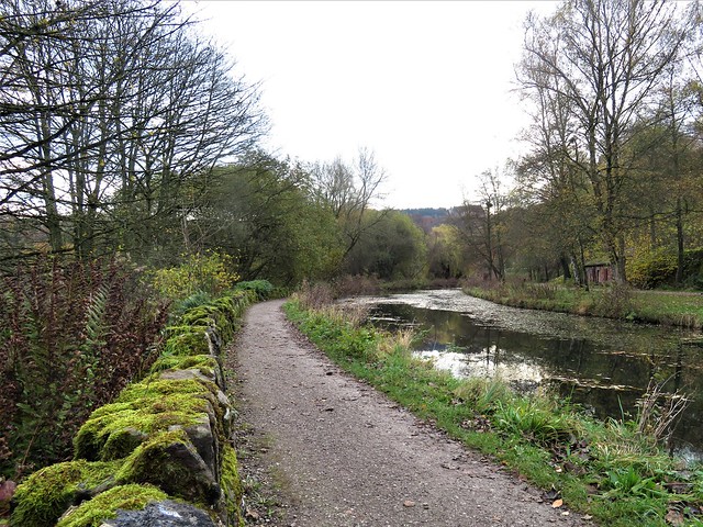
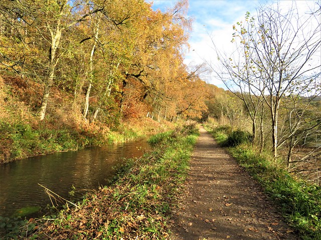
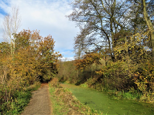
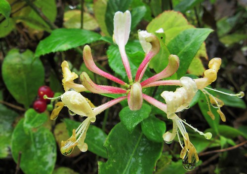
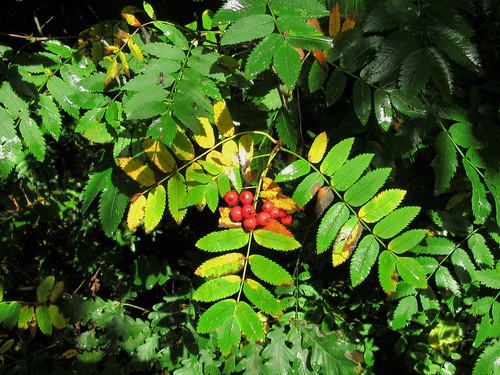
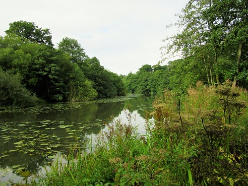
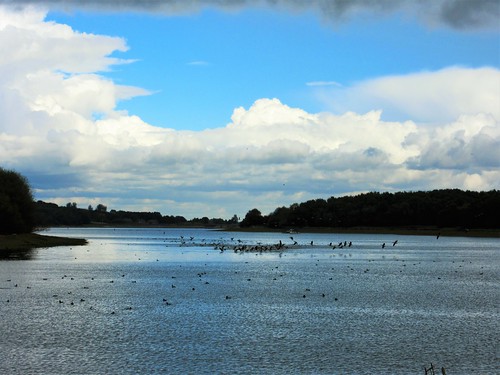
This morning all was quiet along the Cromford Canal, the loudest sounds the musical squeaking of dabchicks as they dived with a neat plop below the scatter of golden oak and birch leaves on the surface.

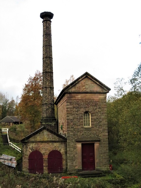
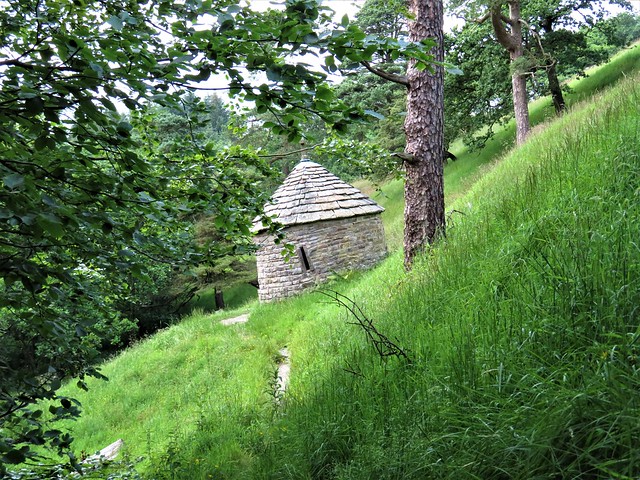
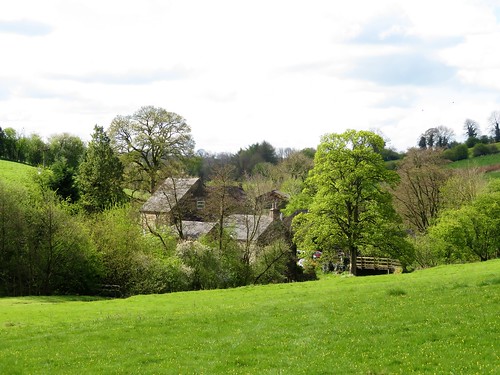
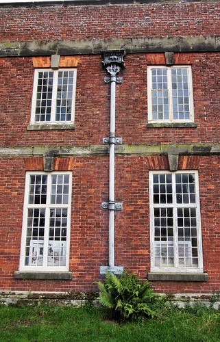
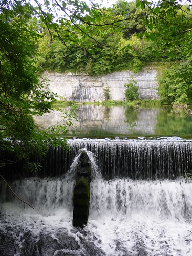
Beside the canal rose the tall chimney of Leawood pump house, built in 1849. Its severe classical style recalled an era when even a humble shed for a water pumping engine needed to be raised to glory by a dignity of architecture proper to Prosperity and Progress.

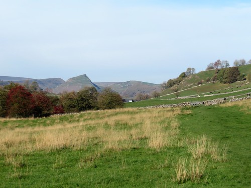
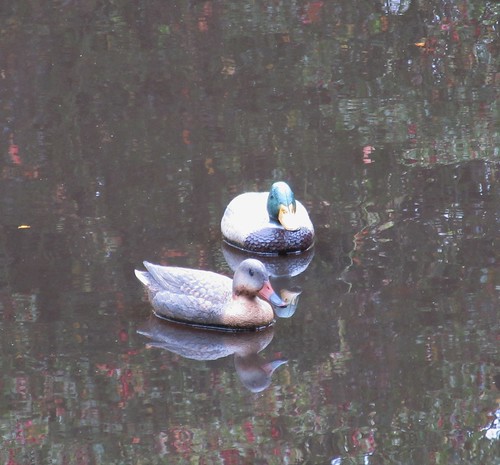
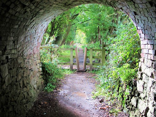
We passed through an echoing tunnel and emerged to find a pair of swans posed on the canal like a picture postcard, one daintily selecting specific morsels of greenstuff from the surface, the other preening breast and neck in a cloud of down. Ahead on the skyline a sunlit quarry cliff was topped by a tall obelisk like a lighthouse, the stark Crich Stand memorial to the dead of the First World War.

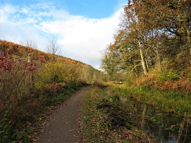
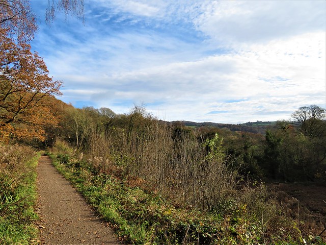
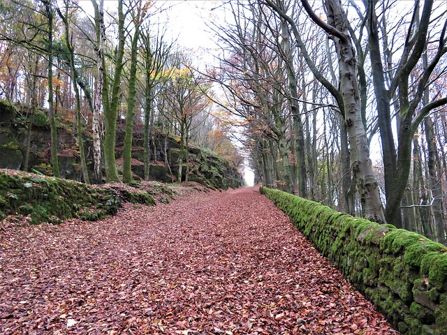
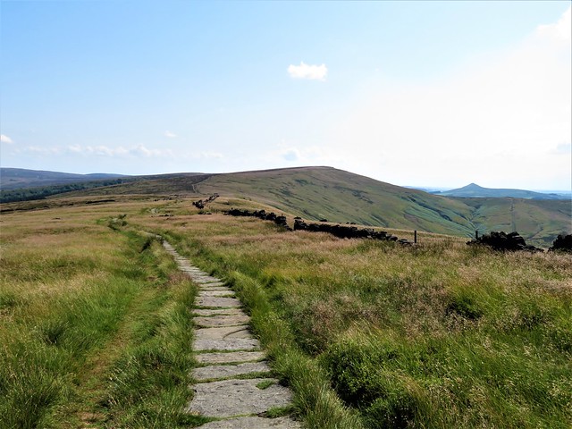
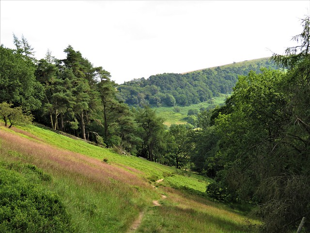
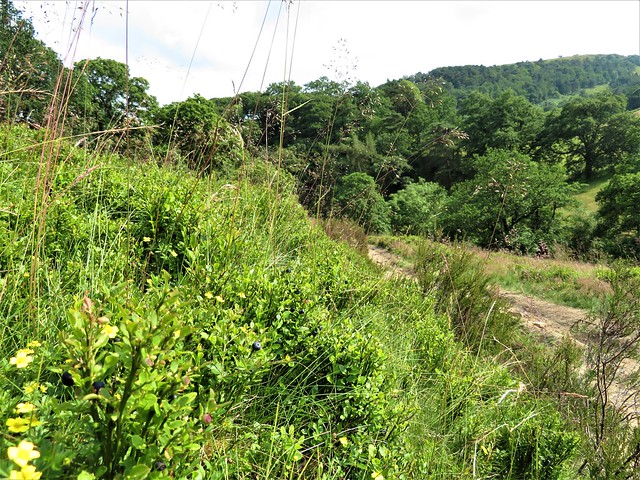
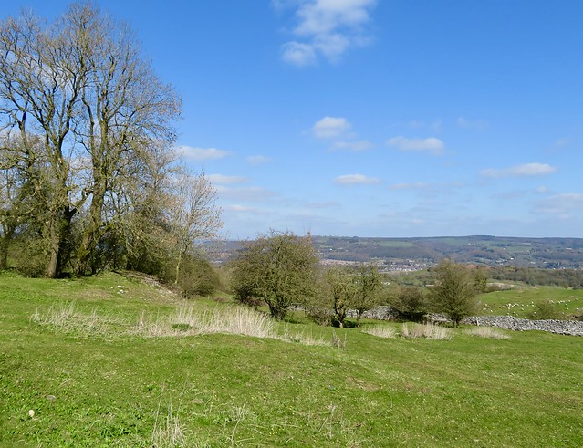
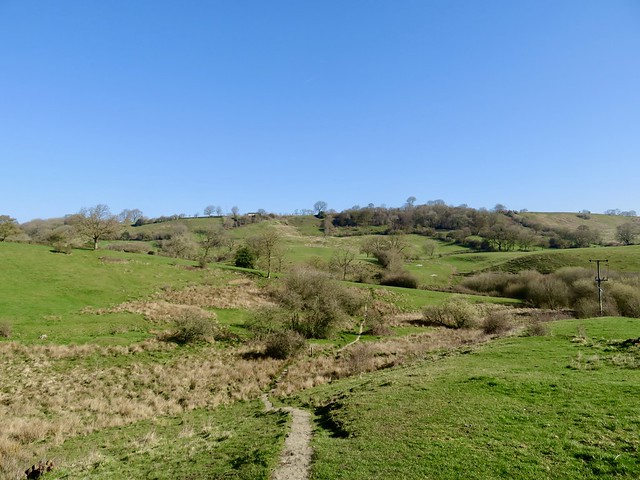
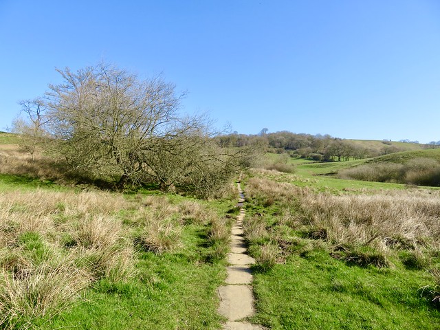
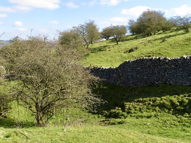
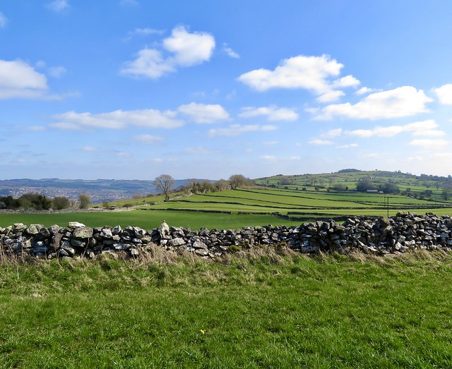
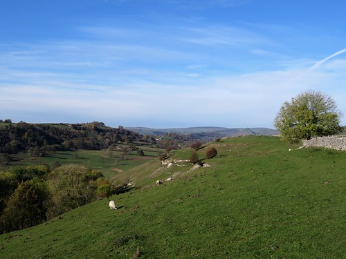
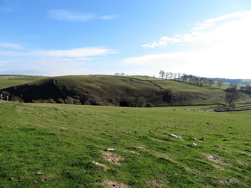
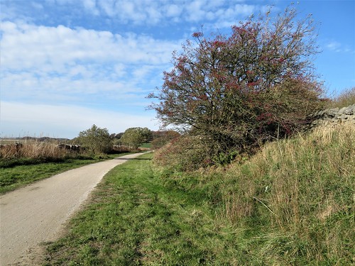
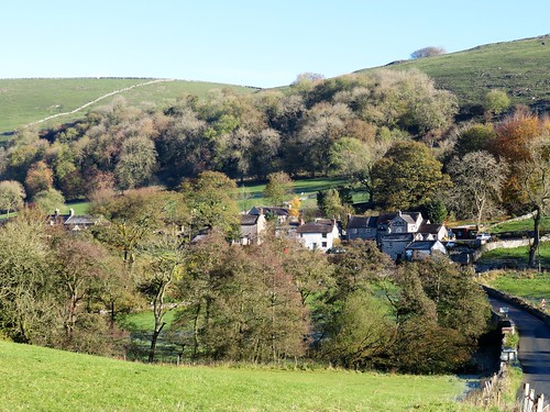
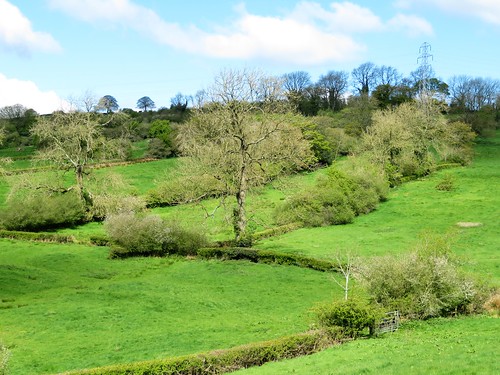
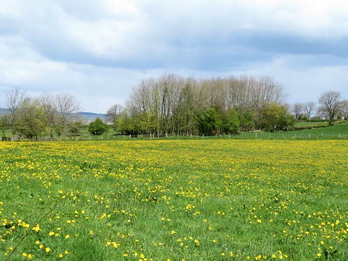
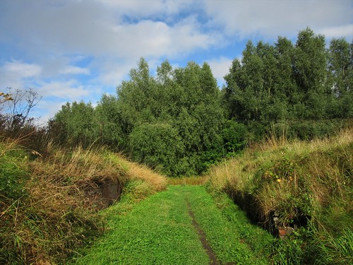
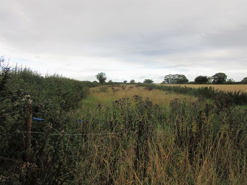
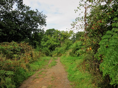
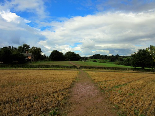
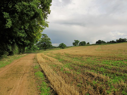
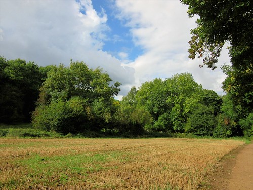
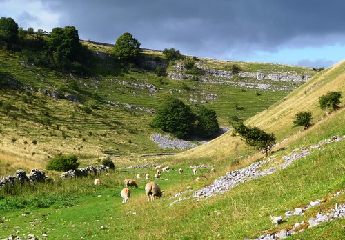
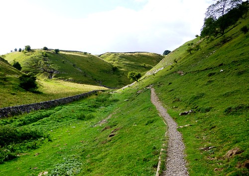
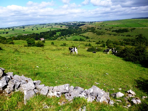
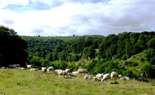
At Whatstandwell we crossed the Derwent and took to narrow stone-walled lanes that rose up the southern slopes of the valley. From Watergate Farm tucked low in its hollow we climbed past farms and sheep pastures, descending at last through a beechwood carpeted with bronze-coloured leaves to the steep incline of the horse-drawn Cromford & High Peak Railway.

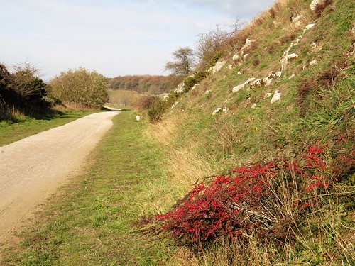
Near the bottom a black cave mouth opened beside the track – a catch pit, into which breakaway wagons could be diverted as they hurtled down the incline at over 100 mph. Peering into the catch pit, we saw the crumpled remains of one such truck, a salutary reminder of how danger once went hand-in-hand with working men’s employment.

How hard is it? 5½ miles; easy; towpath, hill paths, lanes

Start: High Peak Junction car park, near Cromford DE4 5AA (OS ref SK 314560)

Getting there: Bus TP2 from Cromford
Road – car park is off Lea Road, signed off A6 between Cromford and Whatstandwell.

Walk (OS Explorer OL24): Follow ‘High Peak Junction’ across River Derwent and railway. Left along left bank of canal (‘Ambergate’). Pass pumping house; in 150m, right across canal (316556, ‘Ambergate’) and on for 1¾ miles to Whatstandwell (332544). Right on A6 across river; on right bend, across stile ahead (330544, yellow arrow/YA, ‘Derwent Valley Walk’/DVW). Up to cross road and on (squeeze stile). In 150m, left (330545, YA) up steps. Follow DVW and YAs. In ½ mile, at gate (322541), don’t go through; turn right downhill (‘Midshires Way’/MW, ‘Cromford’) to Watergate Farm (322544). Cross drive; follow MW up fields to walled lane (320546); left (MW). At Whatfield Farm (319547) up right side of buildings (MW); on for 500m to cross B5035 (316551). Follow lane (MW) for 1 mile to High Peak Trail incline (304562). Right to car park.

Lunch/Accommodation: Greyhound Hotel, Cromford DE4 3QE (01629-823172, thegreyhoundatcromford.co.uk)

Info: visitpeakdistrict.com

 Posted by at 13:47
Jul 102021


First published in: The Times Click here to view a map for this walk in a new window
picture picture picture picture picture picture picture picture picture picture
Facebook Link:

The Goyt Valley lies just west of Buxton, a north-south cleft in the moors, tree-shaded and floored with two long and gracefully shaped reservoirs. A skein of paths leads along the River Goyt and up to the moors that stretch away on either hand.

The humpback packhorse bridge that spans the river below Goyt’s Clough Quarry stands witness to the importance of the valley as a crossing point for goods in times gone by. Quarrying, milling, and gunpowder making – they all went on down here along the rushing Goyt, so quiet and peaceful nowadays in its brackeny dell.

We climbed a stony track that steepened beside a tumbledown wall, its stones sparkling with mica in the sunshine. Up at the crest a thoroughly trodden path led up to the summit of Shining Tor and a tremendous view – west over a hazy Manchester to vague mountain outlines towards the Clwydian Hills in Wales, east over waves of Peak District heights, further south to the sharp shark’s tooth of Shutlingslow.

Now came a couple of miles of heavenly ridge walking, going north along an airy saddleback by way of Cats Tor where the brilliantly coloured bow shapes of paraglider sails appeared suddenly from below as though magically conjured out of the hill. This was sheer exhilaration, a walker’s reward for sweating uphill.

At Pym Chair (named after a highwayman said to have lain in wait hereabouts for unwary wayfarers), we turned down the road and back into the Goyt Valley along the slopes of the Errwood Estate.

A tiny circular chapel below the path held a tiled picture of Christ as a child with his father, Joseph the carpenter. The shrine was built in 1889 as a memorial to Doña Dolores de Ybarquen, an impecunious Spanish aristocrat who acted as governess to the children of Errwood Hall in the valley below.

We descended the slopes, plucking and eating ripe bilberries till our hands were as red as a murderer’s. The ruin of Errwood Hall stood forlorn above a stream, a run of Italianate arches hinting at its former glories.

Here we picked a handful of wild strawberries, and savoured their sweet bursts of flavour one by one as we followed the riverside path back down the Goyt Valley.

How hard is it? 7½ miles; moderate; moorland and estate paths

Start: Goyt’s Clough Quarry car park, near Buxton, Derbs SK17 6TT approx (OS ref SK 011734)

Getting there: Goyt Valley is signed from A5004 Buxton-Whaley Bridge road.

Walk (OS Explorer OL24): From Goyt’s Clough Quarry/GCQ, right along road. In 150m, right past wooden barrier; bear left through old quarry on track above road. At 3-finger post, right (014730, ‘Stakeside’) through wood. Follow ‘Shining Tor’ signs up to stile at crest (000730). Right; in 250m, left (001731, fingerpost) to Shining Tor (995738). Right along ridge for nearly 2 miles to Pym Chair (996767). Right on path beside road. In ½ mile, right (002761, ‘Errwood’ fingerpost); follow ‘Errwood’ past chapel (002759) and on. In ¾ mile, right in valley (006749, ‘Errwood’), then left before bridge (‘Errwood Hall’). At Hall, follow path passing below ruin; in 50m, left down steps (008747); left along lower drive with river on right. In 400m pass metal barrier and ‘Errwood Hall’ sign (010748); right on cobbled path, following ‘GCQ’. In 650m cross road (011741); follow ‘Riverside Path’. In 750m path climbs to road (011735); left to GCQ.

Lunch: Picnic.

Accommodation: Lee Wood Hotel, Park Road, Buxton SK17 6TQ (01298-23002, leewoodhotel.co.uk)

Info: Buxton TIC (01298-25106); visitpeakdistrict.com

 Posted by at 02:13
Mar 142020


First published in: The Times Click here to view a map for this walk in a new window
picture picture picture picture picture picture picture picture picture picture picture picture picture picture
Facebook Link:

Winster and its surrounding countryside were once a roaring, clanking, fume-laden lead mining environment, but you’d scarcely guess that nowadays. The grey-roofed hillside village lies along its jitties, a tight tangle of picturesque laneways that overlook a beautiful green valley. Only the velvety nap of the lumps and bulges on the hill slopes tells of the spoil heaps and mineshafts now sinking back into the landscape.

Under a sky of unblemished blue we threaded our way down the jitties and through the village. A path paved with old stone flags hollowed by countless feet led down across wet pastures into the valley and up again to the former packhorse road of Clough Lane.

Rutted, puddled, stony and scarred, the old way led east between its flanking stone walls. As it dipped and snaked through the wooded banks of Cowley Knowl, we saw ahead through the leafless trees the houses of Matlock wedged under their hill across the valley. Beyond, the skyline was broken by a fantastic cluster of black towers and battlements – the silhouette of Riber Castle, a grand 19th-century baronial pile built by Matlock mill owner (and millionaire) John Smedley.

In the valley bottom we cast around among old mine heaps to find the path. It rose steeply through Cambridge Wood to reach Wensley, another former lead mining village charmingly placed for views of hill and dale.

Beyond Wensley a green path followed the edge of Wensley Dale through stone walled pastures, then up a long bank peppered with old lead mine shafts, now sunk to mossy dimples in the ground.

At the top we turned along the Limestone Way long-distance trail, crossing tiny walled fields by way of innumerable squeeze stiles, their ancient stone uprights supplemented by tiny wicket gates on springs that snapped shut with a bang. Persons unusually stout of leg would have quite a job to negotiate these.

Lark song shimmered overhead. Pied wagtails hopped and bobbed as they turned over flakes of cow dung, looking for titbits. And as we came in sight of Winster’s pink-grey houses far below, the view opened northward past Darley Dale to Chatsworth House, pale and magnificent, half a dozen miles off, and the cushiony outlines of the South Yorkshire moors far in the distance against the china-blue sky.

Start: Winster South car park, Winster, Derbs DE4 2DR approx (OS ref SK 239602)

Getting there: Bus 172 (Bakewell – Matlock)
Road: Winster is on B5057, signed from A6 (Matlock – Bakewell) at Darley Dale.

Walk (7 miles, moderate, OS Explorer OL24): Right on gravel track to pass houses. Down lane by Rock View cottage; right at junction; right past Bank Cottage, down to cross B5057 at Market House. Down Woodhouse Lane; on down paved path for ¾ mile; north across valley and up to Clough Lane near Ivy House (244617). Right for 1 mile. Descend to T-junction by gateposts at Cowley Knowl (259619). Right to T-junction; right past barrier; fork left (fingerpost) downhill. At bottom, right across footbridge (258617, yellow arrow/YA); steeply up through Cambridge Wood and on to Wensley. Dogleg right/left across road (261610). Down steps; left along path (YA); in 200m fork sharp right uphill (not ‘Snitterton’). Follow path (YAs, stiles) southeast, soon steeply uphill, for 1½ miles. Just before road (271592), right on walled path; cross road and on along Moorlands Lane. In 400m right (266590), following waymarked Limestone Way for 2 miles to Winster.

Lunch/Accommodation: Miners Standard PH, Bank Top, Winster (01629-650279, theminersstandard.co.uk)

Info: winster.org; satmap.com; ramblers.org.uk

 Posted by at 00:30
Jan 192019


First published in: The Times Click here to view a map for this walk in a new window
picture picture picture picture picture picture picture picture picture picture picture picture picture picture picture picture
Facebook Link:

The trains of the Cromford & High Peak Railway – first drawn by horses, then by steam locomotives – ran through some of the most beautiful landscapes in the Derbyshire Peak District. Where horses once plodded with coal and limestone, and tank engines puffed with sparse numbers of passengers, cyclists and walkers now follow the narrow curves of the line, rechristened the High Peak Trail.

On a superb morning, crisp and cold, we joined the trail at Hurdlow. Either side the limestone landscape rolled away, intensely green under the low sun, an upland broken into sharp peaks and shadowy valleys.

At the vast open chasm of Dowlow Quarry we left the High Peak Trail for stone-walled lanes with wonderful high prospects south into a countryside so fractured it resembled a choppy sea. A knobbly path led us in the shadow of High Wheeldon, a conical knoll presented to the National Trust as a war memorial to men of Staffordshire and Derbyshire killed in World War Two.

Down in the lane to Crowdecote they were herding cattle between field and farm. Those in the lane bellowed and trumpeted, and those in the adjacent fields returned the compliment. ‘Bit lively,’ grinned the farmer waiting to turn them into the farmyard.

Crowdecote clung like a limpet to its steep, sunny hillside. Beyond the hamlet there was ice in the hoof pocks of the bridleway, and frost blanketing the fields on the shadowed side of the dale. Limestone outcrops scabbed the high slopes. Pale grey field walls striped the pastures, footed in their own black shadows, resembling giant claw scratches in the ground.

The path led past the crumpled hillocks where Pilsbury Castle once stood – a pair of baileys and a motte, built by the Normans shortly after the Conquest to levy tax on the traders that used the ancient packhorse route through the dale.

We followed the old way through uplands of sheep fields, past standing stones whose edges had been rubbed shiny by sheep easing their manifold itches. A dip and climb past Vincent House farm, another past the farmyard at Darley, and we were bowling along the High Peak Trail towards Hurdlow with sublime hill scenery unrolling on either hand.

Start: Hurdlow car park, Sparklow, Derbs SK17 9QJ (OS ref SK 128659).

Getting there: Bus 442 (Ashbourne) to Bull-i’-th’-Thorn (½ mile by footpath)
Road – Hurdlow car park is off A515 between Pomeroy and Parsley Hay.

Walk (9½ miles, cyclepath and well marked field paths, OS Explorer OL24): North-west along High Peak Trail for 1½ miles to end (111673); left on Cycleway 68. In ½ mile, right on lane (109665) to cross road at Wheeldon Trees (102662). Through gate (fingerpost) down to NT High Wheeldon notice; right downhill (yellow arrow/YA) to road. Left to Crowdecote. Just past Packhorse Inn, left along lane (101652, ‘South Peak Loop’ bridleway). Follow SPW (blue arrows) through fields. In 1 mile pass Pilsbury Castle mounds (115639); left through gate; fork left up footpath; follow YAs over hill, crossing one road (121634), then another at Vincent House farm (137632). Through farmyard (YAs); up right-hand of two parallel tracks. Follow ‘Parsley Hay’ and YAs to cross road at Darley Farm (142637). YAs through farmyard, up field edge to High Peak Trail (143639); left for 2 miles to Hurdlow car park.

Lunch: Royal Oak, Hurdlow SK17 9QJ (01298-83288, peakpub.co.uk) – busy, friendly pub near car park.

Accommodation: Ye Olde Cheshire Cheese, Longnor SK17 0NS (01298-83218; robinsonsbrewery.com)

Information: Ashbourne TIC (01335-343666); visitpeakdistrict.com; satmap.com; ramblers.org.uk

 Posted by at 01:13
May 122018


First published in: The Times Click here to view a map for this walk in a new window
picture picture picture picture picture picture picture picture picture picture picture picture picture
Facebook Link:

A beautiful, bitterly cold late spring morning of blue sky in the southern skirts of the Peak District. Carsington Water lay glittering in the sunshine, early joggers already limbering up by the Visitor Centre. Once we’d crossed the Wirksworth road, though, we met no-one on the field paths except sheep.

Young lambs with wriggling tails dived under their mothers’ fleeces to butt and tug at the maternal udder. Around Overtown Farm the corrugations of ancient ridge-and-furrow undulated beneath the grass, a sign that these dandelion-spattered fields have remained unploughed pasture since medieval times.

Hedge roots were lost in a blue blur of forget-me-nots, and trees still scarcely in leaf rang with spring bird calls, chiffchaffs in blurting phrases and lesser whitethroats in ecstatic scribbles of song.

At the Church of St Bartholomew at Hognaston we came across a sign from even more distant ancestors – an 800-year-old image, carved in the tympanum over the south door, of a shepherd, crook in hand, guarding the Lamb of God from the attentions of a wolf, a wild boar and a bushy-tailed fox. Overhead an eagle, having seized its chance, is making off with a long-beaked fowl in its clutches.

Silver-bellied clouds were beginning to sail across the blue sky as we climbed the lane to Atlow Winn. A Jacob ewe with four horns and a fleece of white and tarry brown stared flintily at the two trespassers in its pastures. Four tiny lambs squirmed out of their pen to sniff my hands, attracted by the woolly texture of my fingerless mittens.

As we climbed the steep pastures the backward view widened over the gunmetal grey sheet of Carsington Water in its cradle of hills. At the ridge of Madge Hill a superb forward prospect opened westward across a billowing green landscape to the sharply peaked cliffs of The Roaches, rising above the Staffordshire moorlands fifteen miles off.

A wintry shower rushed out of the west, blowing pellets of snow around us. Winter was not quite done with this countryside, it seemed. We headed back towards Hognaston over fields thick with dandelions, every golden head still turned towards where the sun had been pouring out its springtime warmth and light only moments before.

Start: Carsington Water Visitor Centre, near Wirksworth, Derbyshire DE6 1ST (OS ref SK 241517)

Getting there: Bus 111 (Ashbourne-Matlock). Road: signposted off B5035 (Ashbourne-Wirksworth).

Walk (5¾ miles, easy, OS Explorers OL24, 259): Return to car park entrance; left along cycle/footpath (red trail marker, ‘Carsington Water Circular Route’). In 150m, right (fingerpost) through trees to cross B5035 (239515). Up hedge; in 80m, left through wicket gate/WG. Cross fields through successive gates (yellow arrows/YA). In 2nd field, aim for bottom left corner and squeeze stile (SS) into green lane (237512). Left; in 200m, right through 2 WGs (YA) into field. Left along hedge to SS and on to Green Cottage (WGs) and road (236507).

Ahead up road; left at Hognaston church (235506). In 100m, right at bus shelter through drive gate of Old Hall (footpath post). Follow right-hand wall, through 2 WGs (YA). In field beyond house, follow middle of 3 paths, half left down to WG/SS in bottom left corner (234502). At 2nd WG/SS, keep ahead to cross footbridge, then duckboards (SS, white arrow/WA). Keep same line through succession of SS (WAs). Approach mill buildings, bear left across stream to cross lane (232495). On along left bank to lane at Highfields Farm (232490).

Right; in 100m, right up Winn Lane (‘Unsuitable for Motors’). In 100m fork right (‘The Shaws’). In 600m through ‘Shaws’ entrance gate (224493, WA). Before house, right through gate; half left to cross stile on skyline. Right (WA), heading half left to gate into Atlow Winn farmyard (222494). Left between house and barn; through gate (YA); ahead to stile (YA); half left across field to waymark post by wall gap (221497). Cross step stile; up field edge with wall on right; in 100m, right (YA), bearing half right across ridge to step stile into lane (219498).

Right. In 400m, opposite old metal WG on left, turn right up steps (219503, YA), through trees to cross drive. Through metal WG (fingerpost); half left across field, aiming not for WG, but for metal gate to its left (222504, YA). Descend across fields for 500m to gravel track (228505). Left; in 400m, approaching Hognaston, fork right, descending to village street (234507). Right to church; retrace outward route to car park.

Lunch: Red Lion, Hognaston (01335-370396, redlionhognaston.uk)

Accommodation: Breach Farm, Carsington DE4 4DD (01629-540265, breachfarm.co.uk) – immaculate, delightful B&B

Carsington Water Visitor Centre: 01629-540696, visitcarsington.co.uk
Info: visitpeakdistrict.com; satmap.com; ramblers.org.uk

 Posted by at 01:30
Oct 282017


First published in: The Times Click here to view a map for this walk in a new window
picture picture picture picture picture picture picture picture picture picture picture picture picture picture picture picture picture picture picture
Facebook Link:

A bunch of lads and girls were shouting cheerfully at one another as they punted a ball about the playing field at Rosliston Forestry Centre. Under a brisk sky they gave an upbeat flavour to the start of our walk through the young plantations along the National Forest Way.

What the National Forest has done for a great swath of the post-industrial Midlands is an unsung miracle. Across 200 square miles of countryside dug, delved and scooped into holes by coal mines and quarries, a green flood of trees is being released – 20 million of them. Dozens of small new woodlands, many linked to form wildlife corridors, lie scattered across the scarred landscapes of Derbyshire, Leicestershire and Staffordshire, their skein of footpaths beckoning to walkers.

The National Forest Way forms the spine of this network of paths. We followed the well-marked Way along the edge of Rosliston Wood until we left it for the farmland paths around Caldwell. A hundred starlings blackened the hedges at Longlands Farm, stripping the elderberries until our approach had them whirring off in a cloud like clockwork birds.

We crossed an old railway, a curve of thistles and thick grass in the corn stubble, and threaded our way along the footpath through Long Close Wood among oak, ash and wild cherry now thirty feet tall. Long Close Wood was planted twenty years ago as part of the ‘Woods on your Doorstep’ scheme, a far-thinking initiative that saw 250 new woods created to celebrate the Millennium.

In Top Wood the rowans hung thick with orange berries, the guelder rose bushes with crimson fruit. Hard green crab apples lay where they had tumbled onto the path. Every leaf shone in the sun, making a glitter of the patchwork of gold, green and scarlet. Near Park Farm a row of poplars stood tall as guardsmen with straight backbones and puffed out chests.

The trees of Penguin Wood, planted just ten years ago, stood only shoulder-high. But the ground around them was bright with late-blooming wild flowers – ragwort, plantain, meadowsweet and lady’s bedstraw. We left the young wood and followed the National Forest Way back to Rosliston, scarcely able to believe the transformation of what was, only a generation ago, a dark and derelict landscape.

Start: Rosliston Forestry Centre, Burton Rd, Rosliston, Derbs DE12 8JX (OS ref SK 243176)

Getting there: Bus 22 (not Sunday), Burton-Swadlincote.
Road – M42 (Jct 11), A444 towards Swadlincote, then follow ‘Linton’ and ‘Rosliston’.

Walk (6 miles, forest and field paths, OS Explorer 245): From ‘National Forest Way’/NFW notice at back of car park, go left and follow NFW arrow to right. In 100m cross playing field to bottom right corner. Left on gravel track. In 200m, right; follow NFW past lakes and across a long footbridge (247177). Right along forest edge. In ½ mile, reach a clearing with bench and crossing of tracks (250170). Leave NFW here, turning sharp left on grass path, passing ‘Cauldwell’ signpost. Along field edge to driveway; ahead to road in Caldwell (255173).

Right past Pegasus School. In ¼ mile on right bend, left through gateway (257170, fingerpost); half right across field to cross Cauldwell Road (259167, stiles, fingerposts). Half left across field, aiming for Longlands Farm (261164); left through 2 wicket gates; on along left side of shed. At far end, cross stile; half right across paddock to gate at far right corner. Left up field edge with hedge on left; through gateway; on with wood on left. Over stile; cross field, then old railway (267165). Cross next field; through hedge; half right, aiming left of white house on far side to reach road (270165).

Cross into Long Close Wood (signed). In 20m fork left along north edge of wood. In 150m, at info board, right along Public Right of Way. In 450m, cross old railway (272159) and on. At a clearing, fork left under electricity wires, past a stile (yellow arrow/YA) and on with poplar hedge on left. Enter Top Wood (271153, signed); in 70m, right (NFW) past Park Farm and on.

In 600m dogleg left/right across road (262156); on past ‘Penguin Wood’ sign across field with trees on right. In 150m turn right, then immediately left over stile into enclosure. Follow grass path to telegraph pole; fork left to cross lower stile; path to north edge of Penguin Wood (259159). Left; follow wood edge as it curves left. In 100m, right across plank bridge; right to footbridge (257159). Ahead (NFW) across large field, aiming to left of Blakenhall Farm. Between 2 oak trees; cross path (255162); past 2 trees beyond; ahead to cross Linton Road (253165).

Along drive, past Cinderlands Cattery (251166), then field edges and forestry outskirts (NFW). Just short of Calves Croft Farm, NFW turns right (249169); keep ahead here to ‘No Public Access’ notice. Left (footpath waymark) round field edge to stile (246170, YA). Right through Rosliston Wood on grass path, past wooden playground, to car park.

Lunch: The Hub Café, Rosliston Forestry Centre

Accommodation: Riverside Hotel, Branston, Staffs DE14 3EP (01283-511234, facebook.com/oldenglishinns)

Rosliston Forestry Centre: 01283-563483, www.roslistonforestrycentre.co.uk

Info: nationalforest.org
visitengland.com; satmap.com; ramblers.org.uk

I would like to  draw your attention to the Isle of Wight Classic Buses, Beer and Walks Weekend taking place 14/15 October.   This is an annual event and travelling on classic buses – 101 in total – and is absolutely free.    People are encouraged to purchase a £6 programme which details all walks and pubs with maps and timetables, plus £40 worth of offers from participating pubs. 
 
Here’s a list of walks http://iwbeerandbuses.co.uk/walks.php.     

 Posted by at 02:33
Nov 192016


First published in: The Times Click here to view a map for this walk in a new window
picture picture picture picture picture picture picture picture picture picture picture
Facebook Link:

On a lovely crisp morning we went up the narrow road from Bowden Bridge with Kinder Edge in our sights and old heroes on our minds. It was up this road that the Mass Trespassers came on an April morning in 1932, a righteous crowd of left-wing youngsters from Manchester and places around. Kinder was their aiming point, too, the great moorland plateau and its gritstone crags that had become symbols of exclusive privilege and the closing of upland country to ordinary folk.

The long path up to the moor led us above Kinder Reservoir through the heather and bilberries of White Brow, then steeply up the rocky cleft of William Clough where a beck came sluicing down over its boulders. The full sweep of Kinder Edge stood out to the east, a sharply cut skyline of dark rock outcrops traversed by diminutive figures of walkers. The flanks of William Clough opened out to shoulders of hillside, where in 1932 a line of keepers had waited with sticks to beat the trespassers back where they belonged.

These young men and women, many of them Communists, had had enough of staring up from the depression-hit, dirty and poverty-ridden cities of Manchester and Sheffield to the high open moors where grouse-shooting and water board interests forbade them to ramble. When they reached the higher slopes of William Clough the singing and chattering turned to angry shouting as they closed with the keepers. No heads were broken: some bumps and bruises were exchanged, and the trespassers broke through to rejoice as they reached the top at Ashop Head.

We pictured that excited, flush-faced crowd as we turned across the peat bog of Ashop Head and climbed to the start of the long escarpment of Kinder Edge. From here it was a question of following the edge for mile after mile, the wind nudging us, the gritstone crunching under our boots, looking out over a magnificent view to Manchester and the far hills of Wales. The rock outcrops had been cut and smoothed by wind and weather into multiple grotesques: chef hats, shark fins, dog heads, ogre noses.

We picnicked on a rock beside the trickling river at the head of the cleft of Kinder Downfall, and went on to where the Pennine Way fell away east towards its starting point at Edale. A good long stare down the delectable green Vale of Edale, and we were trudging westward down an endless lane home, thankful to those hearty lads and lasses from long ago whose bold law-breaking laid the foundations for today’s Right to Roam over all these high moorlands and mountains.

Start: Bowden Bridge car park, Hayfield, Derbyshire, SK22 2LH approx (OS ref SK 049870)

Getting there: Hayfield is at junction of A6015 from New Mills and A624 (Chapel-en-le-Frith to Glossop). Beside Packhorse PH, take Kinder Road; car park is 1 mile on left (£4.50 all day).

Walk: (9 miles, strenuous, OS Explorer OL1): Continue up road. At Booth Sheepwash cross river (051876); in 100m, ahead up path (yellow arrow, YA). In 250m, left across river; at reservoir gate, take cobbled bridleway on left (‘White Brow’). In 300m, by stone gateway, hairpin left (054882, metal ‘bridleway’ sign). Climb to gate; right (‘Snake Inn’, YA). Follow path for 1½ miles via White Brow and William Clough (steep near top) to meet Pennine Way/PW at Ashop Head (065900). Right along PW, following Kinder Edge, for 3½ miles. Beyond large outcrop of Edale Rocks (079867), descend to cairn at junction. Right on flagstone path; 150m short of junction on wide saddle, fork right off PW onto dirt track to junction (081861). Right through gate; follow lane for 2¾ miles down to Kinder Road and car park.

Conditions: Rugged hill walk, tricky underfoot – wear good boots!

Lunch/Accommodation: Sportsman Inn, Kinder Road SK22 2LE (01663-741565)

Kinder Scout mass trespass walk: nationaltrust.org.uk

visitengland.com; satmap.com; ramblers.org.uk

 Posted by at 01:38
Oct 312015


First published in: The Times Click here to view a map for this walk in a new window
picture picture picture picture picture picture picture picture picture picture picture picture picture picture picture picture
Facebook Link:

Soft autumn sunlight lay over south-west Derbyshire, tipping the hedges with scarlet berries and showing up the medieval ridge-and-furrow in the fields around Ticknall. Once across the old limestone tramway and into the broad acres of Calke Park, it was all a gentleman’s idealised landscape of graceful old oaks and chestnuts, in whose shade fat white sheep grazed the parkland meadows.

Acres of land and quarries of limestone made the Harpur family’s fortune, and the park they laid out around their Palladian house of Calke Abbey in the 18th century is a dream-like place to wander on a soft autumn day. We followed the National Forest Way as it wound past enormous gold-crowned oaks, bulbous with age, and the long ponds below the house and stables.

The Harpurs (later Harpur-Crewe) were famous for their love of racehorses, their lack of impact when they tried their luck in the political world, and their almost pathological craving for solitude. All they wanted was to be left alone in their great park and house.

When the National Trust acquired the property in 1985 in lieu of death duties, it was as a time capsule, perfectly illustrating the decline of the English country house in the 20th century. There’s no Downton Abbey glamour or polish to Calke Abbey. This is a family house where spending trickled to a stop. Low-wattage bulbs dimly light the mounted heads of favourite cattle, caskets of mineral collections and ancient cartoons pasted onto the wallpaper. It’s all tremendously subfusc and poignant.

From the great house in its hollow we found our way along a back road to the shores of Staunton Harold reservoir, a lion-shaped sheet of water where hundreds of greylag geese trumpeted to the cloudy heavens. In Calke Abbey’s deer enclosure a couple of magnificently antlered fallow bucks were restlessly pawing the ground in anticipation of the rutting season.

Out across stubble fields, and in among the iridescent grey ponds, the steep hummocks and canyons of Calke Limeyards, where limeburners once slaved at the kilns for the Harpur-Crewe family. We ducked through a tramway tunnel towards a chink of green and gold light at the far end, and came out into fields around Ticknall where medieval peasants ploughed the ridge-and-furrow when monks still sang their vespers at Calke Abbey, long centuries before the Harpurs had ever been heard of.

Start: Staff of Life PH, Ticknall, Derbyshire, DE73 7JH (OS ref SK351238)

Getting there: Bus service 61, Derby-Swadlincote
Road – Ticknall is on A514 between Derby and Swadlincote.
Staff of Life PH is on corner of A514 and B5006 road (‘Smisby’).

Walk (6 miles, easy, OS Explorer 245): From Staff of Life PH, left along B5006. In 100m, left (fingerpost) across 2 fields (yellow arrows/YA) to cross tramway path (353235). Cross next field; turn right along gravelled cyclepath. In 250m, opposite Middle Lodge, through gate (357232, ‘National Trust’ sign): emerge from woodland; bear right down left side of driveway. In 200m, pass yellow-topped post/YTP (359229, ‘National Forest Way’/NFW); follow path through trees. In 400m, just before Betty’s Pond, hairpin back on your left at YTP (363228; yellow, blue, pink arrows) up path and steps. At top, right for 100m to ‘Old Man of Calke’ oak (363229).

Return to pass east end of Betty’s Pond. Through gate; bear left on narrow path beside long pond. In 250m, bear right at gate (365228) up steps. In 100m, hairpin left, through gate and car park to Calke Abbey.

Follow path down right side of stable block (NB shop, restaurant). Through gate (367226); on down drive with wall on left; pass church (369223) and on to road (373223). Left; in 450m, at end of road, ahead through wall gap (375226, ‘Maroon Walk’, NFW), down to Staunton Harold reservoir. Left along shore; right across weir (372228). Follow path anticlockwise round edge of deer enclosure. In 700m, through gate; ahead past info board (368233); in 50m, right through gate (YA); left over stile.

Half-right across fields past White Leys house. At far side of second field, path enters hedge. Follow path to right; continue with hedge on left. Over stile (YA) and on with hedge on right. In 300m, path bends right into trees (362236). In 200m look left for gate and stile down a slope. Through gate (NT); follow trail (NT markers) through Calke Limeyards. In 400m, through arch; continue along trail to go through Ticknall Tramway Tunnel (356237). In 200m, right through gate (353235); retrace steps to Ticknall.

Lunch/Accommodation: Staff of Life, Ticknall (01332-862479, thestaffoflife.co.uk) – excellent village pub with rooms

Calke Abbey (NT): 01332-863822, nationaltrust.org.uk. House open mid Feb-end Oct; park, restaurant, shop open all year.

Info: Swadlincote TIC (01283-222848)

visitengland.com satmap.com; ramblers.org.uk

 Posted by at 01:51
Jan 112014
 

Litton lay stretched like a sleepy cat along its lanes; a grey stone village, typical of the Derbyshire uplands, in the embrace of green pastures and loosely knit stone walls. First published in: The Times Click here to view a map for this walk in a new window
picture picture picture picture picture picture picture picture picture picture picture picture picture picture picture picture picture picture picture picture picture picture picture
Facebook Link:
It had been too long since I’d had a good day’s walking with my London-based daughter Ruth. Crossing the fields and dropping south into the curving cleft of Tideswell Dale, we chatted away nineteen to the dozen, catching up on each other’s lives.

It’s small wonder that the Peak District is so tremendously popular with walkers, especially the very beautiful and spectacular dales or water-sculpted canyons that burrow their way through the pale grey limestone of the White Peak district. History doesn’t relate whether these strikingly beautiful surroundings were of any comfort to the 19th-century workers – some of them small children – who slaved away in the textile mills in the dank and cold dale bottoms.

In Miller’s Dale we crossed the River Wye beside the mill-workers’ terrace cottages and climbed the steep bank of Priestcliffe Lees, where young Friesian heifers put their rubbery noses over the wall to sandpaper our fingers with glutinous yellow tongues. At Brushfield the old farm-children’s school stood high among stone cottages with massive lintels, looking down into the tree-choked canyon of Taddington Dale.

Down in Monsal Dale we picnicked on a grassy shelf by the gurgling Wye, and then followed the old Buxton-Matlock railway line – now a superb cycleway – into Miller’s Dale, where Cressbrook Mill stood huge and handsome in the throat of the valley. The Brewstop Café behind the mill is run by three siblings (the oldest is 14), and their tea and cakes are a walker’s dream.

In Cressbrook Dale, up where the cleft opens grey rocky lips to the sky high overhead, a great outcrop of limestone hangs over the path – Peter’s Stone, where the bodies of executed felons were once hung in a gibbet as a terrible warning to all. Today, as we turned back along the rim of the dale towards Litton, the dark stain of the past seemed cleaned away by the low evening sun that washed the rock in a flood of gold.

Start: Red Lion, Litton, near Tideswell, Derbyshire, SK17 8QU (OS ref SK 164752)
Getting there: Bus – 173, 65, 66 (Buxton – Tideswell). Road – Litton is signed off A623 Peak Forest – Baslow road at Wardlow Mires near Tideswell
Walk (12 miles, moderate, OS Explorer OL24): From Red Lion, left along village street. Pass ‘Cressbrook’ turning; in 50m, right, then left over stone stile (166751). To far left corner of field; right along lane to road (165749). Ahead to left bend; over stile (fingerpost); follow field path/stiles to cross road (161748). On down to road (160749); left to B6049 (155748). Left for 20m; left through gate; follow wall beside road, past car park (154742) and on along Tideswell Dale. Left at ‘Quarry’ sign (154740) to quarry (155738); follow ‘Concession Path’ to steps back into dale bottom (155736). Left for ½ mile to road in Miller’s Dale (157731).
Left to cottages at Litton Mill; right (159730, ‘Monsal Trail to Miller’s Dale’) across river and up dale side. Cross Monsal Trail (158730); up steps by bridge, left over stile; up path (‘Priestcliffe Lees’), following yellow arrows/YAs. At top, through lumpy mining ground, following left-hand wall to turn left over stile (154725, YA). Right to stile into stony lane (153723). Left for ¾ mile to Middle Farm. At T-junction, left (159715, ‘Monsal Dale’). In ½ mile pass fingerpost (167717, ‘Upper Dale’), in 100m, right (‘Lees Bottom, White Lodge’) to farm track; follow it to farm (167712). Follow ‘path’ sign/YAs onto stony track beyond barn. In 200m, left (168710; fingerpost) over stile; follow stepped path down into Monsal Dale. At bottom, left (171708, ‘Monsal Head’) for 1¼ miles to viaduct (181716).
Left along Monsal Trail for nearly 1 mile. At mouth of Cressbrook Tunnel, right through gate (172724, ‘Cressbrook’) on path descending to cross river beside weir (172728). Bear right on path past Brewstop Café and Cressbrook Mill. At road, left; fork right (‘Cressbrook, Litton’); in ¼ mile, fork right (171732, ‘Ravensdale’). Pass Ravensdale Cottages (172737); in ¼ mile go through gate marked ‘Cressbrook Dale’ (172741); in 100m fork left and follow dale bottom for 1½ miles past Peter’s Rock to A623 (180756) at Wardlow Mires (NB 3 Stags’ Head PH to right). Left along A623 for 100m; left (stile, ‘public footpath’) up field wall to cross stile (177756); across field to cross stile; right up wall to road (173754); left into Litton.
Lunch: Brewstop Café, Cressbrook (weekends, school holidays); 3 Stags’ Heads, Wardlow Mires (01298-872268); Red Lion, Litton (01298-871458).
Accommodation: Cheshire Cheese Inn, Castleton, S33 8WJ (01433-620330; cheshirecheeseinn.co.uk) – bustling, cheerful place.
Info: Bakewell TIC (01629-816558); visitpeakdistrict.com;
www.ramblers.org.uk www.satmap.com www.LogMyTrip.co.uk visitengland.com

 Posted by at 01:41
Oct 192013
 

Click here to view a map for this walk in a new window
Walk Directions (7 miles, easy gradients, OS Explorer 245):

Through gate in car park fence (yellow arrow/YA); past church, along 2 field edges. Cross bridleway (349242, blue arrows); ahead with hedge on left, past Windmill Wood. Through gate under big ash tree (343250); through next gate at Hangman’s Stone and turn left (341252; no waymark), following field edge for ½ mile to road at Bendalls Farm (334249). Left, then right (336248, ‘Foremark Reservoir’) along roadway. In 300 m, by 3 tall wooden posts, right (336245) to reservoir edge (334244). Left for 500 m to Visitor Centre (336241); take path through woods (you soon pass a ‘Carver’s Rocks’ sign). In ¾ mile you cross a wooden stage over a pond in a dip (333229); fork left up bank to ‘Badger Path’ sign (334228); right up steps. At top (334226), right through car park; follow roadway as it curves left.

In 250 m, right through gate in fence (YAs); down stony path to Carver’s Rocks (331227; notice board). Follow path anticlockwise at feet of Rocks for 400 m, up to open area (331225). Ahead to cross it, and keep same direction along grassy path between blocks of trees. In 300 m, in a wet dell (333222 – an angle of fencing is shown on OS Explorer map), don’t bear right or take path past notice board, but keep ahead on lowest path to A514 (334222). Turn right on grassy path with hedge on left between you and road. In 200 m, left across stile, left to cross A514 (334220).

Ahead up Coal Lane. Just beyond entrance to coppice House Farm, left through hedge gap (336220). Ahead with The Oaklands wood on right; cross stile and keep ahead. Round right bend; in 70 m over the first of 2 stiles close together (339221). Follow field edge with fence and ditch on right; follow it round left angle; in another 100 m, through gateway in hedge (341224). In big open field, keep same direction for 150 m; then (342225) bear right (due east) for 300 m to B5006 (346225). Left along road for 400 m, passing side road on right, to reach brick house on right with outbuildings on left (349228). In another 50m, right through hedge and left along gravelled path (disused tramway). In 400 m go through stone tunnel (351232). In another 600 m, at brick mouth of next, longer tunnel (355237), up steps to turn left across tunnel mouth. In field beyond, aim for small brick building ahead (355239). Through gate, down to A514; left; first right to car park.

 Posted by at 01:58