Search Results : devon

Apr 222023


First published in: The Times Click here to view a map for this walk in a new window
Salcombe Cliff, looking west to Sidmouth and Ladram Bay 1 Salcombe Mouth and Higher Dunscombe Cliff 1 Salcombe Mouth and Higher Dunscombe Cliff 2 Salcombe Mouth and Higher Dunscombe Cliff 3 Salcombe Cliff, looking west to Sidmouth and Ladram Bay 2 sloping undercliff of Lincombe with Lower Dunscombe Cliff beyond path from Weston Mouth to the Donkey Sanctuary view from Lower Dunscombe Cliff towards Weston Mouth sea below Lower Dunscombe Cliff stained red with cliff mud

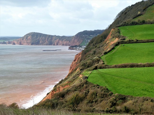
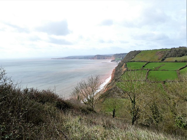
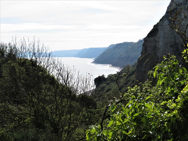
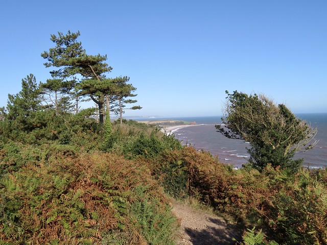
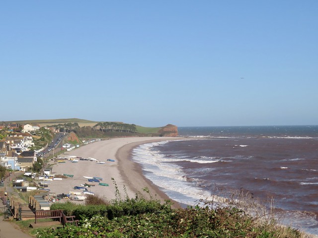
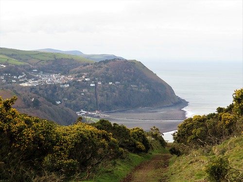
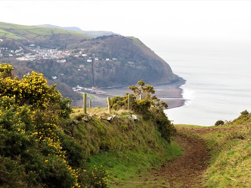
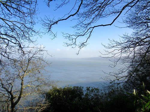
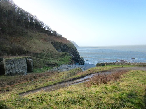
A brisk day on the east Devon coast, with a grey and blue sky racing over the white houses of Sidmouth. From the coast path just east of the town the sea gave the impression of inexorable power as it picked at the sandstone cliffs, staining its shallows a dusky red.

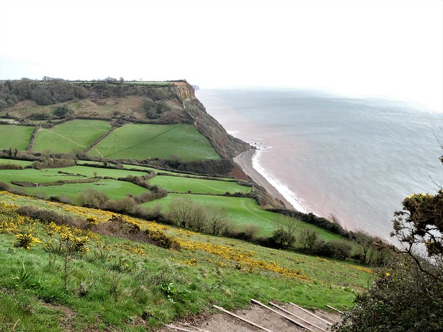
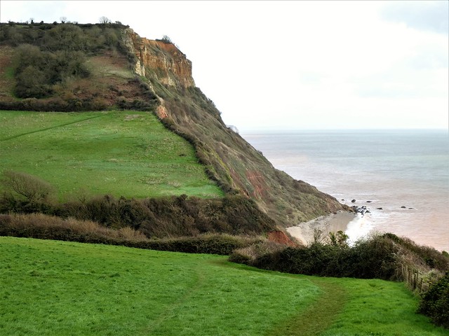
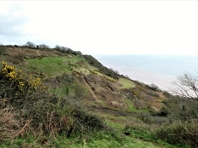
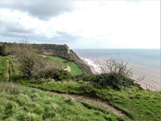
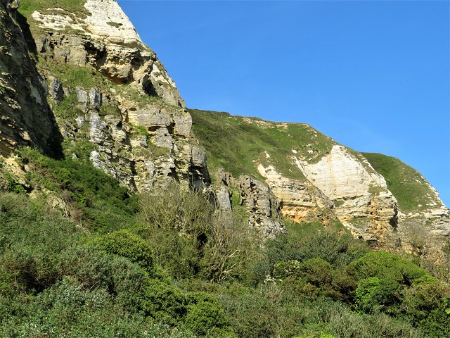
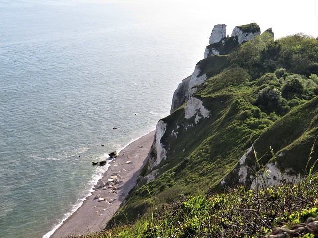
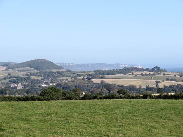
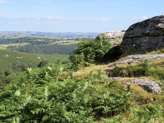
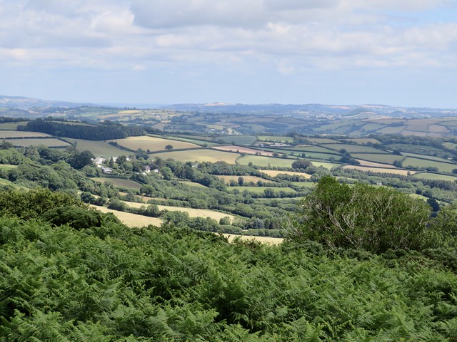
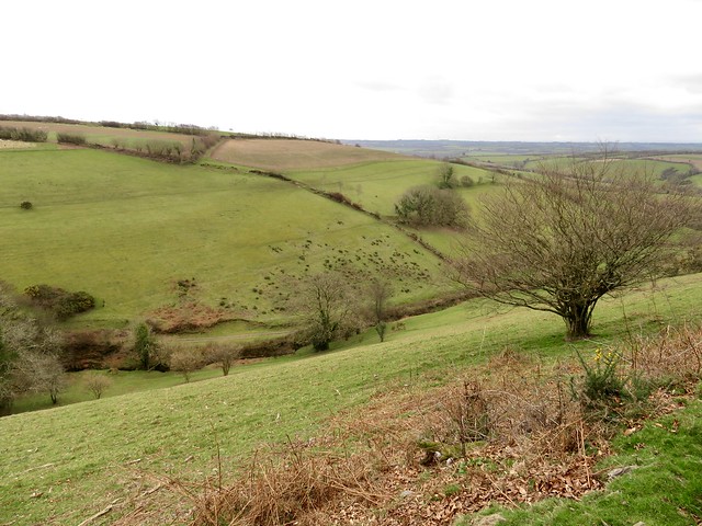
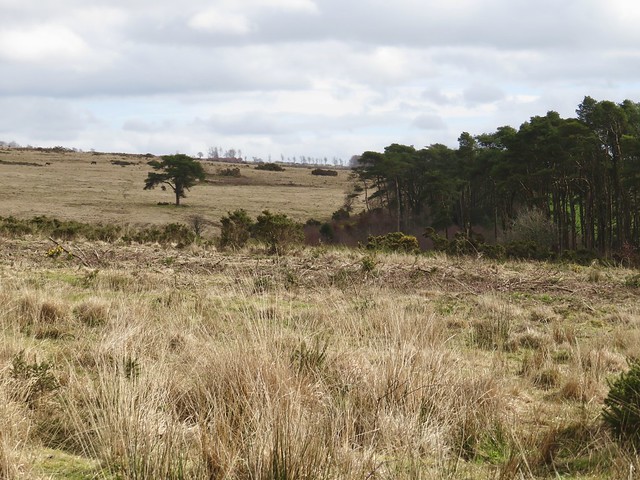
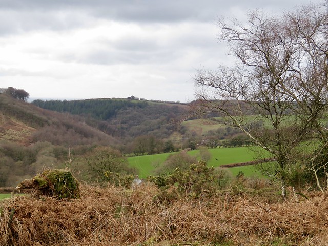
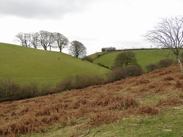
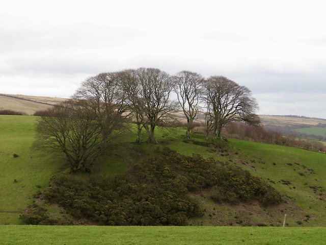
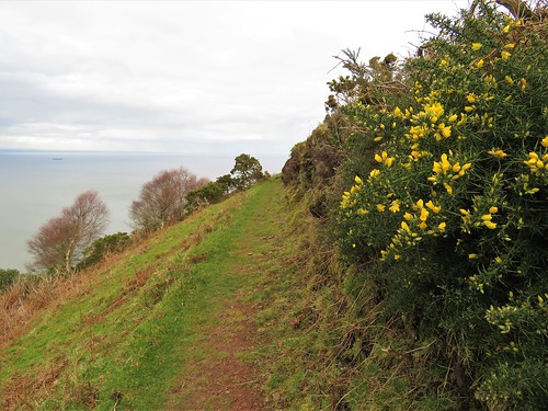
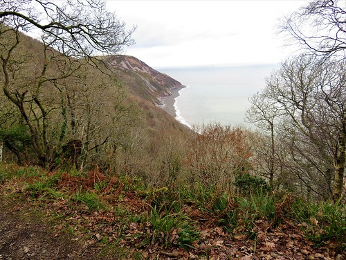
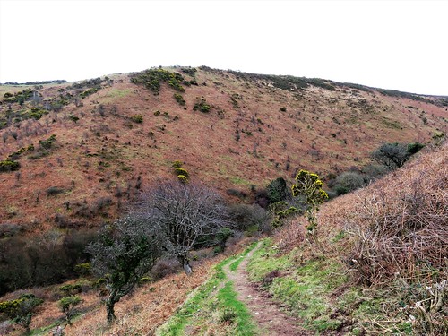
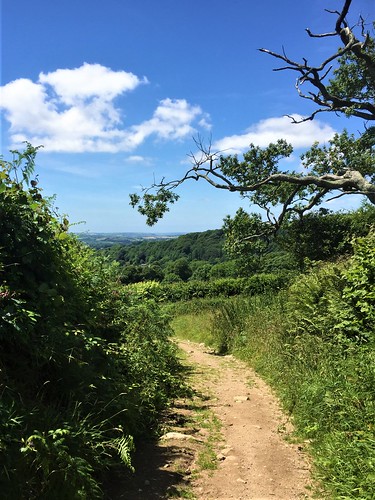
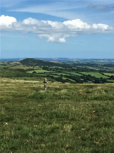
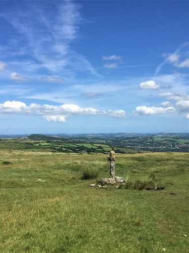
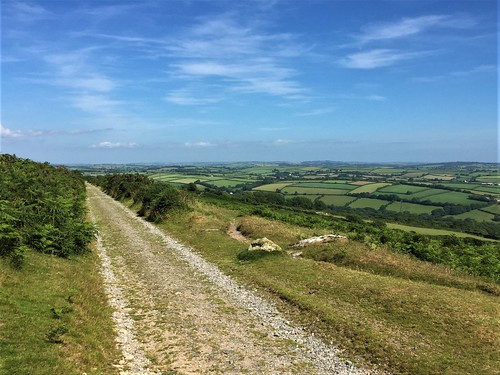
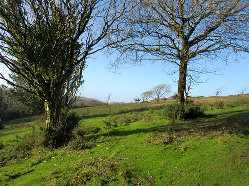
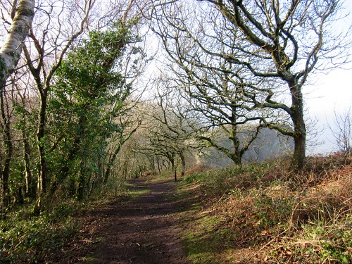
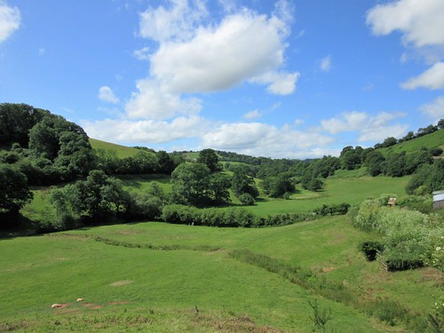
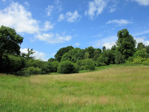
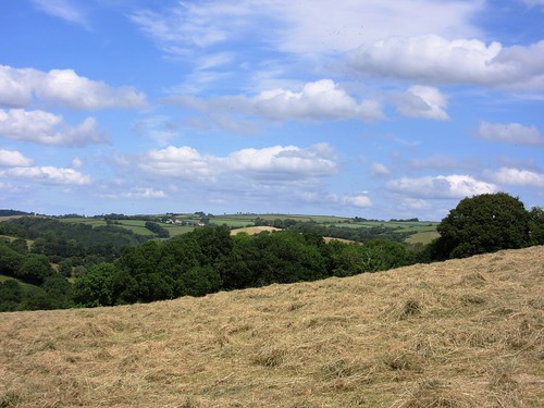
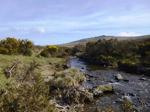
All the flowers of spring were out along the cliff path – primroses, daffodils, celandines, coconut-scented gorse, a feast of yellows. The strong west wind whistled in the blackberry scrub, the waves sighed gently on the shore far below. Beyond the deep cleft of Salcombe Mouth, Higher Duncombe Cliff stood tall, capped with rock faces of orange and yellow exposed by recent falls.

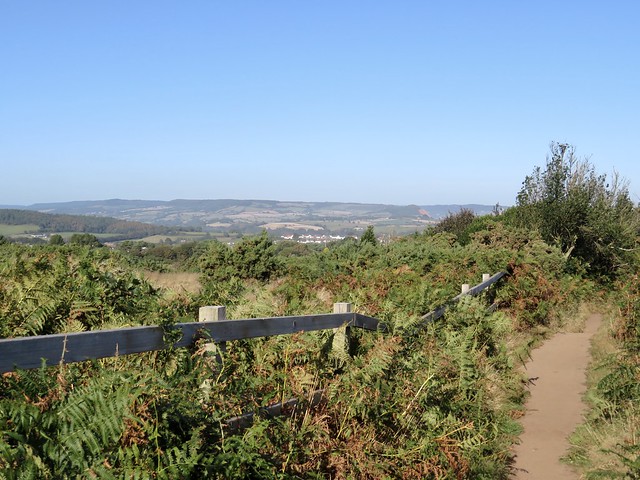
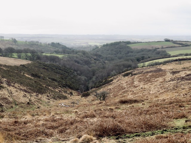
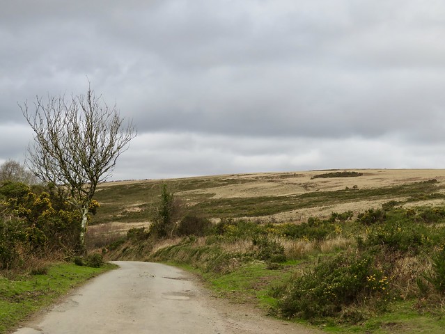
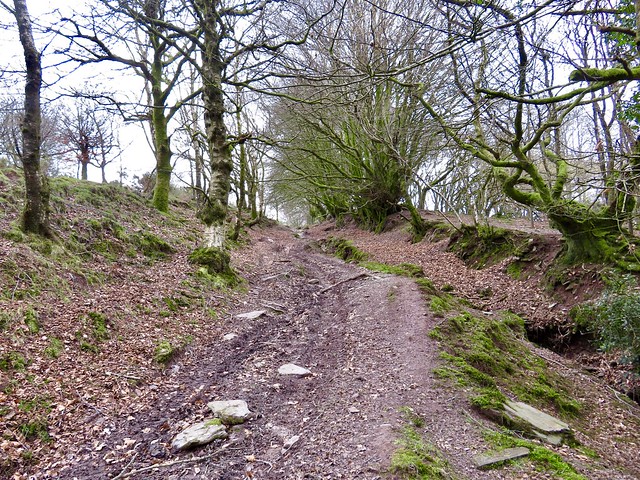
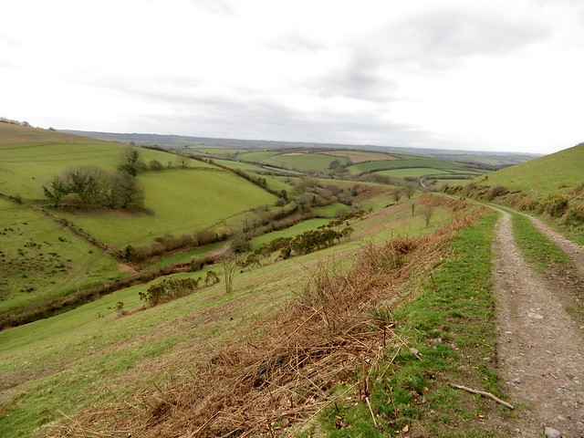
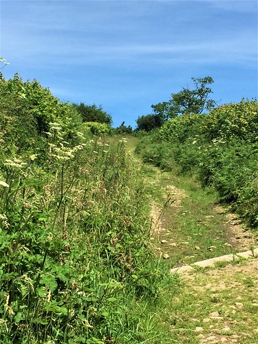
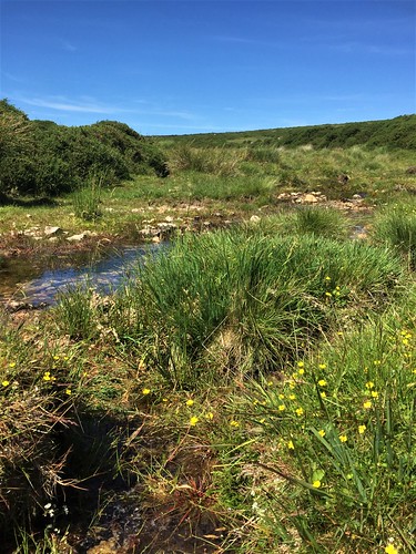
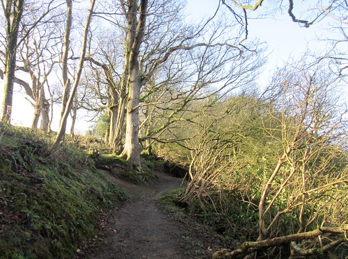
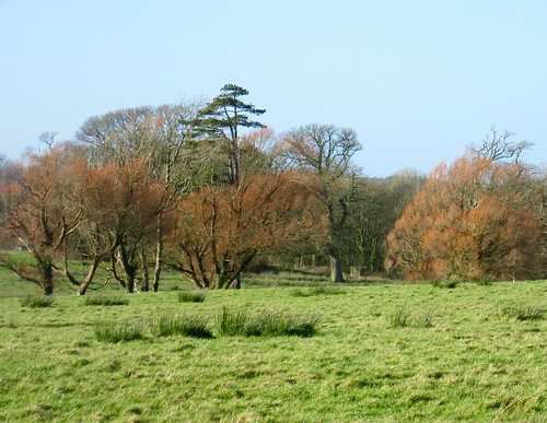
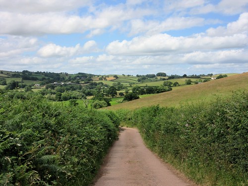
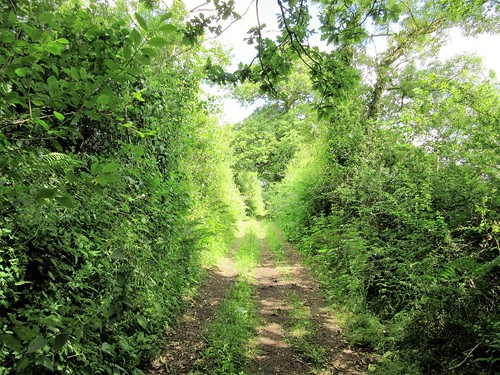
A long flight of steps led down to the valley bottom, handing over there to a slog of a climb by zigzags to the cliff top once more. An oil beetle hauled its shiny carapace up the path among clumps of violets and just-emerging speedwell. Over in the valley of Lincombe we heard the first chiffchaff of the year broadcasting its two-tone claim to ownership of a few square metres of ash saplings and briar bushes: tzip-tzap, tzip-tzap, a proclamation of spring.

Robin and wren contested bragging rights nearby. A pair of jackdaws jousted in the wind, their playfulness contrasting with the furious cries of two herring gulls as they divebombed a circling buzzard.

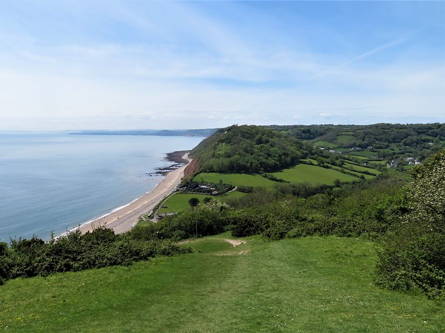
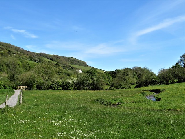
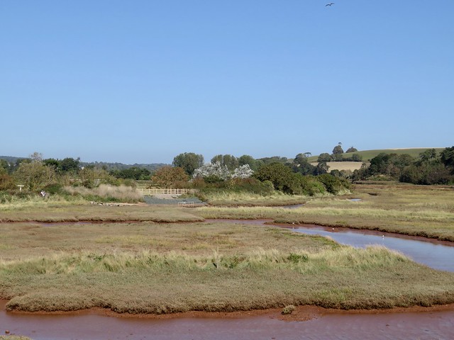
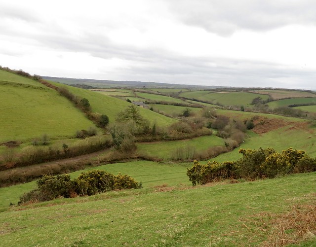
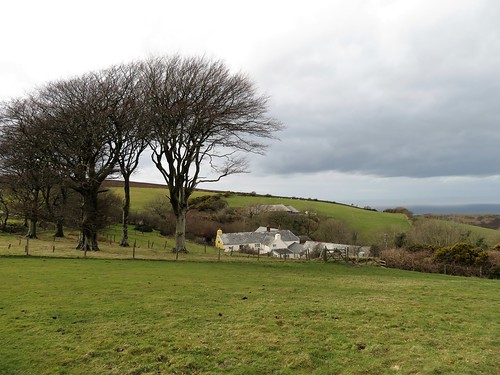
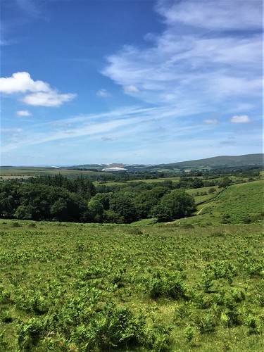
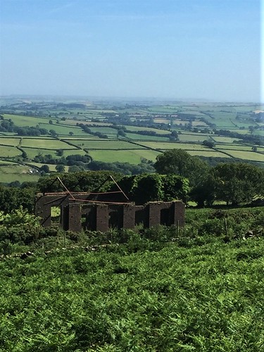
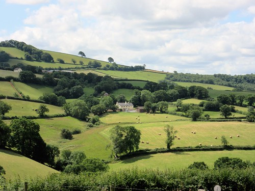
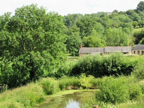
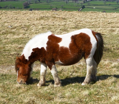
Down at Weston Mouth we passed the old market gardens of Weston Plats, overgrown and neglected since the days when famous early spuds were grown in these sheltered cliff nooks. A steep path led inland to Slade House Farm where donkeys of all ages and stages find sanctuary. Oldsters trotted and brayed, foals raised their angelic little faces to the visiting children.

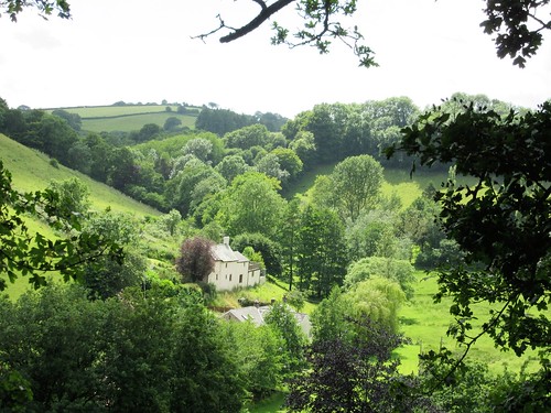
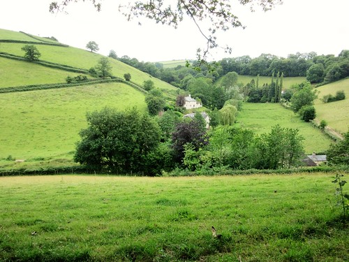
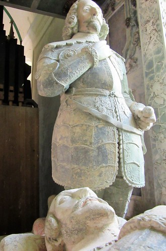
In snug little Salcombe Regis daffodils were out in the churchyard. Here lie two eminent scientists who loved this delectable spot – Sir Norman Lockyer (1836-1920), discoverer of helium; and Sir Ambrose Fleming (1849-1945), designer of the radio transmitter with which radio pioneer Guglielmo Marconi made the first transatlantic transmission in 1901. Marconi took the credit; Fleming nursed his wounded pride in dignified silence. One hopes the beautiful little village where he chose to be buried soothed his spirit.

How hard is it? 5 miles; moderate/strenuous; clifftop and field paths.
NB: steep climbs and descents; many steps, slippery paths, several stiles.

Start: Salcombe Hill car park, near Sidmouth EX10 0NY (OS ref SY 139881). NT car park – £3, card only (members free).

Getting there: Car park is opposite Norman Lockyer Observatory, Salcombe Hill, between Sidmouth and Salcombe Regis (signed off A3052, Sidmouth-Seaton).

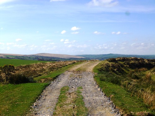
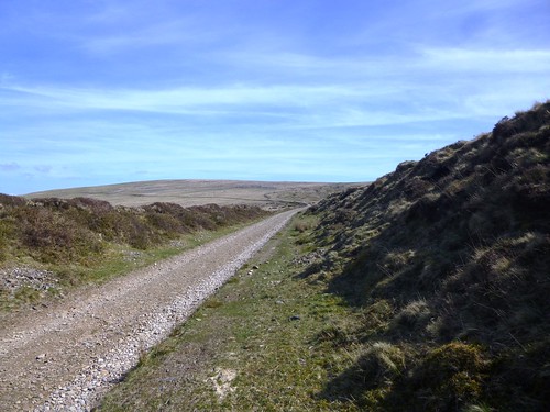
Walk (OS Explorer 115): Past NT payment sign; left on tarmac path; in 150m ahead on stony path to Coast Path (139876). Left; follow Coast Path for 2 miles to Weston Mouth (163880). Left inland (fingerpost/FP, ‘Dunscombe’). In 250m path rises to gate, then FP (162884). Fork right (‘Donkey Sanctuary’). In ½ mile at top of rise by sanctuary buildings, left (161892, 2 stiles, FP ‘Salcombe Regis’). Through sanctuary grounds to road (159851). Dogleg left/right (FP ‘Trow, Salcombe Regis’) and on. In 5th field (153889) half left to stile into road (152888). Right into Salcombe Regis. At road, left (149888), fork left past church; at Southcombe House fork right (148886, ‘South Combe Farm, Coast Path’). In ¼ mile fork right uphill through trees (145883, FP ‘Sidmouth’); at top of climb cross track (143882, FP ‘Salcombe Hill, Car Park); ahead to car park.

Lunch: Donkey Sanctuary, EX10 0NU (01395-578222, thedonkeysanctuary.org.uk)

Accommodation: Blue Ball Inn, Stevens Cross, Sidford EX10 9QL (01395-514062, blueballsidford.co.uk)

Info: visitdevon.co.uk

 Posted by at 02:56
May 142022


First published in: The Times Click here to view a map for this walk in a new window
looking east from the coast path west of Beer view over Branscombe Mouth from East Cliff Branscombe Mouth and West Cliff path through the meadows to Branscombe Lust, the only surviving Deadly Sin in Branscombe church Branscombe from the path beyond the church coast path towards West Cliff view over Branscombe Mouth from West Cliff 1 view over Branscombe Mouth from West Cliff 2 in Hooken Cliff undercliff 1 looking west from Hooken Cliff undercliff in Hooken Cliff undercliff 2 looking east from the coast path west of Beer 2

The seaside village of Beer was looking particularly good this sunny afternoon from our viewpoint on Beer Head cliffs. The houses huddled close behind their pebbly beach, set between cliffs spectacularly coloured in red, grey and white. Beyond the cove a yellow strand led off east toward the long line of Chesil Beach and the low wedge of the Isle of Portland, blue and misty in sea haze.

Its isolated position and handy nearby caves made Beer a natural haven for smugglers. King of them all was Jack Rattenbury, the ‘Rob Roy of the West’. What a rollercoaster life he enjoyed in the early years of the 19th century. Jack was captured again and again, by the French, by the Spanish, by the excisemen and the press gang. Somehow he managed to return like a bad penny to his native harbour at Beer; usually richer and never the wiser.

We followed the path over the coastal pastures of South Common, past a gaunt old signal tower and steeply downhill to the pebbly beach at Branscombe Mouth.

Just inland, the village of Branscombe curled along its road towards the fortress-like tower of St Winifred’s Church. In the cool interior we found a beautifully carved Elizabethan west gallery, and on the wall nearby a painting made perhaps a hundred years earlier.

Only one of the Seven Deadly Sins depicted has survived – Lust, portrayed by a man with flowing hair under a green cap, and a woman in décolleté with a saucy pillbox hat. Gazing amorously at one another, they seem quite undeterred by the spear being rammed through their midriffs by a half obliterated devil.

A fluffy cat came to help us with our picnic on the bench outside. Then we climbed a steep path up the bank opposite, through woods scented with wild garlic, to reach the coast path and a steep descent to Branscombe Mouth once more.

In March 1790 a mighty landslip caused Hooken Cliff, just east of Branscombe Mouth, to crash seaward. The homeward path led through the undercliff created by the slip, a tremendously lush, ferny ‘lost world’ where whitethroats and thrushes sang their evening melodies among spires and towers of rock.

The cliff faces over our heads were banded in brilliant white chalk, dusky red mudstone and greensand. Looking back from the top of the climb we had a last glimpse of the westward coast, the sea sparkling in late sun, the cliffs marching away in red sandstone slopes to be lost in the evening sea fog along the distant shores of Tor Bay.

How hard is it? 6 miles; strenuous; many steep steps, some unguarded cliff edges.

Start: Cliff Top car park, Common Hill, Beer, EX12 3AQ (OS ref SY 227888)

Getting there: Bus 899 (Sidmouth-Seaton), Mon-Sat
Road – Beer is on B3174 (signed off A3052, Lyme Regis-Sidford)

Walk (OS Explorer 115, 116): Left up road. In 400m fork left (224887, ‘Bridleway’). Follow Coast Path to Branscombe Mouth. Many steps down East Cliff. At foot of West Cliff, right (207881, ‘Branscombe Village’) to Branscombe. Left at road (198887) to church (196885). Left through churchyard, down to cross stile on south boundary (yellow arrow). Steeply up steps to Coast Path (196882). Left to Branscombe Mouth. Up first field of East Cliff; keep ahead at fingerpost (210881, ‘Coast Path Beer’) between chalets and on through undercliff (narrow path, slippery in places, unguarded edges, many steps). In 1 mile climb to clifftop path (222880); right to car park.

Lunch: Smugglers Kitchen, Fore St, Beer EX12 3JF (01297-22104, thesmugglerskitchen.co.uk)

Accommodation: Bay View, Fore St, Beer EX12 3EE (01297-20489, bayviewguesthousebeer.com)

Info: beer-devon.co.uk

 Posted by at 04:37
Nov 212020


First published in: The Times Click here to view a map for this walk in a new window
picture picture picture picture picture picture picture picture picture picture picture picture
Facebook Link:

The Otter Estuary is a remarkable place. Long and thin, it penetrates the English Channel on the outskirts of Budleigh Salterton. This is a place for binoculars and sharp eyes, where wintering birds in their tens of thousands have arrived just now to feed on the invertebrate life of the muddy tideway and marshes.

On this wild, blustery and sunny day it was easy to see why there’s concern for this East Devon coast on account of climate change and rising sea levels. The sandstone cliffs with their sandwiched layers of ancient pebbles are crumbling, the estuaries of Otter and neighbouring Exe eroding.

The sea, flecked with wind-driven whitecaps, was stained a rich red by the sandy mud and rock it had sucked away. It was an extraordinary sight, and a salutary one.

We followed the coast path inland up the Otter Estuary, where the last of the pale blue sea asters starred the saltmarsh and sandpipers pattered fastidiously on the muddy banks. The path in its tunnel of bushes was spattered scarlet with rosehips, crimson with hawthorn peggles and indigo with over-ripe blackberries. A flock of linnets went skimming up the hedge. Inland the ground rose in those steep green slopes so characteristic of the south Devon landscape.

Bright gold buttons of tansy flanked the path into East Budleigh. You can hardly escape the village’s connection with its most celebrated son, Sir Walter Raleigh, born just down the lane. We found a fine statue of the poet-courtier-colonist in doublet and padded hose outside the church where his parents lie buried, and a fine pint of beer and sandwich in the pub that carries his name.

West of East Budleigh ramifies a network of old-style country lanes, high-banked, stony and thick-hedged. From the gate onto bracken-smothered Shortwood Common we had a superb view east along the red and white cliffs of the Jurassic Coast, round the great curve of Lyme Bay as far as the distant hump of the Isle of Portland.

A ferny stretch of old railway path, the swift transition of a golf course, and we were walking down to Budleigh Salterton in a clifftop tunnel of gorse. Before us the wind whistled on, rocking the gorse, clearing the sky to china blue, and whipping up a lacy surf on the red sea shallows.

Start: Lime Kiln car park, Granary Lane, Budleigh Salterton EX9 6JD (OS ref SY 073820)

Getting there: Bus 58 (Exeter)
Road: Budleigh Salterton is signed from A3052 (Exeter-Sidmouth)

Walk (9 miles, easy, OS Explorer 115): Up Otter Estuary on Coast Path. In ⅔ mile pass bridge (075830); in ½ mile, ahead at fork (075839, ‘Otterton’); in 250m through left-hand gate (077841, yellow arrow/YA) on raised path. In 450m cross track (074844, YA); on to road (072844). Left; in 300m cross B3178 (070844); up Lower Budleigh – Middle Street – High Street. Opposite Sir Walter Raleigh PH, down Hayes Lane (066848). In 450m, opposite electricity substation, left (062849) up stony lane. In 200m, on over crossroads (061846); downhill to Hayeswood Lane (062845). Right for ½ mile. 150m beyond right bend, left (054842, kissing gate, fingerpost) on path; in 200m, stile/YA (053840) onto Shortwood Common.

Turn right; don’t go further right, but keep ahead (YA) south across common for 300m, descending to Shortwood Lane (052837, ‘Country Road’). In 250m, at gate on left (052835), sharp right downhill. At road, left (049833). In 100m, right (049832, ‘Permissive Cycleway’). In 250m, right along old railway (047830). In 600m, pass below B3178 (045825); in 300m, under next bridge (043823); in 200m hairpin back left (042821, ‘Castles Lane’) to road (043823). Right; in 200m, fork left (044821); follow lane (‘West Down Beacon’). At golf course, keep ahead (white sticks, YAs, ‘Coastal Path’) for ⅓ mile to coast (045811). Left to Budleigh Salterton.

Lunch: Sir Walter Raleigh PH, East Budleigh (01395-442510)

Accommodation: The Long Range, Vales Rd, Budleigh Salterton EX9 6HS (01395-443321, thelongrangehotel.co.uk)

Info: pebblebedheaths.org.uk; visitsouthdevon.co.uk; satmap.com; ramblers.org.uk

 Posted by at 01:19
Aug 012020


First published in: The Times Click here to view a map for this walk in a new window
picture picture picture picture picture picture picture picture picture picture picture
Facebook Link:

The painted saints contemplated one another from their rood screen panels in the Church of St Mary the Virgin at Holne. Looking at their long, expressive faces and richly coloured robes, we wondered what could have persuaded an artist of such talent to come in Tudor times to this obscure village church under the eastern rim of Dartmoor. Whoever he was, he left a remarkable legacy here.

Holne lies sunk in a hollow above the young River Dart. A green churchyard path led out of the village, and soon we were descending the narrow road to Michelcombe under a hot afternoon sun. Cooper the golden retriever bounced out of a house to bark us on our way up a clinking stony lane that climbed towards the moor.

Sheep lay panting on a heap of soil in a gateway, their chins pressed deep into the cool earth. The views broadened all the way, south and east over steep pastureland to where the sea lay beneath a grey haze in Tor Bay.

A gate led out onto the open moor. We crossed the granite bars of an ancient cattle grid over Wheal Emma Leat, once the power source for the tin mines of this area, now a low ditch half hidden among sedges.

A path wound through the bracken, heading northeast, its dry peat surface stamped with the prints of sheep’s hooves and pony shoes. Soon it made rendezvous with a moor road that ran between banks of devil’s-bit scabious and wild thyme.

A dozen moor ponies were hanging out in the car park at Venford Reservoir, moodily swishing their long tails as they waited for tourist sandwiches. We made for the flat granite boulders of Bench Tor, a grandstand from which to admire the giant view and to spy out the homeward path.

A precipitous scramble down beside a stone wall into the depths of the River Dart’s gorge, a delicious cool plunge in the peat-dark waters of Sharrah Pool, and we were heading back to Holne on the riverside track through oak woods where the declining sun dappled tree trunks, pathway and the shallows of the river in the quiet valley.

Start: Village car park, Holne, Newton Abbott TQ13 7SL (OS ref SX 706695)

Getting there: Holne is signposted off B3357 Two Bridges road, west of Ashburton (A38)

Walk (7½ miles, moderate/strenuous, OS Explorer OL28): From west end of church, left through hedge gap; right (fingerpost/FP) across field. Cross road (705694); on to Michelcombe. Right at junction (697690), follow ‘Bridleway’ up stony track. In ½ mile, ahead through gate (687690) onto Access Land; same direction to cross stone bars over Wheal Emma Leat (685691). In 150m, right on grass track (685692); in 500m, meet and follow wall (687697); in 400m, join stony road (690698). Cross stream (692699); in 150m, sharp right at junction (691700) to road (694701). Left to Venford Reservoir car park (688709). Aim across moor to Bench Tor (692716); then southeast to corner of stone wall (692715). Keep wall on right; in 300m, follow it left (695713), very steeply down beside wall through woods to River Dart (697715). Left along track to Sharrah Pool (696717). Return along track and on. In 1¾ miles hairpin sharp right (711703, FP on right) up Two Moors Way back to Holne.

Conditions: Very steep descent to River Dart – for surefooted people! Unwaymarked paths across the moor.

Picnic: On Bench Tor, or down by the River Dart

Info: Totnes TIC (01803-411183); visitsouthdevon.co.uk; satmap.com; ramblers.org.uk

 Posted by at 01:17
Mar 072020


First published in: The Times Click here to view a map for this walk in a new window
picture picture picture picture picture picture picture picture picture picture picture picture picture picture picture picture
Facebook Link:

It’s just as well that the Courtenay family, stout recusants and traditionalists, held such sway in the countryside around Molland back in the 19th century. They didn’t see why Victorian ‘improvers’ should be allowed to lay a finger on the tiny moorland village’s Church of St Mary. So no-one did. What’s survived here is the most perfect Georgian interior, a rare treasure.

We opened the church door on a maze of softly shining box pews, a fine 3-decker pulpit, and the Ten Commandments sternly admonishing us from their place above the low chancel screen. The north arcade leans so dramatically out of kilter that it had to be braced with wooden beams. And the elaborate, faded Courtenay wall monuments are a-bulge with cherubim, swags, scrolls and elaborate encomia.

Daffodils and primroses were struggling out in the churchyard, whipped by a cold wind from the south. We put our backs to it and went trudging up a stony bridleway over the moors that rose to the north in waves of creamy grass and black heather.

Up here it’s all airy bleak and open, proper Exmoor upland where the weather comes hard at you. The views are enormous, across the winter-dried moors to lush pasturelands lower down. A lark sprang up singing, the first of the year, and a group of moorland ponies champed their way along a combe bottom, shaggy manes and tails flailing in the wind.

We followed the hoofmarks of trekking ponies along the bridleway until it reached Anstey Gate. Just down the road we passed a memorial stone to Philip Froude Hancock (1865-1933), genial huntsman and international rugby player. A rugged monument to a rugged man, this 13-ton granite boulder was hauled up here in 1935 by a steam lorry, which almost blew up its boiler climbing the steep Exmoor lanes.

Below Guphill Common we turned back along a moor road, skirting its winter potholes and dipping into muddy combes. A bridleway brought us down into lower country of steep green pastures, where heavily pregnant ewes lumbered off and starlings whistled their jaunty vespers from the bare oak tops far below.

Start: Church car park, Molland, South Molton EX36 3NG (OS ref SS 807284)

Getting there: Molland is signed from B3227 (Hayne Cross intersection on A361).

Walk (6½ miles, rough moorland tracks, some short steep sections, OS Explorer OL9): Up lane between church and London Inn; left by church; in 30m, right on footpath past farmyard, across fields (fingerposts) and Moor Lane (810286). Ahead (yellow arrow/YA); down to cross footbridge (812288); steeply up to gate; up to far right corner of field (814290). Lane to Smallacombe. Follow bridleway (blue arrows) across ford (816291). Fork left; in 100m, ahead (not right; fingerpost). Follow bridleway hoofprints northeast, then east across moor. In ½ mile ignore left fork (821297); keep ahead on track bending gently right over hill ahead.

At Anstey Gate, right along road (835298). In 500m pass memorial stone on left; in another 100m, right opposite boundary stone (840296); between posts, and follow faint track running half-left across Guphill Common, heading for line of trees, then for their right-hand end. At road, right (845288); in 1 mile pass 4-finger post (830293, ‘Molland’). Cross Anstey’s Combe (827294), then the following ford (824294). In 300m, bridleway bends left with hedge-bank; on through gate (821291, fingerpost). Follow it down to road (819282).

Right (‘Molland’); cross stream; immediately right (817283, steps, stile, fingerpost). Steeply up to YA post; up to stile (YA). Follow YAs to road (813283); follow ‘Molland’ to village.

Lunch: London Inn, Molland (01769-550269, londoninnmolland.co.uk)

Accommodation: George Inn, South Molton EX36 3AB (01769-572514, thegeorgesouthmolton.co.uk)

Info: South Molton TIC (01769-572591); satmap.com; ramblers.org.uk

 Posted by at 04:51
Mar 232019


First published in: The Times Click here to view a map for this walk in a new window
picture picture picture picture picture picture picture picture picture picture picture
Facebook Link:

A windy cold noon on the Foreland promontory outside Lynmouth. Moor ponies chewed the gorse on the slopes above Countisbury church, drawing back their lips as though seized with private laughter as they delicately snipped off the yellow flowers with their pale green teeth.

We walked north along the cliff path, treading warily above steep drops where the sea creamed in lace-edged waves on black pebble beaches eight hundred feet below. A milky sky stretched over land and sea. A big blue and white freighter idled in the Bristol Channel, and fifteen miles away the dunes and low hills of the south Wales coast rose under a white surf of cloud.

A teetering path descended over skiddy scree to Foreland lighthouse. But we favoured the wider South West Coast Path and the narrow service road to the lookout eyrie above the stumpy tower, where great curved scimitar blades of shaped glass flashed a continuous message of danger to shipping.

This is a wicked coast in winter, all unforgiving tides, cross currents, hidden reefs and a lack of safe havens. In a January storm in 1899, the lifeboatmen of Lynmouth hauled, shoved and cajoled their vessel up and over these cliffs by night. Heavy seas had rendered their home harbour inoperable; there was a ship in distress requiring their attendance. So they dragged the boat for fifteen precipitous miles to the next harbour of Porlock, and rowed to the rescue from there – an extraordinary feat.

The coast path ribboned eastward through oak and birch woods, up and down along the cliffs. Glimpses forward showed the plunge of slit-thin combes to dark narrow beaches.

In the cleft of Glenthorne Cliffs we passed a walkers’ honesty café – tea, coffee, mugs, milk, a thermos of hot water and some chocolate bars on a picnic table. ‘What a treat to find in the middle of nowhere!’ Colin and Adrian had written in the comments book. ‘It made us laugh and smile! Thank you!’

The sense of height, space and freedom up here in the cold winter wind set my head spinning. At last we turned inland below the unseen farm called Desolate and followed the field path back past Kipscombe. The grey and white house lay quiet below its sheltering beech trees, looking out across a wooded combe to a misty grey and white sea that lisped and murmured at the edge of sight and sound.
Start: Barna Barrow car park, Countisbury Hill, Lynmouth EX35 6ND (OS ref SS 753496))

Getting there: A39 (Lynmouth-Porlock); car park is at top of Countisbury Hill, beyond Blue Ball Inn.

Walk (5¾ miles, moderate, OS Explorer OL9): From car park walk seaward; left along wall; in 500m, right on Coast Path/CP beyond bench (747499). In 600m bear left downhill at 3-finger post; right at 2-finger post below (‘Porlock’), descending to road (756505). Left to lighthouse viewpoint (754511); return up road. At sharp right bend (758503) keep ahead on CP. In 200m CP zigzags right (759503, YA). In 1 mile CP rises up steps; at top, right off CP (775498, ‘Countisbury 2’). At top of rise, right at 2-finger post (770498); in 50m, left (YA) up path to Desolate farm drive. Right to gate (770496); right (‘Countisbury 1¾’) across fields (fingerposts, YAs) past Kipscombe Farm, back to car park.

Conditions: Careful on coast path – unguarded edges, steep slopes.

Lunch: Blue Ball, Countisbury EX35 6NE (01598-741263, blueballinn.com)

Accommodation: Rising Sun Inn, Lynmouth EX35 6EG (01598-753223, risingsunlynmouth.co.uk) – comfortable, cheerful, full of character, wonderful food.

Info: Lynton & Lynmouth TIC (01598-752225)
satmap.com; ramblers.org.uk

Ships of Heaven – The Private Life of Britain’s Cathedrals by Christopher Somerville (Transworld) is published on 11 April

 Posted by at 15:30
Jul 142018


First published in: The Times Click here to view a map for this walk in a new window
picture picture picture picture picture picture picture picture picture picture picture picture
Facebook Link:

As we crossed Stowford Bridge on the northern outskirts of Ivybridge in proper summer sunshine, the slopes of Dartmoor rose to the north under a blue sky. A stony lane brought us up there, climbing between hedges thick with bedstraw and foxgloves, among which the velvety wings of small heath butterflies flicked open and shut.

Out on the moor cattle and sheep grazed, muzzles all down. Two contrasting landscapes lay in view – harsh green and brown slopes of bare moorland ahead, with a white scab of china clay workings to the west, and the broad stretch of the South Hams of Devon behind us, a patchwork of hedges, woodland, green pastures and the yellow squares of meadows just cut for silage.

Extracting china clay was one of the most important Dartmoor industries in bygone times. In 1911 a narrow-gauge tramway was built from Ivybridge to the Redlake works in the middle of the moor. We followed its snaking course along the flanks of Weatherdon Hill, across stream trickles where dragonflies with biplane wings and electric blue bodies hunted the sodden green jungles of moss.

Beyond the piled granite boulders of Hangershell Rock a stone row crossed the old tramway. No-one knows when this monument of stubby, shin-high standing stones was erected – perhaps 4,000 years ago – but here it still stands, defying time and weather.

A harras* of moor ponies was gathered round a pond, their manes and tails streaming like the steeds of pre-Raphaelite knights. Nearby stood Spurrell’s Cross, weather-beaten and stumpy, a marker of pink granite sparkling with mica, raised by medieval monks to mark the meeting place of two of their routes across the moor. Here we sat, munching chocolate eggs (nutritious, no – delicious, yes) and gazing north-east over thirty miles of tumbled lowlands.

From Spurrell’s Cross we headed south towards Wrangaton along the old monks’ road, a groove in the heather and grass worn by countless boots and hooves. We dropped down to cross Lud Brook at a ford of pink granite rubble. At the foot of Western Beacon we found the old tramway once more, and turned along it for home with half of south Devon spread out gloriously before us in the late afternoon sun.

*Please retain this word – it’s the correct term for a group of these wild ponies!
Start: Stowford Bridge, Cole Road, Ivybridge, PL21 0EY approx. (OS ref SX 641567)

Getting there: Rail to Ivybridge (half mile footpath to Stowford Bridge)
Bus 20A (Plymouth – Macandrew Walk, Ivybridge)
Road – Ivybridge is signed off A38 Exeter-Plymouth. Parking spaces on Cole Road near Stowford Bridge.

Walk (7 miles, easy underfoot, OS Explorer OL28): Cross Stowford Bridge (‘Harford’). In 300m, right opposite Stowford Farm (642570, ‘2 Moors Way’/2MW) up lane. In ½ mile, through gate onto moor (645576); half right on 2MW. In ½ mile, left along tramway track (651583). In 1½ miles, right at pond (658599) for 150m to Spurrell’s Cross. From here, south on broad grass track, keeping Ugborough Beacon on left. In ⅔ mile (663589 approx), keep stream valley close on right, descending to ford Lud Brook (662587). Left along right bank; in 400m through gate (661583); down grass path to gate (661579, ‘Private Property’). Right along edge of Access Land; in 100m, through gate; bear left on grass path round lower slopes of Western Beacon. In ½ mile (658572), right along tramway track. In ¾ mile, left (649575) to moor gate; return to start.

Conditions: Best avoided in mist.

Lunch: Picnic

Accommodation: Anchor Inn, Ugborough, PL21 0NG (01752-690388, anchorinnugborough.co.uk) – excellent, comfortable village inn.

visitdartmoor.co.uk; satmap.com; ramblers.org.uk

 Posted by at 09:30
Jan 142017


First published in: The Times Click here to view a map for this walk in a new window
picture picture picture picture picture picture picture picture picture picture picture picture picture picture picture
Facebook Link:

It was a brilliantly sunny winter’s afternoon, and as blowy as hell on the hillside above Clovelly. This stretch of the North Devon coast was always notorious for the lack of shelter it afforded to seafarers and fishermen in the days of sail, and the waves were dashing against the tall black cliffs as though they would grind heaven and earth to pieces. In the woods the wind roared softly, and as we walked the coast path westward we had glimpses between the leafless oaks of the sea whipping itself into cream on the pebbly beaches far below.

The constant sea wind has streamlined these clifftop woods into a smooth curve that bends inland with hardly a twig breaking the continuous line of the treetops. In the shelter of the trees spring was coming early to North Devon, with shoots of bluebells and sprigs of primrose leaves already showing.

The view back from Gallantry Bower showed the eastward run of the coast to the estuary of Taw and Torridge, then on towards the ghost of Baggy Point in a haze of spray. The cliffs around Mouthmill Beach were full of fantastic geological contortions, the rocks bent into acute angles by tremendous upheavals below the surface hundreds of millions of years ago.

We dropped steeply down to lonely Mouthmill Beach with its abandoned limekiln. In Victorian times the Welsh limestone boats would dump great stone blocks here to be burned to quicklime and spread as fertilizer on the acid local land. Steeply up again to Brownsham Cliff, where we left the coast path to follow the fields to the ancient farming community of Brownsham.

Down in the ferny depths of Brownsham Wood we sat on a mossy wall to hear the wind make a roaring sea of the treetops. Then up and on through the parkland of Clovelly Court, and a steep descent on a path of cobbled steps into Clovelly.

The early 20th century chatelaine of Clovelly Court, Christine Hamlyn, was a bit of a tyrant, and she certainly ran an extremely tight ship. Everything in Clovelly had to be kept just so, with never a whiff of ‘tripper’. What she left for posterity is a village about as perfect as you could wish for, a photogenic tumble of cottages down a ludicrously steep cobbled street. As we climbed the roadway back to the car park, a full moon sailed across the bay and spread a sheen of silver across the restless sea, a scene so beautiful it was hard to believe it was real.
Start: Clovelly car park, North Devon EX39 5TL (OS ref SS 315249)

Getting there: Bus 319 from Barnstaple. Road – Clovelly is signed from A39 between Bideford and Bude.

Walk (6 miles, moderate, OS Explorer 126): Through Visitor Centre, down to roadway. Left (‘Coast Path/CP, Brownsham’). In 100m, left through gate (CP) into field. In 50m, fork right (CP) parallel to road. Follow CP for 2¼ miles. On Brownsham Cliff, where CP turns right down steps, keep ahead (290264, ‘Brownsham ¾’). In 200m, stile (red arrow/RA) into trees. Follow RA/’Brownsham’ to Brownsham car park (286260). Right through car park; left down steps; left (CP) along drive. Past shed, turn right (‘Mouth Mill’, Bridleway).

Follow bridleway track through woods. In ¾ mile, at fork keep right (ahead) across stream (297259). Left at junction (‘bridleway’); in 50m, right up stony track (blue arrow/BA). Through gate (299259); ahead along wood edge; through gate (BA). Half right up field slope to meet track at top right corner of wood ahead (302256, arrow on post). Left along track for ½ mile, through Court Farm to Clovelly Court. Right in front of church (309251); left at road. Keep left where cars fork right for car park (313250). In 300m, right at T-junction (316250); in 50m, left down woodland path, then steep cobbled steps into Clovelly. Left down village street (318248) to harbour; return up street to top (316247); right to car park.

Conditions: Slippery cobbles, muddy paths, unguarded cliffs; steep climb from Mouth Mill.

Lunch/Accommodation: Red Lion, The Quay (01237-431237) or New Inn (01237-431303); both stayatclovelly.co.uk

Info: Clovelly Visitors Centre (01237-431781); clovelly.co.uk; visitengland.com; satmap.com; ramblers.org.uk

The January Man – A Year of Walking Britain by Christopher Somerville (Doubleday, £14.99)

 Posted by at 01:05
Jul 022016


First published in: The Times Click here to view a map for this walk in a new window
picture picture picture picture picture picture picture picture picture picture picture picture picture picture
Facebook Link:

Under a blue sky patched with summer clouds we set out from the hilltop village of Cadeleigh, across grazing meadows and hayfields where the grass lay cut but not yet gathered. A heady scent arose as our boots crushed clover and sweet vernal grass. It was perfect weather for summer walking – warm but not too hot, breezy but not too chill.

The fields plunged high and low. This mid-Devon farming country is steep with tree-crowned hills, the fields conforming their shapes to the roll of the land. The far perspectives were all tumbled between green grazing, yellow cut hayfields and the dense milky pink of ploughland. In a coop at Little Century smallholding, fifteen ducklings seethed around two old hens, their foster-mothers. At Well Town, Tommy the black-and-white terrier came out to bark us off his patch – and quite right, too.

Up at Kingdom’s Corner we found a wonderful old green lane of the kind that has threaded these valleys and hills since men began to move beasts across the land. Overhung with oak, ash, hazel and blackthorn, floored with stones and fallen bird cherries, it swooped and swung above the bends of the River Dart in its thickly wooded valley. A barn beside the lane was footed with stone, with upper works of cob – mud, stones and straw sun-baked into hardness. Rain, wind, mice and martins had burrowed it into a tissue of holes across which spider gossamer glittered in tightly drawn threads.

We reached the valley road near Burn Bridge, and turned along a field lane towards Cadeleigh. The green track skirted East Court, where wooden farm carts shared the hedge with an ancient crimson Commer lorry like great-gran’fer used to drive.

The path led between hedges of horehound, wood sage and flesh-pink centaury. We found ourselves passing through flickering clouds of meadow brown butterflies. They had all hatched at once, drawn out of their chrysalises by the sun’s warmth. The new butterflies blundered about the grasses and danced along the lane before us, whirling giddily round and round one another as though for sheer joy of the summer’s day.

Start: Cadeleigh Parish Hall car park, Cadeleigh, Devon EX16 8HW (OS ref SS 915081)

Getting there: M5 Jct 27, A361 to Tiverton, A396 to Bickleigh Bridge, A3072 (‘Crediton’); in ¼ mile, right (‘Cadeleigh’) to village. Pass Cadeleigh Arms PH on right; immediately right (‘Little Silver’). In 200m, Parish Hall on right; park opposite.

Walk (7 miles, strenuous, OS Explorer 114): Turn up Glebelands drive (‘footpath’). Through farmyard and on, following yellow arrows/YA along field edges. In 3rd field, go steeply downhill with trees on left, then bear right along bottom of field to driveway (911087, YA). Left; in 40m, left over stile (YA). Up track, then cross to right-hand hedge (YA). Continue, to go through hedge gap (YA). Down to cross stile under trees; over 2nd stile and cross stream (911088, YA).

Steeply up right-hand hedge to cross stile into Round Wood; left and follow YAs/red blobs through wood, to cross stream by stile (908091). Half left, steeply up field; through hedge (YA); up field with hedge on left. Half left across next field (YA) to cross farm road (906094). On through gate (YA); half left across field to skirt to right of house and garden at Well Town. Through gate (YA) onto drive; right for 350m to road at Kingdom’s Corner (905099).

Right along road, immediately right (‘Bridleway’). Follow green lane east for ¾ mile to tarmac lane; ahead for 100m to road (917096). Right; in 50m, fork left up stony lane. In 500m, descend through gate by barn (blue arrow/BA); right in front of cottage to road (921092). Left; in 50 m, right (‘Bridleway’) along lane. In ⅔ mile pass Dart Cottages (928085); at ford beyond, fork right (BA) along right bank of River Dart. Ignore YAs and continue along stony lane for ⅓ mile to road (931079).

Right; in 200m, opposite steps of The Coach House, fork left (‘footpath’) along lane. In ¼ mile, beyond barns, take right or upper fork (927077, YA; diversion notice on gatepost) past East Court. In another 150m take lower fork (‘footpath’) past barn and follow green lane. At gate into field before reaching Cadeleigh Court (922075, YA) aim half right across field to gate (hidden at first, soon in view, YA). On along track that skirts anticlockwise round farm. At T-junction by Manor House garden wall, right (919074, YA) on lane for ½ mile to road (911073). Right uphill for ½ mile into Cadeleigh.

Lunch: Cadeleigh Arms, Cadeleigh (01884-855238, cadeleigh.com) – excellent community-owned pub

Accommodation: East Dunster Deer Farm, Cadeleigh, EX16 8HR (01884-855386, airbnb.co.uk)

Info: Tiverton TIC (01884-230878); Cadeleigh village website, cadeleigh.com

visitengland.com; satmap.com; ramblers.org.uk

 Posted by at 02:52
Jan 172015


First published in: The Times Click here to view a map for this walk in a new window
picture picture picture picture picture picture picture picture picture picture picture picture picture picture picture
Facebook Link:
‘The peat fires!’ rhapsodised Sabine Barry Gould in his 1910 Book of Dartmoor. ‘What fires can surpass them? They do not flame, but they glow, and diffuse an aroma that fills the lungs with balm.’

It wasn’t the dream of a lungful of balm that lured so many 19th-century prospectors out into the wilds of Dartmoor, but the chance of turning a fat profit by distilling naphtha oil from the ‘black gold’ of the peat that blanketed the moors. Naphtha oil could be converted into candles and mothballs, as well as the spectrally flickering naphtha flares that lit the evening markets of country towns.

Following the trackbed of the horse-drawn tramway built in 1879 for the Rattlebrook Peat Works, we marvelled at the ingenuity and sheer muscle power that the moorland railway had demanded – the cuttings in the granite rock, the curves and embankments, the granite sleepers hand-bevelled for the rails. A couple of miles out from the Dartmoor Inn, we stopped and took in a mighty view, forty miles across the dun-coloured moor and green farmlands to a broad strip of cobalt Atlantic where the land met the eggshell-blue sky.

Moor ponies grazed the sunny slopes, their long manes and tails streaming wildly in the cold wind. At the end of the old railway line a hundred men once laboured to dig, dry and load the peat. Here we found a couple of tumbledown peat-drying kilns and two venerable rusty boilers.

Nearby on the banks of the Rattle Brook stood the ruin of the aptly named Bleak House, home of the peat company’s caretaker. All around, the moor slopes had been combed into drainage channels for peat cutting. The ditches, like the ancient packhorse tracks we followed back to the Dartmoor Inn, were already half obliterated by the inexorably growing peat.

Tinning, quarrying, farming, peat cutting – man has tried them all in the wilds of Dartmoor and the land has swallowed all his endeavours. The meadow pipits, the moor ponies and the harshly calling ravens are the true masters of these moors.

Start: Car park off A386 near Dartmoor Inn, Lydford, Okehampton, Devon EX20 4AY (OS ref SX 525854)

Getting there: Bus service 11, 118 (Tavistock-Okehampton)
Road: A30 past Okehampton, A386 towards Tavistock. In 4½ miles, 20m before Dartmoor Inn, left up narrow tarmac lane. Car park is beyond gate.

Walk (8 miles, moderate, OS Explorer OL28. NB: online maps, more walks at christophersomerville.co.uk): Follow stony track by left-hand wall to River Lyd stepping stones/footbridge (532857). Don’t cross; turn left beside river for a ⅓ of a mile. Where wall turns left (532863) keep ahead; in 50m, cross old tramway; on up path opposite. In 100m, right (533865) along higher tramway track, passing Great Nodden. In 1¾ miles, reach reversing point/turning circle on Coombe Down (546887). Hairpin back up to right; follow tramway track for 1½ miles to ruined kiln houses (560871). Just before ruin, right on boggy track for 500m. 100m before Bleak House ruin, cross Rattle Brook (560866); follow clear track, bearing away from brook. Pass Lower Dunna Goat tor; in another 250m, turn right/west (557861) on wide, well-walked bridleway path for 1¾ miles to River Lyd footbridge (532857), aiming to descend between Arms Tor and Widgery Cross. Ahead to Dartmoor Inn.

NB: Good boots, hill walking gear. Map, compass, GPS. Not advisable in heavy mist.

Lunch/Accommodation: Dartmoor Inn, Moorside, Lydford (01822-820221, dartmoorinn.com)

Info: Museum of Dartmoor Life, Okehampton (01837-52295, museumofdartmoorlife.co.uk) or Princetown Visitor Centre (01822-890414)
www.satmap.com; ramblers.org.uk; LogMyTrip.co.uk

 Posted by at 01:15