Search Results : exmoor

May 122020


From the crooked elbow of Slippery Lane you can look back over the village and the valley. It’s a view that never palls in any season: the red and grey roofs, the chimneys and windows among their trees, and on across the flat country to far hills, Quantocks and a hint of Exmoor, pale blue with distance against the sky.

It’s a fight for life in the verges of Slippery Lane. The flowers have left the season of yellow, primroses and celandines, and they are slipping out of their blue attire too, bluebells and violets. Now crimsons and whites are all the rage, tall red campion shooting up two feet tall, racing for the light against the delicate white fretwork of cow parsley – gypsy lace, the schoolchildren used to call it, and maybe still do. Snakes of spineless bryony twine round anything they can find to support them in the hedges.

This Time of Covid is a curious mix of curse and blessing. The plug has been pulled out of the socket. No engine roar, no tyre swish from the valley road. No cars climb Slippery Lane, poisoning walkers with their diesel farting. Birdsong seems twice as loud, the woods seethe with insect hum. No con trails in the abnormally blue sky. And a tantalising spring of unbelievably sunny days in a long straight line.

Halfway up the hill we glance over a gate and are struck stock still by something we’ve never seen here before – three brown hares, great fat fellows, twitching their black-tipped ears in the lush unmown grass of Long Field. They face one another like cats, socially distancing, but only just.

A chiffchaff has been getting his declaration in order down in Valley Wood. Chiff-chiff! Chaff! Chiff-chaff-chaff! Chiff-chaff! Now he stows his gab, and there’s just the fat hum of a bee in the campion and a rustle of grasses in Long Field – Three Hares Field, it will be from now on – where the hares crouch and lollop, nibbling the stems and measuring each other up, indifferent to our little existence.

 Posted by at 16:23
Jan 182020


First published in: The Times Click here to view a map for this walk in a new window
picture picture picture picture picture picture picture picture picture picture picture picture
Facebook Link:

A perfect Somerset winter’s day of sharp blue sky. Sunlight gilded the roofs of Rowberrow, nowadays a quiet little village, but in times past a rough mining centre where men dug calamine for the brass-making industry. Martha More, visiting in 1790, judged the locals ‘savage and depraved, brutal and ferocious.’

The long shape of Blackdown, highest point of Mendip, looms on the southern skyline. Today its slopes were trickling with water. With a hollow gushing a stream tumbled into the chilly depths of Read’s Cavern, one of dozens of water-burrowed caves in Mendip’s limestone massif. When Read’s was excavated in the 1920s, a set of Iron Age slave manacles was unearthed, their story untold but ripe for imagining.

A broad track rises up the flank of Blackdown. We climbed through fox-brown bracken where cattle grazed and thirty-five semi-wild ponies snorted and cantered away in a bunch. From the ridge the view was enormous, from the Quantock Hills and Exmoor down in the southwest to the steely grey Bristol Channel with its twin islands, pudding-shaped Steep Holm and sleeping-dog Flat Holm.

Along the foot of Blackdown the muddy Limestone Link footpath took us sliding and squelching past Burrington Combe. Wild goats were grazing the grey striped cliffs of the gorge, their white coats contrasting with the scarlet berries of cotoneaster.

On the slopes opposite the combe the Reverend Dr Thomas Sedgwick Whalley, rich through a ‘good marriage’ in mid-Georgian times, developed a humble cottage into the Italianate extravaganza of Mendip Lodge, a massive country house with a state bedroom, mile-long terraces and a verandah nearly a hundred feet wide.

Mendip Lodge, like the good doctor’s wealth, eventually fell into decline. All we found of the grand design was a huddle of ruins behind an archway in Mendip Lodge Woods, beside the winding path that was once a fine carriage drive.

High above on the limestone upland of Dolebury Warren the sloping ramparts of a massive Iron Age hill fort encircle the western end of the ridge. Here we sat to catch our breath and gaze across the channel to the far-off hills of Wales.
Start: Swan Inn, Rowberrow, Winscombe, Somerset BS25 1QL (OS ref ST451583)
Parking: please ask, and give pub your custom.

Getting there: Rowberrow is signed off A38 between Churchill and Winscombe

Walk (8 miles, easy, OS Explorer 141): Left down School Lane. Just after right bend, left down track (453583); in 300m at T-junction, right (454586). In ¾ mile, right (465586, ‘Bridleway, Ride’, waymark post); in 100m, left on path through bracken. In 250m detour left to Read’s Cavern (468584). Resume bracken path, uphill to ‘Rowberrow Warren’ sign (469581); left through gate; right uphill. In 200m fork left (469579), upwards for ¾ mile to track on Blackdown ridge (477573); left to Beacon Batch trig pillar (485573). Left downhill to foot of slope; left (490577, waymark post, Limestone Link /LL) for 1¼ miles. On open ground 350m after crossing West Twin Brook, at crossing of broad grassy tracks, right downhill (473583). In 700m, near Link hamlet, left (475590, fingerpost) on path through Mendip Lodge Wood. In ⅔ mile pass Mendip Lodge ruin (466591); in 150m, left up bridleway. Pass gate/’Dolebury Warren’ sign on right; in 100m right (gate, blue arrow, ‘National Trust’) across Dolebury Warren (LL) for 1¼ miles, down to T-junction by Walnut House (446591). Left (LL) for ¾ mile; right (454586) to Rowberrow.

Conditions: Can be very muddy.

Lunch: Swan Inn, Rowberrow (01934-852371, butcombe.com)

Accommodation: Woodborough Inn, Winscombe BS25 HD (01934-844167, woodborough-inn.co.uk)

Info: mendiphillsaonb.org.uk; satmap.com; ramblers.org.uk

 Posted by at 03:00
Mar 232019


First published in: The Times Click here to view a map for this walk in a new window
picture picture picture picture picture picture picture picture picture picture picture
Facebook Link:

A windy cold noon on the Foreland promontory outside Lynmouth. Moor ponies chewed the gorse on the slopes above Countisbury church, drawing back their lips as though seized with private laughter as they delicately snipped off the yellow flowers with their pale green teeth.

We walked north along the cliff path, treading warily above steep drops where the sea creamed in lace-edged waves on black pebble beaches eight hundred feet below. A milky sky stretched over land and sea. A big blue and white freighter idled in the Bristol Channel, and fifteen miles away the dunes and low hills of the south Wales coast rose under a white surf of cloud.

A teetering path descended over skiddy scree to Foreland lighthouse. But we favoured the wider South West Coast Path and the narrow service road to the lookout eyrie above the stumpy tower, where great curved scimitar blades of shaped glass flashed a continuous message of danger to shipping.

This is a wicked coast in winter, all unforgiving tides, cross currents, hidden reefs and a lack of safe havens. In a January storm in 1899, the lifeboatmen of Lynmouth hauled, shoved and cajoled their vessel up and over these cliffs by night. Heavy seas had rendered their home harbour inoperable; there was a ship in distress requiring their attendance. So they dragged the boat for fifteen precipitous miles to the next harbour of Porlock, and rowed to the rescue from there – an extraordinary feat.

The coast path ribboned eastward through oak and birch woods, up and down along the cliffs. Glimpses forward showed the plunge of slit-thin combes to dark narrow beaches.

In the cleft of Glenthorne Cliffs we passed a walkers’ honesty café – tea, coffee, mugs, milk, a thermos of hot water and some chocolate bars on a picnic table. ‘What a treat to find in the middle of nowhere!’ Colin and Adrian had written in the comments book. ‘It made us laugh and smile! Thank you!’

The sense of height, space and freedom up here in the cold winter wind set my head spinning. At last we turned inland below the unseen farm called Desolate and followed the field path back past Kipscombe. The grey and white house lay quiet below its sheltering beech trees, looking out across a wooded combe to a misty grey and white sea that lisped and murmured at the edge of sight and sound.
Start: Barna Barrow car park, Countisbury Hill, Lynmouth EX35 6ND (OS ref SS 753496))

Getting there: A39 (Lynmouth-Porlock); car park is at top of Countisbury Hill, beyond Blue Ball Inn.

Walk (5¾ miles, moderate, OS Explorer OL9): From car park walk seaward; left along wall; in 500m, right on Coast Path/CP beyond bench (747499). In 600m bear left downhill at 3-finger post; right at 2-finger post below (‘Porlock’), descending to road (756505). Left to lighthouse viewpoint (754511); return up road. At sharp right bend (758503) keep ahead on CP. In 200m CP zigzags right (759503, YA). In 1 mile CP rises up steps; at top, right off CP (775498, ‘Countisbury 2’). At top of rise, right at 2-finger post (770498); in 50m, left (YA) up path to Desolate farm drive. Right to gate (770496); right (‘Countisbury 1¾’) across fields (fingerposts, YAs) past Kipscombe Farm, back to car park.

Conditions: Careful on coast path – unguarded edges, steep slopes.

Lunch: Blue Ball, Countisbury EX35 6NE (01598-741263, blueballinn.com)

Accommodation: Rising Sun Inn, Lynmouth EX35 6EG (01598-753223, risingsunlynmouth.co.uk) – comfortable, cheerful, full of character, wonderful food.

Info: Lynton & Lynmouth TIC (01598-752225)
satmap.com; ramblers.org.uk

Ships of Heaven – The Private Life of Britain’s Cathedrals by Christopher Somerville (Transworld) is published on 11 April

 Posted by at 15:30
Oct 272018


First published in: The Times Click here to view a map for this walk in a new window
picture picture picture picture picture picture picture picture picture picture picture picture picture
Facebook Link:

A wild, blustery autumn day had marched in on Exmoor from the west. We waited in the car park at Dunkery Gate until the rain army had charged through and away, and set out in its heels to climb the path to the crest of Dunkery Beacon. A piglet-like squealing came down the wind from above, and when we came over the brow we found three children leaping and yelling for sheer glee round the summit cairn, their coats flying in the gale.

Up here on Exmoor’s highest point, standing by the cairn on the rocky tomb of some long-forgotten king, we drank in the view, as brisk and refreshing as a great gulp of cold water. Ninety wide and beautiful miles stretched out from the tiny tip of the Sugar Loaf, north across the Bristol Channel in Wales some 50 miles away, to Yes Tor’s hummock on Dartmoor nearly 40 miles to the south. Not that we could see those two distant landmarks in such conditions of wind and sun dazzle and rain curtains – it was enough to know they were out there, visible from Dunkery Beacon on the clearest of clear days. What we saw today were rolling ridges of moorland, humped green fields squared with tall hedge-banks, and a sunlit valley leading north to the bulky seaward slope of Hurlstone Point.

We turned east on the rocky ridge track, bowling along with the wind astern pushing us like a second-row rugby forward. The sun burst out across the hills, bringing the whitewashed farm houses far below into brilliant relief against their green meadows and woods. Suddenly a flight of twenty small birds went skimming across the path just ahead, cutting and turning like one creature, the sun flashing on their white breasts and sabre-blade wings – dunlin or plovers, they passed and vanished too quickly to be sure.

From the ridge, a squelchy river of a bridleway made a sloshy descent southward into the sheltered cleft of Mansley Combe. Down here, deep sunk in the valley bottom, the day fell suddenly calm. Gale-driven clouds tore over from rim to rim of the combe a hundred feet overhead, and the wind rushed and sighed in the beech canopy where leaves scattered horizontally in showers of gold.

We forded the River Avill, hurrying in bubbles and miniature rapids under a canopy of silver birches and luxuriant, rain-pearled ferns. As we followed the red mud track steeply up towards Dunkery Gate again, from the trees in the depths of the combe came a grinding, grating roar – a red stag bolving*, calling out a defiant rutting challenge to all comers, a wild voice to suit the wild day.
* Yes, that’s the word!

Start: Dunkery Gate car park, near Wheddon Cross, TA24 7AT approx (OS ref SS 896406)

Getting there: Dunkery Beacon is signed off B3224, 1 mile west of Wheddon Cross (A396 Dunster-Dulverton)

Walk (4½ miles, moderate, OS Explorer OL9): Cross Dunkery Bridge; in 100m, left (‘Public Bridleway Dunkery Beacon’) to summit cairn (892416). Right along main ridge track for nearly 1 mile. Cross road (904420) and continue; in 300m, right (907422, cairn) on bridleway through heather for nearly 1 mile. At hedge-bank (914410), don’t go through gate; turn right, keeping hedge-bank on left. In 450m, bear sharp left (910410); follow hedge-bank downhill, through gate (910407, ‘bridleway’), down to track in combe bottom. Right (‘Draper’s Way, Dunkery Gate’); uphill for 1 mile to Dunkery Gate.

Lunch/accommodation: White Horse, Exford, TA24 7PY (01643-831229; exmoor-whitehorse.co.uk)

Information: National Park Centre, Dulverton (01398-323841); visit-exmoor.co.uk
satmap.com; ramblers.org.uk

 Posted by at 02:22
May 192018


First published in: The Times Click here to view a map for this walk in a new window
picture picture picture picture picture picture picture picture picture picture picture picture picture picture picture
Facebook Link:

The Preseli Hills march east to west across the heart of West Pembrokeshire, and the Golden Road marches with them – an ancient drove road and highway that hurdles their peaks. Out at the western end of the range the Golden Road climbs gently up the flanks of Foel Eryr, the Eagle’s Peak, and we climbed with it, peat and soakwater squelching underfoot.

By the summit cairn a topograph specified places in view and their distances, but these cold facts and figures could never catch the splendours of this extraordinary view. Lundy lying like a sleeping sea-dog 50 miles off in the south, with a faint hint of the North Devon coast beyond Exmoor’s long spine; the shadowy shapes of the Cambrian mountains far to the north; west to Skomer and Ramsey islands; and in the east the dragon humps of Worm’s Head promontory.

We stood and marvelled, while the mountain ponies of Foel Eryr cropped the grass nearby and nibbled the itches out of one another’s necks. Then it was down over sedgy ground to the lonely farm of Pen-lan-wynt, where wind-bent thorn trees lined the hedges.

This is the land of small farms and smallholdings – Pentrisil, where the fine rich savour of a freshly opened silage clamp wafted across the lane; the stone cottage of Gernos Fawr in a watery dell full of runner ducks; the hillside farm of Gernos Fach, where a young sheepdog leaped gymnastically between the high bars of a gate to fawn on us and lick our hands in welcome.

Beyond the farm a moorland track led away, the cold cloudy sky reflected in its peaty pools. A little way off the track, standing stones stood in the heather – a hip-high pair sloping close together, and a short distance away a fine solo stone of man height, crusted with lichens, upright in a little circular moat of water. A posy of wild flowers had been laid at its foot.

We crossed the road and climbed a boggy old path that snaked up the wet hillside of Rhwngyddwyffordd. Ponies with tangled manes moved reluctantly off the track as we followed it to the saddle. Here we turned for a final stare over bog and hillside, coasts, islands and distant mountains, before a last homeward stretch along the miry ridgeway of the Golden Road.

Start: Bwlch-gwynt car park, near Tafarn-y-Bwlch, Pembrokeshire SA66 7RB approx. (OS ref SN 075322)

Getting there: Bwlch-gwynt car park is on B4329 (Cardigan-Haverfordwest), between Tafarn-y-bwlch and Tufton

Walk (6½ miles, moderate, OS Explorer OL35): Cross B4329; path to Foel Eryr summit (066321). Keep same line descending. At fingerpost with arrow (061321), right on path. In 300m at another fingerpost with arrow (061324) fork left, soon bearing downhill to wall. Right to 4-finger post (060327); follow wall to Pen-lan-wynt farm (058330). Follow blue arrows/BA to track (057333), then road (055337). Right; 250m beyond Pentrisil, right (062342, ‘Tafarn Bwlch, Pembrokeshire Trail’). Follow track past Gernos-Fawr (069341, BAs); up green lane to gate (069344); right (bridleway fingerpost) to Gernos Fach (075343). Right (fingerpost) on track to B4329 (084337). Right; in 350m, fork left (082333, BA) up hill track for ¾ mile to fence at Bwlch Pennant (085321). Don’t go through gate; turn right along fence to car park.

Conditions: Very wet and boggy in parts

Lunch: Tafarn Sinc, Rosebush SA66 7QU (01437-532214, tafarnsinc.co.uk) – 3 miles

Accommodation: The Harp Inn, Letterston SA62 5UA (01348-840061, theharpatletterston.co.uk)

Info: Fishguard TIC (01437-776636), visitwales.com; satmap.com; ramblers.org.uk

 Posted by at 01:10
Feb 252017


First published in: The Times Click here to view a map for this walk in a new window
picture picture picture picture picture picture picture picture picture picture picture picture
Facebook Link:

A blowy day at Nash Point on the Glamorgan coast, with the sea breaking in wrinkled lines on unseen reefs far out into the Bristol Channel. A bell buoy clanged a dolorous warning as it swung with the waves. Exmoor lay extended along the opposite shore, with Dunkery Beacon a landmark whaleback. An enormous red container ship was pushing upstream against the tide, making for the docks at Avonmouth.

A group of Afghani men conversed excitedly in staccato shouts at the edge of the cliff. They were competitive kite flyers, down from London for the day; experts at the manipulation of air, their brilliantly hued kites swooping and clashing out over the sea as each flyer strove to tangle or cut his rival’s strings. A scene of pure exhilaration, colour and skill, from which we turned away grinning with delight to start the walk eastwards along the cliffs.

The twin Nash Point lighthouses and their monstrous black foghorns were soon left behind. Long leafless spikes of sea buckthorn lined the cliff path, coated in piccalilli-yellow lichen. In the cornfields, larks were singing. Newly emerged daffodils raised golden trumpets to the wind, as though in honour of St David’s Day.

Celandines and early bluebell spears bordered the way as it dropped through trees to the rocks and pools of St Donat’s Bay. From here at low tide the coastal landscape looked starkly apocalyptic, the fractured strata of the grey and yellow cliffs worn ragged by the sea. We teetered along the shore as far as Tresilian Bay with its pirate cave and solitary white house.

Back at St Donat’s we made our way towards the homeward path through the grounds of St Donat’s Castle. In the 1920s the castle was thoroughly done up by its owner, American newspaper tycoon Randolph Hearst. George Bernard Shaw, one of a string of eminent guests, remarked appreciatively, ‘This is what God would have built – if he had had the money.’
Start & finish: Nash Point car park, Marcross, Glamorgan CF61 1ZH (OS ref SS 916683)

Getting there: Bus service 303 (Bridgend-Barry) to Marcross.
Road: Marcross is signed from B4265, 2 miles west of Llantwit Major (reached via B4270 from A48 at Cowbridge). Lane beside Horseshoe Inn to car park.

Walk (Option 1 – 6¼ miles; Option 2 – 5 miles. Cliff and field paths, rough rocky beach extension; OS Explorer 151): Pass lighthouse; east along cliff path for 1½ miles, descending to St Donat’s Bay (935678). Cross concrete aprons. Option 1 (low tide only; rough and slippery) – continue ½ mile along shore to Tresilian Bay (947676), returning along cliff top. Option 2 – follow coast path up from St Donat’s Bay for 500m to kissing gate in wall with ‘St George’s Field’ plaque (940679). Left up side of field (‘Valeways Millennium Heritage Trail’/VMHT). Left at road (941682); pass Atlantic College gates; in another 200m, left (936685, VMHT) down drive into college grounds.

Just before St Donat’s Castle, right (935682, VMHT) down path. Just before church, right (934681, VMHT) on woodland path up Cwm Hancorne to road at Parc Farm (932685). Left; in 50m, left over stile; follow VMHT to cross stone stile and follow wall. In 100m, right over stile (930684); diagonally left across field, aiming for Marcross Farm. Cross stile and kissing gate (927686) into lane; turn right. In 300m VMHT turns left (927688), but keep ahead here along lane to cross road (927691). Field path to cross lane at Lan Farm (927695); across field with earthworks to cross lane at Pen-y-Cae Farm (925696). Follow field path south-west, parallel with lane to lighthouse, for ¾ mile to coast; left across mouth of Marcross Brook (915685) to return to car park.

Conditions: St Donat’s Bay – Tresilian Bay optional shore walk is low tide only. Tide times: http://tides.willyweather.co.uk

Lunch: Plough & Harrow, Monknash CF71 7QQ (01656-890209); Horseshoe Inn, Marcross (01656-890568, theshoesmarcross.co.uk)

Accommodation: Mehefin, Siggingston Lane, Llanmaes, Llantwit Major CF61 2XR (01446-793427)

Nash Point Lighthouse: opening times, visits 07850-047721, nashpoint.co.uk

Info: Bridgend TIC (01656-654906); Llantwit Major (01446-796086), Easter-Sept

visitwales.com; satmap.com; ramblers.org.uk

The January Man – A Year of Walking Britain by Christopher Somerville (Doubleday, £14.99).

 Posted by at 14:22
Feb 132016


First published in: The Times Click here to view a map for this walk in a new window
picture picture picture picture picture picture picture picture picture picture picture picture picture picture picture picture
Facebook Link:

A brisk wind over the Mendip Hills scoured the sky to a delicate china blue as we set out from Rodney Stoke on the valley road to Cheddar. Daffodils were struggling out by the stream in Scaddens Lane, half their buds still hard and waxy. Scarlet elf-cap fungi lay like chucked-away orange peel among the frosted leaves in Stoke Woods, where the steep path was a stodge of dark red mud. The tips of the silver birches were just beginning to flush a milky pink, but otherwise the woods were still caught fast in their long hibernation.

At the top of the ridge we found craggy outcrops of limestone, very pale in the late winter sun, and one of those giant West Mendip views over the Somerset Levels that took in the low ridge of the Polden Hills, the Blackdowns beyond, the Quantocks further west, Exmoor in ghostly grey, and the Welsh hills beyond a broad chink of sea in the Bristol Channel. The long, canted back of Glastonbury Tor with its pimple of a tower lay at the heart of this truly remarkable prospect.

The West Mendip Way led east, an upland path through big square fields enclosed by drystone walls. Each wall contained its stile, a solid slab of limestone with steps up and down, some of the stiles three or four feet tall.

On the outskirts of Priddy, the only settlement on Mendip’s broad plateau, we turned back on a path slanting south-west down the long slope of the escarpment. The thickening light of afternoon gave the enormous view the quality of a watercolour painting, the colours blurred and melting together.

In Cook’s Fields Nature Reserve the path ran over limestone sheathed in aeolian soil, a pleasing name for the soil that blew down here 10,000 years ago on Arctic winds from the retreating glaciers to the north. Horseshoe vetch, carline thistles and autumn lady’s tresses grow in Cook’s Fields, chalkhill blue butterflies disport themselves on wild thyme – but not on a cold winter’s day such as this.

We descended over strip lynchets made by ox ploughs a thousand years ago. Lambs sprang and bleated at Kites Croft, and six jolly porkers looked over their stye wall and grunted us back to civilization down at Old Ditch.

Start: Rodney Stoke Inn, near Cheddar, Somerset BS27 3XB (OS ref 484502)
Getting there: Bus 26, 126 (Wells-Cheddar)
Road – Rodney Stoke is on A371 (Wells-Cheddar).

Walk (7 miles; moderate – one steepish climb, many stiles; OS Explorer 141. Online maps, more walks at christophersomerville.co.uk): From Rodney Stoke Inn, right along A372. In 250m, left (486501) up Scaddens Lane. In 400m, left (490502) on path climbing north up field, through Stoke Woods (yellow arrows/YA). At top, over stile (487510, YA). Half right; cross stile at left end of hedge on skyline (489513). East along West Mendip Way/WMW for 1½ miles to road (512513). Lane opposite; in 250m (514514), right on WMW. Just before Coxton End Lane, right on path for 1¾ miles, south, then south-west over Cook’s Fields Nature Reserve to gate below barn (506493). Track to Stancombe Lane; left; in 50m, right down field to stile into lane; fork right to road (502493). Right; in 200m pass ‘Martins’ house on right; in 150m, left (499495, fingerpost) up Westclose Hill. At top, right for 700m to road (492497). Left to cross A371 (489497); Millway to T-junction (483499). Left; in 100m, right up Butts Lane to A371; right to inn.

Lunch: Rodney Stoke Inn (01749-870209; rodneystokeinn.co.uk) – cheerful, bustling pub
Info: Wells TIC (01749-671770)
visitengland.com; satmap.com; ramblers.org.uk

 Posted by at 02:47
Aug 152015


First published in: The Times Click here to view a map for this walk in a new window
picture picture picture picture picture picture picture picture
Facebook Link:

It’s not every day you celebrate your 300th ‘A Good Walk’ for The Times, and Jane and I wanted to make it something really special. Our good friend Alan came up with a tempting-looking route through the deep leafy combes and over the brackeny brows of the Quantock Hills – Wordsworth and Coleridge country. A sight of the sea, a proper draught of moorland air. That was just the ticket.

We set off from Beacon Hill, nine walking buddies talking nineteen to the dozen as we dropped steeply down under sweet chestnut trees to Weacombe. From there a long track led south under scrubby banks flushed purple by the overnight emergence of thousands of foxgloves. From the depths of Bicknoller Combe we looked up to see the western sky a slaty blur of rain. Soon it hit, and soon it passed, leaving us shaking off water like so many dogs in a pond.

Up on Black Ball Hill a faint sharp hooting carried to us on the wind. A steam train on the West Somerset Railway was panting its way down the valley towards Minehead, but locomotive and carriages stayed hidden from sight in the steep green countryside.

We sat on the heather among Bronze Age burial mounds to eat our sandwiches with an imperial view all round, north over the Severn Sea to Wales, east to the camel hump of Brent Knoll, west into Exmoor’s heights. By the time we’d brushed away the crumbs, serenaded the skylarks with mouth organ tunes and descended among the trees of Slaughterhouse Combe, the sun was backlighting oak leaves and pooling on bracken banks where bilberries and star mosses winked with raindrops.

Thunder ripped across the sky, a last sulk of the weather gods, as we walked west up Shepherd’s Combe – a favourite ramble of William and Dorothy Wordsworth and their friend and fellow poet Samuel Coleridge. A bank of sundews lay pearled with rain, their tiny pale flowers upraised on long stalks above sticky scarlet leaves. One minuscule blob of a sundew’s insect-trapping mucilage is capable of stretching up to a million times its own length. Biomedical researchers are looking for ways to exploit that remarkable property as a platform for healthy cells in the regrowth of damaged human tissue. This is the sort of thing Jane knows.

We climbed to Bicknoller Post on its wide upland with a wonderful prospect north-west to the stepped flank of Porlock Hill and a sea full of shadows and streaks of light. Our steps quickened along the homeward path – not to unload nine souls full of immortal verse, but to beat the clock into Holcombe for the cream tea we suddenly knew we’d earned.

Start: Beacon Hill car park, Staple Plain, Hill Lane, West Quantoxhead, Somerset TA4 4DQ approx. (ST 117411)

Getting there: Jct 27; A39 (Bridgwater-Minehead); at West Quantoxhead, just past Windmill Inn, left (‘Bicknoller’). In 350m, left up Hill Lane (‘Staple Plain’). Continue for ⅔ mile to car park at end of track.

Walk (5½ miles, moderate, OS Explorer 140): From NT Staple Plain info board walk back through car park. Don’t go through gate of left-hand fork of tracks, but turn left downhill beside it (green NT arrow), steeply down through trees. At bottom (117408), right on grassy track. Continue to descend, keeping downhill at junctions, for 500m to cottage beside track (111408). Left (‘Quantock Greenway’, arrow with quill), through gate and up track. In 200m, through gate; in another 150m, go over cross-track (113404) and continue SSE beside Haslett Plantation.

In 500m, arrow post points right (115399); but go left here (east) and continue up Bicknoller Combe, keeping ahead over all crossing tracks. In 1 mile, reach top of ascent at crossing of tracks from Bicknoller Post, Paradise Combe, Bicknoller Combe and Slaughterhouse Combe (130398 – just west of ‘302’ on map). Keep ahead on stony track towards Slaughterhouse Combe. In 200m, just past low wooden post on left, fork left onto less obvious grassy track with some ‘kerb’ stones at its entrance (131397) – as a marker, look half right to see two trees, one on either side of the stony track you have just left.

Follow this grassy track east over brow of Black Ball Hill, past tumulus (134396) and descend. After 600m, look for fork; take right-hand path. In 100m it swings 180o to the right (138397), descends SW for 250m to meet stream (137395) and bends left to descend for ½ mile to bottom of Slaughterhouse Combe (143401). Left along bridleway WNW under Lady’s Edge and up Sheppard’s Combe for 1 mile, ascending to Bicknoller Post (128403). Right (north) along broad stony track; in 200m, fork left; in 50m, left again to meet The Great Road track (126407). Left, descending to car park.

Lunch: Picnic

Accommodation: Rising Sun, West Bagborough, TA4 3EF (01823-432575, risingsuninn.info) – excellent, well-run pub

Info: Taunton TIC (01823-336344)

satmap.com; ramblers.org.uk; visitengland.com

 Posted by at 01:19
Nov 082014


First published in: The Times Click here to view a map for this walk in a new window
picture picture picture picture picture picture picture picture
Facebook Link:
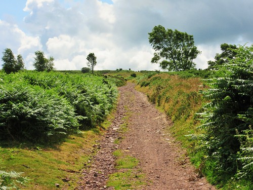
A grey cool day had hung low cloud over the Somerset coast and capped the Quantock Hills with mist. A stodge of red mud sucked at our boots in the ferny old lane that rose from West Bagborough up the steep south face of Lydeard Hill. A ghostly hoot and a frantic heartbeat of chuffing from far below tracked the progress of a train, rattling along the West Somerset Railway and leaving fat white gouts of smoke to dissolve in the breeze.

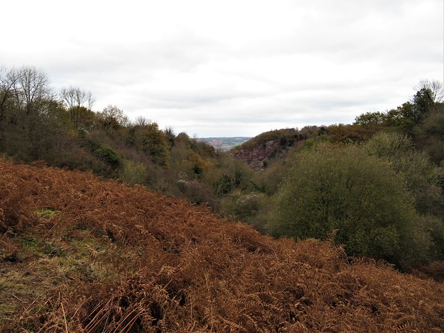
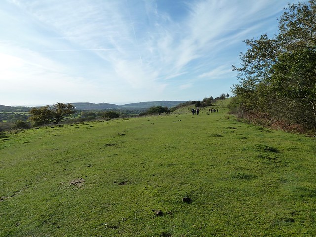
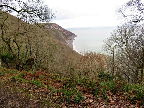
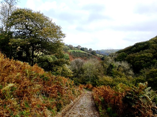
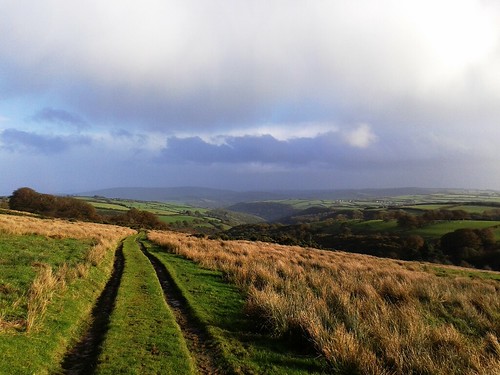
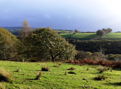
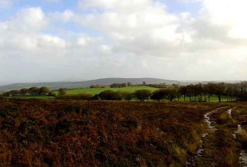
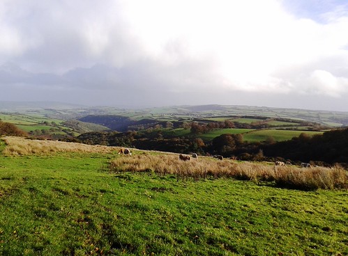
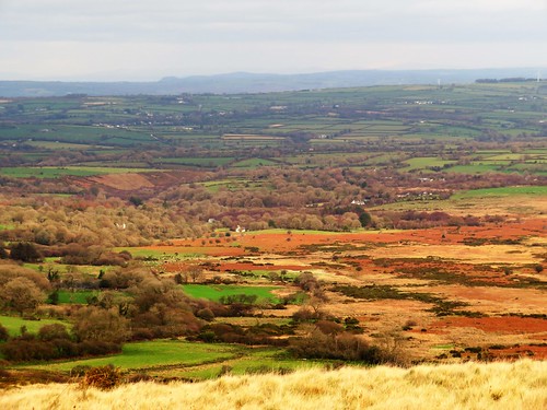
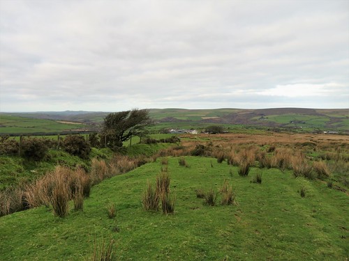
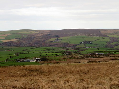
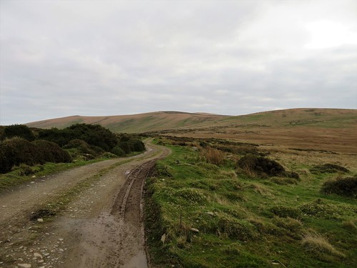
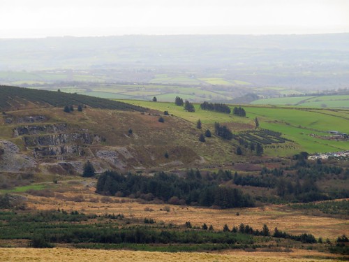
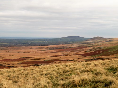
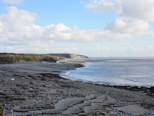
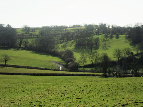
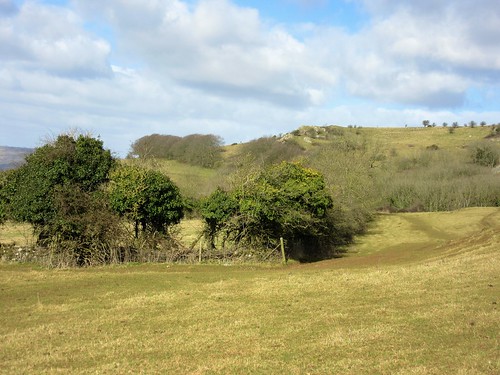
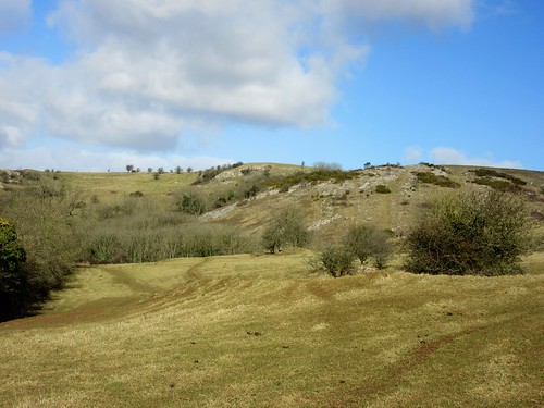
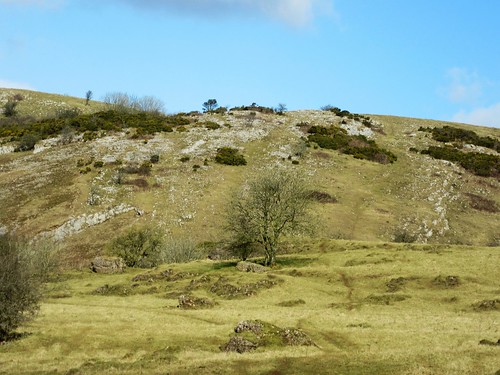
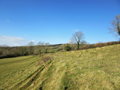
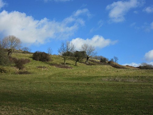
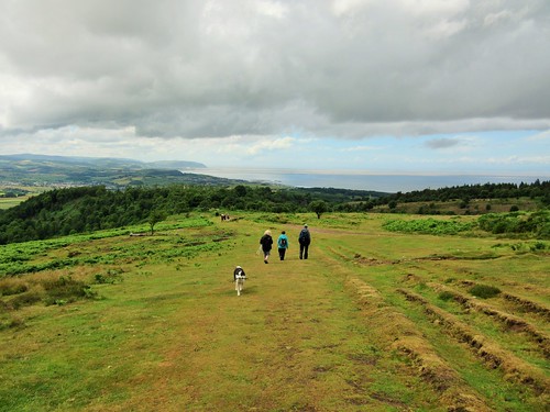
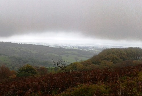
Up on the brackeny back of Lydeard Hill we found ourselves just under the mist line. A giant view opened northwards over the coastal plain to the silver coils of the River Parrett snaking into the low-tide mud flats of the Severn Estuary. Steep Holm and Flat Holm islands lay black and two-dimensional, as though cut from slate. The Welsh shore ran away westward, the grey whaleback of the Mendip Hills barred the northward horizon twenty miles off, and at our feet opened a steep, nameless little valley, a Quantock combe full of golden treetops.

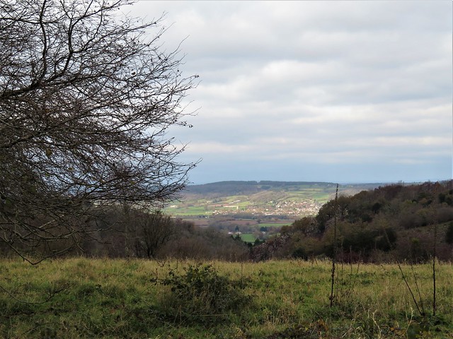
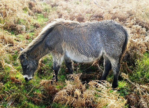
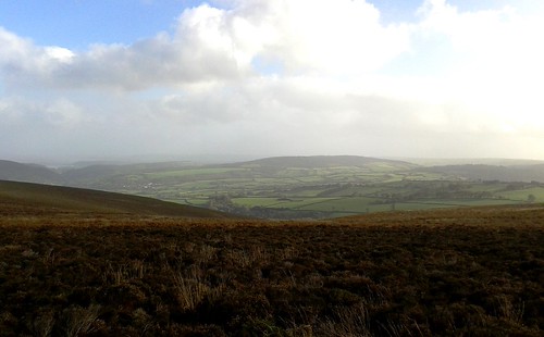
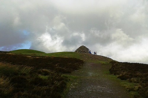
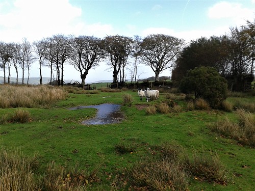
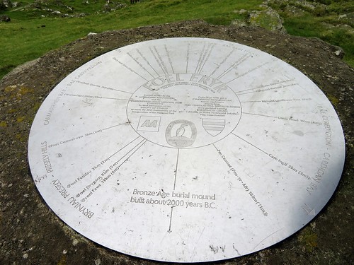
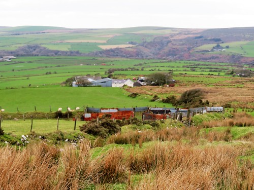
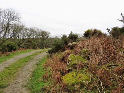
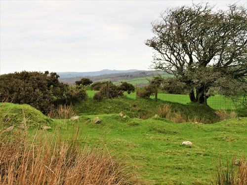
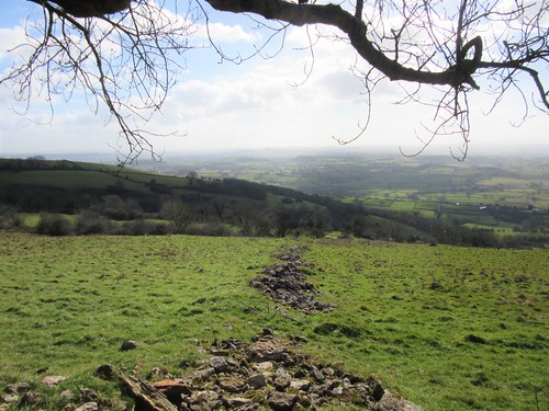
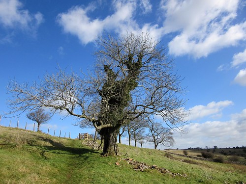
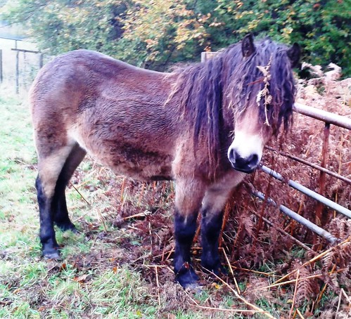
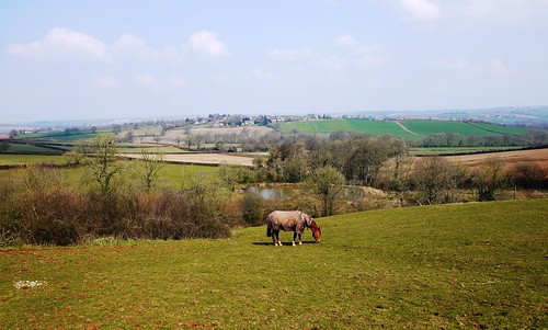
A pink horse came ambling past. ‘Oh,’ laughed his rider, ‘he should be white, but he loves rolling in all this red mud!’ We followed a ridge path down to Bishpool Farm, richly scented with applewood smoke and lying in a red and green valley. A little girl came out among barking dogs at Lambridge Farm to watch us go by. We rounded Gib Hill and followed a bridleway up through the woods to the summit of Cothelstone Hill. Some British chieftain lies here under a round barrow, lord of a hundred-mile prospect – Blackdown, Quantock, Mendip, Exmoor, Cotswold and Wales.

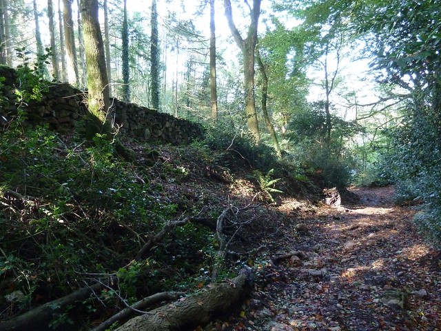
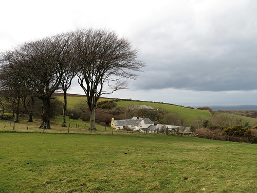
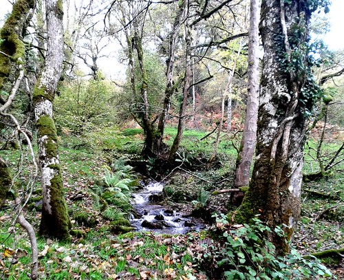
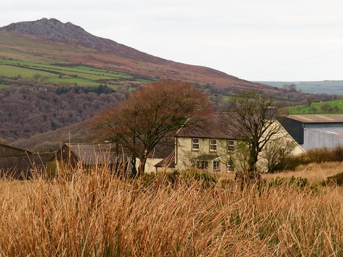
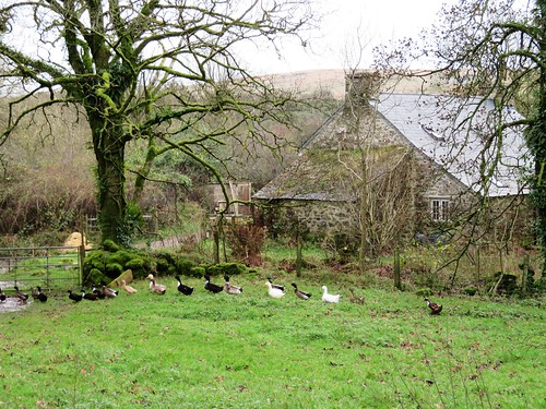
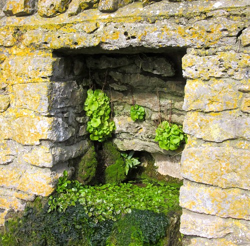
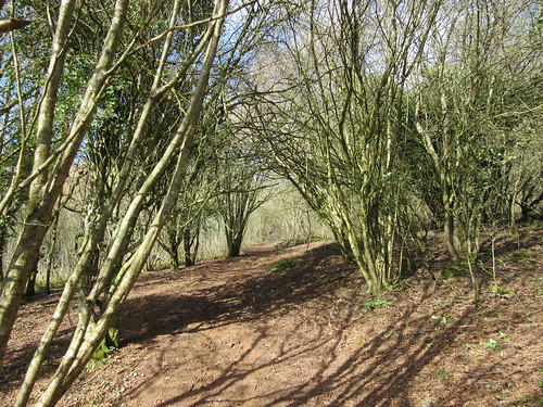
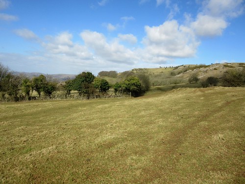
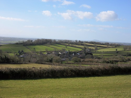
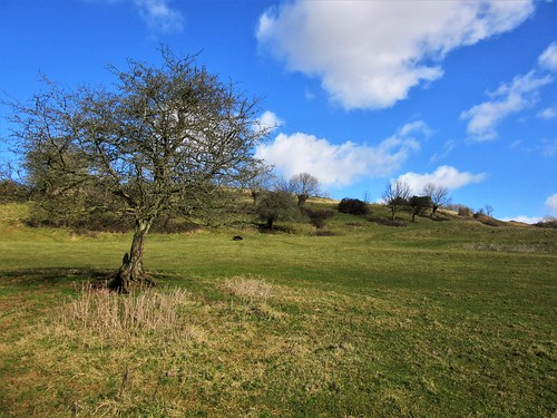
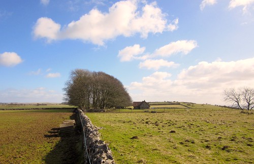
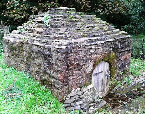
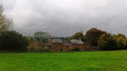
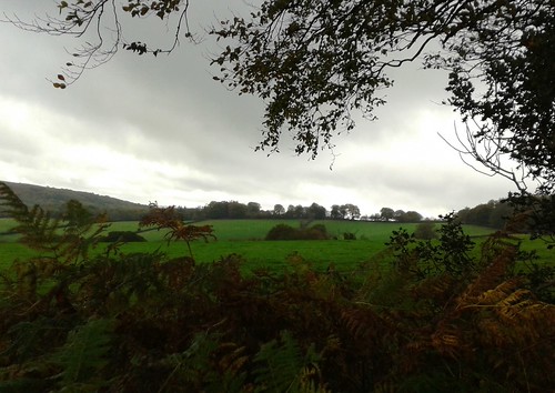
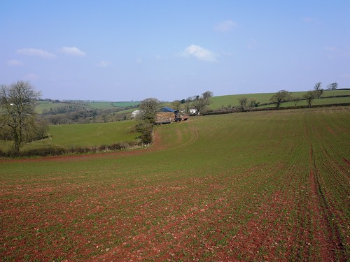
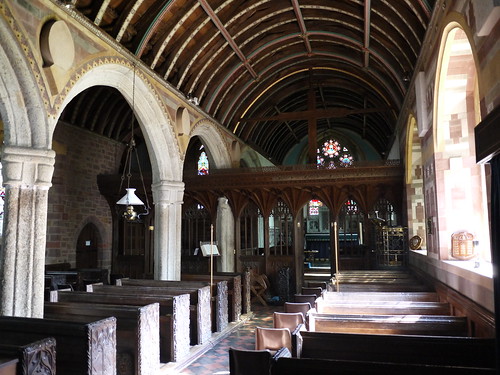
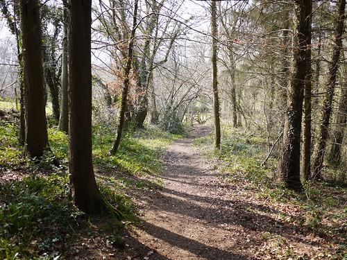
We stood to savour it all, then plunged down the mucky bridleway through Paradise woods to Cothelstone where the red sandstone church, model farm and Elizabethan manor house huddled together in a beautiful cluster under the hill. St Agnes Well lay under a corbelled cap by the road, its dimpling water efficacious in curing infertility and vouchsafing virgins a glimpse of their future husbands. We trailed our fingers in the spring, and then made west across handsome parkland where black cattle stared stolidly from under the trees.

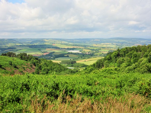
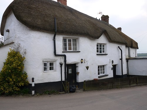
A high-banked lane, a last glimpse of broad Taunton Vale from a bridleway, and we were back in West Bagborough in time for tea at the Rising Sun.

Start: Rising Sun Inn, West Bagborough, Taunton, Somerset TA4 3EF (OS ref ST 171334)

Getting there: West Bagborough is signed off A358 Taunton-Williton road between Combe Florey and Crowcombe.

Walk (7½ miles, moderate with some ups and downs, OS Explorer 140): Up lane beside Rising Sun, through gate; on uphill for ⅔ mile. At top of hill, path forks; right here (174344; ‘Restricted Byway’) through gate. Three paths diverge; follow left-hand one. In 100m go over path crossing and on east over Lydeard Hill for ½ mile. Into woods (183343, yellow arrow/YA). In 200m, track curves right; left here (185341); in 100m, right through kissing gate. Keep ahead along ridge with hedge on right; in ½ mile, right through gate (194344, no waymark); follow hedge down to road (197342). Right past Bishpool Farm; in 50m, left through kissing gate (YA) and farmyard. Left through gate; right over stile (fingerpost); aim half-right down field to cross stream (200339). Track to road.

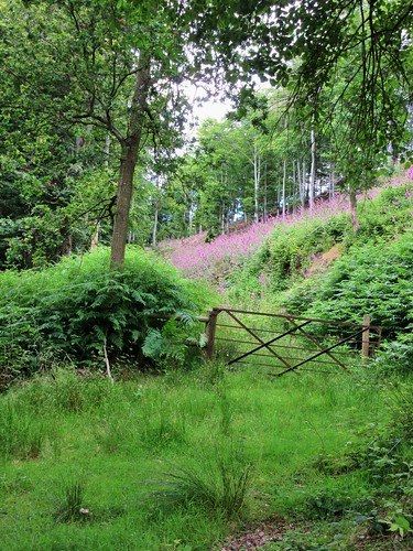
Right past Lambridge Farm; steeply up through gate (199337); pass to right of cottage. Up through gate (blue arrow/BA); up through next gate; follow hedge on left for ⅓ mile to go through gate into wood (195333, BA). In 100m track bends right; follow it up to road (193331). Right along road (take care! Left side is best!) for 300m. Just before road on right, turn left up bridleway through wood (190330, BA, ‘The Rap’ fingerpost). In 150m, at T-junction, left (189330); in 200m, fork left through gate (188328, ‘footpath’ arrow). Up through trees for 250m to fenced tumulus on ridge (188326). Left to stony knoll and viewpoint at summit of Cothelstone Hill (190327)

Bear right downhill on broad grass path. In 100m ignore fork to left. Down to pass animal pens on your right. In 200m, 2 gates on right (193324). Go through kissing gate beside left-hand one; turn right and immediately left to post with 2 waymark arrows. Right here; in 100m, at crossing of tracks (192323), bear left downhill on bridleway through Paradise Wood, keeping ahead over various track crossings (occasional BAs) for ¾ mile to road (185319). Ahead downhill in Cothelstone. In 150m, right (fingerpost) across footbridge (optional detour, signed right, to St Agnes Well). Follow path past back of Cothelstone Farm. Left through gate (182319, YA); through gate at churchyard corner; across parkland field. In ¼ mile, over stile in dip (178321); ahead to gate into woodland strip; cross road (175322, YA). Half right across field to stile (174325, YA) and fenced path to road. Ahead up road; in 200m, pass Pilgrim’s Cottages; in 150m, left (175329, ‘bridleway’) on bridleway for ¼ mile to road (171331). Right into West Bagborough.

Lunch: Rising Sun, West Bagborough (01823-432575, risingsuninn.info) – very cheerful, friendly pub with rooms

Accommodation: Rising Sun (see above), or Cothelstone Manor (01823-433480; cothelstonemanor.co.uk)

Info: Taunton TIC (01823-336344)

www.LogMyTrip.co.uk; www.satmap.com; www.LogMyTrip.co.uk

 Posted by at 01:22
Apr 202013
 

A fresh cold day with a dilute blue sky over the mid-Devon woods and fields. First published in: The Times Click here to view a map for this walk in a new window
picture picture picture picture picture picture picture picture
Facebook Link:
The little Tarka Line train rattled away north from Morchard Road station into Henry Williamson country. I was glad to swap the rush of lorries on the Barnstaple road for the call and response of ewes and their new-born lambs in the steep green fields. The farmer had been deep ploughing around Oakview; I stumbled among the ruts, and came down to Middle Yeo Farm with boots as heavy as the Emperor of China’s famed iron shoes.
Beyond Old Mill I threaded a resinous pine plantation and took the stony lane up to Zeal Monachorum, where a feeble spring sun was shining on the thatched roofs and thick cob walls. The village lay tightly stretched along its ridge-top, the sloping lanes full of sparrow twitter and the cooing of ring doves. In the rough lane down to Tucking Mill Bridge, a robin gripped a hawthorn twig six feet away in the hedge and sang quite unafraid into my face. The old tucking or cloth-fulling mill lay among daffodils. and periwinkles just above the two-arched bridge, its tin roof and timbers sliding into a green ruin, the double hoop of the mill wheel still attached to the outside wall.
In the fields at Oak Tree Farm two black-faced lambs bounded for safety in the hedge, their mother’s cracked bellow of a call as throaty and querulous as a gin-soaked duchess. ‘Come hyyyaaaah!’ The farmer at Lower Thorne found me fumbling with a tricky horse-proof gate. ‘Pull it up! If you were a proper walker,’ he teased in a gentle Devon burr, ‘you’d have known that!’ How long had he lived here? ‘Oh, about seventy years. See that old house?’ He pointed at a beautiful thatched cottage across the fields. ‘Lammacott – I was born in that house, so I haven’t travelled far.’
Up at Down St Mary, another ridge-top village, I admired the tympanum carved over the south door of St Mary’s Church, a calmly smiling figure assailed by demonic beasts with palm-frond tails. Seven hundred years old? Eight hundred? The drama, the vigour and humour of the work shine through, now as then – a contact with the medieval stonemason as warm and direct as a handshake across the centuries.

Start: Morchard Road station, EX17 5LR (OS ref SS 750051)
Getting there: Rail (thetrainline.com; railcard.co.uk) to Morchard Road.
Road: Morchard Road station is between Copplestone and Lapford on A377 Crediton-Barnstaple road.
Walk: (6½ miles, moderate, OS Explorer 113): From station cross A377; take B3220 (‘Winkleigh’). In 300m, left through gate (747051, yellow arrow/YA) up Ellicombe Farm drive. Don’t fork left to Ellicombe House. By entrance pillars to red brick house, left through gate (745050, YA); follow fence round to right. Pass house; continue along hedge; through kissing gate to right of tin shed (744050). Right through metal gate (YA); immediately left through another metal gate (YA). Pass a tree (ignore gate on skyline to right here); keep ahead up bottom of shallow valley, rising to go through gate at far end (741049). Left (YA); over stile into lane.
Left for 200m; right up steps, over stile (742047). Down left-hand hedge; cross stile and turn left (741047, YA) along hedge. At end of field through gate (741045); right (YA) along irregular edge of field for 400m, with Oakview house on your left. At end of field, right over stile (737045, YA) over stream and stile beyond. Half left across field to cross 2 stiles in far top left corner (737046, YAs). In 30m, left over stile (YA); follow hedge to Middle Yeo Farm lane (733046). Left to road (733045). Right downhill. Just before bridge at The Old Mill, left through gate (732044, fingerpost), and follow YAs and stiles with river on right for ½ mile. At end of plantation, turn right across river by tall footbridge (726039); follow stony lane opposite uphill to road in Zeal Monachorum (721041).
Left; at phone box by church, left downhill (720040, ‘Bow’). At foot of slope left along ‘No Through Road’ (720038; ‘The Waie Inn’) past Waie Inn and on downhill to cross Tucking Mill Bridge (724035). Right (‘Bridleway’). At cottage, left (YA); in 20m, left up track. In 100m at field entrance, bear left and follow inside edge of wood to cross stile (725034, YA). Cross field; through gates; follow hedge on your right. In 200m, at bottom of dip, right over stile and through gate (729034, YAs); left along hedge, cross stream and go through gate (731033, fingerpost). Cross field, aiming for left-hand of 2 trees ahead. Through gate into lane (733033).
Ignore footpath fingerpost pointing right along lane; go through gate to right of Merrifield drive; diagonally right across field; through gate on far side (735031, YA). Left with hedge on left; at far end of field, descend to go through kissing gate (YA) and cross stream in dell (738032). Keep hedge on right to reach gate into lane at Lower Thorne (741032). Left; in 20m, sharp right (fingerpost) through several gates and farmyard. Continue on path across fields (YAs). In dip, through wood (744032), crossing stream and bearing left downhill to stile. Cross field to bridleway by cottage (736033). Left for ½ mile to road (741040); right uphill through Down St Mary.
Pass church (743045) and on (‘Morchard Road’). In 150m, left over stile (744046, YA, fingerpost). Follow right-hand hedge, then centre of long field downhill to two neighbouring metal and wooden gates. Turn right through wooden gate (744050); retrace steps to Morchard Road station.
Lunch/accommodation: Waie Inn, Zeal Monachorum (01363-82348; waieinn.co.uk); Devonshire Dumpling, Morchard Road (01363-85102; devonshiredumpling.com)
‘Tarka Line Walks’ by Peter Craske (Crimson Publishing) – 60 walks in the locality.
Exmoor Walking Festival: 27 April-6 May (exmoorwalkingfestival.co.uk)
Info: Exeter TIC (01392-665700)
visitdevon.co.uk vistengland.com www.ramblers.org.uk www.satmap.com www.LogMyTrip.co.uk
Click on Facebook “Like” link to share this walk with Facebook friends.

 Posted by at 01:36