Search Results : exmoor

Nov 182023


First published in: The Times Click here to view a map for this walk in a new window
Brutalist concrete dam at Wimbleball Lake footbridge over River Haddeo in Hartford Bottom Wimbleball Lake from Haddon Hill 1 Exmoor pony on Haddon Hill with Wimbleball Lake beyond pink sandstone track on Haddon Hill steep green pastures beside Haddon Lane 1 steep green pastures beside Haddon Lane 2 packhorse bridge and ford at Bury in Hartford Bottom between Hartford and Bury

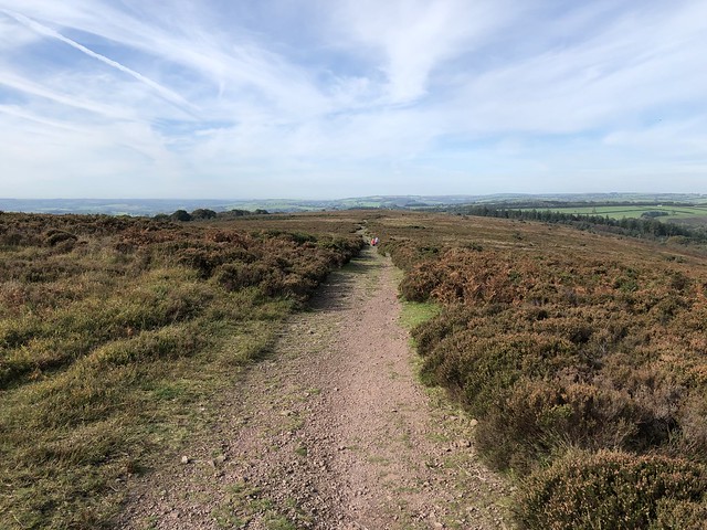
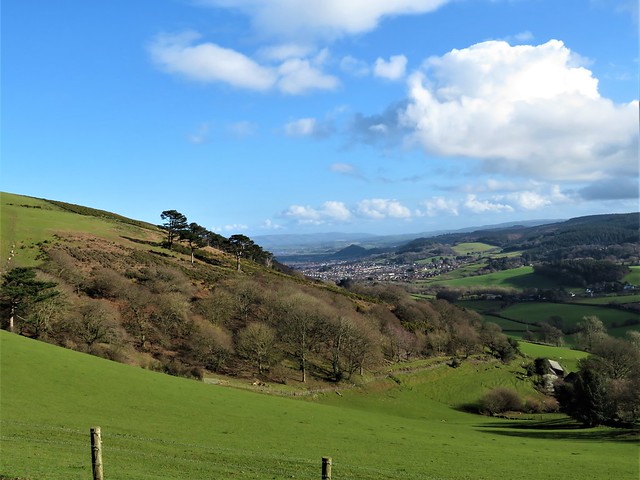
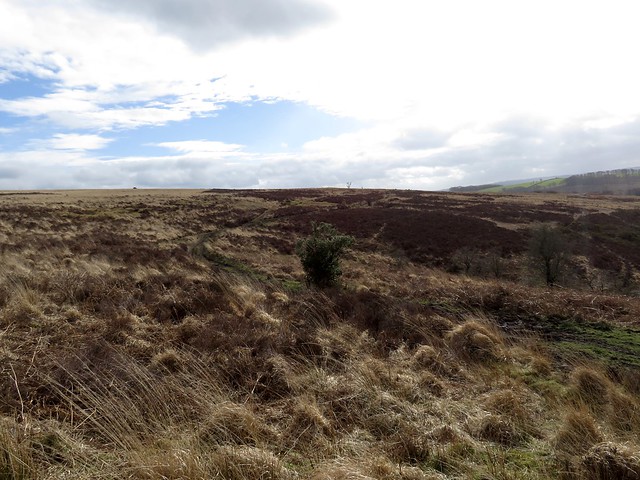
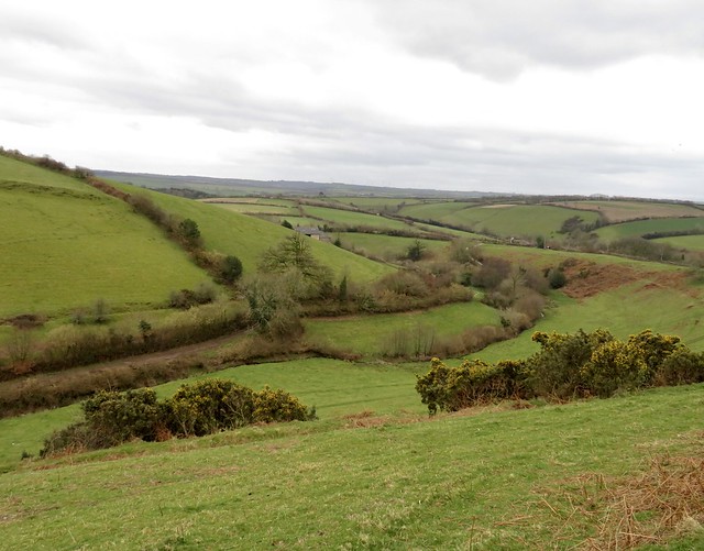
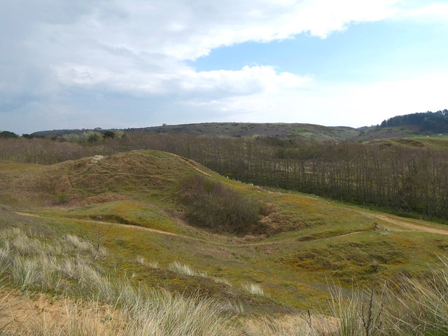
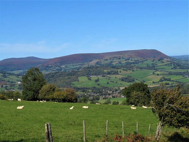
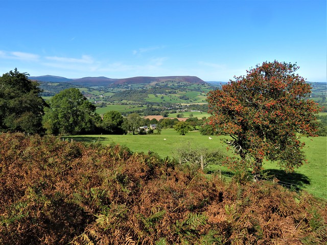
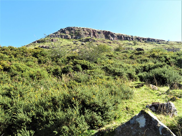
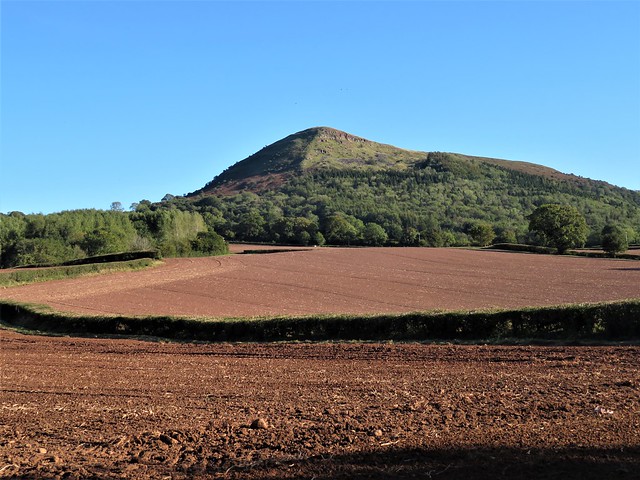
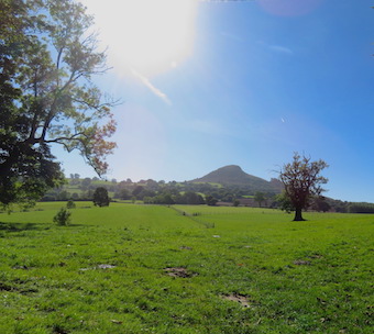
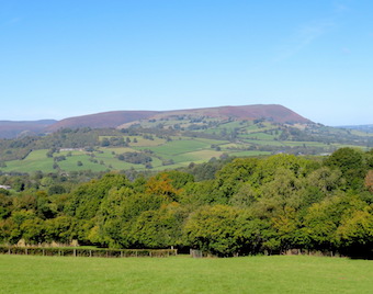
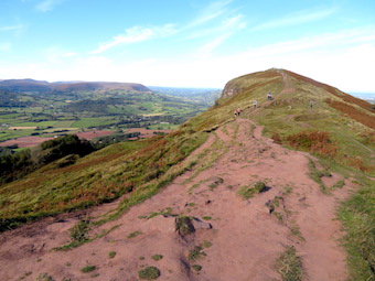
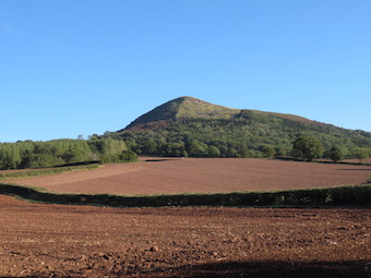
Unseasonably warm, unseasonably sunny – so said everyone in the car park as they prepared for their Sunday constitutionals across Haddon Hill, a fine double hump of sandstone standing proud on the south-eastern edge of Exmoor.

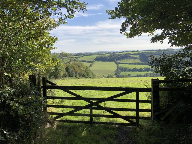
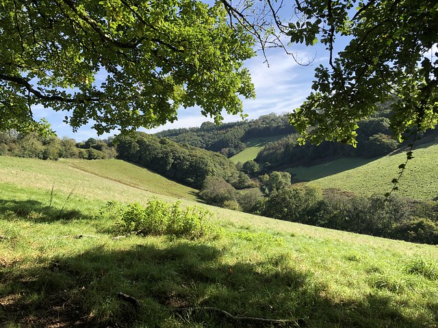
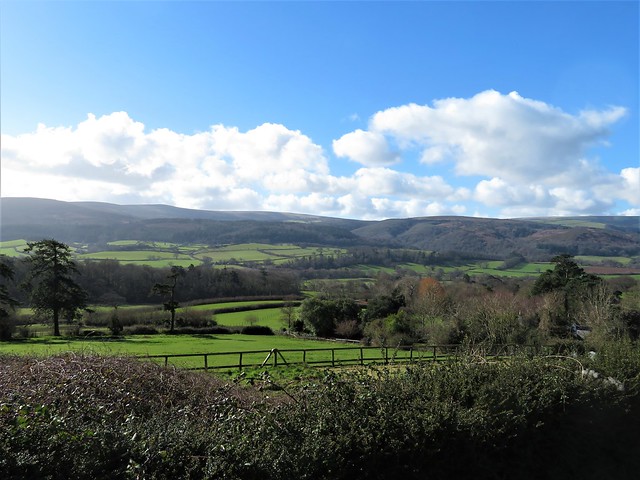
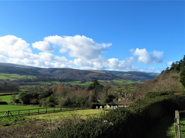
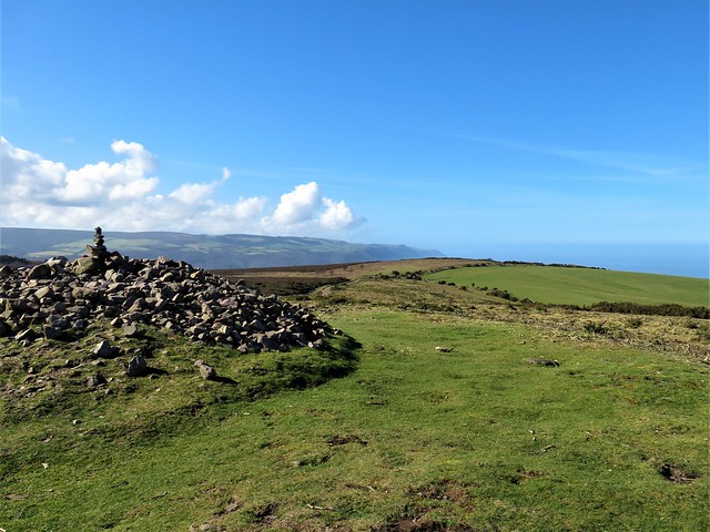
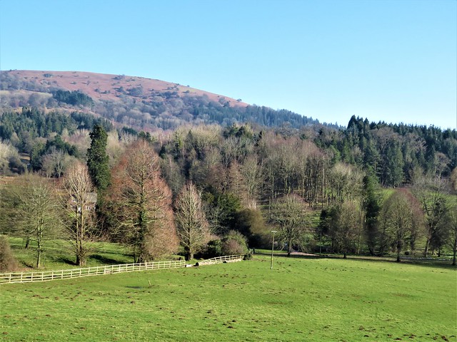
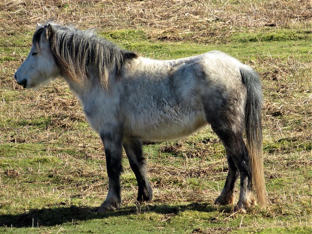
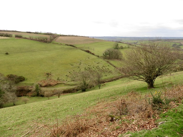
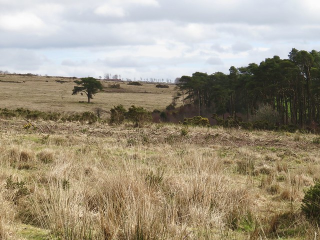
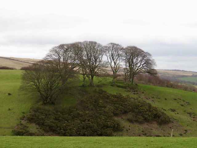
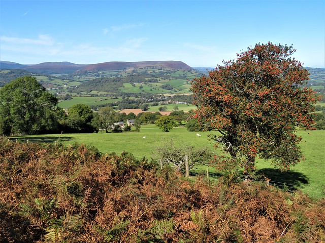
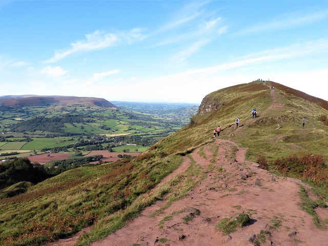
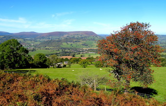
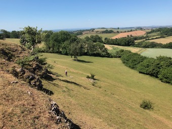
Once out on the open moor there were dark shaggy Exmoor ponies cropping the grass among the bracken, stonechats with black caps and white clerical collars calling wheesht-chip-chip! from the tips of gorse bushes, and a wonderful view north down to Wimbleball Lake lying as smooth as iced glass.

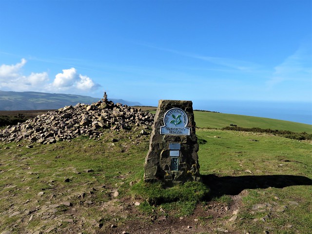
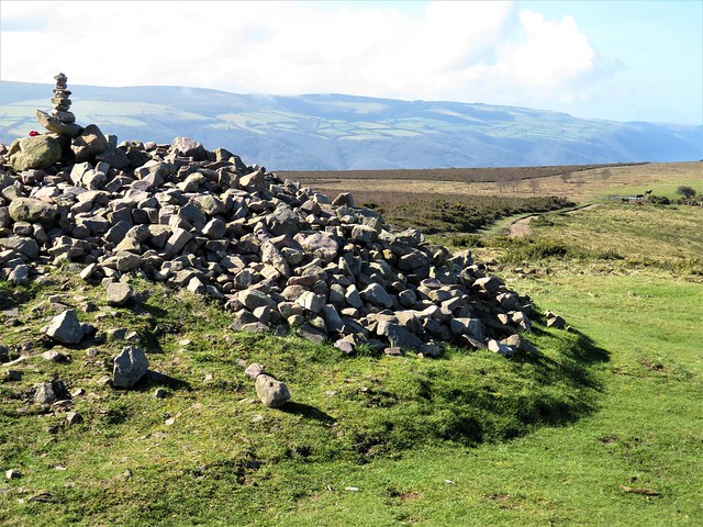
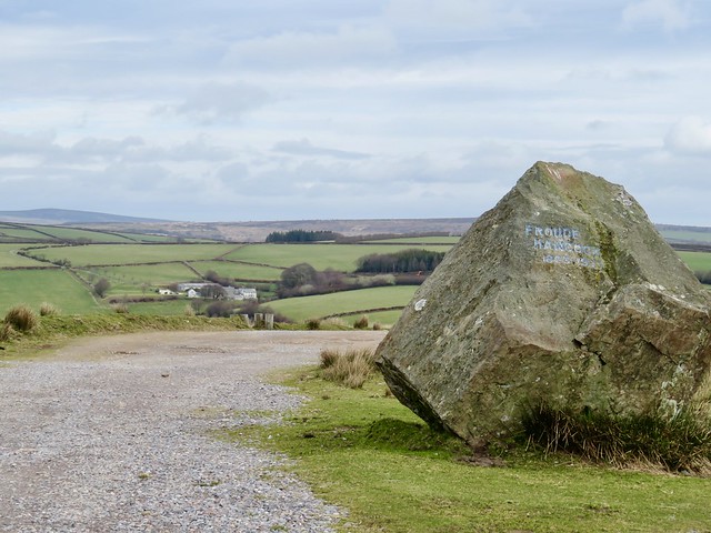
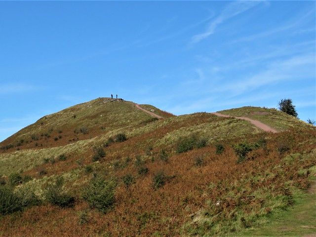
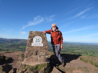
On top of the trig pillar at the summit of Haddon Hill sat a tiny boy clutching a woollen rabbit. His father teetered a-tiptoe behind him on the pillar, expounding on the remarkable view from the Exmoor outliers in the north to the craggy profile of distant Dartmoor away to the south.

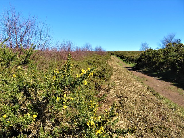
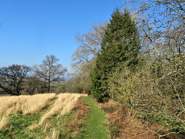
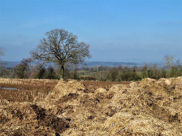
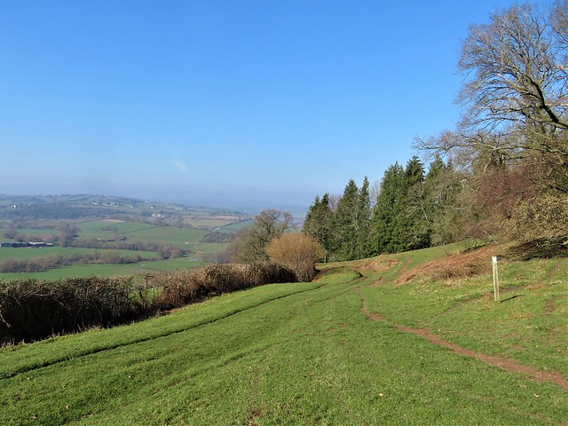
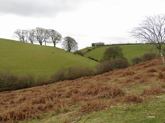
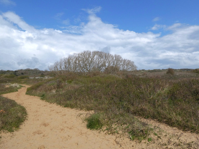
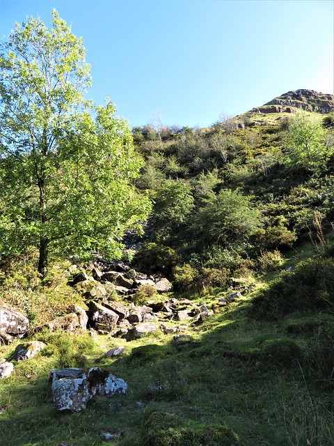
I followed a rubbly track steeply down through a bronze sea of bracken towards the lake. Autumn seemed on the cusp of handing over to winter with the silver birch already bare, leaves of toffee and lemon hue lining the verges of the paths, and a robin giving out that sharp silvery burst of song so characteristic of woodland at the dead end of the year.

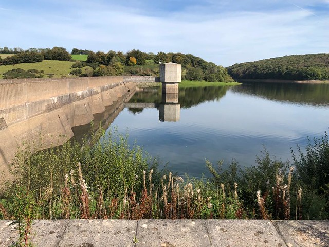
The dam wall and control house of Wimbleball Lake are an essay in stark brutalist concrete, in striking contrast to the naturalistic curves of water and woodland. A boy came riding his bike across the dam, wheelie-ing all the way and grinning like a prancing cowboy at a rodeo.

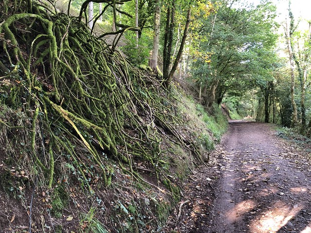
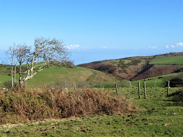
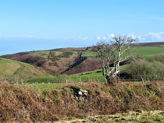
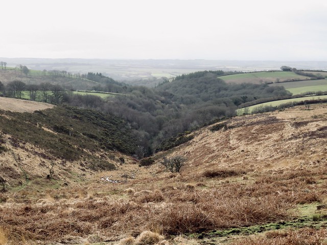
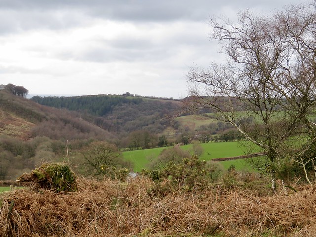
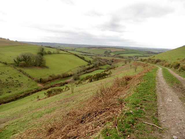
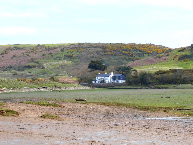
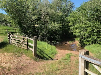
Down in the depths of Hartford Bottom, the densely wooded combe beyond, I trudged the muddy track from the few cottages of Hartford past the bubbling tanks of a fishery and on beside the meanders of the fast-rushing River Haddeo. A beautiful green cleft in the hills, mossy and full of the noise of lively water.

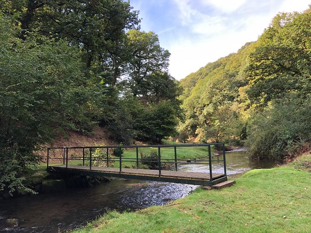
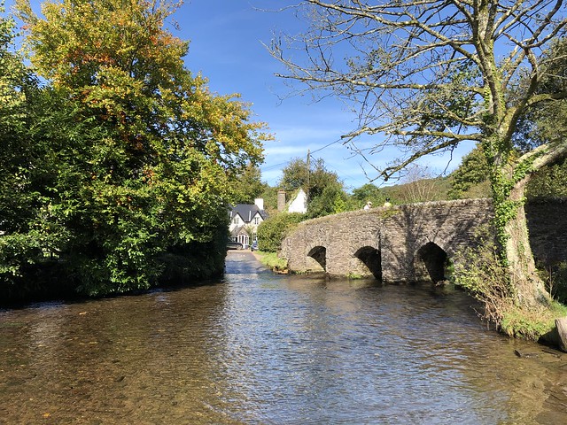
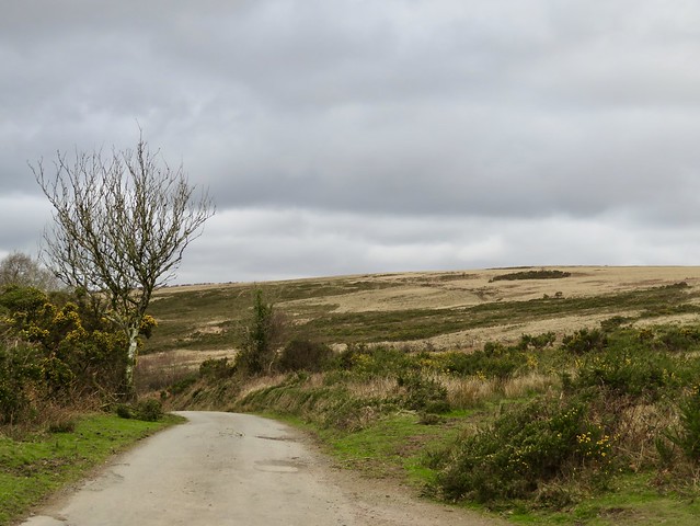
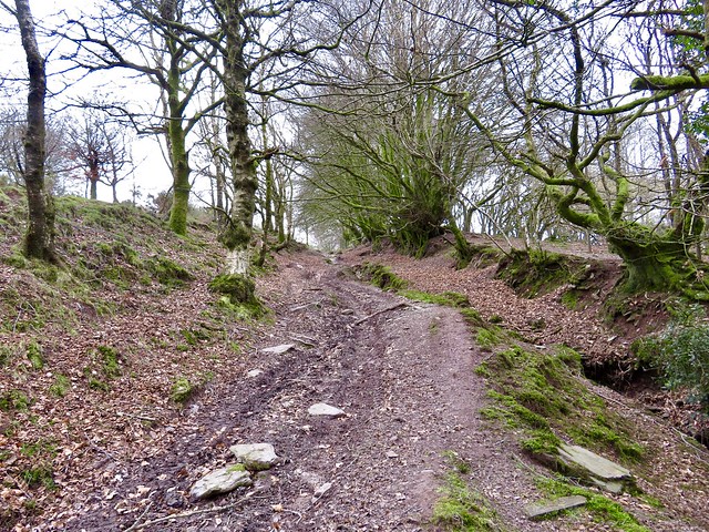
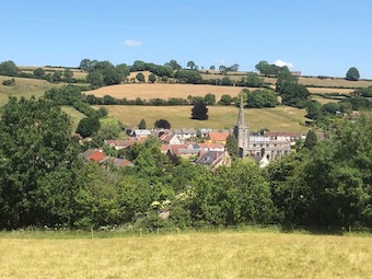
At Bury a car moved slowly between the trim stone cottages before inching across the village ford. I crossed the river alongside by way of a handsome old packhorse bridge with humpy back and pointed arches. Then it was a long winding climb from the sunny valley up to the open moor again under the overarching beeches of shaly, slippery Haddon Lane, half steep holloway, half trickling stream.

How hard is it? 6½ miles; moderate; bridleway road from reservoir dam down to Hartford is slippery; muddy between Hartford and Bury, and in Haddon Lane.

Start: Haddon Hill car park, near Dulverton TA4 2DS (OS ref SS 970284)

Getting there: Car park is off B3190 (Watchet-Bampton) between Ralegh’s Cross and Morebath.

Walk (OS Explorer OL9): Through gate at NW (top left) corner of car park. Bear right away from trees; follow main stony track gradually uphill to pass trig pillar (962286). Continue along track; in 300m fork right on grass path; in 150m sharp right (959286) on track heading for lake. In ½ mile fork left (967288) downhill past reservoir to road (969288). Left downhill to pass dam (965292). Continue downhill (‘Hartford ½’); at road, left (960294) through Hartford and on (‘Bury 2’). At Bury, left across bridge (945274). In 150m, just past Chilcotts house, left up Haddon Lane (‘Haddon Hill 1¼’). At Haddon Farm (955281) dogleg left/right onto track (‘Haddon Hill’). In 400m fork right through trees (958281, ‘Bridleway Upton’). In 100m into field; ahead through gate; half left up field slope to gate at far top left (962282). Forestry track to car park.

Lunch: Picnic

Accommodation: Ralegh’s Cross Inn, Brendon Hill TA23 0LN (01984-640343, raleghs-cross.co.uk)

Info: visit-exmoor.co.uk

 Posted by at 01:51
Dec 252021


First published in: The Times Click here to view a map for this walk in a new window
view above Wydon Farm view from Selworthy towards Exmoor view from Selworthy towards Exmoor 2 gorse by the moor track above Selworthy Combe trig pillar and cairn on Selworthy Beacon cairn on Selworthy Beacon 1 cairn on Selworthy Beacon 2 looking seaward from Selworthy Beacon easterly view from the South West Coast Path easterly view from the South West Coast Path 2 path near Wydon Farm homeward path maize mud moor pony homeward path towards Selworthy

Above the thatched cottages of Selworthy, the whitewashed tower of All Saints Church looked out across a wide green valley to the high undulating skyline of the Exmoor hills. A perfect view for a perfect winter’s day of blue sky and brisk wind.

A buzz like that of an angry wasp showed where someone was busy cutting wood in Selworthy Combe. The path rose through the trees between banks of tiny trumpet-shaped mosses. A robin perched on a post, puffing out his red breast and trilling a silvery call, quite unafraid as we passed within touching distance.

A brook came rustling down over neat little log spillways, its soft rich chuckle accompanying us all the way up through the oak and holly groves to the moor above. A contrast as abrupt as a knife cut, abandoning the shelter of the woods for the open moor where a biting wind ruffled the seas of heather and gorse running away to the horizon.

The National Trust and Holnicote Estate take great care and trouble over these 12,000 acres of upland, moor and combes. The woods are sensitively managed, the farms well run, and the hundreds of miles of footpath properly signposted.

We followed a broad bridleway through the gorse to the cairn on Selworthy Beacon. From here the view was mighty, over the rolling Exmoor hills, east and west along the curved cliffs of the Somerset coast, and out north across a Bristol Channel as pale as ice to the misty shores of South Wales under a long triple bar of cloud.

Above us only sky, as blue as delicate porcelain. We skirted a harras of Exmoor ponies, long tails billowing in the wind, and struck east along the South West Coast Path with the sea at our left elbow. A long cattle train of belted Galloway heifers went gadding and lurching along the skyline at a clumsy canter, delighted to be out in the open air.

The coast path led between sheep pastures through wind-stunted gorse bushes as stout as trees. A solitary bee buzzed among the gold gorse flowers, first raider of the year.

We turned inland and dropped down to Wydon Farm, hidden in a cleft so steep that, like Lucy in ‘The Tale of Mrs Tiggy Winkle,’ it looked ‘as though we could have dropped a pebble down the chimney.’

The homeward path lay along high-banked farm lanes. Tiny lambs bleated in quavering voices for their mothers, and a little egret stepped fastidiously along a streamlet, searching with gimlet eyes for any morsel to assuage its winter hunger.

How hard is it? 5½ miles; moderate hill walk, very well waymarked

Start: All Saints Church car park (£1 donation), Selworthy, Minehead, Somerset TA24 8TR (OS ref SS 920468)

Getting there: Selworthy is signed off A39 (Minehead to Porlock)

Walk (OS Explorer OL9): Left along road; right by church and follow ‘Selworthy Beacon’ fingerposts for 1 mile to Selworthy Beacon (919480). At cairn/trig pillar, left for 100m; right down to South West Coast Path (917481). Right along SWCP; in 1½ miles, right (938476, ‘Wydon ½’ fingerpost). In ½ mile at Wydon Farm, right (938470) on road. In 400m fork right (939466, ‘Hindon’). At Hindon Farm, left (933466) up track to road (931464). Ahead; in 300m, right (932461, ‘Selworthy Beacon’). At East Lynch Farm fork right (929462, ‘bridleway’). In 100m fork right again; in 50m, left (927463, stile, ‘public footpath’). Along fence to stile (935464); half right to road (923466); left into Selworthy.

Lunch/accommodation: Ship Inn, Porlock TA24 8QD (01643-862507, shipinnporlock.co.uk)

Info: nationaltrust.org/selworthy

 Posted by at 01:57
Mar 072020


First published in: The Times Click here to view a map for this walk in a new window
picture picture picture picture picture picture picture picture picture picture picture picture picture picture picture picture
Facebook Link:

It’s just as well that the Courtenay family, stout recusants and traditionalists, held such sway in the countryside around Molland back in the 19th century. They didn’t see why Victorian ‘improvers’ should be allowed to lay a finger on the tiny moorland village’s Church of St Mary. So no-one did. What’s survived here is the most perfect Georgian interior, a rare treasure.

We opened the church door on a maze of softly shining box pews, a fine 3-decker pulpit, and the Ten Commandments sternly admonishing us from their place above the low chancel screen. The north arcade leans so dramatically out of kilter that it had to be braced with wooden beams. And the elaborate, faded Courtenay wall monuments are a-bulge with cherubim, swags, scrolls and elaborate encomia.

Daffodils and primroses were struggling out in the churchyard, whipped by a cold wind from the south. We put our backs to it and went trudging up a stony bridleway over the moors that rose to the north in waves of creamy grass and black heather.

Up here it’s all airy bleak and open, proper Exmoor upland where the weather comes hard at you. The views are enormous, across the winter-dried moors to lush pasturelands lower down. A lark sprang up singing, the first of the year, and a group of moorland ponies champed their way along a combe bottom, shaggy manes and tails flailing in the wind.

We followed the hoofmarks of trekking ponies along the bridleway until it reached Anstey Gate. Just down the road we passed a memorial stone to Philip Froude Hancock (1865-1933), genial huntsman and international rugby player. A rugged monument to a rugged man, this 13-ton granite boulder was hauled up here in 1935 by a steam lorry, which almost blew up its boiler climbing the steep Exmoor lanes.

Below Guphill Common we turned back along a moor road, skirting its winter potholes and dipping into muddy combes. A bridleway brought us down into lower country of steep green pastures, where heavily pregnant ewes lumbered off and starlings whistled their jaunty vespers from the bare oak tops far below.

Start: Church car park, Molland, South Molton EX36 3NG (OS ref SS 807284)

Getting there: Molland is signed from B3227 (Hayne Cross intersection on A361).

Walk (6½ miles, rough moorland tracks, some short steep sections, OS Explorer OL9): Up lane between church and London Inn; left by church; in 30m, right on footpath past farmyard, across fields (fingerposts) and Moor Lane (810286). Ahead (yellow arrow/YA); down to cross footbridge (812288); steeply up to gate; up to far right corner of field (814290). Lane to Smallacombe. Follow bridleway (blue arrows) across ford (816291). Fork left; in 100m, ahead (not right; fingerpost). Follow bridleway hoofprints northeast, then east across moor. In ½ mile ignore left fork (821297); keep ahead on track bending gently right over hill ahead.

At Anstey Gate, right along road (835298). In 500m pass memorial stone on left; in another 100m, right opposite boundary stone (840296); between posts, and follow faint track running half-left across Guphill Common, heading for line of trees, then for their right-hand end. At road, right (845288); in 1 mile pass 4-finger post (830293, ‘Molland’). Cross Anstey’s Combe (827294), then the following ford (824294). In 300m, bridleway bends left with hedge-bank; on through gate (821291, fingerpost). Follow it down to road (819282).

Right (‘Molland’); cross stream; immediately right (817283, steps, stile, fingerpost). Steeply up to YA post; up to stile (YA). Follow YAs to road (813283); follow ‘Molland’ to village.

Lunch: London Inn, Molland (01769-550269, londoninnmolland.co.uk)

Accommodation: George Inn, South Molton EX36 3AB (01769-572514, thegeorgesouthmolton.co.uk)

Info: South Molton TIC (01769-572591); satmap.com; ramblers.org.uk

 Posted by at 04:51
Nov 212009
 

First published in: The Times Click here to view a map for this walk in a new window
picture picture picture picture picture picture picture
Facebook Link:

A dawn start on West Anstey Common, watching a magnificent red deer stag roaring rivals away from his harem of hinds. How to follow that? A pint and a sandwich at Tarr Farm Inn didn’t hurt at all, and we strode out across Tarr Steps among the gold and green oaks of the Barle Valley just as if the western sky were not heaping with ominously slaty clouds.

No-one really knows how long the ancient clapper bridge of Tarr Steps has spanned the nut-brown River Barle in its narrow combe. Saurian in shape, resistant to flood waters yet built to allow them free passage, this subtle old bridge might have been placed across the river by medieval monks, or it could have been carrying travellers dryshod over the Barle for as long as three thousand years. Its flagstone decking rang underfoot, and the swollen river rushed through the rough piers in curling trails of bubbles.

High above the valley an enthusiastic dog came to meet us at Parsonage Farm, drawing his black lip back from his teeth in an ingratiating grin. At Hill Farm it was the hens that greeted us with fat volleys of clucks; at Cloggs Farm, a sweet smell of hay from the barn. From farm to farm we pursued the path, dipping to cross Dane’s Brook among rushes and thorn hedges, climbing to Lyshwell Farm and sight of a scattered herd of hinds on the canter. Some Exmoor farmers detest the red deer for the damage they do; others, such as Raymond and Sarah Davey of Lyshwell, rejoice in the sight and sound of them.

On Anstey Rhiney Moor the weather caught us a smack. There were smells of wet bracken and turf, sodden grass and sedges. The rain-slick path fell away to a flooded ford over Dane’s Brook. Take the detour to Slade Bridge and forgo the pleasure of splashing across? Not on your nelly. The brook came up to our knees, and sent impertinent scouting parties higher still. On the far bank we tipped a good pint of peat-stained water out of each boot, and squelched on up past Zeals Farm, up the lane and field slopes to Hawkridge on its crest.

A mile or so along the heights, then a final plunge down through dripping trees to walk up to Tarr Steps against the brown tides of the Barle; a beauty of a walk, all in all.


Start & finish: Tarr Farm Inn, Tarr Steps, Dulverton TA22 9PY (OS ref SS 869322)

Getting there: Bus: service 401 (www.somerset.gov.uk/media), summer only

Road: M5 Jct 27, A361 to Tiverton; A396, B3222 to Dulverton; B3223 towards Exford; Tarr Steps signposted in 5 miles; minor road to car park (872323)

Walk (7½ miles, moderate, OS Explorer OL9): From car park, down path to cross Tarr Steps (868321); bear right off road up Two Moors Way/2MW (‘Withypool Hill, Hawkridge’). In 50 yards at private gateway, keep ahead uphill on stony lane which doglegs right. In field above, left along hedge, and on with hedges on your left. At end of 3rd field, through gate; follow yellow squares through farmyard of Parsonage Farm (857320). On down lane (2MW) to sharp left bend; right (854318) across stile, diagonally left up slope, aiming for 3rd telegraph pole to left. Follow hedge up to top corner of field; through gate; on to gate above. Don’t go through, but turn left with hedge on your right. Through left-hand of 2 gates close together; in 50 yards, right through gate; left along hedge; through next gate. Skirt below Hill Farm (847320); through another gate, and on to road. Left to Withypool Cross (845315); right (‘Molland’), then left (‘Bridleway, Shircombe Drive’) to Cloggs Farm (840310). By barn, left through gate (‘Anstey Gate’); down to cross stream (841311); through gate, right along fence above stream for a few yards, then left up bank (‘Anstey Gate’ fingerpost at top). Descend to cross Dane’s Brook footbridge (840308); right up stony track, then field slopes, aiming for line of trees on skyline. Through gate (fingerpost), on past Lyshwell Farm (837306); farm drive to road at Anstey Gate (835298). Left across cattle grid; then diagonally left across Anstey Rhiney Moor (left-hand of 2 diverging tracks) for 1 mile, descending to cross ford (850300; NB – Deep, maybe up to knees! Detour via Slade Bridge signposted!). Up track to pass below Zeals Farm house (853300); through white gate; right between barns, out of farmyard gate. Bear half left off drive (bridleway fingerpost) on grassy field track to gate; continue to Slade Lane (855303). Left to next corner; right (bridleway fingerpost) across field to road. Right through Hawkridge. At crossroads in village, left (‘Withypool’) for 100 yards; right to follow 2MW through fields for ¾ mile. Right (856317) through Row Down Wood, down to road at Penny Bridge (860316); left to Tarr Steps.

Lunch: Tarr Farm Inn (01643-851507; www.tarrfarm.co.uk)

Accommodation: The Bark House, Oakfordbridge, Devon EX16 9HZ (01398-351236; www.thebarkhouse.co.uk)

More info: Exmoor National Park Visitor Centre, Dulverton (01398-323841; www.exmoor-nationalpark.gov.uk; www.exmoor.com); www.ramblers.org.uk

 Posted by at 00:00
Nov 062009
 

Martin French deserves a medal. Not only did he get up in the cold and dark to see me off from his Bark House Hotel at Oakfordbridge, but he put porridge, bacon and eggs on the table at six in the morning. They make them tough down there on Exmoor. Ranger Richard Eales was nursing flu and the effects of a kick from an over-excited Exmoor pony, but he turned up for our dawn rendezvous at Exmoor National Park headquarters in Dulverton in his usual form – humorous, observant, and passionately knowledgeable about red deer.

From West Anstey Common Richard and I surveyed the ground around Lyshwell Farm. The farmer, Raymond Davey, enjoys seeing red deer, so Lyshwell is a likely spot to find a sample of Exmoor’s herd of some 4,000 of these beautiful and impressive creatures. Red deer have been native to Britain since shortly after the last Ice Age. Stags and hinds spend most of the year apart, but in autumn they come together briefly for the rut or mating season. That’s when the wooded combes and farm pastures of Exmoor echo to one of the most thrilling sounds in nature – the roaring of the stags.

As Richard and I watched from the high common, a deep dog-like bark rose from the oakwoods in the combe of Dane’s Brook far below. ‘A hind,’ said Richard. ‘She’s spotted us, and she’ll be warning the others.’ Then came the sound we had been waiting for – a grating, throaty roar from the direction of Lyshwell Farm. ‘Ah, he’s bolving,’ exclaimed Richard with satisfaction. ‘That’s the Exmoor word for the roaring. It’s a threat and a challenge to any other stag: “I’m here, and I’m in charge!” ’

Through binoculars I made out the stag as he stood by the hedge, head back and bolving, a large figure indistinct in the early morning light. In the field above him several hinds and two little calves came into focus. Beside them were a couple of prickets, two-year-old stags with two long dagger-blade horns where their antlers would eventually grow. ‘When a stag’s in his pomp,’ Richard expounded, ‘he’ll have his “rights” – his brow, bay and tray spikes at the base of the antler – and up to three “points” at the top of each antler. That stag we’re looking at, he’s a fine beast – he’s got all his rights and three points on one side, and all his rights and two on the other. Let’s have a closer look at him.’

Down in the Lyshwell fields we crept with bent backs along a hedge to a point where we could see through a screen of twigs. The stag was the size of a racehorse. He stood sideways on about 50 yards away, a magnificent spectacle against the rising sun, his dark form dazzlingly outlined in dewdrops, his heavily-antlered head thrown back as he bolved. The roar, a mixture of circular saw, Harley-Davidson and outraged lion, echoed out across Lyshwell Wood, projected forth on a puff of steamy breath.

‘See how dark his coat is?’ breathed Richard. ‘He’s been wallowing in his soiling pit, peeing in the mud and rolling in it to get a good stinking smell all over. A stag’s cologne, that is.’

Among his harem of a dozen hinds, most faces were turned towards us, but the stag seemed oblivious. He was sizing up one of the hinds, and had nudged her a little apart from the others, scenting her hindquarters and lifting his head between sniffs as if pondering a rare old vintage. Hinds are in season for a matter of hours only, so the stag relies on all sorts of clues to tell him the time is right. ‘He’ll lick up the hind’s urine,’ murmured Richard, ‘and run it along the Jacobson gland in his upper lip to see if she’s ready to be served.’

This hind was ready. It has to be admitted that the red stag is no languorous artiste du chambre. Ten seconds and the embrace was finished. The hind resumed her grazing, the stag his bolving and scenting of other posteriors. But the group of hinds remained uncomfortably aware of us. Soon enough they began to move off. Richard’s nudge was followed by his whisper, ‘We’ll go down in the wood and catch them there.’

Deep in Lyshwell Wood the stag’s soiling pit lay well-trodden, the wet mud exuding a powerful goaty smell. We crept along a sunken path. From the field above came the groans and roars of bolving in several separate voices – not just one stag, but three. Peeping over the top we saw ‘our’ stag trotting and roaring, and another animal making off in disappointment.

‘He’ll be back,’ said Richard as the herd disappeared into the wood and we straightened our stiff backs. ‘There’s a lot of hard work for the stags during the rut, keeping the hinds together, seeing off rivals, not to mention the mating. But they must think it’s worth it – they’ve been doing it for about ten thousand years.’

FACT FILE

Red Deer Watching: Ranger-led expeditions: contact Exmoor National Park Visitor Centre, Dulverton (01398-323841) or Exmoor National Park Authority, Exmoor House, Dulverton (01398-323665); www.exmoor-nationalpark.gov.uk. NB Lyshwell Farm is private property, but there are several footpaths across it.

Richard Eales’s deer-watching hints:

  • Go at dawn or dusk

  • Take good binoculars

  • Keep your eyes open, and give them time to adjust to spotting the deer

  • Be quiet, move slowly and keep downwind of the deer

  • Keep low to break up your outline

  • Stop still as soon as you spot a deer

World Bolving Championship: Held each October at Blaydon Rails above the Barle Valley, in aid of Devon Air ambulance. Details: Rock House Inn, Dulverton (01398-323131; www.rockhouseinndulverton.com)

Video:

http://www.thisiswesternmorningnews.co.uk/news/wild-beats-TV-talent-shows/article-1438375-detail/article.html

Accommodation: The Bark House, Oakfordbridge, Devon EX16 9HZ (01398-351236; www.thebarkhouse.co.uk) – really charming, welcoming small hotel, happy with very early starts!

Reading:

Kia – A Study of Red Deer by Ian Alcock (Swan Hill Press); Red Deer by Richard Jefferies (Halsgrove); Exmoor’s Wild Red Deer by N.V. Allen (Exmoor Press)

Information: www.exmoor.com

 Posted by at 00:00
Sep 222007
 

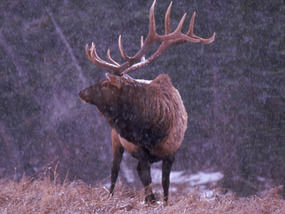
An answering roar, deep and melancholy, echoes from the hillside opposite. “Ah, there they are, dear old boys, giving each other the early warning,” smiles Richard Eales, Exmoor National Park Ranger of several years’ experience and a born deer fanatic.

“There are about 4,000 red deer on Exmoor,” whispers Richard. “The stags can tolerate each other’s company most of the year, in a laddish sort of way – a fair amount of bumping and barging, and even a bit of boxing with their forelegs when their new antlers are growing and itchy.
“But come this time of year, a hint of rough weather gets the old hormones flowing. Their necks thicken up into a big, dark mane and they get all edgy and restless. That’s when they have to collect a harem and try to hold on to it.”

The throaty roar, like a turbo-charged ram in full voice, comes up from the edge of a wood that we’re cautiously approaching. “Some call it belling, others say boving,” Richard murmurs. “It’s a challenge and a threat. Usually that’s enough to keep a rival away, but sometimes two stags will come face to face. If they’re serious, it’s heads down and let’s get to it.

“Lots of people think they fight to the death, but normally it’s just a clash of antlers. Or you’ll see them walking round each other, sizing one another up, like two blokes in a pub – ‘Come on, then, if you think you’re hard enough’, that sort of thing. Then one will back off, and it ends there.”
Hunched down and tiptoeing through the wet grass, we creep towards a five-barred gate.

Here he comes, cantering into view a couple of hundred yards away, a magnificent stag with heavy antlers and a big muscular body. He launches himself clean over a five-foot barbed-wire fence and then a hedgebank before charging straight up the hillside towards his opponent, who’s guarding a small hind – sole member of his harem.

The other stag skitters about nervously. And a particularly loud roar seems to convince him that the game is not worth the candle, and he backs away and moves uphill.
The victor stops to bell a couple more times, then turns his back and makes his way downhill and into the wood. Behind him trots the hind, now his exclusive property – unless and until some new stag, bigger, stronger or more aggressive, can manage to lure her away.

Crouched by the gate, we draw breath at the conclusion of this drama. “That one up on the common has to start all over again,” Richard says. “And this one in the wood, he’ll have one more hind to guard. And that’ll go on for another month or so, until the rut’s over and he’s mated with as many hinds as he can. The stags get really run down by the end of it, all thin and on edge.
“They’re absolutely knackered, poor old boys. Come to think of it – I was up at five this morning, so I’m feeling a bit that way myself. Fancy a cup of tea?”


 Posted by at 00:00
Apr 202024


First published in: The Times Click here to view a map for this walk in a new window
Sand dune path, Merthyr-Mawr 2 Ogmore River 1 Portobello House by the Ogmore River Sand dune path, Merthyr-Mawr 3 Sand dune path, Merthyr-Mawr 4 Sand dune path, Merthyr-Mawr 1 Sand dune path, Merthyr-Mawr 5

A hazy, breezy day on the Glamorgan Coast, and a Sunday buzz in the car park at Candleston Castle.

Merthyr-Mawr National Nature Reserve lies at the mouth of the Ogmore River. It boasts the tallest dunes in Wales, a great spread of sandhills that covers 840 acres of coast. The dunes sit on top of a shelf of limestone, hence their great height and also their remarkable fertility. Here you can find a dozen species of orchid, rare liverworts in damp patches, and delicately beautiful dune pansies from spring into autumn.

We climbed a slope of naked sand speckled with fragments of shell, past deep valleys dotted with sulphur-yellow hawkbit and bushy hollows where strawberry flowers spattered white across the mossy turf.

Down beside the ebbing Ogmore River, a flat littoral of saltmarsh lay strewn with the whitened trunks of trees washed out of the river banks in winter floods. We climbed a dune through scratchy marram grass to where the seaward view opened – galloping horses on the wide beach, and the pale rise of the Exmoor hills far across the grey-green Bristol Channel.

Between a shingle bar and the sandhills someone had built a charming little hut into a dune, its driftwood roof and carefully laid stone walls so seductive to the inner child that we were sorely tempted to play houses there all afternoon.

Soon the path ran up into the dunes again, crossing swards of violets and tiny pink cranesbills. We stopped to listen to an invisible bird singing with a silvery little trill, then headed east on sandy paths through an enchanting coppice of wind-stunted hazel where bluebells and wood anemones splashed the undergrowth with colour.

Late afternoon sunshine lay on distant hills, inland and across the sea. Our homeward path lay along a rubbly lane where an ivied angle of stone wall was all that remained of Candleston Castle, a fortified house 700 years old. Most of the strongholds along this coast were buried or choked out of existence by catastrophic sandstorms late in the 14th century – but Candleston on its limestone ledge had been built just high enough to escape that deadly tsunami of sand.

How hard is it? 5 miles; easy; sand dunes, beach and woodland paths.

Start: Candleston Castle car park, near Bridgend CF32 0LR (OS ref SS 872771) – 
£5 all day.

Getting there: Merthyr-Mawr signposted from A48 Bypass Road between Bridgend and Porthcawl. In ½ mile dogleg right/left; follow road to car park at end.

Walk (OS Explorer 151): With your back to road, take downhill path (red, yellow arrows); cross stream; ahead up dune slope. At prominent tree stump bear left. In hollow, pass blue arrow, ‘To The Beach’. When you reach a fence, follow it to go through gate. With fence on right, head for beach. Right along beach for ¾ mile. Opposite Black Rocks, Wales Coast Path/WCP sign points to dune path along fence (855767). In 200m fence bends inland, but keep ahead here. In 250m, at 2nd WCP post beyond fence, turn right inland (850770) on wide sandy track. Follow path inland for 400m to junction (851774); right on broad path. At fork, left (post with both waymarks missing); follow path for 1 mile, passing four gates with ‘Newton & Candleston Circular Walk’ signs. At stone wall, right on farm road (866778). In ⅓ mile drive bends left, then right to Candleston Farm. Hairpin right here (870779) down stony lane for ½ mile to car park.

Lunch: Picnic

Accommodation: Ewenny Farm Guesthouse, St Brides Road, Bridgend CF35 5AX (01656-658438, ewennyfarmguesthouse.co.uk)

Info: visitwales.com; first-nature.com/waleswildlife

 Posted by at 04:45
Dec 112021


First published in: The Times Click here to view a map for this walk in a new window
view north from foot of The Skirrid 1 fabulous barn, Llanvihangel Court view north from foot of The Skirrid 2 view north from foot of The Skirrid 3 view north from foot of The Skirrid 4 Skirrid peak from western side 1 Skirrid peak from western side 2 Skirrid peak from western side 3 path to the peak 1 path to the peak 2 Skirrid peak from northwest 1

The River Severn’s estuary was at a fantastically low tide as we crossed the ‘new’ bridge on a day of no cloud whatsoever. Looking seaward through the stroboscopic flicker of the bracing wires, we could see the tidal outcrop of the English stones fully exposed and slathered in red mud.

Downriver, the little hump of Denny Island off Portishead stood marooned in a huge desert of sand. Other sand and mud banks lay around the widening tideway like beached whales.

We were heading to Llanvihangel Crucorney, a placename whose sound put the immortal walking writer John Hillaby in mind of ‘a toy train scampering over points’. Llanvihangel Crucorney lies in the River Monnow valley that forms the eastern boundary of the Black Mountains and Brecon Beacons. It’s a great jumping off point for walks westward into those mountains, but today we were aiming east to climb The Skirrid (Ysgyryd Fawr, the ‘big split one’), a tall hill that lies north-south with its head cocked and spine raised like an alert old dog.

The Skirrid is made of tough old red sandstone lying in a heavy lump on top of thin layers of weaker mudstone – hence its history of slippage and landslides. We came up to it in cold wind and brilliant sunshine across fields of sheep, skirting its western flank through scrub woods, gorse bushes blooming yellow and holly trees in a blaze of scarlet berries, with the dark purple crags of the northern end hanging over little rugged passes of landslide rocks fallen in a jumble.

The ascent is short, steep and stepped, but it’s the sort of ‘starter mountain’ that families with six-year-olds can manage. Many were out – mums, dads, children, students, ‘maturer’ folk such as us.

Once at the peak in this unbelievably clear weather we gasped to see the landscape laid out in pin-sharp detail a thousand feet below and fifty miles off – Malverns, Black Mountains; farmlands rising and falling towards Gloucestershire and the Midlands; the slanting tabletops of Penyfan and Cribyn over in the Brecon Beacons; Cotswolds, Mendip, Exmoor; and the south Wales coast trending round into far-off Pembrokeshire.

Nearer at hand a grey streak of softly glimmering sea showed the tide rising in the Severn Estuary past Brean Down’s promontory, the slight disc of Flat Holm and the hump of her sister island Steep Holm, their lower edges lost in mist so that they looked like floating islands in some fabulous sea.
How hard is it? 6½ miles; strenuous short climb, some stumbly parts.

Start: Skirrid Mountain Inn, Llanvihangel Crucorney, Abergavenny NP7 8DH (OS ref SO 326206)

Getting there: Bus X3 (Hereford-Abergavenny)
Road – Llanvihangel Crucorney is on A465 (Abergavenny-Hereford)

Walk (OS Explorer OL13): Opposite church, lane (gateposts) to cross A465. Down drive; right at wall (325204); follow Beacons Way/BW arrow waymarks. Pass wood-framed barn; in 100m, right (328202, BW, gate). Follow BW across fields to lane at Pen-y-parc (336192). Right; beyond ‘Steppes’ house, left (332191, stile); follow BW to foot of Skirrid (333186). Right on path along west side of Skirrid to rejoin BW at southern foot of mountain (327169). Follow BW up to Skirrid summit (331183). Return; in 200m, sharp left beside hollow (331181); path descends to north foot (333185). Retrace BW back to lane at Steppes (332191). Left; in ½ mile, opposite Llwyn Franc, right (325190, gate, fingerpost ‘Crossways’). Follow hedge on right to gate/stile (325192). Half left across field, crossing Great Llwyn Franc drive (324193); on down to Crossways House (323200) and Llanvihangel Crucorney.

Lunch/Accommodation: Skirrid Mountain Inn, Llanvihangel Crucorney (01873-890258, skirridmountaininn.co.uk)

Info: Abergavenny TIC (01873-853254, visitwales.com)

 Posted by at 01:32
Oct 022020


The River Severn’s estuary was at a fantastically low tide as we crossed the ‘new’ bridge on a day of no cloud whatsoever. Looking seaward through the stroboscopic flicker of the bracing wires, we could see the tidal outcrop of the English stones fully exposed and slathered in red mud. Downriver, the little hump of Denny Island off Portishead stood marooned in a huge desert of sand. Other sand and mud banks lay around the widening tideway like beached whales. Unwary strangers might even suppose you could cross the five miles from the English to the Welsh bank on foot and do no more than bespatter your spats. And maybe you could, if you were able to walk on water while negotiating quicksand, slow mud, sudden drops, fathomless pools, and the second highest tidal range in the world sneaking round the corners to cut you off.

Over in Wales we hightailed it to Llanfihangel Crucorney, a placename whose sound put the immortal walking writer John Hillaby in mind of ‘a toy train scampering over points’. LC lies in the River Monnow’s valley that forms the eastern boundary of the Black Mountains and Brecon Beacons. It’s a great jumping off point for walks westward into those mountains, but today we were aiming east to climb The Skirrid (Ysgyryd Fawr, the ‘big split one’), a tall hill that lies north-south with its head cocked and spine raised like an alert old dog.

The Skirrid is made of tough old red sandstone lying in a heavy lump on top of thin layers of weaker mudstone – hence its history of slippage and landslides. We came up to it in cold wind and brilliant sunshine across fields of sheep, skirting its western flank through scrub woods, gorse bushes blooming yellow and holly trees in a blaze of scarlet berries, with the dark purple crags of the northern end hanging over little rugged passes of landslide rocks fallen in a jumble.


The ascent is short, steep and stepped, but it’s the sort of ‘starter mountain’ that families with six-year-olds can manage. Many were out – mums, dads, children, students, ‘maturer’ folk such as us, all hurrying to revel in this one-in-a-thousand day before the threatened reintroduction of lockdown in Wales should come into force.


Once at the peak in this unbelievably clear weather we gasped to see the landscape laid out in pin-sharp detail a thousand feet below and fifty miles off – Malverns, Black Mountains; farmlands rising and falling towards Gloucestershire and the Midlands; the slanting tabletops of Penyfan and Cribyn over in the Brecon Beacons; Cotswolds, Mendip, Exmoor; and the south Wales coast trending round into far-off Pembrokeshire.

Nearer at hand a grey streak of softly glimmering sea showed the tide rising in the Severn Estuary past Brean Down’s promontory, the slight disc of Flat Holm and the hump of her sister island Steep Holm, their lower edges lost in mist so that they looked like floating islands in some fabulous sea.


 Posted by at 19:43
Jun 042020
 

Leaving the village early on a hot windy morning, we skirted the west end of Quarry Hill. Ash dieback disease has got a firm grip of the young trees here, and is reducing them to pale skeletons in the wood. On the far side we crossed the dry yellow pastures of Dragondown where the cattle plodded one after another towards the shade of oak trees now turned as dark as iron by this two-month drought.

In the quiet green valley of the Russet Mere stream beyond Dragondown, a private revolution is taking place. The old knockabout farmhouses, beautifully sited but long neglected, have been bought up and spruced to the nines. The former dairying pastures of poached slopes and tough grass have been transformed into wildflower meadows thick with buttercups, knapweed, clovers and silky grasses with lovely names – Yorkshire fog, cock’s foot, crested dog’s tail. Aspens in stout tree guards, rustic park fencing and carefully signed paths all point to new influences, welcome ecologically, but oddly troubling too. At what point do the economics of everyday farming fall below feasibility, obliging the old farming families to give way to well-heeled conservers of the countryside?

Food for thought as we wandered the path through these delectable meadows and up to the strange gritty outcrop called Monk’s Kitchen. From here a really wonderful view down over the track of an old railway sneaking round the foot of Quarry Hill, and out across fields and woods to a prospect opening over the distant coast and the Quantock and Exmoor hills beyond.

The path to Holdfast Farm below had been impenetrably blocked with a crop of wheat. Damn you, farmer! We pushed our way along the field margin ploughed and sown right up to the spiky hedge. Hmm, yes, old style farming ahoy!

Up on the rise beyond we stood looking down on our neighbour village with its tall grey church spire, roofs and trees – a classic English view in early summer.

In a quiet green valley beyond.


 Posted by at 17:40