Search Results : kent

Mar 102018


First published in: The Times Click here to view a map for this walk in a new window
picture picture picture picture picture picture picture picture picture picture picture picture picture picture picture picture
Facebook Link:

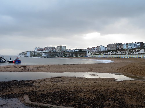
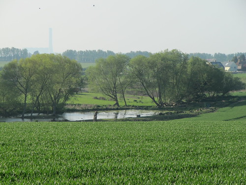
A huge wind from the north-west and a racing, bracing blue sky to greet us as our train came into Margate. The old Kentish seaside resort, once elegant, then raffishly ramshackle, now trendifying itself once more, hangs on the outermost lip of the River Thames where London’s river finally yields sovereignty to the North Sea.

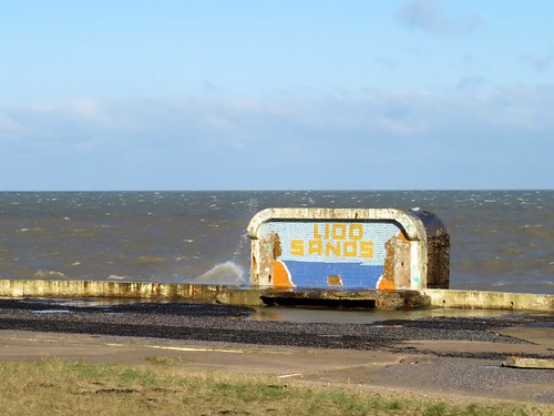
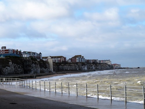
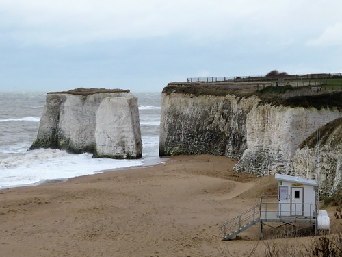
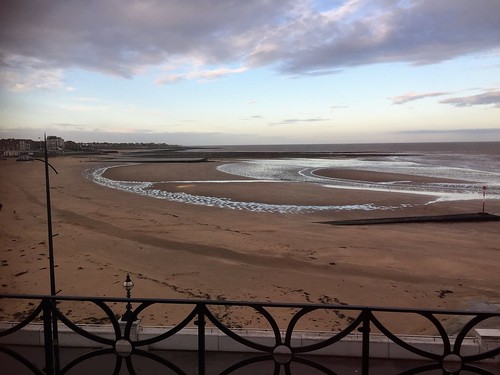
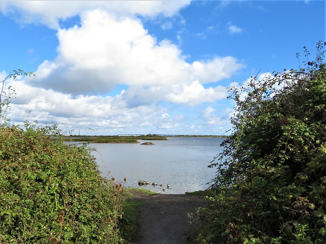
Kite surfers leaped and twirled joyfully in the breakers, and dogs in ecstasies galloped the crescent of tan-coloured sand in front of the town. The wind giants had pummelled everything into life and motion. We bowled along the sea-level promenade under low chalk cliffs with faces fractured by wind and weather.

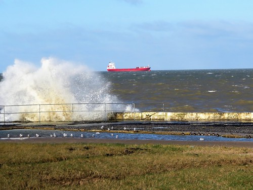
The sea boomed and shot up spray, each wave slapping back on its successor in rearing white horses. A flock of tiny, white-breasted sanderlings pattered this way and that, out to the tide-line after every wave to snatch whatever edible had been tossed ashore, back to the safety of the promenade wall as the next surge of foam hissed after them up the sand.

Out beyond all this activity and noise, big ships silently trudged the sea horizon, garishly lit in scarlet and white by shafts of intense sunlight. Already paired for the oncoming nesting season, a couple of fulmars contemplated the scene from a crevice high in the cliffs, while others planed the wind on wings stiffly out-held.

In Palm Bay a woman strode towards us, a length of green fishing net trailing from her fingers. ‘Beach-combed it,’ she said with pride, ‘I’ll train my runner beans up it. Recycling, you know!’

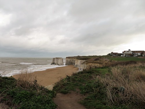
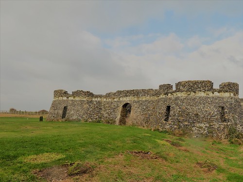
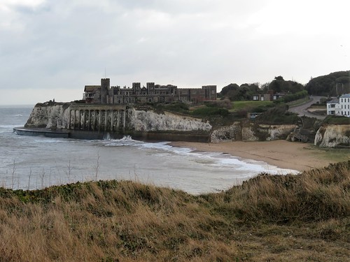
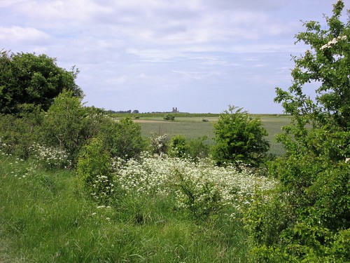
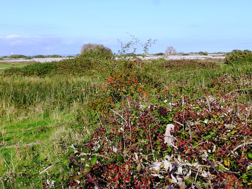
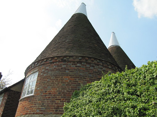
At Foreness Point the coast path swung more southerly, and the wind pushed at our backs. On the cliffs of Kingsgate Bay an enormous flint-built mock castle filled the headland, the cliffs below braced and buttressed to prevent them collapsing under its weight. The castle was built in Georgian times by Lord Holland for use as his stables. The only horses there today were the white ones that the jade-coloured sea sent prancing along the feet of the cliffs below.

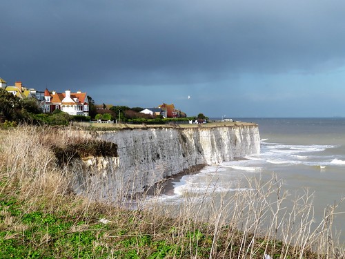
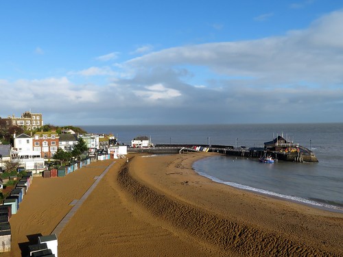
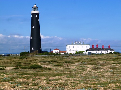
We passed North Foreland’s stubbly white lighthouse, threaded a maze of fabulous clifftop villas, and came down into Broadstairs windblown, salt-spattered and ruddy-cheeked, our ears still full of the roar of wind and sea.

Start: Margate Station, Kent CT9 5AD (OS ref 347705)

Getting there: Rail to Margate. Road – Margate is on A28 (Canterbury)

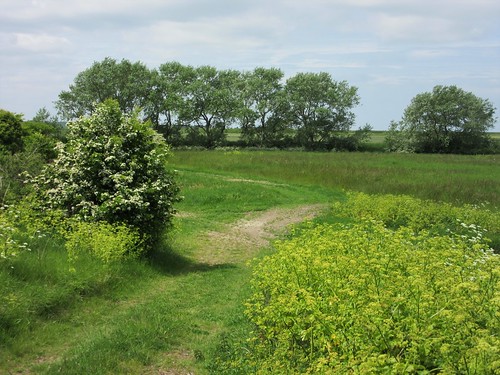
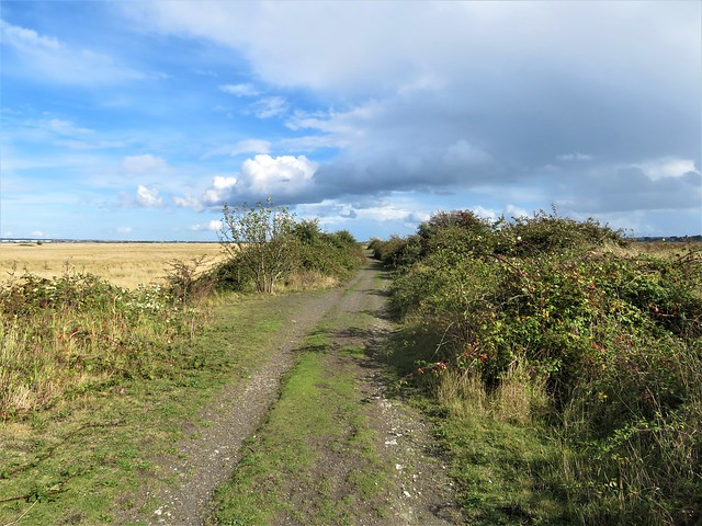
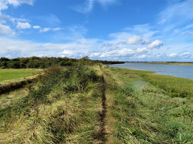
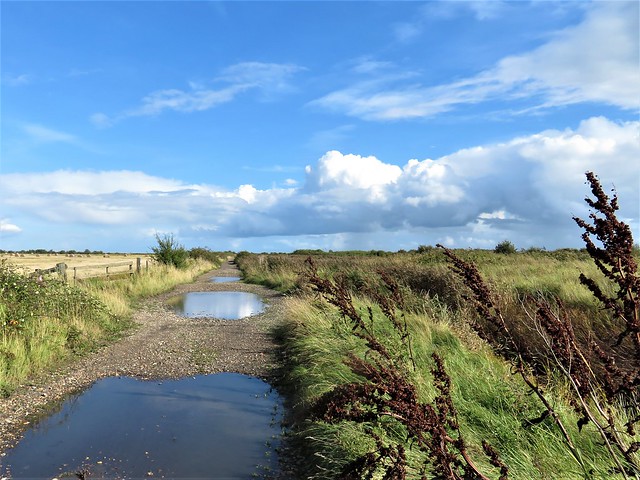
Walk (7½ miles, easy, OS Explorer 150): From Margate station, walk to seafront; turn right along Viking Coastal Trail/VCT. In 2¾ miles, turn up slipway at Foreness Point (384716); follow VCT along cliffs. In 1¼ miles join B2052 at Kingsgate Bay (3957707). In 350m, take cycle-path on right of road. At Elmwood Avenue cross Joss Gap Road (399701); follow VCT along cliffs. In 500m VCT turns inland towards North Foreland lighthouse, but keep ahead here along Cliff Promenade. In ½ mile turn inland along Cliff Road (401690); left along North Foreland Road. In 250m, opposite Bishops Avenue, left down alley (397689, fingerpost); right along shore promenade to Viking Bay at Broadstairs (399678). Inland past Old Curiosity Shop; left along VCT. In 250m VCT turns inland (398677); right along Buckingham Road, left up High Street for 600m to Broadstairs station (391680). Rail to Margate.

Conditions: Some shore sections may be inaccessible at very high tide. Check tides at visitthanet.co.uk/weather

Lunch: Many cafés and pubs in Broadstairs.

Accommodation: Sands Hotel, 16 Marine Drive, Margate CT9 1DH (01843-228228; sandshotelmargate.co.uk) – stylish, comfortable seafront hotel.
‘The independently-owned Sands hotel in Margate has been included in the Sunday Times 8 Best UK Seaside Hotels for the past three years (No.1 in 2016). It sits on the Prom, overlooking the beach and arching bay, retro-theme park Dreamland and the Turner Contemporary (Turner painted more canvasses in Margate than anywhere else). Margate has taken the mantle as the coolest place to be seen by weekending Londoners and the boutique hotel is also just a two-minute stroll from the bijoux art galleries and quirky artisan shops in the revitalised old town, You might even be able to catch one of those fiery Turner sunsets with a cocktail from the open-terrace roof bar.  A double room with breakfast costs from £130 per night.’ – (thanks to Paul Gogarty for these details)

Info: Margate TIC (01843-577577; visitthanet.co.uk)
visitengland.com; satmap.com; ramblers.org.uk

 Posted by at 01:58
May 142016


First published in: The Times Click here to view a map for this walk in a new window
picture picture picture picture picture picture picture picture picture picture picture picture picture picture picture picture
Facebook Link:

‘Bond motored slowly over to Reculver, savouring the evening and the drink inside him and the quiet bubble of the twin exhausts. This was going to be an interesting dinner party.’ Of course it was – Bond was driving his battleship grey DBIII with its ‘extras’ (battering ram bumper, radar set, long-barrelled Colt .45 in a trick compartment) towards a fight to the death with evil Auric Goldfinger and inscrutable henchman Oddjob.

The old village of St Nicholas-at-Wade lies hidden in plain view in the flat farmlands near the Kentish coast, its flint church tower rising among the red brick houses. The royal blue flowers of green alkanet brightened the dusty clay verges of the track I followed from the village through fields of barley and rape towards the distant twin towers of Reculver.

A sparrowhawk and a little egret crossed aerial pathways, the raptor flying at twice the speed of the bright white wader. Skylarks sang incessantly, and a reed bunting gave out its scratchy wheedle from a ditch where frogs were croaking, ‘Brexit! Brexit!’

Up on Rushbourne Sea Wall the path grew thick and jungly with alexanders. I shoved my way through, aiming for Reculver’s twin towers, with the rectangular pans of a shellfish hatchery – some dry, some glinting with water – stretching away to the low cliffs along the Thames. Sea wall met shore beside the towers, relics of the monastic Church of St Mary. Saxon monks founded the monastery on the ruins of a Roman shore fort to offer a beacon of civilization on a wild and lonely coast.

Out where the Thames Estuary dissolves into the open sea, I could just distinguish among the whirling arms of a giant offshore wind farm the Star Wars shapes of abandoned Second World War forts. It was a strange image to take with me along the coast path towards Margate among cyclists, strollers, scampering kids and dog walkers.

At Plumpudding Island a terrier with a coiffured hairdo like Little Richard’s pompadour came up barking. I gave him a pat, and took the homeward path along Wade Marsh. If that was 007 in disguise, he certainly fooled me.
Start: Bell Inn, St Nicholas-at-Wade, Kent CT7 0NT (OS ref TR266666)

Getting there: Bus 36 from Margate, 38a from Ramsgate
Road – M25 Jct 2; A2, M2, A299; past Herne Bay, St Nicholas-at-Wade is signposted.

Walk (8¼ miles, easy, OS Explorer 150. NB: online maps, more walks at christophersomerville.co.uk): From Bell Inn, left along road past church; over A299; left at junction (260674). At Chambers Wall, on left bend, right along field track (254676, fingerpost). In 700m track bends right; in 150m, left across ditch (250683). Follow concrete track to cross railway (248686); left along grassy bank. In 600m, opposite farm railway crossing, path bends right (242685); in 400m fork left (242689); in 100m track bends right (seaward), but keep ahead up bank (241689) and on (NB: can be rather overgrown) with shellfish hatchery on right, aiming for Reculver towers. At coast, (230694), left for St Mary’s Church. To continue walk, right along Thanet Coastal Path. In 3 miles at Plumpudding Island, opposite big grey shed on right, turn right down steps (273694). Follow path along embankment; in ¼ mile, cross railway (270690); follow path to Shuart (269678); right along lane to St Nicholas-at-Wade.

Lunch: Bell Inn (01843-847250, thebellstnicholas.co.uk) or Sun Inn (01843-841646), St Nicholas-at-Wade

Reculver Towers: 0370-333-1181, english-heritage.org.uk

Goldfinger by Ian Fleming (Penguin)

Info: Margate TIC (01843-577577)

visitengland.com; satmap.com; ramblers.org.uk

 Posted by at 01:44
Oct 032015


First published in: The Times Click here to view a map for this walk in a new window
picture picture picture picture picture picture picture picture picture picture picture picture picture picture picture picture
Facebook Link:

Looking back from the old fell path from Kentmere over to Long Sleddale, the Kentmere Valley on this gorgeous clear morning looked almost too good to be true. Church, houses and scattered farms lay in a dale bottom so richly and uniformly green it might have been stroked there with a painter’s brush.

A farmer went bouncing down the fields on her quad, shouting ‘C’m-aan!’ to the madly bleating sheep chasing her trailer with its load of feed. Near the crest of the path we were following, a tiny just-born black Herdwick lamb wobbled on splayed legs, sniffing along its mother’s blue-grey body to locate the bulging udder that awaited it.

We found the steep upward path to Wray Crag and set our boots to it, pushing upwards under lark song that poured out from invisible singers overhead. Wray Crag came and went. Up on Shipman Knotts beyond we sat to catch our breath, looking east to the long back of Sleddale Fell and a gleam of Windermere down in the south-west.

Now the rocks and crags gave way to a smooth saddle of moor grass, the dark stain of the path leading on and up the long nape of Kentmere Pike to the summit cairn at 730 metres. Up here the wind blew strong and cold. We huddled down and gazed our fill at the westward view – Coniston Old Man and Windermere, Great End and Bowfell beyond the breaking wave of Ill Bell – just about level with us now – and a shoulder of Helvellyn crusted with snow.

A long descent over bogs and crags, down to Hallow Bank and the walled and cobbled lane back to Green Quarter. We chatted with a farmer looking over the wall at his sheep – tales of winter storms, lost lambs, and ewes completely covered by snowdrifts. ‘We’d 40 lambs indoors being bottle fed,’ he said, ‘and 40 ewes looking for ’em once the snow went! But we got ’em all matched,’ and he smiled with satisfaction as though it had only happened yesterday.

Start: Green Quarter, Kentmere, near Staveley, Cumbria postcode (OS ref NY 461040)

Getting there: Staveley is signed off A591 (Windermere-Kendal). Follow road to Kentmere. Just before village, right (‘Hallow Bank, Green Quarter’). Limited parking at Green Quarter (4-car space on left just before triangular green). If none available, park in Kentmere and walk to Green Quarter.

Walk (6½ miles, strenuous, OS Explorer OL7): From triangular green, right up lane (‘Longsleddale’). At Old Forge gate, right through gate (yellow arrow, ‘Longsleddale’). Bear left; through gate at wall angle; follow track (public right of way) across fields NE for 1 mile. Through kissing gate (476050) onto Hallow Bank-Sadgill track. Left through gate; right up track, following wall on right steeply uphill northwards for 1¼ miles over Wray Crag (473054) and Shipman Knotts (472062) to ladder stile across wall (472067). From here, clear path up Kentmere Pike (fence soon coming in on right) to summit cairn (465078).

Return in poor weather/mist – back the way you came. Otherwise – return to where wall meets fence on left (468075). Fork a little right away from ascent path, following clear path. Cross ladder stile 250m NW of ascent stile (470069). Follow path (sometimes faint, but well trodden) SSW downhill for 1 mile to farm lane gate at Hallow Bank (466055). Through gate, down track; in 50m, left through gateway beside parking area; fork right down stony track. In 200m cross stream; next right (465052, ‘Mardale’), down road, through gate, and on to where farm buildings are in front of you. Bear left (not sharp left) past barn and on downhill. Track bends left; don’t bear right through gate (463053), but keep ahead along Low Lane. In ⅔ mile join road (461044); right to Green Quarter.

Conditions: A moderately hard fell walk; appropriate clothing and boots recommended.

Lunch: Picnic

Wainwright Book 2 – The Far Eastern Fells (Frances Lincoln)

Accommodation: Eagle & Child, Staveley, LA8 9LP (01539-821320; eaglechildinn.co.uk) – very cheerful, walker-friendly inn.

Information: Kendal TIC (01539-735891); golakes.co.uk

satmap.com; ramblers.org.uk; visitengland.com

 Posted by at 01:34
May 172015


First published in: The Times Click here to view a map for this walk in a new window
picture picture picture picture picture picture
Facebook Link:
Late spring bursting across the Kentish Weald out of a blue sky, its drifting grey and silver clouds backlit by the first honest sunshine of the year. Ide Hill woods were a mass of bluebells already in seed. Wildly overshot stems of sweet chestnut coppice brushed their saw-edged leaves across the sky and threw dappled shadows along the muddy track of the Greensand Way.
‘To the honoured memory of Octavia Hill,’ read the inscription on a strategically place bench, ‘who, loving nature with a great love, secured this view for the enjoyment of those who came after her.’ The bench looked out on a ten-mile view across woods and pastures, over the pale blue waters of Bough Beech Reservoir and on to the long ridges of the Wealden Hills.
The Greensand Way led us out of the woods, down through hay meadows in a shallow valley below Toy’s Hill where fat bees were bumbling their way into the bell-like flowers of foxgloves. Two blackcaps challenged each other in a contest of liquid melody from opposing hedgerow oaks. Railed paddocks, duckponds, meadows, mellow red pantile roofs, a pigeon cooing in an ash bough – an English summer idyll that would have any Romantic poet reaching for the rhyming dictionary.
Below Toy’s Hill we crossed a meadow flooded with gold buttercups and dotted with clumps of common spotted orchid, their pale pink lips streaked with splashes of dark purple. On the other side of the hedge stretched fields of intensively managed new grass, a uniform green with not one flower head to be seen.
A rough field road led us past half-timbered old Henden Manor. A green ride led east to the conical-capped oast house where Bough Beech Reservoir’s nature reserve has its visitor centre. Nightingales, hen harrier, breeding mandarin duck, the occasional osprey on migration – the reservoir is birdwatching heaven.
The afternoon was slipping away as we turned north for the sharp climb to Stubb’s Wood and Ide Hill. ‘I’ve lived here 52 years,’ said a lady at the garden gate of a cottage, ‘and every day is different, every season is lovely,’ and she gestured out across her daily prospect – woods, water, flowery fields, and distant hills blue and hazy under the sun.

Start: Ide Hill car park, on B2042, 1 mile SW of Goathurst Common, TN14 6JG (OS ref. TQ 488517)
Getting there: M25 jct 5, A21, A25 (‘Sevenoaks, Riverhead’). In ½ mile, right at King’s Head PH; in 350m, right on B2042. Through Goathurst Common; in 1 mile, car park on right (WC, shop)
Walk (6½ miles, easy, OS Explorer 147): Cross Ide Hill road on west of car park, into Ide Hill wood; turn left and follow Greensand Way (GW) for 1¾ miles via Cock Inn at Ide Hill village, Scords Wood and Toy’s Hill woods. At T-jct of tracks just NW of Toy’s Hill village (468514), turn left off GW, down to crossroads in Toy’s Hill (470513). Ahead down road for 400m. On right bend, left (472510, fingerpost/FP) along green lane. In 150m, right through kissing gate/KG; half right across field (yellow arrows/YA). Through KG (476509); across 2 fields (YA); bear right along wood edge to KG (478507) and on along track (YAs) past Henden Manor and south on tarmac to B2042 (481495).
Ahead for 200m; on right bend, left on path (FP). In 50m, don’t turn left; keep ahead to cross stile on left (YA). Follow fence on right; stile (482493, YA); through trees; stile. Right along fence. In 150m (483493) bear left along green ride for 450m to cross road at Winkhurst Farm (488492). On ahead down green lane. In 350m, at gateway with multiple YAs on left (491493), aim half right across field to waymark post by trees (493492). Left (YA) along hedge. In 100m, right through hedge (YA); across field and into wood (494491). In 70m, left up path through wood, then meadow; at top of meadow, right through gate to Bough Beech Nature Reserve visitor centre (494494).
Ahead between oast house centre and outbuilding, to road (495494). Right to view Bough Beech Reservoir; return up road for ½ mile. At T-junction (495501), cross road; through gate, up gravelled drive, then green lane, then field edges, heading north. In 400m, cross railed footbridge; in another 100m turn right (495506, unmarked) across footbridge on path through trees. Out into field; right up hedge for 700m to Boarhill Cottage (493513). Left up lane; at left bend (493514) bear right, then left (FP) into Stubbs Wood, climbing many steps. In 150m, meet a wide, obvious woodland track (492515); right for 250m to crossroads of tracks at waymark post (494517). Left (blue arrow/BA) on Greensand Way. In 450m, hairpin back left (490516, BA). At turning circle by house, right (BA) to B2042 and car park.
Lunch: Community Shop, Ide Hill car park (tea, snacks, picnic ingredients); Cock Inn, Ide Hill (01732-750310)
Bough Beech Nature Reserve: Visitor Centre (01732-750624, kentwildlifetrust.org.uk) open Wed, Sat, Sun, BH Mon, 10-5
Chiltern Society Golden Jubilee 2015: Book of 50 Chiltern walks, available from 29 May from chilternsociety.org.uk
Information: Sevenoaks TIC (01732-450305)
satmap.com; ramblers.org.uk; LogMyTrip.co.uk

 Posted by at 21:00
Oct 242014


First published in: The Times Click here to view a map for this walk in a new window
path to Cliffe Fort 1 haw berries and brambles beside the marsh track 1 haw berries and brambles beside the marsh track 2 sand quarry with Cliffe Fort beyond path to Cliffe Fort 2 path to the sea wall opposite Flamingo Pool cranes of London Gateway port seen across Flamingo Pool Flamingo Pool puddles on the marsh track to Cliffe

A sunny, breezy morning on the Kentish shore of the Thames Estuary, with big ships seen far off like ghost vessels gliding across the grazing marshes. The wind from the river whispered in the reeds, and a constant chatter of ducks from the fleets of water in the RSPB’s Cliffe Pools reserve spoke of the autumn gathering of wildfowl in enormous numbers.

Cliffe sits way out on a blunt estuarine peninsula. Here were the bleak marshes where Charles Dickens set the opening scenes of Great Expectations, and some of the old atmosphere still clings, the feeling of remote country, although central London lies only twenty miles upriver.

We set out along a causeway between the pools. Elder leaves were turning a dusky pink. A flock of goldfinches twittered in excitement as they darted between the seed feast of feathery ragwort heads and the shelter of hawthorn bushes.

Side paths through the scrub led to viewing stances on Flamingo Pool. No flamingos in sight; instead, a raft of coot bobbing on the wind-ruffled waves, a dozen lapwings on a muddle islet, and a flash of silver as a great crested grebe flicked a fish out of the water, tossed it up, caught it again and swallowed it with a shake of the head.

Out by the river we crossed the sea wall and followed a slippery clay path to where a miniature range of gravel alps rose beside a jetty. Diggers and conveyors clattered, and the air thrummed with the beat of marine engines as a rusty old Port of London dredger went steadily seaward down the Thames.

Beyond the workings crouched Cliffe Fort, grey and grim, built in the 1860s to deter a French invasion, now abandoned to scrub. Rusty rails leading out into the muddy estuary were all that remained of the experimental Brennan torpedo, a 19th century guided missile that might have dented a French ironclad if it had ever been put to the test.

Back on the sea wall we followed the long curve of the Thames. In the ooze of a creek a bar-tailed godwit stood on watch, a bulky wading bird with a great pink dagger of a bill, newly arrived from its Arctic summering grounds. Behind it the creek shores were lined with glasswort in autumn purple and crimson.

The homeward path lay across wide marshes over which a dense clot of black dots resolved itself into a whirling army of starlings. Sheep grazed stolidly, and in the distance a line of cranes at London Gateway port stood with heads raised like a herd of giraffes on high alert.

How hard is it? 5½ miles; easy; level tracks and paths

Start: Cliffe Pools car park, Cliffe, near Rochester ME3 7SX (OS ref TQ 723760). Car park free – closes at 4pm

Getting there: Bus 133 (Chatham, Rochester) to Cliffe
Road: A2, A228 (‘Grain’); B2000 to Cliffe; RSPB reserve signposted here (brown sign)

Walk (5½ miles): Pass noticeboard; left along lane. In 500m, just past ‘Pinnacle Trail’ sign on right, track bends left (725764). Fork immediately left on track. In ¾ mile at ‘England Coast Path’/ECP sign, left (715769); in 100m, right across sea wall (‘Saxon Shore Way’, yellow arrow). On between two blocks; path through scrub, then on. In ½ mile reach south side of Cliffe Fort (706766). Return to recross sea wall (715768); left along ECP. In nearly 1 mile, at metal gate with kissing gate (710775), fork right on track across marshes for 2½ miles back to car park.

Lunch/Accommodation: Six Bells, Church Street, Cliffe ME3 7QD (01634-221459, sixbellscliffe.co.uk)

Info: rspb.org.uk/cliffepools

 Posted by at 02:45
Oct 182014


First published in: The Times Click here to view a map for this walk in a new window
picture picture picture picture picture picture picture picture picture picture picture picture picture
Facebook Link:
Dungeness is one of the great uncommon landscapes of Britain, a vast sheet of pebbles – the greatest in all Europe – studded with tough fleshy and prickly plants, thronged with wild birds, a Kentish pampas that pokes a knobbly nose into the English channel. Dungeness is a great wilderness, but not unaffected by man – there are fishing boats and tarry fishermen’s huts, scattered bungalows, and the giant, pale grey boxes of a nuclear power station.

Our first encounter with the naked rambler was at the start of our walk, when he rose up in all his glory from the shingle bank beyond the power station, bade us good day and marched off past the scandalised beach fishermen of Dungeness. We soon forgot him as we followed a grassy path through the RSPB’s enormous 2,000-acre reserve whose pools, pastures and reed beds lie at the heart of the great shingle wasteland.

Swans sailed with nonchalant grace on the meres. ‘Look!’ exclaimed Jane suddenly. ‘Marsh harrier!’. The big bird of prey got up quite slowly from its stance in a field of stubble and flapped off low over the reeds, the sun glinting among its wing feathers. There was great complaining and loud lamentation among the shelduck and coots, and a party of teal sprang into the air and went away from the vicinity of the dark destroyer as fast as they could. We saw the harrier several times after that, quartering its territory like a king and causing commotion wherever it went.

Among the birds, the yellow-horned poppies, the wide stony wastes and the gentle whisper of the wind, it was easy to forget the strangeness that the nuclear power station and its marching columns of pylons brought to the scene. We turned for home with a two-mile trudge across the pebble sheet in prospect, and there were the ghostly grey boxes and the skeleton pylon army ahead, dwarfed under the blue bowl of the sky.

And here came the naked rambler once more, this time clad in the briefest of brief briefs. We exchanged greetings and he was gone like an Old Testament prophet into the wilderness, leaving us the plants, the birds, the pebbles and the blue sea horizon, with a blood-red sunset spreading in the west.

Start: Britannia Inn, Dungeness, TN29 9ND (OS ref TR 092169)

Getting there:
Rail – Romney, Hythe & Dymchurch Railway (rhdr.org.uk) to Dungeness
Bus service 11/11A/11B (stagecoachbus.com) from Ashford via Lydd.
Road – From Lydd (signposted off A259, Rye-New Romney), follow ‘Dungeness Nature Reserve’; then, near power station, ‘Britannia Inn’.

Walk (7½ miles, easy but pebbly!, OS Explorer 125. NB: online map, more walks at christophersomerville.co.uk): Follow boardwalk near black-and-white lighthouse to shore. Right past power station – hard-surfaced track by fence makes easier walking! In 1¾ miles, turn right inland by Lydd Ranges boundary tower (065167) on gravel road. In ½ a mile, road bends left – in 600m, pass roadway on left (057179). In 400m, right (054181, blue topped post, ‘Footpath No. HL33’). Follow grassy path through RSPB reserve. In ⅔ of a mile, keep ahead at 3-finger post (059184, ‘Hooker’s Pits’); follow bridleway blue arrows to road (063196). Right (‘footpath’ fingerpost), across shingle (occasional wooden posts) for 2 miles, aiming for black lighthouse. Cross road (083175); beyond old coastguard cottages, road to Britannia Inn.

NB: Last section across shingle is hard going! Keep to path – risk of unexploded ordnance!

Lunch: Britannia Inn (01797-321959) or Pilot Inn (01797-320314; thepilotdungeness.co.uk)

Dungeness RSPB Reserve: 01797-320588; rspb.org.uk/dungeness

www.LogMyTrip.co.uk; www.satmap.com;

 Posted by at 01:28
Apr 062013
 

The nightingale sang as though its heart would break. The infinitely slow and sweet contralto warbling filled the scrubby wood at the RSPB’s High Halstow reserve, an operatic aria against the plainer chorus of blue tits, chiffchaffs and wrens, and the stage-hand knocking and hammering of great and lesser spotted woodpeckers.
First published in: The Times Click here to view a map for this walk in a new window
picture picture picture picture picture picture picture picture
Facebook Link:
There can’t be a more poignant or a richer bird song anywhere in England on a misty spring morning, and it held us enchanted on our way down the Isle of Grain’s escarpment to the moody Kentish shore of the River Thames.

We followed a path out of the woods through green wheatfields and a blue haze of linseed towards the first glimpse of the Thames – a broad leaden tideway rolling seaward, the tall spindly stacks of an oil refinery on the Essex shore misted out into grey and white spires like a city in a dream.

A rough old lane led north between vigorous young elm hedges, a puddled track under a thick grey sky that brought us through the dead flat grazing meadows of Halstow Marshes to Egypt Bay in a crook of the sea wall that rims the Isle of Grain.

Yellow cockle shell sands lay at the feet of low black cliffs, leading out to a wide sheet of bird-haunted tidal mud, slippery and glutinous. In Egypt Bay the overarching imagination of Charles Dickens tethered the dreaded prison hulk from which the convict Magwitch escaped to terrorise young Pip in Great Expectations. There really were hulks in Egypt Bay in Dickens’s day – stinking, superannuated men-of-war in which convicts were incarcerated to rot away in hellish isolation.

Nowadays Egypt Bay and neighbouring St Mary’s Bay hold nothing more threatening than oystercatchers, avocets, curlew and brent geese. They are beautiful, sombre, wild places, destined to be overwhelmed if ‘Boris Island’, the monstrous Thames Estuary airport now under consideration, ever comes to pass – because it would be built right here.

A herd of bullocks paced the sea wall, evenly spaced one behind the next like the wagons of a slow-moving goods train. We left them to it, took a last lungful of salty estuary air, and made inland for the pretty duckpond hamlet of St Mary Hoo and the homeward path.

START& FINISH: RSPB car park, Woodside, High Halstow, Kent ME3 8TQ (OS ref TQ 781757).

GETTING THERE: From M2 Jct 1, A289, A228 towards Grain. At roundabout on outskirts of Hoo St Werburgh, left down Dux Court Road (‘Deangate Ridge’). At High Halstow church, right along The Street past school. Left into Harrison Drive; 2nd left into Northwood Avenue; immediately left down Woodlands to RSPB car park.

WALK: (8 miles, easy, OS Explorer 163):
From car park, don’t take the path with several arrows, but the other path through a swing gate with ‘No Fouling’ notice. In 150 m, left (‘Toddler Trail’); in 100 m, right, in 150 m, right again (‘Heron Trail’) up slope. At top, at T-junction, left; in 250 m, ‘Woodland Trail’ points ahead but turn right here up steps. In 100 m, with stile on right, turn left; in 50 m, right on Saxon Shore Way/SSW (782761). Leave wood; bear left along edge of picnic field, through hedge (785761) and on over field. In 200 m, left along field edge (787762; yellow arrow/YA). At top of field dogleg right and left (787764, YA) and on through scrub wood to road (787766). Left past Decoy Farm to Swigshole (788776). Over stile (YA; ‘Curlews, Convicts & Contraband’/CCC). In 100 m at fork, keep ahead (CCC) on Manor Way track for ¾ mile to end of track (783786). Left over stile (CCC) and next one; bear left along flood bank. Soon you cross stile with 2 YAs; bear right up onto flood bank at Egypt Bay (778790).

Right over stile (YA; CCC) and follow sea wall for 1½ miles. At south-east corner of St Mary’s Bay, right over stile (796788); head inland along green lane. In ½ mile, cross stile (796779; YA); ahead past sheepfold (797776; CCC); up slope to cross stile (798772; YA) and follow track to gate and stile into lane (801769; CCC). Follow lane round Ross Farm buildings to road in St Mary Hoo (803766). Ahead to visit church and pond. Retrace steps; at right bend (803766) keep ahead down stony lane (fingerpost, YA), through fields to pass Newlands Farm. Up steps by corrugated barn (797763; YA); on across field. At path crossing rejoin SSW (792763); ahead to road. Ahead round next bend; left (789762, SSW) to where SSW enters Northward Hill Wood (783761). Bear left on wide grass path across picnic field to gate and road (782759). Right (YA); in 250 m, right (RSPB sign) down Woodside to car park.

LUNCH: Red Dog, High Halstow (01634-253001; reddogpub.co.uk)

RSPB: Northward Hill and High Halstow Reserves: 01634-222480; rspb.org.uk

INFORMATION: Medway Visitor Centre, Rochester (01634-843666); visitkent.co.uk
www.ramblers.org.uk www.satmap.com www.LogMyTrip.co.uk
Click on Facebook “Like” link to share this walk with Facebook friends.

 Posted by at 01:42
Aug 042012
 

If you are going to be a champion of this country’s heritage and the survival of all that’s best about it, Kent seems the ideal place to have as your bedrock.
First published in: The Times Click here to view a map for this walk in a new window
picture picture picture picture picture picture picture picture
Facebook Link:
Two contrasting but quintessentially English fighters for freedoms are celebrated on this walk through the Garden of England: Octavia Hill, one of the founders and pioneering visionaries of the National Trust, and Sir Winston Churchill – now, what did he ever do for us?

Octavia Hill’s large, calm eyes, generous mouth and determined chin show to advantage in the portrait that features in the National Trust’s leaflet guide to the Centenary Trail they have set up in her honour. We picked up the leaflet from the Toy’s Hill car park dispenser and set off through the bluebell woods on a misty day, with the Weald of Kent lying veiled in thick dove-grey air. Octavia Hill lived locally in Crockham Hill, and her gift of property at Toy’s Hill in 1898 was one of the first made to the infant NT. Since then a big swathe of these lovely wooded hills has been acquired by the Trust, a slice of England to be safeguarded for ever by the organisation that most of us take for granted and for whose existence all of us should thank our lucky stars.

Twisty old beech pollards, warty and knobbled, stood in the mossy banks of the bridleway, their multiple smooth-skinned arms shooting skywards. Tiny hornbeam and ash suckers grew among them, rooted in rotting tree debris still evincing the terrible destruction of 1987’s Great Storm over southern England.

On Toy’s Hill village notice board a poster in a child’s huge wobbly writing advertised ‘Purfyoom For Sale’. We followed Puddledock Lane, a deep holloway in the soft greensand with sublime misted views out across the woods and fields of the Weald, past fields of fat white lambs and a cow pasture where a fox went slinking across the grass between utterly oblivious cattle. Chartwell was a huddle of red tiled roofs and white-capped oasts sailing in a frothy pink sea of apple blossom. Here in the big red Victorian house Winston Churchill painted his depressions away, walked the gardens, lived surprisingly modestly, and looked out on a view of meadows and wooded ridges as supremely English as any call-to-arms wartime leader could desire in the way of inspiration.

Beyond Chartwell we followed a mesh of beech-shaded country lanes to Crockham Hill, where Octavia Hill lies under a yew tree in the churchyard. On through buttercup meadows to high-perched Froghole Farm, all half-timbering, red tiles and oast caps, and then a final bluebell path over Mariners Hill to descend to Toy’s Hill once more.

START & FINISH: Toy’s Hill NT car park, Chart Lane, Toy’s Hill, near Westerham, Kent TN16 1QG (OS ref TQ 469517).

GETTING THERE:
M25 Jcts 6 or 5; A25 Sevenoaks-Westerham; turn off in Brasted on minor road through Brasted Chart; car park on right, just before Toy’s Hill.

WALK (6 miles, moderate, OS Explorer 147):

Go up steps behind information board; follow Olivia Hill Centenary/OHC waymarks through woods. In 300 m at junction, turn left (468514/OHC); at lawn area below (469513) bear left down tunnel of hollies to road (470513). Right past phone box along Puddledock Lane. In ⅔ mile pass foot of lane by ‘Windswept’ house (462509); in 100 m, right over stile (fingerpost, OHC) on fenced path to Chartwell. Pass oasts and Herdsman’s Cottage; up lane to road (453513). Left; in 50 m, right up Mariners drive (fingerpost). In 200 m at sharp right bend, ahead through gate (453510, OHC); in 275 m, at 3-way fingerpost, bear left down lane and on down green lane. At crossroads near Coachmans bear right (451507, OHC) on lane for ½ mile to Crockham Hill.

At B2026 (442506; Royal Oak PH on your left), turn right; in 50 m, right past school and church. Go through gate (444507, OHC); on across fields for ⅓ mile to Froghole; at top of long flight of steps, left (449509) along lane past Froghole Farm to B2026 (448513). Right here up steps (OHC) and follow OHC through woods and over Mariners Hill for ½ mile. In trees again near road at Chartwell, watch for left turn uphill (453514, OHC) on path. In ¼ mile, descend to cross road at Chartwell entrance gates (453519).

Ahead along bridleway (OHC). In ¼ mile cross road (456522, OHC) and on for ⅔ mile to French Street. At road, right (459527, OHC) along road for ½ mile past Frenchstreet Farm. At a fork, left uphill (463521, OHC) into Toy’s Hill Woods. Follow track (ignore side turns) and OHC past site of Weardale House (468518). In 100 m, fork left; in another 20 m, right (OHC) to car park.

LUNCH: Royal Oak, Crockham Hill (01732-866335, westerhambrewery.co.uk); NT Restaurant at Chartwell (01732-863087).

ACCOMMODATION: King’s Arms, Westerham, Kent TN16 1AN (01959-562990; oldenglishinns.co.uk/westerham)

Chartwell (NT): 01732-868381; nationaltrust.org.uk/chartwell/

Octavia Hill Centenary Trail: Leaflets at Chartwell and Toy’s Hill car park.

NT Octavia Hill photo competition to celebrate her love of green places (closes 31 August) – nationaltrust.org.uk/yourspace.
www.ramblers.org.uk www.satmap.com www.LogMyTrip.co.uk

 Posted by at 02:53
Mar 312012
 

The Upchurch peninsula sticks up from the North Kent coast into the wide tidal basin of the Medway Estuary.
First published in: The Times Click here to view a map for this walk in a new window
picture picture picture picture picture picture picture picture picture picture picture picture picture picture picture
Facebook Link:
This is one of those outposts, remote and full of character, yet amazingly close to London, that one stumbles upon with a thrill of discovery – especially at this time of year when the apple orchards are in full blossom.

Under the 700-year-old roof of St Mary’s Church at Newington the damned bared their teeth in the agonies of Hell while angelic trumpet blasts summoned the righteous from their coffins – the vivid events of Judgement Day depicted by a medieval fresco painter, as admonitory as a slap on the backside. From the candy-striped flint and ragstone tower of St Mary’s we followed a path north over the green upland of Broom Down to Lower Halstow, neatly tucked along its creek beside the great marsh and mud expanse of the Medway estuary.

Black-headed gulls screeched around a brace of beautifully restored Thames barges moored at Halstow Quay. On the seaward horizon the big blue cranes on the Isle of Grain dipped with majestic slowness like giraffes stooping to graze. A wind scented with salt and mud blew stiffly inland to rustle a million pink and white apple blossoms in the orchards around Ham Green.

Up the seaward edge of the peninsula we went, past the old coasting craft-turned-houseboats lying belly down in Twinney Creek, a curl of smoke rising from a home-made tin chimney. Then inland past the orchards around Frog Farm, the tiny shoulder-high apple trees frothing with blossom and already beginning to hum with hoverflies and early bees. The tremulous, bubbling cries of a curlew came from the saltmarshes behind us as we followed the narrow lanes through Ham Green and on by the fishing lakes.

As we passed through Upchurch, the village cricket team in well-washed whites was walking out onto Hollywell Meadow. In Chaffes Lane a bunch of lads puzzled over the oily innards of an old scooter. A flat-capped man who must have seen off at least eighty winters gave us a wink as he shuffled into the side door of the Crown Inn, and in St Mary’s Church an effigy of the Green Man spewed a mouthful of flowers like a promise of spring.

Start & finish: Newington Station, Newington, Kent ME9 7LQ (OS ref TQ 859650)
Getting there: Train (www.thetrainline.com; www.railcard.co.uk) to Newington. Road: M25 (Jct 2), M2 (Jct 5); A249 towards Sittingbourne; A2 towards London for 1½ miles. Park near Newington station.

Walk (7 miles, easy, OS Explorer 148): Down Station Road; in 20m, opposite No 41, left along alleyway; left along Church Lane. Under railway; on to crossroads (861653) with Church of St Mary the Virgin to right. From crossroads, ahead (‘Lower Halstow’) down Wardwell Lane. In 200m on right bend, left (861655; footpath fingerpost); on through valley by footbridges and stiles. At foot of slope (860660), bear left up slope, aiming left of pylon; cross left-hand of two stiles. Follow path under power lines, over Broom Downs to road at Lower Halstow (859669). Left; immediately right along path with stream on left; in 300m, left across footbridge; right at end of alley to T-junction (859672), with Three Tuns PH and St Margaret’s Church to right.
Across junction by pub; pass ‘Private – No Parking’ sign, then ‘Moorings’ house to reach Halstow Wharf. Continue along Saxon Shore Way/ SShW past Halstow and Twinney Creeks for 1½ miles to Shoregate Lane (850691). Inland (SShW) for ¼ mile to Ham Green Farm (847688). Right along road; in 20 m, left (SShW) on track through orchards, past riding stables (SShW) to road (844683). Left (SShW); in 250m, right (SShW) across field; through kissing gate (843679) with lake on right. SShW bears right here, but turn left (‘public footpath’ arrow) along hedge; cross paddocks into housing estate at Upchurch. Left to T-junction; right up The Street, past The Crown PH and St Mary’s Church (844675).

Opposite Post Office, left down Chaffes Lane. In 200m, left opposite Bradshaws Close (844672). Take right-hand of two footpaths (stile, ‘footpath’ fingerpost), across paddocks by kissing gates for ⅓ mile. At far side of paddocks, right over stile (846667); bear left around paddock. On far side, left over a stile (847666, yellow arrow) down path to road (848665). Right to crossroads with Breach Lane (851663). Through a kissing gate opposite; aim for pylon, then keep same line over fields and through an orchard to its top right corner (853658). Left over stile, across field, then between paddocks to cross road (854655). Continue same line across large field; under railway (856650); ahead to A2 in Newington; left to Station Road; left to station.
One of 25 walks in Walks In The Country Near London (new edition) by Christopher Somerville, just published by New Holland.

Lunch: Three Tuns, Lower Halstow (01795-842840)
Church keyholders (NB Please contact several days in advance of your walk in order to avoid disappointment): St Mary’s Church, Newington – Rev Liz Cox (01795-844241; rev.liz.cox@btinternet.com); St Margaret’s Church, Lower Halstow, and St Mary’s Church, Upchurch – Rev Jacky Davies (01795-842557; jackytd@halstowmillhouse.eclipse.co.uk)
More info: Sittingbourne TIC (01795-417478); www.visitkent.co.uk
Readers’ Walks: Come and enjoy a country walk with our experts! Dates, info etc.: http://www.mytimesplus.co.uk/travel/uk/1867/times-walks. Next walk: Lake District, 8 April
www.satmap.com www.LogMyTrip.co.uk

 Posted by at 01:23
May 282011
 

The sun beamed on bean rows and potato ridges in the gardens we passed on our way out of Borough Green.
First published in: The Times Click here to view a map for this walk in a new window
picture picture picture picture picture picture picture picture
Facebook Link:
If Kent is the Garden of England, the stretch of idyllic countryside round this village on the northern edge of the Weald is a particularly lush corner of the vegetable plot. The trees are thriving well, too – there are enough deep pockets of forest left to give a flavour of how dense and green the sprawling old Wealden wildwood must have been before the Kentish ironmasters began stripping the ancient forest for charcoal.

A tangle of bluebell woods runs down the twisting Basted valley, skirting the old millpond with its white-browed coots and delicately stepping moorhens. There were mills all down the River Bourne here, all gone now in favour of fabulous new houses. We walked the woodland paths past long-forgotten watercress beds, then climbed a flinty track onto the roof of the downs, with heat-hazed views over rolling, darkly wooded country. Near the triplet oasts at Yopps Green – how long since they last dried a load of hops? – we turned onto a bridleway and came down off the ridge to Ightham Mote.

A dream of a moated Elizabethan manor, Ightham Mote contains a far older hall house, dark panelled and timbered. This ‘vile and papisticall house’, as it was styled in a Catholic-bashing report of 1585, is truly a place of secrets, of concealed passages and priest’s holes. Tales say that Ightham Mote is haunted by a Grey Lady, the ghost of Dame Dorothy Selby, who gave away the Gunpowder Plot by warning her cousin not to attend Parliament on 5 November 1605, and was walled up alive in the house as a punishment. It never happened like that – but who can stop a good gothic yarn?

We could have stayed all afternoon at Ightham Mote – most of the visitors seemed set to do that. Tearing ourselves away at last, we climbed steep Raspit Hill and followed the path over an overgrown common and into Oldbury Wood. One of the largest Iron Age hill forts in Britain lies hidden in the wood, its earthen ramparts rooted with oak and sweet chestnut. The invading Romans captured it from the Belgae warrior tribe in 43AD as they advanced towards the Thames – perhaps ‘with extreme prejudice’, if the burned defences and mounds of slingshots excavated here tell a true tale.

Picturing the mayhem, we followed the ancient trackway through the silent, tree-smothered old fort and out into the late afternoon sun.

Start & finish: Borough Green & Wrotham station TN15 8BG (OS ref TQ 609574)
Getting there: Train (www.thetrainline.com; www.railcard.co.uk) to Borough Green & Wrotham station. Road: M25 (Jct 5), M26 (Jct 2a); A20 to Wrotham Heath, A25 to Borough Green.
Walk (8½ miles, moderate grade, OS Explorer 147): From Borough Green and Wrotham Station (609574), turn right over the railway. On the following right bend, keep ahead along Borough Green’s High Street (with National Westminster bank on your right). Cross A25 at the end, and continue along Quarry Hill Road (‘Church’). Opposite the church, turn left (608572, ‘footpath’ fingerpost) and follow the footpath south out of Borough Green, crossing a couple of roads and keeping the same direction, to descent through woods to a road near Basted mill pond (607563). Turn left past the pond.
You pass a Southern Water pumping station on your right, and at the foot of Plough Hill fork right (607557) through the woods along the valley bottom. At Winfield Lane (606550) turn right uphill for 100 yards (100 m); then turn left over a stile (fingerpost) and on through an orchard. Cross a river and continue up a stony lane between orchards for two-thirds of a mile to the road in Yopps Green (602542).
At Yopps Green turn left along the road past the three oasts. Opposite White Beam house turn right (602540; concrete bridleway marker) along a bridleway. Keep heading west over crossing paths for a third of a mile (0.5 km) to a T-junction of paths at the top of a rise (596539). Turn right (‘bridleway’) for a third of a mile (0.5 km) through woods to A227. Cross the road (591541); bear left through a gate and along a bridleway (fingerpost). In 200 yards (200 m) bear half-right over a crossing of paths (591539) and continue along the wooded ridge. Follow the path downhill beside a hedge; at the bottom, turn right along a lane (589534) to reach the road at Ightham Mote (584534).
To continue the walk, keep on between the house (on your right) and the lake (on your left). Bear left at the end, then through gates and right up the road for a third of a mile (0.5 km), passing Mote Hill Cottage on your right (583538). In 100 yards (100m) bear left (‘bridleway’) up a woodland track for ½ mile (0.8 km) to cross a road (580546). Climb steeply uphill (‘bridleway’). At the top the path doglegs left and right to reach a crossing bridleway (579547). Turn left for 50 yards (50m), then right (blue arrow) down steps and on northwards across the wooded land of Raspit Hill for a good half-mile (almost 1 km). Pass ponds to reach A25 (579555). Turn right for 200 yards (200m), cross the road with great care to the central reservation, then on to a bus stop at the far side. Fork right here past a National Trust ‘Oldbury Hill’ notice, on a bridleway that rises through the trees.

The bridleway soon levels out. Follow it north for a quarter of a mile (400 m) to a 5-way junction of tracks (582560). Bear half-right (‘bridleway’) and follow this bridleway, crossing various paths, for another quarter of a mile (400 m) to a T-junction at the northern edge of the trees (584564). Right down a bridleway here to follow Oldbury Lane to the A25 (592565). Cross and go down Sevenoaks Road opposite. At A227 turn left, then right up Tycewell Lane opposite the George and Dragon Inn (595566). In 150 yards (150m) bear right up a path just before an oast (fingerpost). In 200 yards (200m), at the top of a bank (598566), bear left along a fence. Just before the A227, turn right along a path (599570), under power lines and across a minor road (602570). Continue along the path for a quarter of a mile (400 m). At a housing estate turn left, then right up Tilton Road. By a ‘Staley Avenue’ sign, keep ahead up a short path. Turn right at the end, then left up Quarry Hill Road (607571) to return to the station.

Lunch: Mote Restaurant, Ightham Mote (01732-811314); George & Dragon Inn, Ightham (01732-882440).
Ightham Mote (NT): 01732-810378, ext. 100)
More info: Sevenoaks TIC (01732-450305); www.visitkent.co.uk

 Posted by at 01:43