Search Results : kent

Oct 282023


First published in: The Times Click here to view a map for this walk in a new window
Looking west from the foot of the North Downs 1 Looking west from the foot of the North Downs 2 Looking west from the foot of the North Downs 3 Looking west from the foot of the North Downs 4 Looking west from the foot of the North Downs 5 Looking west from the foot of the North Downs 6 chalk crown commemorates 1902 coronation of King Edward VII homeward path through the stubble fields near Withersdane The Devil's Kneading Trough view from the North Downs Way over the Kentish Weald

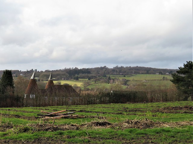
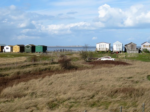
What a perfect ideal of a village Wye encapsulates, with its charming red brick and whitewashed houses round the village green, its post office, sports field, pubs, shops, surgery and public conveniences, all tucked under a beautiful corner of the North Downs.

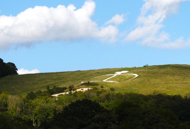
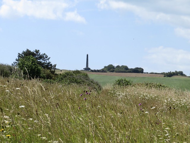
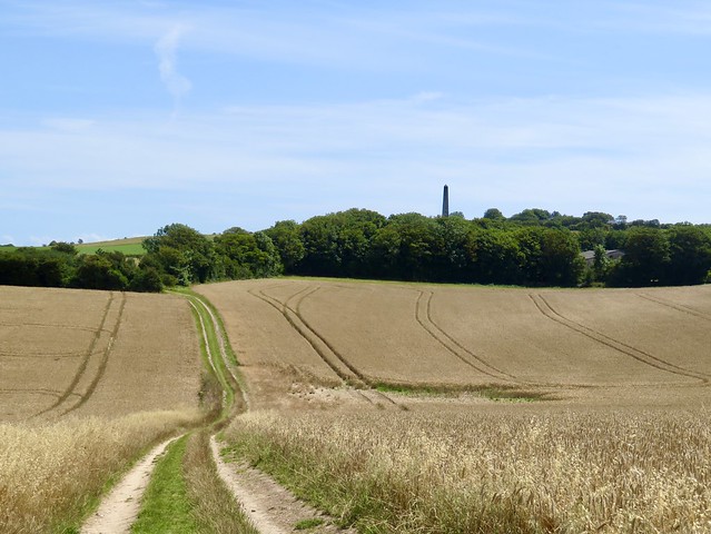
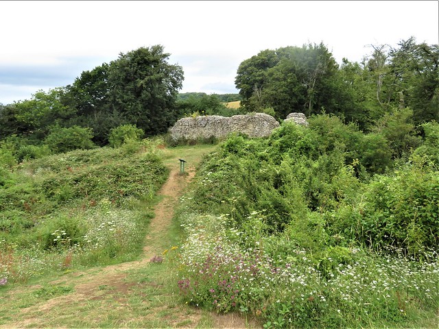
The Church of St Gregory and St Martin is a building of shreds and patches, odd corners and uneven walls that reflect its many collapses and rebuildings over the centuries. Beyond the church we found the North Downs Way arrowing through the fields towards the steep, tree-topped rampart of the Downs, where a huge chalk crown was cut high in the downland turf in 1902 by Wye College students to commemorate the coronation of King Edward VII.

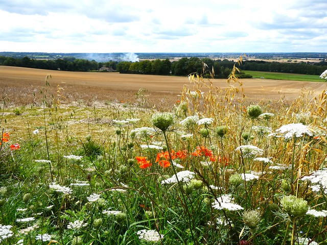
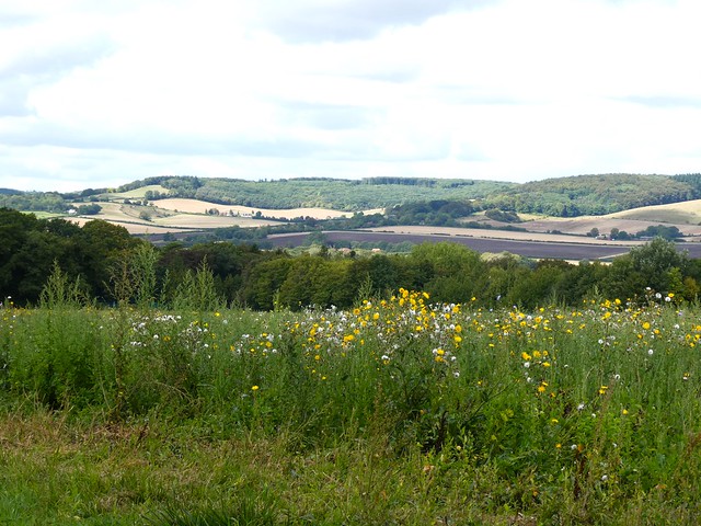
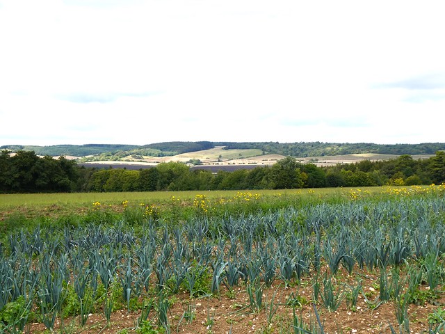
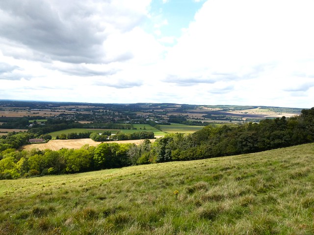
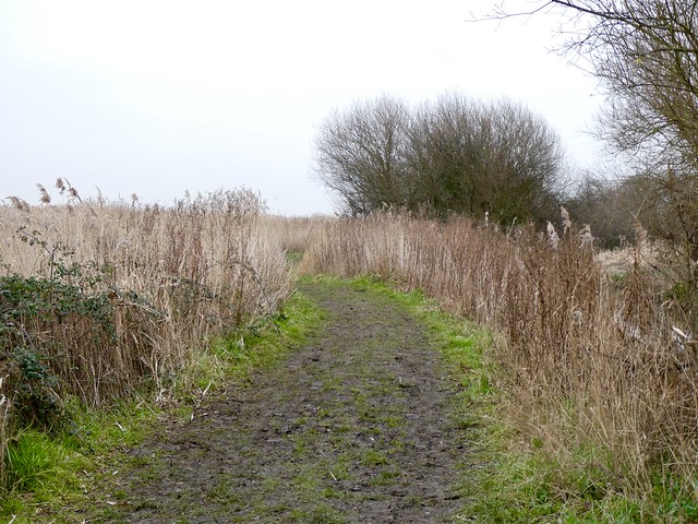
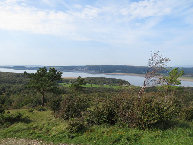
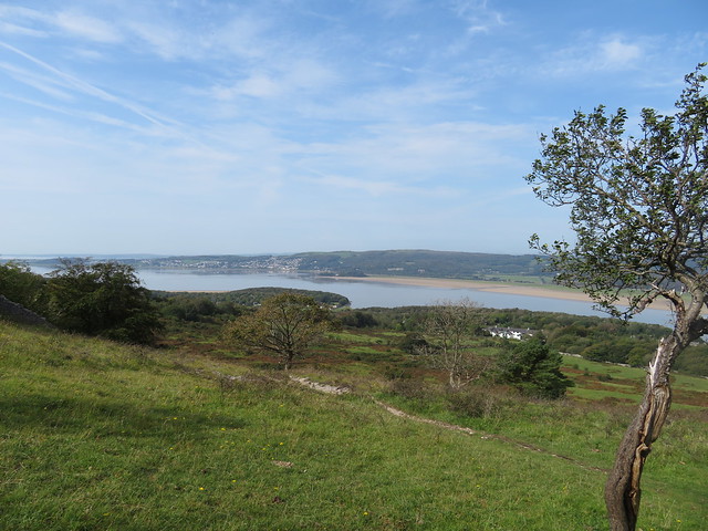
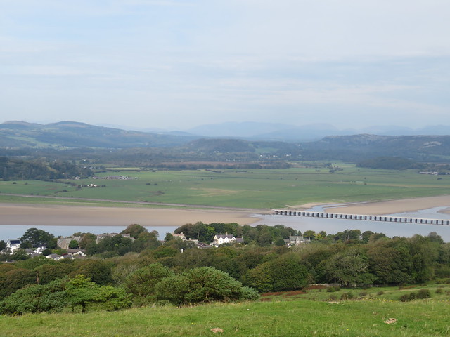
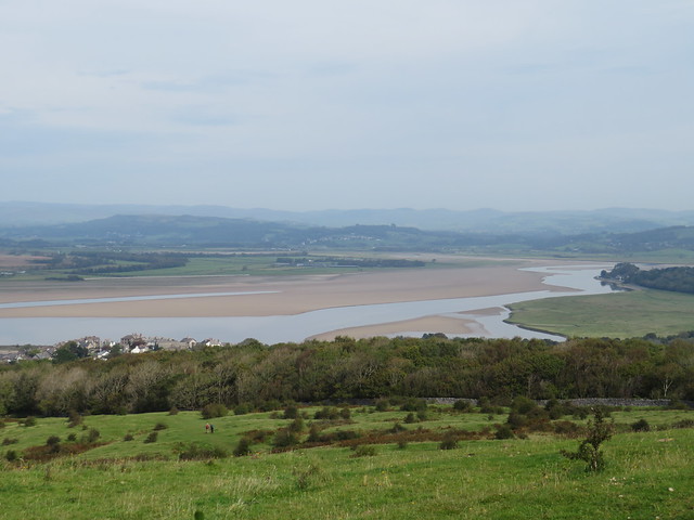
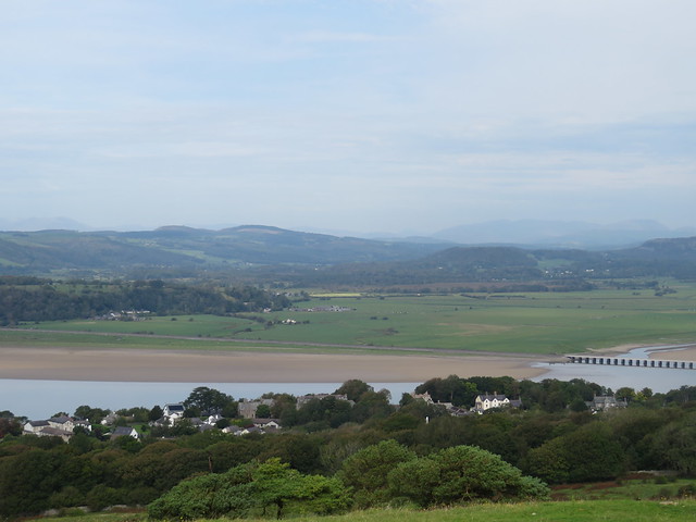
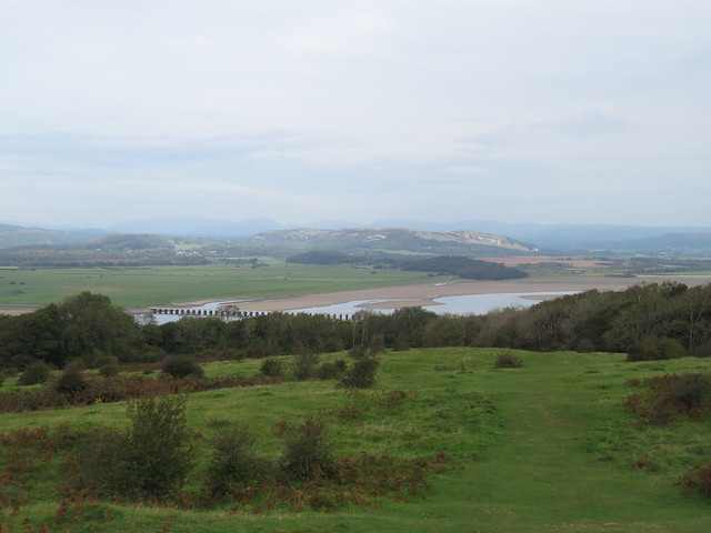
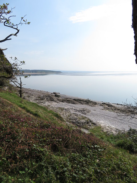
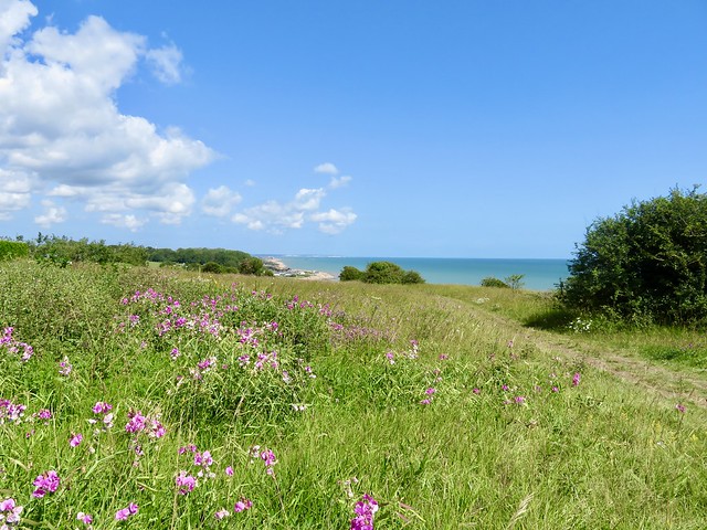
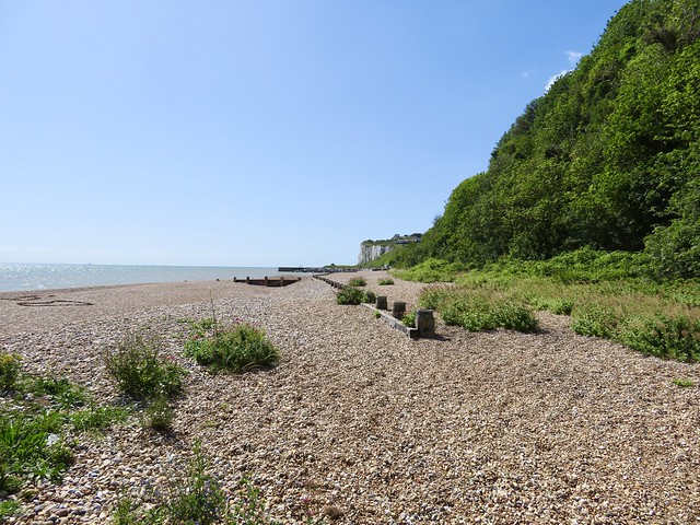
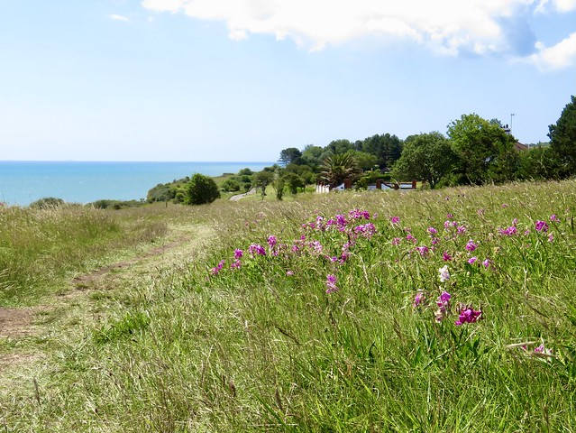
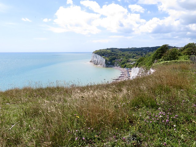
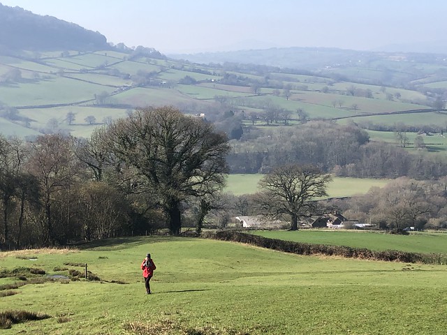
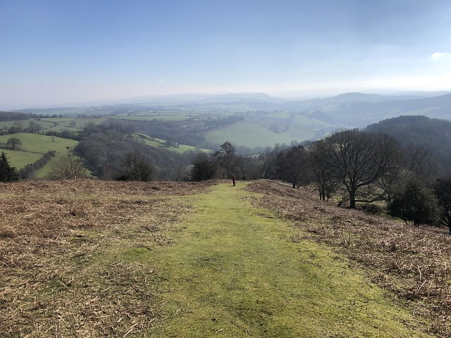
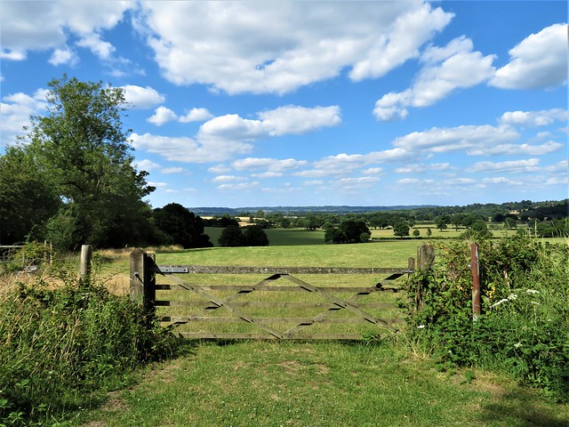
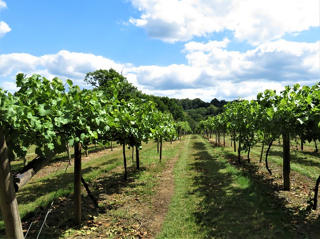
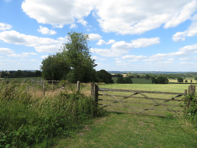
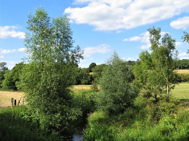
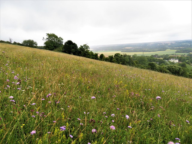
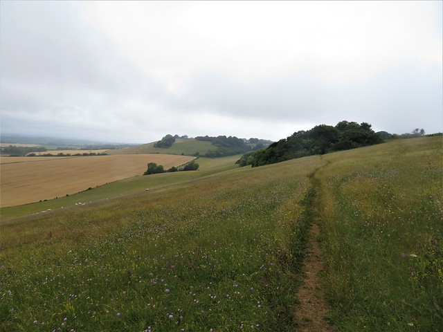
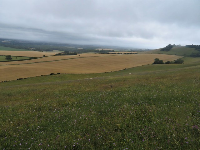
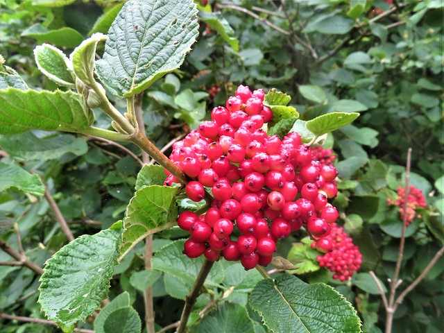
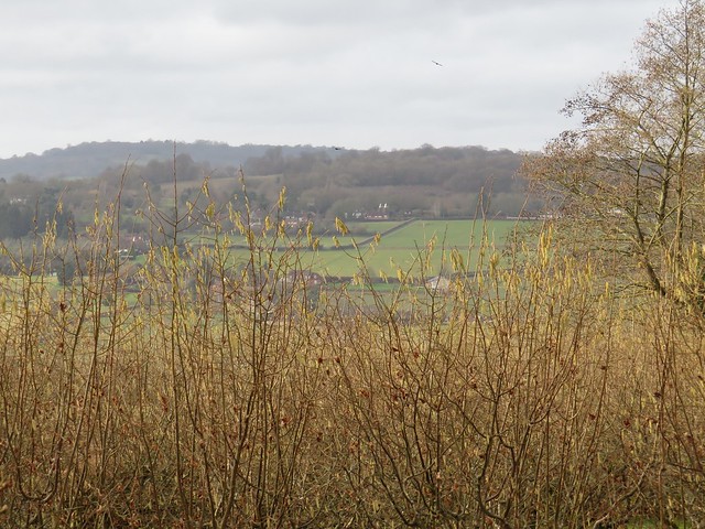
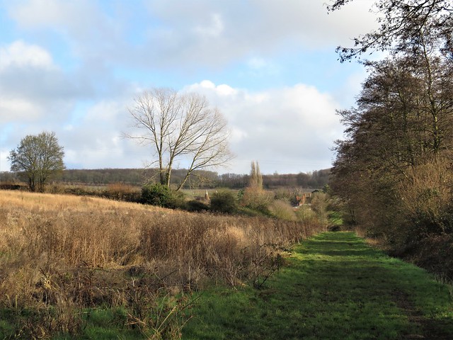
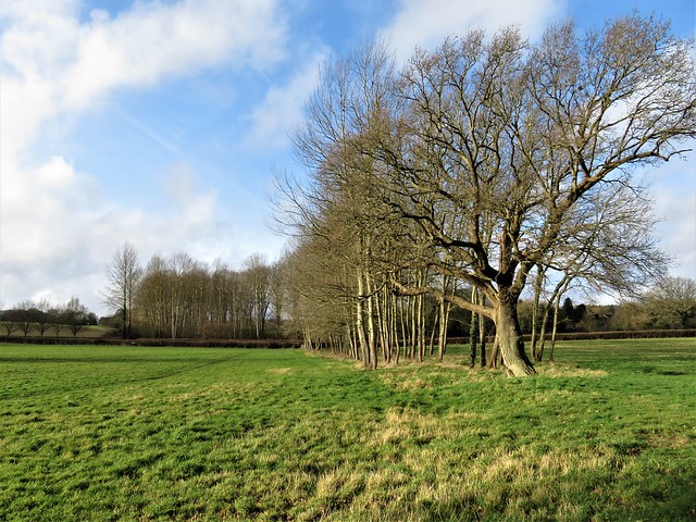
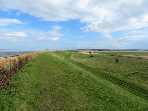
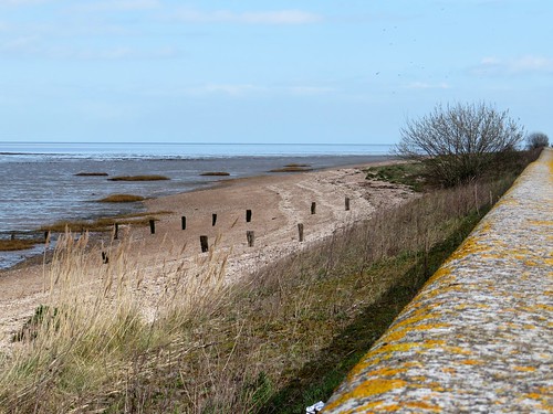
Hops still hung like pale green lanterns in the hedges, sticky to the fingers. A jay swore among the tangled hazels and clattered off, leaving one sky-blue feather to float gently to earth. We climbed a chalky path up through the trees to emerge at the top of the downs with a remarkable prospect spread out across the flat wooded Weald of Kent. To the south, distant views of Romney Marsh, Dungeness power station buildings and the tiny shapes of cargo ships in the English Channel; to the north a silver-grey strip of the Thames, with the Essex shore a knobbled blue line beyond.

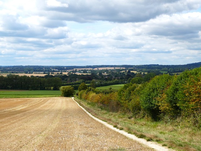
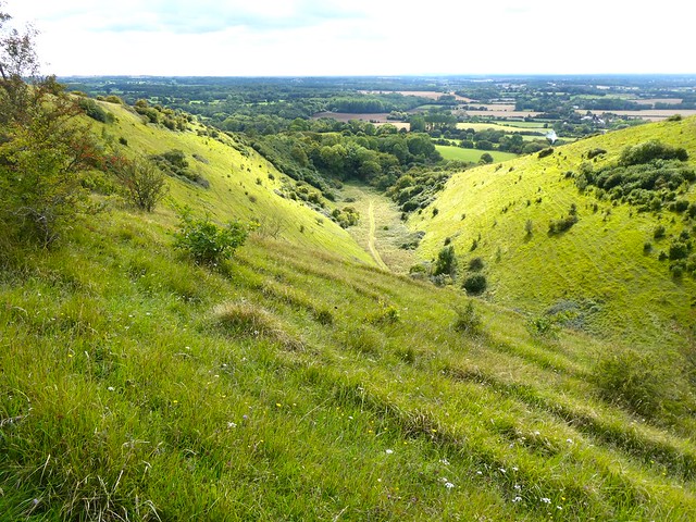
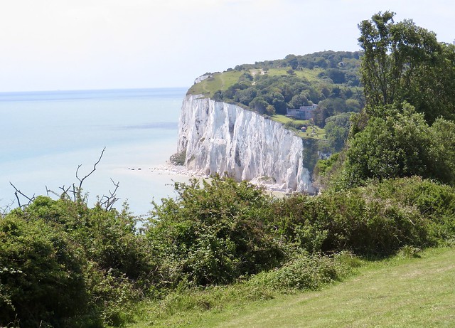
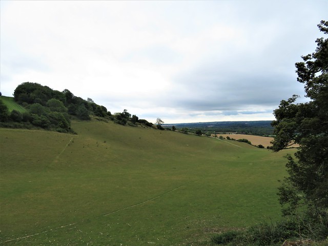
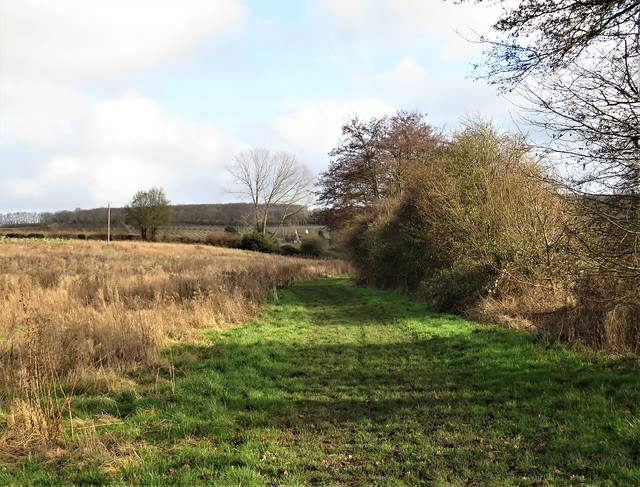
We strolled the upland path, absorbed in this South Country panorama. A handily placed bench gave a vantage point over the steep sides and narrow flat bottom of the Devil’s Kneading Trough, a coombe carved out of the chalk downs by Ice Age freezing and melting of water.

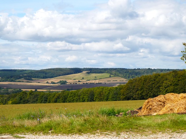
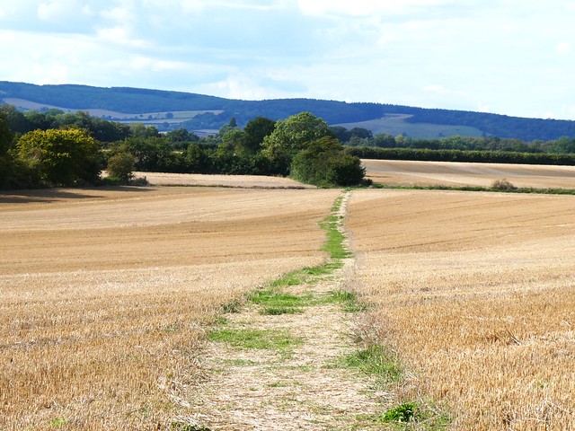
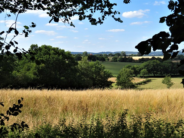
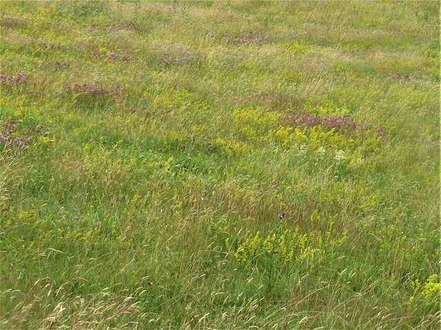
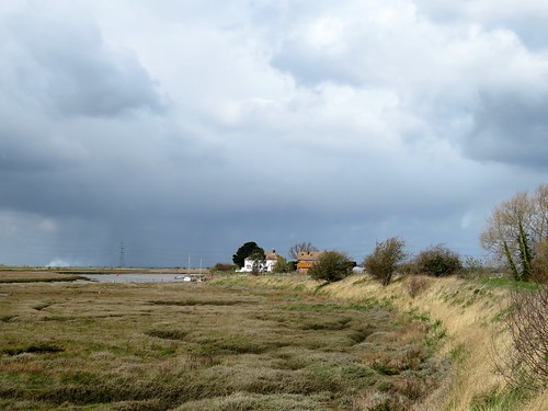
The Devil seems to have taken quite a fancy to this part of the world. Following the homeward path through the stubble fields at the foot of the downs, we passed near the cottage at Withersdane where the holy well of St Eustace still whelms. A local woman swollen by an evil dropsy once drank its waters in hope of a cure. She immediately vomited forth a pair of black toads that changed into hellhounds, then demonic asses. When sprinkled with holy water from the well, they shot into the sky and disappeared.

How hard is it? 5½ miles; easy; downland tracks and field paths.

Start: Wye village car park, Gregory Court, Wye TN25 5EG (OS ref TR 053468); or Wye railway station, Bridge Street TN25 5LB (048469)

Getting there: Train to Wye
Road: Wye is signposted from A28 (Canterbury – Ashford)

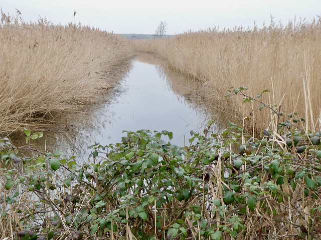
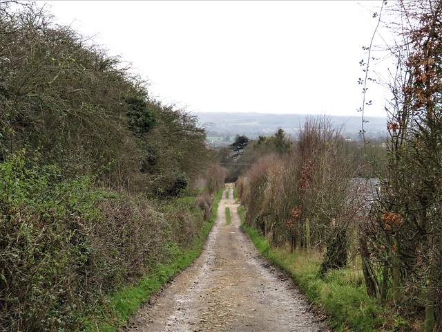
Walk (OS Explorer 137): Left along Bridge Street; in 100m, left along Churchfield Way. In 500m left through churchyard to NE corner (055469); up path by allotments. Cross road (056470), up Occupation Road (‘North Downs Way’/NDW). Follow NDW (road, then path) across road (066468), up hill into woods (069469). At top of climb (blue arrow on post points ahead) (070469), but fork right here. In 500m cross Crown Field (072466), then road (077457). Follow NDW through trees, then at edge of open downs. In ¼ mile pass Devil’s Kneading Trough coombe (078454); in 600m reach waymarked post with 2 arrows (081450). NDW keeps ahead, but go sharp right downhill through kissing gate. At bottom, right along road (072449); right at fork (075450, ‘Wye’); in 200m, left through hedge (074451, fingerpost) on path across fields. Cross road at Silks Farm (065460); at road near Withersdane Hall, ahead (060462); at next bend, ahead on path (060463). At road in Wye, ahead (055466, New Flying Horse inn to right), to station, or next right to car park.

Lunch/Accommodation: King’s Head, Church Street, Wye TN25 5BN (01233-812418, kingsheadwye.co.uk)

Info: wyeheritage.org.uk

 Posted by at 01:10
Mar 252023


First published in: The Times Click here to view a map for this walk in a new window
Stodmarsh - shoveler and teal path through the wet woodland reeds and a ridge path through the reedbeds path through the reedbeds 2 reeds and marsh many waterways through the reedbeds gnawing marks from beaver incisors

‘Keep an eye out for the beavers,’ advised a man festooned with wildlife cameras whom we passed in the car park at Stodmarsh National Nature Reserve. ‘Lots of signs around – look for those toothmarks of theirs, eh?’

We didn’t see any of the recently reintroduced rodents on our walk round the East Kent reserve under cloudy winter skies. But evidence of their presence was widespread in the shape of young trees felled with a curious hinged effect, the severed parts gnawed white and smooth with fine patterns of chiselling by beaver incisors.

The first creature we did see was another species of aquatic rodent, a little grey-brown water vole scuttling along the bank of the Lampen Stream. We heard other voles too, plopping into ditches at our approach. So much of nature is secret, hidden or only momentarily glimpsed, especially in the ‘downtime’ of winter. But if you have an eye for the birds, Stodmarsh NNR is bursting with overt life, loud and proud.

In the still grey afternoon, perched in the Reedbed Hide, we looked out on a bay between enormous stretches of creamy-white reeds – the reserve has the largest area of reedbeds in the southeast of England. Shoveler drakes with snowy breasts and chestnut wings went dabbling beside their drab brown mates, their long spatulate bills giving them a solemn air of consequence. Among them swam teal with yellow flashes on their afterparts, and breasts very delicately patterned in ash-grey and black.

A sudden panic had them all dashing into mid-pool with agitated squawking and a might clatter of wings on water. What had caused the upheaval? ‘Probably a fox,’ grunted one of the twitchers from behind an immense telescopic lens. ‘Spooked ’em and scarpered’.

We followed a broad and muddy path north between reed pool, ditches and sodden green acres of freshwater marsh. Stodmarsh’s watery landscape was formed partly through subsidence of old mine workings below ground, a reminder of the now-vanished Kentish coalfield.

Seduction smells of Sunday roast emanated from the Grove Ferry Inn, where we turned back along the wide and muddy River Great Stour. An angler on the far bank hooked a roach and lifted it out, a wriggling strip of silver. We watched another hunter of the waterways, a big marsh harrier, cruising low above the reedbeds, looking for frogs or water voles.

The light began to seep out of the afternoon as we followed the homeward path, serenaded by the harsh pig-like screech and snuffle of a water rail creeping through the reeds, another winter sound of this magical place.

How hard is it? 4¾ miles; easy; flat walking, can be muddy. Bring binoculars!

Start: Stodmarsh NNR car park, near Canterbury CT3 4BB (OS ref TR 222609)

Getting there: Reserve is signed from A257 (Canterbury to Littlebourne).

Walk (OS Explorer 150): From bottom right corner of car park pass info board; follow track for ¼ mile to cross bridge to T-junction (223610). Left; follow ‘Reedbed Hide’ signs to hide (222612). Return to pass bridge (don’t cross); follow path (‘Footpath’, yellow arrows) past Undertrees Farm. In ¾ mile pass Marsh Hide (226618); in ½ mile dogleg right/left across track (233623, red arrow); follow ‘Grove Ferry car park’ signs for ⅔ mile to road (236630). Left (Grove Ferry Inn is opposite); in 40m, left (‘Stour Valley Walk’). Follow riverbank path. In 1½ miles path veers inland (221620); follow it past Tower Hide (222617), then follow signs to car park.

Lunch/Accommodation: Grove Ferry Inn, Upstreet, Canterbury CT3 4BP (01227-860302, groveferryinn.co.uk)

Info: Stodmarsh NNR – 0845-600-3078; explorekent.org

 Posted by at 01:33
Sep 102022


First published in: The Times Click here to view a map for this walk in a new window
Arnside from the Kent Estuary view north from Arnside Knott west over Kent Estuary towards Grange-over-Sands 2 view north from Arnside Knott west over Kent Estuary towards Grange-over-Sands view north from Arnside Knott over Kent Viaduct towards south Lakeland fells 3 view north from Arnside Knott over Kent Estuary towards south Lakeland fells view north from Arnside Knott over Kent Viaduct towards south Lakeland fells 2 view north from Arnside Knott over Kent Viaduct towards south Lakeland fells Arnside from the Kent Estuary 2 looking west along Kent estuary from Grubbins Wood towards Blackstone Point looking west along Kent estuary from Grubbins Wood towards Blackstone Point 2 looking west along Kent estuary from Grubbins Wood towards Blackstone Point 3

A rich scent hung over Arnside, the smell of the sea and of new mown hay. They were raking the fields on one side of the station, while on the other the tide was going out along the Kent Estuary towards the sandy immensities of Morecambe Bay.

We climbed up a walled lane away from the little resort town, peaceful green paths leading into Red Hills Wood. ‘Beautiful bluebells here in spring,’ confided the dog-walking lady we met on the path, ‘and you should just see the wild daffodils down at Far Arnside.’

From the crest of Arnside Knott we got a most sensational view. Huge sprawling sands were uncovering themselves as they slid free of the sea’s grey blanket, the River Kent a sinuous coil of silver, its seaward movement seen as a writhing snake among the tan and mauve sandbanks. To the north and west, beyond a green apron of marshland fringing the estuary, stood the rugged profiles of the Furness Fells and the outlying fells of south Lakeland. The fingers of other peninsulas reached their long tips out into the margin of the great sands.

We crossed the grassy top of Arnside Knott among juniper, yew, gorse and brambles. A solitary walker inched like an ant far below, dwarfed by the sands he was striding on. A topograph gave further clues about the distant peaks and ridges to the north – Helvellyn and Striding Edge, Skiddaw and Bowfell, Coniston Old Man and the westward hump of Black Combe – all these in view from the Knott’s modest elevation of 770 ft.

Down at Park Point we found a slanting ledge of rock from which to scramble down onto the shore. Jane went barefoot on the ribbed sand while I clambered over the limestone rubble in boots, looking for fossils. Rounding Blackstone Point we found the outgoing Kent’s channel suddenly near at hand, with a fine view up the estuary to the centipede legs of Arnside’s railway viaduct.

We reached the resort in time for an ice cream with the tide still ebbing. Arnside was a busy port till the 1850s, when the building of the viaduct caused the harbour to silt up. Then tourism took over, a new source prosperity for the little town with the mighty views.

How hard is it? 6½ miles; moderate; woodland and shore paths

Start: Arnside railway station, Cumbria LA5 OHJ (OS ref SD 461788)

Getting there: Rail to Arnside. Bus 551 (Kirkby Lonsdale).
Road: Arnside (B5282) is signed from Milnthorpe on A6 (M6, Jct 36)

Walk (OS Explorer OL7): From station, left along road. Pass Milnthorpe turn; in 100m, right (‘Silverdale Road’ fingerpost). Right at Silverdale Road (459783). In 200m left (457784, ‘Arnside Knott’). In 150m, left (456784, ‘High Knott Road’); bend left by ‘Windrush’; in 250m, right (457783, ‘The Knott’) through Red Hills Wood. Through kissing gate onto open ground (456780); head uphill to bench and gate (456776). Follow main path to another bench and on, soon descending. Round sharp left bend (452772); down through gate in wall (452770). Ahead on path outside trees. At Hollins Farm, right (451766, ‘Far Arnside’). At road, right (450764, ‘Park Point’); ahead through holiday park. At Shore Close fork right (‘Bridleway); at Knott Drive fork left. Follow woodland path back to Arnside.
Low tide option: Descend to shore just north of Park Point (437769); shore path back to Arnside.

Conditions: Woodland path from holiday park is stony and stumbly; shore option is for low or falling tide.

Lunch/Accommodation: Fighting Cocks, The Promenade, Arnside LA5 0HD (01524-761203, fightingcocksarnside.co.uk)

Info: Arnside AONB Centre (01524-761034)

 Posted by at 01:27
Jul 162022


First published in: The Times Click here to view a map for this walk in a new window
Coast path near Kingsdown The beach at Kingsdown coast path along the cliffs between Kingsdown and St Margaret-at-Cliffe 1 path over the downs coast path along the cliffs between Kingsdown and St Margaret-at-Cliffe 2 St Margaret’s at Cliffe 1 Coast path, looking to the Dover Patrol memorial 1 St Margaret’s at Cliffe 2 Coast path, looking to the Dover Patrol memorial 2 St Margaret’s at Cliffe 3

A glorious day of blue sky over the coast of East Kent. At Kingsdown the white chalk cliffs shone in clear light polished and sharpened by sea and sunshine. Along the pebbly shore stood old iron winches, rusted into immobility by salt-laden water and winds. Decades have passed since the village fishermen used them to haul their boats up the steeply shelving beach.

We climbed the steps at the end of Oldstairs Bay and set out on the cliff path with a stiff north breeze pushing us along. A kestrel balanced on the wind, infinitely fine adjustments of wings and body keeping it in place. Looking back, we saw a line of white cliffs curving east beyond the murky waters of Pegwell Bay, Ramsgate’s buildings lying low along the shore, the red roofs of Broadstairs cresting their rise of ground beyond.

The green sea heaved gently below, reflecting a light clear enough for us to pick out the coast of France some twenty miles off – field shapes, woods, radio masts and a long pale line of sandy beaches. Air balloons, stringbag aeroplanes, greasy swimmers and long-range shells from coastal guns – all have crossed that narrow stretch of sea, but never an invading army for the past thousand years.

One dastardly enemy of England did launch a deadly stroke against the capital from these Kingsdown cliffs – arch-villain Sir Hugo Drax with his ogre’s-teeth and sweaty ruin of a face. Lucky for all of us that James Bond was on hand to frustrate his knavish tricks and redirect the London-bound Moonraker rocket to plunge to its destruction in the sea.

Ian Fleming, Bond’s creator, had a holiday home at St Margaret’s-at-Cliffe, just along the coast. We came by the spot where Fleming had Drax’s men collapse the cliff onto 007, near a tall obelisk commemorating the brave Great War deeds of the Dover Patrol. Just beyond we found a magnificent view over the tight, cliff-encircled bay that cradles St Margaret’s, and a zigzag of steps running down to the pebbly shore.

The homeward path led across inland fields sown with winter cereals, a landscape of long parallel valleys and tufts of woodland, with the sea diminished to a green backdrop caught in a vee between one slope and the next.

How hard is it? 6¾ miles; easy; cliff and field paths

Start: Cliffe Road, Kingsdown CT14 8AH (OS ref TR 380482).

Getting there: Bus 82 from Deal
Road: Kingsdown is signed off A258 between Walmer and Dover.

Walk (OS Explorer 138): Coast Path south for 2¾ miles to St Margaret’s-at-Cliffe. ½ mile past Dover Patrol monument, left down steps to shore (369446; yellow arrow). Right to seafront. Up road beside Coastguard PH (368445). On right bend, ahead up steps (367444, fingerpost/FP). Fork right at top to road (366444); right, in 150m, fork left on Hotel Road. In 100m, left (368445, FP) up steps; on up Cavenagh Road; on up grass path (FP) to The Droveway (366448). Right; follow road for ⅔ mile to Bockhill Farm. 150m beyond farm, left at path junction (372455). Keep ahead up field margin path; in 600m it bends sharp left, through kissing gate; in 100m, right down tarmac track (367459, cycleway No 1). In 400m pass tall pole on left (368464); in 100m, left through hedge; half right on path across field. In 1 mile keep left of houses (373478) to road (374481). Left; right down Upper Street into Kingsdown.

Lunch: Coastguard PH, St Margaret’s, CT15 6DY (01304-853051, thecoastguard.co.uk)

Accommodation: Five Bells, Ringwould CT14 8HP (01304-364477, fivebellsringwould.co.uk)

Info: Dover TIC (01304-201066)

 Posted by at 03:40
Mar 122022


First published in: The Times Click here to view a map for this walk in a new window
Stones of Coldrum Long Barrow Boggy course of the old Pilgrim's Way ancient yew overhangs the Pilgrim's Way 1,000-year-old Church of Our Lady of the Meadows, remnant of depopulated village of Dode bare ploughland along the Weald Way primrose path above the 1,000-year-old Church of Our Lady of the Meadows Horses at Great Buckland Farm, shaggy for winter chanting at the Coldrum Stones Daphne laurel, spurge laurel, in White Horse Wood

A cold day over the North Downs of Kent at the cusp of the seasons, with winter proving reluctant to move over in favour of spring. Along the lane on Holly Hill snow drops still hunt their heads, grubby at the end stage of their flowering. But dog’s mercury had spread its green leaves and tiny blooms all over the floor of Greatpark Wood, and among the silver birch and pines we heard a familiar introit to spring, the tentative tsip-tsap, tsip-tsap of a newly arrived chiffchaff.

Sweet chestnut coppice forms a large part of these woods on the chalk and greensand escarpment, the long-unattended shoots grown house-high and as thick as individual tree trunks. The toothed spearblade leaves of last autumn, crisp and grey, shuffled underfoot as we dropped down to the valley road and hop fields at Great Buckland.

From the Weald Way path in Tranquil Wood we looked down on the red tiled roof and flint walls of the thousand-year-old Church of Our Lady of the Meadows. The village of Dode was depopulated and abandoned during the Black Death plague of 1349, but its humble little church still stands under the wooded hillside.

The Weald Way, doughy with dark mud, forged south through hazel and chestnut coppiced tangled with lianas like thickets in a fairy tale. Fat green buds were bursting from hawthorn twigs, and sheaves of green shoots showed where bluebells would soon be carpeting these woods.

At the southern edge of White Horse Wood we crossed the wet ditch of an ancient ridgeway and dipped sharply down the face of the escarpment among yew trees. At the foot of the slope ran another ancient route, the Pilgrim’s Way path that brought penitents and not-so-penitents (Chaucer’s adventurers among them) to the shrine of St Thomas Becket at Canterbury.

A pilgrim shrine that predates Becket’s by perhaps four thousand years stood on a knoll in the field beyond. The great uprights of Coldrum Long Barrow form the centrepiece of a circle of recumbent standing stones. Joss sticks were smouldering in the turf, and a pagan celebrant stood singing to the stones, a stick in either upraised hand.

We left her to her devotions and went quietly away to join the Pilgrim Way and the homeward path.

How hard is it? 7 miles; easy; one short climb with steps; muddy in woods.

Start: Holly Hill car park, Meopham, Gravesend DA13 0UB (TQ 670629). NB Closes at 5 pm.

Getting there: M20, Jct 3; A227 Gravesend road; car park signed from White Horse Road, 1 mile east of Vigo Village.

Walk (OS Explorer 148): From Holly Hill car park, left along road. Beyond Holly Hill House, fork right (670634) past metal barrier. In ⅔ mile, left (673643, blue arrow/BA). At road, right (670642); in 150m, left (670644, ‘Vigo, Harvel’). 150m past Great Buckland Farm, left (668641, ‘Tranquil Wood’, ‘Weald Way’/WW). In ⅔ mile, at gate on right (662634) don’t go right (WW), but keep ahead (WW, ‘BA NS 246’). At road, left (659632). In 350m, on right bend, left (658629, WW) along field edge, then follow YA 235. At road (656623) dogleg right/left (WW) into Whitehorse Wood. In ½ mile (654616), descend escarpment. At Pilgrim’s Way/North Down Way/NDW, right (653613); in 50m left (’Coldrum Long Barrow’). Follow path to Coldrum Long Barrow (654607). Return to NDW; right for 1½ miles to road (671624); ahead to car park.

Lunch: The Villager Inn, Vigo Village DA13 0TD (01732-822305, villagervigo.com)

Accommodation: Bull Hotel, Wrotham TN15 7RF (01732-789800, thebullhotel.com)

Info: Sevenoaks TIC (01732-450305)

 Posted by at 06:06
Jan 222022


First published in: The Times Click here to view a map for this walk in a new window
Looking back from lower slopes of Garway Hill 1 Looking back from lower slopes of Garway Hill 2 Jane on Garway Hill view east from upper slopes of Garway Hill twisted old thorn tree on Garway Hill

The white tips of snowdrops were peeking in the graveyard of St Mary’s Church at the gates of Kentchurch Court. This fine old dwelling, half stronghold and half house, tucked down behind trees in a corner of the River Monnow’s broad valley, has been in the possession of the same family since before the Norman Conquest.

We got a glimpse of a castellated turret as we followed the lane south beside the Monnow, the river hurrying its grey waters through the valley and away towards Monmouth. Sheep grazing the riverside pastures were decked in their winter plumage of dusky pink from foraging in the rich red mud.

Garway Hill lay squarely ahead, a bald crown above a collar of leafless trees. We found a path that skirted the southern slopes of the hill, ascending gradually through green fields with a fine view opening across the valley, slopes and skyline all softened in the haze the sun had drawn up from fields and woods lying cold and damp with winter.

At Little Adawent the proper climb began, a steep grassy path rising through bracken past mossy seeps of water and wind-twisted thorn trees. Overhead, a solitary skylark sang its little crested head off.

Garway Hill has a witchy reputation. A local man once suffered the misfortune of having his wife stolen by the fairies, so stories say. He waited till the wee folk under Garway brought her forth to dance, then snatched her away and ran with her to the top of the hill. As soon as he reached the summit the spell was broken, she awoke from her enchantment and the fairies went away to find another playmate.

You couldn’t get a less fantastical structure than the prosaic brick shelter at the top of Garway Hill. But the views today were magical, anyway, west to the conical Sugarloaf, the whaleback Skirrid and the long spine of the Black Mountains, east to the Malverns and the Cotswold Hills, all dreamy and insubstantial in the cloudy air.

Families were picnicking around the shelter, their junior mountaineers dashing about. A white pony followed us off the hill, before thinking better of his choice and turning aside towards a couple trailing the scent of peppermint.

A green lane took us back down to lower ground, where in the pastures along the homeward path new-born lambs would soon be calling in their feeble, treble voices, to the counterpoint of phlegmy contralto from their anxious mothers – a whisper in the inner ear from faraway spring.

How hard is it? 7½ miles; moderate; short, steep climb up Garway Hill.

Start: Bridge Inn, Kentchurch, HR2 0BY (OS ref SO 410258)

Getting there: Kentchurch is signposted from A465 (Abergavenny-Hereford) at Pontrilas.

Walk (OS Explorer 189): From Bridge Inn, right; ahead (‘Garway’) at junction; in 800m, right past St Mary’s Church (420257, ‘Garway’). In ¾ mile, left off road (424248) following waymarked Herefordshire Trail (gates, stiles, yellow arrows/YA) across fields. In 1 mile, by gate on right (438243, ‘Little Adawent’), bear left away from wall, up broad grass track to summit shelter of Garway Hill (437251). Aim for gate on left of radio mast (440255); green lane downhill; in ⅓ mile at phone pole (441261, ‘Herefordshire Trail), right to road. Left; at junction, ahead (443264, ‘Bagwyllydiart’). In 100m, left (443266, YA) across fields, skirting right hand edge of Burnt House Wood and on for 1½ miles (YAs) to road at Bannut Tree Farm (423263). Left to Kentchurch.

Lunch: Bridge Inn, Kentchurch (01981-241158, thebridgeinnkentchurch.com)

Accommodation: Temple Bar Inn, Ewyas Harold HR2 0EU (01981-240423, thetemplebarinn.co.uk)

Info: visitherefordshire.co.uk

 Posted by at 02:13
Oct 022021


First published in: The Times Click here to view a map for this walk in a new window
picture picture picture picture picture picture picture picture picture picture

A sunny afternoon over Penshurst, the blue sky silvered with lazily drifting clouds. The village houses of mellow brick and Kentish weatherboard held enough olde-worlde charm to spark nostalgia for JRR Tolkien’s mythical Shire. I popped into the Forge Stores, with its round wooden hobbit-hole frontage, and was tempted to ask for a flask of mead and a pouch of Longbottom Leaf along with my chocolate bar.

An embanked lane led west between bracken slopes, sloe bushes heavy with shiny dark fruit and hedges a-twitter with flocks of pink-breasted linnets. This is beautifully maintained countryside, giving off a whiff of money well spent, of care taken and forethought applied. Field ditches have been properly dug and cleaned, new plantations of cherry, hazel and hawthorn established, hedges allowed to bulk out as food and cover for wildlife.

Along the valley stretched a line of Second World War pillboxes, the derelict old strongpoints sprouting ivy and elder. We crossed the sluggish River Eden, where silver dace flicked with a tiny splash into the sheltering shade of alder roots as our shadows loomed over the bridge railings. There was a whisper of wind and a shiver of leaves in the poplar groves. A straggle of straws and leaves along the way showed where last winter’s floods had drowned the path as they encroached on these low-lying fields.

This part of Kent is famous for its hops, witness the cluster of former oasts or drying kilns that stood at Salman’s Farm like red-habited nuns under white coif caps. Beyond on a slope vines had been planted, the grapes in bunches hanging from wires stretched at shoulder height. We sat on a bench to eat our picnic, looking down the rows and imagining the harvest. Regent grapes for a nice rosé, said the adjacent notice. That would do.

Twisted hornbeams and hollies reflected a sombre light in Russell’s Wood. Beyond in Yewtree Wood a gaggle of children shouted and swooped, walking the plank along the smooth recumbent trunks of enormous old beeches that had been thrown in storms long gone and forgotten.

At Wat Stock Farm on the homeward path we sat on a bank and listed to squirrels crunching the last of the hazelnuts in the hedge behind us. Back at Penshurst young men and women were jumping with much ado into and out of the river. The walk ended with a stroll across the sward in front of 14th-century Penshurst Place, an extravagant architectural mishmash of brick, stone, chimneys, gables and arches all picked out in the low sun of late afternoon.

How hard is it? 5½ miles; easy; field paths and lanes
 
Start: Penshurst Place parking field, Penshurst TN11 8DG (OS ref TQ 530440) 

Getting there: Bus 231, 233 (Lingfield-Tunbridge Wells)
Road: Penshurst is signed from A26 (Tonbridge-Tunbridge Wells)

Walk (OS Explorer 147): Down Penshurst Place drive; right along village street. Past Forge Stores, right along The Warren (525436). In 1 mile at Salman’s Farm, through kissing gate/KG (512432); right up track; left, and keep ahead (yellow arrow/YA). At T-junction in Russell’s Wood, right (507430, YA, ‘441’). Opposite Oakenden house, right (501428, YA, stile), then right through KG, across fields; through Yewtree Wood. On west edge of wood cross stile (502435, YA); on to road (501436). Right; pass Sliders Barn; in 150m, right along drive (503439); follow Eden Valley walk for 1½ miles to Penshurst. Left at B2176 (525439); in 200m, right (525440, KG) through grounds of Penshurst Place to car park.
 
Lunch/Accommodation: Leicester Arms, Penshurst TN11 8BT (01892-871617, theleicesterarms.com)
 
Info: Penshurst Place – 01892-870307, penshurstplace.com

 Posted by at 02:54
Jul 042021


First published in: The Times Click here to view a map for this walk in a new window
picture picture picture picture picture picture picture picture
Facebook Link:

A cloudy summer’s day across the Kentish Downs, with rain simmering not far away.
The remnant flint walls of Thurnham Castle couldn’t keep a mouse at bay these days.
From their shelter we admired a prospect over Wealden valleys tangled with thick
dark woods, then dropped down the castle mound to find the North Downs Way.
Pilgrims, packmen, rogues and vagabonds have been travelling this ancient trackway
for many millennia. It ribbons along the flanks of the downs, a pale line scribbled
through the woods and across chalk downlands where sheep nibble the rich
vegetation, a salad of herbs and wild flowers.
We looped round the head of a dry chalk valley, the olive-green turf bitten to a close
sward of smooth grass. A shower came rattling through Civiley Wood, polishing
leaves and stems. Nettle-leaved bell flowers glowed a milky blue in the shade of yew
trees whose knotty forms resembled limbs flayed back to muscle and bone.
Out in the open, the chalk grassland of Cat’s Mount lay washed with an astonishing
spatter of colour – yellow froth of lady’s bedstraw, gold twists of bird’s-foot trefoil,
sky blue powder-puffs of scabious, purple thistle tufts and white florets of yarrow. A
multi-hued haze of flowerheads that stretched ahead along downland flanks preserved
to maintain this precious and rare environment.
The North Downs Way ran on across the slopes. One or two bees were braving the
mizzly air to forage among the flowers, but the butterflies were all in shelter and
waiting for a peep of sun.
At Broad Street Hill we left the old trackway for the woodland paths of the Hucking
Estate. The Woodland Trust bought this 230 ha estate back in 1997 when only one-
third was under trees. Now it’s two-thirds wooded, a mix of ancient woodland and
new plantings, with broad paths mown through the trees and across the open grassland
that link the woods.
Much of the surrounding farmland of this part of Kent is tricky for walkers, with
neglected rights of way, a lack of waymarks and footpaths smothered under crops.
But at Hucking the Woodland Trust actively encourages walkers to wander and enjoy
this varied mosaic of landscapes.

At the peak of the hill stood a wooden sculpture of a shepherd in cap and baggy
jacket, one of the sturdy, silent men that spent their lives minding the downland
sheep. He seemed a fitting spirit for these wide hills and woods.

How hard is it? 7¼ miles; downland and woodland tracks; easy, but NB several steep
flights of steps on NDW.
Start: White Horse Wood Country Park, Detling, Maidstone ME14 3JE (OS ref TQ
808586)
Getting there: Signed off A249 (Sittingbourne-Maidstone)
Walk (OS Explorer 148): From car park head south across grass; cross track; follow
‘Castle’ signs to cross road (808583). Fenced path to castle. Left across mound
opposite; path down to North Downs Way/NDW (809582). Left, and follow NDW for
2 miles to cross Broad Street Hill road (836571). In 100m, dogleg left/right
(‘Viewpoint’); follow Woodland Trust/WT arrows past shepherd sculpture (840569).
In 150m fork left (WT); in 100m left (843569, kissing gate/KG, WT); ahead on path
through wood. In 300m at bench, fork left; in 400m leave woodland (839574, KG).
Half right to go through KG opposite (WT sign); woodland path to Broad Street Hill
road (838577). Left for 800m to meet NDW (836571). Right; retrace route to car
park.
Lunch/Accommodation: Black Horse Inn, Thurnham ME14 3LE (01622-737185,
blackhorsekent.co.uk)
Info:
Hucking Estate – woodlandtrust.org.uk
White Horse Wood Country Park – 01303-266327, kent.gov.uk
Maidstone TIC (01622-602169)

 Posted by at 08:20
Jan 162021


First published in: The Times Click here to view a map for this walk in a new window
picture picture picture picture picture picture picture picture picture picture
Facebook Link:

Across the Low Weald of Kent the sun was flooding paddocks and pastures with a rich wash of gold. It was one of those cold bright winter days when you can dream of spring, even though there isn’t a flower to be seen.

We set off from Dunk’s Green along footpaths dry and crunchy over the underlying greensand. Out in the fields it was a different matter. Brooks and ditches brimmed with winter rain, and every step brought a squelch and squirt underfoot.

On the outskirts of Plaxtol Spout a flock of siskins flirted among the alder cones they were feeding on. Beyond lay Old Soar Manor, a jumbled old structure with a very ancient building attached – a knight’s dwelling, built some seven hundred years ago by one of the local Culpeper family, of solid red ragstone with tiny arrow-slits in the walls.

Walking on, we wondered what this bowl of country might have looked like seven centuries ago. When did today’s immaculate apple and fruit orchards make their appearance, and when did money begin to lay out these manicured lawns and plant such immaculate hedges?

Up in Hurst Wood the ways were rutted and muddy, the views sublime. Winter had stripped away the leafy screens of the trees to reveal long wooded ridges in the distance, all painted in muted greys and blues by the low afternoon light.

We passed the smoke and small flames of a clearing where a forester was coppicing sweet chestnut, and descended green lanes to handsome red-and-white Yotes Court.

This lovely house was built in the last days of the Commonwealth by James Master, a gentleman whose expenses book still survives. What he spent his wealth on gives a good idea of who he was – a man of leisure, a hawker and rider, a gambler and cock fighter. A wide reader, too, and quite a dandy – his boot tops of sea-green silk were each embellished with a yard of costly lace.

The countryside where his house stands is embellished, too. Our homeward path lay past apple orchards and raspberry cages, shaven pastures and perfectly shaped hedges, among which the mellow brick farms and white-capped oasts sat ensconced like so many plump and satisfied judges after dinner.

How hard is it? 7¼ miles; easy; muddy in woods

Start: Kentish Rifleman, Dunk’s Green, Tonbridge, Kent TN11 9RU (OS ref TQ 613527)

Getting there: Bus 222 (Wrotham – Tunbridge Wells)
Road – M26, Jct 2a; A25 Borough Green; follow ‘Plaxtol’, then ‘Dunk’s Green’

Walk (OS Explorer 148): From pub, right along road. In 250m, left (615527, fingerpost/FP) to cross road (613433, FP). Bear left to stile/road (611534); right into Plaxtol Spout. Right (611537, ‘The Street’, ‘Crouch’). In 200m right (612538, FP). In 650m path approaches Old Soar; fork left (618541, arrow) to road (619540). Left; in 400m, right (‘West Peckham’); in 200m, left (624543, FP) into woods. In 200m, right (626543,); in 400m, right (628541); in 50m, left (white arrow). In 150m fork right (630540) to T-junction (631538). Left; in 150m, opposite gate, right (631540) down path, eastward for 1 mile to road (646539) in Swanton Valley. Dogleg left/right and on; just before Yotes Court, right at junction (650535) for ⅔ mile to road (641533). Right; in 15m fork left. In 400m fork left (636533). In 600m cross Gover Hill crossroads (631530); bridleway downhill to junction (630524); right, following Greensand Way for 1¼ miles to Dunk’s Green.

Lunch: Kentish Rifleman, Dunk’s Green (01732-810727, thekentishrifleman.co.uk) – takeaways available (ring to check).

Accommodation: Bull Hotel, Wrotham TN15 7RF (01732-789800, thebullhotel.com)

Info: visitsoutheastengland.com; satmap.com; ramblers.org.uk

 Posted by at 02:01
Apr 202019


First published in: The Times Click here to view a map for this walk in a new window
picture picture picture picture picture picture picture picture picture picture picture picture picture picture picture picture picture picture picture
Facebook Link:

The dead flat North Kent coast is a psychogeographical kind of a place. It has little in the way of chocolate box appeal, but is packed with wildlife, rumbustious local history and quirky corners.

Wandering down Preston Road in Faversham on a nippy spring morning, it seemed a place that Charles Dickens would recognise with its Assembly Rooms, weather-boarded shops (‘Baldy the Butcher’) with jutting upper storeys, curly Dutch gables and ornamental clock brackets over the pavements.

A handsome wooden-legged Guildhall straddled the Market Place. Half-timbered medieval houses along Court Street led down to the quays on Faversham Creek. Oyster smacks, sailing barges, a yacht hoisted in a sling while a whistling man in blue overalls scrubbed her bottom clean after the long mucky winter.

Black headed gulls already in chocolate summer hoods screeched like urchins on the muddy banks of Faversham Creek. It was this winding tidal inlet that brought prosperity to the town in Tudor times. Cherries, corn, bricks and beer went out to the Thames on flat-bottomed barges, thence to London and the continent, while exotic items such as French wine and Scandinavian softwood made their way inland via Faversham.

The Saxon Shore Way led us along the creek, then across the sticky, fertile beanfields of Nagden and Graveney Marshes. Big clouds pushed eastwards, a rain shower came and went, and skylarks uplifted body and voice over the fields. There was a sense of space, freedom and one’s own smallness.

A picture of a marsh harrier hung on a fence. ‘I live here,’ it proclaimed, ‘but how much longer?’ A solar park the size of Faversham is planned to cover these marshes. Meanwhile, birdwatchers and walkers savour the solitude.

At the concrete bar of the sea wall, a revelation – a ten-mile view opening over cockleshell beaches, the Isle of Sheppey opposite, Whitstable on its shallow hill to the east, and a scattered mass of birds harvesting the muddy shores of the Swale, a silver-blue backwater of the distant Thames.

Skylarks rose singing against silver and grey clouds inland, while from the tideline came the chuckling bark and bubble of brent geese feeding.

We turned eastward and followed the sea wall past brightly painted shore shacks and the blackened stakes of old oyster beds, ranks of wooden groynes and scampering dogs, all the way to the tall boarded shapes of the fishermen’s huts by Whitstable harbour.

Start: Faversham railway station, Kent, ME13 8EB (OS ref TR 016609)

Getting there: Rail to Faversham. Bus 3 (Canterbury-Sittingbourne). Road – M2, Jct 6

Walk (9 miles, easy, OS Explorers 149, 150): From north side of station, walk down Preston Road. Left along Market Street, right down Market Place and Court Street. Left by Anchor Inn (019619); right along quay. Follow Saxon Shore Way/SSW for 1¾ miles. Just past Nagden cottages, SSW turns left (031632), but keep ahead here (‘public footpath’, yellow arrow/YA). In 600m, right (031638, YA) under power lines on field path across Nagden Marshes. In 450m, left (035640, YA); in 500m, right along seawall (034645) to Sportsman Inn (062647). Continue along shore path for 5¼ miles past Seasalter to Whitstable Harbour (109670). Right down Cromwell Road; in 600m, left (111664) along Railway Avenue to Whitstable station. Return to Faversham by train.

Conditions: Path can be muddy and wet in places

Lunch: SportsmAn Inn, Faversham Rd, Seasalter CT5 4BP (01227-273370, thesportsmanseasalter.co.uk)

Accommodation: Swan Quay Inn, Conduit St, Faversham ME13 7DF (07538-106465, swanquayinn.com)

Info: Faversham TIC (01795-534542)

Wales Coast Path Walking Festival, 4-19 May – ramblers.org.uk/go-walking/wales-coast-path

satmap.com; ramblers.org.uk

 Posted by at 02:41