Search Results : northants northamptonshire

May 272023


First published in: The Times Click here to view a map for this walk in a new window
Canons Ashby house guinea hen at South West Farm neat and clean - ewes and lambs at South West Farm Canons Ashby Priory fish ponds 1 Canons Ashby Priory fish ponds 2 blackthorn hedge on the field path towards the ridge road looking south along Oxford Lane fossil shell from the wheatfield alongside Oxford Lane Canons Ashby - St Mary's Church and houses 1 Canons Ashby - St Mary's Church and houses 2 Canons Ashby - St Mary's Church

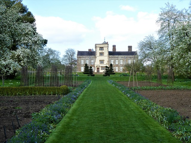
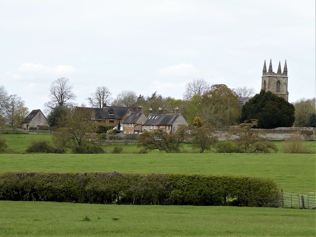
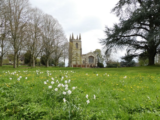
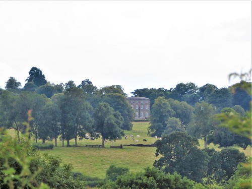
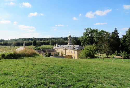
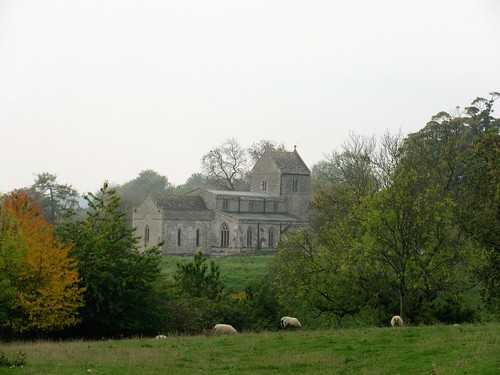
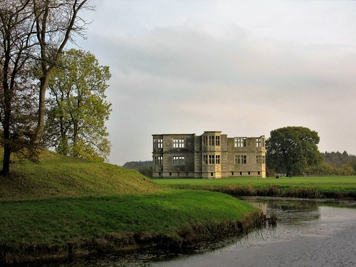
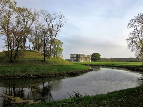
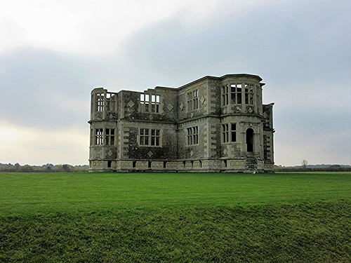
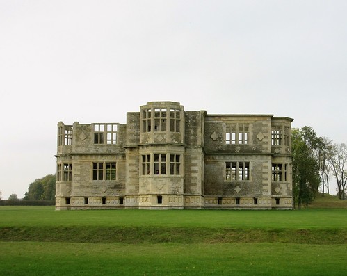
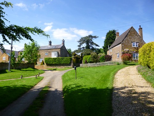
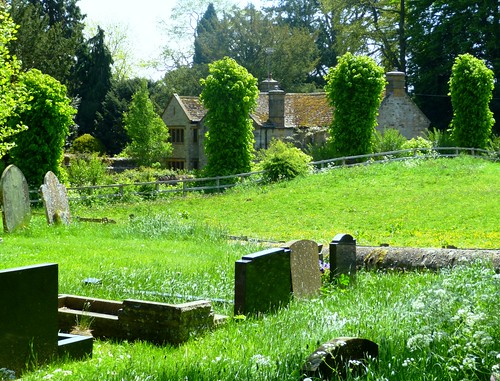
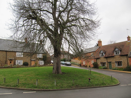
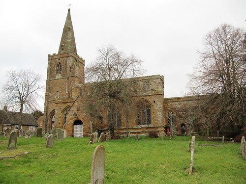
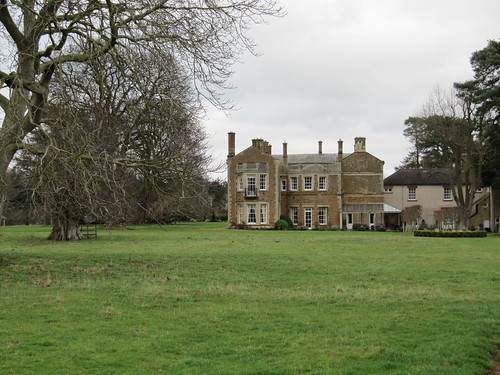
When the National Trust took over Canons Ashby in 1981, the Tudor country house in gently rolling Northamptonshire countryside was a wreck, its gardens run wild. It was hard to imagine that, on this brisk spring day with volunteers tending the tulip beds and topiary in the immaculate gardens, and others ready to fill in the story of the ironstone house and its dark panelled rooms gathered tightly round a tall courtyard.

The Augustinian canons of the medieval priory here were rather a naughty lot. In 1432 the visiting Bishop had to rebuke them for lecherous, rowdy and drunken behaviour. When the priory was finally dissolved in 1536, the outgoing Prior had earned a sorry reputation for hosting wild student parties, worshipping in a lavish silver robe, and flouting his vows of celibacy.

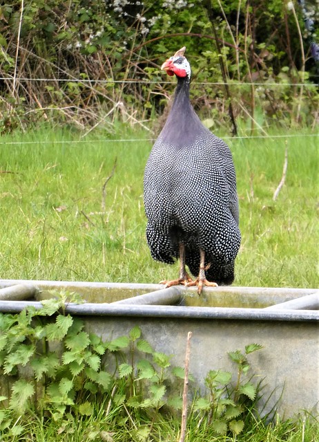
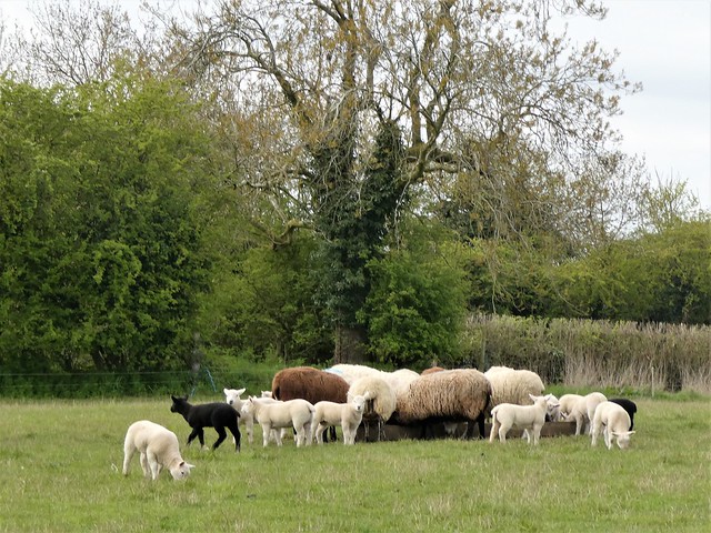
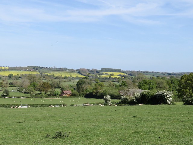
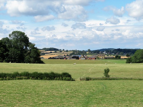
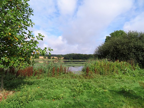
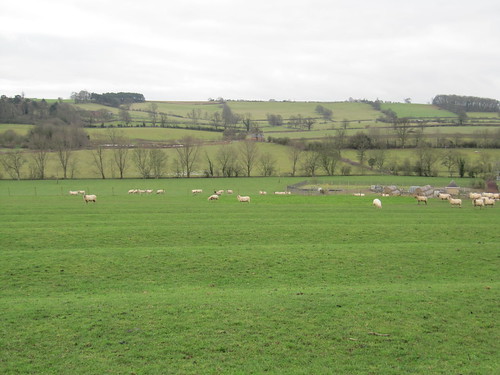
Out in the parkland beyond the house, ewes bleated for lambs who scampered up with grubby knees. Bullocks jostled to stare at us over the hedge. At South West Farm a couple of guineafowl went scuttling across the road with their characteristically furtive air, hunched down in spotted cloaks of feathers as though guilty of some misdoing.

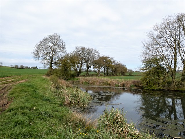
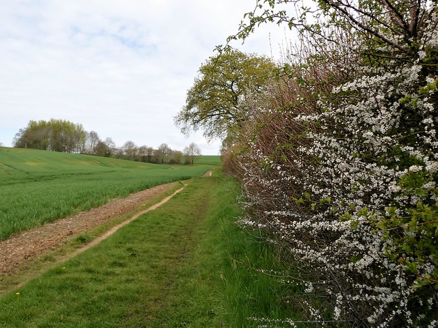
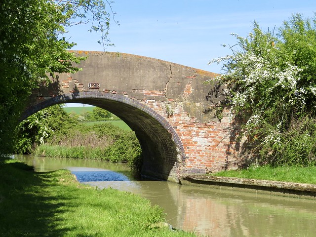
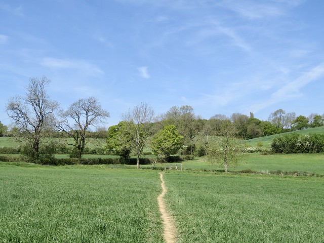
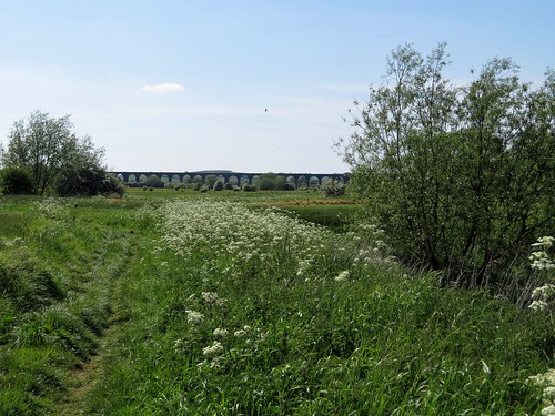
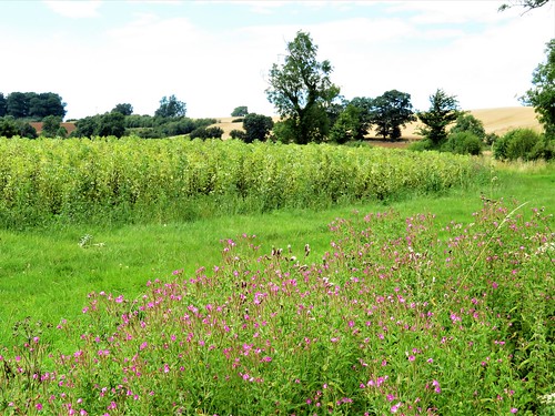
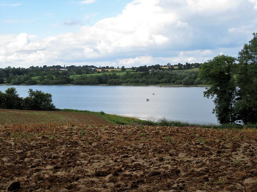
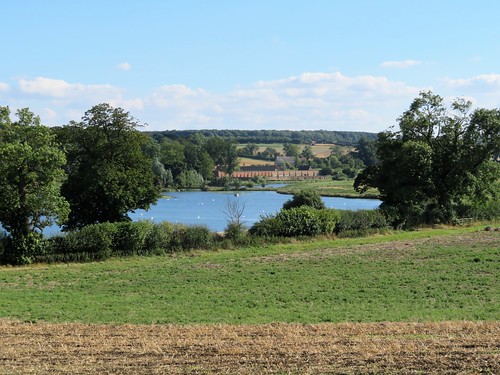
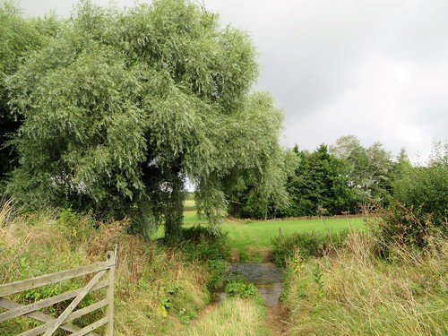
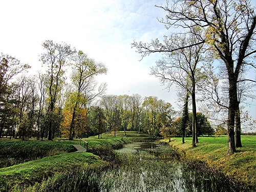
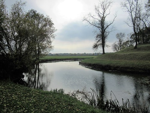
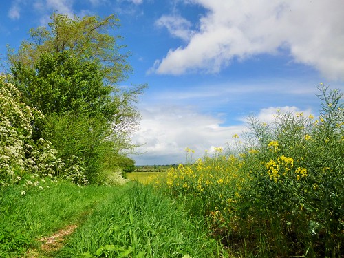
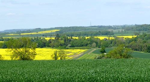
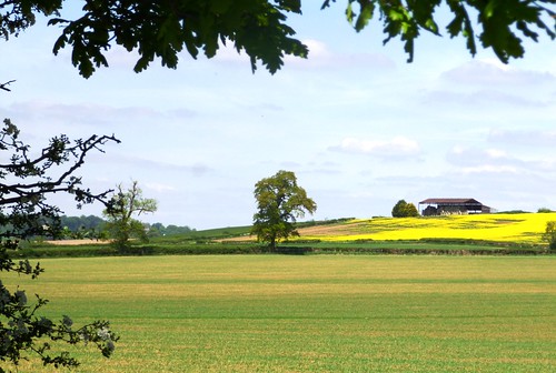
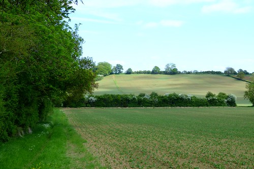
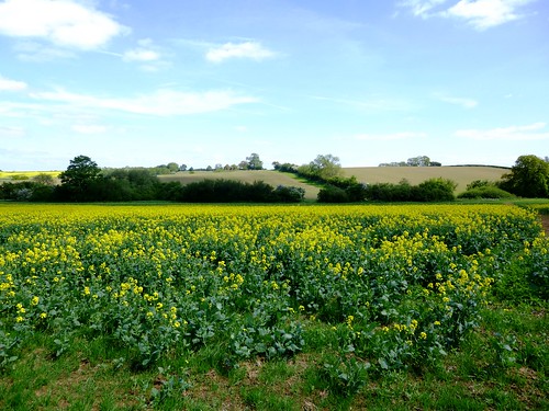
The trees around the priory fishponds were loud with birdsong – chaffinches, blackbirds, great tits, blackcaps and song thrushes giving it their best springtime chorus. The path led round the margins of enormous fields of wheat. In their hedges white blossom of blackthorn and pink of crab apple gave promise of a fruitful autumn six months hence.

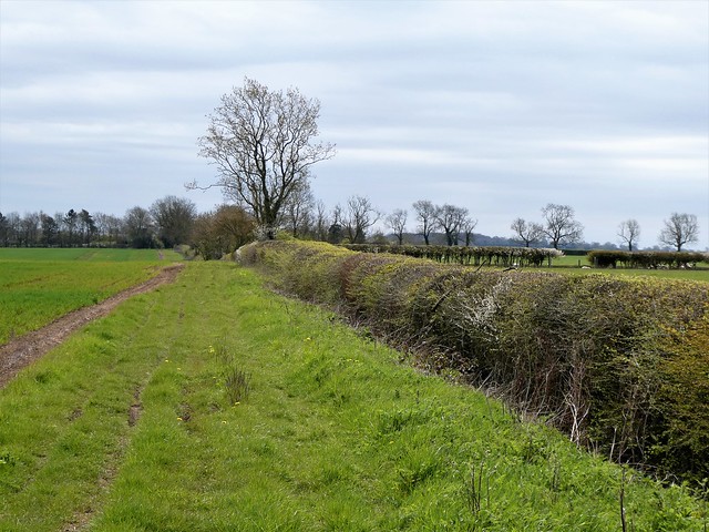
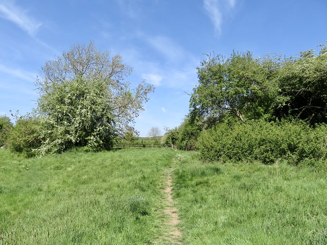
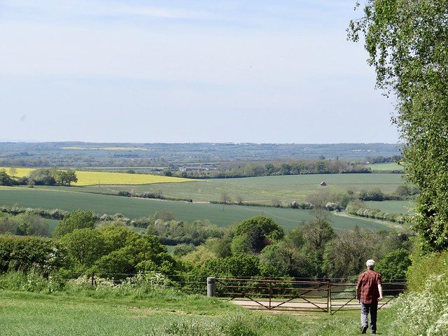
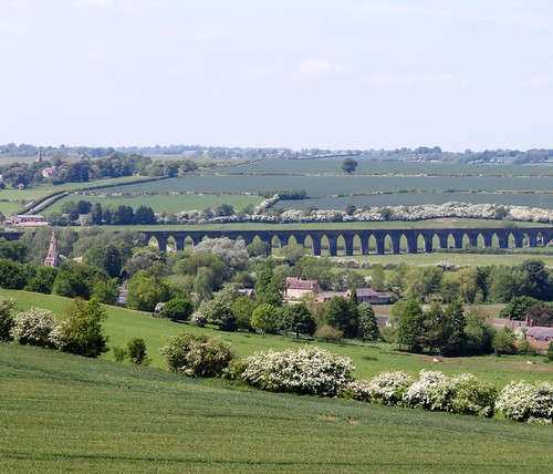
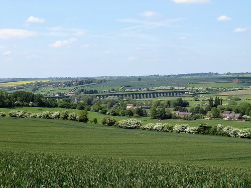
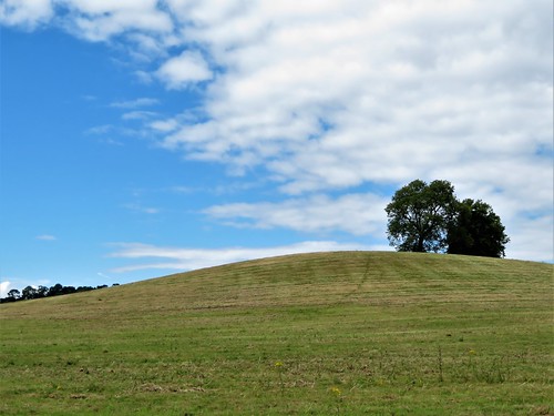
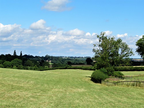
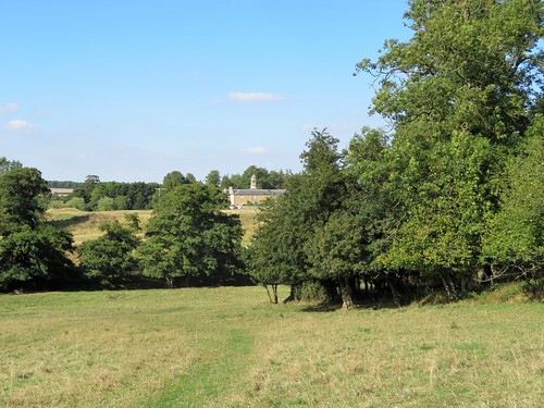
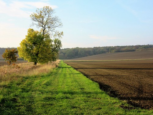
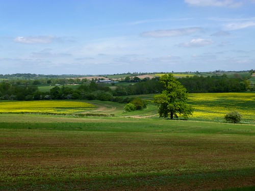
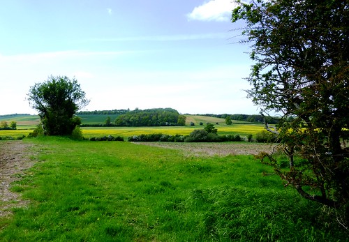
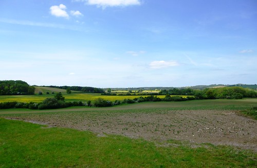
Up on the crest of the land we turned along a ridge road with long views over the plough-striped undulations of the countryside. The verges of the road were lined with trees, wide grassy strips that told of past animal droving.

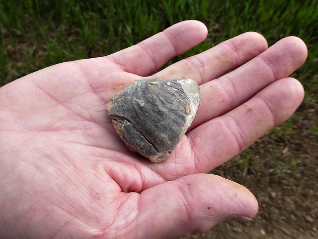
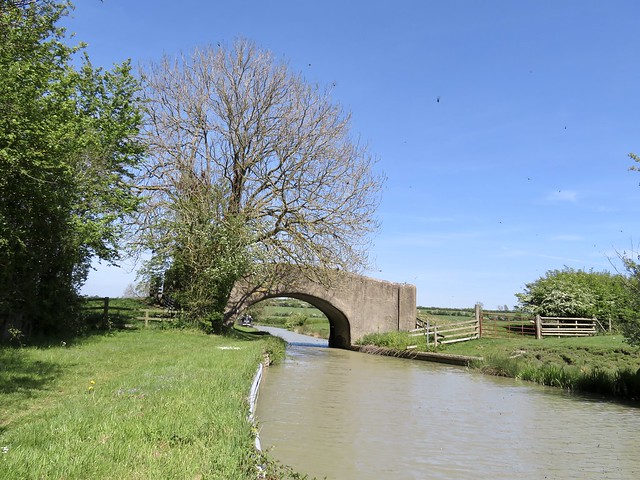
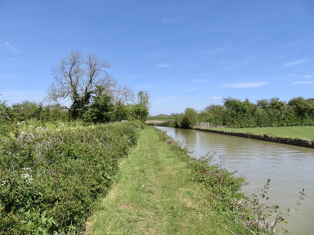
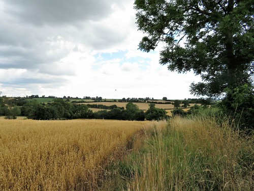
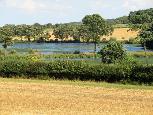
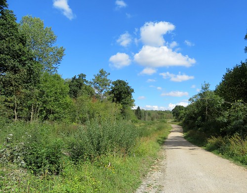
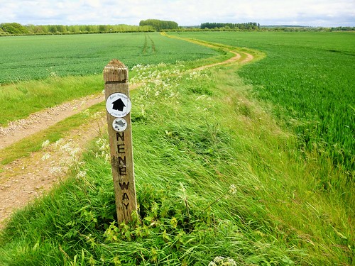
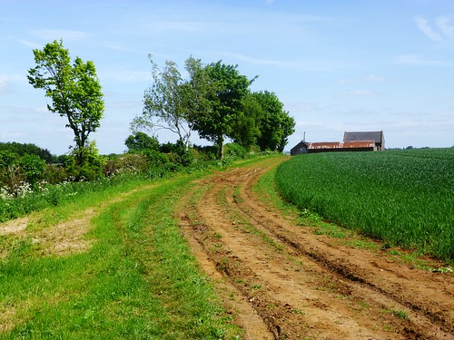
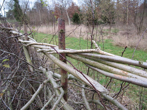
Oxford Lane, our return route to Canons Ashby, was another broad green highway. Cattle, sheep and pigs would be driven down here towards the slaughterhouses and college kitchens of the University Town. The old green road has lost its easterly hedge to modern farming. The soil of the wheatfields that bordered it was thick with flint, chert, fossil shells and pebbles rolled smooth and round by some great prehistoric river.

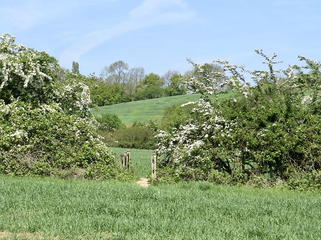
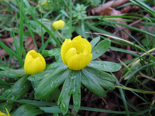
Bluebells hazed the ground under the larches of Ashby Gorge, pink bonnets of milkmaids spattered the damp ditches, and a few early bees went buzzing among the white sloe blossom.

How hard is it? 5 miles; easy; field paths

Start: Canons Ashby house, near Daventry, Northants NN11 3SD (OS ref SP 577505) – NT pay car park. Limited parking at church

Getting there: Canons Ashby is signposted from A361 (Daventry-Banbury)

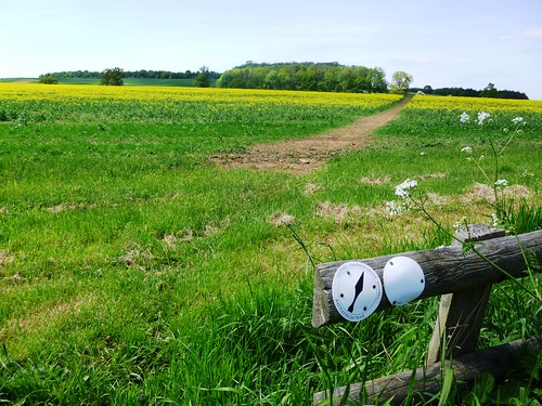
Walk (OS Explorer 206): From car park, right down road. Just past South West Farm, right (573503, fingerpost) on field path, following arrows. In ¾ mile, at ‘Private’ notice (568512), left along farm track, then hedgeside track. In ½ mile at oak tree with arrows (564519), right with hedge on right. In 400m left up hedge (568520) to road (568521). Right; in ⅔ mile, opposite road on left, right down Oxford Lane hedged track (578525, ‘Byway, Macmillan Way’/MW). In ½ mile MW bears right (580516), but keep ahead. In ½ mile cross road (584508) and on. In 400m right (584504, gate, arrow); half left across pastures till right-hand hedge meets fence (579501). Through 3 kissing gates, across footbridge; on across field to cross road (577499, fingerpost). Field path to road at South West Farm (574503); right to car park.

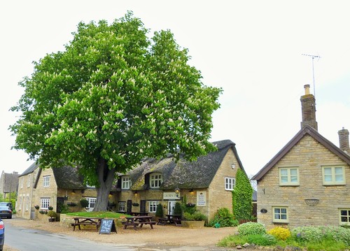
Lunch: Crown Inn, Weston NN12 8PX (01295-760310, thecrowninnweston.co.uk); NT teashop at Canons Ashby.

Accommodation: Weston Hill Farm, Moreton Pinkney NN11 3SN (01295-760217)

Info: nationaltrust.org.uk

 Posted by at 01:54
Apr 242021


First published in: The Times Click here to view a map for this walk in a new window
picture picture picture picture picture picture picture picture picture picture
Facebook Link:

It’s an ironstone landscape here on the borders of Northamptonshire and Warwickshire, and the many handsome villages are the beneficiaries in terms of the beauty of their building stone.

On a glorious day of blue sky, with everything near and far standing out as clear as glass, the houses of Upper Boddington glowed the colour of dark honey. Rusty-looking streaks in their walls showed where nodes of iron lay embedded in the stone.

On the outskirts of the village we crossed a brook among milky blue bells of comfrey and a froth of cow parsley newly opened. Buttercups made golden drifts in the meadows by the stream. The path led us north across fields of young wheat, the pale crumbly soil free of stones and already cracked and drying under the sun.

Ahead the land heaved up into the long wooded billow of a ridge. From the top we had a wonderful view west over a great green disc of Warwickshire lowlands.

Lumps and hollows in the slope at our feet betrayed the site of the medieval village of Stoneton, abandoned in early Tudor times when its arable land was converted to more profitable sheep grazing. And the sheep are still here. Ewes called for their lambs, who were playing ‘I’m-the-king-of-the-castle’ on a hollow tree stump with maximum glee.

We made our way down past the rushy moat of Stoneton Manor, across the sheep pastures to the grassy towpath of the Oxford Canal. Walking north along its sharp curves, it was hard to believe that this clay-coloured waterway meandering inconsequentially across the plain could once have been the main communications link between London and the Midlands.

A bare-chested man in a kayak came past in a flash and splash of paddle blades. Narrow-boats cruised by, roof-boxes fragrant with basil, thyme, and rosemary, their freshwater admirals raising cans of beer in cheery salute.

From Priors Hardwick, a picture of perfection in sun-kissed ironstone and immaculate gardens, the homeward path ran above sheep pastures whose medieval ridge-and-furrow showed the patterns of vanished agriculture. Dandelions dotted the fields, their miniature yellow suns all gone into the globular seed heads that children blow to tell the time.

As I leaned on a gate to stare, a fine red fox came across the path twenty feet ahead, low-slung and intent. It stopped dead still, held me at gaze for a few seconds, and then turned tail and raced away to safety in the hedge.

Start: Plough Inn, Upper Boddington, Daventry, Northants NN11 6DH (OS ref SP 483534)

Getting there:
Upper Boddington is signed from Westhorp on A361 (Banbury-Daventry)

Walk (8 miles, easy, OS Explorer 206):
From Plough Inn, left along road; right up Frog Lane. Fork right by Hillside View; follow Millennium Way/MW waymarks north-west for 1 mile. From woodland strip (470547) dogleg right/left to Berryhill Farm; left along drive to road (464545). Right; in 600m, sharp left (466550) across field to drive (463547); in 100m, right to cross canal (458551). Right on towpath; in 1½ miles at Bridge 123 (461568), right (SE) across fields for ¾ mile to road in Priors Hardwick (472563). Right past church and Butchers Arms; right at road; in 150m, left off bend (470559, ‘Hill House’). Immediately left (yellow arrow/YA) across fields (occasional YAs and black arrows), heading SSE for 1¾ miles back to Upper Boddington.

Lunch: Plough Inn, Upper Boddington (01327-260364, ploughinnboddington.co.uk) – a very friendly village inn

Info: Banbury TIC (01295-236165)
satmap.com; ramblers.org.uk
More walks info: @somerville_c

 Posted by at 01:17
Jun 082019


First published in: The Times Click here to view a map for this walk in a new window
picture picture picture picture picture picture
Facebook Link:

It’s always a pleasure to walk with a dog, especially one as full of fizz as Ozzy the black retriever. Our friends Carry and Gordon had brought him along to enliven our 10-mile circuit of the woods and fields along the borders of Rutland and Northamptonshire, and Ozzy more than did his bit.

A hot, cloudless day, last in a brilliant spell of walking weather, had us setting out in good time from Barrowden, a village of creamy oolitic limestone, like a segment of the Cotswolds dropped by a benevolent djinn on the uplands of the River Welland’s wide, fertile valley.

Soon the pale stone spire of Barrowden church sank behind, and we were following the Jurassic Way long distance path through the cool rides and sun-splashed glades of Wakerley Great Wood. This swathe of ancient woodlands is now a playground for Sunday cyclists, rovers and family groups. In the meadows on the far side of the wood we found a golden road spread before us, a path strewn thickly with buttercups.

Inquisitive little black Dexter cattle snuffed cautiously at Ozzy, and he rolled off their scent in the half-grown hay meadows around Laxton Hall. A Polish picnic party was in full swing in the grounds of the hall, the chatter and laughter soon falling away under blackcap song in Town Wood.

Beyond Laxton we rejoined the Jurassic Way and headed north through green cornfields where Ozzy breasted the tides of leaves, only his head showing, like a cross-channel swimmer. Ahead opened a memorable view, the wide Welland Valley with may bushes laden white, church spires poking up among the fields, and the 80 arches of the Welland Viaduct striding majestically from one side to the other. It took 400-odd navvies three years to build this fantastic structure, opened in 1878 – they used thirty million bricks, camped out in the fields, and caused local consternation.

Our way home lay along the snaky curves of the River Welland. Ozzy swam after sticks, the buttercup fields were flooded with gold, and the slim silvery needle of Barrowden spire beckoned us on like a harbour light beyond the green seas of wheat.

Start: Exeter Arms, Main St, Barrowden, Rutland LE15 8EQ (01572-747365, exeterarmsbarrowden.co.uk) (OS ref SK 946001)

Getting there: Bus 47 (Uppingham-Peterborough); 12 (Stamford-Uppingham)
Road – Barrowden is signed off A43 (Corby-Stamford) and A47 (Peterborough-Leicester)

Walk (9½ miles, field and woodland paths, OS Explorer 224): From Exeter Arms cross green; left along road. At corner with 2 fingerposts/FPs (950000), fork right downhill, over field, under railway bridge to road in Wakerley (951996). Left; just beyond road on left, right up path on right of Exeter House (955994, ‘Jurassic Way’/JW). Follow JW to road (958991); right for 700m, then right (962986) onto JW with car park on right.

Follow JW waymarks through Great Wakerley Wood. In 700m past Post No 6 (965979, green with red ring). Right along ride; in 20m, left uphill into St Mary’s Wood. In 250m, leave wood; on over meadows. In 2nd meadow JW goes left through gate, but bear right here (968974) on bridleway (black arrows/BLA). In ½ mile arrive opposite Laxton Hall (959972); bear a little right to far corner of wood on your right. Into wood here (955971, gate, BLA).

Keep ahead; in 500m, left at ‘No Horse Riding’ notice (950970, BLAs) through Town Wood for 500m to leave wood (950968). Cross field and stile to track by house (951962); right to road; right through Laxton. In ½ mile, left (942961, stile, FP); half right across field; half left across next field (BLA) to gate and road (937958). Left; in 100m, right (FP) on track; after 3 fields, right on JW (930956) with wall on right, for ½ mile to road (928964).

Left; in 30m, right (stile, JW); left through hedge gap; half right across field and down to lane into road in Shotley. Forward to cross road (924974, FP); cross field to River Welland (923978); right on Jurassic Way. In ½ mile cross Turtle Bridge (928985); in 150m, just before old railway bridge, right through hedge (YA, JW). Half left to hedge beside old railway line; right along it. In ¾ mile, left across line (937993, stile, CPRE yellow arrow); right along far side of old railway. In 400m, half left (940995, CPRE arrow) across 3 fields to road (943001); right to crossroads; right down Main Street to Exeter Arms.

Lunch/Accommodation: Exeter Arms, Barrowden (01572-747365, exeterarmsbarrowden.co.uk) – friendly village pub with rooms.

Info: discover-rutland.co.uk; northamptonshiresurprise.com; satmap.com; ramblers.org.uk

 Posted by at 01:34
Jul 282018


First published in: The Times Click here to view a map for this walk in a new window
picture picture picture picture picture picture picture picture picture picture picture picture picture picture
Facebook Link:

A blustery grey morning was giving way gradually to a sky of scattered blue over the Northamptonshire farmlands. At East Haddon, Sunday lunchers clinked their glasses in the Red Lion, and somewhere near the recreation ground a children’s party was getting under way with tremendous music and megaphone announcements.

The building stone hereabouts is all honey-coloured ironstone. The rich, dark gold soil lay stiff with flints and water-smoothed pebbles. The farmers had left generous headlands around the fields, growing ground for thistles and white campion, yellow and purple vetches, tall rusty docks and pink spears of willowherb.

Slate grey clouds hung low above the northern skyline, where a strip of brilliant blue piled with whipped cream cumulo-nimbus inserted itself between heaven and earth. A church tower, peeping among trees, heralded Holdenby, a dream of an orderly estate village with handsome stone houses and high-gabled cottages around a broad oak-shaded green. Long gone is the great Elizabethan house with its 80,000 square feet of bulk and its 123 windows, where King Charles I endured a gilded captivity between the end of the Civil War and his eventual execution in 1649.

Beyond Holdenby the pastures rolled out northwards toward low hills. Medieval ridge-and-furrow undulated below the grass, more sensed than seen. We skirted Holdenby North Lodge, where two glossy horses in the absolute nick of health came up inquisitively to see what apples or mints we might be hiding in our pockets. They scorned my proffered handful of grass with snorts of aristocratic contempt.

The path crossed huge, hedgeless cornfields where the red brick barn of Tithe Farm lay half hidden in a fold of ground. A glimpse of the wind-furrowed grey lake of Ravensthorpe Reservoir, where fly fishermen rhythmically flogged the water from tiny boats, and we set back south along a well-found field path.

Oats, beans and barley grew, just as in the old nursery song. The ripe oat seeds hung like so many million silver bells, trembling in the breeze. Lime green shield bugs clung among the oats, and damselflies hovered, vanished and materialised a foot away, their electric blue bodies barred with black. Overhead, elephantine clouds moved massively across the sky, subtly backlit by a sun that never left their shelter all afternoon.

Start: Red Lion Inn, East Haddon, Northants NN6 8BU (OS ref SP 670682)

Getting there: Bus 96 (Rugby-Northampton)
East Haddon is signed off A428 between Rugby and Northampton

Walk (7 miles, easy, OS Explorer 223): Opposite Red Lion, up Mill Lane. At sports field, left (yellow arrow/YA) along field edges. Clockwise round three sides of 3rd field to gate (679677); left past Rowell Leyes barn. At foot of slope, left (678673) along field margin for 800m to bridleway (683668). Left (‘Holdenby’), following bridleway to road in Holdenby (695678).

Left to road (695680); cross, and follow Macmillan Way (black arrows/BLA) to Holdenby North Lodge. Cross stile into field to right of house (695687); left over next stile, and through farmyard. BLAs point west through paddock (stiles), then along field edge. In 400m (688686, gate on left), right across 2 fields. At foot of slope (687691), ahead with hedge on left; in 200m, left through hedge (687693, BLA, blue arrow/BA). Diagonally across field, over footbridge (686696); follow hedge on left to Teeton Road (680701).

Left; in 100m, left (NB – another 100m along road gives a view over Ravensthorpe Reservoir) at footpath fingerpost. Along field edge with hedge on right. In 300m, right through hedge (678698), across corner of field to footbridge. Half right across next field; through hedge in top right corner (677694); down field edge. In 150m right (stile); left along hedge (YA), then across open field to stile (676688). Half right in front of Rye Hill Farm; beyond ponds, right off drive (674687, YA). Follow hedge, then fenced path past sewage works (672685). Keep stream on right before bearing left to stile (arrow) and road (672682). Right to Red Lion.

Lunch: Red Lion, East Haddon (01604-770223, redlioneasthaddon.co.uk)

Accommodation: Murcott Mill, Long Buckby, Northants NN6 7QR (01327-842236, murcottmill.com)

Info: northamptonshiresurprise.com; satmap.com; ramblers.org.uk

 Posted by at 01:22
Mar 112017


First published in: The Times Click here to view a map for this walk in a new window
picture picture picture picture picture picture picture picture picture picture picture
Facebook Link:

In the west window of All Saints’ Church at King’s Cliffe, an upside-down angel plays the lute with spatulate fingers. Whoever re-assembled these fragments of medieval glass got some sly fun out of the job. Opposite the lutanist, another angel strums a dulcimer – an angel with the head of a pompous-looking eagle.

The streets and narrow alleys of King’s Cliffe are lined with handsome houses of creamy limestone, very characteristic of this north-eastern corner of Northamptonshire. Under today’s blue sky they glowed with a light as soft and silvery as moonshine.

Up on the slope above the village we followed the Jurassic Way, a broad track that snakes through the ancient woodland of Westhay and Fineshade Woods, a remnant of what was once the great sprawl of Rockingham Forest. These days forestry and leisure go together here. Families strolled and walked the dog, runners thudded by, and coveys of kids on bikes competed to ‘do a Wiggins’ up the slopes and down the dips.

We ducked aside among the trees to peer over the edge of a precipitous jungly ravine, the deep cutting where the goods trains of the London & North Western Railway once rattled immense loads of limestone through the woods and away to the outside world. A cup of tea at a table outside the Top Lodge Forest Café, and we turned south along the Jurassic Way into a green valley. A striking set of Palladian stables lay in a fold of ground, all that remains of the grand Georgian house that was built on the site of Fineshade Abbey. Up across a ridge of sheep grazing, and down again towards the wide valley of the Willow Brook where Blatherwycke Lake turned its polished steel face to the blue sky.

Blatherwycke’s 19th-century estate houses lead down to a beautiful zigzag bridge over a neck of the lake. As at Fineshade, a great country house stood here until a post-war decline in fortunes saw it demolished. We passed the Norman church under horse chestnuts and beeches, and followed a broad path planted with young trees – chestnut-leaved oak, black mulberry, tulip tree – through rolling parkland and cornfields. The sun shone, shadows lengthened, and the Willow Brook chuckled and sparkled as it guided us on towards King’s Cliffe.

Start: Cross Keys Inn, King’s Cliffe, Northants, PE8 6XA (OS ref TL 007971)

Getting there: Bus – CallConnect service (0845-263-8153)
Road – King’s Cliffe is signed from A47 between Duddington and Wansford

Walk (7½ miles, easy, OS Explorer 224): From Cross Keys, right along West Street. At edge of village, right (001972) up Wood Lane. In 500m, left at barrier (SP 998976). Follow waymarked Jurassic Way/JW through Westhay and Fineshade Woods for 1½ miles to Top Lodge café (979983).

Bear left along road; just past railway bridge, left and follow JW southwest. Just past Fineshade Abbey stables, JW goes right across concrete footbridge (972975); but keep ahead here. Cross stile; bear left up field, then aim for gateway on ridge at left end of hedge (972972). Follow fence on right to far end of field; right across stile (973970). Half left across field, aiming for Blatherwycke Lake; field path for 800m to road junction (971962); right (‘Blatherwycke’). In 600m cross bridge; in another 200m, left (973955, ‘Historic Church’) up drive to Blatherwycke Church (974958).

Continue along drive (black arrows/BLA, then yellow arrows/YA). In ¾ mile, just before ‘Private: No Right of Way’ notice, left through hedge (984964, BLA). Continue with hedge on right to pass through Alders Farm (989966). On through fields (YAs, BLAs, stiles); in ⅔ mile, left across footbridge (998968, BLA); on across fields and past allotments to King’s Cliffe. Ahead along Church Walk (002971) for 600m to church; left to Cross Keys Inn.

Lunch: Cross Keys Inn, King’s Cliffe (crosskeyskingscliffe.uk; 01780-470276), or Top Lodge Café, Fineshade Wood.

Accommodation: Old White Hart, Lyddington, Oakham, Rutland LE15 9LR (01572-821703, oldwhitehart.co.uk) – friendly and cheerful village inn.

Info: Stamford TIC (01780-755611)

Kempley Daffodil Weekend walks, Glos: 18, 19 March (daffs.org.uk)

visitengland.com; satmap.com; ramblers.org.uk

 Posted by at 01:31
Oct 152016


First published in: The Times Click here to view a map for this walk in a new window
picture picture picture picture picture picture picture picture picture picture picture picture picture picture
Facebook Link:

Another chance to walk with our artist friend Carry Akroyd through the Northamptonshire countryside that inspires her. A beautiful day of soft autumn light showed off these understated fields and woods in all the colour and detail she catches so strikingly in her East Anglian landscapes.

We left the pale limestone walls and thatched roofs of Wadenhoe, climbing gently from the valley of the River Nene into pastures of medieval ridge-and-furrow cropped by fat ginger-coated bullocks. A pair of red kites circled overhead, and Carry let out a perfect imitation of a kite’s shrill whistle to bring them lower. Along an old trackway we fingered the pink leaves of blackthorn bushes whose sloes hung in thick dark clusters, ripe for the gin bottle.

Through Lilford Wood on a speckled carpet of brown-and-yellow elm leaves, to a view at the far end across a ploughed field to the stone shell of Lyveden New Bield, Sir Thomas Tresham’s never-completed dream of a country lodge. Tresham, a staunch and devout Catholic, died in 1605, shortly before his son Francis became embroiled in the Gunpowder Plot. Disgrace and financial ruin followed for the family, and the unfinished lodge (a mansion in all but name) and its adjacent pleasure gardens were left to fall into decay.

Lyveden New Bield has been preserved and its grounds restored by the National Trust. We explored the eerie hollow skeleton of the lodge with its fine carvings of discreetly placed Catholic symbols, and climbed the moated mound behind for a view over the whole fantasy landscape. Then we took the homeward path through Lady Wood where the oak trees held up a canopy of quince-coloured leaves with wonderfully distorted limbs.

Long-tailed tits and siskins thronged the trees down by the River Nene, feasting among the seed cones of alders. Carry spotted a marsh tit, a rare sighting that made her exclaim with delight. And in the recesses of Wadenhoe’s box-backed church I found an old friend of ours – the Green Man, carved by some anonymous medieval mason, hiding in the shadows with a secret smile seven centuries old.

Start: Village hall car park, Wadenhoe, Northants, PE8 5ST (OS ref TL 011833)

Getting there: Wadenhoe is signed off A605 between Thrapston and Oundle

Walk (8½ miles, easy field and woodland paths, OS Explorer 224): Walk back up village street (‘Lyveden Way’/LW). Left at top (LW); in 30m, left through gate (LW). Aim a little right of church; in 200m, further right to kissing gate (009835, LW). Aim ahead through trees and across next field to far left corner to cross road (008836, LW). Cross next field to far left corner; right along road.

In 150m, left down track (006838, ‘Wadenhoe Lodge’). In ½ mile pass Wadenhoe Lodge; continue following LW. In another 500m pass track on left (994845, ‘No Footpath’); in100 m, left through gate, across 2 fields to path into Lilford Wood (992847, LW). Follow LW through wood, across fields to Lyveden New Bield (984853).

Returning from house, retrace steps to edge of field; right (LW) on path which curves to meet Lady Wood (980850). Right (LW); in 100m, left into wood, past picnic tables, across 2 duckboard footbridges and on south along path. In 300m, right at cross-path to observation tower (978848). Left down ride to bottom of wood (978844); left along LW. In 250m bear left (981843, LW); in 300m, at wood edge, right at T-junction (984842, LW).

In ½ mile, leave trees (989835) and continue on field path (LW). In 650m pass a brambly, iron-fenced pond on your left (993930); through next kissing gate (LW); on across next field to go through kissing gate (996827). LW goes left here; but turn right along green lane. In 300m, just past gate across lane, left (994825) along field edges with ditch on left. In 4th field, angle slightly right, following line of trees to cross stile to right of house (002821).

Ahead to Cross Lane; left to road in Aldwincle (004820). Right; in 200m, at junction, left (‘Nene Way’ fingerpost) across paddock and down path. In 200m, left at field edge (007820), and follow waymarked Nene Way for 1 mile to Wadenhoe.

Conditions: Lyveden Way signs are badly faded, but visible as white rectangles.

Lunch: NT café at Lyveden New Bield, or King’s Head PH, Wadenhoe (01832-720024, wadenhoekingshead.co.uk)

Accommodation: Talbot Hotel, Oundle PE8 4EA (01832-273621, thetalbot-oundle.com) – comfortable, long-established hotel.

Lyveden New Bield: 01832-205358, nationaltrust.org.uk/lyveden

Carry Akroyd: carryakroyd.co.uk

www.visitengland.com; satmap.com; ramblers.org.uk

*’The Times Britain’s Best Walks’ by Christopher Somerville (Harper Collins) – 200 walks from the ‘A Good Walk’ column – published 6 October.

 Posted by at 01:47
May 232015


First published in: The Times Click here to view a map for this walk in a new window
picture picture picture picture picture picture picture picture
Facebook Link:
A cloudy, blustering, boisterous day on the Cambridgeshire/Northamptonshire border. The wind roared in the trees and spat in my face as I walked out of Elton. Even in weather like this, Elton is a postcard picture of an English village with its cottages of creamy limestone packed with fossils, sturdy and enduring under heavy brows of thatch.

In the fields, dandelion clocks by the million, wrens and chaffinches loud and persistent in the willows along the broad and slow-flowing River Nene. By the river I met a flock of cheerful youngsters on a Duke of Edinburgh Award trudge, wrapped like small parcels against the wind and rain.

Low-rolling countryside like this catches plenty of weather – one moment a bright blaze of sunlight bringing skylarks out in full voice over the barley, the next a slash of rain and a burst of wind to silence the birds and turn the field paths sticky. I went on, whistling, towards Nassington’s graceful church spire. King Cnut dined and played chess at Nassington in a great wooden hall a thousand years ago. The Time Team discovered remnants of the structure in 2003, under and around the ancient stone-built manor house opposite the church.

History lies thick on this corner of the countryside. It was at Fotheringhay, a couple of miles to the south, that Mary Queen of Scots met her end in 1587 in the castle by the River Nene. Mired in Catholic plots, real or imaginary, Mary was too much of a threat to her cousin, Queen Elizabeth I, to be permitted to live.

I came into Fotheringhay along the Nene Way, a beautiful pathway across yellow rape fields and between hedges laden thickly with may blossom. The bare castle mound, innocent of all masonry, lay isolated in a field beyond the village’s mellow stone houses and the grand and stately church. I climbed to the top of the mound and found it thick with self-heal and scotch thistles – a poignant flora; for here in the early morning above the sinuating bends of the Nene, the pale and self-controlled Queen of the Scots knelt for the two axe blows that severed her head.

Walking back to Elton across the fields, a flash of red and white stopped me in my tracks. A magnificent red kite hung in the wind on elbow-crooked wings as it searched the barley for prey, utterly indifferent to my existence – a lordly presence above the rain-pearled land.

Start: Elton, Cambs, PE8 6RQ (OS ref TL 086940)

Getting there: Bus service 24 (Oundle-Peterborough)
Road: Elton is signed off A605 (Oundle-Peterborough). Park (neatly!) on village green.

Walk (8½ miles, easy, OS Explorer 227): From village green walk north up Duck Street passing Crown Inn on your right (pavement along road). In 450m, fork right on left bend (086945; Yarwell Mill, Sibson’). Follow this track north for 1 and a half miles; then left (081968) for 700m to meet Nene Way (076969). Left to meet Fotheringay Road in Nassington (068961).

Right to pass Black Horse Inn; left along Nassington village street. Opposite church, and just short of Nassington Manor, left (064961, fingerpost) down path and on over field. In 400m, right along Nene Way/NW (065958). Follow NW (BLAs) for 4 miles via Model Cottages (052937), Falcon Inn (059933) and castle mound (062930) at Fotheringhay, and mill at Eaglethorpe (074916) to go under A605 and on to road at Eaglethorpe sign (076915). Left round right bend; in 100m, left (fingerpost) through kissing gate/KG; right over stile; left between fence and polytunnels. In 300m, left through KG to cross A605 (077918 – please take care!).

Right; in 50m, left through KG; then another. Right up slope; in 50m, left through KG (079919). Follow path north for 1⅓ miles, past quarry heaps, then across Elton Park (occasional BLA) to road in Elton (085939). Left to reach village centre.

Lunch: Black Horse, Nassington (01780-784835, blackhorsenassington.co.uk); Falcon, Fotheringhay (01832-226254, thefalcon-inn.co.uk)

Accommodation: Crown Inn, Elton (01832-280232, thecrowninn.org)

Information: Oundle TIC (01832-274333)
satmap.com; ramblers.org.uk; LogMyTrip.co.uk

 Posted by at 01:27
Jul 272013
 

A gloriously sunny day was spread across the bean-green and rape-yellow fields of the Oxfordshire/Northamptonshire border.
First published in: The Times Click here to view a map for this walk in a new window

picture picture picture picture picture picture picture picture picture picture picture picture picture picture
Facebook Link:
At Thorpe Mandeville the sun bathed the dark gold stone walls of the Three Conies inn, ancient resort of drovers and packmen, as I made my way out of the village.

In the medieval wall paintings in St John the Baptist’s Church the infant Jesus rode the broad shoulders of St Christopher, the eyes of saviour and saint glowing like coals out of the faded pigments. I stopped in the churchyard to pay my respects at the granite memorial to Percy Honri, ‘The World’s Greatest Concertinist’, born in Thorpe Mandeville in 1874. Honri was so famous and successful a concertina player that he could afford to turn down a personal invitation from John Philip Sousa to join the great march composer’s band. He lies in a modest grave, returned in death to the place where his incredible journey began.

Out in the low-rolling countryside the overgrown trackbed of the Great Central Railway ran through fields of wheat and of pale, iron-rich earth. This is horse country; railed-off training gallops rollercoastered down the slopes, and a girl on a grey mare gave me ‘Good morning’ as she cantered by. In the early morning of 26 July 1469, it was the drumming of charging horse hooves that the hapless men on the crest of Edgecote Hill heard, long before they saw their enemies come bursting over the ridge towards them.

Images from BBC1’s The White Queen came vividly to mind. The Earl of Pembroke, trying to put down a rebellion by the Earl of Warwick against his master King Edward IV, had drawn his forces up on the hill, and had beaten off a strong attack already. But when Warwick’s rebels came thundering in from another quarter entirely, the King’s men threw down their weapons and took to their heels. A terrible slaughter ensued; some say 5,000 men or more died in the battle and its aftermath. Standing where Pembroke’s men had stood, I could see just how it had happened – they wouldn’t have had more than a minute’s warning of the nemesis sweeping down on them. I’d have run, that’s for sure.

I went on along the crest of the hill and down through fields of horned ewes to Upper Wardington, all mellow stone and green sward in the sun. The homeward path threaded fields where sheep stood on their hind legs nibbling the hawthorn hedges, blue dots of speedwell studded the headlands frothing with gypsy lace, and enormous harlequin views of green and gold unfolded to the south and west under the cloudless bowl of the sky.

Start: Three Conies PH, Thorpe Mandeville, OX17 2EX (OS ref SP 531447)

Getting there: Bus – Service 499, 508 (helmdon.com), Banbury-Brackley
Road – M40 Jct 11 (Banbury); A422 towards Brackley; in 1 mile, B4525 (‘Sulgrave Manor’); Thorpe Mandeville signposted in 2½ miles.

Walk (7 miles, easy, OS Explorer 206): From Three Conies PH, right along village street. By church gate, left through field gate (532449, ‘footpath’ fingerpost): up field edge. At top of churchyard, right through gate; across to top right corner of paddock; stile; across field to far right corner (528452). Through hedge onto Hill Farm drive; right through gate; follow hedge on your right past spring in hollow; on over ridge, down to cross disused railway (528456, Millennium Way; blue arrow).

Follow path north. In ⅔ mile, left up hedge (525465, Battlefield Trail/BT); over crest; down to cross stream (520465). Half right across field (BT); up right side of wood (BT); on through Edgecote Lodge farmyard (514467, BT). At end of farmyard, right across field; follow track (BT) past Douglas’s Barn (508465), across horse gallop, past Hill Barn (503466) to cross stile at meeting of 5 tracks (499464). Half left (BT) downhill; through double gateway (498462, BT); half right across meadow to kissing gate and path to Upper Wardington and Plough PH (495461).

Return to kissing gate; follow yellow arrows (YA) across fields. In 3rd field at top of rise, right down hedge (503462, YA); follow YAs. In 1 mile, cross stile (514452); bear right of stone barn to stile (black arrow/BLA); descend to disused railway (516452). Straight across; up far bank on path bearing right. At top, cross grassy ride; ahead on path into trees. In 10m, fork left through trees to cross stile (517451). Across 2 pastures (YA, stiles). At far side of 2nd pasture, follow path bearing right through trees. In 100m, fork left and over stile (522450, YA). Ahead across field, keeping right of telegraph poles. In far right corner, cross stile (523450, BLA); follow hedge on left to corner (526450); bear right to stile (528449). Cross road; cross field opposite (‘footpath’) to Thorpe Mandeville.

Lunch: Plough Inn, Upper Wardington (01295-750476; closed lunchtimes Mon-Fri, but groups welcome – please telephone); Three Conies, Thorpe Mandeville (01295-711025)

Accommodation: Brasenose Arms, Cropredy, Banbury OX17 1PW (01295-750244; brasenosearms.co.uk) – friendly pub, frequent live music

Battle of Edgecote Moor: battlefieldstrust.com

www.ramblers.org.uk www.satmap.com www.LogMyTrip.co.uk

 Posted by at 01:02
Mar 242012
 

A late winter sky of chilly blue lay over Northamptonshire, lending a glow to the deep orange ironstone of Badby’s houses.
First published in: The Times Click here to view a map for this walk in a new window
picture picture picture picture picture picture picture picture picture picture picture picture picture picture picture picture
Facebook Link:
Children were rushing to school as we set off out of the village, and we heard their playground squeals as we followed the Nene Way through green fields. Mention of the River Nene usually brings a picture to mind of the broad, mud-choked tideway that empties into the Wash, but here a hundred miles away the Nene crawls below overshot willows, an infant stream narrow enough to jump across.

Trees shaded the golden houses of Newnham along the village green. The path ran through the churchyard where the arcaded memorial to Eric Newzam Nicholson of the 12th Lancers (died 1917 ‘in the service of his country’) stood wrapped in creepers and ivy tendrils, looking out of its thicket over classic English countryside of sheep pastures corrugated by medieval ploughing, wooded ridges and well laid hedges.

Rooks cawed in the oaks around the farming enclave of Little Everdon with its handsome buttery gold houses. Three fields away, hounds were singing. In the lane we met 4-year-old Grace, dolled up in immaculate jodhpurs and just about big enough to stay on board Stumpy, her Shetland pony. Grace was not happy. ‘She wanted to follow the hounds,’ explained her mother, ‘but she couldn’t really have kept up.’ Grace cracked a watery smile as Stumpy bore her away home.

There were big views all round from the summit of Everdon Hill. Storm-battered cedars and wide gleams of water heralded Fawsley Park, the two slender arms of its man-made lake cradling the estate church on a knoll – another dream of settled tranquillity in the heart of England.

The peaceful woods of the Fawsley Estate provided a refuge and haven for Joseph Merrick, the Elephant Man, during the late 1880s, in the last stages of the mysterious affliction that grotesquely distorted his face and body. Travelling from London in a private railway carriage to avoid the public consternation caused by his appearance, Merrick stayed in the gamekeeper’s cottage as the guest of Lady Louisa Knightley. Walking back to Badby we pictured the outcast man in these bluebell woods, free to stroll among the trees, pick flowers and feel at ease for the only time in his life.

Start & finish: Windmill Inn, Badby, Northants NN11 3AN (OS ref SP 559589)

Getting there: Bus – Service 200 (www.stagecoachbus.com) Banbury-Daventry
Road: M1 Jct 16, A45 towards Daventry, B4037 to Badby

Walk directions: (7½ miles, easy, OS Explorer 207): From Windmill Inn, left through Badby. Opposite Maltsters Inn, right down Court Yard Lane (560592). Follow well-waymarked Nene Way for 3 miles via Newnham to road at Little Everdon (594580). Forward; in 150m Nene Way goes left (595579), but keep ahead on road to Everdon, past church and on. At top of village, left (‘Fawsley’). In 100 m, right (590576; fingerpost, black arrow/BLA); follow BLAs for 1 mile to cross road near Westcombe Farm (573573). Through gate, up field to gate (570572); follow BLAs to road (566570). Right, round bend to Fawsley Church (565568); return to bend; left on Knightley Way (KW). Follow KW for 1 mile through Fawsley Park and inside west edge of Badby Wood (559580). Leaving wood (559584), aim diagonally right across field; follow KW to Badby Church (560587). Right to Windmill Inn.

Lunch: Romer Arms, Newnham (01327-702221; www.charleswells.co.uk); Plough Inn, Everdon (re-opening shortly; check online)

Accommodation: Windmill Inn, Badby (01327-311070; www.windmillinn-badby.com)

Info: Daventry TIC (01327-300277)

Readers’ Walks: Come and enjoy a country walk with our experts! Dates, info etc.: http://www.mytimesplus.co.uk/travel/uk/1867/times-walks. Next walk: Lake District, 8 April
www.ramblers.org.uk www.satmap.com www.LogMyTrip.co.uk

 Posted by at 02:52