Search Results : powys

Jul 012023


First published in: The Times Click here to view a map for this walk in a new window
Pecelli Pecelli Pecelli Pecelli Pecelli Pecelli Pecelli

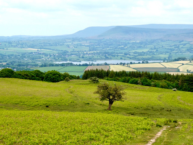
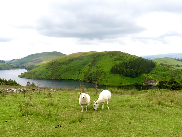
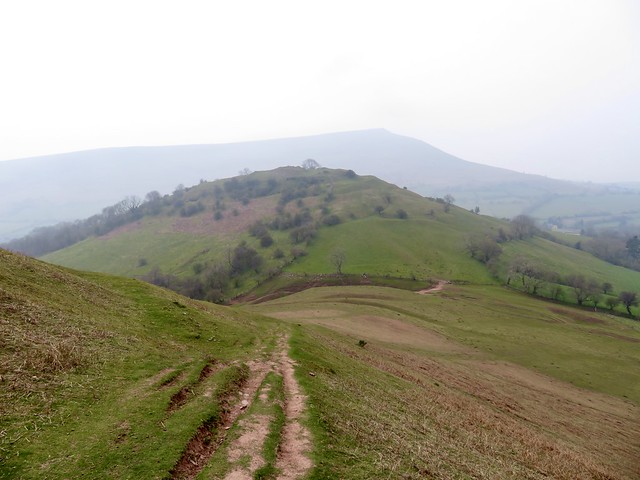
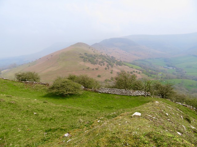
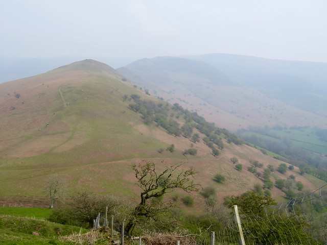
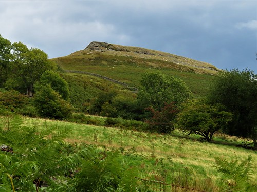
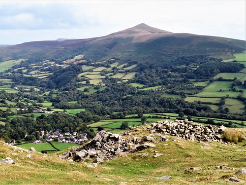
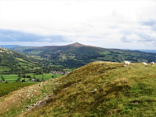
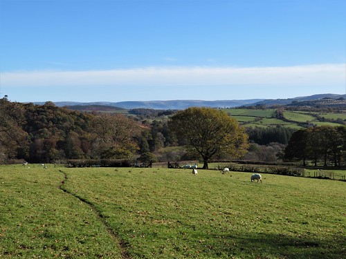
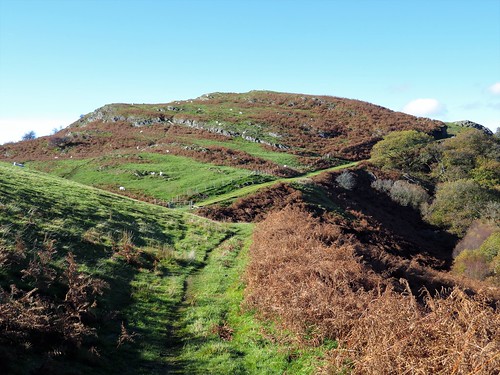
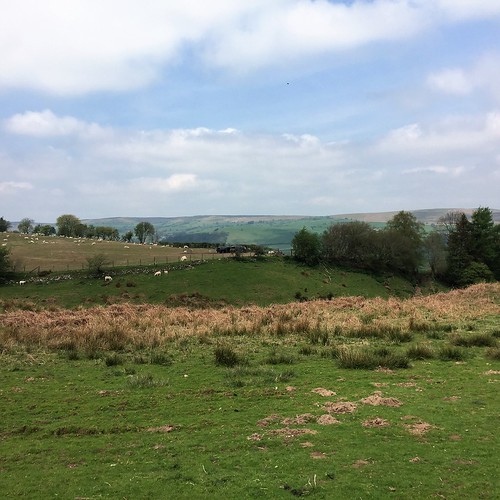
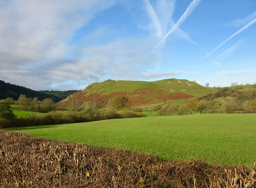
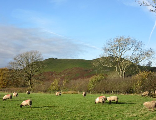
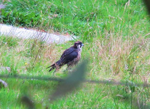
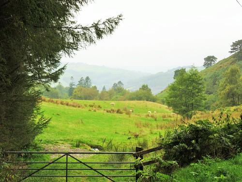
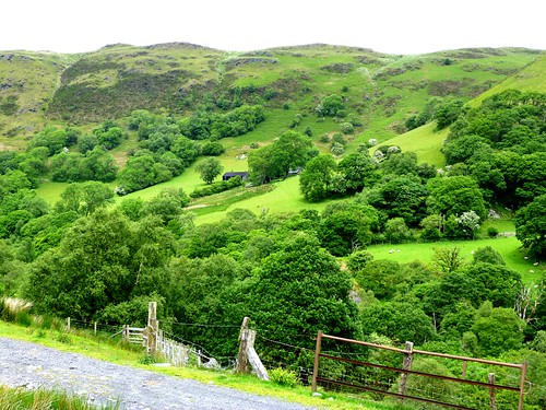
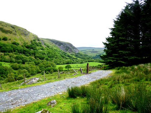
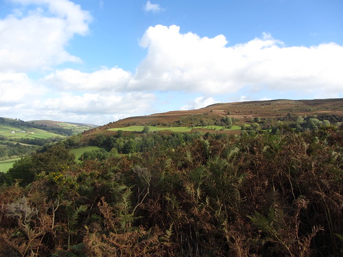
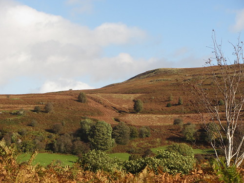
The Brecon Beacons may have changed their name to Bannau Brycheiniog, ‘the peaks of Brychan’s Kingdom’, but the allure of these sharply profiled Welsh mountain remains, as it always was, irresistible to walkers. The wedge-shaped summit of Pen y fan, tallest of the range, was bristling with tiny figures on this warm summer afternoon. Nearer at hand, the gentle green dome of Pen y Bryn, a north-easterly outlier, held only a scattered flock of Welsh mountain ewes and lambs, very wary of intruders onto their hill.

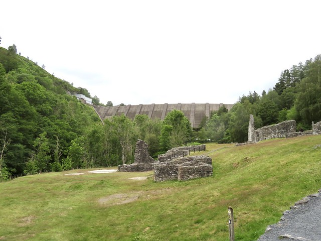
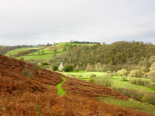
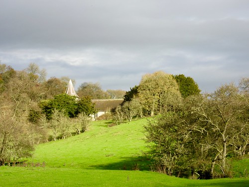
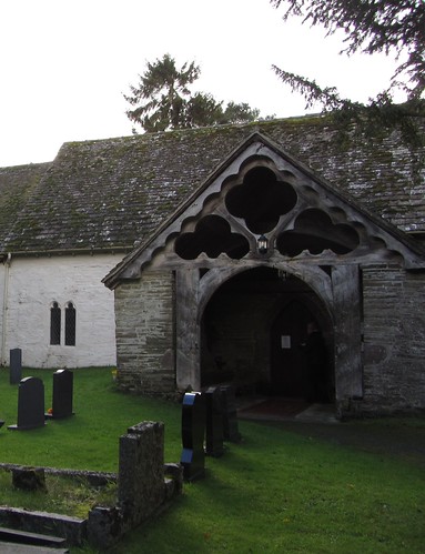
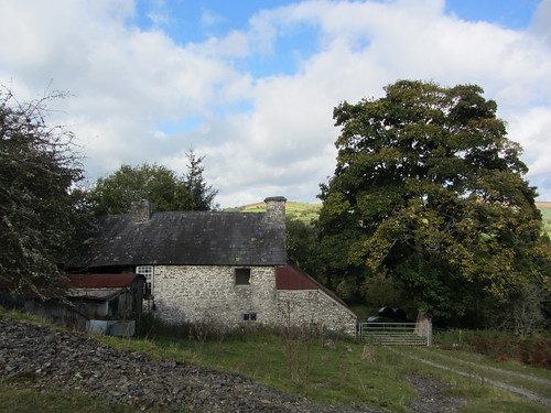
The church of St Meugan stood among trees in a dip of ground above the village of Pencelli. In the cool, musty interior a wall plaque commemorated John Jones (1875-1942), a much-travelled cleric, ‘priest and missionary to the Natives of Australia’. Outside, the windowless north wall of the tower was used in times past as a goal by Pencelli’s handball players. Other locals would gather round the nearby cockpit, nowadays a bushy dingle, to wager and bicker as their game birds battled it out.

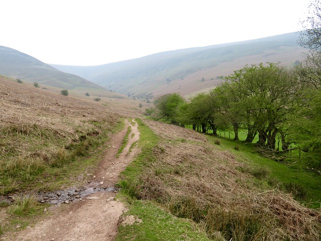
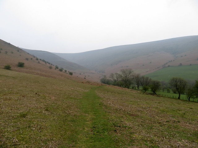
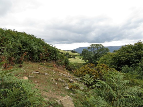
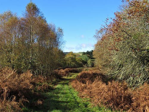
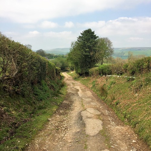
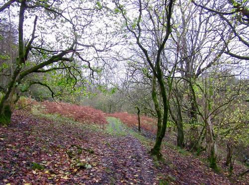
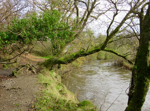
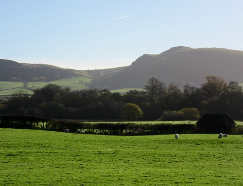
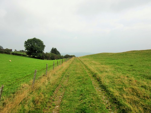
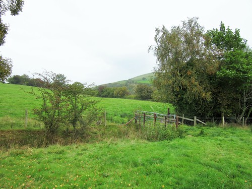
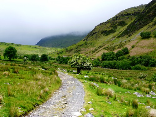
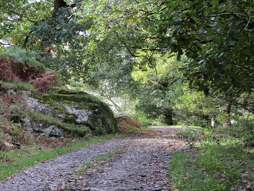
Beyond the church we crossed fields where the hazel hedges sheltered lines of sheep as yet unshorn, all panting in the heat. A green lane led away uphill, a grassy track indented in the ground that steepened past twisted thorn trees.

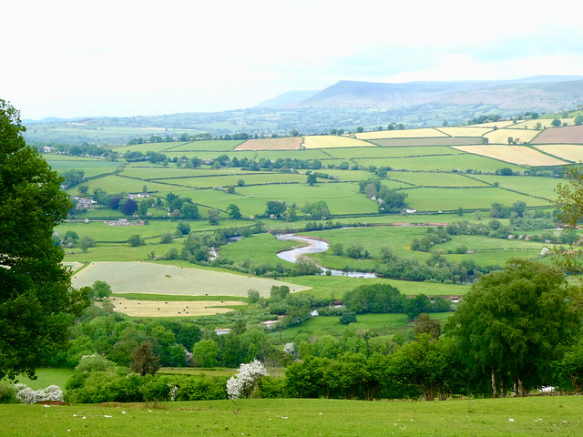
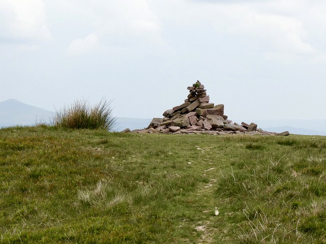
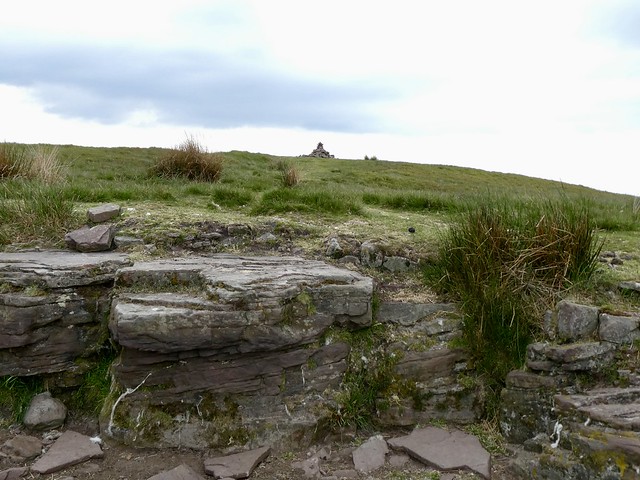
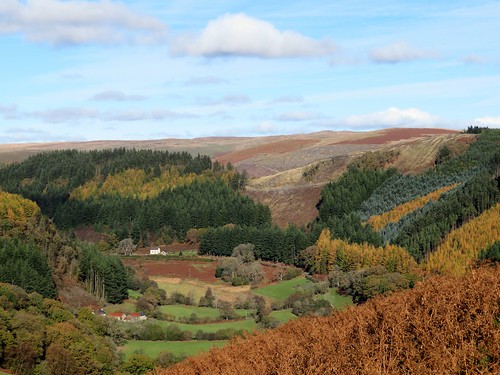
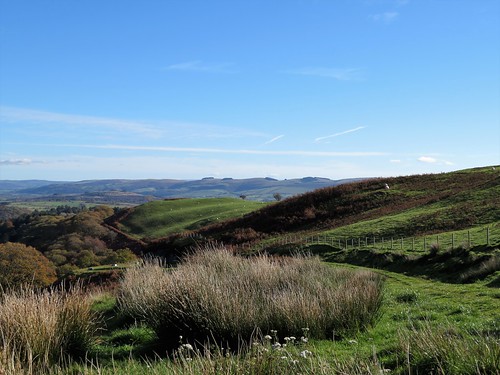
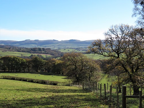
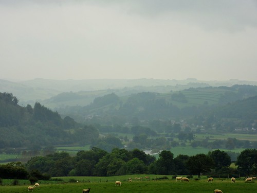
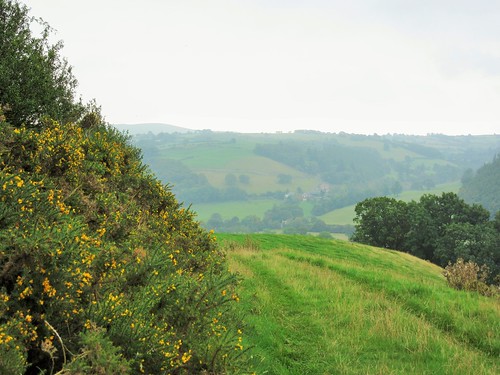
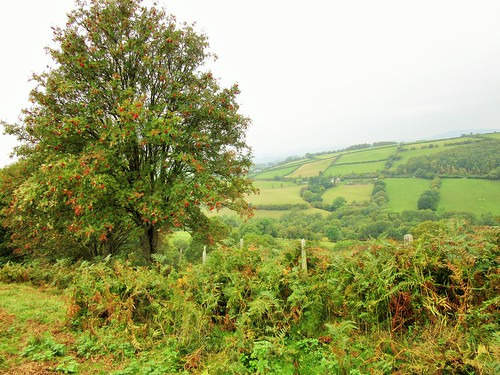
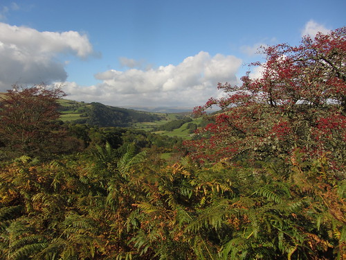
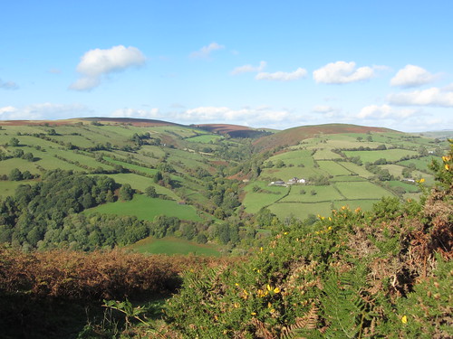
On the southwest skyline the canted top of Pen y fan stood tall and shadowed, lord of steep ridges and valleys. Below the path a stream was flowing underground, its subterranean trickling a guide for our footsteps as we neared the top of Pen y Bryn. A side turning over trackless ground and we were standing by the summit cairn with a magnificent panorama opening north and east, the long snouts of the Black Mountain ridges descending to green patchwork farmlands.

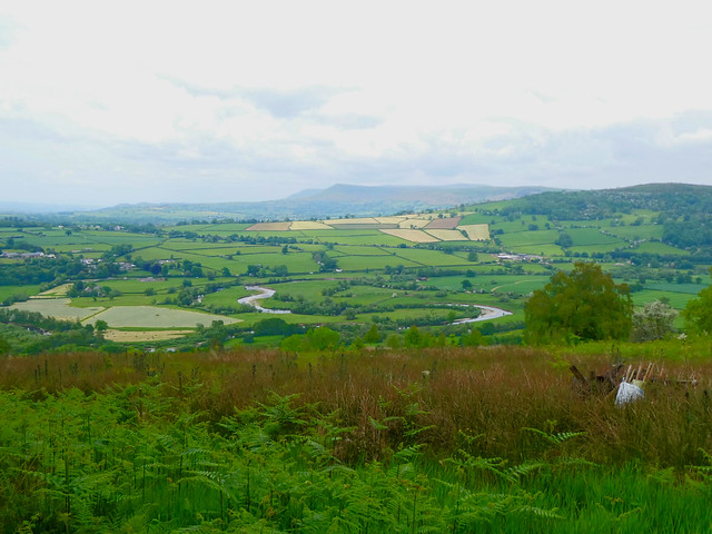
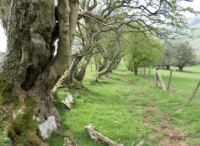
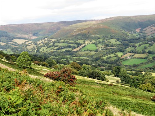
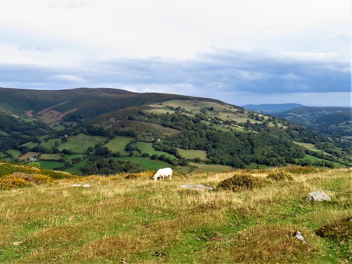
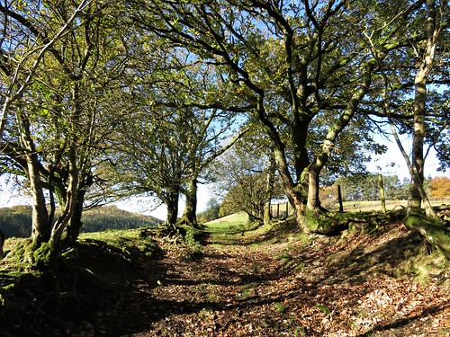
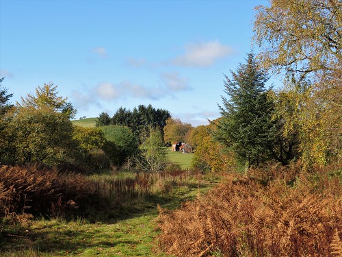
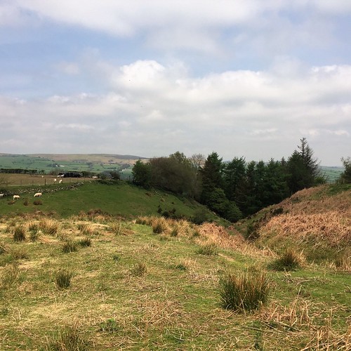
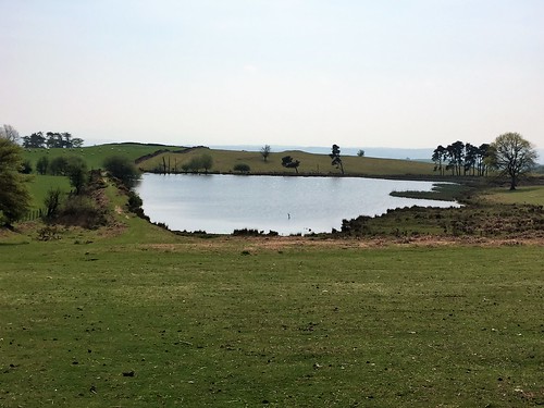
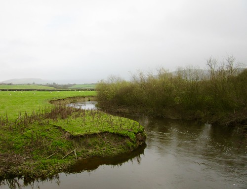
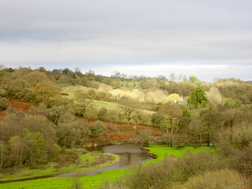
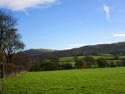
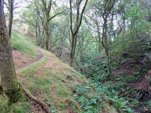
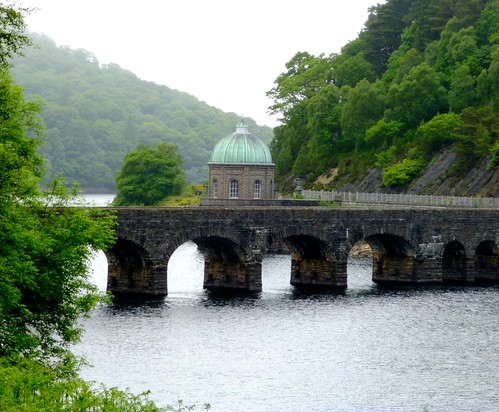
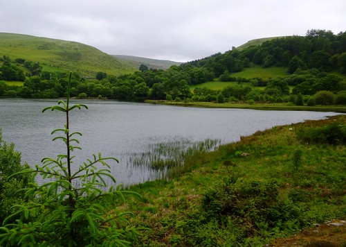
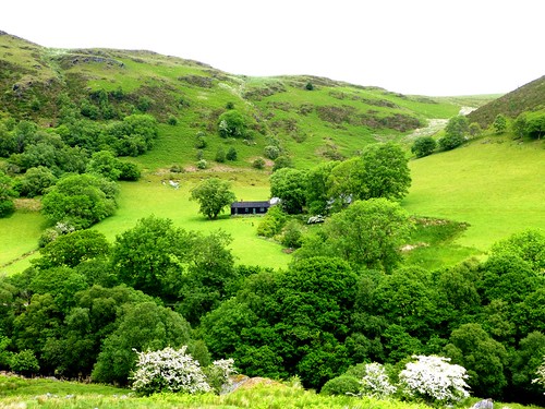
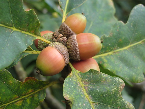
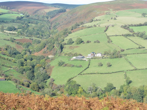
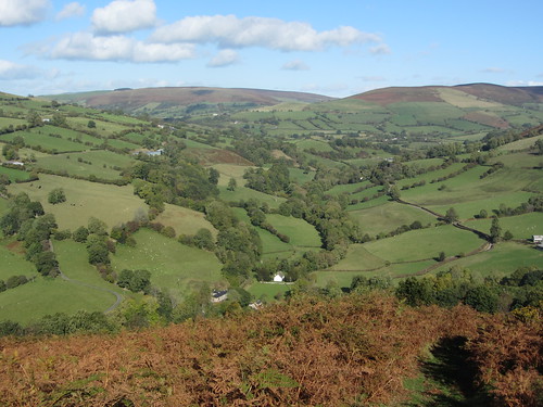
With views like these, who would ever want to take the downward path? Eventually we did, scooting down across a long grass upland towards the oakwoods of Allt Feigan, where cuckoos were calling. A shady track beside a mossy wall; then a long descent on a dusty red cart road under enormous, bulbous old oaks, looking out across newly mown meadows where the River Usk glinted and curved in extravagant bends like a monster eel caught in a trap.

How hard is it? 6 miles; moderate hill walk; some upland paths faintly marked on ground. Avoid in mist.

Start: Pencelli, near Talybont-on-Usk LD3 7LX (OS ref SO 092250)

Getting there: Signed from Talybont-on-Usk (A40, Crickhowell-Brecon). At entrance to village, left (‘Plas Pencelli’) to parking place by canal bridge.

Walk (OS Explorer OL12): Up lane opposite (‘Llanfeigan Church’). In ½ mile at parking place, fork right for church (087245), left to continue walk. Right at Ty’r Eglwys; steps down to footbridge (086245); up under trees, then across 2 fields (yellow arrows/YAs) to road (083246). Left; in 300m, right up green lane (081244, YAs, yellow-topped post). In ½ mile, where ground levels off (074238 approx), fork left off stony path onto grassy one. Continue climb on clear path for ¾ miles till ground levels again at top of climb (070227 approx). Left over open ground to summit cairn of Pen y Bryn (073227). From here descend ENE for 1½ miles on clear path across open grassland, at first aiming for left edge of forestry, then for angle where coniferous and broadleaved woodlands meet. Left here over stile (094237); follow track beside wall. In 500m fork left downhill (099237), following Usk Valley Walk back to Pencelli.

Lunch: Royal Oak, Pencelli (01874-665396, theroyaloakpencelli.com)

Accommodation: Peterstone Court, Llanhamlach, Brecon LD3 7YB (01874-665387, peterstone-court.com) – comfortable, friendly stopover

Info: visitwales.com

 Posted by at 02:43
Feb 262022


First published in: The Times Click here to view a map for this walk in a new window
Clywedog Reservoir from the hillside path 1 Brintail lead mine ruins, with Clywedog dam in distance Clywedog Reservoir from the Scenic Trail 1 Llyn Clywedog dam Clywedog Reservoir from the Scenic Trail 2 Brintail lead mine ruins, with Clywedog dam in distance 2 Clywedog Reservoir from the hillside path 2 Clywedog Reservoir from the hillside path 3

Forty years had passed since last I looked on Llyn Clywedog’s great dam wall. My father had figured in the sketch I made in my notebook that day, a slim 60-year-old in a checked shirt and walking boots, contemplating the enormous concrete structure that seemed to bulge outward as it towered above him.

Nothing much had changed since then, though the dam, like me, had got older and greyer. Seen from the close-grouped ruins of Brintail lead mine at the foot, I could see the ominous bulge was an optical illusion that made the buttressing ribs appear to converge nearly 300 feet overhead. Just as well, since this massive barrier is all that prevents 11,000 million gallons of water roaring down to Llanidloes and the River Severn.

I wandered round the shattered old structures of the lead mine – ore processing mills, crushing houses, square tanks and a deep stone-lined slot where a waterwheel once revolved. By the time the Brintail mine closed in 1884 the miners had worked four seams, each one deeper than the last – sweaty, hard and dangerous labour.

Up the winding road at the dam viewing wall a couple of hundred school children craned over and exclaimed. It was a splendid view, for sure, the dark water snaking between tall green hills and the arc of the dam curved below.

Glyndŵr’s Way led up a hillside of bracken to where a signpost to the Scenic Trail caught my eye. ‘So there you are,’ said a man with a lurcher. ‘You can get along here easy, and it’s a nice view across the water to enjoy. Well, I never tire of it, anyway.’

I followed the path along a hillside, then through a crest of tattered larches and along the narrow nape of a wooded promontory, its brackeny flanks falling sharply to the lake on either side. Out at the point the water lapped in shallow wavelets on a tiny beach of fine grey shingle that looked across to a crumpled spine of hills.

The return path ran along the north shore of the promontory through larch groves where the trunks were sheathed in moss and crusty grey lichens, with globules of sap glinting among their roots. A paddleboarder came by, absorbed in conversation with his partner and dog in a kayak alongside. I let them drift ahead, content to hear their splashes and banter fade slowly out to silence.

How hard is it? 5 miles; easy; hill and lakeside paths

Start: Brintail Mine car park, Llyn Clywedog, Llanidloes SY18 6NU (OS ref SN 914867)

Getting there: Llyn Clywedog and Brintail Mine are signed off B4818 near Llanidloes (A470, Newton-Llangurig)

Walk (OS Explorer 199): From Brintail Mine car park, follow Glyndŵr’s Way/GW downhill, cross river to Brintail Mine (914869). Return to car park; up road, and follow GW for ⅔ mile up zigzag road to café and viewing wall (911869). In another 300m GW forks right on left bend (909871); follow it uphill to cattle grid (907871). Right (kissing gate/KG, ‘Scenic Trail Alternative Start Point’), following hill path. At end of larch grove on crest, left downhill (909876); path along promontory spine to far point (916882). Return along north shore. In ⅔ mile at fingerpost and kissing gate fork right (907878, ‘Long Trail’) along lake shore. In 600m turn left up steps (901875, GW). Follow GW up bank to road at Ty Capel (904872). Left to cattle grid (907871); retrace GW route to car park.

Lunch/Accommodation: Unicorn Hotel, Long Bridge Street, Llanidloes SY18 6EE
(01686-411188, unicornllanidloes.co.uk)

Info: llanidloes.com, visitwales.com
@somerville_c

 Posted by at 01:25
Apr 102021


First published in: The Times Click here to view a map for this walk in a new window
picture picture picture picture picture picture picture picture picture picture picture
Facebook Link:

For years we’d been saying to ourselves: ‘Must walk the Dragon’s Back!’ Now the day had come, a cold and misty one down at Pengenffordd. But we could feel a warmer morning waiting in ambush behind the clouds that wreathed the western outliers of the Black Mountains.

The knobbled ridge of the Dragon’s Back rises quite abruptly from the banks of the Rhiangoll stream. We climbed steeply through sheep pastures where fat lambs ran crying to their anxiously bleating mothers. Celandines spattered the grass, ten thousand miniature suns glittering in the steamy light.

Up on the roughly mounded ramparts of Castell Dinas, it was easy to see why Norman invaders chose this ancient hill fort for their stone stronghold. The castle commands the valley, the road from south to north, and the looming heights of Mynydd Troed beyond.

The dominant aspect of its position proved deceptive however; Castell Dinas was besieged, captured, yielded and recaptured over the course of three hundred years of border strife, till Owain Glyndŵr destroyed it and vanished into the mists of mythology.

We passed the dimpled hollow of the castle well, and went down to a saddle of ground below. Families out for a hike were climbing the steep spine of the Dragon’s Back, their children gambolling ahead like spring lambs. It was a good old puff up to the stone shelter at the summit, and once up there the prospect into the wildest quarter of the Black Mountains took our breath away all over again.

From the pass beyond, a green track sloped away into a silent valley hemmed in by mountain slopes, a secret little corner of these hills. Iridescent oil beetles were excavating egg-laying nests in the loose pink soil of the path. Cuckoo flowers had opened among the boggy sedges where the first leaves of spearmint yielded their distinctive chewing gum scent to our pinching fingers.

Down at Rhyd-y-car the householder was digging over her raised beds. ‘Beans and onions, a row of potatoes and some nice beetroot,’ she told us. ‘I’ve lived here more than sixty years now,’ and she smiled as though every spring had been a particular gem.
Start: Car park near Dragon’s Back Inn, Pengenffordd, nr Talgarth LD3 0EP (OS ref SO 174297) – £2 honesty box.

Getting there: Dragon’s Back Inn is on A479, Crickhowell-Talgarth.

Walk (4½ miles, strenuous, OS Explorer OL13): Go down steps beside the map board; turn right along path; in 40m, left up steps (yellow arrow/YA). Down the slope to cross the brook; steeply up 3 fields to Castell Dinas fort (179300). Down the north side to gate (180303); ahead up a clear hill path to the summit shelter (185306). On down to Bwlch Bach a’r Grib saddle (187308). Bear half right down a grassy track past trees; on for ⅔ mile to reach a sheep dip (196304). Where the wall turns sharp right, go right across the stream. Follow path to a gate; left up the wall to turn the corner (196302); follow the wall to the right. In 300m, right through a gate (193301); follow green lane to Rhyd-y-car (187300). Ahead along the road; in 500m, right on track (187295, gate). In 50m, bear left, keeping the hedge on your left (yellow arrows) for 500m to the road at Cwmfforest (182291). Turn right up the road; in 250m at left bend (180291), keep ahead on a dirt road for ½ to car park.

Info: Crickhowell TIC (01873-811970)
satmap.com; ramblers.org.uk
More walks info: @somerville_c

 Posted by at 03:36
Feb 162019


First published in: The Times Click here to view a map for this walk in a new window

picture picture picture picture picture picture picture picture picture picture

Facebook Link:

Everyone who comes to Crickhowell for the Walking Festival in March looks out for Table Mountain, the slanted, flat-topped outcrop of old red sandstone that rises some 1,200 feet above the little Welsh Border town.

Distinctive though its shape is, you scarcely notice the hill when you’re down in the streets of Crickhowell. The outer edge of the Black Mountains looms beyond, far higher and grander than modest Table Mountain. But it’s Crickhowell’s guardian hill that everyone must climb, willy-nilly, a tasty starter for the mountain delights in the distance.

Proud householders have landscaped the lower banks of the Cumbeth Brook. We climbed the northward field path beside the wooded dingle whose stream came rushing down over smooth sandstone boulders. A stumbly stretch over the streambed led up to a stone-walled sheepfold where we sat on a fallen bough to absorb the view.

From up here we looked back south over the grey huddle of Crickhowell, across the sunlit valley pastures of the River Usk to high rocky ledges and the dun-coloured moorland of Mynydd Llangatwg rolling away. To the east Table Mountain, hidden by trees until now, poked its flat head into the sky. It looked noble, a proper slab of mountain, with what appeared to be a stout white horse cropping its summit. But perspective plays funny tricks. Once we had climbed up there, the great upthrust resolved itself into a homely little wedge of rock, the grazing stallion into a fat white sheep.

Table Mountain’s Welsh title is Crug Hywel, ‘Hywel’s Fort’. Was it Hywel the Good, King of all Wales, who kept a stronghold here in the 10th century, or a more local King, Hywel ap Rhys of Morgannwg? No-one’s sure – and anyway, the double rampart, the rock-dug ditch and tumbled stone gateway that fortify the knoll were made a thousand years before either Hywel reigned here.

We walked a circuit of the Iron Age fort, spying out the land – the cone of the Sugarloaf in the east, the twin gables of Pen-y-Fan and Corn Du forming the roof of the Brecon Beacons away west, and the Black Mountains rearing back and away to the north.

A memorable prospect – one to savour before dropping back down to Crickhowell and a cup of tea.

Start: Crickhowell car park, Beaufort Street, Crickhowell NP8 1AE (OS ref SO 219184)

Getting there: Bus X43, Abergavenny-Brecon
Road – Crickhowell is on A40 (Abergavenny-Brecon), 6 miles west of Abergavenny.

Walk (5 miles, moderate, OS Explorer OL13): On Beaufort Street (A40), right past TIC and Bear Hotel. Just past garage, right up Llanbedr Road (218186). In 350m, left along Oakfield Drive (220188). In 350m, Oakfield Drive bears left; follow it for 150m; right up alley by No 56 (216191). Cross 2 roads; at double gate, left/right (217192, stile, ‘Beacons Way’/BW). Follow BW north up field edges with Cwm Cumbeth on left for 1¼ miles (stiles, BW) to stone walled sheepfold at top (218209). Right along wall for ¾ mile to climb to Table Mountain summit (225208). At 2nd of 2 cairns, descend through stones of fort gateway (226207); path left, then downhill for 150m; then right (clockwise) on grass path round lower slopes of mountain. Yellow arrows/YA, stiles, field path south for ¾ mile. Just before gate across path just east of The Wern farm, right through another gate (225196) to The Wern (223196); left down farm drive to road (223193). Right downhill; in 250m, right (222191) down Llanbedr Road to A40 and car park.

Conditions: Many stiles, some rubbly paths underfoot.

Lunch: The Bear, Crickhowell (01873-810408, bearhotel.co.uk)

Accommodation: Glan y Dwr, Llanbedr Rd, Crickhowell NP18 1BT (01873-812512, crickhowellbandb.co.uk) – immaculate B&B.

Info: Crickhowell Resource & Information Centre (01873-811970, visitcrickhowell.co.uk)

Crickhowell Walking Festival: 9-17 March 2019 (crickhowellfestival.com)

ramblers.org.uk; satmap.com

 Posted by at 01:46
Dec 082018


First published in: The Times Click here to view a map for this walk in a new window
picture picture picture picture picture picture picture picture picture picture picture
Facebook Link:

A winter day in a million. A gentle breeze out of a cloudless blue sky over mid-Wales, with the sheep pastures along the valley of Cwmannell sparkling in the sunlight as they sweated off last night’s sharp frost.

We followed the farm road from Beulah to the horse paddocks around Hafod-y-garreg, then a slippery hill path that descended through golden oaks to a water-splash pond below Erw-felin. Here a solemn tribe of shaggy-legged horses came to sniff at our hands. No biscuits, lads, sorry!

Up beyond Bwlchmawr the hills grew lumpy, their flanks patched with bracken glowing rusty red in the sun. A network of old green tracks crisscrosses these valleys, and we followed one that dipped in and out of the dingles of Nant Cwm-du and Nant Einon. A cottage stood in roofless solitude above the Einon stream, where a flock of grey-headed fieldfares flew off with sharp grating calls.

The three faces of Mynydd Epynt stared back at us on the southern skyline as we stopped for a breather at the crest above Bron-rhydd. Then it was steeply down to cross the Nant yr Annell stream, and steeply up to meet a broad ridge track. It led us west to a high pass and a sensational view from the nubby heights of Cribyn Bedw.

A seat on a prominent rock, and a good long stare round the wide bowl of hills that encircled the well-wooded farmland down along the Annell and away up the curved valley of the Afon Cammarch. Mynydd Epynt looked massive and solid from here, a crouching beast of a hill.

Far below lay a side valley that might have been modelled by Disney, so perfect were the proportions of its fields, hedges, farm, chapel and forested slopes. Yellowing larches stood up like rockets among the dark conifers, and the guns of invisible shooters went pop-pop-pop as a line of beaters drove pheasants out of cover.

At last we rose and started back down the broad green track to Beulah. Rams stood at the fences, nose-to-nose with ewes in adjacent pastures, and the winter sun poured down like cold honey over woods and fields.

Start: Trout Inn, Beulah, near Llanwrtyd Wells LD5 4UU (OS ref SN 920513)

Getting there: Bus 48 (Builth Wells – Llanwrtyd Wells)
Road: Beulah is on A483 between Builth Wells and Llanwrtyd Wells. Trout Inn car park is behind garage – please ask landlord’s permission!

Walk (6½ miles, moderate hill walk, some short overgrown stretches, OS Explorers 187, 188): Right along A483, in 100m, right (‘Abergwesyn’). In 300m, left (917515) on bridleway road past Aberannell and on for ¾ mile to Hafod-y-Garreg (905513). Pass sheds on left; in 150m, at entrance to Bron-rhudd drive, left down track. In 150m, right (905512, gate/stile) across field to stile (903511); ahead, parallel with Nant Einon stream on left. In 400m, fork left, descending to ford stream (900512, stile).

Up brambly bank opposite; up field to gate; up next field to gate into Erw-felin stableyard (899510). Ahead up lane for 700m to road (898504). Right to Bwlchmawr farm (893508); fork right between house and barns up green lane. In 400m at waymark post, right to cross Nant Cwm-du (889510); through gate; track past cottage (blue arrow), descending to cross Nant Einon by decorative bridge (891513). Right up fence to second gate (892513); right along grass track with fence on right for ½ mile, rising to summit (901515).

Same direction through 2 gates; track bears left (902516), descending to cross Nant yr Annell (899513), then bearing right and rising to gate (903519). Ahead for 50m to ridge track; left for ¾ mile to summit of Cribyn Bedw (891523) for sensational views. Return down track and on for 1½ miles to lane at Aberannell (915515); left to road; right to A483; left to Trout Inn.

Lunch: Trout Inn, Beulah (01591-620235, thetroutinn.net).

Accommodation: Lake Country House, Llangammarch Wells LD4 4BS (01591-620202, lakecountryhouse.co.uk) – friendly, comfortable former fishing lodge.

Info: Builth Wells TIC (01982-563307), visitwales.com; satmap.com; ramblers.org.uk

 Posted by at 01:30
Jun 242017


First published in: The Times Click here to view a map for this walk in a new window
picture picture picture picture picture picture picture picture picture picture picture picture picture
Facebook Link:

There are parts of the Welsh Borders that are neither rugged mountains nor agricultural lowlands, but rather semi-wild uplands where sheep and cattle roam freely and a walker can step out along grassy pathways in every direction. The Begwns are a fine example, a rolling ridge of common land north-west of Hay-on-Wye that separates the Brecon Beacons from the hills of southern Radnorshire.

The National Trust owns the Begwns, and keeps the common beautifully grazed, mown and open of access. We set out west from the hill road south of Painscastle on a midday of brisk wind and hazy blue sky. A woman strode another path parallel with ours, her dark hair blowing out behind her, three dogs scampering around her heels.

Yellow tormentil flowers dotted the slopes. Bees bumbled among the dandelions in a nectarous daze. Our inland track became a pot-holed lane where foxgloves grew among the stone slabs of the walls. We passed the tumbledown farm of Bailey-bedw, the house roof in holes, an elder bush rising from the chimney pot like a puff of green smoke.

Beyond Bailey-bedw, sheep were gobbling turnips in a field beside the track. I watched a ewe make her selection, scrape it open with her incisors, then slide it with an upward jerk of the head to the back of her mouth where she crushed it between her strong yellow molars.

The track swung up and over a shoulder of hill, then bent back on itself to climb to The Roundabout. This conifer plantation perches at the brow of the Begwns inside a circular wall, commanding a really spectacular view. We gazed our full, south to the tumbled heights of the Brecon Beacons and the ship’s prow of Hay Bluff as pale as a lead cut-out in the haze, north across the Painscastle valley to where the green patchwork of pastures rose into dun brown moorland.

A grass track took us down from The Roundabout to Monks’ Pond, flat on its saddle of ground in a golden collar of flowering gorse. The margins of the water were spattered with white blooms of water crowfoot. We walked a circuit of the wind-ruffled lakelet, and headed back home over the grassy shoulders of the Begwns.

Start: Parking bay at cattle grid, Croesfeilliog near Painscastle, Powys, HR3 5JH approx. (OS ref SO 182445)

Getting there: On hill road to Hay-on-Wye, 1 and three quarter miles south-east of Painscastle. Park opposite National Trust ‘Begwns’ sign.

Walk (5½ miles, easy, OS Explorer 188):
Cross road; follow track west along lower, right-hand edge of Access Land with fence on right. In ¼ of a mile cross stony track (177444). Two green tracks diverge here; take left one to ridge (175444). Right here (west) along rutted track, soon becoming tarmac lane. In ¾ of a mile cross road (163447); in ½ a mile, pass track to ‘Top of Lane’ (156448). In 100m fork left onto grassy path, which bends left over shoulder west of The Roundabout. In 600m, at large pond on right, turn left (149443) uphill to Roundabout (155444). From gate, head along spine of Begwns, bearing right across road (161440) to Monks Pond. From north-east corner (166438), head for angle of wall; north, then east on track with fence, then wall on right. In ½ a mile join farm track at Bird’s Nest ruin (176440); ahead to road (183442); left to car.

Lunch: Picnic at The Roundabout

Accommodation: Baskerville Arms, Clyro, Hay-on-Wye HR3 5RZ (01497-820670, baskervillearms.co.uk)

visitwales.co.uk; satmap.com, ramblers.org.uk

The January Man – A Year of Walking Britain by Christopher Somerville (Doubleday, £14.99).

 Posted by at 02:24
Jan 302016


First published in: The Times Click here to view a map for this walk in a new window
picture picture picture picture picture picture picture picture picture picture picture picture
Facebook Link:

The last of the morning’s bright sun shone on Cefnllys’s little grey Church of St Michael on its saddle of ground above the River Ithon. In 1893 the Rector had been so keen to lure the congregation of this scattered rural parish to his new church in nearby Llandrindod Wells that he ordered the roof of St Michael’s taken off. Two years later, defeated by the stubborn loyalty of the parishioners to their medieval chapel, he had the church restored and re-opened for worship.

They build to last in this part of Wales. Solid old farmhouses stood above the snaking Ithon as we walked a bank of ruddy brown bracken high above. But the twin castles that once crowned the peaks of Cefnllys are no more than heaps of stones now. In their 150-year history they were besieged, taken, retaken and burned out – part of the savage history of Welsh rebellion against the English overlords.

In the field beyond Neuadd farm two black-and-white horses with feathery legs stood outlined like gods on the ridge. We followed a bridleway down to a bend of the fast-flowing Ithon, where a treeful of fieldfares swooped from oak to ash in the blink of an eye. A gang of chattering starlings went whooshing across the rooftops of Brynthomas farm, chased by the first spits of rain out of the sullen western sky.

These tangled lanes of Radnorshire are quiet enough to walk with pleasure. A farmer in a mud-splattered Land Rover chuntered by, raising one large hand in laconic greeting. At Rhewl we found a boggy old green lane, and squelched along it through rushy fields and the tumbled stones of long-dissolved farmhouses.

As the wind and rain pattered on our coats we took to an old drove road running across the open green uplands of Pawl-hir. Lumpy hills rose and fell along the horizons all round, every hillside with its loose white scatter of sheep. The Ithon reappeared, bouncing in glittering runs of water through the oakwoods below our homeward path, and a rainbow planted its foot in a pot of gold somewhere beyond Cefnllys.

Start: Shaky Bridge car park, Cefnllys Lane, 2 miles east of Llandrindod Wells, Powys, LD1 5SR approx. (OS ref SO 085612)

Getting there: Cefnllys Lane is off A483 roundabout at the southern end of Llandrindod Wells, marked ‘County Hall’. Follow it east for 2 miles to Shaky Bridge car park.

Walk (8 miles, moderate, OS Explorer 200): From car park, cross Shaky Bridge; uphill to church (085615). From east side of churchyard, aim across field to go through gate; left along green track. At Neuadd, left through gate (090618, yellow arrow/YA), skirting house to road. Left; in ¾ mile, opposite Cwm, right (099626, ‘bridleway’) through right-hand of 2 gates. Follow hedge on left; then down long field to River Ithon (105622); left along it to road (106622).

Right past Brynthomas (107620); in 250m, right (‘Hundred House’). In ½ mile, just past barn at Rhewl (113612), right through gate; past farmyard on right; on along green lane. In 200m fork left on green lane, continuing with overhanging trees on right. Through metal gate and on. 600m from Rhewl, pass through ruins of Trawsty (108609). Cross stream, and head a little left, keeping above and to left of house, to cross wooden fence/hedge, then field to gate into road (104608) at Upper Cwmbrith.

Left up road past Trawsty-bach (104607); on up bridleway (blue arrows/BA). In ¼ mile near Careg-grog, fork left through gate (104603, BA) along track. In another quarter of a mile, track bends left; but keep ahead on bridleway through gate (106599), descending slope with gully on right. In 500m you reach foot of slope, with scrub trees on right and patch of tussocky bog ahead. If bog is wet, bear left to join farm track and follow it to road, turning right for 400m to reach entrance to Bwlch-llwyn’s drive (113597) where bridleway meets road. If bog is dry, descend to cross deep, narrow ditch, then bog patch, aiming for conifer clump. Cross fence on far side of bog, then field, to reach road by conifer clump at entrance to Bwlch-llwyn’s drive (113597). Right along road; in 300m, on sharp left bend, keep ahead (111596, ‘Byway’). Follow byway west for 2 miles. Pass Pen-rhiw Frank (084600); descend slope; on left bend just before road, right through gate (082603, YA). Follow green lane with hedge on left, then in woods, north for ⅔ mile to Shaky Bridge.

Conditions: Field paths muddy; can be very wet. Wear hill-walking gear.

Lunch: Picnic

Accommodation: Metropole Hotel, Llandrindod Wells LD1 5DY (01597-823700, metropole.co.uk). Comfortable, long-established spa hotel.

Info: Llandrindod Wells TIC (01597-822600)

visitwales.com; satmap.com; ramblers.org.uk

 Posted by at 01:37
Apr 252015


First published in: The Times Click here to view a map for this walk in a new window
picture picture picture picture picture picture picture picture picture picture picture picture picture picture picture
Facebook Link:
They were setting up market stalls around the handsome half-timbered Tudor market hall in the centre of Llanidloes. We stopped in Long Bridge Street to buy Welsh cakes in Talerddig Bakery (‘Oh, our cakes are sturdy enough to withstand the rigours of a rucksack!’) and some Black Bomber cheese from Darren Tonks’s fine food emporium. Llanidloes is that sort of town – long-settled, neat, well-provisioned and a little bit rarified in flavour, with the River Severn on its doorstep and the mid-Wales hills cradling it in isolation.

Up in Allt Goch Wood, dream-catchers of twigs and feathers turned in the wind, suspended in the framework of an ash-bough bender. Wooden shelters and a stout earth closet hinted at alternative lifestyles being enacted among the trees. Beyond the woods the bathing goddess symbol of the Severn Way beckoned us east along old-fashioned country lanes floored with shaly rock and grass.

This is sheep-farming country. At Cefnmawr a flock of black-faced ewes jostled round the farmer, anxiously eyeing the feed sacks on his trailer. The views were opening out, steeply down into the Severn Valley 500 feet below where Llanidloes lay tucked into the foot of the wooded slopes of Allt Goch.

A long lane led us down across the Severn to the Newtown road, where bearded bikers drank great mugs of tea outside the Riverside Café. We took the lane running steeply up the hill towards Newchapel, before turning off up a green lane that rose steadily into the open country around the humped hill of Moelfre. A moment in the cold wind to stand and admire the prospect across lumpy fields, woods, farms and the white church at Newchapel, before turning west along the upland trail of Glyndŵr’s Way.

Under a big old silver birch we sat to enjoy our Welsh cakes and Black Bomber. Then we found the twisty lane down to Llanidloes, with a pair of red kites wheeling and mewing above us among the low grey clouds.
Start: Llanidloes town centre, Powys SY18 6HU approx. (OS ref SN954845).

Getting there: Bus service X75, Shrewsbury-Rhayader
Road – Llanidloes is on A470 (Rhayader-Newtown)

Walk (11 miles, moderate, OS Explorer 214): From Market Hall down Long Bridge Street. At bottom, left across River Severn. Left up Westgate Street (955849, Glyndŵr’s Way/GW). Just past Tan-yr-Allt, right (953849; GW, ‘Severn Way/SW’) up through trees. In ½ mile, beside organic toilet on right (100m beyond junction of tracks), fork left (956856, GW, SW). Follow GW/SW through and out of woods; left along golf course edge to clubhouse (954859). Right (GW) down drive; in 100m left (GW, SW) along stony lane. In 250m GW turns left (955863), but continue along SW (‘goddess’ waymark symbol) to cross B4569 (962864).

On along lane. In ½ mile pass Cefnmawr (969867); right to road (972866); turn left. In 400m fork right (974867); in 300m, right (978868) down stony lane. Ahead along next field edge, over brow to gate in far left corner (980864). Ahead along left-hand hedge (not track by right-hand fence!), with bank steepening on right. Keep hedge on left and descend through gates for 600m to rough lane (982855), soon becoming surfaced. Left for ½ mile, passing Pentre, to road (988863). Right for 1 mile to A470 (997851).

Right past Riverside Café; in 100m, left (‘Newchapel’). In 600m fork right by house (997845); in 150m, by next house, fork left off road up green lane (996843). Down to cross stream (994840); bear left up track. Through gate (blue arrow/BA) to barns at Celyn (995839). Left to pass in front of them, then right (BA) up their left side. Through next gate and fork left (995837). Follow left hedge uphill. In 200m bear left through hedge and clockwise round field; left through gate (995834) and up open hillside. Aim half right for upper edge of bracken patch and follow it past thorn tree and on south to gate (994829, BA). Ahead into dip to meet GW (997825); right to cross stony driveway at Blaen-y-Cwm (992825). Follow GW down field, through hedge (989824); right (GW) to gate (GW); into dell, across footbridge (987824); over fields to Ashfield (985825).

Along lane to road (985831). Right; in 400m, left at Newchapel (987834), passing side lane and chapel on right. In 450m, left (983836, GW) down drive to gate in front of large shed (GW). Down field to stile (GW); steeply down through wood to cross Nant y Bradnant stream (982836). Up (GW) along woodland track for 400m to gate (978838). Half left across field to road (978838). Right (GW) for 1½ miles into Llanidloes.

Lunch: Riverside Café, Dolwen layby on A470, SY18 6LL

Accommodation: Lloyds Hotel, Llanidloes, SY18 6BX (01686-412284, lloydshotel.co.uk) – welcoming and comfortable.

Information: Llandrindod Wells TIC (01597-822600)
satmap.com; ramblers.org.uk; LogMyTrip.co.uk

 Posted by at 02:18
Jan 182014
 

When Queen Elizabeth II came to the Elan Valley in October 1952 to open the brand-new Claerwen Dam, she was a young woman of 26, only eight months into her reign. First published in: The Times Click here to view a map for this walk in a new window
picture picture picture picture picture picture picture picture picture picture picture picture picture picture picture picture picture picture picture picture picture picture
Facebook Link:
The enormous Claerwen Reservoir completed a hand of five here in the hilly heart of Wales – the others had been built when Elizabeth’s great-great-grandmother was still on the throne. Today the five resemble natural lakes. It seems as though they must always have been here, snaking their way gracefully at the feet of the hills.

Thick mist was settling in along the hilltops as we splashed across a succession of silvery cascades and took the stony hill track from Claerwen Reservoir up to the shallow pass at Cefn Llanerchi. The cool air gently stirred sedges and dried thistle heads. A stonechat with bold white eye-stripes and peach-pink throat perched at the uppermost point of a sprig of gorse and cried, ‘Wheesh-tsk-tsk!’ Moorland rills coursed down the wet peaty slopes in scribbles of silver.

Out in the squelchy grassland beyond the pass stood a stone row – two monoliths roughly shaped into slabs, two massive boulders alongside, and a standing stone five feet tall. Who thought it worthwhile to align them up here five or six thousand years ago, and why? There’s no knowing – but the view was beautiful, even under the mist, a keyhole glimpse of the screes, crags and high slopes cradling Garreg-ddu Reservoir.

Down through a sweet-smelling conifer plantation among rain-polished liverworts and mosses, with Caban-coch reservoir lying below, and then on along a bumpy and puddled old track beside the loudly rushing Afon Claerwen. Two red kites circled high over Rhiwnant Farm, where black cattle were enjoying their last graze of the year before the farmer put them under cover for the winter. A tough old ewe perched precariously on top of a stone wall, cropping whatever greenery she could find among the roots of a hazel hedge.

Big slugs crawled through the wet grass of the bog, making the most of the moist afternoon, their black bodies shining as though encased in PVC. Back at Claerwen Reservoir, we crossed the river and climbed up beside the great dark dam wall once more.

Start: Claerwen Dam upper car park, Elan Valley (OS ref SN 871636).

Getting there: Bus T57 (pre-book on 01597-810666), Rhayader to Elan Valley Visitor Centre
Road – A44/A470 to Rhayader; B4518 through Elan Village and on; in 1 mile, left across dam (‘Claerwen’); in 4 miles, fork right to upper car park.

Walk (9 miles, moderate, OS Explorer 200. NB: online map, more walks at christophersomerville.co.uk): Return down road. At fork, left. In 100m, left (877630, bridleway fingerpost); follow bridleway (occasional blue arrows/BA) up past masts (899636). Detour SE to stone row (905631); return to gate at corner of plantation (903635). Woodland track (occasional BA) descends for ⅓ mile to track crossing (908636). Right; follow track for 1½ miles, out of wood and down to road (904617). Right for 300m; left by phone box, over bridge. Right by barns (901615, bridleway fingerpost) along minor road. At Rhiwnant, right (895617, cycleway arrow) on stony lane. In 300m fork right and keep near river for 2 miles to Cerrigcwplau Farm by Claerwen Dam. Cross stream by footbridge (869633); cross river by road bridge. Though metal kissing gate opposite (870634); path up to upper car park.

Lunch: Picnic. Tea: Elan Valley Visitor Centre

Accommodation: Elan Valley Hotel, near Rhayader, LD6 5HN (01597-810448; elanvalleyhotel.co.uk) – very friendly; ace chef!

Information: Elan Valley Visitor Centre, LD6 5HP (01597-810898; elanvalley.org.uk) – ranger service, walks, etc.

www.ramblers.org.uk www.satmap.com www.LogMyTrip.co.uk visitwales.com

 Posted by at 09:00
Nov 172012
 

The Seven Stars sits next to one of the most appealing churches in Wales, dedicated to St Cewydd (a rainmaker, like St Swithun).First published in: The Times Click here to view a map for this walk in a new window
picture picture picture picture picture picture picture picture picture picture picture picture picture picture picture picture
Facebook Link:
Not so long ago the Seven Stars at Aberedw lay closed down, boarded up and despaired of by all and sundry. These days it’s a thriving little place – a testament to how a tiny mid-Wales community and a lively-minded landlord can rally round a moribund pub and breathe life into it once more.
The Seven Stars sits next to one of the most appealing churches in Wales, dedicated to St Cewydd (a rainmaker, like St Swithun). Inside, a glass case displays the two flutes of William Williams, church flautist in Victorian times – he’d also play for dancing, seated in the timber framed porch while the local swains and damsels footed it on the church green.
With such bucolic images as sauce for the day, we set off into a big blowy morning. Enormous clouds marched east across blue sky fields, with sunbursts at their trailing edges. A stony track beyond the River Edw took us up the tiers of a giant natural amphitheatre, a curved hillside of stepped cliffs facing north-west across the Edw’s valley. Here in the winter of 1282 Llywelyn ap Gruffydd, last true prince of Wales, spent his final night on earth in a dark slit of a cave among the hazels, a fugitive from the might and wrath of King Edward I. Next day Llywelyn was caught and killed, his severed head was paraded in London, and Welsh hopes of freedom were snuffed out with the prince evermore to be known as ‘Llywelyn the Last’.
We contoured the curved valley on a green grassy path, then climbed to the broad back of Llandeilo Hill, a sombre sea of dark heather beyond which the graceful peaks of the Brecon Beacons, Pen y Fan and Cribyn, rose pale and ghostly in the south, with the long prows of the Black Mountains low on the south-east horizon. Everything lay marinated in beautiful sunlight – hills, farms, the sloping green fields and fox brown hilltops overlooking the Edw. We passed the low stone cairn that marks the grave of Twm Tobacco – maybe a hanged felon, maybe a much-loved pedlar, depending on who’s relaying the tale – and went steeply down through the bracken with its sheep farms and ancient oak groves.. A muddy path along the Edw among incurious long-horned cattle, and we were heading up the road towards the Seven Stars in the last sunshine of the day.

Start: Seven Stars Inn, Aberedw, Builth Wells, LD2 3UW (OS ref SO 080474)
Travel: Aberedw is signed off A470 Talgarth-Builth Wells just beyond Erwood.
Walk: (7½ miles, moderate, OS Explorer 188. NB: detailed instructions – highly recommended! – online maps, more walks at christophersomerville.co.uk): From Seven Stars pub, right along road past church to cross River Edw (085471). In 50m, fork right up ‘No Through Road’ lane. In 100m, hairpin right up track, through gate and on up track. In ⅓ mile, pass a ruined farmhouse (085467). In another 100m track forks; bear left and follow the grassy stony track, ignoring side tracks. In 250m, track forks again (087465); go right, and follow this track anticlockwise round curve of hillside. In ⅓ mile go under power lines; in another 100m, turn right uphill on track (092464). At top of rise, ahead for 150m; then left along grassy bridleway (094462).
Follow edge of ridge for ⅔ mile; then veer east away from ridge (100472) to meet bridleway at Glannau Pool (104471). Left (blue arrow/BA); follow BAs for nearly ½ mile to Twm Tobacco’s Grave (109475); small cairn). Keep ahead (white arrow on green disc) for 250m; hairpin back to left (112476) along lower track. In ⅓ mile, just past triangular pond on right, bear right on path (106478) past pond and on downhill. Follow this path down through bracken for ⅓ mile to T-junction of tracks (108482). Left downhill to go through gate; follow right-hand side of field downhill and through gate to 3-way junction of tracks (108484). Left here, down through Pentwyn Farm to road (106487). Left for 1 mile. Pass white-painted Glan Dwr house on left; right here to cross river (094478). In 20m, left through gate; in 30m, left across stile (yellow arrow, fingerpost) and follow riverside path (very boggy!). In ⅔ mile where path forks (086473), keep left beside river across field to stile in onto road (085471). Right into Aberedw.

From Seven Stars, right along road – cross River Edw (085471). Fork right up lane; in 100m, right up farm track. In ⅓ mile, pass ruined farmhouse (085467). On up track; in 100m fork left; in 250m fork right (087465); follow track round hillside for ⅓ mile. Under power lines; in 100m, right (092464) uphill. At top, left along bridleway (094462). It follows ridge edge for ⅔ mile, then bends right to Glannau Pool (104471). Right (blue arrows); in ½ mile, pass Twm Tobacco’s Grave cairn (109475); in another 250m, hairpin back left (112476) on track. In ⅓ mile, right (106478) past pond; downhill for ⅓ mile to T- junction of tracks (108482). Left downhill through gates to 3-way track junction (108484); left down through Pentwyn Farm to road (106487). Left for 1 mile; right across river (094478). Left through gate; left across stile (yellow arrow, fingerpost); follow boggy riverside path for ¾ mile to road (085471). Right to Aberedw.
NB Conditions: riverside path is very boggy! Drier alternative between the two bridges is by road.
Lunch/accommodation: Seven Stars Inn, Aberedw, Builth Wells, LD2 3UW (01982-560494)
Info: Builth Wells TIC (01982-553307); visitwales.co.uk; tourism.powys.gov.uk
www.ramblers.org.uk www.satmap.com www.LogMyTrip.co.uk

 Posted by at 02:01