Search Results : shropshire

May 202023


First published in: The Times Click here to view a map for this walk in a new window
Coalport Bridge River Severn between Bridgnorth and Jackfield 1 River Severn between Bridgnorth and Jackfield 2 wild garlic in a sandstone cutting on Mercian Way old railway path Apley Hall 1 Linley Station, Severn Valley Railway, built for Thomas Whitmore of Apley Hall old mill building near Linley Station Molehills along River Severn between Bridgnorth and Jackfield 3 Severn Way between Bridgnorth and Jackfield

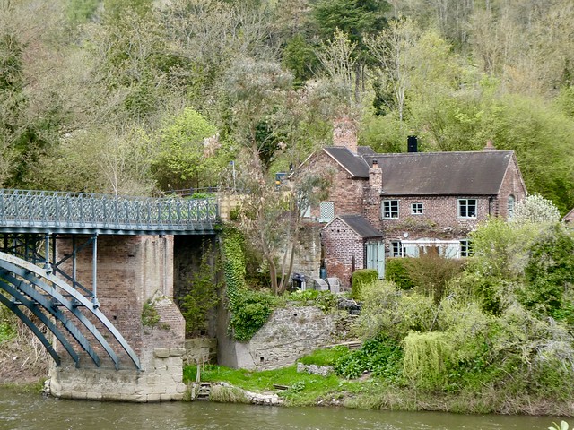
Bridgnorth hangs over the River Severn, crowned by a pinnacled church tower, its buildings piled one above another like an Italian hill town. But there the resemblance ends. These three-storey red brick river warehouses, gable-end advertisements for ancient seed merchants and beamy pubs belong to England alone.

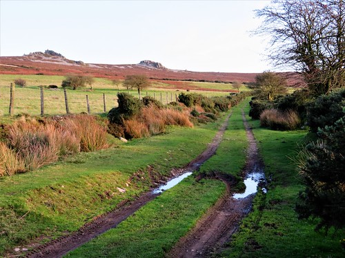
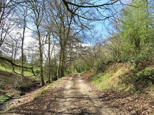
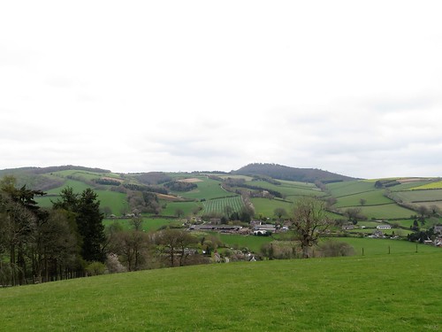
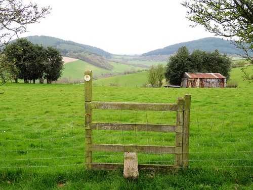
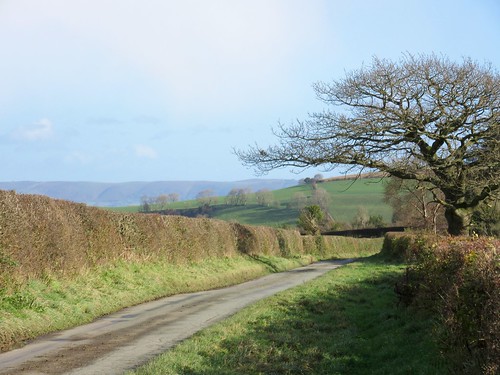
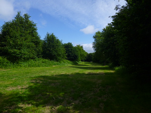
The old Shropshire river port is chock full of character. It was hard to tear ourselves away from the tangled hilly streets packed high with houses, but as the clock chimed midday we set out along the Severn Way footpath that clings closely to the west bank of the river.

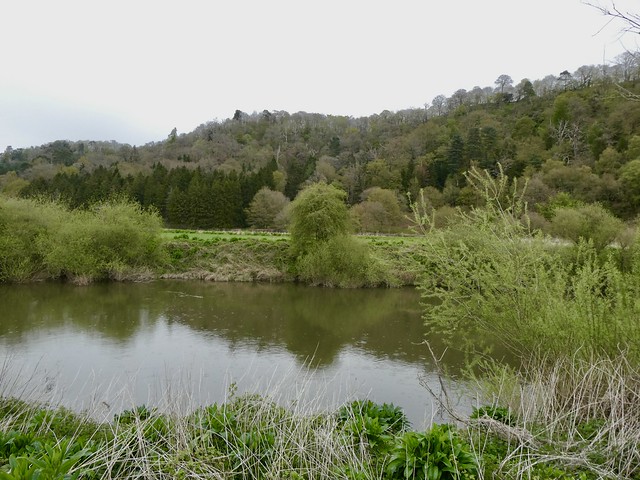
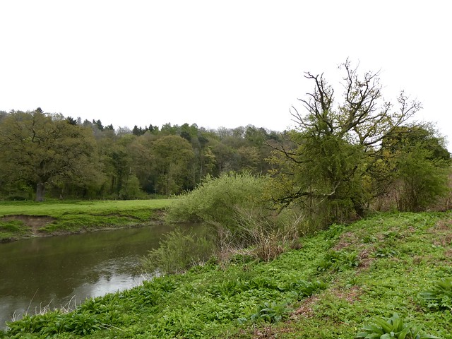
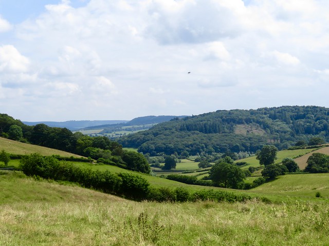
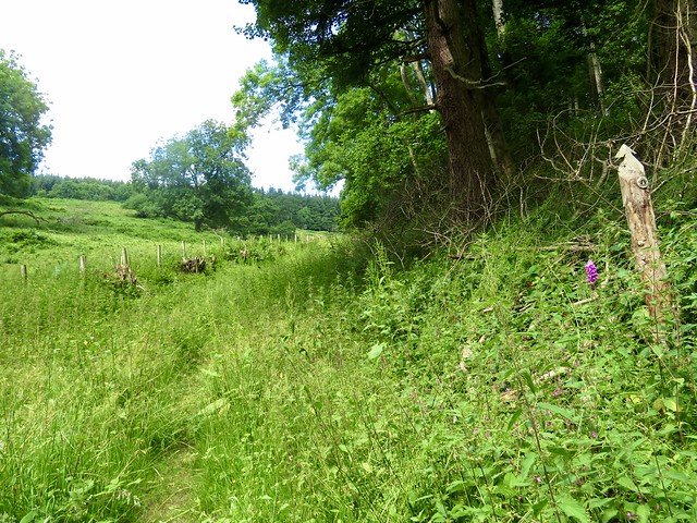
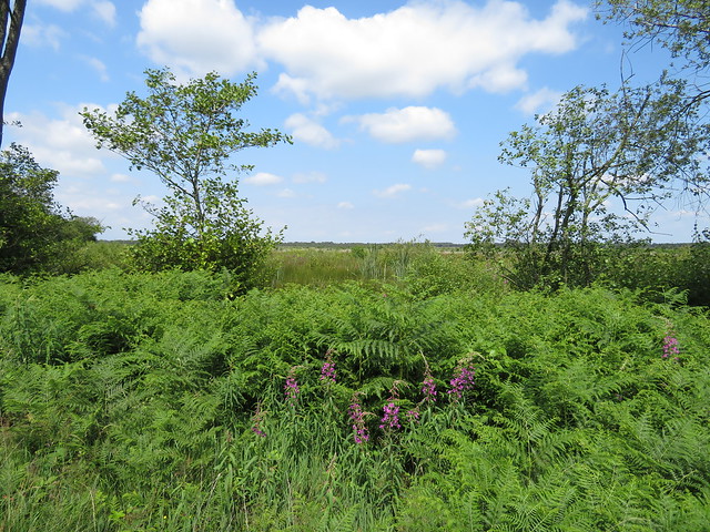
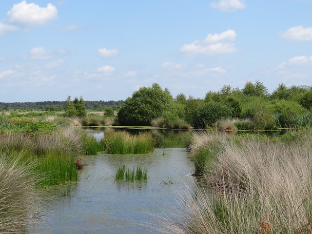
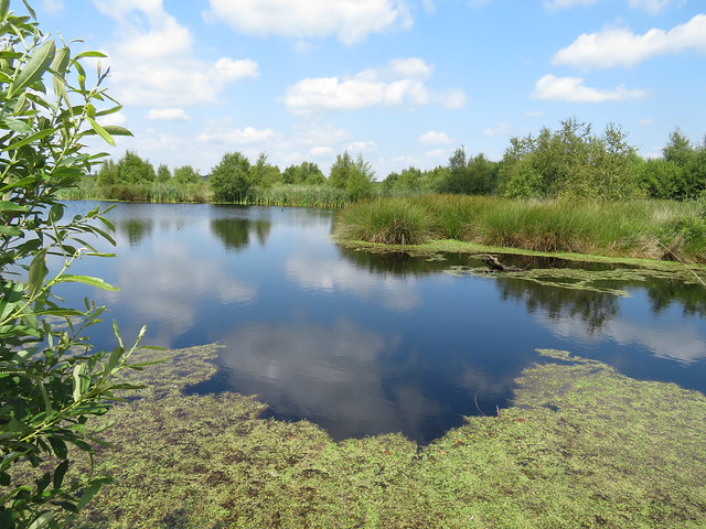
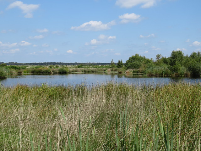
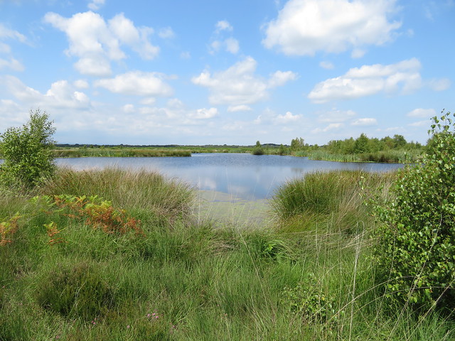
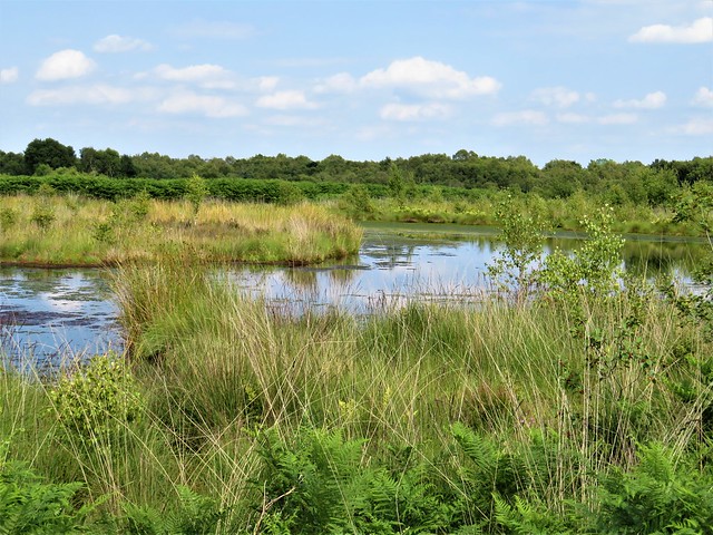
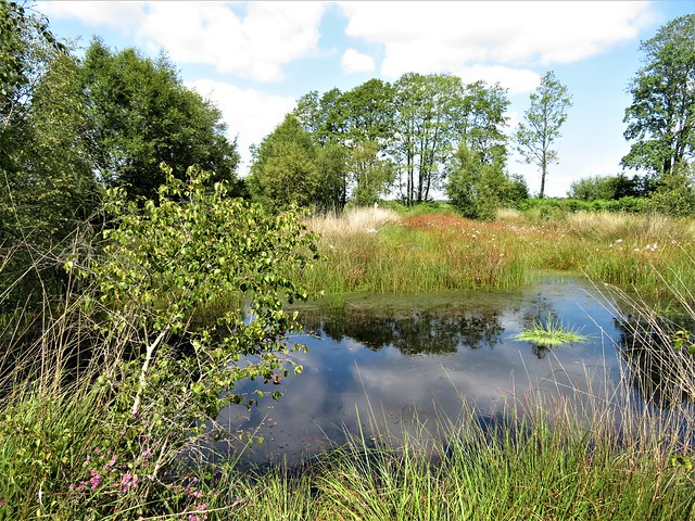
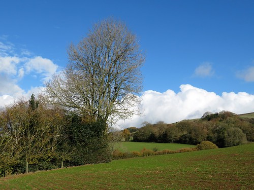
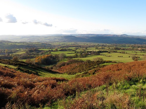
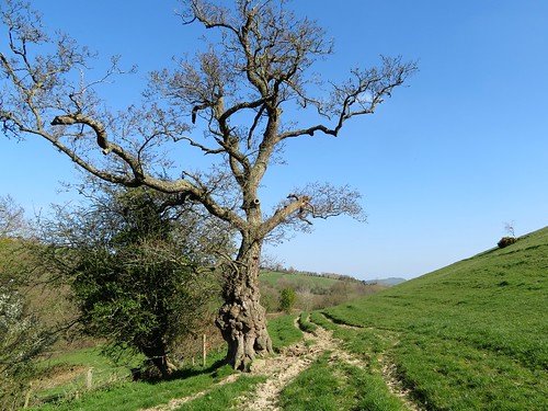
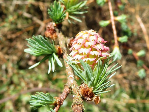
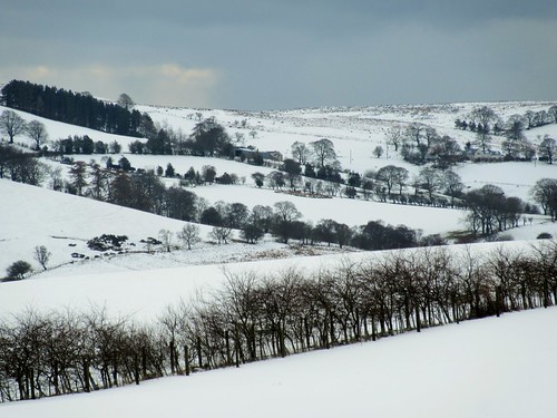
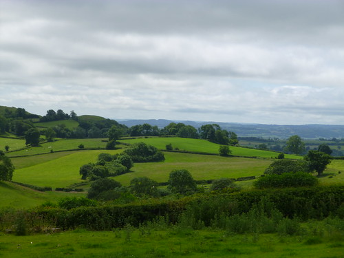
There was a strength and power to the Severn today, the water gleaming with a bronzy sheen and exuding that unmistakable riverine smell of muddy vegetation. Tender new green leaves poked out on weeping willows, and bushes of comfrey along the bank were hung with white and pink flower bells.

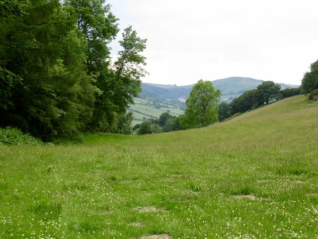
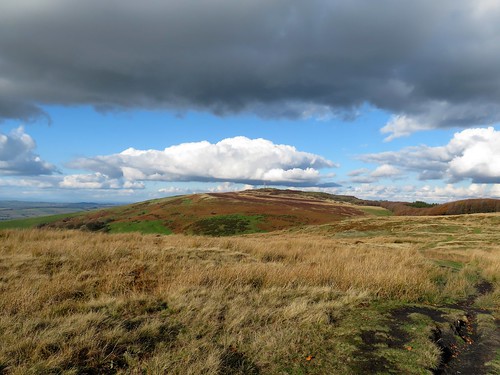
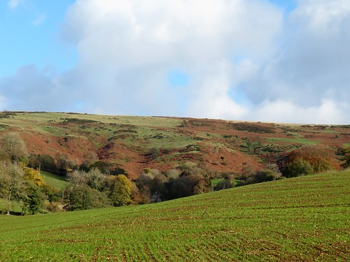
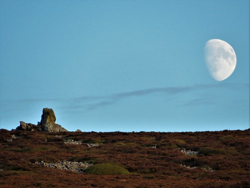
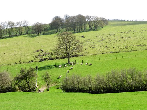
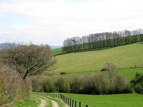
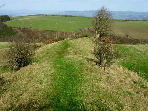
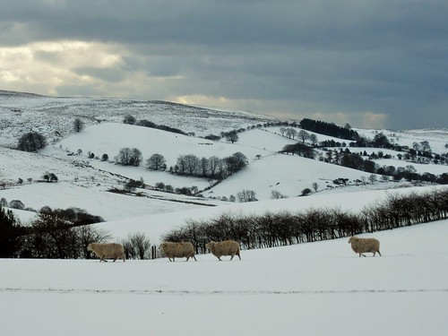
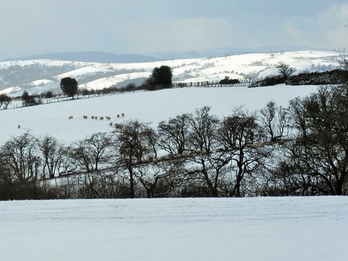
A man in a yellow singlet sculled a long racing shell upriver, easily overtaking us with powerful strokes against the current. We threaded a golf course margin past the ochre and grey sandstone cliff of High Rock, then followed the path at the edge of clover leys and ploughed fields of dark red earth scattered with last year’s wrinkled remnants of beets and potatoes.

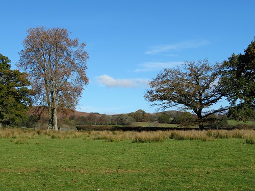
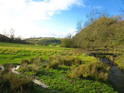
A goldfinch skimmed away with a swooping flight. A dozen swallows perched chirping in a hawthorn, and a gang of blue tits tinkled and bounced from branch to branch of a sycamore half in and half out of the river. Floods had pulled some trees down to water level; others tottered precariously, barely clinging to the bank with roots exposed.

Two men were building a flight of steps for fishermen into the bank. ‘Hard work,’ one grunted. ‘See them molehills? Can you tell the moles to come down here and give us a hand?’

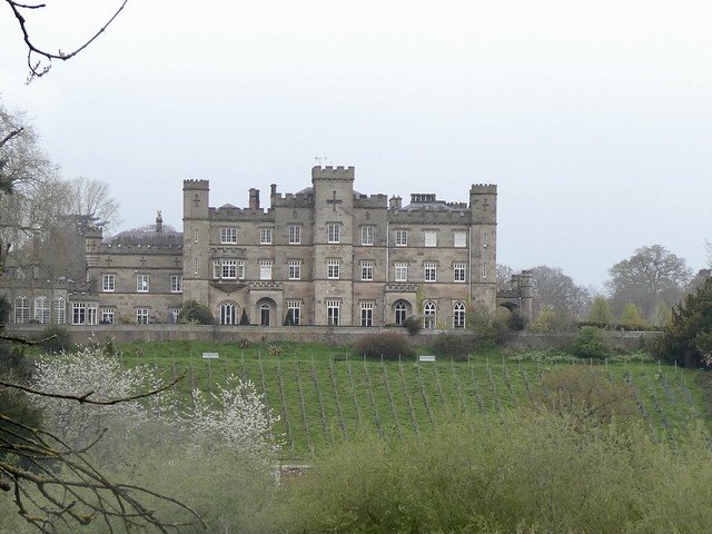
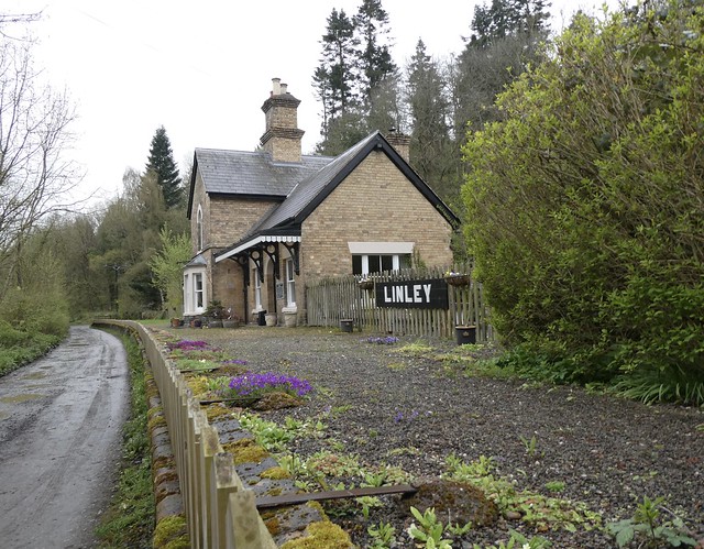
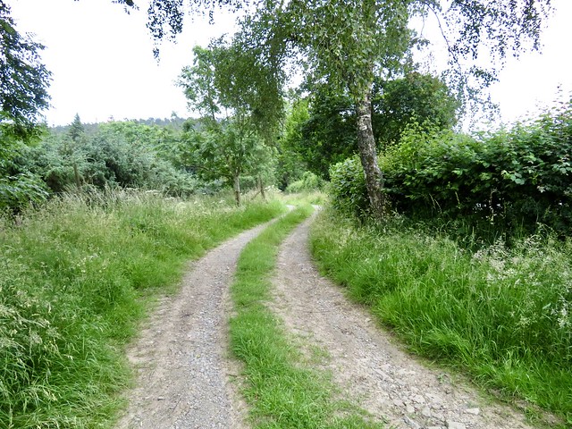
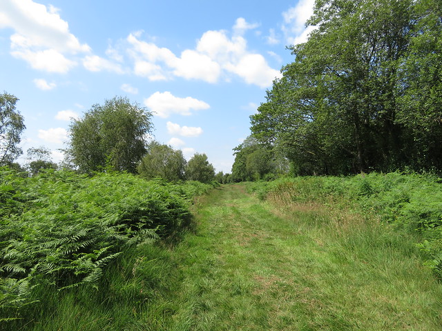
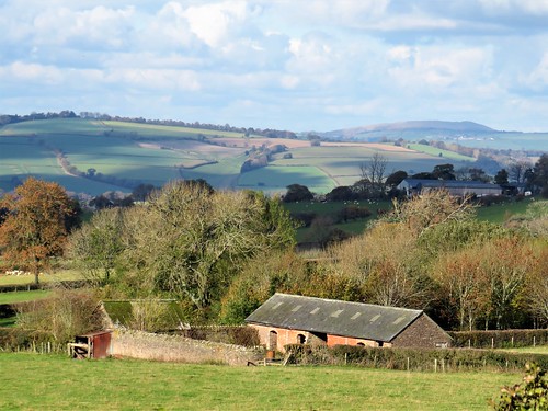
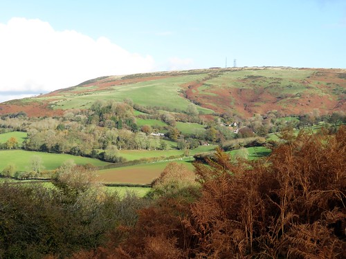
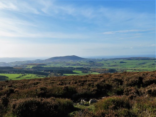
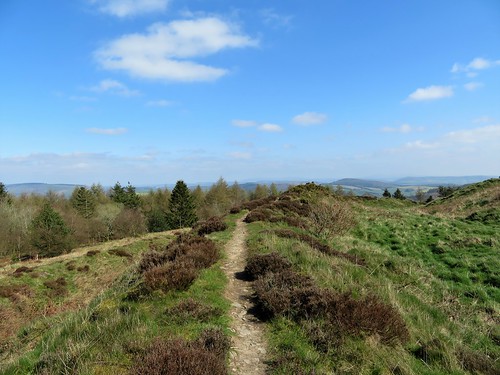
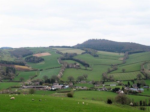
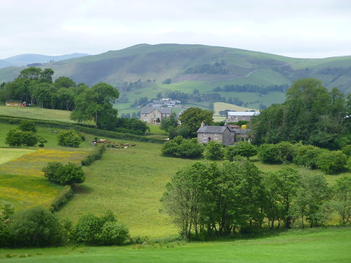
We crossed a stile and turned along the line of the old Severn Valley Railway, now the Mercian Way multi-user path. On a rise of ground above the far bank, the enormous Gothic Revival façade of Apley Hall looked out over the Severn. Thomas Whitmore, owner of the Apley Estate, bitterly opposed the building of the railway across his land and through his sightline in the 1850s. He was appeased with a payoff of £14,000 – about £2 million today – and the building of a special station at Linley (now a private house) where he could hail up trains for a personal pick-up.

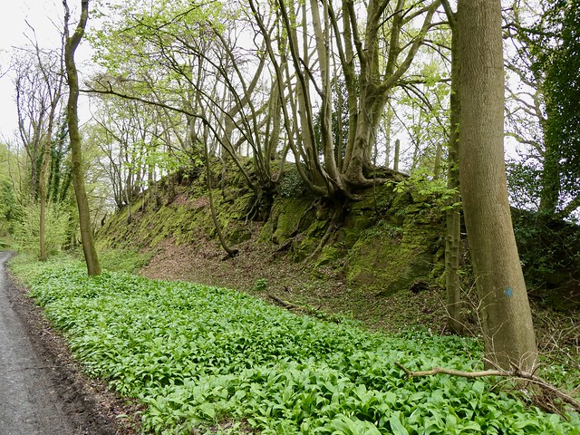
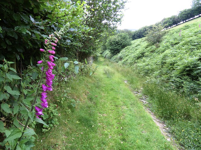
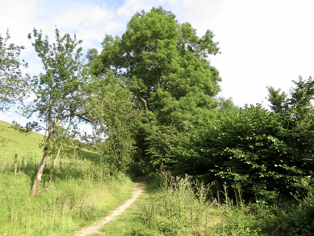
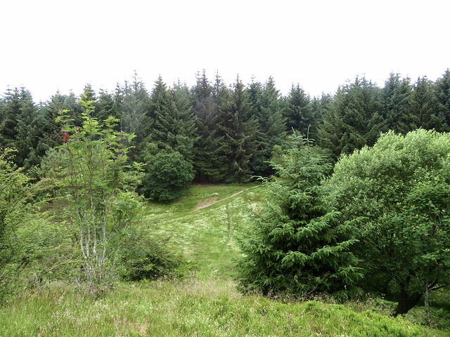
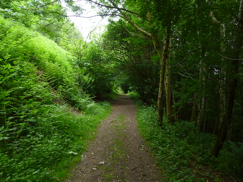
We passed Linley Station’s flowery platform and walked on through mossy sandstone cuttings lined with cowslips and wild garlic, the Severn never more than a field away, till railway and river reconnected for the last mile into Jackfield.

How hard is it? 8½ miles; easy; riverside and railway path

Start: Riverside car park, Bridgnorth WV16 4BH (OS ref SO 719931). Limited parking; other all-day car parks available in Bridgnorth.

Getting there: Bus 8 (Telford – Bridgnorth)
Road: Bridgnorth is on A442 from Telford (M54 Jct 4)

Walk (OS Explorer 218, 242): Follow road upstream beside river, then Severn Way to Jackfield.
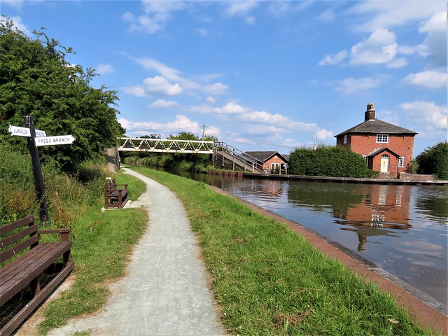
Alternative: in 3 miles, where Severn Way and old railway run close together (721974), left over stile onto Mercian Way multi-user path and turn right. In 1¼ miles, just past Linley Station (705983), pass notice forbidding traffic and cycles, and continue. In another 2¾ miles at Coalport Station (702019), sharp right along road; opposite Woodbridge Inn, left along Severn Valley Way to Jackfield.
Return to Bridgnorth by Bus 8, Telford-Bridgnorth.

Lunch: Woodbridge Inn, Coalport TF8 7JF (01952-882054, brunningandprice.co.uk) – very friendly, welcoming pub.

Accommodation: Falcon Hotel, St John’s Street, Bridgnorth WV15 6AG (01746-763134)

Info: visitshropshire.co.uk, ironbridge.org.uk

 Posted by at 01:25
Jul 092022


First published in: The Times Click here to view a map for this walk in a new window
View from the steep fields outside Bucknell View from the steep fields outside Bucknell 2 green lane near Bucknell green lane near Bucknell 2 green lane near Bucknell 3 tangled path in Darky Dale 'viewpoint' at the summit of Hopton Titterhill beautiful green cleft of Honeyhole, descending to the Redlake valley path through lush grassland descending to the Redlake valley

A hot summer’s afternoon in Shropshire, the River Redlake overgrown with rushes, the grey stone walls along Bucknell’s village street sprouting deep pink valerian.

A green lane us away up sloping fields where brown and white cattle chomped their cud in the shade of big old hedgerow oaks. A red kite planed low over the grass on long crooked wings, and a pair of swallows raced overhead in a twitter of excitement as they swerved and snatched insects out of the still air.

‘Walking With Offa’ said the waymarks along the path. The mighty defensive rampart and dyke built by King Offa of Mercia in the late 8th century runs south and north along the Welsh Borders a few miles west of here, but the terrain around Bucknell offers the same challenge to a walker – steep slopes, sudden descents, boggy valleys and forested hills.

A high-banked lane fringed with white bindweed and deep yellow St John’s wort led to the high farmstead of Mynde, from which the path plunged down a hillside into the well-named depths of Darky Dale. Next came a climb through bracken banks and up the thickly forested slopes of Hopton Titterhill, which landed us breathless at the summit.

The viewpoint marked on the OS map turned out to have been obliterated by the growth of trees, but it didn’t matter. In a clearing under the knoll we sat to eat our apples and crunchy biscuits on a lacy white picnic cloth of heath bedstraw, serenaded by the clicks and whistles of a tree pipit perched in a spruce nearby.

The forest track went gradually downhill among soft hair-like grasses full of cuckoo spit, a frothy defence extruded by the nymphs of froghopper insects. They shelter from predators in these gooey cradles, tiny white bugs in their hundreds.

We followed the path down to Meeroak Farm, and on down a beautiful green cleft looking across the River Redlake’s green cleft valley to the crumpled faces of Stowe Hill and Caer Caradoc. The return path along the valley was a delight, with the river curving close below and a thrust fluting its evening song.

How hard is it? 6¾ miles; moderate; field and footpaths

Start: Baron at Bucknell Inn, Bucknell SY7 0AH (OS ref SO 351741)

Getting there: Train to Bucknell
Road: Bucknell is on B4367, signed off A4133 Ludlow-Knighton road

Walk (OS Explorer 201): Left along road; left up Dog Kennel Lane. Between Brookside and Caverswall, left (355742, ‘Walking With Offa’/WWO) up green lane, then fields to cross road (355747, ‘Mynd’). In 100m, right (WWO, stile); field path (stiles, yellow arrows) to lane beyond house (356752). Right; in 300m, left (358753, fingerpost, ‘No Through Road’). 40m past Mynde Farm*, right on field path, descending to lane (359758). Dogleg right/left (WWO) and on through gate.

Cross valley floor (359759) and bear left, keeping parallel with Darky Dale stream on left. In 200m, stile into trees (359760, WWO). In 150m at gate, bear right uphill (357761, WWO). By metal gate at top of bank, left (359764, WWO) on path inside edge of wood. In 100m cross forest track (359765); take right-hand of two paths (not one with red/white arrow/RWA). In 300m cross track (357767); ahead up track (RWA). In 250m, where climb flattens, fork left (356769) on downhill track. In 150m, by pond opposite RWA pointing ahead (354770), right up through trees to meet a cross-track at hill summit (354771).

Left on track across hill; on down to track junction (353774). Left; in 250m, bear right off track onto clear grassy path (351773), descending to cross forest road (349773) and on. Keep straight line ahead at edge of forestry for ½ mile. At Meeroak Farm, through kissing gate (344766); left (yellow arrow, ‘Viaduct’ waymark). Follow farm track for 300m. In a dip, right (345762, WWO); follow WWOs for ¾ mile down to valley road (336756). Left; in 800m on right bend, ahead through gate (342753, WWO). Follow WWO for ¾ mile; at house, fork right (345743, gate, ‘Viaduct’) along lane to Bucknell.

Lunch/Accommodation: Baron at Bucknell Inn, Bucknell (01547-530549, baronatbucknell.co.uk)

Info: Ludlow TIC (01584-875053), visitshropshire.co.uk

 Posted by at 01:56
Mar 192022


First published in: The Times Click here to view a map for this walk in a new window
Caradoc Hills from Earl’s Hill

A rain-spattered morning gave way to a brighter sky over the Welsh Borders. From the pastures south of Shrewsbury rose thickly forested Pontesford Hill, a double hump leading up to the Iron Age ramparts at the grassy crown of Earl’s Hill.

A long stony track led up the flank of Pontesford Hill, steepening through pine and oak woods and the slender white stems of silver birch. The track was littered with fragments of pine branches torn loose by winter storms, among which lay little heaps of scales dropped from larch trees by feasting grey squirrels.

We stopped to watch one at his work forty feet above our heads. He sat upright, intense and efficient, balanced by his fluffed out tail, nibbling energetically at a cone held in his paws, neatly picking out the nutritious seeds and letting the scales fall spinning to the ground.

Rocks and tree roots offered slippery footholds as we went up to where the tattered trees of Pontesford Hill give way to the grassy slope of Earl’s Hill. Shropshire Wildlife Trust have plans to remove the failing conifers planted on Pontesford Hill in the 1960s and to restore a sheep-grazed sward for wild flowers and butterflies, an exciting prospect.

A great Iron Age hill fort encloses the elongated top of Earl’s Hill, and from here we gazed round a breath-taking 360o panorama, north to the Cheshire plain and its sandstone ridge, west to the Welsh hills, and south towards a rise of ground where the jagged outcrop of the Stiperstones broke the skyline. The big isolated hump of the Wrekin lay to the east, while away in the southeast the furrowed flanks of the Caradoc Hills were dramatically sunlit under a dark wave of cloud.

A broad tongue of grass led steeply off the hill and down into woods where celandines were beginning to show their miniature golden suns beside the path. At a mucky crossing of tracks, more slurry than solid ground, we turned northeast through sunny Oaks Wood and down to the rushing Habberley Brook in its dell below the cliff face of Earl’s Hill.

A path led downstream, crossing and recrossing the stream before heading for Pontesbury across shaggy pastures. Some of the wildlife ponds at Earlsdale carried a paper-thin skin of ice, and the afternoon sun put a shimmer on the water of those pools as yet unfrozen.

How hard is it? 4¾ miles; moderate; hill and woodland tracks, muddy in woods.

Start: Pontesford Hill car park, near Pontesford, Salop SY5 0UH (OS ref SJ 409057)

Getting there: Bus 552/553, Shrewsbury-Bishop’s Castle
Road – ‘Pontesford Hill’ is signed from A488 at Pontesford, between Shrewsbury and Minsterley

Walk (OS Explorer ): Pass bollards, up main track. In 350m, left up steps (408055, ‘Summit’); steeply up to summit trig pillar on Earl’s Hill (409048). Ahead, steeply downhill to stile (406043); right (‘Walk 17’). At foot of slope, left (405044, gate, ‘Ride UK’). In 500m at path crossroads (406039, gate), left (blue arrow/BA). In 200m, half right across field to gate/footbridge (409041, yellow arrow/YA, ‘Chris Bagley Walk’). Path through Oaks Wood. In ¾ mile at top of wood (417046) path curves left and descends; at bottom, right; immediately left (415048, BA, ‘Ride UK’) down to cross footbridge (415051). Right (BAs); in 250m, cross stream (416052, BAs); in 100m recross (416053, YA). Up to kissing gate/KG; keep ahead, following YAs and keeping Earlsdale ponds on your right, across fields to car park.

Lunch: Picnic; or Mytton Arms, Habberley SY5 0TP (01743-792490 – ring first for details!)

Accommodation: Prince Rupert Hotel, Butcher Row, Shrewsbury SY1 1UQ (01743-499955, princeruperthotel.co.uk)

Info: shropshirewildlifetrust.org.uk

 Posted by at 01:11
Jun 272020


First published in: The Times Click here to view a map for this walk in a new window
picture picture picture picture picture picture picture picture picture picture picture picture picture picture picture picture
Facebook Link:

‘We’ve done something quite special here,’ says Pete Bowyer, senior manager at Fenn’s Moss National Nature Reserve, with modest pride. ‘Pretty much the whole bog had been wrecked and destroyed, and we’ve gradually brought it back to life.’

If there’s one outstanding example of how conservation can work to dramatic effect, it’s here on the borders of Shropshire and Clwyd, where England and Wales rub shoulders. Fenn’s, Whixall and their neighbouring ‘mosses’ form over 2,000 acres of raised bog, a rare landscape brought into being by the growth of sphagnum mosses that trap and hold rainwater.

We set out along the NNR’s History Trail. It’s a juicy and squelchy environment, a vast cushion of carbon-absorbing sphagnum where butterflies, spiders, wetland birds and flowers throve undisturbed for 10,000 years after the last Ice Age – the mosses were too deep, sodden and dangerous for man to do more than a little wildfowling and fishing. Then in the 19th and 20th centuries came commercial drainage and peat harvesting on a massive scale.

We passed scrubby areas of irregular banks, where peat was hand-cut by local villagers – ‘Whixall Bibles,’ they called the square black slabs of peat. Further out were vast acreages of bleached grass, heather and bog cotton, golden spatters of bog asphodel, oily black bog pools where dragonflies skimmed, and big skies full of swifts and swallows. Overhead sped the intent dark crescent shapes of hobbies, slender birds of prey hunting dragonflies to munch on the wing.

We walked the Long Mile and the old railway track to Fenn Old Peat Works, a skeleton shed holding rusty old pulley wheels, conveyors and ramps, the derelict rump of destructive industry. Harebells, mulleins, heath spotted orchids and yellow loosestrife clustered here.

Back on the bog track we crossed the regrown heath of Oaf’s Orchard. Rusted wire baskets once held incendiary devices to trick wartime German raiders into dropping their bombs on the ‘useless wasteland’ of the bog.

Walking the homeward tracks across the moss it was hard to credit that this wonderful multi-coloured world of busy wildlife, buzzing and calling, was a dead black desert only forty years ago, cut and dried and abandoned. The painstaking work of professional conservationists and the volunteers that help them, the water management, the restoration of vegetation and encouragement of wildlife have combined to work a miracle in the Welsh Borders.

Start: Manor House NNR Base car park, Whixall, Salop SY13 2PD (OS ref SJ 505366)

Getting there: From Wem, follow ‘Whixall,’ then ‘NNR Base’ and brown NNR signs.

Walk (9¼ miles, level paths, OS Explorer 241): Obtain ‘History Trail’ leaflet from Manor House office or dispenser, or download at publications.naturalengland.org.uk.

From car park, down drive, right at road for 500m to Post 1 beside gate (498364); follow History Trail clockwise to Post 21(504368). Left along Long Mile green lane. In nearly 1 mile, left at post with arrows and dog notice (505382); in ½ mile, left (497381) along railway path. In 1½ miles left at Fenn’s Old Peat Works (478367), heading SE on Mosses Trail. In nearly 1 mile, right at Post 10 (487355). At Post 11 (485354), left to Llangollen Canal (485353); left to Roving Bridge junction (488352). Fork left (‘Hurleston’). In ¼ mile, left at Morris’s Bridge (493354, green arrow) on green lane. In 300m pass gate (492356); at Post 8, right (490358). At Post 6, left (496363) and retrace outward walk to Manor House.

Conditions: Can be wet and muddy.

Lunch: Picnic.

Info: Manor House NNR Base (01948-880362);
first-nature.com/waleswildlife/n-nnr-fenns-whixall.php; shropshiresgreatoutdoors.co.uk satmap.com; ramblers.org.uk

 Posted by at 02:19
Feb 022019


First published in: The Times Click here to view a map for this walk in a new window

picture picture picture picture picture picture picture picture picture picture picture picture

Facebook Link:

Abdon’s little red church of St Margaret stands within the bank of a circular graveyard, the sign of a very old, probably pre-Christian site. People have been working and living for many millennia here in remote rural Shropshire below the Clee Hills – and on top of them too, in the steeply ramparted hill forts that crown their basalt peaks.

Looming at the back of Abdon is Brown Clee, at 1,770ft the highest peak in Shropshire, a great weighty whaleback of green, purple and red that rises in the east to blot out half the sky. On this bright winter morning big clouds came bustling across from the sunlit uplands of Wenlock Edge out to the west.

A field path led us from the straggling houses of Abdon down to Cockshutford where the cocks and dogs combined to give us a loud welcome. Clee Liberty Common beyond lay pitted with the hillocks and holes of former coal pits and quarries. Above stood the neat oval ramparts of Nordy Bank, rare among hill enclosures hereabouts in having been left undamaged by the quarrymen.

Twisted old silver birches flanked the sunken track that meandered up across the common to the radio mast at Clee Burf. From this great ringfort we had a fine view south to the stepped profile of much-quarried Titterstone Clee.

We sat in a rushy hollow out of the wind, eating tangerines and listening to the sigh and rustle of a beech hedge. Then we headed north on the Shropshire Way along the spine of Brown Clee, passing the poppy-strewn memorial to flyers, both Allied and German, killed nearby in plane crashes during the Second World War. Weather and conditions can be treacherous up here, and the Clee Hills claimed the lives of more flyers than any other hill range in these islands.

Up at the topograph on Brown Clee’s summit rampart we stood and marvelled at an incomparable prospect, 300 miles all round the circle of the horizon from Cader Idris and the Berwyns to the west and Brecon Beacons to the south, to the Peak District hills in the north-east and Birmingham’s towers in the east. The Wrekin, the Malverns, Cannock Chase and Wenlock Edge. All drenched in sun under a china blue sky, a once-in-a-lifetime view on such a winter’s day.

Start: Abdon Village Hall, Abdon, Craven Arms, Shropshire SY7 9HZ (OS 576868)

Getting there: B4368 (Craven Arms – Much Wenlock); at Beambridge, turn off for Tugford; from here, follow signs to Abdon.

Walk (7½ miles, moderate hill walk, OS Explorer 217) From village hall car park, left down road past church (575866). Left at junction (574863); in 600m, opposite last buildings on right, turn left off right bend (577862), and fork right along level track between hedges (yellow arrow/YA, blank fingerpost). Follow YAs through fields south for ¾ mile to cross lane at Cockshutford (579851).

Up steps opposite, through kissing gate; right (YA) with hedge on right for ½ mile (stiles, gates) to stile into green lane (573852, YA). Left to road, left past Clee Liberty Common notice on right. In another 150m, right through gate at another notice (573850); up gravelly track past Nordy Bank hillfort (577848) for 1½ miles to Clee Burf radio mast 593843).

Left along Shropshire Way/SW with wall on right. In Five Springs Hollow go through right-hand gate (596864, ‘SW main route’) and on past flyers’ memorial (596855). In ¾ mile, with gate on left, bear right (591863) to topograph on Abdon Burf (594866).

Back to go through gate (blue arrow); follow grassy trackway downhill; in 150m it turns right and descends for ½ mile to road (586869). Right to junction; left (‘Abdon Village Hall’). In 100m, left on bridleway (584870, fingerpost). Follow it across fields with hedge on left. In 400m pass Marsh Farm on your right; in another 200m, right to cross stile (578867). Up fence to stile into road beside car park.

Lunch: Tallyho Inn, Bouldon SY7 9DP (01584-841811, thetallyho.co.uk) – 3 miles.

Accommodation: The Crown, Munslow SY7 9ET (01584-841205, crowncountryinn.co.uk) – 5 miles.

Info: Ludlow TIC (01584-875053); shropshiretourism.co.uk; ramblers.org.uk; satmap.com

 Posted by at 02:43
Sep 152018


First published in: The Times Click here to view a map for this walk in a new window
picture picture picture picture picture picture picture picture
Facebook Link:

Geologically, the Stiperstones are easy enough to explain – outcrops of quartzite some 500 million years old, spread along a mile or so of heathery Shropshire ridge on a westerly spur of the Long Mynd.

It’s their contrary aspect – jagged upthrusts of naked rock in the midst of smoothly rolling countryside – that has cloaked them in all manner of strange and demonic myths. And certainly, walking towards Cranberry Rock at the southern end of the line, it was disconcerting to find the harsh outline of the tor suddenly appearing between one minute and the next as though the ground had disgorged it all in a moment.

It was a beautiful autumn afternoon. The Long Mynd was a glowing green bar of dimpled slopes in the east, the Welsh borderlands a sunlit haze of woods and hills to the west. Cranberries spattered the heather with scarlet. A pair of ravens flew high overhead, one giving out deep croaks, the other emitting a strange, musical warble.

The path among the Stones, rocky and full of angular quartzite lumps, required careful watching. We followed it through the heather past Cranberry Rock and Manstone Rock to the Devil’s Chair – more like a giant and horrendously uncomfortable chaise longue of unforgiving stone.

Wild Edric the Saxon, Lady Godiva and all the witches and warlords of Shropshire have the Devil’s Chair as their trysting spot. Here Slashrags the Tailor got the better of the Evil One, once he’d spotted his cloven hooves.

And here the Devil reclines in stormy weather watching between the lightning bolts for the ruination of Old England. On that day, it’s said, the Stiperstones will sink back whence they sprang – into the bowels of Hell.

We descended a steep grassy path among old lead mine workings to the village of Stiperstones a thousand feet below. Down there, with the Stones shut away from sight by steep hillsides, it was hard to bring their otherworldly atmosphere to mind. But as we headed home along a track that skirted the ridge, we saw their ragged profiles lit by the setting sun and a spectral half-moon that sailed up out of the ridge. The Stiperstones stood sentinel, a ghostly guard above our homeward path.

Start: The Bog car park, near Stiperstones, Shropshire SY5 0NG (OS ref SO 358978)

Getting there: Shuttle Bus, weekends and BH Mon, May-end Sept; Bus 552 from Shrewsbury
Road: From A488 between Bishop’s Castle and Shrewsbury, follow ‘Shelve’, then ‘Stiperstones’.

Walk (5 miles, strenuous, OS Explorer 216): Follow Shropshire Way/SW signs to right of pond; follow path, up steps, through kissing gate (arrow). Ahead along gorsy bank to kissing gate; left to cross road (362976). Follow SW ‘main route’ for 1 mile along ridge past Cranberry Rock (365981), Manstone Rock (367986) to Devil’s Chair (369992). In another 600m, SW turns right (371996); keep ahead here. In 350m, at crossing and cairn by Shepherd’s Rock (373999, yellow arrow/YA, ‘Cross Britain Walk’) left down grassy path to road in Stiperstones village (363004). Left past Stiperstones Inn; in 400m, hairpin left (361002, fingerpost); cross stile; right, steeply up fence for 300m. Left at post (359999, arrow); cross stile, pass NNR notice; steeply up through trees to cross stile at top (361996). Half left across field; right (361994) on stony lane for 1 mile to road (359980) and car park.

Conditions: Rocky underfoot along Stiperstones ridge; steep climb from Stiperstones village

Lunch: Bog Centre (01743-792484, bogcentre.co.uk)

Accommodation: Stiperstones Inn, Stiperstones village SY5 0PD (01743-791327, stiperstonesinn.co.uk)

Info: Bog Centre, Stiperstones (see above); visitengland.com; satmap.com; ramblers.org.uk

 Posted by at 07:48
May 132017


First published in: The Times Click here to view a map for this walk in a new window
picture picture picture picture picture picture picture picture picture picture picture picture
Facebook Link:

On this cool spring morning Clunton lay as quiet as anywhere under the sun. Green slopes rose steeply on all sides, crowned with dark conifer woods, cradling the little village in a fold of the Shropshire hills. Looking back from the side of Clunton Hill, it might have been an Alpine rather than an English scene.

A field path led steeply up to the tangled ways of Merryhill Plantation. A quick phone call confirmed that its forbidding forestry notices were long out of date. We swung down the track and out into lambing fields where the northward view made us gasp, a painter’s ideal of hill country with patchwork fields, snaking lanes and artfully placed spinneys. This was the Walcot Estate bought by soldier-of-fortune Robert Clive (‘Clive of India’) in 1763, with the vast riches he acquired during colonial service with the East India Company.

Down in the valley we joined the Shropshire Way, a dusty white road running west between banks of violets, bluebells and star-like wood anemones. Giant old oaks, contorted and massive, stood on the banks of Walcot Wood, survivors of storms and the woodman’s axe, nowadays individually tended by the National Trust.

Up on Sunnyhill we came to Bury Ditches, a great oval hill fort built 3,500 years ago with four concentric rings of ramparts and ditches. Uncountable slaves and prisoners-of-war lived and died while mounding these prodigious earthworks. We walked a circuit of the ramparts, taking in the mighty view – the long whaleback of the Clee Hills, Long Mynd and Wenlock Edge in the east, the quartzite upthrust of the Stiperstones like a black excrescence on the northern skyline, and Corndon Hill looming bulkily over the huddled houses of Bishop’s Castle.

High in the sky a raven fought for mastery with a peregrine, black against silver, a scribble of swoops, sideslips and angry screams. We watched the battle until the birds had circled out of sight, and then dropped down the woodland tracks and out in brilliant sunlight over the long slopes back to Clunton.

Start: Crown Inn, Clunton, Shropshire SY7 0HU (OS ref SO 335814)

Getting there: Clunton is on B4368 between Craven Arms and Clun. Park at Crown Inn (please ask permission, and give the pub your custom!)

Walk (7½ miles, moderate, OS Explorers 201, 216): From Crown Inn car park, left up road (‘Bury Ditches’). At No. 5, Gunridge, fork right up lane (353817). Through kissing gate on left, over stile, uphill beside fence to stile (yellow arrow/YA) into wood. In 150m, right over stile; uphill beside fence to cross stile under tree at top left corner of field (337819). Right with hedge on right for 2 fields (stiles); half left to cross stile (341821); follow hedge on right uphill. Near the top, right over stile (343823, YA); left up hedge and through strip of woodland.

Exit over stile (345827, YA); right to cross stile into Merryhill Wood; track down to gate (350828, YA). Half left down field, aiming for dark treetops, then stile (354830, YA). Down to stile near corner of wood; down to stile/gate (356832, YA); left along valley road. Following Shropshire Way/SW for 1¼ miles past Lodge Farm (346838) to Stanley Cottage (335839). Through garden gate (SW) to pass in front of cottage; leave garden through another gate, and up drive to road. Right; left into Bury Ditches car park; take first path on right past Bury Ditches info board, and follow track (red, blue trail marks) uphill to Bury Ditches hill fort (328838).

At far (west) side, follow path down to gate (326836). Bear right on track parallel with hill fort. In ¼ mile, at junction, bear left (325840, red marker, SW); in 100m, left (red marker, YA); in 50m, right (red marker, YA). Descend into valley, cross wide forest road (322836), and descend grassy track (red marker, YA).

In 200m, red route turns left across stream, but bear right here (321834) on boggy, grassy track, keeping stream on left. In 200m, fork left down forest road (YA). At sharp right bend, go left through kissing gate (324831, ‘Walking With Offa’ arrow). Right along hedge, descending to turn right along farm road. At Stepple farm, keep to left of buildings (325826); pass between wooden gate posts, and fork right off drive through gate (YA). Track descends to gate (326823, YA); cross stream, and bear left with stream on left, through fields for ¾ mile back to Clunton.

Lunch: Crown Inn, Clunton (01588-660265, crowninnclunton.co.uk) – phone for opening times.

Accommodation: School House B&B, Chapel Lawn, Bucknell, Salop SY7 0BW (01547-530836, theschoolhousebandb.co.uk) – excellent, friendly place

Bishop’s Castle Walking Festival, 13-17 May: bcwalkingfest@gmail.com; walkingfestival.co.uk

Info: visitshropshirehills.co.uk; visitengland.com; satmap.com; ramblers.org.uk

 Posted by at 01:03
Jan 162016


First published in: The Times Click here to view a map for this walk in a new window
picture picture picture picture picture picture picture picture
Facebook Link:

On a bright winter afternoon we studied the big OS map in the hall of the Castle Hotel at Bishop’s Castle. We were looking for a short, sharp walk, something to shake down some excellent bangers and mash. Churchtown, a few miles west, looked just the job – the rollercoaster ups and downs of Offa’s Dyke for exercise, and the ancient Kerry Ridgeway for the views.

There’s no town at Churchtown – just a church and a house or two sunk in a deep valley. We headed north up the knee-cracking rampart of Offa’s Dyke, a good stiff puff uphill. When Offa, 8th-century King of Mercia, ordered the great boundary built between his country and the badlands of the wild Welsh, he meant it to last, and it has – a solid raised bank and attendant ditches, running north and south like a green scar across the face of the Welsh Border.

We plunged into the Edenhope Valley, crossed the stream and plodded up another steep stretch of dyke to where the Kerry Ridgeway ran along the crest of the hills. Sunlight and hail showers chased each other, the wind roared in the holly hedges, and the view northwards swung from the distant whaleback peaks of the Berwyns and the green knuckles of the Breidden Hills round to the craggy Stiperstone outcrops of the Long Mynd and the radar globes on Titterstone Clee. A fifty-mile view under sun, storm and a rainbow.

This is tumbled country, overlooked from on high by the Kerry Ridgeway. We followed the former drover’s road to the few houses of Pantglas, then headed south across sheep pastures and steeply down to where the neat slate-roofed farm of Lower Dolfawr lay tucked out of sight in its roadless valley.

Across the little rushing stream, up around the silent farmhouse and sheds, and up again along a holloway all but choked with gorse and broom, to the broad pastures on Edenhope Hill. A last battering from the wind, a scud along a rutted trackway, and we were descending into Churchtown down King Offa’s mighty landmark and memorial.
Start: St John’s Church, Churchtown, near Bishop’s Castle, Salop SY9 5LZ (OS ref SO 264873)

Getting there: From A488 Clun road, 3½ miles south of Bishop’s Castle, turn right, following ‘Bryn’, ‘Cefn Einion’, ‘Mainstone’ and then ‘Church Town’.

Walk (4½ miles, strenuous, OS Explorer 216): From car park, cross road; follow Offa’s Dyke Path north for 1½ miles to Kerry Ridgeway/KR (258896).

Left along KR. At Pantglas, fork left (247896, KR); in 150m, just past Upper Pantglas cottage, left (fingerpost) through gate. 100m up track, right over stile (yellow arrow/YA); left along fence; left over stile at far end (248892, YA); right along fence past pond. Through gate at field end (not right over stile); down slope through next gate (249889). Left (YA) downhill; in 300m, hairpin right to bottom of track (251887), to cross river.

30m after crossing river, before farm buildings at Lower Dolfawr, right up bank. Through gate (YA); skirt to left around farm and along conifer hedge. Right up bank, through gate (251885, YA). Up hollow path to gate (YA). On up hollow path among broom and gorse bushes through felled plantation. At top, through gate (255884); keep same line across field to road near pump house on Edenhope Hill (258881). Left; in 50m, at left bend, keep ahead on green trackway for 600m to meet Offa’s Dyke (263878). Right to Churchtown.

Conditions: Steep ascents/descents on Offa’s Dyke; path through felled plantation above Lower Dolfawr rather overgrown.

Lunch: Picnic

Accommodation: Castle Hotel, Bishop’s Castle, Shropshire SY9 5BN (01588-638403, thecastlehotelbishopscastle.co.uk) – friendly, characterful, very help.

Info: Church Stretton TIC (01694-723133)
visitengland.com; satmap.com; ramblers.org.uk

 Posted by at 01:42
Mar 072015


First published in: The Times Click here to view a map for this walk in a new window
picture picture picture picture picture picture picture picture
Facebook Link:
It was a cold late winter’s afternoon over the Shropshire hills when I set off from the Bottle & Glass at Picklescott; so cold that the cows were in their sheds, making the air foggy with their soft silage-sweetened breaths. The broad lowlands of the great Shropshire and Cheshire plan stretched out green and sunlit as I climbed the lane from the village. But there was a frosting of white along the upper bulwarks of The Wrekin, fifteen miles off, and when I got out into the high fields I found that the slopes of Cothercott Hill were still blanketed in snow freshly dinted with boot prints.

I followed the bootmarks southwest up the broad nape of the Long Mynd where it rose from the lowlands. This enormous whaleback upland dominates the north Shropshire landscape from afar, a billowing presence full of hidden valleys known as ‘beaches’ which only sheep and walkers know. The sheep were still out in the fields, hardy endurers of the cold, staring incredulously as I trudged by, as though they had never seen a human before. It was wonderfully exhilarating walking, with the Welsh hills in the west white-capped and whirling with localised snowstorms, and a bullying north wind to shove me roughly on and up to the ancient Portway at the crest of Wilderley Hill.

Men have been travelling the ridgeway route know as the Portway for perhaps 5,000 years, traversing the length of the Long Mynd by way of this broad green thoroughfare. The Portway was white this afternoon, its black hedges knee-deep in wind-sculpted snow. My boots creaked and crunched in the drifts as I followed the old way south, with Breughelian vistas of black-and-white winter landscapes on either hand.

At last my homeward path diverged from the Portway, and I went slipping and sliding down through the fields towards Picklescott with the temperature dropping, the afternoon light draining and the cold nipping at my fingers. In the firelit bar of the Bottle & Glass, I found a cheerful party of walkers. It was their boot prints I had been treading in all the way round. A touch of Good King Wenceslas, we all agreed.

Start: Bottle & Glass Inn, Picklescott, near Shrewsbury, Shropshire SY6 6NR (OS ref SO 435994)

Getting there: M54, A5 to Shrewsbury; A49 towards Leominster; minor road to Picklescott from A49 at Dorrington.

Walk (4¾ miles, moderate, OS Explorer 217, 241; download map/guide leaflet at bottleandglass.co.uk): From Bottle & Glass, left to crossroads; right (‘Ratlinghope’); in 30m, keep ahead (not left). In 200m, right down ‘No Through Road’ (433995; ‘Humphrey Kynaston Way’/HKW; blue arrows/BA). In ¾ mile, where lane bends right and descends, left through gate (428005; HKW; ‘Walking With Offa’/WWO; BA). Bear slightly away from hedge on right, into dip, to go through bridleway gate (426007; HKW, WWO, BA). Right up hedge for 100m; diagonally left at hedge corner, across field to hedgebank with thorn trees (426009; Shropshire Way/SW – unmarked here). Left, and follow SW for ¾ mile along hedgebank, climbing up right side of conifer wood to crest (417000). From here aim for wood ahead. In another 400m, through double gate (424997; SW, WWO, BA); half left to road (413995).

Cross, and follow lane opposite (SW, WWO, ‘Darnford Walk’). In just over half a mile, at gate across lane, left through another gate (420985; WWO, HKW). Up to fence corner (BA); follow fence on right to gate at corner of wood (421988, HKW). Right through gate; follow hedge down to next gate (424990); left along farm drive. In 400m, right at road (428995); right again into Picklescott.

Lunch & Accommodation: Bottle & Glass, Picklescott (01694-751252; bottleandglass.co.uk): cosy, lively and friendly place

Info: Shrewsbury TIC (01743-258888)
visitengland.com; www.satmap.com; ramblers.org.uk; LogMyTrip.co.uk

 Posted by at 02:09
Aug 172013
 

Fine old high jinks they had in former days on the hilltop of Cym-y-Bwch, the ‘Horns of the Buck’, just outside Oswestry where Shropshire looks west into Wales.
First published in: The Times Click here to view a map for this walk in a new window
picture picture picture picture picture picture picture picture
Facebook Link:
From Georgian into Victorian times, hotly contested horse races were held up here, competing for purses of golden guineas and the solid silver Sir Watkin Williams Wynn Cup. What with the drinking, gambling, pickpocketing and lewd behaviour that came to plague the occasion, the gentry stopped attending, and in 1848 the last races were run.

These days the old grassy figure-of-eight track is a favourite place to take a breather and walk the dog. The Offa’s Dyke Path National Trail runs through the Old Racecourse, and we followed its straight course along a thickly wooded scarp edge among firs that gave out a resinous, almost buttery smell. Tiny goldcrests flitted in the treetops. A brisk, blowy sky ran overhead, and huge views opened from the blue distances of the Cheshire plain to the Long Mynd and the Breidden Hills further south.

A tangle of steep lanes led out of the trees along the line of Offa’s Dyke. In the fields beyond Pentre-shannel farm we found the old rampart more than man-height, its earthen bank knitted with big oak and ash trees and burrowed to a grey tissue by rabbits that scampered for cover. By a cottage on a green lane we met a couple walking their sheepdogs ‘Oh,’ said the woman, ‘try Hafod Lane if you want lovely flowers and views.’

It proved a great piece of advice. The narrow lane runs round the flank of the knobbly hill of Mynydd Myfyr. We climbed between banks of frothy yellow crosswort, red campion, blue speedwell and little scarlet wild strawberries to a superb view west over green lumpy country towards the higher Welsh hills – a steeply folded landscape nurtured and shaped by sheep and cattle farming, but somehow retaining a smack of wildness.

We found a path skirting the northern slope of Mynydd Myfyr. A lonely farm lay there, so deep in its cleft that only its roof showed until we were right on top of it. We crossed fields of lush grass and descended flower-bordered lanes, then headed back into the woods once more. A stiff climb, a shady tunnel of firs, and we were up at the Old Racecourse, on the Horns of the Buck, with the wind in our faces and a fifty-mile view to savour.

Start: Oswestry Old Racecourse car park, Shropshire, SY10 7HL approx. (OS ref SJ 258305).

Getting there: Signed to left off B4580 Rhydycroesau road, 2 miles west of Oswestry.

Walk (7½ miles, moderate, OS Explorer 240): Turn left along grass track of Old Racecourse to Janus Horse sculpture (257303). Left here along Offa’s Dyke Path/OD (yellow arrows/YA, OD acorn symbols) for 2 miles, passing Pentre-shannel farm (257279) to reach a lane (258274, ‘Trefonen ½ mile’). Leave OD and turn right to T-jct. Over stile (YA, ‘50’ logo), up hedge, through gate (254273). Aim a little right of white cottage opposite, crossing 2 fields (stiles, YAs) to green lane (250273). YA points right, but go left to road by cottage.

Left along lane for ¼ mile to junction just past New Barns (250269). Right here through gateway and up drive. Through gate, on along right side of barns; follow track across 2 fields to cross stile on right of gate (245268). Right up Hafod Lane round Mynydd Myfyr for a little over ½ mile; turn right over stile (243277, ‘footpath’) up hedge to stile (YA). Follow fence on left (YAs, stiles) to Pant-y-ffynon farm. Right into grassy drive (247277, YA), left along it. Through gate, immediately right over stile (YA); half left across field to cross stile to left of gate (249276, YA). In bottom right corner of next field, stile into lane.

Left; in 100m, right over 2 stiles close together (250277); half right across field to go through hedge gap a little to right of tall trees (249279). Keep parallel to the upper hedge, down to cross stile, right along track to road at Croesau Bach (247280). Cross road; bear right along lane opposite for ⅔ mile, down to bear left across bridge (256282). Follow Offa’s Dyke Path for ¼ mile back into Candy Wood. Where OD turns right (254286), go left along woodland track. At first fork after that, go left (YA); at next fork, go right (252288, YA) for 600m along bottom of wood with river on left. Track then rises steeply to rejoin OD (255298); left to Old Racecourse car park

Lunch: Picnic; or Barley Mow, Trefonen (01691-656889; offasdykebrewery.com)

Accommodation: Helen Gilbert, The Pentre, Trefonen, Oswestry, postcode (01691-653952; thepentre.com) – first class, friendly B&B; evening meal by arrangement.

Information: Oswestry TIC (01691-662753/662488)

www.ramblers.org.uk www.satmap.com www.LogMyTrip.co.uk

 Posted by at 01:51