Search Results : somerset

Feb 132016


First published in: The Times Click here to view a map for this walk in a new window
picture picture picture picture picture picture picture picture picture picture picture picture picture picture picture picture
Facebook Link:

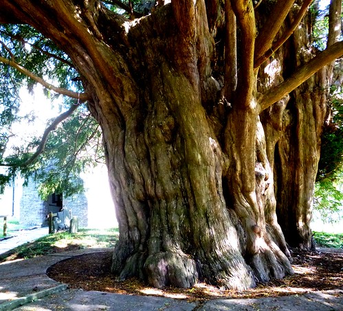
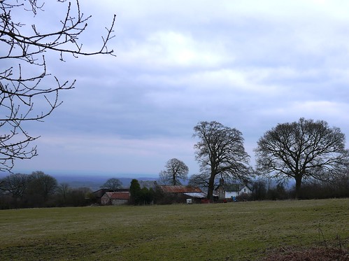
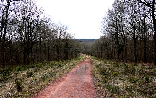
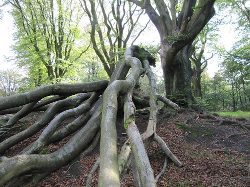
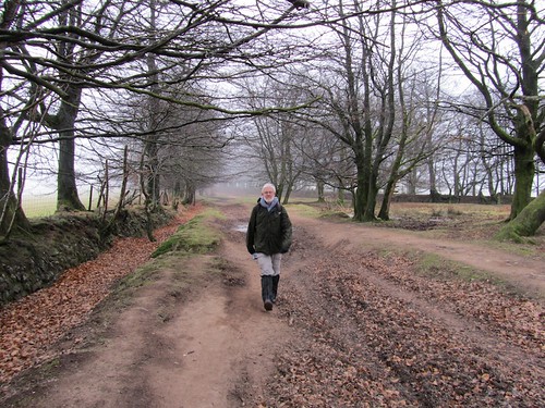
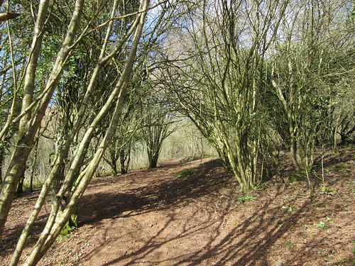
A brisk wind over the Mendip Hills scoured the sky to a delicate china blue as we set out from Rodney Stoke on the valley road to Cheddar. Daffodils were struggling out by the stream in Scaddens Lane, half their buds still hard and waxy. Scarlet elf-cap fungi lay like chucked-away orange peel among the frosted leaves in Stoke Woods, where the steep path was a stodge of dark red mud. The tips of the silver birches were just beginning to flush a milky pink, but otherwise the woods were still caught fast in their long hibernation.

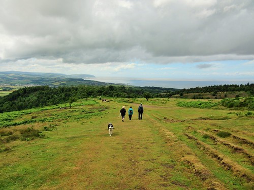
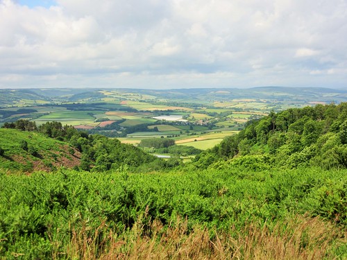
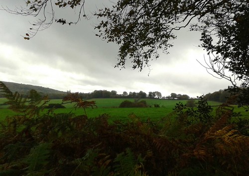
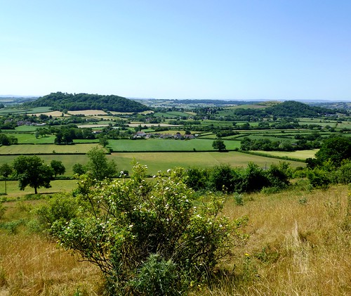
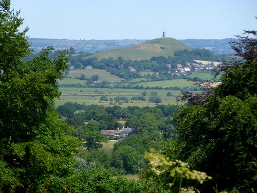
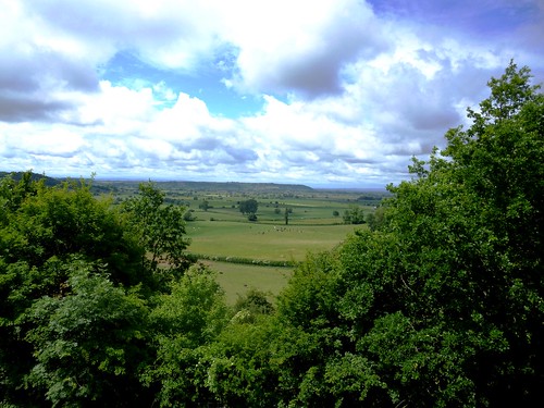
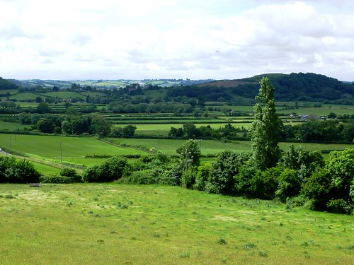
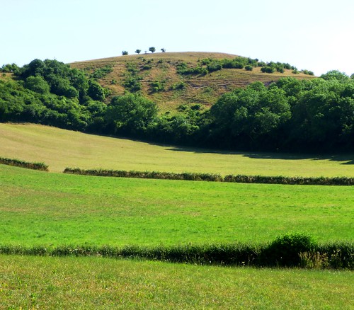
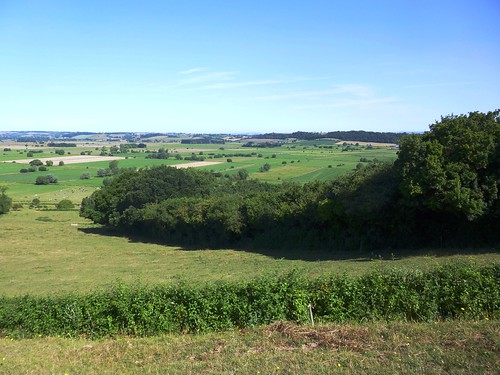
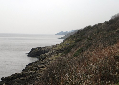
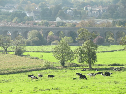
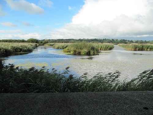
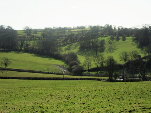
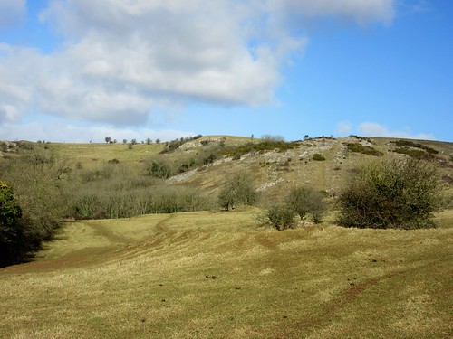
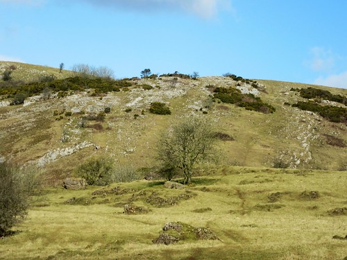
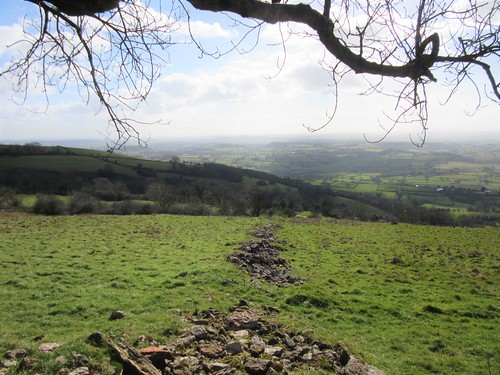
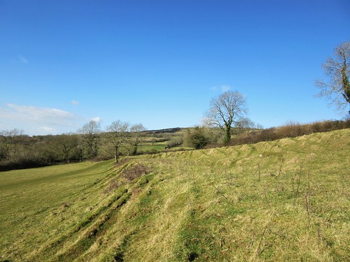
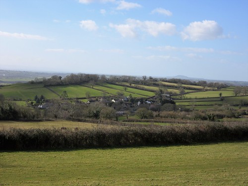
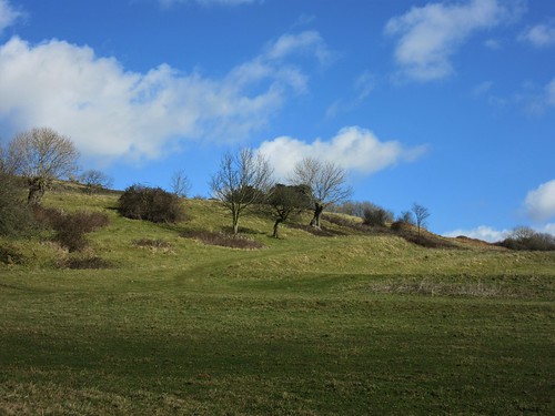
At the top of the ridge we found craggy outcrops of limestone, very pale in the late winter sun, and one of those giant West Mendip views over the Somerset Levels that took in the low ridge of the Polden Hills, the Blackdowns beyond, the Quantocks further west, Exmoor in ghostly grey, and the Welsh hills beyond a broad chink of sea in the Bristol Channel. The long, canted back of Glastonbury Tor with its pimple of a tower lay at the heart of this truly remarkable prospect.

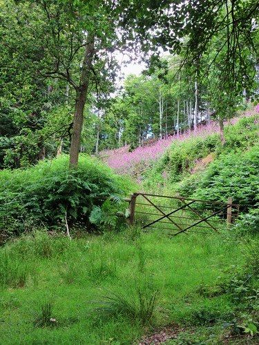
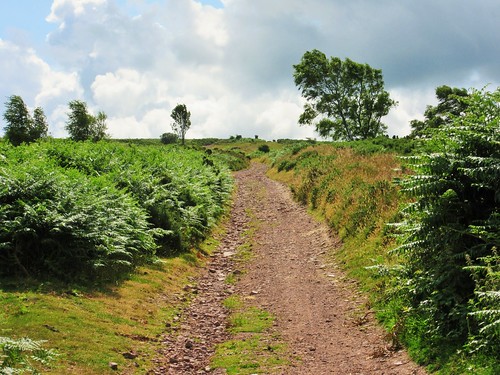
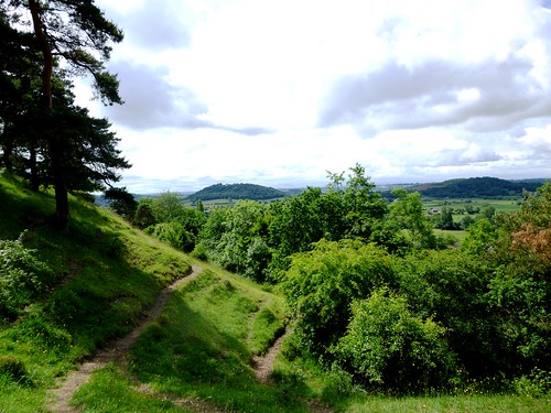
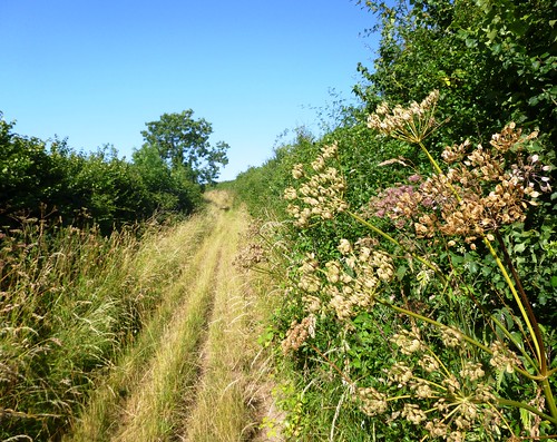
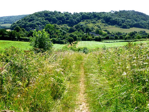
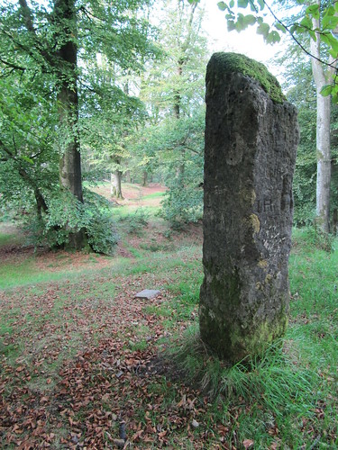
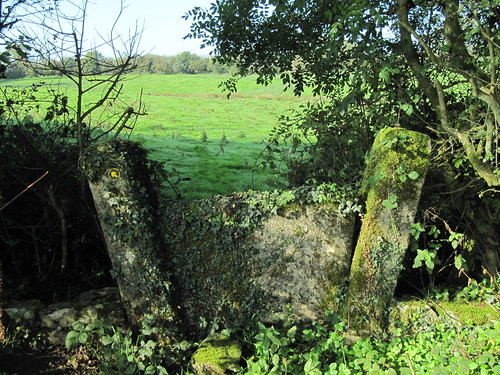
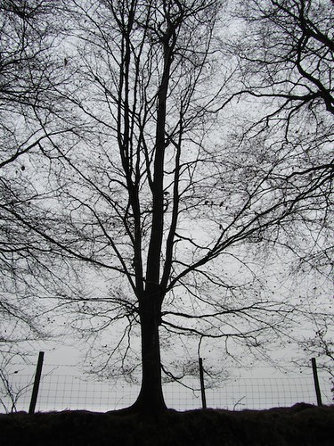
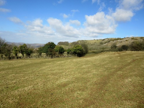
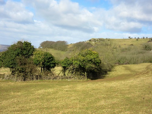
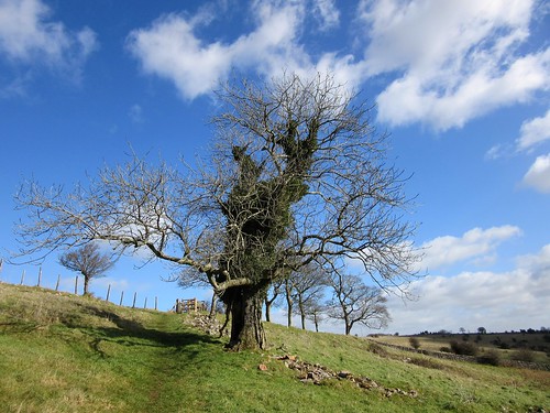
The West Mendip Way led east, an upland path through big square fields enclosed by drystone walls. Each wall contained its stile, a solid slab of limestone with steps up and down, some of the stiles three or four feet tall.

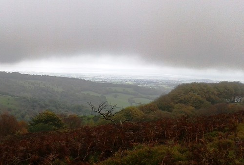
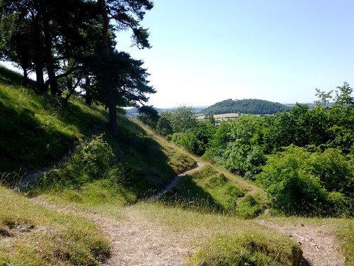
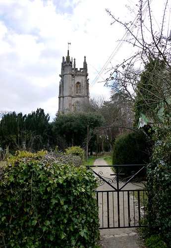
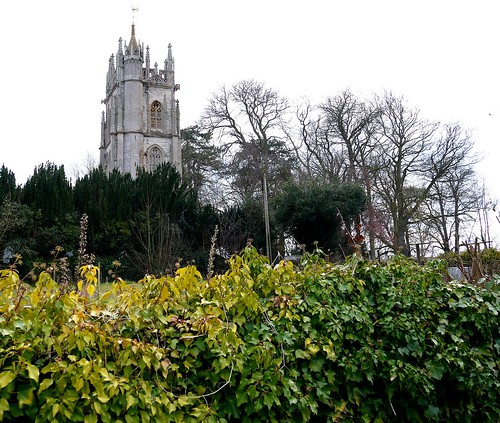
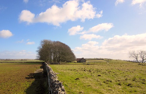
On the outskirts of Priddy, the only settlement on Mendip’s broad plateau, we turned back on a path slanting south-west down the long slope of the escarpment. The thickening light of afternoon gave the enormous view the quality of a watercolour painting, the colours blurred and melting together.

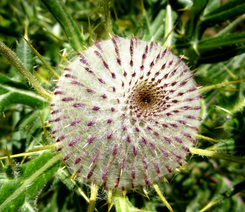
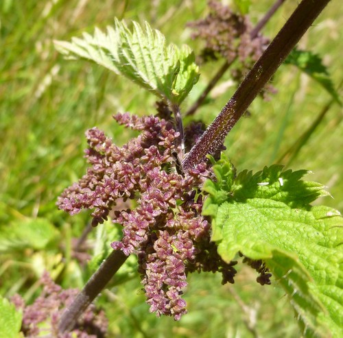
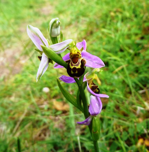
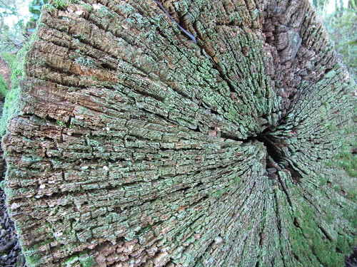
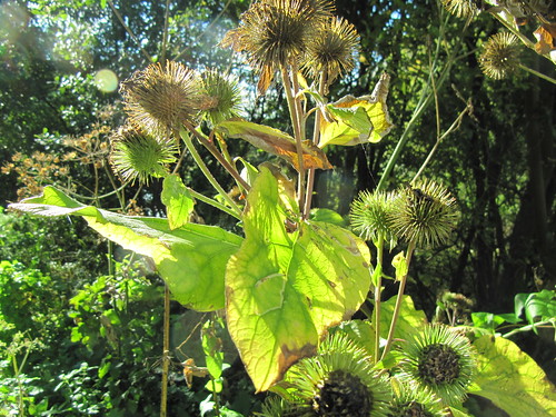
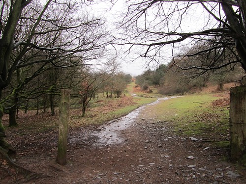
In Cook’s Fields Nature Reserve the path ran over limestone sheathed in aeolian soil, a pleasing name for the soil that blew down here 10,000 years ago on Arctic winds from the retreating glaciers to the north. Horseshoe vetch, carline thistles and autumn lady’s tresses grow in Cook’s Fields, chalkhill blue butterflies disport themselves on wild thyme – but not on a cold winter’s day such as this.

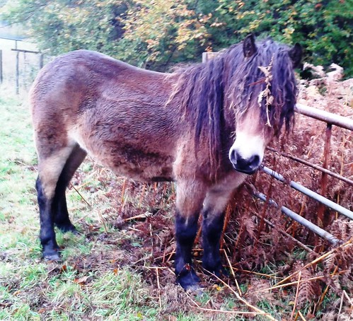
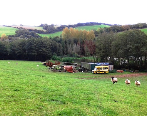
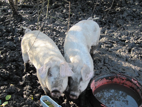
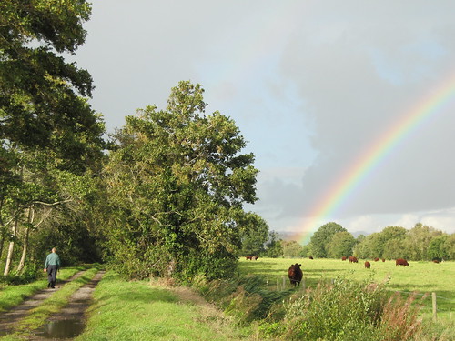
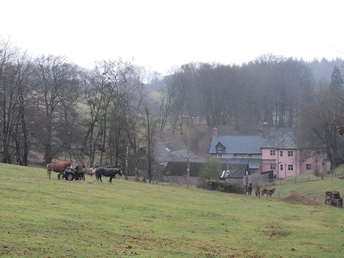
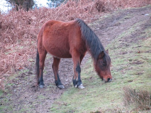
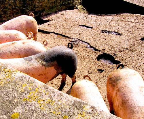
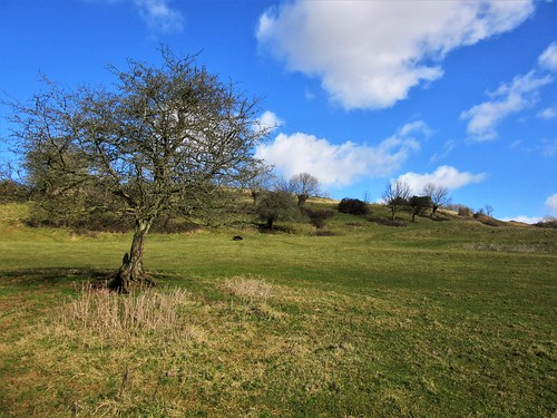
We descended over strip lynchets made by ox ploughs a thousand years ago. Lambs sprang and bleated at Kites Croft, and six jolly porkers looked over their stye wall and grunted us back to civilization down at Old Ditch.

Start: Rodney Stoke Inn, near Cheddar, Somerset BS27 3XB (OS ref 484502)
Getting there: Bus 26, 126 (Wells-Cheddar)
Road – Rodney Stoke is on A371 (Wells-Cheddar).

Walk (7 miles; moderate – one steepish climb, many stiles; OS Explorer 141. Online maps, more walks at christophersomerville.co.uk): From Rodney Stoke Inn, right along A372. In 250m, left (486501) up Scaddens Lane. In 400m, left (490502) on path climbing north up field, through Stoke Woods (yellow arrows/YA). At top, over stile (487510, YA). Half right; cross stile at left end of hedge on skyline (489513). East along West Mendip Way/WMW for 1½ miles to road (512513). Lane opposite; in 250m (514514), right on WMW. Just before Coxton End Lane, right on path for 1¾ miles, south, then south-west over Cook’s Fields Nature Reserve to gate below barn (506493). Track to Stancombe Lane; left; in 50m, right down field to stile into lane; fork right to road (502493). Right; in 200m pass ‘Martins’ house on right; in 150m, left (499495, fingerpost) up Westclose Hill. At top, right for 700m to road (492497). Left to cross A371 (489497); Millway to T-junction (483499). Left; in 100m, right up Butts Lane to A371; right to inn.

Lunch: Rodney Stoke Inn (01749-870209; rodneystokeinn.co.uk) – cheerful, bustling pub
Info: Wells TIC (01749-671770)
visitengland.com; satmap.com; ramblers.org.uk

 Posted by at 02:47
Aug 152015


First published in: The Times Click here to view a map for this walk in a new window
picture picture picture picture picture picture picture picture
Facebook Link:

It’s not every day you celebrate your 300th ‘A Good Walk’ for The Times, and Jane and I wanted to make it something really special. Our good friend Alan came up with a tempting-looking route through the deep leafy combes and over the brackeny brows of the Quantock Hills – Wordsworth and Coleridge country. A sight of the sea, a proper draught of moorland air. That was just the ticket.

We set off from Beacon Hill, nine walking buddies talking nineteen to the dozen as we dropped steeply down under sweet chestnut trees to Weacombe. From there a long track led south under scrubby banks flushed purple by the overnight emergence of thousands of foxgloves. From the depths of Bicknoller Combe we looked up to see the western sky a slaty blur of rain. Soon it hit, and soon it passed, leaving us shaking off water like so many dogs in a pond.

Up on Black Ball Hill a faint sharp hooting carried to us on the wind. A steam train on the West Somerset Railway was panting its way down the valley towards Minehead, but locomotive and carriages stayed hidden from sight in the steep green countryside.

We sat on the heather among Bronze Age burial mounds to eat our sandwiches with an imperial view all round, north over the Severn Sea to Wales, east to the camel hump of Brent Knoll, west into Exmoor’s heights. By the time we’d brushed away the crumbs, serenaded the skylarks with mouth organ tunes and descended among the trees of Slaughterhouse Combe, the sun was backlighting oak leaves and pooling on bracken banks where bilberries and star mosses winked with raindrops.

Thunder ripped across the sky, a last sulk of the weather gods, as we walked west up Shepherd’s Combe – a favourite ramble of William and Dorothy Wordsworth and their friend and fellow poet Samuel Coleridge. A bank of sundews lay pearled with rain, their tiny pale flowers upraised on long stalks above sticky scarlet leaves. One minuscule blob of a sundew’s insect-trapping mucilage is capable of stretching up to a million times its own length. Biomedical researchers are looking for ways to exploit that remarkable property as a platform for healthy cells in the regrowth of damaged human tissue. This is the sort of thing Jane knows.

We climbed to Bicknoller Post on its wide upland with a wonderful prospect north-west to the stepped flank of Porlock Hill and a sea full of shadows and streaks of light. Our steps quickened along the homeward path – not to unload nine souls full of immortal verse, but to beat the clock into Holcombe for the cream tea we suddenly knew we’d earned.

Start: Beacon Hill car park, Staple Plain, Hill Lane, West Quantoxhead, Somerset TA4 4DQ approx. (ST 117411)

Getting there: Jct 27; A39 (Bridgwater-Minehead); at West Quantoxhead, just past Windmill Inn, left (‘Bicknoller’). In 350m, left up Hill Lane (‘Staple Plain’). Continue for ⅔ mile to car park at end of track.

Walk (5½ miles, moderate, OS Explorer 140): From NT Staple Plain info board walk back through car park. Don’t go through gate of left-hand fork of tracks, but turn left downhill beside it (green NT arrow), steeply down through trees. At bottom (117408), right on grassy track. Continue to descend, keeping downhill at junctions, for 500m to cottage beside track (111408). Left (‘Quantock Greenway’, arrow with quill), through gate and up track. In 200m, through gate; in another 150m, go over cross-track (113404) and continue SSE beside Haslett Plantation.

In 500m, arrow post points right (115399); but go left here (east) and continue up Bicknoller Combe, keeping ahead over all crossing tracks. In 1 mile, reach top of ascent at crossing of tracks from Bicknoller Post, Paradise Combe, Bicknoller Combe and Slaughterhouse Combe (130398 – just west of ‘302’ on map). Keep ahead on stony track towards Slaughterhouse Combe. In 200m, just past low wooden post on left, fork left onto less obvious grassy track with some ‘kerb’ stones at its entrance (131397) – as a marker, look half right to see two trees, one on either side of the stony track you have just left.

Follow this grassy track east over brow of Black Ball Hill, past tumulus (134396) and descend. After 600m, look for fork; take right-hand path. In 100m it swings 180o to the right (138397), descends SW for 250m to meet stream (137395) and bends left to descend for ½ mile to bottom of Slaughterhouse Combe (143401). Left along bridleway WNW under Lady’s Edge and up Sheppard’s Combe for 1 mile, ascending to Bicknoller Post (128403). Right (north) along broad stony track; in 200m, fork left; in 50m, left again to meet The Great Road track (126407). Left, descending to car park.

Lunch: Picnic

Accommodation: Rising Sun, West Bagborough, TA4 3EF (01823-432575, risingsuninn.info) – excellent, well-run pub

Info: Taunton TIC (01823-336344)

satmap.com; ramblers.org.uk; visitengland.com

 Posted by at 01:19
Nov 082014


First published in: The Times Click here to view a map for this walk in a new window
picture picture picture picture picture picture picture picture
Facebook Link:
A grey cool day had hung low cloud over the Somerset coast and capped the Quantock Hills with mist. A stodge of red mud sucked at our boots in the ferny old lane that rose from West Bagborough up the steep south face of Lydeard Hill. A ghostly hoot and a frantic heartbeat of chuffing from far below tracked the progress of a train, rattling along the West Somerset Railway and leaving fat white gouts of smoke to dissolve in the breeze.

Up on the brackeny back of Lydeard Hill we found ourselves just under the mist line. A giant view opened northwards over the coastal plain to the silver coils of the River Parrett snaking into the low-tide mud flats of the Severn Estuary. Steep Holm and Flat Holm islands lay black and two-dimensional, as though cut from slate. The Welsh shore ran away westward, the grey whaleback of the Mendip Hills barred the northward horizon twenty miles off, and at our feet opened a steep, nameless little valley, a Quantock combe full of golden treetops.

A pink horse came ambling past. ‘Oh,’ laughed his rider, ‘he should be white, but he loves rolling in all this red mud!’ We followed a ridge path down to Bishpool Farm, richly scented with applewood smoke and lying in a red and green valley. A little girl came out among barking dogs at Lambridge Farm to watch us go by. We rounded Gib Hill and followed a bridleway up through the woods to the summit of Cothelstone Hill. Some British chieftain lies here under a round barrow, lord of a hundred-mile prospect – Blackdown, Quantock, Mendip, Exmoor, Cotswold and Wales.

We stood to savour it all, then plunged down the mucky bridleway through Paradise woods to Cothelstone where the red sandstone church, model farm and Elizabethan manor house huddled together in a beautiful cluster under the hill. St Agnes Well lay under a corbelled cap by the road, its dimpling water efficacious in curing infertility and vouchsafing virgins a glimpse of their future husbands. We trailed our fingers in the spring, and then made west across handsome parkland where black cattle stared stolidly from under the trees.

A high-banked lane, a last glimpse of broad Taunton Vale from a bridleway, and we were back in West Bagborough in time for tea at the Rising Sun.

Start: Rising Sun Inn, West Bagborough, Taunton, Somerset TA4 3EF (OS ref ST 171334)

Getting there: West Bagborough is signed off A358 Taunton-Williton road between Combe Florey and Crowcombe.

Walk (7½ miles, moderate with some ups and downs, OS Explorer 140): Up lane beside Rising Sun, through gate; on uphill for ⅔ mile. At top of hill, path forks; right here (174344; ‘Restricted Byway’) through gate. Three paths diverge; follow left-hand one. In 100m go over path crossing and on east over Lydeard Hill for ½ mile. Into woods (183343, yellow arrow/YA). In 200m, track curves right; left here (185341); in 100m, right through kissing gate. Keep ahead along ridge with hedge on right; in ½ mile, right through gate (194344, no waymark); follow hedge down to road (197342). Right past Bishpool Farm; in 50m, left through kissing gate (YA) and farmyard. Left through gate; right over stile (fingerpost); aim half-right down field to cross stream (200339). Track to road.

Right past Lambridge Farm; steeply up through gate (199337); pass to right of cottage. Up through gate (blue arrow/BA); up through next gate; follow hedge on left for ⅓ mile to go through gate into wood (195333, BA). In 100m track bends right; follow it up to road (193331). Right along road (take care! Left side is best!) for 300m. Just before road on right, turn left up bridleway through wood (190330, BA, ‘The Rap’ fingerpost). In 150m, at T-junction, left (189330); in 200m, fork left through gate (188328, ‘footpath’ arrow). Up through trees for 250m to fenced tumulus on ridge (188326). Left to stony knoll and viewpoint at summit of Cothelstone Hill (190327)

Bear right downhill on broad grass path. In 100m ignore fork to left. Down to pass animal pens on your right. In 200m, 2 gates on right (193324). Go through kissing gate beside left-hand one; turn right and immediately left to post with 2 waymark arrows. Right here; in 100m, at crossing of tracks (192323), bear left downhill on bridleway through Paradise Wood, keeping ahead over various track crossings (occasional BAs) for ¾ mile to road (185319). Ahead downhill in Cothelstone. In 150m, right (fingerpost) across footbridge (optional detour, signed right, to St Agnes Well). Follow path past back of Cothelstone Farm. Left through gate (182319, YA); through gate at churchyard corner; across parkland field. In ¼ mile, over stile in dip (178321); ahead to gate into woodland strip; cross road (175322, YA). Half right across field to stile (174325, YA) and fenced path to road. Ahead up road; in 200m, pass Pilgrim’s Cottages; in 150m, left (175329, ‘bridleway’) on bridleway for ¼ mile to road (171331). Right into West Bagborough.

Lunch: Rising Sun, West Bagborough (01823-432575, risingsuninn.info) – very cheerful, friendly pub with rooms

Accommodation: Rising Sun (see above), or Cothelstone Manor (01823-433480; cothelstonemanor.co.uk)

Info: Taunton TIC (01823-336344)

www.LogMyTrip.co.uk; www.satmap.com; www.LogMyTrip.co.uk

 Posted by at 01:22
May 242014
 

A hot summer morning with a hard blue sky, the mid-Somerset hayfields already cut and dried, the hedges murmurous with bees and hover-flies. First published in: The Times Click here to view a map for this walk in a new window
picture picture picture picture picture picture picture picture picture picture picture picture picture picture picture picture
Facebook Link:
The view from the steep slopes of Collard Hill was sensational – Glastonbury Tor to the north, Dundon Hill and Lollover Hill out to the south-west, yellow-green pastures spread out and shimmering in the heat of afternoon. I followed the ridge path west to where the Hood Monument’s sailing-ship crown rose above the trees on Windmill Hill. Vice-Admiral Sir Samuel Hood was one of those energetic, apparently fearless sailors who came to glory in Nelson’s Navy, and when he died in 1814 his brother officers raised the great column to his memory.

Down in Dundon churchyard I sat a while in the dense shade of a great yew tree, as thick as ten men belted together, far older than the ancient church it dominates. Then I struck out on the old cart track that loops round Lollover Hill. By the time I had made the circuit and got down into the flatlands north of Dundon, everything far and near seemed quivering in the radiance of reflected sunlight – cattle, ditches, hedgerow oaks, and the long dark whaleback of Collard Hill lying across the landscape to the north.

The wardens who welcome visitors to the National Trust’s Collard Hill Nature Reserve really know their stuff. I was lucky enough to stroll round with Matthew Oates, the Trust’s very own ‘Butterfly Man’, as he expounded the story of the Large Blue butterfly, a creature whose existence relies on cutting a deal with the red ant species myrmica sabuleti. The ants take the caterpillar to their nest, where they feed on a sticky juice it exudes; in return – notwithstanding this huge guest’s appetite for their own eggs and larvae – they look after it until it emerges from its chrysalis. They escort the brand-new Large Blue butterfly above ground, and wait for its wings to harden into flight before they part from it.

Small wonder the Large Blue’s existence is precarious. By 1979 it had become extinct in UK, but has been successfully reintroduced at Collard Hill and a handful of other places. I’d always longed to see one of these large and brilliantly blue butterflies, and it was a fantastic thrill when one flitted across the slope of thyme and scabious – big, blue and beautiful, as it wrangled with a common blue and then fluttered off and out of sight.

Start & finish: NT car park, Street Youth Hostel, Marshall’s Hill, Somerset BA16 0TZ (OS ref ST 488340)

Getting there: Bus – Service 377 (firstgroup.com) Yeovil-Wells, to Marshalls Elm crossroads. Road – B3151 Street-Somerton road; right at Marshalls Elm crossroads to car park.

Walk (7½ miles, easy, OS Explorer 141): From the NT car park, follow blue-topped posts; cross B3151 at Marshall’s Elm crossroads (485344; NB dangerous crossing – please take great care!). Through kissing gate opposite; follow Polden Way/PW (blue-topped posts) or other footpaths through Collard Hill Nature Reserve. At far side, make for NE (top left) corner of reserve by a prominent, solo oak tree (490339); follow track uphill; in 100m, right (KG, PW) to leave reserve. In ¼ mile cross road (494339); through KG opposite (PW) into trees. In 70m path forks; both lead to Hood Monument (496338).

From SE corner of monument, follow clear path west through trees. In 150m go through KG (497337; PW). Don’t continue to road, but go sharp right downhill on stony path to turn left along road (495337). In ¼ mile road forks; bear right to T-junction (493334). Left along Compton Street; in 50m, right beside East Barn; on through wicket gate and across following stile. Ahead along field edge. In 100m cross ditch (490334); half-left across field to cross pair of stiles in far corner (489333; YA). Cross field to B3151 beside house (488332). Right for 50m; left over stile (‘Hurst Drove’ waymark post). Ahead up field edge to go through gate (486332); left along 3 field edges with hedge on left. At end of 3rd field (487329), left along track to road; left to B3151 (489328); right past Castlebrook Inn (closed at time of writing – due to reopen summer 2014).

In 100m pass gate marked ‘Castlebrook Holiday Cottages’; in another 30m, right through hedge and kissing gate/KG. Follow path west for ½ mile along field edges. At end of 4th field, through KG (482325) and on along paved lane to road in Dundon (480325).

Left for 50m; just past foot of lane to church, right (‘Lollover Hill’, yellow arrow/YA) up hedged path. In 100m, up steps; left (478325); in 150m, right (478323; ‘Hayes Lane’) along stony lane. In ⅓ mile it starts to descend (473322); in another 250m, where it bends left, go right over stile (471321; YA). Aim up field, parallel to hedge; over stile on far side (468320); right along hedge, right through gate at field end (468322; YA); left along hedge and follow it for 2 fields. At top of rise, cross 2 adjacent stiles (473325); on along green lane. In ⅓ mile it descends to bend right; in another 30m, right down steps (478325) to return to road in Dundon (479324).

Left and follow road to foot of hill; cross (480327) into Hurst Drove. Pass Hurst Farm and continue. In 300m, just beyond gate into Lower Hurst Farm, left over stile (481335; YA); right along hedge; in 100m, right over stile, left along hedge (YA); in 100m, left over adjacent stiles (480337, YA) and right along hedge. At top of field, cross stile (480340; fingerpost) and on up hedged lane to road by gates of Ivythorn Manor (481342). Follow lane up Page’s Hill to Marshall’s Elm crossroads and car park.

Click on Facebook “Like” link to share this walk with Facebook friends.

Lunch: Picnic. NB: Castlebrook Inn, Compton Dundon, currently closed – due to reopen shortly

Collard Hill Nature Reserve (NT): nationaltrust.org.uk; Large Blue blog – http://ntlargeblue.wordpress.com/; wildlifeextra.com/go/uk/collard-hill

Large blue flight season: Generally early June-mid July (check website!)

visitengland.com www.satmap.com www.LogMyTrip.co.uk

 Posted by at 02:06
Feb 152014
 

When the kids were tiny, a winter treat was a visit to the Greyhound Inn at Staple Fitzpaine to watch the morris men. First published in: The Times Click here to view a map for this walk in a new window
picture picture picture picture picture picture picture picture
Facebook Link:
On this cold midwinter day the old grey stone Somerset inn still smelt and felt much as we remembered it from back then, a rich and heady mix of open log fire, furniture polish, beer, good food and a whiff of muddy boots. But I’d forgotten how the church tower stood tall behind its trees in a prickly welter of crocketed pinnacles and the goat-faced, humpbacked gargoyles that are known in this part of the world as hunky-punks.

We went up the long farm track past Staple Park and Staple Lawns, then turned south through the woods and began to climb the escarpment of the Blackdown Hills. The silver grey clouds over the hills parted reluctantly enough, and I felt the lift of the heart that comes with the first honest sun of the year warming a face too long chilled by the east winds of winter. The countryside dipped and rose in waves of grey and cream-coloured stubbles and olive-green pastures rising to the leafless woods on Blackdown ridge.

A buzzard flew down and landed on an oak branch, and we stopped still to admire its speckled breast and fiercely hooked yellow beak. The path led on among the trees, gradually gaining height, with a grand view opening behind us across Taunton Vale for 30 miles to the long blue bar of the Mendip Hills on the northward horizon. We crossed a string of former commons, now partly overgrown with well-managed woodland, in other parts still lying open and pimpled with the tussocky nests of yellow meadow ants. Boggy ground had invaded the small fields around the ruined farm of Britty, and there were the mossy remnants of old cart lanes to follow up to the sandy heights of ancient Neroche Forest.

Saxon kings hunted Neroche, and so did the Norman lords who superseded them. But the broad summit of the range with its wide views to all quarters must always have been a valuable strongpoint. When Robert Count of Mortain, half-brother to William the Conqueror, came to construct a castle at the top of the forest, he founded it on a great ramparted fort that Iron Age tribesmen built up here.

We went up through enormous earthen ramparts to find the motte or castle mound and the ruin of its baileys and ditches among widely spaced oaks and beeches. Between the trees we looked south towards the green hills of East Devon, and then made for Staple Fitzpaine with Somerset’s flatlands and hill ranges spread out before us, a feast of West Country landscape lying waiting for spring.

Start & finish: Greyhound Inn, Staple Fitzpaine, Taunton, Somerset TA3 5SP (OS ref ST 264184)
Getting there: Bus – Stagecoach (stagecoachbus.com) service 99, Taunton-Yeovil
Road: Staple Fitzpaine is signed from Bickenhall, off A358 Taunton-Chard road (M5, Jct 25)
Walk (7 miles, easy, OS Explorer 128): From crossroads by Greyhound Inn, follow ‘Park Farm’ road. In 150m, on left bend, keep ahead (262182). In ½ mile pass Staple Park Farm; keep ahead (‘Bridleway’ fingerpost, blue arrows/BA) through gates on gravel track (‘East Deane Way’/EDW) and Herepath Trail/HP. Dogleg round Staple Lawns Farm. In Oakey Copse, turn left (245185) on broad bridleway. In 1 mile turn right up Underhill Lane (247173). In 300m, opposite cream-coloured house, left through kissing gate (247169, EDW). Ahead along grassy ride, keeping close to fence on left, following EDW and yellow arrows/YA. In 350m go through a gate (248166, EDW), cross a track, through another gate (YA) and keep ahead. In 200m dip to cross a stream beside a wooden railing with EDW arrow. Follow main track uphill to reach T-junction of tracks just below conifers. Left here (EDW, BA) on path, to meet track above Mount Fancy Farm (251163).

Turn right up track; left into wood through gate (EDW). Follow surfaced bridleway, then main path (EDW, HP) for ½ mile to Britty ruin (258160). Right (EDW, BA) along lane. In ¾ mile cross road and on (267159, EDW) into trees. In 150m, track bends left; in 400m, at 3-finger post (271161), turn right (‘Castle Neroche car park’) up track to castle ramparts. Return to 3-finger post; ahead downhill (BA) along Green Lane. At road, right (270167); pass drive, then in 10m right up lane past former chapel. Through V-stile; follow hedge round to left; through another V-stile; ahead through 4 fields by stiles to cross road (274174). Down Crosses Farm equestrian centre’s drive opposite (fingerpost with YA). Over stile by barn; over following gate; through boggy field. Follow path round to right; in 100m, left at fingerpost, through bushes; follow path over rough ground to Perry Hall (seen ahead). Cross farm drive (271179); through gate ahead (YA). In first field keep hedge on right; in 2nd and 3rd fields, hedge on left; cross stream in dip (270183); ahead to Staple Farm on skyline. At road (268184), left into Staple Fitzpaine.

Click on Facebook “Like” link to share this walk with Facebook friends.

Lunch: Greyhound Inn (good food, beer, cheer, smells) – 01823-480227; greyhoundinn.biz
More info: Taunton TIC (01823-336344)

www.ramblers.org.uk www.satmap.com www.LogMyTrip.co.uk visitengland.com

 Posted by at 07:35
Nov 162013
 

Today’s still and chilly weather had stroked a sombre brush along the Somerset coast where the elegant wrought-iron arches of Clevedon Pier strode out from shore into the chocolate brown waters of the Bristol Channel.
First published in: The Times Click here to view a map for this walk in a new window
picture picture picture picture picture picture picture picture
Facebook Link:
All lay quiet and misty: the Victorian seaside houses of Clevedon, the sluggishly lapping sea, and the narrow old catwalk of a cliff walk that we followed out of the town.

The path wound along the cliff slope through ash and sycamore clumps and dark ilex trees, all bent inland by the never-ending shore breeze. Oystercatchers pointed their orange pickaxe bills into the wind along the salt-eroded limestone pavement above the water, where fishermen crouched in hope of a bass or perhaps a conger eel. A big tanker moved ponderously down-channel from Avonmouth Docks, the thrum of its engines coming faintly to us. Somewhere beyond the ship ran the Welsh coast, nearly ten mile off as the cormorant flies – marshes, creeks and the great sprawls of Newport and Cardiff, all silent and invisible like a dream shore.

We passed the neat gardens of Farley and turned inland, steeply up a field and on into Common Hill Wood. The sun slipped a furtive ray or two through the clouds over the estuary, painting Wales as a pale grey streak along the water.

On the open ridge of Walton Common we crossed an arc of ancient ramparts, scarcely discernible in the grass and bracken. Iron Age tribesmen use limestone boulders to form this great circular stronghold and its straight entrance-way – a ‘banjo enclosure’, very rare in this part of Somerset. Any high ground gave a huge advantage in terms of security and forewarning to those who held it, and they took advantage of a knoll a little further along the ridge to make a hillfort with wonderful views round the country and out over the sea.

Here Lord John Paulet built a hunting lodge in 1615 – Walton Castle, a tall keep surrounded by turrets and a curtain wall, rising out of a thicket like the palace of the Sleeping Beauty. We passed below the castle, dropped steeply down to the coast path once more, and turned for Clevedon with the views broadening all the time – the twin promontories of Sand Point and Brean Down ahead, and out in the Bristol Channel the hummocks of Steep Holm and Flat Holm islands stretched on the water like basking sea beasts.

Start & finish: Clevedon Pier, Marine Parade, Somerset BS21 7QU (OS ref ST 402719)
Getting there: Bus (firstgroup.com) – 361, 362, 363 Bristol-Clevedon; 125 Weston-super-Mare to Clevedon. Road: Jct 20 M5; ‘Clevedon’, then ‘sea front’.
Walk (6 miles, moderate grade, OS Explorer 154): Walk north up Marine Parade. In 250m, opposite church (403721), left down walled pathway. Follow coast path (yellow arrows/YA, ‘Gordano Round’/GR) for 2¼ miles to Farley (429745; houses, fences, gardens by path). In another 200m, right on path past post with YAs (430747). Over stile, up slope beside wall/hedge on right, to cross stile to right of house. Cross road (432746); ahead down lane (fingerpost). Pass farm drive (433744); in 50m bear right through gateway; in another 50m take 3rd track on right through Common Hill Wood. In 600m leave trees to cross circular ramparts of earthwork (428738); in 150m, in open area, fork left. Follow main, obvious track, ignoring fainter side turnings, for ⅓ mile through woods, descending to road on bend (424735). Cross with care; left for 100m; right up track by cottage; in 50m, left (fingerpost) on track through Rock Wood. In 700m, through kissing gate (418731); on beside golf course. Through gate below Walton Castle; on along stony track. In 100m, right by ‘Beware of golfers’ notice and fingerpost (415730); through gate by club house; in 100m, by fence, left (414731, YA). In 200m, right (412730); follow fence seaward downhill for 250m. At bottom of slope (410732), left on coast path, back to Clevedon.
Click on Facebook “Like” link to share this walk with Facebook friends.

Lunch: Tiffin, 11 The Beach, Clevedon (01275-871605; tiffinteahouse.co.uk)
Info: Weston-super-Mare TIC (01934-417117); visitsomerset.co.uk
www.ramblers.org.uk www.satmap.com www.LogMyTrip.co.uk

 Posted by at 01:47
Apr 112013
 

Walked around Stanton Drew, Somerset – stone circles, great views of Chew Valley Lake, cattle out on the spring grass. Primroses, white violets and first cuckoo flower. Avon Wildlife Trust volunteers improving paths at Folly Farm nature reserve – unsung heroes!

 Posted by at 16:51
Sep 222012
 

A cold North Somerset wind blew like a trumpet across the Mendip Hills as we set out from Chelynch. First published in: The Times Click here to view a map for this walk in a new window
picture picture picture picture picture picture picture picture

It’s all farming country round here. A couple of porkers came snuffling to the gate at Newman Street Farm, and a bunch of peahens fled down the lane, their speckly grey and white bodies bent forward as they scurried between the hedges like plump little old ladies heading for a bring-and-buy.

We crossed the fields by way of proper Mendip stone stiles, big slabs of limestone a farmer can hop over but a sheep can’t. Three Ashes Lane took us west in a tunnel of trees where fallen crab apples littered the trackway, already rotting from blotchy green to soft toffee browns and blacks.

At a dip in the lane stood a mighty cast-iron contraption, all bolts and cogs and great spoked wheels. ‘It’s an early kind of cultivator,’ explained its owner, emerging from a shed under the hazels. ‘You’d have a steam traction engine at either side of the field, hauling this thing from one to the other and back again on a rope as it ploughed the soil.’ How cumbersome such a monster looked to our modern eyes; but how our forefathers must have blessed its power, its capacity to spare them sore bones and wrenched muscles, back in the dawn of mechanised agriculture.

At a junction of lanes we turned south down the Fosse Way. The military highway where Roman soldiers marched and grumbled is now a beautiful leafy lane, cutting across the grain of the Somerset landscape. In Beacon Hill Wood we veered away from the old road and up through a giant’s graveyard of fallen beech boughs to where a standing stone rose at the apex of the hill, already ancient when the legionaries marched by.

Near Shepton Mallet the graceful curve of the Charlton Viaduct, pierced by 27 arches, carried the trackbed of the long-defunct Somerset & Dorset Railway across the infant River Sheppey. Walking back over Ingsdons Hill to Chelynch I thought of the miserable journeys I’d endured along that line, sulking back to school after the holidays – and the joys of watching the clots of steam float by the window as the S&D wafted me home at each term’s end. Happiest days of my life? Well – some of them were.

Start & finish: Poacher’s Pocket PH, Chelynch, Shepton Mallet, Somerset BA4 4PY (OS ref ST 649439)
Getting there: A37 (Bristol) or A367 (Bath) towards Shepton Mallet. 200 m after they merge (2 miles from Shepton Mallet), left at top of Long Hill (signed ‘Wagon & Horses’) along Old Frome Road. In 1¼ miles, right at Wagon & Horses PH (signed ‘Doulting’) to Poacher’s Pocket PH in Chelynch.

Walk (6½ miles, easy/moderate, OS Explorer 142. NB – Online map, more walks: www.christophersomerville.co.uk): From Poacher’s Pocket, left; pass top of King’s Road; in 20 m, left over stile (fingerpost). Across field and next stile; path across field to corner of hedge (649443); right over stone stile. Cross field to Newman Street farm lane (652444); left to T-junction (648450). Right to first crossroads (649455); right to cross Old Frome Road (652455; fast! take care!); through gateway opposite and on (yellow arrow/YA). Through hedge by 2 tall trees; keep same line to cross stone stile (654458; YA). Left with hedge on left; over stile; through narrow woodland strip; over stile. Diagonally right through 3 fields (stiles). In 4th field, left over stile (657462); down to gate into Three Ashes Lane (658464). YA points ahead, but turn left along lane. In ⅓ mile, cross road (652464) and on along lane. In 200 m lane curves left, then right (650464); ignore both gates here, and continue along lane, then same direction along field edges for ⅔ mile to T-junction with Fosse Way (639466). Left to cross Old Frome Road (638461; take care!). Left for 70 m, then right through Beacon Hill Wood; continue along Fosse Way to road (636451). Left to T-junction; right; in 200 m, left (635449) along Fosse Way for nearly 1 mile. Pass barn on right (632437); in 200 m, left up steps, over stone stile (631435; green arrow, East Mendip Way/EMW). Cross field, then Bodden Lane (634436); on up Ingsdons Hill (EMW). At summit (638437), ahead along EMW for ⅔ mile to road (647439); right into Chelynch.

NB: Click on Facebook “Like” link to share this walk with Facebook friends.

Lunch: Poacher’s Pocket Inn, Chelynch (01749-880220) – good food and friendly atmosphere
More info: Shepton Mallet TIC (01749-345258); visitsomerset.co.uk
www.ramblers.org.uk www.satmap.com www.LogMyTrip.co.uk

 Posted by at 02:34
Oct 082011
 

Nothing glows like the skin of a nice ripe cider apple – unless it’s the cheeks of a nice ripe cider drinker.
First published in: The Times Click here to view a map for this walk in a new window
picture picture picture picture picture picture picture picture
Facebook Link:
You’re likely to meet your fair share of both on the Somerset Levels around this time of year, when the windfalls are lying on the ground and so are unwary samplers of the fruit of the orchard.

My friends Alan and Joy have the best of both worlds when it comes to views from their house on the ridge in Panborough village – the long green whaleback of Mendip rising on the north, and a few steps to the south a glorious prospect over the Levels, great flat grazing moors dented with old flooded peat diggings, bristly with reedbeds, their meadows divided by watery ditches known as rhynes. Down on the moors we found Dagg’s Lane Drove and walked its puddled course south over Westhay Moor in a tunnel of willows, while Megan the sheepdog went bouncing after sticks in the lush grass verges.

Centuries of peat digging have provided Westhay Moor with exactly what wild birds need – open fleets of sheltered water, wet alder woods, reedbeds to hide and nest in, seeds and insects to feed on. We were here a little too early in the afternoon to witness Westhay’s most famous spectacle, the dusk sky dance of a million wintering starlings which floats a thickening and lengthening veil of densely packed birds across half the sky. But from one of the hides we watched a mysterious large bird – not a great northern diver, not a great crested grebe – splashing and diving, lone lord of its reedy pool. A slight movement beyond a screen of alder boughs, and five well-grown cygnets with their parent swans sailed gracefully out of sight.

Turning back up Parson’s Drove, we watched a leaden block of rain marching east across the Levels, with a most brilliant rainbow stamped in a perfect arc across it. Such moments mark a walk indelibly in the memory.

Up on the ridge again we followed the lane through Mudgley, past Land’s End and Wilkins’s cider farm. I’ve spent a few drowsy afternoons in that fragrant dark cider shed watching Roger Wilkins draw a drop of sweet, a drop of dry from his barrels, blending them into a nectar to suit one’s particular palate. Temptation? You just bet. But Roger must have been elsewhere this evening. We walked on, vowing to return, heading along the sloping fields towards home, with the Levels glinting below and Glastonbury Tor intensely sunlit on the south-west horizon, washed in pure cidrous gold, a Somerset Shangri-la.

Start & finish: Panborough Inn, Panborough, near Wedmore, Somerset BA5 1PN (OS ref ST 471456)
Getting there: Bus (www.webberbus.com) Service 670 (Wells to Burnham-on-Sea). Road: On B3139 between Wells and Wedmore.
Walk (6½ miles, easy grade, OS Explorer 141): From Pan borough Inn, right up B3139 for 100m (careful! blind bend!). Hairpin back left up drive; bear right by house (yellow arrow/YA) along farm road. In 250m, through gate (469457); left (YA) to bottom of field. Right over stile by trough (468456; YA); keep hedge on left, cross next stile; left to cross footbridge (467455); aim halfway along end of next field for stile into North Chine Drove (466454). Right for ⅓ mile; left (461454; blue arrow/BA) down Dagg’s Lane Drove. Cross North Drain (459448); in another ½ mile, right (457440) past Viridor Hide on grass path for ½ mile to London Drove (450437). Left to road (448432); right for ⅓ mile past Peacock Farm; next right up Parson’s Drove (442432; ‘restricted byway’) for 1¼ miles to North Chine Drove (449451).
Left for 300m; right through metal walkers’ gate (445450, YA). Follow field edge, over footbridge (446453), right through gate in hedge; left up hedge for 3 fields (YA) to road (446456). Right through Mudgley for ½ mile. Just past Wilkins’s cider farm on right (454456), left (YA, ‘Moor View Cottage’) up path. In 150m, right over stile (454458). On into dip ahead; follow same contour of hill with hedge on left for ⅓ mile. Near Batch Farm, take right-hand (lower) of 2 gates (459458, YA). Cross field to Dagg’s Lane. Left up lane; opposite farm (460458), right over stile. Follow hedge to next stile, and follow field hedge to lane (464458). Forward past houses; left at end (465458, YA) up old lane, which soon bends right and downhill; but keep ahead (level) here on green lane (watch your step! some holes!) for ⅓ mile back to Panborough Inn.
NB Online map, more walks: www.christophersomerville.co.uk. Click on Facebook “Like” link to share this walk with Facebook friends.
Lunch: Panborough Inn: 01934-712554; www.panboroughinn.co.uk
Wilkins’s Cider Farm, Mudgley, BS28 4TU (01934-712385; www.wilkinscider.com): 10-8 Mon-Sat, 10-1 Sun.
Westhay Moor Nature Reserve: http://www.somersetwildlife.org/westhay_moor.html
More info: Wells TIC (01749-671770); www.visitsomerset.co.uk
www.ramblers.org.uk www.satmap.com
www.LogMyTrip.co.uk

 Posted by at 00:52
Feb 122011
 

Mist on the Quantock Hills, the gentle clop of hooves on a bridleway, and a trickle of birdsong among the big old oaks and the cathedral-high firs of Great Wood.
First published in: The Times Click here to view a map for this walk in a new window
picture picture picture picture picture picture picture picture
Facebook Link:
In Ramscombe car park, deep in the heart of the wood, I got my bearings and a bit of background information from the pictorial notice-board. I didn’t need a pee, as it happened, but if I had done so there was a public convenience not too far away; also a picnic table, and a place for a football kickabout. Nothing out of the ordinary for a wood managed by the Forestry Commission; just an excellent example of it.

The broad, hard-surfaced track, waymarked and well-drained, led away up Rams Combe and out onto the moor where sheep were grazing and a pair of Exmoor ponies with winter-shaggy manes and tails cropped the icy grass. Along the ridge I followed the broad old packhorse way called The Drove, looking out on heavy cloud billowing like smoke over far sunlit pastures. At pink-faced Quantock Farm horses with steaming nostrils trotted excitedly after a little quad bike, from whose tray the farmer shovelled out bundles of hay.

Down into Great Wood again with one eye on the map, following signposted bridleways and waymarked footpaths, dipping into the forest along unmarked permissive paths here and there. Out at Adscombe into open country; back among the trees at Friarn Cottage on a mossy bridleway fragrant with pine resin that brought me curling down the slope to Ramscombe once more.

Nothing about the atmosphere of Great Wood scowls, ‘You’re here on sufferance, so watch your step.’ Nowhere growls, ‘Keep out!’ On the contrary – the public facilities tell you you’re welcome, and the rest of the forest says it’s fine if you’re there, no-one’s going to bother you, walk or bike or ride at your pleasure. That’s what we expect from our Forestry Commission woodland, and that – by and large – is what we get. Public loos, car parks, picnic tables, cleared paths and bridleways, waymarks, good information on site and online; can their continuation really be guaranteed to the same high standard under private management? One thing’s for sure: any new lessee neglecting that tradition of maintenance for the public good, or curtailing the public access we all enjoy, is likely to reap a pretty impressive whirlwind.

Start & finish: Ramscombe car park, Great Wood, Nether Stowey (OS
ref ST 166378)
Getting there: M5 Jct 24, A39 towards Minehead. Ramscombe signposted 1½
miles before Nether Stowey. Forest road starts at Adscombe Farm. In ⅓
mile pass Great Wood Camp (178375); in another mile, sharp right
bend; Ramscombe car park in 100m on right.
Walk
(5 miles, easy grade, OS Explorer 22): Walk back to bend; ahead (‘No
Vehicles’) on track for ⅔ miles to gate; ahead to road at
Crowcombe Combe Gate (150375). Left for 200m; left (‘Triscombe
Stone’) along The Drove. In ½ mile, in dip, left through gate
(166369; bridleway). 100m before Quantock Farm, right through gate
(blue arrow/BA). Up field hedge; through gate (BA); down to drive
(160369); right for ⅓ mile to re-enter woods. In another ¼ mile,
ahead off drive on right bend (166365, BA) on grass ride to
T-junction (168365). Descend left; in 200m, ahead across track, down
to bottom (169370). Right (Red Trail marker post) to valley road by
house (173373); right for ⅓ mile. Opposite Great Wood Camp Activity
Centre, left off road up slope (BA; ‘Quantock Greenway’/QG). In
50m take lower footpath for 250m to cross track (179378, QG). Follow
wood edge; through gate (QG); left up field edge to road (180381).
Left for 400m; by Friarn Cottage, left up track (178383; bridleway).
In 100m fork left at gate. Follow this track for ⅔ mile. At top of
long rise, right through gate (168380); immediately left on track
with hedgebank on left. Descend for 200m to go through gate (166380);
follow track down to car park.
NB –
Online map, more walks: www.christophersomerville.co.uk
Lunch:
Rose & Crown Inn, Nether Stowey (01278-732265);
www.roseandcrown-netherstowey.co.uk
More
info
: www.forestry.gov.uk;
tel 01278-732319
www.ramblers.org.uk;
www.satmap.com

 Posted by at 05:25