Search Results : somerset

Feb 112023


First published in: The Times Click here to view a map for this walk in a new window
Looking north over Montacute from Hollow Lane footpath 1 Liberty Trail descends a ferny holloway Willows along the Witcombe Valley brook 1 Looking north over Montacute from Hollow Lane footpath 2 lumps and bumps of abandoned medieval village of Witcombe Looking north over Montacute from Hollow Lane footpath 3 GV of wintry country from Ham Hill folly tower on St Michael's Hill Willows along the Witcombe Valley brook 2 Witcombe Valley

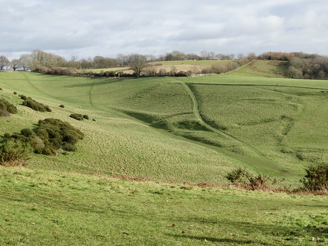
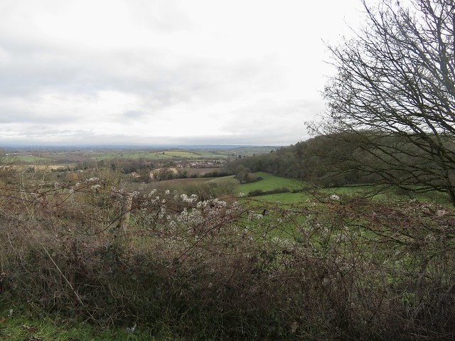
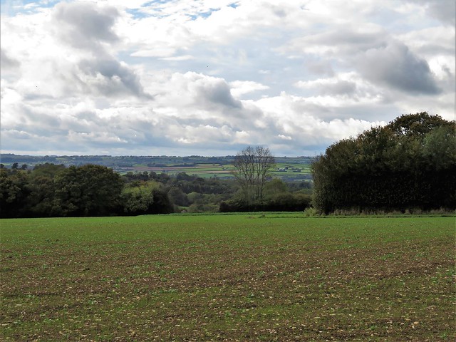
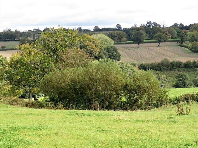
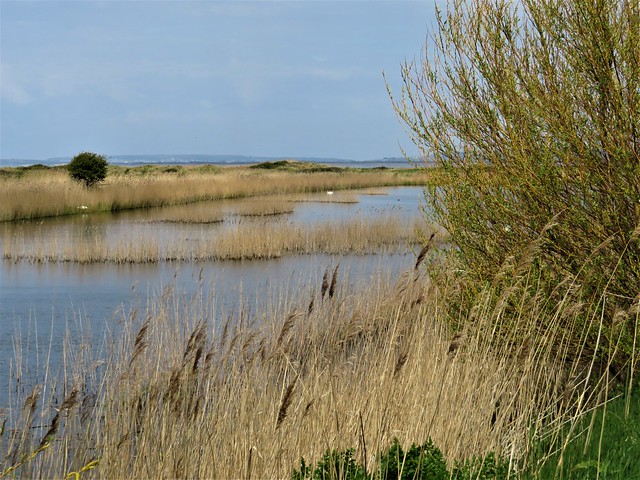
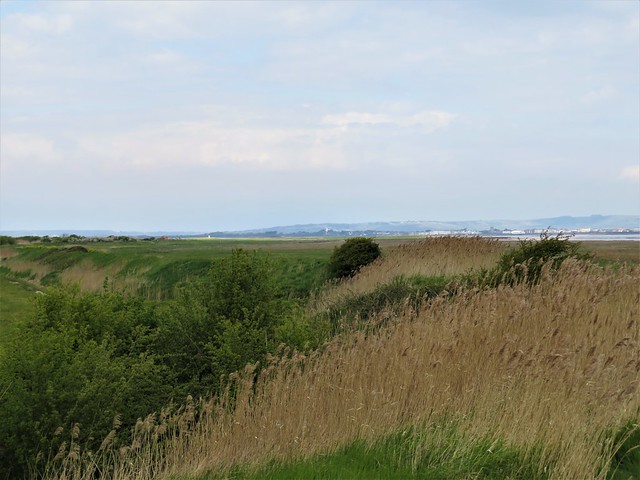
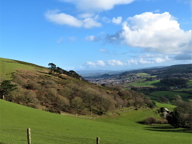
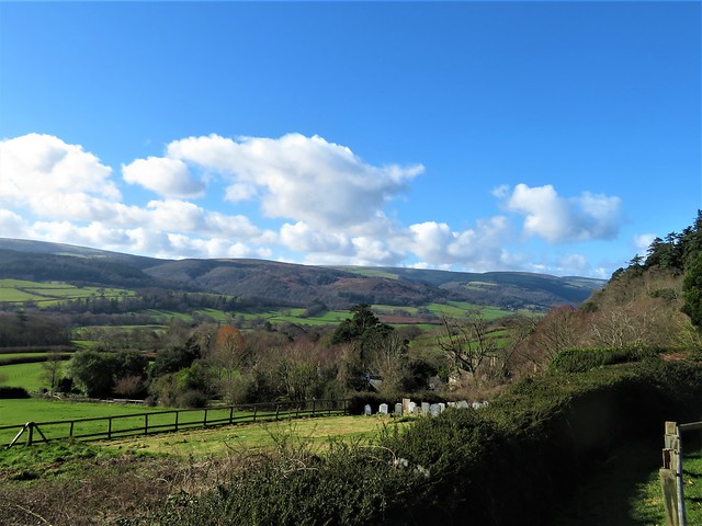
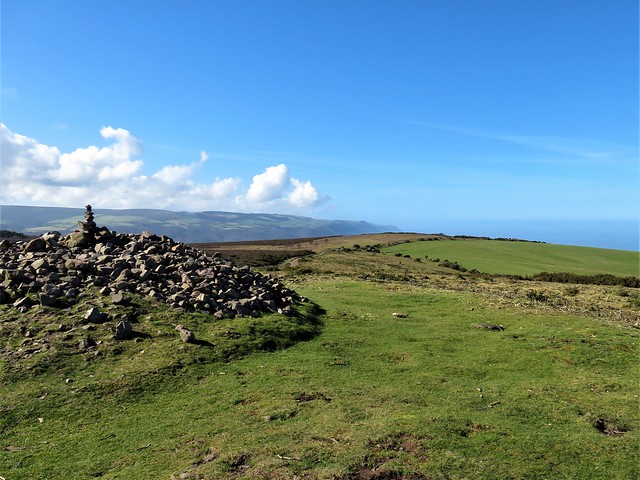
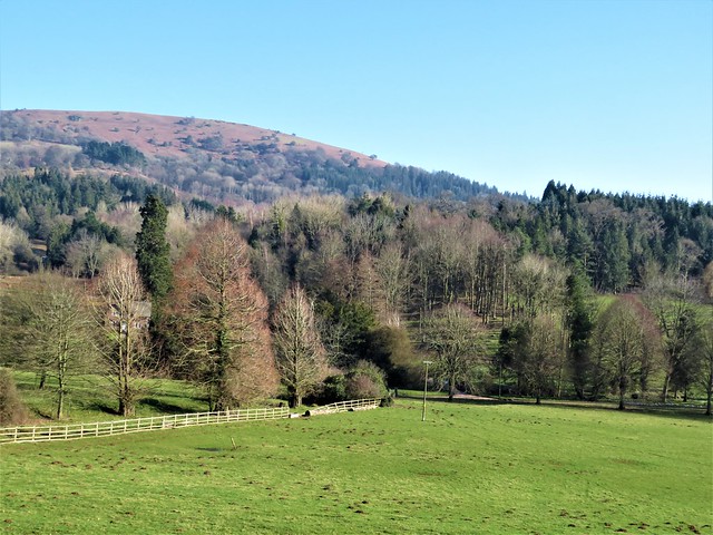
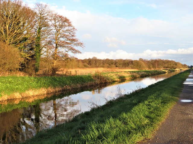
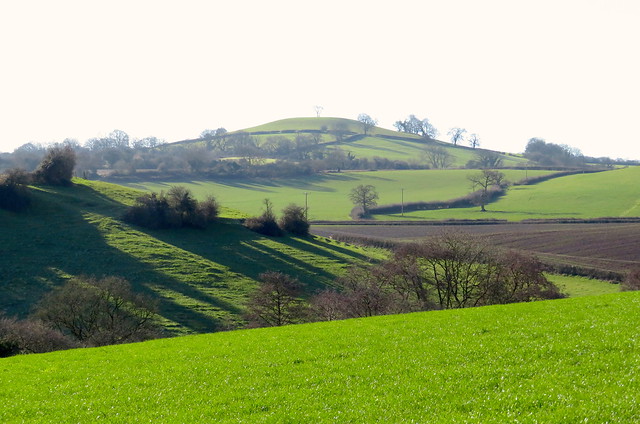
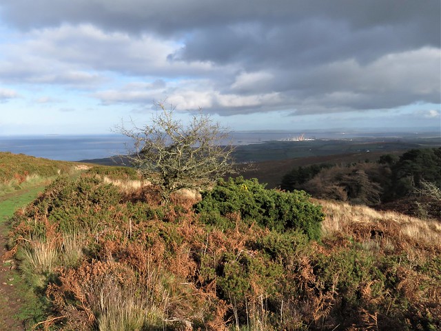
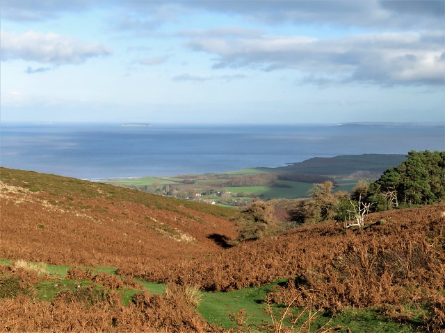
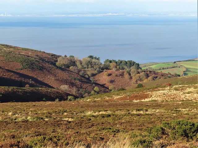
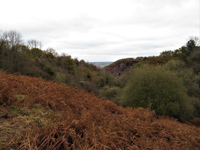
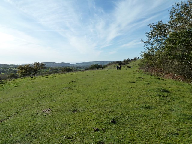
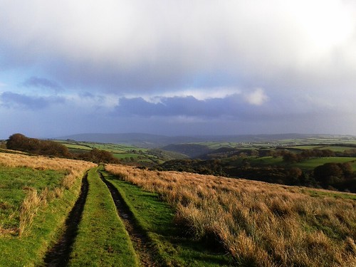
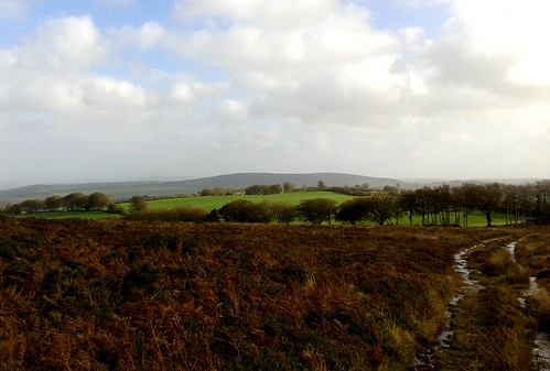
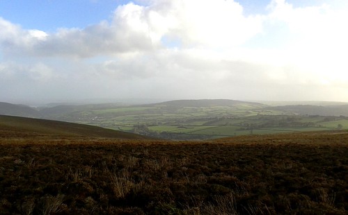
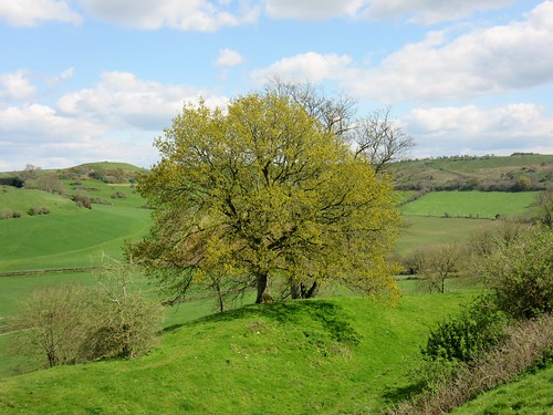
The Celtic tribe known as the Durotriges were expert builders of hilltop forts. The stronghold they dug and mounded on Ham Hill is a remarkable structure. It encompasses more than two hundred acres of south Somerset hilltop within a huge L-shaped enclosure of steep-sided double ramparts. On this windy winter morning the views were sensational, taking in dozens of miles of low-lying farmland bounded by blue and grey hill ranges – Mendip, Blackdown, Quantock and the Dorset downs. The local sandy limestone, known as hamstone, is a glorious deep gold, much prized by builders down the centuries.

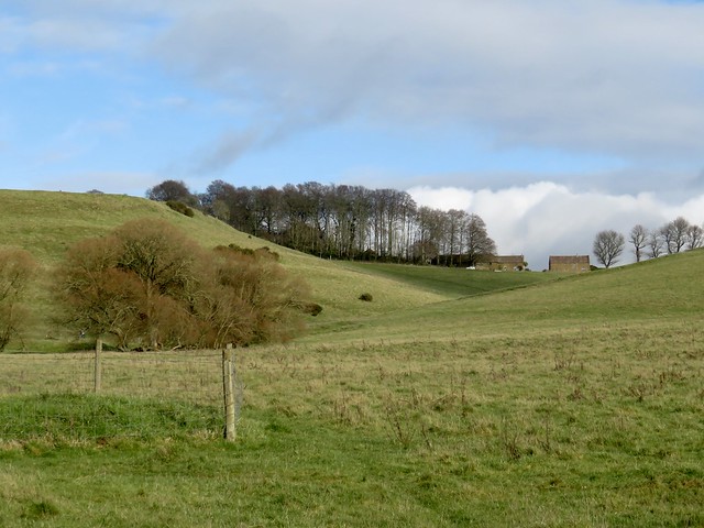
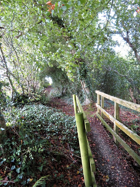
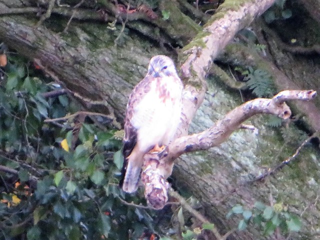
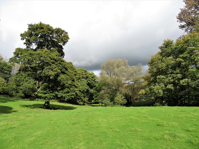
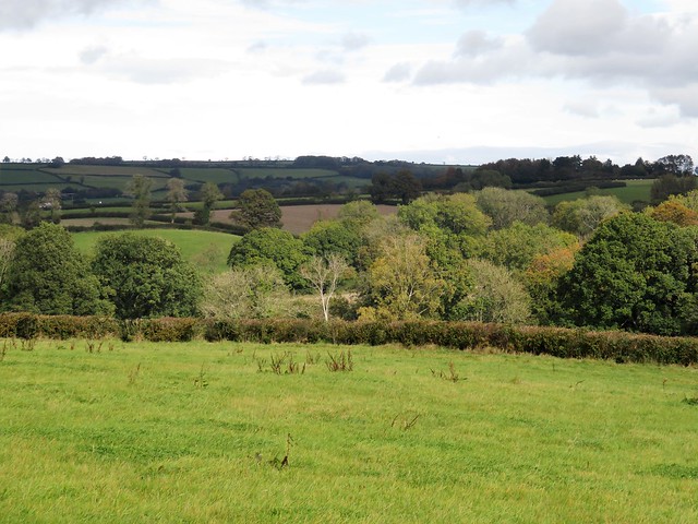
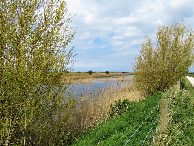
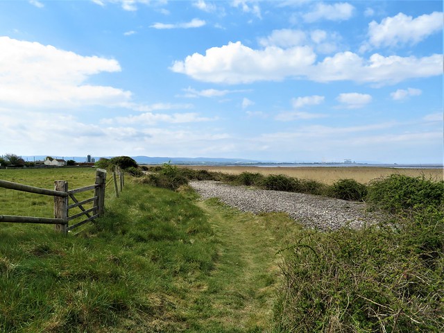
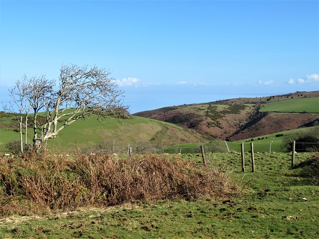
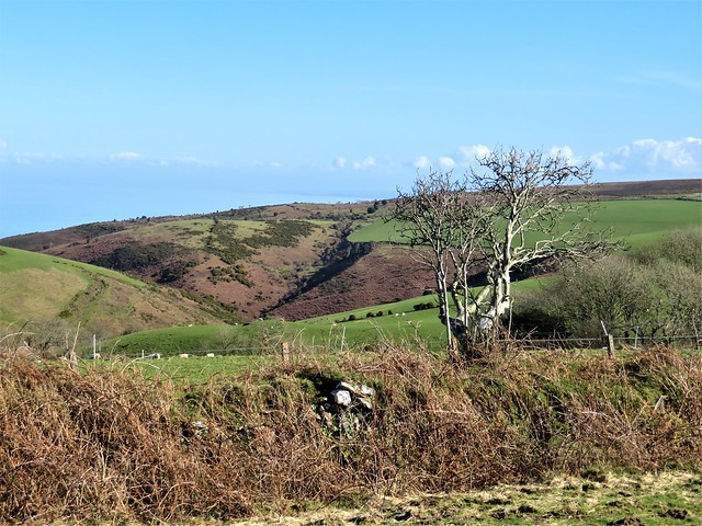
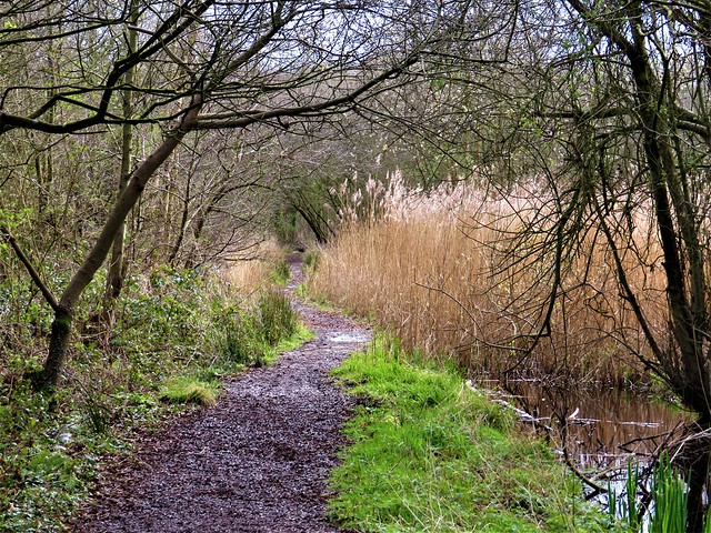
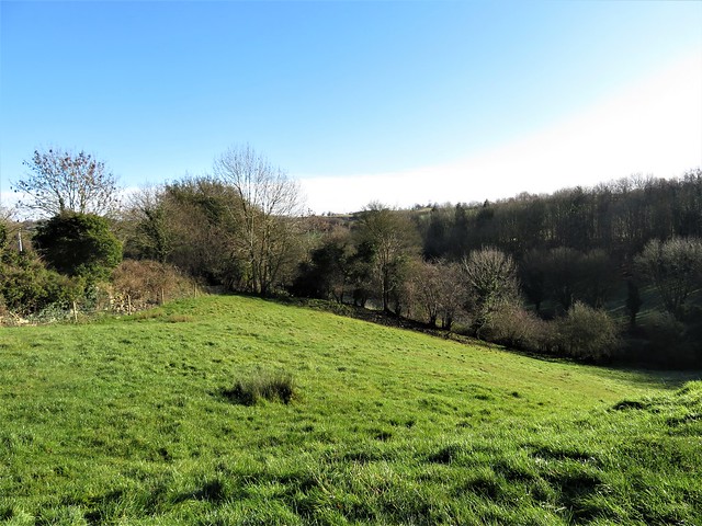
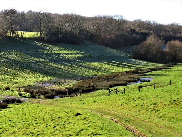
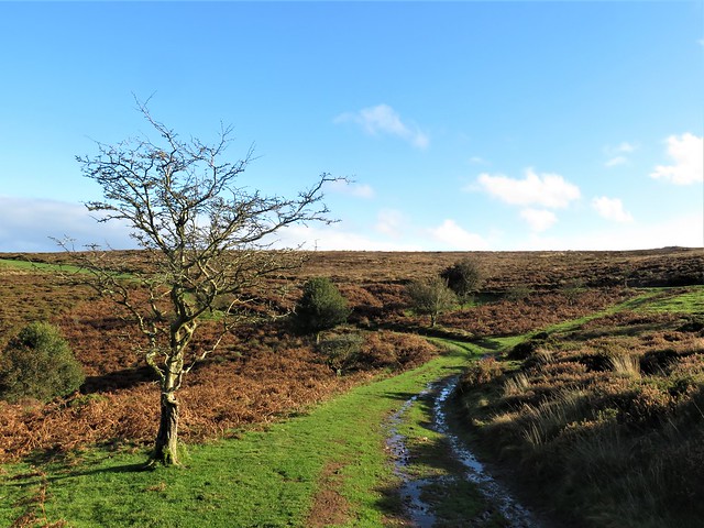
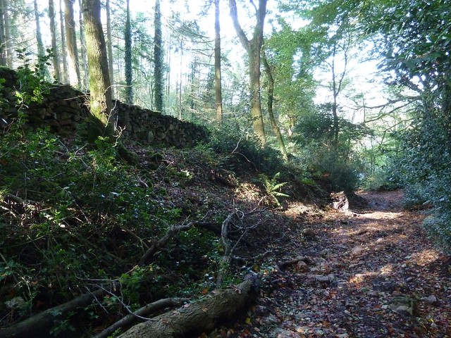
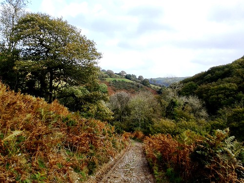
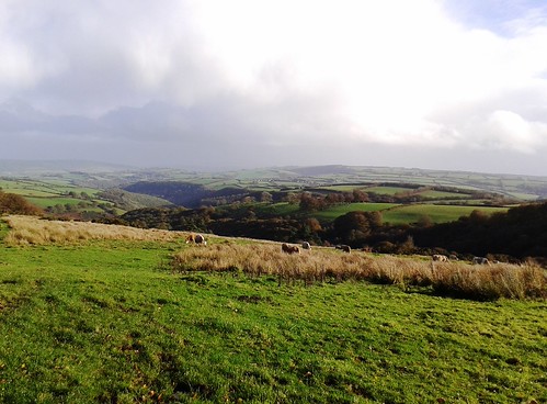
A hungry buzzard wheeled and mewed overhead as I followed the brambly ramparts south off the hill through lumps and delvings of many centuries of quarrying. At the foot of the ridge lay the quiet green valley of Witcombe, where mown paths led north again past the grassy outlines of a medieval village, abandoned when sheep farming became more profitable to landlords than the arable husbandry of the peasants.

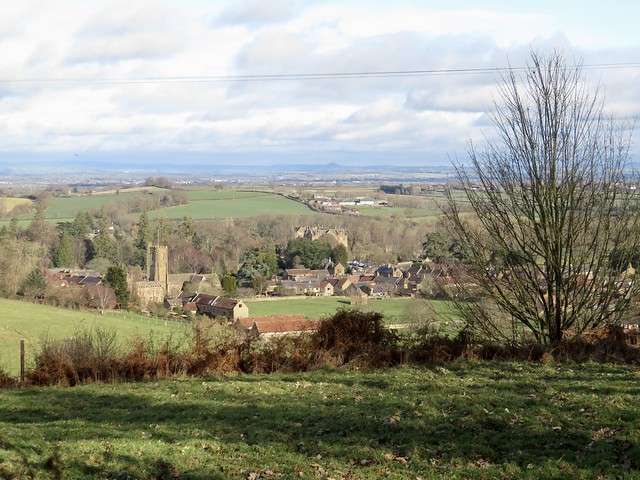
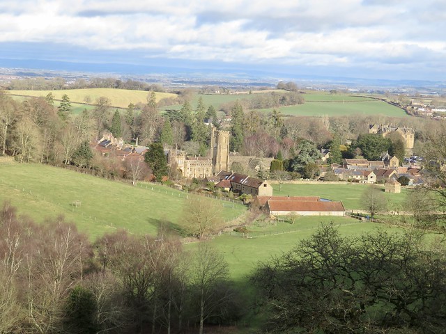
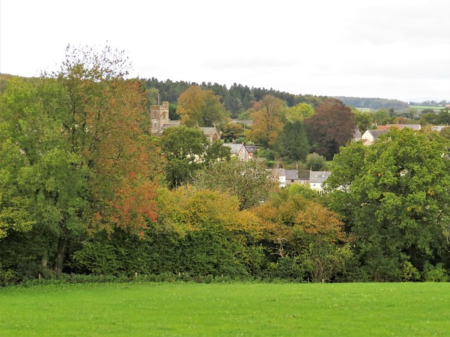
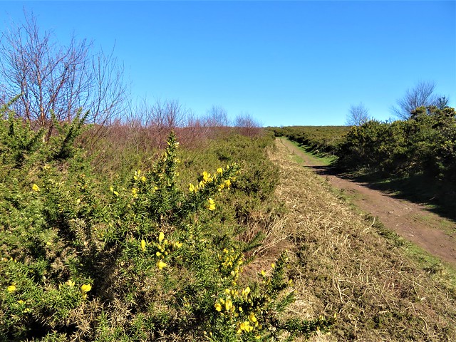
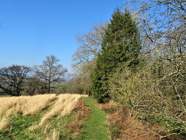
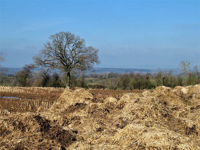
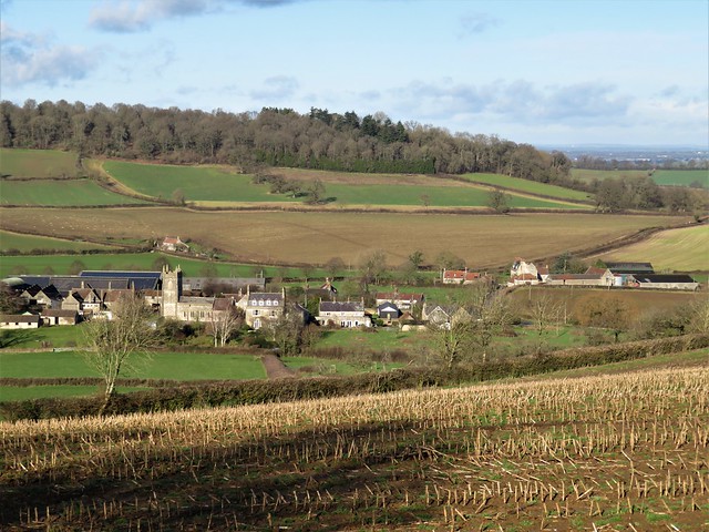
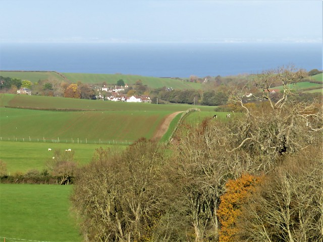
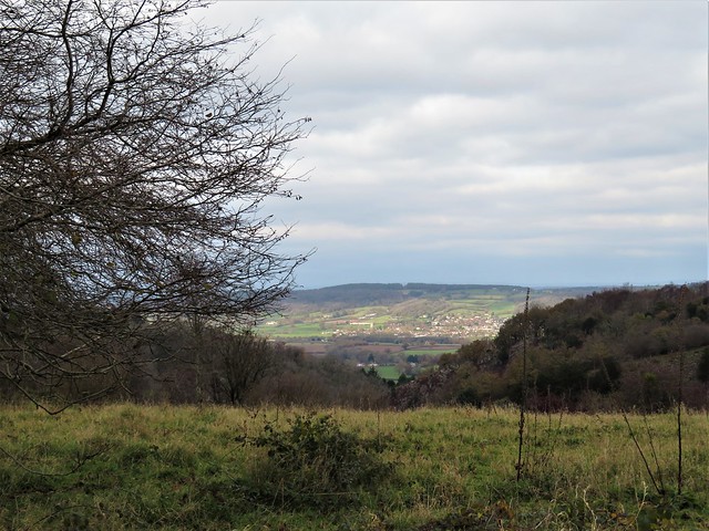
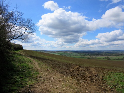
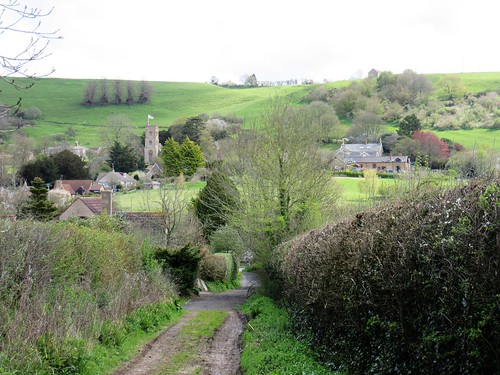
On the far side of the ridge I found a path edged with emerging daffodils. Last autumn’s beechmast crackled underfoot as I dropped downhill towards Montacute. The village lay below in clear wintry sunshine, a perfect composition, church tower, cottages and great Elizabethan mansion all glowing in golden hamstone.

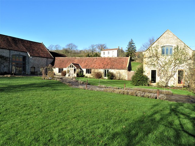
A quick pint of Palmers and a bowl of leek-and-potato soup in the conversational, dog-friendly Phelips Arms, and I made for the tree-smothered tump of St Michael’s Hill beyond the handsome old Cluniac priory gatehouse on the western edge of Montacute.

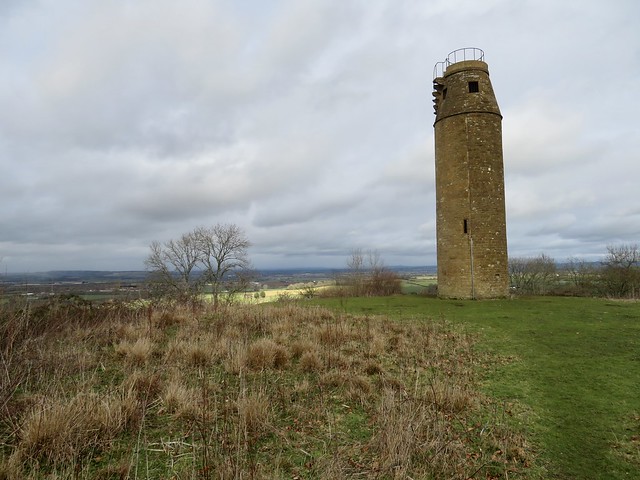
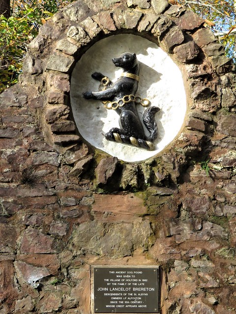
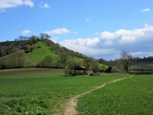
‘Mons Acutus, Mont Aigu’ – the abrupt profile of the hill gave its name to the village. Legend says that the Devil appeared in a dream to Tostig, standard bearer to King Cnut, ordering him to dig on the hill. A blacksmith was told to get on with it, and promptly unearthed a life-size crucifix of pure black flint.

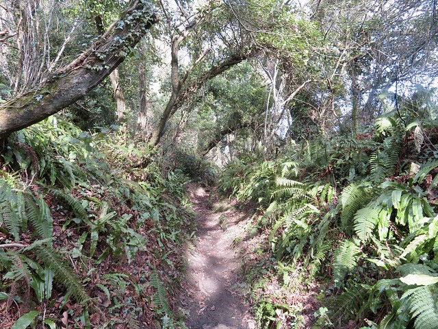
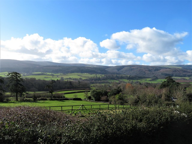
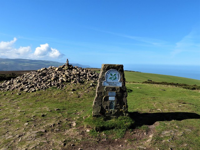
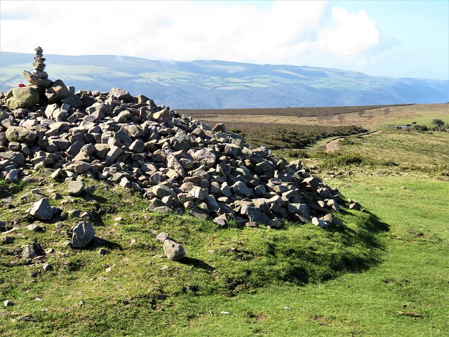
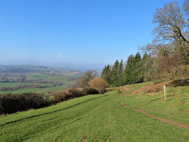
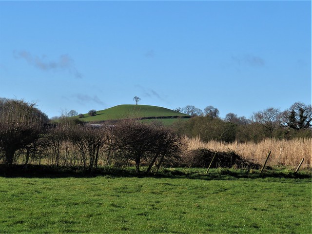
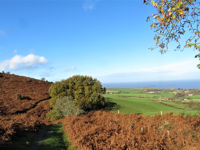
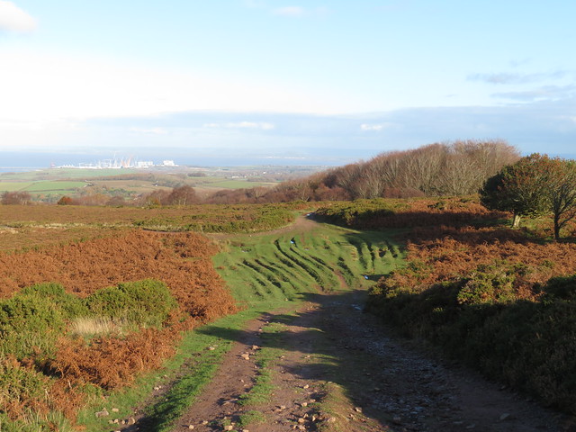
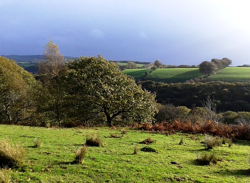
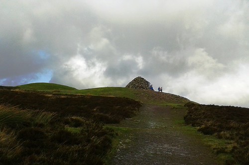
The Norman castle built on the summit was replaced by a chapel, itself supplanted in 1760 by a phallic folly tower of hamstone. I climbed the steep holloway to the summit and got a memorable prospect over sunlit lands where Blakean shafts of rain radiated out of the clouds as though to spotlight hidden treasure below in the gleaming floods of winter.

How hard is it? 5 miles; easy, but steep climb up St Michael’s Hill

Start: Ham Hill Country Park, near Stoke-sub-Hamdon TA14 6RL (OS ref. ST479168)

Getting there: Country Park signed from Stoke-sub-Hamdon (signed off A303 between Ilchester and Ilminster)

Walk (OS Explorer 129): Return to road. Left; pass right fork (478166); in 100m right to fingerpost (‘Monarch’s Way’/MW); left, following uppermost path (MW) for ¾ mile to T-junction (485159). Right downhill (‘Liberty Trail’). Near bottom, left (486154, ‘Witcombe Lane’); up valley; across road (492163). Follow footpath (fingerpost) above Hollow Lane; in 500m left along Hollow Lane (497166) into Montacute. Left down South Street (499168); at church and King’s Head PH, left (497169). Through gate; right (‘Hedgecock Hill’); follow MW up St Michael’s Hill. In 200m fork right (494168); in 50m right through gate; left up steep holloway, then path to summit tower (494169). Return down path; at purple arrow fork right; path descends to field. Ahead; in 100m sharp left (494170, purple arrows) downhill. Through gate; keep ahead; left beside stream. In 200m right (491169, stile, MW); in 30m left; follow track. In 250m, gate onto open ground (489169). Follow wood edge; in 700m right (481166, gate); right past circular stone; fork left on MW to car park.

Lunch/accommodation: Phelips Arms, Montacute TA15 6XB (01935-822557, phelipsarms.co.uk)

Info: friendsofhamhill.org; visitsouthsomerset.com; nationaltrust.org.uk/montacute

 Posted by at 03:50
Dec 092022


First published in: The Times Click here to view a map for this walk in a new window
Thorncombe near Forde Abbey Farm footbridge over Stonelake Brook near Thorncombe fungi on the Monarch's Way near Thorncombe IMG_5264 flooded gravel workings at Westmills Plantation rain approaching parkland near Forde Abbey IMG_5255 bushy hollow near Thorncombe near Thorncombe

The old wool-trading and lace-making village of Thorncombe lies up and down its sloping street, a handsome huddle of old cottages in a steep, remote piece of countryside where Dorset tips over into Somerset.

The sun was finally groping its way through the clouds after days of miserable rain. The fresh wind and brilliant autumn colours of the woods put a spring in our step as we followed the rim of the deep ferny cleft of Stonelake Brook.

The Monarch’s Way led north through pastures where the wet grass polished our boots for us. Flints underfoot crunched and crackled. Off on our left side the church and houses of Thorncombe sloped down their hillside, framed by oaks and beech trees in wind-tattered gold and scarlet.

Down at Synderford bridge we picked up the Jubilee Trail and followed it north across the red mud squelch of rain-swollen brooks and the broad clover leys on Chitmoor. Devon Ruby cattle grazed the fields at Wheel House Lane, the sturdy little bull inspecting the females with close solicitude.

A screeching chorus of pheasants arose from a maize field as we neared Forde Abbey, where the last of the afternoon was slanting across the old monastic buildings. The view down the drive from the ornate gates was of a surf of pink, white and purple cyclamen along the lime avenue leading away to beautiful gardens and fountain pools.

Just beyond Forde Abbey the meanders of the River Axe mark the Dorset border. We crossed the bridge into Somerset and turned west through lush river meadows dotted with fine old cedars. Along the river, the pink blooms of Himalayan balsam opened their spotted throats to release a spicy fragrance. We edged round a deep gravel pit, pushed our way through an elephantine jungle of maize nine feet tall, and skirted the empty yards of Forde Abbey Farm.

Now the sun made a belated return, streaking the sky with patches of blue and fringing the clouds with a sharp lining of silver. Lemon yellow beech leaves scuffed under our boots as we came past Whistling Copse and turned for home.

A great view of rolling country to west and east, and we were crossing Thorncombe’s cricket field where goldfinches in a flicker of wings were gobbling up the grass seed laid on the pitch by the groundsman in hopes of a perfect surface for next summer’s opening match.

How hard is it? 6½ miles; easy; field paths. NB GPS and OS Explorer map are helpful for route-finding.

Start: St Mary’s Church car park, Thorncombe, Dorset TA20 4NE (OS ref ST376034)

Getting there: From Crewkerne (A30, Chard-Yeovil) follow ‘Forde Abbey’, then ‘Thorncombe’.

Walk (OS Explorer 116): Path through churchyard to road; left to junction at chapel (376032); right uphill. In 100m pass ‘Old Alley’; left (375032, fingerpost/FP). At stile, ahead (yellow arrow/YA); in 2nd field, stile (377027, ‘Liberty Trail’) through trees. In 200m, sharp left on Monarch’s Way/MW (377025) to pass Yew Tree Farm (383031, ‘Wessex Ridgeway’). At road, right (380035).

At Synderford sign, left (382037, FP, Jubilee Trail/JT), skirting water treatment plant. Cross brook; bear right up field slope with hedge on right to gap (380037, JT). On by hedge, following JT waymarks to cross brook in trees by stepping stones (376041). Left up hedge, left through hedge at top of bank (375043); right to kissing gate/KG. Follow right-hand hedge; in 200m, right (374045, KG); left up hedge. In 200m, left with hedge on left (374047); follow JT to Wheel House Lane (371048).

Left; opposite Thorncombe turning, right (366047, FP, JT) across fields to road (362053). Right past Forde Abbey gates, across River Axe. Left (362054, ‘Horseshoe Road’). In ½ mile, recross Axe (356051, YA). Follow Liberty Trail/LW and YAs clockwise round gravel excavation at Westmills Plantation (354050). Cross road (355046, ‘Forde Abbey Farm’) across field. Skirt to right round Forde Abbey Farm buildings (357042); follow farm drive. At fuel tank fork left (363037, blue arrow) across field to Horseshoe Road (366037). Right (LT). In 200m bear right along hedge (366036, FP). In 650m path descends and bends right; left here (368030, stile) to stile in conifer hedge (370030). Across recreation ground to cross road (371031), then more fields (YAs) to Thorncombe.

Lunch: Bell Inn, Winsham TA20 4HU (01460-30677)

Accommodation: Haymaker Inn, Wadeford, Chard TA20 3AP (01460-64161, thehaymakerinn.co.uk)

Info: Chard TIC (01460-260051); fordeabbey.co.uk

 Posted by at 16:52
Apr 092022


First published in: The Times Click here to view a map for this walk in a new window
shore path to Steart Point scrub full of birdsong coastal reedbeds 1 coastal reedbeds 2 brackish water-crowfoot view across the reedbeds to the Severn Estuary signpost at the Tower Hide Tower Hide at Steart Point Tower Hide at Steart Point 2 coastal scrub and reedbeds, looking to Mendip Hills misty shape of Steep Holm island in mid-estuary looking west along the coastal path from Steart Point coastal path towards Steart Point

Where the Severn Estuary merges with the Bristol Channel is a moot point, but the tidal water is always full of energy, swirling in purple and chocolate at high tide, then retreating with the ebb to expose vast sand and mud flats.

Off Steart Point the turbid River Parrett enters the tideway. At low tide the mud flats here stretch two miles out into the estuary, a haven for feeding birds. But flood tides are another story. The mud and sand are swallowed up, the Bristol Channel brims, and inundation can threaten the farmland and small settlements along the coast and far inland.

We set off at low tide along the coast path from the scattered hamlet of Steart. The dimpled miles of mud flats gleamed. The distant island of Steep Holm appeared marooned in mud and sand. In the southwest the Quantock Hills stood beyond the giant cranescape of half-finished Hinkley Point nuclear power station, while in the east rose the green whaleback of Brent Knoll and the long spine of the Mendip Hills.

The shoreline path ran on rabbit-riddled sands, turf and crunchy pebbles. A pale yellow bloom on one of the coastal fields turned out to be a solid mass of cowslips. Wild birds were everywhere – greenfinches and linnets on the bramble stems, shelduck assiduously hoovering the mud for crustaceans with sideways sweeps of their bright red bills, and a reed warbler complaining with unending chittering in the reedbeds.

At Steart Point a tall hide looked out across this remote landscape of flat fields, far hills, upstart knolls and tidal flats. From here the River Parrett Trail led back inland, the mud-slimed banks of the Parrett shining silver in the sun and wind. Here the Wildfowl & Wetland Trust had been working with Environment Agency to create anti-flooding buffer zones with flood banks built to encourage new saltmarsh to grow to the seaward – a bold initiative that works with nature rather than trying to strongarm it into submission.

We followed the trail down to where a breach has been cut in the Parrett’s defences. New mud, marsh, reedbeds and creeks show the effectiveness of the work. Pochard cruised a big pool where three herons stood on one leg apiece and regarded us with grave suspicion.

A grassy path led back to the shore. The morning mist shredded away to reveal the hills of South Wales far across the rising tide, and a flight of golden plover flickered low over the rapidly vanishing mudflats where the Parrett met the sea.
How hard is it? 6 miles; easy; shore paths

Start: Steart car park, Steart, Bridgwater TA5 2PX (OS ref ST 276459)

Getting there: A39 (Bridgwater-Minehead); at Cannington, right (‘Hinkley Point’, then ‘Steart Marsh’). Pass Steart church; car park in 500m on left (gate).

Walk (OS Explorer 140): From car park follow green lane north to sea wall (274460). Right (‘Steart Point’) for ⅔ mile. At Steart Point, right past tall hide (283467); right (‘Wall Common’). In 150m, left (kissing gate/KG); follow River Parrett Trail/RPT. In 700m at Manor Farm, ahead along road (278462); by Dowells Farm, left (276458, KG, RPT) to river wall; left to breach and hide (280454). Return to KG; dogleg left/right along river wall (‘Steart Gate, Polden Hide’), following RPT. Pass turning to Steart Gate car park (267454); in ½ mile, signpost ‘Polden Hide 0.71’ points left (261449), but keep ahead to cross road. On between 2 marker stones on grassy path to shore (254451); right (‘Steart’) to car park.

Lunch: Picnic

Accommodation: Malt Shovel Inn, Cannington TA5 2NE (01278-653880, themaltshovelinn.com)

Info: wwt.org.uk/steart-marshes (01278-651090)

 Posted by at 01:01
Dec 252021


First published in: The Times Click here to view a map for this walk in a new window
view above Wydon Farm view from Selworthy towards Exmoor view from Selworthy towards Exmoor 2 gorse by the moor track above Selworthy Combe trig pillar and cairn on Selworthy Beacon cairn on Selworthy Beacon 1 cairn on Selworthy Beacon 2 looking seaward from Selworthy Beacon easterly view from the South West Coast Path easterly view from the South West Coast Path 2 path near Wydon Farm homeward path maize mud moor pony homeward path towards Selworthy

Above the thatched cottages of Selworthy, the whitewashed tower of All Saints Church looked out across a wide green valley to the high undulating skyline of the Exmoor hills. A perfect view for a perfect winter’s day of blue sky and brisk wind.

A buzz like that of an angry wasp showed where someone was busy cutting wood in Selworthy Combe. The path rose through the trees between banks of tiny trumpet-shaped mosses. A robin perched on a post, puffing out his red breast and trilling a silvery call, quite unafraid as we passed within touching distance.

A brook came rustling down over neat little log spillways, its soft rich chuckle accompanying us all the way up through the oak and holly groves to the moor above. A contrast as abrupt as a knife cut, abandoning the shelter of the woods for the open moor where a biting wind ruffled the seas of heather and gorse running away to the horizon.

The National Trust and Holnicote Estate take great care and trouble over these 12,000 acres of upland, moor and combes. The woods are sensitively managed, the farms well run, and the hundreds of miles of footpath properly signposted.

We followed a broad bridleway through the gorse to the cairn on Selworthy Beacon. From here the view was mighty, over the rolling Exmoor hills, east and west along the curved cliffs of the Somerset coast, and out north across a Bristol Channel as pale as ice to the misty shores of South Wales under a long triple bar of cloud.

Above us only sky, as blue as delicate porcelain. We skirted a harras of Exmoor ponies, long tails billowing in the wind, and struck east along the South West Coast Path with the sea at our left elbow. A long cattle train of belted Galloway heifers went gadding and lurching along the skyline at a clumsy canter, delighted to be out in the open air.

The coast path led between sheep pastures through wind-stunted gorse bushes as stout as trees. A solitary bee buzzed among the gold gorse flowers, first raider of the year.

We turned inland and dropped down to Wydon Farm, hidden in a cleft so steep that, like Lucy in ‘The Tale of Mrs Tiggy Winkle,’ it looked ‘as though we could have dropped a pebble down the chimney.’

The homeward path lay along high-banked farm lanes. Tiny lambs bleated in quavering voices for their mothers, and a little egret stepped fastidiously along a streamlet, searching with gimlet eyes for any morsel to assuage its winter hunger.

How hard is it? 5½ miles; moderate hill walk, very well waymarked

Start: All Saints Church car park (£1 donation), Selworthy, Minehead, Somerset TA24 8TR (OS ref SS 920468)

Getting there: Selworthy is signed off A39 (Minehead to Porlock)

Walk (OS Explorer OL9): Left along road; right by church and follow ‘Selworthy Beacon’ fingerposts for 1 mile to Selworthy Beacon (919480). At cairn/trig pillar, left for 100m; right down to South West Coast Path (917481). Right along SWCP; in 1½ miles, right (938476, ‘Wydon ½’ fingerpost). In ½ mile at Wydon Farm, right (938470) on road. In 400m fork right (939466, ‘Hindon’). At Hindon Farm, left (933466) up track to road (931464). Ahead; in 300m, right (932461, ‘Selworthy Beacon’). At East Lynch Farm fork right (929462, ‘bridleway’). In 100m fork right again; in 50m, left (927463, stile, ‘public footpath’). Along fence to stile (935464); half right to road (923466); left into Selworthy.

Lunch/accommodation: Ship Inn, Porlock TA24 8QD (01643-862507, shipinnporlock.co.uk)

Info: nationaltrust.org/selworthy

 Posted by at 01:57
Mar 202021


First published in: The Times Click here to view a map for this walk in a new window
picture picture picture picture picture picture picture picture picture picture picture
Facebook Link:

Seen from the escarpment edge of the Mendip Hills, the aspect of the Somerset Levels after weeks of flooding had turned from streaky silver back to green and brown. On a lovely afternoon of early spring, a bit cloudy, a bit sunny, we set out from the Avalon Marshes Centre to explore Shapwick Heath National Nature Reserve, one of several bird-haunted NNRs in these watery West Country moors.

The main spine of the Shapwick Heath Reserve is the old branch railway line across the moors to Burnham-on-Sea. From this ruler-straight track, side paths and boardwalks lead to observation hides (temporarily closed).

The path we followed led through lush carr woodland of birch, alder and pussy willow stubbled with silky catkins. Sunlight glinted in the wet glades and on the birch trunks. Pollarded willows bristly with stems stood above their own reflections in black mirrors of shallow, peat-stained water. Bracket fungi multiplied their creamy frills, thriving on sodden birch trunks fallen into the water. A lush, marshy, ferny place of luminous green mosses, the surfaced paths springy underfoot, everything permeated by water.

Our ancestors built cunning wooden trackways to get them safely over this treacherous ground. We came across two replicas of these early thoroughfares deep in the carr woods. The Meare Heath trackway of the late Bronze Age had planks laid lengthways in pairs, held in place with wooden pegs. Further into the marsh lay a wobbly section of single planks about eight inches wide, laid end to end, held with pegs and cross ribs – a replica of the Sweet Track that was built over these marshes 6,000 years ago.

We teetered along the bouncy planks with arms outstretched for balance, conscious of the black water just one clumsy step away, before reaching firmer footing and the path to Decoy Hide. Here we paused, looking out over lake and reedbeds to a sunlit Glastonbury Tor and tower in the distance.

Back on the railway path we followed the old track east past huge reedbeds and lagoons, former peat diggings now flooded and packed with wintering ducks – shovelers with spatulate beaks and iridescent green heads, tufted duck with white side patches and golden eyes, and pochard with pink beaks and scarlet eyes.

As we turned for home, a Cetti’s warbler suddenly emitted a burst of chatter from the scrub, loud enough to make us jump. A marsh harrier went flapping slowly along the edge of a mere, its legs bright yellow, its wings patchworked in buff, white and orange, with long black feather ‘fingers’ at the tips. And a foghorn voice came booming from a reedbed – a bittern, asserting mating season sovereignty over its watery kingdom.

How hard is it? 6½ miles; easy, level walking; some parts can be boggy

Start: Avalon Marshes Centre, Shapwick Road, Westhay, Glastonbury BA6 9TT (OS ref ST 426416)

Getting there: Shapwick Heath NNR is signed from Westhay (B3151, Glastonbury-Wedmore)

Walk (OS Explorer 141; leaflet maps/trail guides available at Avalon Marshes Centre or online at avalonmarshes.org; NB hides are temporarily closed): Left along Shapwick Road; just after bridge, left (423411) along old railway track (‘Bittern Trail’). In 200m right, following ‘Sweet Track’, then ‘Decoy Hide’ for ¾ mile to Decoy Hide (closed at present, but still a great birdwatching spot). Return, following ‘Reserve Entrance’ to old railway (427409). Right for 1¾ miles to Ham Wall Reserve car park (450396); return along old railway to Avalon Marshes Centre.

Info: Avalon Marshes Centre (01458-860120, avalonmarshes.org). Marshes Hub Tea Stop café open for takeaway 10-4.
satmap.com; ramblers.org.uk
More walks info: @somerville_c

 Posted by at 02:38
Feb 202021


First published in: The Times Click here to view a map for this walk in a new window
picture picture picture picture picture picture picture picture picture picture picture picture picture picture
Facebook Link:

We set out under a cold grey sky on one of those dank winter days when you are glad of the company of two pelting dogs to cheer you up and urge you into motion. There is nothing more ridiculous than a dog frisking about like a mad thing, and nothing better at barking the midwinter blues away.

Priston lies sunk in a fold of ground just south of Bath in that debatable land where Cotswold and Mendip hills blur together. Beyond the stone-built cottages we passed the church of St Luke & St Andrew with its curious central tower and outsize weathercock.

The path led south-west down a narrow valley where a slim and nameless stream slid round its bends under a coat of leaf-green weed. On the far side of the park-like wooden fences, ewes heavy with lambs stared and turned tail. Hazel twigs wriggled with catkins, snowdrops hung their white heads among the damp black leaves of last summer, and the bare hedges were netted with ragged powder puffs of old man’s beard.

The dogs played follow-my-leader, sheepdog Megan with a stick across her jaws. Cockapoo Philip zigzagged from one ditch to another like an earthbound snipe. By the time we reached the farm lane at the foot of the valley, he was sporting a thick and clotted pair of mud trousers, and had turned colour from pale cream to chocolate brown.

Turning north up the hill, we passed an old sheep-dip in the break of a field, beautifully shaped and stone-walled. Alas, no water in it for cleaning filthy Philip. From beyond the hillock of Priest Barrow came the pop-pop of shotguns and a faint cawing of rooks disturbed from the roost.

The path sloped down to Stanton Prior and the little grey church of St Lawrence. From here we turned south across the slopes of Pendown Hill to drop into the Priston valley, spread in greens and greys below. At Priston Mill the pool lay as dark as smoked glass. Beyond, the cottages and farm of Inglesbatch stood along their ridge.

The dogs, garbed from muzzle to tail in mud, led the way home beside a brook overhung with pussy willow buds as soft as kittens’ paws. In the sodden fields buzzards sat and waited, hungry enough in this back end of winter to be grateful for every unwary worm they could seize and swallow.

How hard is it? 7 miles; easy; field paths, muddy in places; 2 streams to ford)

Start & finish: Ring o’ Bells PH, Priston BA2 9EE (OS ref ST 694605)

Getting there: Priston is signed from Marksbury on A39 Bath-Wells road

Walk (OS Explorers 155, 142): Leaving Ring o’ Bells, turn left along side of pub. Take left fork to pass church; bridleway continues (692604, ‘Bridleway’); over stile and on (yellow arrows/YA). In 250m, fork left (YA) to valley bottom, and follow path for 1 mile to road (677595). Right uphill. In 200m, left through kissing gate/KG (677597); right along hedge, following YAs north for ¾ mile past Priest Barrow to road (675610).

Forward for 50m; forward off road (fingerpost, KG). North along hedge; across footbridge; through KG, up to top of hill. At road (675618), dogleg right/left; on up green lane, crossing road (675620) and on for half a mile to Stanton Prior (676627). Right along road past church; in 150m, on left bend, right along byway (679628) for ⅓ mile to cross road (682623). On south (‘Bridleway’) for ⅔ mile to road at Pottern (685614). Left; fork left for ⅔ mile to pass Priston Mill (695615).

In another 100m, fork right (‘Byway’) across ford and on for 350m to gate (699613). Left along green lane; cross ford; up slope, right at top (701614). In 100m, pass barn; right through small gate; through KG. Down slope to next KG; down to cross footbridge (700611). Follow field edge, YAs south to road (697606); right into Priston.

Info: priston.org.uk; satmap.com; ramblers.org.uk

 Posted by at 02:23
Dec 192020


First published in: The Times Click here to view a map for this walk in a new window
picture picture picture picture picture picture picture picture picture picture
Facebook Link:

One dark night long ago the huntsman at Alfoxton Manor was eaten by his own hounds, so says the tale. He got up from his bed to quell a dogfight in the kennels, and they didn’t recognise him in his nightshirt.

Setting off from Holford on a glorious winter day of blue sky above the Quantock Hills, we stopped to admire the old dog pound beside the path to Alfoxton. What a pity those hungry hounds hadn’t been safely penned up behind its stout stone walls.

William and Dorothy Wordsworth came to roost at Alfoxton (then ‘Alfoxden’) in the summer of 1797. Nearby lived their new best friend, Samuel Taylor Coleridge.
We passed the manor house, solid and white among beautiful beech and oak woods. Coleridge and the Wordsworths walked daily over the hills and through the deep wooded combes of Quantock, ‘three people, but one soul’, as Coleridge put it. Rumours spread that the three strangers were spies for Napoleon, and the Wordsworths had to leave their Eden in the Quantocks, never to return.

Along the drive missel thrushes with spotted throats were busy raiding the cherry trees whose scarlet fruits dangled at the end of long stalks. The birds darted from tree to tree with their characteristic muscular wing thrusts and direct, purposeful flight.

Red deer hinds went trotting springily across the paddocks among the horses. The Quantock Greenway path wound at the foot of the hills, with breathtaking views opening northwards over the Bristol Channel, its tides stained a milky mulberry hue by the mud of many estuaries. As we gained height we made out the upturned hull shape of Steep Holm island, the white lighthouse on neighbouring Flat Holm, the long spine of Mendip running inland, the far coast of Wales in a blur of distance – and on the shore below, the giant’s geometry set of Hinkley Point C nuclear power station, still laboriously a-building.

Up on the top the wind blew cold. We followed wide grassy bridleways where hill ponies with ground-sweeping tails cropped the verges. A fantastically exhilarating ramble, east along the ancient green trackway evocatively titled The Great Road, then slanting steeply down to join the homeward path in the depths of Hodder’s Combe with its skein of rustling brooks and springs.

‘Upon smooth Quantock’s airy ridge we roved
Unchecked, or loitered ’mid her sylvan coombs*.’
*Wordsworth’s spelling.

That’s how Wordsworth remembered those happy Quantock days in ‘The Prelude’, and it neatly summed up our day, too.
How hard is it? 6 miles; moderate, some short climbs; moorland and valley tracks, some muddy; streams to ford
Start: Holford Bowling Green car park, Holford, Bridgwater TA5 1SA (OS ref ST 154410)
Getting there: At Holford (A39, Bridgwater-Minehead) follow lane by Plough Inn (brown sign ‘Combe House Hotel’) to car park.

Walk: Left along valley road. Follow ‘Quantock Greenway’/QG (green arrows), and ‘Coleridge Way’/CW (quill symbol) for 2 miles. Cross Smith’s Combe stream (132422, signposted); continue on QG, CW. Pass conifer plantation; in 150m, sharp left (129423, fingerpost, blue arrow/BA) up bridleway. In 450m at top of slope, left at track crossing (127420). Follow broad green bridleway south for 1 mile, keeping ahead over all track crossings, to Great Road trackway (132407, fire beaters). Left; in ⅔ mile, descend across widespread track crossing (141410); in 150m, fork right beside trees (BA, ‘No Vehicles’). In 300m cross track (145408); descend into Hodder’s Combe. Ford streams (144403); left along far bank for ¾ mile to car park.
Lunch: Plough Inn, Holford (01278-741652, holfordvillage.com)
Accommodation: Combe House Hotel, Holford TA5 1RZ (01278-741382, combehouse.co.uk)
Info: quantocks.com; satmap.com; ramblers.org.uk

 Posted by at 01:27
Jan 182020


First published in: The Times Click here to view a map for this walk in a new window
picture picture picture picture picture picture picture picture picture picture picture picture
Facebook Link:

A perfect Somerset winter’s day of sharp blue sky. Sunlight gilded the roofs of Rowberrow, nowadays a quiet little village, but in times past a rough mining centre where men dug calamine for the brass-making industry. Martha More, visiting in 1790, judged the locals ‘savage and depraved, brutal and ferocious.’

The long shape of Blackdown, highest point of Mendip, looms on the southern skyline. Today its slopes were trickling with water. With a hollow gushing a stream tumbled into the chilly depths of Read’s Cavern, one of dozens of water-burrowed caves in Mendip’s limestone massif. When Read’s was excavated in the 1920s, a set of Iron Age slave manacles was unearthed, their story untold but ripe for imagining.

A broad track rises up the flank of Blackdown. We climbed through fox-brown bracken where cattle grazed and thirty-five semi-wild ponies snorted and cantered away in a bunch. From the ridge the view was enormous, from the Quantock Hills and Exmoor down in the southwest to the steely grey Bristol Channel with its twin islands, pudding-shaped Steep Holm and sleeping-dog Flat Holm.

Along the foot of Blackdown the muddy Limestone Link footpath took us sliding and squelching past Burrington Combe. Wild goats were grazing the grey striped cliffs of the gorge, their white coats contrasting with the scarlet berries of cotoneaster.

On the slopes opposite the combe the Reverend Dr Thomas Sedgwick Whalley, rich through a ‘good marriage’ in mid-Georgian times, developed a humble cottage into the Italianate extravaganza of Mendip Lodge, a massive country house with a state bedroom, mile-long terraces and a verandah nearly a hundred feet wide.

Mendip Lodge, like the good doctor’s wealth, eventually fell into decline. All we found of the grand design was a huddle of ruins behind an archway in Mendip Lodge Woods, beside the winding path that was once a fine carriage drive.

High above on the limestone upland of Dolebury Warren the sloping ramparts of a massive Iron Age hill fort encircle the western end of the ridge. Here we sat to catch our breath and gaze across the channel to the far-off hills of Wales.
Start: Swan Inn, Rowberrow, Winscombe, Somerset BS25 1QL (OS ref ST451583)
Parking: please ask, and give pub your custom.

Getting there: Rowberrow is signed off A38 between Churchill and Winscombe

Walk (8 miles, easy, OS Explorer 141): Left down School Lane. Just after right bend, left down track (453583); in 300m at T-junction, right (454586). In ¾ mile, right (465586, ‘Bridleway, Ride’, waymark post); in 100m, left on path through bracken. In 250m detour left to Read’s Cavern (468584). Resume bracken path, uphill to ‘Rowberrow Warren’ sign (469581); left through gate; right uphill. In 200m fork left (469579), upwards for ¾ mile to track on Blackdown ridge (477573); left to Beacon Batch trig pillar (485573). Left downhill to foot of slope; left (490577, waymark post, Limestone Link /LL) for 1¼ miles. On open ground 350m after crossing West Twin Brook, at crossing of broad grassy tracks, right downhill (473583). In 700m, near Link hamlet, left (475590, fingerpost) on path through Mendip Lodge Wood. In ⅔ mile pass Mendip Lodge ruin (466591); in 150m, left up bridleway. Pass gate/’Dolebury Warren’ sign on right; in 100m right (gate, blue arrow, ‘National Trust’) across Dolebury Warren (LL) for 1¼ miles, down to T-junction by Walnut House (446591). Left (LL) for ¾ mile; right (454586) to Rowberrow.

Conditions: Can be very muddy.

Lunch: Swan Inn, Rowberrow (01934-852371, butcombe.com)

Accommodation: Woodborough Inn, Winscombe BS25 HD (01934-844167, woodborough-inn.co.uk)

Info: mendiphillsaonb.org.uk; satmap.com; ramblers.org.uk

 Posted by at 03:00
Oct 272018


First published in: The Times Click here to view a map for this walk in a new window
picture picture picture picture picture picture picture picture picture picture picture picture picture
Facebook Link:

A wild, blustery autumn day had marched in on Exmoor from the west. We waited in the car park at Dunkery Gate until the rain army had charged through and away, and set out in its heels to climb the path to the crest of Dunkery Beacon. A piglet-like squealing came down the wind from above, and when we came over the brow we found three children leaping and yelling for sheer glee round the summit cairn, their coats flying in the gale.

Up here on Exmoor’s highest point, standing by the cairn on the rocky tomb of some long-forgotten king, we drank in the view, as brisk and refreshing as a great gulp of cold water. Ninety wide and beautiful miles stretched out from the tiny tip of the Sugar Loaf, north across the Bristol Channel in Wales some 50 miles away, to Yes Tor’s hummock on Dartmoor nearly 40 miles to the south. Not that we could see those two distant landmarks in such conditions of wind and sun dazzle and rain curtains – it was enough to know they were out there, visible from Dunkery Beacon on the clearest of clear days. What we saw today were rolling ridges of moorland, humped green fields squared with tall hedge-banks, and a sunlit valley leading north to the bulky seaward slope of Hurlstone Point.

We turned east on the rocky ridge track, bowling along with the wind astern pushing us like a second-row rugby forward. The sun burst out across the hills, bringing the whitewashed farm houses far below into brilliant relief against their green meadows and woods. Suddenly a flight of twenty small birds went skimming across the path just ahead, cutting and turning like one creature, the sun flashing on their white breasts and sabre-blade wings – dunlin or plovers, they passed and vanished too quickly to be sure.

From the ridge, a squelchy river of a bridleway made a sloshy descent southward into the sheltered cleft of Mansley Combe. Down here, deep sunk in the valley bottom, the day fell suddenly calm. Gale-driven clouds tore over from rim to rim of the combe a hundred feet overhead, and the wind rushed and sighed in the beech canopy where leaves scattered horizontally in showers of gold.

We forded the River Avill, hurrying in bubbles and miniature rapids under a canopy of silver birches and luxuriant, rain-pearled ferns. As we followed the red mud track steeply up towards Dunkery Gate again, from the trees in the depths of the combe came a grinding, grating roar – a red stag bolving*, calling out a defiant rutting challenge to all comers, a wild voice to suit the wild day.
* Yes, that’s the word!

Start: Dunkery Gate car park, near Wheddon Cross, TA24 7AT approx (OS ref SS 896406)

Getting there: Dunkery Beacon is signed off B3224, 1 mile west of Wheddon Cross (A396 Dunster-Dulverton)

Walk (4½ miles, moderate, OS Explorer OL9): Cross Dunkery Bridge; in 100m, left (‘Public Bridleway Dunkery Beacon’) to summit cairn (892416). Right along main ridge track for nearly 1 mile. Cross road (904420) and continue; in 300m, right (907422, cairn) on bridleway through heather for nearly 1 mile. At hedge-bank (914410), don’t go through gate; turn right, keeping hedge-bank on left. In 450m, bear sharp left (910410); follow hedge-bank downhill, through gate (910407, ‘bridleway’), down to track in combe bottom. Right (‘Draper’s Way, Dunkery Gate’); uphill for 1 mile to Dunkery Gate.

Lunch/accommodation: White Horse, Exford, TA24 7PY (01643-831229; exmoor-whitehorse.co.uk)

Information: National Park Centre, Dulverton (01398-323841); visit-exmoor.co.uk
satmap.com; ramblers.org.uk

 Posted by at 02:22
Apr 292017


First published in: The Times Click here to view a map for this walk in a new window
picture picture picture picture picture picture picture picture
Facebook Link:

A glorious day of sun and wind, with cotton-wool clouds chasing each other across the deep blue sky over Corton Denham. Aubretia glowed in purple and pink along the garden walls of the South Somerset village, sprawled along its lanes at the foot of the long green down of Corton Hill.

Out in the fields skylarks sprang up singing from the chocolate-brown plough furrows, where chunks of pale limestone lay scattered. We headed north along the Monarch’s Way with an enormous prospect spread on our left hand, a wooded vale leading to Glastonbury Tor, the summit tower a tiny pimple at the apex of its steadily rising, beast-like back. The long line of the Mendip Hills closed the view, running off westward to the green wedge of Brent Knoll 25 miles away.

On the slopes under Parrock Hill a flock of sheep ran frantically bleating after the farmer as she puttered by on her quad to refill the feeder. One of the ewes came cautiously up to sniff my fingers. Her lamb peeped out shyly from the shelter of its mother’s flank, the sun shining shell-pink through its outsize propeller-shaped ears.

From the mellow stone houses of Sutton Montis the old greenway of Folly Lane brought us across the medieval ridge-and-furrow to South Cadbury, tucked in the lee of Cadbury Castle’s great ramparted hill fort. A look round the excellent archaeological display in the Camelot Inn, a glance at the 700-year-old figure of Thomas à Becket painted on a window arch in the village church, and we were climbing a stony cart track through the Iron Age ramparts to the wide, sloping summit of the hill.

Did King Arthur, the ‘once-and-future King’, ever feast here with his warriors and his treacherous queen? Undoubtedly not as Tennyson and Hollywood depict him, all in shining armour in many-towered Camelot. But a major excavation in 1966-70 brought to light the foundations of a great aisled feasting hall, built in the early Dark Ages at the crown of Cadbury Castle. And spectral riders still sally forth from the fort at midnight, local stories say, their horses shod with silver that flashes in the starlight.

Start: Queen’s Arms, Corton Denham, Somerset DT9 4LR (OS ref ST 635225)

Getting there: Corton Denham is signposted from South Cadbury (A303 between Wincanton and Sparkford)

Walk (7½ miles, lanes and field paths, OS Explorer 129): From Queen’s Arms, left. Opposite church, left along Middle Ridge Lane. Round left bend; in 30m, right (633224, ‘Woodhouse’) up lane. At top, over stile; west across 3 fields, then cross 2 stiles and turn right (625224, ‘Monarch’s Way’/MW). MW north for 1 mile; descend from Parrock Hill to road (629241).

Up road opposite (‘South Cadbury’); in 150m, left up stony lane to road (626246). Left to T-junction; right (‘Little Weston’) out of Sutton Montis. In ½ mile on left bend, right on footpath (620252, ‘Leland Trail’/LT, ‘South Cadbury’). In 100m (626256), left over stile (LT); right along hedge. Stiles, LT for 600m to Folly Lane; left to South Cadbury. At Camelot pub, right (632256); 100m past church, right up lane (632254, ‘Cadbury Camelot’) to Cadbury Castle hill fort.

Make circuit of ramparts; return to road. Right; in 500m pass Crang’s Lane on left. In 100m, left (633249, fingerpost, yellow arrow/YA), down across field, across brook (YA) and on ahead across field and past barn. At entrance to green lane (633246), right over stile; left along hedge, then line of trees, then bank on left. In ½ mile, right (637240, YA) down fenced path, then lane past Whitcombe Farm and on to road junction (631237). Left; pass road on left; in 100m, left up steps and over stile (‘Corton Denham’). Follow path up through hedges, on with hedge/fence on right for ⅔ mile. Through gate (635229); down green lane to road; left to Queen’s Arms.

Lunch: The Camelot, South Cadbury (01963-441685, camelotpub.co.uk) – features Cadbury Castle exhibition

Accommodation: Queen’s Arms, Corton Denham (01963-220317, thequeensarms.com) – stylish, comfortable village inn.

Info: Yeovil TIC (01935-462781)

Walk The Wight: Sponsored charity walk across the Isle of Wight, Sunday 14 May –
iwhospice.org/page/walk-the-wight.html

visitengland.com; satmap.com; ramblers.org.uk

 Posted by at 05:37