Search Results : suffolk

Feb 242024


First published in: The Times Click here to view a map for this walk in a new window
Lavenham - medieval houses lean together in the High Street Lavenham Church - demonic lion guards the west door Lavenham Church tower from Park Road Lavenham Church tower from Park Road 2 Lavenham Church tower across the plough 1 Lavenham Walk - the muddy old railway path Balsdon Hall isolated among its trees sugar beet mountain near Peek Lane Lavenham Church tower across the plough 2 Lavenham Church tower across the plough 3

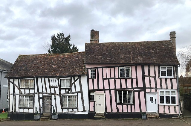
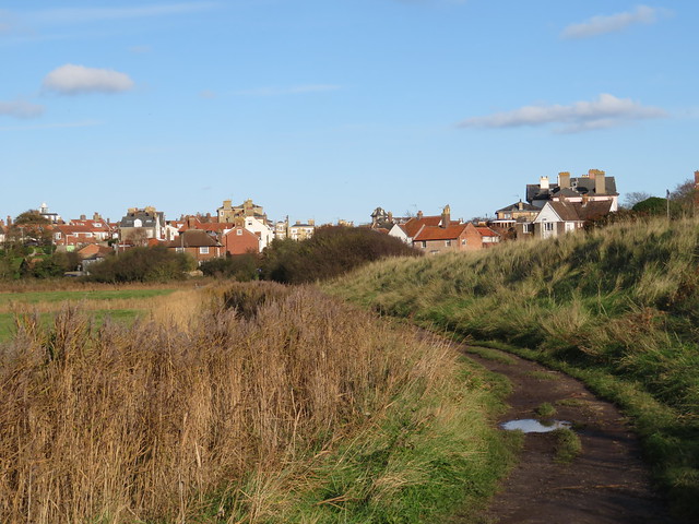
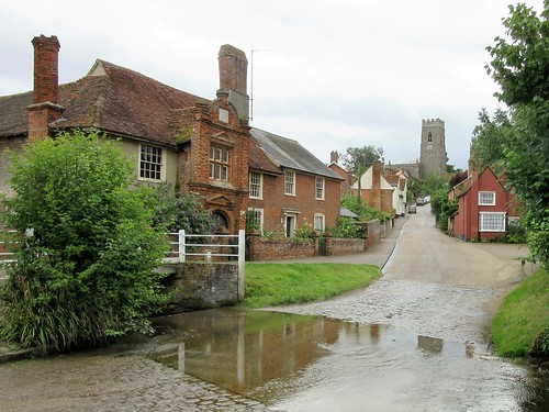
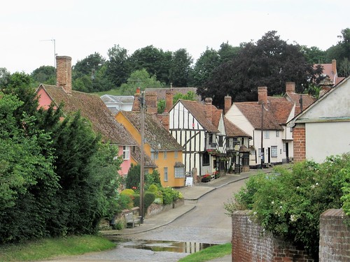
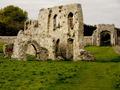
Lavenham is ridiculously pretty, its High Street an unbroken run of delectable medieval buildings, each one more cranky, crooked and colour-washed than the last. No wonder the young American flyers of 487th Bomb Group, stationed nearby during the Second World War, came to walk its fairytale byways and drink and yarn in the impossibly beamy and lopsided old Swan Inn. Here the graffiti and signatures they scribbled on the wall plaster are lovingly preserved under glass.

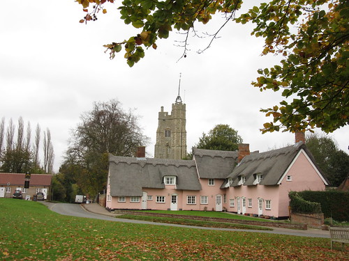
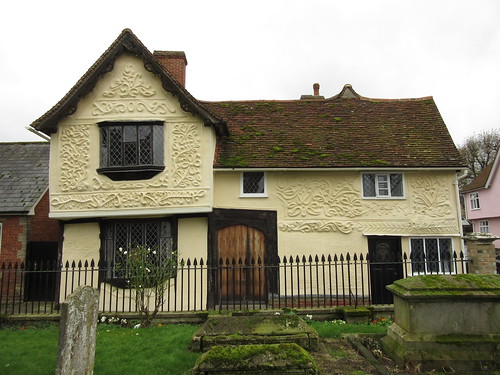
Medieval Lavenham grew rich on the wool trade, a prosperity witnessed in its wonderful houses, guildhalls and great cathedral of a church. And it was a massive economic slump in Tud
or times, caused by competition from cheaper and better cloth produced elsewhere, that fixed Lavenham’s buildings in aspic. The impoverished townsfolk couldn’t afford to modernise or demolish them, so in their early medieval glory they remained through the succeeding centuries.

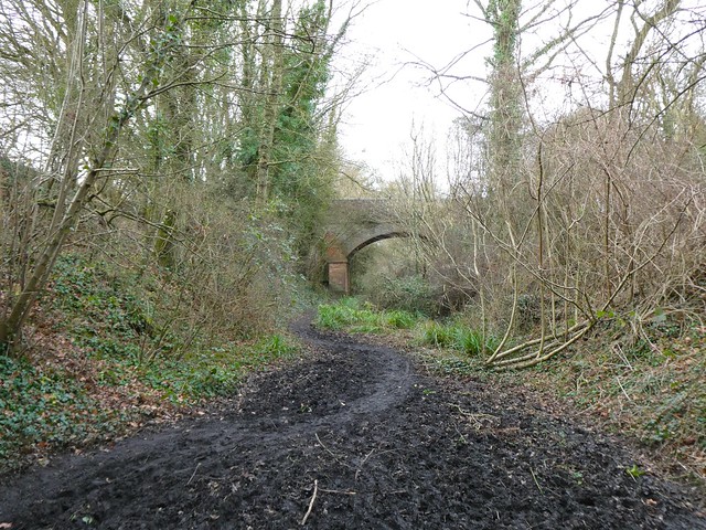
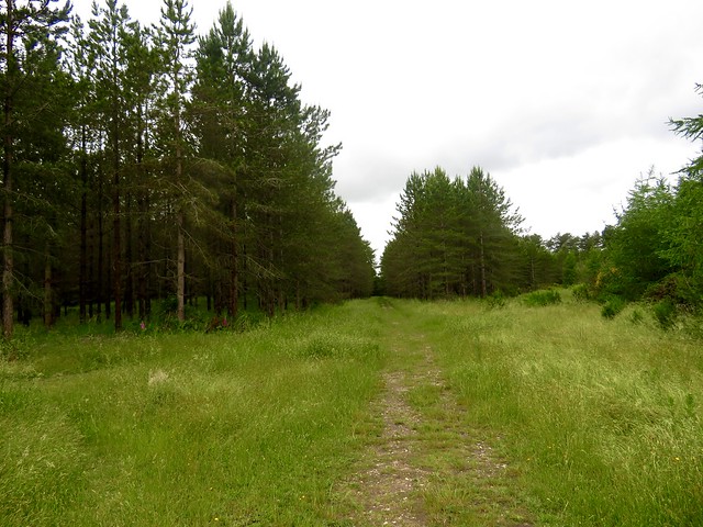
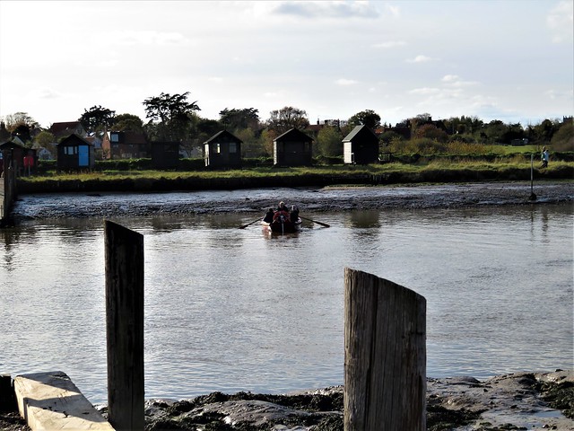
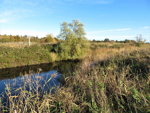
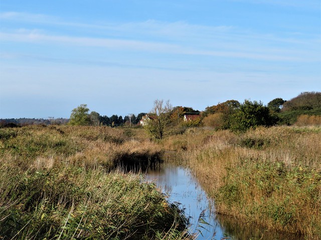
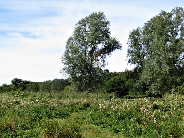
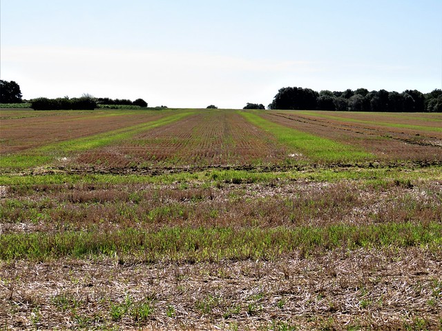
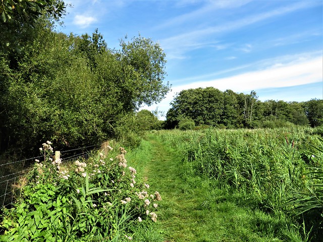
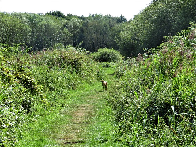
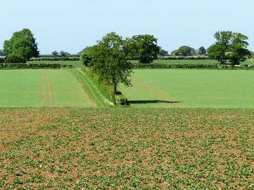
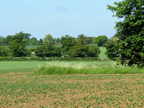
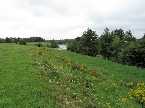
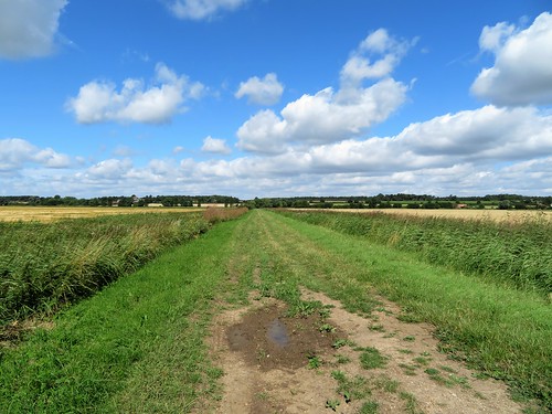
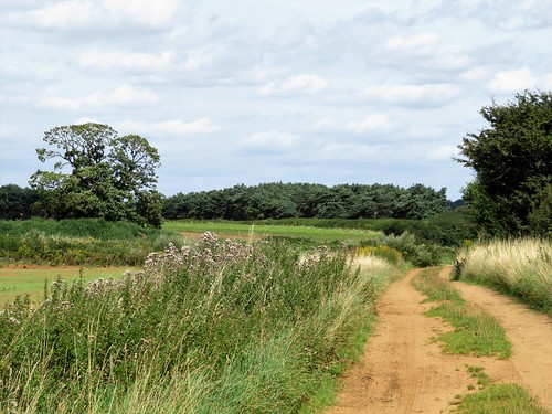
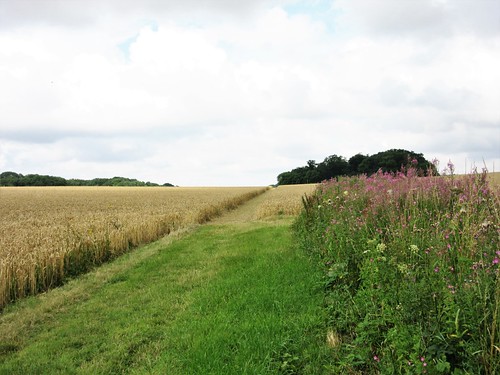
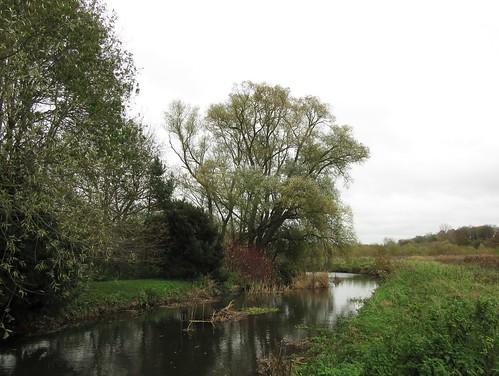
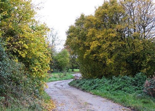
A cold west wind blew out of a wintry sky as we followed the trackbed of the old Long Melford branch railway out of the town. Arable land lay on either hand, the heavy dark soil sliced by recent ploughing into long gleaming furrows. We watched a trail of seagulls following a distant tractor, each new furrow no sooner opened than lined with screeching, squabbling birds.

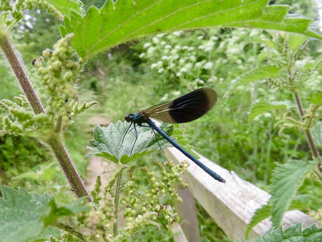
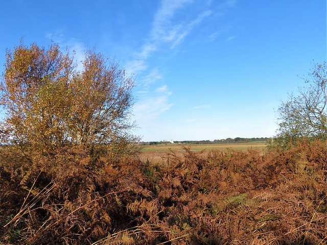
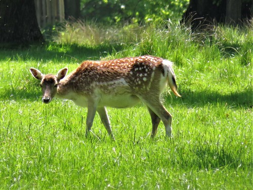
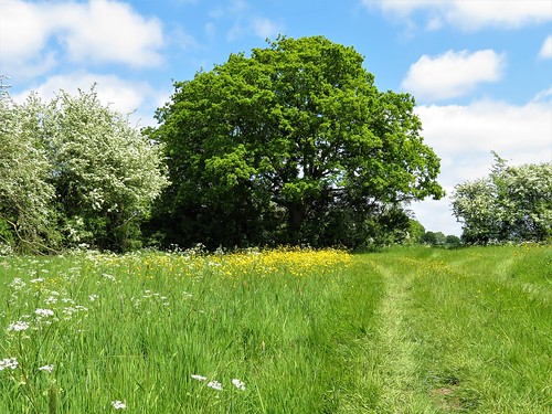
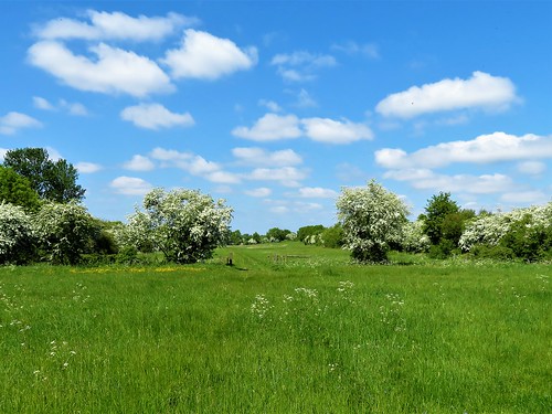
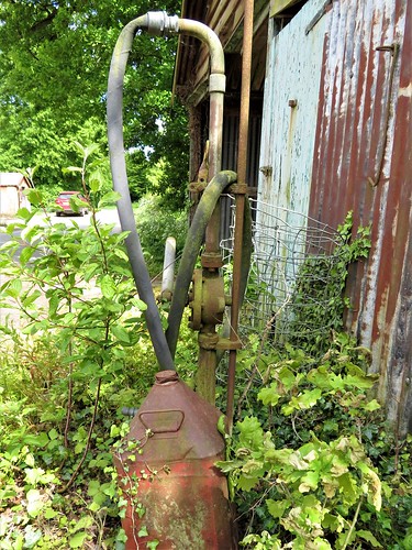
Spring was beginning to knock on winter’s door. Hazel catkins trembled in the wind, daffodil spears were pushing up along the hedge roots, and over the open fields the first skylarks of the year poured out their continuous, ecstatic song. But winter was not done yet. Grey-headed fieldfares, overwintering from Scandinavia, flocked round a stark concrete wartime pillbox, crowds of goldfinches twittered in the treetops, and the mud of the winter rains lay black and stodgy underfoot.

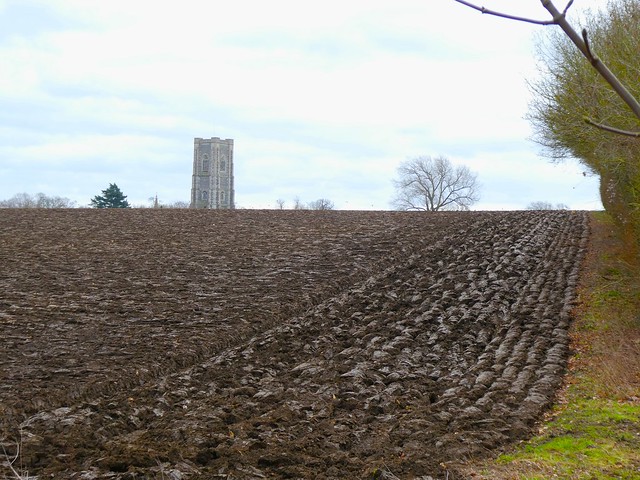
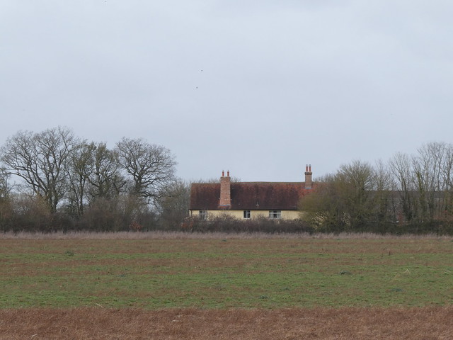
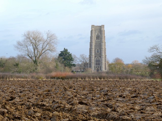
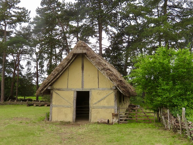
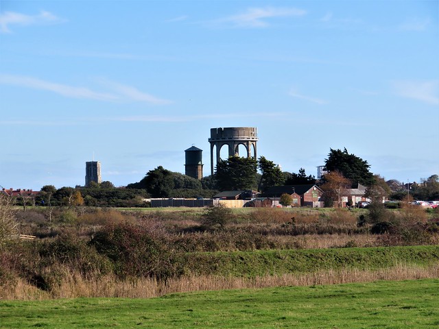
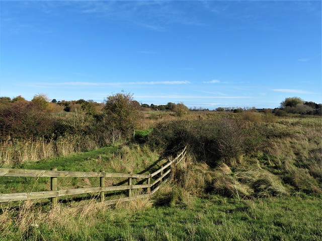
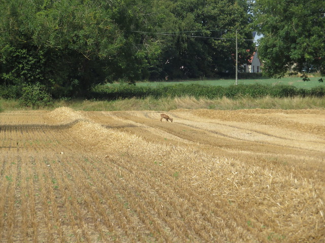
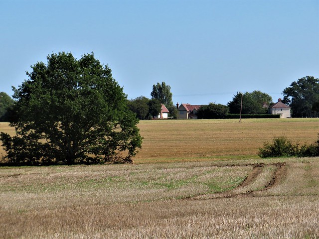
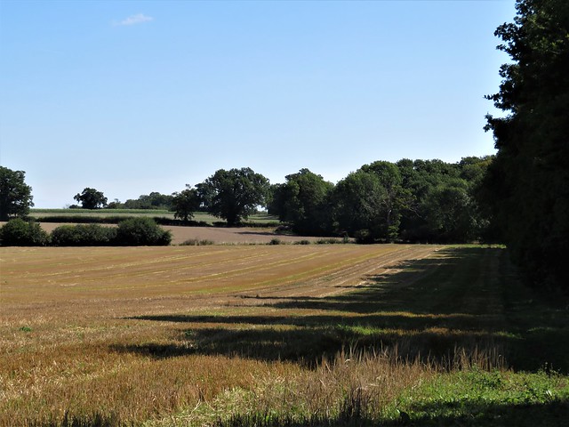
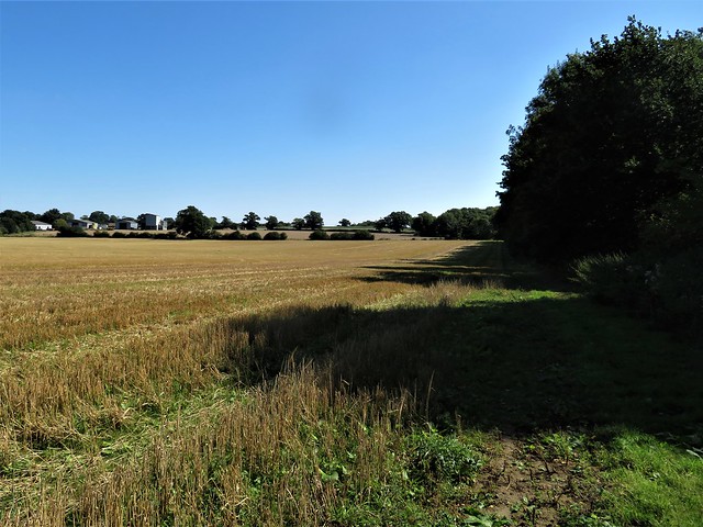
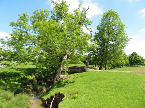
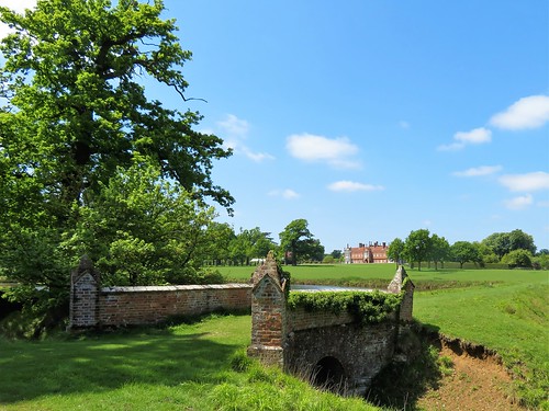
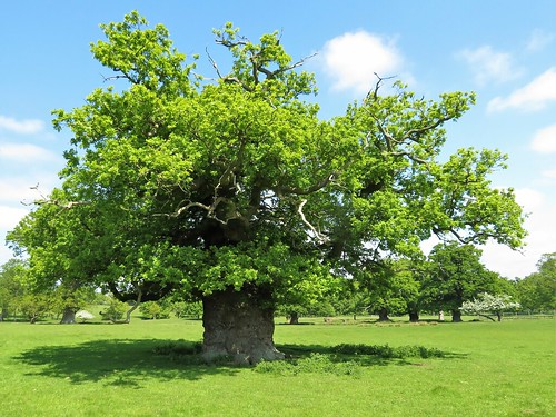
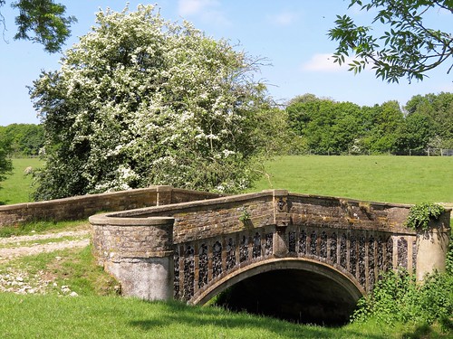
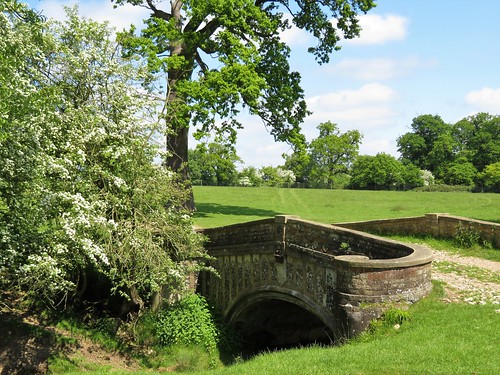
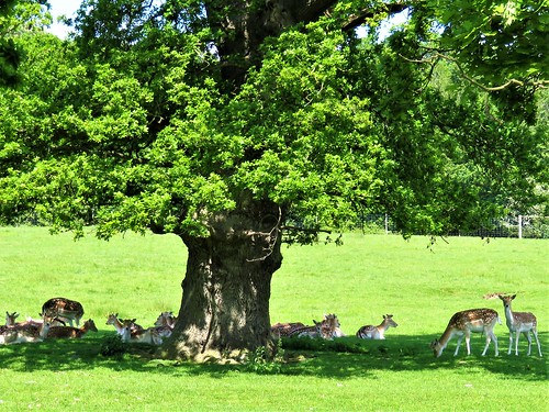
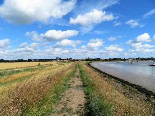
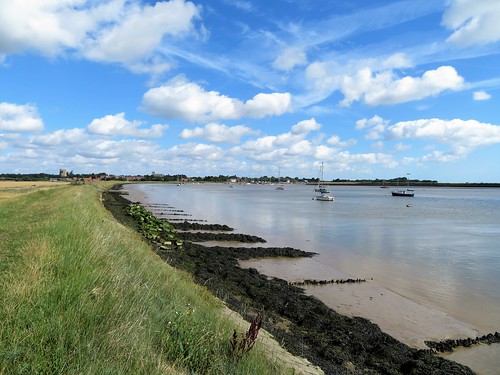
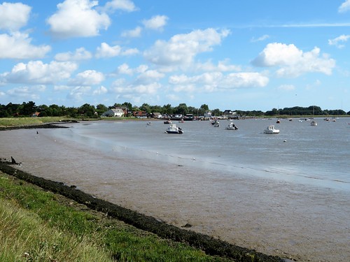
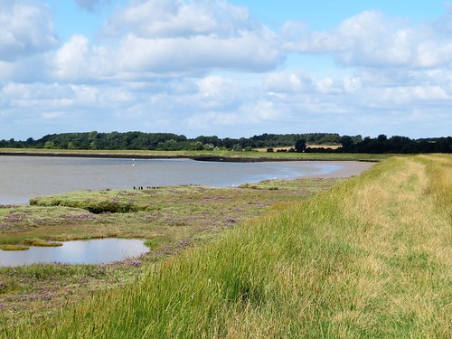
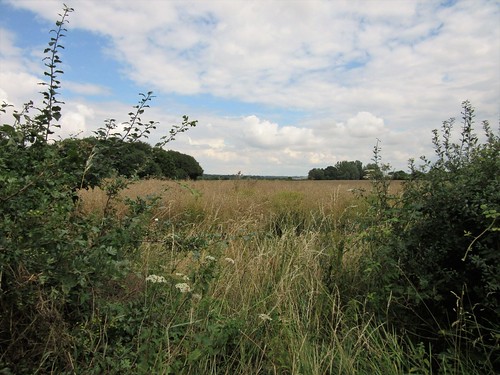
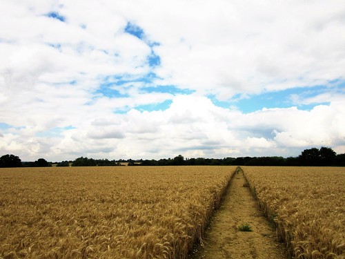
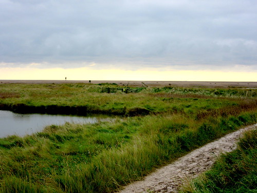
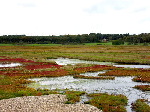
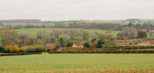
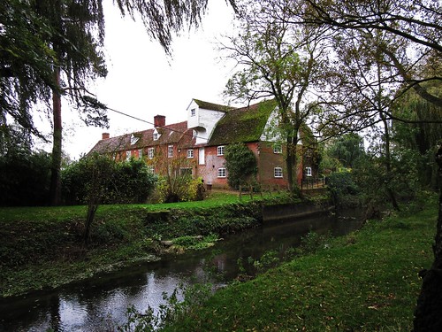
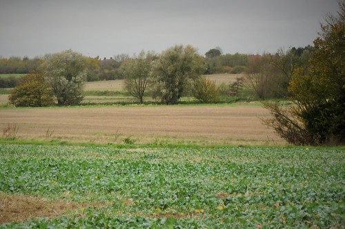
Beyond the bare skeletons of beech and oak in ancient Lineage Wood we traversed fields of river-rolled pebbles to cross a tangle of old moats at Balsdon Hall farm. The yellow-faced 17th-century farmhouse lay tucked away behind trees, a remote setting among the fields. A characteristic rural Suffolk landscape, agricultural and unsmartened. Sugar beets lay heaped in roadside ramparts ten feet tall, and the great flint tower of Lavenham church rose across the waves of ploughed earth like a landlocked lighthouse.

How hard is it? 5¾ miles; easy; field and old railway paths

Start: High Street, Lavenham CO10 9QA (OS ref TL 915491)

Getting there: Bus 753 (Bury St Edmunds – Sudbury)
Road: Lavenham is signed off A134 (Bury St Edmunds – Sudbury)

Walk (OS Explorer 196): Up High Street, over ridge and down. In ⅓ mile fork left (017496, ‘Lavenham Walk’). In 100m, left along old railway. In 100m, right (‘Dyehouse Field Wood’). In 200m right by bench (914497, ‘St Edmund Way’) across field. Left along hedge. At Park Road, left (908497); in 300m, right along old railway (911494). In 1⅓ miles, Paradise Wood ends on left (893484); in another 300m, left (891481, arrow post) on field track. At Balsdon Hall Farm, follow farm drive between buildings (898484) to 3-arrow post at fork, with Balsdon Hall on right (900484). Ahead across fields to road (906476). Left; in 400m, left up Harwood Place (808480). In 50m, right (‘Byway’) along Peek Lane for ½ mile to road (909487). Left; in 200m, right (907487, fingerpost) on field path to road (913490). Right to Lavenham Church. Leaving south door, left along south side of church, then north side of graveyard to kissing gate. Follow tree avenue and walled path to Hall Road (914492); right to High Street.

Lunch/Accommodation: Swan Hotel, High Street, Lavenham CO10 9QA (01787-247477, theswanatlavenham.co.uk)

Info: Lavenham Information Point (01787-247983)

 Posted by at 01:42
Jun 042022


First published in: The Times Click here to view a map for this walk in a new window
The reedy River Lark West Stow Country Park - here be dragons West Stow Anglo Saxon village 1 West Stow Anglo Saxon village 2 West Stowe Lackford Lakes Path through the King's Forest phallus impudicus, the stinkhorn fungus black-winged damselfly maiden pink at Ramparts Field West Stow Anglo Saxon village

A heavy grey day over the Suffolk Breckland, and a carpet of wild flowers on the sandy heathland at Ramparts Field. White campion, acid yellow stonecrop, blue viper’s bugloss, purple knapweed, and the stars of the show – maiden pinks, each delicate flower on a slender stalk, the five petals an intense cherry pink.

Breckland lies on deep beds of sand under peaty soils. Once exposed by the tree-felling and ploughing of early settlers, the sand began to drift and blow about in sandstorms, the worst of which buried whole villages in the 17th century. Today it hosts enormous numbers of coniferous trees in the shape of Thetford Forest and the King’s Forest, planted between the wars to guarantee the country a supply of timber.

We found St Edmund’s Way at the edge of the King’s Forest and followed it through the trees. Here on a grassy knoll stands West Stow Anglo Saxon village, a remarkable experiment, a group of thatched huts of split timber and wattle built on the site where settlers from what’s now Germany established a village shortly after the Romans left these shores.

We wandered round the dark, fire-scented little houses with their wooden hearths, box beds and skins hung up to cure. The archaeologist who built them weren’t sure what the originals were really like, so each of these dwellings represents a style on the road to enlightenment. One conclusion is inescapable – domestic life in 5th-century Stow must have been crowded, smelly, noisy and without privacy.

A grassy path among head-high umbellifers led us on, the scent of firewood still in our noses. We followed tracks among tall pines, their dusky trunks clad with rough plates of bark like saurian hide, then down along the reedy River Lark and its broad string of gravel-pit lakes where great crested grebes were sailing.

Our return way led through the heart of the King’s Forest, a path of black mud and pink pine needles that passed a paddock hazed blue with viper’s bugloss. At the western edge of the forest we turned for home down the Icknield Way, by whose ancient route travellers have been crossing the great sands of Breckland for at least six thousand years.

How hard is it? 5½ miles, easy, forest tracks

Start: Ramparts Field car park, West Stow IP28 6HF (OS ref TL 788716)

Getting there: West Stow Country Park is signed off A1101 (Barton-Mills – Bury St Edmunds); car park in 100m.

Walk (OS Explorer 229): Left up road. In 300m right (792715, ‘St Edmund Way’/SWE). In  200m  left (791713, kissing gate, ‘Access Land’). In 100m, right (‘Otter Gate’); fork left (‘Lake Walk’). In 500m, at bench, left (795713, ‘Beowulf/Grendel Trail’). Through Otter Gate; at info board, right (St Edmund Way/SEW) to Visitor Centre (800714) and Anglo-Saxon village (798713). From Visitor Centre, follow SEW signs for ⅔ mile via pump house (803712) to roadway (809710). Right; in 200m by car park, left (807709, black arrow/BLA); on SEW. In 400m pass sewage farm (811708); in 150m, left off SEW by fence (812706) to road (813709). Right; in 50m left up track; in 300m left (814712, blue ringed post) on forest path. At T-junction, right (809213); in 40m, left (BLAs) to T-junction (804716). Left. In 300m by Wideham Barn, track bends right (801717);
turn immediately left by pole. In 400m where track bends right beside deep pit (798718), left on path at edge of trees for 350m to Icknield Way (795719). Left to road (792715); right to car park.

Lunch/Accommodation: Guinness Arms, Icklingham IP26 6PS (01638-597547, guinnessarms.com)

Info: West Stow Anglo Saxon Village – 01284-728718, weststow.org

 Posted by at 01:39
Oct 302021


First published in: The Times Click here to view a map for this walk in a new window
Southwold Beach Sandlings Walk towards Southwold Southwold from the marshes Ferry cross the Blyth bronze autumn bracken on Busscreek Marshes fleets of water on Busscreek Marshes water tower on Southwold Common Easton Marshes Buss Creek and Easton Marshes 2 Buss Creek and Easton Marshes 1. Sandlings Walk approaching Southwold old wind pump on Reydon Marshes Gun Cliff, Southwold

Southwold at the cusp of autumn and winter; a trim little resort out on the Suffolk coast, its tight lanes packed with bookshops, cake shops and bric-a-brac emporia. The lighthouse, sited well inland, towered over the town like a guardian nanny in a white cloak.
On the seafront promenade the Sailors Reading Room, built to offer Victorian seafarers an alternative to the demon booze, was packed with photos, drawings, models and mementoes of bygone ships, shipmen and the sea. Below the white railings of the prom a beach of pebbly sand and an orderly rank of beach huts led north to the skeletal finger of Southwold’s pier, its line of neat pavilions and shelters lending it the air of an old-fashioned railway station miraculously suspended above the shingly grumble of the North Sea.
Beyond the pier the fast-crumbling cliffs extended in a low pink arc. We turned inland along the reedy ditch of Buss Creek, the dimity charm of the town instantly exchanged for rough grazing marshes and scrub woodland.
A wild babbling in the sky heralded the approach of a great crowd of barnacle geese, all yapping like excited puppies as they came in to land, the clean white of their heads and breasts in contrast to the sober grey-black of their backs. Further on behind the town on Botany Marshes, the water of the creek lay mirror-still. The flanking reeds were trapping the wind, tossing their feathery heads with a loud hissing, every empty seed cone glistening in the strong afternoon sunlight.
A scuffling in the grass drew our attention. A rabbit was scampering along the seabank nearby, pursued by a stoat, a lithe streak of ginger. The rabbit bounded up the slope and into its hole so adeptly that the stoat seemed baffled, and soon undulated off in search of other prey.
We turned south and crossed the Bailey Bridge that spans the narrow tidal reach of Southwold harbour, its outflowing water olive-green and wrinkled. Beyond lay the church tower and roofs of Walberswick, neighbour and rival to Southwold. Feathery grasses made a ground haze of silver on Robinson’s Marshes as we headed for home by way of the rowing boat ferry that links the twin communities. The jolly ferryman sculled us over the tide, and we strolled back along Southwold promenade with nothing more noble on our minds than a nice pint of the town’s famous Adnams ale.

How hard is it? 5 miles; easy, level walking
Start: Southwold Pier car park, 27 North Parade, Southwold IP18 6LT (OS ref TM 512769) – £6 all day.

Getting there: Bus 146 from Norwich.
Road: Southwold is on A1095, signed from A12 between Blythburgh and Wangford
Walk (OS Explorer 231): Turn north from car park; in 50m, left (513769, fingerpost) on path across marshes. Cross A1095 (504769); on across Botany and Busscreek Marshes to Bailey Bridge over River Blyth (495759). Right across bridge; follow cycleway. In ½ mile, just before Heath House, left (492750, bridleway fingerpost). In ¼ mile, left at road (496748); in 150m, left (‘Bird Hide’). At hide (497750), right (yellow arrow). Follow ditch on right for 250m to gate and steps (500748); left along bank to West Harbour and Walberswick ferry (501749). Cross harbour; ahead (‘Sandlings Walk’) for ⅔ mile to Queen’s Road (508758). Right across green to Gunhill Cliff (509757); left along promenade for ¾ mile to car park.
Lunch/accommodation: Crown Hotel, High Street, Southwold IP18 6DP (01502 722275; thecrownsouthwold.co.uk)
Info: thesuffolkcoast.co.uk; exploresouthwold.co.uk
Walberswick ferry: runs on demand. Adults £2, children under 5 free, under 18 £1. Check timetable first! – walberswickferry@gmail.com, walberswickferry.com

 Posted by at 01:50
Aug 142021


First published in: The Times Click here to view a map for this walk in a new window
picture picture picture picture picture picture picture picture picture picture picture
Facebook Link:

A hot sunny day in Half Moon Lane, the fair weather bringing ‘Good morning’ from cyclists passing through Redgrave. Lambs crouched panting in the shade of the hedges, and the stubble fields beyond the village glistened with reflected sun.

This stretch of north Suffolk is well wooded, a low landscape of corn and pasture whose long-established field paths run straight to their meetings with roads and farms. Moles had thrust up hundreds of miniature volcanoes of powdery dark earth along the edge of the old hornbeam coppice of Tanglewood.

A short detour led to St Mary’s Church, tall and stately on its tump – the parish church of Redgrave, nearly a mile outside the village. Green men clustered round the south door, and goggle-eyed gargoyles spewed viciously toothed water spouts. Opposite the church, Hall Farm makes tasty beer in its Star Wing Brewery – a treat we promised ourselves for after the walk, when we’d worked up a thirst.

Back on the path we passed the rusty old shed at Holly Farm and went north across a huge, hedgeless field towards the contrasting wild greenery of Redgrave and Lopham Fen National Nature Reserve in the valley below.

The infant River Waveney runs through this remarkable nature reserve, the largest valley fen in England. Considering how much water is extracted hereabouts by farms and houses, it’s a fantastic achievement to keep the water levels constant enough to nurture the snipe, the marsh orchids, the dragonflies and rare insects that thrive in this juicy green wilderness.

This summer’s exceptional heat, however, had dried up most of the pools and flashes of water, home to the reserve’s famed fen raft spiders with their yellow stripes and five-inch leg span. We’d have to return in rainier times to spot them, said the warden.

But we were happy enough walking the peaty paths through whispering thickets of reeds, watching orange comma butterflies among the thistles and tiny roe deer in the hedges. Through the green screen of willows there was the occasional glimpse of the hard dry arable fields beyond, an alien world that seemed shut outside and far away.

How hard is it? 7 miles; easy; farmland tracks and paths

Start: Redgrave Activities Centre car park, Redgrave IP22 1RL (OS ref TM 048780)

Getting there: Bus 304 (Bury St Edmunds)
Road – Redgrave is on B1113, between A143 (Bury St Edmunds-Diss) and A1066 (Thetford-Diss)

Walk (OS Explorer 230; Redgrave & Lopham Fen downloadable trail map, see below): Left into Redgrave; left (‘Bury St Edmunds’). In 200m, left down Half Moon Lane. After houses, along footpath (fingerpost). In 250m, right at fingerpost (053777, yellow arrow), then left for nearly 1 mile. At road, left (066779). In 150m, right up field edge to road (065784). Dog right/left, north for ¾ mile to road (064797). Left; in 300m, right (062797, fingerpost, ‘Angles Way’/AW). In 200m, cross footbridge, through gate into Redgrave & Lopham Fen NNR (062799). Left (‘Waveney Trail’/WT). In 300m through kissing gate/KG (060801); in 100m, left (KG, WT). In ½ mile, left opposite Visitor Centre (053802) on waymarked Spider Trail. In 600m, through KG (053796); right. In 500m Spider Trail turns left (050796), but keep ahead (WT). In ¼ mile, left across River Waveney (045794)’ in 150m, right at junction (046793, AW). In ½ mile cross road (043797); south for ½ mile to Churchway (046780); left to car park.

Lunch: Cross Keys, Redgrave (01379-779822, crosskeysredgrave.co.uk); Star Wing Brewery, Hall Farm, Redgrave IP22 1RJ (01379-890586, starwingbrewery.com)

Accommodation: Park Hotel, Diss IP22 4LE (01379-642244, parkhotel-diss.co.uk)

Info: Redgrave & Lopham Fen NNR (suffolkwildlifetrust.org)

More walks at christophersomerville.co.uk

 Posted by at 01:25
May 182019


First published in: The Times Click here to view a map for this walk in a new window
picture picture picture picture picture picture picture picture picture picture picture picture picture picture picture picture
Facebook Link:

The young roe deer browsing the hawthorn hedge in the field behind the White Hart glanced casually over its shoulder at us, quite unafraid, then carried on nibbling the leaves. Finches and blackbirds chirped away under the blue sky and warm morning sunshine. A perfect day to walk the field margins and parklands of south Suffolk as spring made way for summer.

The dandelions were all gone to powder-puff cloaks, the hedges full of may blossom. Brilliant yellow oilseed rape gave out its sweet thick scent. A long red fox loped along a ditch and vanished, leaving the hare it had been stalking to continue nibbling bean shoots unmolested.

In the broad parkland of Helmingham Hall the fallow deer grazed as they have done for five hundred years, ever since the Tollemache family built their palatial country house of good red Tudor brick. The path meandered across the grass to The Mount, an obelisk-topped viewing mound from where we got a wonderful view eastward to the Hall, all chimneys and windows.

Strolling back along the rabbit-burrowed banks of a stream, we were watched by three tribes of deer – red, roe and fallow – each in their ear-flicking and tail-twitching segregated groups under giant old oaks. Some of these tremendous trees, storm-blasted and squat, could date back to the Norman Conquest.

Beyond the park and its church of flint and pale limestone, a path led alongside fields of young beet and corn. In the little flowery haven of Rectory Strip we picnicked among buttercups and lady’s bedstraw. A brown hare came lolloping through the hedge, stopped to inspect us from a few feet away, and lolloped away quite calmly.

The homeward path lay along arable field boundaries, punctuated by a swampy old horse-pond where trees had rooted, a miniature Everglades of Suffolk. A breath of earthy fragrance heralded a beanfield full of pink and white flowers with dark velvet eyes.

Beyond Hall Farm we finished the walk along a green lane hung with briars, waiting for a few more days in the sun to burst out in dog roses all over.

Start: White Hart PH, Helmingham Rd, Otley, Suffolk IP6 9NS (OS ref TM 202557)

Getting there: Bus 119, Framlingham-Ipswich. Road – White Hart is ½ mile north of Otley, on B1079 (off A12 Woodbridge bypass). Please ask permission to park, and please give pub your custom!

Walk (8 miles, easy, OS Explorer 211): From car park, right round field edge. In 500m, at T-junction (196557, fingerpost/FP), right on grassy track. In 400m at field corner, through hedge; dogleg right/left (194560, FP) under power lines and on with hedge on left. At 3-finger post, ahead; in 50m, right; in 20m, left over plank bridge and on along field edge. At end by Round Wood, left (192565); in 30m, hedge turns right, but keep ahead (west) over fields towards path by hedge in dip. Follow it to B1077 (187563).

Cross road (FP); across to corner of field; right with hedge on left. At next corner, through hedge (185566), across field to road (184569). Right past Mill Mount to B1077 (188572). Behind ‘Helmingham’ sign, cross 2 ladder stiles (FP). Follow yellow arrows/YAs across Helmingham Park. In 500m at corner of fence, left (184576, YAs) past The Mount and Obelisk (178577). Just before fence and deer gate, turn back right (175578), following YAs along stream. In ¾ mile, by ornamental bridge, right (186581, YA) to left of Helmingham Hall. Through deer gate (187579); along drive (YA); in 150m, left (YA) to cross brick bridge (189577) to church and B1077 (191576).

Left for 50m to B1079 (Grundisburgh) turning on right. Beyond central triangle, path (FP) across field with hedge on left. Across footbridge (194577, YA); up field edge; in 50m, left through hedge, right up narrow meadow and following field edge to east corner of Highrow Wood (201582). Right along field edges, heading south. In ⅔ mile, pass memorial bench to Rita Ling (203573); in another 3 fields/700m, look left for unmarked hedge gap and plank bridge (203566). Path crosses narrow field, then broad one, east to road (208566). Don’t go on to road; turn right along hedge, skirting Hall Farm’s embankment and cottage gardens beyond. At end of garden fences, through hedge, across plank bridge (FP) to green lane (206563). Right to return to White Hart PH.

Lunch: White Hart, Otley (01473-890312, thewhitehartotley.co.uk)

Accommodation: Premier Inn, Paper Mill Lane, Ipswich IP6 0BE (0333-003-1739; premierinn.com).

Info: visitsuffolk.co.uk
satmap.com; ramblers.org.uk

 Posted by at 01:02
Jul 072018


First published in: The Times Click here to view a map for this walk in a new window
picture picture picture picture picture picture picture picture picture picture
Facebook Link:

A cool damp afternoon in the flat river country of the Norfolk/Suffolk border. Pale sprigs of mugwort and purple-flowered teasels grew with royal blue viper’s bugloss in the verges of Moor Drove East, and the banks of the Little Ouse River and its tributary drains were bright yellow with ragwort and lady’s bedstraw. This is not all soulless prairie farming country, but a complex maze of water channels and lush grassy banks.

Beyond the tall twin gates of Little Ouse sluices and a brief roaring strip of road, we turned aside into the ‘otherworld’ of the RSPB’s nature reserve at Lakenheath Fen. Ditches lay spread with waterweed, marsh woundwort raised stout pink flowerheads, and outside the picture window of the visitor centre a kingfisher perched in all its bronze and cerulean glory beside a pond that plopped with fish.

‘Used to be carrot fields,’ said the warden, ‘very intensively farmed. We dug it out, replanted it with fen species and let the water in – controlled it carefully. Now we’ve otters, bitterns, water voles, marsh orchids, even nesting cranes – just about everything that was here before the Dutch drained the Fens nearly 400 years ago. Isn’t that something special?’

Lakenheath Fen is special, all right. We followed the main trail west on paths of grass and gravel, ducking aside into strategically placed hides to watch great crested grebes preening themselves and swallows zipping low over the meres. With ping and a whistle a flock of bearded tits came skimming through the reed heads – endearing little birds with fine black Fu Manchu moustaches.

From the viewing point at Joist Fen we saw a male marsh harrier pounce into the reedbed in a flurry of large pale wings, while his dark-hued mate perched in an elder bush, turning her gold-crowned head from side to side.

Following the flood banks of the Little River Ouse back to Hockwold, we passed scattered herds of cattle, surely the most contented beasts in Fenland, up to their hocks in the green swamp and chewing lush grass with all the appreciative deliberation of connoisseurs.
Start: Red Lion, Hockwold-cum-Wilton, Norfolk IP26 4NB (OS ref TL 735880)

Getting there: Bus 40 (Thetford-King’s Lynn)
Road: Hockwold-cum-Wilton is on B1112 between Lakenheath and Feltwell (A11 to Mildenhall)

Walk (7¾ miles, easy, OS Explorer 228): Pass church; on down Church Lane. In 500m fork right (734876) along Moor Drove East. At river bank, left (729873); right across sluice (731870); bear right along riverbank to B1112 (724868). Left (grass verge – take care!); in 300m, right into Lakenheath Fen nature reserve (724866). Roadway to Visitor Centre (718863). Follow Main Circular Trail/MCT (white arrows/WA). In 900m fork right (712860, 2 WAs), following MCT. In 50m detour right to New Fen viewpoint and back; in 650m, left (704861) to Mere Hide and back. In 200m take left fork (702861) on gravel, not grassy path; in another 500m, right (697860) past Joist Fen viewpoint. At T-junction with fingerpost (698861), left for 100m; right up river bank, through kissing gate; right along river bank (Hereward Way) for 2 miles back to B1112 (724866). Left (take care!); retrace steps to Hockwold.

Conditions: Paths can be wet and muddy

Lunch: Red Lion, Hockwold-cum-Wilton (01842-829728) – decent village pub

Accommodation: Bridge Hotel, 79 High Street, Brandon, Suffolk IP27 0AX (01842-338228, bridgehotelbrandon.com)

Lakenheath Fen nature reserve, IP27 9AD (01842-863400, rspb.org.uk) – RSPB members park free, others £4. Very helpful staff

visitengland.com; satmap.com; ramblers.org.uk

The Times Britain’s Best Walks by Christopher Somerville (£16.99, HarperCollins) is now out in paperback

 Posted by at 01:27
Aug 122017


First published in: The Times Click here to view a map for this walk in a new window
picture picture picture picture picture picture picture picture picture picture picture picture picture picture picture picture
Facebook Link:

A pure blue-sky morning, a dreich drizzly afternoon, and in between whiles, one of the classic walks of coastal Suffolk. Senior citizens perambulated the village green in Orford between mellow red brick cottages whose windows peeped out among rambling roses. Down on the quay, fresh-landed skate had just hit the slab in Brinkley’s shed.

Orford is a pure delight, a self-sufficient coastal village at the end of a long road. Not that Orford faces the bracing tides of the North Sea directly – the monstrous shingle spit of Orford Ness, ten miles long and still growing, cut the village off from the open sea hundreds of years ago.

The strange pagoda shapes of long-abandoned MOD nuclear laboratories straddled the pebbly spine of Orford Ness. We turned downstream along the flood banks of the River Ore, looking back to see the red roofs of Orford bookended by the village church and the octagonal tower of Orford Castle. The garrison of the castle in medieval times, it was said, once hung a captured merman upside down in their dungeon when he refused to speak. He got the better of them in the end, though, slipping away and back to the sea when no-one was looking.

Hares scampered in the meadows under the seawall, and a tern dive-bombed a shoal of fish in the incoming tide of the Ore. We made inland for the dusty road to Gedgrave Hall, where the breeze carried beautiful tarry whiff from Pinney’s fish smokery near Butley Ferry.

‘Smallest ferry in Europe’, said Roy the ferryman, skilfully balancing the forces of wind and tide as he rowed us across the Butley River in his little muddy dinghy. ‘We don’t like to drown too many, though.’

We crossed the back of Burrow Hill, at 50 feet high a mountain hereabouts, and followed broad flowery lanes inland for miles to Chillesford. It was slow, heavenly walking in calm clear air through a seductively beautiful coastal landscape.

In Sudbourne Park on the homeward stretch, cricketers in their whites were preparing for their Sunday match. Bowlers pounded the nets, batsmen practised immaculate strokes they’d never execute, and as the umpires emerged from the pavilion the first spits of rain were felt on the wind, in true traditional style.

Start: Orford Quay car park, Orford, Suffolk IP12 2NU (OS ref TM 425496)

Getting there: B1084 from Woodbridge, B1078 from Wickham Market, both off A12 north of Ipswich.

Walk (10 miles, easy, OS Explorer 212): From quay, right along seawall for 1½ miles, passing Chantry Point. At tide gauge where River Ore bend south-west, bear right off sea wall path, through gate (416485, ‘Suffolk Coast Path, Orford Loop’/SCP/OL). Up grassy lane for ½ a mile to road (409490). Left; 500m past Gedgrave Hall, right (401483, ‘Butley Ferry’) past Pinney’s fish smokery (397485), following SCP to Butley Ferry (393482). Cross Butley River; ahead through gate; in 150m, right through gate (390482, SCP); follow well-marked SCP for 2½ miles via Burrow Hill (389485), Coulton Farm (382498) and South Chapel (380496) to road at Butley Mills (383515). Right to B1084 in Chillesford (386522); right past Froize Restaurant. In another 100m, right (391522, SCP/OL, ‘Orford 2¼’); follow marked SCP back to Orford.

Conditions: NB This is a weekend walk. Butley Ferry runs 11 am-4 pm Sat, Sun, BH, Easter-end October; £2 (07913-672499, butleyferry.org)

Lunch: Picnic

Accommodation: Crown & Castle, Orford, Woodbridge, IP12 2LJ (01394-450205, crownandcastle.co.uk) – wonderfully friendly and classy village inn.

Info: Ipswich TIC (01473-432017);
visitsuffolk.com; satmap.com; ramblers.org.uk

 Posted by at 01:56
Jul 232016


First published in: The Times Click here to view a map for this walk in a new window
picture picture picture picture picture picture picture picture picture picture picture picture
Facebook Link:

Crooked houses, colour-washed in apricot and cream, pink and burnt orange, line Kersey’s single village street that slopes from the high-perched church to the water-splash in the valley bottom. Suffolk has dozens of beautiful villages, enriched through medieval wool wealth and dignified through age, but none matches Kersey for sheer eye-catching perfection. The rippling water-splash reflected a blue sky as Jane and I set out up the street with our long-term friend Patsie for company.

On the outskirts of Kersey we noticed a gathering of wasps, questing round a hollow in a hedge root. Looking in, we saw their nest – a wall of papery fibre, the colours of white and milk chocolate. A cleanly cut footpath led us away across an enormous prairie field, a mile of hedgeless upland where oak spinneys stood marooned. At first sight the field seemed bereft of all wild flowers, but a closer look showed scarlet pimpernel, speedwell and tiny pink cranesbills in the cracked soil, while stands of great willow-herb grew in strips where the ditches used to be.

A sea-urchin fossil lay half smothered in the mud among flints and pebbles. I dug it out and held it up to admire the tiny rows of sockets where the urchin’s spines had grown. When it lived and died, perhaps 200 million years ago, warm tropical seas had stretched where we now stood – a concept that never fails to strike wonder in the imagination.

A tangle of quiet lanes led us to the chapel of St James. Back in medieval times, the tiny church and its priest lay under the control of the lords of Lindsey Castle. The proud castle is now a tumbled heap in an adjacent field; the humble chapel, built of roughly knapped flints nearly 800 years ago, stands renovated under its wooden Tudor roof. This simple prayer room was restored after centuries of use as a barn.

Our way ran on south over arable country. Down by the stream in Kersey Vale we sheltered in a hazel grove while rain pattered on the leaves and thunder groaned in the distance. The shower hissed away, the insects flew out of hiding to sun themselves, and flights of swallows swooped after them along the homeward path.
Start: Bell Inn, Kersey, Suffolk, IP7 6DY (OS ref TM 000442)

Getting there: Bus 112 from Hadleigh. Road – Kersey is signed off A1141, 2 miles north of Hadleigh

Walk (6¼ miles, easy, OS Explorer 196): From Bell Inn, uphill away from water-splash. At right bend, ahead up path to road (TL999443). Left; at left bend, right (997444) through hedge gap; north along field edge. In 500m, at hedge corner, left/west (995450, yellow arrow/YA) across field, past spinney (991450, arrow) and on to reach trees (985452). Into trees; in 15m, left through thicket into field (984452). Ahead with hedge on right to road (982450). Left; in 400m at T-junction, left (980447, ‘Kersey’) to T-junction (9814444). Right for 350m to St James’s Chapel (978444).

Return to T-junction (981444); ahead for 150m; right (982444, fingerpost) on path through trees. On across fields (yellow arrows) for ¾ mile to road (986433). Right to T-junction in Kersey Tye (985431). Left round left bend and continue (‘Kersey’) for 450m to T-junction. Left (90430, ‘Kersey’); in 100m, in Kersey Upland, right (‘Polstead’). In 200m, fork left off road beside Harts Cottage (992428) down gravel lane. In ¼ mile, where tree tunnel ends, left (995425) along field edge. In 100m, keep ahead with hedge on left, descending to stream (001427). Left (YA). In ¼ mile pass Vale Cottage (003430); in 100m at wood edge, left, then right down drive (fingerpost). Drive becomes tarmac lane; follow it for ½ mile past houses to road with Kersey church seen ahead (002437). Right; in 100m, left (‘Kersey St.’) into Kersey.

Lunch: Bell Inn, Kersey (01473-823229, kerseybell.co.uk)

Accommodation: The Gables, Hadleigh IP7 5EL (01473-828126, thegableshadleigh.co.uk) – everything just right, and very welcoming. Dinner at The Ram, Hadleigh (01473-822880, thehadleighram.co.uk) – upmarket cooking.

Info: Lavenham TIC (01787-248207)

http://visithadleighsuffolk.co.uk/; visitsuffolk.com; satmap.com; ramblers.org.uk

 Posted by at 01:25
Nov 282015


First published in: The Times Click here to view a map for this walk in a new window
picture picture picture picture picture picture picture picture
Facebook Link:

A tangle of trees has almost smothered Dunwich’s famous ‘last grave’. But still the solitary curly-topped headstone of Jacob Forster clings to the cliff edge above the hamlet on the Suffolk coast, the last relic of the church of All Saints that toppled to the beach in 1922. Just inland, the grand flint walls and gateways of Greyfriars priory enclose an empty square of grass.

These remains are all that speak to us today of medieval Dunwich, the great trading port whose churches, hospitals, squares and houses were utterly consumed by the sea. A model of Dunwich in the village’s excellent small museum shows the extent of what was lost, and it made a sobering image to take with us as we set out across the green hinterland of Dingle Marshes.

A brisk wind pushed us along the flinty tracks through copses of old oak and pine trees. The grazing meadows, dotted with black cattle, stretched away east towards a dun brown line of brackish marshes below the long straight bar of the shingle-banked sea wall. There’s a feeling of country walked by many, but known by very few.

Beyond Dingle Stone House stretched the great reedbeds of Westwood Marshes, burnt orange and green, whispering in a million scratchy sibilants. A flock of a hundred pinkfooted geese lined the edge of a fleet of still water. Tiny bearded tits bounced and flitted through the reed heads, trailing their long tails low behind them and emitting pinging noises like overstretched wire fences. Over all floated the kingly black silhouette of a marsh harrier, circling with deliberate flaps of its wings as it scanned the reeds for mice and frogs.

We crossed the Dunwich River and came up on to the shingle bank. An instant switch of view and perspective, out over a slate grey sea and round the curve of the bay to Dunwich under its sloping cliff and the distant white sphere of Sizewell nuclear power station. Sea inundations are increasingly common hereabouts, overtopping the shingle bank and flooding the freshwater marshes behind – part of the ongoing dynamism of this coast and its all-devouring neighbour the sea.

Among the shore pebbles a flat black stone caught my eye. It was a worked flint tool, dark and ribbed, snugly fitting in my palm, its edges scalloped by some ancient maker. Dunwich Museum has it now – one more stage on its journey from hand to hand through the millennia.

Start: Dunwich car park, Suffolk, IP17 3EN (OS ref TM 478706)

Getting there: Dunwich is signed from A12 between Yoxford and Blythburgh

Walk (6¾ miles, easy, OS Explorer 231. Online map, more walks at christophersomerville.co.uk): At car park entrance, left up footpath (fingerpost, ‘Suffolk Coast Path’/SCP arrow). Just past ‘last grave’ on left (479704), turn right through Greyfriars wall, across monastery site, through archway. Right along road; in 100m, left down footpath (fingerpost) to road with Dunwich Museum on right (477706). Left; fork right at church (‘Blythburgh’). In 150m, right past Bridge Farm (474707) along SCP. In 1½ miles, leaving Sandymount Covert (483728), fork right along marsh path. In ¾ mile, just past windpump ruin (487737), right down steps, over footbridge, along boardwalk. In ⅔ mile, right across footbridge (495742, SCP) to shingle bank; right to Dunwich.

Condition: Final 2½ miles is on shingle.

Lunch/Accommodation: Ship Inn, Dunwich, IP17 3DT (01728-648219, shipatdunwich.co.uk) – cosy, friendly village inn.

Dunwich Museum: Open March-October, varying times; also for parties by arrangement. 01778-648796, dunwichmuseum.org.uk).

Info: Southwold TIC (01502-724729); thesuffolkcoast.co.uk, touchingthetide.org.uk
visitengland.com satmap.com; ramblers.org.uk

 Posted by at 01:36
Dec 062014


First published in: The Times Click here to view a map for this walk in a new window
picture picture picture picture picture picture picture picture picture picture picture picture
Facebook Link:
Cavendish lies perfectly arranged for a painter’s canvas. Why John Constable never got himself along here to capture the thatched and pink-faced cottages on the village green, and the flint tower of St Mary’s Church peeping over their shoulders, is a mystery. Even on this blowy winter’s morning under a scudding grey sky, the composition seemed flawless.

We passed crooked old Tumbleweed Cottage, half pink and half green, and turned down a path among poplars to cross the slow-flowing River Stour. Out in the fields a green bridleway led through gently rolling country, the meandering of the invisible Stour marked by grey and gold willows. Wide ploughed fields slanted up from the river, their crests bristling with hedge oaks. From this high ground we looked back to see Cavendish church tower poking up above the trees. Then it was down again over the sticky fields to a wandering green lane between banks of iron-rich, burnt orange soil across which burrowing badgers had spread their bedding.

On the outskirts of Clare the grounds and ancient flint buildings of the Priory lay very quiet and still. Opposite rose the castle mound with its tall fragment of Norman masonry. In 1865 local ‘detectorist’ Walter Lorking unearthed a gold cross and chain in the castle grounds. It had been lost there 500 years before by King Edward III, and contained a fragment of the true cross in a tiny compartment. Walter was more than happy to sell it to his Sovereign, Queen Victoria, for the rather appropriate sum of three gold sovereigns.

There was beautiful pargetting – ornate plasterwork – on many of the houses in Clare, and a host of scowling and howling Green Men to guard the doorway of the village church, the ‘cathedral of the Stour Valley’. I left my companions to linger among the antique shops of Clare, and hurried back to Cavendish along the high ground north of the river. The cold wind tousled me all the way, pouring out of a sky ridged with grey billows of cloud, a wintry ceiling for the furrowed ploughland below.

Start: George Inn, Cavendish, Suffolk CO10 8BA (OS ref TL805465)

Getting there: Bus service 236 (Haverhill-Sudbury)
Road – Cavendish is on A1092, between Long Melford (A134) and Haverhill (A143)

Walk (8 miles, easy, OS Explorers 196, 210. NB: Detailed directions, online maps, more walks at christophersomerville.co.uk): From George Inn, left (east) along main street. Opposite Bull Inn, right on path (fingerpost, yellow arrow/YA) to road (810464). Right across Pentlow Bridge; on along B1064. In 300m, on left bend, right (812461, ‘Bridleway’) along field edges. In ½ mile, through trees (805458) and on to Bower Hall. Just before first barn, left (800455) up field edge. 50m before hedge at top, right (803450, post with YA) across field to hedge end of green lane. Follow it (YA) to road (749449). Right downhill.

Just before reaching river, left by waterworks hut (797453, ‘Bridleway’) along green lane and field edges. In 1 mile, bridleway bends right (782449) to river bank (782451). Left here (‘Bridleway’) to road at Hickford Hill (777447). Right; in 200m, right across field (fingerpost) to cross river (775450). Fork left across meadow to cross weir (774451) and on. In 350m, opposite car park and castle mound, pass metal bridge on right, and in 50m turn left (770451) through stone gateway into Clare Priory grounds.

Returning through gateway, turn right and immediately left across footbridge into Clare village. Right to church (770455). Follow A1092 Cavendish road out of town. In 300m, left up Harp Lane (773454, fingerpost); pass sheds and keep ahead through trees, following ‘Stour Valley Path/SVP’, YAs and ‘Heritage Trail’ purple arrows/HT. Opposite Hermitage Farm (775463) bear right up field edge. At top, left through hedge (778464, HT) and on along field edge, aiming to pass roofs and outbuildings of Houghton Hall (785466). In another 600m, at field bottom, right (791468, SVP, HT, fingerpost). In 150m, left and right over 2 ditches (792466, SVP, HT) and on to road at Mumford Cottages (796468). Right; in 450m, right down field edge (SVP, HT, ‘Cavendish’). At bottom (802465), left through hedge (SVP); diagonally left across field; path beside graveyard into Cavendish.

Lunch: Plenty of cafés and pubs in Clare and Cavendish.

Accommodation: George Inn, Cavendish (01787-280248, thecavendishgeorge.co.uk) – smart, stylish, comfortable

Information: Sudbury TIC (01787-881320)
visitengland.com; www.satmap.com; ramblers.org.uk

 Posted by at 02:24