Search Results : surrey

Aug 302014
 

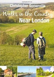
Geologists say the Devil’s Punch Bowl is the sandstone roof of a giant cavern that collapsed after springs had hollowed it out; folklorists that it’s the imprint of the Prince of Evil’s arse when he landed there after a mighty jump from the Devil’s Dyke near Brighton.
First published in: The Times Click here to view a map for this walk in a new window
picture picture picture picture picture picture picture picture
Facebook Link:
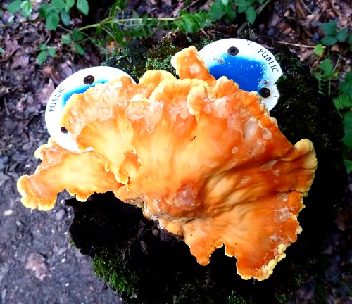
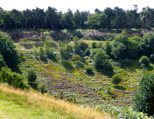
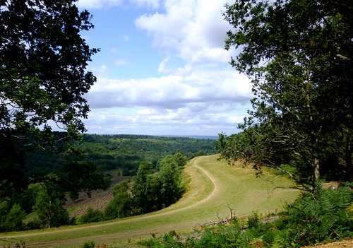
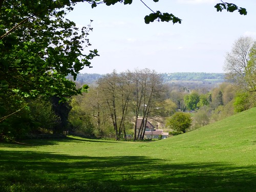
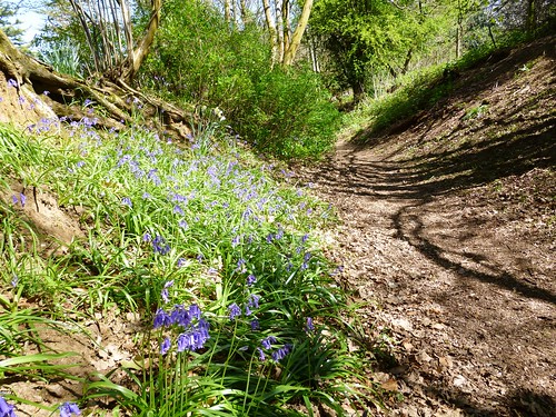
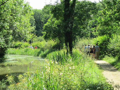
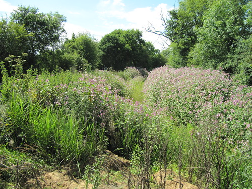
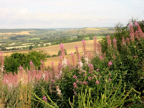
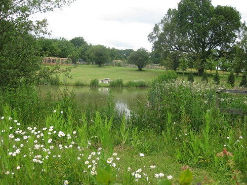
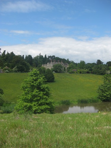
Whatever its origin, this great green hollow in the Surrey Hills is packed with wildlife – slow-worms and lizards, butterflies and beetles, flowers and trees. We followed a path down under silver birches, through a boggy green dell and on across heathland of ling and bell heather gleaming purple in the strong midday sunlight.

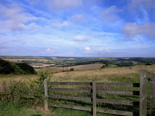
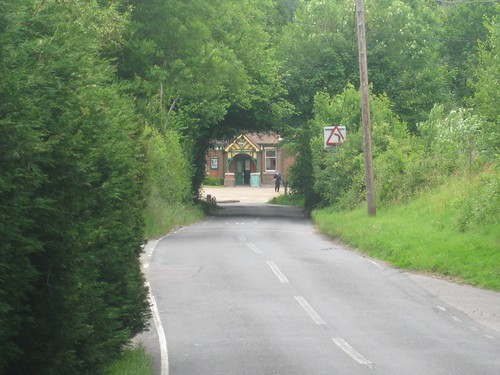
A short climb to the tip of the Punch Bowl and we were walking the A3 London-Portsmouth trunk road – not the modern version, which has been buried far underground in twin tunnels since 2011, but the old road that was left abandoned. Where single-file traffic once queued and fumed, a wide green pathway now sweeps round the rim of the Devil’s Punch Bowl, subtly landscaped, edged with silvery grasses and wild flowers. Common blue butterflies opened their gorgeous wings to the sun, and a pair of clouded yellows enacted a crazy chase as we strolled the grass-grown track.

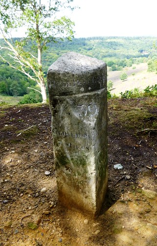
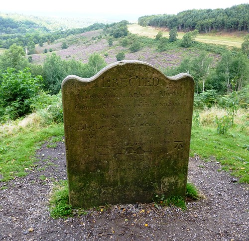
Just above the abandoned road runs another, an ancient highway that once linked the capital with the Royal Navy’s home port of Portsmouth. On a September day in 1786 three ruthless rogues murdered a sailor here for the price of his clothes. We found a memorial stone beside the track ‘erected in detestation of a barbarous Murder’, its reverse face bearing a faded inscription calling down a curse on anyone ‘who injureth or removeth this Stone.’

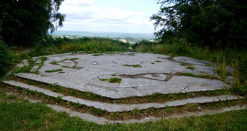
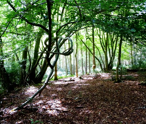
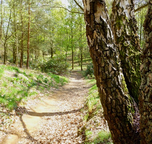
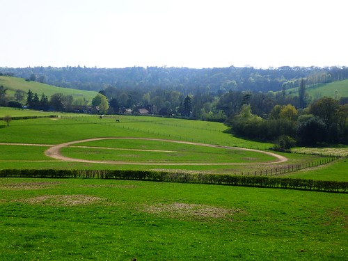
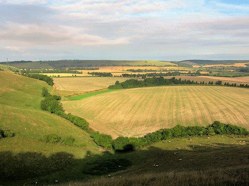
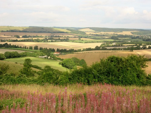
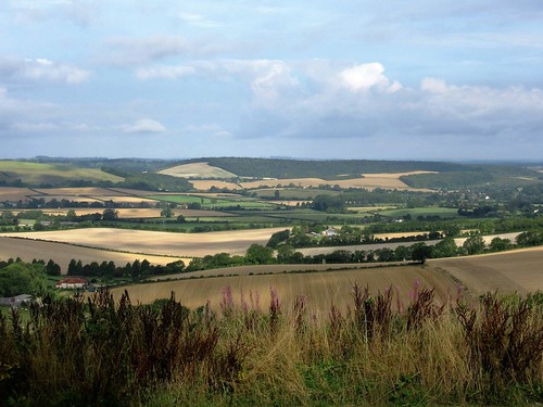
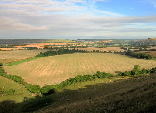
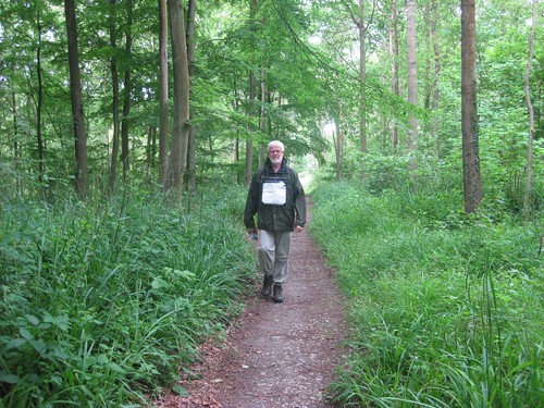
On Gibbet Hill nearby the three malefactors were hung in chains for all to see. It’s a haunted place, and a sensationally beautiful one, with a view that stretches out across the Sussex Weald from the South Downs to the ghostly towers of London 40 miles off. We sat to take it all in, then followed the National Trust’s ‘Hidden Hindhead’ walk through woods of oak and sweet chestnut coppice, up hollow chalk ways under bulbous pollarded beeches filtering green light, and back across an open heath where the wind was sweetened with pine resin and our finger ends grew purple with the juice of ripe little bilberries.

Start: Devil’s Punch Bowl car park, Hindhead, Surrey, GU26 6AG (OS ref SU 890358)

Getting there: Bus – Stagecoach (stagecoachbus.com) service 18, 19 (Aldershot-Haslemere)
Road – A3 or A287 to Hindhead; car park signed in village

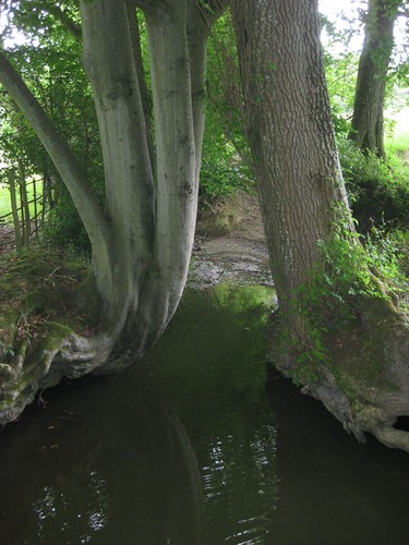
Walk (5 miles, easy, OS Explorer 133. NB: Online map, more walks at christophersomerville.co.uk): From car park walk to viewpoint; right (‘Hidden Hindhead’/HH fingerpost). In 150m fork left through gate; immediately left (892358) down track into Devil’s Punch Bowl. In 350m, right (891361, yellow arrow/YA on post) down to cross stream (892363). Up slope, follow YAs across heath. In 250m go over path crossing (894364). In 400m, through kissing gate beside road on left (895367); right on gravel path to former A3; right along old road (896366) at lip of Devil’s Punch Bowl.

In 650m, on right bend, left (898360) up track through trees to cycle track; right for 300m to Sailor’s Stone (897358) on right. Return for 100m; right (‘Sailor’s Stroll’); follow cross symbol to Gibbet Hill viewpoint (900359). From here follow HH for 2½ miles back to car park.

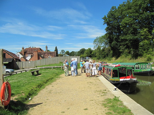
Lunch: NT café, Devil’s Punch Bowl

Hidden Hindhead Walk and local info downloadable at nationaltrust.org.uk

Accommodation: Devil’s Punch Bowl Hotel, Hindhead GU26 6AG (01428-606565; devilspunchbowlhotel.co.uk)

Information: Guildford TIC (014983-444333);
visitsurrey.com; visitengland.com;
www.satmap.com; www.LogMyTrip.co.uk

 Posted by at 01:33
Apr 122014
 

Quite a bunch of us set out from The Jolly Farmer at Bramley. We felt remarkably jolly ourselves. First published in: The Times Click here to view a map for this walk in a new window
picture picture picture picture picture picture picture picture
Facebook Link:
This is just what you want a village pub to be like – cheerful, bouncy, well-kept, a bit eccentric, the sort of place where the landlord tends the flowerbeds and the bargirl talks of herself unselfconsciously as a member of ‘the Jolly Farmer Family’.

You know you’re in deepest stockbroker Surrey when the wind-vanes on the stables are topped, not by foxes or cocks, but by bonus-friendly helicopters. This is beautifully maintained countryside, the fields all smooth green grazing, the woods coppiced, the driveway gates enormous, the paddocks full of glossy thoroughbreds – and one or two horses, too. The secret glory of this corner of Surrey is its ancient lanes, old trackways winding through the woods that have never known a tarmac-spreader. Hooves and boots have worn them hollow down the centuries. They lie deeply sunken into the sandy landscape, a network of shady holloways dappled with sun filtering through the beech and hazel canopy.

We went west from Bramley along a lane bordered with white stars of stitchwort and bells of pungent wild garlic. The spring sunlight reached down out of a china-blue sky, fingering sycamore leaves so intensely green that the woods appeared lit from within. Brick gables and the tall stalks of ornamental chimneys poked out of the treetops at Catteshall and Thorncombe Street, telltale signs of splendid houses hidden away amongst their private greenery.

On the steep hillside above Thorncombe Street we sat in a row on a weather-furrowed beech log to gaze around the valley with its string of old millponds and lakes ribboning south to the treasury of trees at Winkworth Arboretum. Horses grazed broad paddocks between copses of hornbeam and oak, all cradled in a perfect bowl of green hills.

We dipped down through a bluebell wood with a floor more blue than green, and found a straight holloway leading northward back to Bramley. Up on the crest, in the paddock at Hurst Hill Farm, a young god in a pink shirt and a warrior topknot cantered by on a gleaming steed with two other horses on loose reins as outriders. Watching the careless grace of the youth and his beautiful animals shiny with health and exercise, I could understand why men of old believed in centaurs.

Start: Jolly Farmer PH, Bramley, Surrey GU5 0HB (OS ref TQ 008448).

Getting there: Bus service 53 (arrivabus.co.uk), Guildford-Ewhurst. Road – Bramley is on A281, Guildford-Horsham (M25, Jct 10).

Walk (7 miles, easy/moderate, OS Explorer 145): From Jolly Farmer, left along A281. Cross junction with B2128; in 200m, left (007451; ‘bridleway’). In ⅔ mile, cross road (997447). In ½ mile, on Farley Hill, descend to meet T-junction of holloways with ‘Fox Trail’ waymark (990445); right to 5-way staggered junction of tracks (987446). Take 2nd left, uphill with field on right. In 200m, at T-junction (986444), on past houses. In 250m, at The Old Cider House on left, turn left (984442). At gates of Catteshall Manor, left (‘bridleway’). In nearly 1 mile, cross Munstead Heath Road (990430). Ahead (fingerpost); in 300m, over path crossing (990427). In another 300m (991424), left along road for 150m; right (fingerpost) through wood. In ⅓ mile, leave wood over stile (994419); follow field edge down valley towards house. Just before house, right through kissing gate (996418); left (yellow arrow/YA) to pass house; before reaching road, left by garden shed (997417, YA) up steps and on. Follow field edges for ⅓ mile to road in Thorncombe Street (999422).

Right to junction; left (‘Bramley’); in 100m, right (fingerpost, ‘Organic Farm Trail’) up lane. Through gateway; follow left-hand hedge uphill to cross stile at top (003422); on along fenced path. Follow YAs through wood. Down field to cross stile; left on bridleway (011423) past Upper Bonhurst. At a barn conversion, bear right at fork (011431). In 50m cross road; at 3-way ‘bridleway’ fingerpost, don’t turn left, but keep ahead up woodland track. On past Hurst Hill Farm (012438); continue for ½ mile, descending deep holloway to cross road (010444). Ahead to A281; ahead to Jolly Farmer.

Lunch/Accommodation: Jolly Farmer PH, Bramley (01483-893355; jollyfarmer.co.uk) – cheerful, characterful, family-run pub.

Winkworth Arboretum: 01483-208477; nationaltrust.org.uk

Information: Guildford TIC (01483-444333)
www.satmap.com www.LogMyTrip.co.uk

 Posted by at 01:22
Sep 172011
 

A gorgeous sunny day, and a jolly crowd leaving the Onslow Arms at Loxwood to embark in the good ship Zacharaiah Keppel for a cruise on the Wey & Arun Canal.
First published in: The Times Click here to view a map for this walk in a new window
picture picture picture picture picture picture picture
Facebook Link:

What a transformation! Only a few years ago this 23-mile rural waterway, built in the early 19th century to provide the missing transport link between London and the South Coast, lay tangled and forgotten among the woods and fields of the Sussex/Surrey border.

I set off along the towpath beside the olive-green canal, picturing its sleepy working life. The railways stole its modest trade – coal, lime fertiliser, timber, horse dung, corn – and in 1871 a rather mournful-sounding Act of Abandonment closed it. A century of slow decay ensued, of leaking water and encroaching vegetation. Then in the 1970s, local enthusiasts began to unearth and restore London’s lost route to the sea. It has taken 40 years and untold sweat, but the dream is coming true – you can boat three miles of the Wey & Arun already, from Drungewick Lock past Loxwood to the fabulously named Devil’s Hole.

A shady path under the willows, with few birds singing in the noon heat. Triffid-like, towering umbrella leaves of giant hogweed, green reeds whispering, a soporific midday trance over the still canal. I left the Wey & Arun, turning north past the big creamy cattle at Drungewick Hill Farm into a stretch of cool woodland, then across wide clover fields full of drowsily buzzing bees. There was time for a pint in the Sir Roger Tichborne pub at Alfold Bars, and a read of the extraordinary story, displayed on the pub wall, of Arthur Orton, the Tichborne Claimant, This 19th-century chancer almost got his hands on the Tichborne baronetcy, and the land and money that went with it, before he was unmasked and thrown in prison.

Out into a rolling landscape. The donkey at Tokens Farm came up to the gate to have his dusty muzzle patted. Woods, cornfields and a shady bridlepath where a big dog fox went trotting before me, swinging his black-tipped brush. In Gennet’s Wood I picked up the old canal once more, choked with a pink froth of Himalayan balsam, and followed it until water began to gleam in the bottom of its overgrown channel. A scurry of concrete-pouring contractors at Southland Lock, a burst of purple loosestrife around the Devil’s Hole, and I was spinning out the final half-mile along the Wey & Arun in the sunshine of a sleepy afternoon.

Start & finish: Onslow Arms PH, Loxwood, W. Sussex RH14 0RD (OS ref TQ 041311)
Getting there: Bus (www.arrivabus.co.uk) Service 44 Guildford-Cranleigh
Road: Loxwood is on B2133 between Alfold Crossways (A281 Guildford-Horsham) and Wisborough Green (A272 Petworth-Billingshurst). Car park down track beyond Onslow Arms car park.
Walk (7½ miles, easy grade, OS Explorer 134): Follow canal towpath east for 1½ miles; cross Drungewick Aqueduct (060309). Left over bridge; along road; at top of hill, left (060312, fingerpost), skirting right of Drungewick Hill Farm. Farm track into trees, where path forks (058312); ahead (not right) here. In 150 m, right (fingerpost) past pond. In 150 m, keep ahead (not left) at fingerpost (056312). In 100 m, left (fingerpost) along wood edge track. In 150 m, track curves left (056314), but keep ahead (fingerpost) for 400 m to cross Loxwood Road (055318).
On along bridleway (fingerpost) for ½ mile. At wood edge, left (056326); in 100 m, right off bridleway on footpath (fingerpost) into fields. In 300 m pass pond; left along stony track; in 50 m, right (054329, fingerpost) along fenced path. In 200 m, through gate; cross field and on (053332; gate, fingerpost) into trees. In 100 m cross track, and on (fingerpost). In another 100 m you reach a 4-way crossing (052334, 4-finger post). Here you cross a north-south bridleway and continue south-west along the Sussex Border Path (SBP). To do this, go left for 5 m, then right along SBP.
Follow SBP for 1 mile to Alfold Bars and Sir Roger Tichborne PH. Left at B2133 (037333); in 100 m, right down Oakhurst lane. Follow SBP for ¾ mile past Oakhurst Farm (033328) into Gennets Wood. At track crossing by a pond (028325), left off SBP (bridleway fingerpost) to follow towpath of overgrown Wey & Arun Canal for 1⅓ miles back to Onslow Arms.
NB – Online map, more walks: www.christophersomerville.co.uk. Click on Facebook “Like” link to share this walk with Facebook friends.

Lunch: Onslow Arms, Loxwood (01403-752452; www.onslowarmsloxwood.com) or Sir Roger Tichborne PH, Alfold Bars (01403-751873; www.thetichborne.co.uk)
More info: Horsham TIC (01403-211661); www.visitsussex.org
Wey & Arun Canal Trust: 01403-752403; www.weyandarun.co.uk
www.LogMyTrip.co.uk
www.ramblers.org.uk www.satmap.com

 Posted by at 02:46
Mar 202010
 

First published in: The Times Click here to view a map for this walk in a new window
picture picture picture picture picture picture picture
Facebook Link:

A cold winter’s day in Surrey, with snow flurries whitening the North Downs and whirling through the deep lanes around Betchworth. Snowdrops carpeted the aspen groves along the River Mole. Lambs’ tails dangled thick and yellow from the hazels. Spring seemed to be giving winter a bit of a nudge, but half-heartedly as yet. With the heat of the Red Lion’s fire still cracking our cheeks, Jane and I set out well braced.

‘We’re a working forge, a proper forge,’ declared the Betchworth blacksmith, beckoning us in by the furnace and clinking his hammer like a good ’un. It was satisfying to hear that noise, pleasing to know that the sooty old craft clings on among shiny 4X4s and well-scrubbed lifestyles. Along the path the garden gates of Brockham gave onto a child’s wilderness paradise: tangles of scrub, swing trees, thickets and bramble-bush dens, and the grey Mole full of moorhens. A fine contrast to the chocolate-box perfection of the gorgeous old houses around Brockham’s wide village green. In the landscape, too, the local farms were far from airbrushed. Farmyards were muddy and ramshackle, the buildings patched as best they could be. Times are tough for farmers, in the Home Counties countryside as much as anywhere.

Out in the fields the hedges had been stripped to their spiky frames by winter. Strings of rooks wobbled across a white afternoon sky. Pigeons clattered up from the winter wheat. At Bushbury Farm we passed an ancient chaff cutter, crouching like a strange beast in the grass verge, and followed muddy old Tweed Lane to Strood Green. Here is a community fighting back against vanishing rural services, revitalising their village shop by their own efforts to offer all kinds of home-made and locally produced food, a café, internet and postal facilities, news, views and lots of gossip. It’s exemplary. If you want something doing properly …

Brushing off the cake crumbs, we went on through the bare, winter-struck pastures. There were deer slots in the chalky mud of the brassica fields beyond Gadbrook, and flocks of redwings in the overshot brush around Ricebridge Farm, where a crumbling wartime pillbox still guarded the sunken lanes and the river crossing. At deserted Wonham Mill, powder snow came slanting across the dried-out millpond. Musing on the melancholy and stark beauty of this winter countryside, we lost track of the hour, and only beat the dusk by a short head back to the Red Lion and its bright log fire.

Start & finish: Red Lion Inn, Betchworth RH3 7DS (OS ref TQ 214504)

Getting there: Train (www.thetrainline.com; www.railcard.co.uk) to Betchworth; Arriva bus service 21, 22, 32 Guildford-Redhill (01483-505693; www.arrivabus.co.uk); Road: M25 Jct 8, A217 to Reigate, A25 Dorking road

Walk (7½ miles, easy grade, OS Explorer 146): From Red Lion, right for 100 yards; left by Ye Old Gatehouse; follow fingerposts, yellow arrows (YA) past gardens, over drive, down steps to road (215502). Right to T-jct; right along Wonham Lane to T-jct by Dolphin Inn (211497 – Betchworth Forge to right). Cross road (‘Greensand Way/GW’ fingerpost); through arch and churchyard; on along fenced path (GW) for ¾ mile to cross River Mole (199497). Follow GW to road; right to Brockham village green. Cross road (196495); down Old School Lane; in 100 yards, right (GW) along stony lane. In 400 yards, left over stile (191495 – GW, YA). Cross Pondtail Farm drive; in 50 yards, GW turns right (191491), but keep ahead here for ⅔ mile (stiles, YA). Bear left between Bushbury Farm house and buildings (191481 – very muddy!) to gate into lane (192480 – fingerpost). Left to cross Bushbury Lane; follow Tweed Lane to cross road in Strood Green (201480).

Turn right for 150 yards; left (fingerpost) along hedges (stiles, fingerposts, YA) for ⅓ mile. Skirt right of house (stile, YA) to meet drive (208479 – 4-finger post); right to Gadbrook Road (209477). Left for 200 yards; opposite Gadbrook Chapel, left past Gadbrook House (fingerpost). In 150 yards, right (210481) across field to cross Snowerhill Road (216482 – fingerpost). Continue through Knight’s Gorse; follow path (fingerpost) across field and down to cross River Mole over Rice Bridge (223487). In 50 yards ignore stile, YA on right; keep ahead along sunken lane. Approaching Ricebridge Farm, left over stile (224488); bear right around farmhouse; ahead for ⅓ mile to Wonham Mill (224496). Left along road for 50 yards; right (fingerpost); immediately left (stile) past old millpond. Cross paddocks (stiles, gates) to Dungate’s Farm drive (224501). Left for 250 yards; at Fourpenny Cottage, left (223503 – GW). Follow GW across fields for ½ mile to road (216503); left for 50 yards; left down Sandy Lane for 150 yards; right to retrace outward route to Red Lion.

NB – Very muddy around Bushbury Farm – wear appropriate footgear! Online maps, more walks: www.christophersomerville.co.uk

Lunch and accommodation: Red Lion Inn (fires, good food, lovely staff): 01737-843336; www.redlionbetchworth.co.uk; www.innengland.com

Tea: Strood Green shop (01737-843965; www.theshopatstroodgreen.co.uk)

More info: Dorking TIC (01306-879327; www.visitsurrey.com)

www.ramblers.org.uk

 Posted by at 00:00
Dec 122009
 

First published in: The Times Click here to view a map for this walk in a new window
Facebook Link:

It was a golden day on the North Downs, the kind you dream of in the murks of miserable winter, with a bright sun whirling in a silver sky and a light dusting of frost across the Surrey hills. Why kick against such delightful pricks? I downed tools and got the boots on.

The air stung and snapped at my nose as I stepped off the train at Gomshall station – a familiar place to me, hub of many a fabulous North Downs ramble. Today’s was going to be an old favourite, up the escarpment for a treading of the oldest road in Britain, then a return along the hollow way beaten out though the centuries by pilgrims travelling to and from the shrine of St Thomas à Becket at Canterbury. Medieval religiosity often tipped into outlandishness. In the stop-and-gawp-gorgeous village of Shere I found the little quatrefoil window in St James’s Church through which the 14th-century anchoress Christine Carpenter, incarcerated of her own will, viewed the Mass from her tiny cramped cell. Christine let herself out on one occasion and ‘ran about, being torn to pieces by attacks of the Tempter’, before being shut up again to continue her purgatorial imprisonment.

Up above Shere I was grateful to breathe the free air of the Downs. Under the bushy dark yews and leafless beeches the light fell cold and shadowed. The rutted track of the North Downs Way led west, a deep scar in the woods where men and beasts have been travelling, keeping high and safe from the dangers of the valley mires, since time out of mind – perhaps as long as eight thousand years. At the open gap of Newlands Corner I stopped to take in the prospect over carefully managed woodlands and a broad patchwork of hedged fields. What would the ancients have made of such neatness, such order and discipline, imposed on a landscape they negotiated as wild, tangled and full of hidden hazards?

At the chalky funnel of White Lane I went down the slope and into old coppice woods to meet the Pilgrim’s Way, broad and purposeful under the hazels. I followed it up a knoll to the dark ironstone church dedicated to St Martha – or perhaps originally to the ‘sainted Martyr’ St Thomas – and then let the old pilgrim path carry me back east. Before reaching Shere and the crackling fire in the White Horse, I turned aside to Silent Pool among its trees, to stand and dream of Emma, the woodcutter’s beautiful daughter, who bathed here and drowned while being spied upon by wicked Prince John. Just one of a million tales spun and woven along our ancient ways.

Start & finish: Gomshall station (OS ref TQ 089478)

Getting there: Train (www.thetrainline.com; www.railcard.co.uk) to Gomshall. Road: M25 (Jct 10); A3; A247, A25

Walk (10 ½ miles, moderate, OS Explorer 145): From Gomshall Station cross A25; under railway; right down Wonham Way. In 250 yards (250 m), right (087475) at bend. Under railway; left along lane to crossroads (082476); down Gravelpits Lane. In 100 yards (100 m), right by Gravelpits Farmhouse; follow lane across fields. In ⅓ mile (0.6 km), left through gate (076477) to St James’s Church, Shere (074478).

From church, forward; right opposite White Horse PH. Left at T-junction (073479); in 20 yards (20 m) right up recreation ground. Under A25; immediately left up zigzag path, then right up left side of Netley Plantation for ½ mile (0.75 km) to Hollister Farm (073490). Ahead here to road (072494). Right for 10 yards (10 m); left along North Downs Way/NDW (fingerpost) for 1 ¾ miles (2.75 km) to Newlands Corner (044492).

Continue along NDW for ¾ mile (1.2 km) to cross White Lane (033490). Left downhill on path alongside lane. Ahead by Keeper’s Cottage (034486) through wood (NDW); right at NDW junction with Pilgrim’s Way/PW (032484; ‘chapel’ waymarks) to St Martha’s Chapel on hilltop (028483).

Return to NDW/PW junction; ahead along PW for ¼ mile to cross Guildford Lane, ⅔ mile to cross Water Lane (047484), almost a mile to reach A248 (060482).

Left up A248 (footpath on right of hedge) to A25; left for 100 yards (100 m); cross A25 (take great care!) into car park. Follow path to Sherbourne Pond and Silent Pool (061486).

Return to PW. Cross A248; continue across field, through Silver Wood; on across field to cross lane (069478). Follow path for ⅓ mile (0.5 km) to White Horse in Shere; on to Gomshall Station.

Lunch: White Horse, Shere (01483-202518) – log fires; characterful and popular, especially at weekends

More info: Sittingbourne TIC (01483-444333); www.visitsurrey.com; www.ramblers.org.uk

NB – Detailed directions, online map, more walks: www.christophersomerville.co.uk


 Posted by at 00:00
Sep 032016


First published in: The Times Click here to view a map for this walk in a new window
picture picture picture picture picture picture picture picture picture picture
Facebook Link:

On this bright windy day the view from the triangulation pillar on Butser Hill was at its very best – the South Downs billowing east and west, Portsmouth and Southampton sprawled far in the south, while out to sea the matt blue bar of the Isle of Wight stretched along the horizon. To the north-east the great hollow of the Devil’s Punchbowl took a bite out of the shoulder of the Surrey Hills.

Dog walkers trotted by, one couple watching their six sheepdogs fan out across the grass. The hilltop was bright with golden bird’s-foot trefoil, sky-blue harebells, bright yellow heads of wild parsnip, and tall plants of marjoram whose flowerheads we crushed between our fingers to savour their pungent smell.

This southwest corner of Hampshire is a tangle of quiet lanes. At the foot of the hill we followed a white chalk holloway, the breathy roar of a harvester percolating through the trees from the cornfields beyond. Oxenbourne Lane was spattered with fallen hazelnuts, their flesh pale green and milky. The scarlet berry clusters of lords-and-ladies grew along Cumber’s Lane, a favourite with off-road drivers. A temporary ban on their activities had resulted in the smoothing out of boggy tyre ruts and a thickening of greenery along the smashed-up verges.

The bald head of Butser Hill loomed on the eastern skyline as we crossed the infant River Meon, dried to nothing in a pebbly bed. Lower Farm and South Farm lay silent, all thatched sheds, flint walls and Dutch barns packed with round straw bales. We passed a run of olive brown ponds, the source of the Meon, and leaned on the bridge to savour twin smells – the tang of mint flourishing in the trickling water, and the sweet aroma of jam in the making that wafted seductively from the open windows of Springhole Cottage.

A flinty track shaded by a magnificent avenue of beech trees brought us south to Tegdown Bottom, where sheep and lambs were crying to one another. At the crest the South Downs Way made east for Butser Hill. The broad old track flickered with the shadows of low-flying swallows fuelling up for their long flight south to Africa – a tiny frisson from the oncoming autumn.
Start: Butser Hill car park, near Clanfield, Hants GU31 5SP (OS ref SU 712201)

Getting there: Butser Hill is signed from A3 between Horndean and Petersfield.

Walk (6¾ miles, easy, field paths and lanes; OS Explorer 120. Detailed directions are downloadable with online maps, more walks at christophersomerville.co.uk). Pass kiosk hut; through metal gate; follow grass path past radio station to pass trig pillar at summit of Butser Hill (717203). Keep ahead down far slope till you meet wide grass track; left along it (717204; occasional red-topped marker posts), through gate and on, keeping fence close below you. In ¼ mile pass a group of tumuli (714208); go through a belt of scrub and begin descending a ridge. Halfway down fork right, aiming for distant church spire. At foot of slope, into trees; in 50m fork left downhill to kissing gate at bottom (706212). Right along chalk holloway lane to Oxenbourne Lane (706217).

Left along lane; in 200m, right; in 175m, left along trackway. In ½ mile, at junction of six lanes in a grassy circle, turn left (696220) along Cumber’s Lane to cross road (696214). Take lane opposite past Fishpond Cottages to road (694211). Right for ⅔ mile past Parsonage Farm to T-junction; left (685210, ‘Clanfield, Horndean’) past Lower Farm. In 250m, left over stile (fingerpost); across paddock, through gate (yellow arrow/YA); left up South Farm drive. Bear right through farmyard and on along lane to cross bridge over ponds (685205; source of River Meon). Follow drive to Upper Barnes (685196); on up green track (YA, fingerpost) for ½ mile to meet South Downs Way/SDW (693190). Left on SDW to road (706191); left to car park.

Lunch: Rising Sun PH, North Lane, Clanfield, PO8 0RN (023-9259-6975, therisingsunclanfield.co.uk)

Accommodation: Upper Parsonage Farm, Harvesting Lane, East Meon, Petersfield GU32 1QR (01730-823490, upperparsonagefarm.co.uk)

Info: Petersfield TIC (01730-268829)

www.visitengland.com; satmap.com; ramblers.org.uk

 Posted by at 01:40

Books


Walking the Bones of Britain is the story of a thousand-mile journey through the rocks and landscapes of the British Isles, unrolling over three billion years. It starts in the Outer Hebrides at the northwest tip of Scotland among the most ancient rocks in the land, formed in fire and fury when the world was still molten. And it finishes a thousand miles away in the southeast corner of England, where nature and man are collaborating to build new land.

In between, an incredible journey along footpaths and byways, moving from melted rock to volcanic upheaval, the clash of continents, mountain ranges rising and falling, seas invading and retreating, lands ripped apart and oceans snapping shut. In the evidence of the rocks under our feet and the landscapes around us we find life forming and flourishing, snuffed out by crashing asteroids, sent packing by ice sheets a mile thick, flooding back by land and sea.


In my workroom is a case of shelves that holds 450 notebooks. Their pages are creased and stained with mud, blood, flattened insect corpses, beer glass rings, smears of plant juice and gallons of sweat. Everything I’ve written about walking the British countryside has had its origin among these little black-and-red books.

During the lockdowns and enforced idleness of the Covid-19 pandemic, I began to revisit this rough treasury of notes, spanning forty years of exploring these islands on foot. The View from the Hill pulls together the cream of this well-seasoned crop, following the cycle of the seasons from a freezing January on the Severn Estuary to the sight of sunrise on Christmas morning from inside a prehistoric burial mound. In between are hundreds of walks to discover randy natterjack toads in a Cumbrian spring, trout in a Hampshire chalk stream in lazy midsummer, a lordly red stag at the autumn rut on the Isle of Mull, and three thousand geese at full gabble in the wintry Norfolk sky.
https://www.hauspublishing.com/product/the-view-from-the-hill/


Our War Paperback – Unabridged
‘Our War – How the British Commonwealth Fought the Second World War’ tells the extraordinary story of the men and women of the British Commonwealth, from many nations all over the world, who volunteered to fight alongside Britain during World War Two.

How did people of all kinds, races, religions and ways of thinking come together like this? Why did young men and women from Trinidad and Australia, India and Canada, Seychelles, Kenya and New Zealand put themselves at risk thousands of miles from home? Why did they feel so strongly attached to Britain, the ‘mother country’? And how were their lives and attitudes changed by their experiences?

From the jungles of Burma and the night skies over Berlin to the icy waves of the Arctic convoys, the blitzed streets of London and the hellish PoW camps of Borneo and Poland we follow them. Survivor’s guilt, immense pride, PTSD, stoicism and bitter anger: all these are here, in the words of people who never dreamed they would find themselves at the cutting edge of war.

I travelled round the world in the nick of time to catch the experiences of these elderly survivors of many nations. This is the one and only only record of their service and its aftermath.

‘Our War – How the British Commonwealth Fought the Second World War’, published by Weidenfeld & Nicolson 16 April 2020 in paperback and audio.

Our War


Ships of Heaven – The Private Life of Britain’s Cathedrals is the story of Britain’s flotilla of cathedrals, tossed on waves of power and glory, scandal and mayhem for a thousand years. Nowadays these great stone ships seem as solid and unshakeable as any Rock of Ages. But they are leaky old vessels in uncharted waters. They creak and groan, they fail and founder, then resurface against all odds. Theirs is a thrilling saga of crisis and boldness, of ruin and revival.

Ships


The January Man (paperback edition)
The January Man (shortlisted for Wainwright and Richard Jefferies prizes) – Christopher’s much-praised account of a year’s walking and nature watching in Britain, out in paperback.

JanMan
The January Man
The January Man is the story of a year of walks that was inspired by a song, Dave Goulder’s ‘The January Man’. Christopher describes the circle of the seasons around the British Isles, each month in its own unique setting – January in the winter floodlands of the River Severn where he grew up, March in the lambing pastures of Nidderdale, May amid the rare spring flowers of Teesdale, June along towering seabird cliffs on the remote Shetland island of Foula, September among the ancient oaks of Sherwood Forest. Flowers and birds, sensational landscapes and remote corners of country, winter and rough weather, shepherds, musicians and farmers, Robin Hood and the Green Man – they’re all here in this powerful evocation of the countryside, its treasures and secrets, and its cycle of life, death and rebirth.

The walks and landscapes of The January Man are interwoven with meditations on the relationships between people of Christopher Somerville’s post-war generation and their reticent fathers. Christopher’s father John, a senior civil servant at the secret GCHQ establishment in Cheltenham, never spoke about his work or his wartime experiences. But he was a great walker during his lifetime, and it was through walking and talking that he began to open up to his son as they drew closer to one another. As he walks the land through the cycle of the seasons, ten years after John’s death, Christopher comes to appreciate and understand the man that his father really was, as he reflects on the circle of his life.

JanMan


Times Britain’s Best Walks (paperback edition)
Times Britain’s Best Walks – 200 walks all over these islands, this paperback edition offers the cream of Christopher’s long-running ‘A Good Walk’ column in The Times.

BBW
The Times Britain’s Best Walks
At long, long last! – 200 of the best of Christopher’s ‘A Good Walk’ walks from The Times, gathered between covers. Lovely photos (many by Christopher’s wife Jane), maps, detailed directions, where to eat/drink etc., how to get there – and of course, Christopher’s lyrical descriptions of landscape, nature, history and people.
TTBBW

Traveler Ireland
A 4th edition of this top-selling guidebook to Ireland is just out.
‘This book and Map was amazing!! It had EVERTHING on it. I took 4 guide books with us; Rick Steve’s, Ireland for Dummies, Back Roads of Ireland, and this one. I never used any of the other books but this one. It have everything we needed and more. The other books seemed to be promoting areas that were not that great, This book highlighted some of the most amazing places that were off the beaten path of the main tourist areas.’ – Amazon review of 3rd edition by ‘Samantha’, 1 July 2014.

travi

Somerville’s 100 Best Walks
Hooray! Haus Publishing have produced a new paperback of ‘Somerville’s 100 Best Walks’, a collection (first published in 2009) of some of the best walks I did during my 17-year stint as Walking Correspondent of The Daily Telegraph. Entitled ‘Somerville’s 100 Best British Walks’, the new version (in weatherproof laminated covers) is smaller, lighter and more handy, but still contains all the walks complete with their wonderful hand-drawn illustrated maps by Claire Littlejohn.

100

Where To See Wildlife In Britain And Ireland
‘Where To See Wildlife …’ brings together the very best places you can see wildlife in Britain and Ireland – 826 of them, from famous national nature reserves to local sites, hillsides, woodlands, marshes and mountains.

The wildlife of the British Isles is just about the most diverse and fascinating in the world for such a small archipelago. Chalkhill blue butterflies, early purple orchids, golden eagles, spawning salmon, otters, thousands of insects and fungi … We value and admire these beautiful creatures and plants – but where can we actually find them? Where, near your house or your holiday cottage or campsite, can you go to smell a fragrant orchid, see a rare large blue butterfly mating, or hear the roar of a rutting stag or the babble of ten thousand dunlin on a tideline? ‘Where To See Wildlife …’ tells you exactly where.

Each of these sites is individually and evocatively described, and enhanced with how-to-get-there directions, conservation designations, and information on facilities, refreshments and much else. Superb colour photos and maps, too.


This book is a practical tool as much as a treasure-chest of descriptions. Keep it in the car or by the bed; take it with you on holiday or work trips; put it in with the bird-watching binoculars and walking boots.

Wildlife

Traveler Great Britain
A new edition (the 3rd), part of the very highly respected National Geographic Traveler series, which I’ve updated and enhanced with lots of ‘Experience’ and ‘Tips’ panels – how and where to experience everything from watching a cricket match to joining in a Scottish ceilidh, hunting for Ice Age flora to taking a guided walk in Snowdonia.

Great Britain

Traveler Ireland
A new edition (the 3rd), part of the very highly respected National Geographic Traveler series, which I’ve updated and enhanced with lots of ‘Experience’ and ‘Tips’ panels – how and where to experience everything from
discovering Dublin’s great pubs to viewing the gable-end murals of Belfast, and from cookery classes at famed Ballymaloe in Counbty Cork to taking a seaweed bath in County Mayo!

Ireland

The Golden Step
Christopher’s much-acclaimed account of his 300-mile walk across Crete has gone into another, larger-format edition.

Golden Step

Walks in the Country near London
New and improved – 25 walks from railway stations (4 of them new, all of them re-walked – thank you for your help, Ruth!) in the beautiful countryside just outside London. Kentish apple blossom, Surrey lanes, Buckinghamshire beech woods, Essex wildfowl creeks – they’re all here.

walksnearlondon.jpg

Somerville’s Travels’ (AA Publishing – see below), Christopher’s account of 20 journeys at slow pace through Britain from Land’s End to Shetland, has been reissued as an ebook with a new and maybe better title – ‘Slow Travels Around Britain’. Here’s your chance to kick back with Christopher on your Kindle!

slowtravels.jpg

Britain and Ireland’s Best Wild Places
‘A gloriously idiosyncratic guide … Reading him, you want to get out, get walking, get looking’ (Robert Macfarlane, Sunday Times)
‘Brilliant and heartfelt … magnificent … an extraordinary work’ (Sunday Telegraph)
‘An excellent survey .. informative and poetic’ (Financial Times)
‘Utterly charming … a wonderful book and elegant reference guide’ (Irish Times)


That’s what the critics said about Christopher’s best-selling guide to 500 wild excursions, ‘Britain and Ireland’s Best Wild Places’. Now it’s out in paperback!

500.jpg

Never Eat Shredded Wheat, Christopher’s acclaimed gallop through the Geography of the British Isles (complete with Pub Quiz, naturally), is out in paperback! Here’s what the critics said:

‘This is geography not as a dry academic subject full of jargon and terminology, but as the natural history of a living, evolving landscape.’ (Economist )

‘This neat and engaging book will remind you of the geography of our green and pleasant isle, and, aside from anything else, will ensure you are never without the correct fact again’ (The Oldie )

‘Let’s lift our heads from the flat, mechanical, simplistic world inside the video screens and feast our five senses on the earthly delights of real geography where it rules supreme: out there.’ (Sunday Express )

‘An amusing and informative read.’ (Sunday Telegraph )

‘Packed with a wealth of information – making it a must for fans of pub quizzes. And it’s good to know someone else was taught that Great Britain looks like an old lady riding a pig’ (Press Association )

‘This book is brilliant…you will find explanations and descriptions of every nook and cranny of our nation.’ (The Sentinel )


‘A sort of Lynne Truss for our geography, by the author of COAST.’ (The Bookseller )

Never Eat Shredded Wheat

Walking has never been a more popular pastime and nowhere is more beautiful for walkers to explore than Ireland. In this beautifully written and superbly researched guide, Christopher Somerville draws on his very popular column for the “Irish Independent”, to present 50 of the very best walks in Ireland – from the Nephin Beg Mountains in Sligo in the North to Dingle Way in Kerry in the South. Practical instructions for the walks are married with evocative and informative passages on the history, flora and fauna, culture and topography of the land. Whether it’s exploring the Burren in its floral glory or seeing the Walls of Derry, or even sitting at home in your armchair planning your next walk, this book will prove popular with walkers, holiday makers and anyone who loves the Irish landscape.

Walking in Ireland.jpg

I’ve written Never Eat Shredded Wheat for everyone who – like me – found schoolroom Geography a boring parade of facts and figures, or who has forgotten most of what they did learn, or who has come to rely so heavily on Sat Nav that they’ve stopped noticing the landmarks that make our wonderful country such a pleasure to explore. We are so insulated from the real world when we’re in the car, plane or train, so plugged into iPods, stereos, CDs, phones and laptops, that we are in danger of becoming the best-travelled and worst-orientated Britons ever known. Let’s reconnect with the Geography of our islands – their look and feel, what made them and shaped them, where everything is, and why it’s there. Let’s celebrate the journey, and let’s arrive enriched and bewitched, with all our five senses tingling!
Never Eat Shredded Wheat takes you exploring the coasts and islands, the rivers and rocks, the cities and counties of Britain, from the Thames Estuary to the Irish Sea and from Rockall to Land’s End. It’s packed with facts and stories, anecdotes and jokes and ‘did-you-know’s. There’s a huge, 200-question Pub Quiz to test your knowledge and get one up on your friends. And the whole book is delightfully illustrated with maps and cartoons by my long-term collaborator Claire Littlejohn.

nesw.jpg


This book tells the story of 20 journeys- mostly on foot, but also by bicycle, branch line train, bus, narrowboat and ferry – across very special areas of Britain. Here are remarkable landscapes, travelled by the unfrequented ways that reveal their unique characters – the ancient Cornish coast wrapped in mist, the South Country downs threaded by the oldest road in Britain, post-industrial Birmingham and Stoke explored by canal, the Cheviot Hills on the tracks of cattle-thieves, musicians and murderers, the Shetland Isles and the northernmost point of our idiosyncratic archipelago. Illustrated throughout with colour photos, most taken by Christopher on his journeys.

travels.jpg


Christopher Somerville has been walking, exploring and writing all over the world for 30 years, and as the Walking Correspondent of the “Daily Telegraph” has written the “Walk of the Month” for over 15 years. This is his selection of his 100 favourite walks. They are to be read individually, as they are a true traveller’s observations of people, places, moods and reflections as they strike him. As a collection, they take the reader on a vivid, moving and unforgettable adventure through Britain, from the A of Angus Glens to not quite the Z but at least Y of York City Walls.

DT100.jpg

I have had the pleasure of writing the text, the captions and a long poem for this pictorial journey round the coast of Britain by way of sublime aerial photos by Adrian Warren and his wife Dae Sasitorn. These have to be seen to be believed – some of the rock, estuary and shoreline shots are more like collages or sculptures than photos. A real work of art, and it was a tremendous challenge for me to find the words that would enhance rather than weigh down such /images. ‘The Living Coast’ is published by Adrian and Dae’s publishing house, Last Refuge.

the-living-coast.jpg

Christopher’s acclaimed account of his end-to-end walk through Crete is now out in paperback!

gs.jpg


My second collection of poems – 100 of them, all inspired by my travels over the past 10 years. Thank you, Haus Publishing, for taking this on! It isn’t just a solid block of indigestible poems – here are notes and comments to give the context in which each poem was written, so that readers who’d normally run a mile at the thought of reading poetry can enjoy these, while the mystery and magic inherent in poems stays intact.

greenwooddark.jpg


This is a keenly-anticipated treasury of a book, illustrated with over 150 colour photographs and hand-drawn maps, the fruit of Christopher’s 30 years of exploring out-of-the-way places all over Britain and Ireland. Here are 500 Wild Places – overgrown city cemeteries, stormy cliffs and mountains, old quarries filled with orchids, ancient woods loud with nightingales, remote isles off the coasts of Wales, Scotland and Ireland. Lyrical descriptions combine with practical where-to and how-to instructions to make this a unique, indispensable guide to the Wild in these islands in all its forms, out in the wild blue yonder or right there on your doorstep.

NB – one of the 500 doesn’t really exist! Can you spot which it is? Visit www.penguin.co.uk/static/cs/uk/0/callofthewild/ to see how you can win a prize … !

wild.jpg


The Golden Step: A Walk Through the Heart of Crete (Haus Publishing 2007) The story of Christopher’s 300-mile walk from end to end of the magical Mediterranean island of Crete – across some of the toughest mountain terrain in Europe, among some of the world’s most fiercely hospitable people.

GoldenStep.jpg


Coast – The Journey Continues Following the smash hit success of COAST, this new book accompanies the second and third BBC TV series, exploring new regions and uncovering yet more fascinating stories around our British and Irish coasts (BBC Books 2006)

coast2.jpg

Coast – A Celebration of Britain’s Coastal Heritage Accompanies the major television series (BBC Books 2005)

coast1.jpg


The Story of Where You Live – Uncover the history of your home, neighbourhood and countryside (The Reader’s Digest Association Ltd)

tsowyl.jpg

OUR WAR – How the British Commonwealth Fought the Second World War
(Cassell Military Paperbacks 2005)

pbwar.jpg

AA Key Guide Ireland (AA Key Guide 2005)

keyIreland.jpg

Ireland (National Geographic Traveler 2005)

tIreland.jpg

Britain’s Most Amazing Places (The Reader’s Digest Association Ltd)

amazing.jpg

Walks in the Country Near London (Globetrotter Walking Guides)

globwalksnl.jpg

/images OF RURAL BRITAIN (New Holland 2001)

rural.jpg

THE SPIRIT OF RURAL IRELAND
(New Holland 2001)

rurali.jpg

AAA BRITAIN TRAVEL BOOK (2001 – Edition)

aaabrit.jpg

AA SPIRAL IRELAND (AA Books 2000)

ireland.jpg

EXTRAORDINARY FLIGHT – collection of poems (Rockingham Press 2000)

flight.jpg

AA BOOK OF BRITAIN’S WALKS (1999 – contributions)

brit.jpg

NATIONAL GEOGRAPHIC TRAVELER BRITAIN (National Geographic/AA Books 1999)

britain.jpg

OUR WAR – How the British Commonwealth Fought the Second World War (Weidenfeld & Nicolson 1998)

war.jpg

AA EXPLORER CRETE (AA Books 1995)

crete.jpg

COUNTRY WALKS NEAR LONDON (Simon & Schuster 1994)

london.jpg

DAILY TELEGRAPH WEEKEND WALKS (Pan Books 1993)

teleww.jpg

THE ROAD TO ROARINGWATER – A Walk down the West of Ireland
(Harper Collins 1993; p/b 1994)

rr.jpg

THE GREAT BRITISH COUNTRYSIDE (David & Charles 1992)

gbside.jpg

WELSH BORDERS (George Philip 1991)

welsh.jpg

THE BEDSIDE RAMBLER (Harper Collins 1991)

bed.jpg

THE OTHER BRITISH ISLES (Grafton 1990)

other.jpg

ENGLISH HARBOURS & COASTAL VILLAGES (Weidenfeld & Nicolson 1989/93)

harbour.jpg

BRITAIN BESIDE THE SEA (Grafton 1989)

beside.jpg

FIFTY BEST RIVER WALKS (Webb & Bower 1988)

50.jpg

COASTAL WALKS IN ENGLAND AND WALES (Grafton 1988)

coast.jpg

SOUTH SEA STORIES (WH Allen 1985)

southsea.jpg

TWELVE LITERARY WALKS (WH Allen 1985)

12.jpg

WALKING WEST COUNTRY RAILWAYS (David & Charles 1982)

wrail.jpg

WALKING OLD RAILWAYS (David & Charles 1979)

rail.jpg
 Posted by at 14:48
Oct 022010
 

First published in: The Times Click here to view a map for this walk in a new window
picture picture picture picture picture picture picture
Facebook Link:
Foggy moors and misty mountains aren't the only places where a walker can do with a little helping hand from technology. The rolling, heavily wooded Wealden country where Kent and Surrey join hands with Sussex, for example, is beautiful for walking, but baffling enough. What with tree-shrouded tracks, mazy field paths and ancient holloways tunnelling through the hedges, Jane and I were glad of the direction-finding miracle called Satmap – not to mention the ever-reliable OS Explorer.

Among the beeches and oaks of the North Sussex Weald, bramble flowers screened old iron-working ponds and pits, reminders of a time when these deep woods smoked and roared with industry. The only man-made sound today was the hoot and ‘chuff-chuff’ of a steam locomotive on the Bluebell Railway just beyond the trees. We wandered north through buttercup fields, skirting Fen Mill Place with its wonderful meadows of wildflowers – moon-like marguerites, red bursts of campion – and newly planted hedges of maple, rose and blackthorn. How good to see someone putting time, thought and money into enhancing the biodiversity of this countryside.

Splashing sounds came from a pond just beyond Fen Mill. Carp? Pike? Young otters? We couldn’t tell, but it was a great way to spend half an hour, craning between the trees and watching the dragonfly-haunted water while a squirrel in the oak canopy kept his beady eyes on us.

From Crawley Down we went south down a sunken lane whose banks had been burrowed into fans of sticky yellow clay dimpled with rabbit paw-prints. Holly hedges were hung with long strings of the shiny, heart-shaped leaves of bryony. It was quite a shock to come back to civilization in the form of Pots & Pithoi Pottery, a fabulous place where giant earthenware vessels stood out under flowery trellises as if waiting for a visit from Ali Baba.

A cake and a cuppa here fired us up for the last few miles, through the birch and heath of Selsfield Common, round the parkland of Gravetye Manor – all silver-grey stone and ranks of mullioned windows under tall brick chimneys, high and handsome above its lake. ‘Forsyte Saga country,’ murmured Jane as she gazed, and that exactly summed it up.


Start & finish: Kingscote Station, Bluebell Railway, near East Grinstead (OS ref TQ 367657); or Forestry Commission car park, Minepit Wood (360350).

Getting there:

By train/bus: Kingscote Station from Sheffield Park (TN22 3QL) or Horsted Keynes (RH17 7BB) by Bluebell Railway (www.bluebell-railway.co.uk); or by Bus 473 from East Grinstead Station (www.thetrainline.com). By road: Kingscote Station signposted off B2110 East Grinstead – Turners Hill (NB no parking at station). FC car park ½ mile further.

Walk: (7½ miles; moderate, OS Explorer 135. NB – GPS or Satmap are helpful): FC car park – from bottom right corner, right on gravel path; it bends left to follow power lines east. In ⅓ mile cross gravelled roadway (364350; house on right); continue, trending left away from power lines; in 150 yards, forward at double fingerpost to road (368351). Left (‘High Weald circular walks’), passing right turn to Kingscote Station (fingerpost) to cross road (365355; fingerpost). Keep left of Tickeridge Farm buildings; through 2 gates, across field, through kissing gate, across brook. Keep hedge on right (fingerpost, stiles) for ¼ mile to cross B2110 (363362).

Left for 50 yards, right up drive (‘Mill Wood’); in 20 yards, right (fingerpost). Following ‘High Weald Landscape Trail/HWLT’ and footpath fingerposts, skirt round Fen Place Mill. By gate on left marked ‘Private’, HWLT turns right; but keep ahead (fingerposts). Pass pond (360369); right through kissing gate (fingerpost). Cross field; left on West Sussex Border Path (357372) for ½ mile. Left up Sandhill Lane (349372); in ¼ mile, right (footpath fingerpost); in ⅓ mile, left at T-junction (349362) to pass Pots & Pithoi Pottery and reach B2110 (NB Metrobus 84/684 stops here).

Cross road and on (fingerpost); cross stream (353357); right (fingerpost) on track to recross stream. Left up field edge; follow fingerposts under power lines (351355), along field edges and sunken lanes for ¾ mile to 3-way fingerpost on NW edge of Selsfield Common (348346). Left here; in 10 yards pass another fingerpost; ahead (east) across Selsfield Common. Through kissing gate; through grounds of Selsfield Place, through kissing gate; follow grass and flint ride to Vowels Lane (354345). Left to next corner; right up drive (‘Moatlands’); left (fingerpost) through trees to skirt Moatlands. Path descends for ¼ mile to T-junction (360341); right past Old Moat house. Over stile, diagonally up field slope opposite Gravetye Manor. Aim for far right corner of field; cross stream; left (363336, HWLT) on path. Left at field corner; right across lake bridge (363339); up path to drive by Manor gates (363341). Follow drive, in 300 yards bear right (HWLT) past Home Farm; on into Bushy Wood. In 200 yards, right (HWLT) down ride; under 2 sets of power lines; then in 20 yards, left, and retrace steps to car park.


NB: Detailed directions (highly recommended!), online map, more walks: www.christophersomerville.co.uk.

Tea and Cakes: Pots & Pithoi Pottery, on B2110 near Turners Hill (01342-714793; www.postandpithoi.com)

More info: East Grinstead TIC, Library Buildings, West Street (01342-410121; www.visitsussex.org) www.ramblers.org.uk; www.satmap.com


 Posted by at 00:00