Search Results : surrey

Sep 302023


First published in: The Times Click here to view a map for this walk in a new window
lush greenery along the disused Wey & Arun Canal 1 lush greenery along the disused Wey & Arun Canal 2 old glassworking hollows in Sidney Wood pond near Sidney Wood Farm lush greenery along the disused Wey & Arun Canal 4 lush greenery along the disused Wey & Arun Canal 3 lush greenery along a bend of the disused Wey & Arun Canal milestone for the barges silver-washed fritillary??

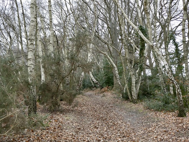
With a brilliant blue flash of side feathers the jay we’d disturbed went screeching off among the trees of Sidney Wood. Raucous birds, jays: the sweary sentinels of the woods.

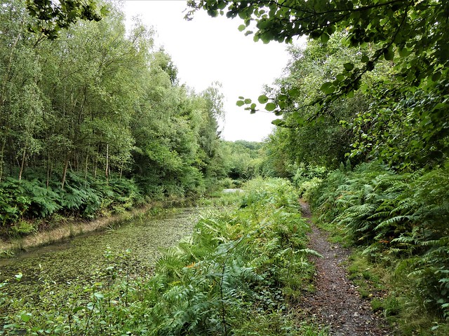
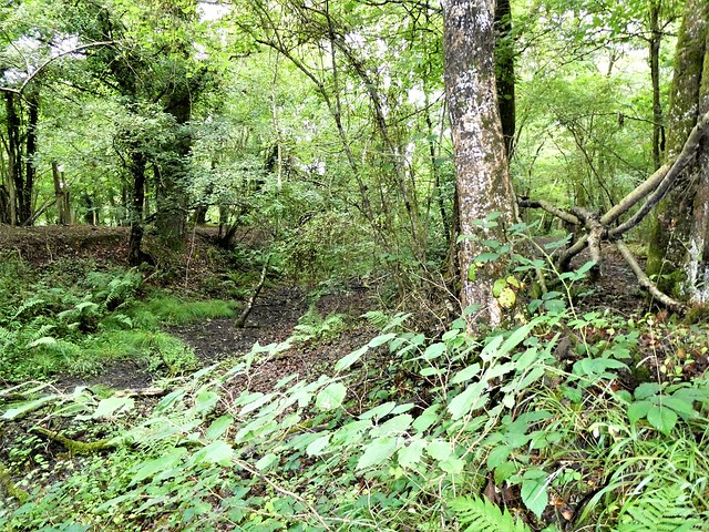
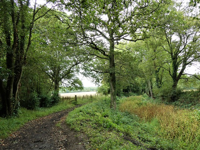
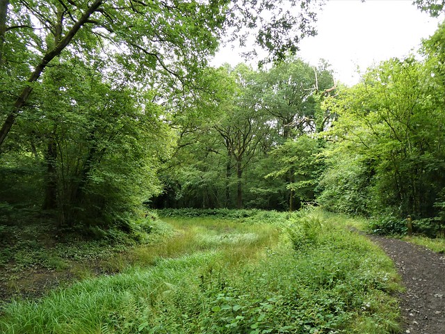
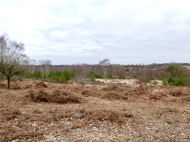
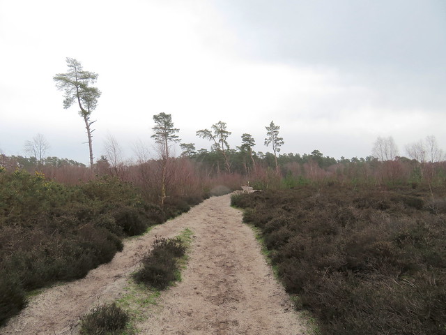
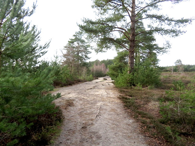
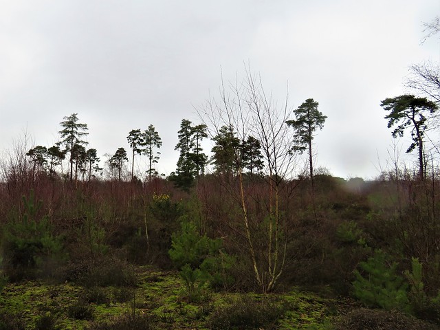
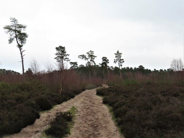
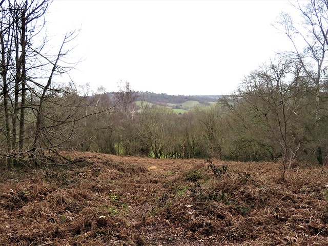
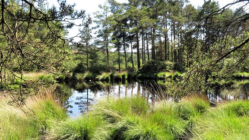
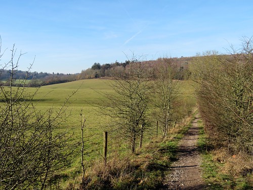
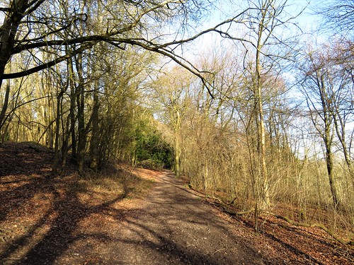
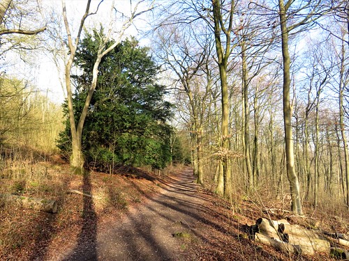
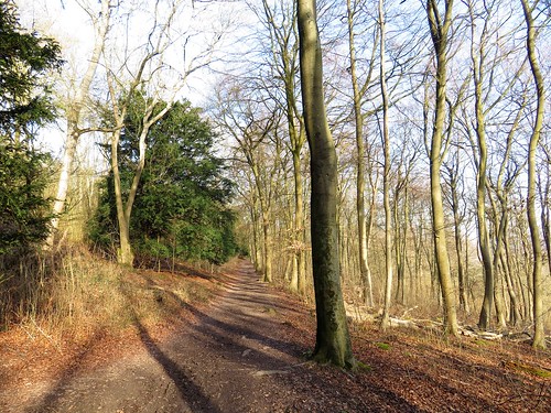
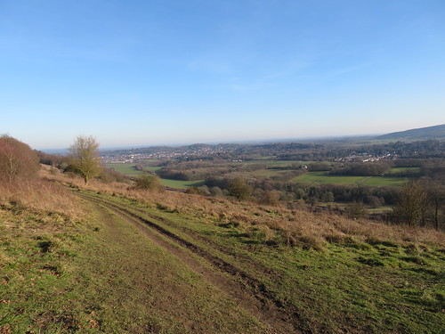
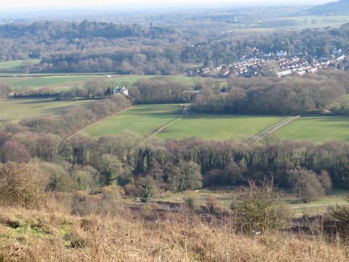
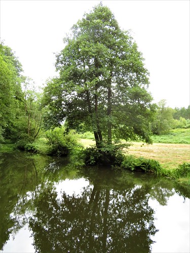
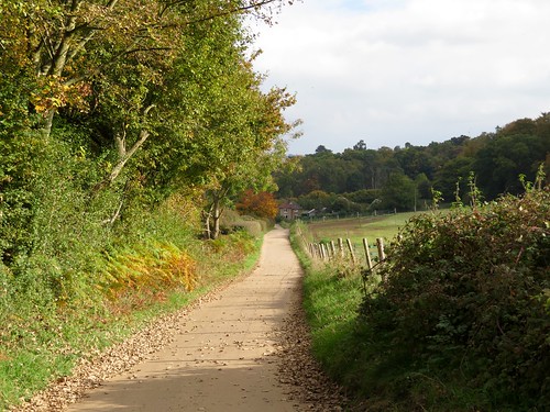
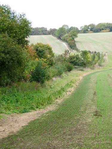
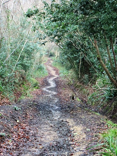
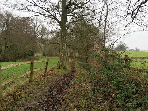
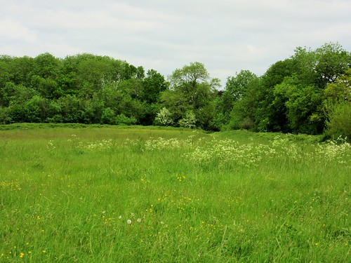
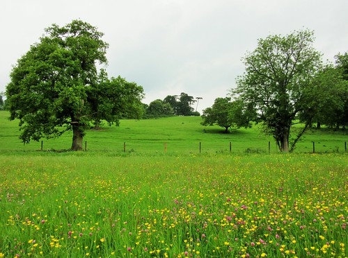
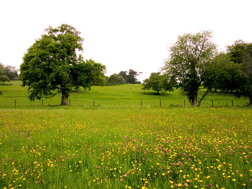
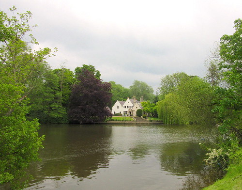
Squirrels had already stripped the hazels of their nuts, leaving eviscerated shells and rejected kernels all over the path. The wood was damp and green this afternoon under the cloudy skies stretched over south Surrey, and the abandoned channel of the Wey & Arun Canal exhaled a fine miasma of mud and stewed vegetation when we found it half-hidden under overarching oaks and wych elms.

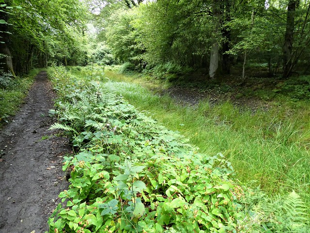
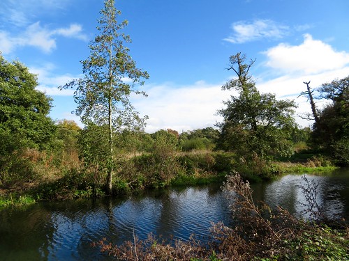
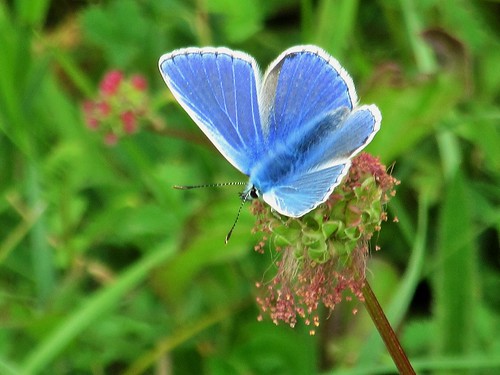
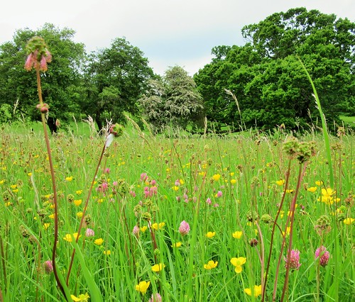
The last of the three-petalled white flowers of arrowhead drooped among spearblade leaves in the damp old waterway. Greenery had triumphed in the cool shade of the wood, overwhelming the canal with reeds and grasses. All that stirred there today were late-hatching pearl bordered fritillaries, their large orange wings streaked with black like a jaguar’s coat.

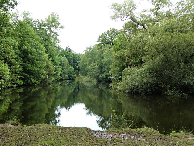
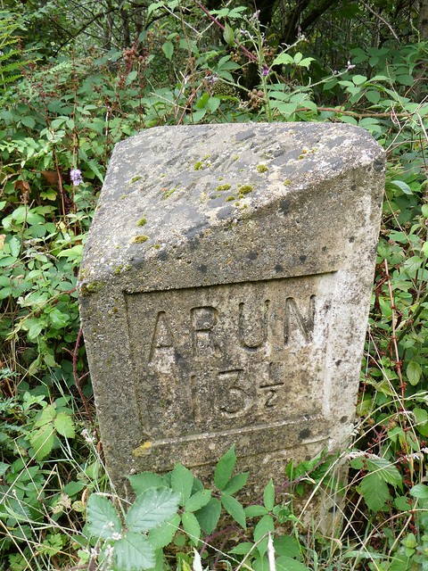
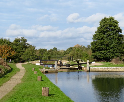
It was hard to credit that this weed-choked waterway, fringed with spearmint, willow leaves carpeting its surface, was planned as a major route for goods travelling between the English Channel and London when war with Napoleonic France meant danger to cargo on the sea routes. Alas for the Wey & Arun – by the time it was opened in 1816 the war was over, and twenty years later the railways sneaked up and stole its trade away.

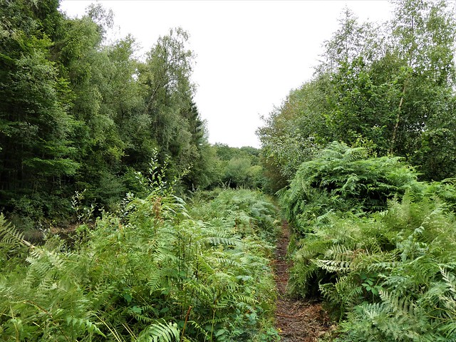
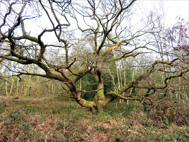
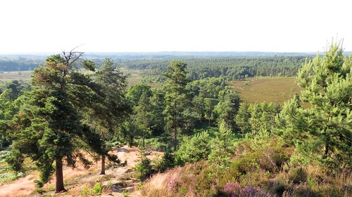
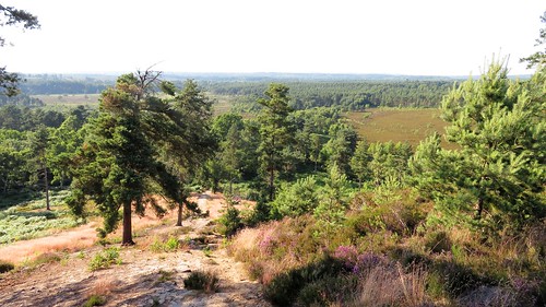
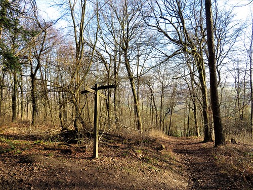
We followed the wide ditch of the canal through Sidney Wood, past the hollows and humps where in times past ‘forest glass’ was made using the local sand, chalk and timber. Glassworks, brickmakers, charcoal burners and potteries of these Wealden woods, the trees have advanced to swallow them all.

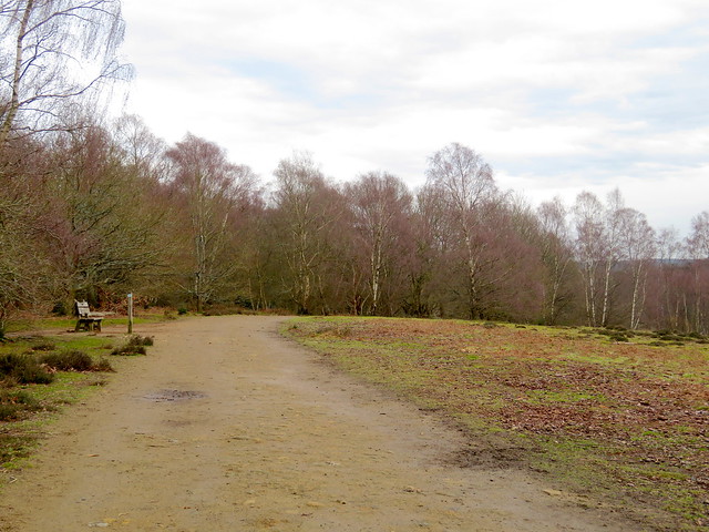
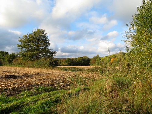
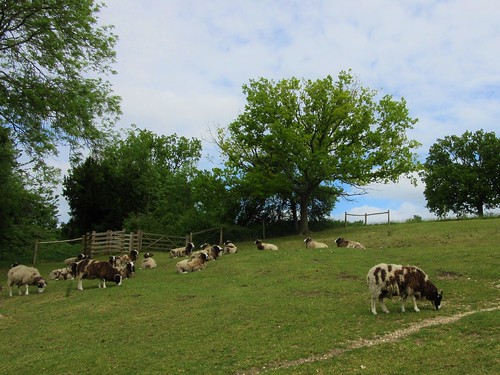
Five minutes munching apples on a fallen beech trunk dotted with tiny brilliant pink fungi, then we walked on out of the trees to Sidney Wood Farm where gangs of hens roamed their compound and a horse followed close at our heels as we crossed his paddock.

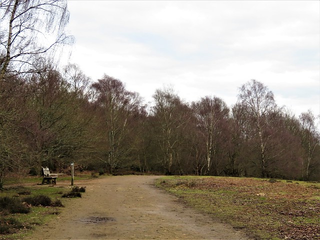
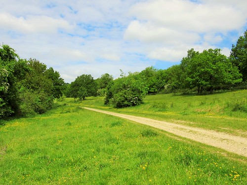
Soon we found ourselves rejoining the Wey & Arun once more – what a convoluted course it took! A last stretch of the old canal and we were treading the black earth of Sachelhill Lane, heading for home after this quiet afternoon’s walk through the Surrey woods and fields.

How hard is it? 4¾ miles, easy, woodland paths (can be muddy)

Start: Sidney Wood car park, near Alfold GU6 8HU (OS ref TQ 027350)

Getting there: From A271 (Guildford-Horsham), at Alfold Crossways follow ‘Dunsfold’. In ½ mile pass turning on bend, signed ‘Three Compasses’. In another ⅔ mile, just after sharp right bend, left (028352, unmarked; ‘Cobdens Farm’ sign visible immediately after turning). Fork left to car park.

Walk (OS Explorer 134): Return along drive. 20m from approach road entrance, hairpin left past ‘Sedgehurst’ sign (‘Wey South Path’/WSP). Keep ahead along drive (blue arrows/BA). In 250m, right (025349, fingerpost/FP, WSP). In ⅓ mile, pass metal gate, cross disused canal; left along right bank (021349). In 1 mile at road, WSP turns left (017338); but go straight over and on. In ½ mile, just past pond, left up gravel road (017331); at Sidneywood Farm gate, right down drive (021330). At Maple Farm, ahead (024326, FP) past cottage on right; through 2 gates; bear left along hedge. Across lane and on (025327, stiles) to meet WSP (027328, BA). In 200m, right over footbridge (026330). Ahead across 2 fields. Left by gate (031334, FP). In 500m cross Rosemary Lane (030337) on woodland path back to car park.

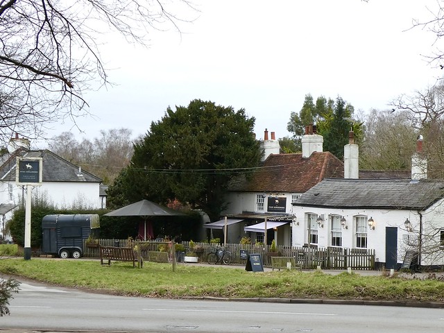
Lunch: Three Compasses PH, Dunsfold GU6 8HY (01483-279749)

Accommodation: Mucky Duck, Tisman’s Common, Rudgwick RH12 3BW (01403-822300, muckyduckinn.co.uk)

Info: Guildford TIC (01483-444333)

 Posted by at 01:31
Mar 042023


First published in: The Times Click here to view a map for this walk in a new window
Great Camp of 1853 memorial cross, Ship Hill, Chobham Common sandy trackway to Ship Hill winter colours of Chobham Common - bracken, gorse and silver birch winter beauty of silver birch, Chobham Common winter colours of Chobham Common - bracken, gorse and silver birch 2 Four Horseshoes Inn, Burrowhill Green avenue of silver birch, Chobham Common

The sixteen hundred acres of Chobham Common form a scrubby stretch of heathland across north Surrey. The track we were following south across the common was floored with sandy yellow soil. It was a grey winter’s day, still and cold. Pine trees, broom and dormant heather added to the sombre effect. But there were signs of spring, too. Pussy willow buds, soft and furry, were just appearing on their twigs, and the gorse bushes were spattered with yellow flowers.

Two young girls clopped past on ponies, one of the animals sporting dayglo pink ear warmers. It was hard to imagine the fear in which travellers in olden times ventured the crossing of the common, an expanse of wilderness notorious for its footpads and highwaymen. ‘A vast tract of land given up to barrenness,’ wrote Daniel Defoe in 1724 in A Tour thro’ the whole Island of Great Britain, ‘horrid and frightful to look upon, not only good for little, but good for nothing.’

Goldcrests went flitting through the bare treetops. We watched a treecreeper dropping down to the base of a silver birch to start another upward scuttle, looking and listening for insects hiding in interstices of the papery bark.

From Burrowhill Green we headed north along a skein of tracks, gravel and flint crunching underfoot and the seashore murmur of the M3 motorway growing louder. On through the underpass, and then a straight climb among gorse and birch to the summit of Ship Hill.

A stubby granite cross marks the spot where Queen Victoria reviewed her troops on a summer’s day in 1853. Eight thousand men and fifteen hundred horses took part in a mock battle, swirling their noise and colour among the hollows of the heath. Among the gallant participants were the officers and men of the Light Brigade, destined to be decimated in the Crimea the following year during their famous charge at the Battle of Balaclava.

Also present were great barrels of molasses, brought to sweeten the tea of the soldiers. Long after the Great Camp, a rumour persisted that the barrels had been buried to await the soldiers’ return; and locals who prospected for them rejoiced in the nickname of ‘treacle miners’.

How hard is it? 6½ miles; easy; heath tracks

Start: Longcross car park, Chobham, Surrey KT16 0ED (OS ref SU 979651)

Getting there: Off B386 (Chertsey-Bagshot) beside M3 at Longcross

Walk (OS Explorer 160): Path south. In 50m fork right. In ¾ mile pass post (blue arrow/BA); in 100m, dogleg right/left (975638) across track. On under power lines. In ⅓ mile (973632, house on left) dogleg right/left (BA) to Gorse Lane (972631). Right to Four Horseshoes PH (972628). Return up Gorse Lane. At right bend, ahead into wood (972631). Just past electricity substation, dogleg right/left (973632, BAs). In 200m, left (974633, BA). In 100m, right (BA on tree) with field on right. In 300m cross trackway (973637). At road, left; cross Staple Hill Road (970639, BA, fingerpost). Ahead for ⅔ mile via Chickabiddy Hill (968644), to cross M3 through subway (970647), then B386 (970650 – take care!). Ahead for ½ mile to memorial cross on Ship Hill (965655). Return to cross track (967656); ahead on track. In ½ mile round right bend; in ⅓ mile ahead at junction (974658, bench on left). At next junction, right (974655) for ½ mile to T-junction (969651). Left through underpass; left to cross Staple Hill road (973646); left for 800m to car park.

Lunch: Four Horseshoes, Burrowhill Green GU24 8QP (01276-856257, fourhorseshoeschobham.co.uk)

Accommodation: The Inn at West End, Woking GU24 9PW (01276-858652, baronspubs.com)

Info: surreywildlifetrust.org

 Posted by at 01:48
Jan 292022


First published in: The Times Click here to view a map for this walk in a new window
The path through Blackheath Forest 1 The path through Blackheath Forest 2 The path through Blackheath Forest 3 The path through Blackheath Forest 4 ancient oak in Blackheath Forest IMG_5788 IMG_5787 IMG_5786 IMG_5800 IMG_5798 IMG_5795 IMG_5794 IMG_5792 IMG_5789

Chilworth station on a cold, cloudy winter’s afternoon, the little train disappearing clickety-clack down the line and our feet itching for a good step-out among the Surrey Hills.

This region of upland heaths and open commons was thought wonderfully remote and wild when arty folk from London began to venture down the railway in late Victorian times. In Chilworth and neighbouring Blackheath they left a legacy of gorgeous Arts & Crafts houses, with tall brick chimneys, wonky walls, and upper storeys hung with mellow red tiles.

In the banks of Sample Oak Lane the coppiced hazels were already hung with catkins, and the very first green spear blades of bluebell leaves were pushing up through the moss in the outskirts of Blackheath Forest. Two robins sprang up from a beech log and battled furiously breast to breast in mid-air, wings winnowing and thorn-like beaks ajar, each intent on making this patch of breeding territory its own.

The path climbed gently through hummocks and hollows, at one moment a stodge of dark peaty mud, the next a pale sandy strip in the heather. Leafless bilberries made a geometric green tangle through which dogs went pattering, drawn by scents unfathomable to mere humans.

We topped out on open ground of sombre colours – heather, moss, bronze-hued bracken and tall pine trees, all bedded on the greensand ridge that underlies this landscape. Nightjars and Dartford warblers nest here in summer, but today the rooks and red kites had the airways to themselves.

Rain came spattering across the heath, then a pale watery sun drifted from the clouds and turned the pine trunks pink. We passed an ancient oak, a knobbed and twisted old monster with limbs flung wide, and turned back west past a cottage deep in the trees on an acre of grass, as snug and lonely as any of Grimm’s woodcutter’s abodes.

At Blackheath the cricket field lay battened down, its gabled pavilion shut. Handsome houses with railed porches and neat gardens lined the road, where a fingerpost pointed to ‘This Way, That Way, Somewhere Else’.

A bridleway led over the heath and down a deep, dark holloway towards Chilworth. In a beautifully laid hedge a little flicker of movement caught the eye – a goldcrest, its forehead embellished with gold, a tiny bright bird as plump as a dormouse, intent on picking sustenance from the bare twigs with a bill almost too miniscule to see.

How hard is it? 5½ miles; easy woodland and heath tracks.

Start: Chilworth railway station, near Guildford GU4 6TT (OS ref TQ031472)

Getting there: Rail to Chilworth. Bus 32 (Guildford).
Road: on A248, signed from Shalford on A281, south of Guildford.

Walk (OS Explorer 145): From station, down Sample Oak Lane. In ⅓ mile, fork left by shelter labelled ‘Brantyngeshay’ (032467, fingerpost/FP). In 100m fork left (blue arrow/BA) on bridleway. In 300m dogleg right/left past Blackheath Common signboard (035465, BA). Keep ahead over cross-tracks (occasional BAs and FPs). In ½ mile, at another Blackheath Common signboard (043462), left on broad track.

In 150m fork right (045461, BA) through trees. In ½ mile at wide clearing (050460), fork right past ‘Beth Edwards’ bench. In 250m, sharp right at 1 Lipscombe Cottage along drive (053458), soon a woodland path. In 300m cross track (049458). In 200m pass cottage (046458, stile, ‘Fox Way’/FW). At Candleford Cottage, right (044457, FP, FW) for ⅔ mile to Blackheath village.

At right hand side of cricket field, left (036461) on track to road (033462). Left; at crossroads, right (‘That Way’); in 100m, left (032463, ‘Bridleway’ fingerpost) on bridleway, keeping ahead over side tracks. In ¼ mile, just beyond ‘Tangley Way’ house, fork left (028464) ‘Downs Link’).

In ⅔ mile, at Deer’s Leap Cottage on left (020465), right on lane past Great Tangley Manor Farm. In ⅓ mile, at T-junction (025469, FP), left beside wall to A248 (025471). Right to station.

Lunch/accommodation: Percy Arms, Chilworth GU4 8NP (01483-561765, thepercyarms.net)

Info: surreyhills.org; Guildford TIC (01483-44433)

 Posted by at 01:38
Jul 132019


First published in: The Times Click here to view a map for this walk in a new window
picture picture picture picture picture picture
Facebook Link:

It’s rather amazing that Frensham Common has not sunk under the weight of its conservation titles. This thousand-acre sandy heath in south-west Surrey is a Special Protection Area, a Special Area for Conservation, a Site of Special Scientific Interest, an Area of Outstanding Natural Beauty. It’s full to the brim with butterflies, birds, insects and lizards. And it’s a beautiful place for a walk on a hot summer’s day.

Unbroken blue sky lay over the common. Our boots kicked up little puffs of sand as we followed a track over humps and through hollows. The sun brought rich resinous smells from the pine trees and scented the purple heather that ran in waves to the wooded horizon in all directions. There was the strange sensation of being enfolded by wild country in a Home Counties landscape.

The sandstone that underlies Frensham Common is a dark rock shot through with iron, rusted to burnt orange, warm to the touch today. We passed a pond tufted with tussocks of moor grass like pale green fright wigs. Dragonflies dodged across water as dark and still as oil. The aptly named Sandy Lane led west past a trickle of stream in the ford at Gray Walls, then out into open heath in a glassy shimmer of heat haze. No birds sang in the mid-afternoon sun. A solitary lizard ran across the path in a little flurry of sand, too quick for the eye to register.

At Frensham Great Pond the scene changed. This big pool, created in early medieval times to provide carp for the Bishop of Winchester’s table, is a great place to splash around on sandy beaches. Fishermen stalked the reeds. Kids sailed tiny boats. There was a cheerful atmosphere of holiday and outdoors fun.

The homeward path lay south of The Flashes ponds and heathland. A steep stony path led up to the summit of the Devil’s Jumps. These three ironstone hummocks were kicked up by Old Nick as he ran off with Mother Ludlam’s cauldron under his arm.

On the top we found the giant boulder that the great god Thor pitched at the Devil. Two young lovers were sitting on it, admiring the sunlit view and each other. We left them to it.

Start: Bel & The Dragon Inn, Jumps Road, Churt, Farnham, Surrey GU10 2 LD (OS ref SU 871393).

Getting there: Inn is at junction of Jumps Road and Hale House Lane, 2 miles east of Churt (A287 Hindhead-Farnham)

Walk (6½ miles, sandy tracks and paths, OS Explorer 133, 145): From Inn, left up Jumps Road. In 100m, right up fenced path. In 150m, ahead through woods. In another 150m, fork right uphill between trees to fork right at waymark post (870395, yellow arrow/YA) into valley. In 500m, fork left past gate (871400, YA) on wide permissive track. In 500m, through wire fence to cross ride (867402) with gate opposite. Left; immediately right across footbridge, follow fence on right (YAs).

In 400m, right through fence (864404, YA) up track to Sandy Lane (865405). Left; in 300m, over ford (862406); in another 100m fork right on tarmac. In 200m, ignore Byway on right (859407). At turning area by Lowicks houses, keep ahead (858407, blue arrow/BA) on sandy path west across Frensham Common for ½ mile to cross A287 (849410).

Pass barrier opposite and on. In 250m, fork left at post (847410, BA, ‘Surrey Hills Cycle’/SHC). Keep straight on for 500m to Frensham Common car park. Bear right to cross entrance road beside notice-board (844406). On among trees (SHC). In 450m descend steps; right (843402) along side of Frensham Great Pond. At road, left (841401, SHC); at Frensham Pond Hotel, fork left (841400) on Pond Lane (soon following path on left among trees, parallel with lane) for ½ mile to cross A287, 100m north of its junction with Pond Lane (849399).

Ahead (SHC, fingerpost) on track. In 300m, right at fork (852400, BA, SHC). In 150m, at 2-finger post, SHC continues ahead, but fork left downhill here on path, then road for 600m. Left (855394) up ‘Permissive Track’ on west edge of Churt Common, then along south edge of The Flashes. In ½ mile, wooden fence joins on right (865397); in another 300m, where fence turns sharp right, ahead over cross path and footbridge (868397). Ahead, then half right, steeply up to summit of easternmost Devil’s Jump (869395). Left down to junction (waymark post); right to return to inn.

Lunch/Accommodation: Bel & The Dragon Inn (01428-605799, belandthedragon-churt.co.uk) – stylish, comfortable stopover.

Info: Frensham Common – waverley.gov.uk
Guildford TIC 01483-444333; visitsurrey.com; satmap.com; ramblers.org.uk

 Posted by at 01:19
Mar 302019


First published in: The Times Click here to view a map for this walk in a new window
picture picture picture picture picture picture picture picture picture picture picture picture picture
Facebook Link:

A lovely crisp sunny day over the North Downs, the sort of day you dream of as winter takes a sly peep behind the curtains of spring. The crocuses were out under the big oak on Ranmore Common, green lambs’-tails swung from hazel twigs, and deep in the woods a great tit rang his two-tone territorial bell.

A bridleway dropped northward through the trees towards the Polesden valley, winding among holly, yew and butcher’s broom – all trees and shrubs that would be in scarlet berry later in the year.

Down in the valley bottom Bagden Farm stood splashed by the late winter sun. A great spotted woodpecker drummed out a rattling claim to its patch of Freehold Wood as we followed a permissive path through the valley, one of many provided by the Polesden Lacey estate. The country house itself lay hidden beyond flint walls and thick belts of shrubbery, but the influence of a well-maintained estate on its surroundings was plain to read in beautiful parkland trees, subtle corners of landscaping, and the excellent waymarking of paths.

Walking the tracks I recalled a previous visit to the house, hearing splendid tales of Polesden Lacey’s early 20th-century chatelaine Mrs. Ronald Greville and her forthright manners (Lady Leslie: ‘Maggie Greville? I would sooner have an open sewer in my drawing room!’).

Actually Maggie Greville, despite her acid tongue, was a generous and warm-hearted person, one of life’s radiators. Born the illegitimate daughter of a Scottish brewer, she loved money and power, but was unashamed of her origins, proclaiming, ‘I’d rather be a beeress than an heiress.’ And it’s Maggie Greville we have to thank for leaving Polesden Lacey to the National Trust in her will.

From the high-perched environs of the house the deeply sunk old holloway of Hogden Lane rolled us down into the valley and up a long flinty rise to the ridge beyond. Here we crossed the ancient route of the Pilgrim’s Way, a shadow track in its contemporary guise of a country road, and turned for home along the North Downs Way among beech and venerable yews on the slope below.

A short detour through a grassy upland, and we were clear of the trees and looking south across a wide valley to where Leith Hill, highest point in Surrey, raised the impudent finger of its crowning tower.

Start: Denbies Hillside car park, Ranmore Common Road, Dorking RH5 6SR (OS ref TQ142504) – NT members free.

Getting there: Train to Dorking West. Road: M25 Jct 9; A 24 to Dorking; Ranmore Road west for 1 mile to car park

Walk (5¾ miles, easy, OS Explorer 146): Cross road; bear right on path to Ranmore Church (145505). Left; in 100m, left on bridleway (fingerpost) north for 1 mile. Just before Bagden Farm, left by shed (148520), through gate; on with fence on right. In ¼ mile, through gate (144517, BA); left; in 30m, right (gate 33, ‘Run England’ red arrow). Follow red arrows and Polesden Valley Walk/PVW. Just beyond Polesden Farm, right (135519, PVW); at top of slope, cross track (gates); ahead on permissive path. In 300m, through gate 20 (132522, yellow arrow); ahead on Hogden Lane, south for 1¼ miles to cross Ranmore Common Road/Pilgrim’s Way (126502). Keep ahead (south) for ⅓ mile; left on North Downs Way (127497, fingerpost) to car park. (NB – in 700m, path across open ground on right gives wide views).

Lunch: Duke of Wellington, East Horsley KT24 6AA (dukeofwellingtoneasthorsley.co.uk, 01483-282312)

Accommodation: White Horse, High Street, Dorking RH4 1BE (01306-881138, whitehorsedorking.com)

Info: nationaltrust.org.uk/denbies-hillside; nationaltrust.org.uk/polesden-lacey; satmap.com; ramblers.org.uk

 Posted by at 01:23
Jun 302018


First published in: The Times Click here to view a map for this walk in a new window
picture picture picture picture picture picture picture picture picture picture picture
Facebook Link:

The Surrey Weald, a great thickly wooded lens of land, lies on a band of ironstone in the shadow of the North Downs. Once it was a smoky, noisy, clangorous industrial hub, part of the medieval iron-making centre of England. You’d never know it now, though, so snug and quiet lie the villages tucked into valley bottoms along the tortuously winding lanes that thread the woods.

Coldharbour is no more than a scatter of cottages loosely based on the Plough Inn. We started off north along Wolvens Lane, a sun-dappled holloway under sweet chestnuts and knobbly pollarded beeches whose roots hung at the rim of the lane, half in earth, and half in air. Flickers of grey and tan betrayed the movement of horse riders down parallel tracks, moving quietly and all but unseen through the woods.

A path dark with hollies and yews led west, down to the fast water race of the Tilling Bourne in its valley-bottom bed, and to the beautiful mill pond at Friday Street. In the quiet beech woods along Abinger Bottom the tree roots grasped the earth like many-knuckled grey fingers.

A quick sandwich in the Stephan Langton Inn, named after the former Archbishop of Canterbury – a local boy, he led the push to force King John to sign Magna Carta in 1215. Then on through quiet beech woods along Abinger Bottom where the tree roots grasped the earth like many-knuckled grey fingers.

On the slopes of Leith Hill, the highest point in Surrey, we broke clear of the trees and stood between pine trees looking out from the greensand ridge, many miles across the wooded Vale of Surrey and north Sussex, a smoky grey and blue prospect over the Wealden landscape. Up on the viewing platform at the top of nearby Leith Tower the panorama sprang outwards, further and further, south to the South Downs around Goodwood and the trees on Chanctonbury Ring 25 miles off, north to a pale grey smear that might have been the Dunstable Downs a full fifty miles away, and the dream-like spectral towers of the London skyline.

In 1765 Richard Hull of Leith Hill Place built the brick-and-ironstone tower sixty feet tall in order to claim a thousand-foot summit for Surrey. He lies buried here, not arrogantly at the apex of his creation, but humbly beneath its foundations, with the world climbing upon his back to enjoy the sensational view he opened for us all.

Start: Plough Inn, Coldharbour, near Dorking, Surrey RH5 6HD (OS ref TQ 151441)

Getting there: Bus service via Dorking railway station – 433 (Mon, Thur); 50 (Tue, Fri).
Road – Plough Inn is on Coldharbour Lane, 3½ miles south of A25 at Dorking.

Walk (6½ miles, easy, OS Explorer 146. NB: Detailed directions, online maps, more walks at christophersomerville.co.uk): From Plough Inn, cross road; take lane to right of bench (‘Byway’). In ¾ mile pass Wolven Cottage Stables on right (145452); in 100m, left past metal barrier; path inside edge of wood. In 250m, fork left at wooden barrier (142451) and on for 500m, descending to gravel bridleway at Tilling Springs (139449). Right; in 100m, right along Greensand Way/GW. In ½ mile at Mare’s Nest, right along road (135457); fork immediately right and continue on GW. In ½ miles pass entrance to Mandrake House (nameplate); in another 100m, left (135465, stile, yellow arrow/YA) across field, then Tilling Bourne stream.

Up slope, across road (131462) and on past Wotton Estate notice. In 150m, over path crossing (130462, fingerpost/FP) and on. In 400m, steep descent to kissing gate and path crossing with bridge ahead (126462). Don’t cross bridge; turn left with stream on right for 450m to cross road by pond at Friday Street (128458). Ahead to pass Stephan Langton Inn.

At end of road, ahead through barrier and on south (‘public bridleway’). In 700m, left along road (127449). In 100m, fork right and on. In ½ mile (127440) fork right. Cross road above house; follow woodland track to road. Left to bend; left (128438, ‘Broadmoor’); immediately right (‘Bridleway’) on woodland track for ¾ mile to Leith Hill Tower (139432). Follow ‘Coldharbour Common Walk’/CCW signs north-east, descending to go through gate (141433, CCW). In 200m go over crossing path and on (142434, blue arrow/BA). In 300m, at meeting of paths, bear right ahead (144437, BA); in 200m, through gate (146438); on past cricket field for ½ mile to Plough Inn.

Lunch: Plough Inn, Coldharbour (01306-711793; ploughinn.com) or Stephan Langton Inn, Friday Street (01306-730775; stephanlangton.pub). Tea: Leith Hill Tower kiosk (10am-3pm)

Accommodation: Plough Inn, Coldharbour; or Henman Bunkhouse, Broadmoor RH5 6JZ (01306-712711, https://www.nationaltrust.org.uk/holidays/bunkhouse-henman-surrey)

Leith Hill Tower: open daily, 10-3

visitengland.com; satmap.com; ramblers.org.uk

 Posted by at 01:24
Feb 252017


First published in: The Times Click here to view a map for this walk in a new window
picture picture picture picture picture picture picture picture picture picture picture picture picture picture
Facebook Link:

A still winter’s day under a mackerel sky of white and blue as we set out from the Withies Inn at Compton. Horses in tarpaulins cropped the paddocks at Coneycroft Stud, where the farm dog ran his nose along the hedge parallel with our boots, and hoarsely proclaimed just what he’d do if he could only get at us.

Along the road the Watts Cemetery Chapel stood tall on its mound. Mary Watts, artist wife of the Victorian painter and sculptor George Frederic Watts, designed it as a brilliant Art Nouveau expression of grief and mourning through the depths of darkness and the redemptive power of light. Local villagers fashioned many of the tiles under Mary’s tuition – she was a passionate believer in everyone’s potential for artistic creativity. The exterior is packed with calm-eyed angels in flaring orange terracotta, the interior full of sombrely coloured, transcendentally beautiful cherubim and seraphim.

Mary and George Watts moved to Compton in 1891 (she was 42, he was 74) and founded a remarkable gallery dedicated to George’s symbolist work. We were tempted to spent the whole afternoon there, but the ancient holloway of the North Downs Way beckoned us away east to the banks of the River Wey on the southern borders of Guildford.

On a sandy river cliff high over the Wey we found the roofless old chapel of St Catherine, round which a notorious fair used to be held. Neither of the Wattses painted that, but JMW Turner did – a vigorous scene of fighting, drinking and sideshow action, the artist depicting the throng in swirling attitudes and splashing colours.

The River Wey was one of the first in England to be canalised, part of a wonderfully ambitious 17th-century scheme to link London to the English Channel in mutual prosperity. We walked south past neat brick lock-keepers’ cottages on the edge of its quiet waters, as still and calm as a linear lake, curving with man-made artistry through meadows where last year’s purple loosestrife stood brown and crackly dry.

Our homeward path lay westward through the arable parkland of Loseley Park. Rooks and black-headed gulls patrolled the furrows in fields of winter wheat, and squirrels scuttered among hazels from which they had stripped every last nut.

Start: Withies Inn, Compton, Guildford, Surrey GU3 1JA (OS ref SU 963468)

Getting there: Bus 46 from Guildford.
Road – From A3 just south of Guildford, Compton is signed. Pass through Compton; in ½ mile, left up Withies Lane to Withies Inn.

Walk (8½ miles, easy, OS Explorer 145): From Withies Inn, right along Withies Lane. Cross road; on along wood edge path (fingerpost/FP). Left at top of paddocks (yellow arrow/YA) to Coneycroft Farm (959475). At shed, left through gate (YA); follow fenced path to road (957475). Left to Watts Cemetery Chapel (956474).

Return up road. In 300m, pass FP on right; in 20m, fork right (957477, ‘North Downs way’/NDW) past Watts Gallery. Follow NDW for 2¼ miles to road (991483). Left (NDW) to A3100. Dogleg right/left into Ferry Lane. Detour right to St Catherine’s Chapel on hilltop (994482); return to Ferry Lane; right to River Wey (994483); right on Wey South Path for 1 mile to cross A248 at Broadford Bridge (997467). Keep on right bank of river; in 450m, fork right at railway bridge (995464) onto railway path to A248 overbridge (993465).

Left here on Cycle Route 22 (‘Peasmarsh’). In 150m join road; immediately left down Oakdene Road. In 100m, right across recreation field to cross A3100 (990465). Follow path into Peasmarsh Wood (signed); in 150m, fork right to cross railway (989465). Ahead along field edge; through far hedge (985467); left along drive to Stakescorner Road (982468). Right; in 200m, left along Loseley Park drive (FP). In 300m, left (979469, FP) past Grove Cottage. Path across 2 fields (YAs) to driveway (975466); left for 100m; right on path among trees. Over stile, then along 2 field edges; left (971465, FP) to dogleg right/left across B3000 (971463).

Cross playing field and road. Follow footpath beside Copse Side. In 400m, right at road (967459); round right bend; in 100m, left along minor road for ½ mile to B3000 (964466); dogleg right/left up Withies Lane to Withies Inn.

Lunch: Withies Inn (01483-421158, thewithiesinn.com)

Accommodation: Eashing Farmhouse, Eashing, Godalming GU7 2QF (01483-421436; compton-surrey.co.uk/eashing-farmhouse)

Watts Gallery and Cemetery Chapel: 01483-810235, wattsgallery.org.uk

Info: Guildford TIC (01483-444333)
visitengland.com; satmap.com; ramblers.org.uk

The January Man – A Year of Walking Britain by Christopher Somerville (Doubleday, £14.99). For 30% off, call 01206 255 777, quoting TIMES302017. 

 Posted by at 02:00
Mar 052016


First published in: The Times Click here to view a map for this walk in a new window
picture picture picture picture picture picture picture picture
Facebook Link:

It was a chilly February morning in the lee of the Surrey hills, but the sparrows of Ewhurst were chirping all round the village nonetheless. Cold fresh air stung our nostrils in Wykehurst Lane, where the sharp, sweet song of a solitary robin laid the archetypal soundtrack for a wintry walk in the woods.

Snowdrop clumps were still full and white down in the sheltered hollow of Coneyhurst Gill. We followed a muddy path up towards the tree-hung escarpment of the great greensand ridge that cradles the lowlands of the Surrey Weald. This was all loud and smoky ironworking country in the late Middle Ages, but these days the fine large houses of the stockbroker belt look out from their hillside eyries onto paddocks and pastures that lie silent and unblemished. Under a hazel by the path we passed a modest plaque: ‘Tony sleeps here. Good dog.’

Signs of spring were already infiltrating the closed doors of winter – lambs-tail catkins and tiny scarlet flowers on hazel twigs, rushy spears of bluebell leaves under the oaks, and an insistent bubbling of birdsong up in the high woods along the ridge. A stream stained orange by iron leachings had cut deeply into the greensand, and the golden ball of a crab apple bobbed endlessly in a back eddy where the brook had trapped it for a plaything.

The Greensand Way trail strings together the promontories and heights of the escarpment, and we followed its knobbly yellow track up through the woods to Holmbury Hill. In the century before the Romans invaded Kent, a Belgic tribe built a mighty fort here with ramparts and ditches as tall as three men. From its southern lip a wonderful view opens out across the Weald and away towards the South Downs some 20 miles off. On clear days, walkers on Holmbury Hill can spot the semaphore flashes of the sea at Shoreham on the Sussex coast. But today all was muted and misty down there.

Using gorse branches as banisters we groped our way down a precipitous slope below the hill fort. At the foot of the escarpment the mud-squelching track of Sherborne Lane led us back through the fields towards Ewhurst, between hedges where primroses were already beginning to cluster among the hawthorn roots.

Start & finish: Bull’s Head PH, Ewhurst, Surrey GU6 7QD (OS ref TQ 090408)
Getting there: Bus 53 (Horsham-Guildford)
Road: Ewhurst is on B2127 between Forest Green and Cranleigh

Walk (6 miles, moderate grade, OS Explorer 145, 146): From Bull’s Head cross B2127; follow Wykehurst Lane (fingerpost/FP). In ½ mile cross bridge over Coneyhurst Gill (082407); in 50m, right (FP, stile) on path through trees. In 600m, left along road (081413); in 50m, right (‘Rapsley’) up drive. Pass Rapsley Farm; on up path on edge of wood. At road, right (081422); in 100m, left up Moon Hall Road.

In 200m, opposite gates of Folly Hill, fork left up bridleway (084422, FP) for 400m to turn right along Greensand Way/GW (085425). In 300m fork right past wooden barrier (086428, GW), downhill and through grounds of Duke of Kent School. Cross Ewhurst Road (090430); on along GW for ¾ mile to car park on Holmbury Hill (098431). Leave car park at far right corner. In 150m, just past pond on right, fork right on path (not broad track) among trees, past wooden barrier (‘Footpath Only’). At edge of escarpment bear left; in 200m turn right along GW (101430). Follow GW to trig pillar on Holmbury Hill fort (104429), and on for 100m into hollow. Right here (105429) down slope past notice ‘Bridleway 193 – Caution, steep slope ahead’. Very steep, rubbly slope down to road (105428).

Right; in 200m, left off road, and follow fenced path to left of gate marked ‘Wayfarers’ (FP). In 100m cross road (103426); ahead along drive with staddle stones (FP). By pond, fork left (‘Bridleway’ FP) along Sherborne Lane bridleway. In ½ mile pass drive to Radnor Place Farm on left (095419). Continue along Sherborne Lane. In 300m, at stile and yellow arrow on right, turn left onto driveway (093418). Right; in 50m, left (FP) along fenced path across Path Four Acres field and into wood (094414). Right (FP) to road in Ewhurst (090409); left to Bull’s Head.

Conditions: Muddy/wet paths; very steep slope down from Holmbury Hill fort.

Lunch/accommodation: Bull’s Head, Ewhurst (01483-277447, bullsheadewhurst.co.uk) – lovely pub, lovely grub
More info: Guildford TIC (01483-444333)
visitengland.com; satmap.com; ramblers.org.uk

 Posted by at 01:05
Jul 182015


First published in: The Times Click here to view a map for this walk in a new window
picture picture picture picture picture picture picture picture
Facebook Link:

Riddlesdown rises opposite Kenley railway station, a steep slope of rough grassland dotted with buttercups and speedwell, and scrub woods thick with yew, oak and ash. Wrens whirr, blackcaps flute, squirrels scuttle up the tree trunks. A rutted chalk track winds up the slope and vanishes over the crest. Walkers stride the grassy paths of Riddlesdown as though they own the place – and in effect, that’s just what they do.

If the Corporation of the City of London hadn’t bought the ‘Coulsdon Commons’ – Riddlesdown and its neighbouring ‘wastes’ of Kenley Common, Coulsdon Common and Farthing Downs – for £7,000 in 1883 (nearly £1 million today), there’s little doubt what would have happened. All four high green open spaces would have been gobbled up in London’s inexorable southward expansion. As it was, the City of London dedicated the 350 acres of Coulsdon Commons, ‘fine, open, breezy downs, already largely used for purposes of recreation by the public, and now for all time secured for those purposes.’

Along the crest of Riddlesdown I followed a flinty track among dog walkers, strollers and kids dashing hither and yon. It was a shock to descend from the open countryside to find the A22 snarling and stinking in the valley bottom. A minute’s wrestling with this monster and I had left the houses behind, climbing up through woods again to the yellow buttercups and blue speedwell drifts of Kenley Common. The occasional rattle of a train came up from the valley, but the birds in the woods along the common were far louder.

A pint of Lancaster Bomber in the Wattenden Arms, whose panelled walls were hung with wartime photographs of fresh-faced fighter aces from nearby Kenley aerodrome who used to drink here in between aerial duels with their German counterparts. Then I moved on, dipping down into suburbia at Old Coulsdon, rising again to the tangled woodland paths on Coulsdon Common.

The local landowner’s enclosure of portions of Coulsdon Common in the 1870s provoked two brothers into taking him to court. Lobbying and legal advice from the newly formed Commons Preservation Society helped the pair to win their case, and pressurised the Corporation of London into making its philanthropic move. The CPS (now called OSS, the Open Spaces Society), is 150 years old this year, and still working to preserve our open green spaces. What would we do without campaigners like these?

I crossed the steep-sided combes of Happy Valley where children were running and yelling through the hay meadows – a sight that would have gladdened the hearts of those public-spirited Victorian aldermen. Then a last long descent through the buttercups and fairy flax of Farthing Downs with the outlandish monoliths of 21st-century London rising on the northern skyline like a nightmare warning of what might have been done with our green spaces – what could still be done – without the vigilance of the OSS and others like them.

Start: Kenley station, Kenley Lane, Surrey, CR8 5JA (OS ref TQ 324601)

Getting there: Rail to Kenley.
Bus 434 (Coulsdon-Whyteleafe)
Road – Kenley station signposted off A22 between Purley and Whyteleafe (M25, Jct 6)

Walk (7 miles, moderate, some steep steps. OS Explorer 161. NB: Detailed directions, online maps, more walks at christophersomerville.co.uk): Down station approach; right to cross A22; up steps and hill path opposite. In ¼ mile, at clearing with 4 gates (327603), go through uppermost gate. Bear right on grass path to join main gravel track, Riddlesdown Road. In ½ mile London Loop path (‘LL’) joins, before track crosses railway and descends to A22 (336593). Left along road; in 50m, right across A22 (LL), across railway, and up New Barn Lane, then up steps through wood (LL, ‘Hayes Lane’). By Kenley Common notice at top (333590) ahead with wood edge on right.

In 150m, into wood (332589). Ahead over path crossing, past Kenley Common notice, on through wood. In 250m, main path bends right (330588); but keep ahead on lesser path to reach open field. Diagonally left across field to fenceless gate and fingerpost in far corner (329585). Ahead (‘Hayes Lane’) past bench; follow path through wood. In 100m, right along lane (LL, ‘Hayes Lane’) for 300m to road (325583). Right (LL); in 150m, left (LL, ‘Old Lodge Lane’) and follow LL signs through corner of Betts Mead and on to road (323582).

To visit Wattenden Arms PH, turn left for 100m. To continue walk, cross road; bear left (LL) along left edge of field. Across next paddock to stile (LL); ahead along lane (‘Waterhouse Lane’ fingerpost). At T-junction, right (323578, LL). Descend to cross Caterham Drive (323576); on up Rydons Lane for 500m to cross road (321571). Ahead (LL, ‘Coulsdon Road’) to cross B2030 (319569). Ahead down Fox Lane. At Fox Inn, bear right round sports field and past Happy Valley notice (317568, LL, ‘Farthing Downs’).

Follow lane along right side of field. In 400m pass bench at corner (313566); on through woodland. Bear right along side of next grassland valley; through neck of woodland; descend slope of next open valley (‘Happy Valley’) diagonally right to bottom (308568). Keep same direction up far slope to top right corner (306569; LL, ‘Farthing Downs’). Ahead on track through Devilsden Wood (LL) to emerge by notice on Farthing Down (302572). Bear right; follow path parallel with road north for 1 mile towards Coulsdon. Where it joins B276, turn left along Reddown Road (300590). In 150m, right across railway to Coulsdon South station.

Return to Kenley by rail via Purley station; or District Cars taxi from Coulsdon South station (0208-668-9000; £7 approx).

Lunch: Wattenden Arms, Kenley (0208-660-4926; thewattendenarmskenley.co.uk) – cheerful place with wartime memorabilia

London Loop: Download leaflet guides at https://tfl.gov.uk/modes/walking/loop-walk; or follow directions in ‘The London Loop’ by David Sharp with Colin Saunders (Aurum Press).

Open Spaces Society: oss.org.uk, 01491-573535

satmap.com; ramblers.org.uk; visitengland.com

 Posted by at 07:11
Jun 132015


First published in: The Times Click here to view a map for this walk in a new window
picture picture picture picture picture picture picture picture
Facebook Link:
The most famous meadow in the world lies modestly beside the River Thames, just downstream from Windsor. When a sulky King John met his angry and defiant barons at Runnymede on 15 June 1215, the king was broke and facing a full-scale rebellion. The barons demanded his agreement to a ‘Great Charter’, guaranteeing no taxation without representation, freedom of worship, justice for all and a limit on the king’s absolute right to command. John squirmed and writhed; he sealed the document, then reneged. Magna Carta was a sickly seed when first planted in the soil of Runnymede. But from it grew the worldwide principles of democratic government.

To get a sense of Runnymede’s place in history, I wanted to see its setting from Cooper’s Hill, the wooded height that bounds the meadow on the south. I followed Cooper’s Hill Lane up to the brow of the hill, where a splendid WWII Air Forces Memorial looks out over Runnymede.

Behan, Belasco, Chander and Cherala; Bardichev, Smik and Gnanamuthu – they came from Canada, Jamaica, Poland, India and New Zealand, and, in the words of the memorial’s inscription, ‘they died for freedom in raid and sortie over the British Isles and the land and seas of northern and western Europe.’

I climbed to the roof of the memorial and stood looking north across Runnymede. West beyond the trees lay Windsor, seat of the monarch. To the east sprawled London, capital of the realm. It’s plain to see how the big, flat meadow by the river offered a good place for a parley on neutral ground.

I descended through the sun-dappled trees of Cooper’s Hill Wood and crossed the fields towards Runnymede. Above the meadow stands the domed colonnade of the Magna Carta Monument (erected in 1957 by the American Bar Association), and the great blunt monolith of the John F Kennedy Memorial. It’s not so strange that both have transatlantic resonances – the American Constitution is founded on the principles of Magna Carta.

Wandering back east through the buttercups and tall grasses of Runnymede, it was easy to picture the pavilions and pennants of 1215, the stern-faced barons sweating in their mail coats, and wretched King John wriggling like an eel as history caught him inescapably in its net.

Start & finish: Egham station, TW20 9LB (OS ref TQ 011710)

Getting there: Train to Egham. Bus 566, 567 (Knowle Hill-Staines). Road – M25 Jct 13, A30, B3407 to Egham.

Walk (5 miles, easy, OS Explorer 160. NB Online maps, more walks: christophersomerville.co.uk): Right along Station Road; follow ‘A30’ to roundabout. Right past car showroom; in 150m, left (007715) along Cooper’s Hill Lane for ¾ mile to Air Forces Memorial (998718). Retrace steps for 200m; on right bend, left through kissing gate (000719); descend steps through Cooper’s Hill Wood (yellow arrows, purple striped posts). At bottom, left across meadow slope to Magna Carta Monument (998727). Half right downhill to cross stile into Runnymede meadow; left for 50m; left up steps to John F Kennedy Memorial. Back in meadow, bear left to pavilion with Magna Carta tearoom (996731). Return to Egham by footpaths through Runnymede meadow.

Lunch: Magna Carta tearoom in pavilion on A308, beside Runnymede NT car park – open 9-5).

Accommodation: Runnymede-on-Thames Hotel, Windsor Road, Egham TW20 0AG (01784-220960; runnymedehotel.com) – large, comfortable, cheerful hotel beside Runnymede.

Big Camp Weekend: Camp out in Runnymede. 4 pm, 18 July to 10 am, 19 July. Ranger-led activities, camp fire, BBQs. Adult £30, child £15. Booking essential: 01784-432891

Magna Carta Celebrations, Runnymede – 15 June 2015

More info: 01784-432891; nationaltrust.org.uk/runnymede; facebook.com/NTrunnymede
satmap.com; ramblers.org.uk; LogMyTrip.co.uk

 Posted by at 01:04