Search Results : sussex

Sep 052019


First published in: The Times Click here to view a map for this walk in a new window
picture picture picture picture picture picture picture picture picture picture
Facebook Link:

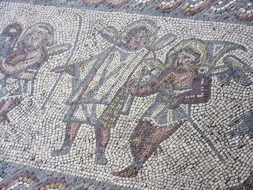
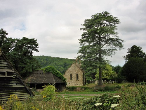
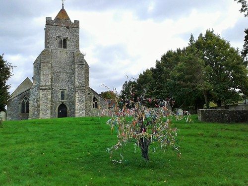
Famous figures from British history lined the arcades inside St Mary’s Church, Chidham – Sir Winston Churchill, Queen Elizabeth II, The Beatles in their round-collared suits. Each little doll had a teasel for a head. Sunday School is obviously a lot of fun for the children of Chidham.

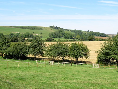
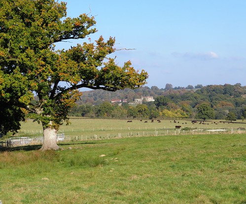
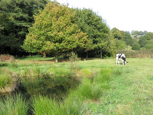
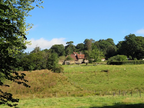
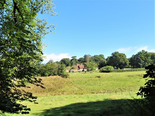
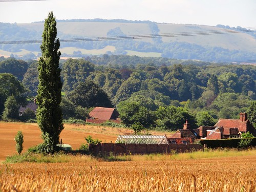
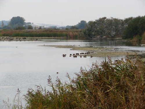
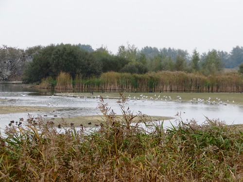
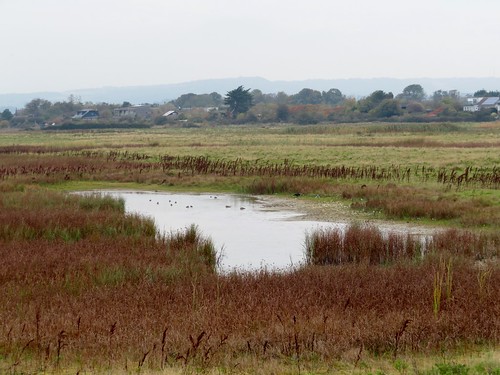
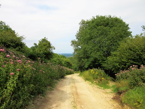
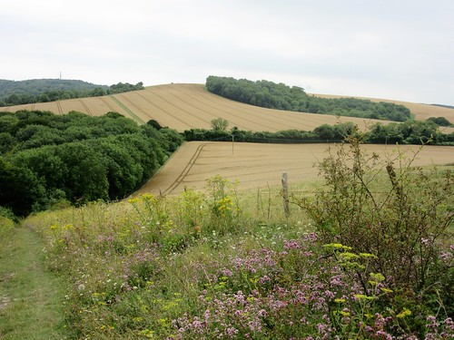
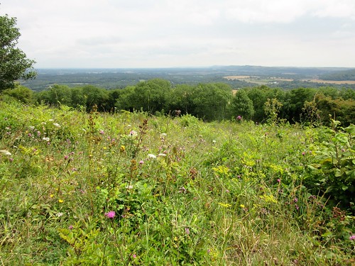
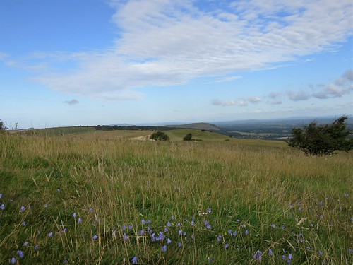
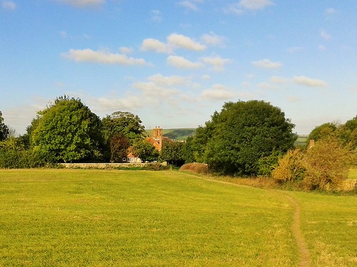
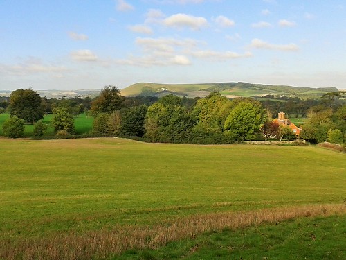
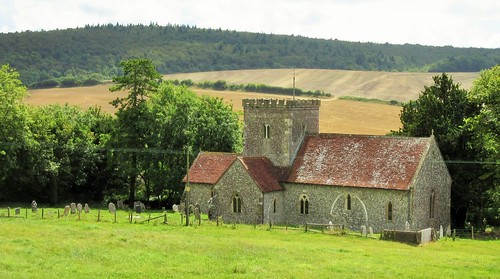
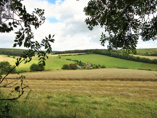
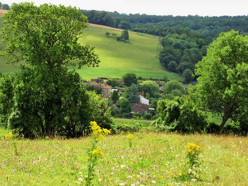
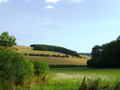
What a charmed place they live in, too. The Chidham Peninsula, in profile like a horse’s head, bulges southward from the inner shoreline of Chichester Harbour. This flat salient of land, its cornfields bounded by hedges and its margins bright with wild flowers, lies among countless mudbanks and creeks where the whirr and screech of seabirds is heard all day long.

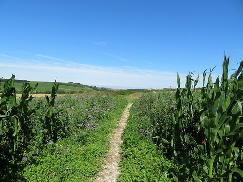
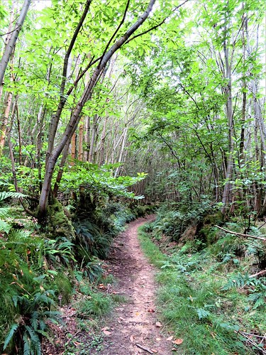
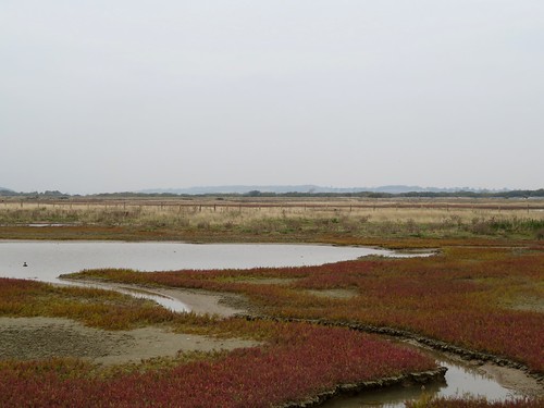
From the church we followed country lanes and the margins of stubble fields to the eastern shore, where the pale mauve rays of sea aster and bushy purple heads of sea lavender smeared the saltmarshes with colour.

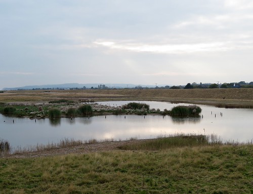
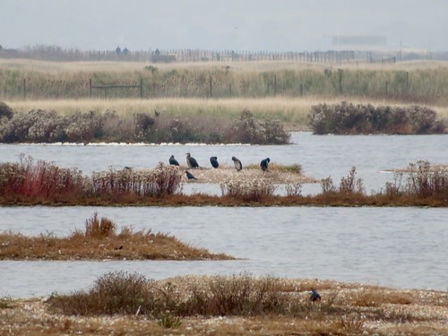
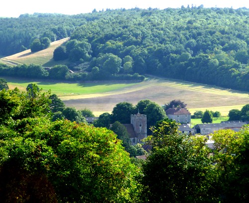
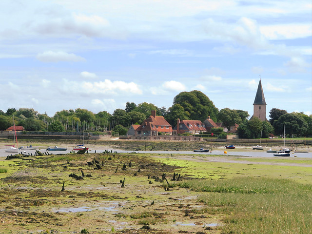
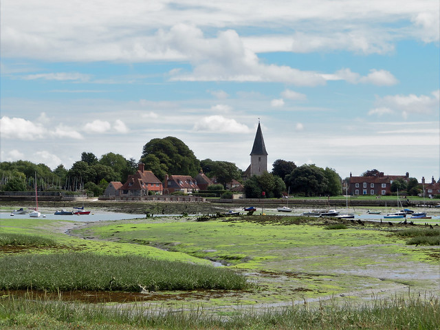
Across the ebbing tide stream of Bosham Channel the stumpy church spire and red brick houses of Bosham rose beyond gleaming mudflats draped with brilliant green weed. There was a pungent whiff of salty mud drying into cracked squares, and a distant chink of halyards and flap of sails as a squadron of children put out from Cobnor Hard in a flock of tiny dinghies.

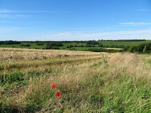
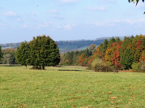
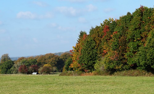
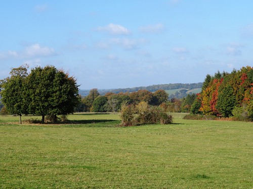
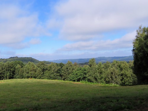
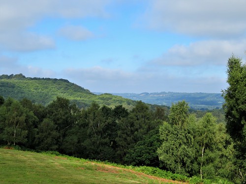
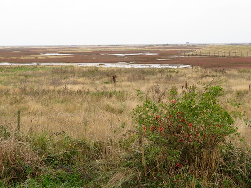
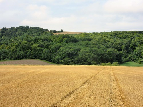
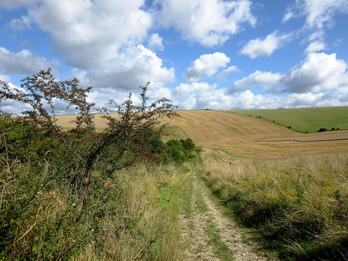
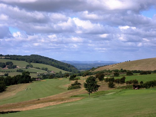
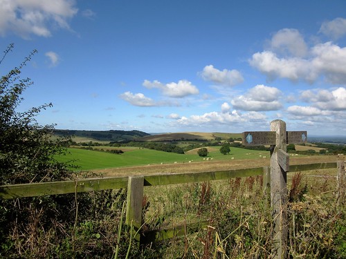
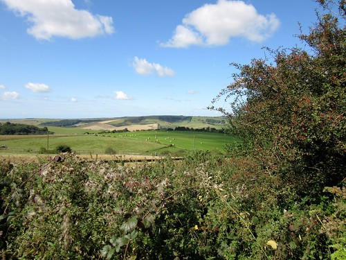
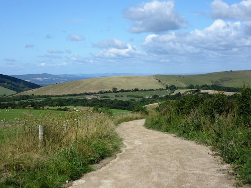
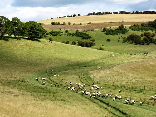
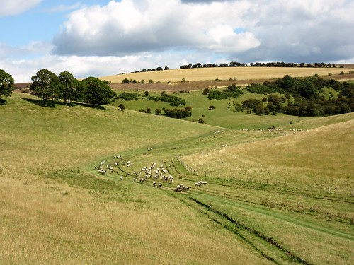
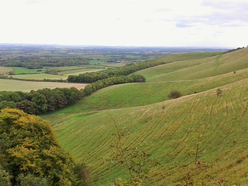
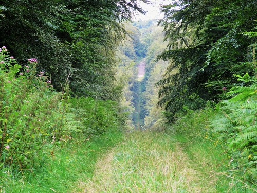
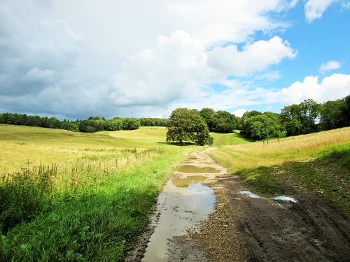
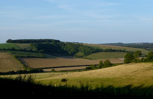
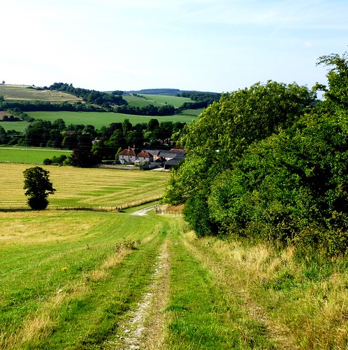
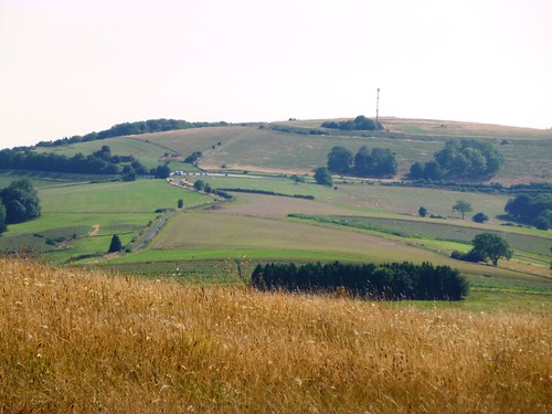
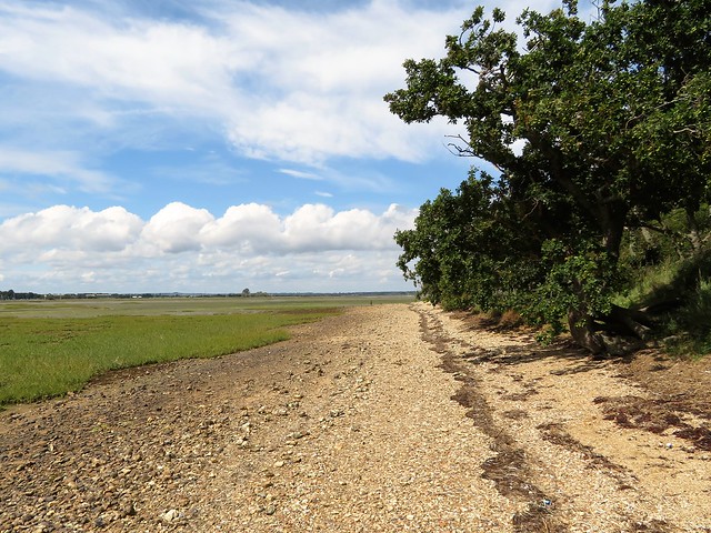
The seawall path led south, dividing the marshy tideway from the dull gold of the Chidham Peninsula’s wheatfields. Away to the north, the darkening woods of summer rode the long ridge of the South Downs. This was West Sussex encapsulated – swelling downs, rich farmland and a level coast deeply indented by the creeping sea.

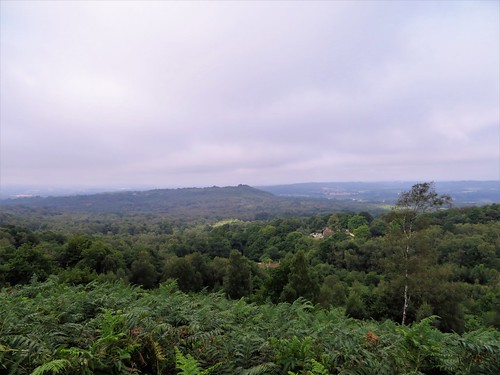
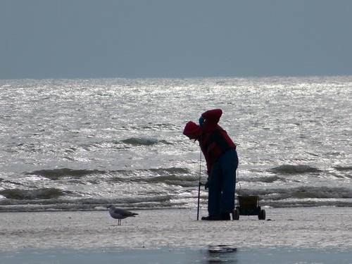
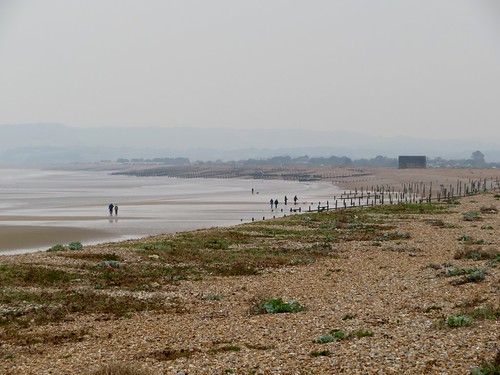
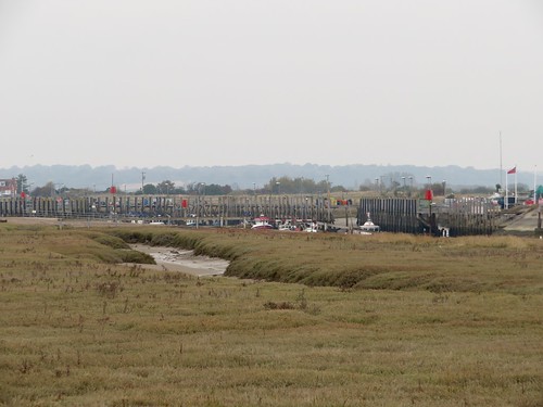
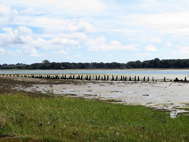
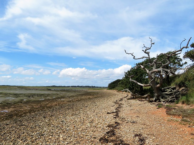
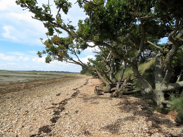
Down at the southern end of the peninsula the path rounded Cobnor Point. A line of gnarled old oak trees, stunted by salt, leaned arthritic limbs towards the sea. The view opened out towards the still invisible mouth of Chichester Harbour, where the ebbing water scudded with yachts and home-made sailing boats – a vigorous, active, outdoorsy scene.

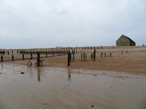
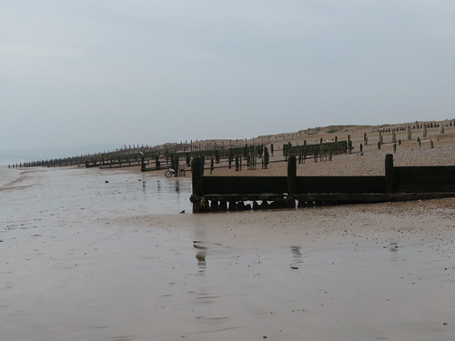
A stiff south-westerly breeze caused all the boats to heel as one. It caught the skirts of our coats and sailed us up the western flank of the Chidham Peninsula, wind-tossed and heading for harbour in the Old House At Home inn.

Start: Old House At Home Inn, Cot Lane, Chidham, West Sussex PO18 8SU (OS ref SV 787040)

Getting there: Train to Nutbourne Station (787058 – 1 mile). Road – A27 to Chichester; A259 Havant road to Chidham; left at Barleycorn Inn down Cot Lane; Old House At Home, 1 mile on right.

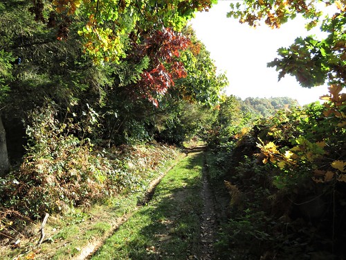
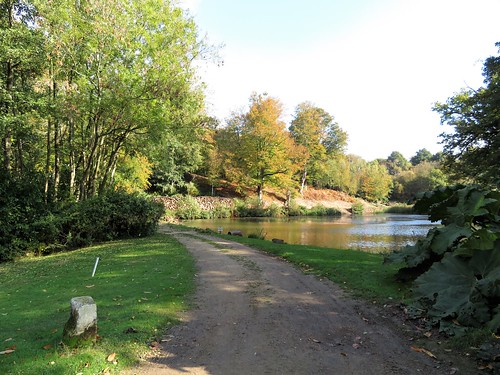
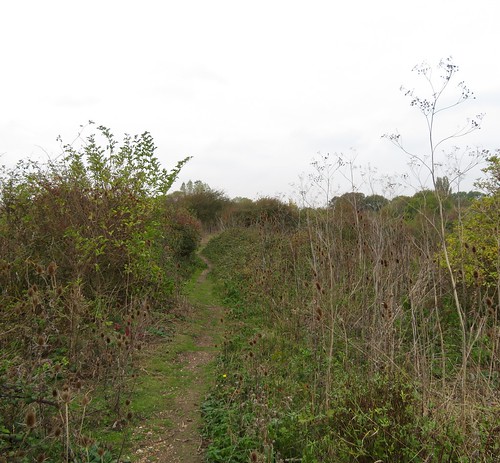
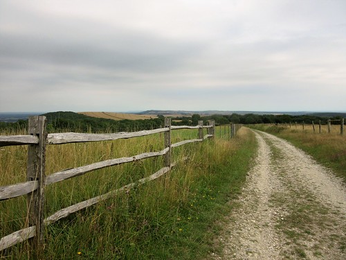
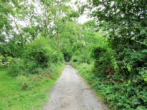
Walk (5½ miles from Old House At Home, 7½ from Nutbourne Station; easy; OS Explorer 120): Leaving Old House At Home, right past church; on along road. At corner of Cot Lane and Chidham Lane (791040), ahead (fingerpost/FP) on grassy verge past glasshouses. Field edge path to road (794041). Turn left; in 50m, right (FP, ‘Pedestrians Only’) along private road. At end of road, hedged path (FP) to shore (799040). Right for 3¾ miles to Chidham Point on west side of peninsula (779042). Here coast path turns inland and rejoins the newer inland floodbank path. In another 200m, right at 3-finger post (781046); follow field edge path to Cot Lane (788044); right to Old House At Home.

Conditions: Coast path on west side of peninsula can be flooded at top of tide. Tide times: tides.willyweather.co.uk

Lunch: Old House At Home, Chidham (01243-572477, theoldhouseathome.co.uk)

Accommodation: The Bosham B&B, Main Road, Bosham PO18 8EH (01243-572572, chichesterbedandbreakfast.co)

Info: Chichester TIC (01243-775888); visitengland.com; satmap.com; ramblers.org.uk

 Posted by at 16:23
Jan 272018


First published in: The Times Click here to view a map for this walk in a new window
picture picture picture picture picture picture picture picture
Facebook Link:

It’s hard to haul yourself out of bed on a chilly morning at sunrise, no matter what the weatherman has prophesied for that day. But there were rewards for our early-birdery. The commuters of West Sussex were still scowling their way to work as we set out from Kithurst Hill along the nape of the South Downs, under a blue sky and with a view that stopped our yawns in their tracks.

To the south-west the slender walls of Arundel Castle rose sunlit above their encircling trees, like a stronghold in a fairy tale. The plastic pavilions of Bognor Regis caught the sun, too, and beyond them a bright white ferry crawled past the grey snout of the Isle of Wight over a pale blue sea.

Nearer at hand, the chalk billows of the downs pitched and rolled. Old trackways and bridlepaths drew green seams through the pale ploughlands and stubble. We picked one running south past a windwhistle copse of beech and sycamore towards Harrow Hill’s green hummocky profile.

Harrow Hill might be, as some local stories say, the last place in England the fairies were seen dancing. It’s certainly a remarkable piece of chalk downland, pierced and riddled with the deep shafts and subterranean galleries of Neolithic flint mines. The northern flank is hollowed by a giant chalk pit, its sides as cleanly cut as though they’d been cored out with a scalpel.

We followed a grassy bridleway that skirted Harrow Hill and ran north beside a hedge of handsomely pollarded old beeches. As so often when walking these Sussex downs, we were struck by the immaculate fettle of the land.

A red kit quartered the roadless valley that opened below us, the sun catching the burnt orange of its wings as it swung this way and that on the wind. Incredible to think that these lovely creatures were all but extinct in Britain only 30 years ago.

A long straight climb to the South Downs Way at the crest, and time before the homeward trudge to lean on a gate and study the view, fifty miles in sunshine, from the wooded weald of Sussex in the north to the glinting sea far down in the south.

Start: Kithurst Hill car park, RH20 4HW approx (OS ref TQ 070125)

Getting there: Kithurst Hill car park is signed at entrance to lane on B2139, 2 miles east of Amberley towards Storrington.

Walk (6½ miles, easy, OS Explorer 121): Beside ‘Kithurst Hill Car Park’ sign by car park entrance, go through metal gate, and wooden gate opposite (‘Public Bridleway’, blue arrow/BA). Half left across field; aim right of water tank to fingerpost/FP (073121). Cross path; follow FPs and BAs for 1 mile to Lee Farm (076104). Left; where drive swings right, ahead through gate (078103, BA). Right across field, through gateway (078099), up rising track. Gate (BA); grass track; in 150m fork left across field for ½ mile to gate (082093). Ahead down drive; in 250m, left through gate (084090, BA). Half right across pasture; at KG and FP, left (086090) on gravel track. In 400m fork left (087092) on fenced grass bridleway. In 500m fork right through gateway (089098); ahead across pastures. In ⅔ mile, through gate (090105); in 100m, right (gate, FP) on bridleway. In 300m, left (093109, BA) for ½ mile to SDW (093117); left to car park.

Lunch/Accommodation: Sportsman Inn, Amberley BN18 9NR (01798-831787, thesportsmanamberley.co.uk)

Info: Chichester TIC (01243-775888)
visitengland.com; satmap.com; ramblers.org.uk

 Posted by at 01:27
Oct 212017


First published in: The Times Click here to view a map for this walk in a new window
picture picture picture picture picture picture picture picture picture picture picture picture picture picture
Facebook Link:


Beech leaves twinkled like gold coins in the cold autumn sunlight as they rained down from the trees of Buckhurst Park. It was just the day to be walking the well-tended and waymarked paths of this prosperous piece of parkland on the northern borders of Ashdown Forest. Cricket field, lake, sheep pastures, neat little estate cottages with red-tiled roofs and walls – Buckhurst is carefully looked after, and it shows.

On the ridge beside Coppice Wood we stood to admire the southward view over a shallow valley rolling upward to meet the fringe of Five Hundred Acre Wood – AA Milne’s ‘100 Aker Wood’, where Christopher Robin and Pooh Bear had their many cosy adventures. Christopher Robin Milne and his parents lived just across the hill at Cotchford Farm, and this billowing, thickly wooded countryside was their enchanted place, a gorgeous snapshot of a mythic England on this brisk autumn afternoon.

On the lane past Whitehouse Farm our boots scuffed drifts of oak leaves and crunched the acorns that the squirrels had not yet gathered for their winter hoards. A tang of woodsmoke hung round Friar’s Gate Farm with its gipsy caravan, shepherd’s hut and wheeled wooden henhouse.

In the fringe of Five Hundred Acre Wood old ponds lay rust-red with iron leached out of the underlying sandstone. We found enormous ancient oaks big enough to accommodate Wol and all his tribe, and carpets of beech mast and acorns that could have fed a thousand Piglets. No hoard of Hunny, though.

At Fisher’s Gate the estate cottages stood neatly in a row, looking back across the valley to the tall chimneys, great mullioned windows and Elizabethan gables of Buckhurst Place, carried aloft on a sea of gold and green treetops. On the lane back to Withyham the flailed hedges were dotted with brilliant autumn colours – scarlet rosehips, crimson haw peggles and spindle berries whose bright orange seeds had split their lipstick-pink cases and were pushing on outwards.

On the far side of Withyham we crossed the slow-flowing infant River Medway and looped back to the village along the Forest Trail railway path, a tunnel of pink elder leaves, roofed and floored with oaken gold.

Start: Dorset Arms, Withyham, Hartfield, E. Sussex TN7 4JD (OS ref TQ 496356)

Getting there: Bus 291 (East Grinstead – Tunbridge Wells)
Road – Withyham is on B2110 between Tunbridge Wells and Hartfield.

Walk (7½ miles, easy, OS Explorer 135): Beside Dorset Arms take driveway (‘High Weald Landscape Trail’/HWLT). In ⅔ mile, 100m past lake, fork left (502350, HWLT). At gate in ⅓ mile, left over stile (506347, HWLT); half left up to corner of wood; half right between 2 trees, on down slope. In ¼ mile, left over stile (504342, HWLT); turn right downhill inside edge of wood to cross B2188 (503341).

Up road opposite. In 300m HWLT turns left (503338), but continue along lane. At right bend, fork left (502335) up farm drive. In 350m, on right bend leading to sewage works gate (501331), bear left over stile. Left up field edge past Friars Gate Farm buildings to drive (499329). Follow it to road (499325). Right (take care!) to B2188 (497331). Right; in 200m on sharp right bend, left along drive (‘Private Road’). In ½ mile, fork right (491336, yellow arrow); in 60m, fork right, and right again beside gate (‘Weald Way’/WW). Skirt a section of driveway to stile (490338) and follow WW north along drive for 1¼ miles to B2110 in Withyham (493356).

Left for 50m (take care!); right (stile, WW) across 2 fields. Cross Forest Way cycle track (491363, WW) and River Medway beyond. Continue on WW (stiles) for ¼ mile to driveway at building (495368); follow it to road (498366). Right; in 250m, right on Forest Way. In ½ mile, left (491363); WW back to B2110; left to Withyham.

Lunch/Accommodation: Dorset Arms, Withyham (01892-770278, dorset-arms.co.uk) – stylish place, great food.

Info: East Grinstead TIC (01342-410121)
visitengland.com; satmap.com; ramblers.org.uk

 Posted by at 08:24
Jul 152017


First published in: The Times Click here to view a map for this walk in a new window
picture picture picture picture picture picture picture picture picture picture
Facebook Link:

Walking the old holloways under the beeches on Henley Common, Jane and I looked out between the trees to see the dull green wall of the South Downs backlit with early light diffused by mist to an apricot glow.

Under recently coppiced sweet chestnuts the light fell cool and grey between the saw-edged leaves. The slender rods of the chestnut stems were footed in thick mosses. I pushed my finger in as far as the second knuckle, and still could not reach the trunk inside the soft moss jacket.

Woolbeding Common fell away from its high viewpoint in a great slump of land, bracken-strewn and thick with silver birch and gorse. Three dogs hared up and bounced around us, tremendously pleased to be lords of all this heathy open space. Lowland heaths are rare commodities these days, thanks to agricultural and housing development, but Woolbeding and Pound Commons are carefully managed by the National Trust for their ground-nesting nightjars, their adders and lizards, the dragonflies and the deadly little hobbies that hunt them.

An old horse came slowly up the track, picking its way very deliberately among the stones, pulling a light two-wheeled gig with a blond-haired woman and her son on board. At that moment it looked the nicest thing in the world, to be jogging at an idle pace behind a stout nag over a common of golden gorse, purple bell heather and fresh green bracken.

We followed the heathery pathways down past handsome Woolhouse Farm. ‘Hammer Wood,’ said the map. ‘Hammer Pond, Hammer Hanger, Hammer Lane.’ Reminders of medieval times when these Wealden woods, the heart of England’s iron-making industry, were loud and smoky with smelting and hammering.

Between the holly stems on Lord’s Common we glimpsed the sharply peaked gables and long red roofs of the King Edward VII Hospital. This great tuberculosis sanatorium, built with its Gertrude Jekyll-designed gardens at the turn of the 20th century, is undergoing conversion to state-of-the-art accommodation. The sanatorium’s star architect, Charles Holden, planned it so as to admit as much daylight and fresh air as possible to the patients – a revolutionary approach at that date.

The midday sun came in through the leaf canopy to brush our faces as we turned for home along hollowed ways tunnelled by badgers since long before these hills knew houses, hammerponds, or humans themselves.

Start: Duke of Cumberland PH, Henley, Midhurst, West Sussex GU27 3HQ (OS ref SU 894258)

Getting there: Bus 70, Guildford-Midhurst.
Road – Henley is signposted off A286, 4 miles north of Midhurst. Ample parking on road verge near pub.

Walk (8 miles, woodland paths and holloways, OS Explorer 133): From pub, right up road. In 200m, right across footbridge (fingerpost/FP, yellow arrow/YA, ‘Serpent trail’/ST), up bank. At drive, right (black arrow/BLA) up bank to cross A268 (893256, FP, ST) – please take care! Follow woodland path (BLA, ST) to Verdley Edge. Pass The Lodge (887260) and turn left (ST). In 30m, fork right (3-finger post, ST); in 100m, fork left uphill off track (ST). Follow ST for 500m to edge of wood (881258); right on track along wood edge.

At gateway into open field (879259), aim for roof in trees ahead, following right-hand edge of field (BLA) to gate. Pass to right of barn (875258); follow track into trees. At T-junction with a track on edge of common, turn right (873258, ‘New Lipchis Way’/NLW). In 250m, left (871260, FP) and follow NLW, ST downhill to cross car park, then lane to reach bench and viewpoint (869260).

Back to lane. Right for 100m, left up gravel track. In 30m fork right on grassy path across common. In 500m, right at track crossing (872255, FP, YA); follow west, soon with wall on right, along edge of common. Follow YA and NLW. In 600m straight across road (866254) and on. In 200m cross larger road and on (NLW). In another 400m, at 3-finger post (861251, NLW), keep ahead past Ivy Cottage and Woolhouse Farm. In 250m, fork right off roadway (862248, 3-finger post). In ⅔ mile NLW forks right (875241), but keep ahead. In 150m, opposite Ash House, bridleway forks right (blue arrow/BA), but keep ahead up path curving left (YA) out of woods.

At Tote Lane (862241), left past Woodgate Farm; in 100m, right (FP) up field edge. Keep hedge on right till track turns right through it; ahead here through woodland to cross road (868242). Ahead (FP, ‘Dene House’) on stony track across Pound Common. In 200m a path forks left (869243), but keep right (ahead). In 150m at crossing of tracks, keep ahead uphill. In 400m track forks (873247); keep to right-hand track (YA) at edge of trees, and cross track to Eastshaw Farm (874247).

On through woods, passing King Edward VII Sanatorium on your left (glimpses through trees). Track bends right (882247), passes a BLA, and in 100m you turn left/north (4-finger post). In 150m fork left, in 350m, at 4-finger post, dogleg left-right up left side of house/garden to cross road (885251). On through trees (FP). In 300m cross Madam’s Farm track (885255, stiles, FP); continue through trees for 500m to descend to Verdley Edge (887260). Turn right and retrace steps to Henley.

Lunch: Duke of Cumberland, Henley (01428-652280, dukeofcumberland.com) – lively, very popular pub with great food. Booking advised!

Accommodation: King’s Arms, Fernhurst GU27 3HA (01428-641165, kingsarmspub.co.uk) – 1 mile.

Info: Chichester TIC (01243-775888)
visitengland.com; satmap.com; ramblers.org.uk

 Posted by at 01:56
Jan 072017


First published in: The Times Click here to view a map for this walk in a new window
picture picture picture picture picture picture picture picture picture picture picture picture picture picture picture picture picture picture picture picture picture picture picture
Facebook Link:

Rye Harbour is a strange old place. The ivy-strangled Martello tower and the grim Second World War bunkers tells you that this is a coast that has lain under constant threat of invasion. And the enormous expanse of flint pebbles, spreading inland for more than a mile, betokens the incursions of thousands of tons of shingle, dumped here by the restless sea.

This is moody country on a cold morning. A whistling east wind drove us along the beach. Lesser black-backed gulls sulked on the sandbanks, and redshank foraged fastidiously with jerky steps in the pools of Rye Harbour nature reserve on the inland side of the sea bank.

A pair of human figures patrolled the tideline, probing the beach with long rods as they sucked out lugworms for fishing bait. I set off to find out what they were doing, and sank without warning up to my knees in glutinous mud that I had mistaken for sand. I struggled out, mud-splattered all over. ‘See you found a mud hole!’ grinned a passing man in a van. ‘Lucky you didn’t go in over your head, eh!’

King Henry VIII built Camber Castle as a coastal stronghold to keep the French at bay. Now, five centuries later, the stark grey fortress stands more than a mile inland among wide fields where a thin skin of grass overlies a wilderness of pebbles. We walked a circuit of the eroded bastion walls, then made for a hide on the shores of Castle Water where green-headed shoveller drakes swept the water with heavy spatulate bills. Elegant terns hung over the water on crooked wings, and the big black outline of a marsh harrier ghosted quietly across the reed beds.

Back on the shore we found the gaunt blocky shed from which a crew of Rye Harbour men launched the lifeboat Mary Stanford on a bitter November morning in 1928. She was lost with all hands; 17 men from one tiny village. The lifeboat house has remained locked and unused ever since – a downbeat memorial to bravery and death on an unforgiving shore.

Start: Rye Harbour car park, Rye, East Sussex TN31 7TU (OS ref TQ 942190)

Getting there: Bus 313 (Northiam-Rye Harbour)
Road – Rye Harbour is signed off A259 between Rye and Winchelsea.

Walk (8¼ miles, easy, OS Explorer 125): From car park follow sea wall past Lime Kiln Cottage info centre (946186) to river mouth (949181). Right along beach or coast road. In 1 mile pass old lifeboat shed (932172); in another 650m, right inland on path past info board (928168) over 2 crossings (925171 and 921173) for ¾ of a mile to road (917175). Right; just past Castle Farm, fork left (920176) to Camber Castle (922185). Clockwise round castle; on east side, path along fence to wooden gate (924185) leading to bird hide. Return to gate; left through metal gate; field edge south. Left across end of Castle Water to junction (925179); right; in 400m, left through gate no. 9 (923177). On past Camber Cottage (921174); through gate, then left for ½ a mile to shore road (928168). Left to lifeboat house; in 300m, left on gravel track (934174). In 300m, through left-hand of two gates (934176); ahead to junction (931178); right on gravel track for 1 mile to road (939191); right to car park.

Lunch: Inkerman Arms (01797-222464) or William the Conqueror PH (01797-223315), Rye Harbour

Accommodation: Ship Inn, Rye TN31 7DB (01797-222233, theshipinnrye.co.uk) – friendly, fun atmosphere.

Lime Kiln Cottage info centre; open 10-4 (wildrye.info); visitengland.com; satmap.com; ramblers.org.uk

Britain’s Best Walks: 200 Classic Walks from The Times by Christopher Somerville (HarperCollins, £30). To receive 30 per cent off plus free p&p visit harpercollins.co.uk and enter code TIMES30, or call 0844 5768122

 Posted by at 01:09
Aug 062016


First published in: The Times Click here to view a map for this walk in a new window
picture picture picture picture picture picture picture picture
Facebook Link:

A breezy, hazy summer’s day on the West Sussex downs, with the stubbles of the recently harvested wheat crop crunching beneath our boots as we crossed the fields from Sutton’s old White Horse Inn to Barlavington Farm. Behind the weatherboarded barns we found St Mary’s Church, plain and graceful under its rafters. A plaque inside commemorated Amy Louisa Bragg, ‘a pioneer in the backblocks of New Zealand,’ and another in the churchyard was marked simply: ‘Stan Mayes, 1917-2014 – A Countryman.’

It was Sussex countrymen, generations of them, who coppiced the ash trees by the sunken holloway up the wooded slopes of Barlavington Hanger; and countrymen who ploughed up the sheep pasture across the heights of Barlavington Down for wartime crops. Gold tides of wheat and barley still roll across the downs. Up there we found a sloping haven of old-fashioned flowery sward grown long and ungrazed – field scabious, yellow-wort, eyebright and harebells, yellow rattle and agrimony. Common blue butterflies flickered among the yellow plants, the males all a dusty blue, the females with orange and black scallops to the edge of their wings.

We sat down to admire the view along the downs, perching on a stone inscribed in memory of Sir Ian Anstruther of that Ilk, local squire, writer and splendid gentleman (he drove an Aston Martin DB5, was once stopped by the police for driving too slowly, and always dressed for dinner in velvet slippers with bells on the toes). Then we followed flinty tracks that dipped and rose to Bignor Hill before wriggling away down the holloways to West Burton and the field path to Bignor.

‘When my great-great-great-great grandfather George Tupper struck a large stone whilst ploughing on the 18th of July 1811…’ begins the foreword of the guidebook to Bignor Roman villa. The Tupper family owns the site today, as they did two centuries ago when the villa with its tiles and statues, its lead water pipes and wonderful mosaic floors was unearthed at the clang of George Tupper’s horse plough.

It was the mosaics, so skilfully and sensitively crafted, that caused us to linger in the villa until closing time. Ganymede in the embrace of an eagle, child-like gladiators tumbling and sparring, a bathing beauty naked to the waist – and as a chill corrective to the luxurious life, a cameo of Winter with pinched white cheeks and hollow eyes, clutching a leafless twig. The Romans, too, had intimations of mortality.

Start: White Horse Inn, Sutton, West Sussex RH20 1PS (OS ref SU 979152)

Getting there: Bus 99 (Chichester-Petworth).
Road – Sutton is on minor road between A29 at Bury and A285 near Duncton.

Walk (8½ miles, moderate, OS Explorer 121): Up path beside White Horse car park. At ‘Private’ gate sign, right through adjacent gate. Up steps; right (yellow arrow/YA) past barn and on through garden into field. Half left across field; cross bridleway (976155, fingerpost/FP) and on to cross footbridge (975158). Half right across field, up to cross stile; left up hedge, then green lane to Barlavington Farm. Opposite barn, left (973161, FP) to chapel.

Follow path through churchyard to far corner; left (YA) along lane. In 100m (971161), right up gravel path and on (YA) along green lane to cross road (970162, FP). Up steps, along field edge; cross stile beside gate; on to cross road (968164). Through pedestrian gate, up green lane into woods of Barlavington Hanger (966162). In 400m, at fork of bridleways (963160, 3-finger FP) keep ahead uphill. Path rises, then falls to cross green lane at corner of Northcomb Wood in valley (963152). On south up path across field; on through Access Land. Through gate at south end of Access Land (963144); on in tunnel of trees. In 450m, at T-junction (962140, 3-finger FP), bear right; in 20m, arrow points uphill along chalk track. In ½ mile, pass NT ‘Bignor Hill’ sign (966133) and keep ahead along track for 900m to car park (974129).

Cross road; on up hedged track over Bignor Hill along South Downs Way (SDW). In ⅔ mile pass Toby’s Stone (983132); in another 400m, left (SDW), descending for 400m to T-junction of tracks at 3-finger FP (989132). Left (SDW) to another T-junction with barns to your right; left here; immediately right; then immediately fork left on grassy path through trees. Descend for ⅔ mile to road junction in West Burton (996139). Left (‘West Sussex Literary Trail’/WSLT); path beside stream, then along field edges, following YAs for ¾ mile to road (986144). Right for 100m; left to Bignor Roman Villa (988147).

Back at Roman Villa car park entrance, turn right through tall deer gate (unwaymarked) along path to road in Bignor (984146). Right (WSLT); round left bend; opposite church, left (982146). In 100m, right through gate (WSLT); on across a lawn; on along grassy path, then beside stream to Bignor millpond. At T-junction of paths (981148, FP), right to cross footbridge; cross 3 fields to Sutton.

NB: Detailed directions are recommended. Download them with online maps, more walks at christophersomerville.co.uk.

Lunch/accommodation: White Horse Inn, Sutton (01798-869221, whitehorse-sutton.co.uk) – smart, well-run inn.

Bignor Roman Villa: Open 10-5, March-Oct; 01798-869259, bignorromanvilla.co.uk

Info: Chichester TIC (01243-775888)

www.visitengland.com; satmap.com; ramblers.org.uk

 Posted by at 01:09
Jul 092016


First published in: The Times Click here to view a map for this walk in a new window
picture picture picture picture picture picture picture picture picture picture picture picture picture picture
Facebook Link:

The shepherd came bouncing up the long flank of Home Bottom on his quad bike, three frisky sheepdogs in attendance. ‘The sheep? Oh, they’re doing all right. Off to be shown soon, and then we’ll sell ’em, all the black-faced ewes. That old red Sussex bull down there? That’s Del-Boy; you can walk right up to him and he won’t say a word. Cold wind today? Hah! This is warm! You should be up here on top of the downs in winter time, in the snow and a north wind – then it does bite a bit!’

These are the sort of things you never learn unless you stop and chat a while. We bade shepherd and sheepdogs goodbye and walked on past circular dewponds and Bronze Age tumuli. Up here above Brighton the South Downs National Park boasts some of its most spectacular scenery, a great circle of East and West Sussex, north for fifteen or twenty wooded miles, south through the dips of Hogtrough Bottom and Home Bottom across the massed roof of Brighton to the sea. In Ditchling Beacon nature reserve, the wild flowers provided us in their close-focus way with as dramatic a spectacle as the view – harebells thickly sprinkled, mauve feathery bartsia, purple knapweed and sky-blue chicory, bright yellow froths of lady’s bedstraw and fragrant pink thickets of wild marjoram.

The Clayton windmills stood breasting the north wind on their ridge, Jill in her white weather-boarded smock, black capless Jack skulking in the trees behind. Here we left the South Downs Way and the panoramic ridge, plunging south into the sheltered bottoms or steep dry valleys that seam these chalk downs. Beyond deep-sunk Lower Standean farm we found another shepherd working his sheep in the pastures of North Bottom, the man flying up and down the slopes on his puttering quad, the dogs racing round behind the flock, the sheep on the canter, every lamb and ewe bleating so that their panicky voices filled the valley, high and low. When all were corralled and their wobbly laments stilled, the three dogs took a leap into a drinking trough and splashed about there luxuriously.

We swung north for the homeward stretch up a nameless bottom, opening on a far view of brilliant white cliffs, the scuff of our boots in the chalk and flint of the path the only sound in this secluded and now silent hollow of the downs.
Start: Ditchling Beacon car park, near Brighton, East Sussex, BN6 8RJ (OS ref TQ 333130) – £2/day (NT members free)

Getting there: Bus 79 from Brighton. Road – Ditchling Beacon signed from Underhill Lane near Ditchling (B2112 from Clayton on A273 Brighton-Burgess Hill road).

Walk (8½ miles, easy/moderate, OS Explorer 122): Head west from car park along South Downs Way/SDW; through gate into nature reserve. In 100m pass boundary stone; in another 50m, fork right off SDW on grassy path through top edge of Ditchling Beacon Nature Reserve, then back onto SDW. On for 1¾ miles to Jack and Jill Windmills (303133). Right across car park; at far side, right on bridleway (blue arrow/BA) to rejoin SDW. Left for 150m; fork right (305132, SDW, ‘Devil’s Dyke’). 100m beyond New Barn Farm, SDW turns right, but keep ahead (306129, BA, ‘Chattri War Memorial)’. In ½ mile, left at 3-finger post (307121); at gate, right (BAs); in 200m, left through gate (308119, waymark arrow 44). In 150m, at gate on right, cross Sussex Border Path (309117); keep ahead, down to Lower Standean farm.

Pass sheds; 100m before house, left (316115) and pass to left of pond. Bear right along lower edge of trees, following path as it curves left to meet pebbly track (318116). Right along track. In 400m, just before cross fence, right through gate (321118); left with fence on your left through North Bottom. Through gate in valley bottom (326118); in 350m, before next gate, right along fence (328121) to cross Ditchling Road (327116).

Fork left, following BA/’Bridleway’ through Highpark Wood for 1 mile. At crossroads of tracks under power cables (337108), hairpin left (no waymark) down through wood to bottom gate (337112). Ahead (BA) with wood on left. In 200m fork right through gate (339113); on with fence on left. In 600m, through gate (343117); left (BA). Through next two gates (344119, 343121); up across wide field for ½ mile to SDW (339128); left to Ditchling Beacon car park.

Lunch: Half Moon Inn, Plumpton BN7 3AF (01273-890253; halfmoonplumpton.com) – well-run, characterful pub.

National Parks Week 2016: 25-31 July (nationalparks.gov.uk)

Info: Brighton TIC (01273-770115)

visitengland.com; satmap.com; ramblers.org.uk

 Posted by at 01:33
Jul 252015


First published in: The Times Click here to view a map for this walk in a new window
picture picture picture picture picture picture picture picture
Facebook Link:

In 1913 Vanessa Bell and Duncan Grant came to live at Charleston farmhouse in the shadow of the Sussex downs. This bohemian London couple (well, scarcely a couple, my dear – it’s said that he prefers men!) decorated the farmhouse walls and furniture with primitive designs. Charleston soon became a magnet for such Bloomsbury Group illuminati as Virginia Woolf, David Garnett, Maynard Keynes and E.M. Forster.

Walking over to Charleston, I was expecting a chocolate-box house in a picture-book setting. Instead there were grunting tractors, workaday sheds, and ordure-spattered dung spreaders busy in the fields around what is still a working farm. It was strange to be guided around the little rooms with their vividly daubed walls and tables, Grant’s nudes and acrobats, Bell’s drooping flowers and dotted circle motifs, and then to step out into such a practical farming landscape.

What shapes the scene is the long green arm of the downs behind, enclosing the southern skyline in a simple and perfect undulation. Two young buzzards were riding low across the slopes, to pull up and hang with cat-like cries a couple of feet above the turf as they scanned for small life cowering there.

Up on the spine of the downs a cold wind came rushing in from the north, hammering at my face and tugging my beard like an impatient child. It was quite a prospect, north for many miles over the wooded hollows of the Sussex Weald, south to the spindly arms of Newhaven Harbour embracing the sea.

I pushed on into the wind to the dimpled hummock of the long barrow on Firle Beacon, and then found a steep chalk track that descended a slope seamed with pale wrinkles of erosion lines like the forehead of an old elephant. A fine flint wall accompanied me back to Firle, one of those well-kept estate villages where all seems right with the world.

Peter Owen Jones, Vicar of Firle, writes lyrically of his downland walks. Outside St Peter’s Church I found a tree festooned in prayer ribbons; inside, a Tree of Life window by John Piper. Its vivid pinks and yellows lit the cloud-shadowed vestry more brightly than any painted room in the Bloomsbury farmhouse across the fields.

Start: Firle village car park, East Sussex, BN8 6NS approx. (OS ref TQ 469074)

Getting there: Bus service 125 (compass-travel.co.uk), Lewes-Alfriston
Road – Firle is signposted off A27 between Lewes and Eastbourne.

Walk (5 miles, moderate, OS Explorer 123. NB: online map, more walks at christophersomerville.co.uk): From car park walk through to Ram Inn. Left along street; left at post office (470071) down lane, through gate. Follow track across parkland. In 200m, right up tarmac roadway; in 50m, left at post, aiming for flint house halfway along edge of wood ahead. Cross road at cottage (478073); through iron gate opposite; follow bridleway through shank of wood (480071), on over fields to pass Charleston Farm (491069). In 200m, right (493068) along concrete track. At barns (494067), bear right, following track towards downs. In 550m, cross track (492062); on in tunnel of trees; through gate (490060, BA). Bear left up rising track to top of downs. Right (490054) along South Downs Way to trig pillar on Firle Beacon (485059). In 300m, through gate (482059); in 150m, fork right off SDW, descending path for ¾ mile to T-junction (475068); left beside wall to Firle.

Lunch/Accommodation: Ram Inn, Firle (01273-858222; raminn.co.uk)

Charleston Farmhouse: 01323-811626; charleston.org.uk; open till 1 November; book your tour!

Peter Owen Jones: Pathlands – Tranquil Walks through Britain (Rider Publishing)
satmap.com; ramblers.org.uk; visitengland.com

 Posted by at 08:00
Feb 072015


First published in: The Times Click here to view a map for this walk in a new window
picture picture picture picture picture picture picture picture picture picture
Facebook Link:
A blustery, breezy sky over West Sussex, with marching rain clouds and brilliant blue intervals. The village of East Dean in a crook of the South Downs is all you want on such a day – as pretty as a picture, flint-built, with its simple cruciform Norman church, the snug little Star & Garter Inn, and a tree-hung pond from whose modest waters whelms the River Lavant.

In between spits of rain and windows of sunshine I climbed an old holloway sunk deep into chalk and flint, heading north for the dark ridge of the downs. A bench perfectly placed to look over the village carried a plaque inscribed:

‘Field, Coppice, Cottage & all I see
Vivified, hallowed by Memory.’
– A.E. West, Copseman and Countryman.

Who was A.E. West, with his dignified title of ‘Copseman’ and his nostalgic little couplet? No more than a shadow and a name to passers-by; but more than that to someone in East Dean, for certain.

Enormous clouds advanced over the ridge, heavy with rain, so purposeful and weighty that I found myself marvelling that clouds make no sound as they travel. As the thought came, so did an ogreish growl from the sky, and a blast of wind that beat at the beech trees and made their boughs twist and rattle.

From Pond Barn a flinty track took me up past green-roofed Postles Barn, its flint walls pierced with arrow-slit windows. I turned up the grassy slope of Brockhurst Bottom into Eastdean Woods where gleams of sun made silver pillars of the birch and pine trunks. The sky muttered again, a sulky rumble like a dyspeptic giant turning over in bed, and a squall of rain blotted out the light among the trees.

Up at the crest of the downs I bowled east along the South Downs Way, through ancient cross dykes or boundary banks, with a long prospect ahead of Bignor Hill curving into a blur of milky grey. There was something so vigorous and uplifting in this rainy stride along the old ridgeway that I felt I could have followed it for ever. Soon enough, though, it was time to turn aside and find the forest road through the beech woods that would carry me down to East Dean and the Star & Garter.

Start: Star & Garter Inn, East Dean, West Sussex, PO18 0JG (OS ref SU 904129)

Getting there: Bus service 99, Chichester-Petworth (pre-booking essential – 01903-264776, compass-travel.co.uk).
Road – East Dean is signposted off A285 (Chichester-Petworth).

Walk (7½ miles, easy, OS Explorer 121): Up road from Star & Garter to church (905132); through gate in NE corner of churchyard; left up sunken lane. In 100m leave trees; in 50m, bear right (904133, blue arrow/BA) up grassy holloway. In 200m, at top of section among trees (905135) footpath bears left, but keep ahead. In another 300m, bridleway bears left (904137, BA); fork right here (yellow arrow/YA, fingerpost) through wood for 400m to Pond Barn (904142).

Right over stile in bottom right corner of field; left at lane, then fork immediately right along gravel track. In 700m pass Postles Barn (911145); in 500m, bear left (917149) at fingerpost. ‘Restricted Byway/RB’ forks right, but fork left here (BA), trending slightly away from fence on left as you climb Brockhurst Bottom’s field slope to gate at edge of wood (916154). Ahead through wood (BAs), keeping same direction for ½ mile to reach South Downs Way (921163).

Right along SDW. In 1 mile pass first Cross Dyke shown on map (937159); in another ¼ mile pass second Cross Dyke (940158; resembles a hedge-bank on your left). In another 350m, where SDW re-enters trees (943155), turn right (‘RB, East Dean’) at fingerpost inscribed ‘Tegleaze’. Follow track south-west through woods (RB, purple arrows; then ‘Public Bridleway’ fingerposts). In 1¾ miles, just before ‘Shepherd’s Croft’ on map, main gravel track curves left at clearing (919144); but keep ahead on lesser track for 1½ miles back to East Dean.

Lunch/Accommodation: Star & Garter, East Dean (01243-811318, thestarandgarter.co.uk) – beautifully kept, welcoming village inn.

Info: Chichester TIC (01243-775888)
visitengland.com; www.satmap.com; ramblers.org.uk; LogMyTrip.co.uk

 Posted by at 01:14
May 032014
 

The Fox Goes Free at deep-sunk Charlton is one of my favourite Sussex pubs, especially when it’s warm enough to sit in the garden with a pie and a pint, looking out across the flint wall and over the grazing sheep in the meadow beyond to the double swell of Levin Down and North Down. First published in: The Times Click here to view a map for this walk in a new window
picture picture picture picture picture picture picture picture picture picture picture picture picture picture picture
Facebook Link:
Those seductive hills soon called Jane and me away, up along North Lane and past open sheds at Ware Barn full of hay bales and sacks of wool from last year’s clip. Old-man’s-beard hung soft and white in the hedges, and loose flints chinked under our boots as we climbed a dark holloway through an old yew grove.

From the broad whaleback of Levin Down we had a wonderful southward prospect across Singleton’s grey houses huddled in their valley, over to the flags and white pavilions of Goodwood’s racecourse and the round knoll of The Trundle, crowned with the ramparts of an Iron Age hillfort. It’s a view from a patriotic wartime poster, a landscape worth fighting for, thousands of years of history rolling out in plain view. And if this is one of southern England’s great views, it’s outdone by the panorama from The Trundle itself – Chichester Cathedral spire, the twin grandstands of the racecourse, the sails of Halnaker windmill, the silvery windings of Chichester Harbour, the Isle of Wight lying like a cloud along the smoky blue bar of the sea.

On the ramparts of the fort we sat and stared. At the height of summer the race meeting aptly nicknamed ‘Glorious Goodwood’ fills the downland racecourse with noise and colour, but today it lay quiet, a green snake of grassy track rollercoasting below us between its white railings. A childhood memory came to Jane – watching an excavation at the foot of The Trundle, a female skeleton being unearthed, and the archaeologist pointing out the woman’s excellent teeth – ‘Because there were no sweeties in those days!’

The Trundle’s embanked fort was built well over 2,000 years ago, but the remnants of an enclosure three times as old underlie the stronghold. It’s a resonant place with a stupendous view. Two sparrowhawks skimmed the ramparts, hanging with heads down as they scanned the banks, and a pair of lovers lay in the long grass at the summit, talking quietly, as lovers have surely been doing here since long before men fortified the hill.

Start: Fox Goes Free Inn, Charlton, West Sussex PO18 0HU (OS ref SU 889130)

Getting there: Bus – Service 99 (pre-book on 01903-264776; compass-travel.co.uk), Petworth-Chichester
Road – Charlton is signed off A286 Chichester-Midhurst road at Singleton.

Walk (7 miles, easy/moderate, OS Explorer 120): From Fox Goes Free, right along road; in 150m, right at crossroads up North Lane. In ⅔ mile, a footpath forks to right (891140), but you keep to track; in 200m, left (bridleway fingerpost). Track climbs through trees; in 350m, near top, you pass yellow arrow/YA footpath marker on left; in another 100m at T-junction, go left (889145, ‘Singleton’) through gate. Bear half right across open grassland of Levin Down between 2 woods to far corner of Lady Wood on right (886143); follow fence over skyline for ¼ mile to gate (883138). On for 100m; bear right past fingerpost for 300m to kissing-gate (880135, ‘New Lipchis Way’); descend to cross road in Singleton (879132).

Bear half left across green; on between houses; in 100m, right (880131) along The Leys. At T-junction, dogleg right and left past houses, across end of recreation ground, past church gate to T-junction at end of churchyard (878130). Left (YA, ‘The Trundle’). Through farmyard, up steep grass path and on for ¾ mile to lane (880119). Right to cross road (880113); follow fingerposts up steps and path to The Trundle hillfort. From summit (877111), left/east past ‘Monarch’s Way/MW’ arrow on post, through wood to join track; left (MW) to road (882110) opposite Goodwood Racecourse.

Right along verge; in 250m, left (883107) beside road past racecourse on grass verges/woodland edge for 1 mile. 100m past end of racecourse, turn left (897114); hairpin back left along first track of several, through gateway (unwaymarked), following Chalk Road track for 1¼ miles back to Charlton.

Lunch: Fox Goes Free, Charlton (01243-811461, foxgoesfree.com)

Goodwood Racecourse: goodwood.co.uk

Information: Chichester TIC (01243-775888; visitsussex.org)

www.ramblers.org.uk www.satmap.com www.LogMyTrip.co.uk

 Posted by at 01:35