Search Results : warwickshire

Sep 172022


First published in: The Times Click here to view a map for this walk in a new window
Stratford-upon-Avon Canal near Wootton Wawen 1 Stratford-upon-Avon Canal near Wootton Wawen 2 Stratford-upon-Avon Canal near Wootton Wawen 3 Stratford-upon-Avon Canal near Wootton Wawen 4 Stratford-upon-Avon Canal near Wootton Wawen 5 Stratford-upon-Avon Canal near Wootton Wawen 6 Stratford-upon-Avon Canal near Wootton Wawen 7 Stratford-upon-Avon Canal near Wootton Wawen 8 monkey flower Stratford-upon-Avon Canal near Wootton Wawen 9

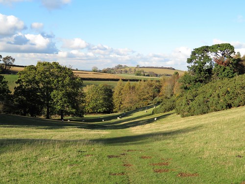
A hot late summer’s day in the Midlands, a hard blue sky overhead and the Warwickshire fields parched and pale. Cheery walkers slathered themselves in Factor 50 and set off under sunhats from the crowded View Café terrace just outside Wootton Wawen.

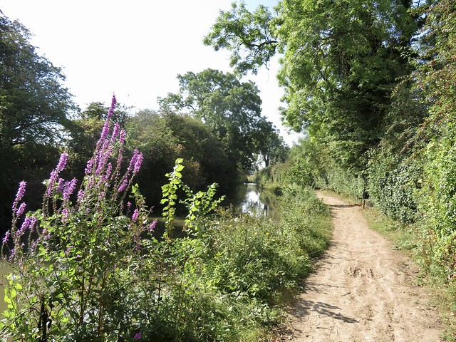
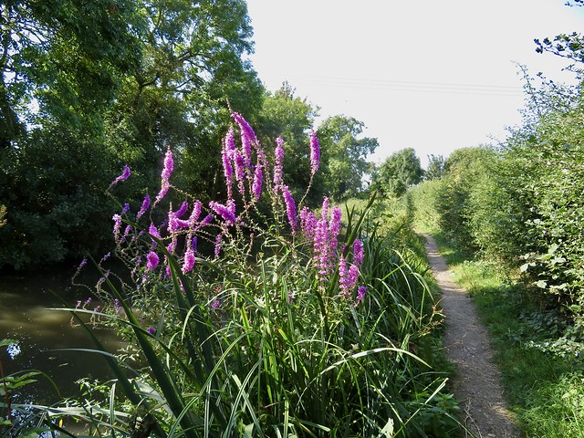
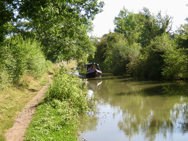
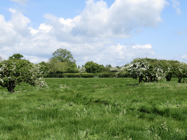
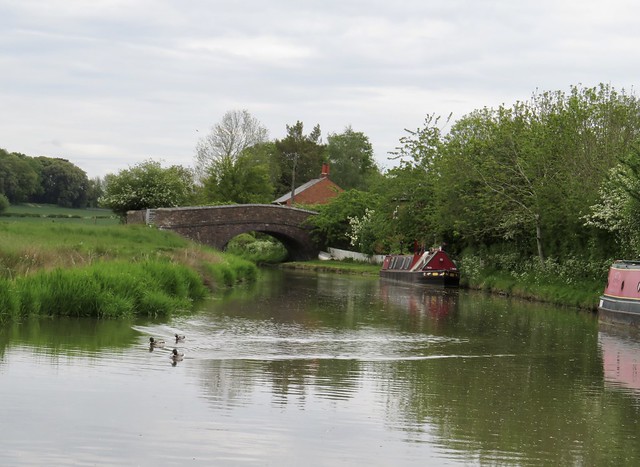
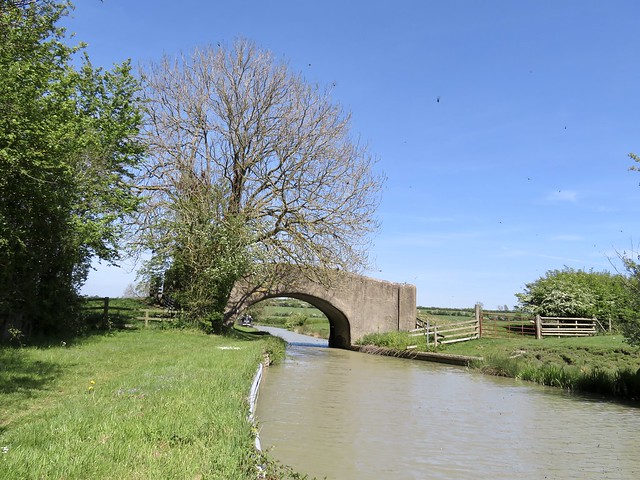
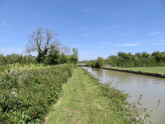
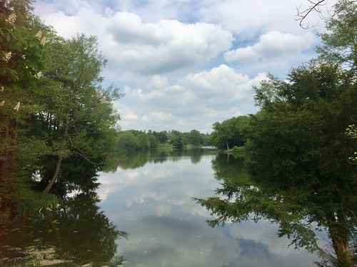
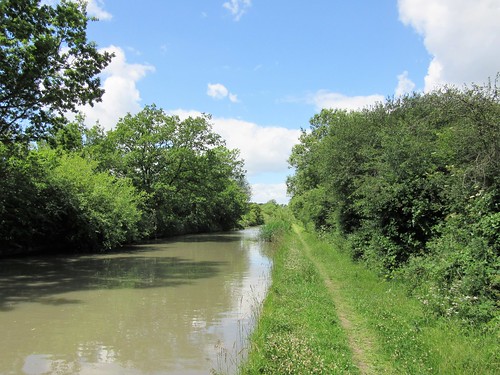
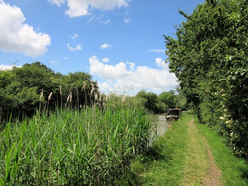
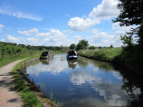
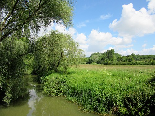
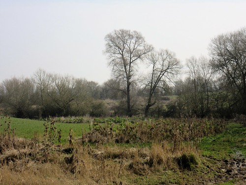
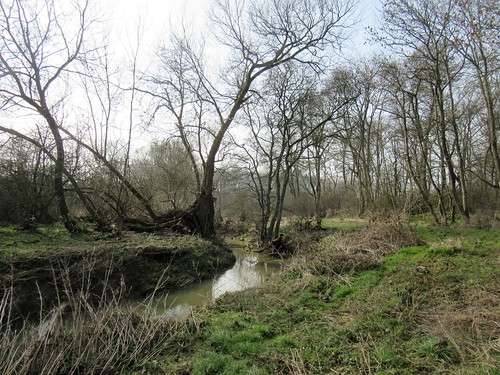
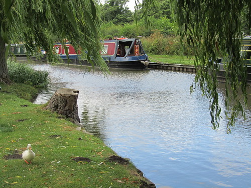
The sheep were too hot to budge from their shady patch under a sycamore tree as we walked among them towards the Stratford-upon-Avon Canal. Limp and still, the olive green water carried a greasy sheen winking with sunspots. Bees hummed soporifically around tall spikes of purple loosestrife, and passing narrowboaters could scarcely raise the energy for a wave.

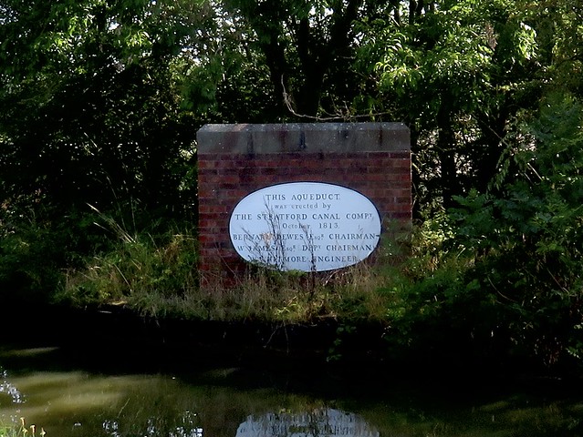
A pair of swans came sailing by, two magnificent white yachts fore and aft of their dowdy brown dinghy of a cygnet. We crossed a cast-iron aqueduct and trudged on along the towpath in a pleasant stupor of sun and insect hum.

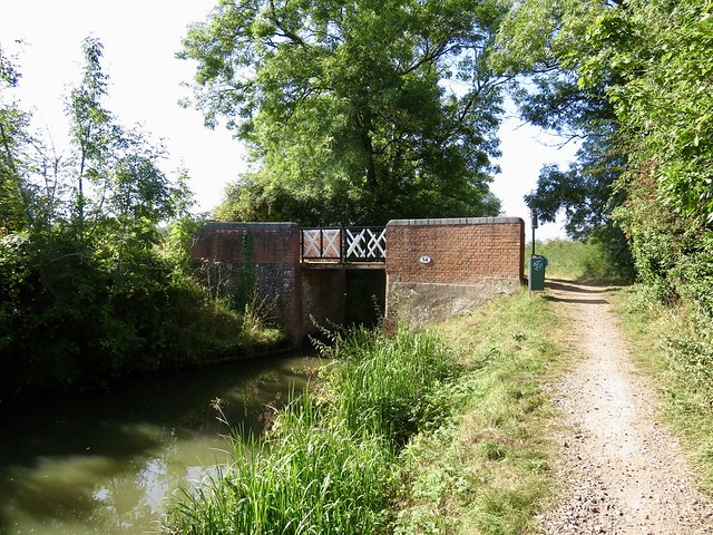
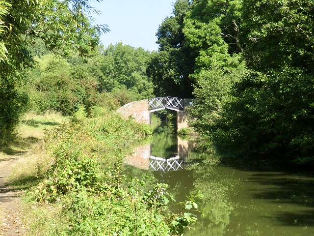
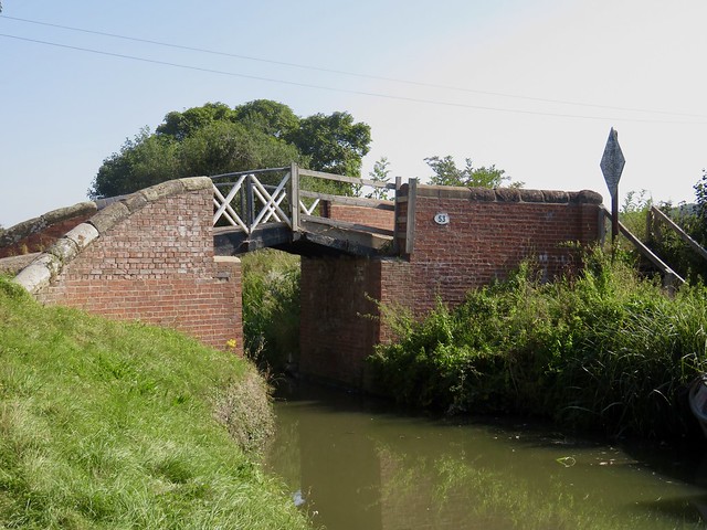
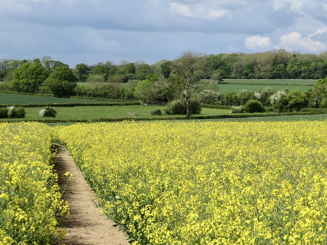
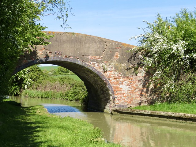
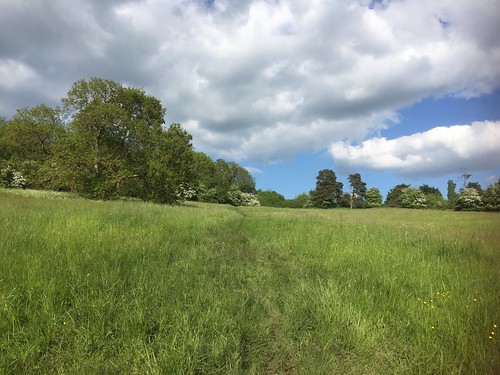
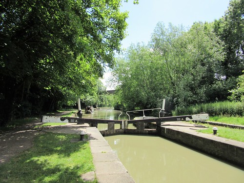
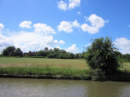
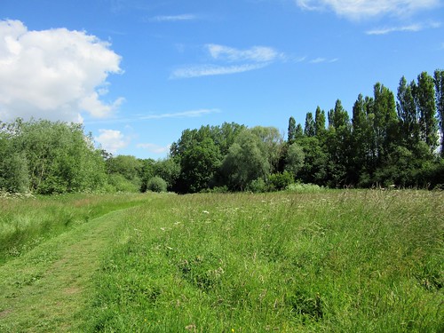
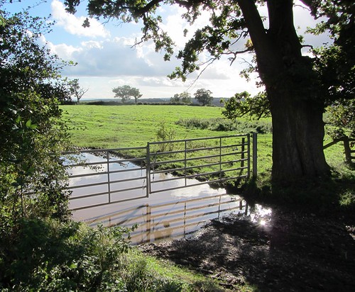
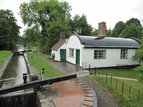
Bridge 49 hove up at last, its central railings ingeniously split to allow passage to a barge towrope without the necessity of unhitching the horse. We crossed the canal and set out across sun-baked pastures where tan coloured cattle stood in a bunch for coolness, fifty tails in motion as they whisked away the flies. A crowd of goldfinches, the liveliest elements in this heat-dazed landscape, foraged for thistle seeds with excited squeaks.

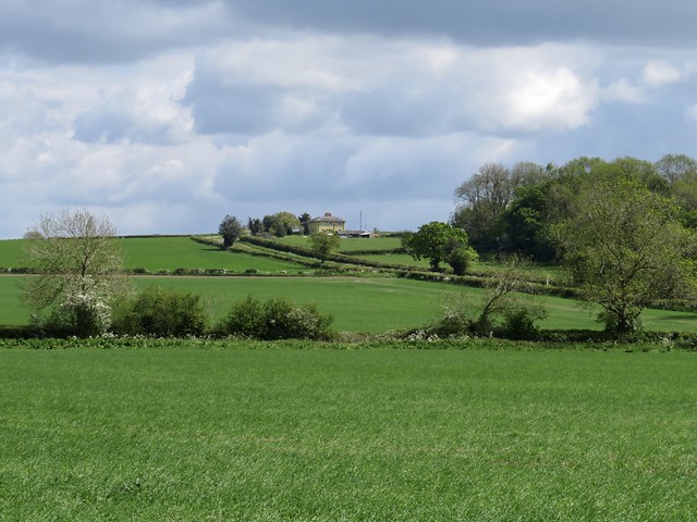
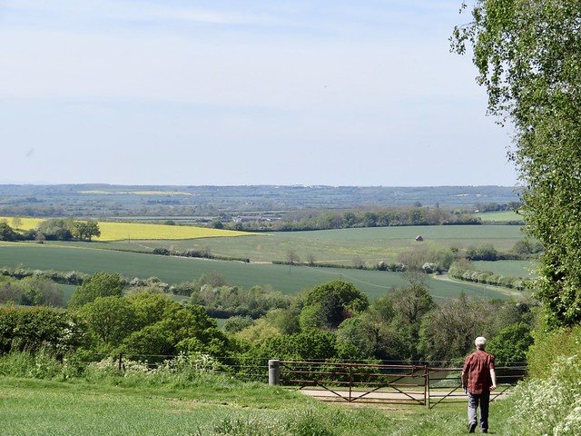
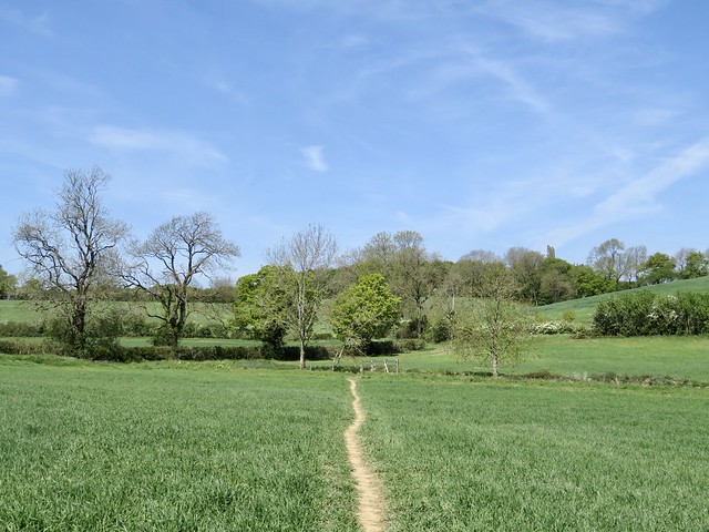
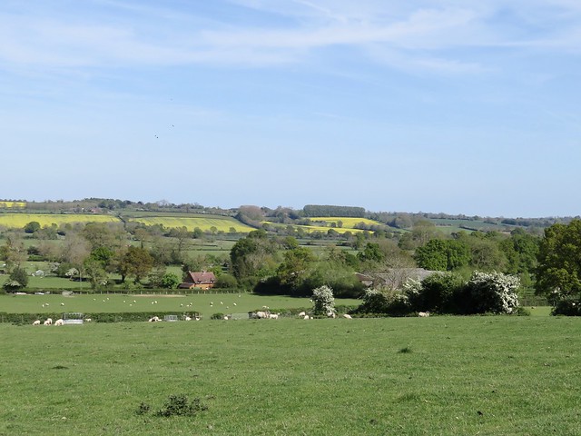
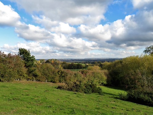
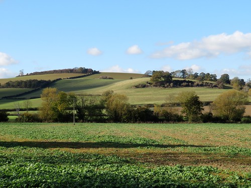
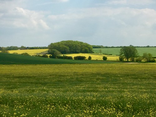
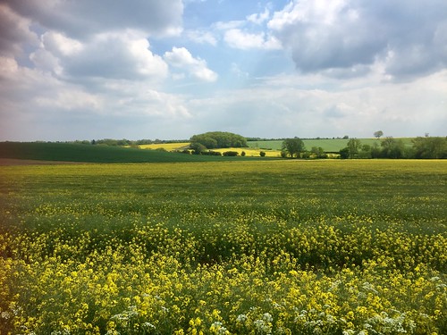
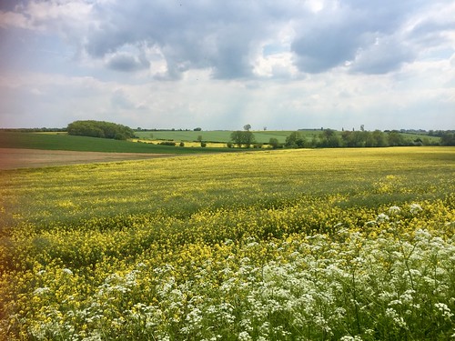
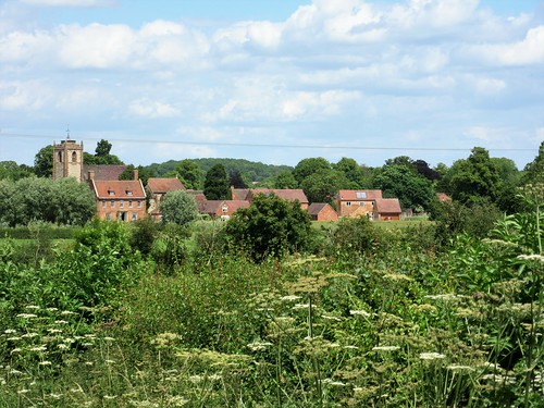
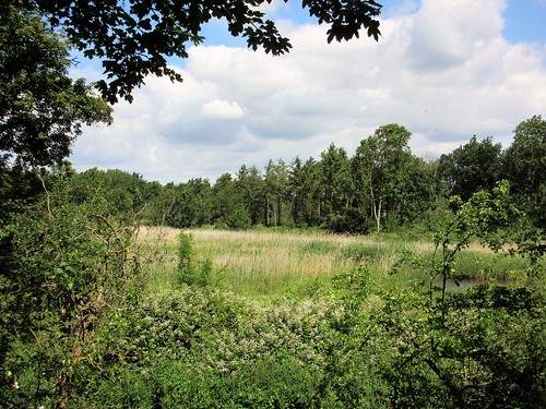
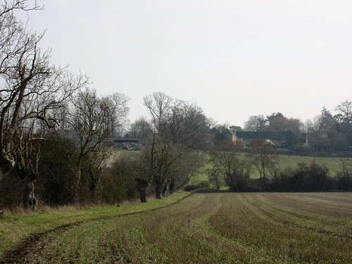
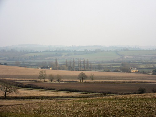
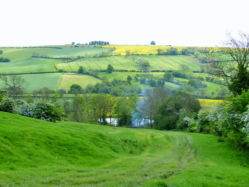
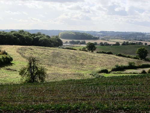
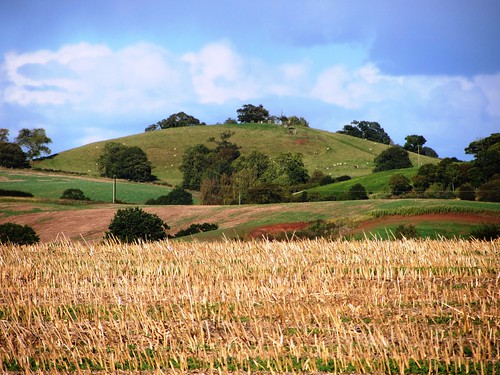
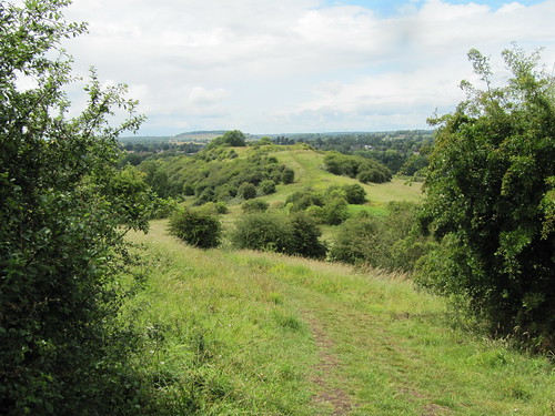
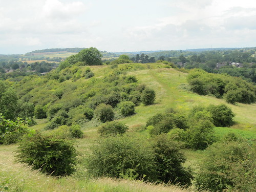
Beyond Kington Grange the path ran south, a wide view opening ahead over broad acres of well wooded Warwickshire countryside around Edstone Hall. Here was the setting for local Squire William Somerville’s epic poem of 1735, ‘The Chase’.

‘With airs soft-warbling, my hoarse-sounding horn
Invites thee to the chase, the sport of kings.’

Hunting, drinking and writing jingling verse were Somerville’s pleasures, and he ran through all his money indulging his lust for fun and a full glass. Dr Johnson damned him with faint praise: ‘His subjects are commonly such as require no great depth of thought or energy of expression … (but) he writes very well for a gentleman.’

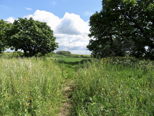
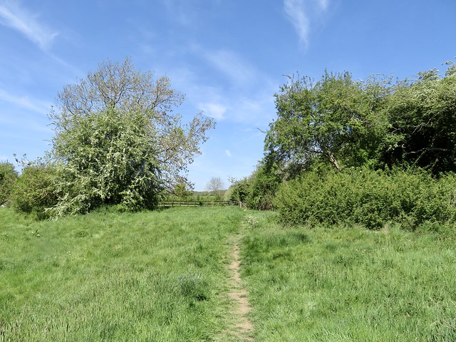
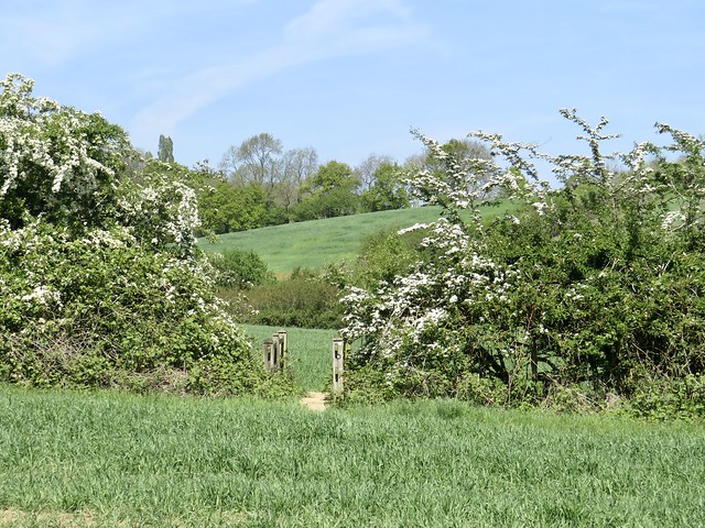
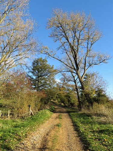
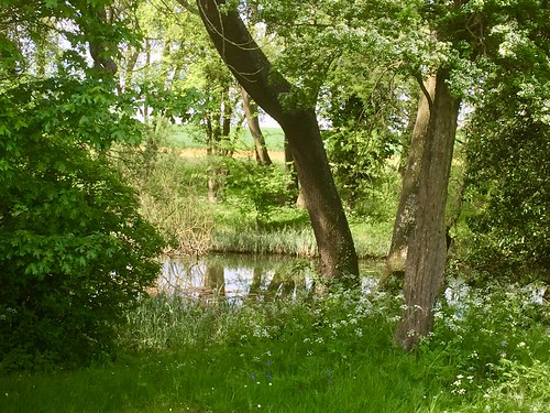
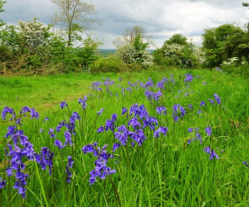
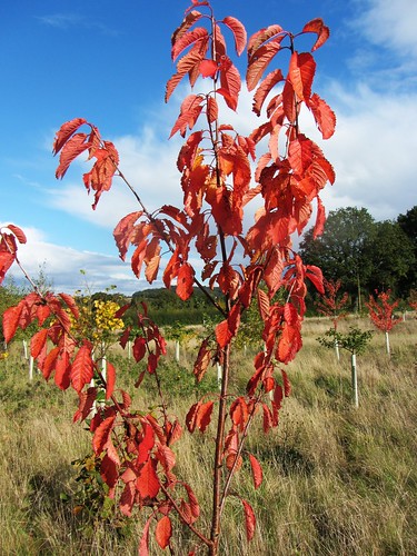
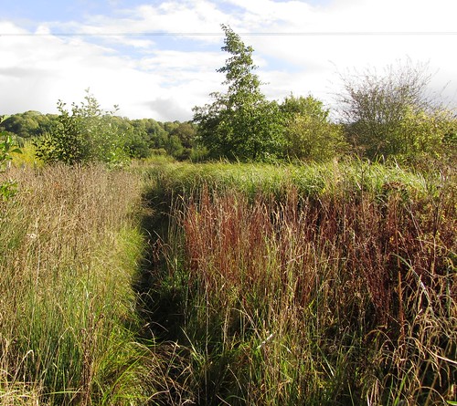
We turned for home through the muddy pathways of Austy Wood where the canopy of larch, oak and ash filtered the sunlight to a cool dapple among myriad dried stalks of bluebells. As we crossed the last beanfield a dust-devil appeared, a miniature tornado that jinked in a spiral across the furrows, wrapping its invisible self in a veil of powdered soil before collapsing as mysteriously as it had arisen.

How hard is it? 6 miles; easy; canal towpaths, field and woodland paths

Start: The View car park, Hill Farm Marina, Stratford Road, Wootton Wawen, Warwicks B95 6DE (OS ref SP 160622)

Getting there: Bus X20, X50 (Stratford-upon-Avon to Henley-in-Arden) to Hill Farm Marina
Road: The View is signed from A3400 (Stratford-Henley)

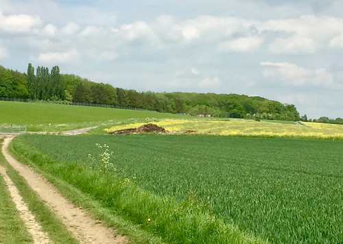
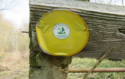
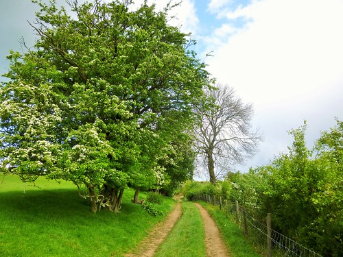
Walk (OS Explorer 220): From kissing gate in top corner of car park, follow mown path across 2 fields to cross Stratford Canal at Bridge 54 (156627). Right (‘Monarch’s Way’/MW) along towpath for 1¾ miles. At Bridge 49, right across canal (172647); right over stile (yellow arrow/YA); half left across field to bottom left corner (173645). Ahead on field path to road (181643). Right past Cherry Pool Farm and Kington Grange. Opposite 2 Kington Cottage, right (182641) along lane. In nearly 1 mile, right at Cutler’s Farm (179628, MW, blue arrow). In 600m through gate into Austy Wood (MW); in 40m, left on woodland path (174629, YA). In 500m leave wood (171626); on along field path for ⅔ mile to A3400 (162622). Cross (take care!); right to bus stop; left to car park.

Lunch: The View Café (01564-627280, theview-eat.co.uk)

Accommodation: White Swan, Henley-in-Arden B95 5BY (01564-792623, thewhiteswanhotel.com)

Info: Henley-in-Arden Heritage Centre (01564-795919)

 Posted by at 01:32
May 152021


First published in: The Times Click here to view a map for this walk in a new window
picture picture picture picture picture picture picture picture picture picture
Facebook Link:

A fine afternoon of big blowy skies over Warwickshire. The cobbled lane of Town Yard led up from Brinklow’s aptly named Broad Street to the green mound of a Norman motte-and-bailey, with far views over a countryside of corn and cattle grazing.

Frisky young bullocks came crowding in the fields round Goodes Farm. We gave them a roar and a wave, and they went scampering off, pitching over the corrugations of medieval ridge-and-furrow farming like a squadron of little dinghies in a choppy sea.

A good clear path led across fields of wheat. A shiver among the stalks, and a brace of partridges burst from cover almost under our feet and panicked away low across the crop with a rattle of stiff wings and squawks of complaint.

Meadows of thick shiny grass awaited their first cut of the year. The wind drove a sharp fragrance from a field of beans, the black velvet eyes of the flowers winking at us as the breeze tossed them to and fro.

Beside the road at Newnham stood a derelict tower, its parent building of St Lawrence’s Church long demolished. Black slit windows gave back a hard blank stare. It was easy to see how the lone tower by the lane got its reputation as a haunted place. That ominous fame must have been enhanced when, during excavations in 1852, the corpse of a decapitated man was unearthed from the abandoned graveyard. Meticulously embroidered in black silk on his funerary chemise were the letters ‘TB’. Nothing else was known, or has ever yet been discovered, about this felon and his story.

Through the fields beyond snaked the tight bends of the Oxford Canal, so winding in its course that boatmen inching their slow way through the many bends were said to be able to hear Brinklow bells ringing for matins and evensong on the same day.

As we went homeward along the towpath, a narrow-boat went by, its stag party crew of jolly jack tars in full uniform saluting us with beer bottles in hand. At the same moment a steam locomotive went streaking by along the railway just beyond – ‘Mayflower’ in beautiful green paintwork, passing with a rush and a roar and a hoarse triumphant cheer from her fan club perched on the bridge overhead.

Start: Broad Street, Brinklow, Rugby, Warwicks CV23 0LN (OS ref SP 436795)

Getting there: Bus 585 (Rugby-Coventry)
Road: Brinklow is signed from A428 at Bretford, west of Rugby. Park near Raven PH.

Walk (6¼ miles, easy, OS Explorer 222): Up Town Yard beside Raven PH; path, then steps to motte-and-bailey (437795). Return to kissing gate/KG; left (‘Coventry Way’). In 40m, through KG; down right-hand hedge to gate onto B4455 (437791). Left across Easenhall Road; follow yellow-topped posts/YTP and KG across fields for 1 mile via corner of All Oaks Wood (443786) to cross road (446780). Field path for ½ mile (stiles, yellow arrows) to road at Newnham Tower (449772).

Turn left, then right down Kings Newnham Road. In 50m, left (KG, YTP) between ponds. Don’t turn right across bridge (451770), but follow YTPs to left up slope, to KG/YTP on right of sheds (453711). Diagonally across fields (KG/YTP) to cross road (457774). Diagonally across field; cross plank footbridge at corner (459777); diagonally across next field to corner (462777). Ahead on path skirting left of Fennis Fields Farm, to reach Oxford Canal at Walton’s Bridge (467782).

Left along towpath for 2 miles. At Bridge 34, up steps to road (443794); left (grass verges; take care!). In 350m cross Ell Lane (440794); ahead (YTP, KG) into field. Half right to fence (438795); left along route to retrace route to Brinklow.
Conditions: Cattle may be in fields; tall stile onto towpath at Walton Bridge; towpath rough in place

Lunch/Accommodation: Bull’s Head, Coventry Rd, Brinklow CV23 0NE (01788-832355, bullsheadbrinklow.co.uk)

Info: Rugby TIC (01788-533217)
satmap.com; ramblers.org.uk

 Posted by at 02:15
Apr 242021


First published in: The Times Click here to view a map for this walk in a new window
picture picture picture picture picture picture picture picture picture picture
Facebook Link:

It’s an ironstone landscape here on the borders of Northamptonshire and Warwickshire, and the many handsome villages are the beneficiaries in terms of the beauty of their building stone.

On a glorious day of blue sky, with everything near and far standing out as clear as glass, the houses of Upper Boddington glowed the colour of dark honey. Rusty-looking streaks in their walls showed where nodes of iron lay embedded in the stone.

On the outskirts of the village we crossed a brook among milky blue bells of comfrey and a froth of cow parsley newly opened. Buttercups made golden drifts in the meadows by the stream. The path led us north across fields of young wheat, the pale crumbly soil free of stones and already cracked and drying under the sun.

Ahead the land heaved up into the long wooded billow of a ridge. From the top we had a wonderful view west over a great green disc of Warwickshire lowlands.

Lumps and hollows in the slope at our feet betrayed the site of the medieval village of Stoneton, abandoned in early Tudor times when its arable land was converted to more profitable sheep grazing. And the sheep are still here. Ewes called for their lambs, who were playing ‘I’m-the-king-of-the-castle’ on a hollow tree stump with maximum glee.

We made our way down past the rushy moat of Stoneton Manor, across the sheep pastures to the grassy towpath of the Oxford Canal. Walking north along its sharp curves, it was hard to believe that this clay-coloured waterway meandering inconsequentially across the plain could once have been the main communications link between London and the Midlands.

A bare-chested man in a kayak came past in a flash and splash of paddle blades. Narrow-boats cruised by, roof-boxes fragrant with basil, thyme, and rosemary, their freshwater admirals raising cans of beer in cheery salute.

From Priors Hardwick, a picture of perfection in sun-kissed ironstone and immaculate gardens, the homeward path ran above sheep pastures whose medieval ridge-and-furrow showed the patterns of vanished agriculture. Dandelions dotted the fields, their miniature yellow suns all gone into the globular seed heads that children blow to tell the time.

As I leaned on a gate to stare, a fine red fox came across the path twenty feet ahead, low-slung and intent. It stopped dead still, held me at gaze for a few seconds, and then turned tail and raced away to safety in the hedge.

Start: Plough Inn, Upper Boddington, Daventry, Northants NN11 6DH (OS ref SP 483534)

Getting there:
Upper Boddington is signed from Westhorp on A361 (Banbury-Daventry)

Walk (8 miles, easy, OS Explorer 206):
From Plough Inn, left along road; right up Frog Lane. Fork right by Hillside View; follow Millennium Way/MW waymarks north-west for 1 mile. From woodland strip (470547) dogleg right/left to Berryhill Farm; left along drive to road (464545). Right; in 600m, sharp left (466550) across field to drive (463547); in 100m, right to cross canal (458551). Right on towpath; in 1½ miles at Bridge 123 (461568), right (SE) across fields for ¾ mile to road in Priors Hardwick (472563). Right past church and Butchers Arms; right at road; in 150m, left off bend (470559, ‘Hill House’). Immediately left (yellow arrow/YA) across fields (occasional YAs and black arrows), heading SSE for 1¾ miles back to Upper Boddington.

Lunch: Plough Inn, Upper Boddington (01327-260364, ploughinnboddington.co.uk) – a very friendly village inn

Info: Banbury TIC (01295-236165)
satmap.com; ramblers.org.uk
More walks info: @somerville_c

 Posted by at 01:17
Feb 092019


First published in: The Times Click here to view a map for this walk in a new window

picture picture picture picture picture picture picture picture picture picture picture

Facebook Link:

A crisp winter’s day, the sun in a clear sky over Warwickshire picking out the gold in the Cotswold stone houses of Ilmington. A whiff of applewood smoke came down on the breeze as we followed the footway of Middle Street past medieval fishponds to the cruciform Church of St Mary.

Among the oak pews of this beautiful Norman building scurry Arts & Crafts mice, the signature speciality of Yorkshire master carver Robert Thomson. The carpenter set these humorous little rodents in the pews and pulpit of St Mary’s in the 1930s, and they still raise a smile today.

In the nave hangs a wonderful embroidered map of the orchards of Ilmington, its hem sewn with the names of apple varieties found here – Howgate Wonder, Laxton Superb, Siberian Crab. A green lane took us up the hill from Ilmington between the orchards, our boots wobbling among cookers and eaters long fallen to ground.

From the crest of the hill a glorious view opened, down slopes deeply indented with the ridge and furrow of Middle Ages strip farming, away over a low-lying vale of lush green meadows to the prominent hump of Meon Hill. The Devil created the hill when he missed his aim while chucking a sod of earth at Worcester Cathedral, and it’s well known that at the darkest hour of night you can catch the howling of the red-eared hounds of King Arawyn, Lord of the Dead, as he conducts his wild hunt around Meon Hill.

A stretch of road between hedges hung with scarlet necklaces of bryony, and we swung off south-west along the well-marked Monarch’s Way. Fat white sheep cropped the pastures around Hidcote Combe, the low winter sun backlighting their fleeces into spun gold and making dark trenches of the medieval furrows in the land.

At the foot of the lane to Hidcote Bartrim we turned east for home, leaving the wonders of Hidcote Gardens – ‘outdoor rooms’ of rare beauty – for a spring visit some other day.

An ancient trackway climbs the slopes to the crest of the hills and a view west as far as the Malverns, Bredon, the Caradoc Hills and far into Wales. We follow this classic ridgeway, then descended through ribbed pastures to Ilmington, sunlit and sleepy in its cradle of trees below.

Start: Howard Arms, Ilmington, Warwicks CV36 4LT (OS ref SP 213437)

Getting there: Bus 3A (Banbury – Stratford-on-Avon)
Road – Ilmington is signed off A3400 between Shipston-on-Stour and Newbold-on-Stour.

Walk (7 miles, field paths, slippery in places, OS Explorer 205): From Howard Arms, right along Middle Street. At black-and-white cottage, right, passing church to road (209435). Right; in 30m, left and follow yellow arrows/YAs. Near top of rise (207436, stile on left), bear right; follow Centenary Way (yellow-topped posts). In 450m, at top of slope, through kissing gate/KG (204438); left along hedge to next KG, then YAs along field edges for 600m to road (197440).

Right to road (198442, ‘Park Lane’ on map); left along road (walkable grass verge). In 500m pass lane to Admington on right (195446); in another ½ mile, left off road (187447, fingerpost, ‘Monarch’s Way’/MW). Immediately left over stile (MW); right along MW with stream on right. In 700m, right across ditch, to gate into wood (184440, MW). Through wood, then another (MWs); follow waymark posts up valley (180436) and on for ½ mile to foot of road to Hidcote (177430).

Left up lane (‘Restricted Byway’). In ¾ mile cross road at radar station (187426); on (‘Bridleway’) to cross next road (194426) and pass tall masts. In another ½ mile, at gate (204425), left off byway, downhill beside hedge. At foot of slope, right across stream (207431, KGs, YAs); left along stream, keeping straight ahead (YAs). At tarmac lane (208432), ahead to road (210433). Right, in 75m, left on path past church to Howard Arms.

Lunch/tea: Ilmington Community shop, Grump Street (café closed Mondays)

Dinner/Accommodation: Howard Arms, Ilmington (01608-682226, howardarms.com) – cheerful, characterful village inn; excellent food.

Hidcote Gardens: 01386-438333; nationaltrust.org.uk/hidcote Info: shakespeares-england.co.uk; ramblers.org.uk; satmap.com

 Posted by at 01:32
Sep 222018


First published in: The Times Click here to view a map for this walk in a new window
picture picture picture picture picture picture picture picture
Facebook Link:

A blackbird was giving us the best of his autumn repertoire from a cottage garden in Combrook. Not even the stone angels forming a guard of honour either side of the church door could have sung more celestially.

We sat on the churchyard wall to hear him out, then followed a grass path under heavy-laden horse chestnuts. The fallen conkers lay all around, their spiny green shells half split to reveal a wink of shiny brown nut within.

Greylag geese waddled complaining among the ewes in Park Field, where the long ornamental lake of Compton Pools glinted between trees just beginning to change their dress from green to gold. From the sheep pastures around Home Farm we looked back down a valley landscaped by Capability Brown in the 1770s for Baron Willoughby de Broke. Artfully shaped slopes and dells guided the eye from tree clumps and skyline down to the lake and its three-arched ornamental bridge, a brilliant trick of depth and perspective.

The parkland path and roads led north past stubble and pastures, between hedges crimson with hawthorn berries – peggles, as old countrymen used to call them. The land in its green and brown stripes billowed like a tarpaulin on a windy day.

The horses in the paddocks around Banisters Meadow Farm were too intent on loading grass into themselves to give us more than a glance. Just beyond, we turned back along the homeward path, skirting the osier beds at Poolfield where the knobbly old trees stood knee deep in dark carr swamp.

On the far side of a great trackless field of plough we found Compton Verney’s parkland opening its sculpted vistas again. The pillars and portico of the early Georgian mansion stood beyond the lake, every painter’s dream of peaceful Middle England.

The Verney family built Compton Verney and held it for 200 years. Soap king Joseph Watson, manufacturer of Nubolic disinfectant and Bumpo soap powder, bought the estate in 1921. The new owner exemplified the self-made man of the post-war world. He died a lord, chasing the fox with the Quorn – a paid-up member of the galloping classes.

Start: Combrook Church, Compton Verney, Warwicks CV35 9HP (OS ref SP 307517)

Getting there:
Bus 67A, 67B to Compton Verney house.
Road – Combrook is signed off B4086 at Compton Verney, between Kineton and Wellesbourne (M40, Jct 12)

Walk (7¼ miles, easy, OS Explorer 206): With church on right continue down ‘No Through Road’. In 200m, left by No 27 (307519, blue arrow/BA) down path, then beside Compton Pools. In 300m through gate (305521, BA), across Park Field. Gate to right of houses (305525, BA), right along drive to B4086 (307528). Left up Compton Hill; in 200m, right (‘Home Farm’, BA) along drive past Home Farm for 1¼ miles to cross road (318540).

Ahead for ½ mile; right (323545, ‘Hill Fields’) down farm road. In 400m, left along muddy lane (327543); at Banisters Meadow Farm (330545), left up drive to road (331549). Right; in 100m, right (stile, yellow arrow/YA) along field edge. At bottom, right; in 50m, left (333546) down field, across stream (334544) and on across large field. At corner of Poolfield Coppice, through gate (336537); right along fence; in 500m cross left end of Upper Pool (332535, BA). In 100m right across bridge (BA); follow field edge for 500m to Poolfield Cottages (328534).

Left up drive; in 150m, right (gate, BA). Aim a little right across paddock to hedge gap and deer gate (326534). On through wood; through another deer gate, across field, trending a little away from hedge on your right, for 500m to road (321536). Right; in 100m, left (kissing gate) into Compton Verney park. Follow path over meadow for ¾ mile to gate into car park (314527).

Cross in front of café; through gate; left on woodland path. Follow ‘Bird Hide’; pass hide, and follow woodland path to cross B4086 at bridge (311526 – take care!). Path across field (YA), into wood (310523, YA); straight ahead, no lefts or rights, to emerge in field (309519). Right, down to road by house (308518); left to church.

Lunch: Picnic, or Compton Verney Café (open 10-4:30)

Accommodation: Howard Arms, Ilmington, Warwicks CV36 4LT (01608-682226, howardarms.com) – cheerful, characterful village inn.

Compton Verney: 01926-645500; comptonverney.org.uk

Info: shakespeares-england.co.uk; satmap.com; ramblers.org.uk

 Posted by at 02:37
Jul 292017


First published in: The Times Click here to view a map for this walk in a new window
picture picture picture picture picture picture picture picture picture picture picture picture
Facebook Link:

We woke in Leamington Spa on a gorgeous midsummer morning, still stiff and bleary after a night’s rock ‘n’ roll cavorting in the town’s St Patrick’s Club. Best way to shake the blues component of all that Rhythm ‘n’ Blues? A good stretch-out on foot, that’s what, in the company of our quick-striding daughter Mary. She’d keep our motors turning, for sure.

Leamington Spa is a truly beautiful town, the pride of Warwickshire, full of well-preserved Regency architecture and large, beautifully kept public parks and gardens. Mary led the way along the leafy pathways of Jephson’s Gardens, and then the Riverside Walk that shadows the slow-flowing River Leam westward out of town through Walches Meadows nature reserve.

At the end of Leam Fields, among head-high grasses, we stopped on a bridge over the Leam to watch a neat brown flycatcher zipping out from its alder-branch perch to snatch a morsel in mid-air. The bird sat perfectly still, an iridescent blue damselfly wing twitching on either side of its beak, observing us, until a tiny movement of my hand sent it flittering away into cover.

Down on the Grand Union Canal we turned east along the towpath. The great commercial waterway of former days was packed with freshwater admirals at the helms of brightly painted narrowboats this morning. Collapsible bicycles lay strapped neatly on deck, and terriers and Alsatians sat at attention on the cabin roofs, watching us go by with a fine proprietorial air.

A blood-red flood of poppies spattered the green wheatfields under the stumpy tower of Radford Semele church. Six striped mallard ducklings with yellow breasts followed their anxious mother in a flotilla under a humpback bridge, where a pair of swans picked loose down from their four fluffy grey cygnets. Flowering rush was out in the canal margins. Dog roses disseminated a smell sweeter than honeysuckle from the hedges. Walking by the greasily shining, milky waters of the Grand Union, reeling off the miles as morning leached into afternoon, it felt wonderful to be alive and outside.

We climbed past the Bascote flight of locks and left the canal for the lane into Long Itchington. There was a bus stop, a table outside the Harvester Inn, and a long cool drink to cap off this restorative walk.

Start: Leamington Spa railway station, Old Warwick Road, Leamington Spa CV31 3NS (OS ref SP 317653)

Getting there: Rail or bus to Leamington Spa. Road – M40, Jct 15.

Return from Long Itchington – Bus 64 to Leamington Spa

Walk (8 miles, easy, OS Explorers 221, 222): From station exit, left through underpass; in 100m, right (‘Cycle Route/CR 41’) to cross road. Ahead along York Walk; in 200m, right over footbridge into gardens; right along river to cross road into Jephson’s Gardens. Follow path with river on right for ½ a mile through gardens to cross B4099. Follow ‘Riverside Walk’ for ¾ of a mile. Beside info board at end of Leam Fields Local Nature Reserve, right across river to A425. Left (‘CR41’); in 300m, right (‘CR41’) to turn left along north bank of Grand Union Canal. Follow this towpath for 4¾ miles, to Bascote Bridge, No 27 (407641). Leave canal here; turn right up Bascote Road into Long Itchington. At T-junction (411652), right to bus stop opposite Harvester Inn.

Lunch: Harvester Inn, Long Itchington CV47 9PE (01926-812698, theharvesterinn.co.uk)

Accommodation: Premier Inn, The Parade, Leamington Spa, CV32 4AE (01926-331850, premierinn.com)

Info: Leamington Spa TIC (01926-742762)
visitengland.com; satmap.com; ramblers.org.uk

The January Man – A Year of Walking Britain by Christopher Somerville (Doubleday, £14.99).

 Posted by at 03:56
May 072016


First published in: The Times Click here to view a map for this walk in a new window
picture picture picture picture picture picture picture picture picture picture picture picture picture picture picture
Facebook Link:

I don’t know whether William Shakespeare ever travelled much of the long-distance footpath from Stratford-upon-Avon to London that bears his name. But several of the gorgeous houses in the Warwickshire village of Honington look as though they’ve been there since the Bard was a lad. It was a day to do them justice as we set out along ‘Shakespeare’s Way’ – a tender blue sky, a cool breeze, and a hazy spring sun to bring out the mellow silver and gold of the local building stone.

Parkland stretched away beside the road that led north out of Honington. Sparrows, chaffinches, rooks and wrens all loudly proclaimed the spring from greening hedges and treetops. A jackdaw was pulling strands of nesting hay from the bales in a red-roofed barn, and a great spotted woodpecker drummed a hollow proclamation of ownership from its patch of woodland beyond Wagtail Spinney.

In a boggy dell we parted company from Shakespeare’s Way. We got across the fast-running stream, and stopped in the damp hollow beyond to clear a tangle of sticks that had dammed a spring. Watching the water bursting away from its confines in a wet sparkle took both Jane and me straight back to our muddy-booted childhoods.

Walking up the field boundaries to Idlicote on its ridge, we paused to admire the superb old trees that formed the margin of the path – giant crack willows burst apart and fallen, ancient coppice stools of field maples, and an ash tree split open to expose a heart of writhing tendrils more like those of an animal than a tree.

Up at Idlicote a scarecrow sat on a bench – a smooth customer in a grey homburg hat, with a pink silk kerchief in his breast pocket. Rooks had built a ragged township in the nearby trees, and they challenged our passing with reedy quacks and phlegmy belches. Sticky paths led us up from Idlicote to a high ridge where the long views melted into mist. Before dropping down the slope into Honington there was time for a sit and stare across the plain, where the slender spire of Tredington Church rose skywards from the heart of Shakespeare’s countryside.

Start: All Saints Church, Honington, Warwicks, CV36 4NH (OS ref SP 261427)

Getting there: Honington is signed off A3400, 1 mile north of Shipston-on-Stour. Left off village street (signed) to church parking spaces.

Walk (6¼ miles, easy but muddy, OS Explorer 221): Walk to village street; turn left. Opposite turning to Barcheston, left (‘Old Post Office’). In 40m, ahead through metal mesh gate. Through woodland strip (kissing gate, yellow arrow/YA); half right across field to kissing gate (YA) and road (268427). Left along road. In 1 mile, cross bridge in Wagtail Copse; immediately right through gate (267443, ‘Shakespeare’s Way’/SW). Follow path on left of stream, then between stream and wood.

In 800m, right over footbridge (273448, blue arrow/BA); follow right bank of tributary stream up through trees (BAs), then along field edges to barns near Whitehouse Farm (277446). Cross track; ahead (BA) up field edges to Idlicote. At top of rise, ahead through gate (281443); ahead to road. Pass tower and kitchen garden; round left bend; immediately right between white gateposts (283442, BA). On to cross road (284440).

On up field with hedge on right. In 600m at top of ridge, right at waymark post (288435, ‘Centenary Way’/CW). At Idlicote Hill Farm, left, then right (288433, CW). Follow hedge on right to corner (post with YA, CW); bear right along hedge. In 70m pass yellow-topped post (CW); on with hedge on left. In ⅔ mile pass pond on right (278426); in 100m, bear right round corner of Hill Clumps Wood; in 30m, left (CW, YA) across strip of ground, then right (CW) and follow CW down to road. Right, then left into Honington.

Lunch: Picnic

Accommodation: White Bear, Shipston-on-Stour CV36 4AJ (01608 664199, whitebearin.com)

Information: Stratford-on-Avon TIC (01789 264293)

visitengland.com; satmap.com; ramblers.org.uk

 Posted by at 01:07
May 092015


First published in: The Times Click here to view a map for this walk in a new window
picture picture picture picture picture picture picture picture
Facebook Link:
All the birds in Warwickshire were singing their little heads off as we climbed away from Upper Brailes up Gilletts Hill. Ben the black labrador barked an unavailing plea from behind his gate to be taken walkies: ‘Oh come on, have a heart…!’ But his owner shouted him down and waved us through with a smile.

On top of Gilletts Hill a great swathe of green bearded barley glistened in the sunlight. Silver and dove-grey clouds were gathering on the western skyline, but we paid them no heed as we dropped down through Ashen Coppice to a wonderful westward view – cornfields, rape fields, hedges, pastures and red roofed farms stretching away for 15 miles or more. Cloud shadow darkened the nearer ground, but a single pale church spire rose to the north-west, brilliantly lit in a ray of sun.

Chiffchaffs, whitethroats and blackbirds warbled fit to beat the band. We skirted above handsome old Famington Farm and climbed the wooded south-westerly flank of Brailes Hill. On the hill’s upper slope an old cart track ran by pastures full of bouncing black and white lambs. We followed it down to Lower Brailes, looking out between veteran sycamores towards the church tower and its zigzag backdrop of green and yellow fields rising to the long ridge of Mine Hill.

St George’s Church in Lower Brailes is a glorious confection of dark gold limestone, its cathedral-like interior dim and scented with age. The 14th-century masons had massive fun with the grotesques they fashioned under the eaves – a mad nun, a bearded demon, a man with three faces, a wolfman with pricked-up ears – some of them blurred with weathering as though breaking half-born through the stone. Inside, overlooking the nave, I found an old friend, the Green Man, with tendrils sprouting from his mouth and bursting into leaf around his cheeks.

Out in the fields north of St George’s we climbed Lower Brailes’s famed ’99 steps’, shallow stone treads in a bank, some of them formed of recycled grave slabs. On across medieval ridge-and-furrow farmland, a circuit of the ramparted mound of Castle Hill, and we were threading our way back into Upper Brailes between neat allotments of beans, peas, radishes, cabbages, onions, showy globe artichokes and humble spuds.

Start: Gate Inn, Upper Brailes, Warwickshire, OX15 5AX (OS ref SP 305398)

Getting there: Bus service 50A (stagecoachbus.com), Stratford-on-Avon to Banbury.
Road – Upper Brailes is on B4035, 3 miles east of Shipston-on-Stour.

Walk (6 miles, moderate, OS Explorer 191): From bus stop outside Gate Inn, left down road. In 100m, right up Gilletts Lane (‘Gillett Hill’). Through gate; between house and garage; beyond, through gate; bear right (303397, yellow arrow/YA) up grassy bank, then up steps. At top, at T-junction, right; in 50m, fork left on path 58b. In 100m cross grass track, then stile (300398); follow path 58 across field, down through Ashen Coppice. At foot of steps, diagonally left (298399, YA) down slope; at bottom left corner of wood, left (296399, blue arrow/BA) along lower edge of wood. In 150m, right along gravel roadway (path 57a) and follow BAs.

In 300m, at gate (292396, ‘Private’), fork right (BA, yellow-topped post/YTP) along field edge and down, aiming for Farmington Farm. At bottom of slope, left along hedge (285393, YA). Pass through cross-hedge; in 100m, left (295389, YTP, YA) across field to go through gate (288387). Diagonally right uphill through trees (YTP, YA). Near top, bear right at YTP (289386, YA), anticlockwise round the upper hill (YAs). Go through 2 gates; after 2nd one, left through side gate (292382, BA) on bridleway for 1 mile (BAs), passing New House Barn (301383) to road at Grove End (306390). Left; in 20m, right over stile (YA); over next stile, and follow path 60 (YAs) to road (310391). Across into Jeffs Close; left at end; follow road round to right, to B4035 in Lower Brailes (312393).

Right along road. Opposite George Inn (314393), left up Butcher’s Lane. In 100m, left through gate; fork left on path 52. Cross footbridge (314396, YTP, ’52’); keep ahead up The 99 Steps; on across 2 fields. In 3rd field, diagonally left; halfway across, fork right (310397) to cross Castle Hill Lane (309398). Through kissing gate/KG; fork right (’52g’) and follow path across field and over stile (’52g’) to Castle Hill. Return over stile; right along hedge; in 70m, through KG (307399) and follow path (’51’). Dogleg right/left through allotments (YAs) to road; left to The Gate PH.

Lunch: The George, Lower Brailes (01608-685223; georgeinnbrailes.com)

Accommodation: The Gate, Upper Brailes (01608-685212; thegateatbrailes.co.uk) – clean and friendly village B&B.

Information: Warwick TIC (01926-492212);
satmap.com; ramblers.org.uk; LogMyTrip.co.uk

 Posted by at 01:58
Jul 132013
 

A brilliant blue day of wind, with big clouds sailing over Warwickshire, building and dissolving in towers of rain and blurry shafts of sunlight.
First published in: The Times Click here to view a map for this walk in a new window
picture picture picture picture picture picture picture picture picture picture picture picture picture picture picture
Facebook Link:
Jane and I were planning on a quick circuit of the fields and woods around Coughton, but we hadn’t reckoned with the seductive powers of Coughton Court. This handsome old house, seat of the staunchly Catholic Throckmorton family, was one of the centres of conspiracy of the Gunpowder Plotters in 1605.

The explosive old story, its heroes and villains twisted topsy-turvy by the distorting mirror of religion, held us spell bound. One peep down the secret alcove of the Tower Room into the deep, chilly refuge of the priest’s hole concealed there was enough to summon up all the desperation and paranoia of that mistrustful age.

Walking away from the grand old house, we crossed thick clay ploughland studded with flood-smoothed pebbles. Big centuries-old oaks in the hedges, rooks sailing with the wind, and lacy curtains of rain sifting sideways across the gently rolling landscape. We crossed the River Arrow, red with mud as it coiled lazily through the fields near Spernall, and went on over a little hill sown with thousands of young poplars and cherries, silver birch and sweet chestnut. These dense plantations of infant trees are a wonderful feature of this walk, an ambitious reseeding of William Shakespeare’s sadly diminished Forest of Arden.

We passed the neat brick house and the immaculately kept garden of St Giles Farm, and found ourselves forging through head-high rushes and reeds on a squelchy path with young aspen leaves quivering a translucent cherry-red against the blue sky. A group of buzzards rode the wind over Spernall Park Wood, their cat-like calls cutting across the continual, wind-generated susurration of the oaks on the knoll.

From Round Hill the path ran south with the Cotswold hills folding gracefully in sunlight far ahead, and then made west over the hump of Windmill Hill along an old green lane. Blackthorn, hawthorn, guelder rose and spindle spattered the hedges with their varying berry shades of crimson, pink and scarlet, and the sky raced vigorously overhead until we came back to Coughton.

Start: Coughton Court, Coughton, Warwickshire, B49 5JA (OS ref SP 082607). NB NT car park – non-members pay. If not visiting Coughton Court, park in Coughton village.
Travel: Road: Coughton Court is signposted in Coughton, on A435 between Alcester and Studley.
Bus: 26 Redditch-Stratford (stagecoachbus.com)
Walk (6 miles, easy, OS Explorer 220. NB – Detailed description (recommended!), online maps, more walks at christophersomerville.co.uk):

Starting from Coughton Court NT car park – Turn left (away from house) through gates and across overflow car park field. Through kissing gate (083608) to join Arden Way/AW.
Starting in Coughton village – go north along A435; pass car entrance to Coughton Court; turn right (‘Arden Way’/AW) across field to kissing gate at 083608. Turn left here along AW.

Both routes now keep ahead along field edge. At far end (082612; AW, Millennium Way/MW), right for 50m; then left through kissing gate (no waymarks). Cross field, through kissing gate (085615; AW, MW); on to cross River Arrow (086618). On to road by Spernall Church (087621). Ahead (AW, MW) to T-junction; right along road (MW) for 300m. Pass Rose Cottage on left; through kissing gate just beyond (089624, MW) and on, up and over a hill, following MW. On far side, under power lines (092626), a broad grass path forks right, but keep ahead here (MW yellow arrow on telegraph pole) with hedge on left, down to cross drive (095629). Through wicket gate (yellow arrow/YA); along edge of St Giles Farm garden; through another gate (MW) and on under power lines. Through gate on far side of field (095631, MW); cross stream and turn right off MW (YA) along rushy path, under power lines again to cross road (098630).

Through pedestrian gate (YA); on with wood on right. Through kissing gate; bear right between plantation and hedge (YA), then across field to corner of Spernall Park Wood (101626). Follow path round right-hand edge of wood. Where it curves into trees (104624), keep ahead down grassy ride, then through kissing gate. Keep ahead (YA) across a field, through kissing gate (106624); across next field, aiming to left of tree. In top left corner of field, turn right down steps onto lane (108623). Left for 150m; right through gate; left (YA) along hedge for 2 big fields, into trees (110618). Through gates; in 15m, right (YA) out of trees and along hedge. Follow field edge to go through kissing gate by a house (110613). Right down drive (‘Heart of England Way’) to road (109610). Right for 30m; left along green lane (AW) for 1½ miles to road (085603). Right to cross river by footbridge beside ford. In 200m, right (083604, ‘Coughton Court’) to car park.

Lunch: Picnic, or Coughton Court restaurant/tea room

Coughton Court: 01789-400777; nationaltrust.org

Information: Redditch TIC (01527-60806)
www.ramblers.org.uk www.satmap.com www.LogMyTrip.co.uk

 Posted by at 04:49
May 262012
 

‘Heavy rain showers’ smiled the weatherman at 7 o’clock in the morning. ‘Some of them prolonged…’
First published in: The Times Click here to view a map for this walk in a new window
picture picture picture picture picture picture picture
Facebook Link:
The sky was freighted with rollers of rain cloud, but I spied intense silver gleams among them. Anyway, a drop of rain never hurt anyone, did it? I waited out a shower that glistened the red roofs and half-timbered walls of Henley-in-Arden, and struck out east into the country of the Forest of Arden.

The Forest that Shakespeare knew and made immortal had shrunk from its former expanse between the rivers Tame and Avon by the time he explored it as a boy. But it was still a wild place. The Romans barred it in with boundary roads, but they never built through the forest or tamed it. Nowadays Arden is a rolling mixture of pasture and cornfields, old hedges, fine solitary trees and thick clumps of woodland, more of a mosaic than a single impenetrable wilderness.

Well-marked paths carried me through this rich farmed Warwickshire landscape, past houses done up and furnished with paddocks, horses and new plantations of broadleaved trees. One reminder of the region’s deep-rooted industrial heritage lay threaded through the countryside – the sinuous, narrow course of the Stratford-upon-Avon Canal. Once the carrier of bricks, blocks, iron and coal to Brummagem, now its cargo consists of white-bearded gentlemen in sailor caps cruising at ease under the alders.

On densely wooded Yarningale Common I lost my way, but it didn’t matter – all paths hereabouts seem to lead to Valley Farm and the fields once more. At Peacock Farm the rain caught me a sharp smack, and I sheltered under a sycamore’s big leaves till the weather had rumbled and rolled off elsewhere. As soon as the sun came out, so did the insects, and the swallows after them, hawking low over the wet hayfields, some dilatory farmer’s regret.

By Lowsonford’s Church of St Luke, a squat ark of red brick stabilised with massive buttresses, I took to the road. Beyond the humpy canal bridge and barrel-roofed lock keeper’s cottage, the Fleur-de-Lys Inn trumpeted its famous pies. Well, you can’t ignore that sort of thing. The pub delights in the tale of a Frenchman who chopped up an English spy and sent him back to England baked in a pie with a pastry fleur-de-lys on top. I heard that after I’d wolfed my own Matador Pie, and had an interesting moment or two.

The homeward path was along the Heart of England Way, beautifully waymarked and clear to follow. A field full of colts staring hard like B-Boys; the enormous Tudorbethan rebuild of Holly Bank Farm; showers in huge blocks tumbling through the sky; the rain-slicked mound of Beaudesert Castle outside Henley. A wonderful walk, in all – nothing dramatic, but everything to do with England on a rainy summer’s day.

Start & finish: Henley-in-Arden station, B95 5JH (OS ref SP 148659).

GETTING THERE: Rail (www.thetrainline.com; www.railcard.co.uk) to Henley-in-Arden. Bus service X20 (Birmingham-Stratford), Flexibus 517 (Wootton Wawen-Redditch).
Road: M40 Jct 16; A3400.

WALK (8 miles, easy/moderate, OS Explorer 220):
From Henley station to High Street, right to church; left down Beaudesert Lane. At end (153660), forward along brick-walled path. Follow yellow arrows/YAs along side of Beaudesert Castle earthworks. Pass school; at path junction turn right down side of school. Cross road; up lane; cross playing field and climb steps. Follow YAs to cross Edge Lane (160658). Take right-hand of 2 gates; halfway across field, don’t turn right, but keep ahead (YA). Over stile and field, to next stile. Right (163658, YA) in tunnel of trees. In 50 m, left over stile (YA). Ahead across fields (YAs) for ⅔ mile to cross road by Church Farm (173660). Up green lane (YA; ‘Church’). Pass to right of church (174660); cross lane and on (YAs) through fields to cross Stratford Canal (179658).

In field beyond, left along hedge next to canal. At end of field, left over stile (182659); aim away from canal for far upper corner of field (183660). At post with arrows, uphill with hedge on left; follow YAs past rugby pitches to stile (186659). Ahead (arrow) through trees along north side of Yarningale Common to road (189658). Left, then left down Yarningale Lane. In 30 m, right (YA) up bank through right-hand of 2 sets of barriers, on up through trees. In 100 m at top of rise, right along grass ride. In 50 m through barrier (YA) and take middle of 3 paths, to left of oak tree, going downhill. In 100 m path bears right to road. Left to Valley Farm (182661). Right past YA on post; don’t fork immediately right, but keep ahead. Ignore stile with YA; ahead into green lane. Follow this for ⅓ mile; just before left bend (196663), left over stile (YA). Along hedge, through kissing gate (YA); follow path over 2 fields to farm drive just right of Peacock Farm (194667).

Left past farmhouse. Follow BA through kissing gate and along green lane. In 350 m cross stream (195670); in another 200 m, through kissing gate (196671, BA). YA and BA are to your right, but keep ahead for 20 m, then left along field edge. Through kissing gate; diagonally across next field to hedge, right along it for 2 fields (YA). In 3rd field follow fence on right over crest, down to road by chapel (190676). Left along road to cross canal; right past Fleur-de-Lys pub (188678) in Lowsonford.

At phone box on crossroads, left (186680; YA; Heart of England Way/HEW) up road. Now follow well-marked HEW for 1 mile to Coppice Corner Farm drive (175677), left across old railway and down to road (174673). Right round bend; left (HEW) to cross Holly Bank Farm drive (173672). Go through hedge gap; diagonally left across field; through kissing gate and up hedge. Follow HEW for 1½ miles by Hungerfield Farm (165669) and Edge Lane (163667) to cross Beaudesert Castle ramparts (155661) and descend to Henley-in-Arden.

LUNCH: Fleur-de-Lys Inn, Lowsonford (01564-782431; www.fleurdelys-lowsonford.com) – try the pies!

ACCOMMODATION: Henley Best Western Hotel (01564-794551; www.bestwestern.co.uk) – very friendly and helpful.

Subscriber Walks: Enjoy a country walk with our experts. Next walk: Tibbie Shiel’s Inn, Selkirkshire, Scotland, 10 June. Email timespluspartners@newsint.co.uk to book. Tickets £10.

Breast Cancer Care’s Pink Ribbon Walks:
0870-145-0101; www.pinkribbonwalk.org.uk. Petworth House, West Sussex, 26 May; Cholmondeley Castle, Cheshire, 9 June; Marble Hill Park, London, 16 June

Info: Warwick TIC (01926-492212); www.visitcoventryandwarwickshire.co.uk
www.ramblers.org.uk www.satmap.com www.LogMyTrip.co.uk

 Posted by at 04:11