Search Results : worcestershire worcs

Nov 192022


First published in: The Times Click here to view a map for this walk in a new window
Looking south along the Malverns path up to Lady Howard de Walden's Drive Lady Howard de Walden's Drive cuts a nick in the hillside Looking east down Green Valley from Lady Howard de Walden's Drive Lady Howard de Walden's Drive the view south to Worcestershire Beacon Looking along the spine of the Malverns view west into lumpy country from the return path

‘Some term them the English Alps,’ wrote the traveller Celia Fiennes in her journal for 1696 after viewing the Malvern Hills for the first time. ‘They are at least 2 or 3 miles up and are a Pirramiddy fashion on the top.’

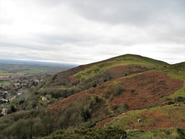
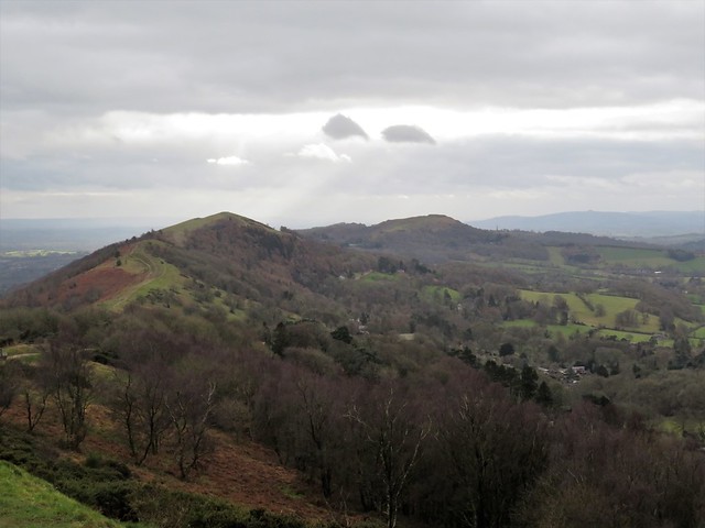
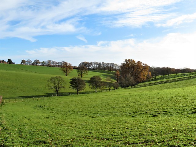
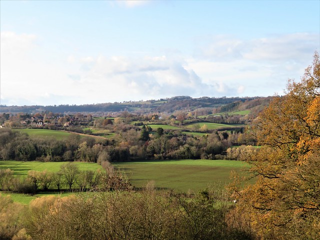
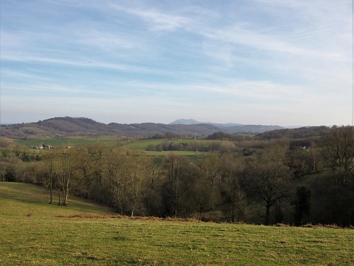
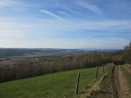
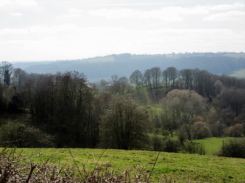
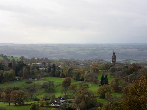
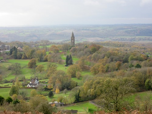
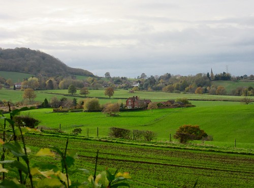
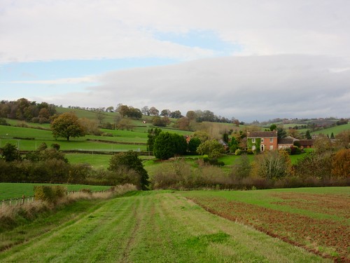
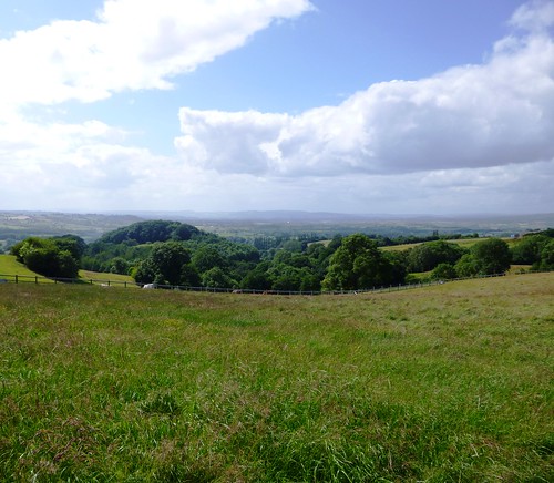
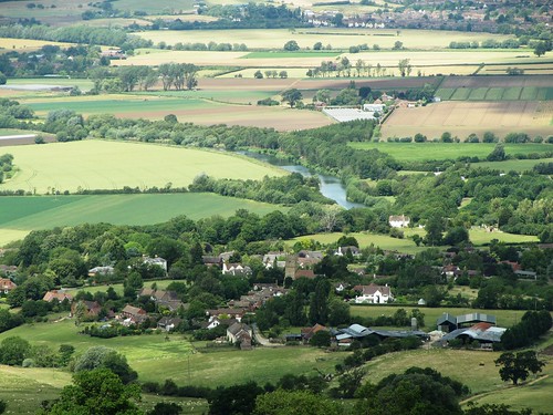
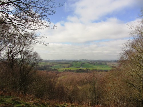
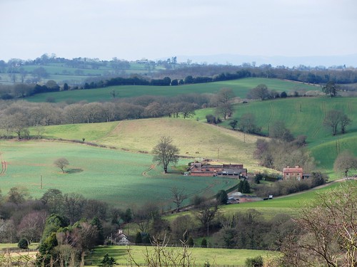
The dust of enchantment may have been in Celia’s eyes when it came to estimating the height of the Malverns – the summit, Worcestershire Beacon, is only 1,395 ft. But there’s no doubt that this dragon-backed, seven-mile chain of miniature mountains dominates both the South Worcestershire plain to the east and the more undulating country towards the Welsh Borders in the west.

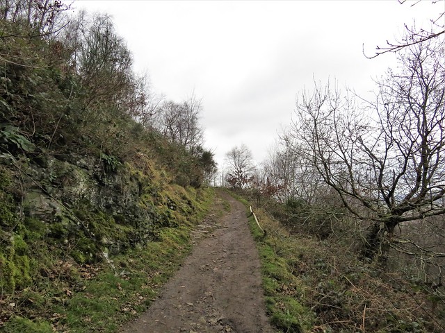
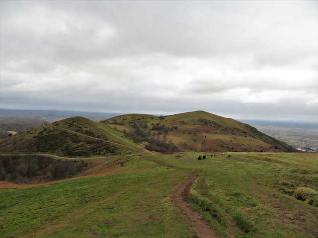
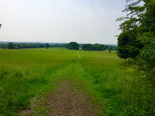
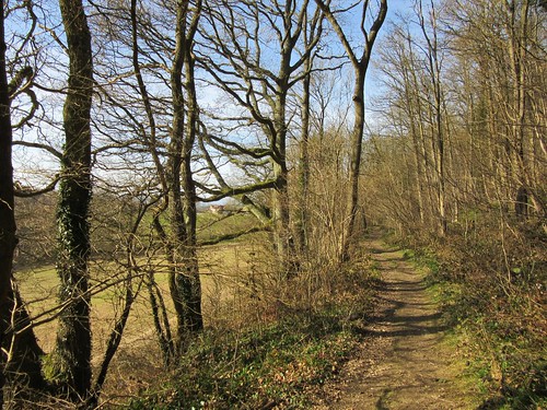
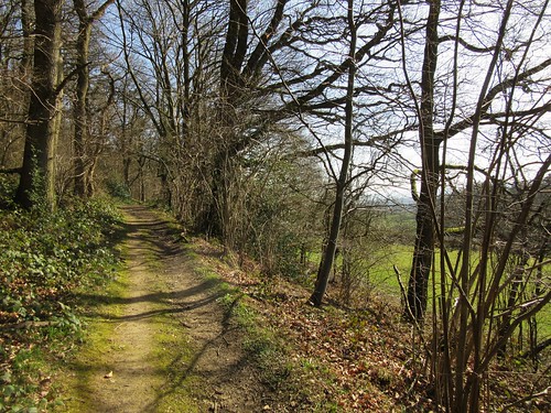
The Malverns are less demanding to climb than they seem. A skein of good paths criss-crosses them, and it’s hard to get lost on the hills because they stand up above everything far and near.

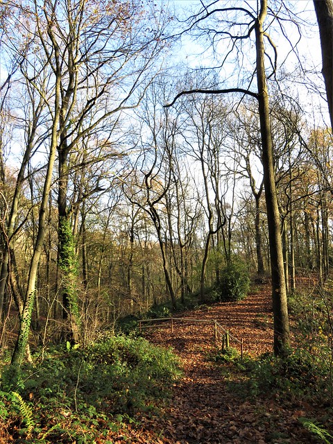
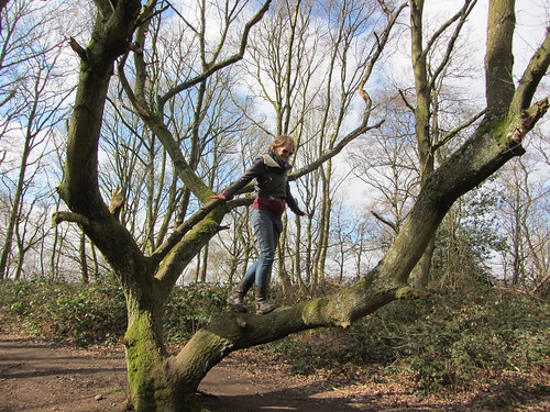
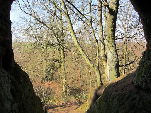
We set out from the northern end of the range on a cold, breezy winter’s day. A stony track led steadily uphill through yew, Douglas fir and larch, then further up into gorse and broom.

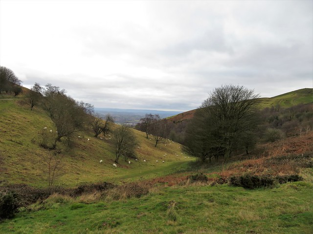
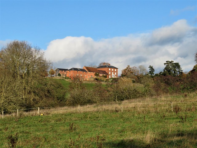
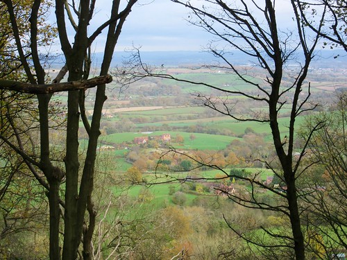
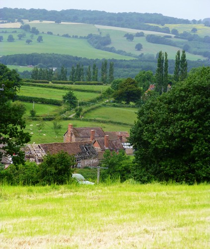
As we climbed the view opened out east over the red roofs of Great Malvern toward the Cotswolds, a long dark bar in the south. At the top of the track Lady Howard de Walden’s Drive curled away south towards the craggy peak of Worcestershire Beacon. The fabulously rich Lady Howard de Walden had this mountain carriageway built in the 19th century to give employment to local people.

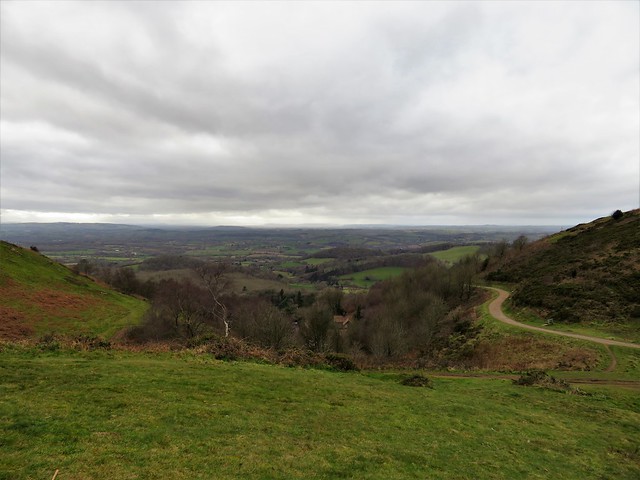
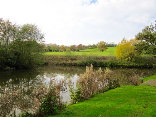
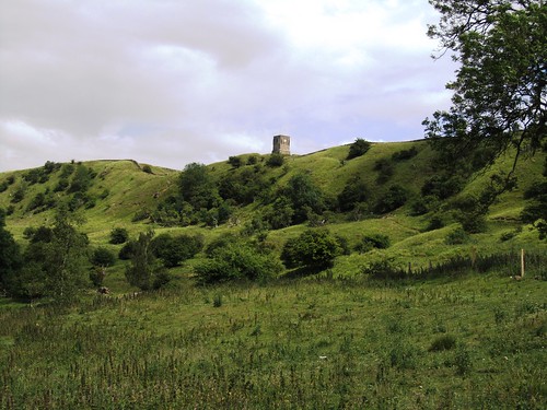
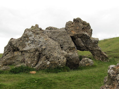
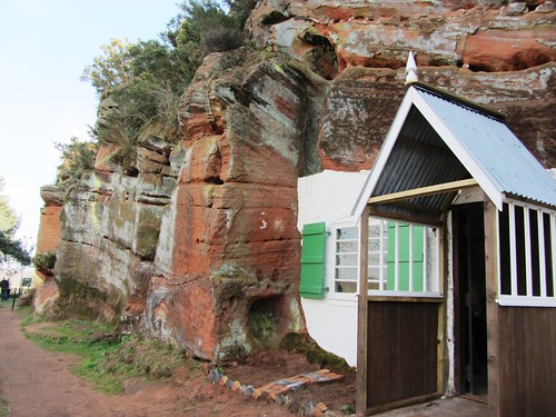
Up on the summit the wind blew like blue blazes out of the valley. We clung to the quartzite crags which have been a thousand million years in existence, a concept bound to make your head spin if the view doesn’t. Black Mountains in the Welsh Borders to the west, Edge Hill nearly forty miles off in the east, the Clee Hills a jagged lump in the north, the Severn Estuary a salmon-pink gleam in the south.

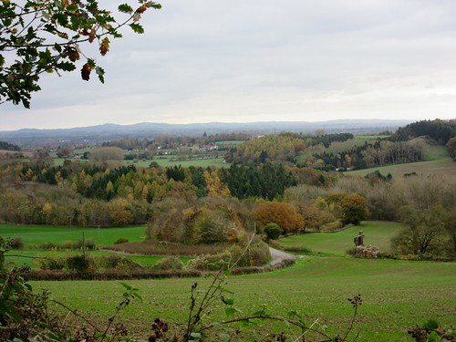
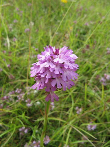
Below Worcestershire Beacon we found the homeward way, a knobbly path along precipitous slopes stained rusty red with last summer’s bracken. Gorse flowers made brilliant golden specks against the dour colours of the winter hills, and the declining sun shot Blakean shafts of silver out of the clouds.

How hard is it? 4¾ miles; moderate/strenuous hill walk; good paths, with some easy ascents

Start: North Quarry car park, North Malvern Road, Malvern WR14 4LT (OS ref SO 771469) – £4.60

Getting there: Rail to Great Malvern station (1 mile). Bus 675/676, Ledbury-Great Malvern
Road: M5, Jct 8; follow signs to Malvern

Walk: Follow uphill track to left of ticket machine. In 600m at post with green, red and blue arrows pointing forward, sharp right (774463) up embanked path. At top, left along Lady Howard de Walden Drive (772464). In 1 mile bear right (769453) up path to summit of Worcestershire Beacon (769452). Continue south round west side of Summer Hill. In ⅔ mile at track crossroads with circular stone marker (769442), sharp left back up stony track. In 750m, at saddle before Worcestershire Beacon by covered bin, fork right (769448) on rutted track. In 300m fork right downhill (771451). In 200m, in low saddle, fork right (771453) across rock outcrop and on. In 300m by bench fork right (772455). Follow track downhill. Just past St Ann’s Well, roadway bends sharp right downhill (771459); cross it here (‘North Quarry’); right along upper track. In 300m, fork left uphill; continue to car park.

Lunch: Picnic, or St Ann’s Well café (01684-560285, stannswell.co.uk)
Open Fri, Sat, Sun 11:30 – 3:30

Accommodation: Mount Pleasant Hotel, 50 Bellevue Terrace, Malvern WR14 4PZ (01684-561837, mountpleasanthotel.co.uk)

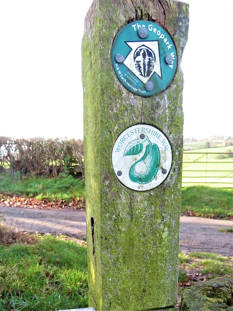
Info: malvernhills.org.uk

 Posted by at 02:00
Jan 232021


First published in: The Times Click here to view a map for this walk in a new window
picture picture picture picture picture picture picture picture picture picture picture
Facebook Link:

Horses in thick winter coats were cropping the paddocks at Berrow Green on a still, cold Sunday morning. Low sunlight crept across the fields, dispersing the last of the early mist, causing the horses’ breath to steam and the post-and-rail fences to cast long skeletal shadows of themselves on the frosty grass.

This country to the west of Worcester is all ups and downs, steep little slopes rising to wooded ridges and falling away into stream clefts where the winter sun doesn’t linger. Walking south from Berrow Green we had the Malvern Hills head-on in front of us, the north end of the range forming an unfamiliar hunchback lump in contrast to the usual prospect of a miniature line of mountains, elegantly extended and rising from the Midland plain.

The woods on Berrow Hill were smoky grey, patched with apricot where the last of the leaves had not yet blown away. On a rise of ground Easinghope Farm stood in solid red brick next to its weatherboarded barn. Seventy black-faced ewes in the farm paddock scuttled away, to stop all together and stare as we went by.

Moss and grass grew in the centre strip of narrow Easinghope Lane. A horse and rider went clopping slowly by. Five fat white turkeys came gobbling and squawking to the gate at Hawksnest Farm, their little pink eyes all agog. We pulled up to admire the eastward panorama over the Worcestershire lowlands, then descended into the steep valley of Bannersbrook.

Treecreepers squeaked their needly calls as they searched for insects hidden in crevices of the oaks and sweet chestnut trees. A trickle in a ferny hollow marked the outpouring of the intriguingly named Nipple Well, perhaps a remedy for mastitis in days gone by.

A sharp climb on slippery oak leaves, and we were up on the ridge of Ankerdine Common with a wonderful view west over the sunlit curves of the Terne Valley. Then down again through the trees to scatter the young ewes in the river pastures around Horsham Farm.

Above the homeward path a pair of redwings perched on the topmost twigs of a young oak, displaying the handsome arch of their pale eyebrows, as the short day’s sun slipped down towards the western woods.

How hard is it? 5¼ miles, moderate; field and woodland paths

Start: Admiral Rodney Inn, Berrow Green, Martley WR6 6PL (OS ref SO 748583)

Getting there: Berrow Green is on B4197 (signed ‘Martley’ from A44 Worcester-Bromyard)

Walk (OS Explorer 204): From pub, right along road. In 150m, left (Worcestershire Way/WW). Follow WW (well waymarked) for 1¾ miles to Ankerdine Common car park (737567) and on down to road (735564). Right uphill. In 200m, left (735566, ‘Sunningdale, Private Road’). In 50m fork left downhill through woods (yellow arrows/YA, green tree markers) to drive (733572). Right to Horsham Farm. Through gate at Lower Horsham Farm (734577); bear right (YA); through gateway (circular ‘public footpath’ waymark). Just past pond, right (gate, YA). In 150m, dogleg right/left (736578, stile, YA); in 15m, right (YA) up hill. In 100m, dogleg right/left (stile, YA). In 150m, through gate in lower field corner (738578). Ahead (fence on left); left at corner of Tinker’s Coppice (740578, YA). Uphill; at top of slope, right (742578, rails, YA) through copse to road (743578). Left; in 100m, right (fingerpost) down fence to stile onto road (745578). Left; right at corner; in 100m, left (fingerpost) across paddock; left (748578) on WW to Berrow Green.

Lunch/Accommodation: Admiral Rodney, Berrow Green (01905-886181, admiral-rodney.co.uk)

Info: Worcester TIC (01905-726311); satmap.com; ramblers.org.uk

 Posted by at 01:49
Apr 072018


First published in: The Times Click here to view a map for this walk in a new window
picture picture picture picture picture picture picture picture picture picture picture picture picture picture picture picture
Facebook Link:

‘Att rising of the sunne,’ said antiquary John Leland, regarding Bewdley at dawn nearly 500 years ago, ‘frome the este the hole towne glittereth, being all of nuy buyldings, as it were of gold.’

Those ‘nuy buyldings’ are venerable now, half-timbered and crooked, leaning along the River Severn like familiar neighbours. There are few signs of old Bewdley, the rough and prosperous river port whose bargemen were so famous for their strength and skill on the water that Nelson’s press gangs frequently invaded the town to march them away for the Navy.

A swan with four cygnets in tow sailed down the bronze-brown Severn and under Bewdley’s graceful old bridge. Cherry blossom was out along the banks as we walked upriver; violets and wood anemones under the trees as we followed rutted woodland paths through the Wyre Forest.

Beside the chuckling thread of Dowles Brook stood long-redundant Knowles Mill, its iron and wooden milling machinery still in situ. A lonely site for a corn mill, but a beautiful one today, with chiffchaffs singing up the spring in the oak tops, and the pink buds of bilberry coming into blossom in the heathery banks of the wood.

I stopped and stared to see a rare duck swimming in the brook – a mandarin, all in ginger and scarlet and white. What was he doing here? Ah – out from the banks swam his steel-blue mate, both birds bobbing their heads as they hunted for a nesting site.

We passed Lodge Hill Farm and headed south among old orchards in blossom, then through woodland cut and coppiced by the Wyre Community Land Trust. The Trust is intent on restoring 300 acres of neglected forest to their former richness of wildlife and of timber production, essential work that goes largely unsung.

At Ribbesford Church the ancient tympanum over the north door showed a huntsman discharging his bow at a ravening mythic beast of the forest. Inside, a bristle-backed boar in medieval stained glass wrinkled his long snout in swinish mirth. We stopped to admire him; then walked the Severn path back to Bewdley, with mergansers pairing off under the river banks, and anemones starring the grasses along the way.

Start: Dog Lane car park, Bewdley, Worcs DY12 2EF (OS ref: SO 785755)

Getting there: Severn Valley Railway (svr.co.uk) from Bridgnorth or Kidderminster
Bus service 2 (Kidderminster)
Road – Bewdley is on A456 (Kidderminster – Tenbury Wells).

Walk (9 miles, easy underfoot, OS Explorer 218.): Left upriver along riverbank footpath. In ½ mile, at bridge abutments (780764), left on path to B4194. Right through former bridge, immediately left (‘Geopark Way’) on path beside old railway. At road (772764) right on minor road for ¾ mile to Knowles Mill (762766).

Left across footbridge (fingerpost/FP). Path goes between mill and cottage, then bend right round end of mill. Don’t cross stile on left, but keep ahead up path above Dowles Brook (yellow arrows/YAs). In 500m, opposite nesting box no. 18 and Lodge Hill Farm, right (760766), down through kissing gate/KG. Bear left up to cross drive (KGs, YA), then old railway. On along path across tussocky ground, then KG (YA) to grassy track (758764). Bear left; over track crossing, keeping pond on left.

In 350m cross forest road (757760); on through trees (YA post). Pass corner of St George’s Farm grounds (756759). In 400m, left at T-junction (755755) past old FP (YAs) and on, soon guided by fence on left. Follow YAs for ¾ mile to pass succession of houses and reach A456 (757742).

Left for 100m (take care!); right (FP) down driveway past water tower. Through gate; bear right along hedge. Stile (YA). In 2nd field, don’t cross stile on right (757738), but continue downhill with hedge on right, over stile, down hedge to enter wood. At far side of wood with house on right (759735, waymark post), turn left; in 40m, fork right (YA) inside edge of wood. In 200m at gate (761735, ‘Keep Out’ notice), bear left (blue arrow/BA) and follow BAs. In 500m, at golf club notice (764739), right (BA). In ¼ mile, at corner of playing field at Park End, left along road (768736, YA).

At Horse Hill Farm (777736), follow road to left; in 300m, fork right off road (780738, YA) and follow waymarked Worcestershire Way/WW for ½ mile to Ribbesford. At lower gate of churchyard, right (787740, BA, ‘Ribbesford Circular Walk’). Left at road (789739); at next corner, right (FP) to river bank; left to Bewdley.

Lunch/Accommodation: Mug House Inn, Severn Side, Bewdley DY12 2EE (01299-402543, mughousebewdley.co.uk) – right on the river

Wyre Community Land Trust: www.wyreclt.org.uk

Info: Bewdley TIC (0845-607-7819); visitwyreforest.co.uk
visitengland.com; satmap.com; ramblers.org.uk

 Posted by at 01:57
Jul 082017


First published in: The Times Click here to view a map for this walk in a new window
picture picture picture picture picture picture picture picture picture picture picture picture picture picture picture
Facebook Link:

Cheerful narrowboaters were drinking and chattering in the sunshine outside the Eagle & Sun at Hanbury Wharf. They lounged under the trees on the banks of the Worcester & Birmingham Canal, their neat blue and red craft moored alongside.

The towpath led away north in a lacy froth of cow parsley. Large bees investigated the inroads of yellow flag flowers, making a soporific bumbling noise.

Reed buntings chattered on the reed stems that fringed the canal, and there was a soft clop-clop of bronze-brown water round the bows of ‘Golden Eagle’ as she negotiated the narrow chamber of Astwood Lock. The lock-keeper’s cottage garden was bright with hollyhocks and granny’s bonnets, old-fashioned cottage garden flowers, and there were roses round the door and gnomes among flowerpots.

From this Wind In The Willows dream of Olde Englande we moved east into fields of barley, wheat and blue-green oats. Webbhouse Farm straddled its low ridge in a huddle of deep-roofed old barns. This is good growing country, the dark red earth full of pebbles smoothed by some antediluvian river.

The sun struck into the glades of Piper’s Hill Wood as we followed a track among enormous old ash and oak trees. Piper’s Hill was once a wood pasture, carefully managed woodland where local commoners enjoyed the rights of pannage (feeding their pigs on acorns) and estover (collecting fallen boughs for firewood). Such uses fell away long ago, leaving a woodland full of mighty trees, ancient and splendidly distorted.

Emerging from Piper’s Hill Wood, we climbed a grassy path to a church perched at the summit. ‘St Mary The Virgin, Hanbury’ said the notice board, but we knew better. Generations of Archers from Ambridge have been married in front of BBC microphones within these crookedly sloping walls, and the bells of ‘St Stephen’s’ have rung out over the Radio 4 airwaves more times than even Joe Grundy can recall.

From the church on its knoll a path led across the broad acres of Hanbury Park. We passed the ornate oriental gates of Hanbury Hall (‘Lower Locksley Hall’ to Ambridge cognoscenti – not too near the edge of that roof, Nigel!) and walked homeward across hayfields full of the smell of new-mown grass.

Start: Eagle & Sun PH, Hanbury Wharf, Worcs, WR9 7DX (OS ref SO 922629)

Getting there: Bus 354 (Droitwich-Redditch).
Road – Hanbury Wharf is on B4090, just east of Droitwich (M5 Jct 5; A38)

Walk (6 miles, easy underfoot, OS Explorer 204): North along canal towpath for 1½ miles. 150m beyond Astwood Lock, right through kissing gate/KG (937651); follow ‘Hanbury Circular Walk’/HCW across field. Cross road (942652) and on. In ¾ mile, left across footbridge (951651); fork right along field edges to enter Piper’s Hill Wood (956649). At track, right (HCW). In 200m, bear right (956648) on broad track to Hanbury Church on hill (954644).

From churchyard gate, HCW points downhill. Right at junction; left (KG); across meadow, down oak avenue and on. Pass Hanbury Hall (945637); in next field, bear away from boundary wall/haha on right), keeping straight ahead across wide meadow to road (941632). Right (HCW) past pond, through trees, through KG. Right along hedge to waymark post; left along hedge; in 150 m, right through hedge to NE corner of Lady Wood (937633, HCW).

Diagonally right up field slope to skirt south end of pond on ridge (935634); same line down to KG; sunken lane down to drive (933636). Left; in 100m, right through gate (932635, HCW); down field edge to cross railway (929635); left along canal to Hanbury Wharf.

Lunch: Eagle & Sun, Hanbury Wharf (01905-799266, eagleandsundroitwich.com)

Accommodation: Vernon Hotel, Droitwich Road, Hanbury B60 4DB (01527-821236; thevernonhanbury.co.uk)

Walk guide: download at worcestershire.gov.uk/download

Hanbury Hall: nationaltrust.org.uk/hanbury-hall-and-gardens

Info: Droitwich TIC (01905-774312)
visitengland.com; satmap.com; ramblers.org.uk

 Posted by at 01:27
Mar 192016


First published in: The Times Click here to view a map for this walk in a new window
picture picture picture picture picture picture picture picture picture picture picture
Facebook Link:

A cold, still day of early spring, with the clouds layered in motionless lines over the Worcestershire hills. The low whine of an organ from the red sandstone Church of St Kenelm heralded the end of Matins as we left Clifton-upon-Teme and headed out over pale pink ploughland. Down in the steep wooded cleft of Witchery Hole, dog’s mercury had taken over the world, a brief flush of tiny green flowers at the crack of spring before the primroses and wood anemones had got properly into their stride.

The Teme is a beautiful river. A.E. Housman called its landscape ‘the country for easy living, the quietest under the sun’, and there’s something leisurely and seductive about the slow green flow of the river, the miniature red cliffs of its steep banks and the winding valley it has smoothed out under high ridges of hard limestone. We walked upstream along the river to Brockhill Court with its stumpy old oasts (this was hop-growing country once upon a time) and red brick barns where a tawny owl was softly hooting.

A series of shallow billowing valleys led up to a little wood. We sat to eat our buns and cheese, watching a pair of tree creepers scuttling up an ash trunk, their neckless heads tucked down into their shoulders as they picked insects from winter shelter in the cracks of the bark.

On up past Hillside Farm with its three architectural eras all jammed improbably together; a steep little burst up to the ridge, and then three glorious south-going miles along the Worcestershire Way, hurdling the dips and striding along the crests with a broad plain stretching out eastward, and the Teme to the west running unseen in its lumpy green valley far below. We saw frogspawn in thick clumps in a pond at Woodbury Old Farm, smelt a whiff of wild garlic on the rim of a petrol-blue flooded quarry, and heard the first chiffchaff of the year in the woods on Pudford Hill.

Down in the valley we recrossed the dully glinting Teme and went up a long bridleway towards Clifton-on-Teme, with the pocket mountain range of the Malvern Hills rising in the south, smoky grey and insubstantial in the last sunlight of the March evening.
Start: Lion Inn, Clifton-upon-Teme, Worcs, WR6 6DH (OS ref SO 714616)

Getting there: Bus 308, 310 from Worcester
Road – Clifton-upon-Teme is on B4204 between Martley and Broadheath (M5, Jct 7; A44 west)

Walk (9 miles, strenuous, OS Explorer 204): Take signed footpath between Lion Inn and church. Follow yellow arrows (YA) into field. On far side, over left-hand of 2 stiles (716617). Ahead with hedge on left. At field end, left over stile (718619); follow hedge on right. In 50m, right over stile (YA); on to cross lower stile (YA). Aim across field to right-hand corner of Harrisfield house (719621); bear left around house, and on down to cross stile into woodland (720623). Right along waymarked track, steeply down Witchery Hole for ½ mile to road (728624). Right, then left across New Mill Bridge. Left (729625) along east bank of River Teme for ¾ mile to road at Brockhill Court (728635).

Right at foot of drive (YA) through gate. Up and through next gate; right (YA) into shallow valley. Bear half right to gate (731639, faded YA). Follow valley bottom NE to stile into wood (735642). Follow path clockwise to cross stream (736642); 50m up the far bank, bear right to leave wood over stile (737643). Aim for far top corner of field (738644); over stile, and follow fence on left. Just past Hillside Farm house, left through gate (739645) onto drive; right to road (741646).

Cross road onto waymarked Worcestershire Way/WW; follow it south for 3 miles to B4204 (743608). Right (take care!) for half a mile to cross River Teme by Ham Bridge (737611). First right after bridge (‘Shelsleys’); pass 2 houses, then left (736611) up bridleway. Climb through wood; in 400m, at top of first rise, dogleg left/right through gate (732612, blue arrow, ‘Sabrina Way’). Continue uphill with fence on right for 1 mile to Church House Farm. Left to road (717615); right to Lion Inn.
Conditions: Strenuous walking, plenty of up-and-down. Steep, slippery, and many steps in Witchery Hole wood.

Lunch/Accommodation: Lion Inn, Clifton-upon-Teme (01886-812975) – friendly, clean village inn.

Information: www.temetriangle.net

visitengland.com; satmap.com; ramblers.org.uk

 Posted by at 01:38
Dec 122015


First published in: The Times Click here to view a map for this walk in a new window
picture picture picture picture picture picture picture picture picture picture picture picture picture picture
Facebook Link:

On a short winter’s afternoon in Worcestershire I set off from the Manor Arms at Abberley to go wherever the waymarked Abberley Circular Walk might lead me.

The old village of Abberley is a thoroughly charming place of red brick cottages and timber-framed farmhouses, cradled among steep wooded hills. I climbed away up the flank of Abberley Hill, where sheep as tame as dogs came trotting up to have their ears scratched and their bouncy fleeces patted.

Up at the crest, the Abberley Circular Walk joined hands with the Worcestershire Way and ran away east along the narrow spine of Abberley Hill among bare woods of sycamore and sweet chestnut. A view opened south through leafless trees across green farmland to the miniature mountains of the Malvern Hills, ancient jagged peaks, pale mauve under a streaky gold sky.

Down by the side of Shavers End quarry the path grew slippery over fallen leaves. There was a glimpse between the trees of a giant abandoned delving with flooded pits and great sections sliced out of the hillside. Aymestry limestone for road-building was extracted here in thousands of tons from strata over 400 million years old, contorted and sandwiched and turned upside down by gargantuan upheavals in the earth’s crust, nowadays so solid and immobile-seeming.

Down at the northern end of the hill the Abberley Circular Walk couldn’t quite make up its mind what to do. I followed the narrow road, and soon saw the path dipping away decisively along the edge of red ploughlands and sheep pasture towards the pond at Netherton House. Here the Abberley Circular Walk dropped hands with the Worcestershire Way and set off through the steep fields for home.

I passed a hop field – a rare sight only a few years ago, but now on the increase thanks to the success of the microbrewery industry. Long straight lines of pergolas carried a tangle of brown tendrils, the few unharvested hop flowers yielding an oily fragrance when pinched between finger and thumb.

Back in Abberley, the chancel of St Michael’s is all that remains of the village’s 13th-century church. Here I found a Green Man with leafy side-whiskers, and a curious epitaph to a shy 17th-century lady, ‘a Person of Extraordinary Faith, high Generosity and great Charity, mixed with extreme secrecy & modesty, as if her left hand knew not what her right hand did.’
Start: The Village, Abberley, Worcs WR5 6BN (OS ref SO 753679)

Getting there: Bus 758, Worcester to Abberley Stores (½ mile)
Road: M5 Jct 5, A38 Droitwich bypass; A4133 to Holt Heath; A433 through Great Witley. In another mile, right on B4202; in ½ mile, right to Abberley Village.

Walk (5 miles, moderate, OS Explorer 204. Online maps, more walks at christophersomerville.co.uk): From Manor Arms, cross road (‘Shavers End’); right up lane (‘Wynniatts Way’, ‘Abberley Circular Walk’/ACW). In 100m, left (ACW) through gate; follow ACW up field, steeply up through woods to road (751674). Right (ACW); in 150m, left along Worcestershire Way/WW. Follow WW for 2 miles to road beyond quarry (771682); left along road. WW deviates from map route here – follow it along road for 350m, then right (WW, ACW) down hedge and continue to Netherton House (764688). WW turns right here, but go left and follow ACW waymarks back to Abberley.

Conditions: Some steep, slippery sections of Worcestershire Way in woods

Abberley Circular Walk:
worcestershire.gov.uk/downloads/file/5208/abberley_circular_walk_leaflet

Lunch/Accommodation: Manor Arms Inn, The Village, Abberley (01299-890300, themanorarms.co.uk) – friendly, warm and stylish

Info: Droitwich TIC (01905-774312)
visitengland.com satmap.com; ramblers.org.uk

 Posted by at 01:37
Sep 282013
 

Sparrows were chirping in a bright morning over north-west Worcestershire as we left the cheerful Tally Ho Inn and plunged out into a wide rolling landscape with the Herefordshire hills lumped blue and cloudy in the south-west.
First published in: The Times Click here to view a map for this walk in a new window
picture picture picture picture picture picture picture picture
Facebook Link:
A big dark hare sprang up almost underfoot and dashed away across a newly mown hayfield, yellow-green and stubbly. This was exhilarating walking, like striding across the backs of great solid waves.

Hanley Child lay at the foot of orchard slopes, a clutch of medieval houses and outbuildings, timber-framed under tiled roofs. By Town Farm sheep came bleating across a field, their phlegmy voices loud and manic. The farmer hurried to block their escape through the gate. ‘Out walking? Yes, it’s lovely round here. A hidden treasure – or so they tell me,’ he smiled wryly.

We descended a nettly and brambly bank to Stonyford, and took the track to Norgrove where cherries hung heavy in the orchard, their colours a spectrum from creamy yellow through tangerine to boot-polish crimson. Beyond the house lay tangled woods and the long, man-made lake of Kyre Pool, centrepiece of an 18th-century landscaped park, perhaps the work of Capability Brown. The multiform house dates back in part to Plantagenet times and looks out on gardens, lawns and pools.

In the adjacent church we found a very beautiful and simple 14th-century painting of a haloed saint, holding in her left hand a book or box, in her right an orb or perhaps a circle of light from a lamp. The red ochre figure is the preliminary sketch made by the artist; the brilliant pigments with which he embellished the saint have all faded or fallen away, and only this ghost of his first inspiration remains.

We turned for home by way of The Grove farmhouse with its early Dutch gable, and the old moat at Bannall’s Farm sunk in a thicket of oak and ash. The farm dogs barked us in and nuzzled us out, down the lane to Coppice House, and along the edges of barley fields. On the hill above Woodstock Bower a great silky-coated bull was roaring softly. ‘He won’t hurt you,’ reassured the farm worker who bounced up in his buggy. ‘He’s got a bad hip, that’s all, and the young heifers won’t leave him alone. I’ll walk you across the field, if you like,’ and he did so, with proper old-style courtesy.

Start: Tally Ho Inn, Broadheath, Worcs, WR15 8QX (OS ref SO 662655)

Getting there: Broadheath is on B4204 between Tenbury Wells (A456) and Clifton-upon-Teme

Walk (8½ miles, easy/moderate, OS Explorer 203): Over stile in left corner of Tally Ho’s car park as you face the road. Down field, aiming for lone tree at bottom. Up far slope, aiming right of bushy patch to right of Hill Farm. Follow hedge right to stile in corner (655654, yellow arrow/YA). Diagonally left to bottom left corner of field (stile/YA); diagonally down to gate at far bottom corner (652653). Left along lane (blue arrow/BA), through gate and on past Court Farm, Hanley Child; at fork, right to junction by Town Farm (648651).

Left; in 100m, right over stile; right along hedge to stile (YA); down jungly bank to road at Stonyford (645650). Left to cross river; in 150m, ahead through gate (fingerpost). Diagonally left through cherry orchard to gate near Norgrove house (639649). YA points left to bottom of orchard. Right over stile (YA), across bottom of garden, clockwise round lawns to go through gate at top left corner of garden. Diagonally left through adjacent gate; half left down slope; cross stile (637649, BA) into trees. At T-junction of paths, right for ⅓ mile to reach Park Pale track beside Kyre Pool dam (631649). Left across dam, follow track for ¾ mile to B4214 (629639).

Cross road; left along it for 200m; right (‘Kyre Park Gardens’) on minor road. In 350m, turn right for Kyre Church and Kyre Park Gardens, or to continue walk, turn left here (627635, fingerpost) along track by walled garden. Pass cottage (628633); on up left side of garden to cross footbridge. Left to recross B4214 (630633). Down drive opposite (‘Bridleway’); pass The Grove and keep ahead (635632) along rutted track (BA). At bottom of slope, left through gate (636634); aim half right across field (BA) to go through gate on far side (639636). Right along hedge, through gap; ahead across field, up next field’s hedge to pass moat (643638).

At Bannall’s Farm (644638), left down stony lane, following BAs. Through gate by Coppice House (643641); on through trees. In 150m, reach 2 gates; through right-hand one (643642); on by fence along bottom of garden. Through gate at end, and on through a series of horse gates. Climb bank; on along field edge, following BAs for nearly ½ mile. Nearing Woodstock Bower, path forks; take upper (left) one. In 150m, just before gate, left over stile (654642, YA); climb bank. Cross stile at top; follow wood edge round to right; cross stile, up bank to turn left over track at top of hill (656644, fingerpost). Cross fields, then drive; through gates (YAs) to cross road (657646; stile, fingerpost). Over field to Broach Cottage (660647); left up drive to cross road (659649, fingerpost). Follow hedge on right; right over stile in top corner (660651, YA); bear left clockwise round garden edge. Cross stile in top right corner; ahead between fence and hedge to road (662651); left to Tally Ho.

Lunch/Accommodation: Tally Ho Inn, Bell Lane, Broadheath, near Tenbury Wells (01886-853241; tallyhorestaurant.co.uk) – cheerful country pub with good clean rooms.

Info: Tenbury Wells TIC (01584-810136 or 01684-892289)
www.ramblers.org.uk www.satmap.com www.LogMyTrip.co.uk

 Posted by at 11:27
Aug 062011
 

A E Housman was probably sublimating when he wrote in ‘A Shropshire Lad’ of lying with a girl in summertime on Bredon Hill.
First published in: The Times Click here to view a map for this walk in a new window
picture picture picture picture picture picture picture
Facebook Link:
He wasn’t really that sort of chap, by all accounts. Jane and I would have got pretty wet if we’d tried it under the troubled sky that the weather forecaster was glooming over today, with rain showers scudding in from the Bristol Channel. But you just can’t abandon an expedition up Bredon, however ominous the forecast. The hill tugs at you like an impatient companion – Housman got that right. And everything turned out bright and breezy anyway, as it happened.

Above the village of Elmley Castle we climbed smooth parkland fields past tremendous storm-shattered old oaks. Up the back slope of the hill past the high, bracken-smothered earthworks of Elmley Castle itself – the Norman castle’s stones were recycled to mend Pershore Bridge in Tudor times. Up through ancient woods full of the tall spikes of pungent woundwort and lace-like enchanter’s nightshade (fabulous name). Up to the ridge that curls round the edge of Bredon Hill’s 900-ft escarpment, and along to the flowery ramparts of a sprawling Iron Age hill fort.

There’s no exhilaration on earth like striding the walls of a hill fort with the wind bashing you and a 50-mile view to stun you speechless. Cotswolds in the east, Malverns in the west. South to Oxenton Knoll, down which they used to roll a fiery wheel to see if the new year would bring good luck. North-west to the Clents and the far-off Clee Hills that so enchanted Housman – a Worcestershire lad, in unromantic fact. The larks he wrote about were up on Bredon Hill today, and so were masses of wild flowers: yellow and white lady’s bedstraw, mats of wild thyme, rockroses with papery yellow petals; harebells, scabious, a single pyramidal orchid in the ditch between the ancient fort’s ramparts.

Up at the summit of the hill we found the Banbury Stone, shaped like a crusty old elephant couchant, and the grim little tower called Parson’s Folly that a local squire built for himself. One more gaze round the best view in the Three Counties, and we were bowling back down the slopes to Elmley Castle and the neat parlour of the Queen Elizabeth inn, everyone’s dream of a proper country pub.

Start & finish: Queen Elizabeth PH, Elmley Castle, Worcs WR10 3HS (OS ref SO 982411)

Getting there: Bus service 565 Evesham-Worcester. Road – M5, Jct 9; A46 (‘Evesham); just after junction with B4078, left to Elmley Castle.

WALK (7 miles, moderate grade, OS Explorer 190):
From Queen Elizabeth PH into churchyard. Keeping church on right, follow wattle fence to cross foot of pond (982410). Cross stile (yellow arrow/YA), follow field edge round 3 angles. In 500 m, just before corner, turn right over plank bridge and stile (985405). Aim for far left corner of parkland field (985402). Left over stile and footbridge; right (blue arrow/BA) through metal gate and up grassy track. In 100 m, right across footbridge (984401). Don’t fork left up bank, but keep ahead on clear dirt track. In 400 m cross footbridge (981400); bear left (BA) uphill. Keep fence on right, up through woods to T-junction of tracks at top of hill (974395). Right beside wood; keep to ridge track, ignoring side tracks. At end of wood, keep ahead with fence on left (967403, BA) for ¾ mile to pass Elephant Stone and Parson’s Folly (957402). Continue beside wall to enter trees. In 100 m, on right bend with BAs, turn even sharper right (952398, YA) down through trees, over gate stile and on down slope. Follow YAs on posts for ¼ mile to gravel drive (952405); left downhill for 2 fields, then right (949408; ‘Private Estate – footpath’) along stony track (YAs) for ½ mile. At water trough, left (957411, YA) downhill with fence on left. At kissing gate (954415) leave fence and fork a little right; follow hedge on right down to road (953418); right into Great Comberton.
At top of hill by ‘Pershore, Bredon’ road sign (954420), ahead along footpath (fingerpost) to enter churchyard. Right along wall to road; right for 50 m past Bredon House; left (955420; ‘Elmley Castle 1½’) on footpath through fields (YAs). After nearly a mile, ignoring all side tracks, reach a bridleway (970418; BAs left and right). Right for 30 m; left through kissing gate (YA) and on. After 3 more fields, pass through kissing gate (976416); in 4th field, keep to right hedge; in 100 m, right over stile (YA). Follow YAs for 3 more fields and through farmyard. Through 2 gates to left of barn; right behind barn to road (980413); left to Queen Elizabeth PH.

Conditions: Many stiles, some tall and awkward

LUNCH: Queen Elizabeth PH (01386-710419) – proper country pub

INFO: Evesham TIC (01386-446944); www.visitworcestershire.org
www.ramblers.org.uk www.satmap.com www.LogMyTrip.co.uk
Click on Facebook “Like” link to share this walk with Facebook friends.

 Posted by at 05:12
Mar 022013
 

The view from the sandstone peak of Kinver Edge on this brisk, sunny morning was utterly sensational. First published in: The Times Click here to view a map for this walk in a new window
picture picture picture picture picture picture
Facebook Link:
It was all there, spread at our feet like butter on a green and lumpy pancake – the Worcestershire plains stretching away south-east, the quarried prow of Titterstone Clee and the amorphous lump of Brown Clee standing up far to the west, and dead in the south the pale blue humps of the Malvern range floating on a surf of mist.

Eventually we tore ourselves away and went south along the ridge, following the broad pebbly track of the Staffordshire Way as it wound between the mossy tree trunks, with tremendous views over the precipitous drop of Kinver Edge’s west flank. A side path brought us down through conifers, and on along a green lane by the balustraded Italianate tower of Blakehall House. Two horses with beautiful feathery legs went snorting impatiently by – ‘Irish cobs,’ said their owner, ‘they don’t like to stand still!’

Just here, hidden in the ground somewhere under our boots, ran the 3-mile complex of Drakelow Tunnels, ghost-haunted by local reputation, the remnants of a Second World War ‘shadow factory’ built well away from the bombed-out Black Country to manufacture Rover aircraft engines. Climbing back to Kinver Edge, we fancied we could hear the hollow boom of the tunnels. A northward stretch past the well-concealed cave called Nanny’s Rock – once home to a ‘cunning woman’ who could cure your ailments and tell your fortune – and we were dropping down towards the remarkable cliff dwellings of Holy Austin Rock Houses.

Burrowed into the rich red sandstone, their outer surfaces smoothed into house walls, windows and doors cut out, floors quarry-tiled, the Holy Austin houses have been dwellings since time out of mind, certainly since pre-Reformation days when resident Augustinian hermits gave them their name. At the turn of the 20th century Rose and Harry Shaw raised 10 children here – mostly boys, so boisterous that Mrs Shaw would banish them outside during the day. J.R.R. Tolkien knew the place, and it may have prompted him to imagine the tunnel homes of Hobbiton. The children playing Bilbo Baggins and Smaug the dragon around the rock houses this afternoon certainly seemed to think so.

Start & finish: National Trust car park on Compton Road, just west of Kinver, DY7 6DL approx (OS ref SO 836836)
Getting there: Bus 228 (networkwestmidlands.com) Stourbridge-Kinver. Road: Kinver is off A458, 3 miles west of Stourbridge.
Walk (4½ miles, moderate, OS Explorer 219): From NT car park, cross clearing with oak tree. Uphill to right – not path with red arrow, but with post labelled ‘Car Park’. At top of slope (834835), left (‘Viewpoint’ fingerpost, ‘Staffordshire Way’/SW) up path and steps to viewpoint (836834). Right (south) along SW (red and orange waymarks). In ¾ mile, go through barrier (829822). By seat, North Worcs Path/NWP continue ahead (fingerpost); but bear left downhill here (angled yellow arrow/YA). In 150m, right (831822, YA) on track through conifers. In 300m, 5 paths meet (831820) – there’s a seat on your right and a post pointing left to a path marked ‘Woodpecker, Nuthatch Trails’. Take path immediately to right of this one – i.e. straight ahead. In 200m, through barrier (831818; ‘No cycling, no horses’); in 250m, ahead (‘Cookley 1) to road in Blakeshall (831813).

Turn right; in 30m, right along green lane with houses on left, to road (829812). Right; in 50m, fork right on sandy track past lodge of Blakeshall House. On along sandy track. In 500m, right through barrier (825812; NWP), along path through conifers. In 500m, in a dip, right through barrier (825817; NWP). At top of slope. left through barrier (828817; YA, NWP, ‘Coal Tit Trail’). In 200m, at grassy reservoir (828819), right; in 30m, left (YAs, NWP). In 300m NWP meets SW at fingerpost (829822). Left here down slope; in 50m bear right (north) keeping parallel with SW above and passing Nanny’s Rock cave (830826). In another ⅓ mile (832831), ahead over crossing of tracks (not left downhill, or right up steps), up slope ahead, over brow and down to path crossing. Fork left (orange waymark). In 400m fork right (‘Rock Houses’/RH post); follow RH to car park. Rock Houses (836836) are just beyond.
NB Excellent directions of a very similar walk at walkingbritain.co.uk

Lunch: Bell & Cross PH, Holy Cross, Clent DY9 9QL (01562-730319; bellandcrossclent.co.uk)
Holy Austin Rock Houses Tea Rooms: 11-4, Thurs-Sun
Holy Austin Rock Houses: 2-4 Thurs, Fri; 11-4 Sat, Sun
More info: nationaltrust.org.uk/kinver-edge; enjoystaffordshire.com
www.ramblers.org.uk www.satmap.com www.LogMyTrip.co.uk
Click on Facebook “Like” link to share this walk with Facebook friends.

 Posted by at 01:21
May 012010
 

First published in: The Times Click here to view a map for this walk in a new window
picture picture picture picture picture picture picture
Facebook Link:

A table full of cheery Midlands pensioners were getting to work on their ice cream sundaes as Jane and I left the Barley Mow and set off across Milford Common into the woods of Cannock Chase. Tits and finches whistled in the treetops, and our boots stirred a litter of weightless leaves. The woodland ponds lay cold and black, mirrors of a long winter sent packing by a few mild days of spring that had brought sticky buds to the ash trees and a gleaming sheen to the leaves of as-yet-unbroken daffodils.

Cannock Chase, an ancient no-man’s-land of hummocks and hollows, mine heaps and quarry scoops, has been greening over for centuries. This is what the neighbouring Black Country would look like if the Industrial Revolution had not ravaged it so thoroughly. Nowadays the diggings and delvings of the Chase hold a mosaic of spring-fed meres and tussocky bogs, threaded by a maze of paths. We followed the Heard of England Way, then the Staffordshire Way up sandy rides flanked by venerable, deeply fissured silver birches, and by bilberry bushes whose every green shoot had been nibbled down to the woody root by hungry deer in their end-of-winter starvation.

The Chase is a place to get lost in, a wanderer’s paradise where a million West Midlanders come for recreation and are never seen again – not by Jane and me today, anyway. We sat on a bilberry bank to admire a haze of purple and gold willow shoots, lingered under the slopes of Harts Hill to hear a wren boldly chittering for a mate, and hopped the stepping stones in the Sher Brook to our hearts’ content. Dogs splashed after sticks in the pools of Sherbrook Valley, and over in Abraham’s Valley a great spotted woodpecker flashed scarlet, white and black as he gave a hollow oak a battering.

From the green enclosures of Cannock Chase we emerged into the open country through which the River Trent snakes round the northern edge of the Chase. The sky expanded, the ground smoothed out into broad, flat river meadows in which the mansion of Shugborough Hall lay like a giant wedding cake on a croquet lawn. You can’t have a Midland scene without canals, and so it turned out here – the Trent & Mersey to carry us north along its towpath to Haywood Junction, the Staffordshire & Worcestershire to lead us past grebe-haunted reedbeds and fields of spring lambs to the Barley Mow and the borders of Cannock Chase once more.


Start & finish: Barley Mow PH, Milford, Stafford (ST17 0UW) – (OS ref: SJ 973212)

Getting there:

Train: (www.thetrainline.com, www.railcard.co.uk) to Stafford (4 miles); Arriva bus 825 (Stafford – Rugeley) to Barley Mow (info: 0871-200-2233 ww.arrivabus.co.uk)

Road: On A513, Stafford-Rugeley.

Walk: (8½ miles, easy, OS Explorer 244):

Cross A513; left along Milford Common. Opposite Shugborough Park gates, 2 paths diverge (975210); take further one (bridleway fingerpost) past one pond to another (974207). ‘Heart of England Way’ (fingerposts) to Mere Pits (978201); left (‘Trail 5, Punchbowl’); in 250 yards, right on Staffordshire Way (981202) for 1 1/3 miles. At pools (986186) left across Sher Brook; up and over into Abraham’s Valley. Left (999186) for 1 1/3 miles (blue arrows) to car park. Follow road across A513 (004207) to Navigation Farm bridge (004213). Left along Trent & Mersey Canal to Great Haywood Junction (995229); left along Staffs & Worcs Canal to Tixall Bridge (975216). Left down road to Milford Common and Barley Mow PH.

Lunch: Barley Mow PH (01785-665230)

Info: Stafford TIC (01785-619619; www.enjoystaffordshire.co.uk); www.visitcannockchase.co.uk

www.ramblers.org.uk

 Posted by at 00:00