Search Results : yorks

Dec 122020


First published in: The Times Click here to view a map for this walk in a new window
picture picture picture picture picture picture picture picture picture
Facebook Link:

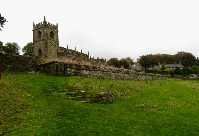
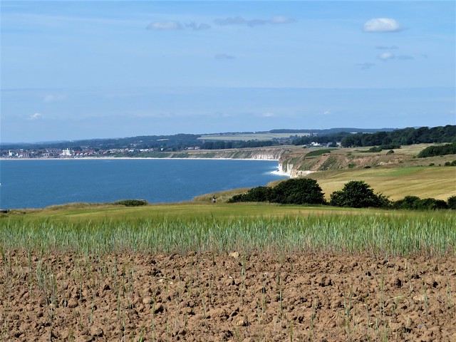
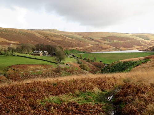
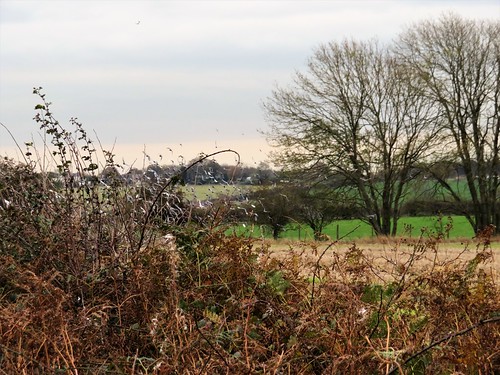
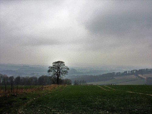
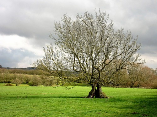
Railway, road and river all wriggle close together through the Ribble Valley at Long Preston. Lumpy fells flank the elongated village on the east, and we were headed up there on a peerless day of unbroken blue sky over the western fringes of the Yorkshire Dales.

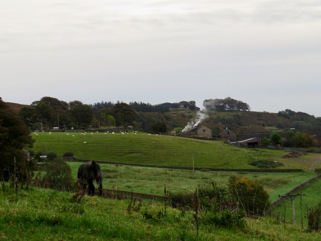
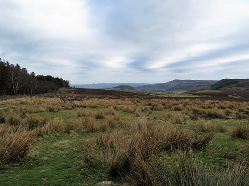
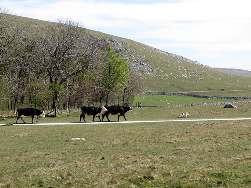
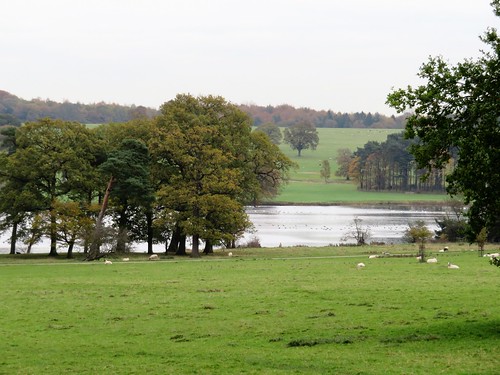
We watched a train of thirty thundering goods wagons crawl its way through Long Preston station. Then we made for Scaleber Lane and a long, gentle climb northwards with the midday chimes sounding below. The stone walls along the lane were hip height, giving views over undulating pastures where somnolent cattle dozed out the day.

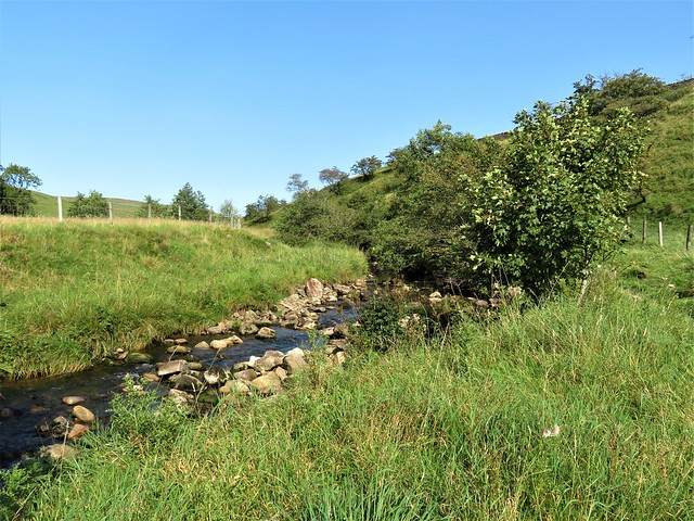
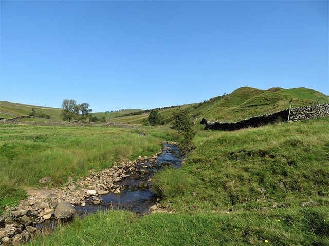
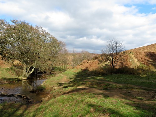
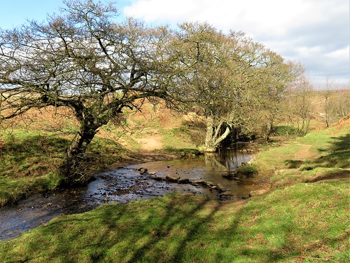
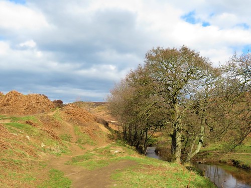
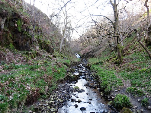
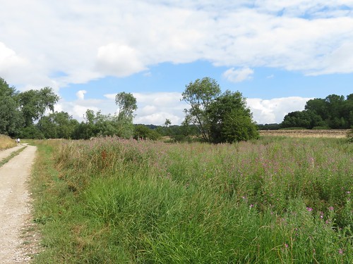
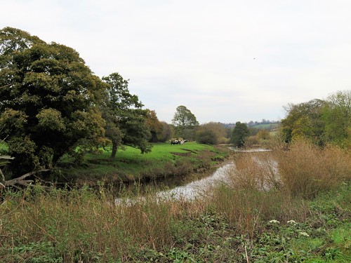
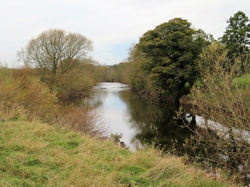
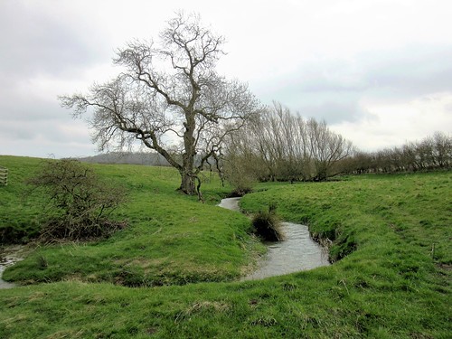
We crossed Long Preston Beck in its rocky bed and went upstream. A pair of scarlet crab claws lay unexplained on the bank – someone’s esoteric picnic, or a titbit let drop by a far-wandering gull? A kestrel floated overhead, pursued by a crowd of tiny birds; perhaps it would fancy a crab snack.

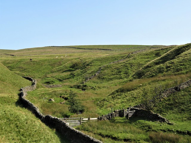
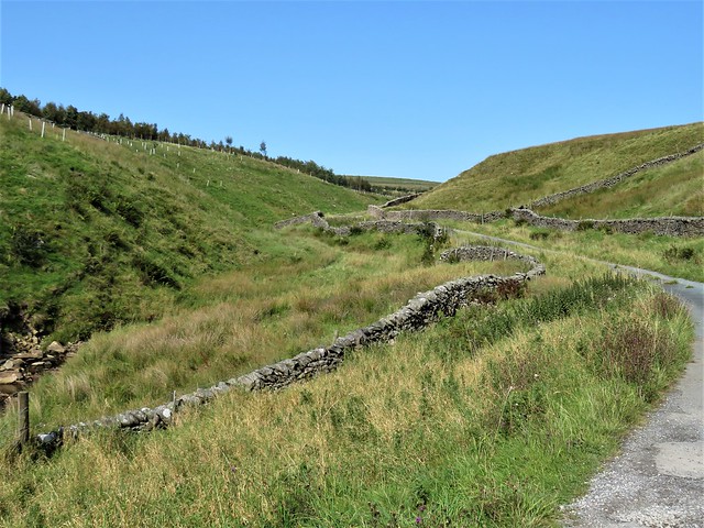
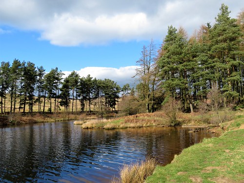
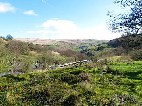
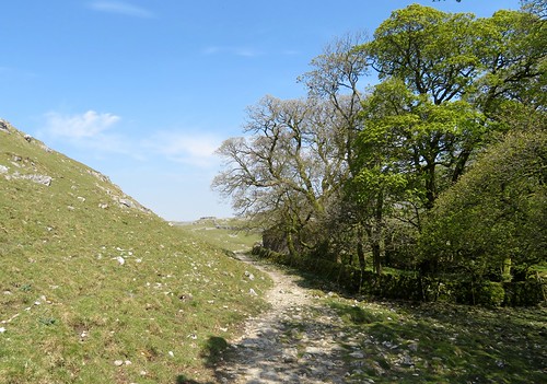
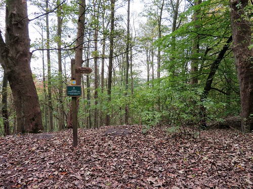
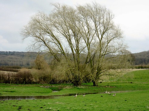
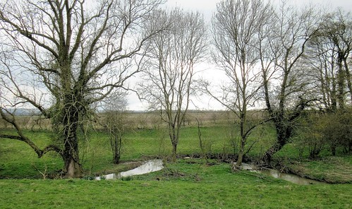
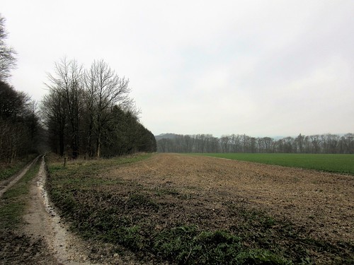
Stepping stones across Bookil Gill Beck brought us to Langber Lane, an old walled lane running confidently north. In Langber Plantation a tree creeper inched up a pine trunk, snicking insects out of their hiding places behind the pink bark scales. Stonechats and whinchats bobbed on the walls beyond, their heads ceaselessly turning, spying out the land for food or danger.

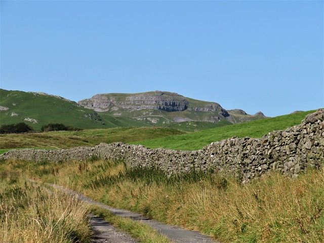
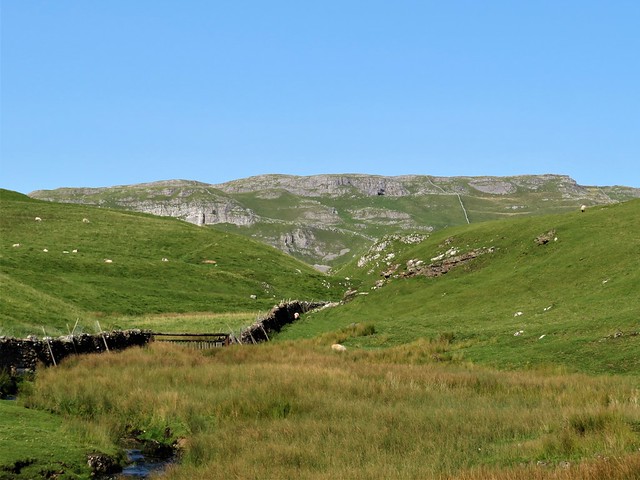
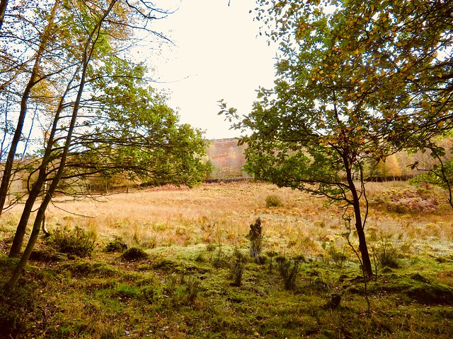
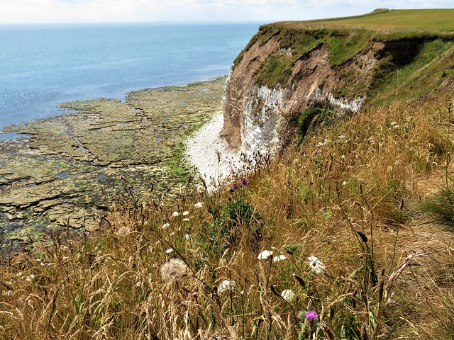
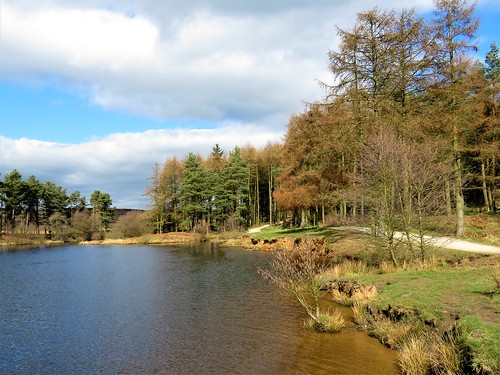
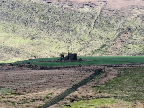
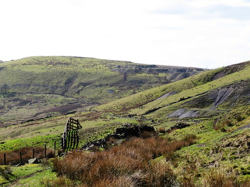
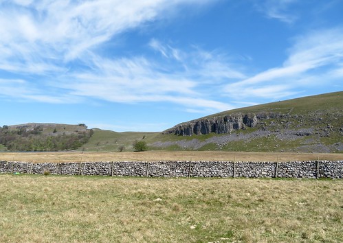
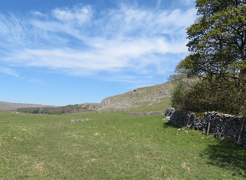
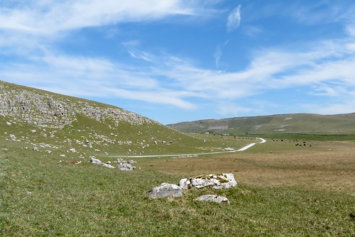
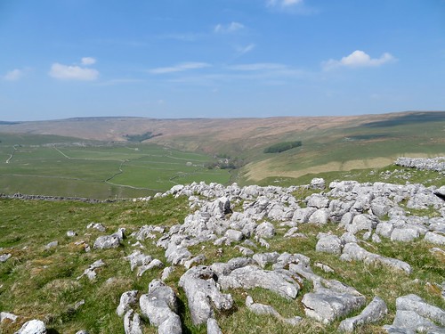
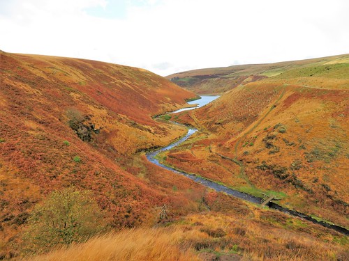
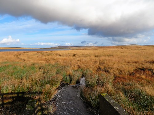
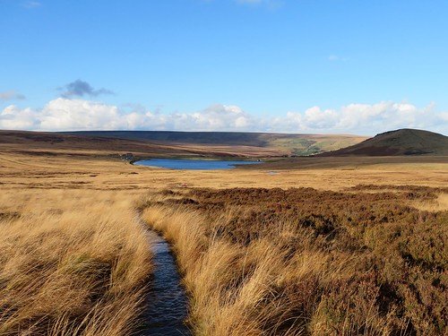
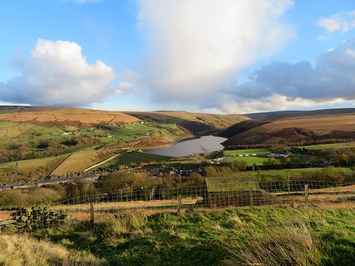
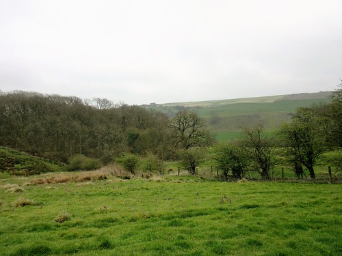
Pale knobbly ramparts of limestone appeared ahead, Warrendale Knotts and Attermire Scar. Below them Stockdale Beck cut through the outcropping strata, tumbling in long hissing tails of white water down tall steps of limestone in a water-delved gorge.

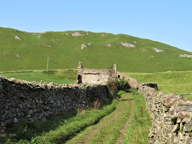
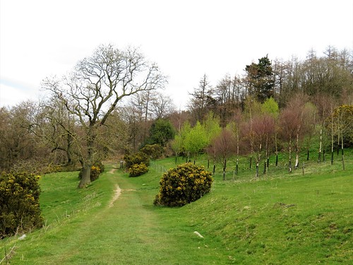
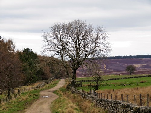
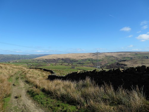
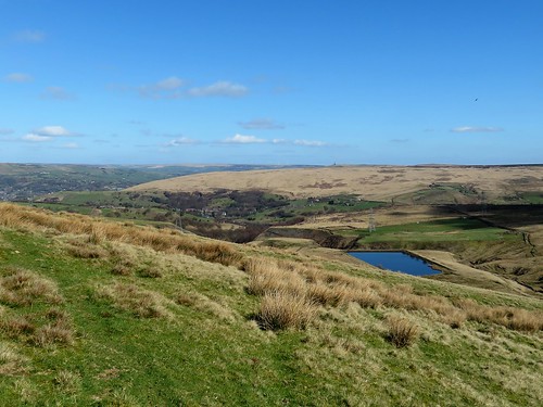
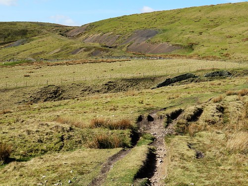
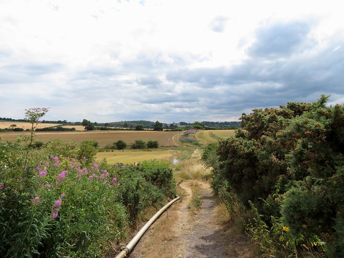
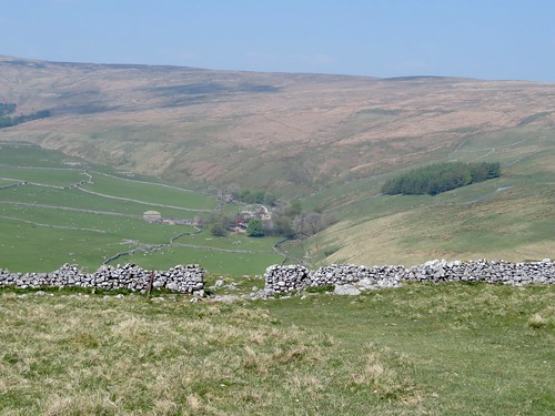
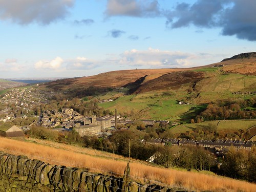
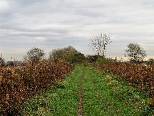
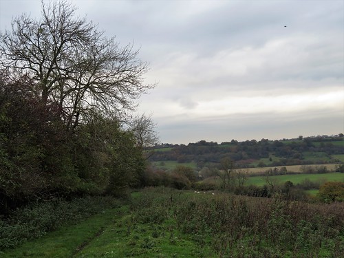
From the heights another walled way, Lambert Lane, ran south through sheep pastures to meet Edge Lane, the old hill road from Long Preston over to Settle. Today in warm sunshine the gritstone walls and the sandy track sparkled cheerfully. In proper old-time winter weather the bumpy and winding hill road must have been a fearsome prospect for drovers and benighted travellers.

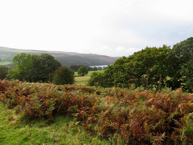
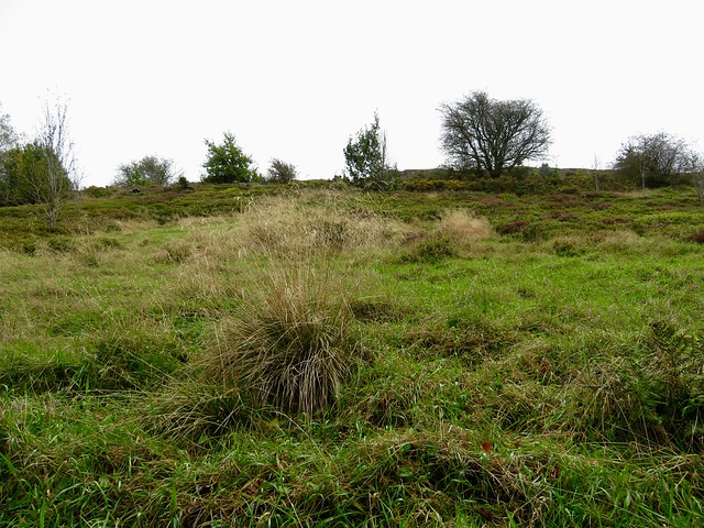
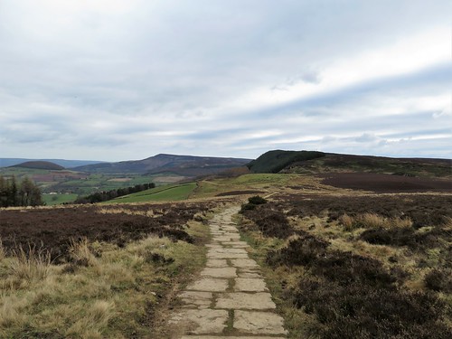
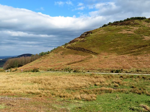
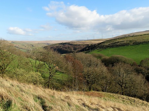
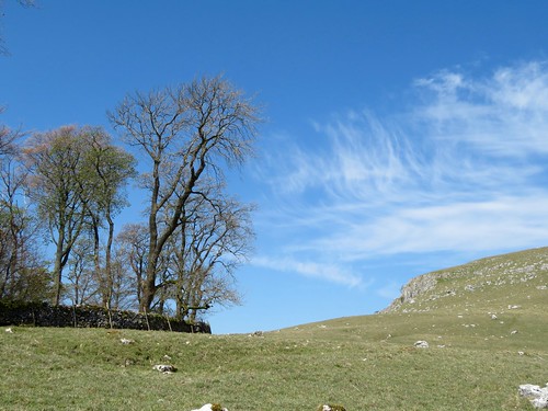
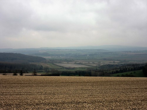
Edge Lane rose to the heathery heights of Hunter Bark, highest point on the old road. We stood and stared round at the 50-mile view – Ingleborough flat-topped in the northwest, the long green stretch of the Craven lowlands running away west, and down in the southwest the hummocks of the Bowland Fells and the grey upturned hull of Pendle Hill, all under a sky of unblemished china blue.

Start: Long Preston railway station, near Settle BD23 4RY (OS ref SD 834579)

Getting there: Rail to Long Preston. Bus 580, 581, 582 (Settle).
Road – Long Preston is on A65 (Settle-Skipton)

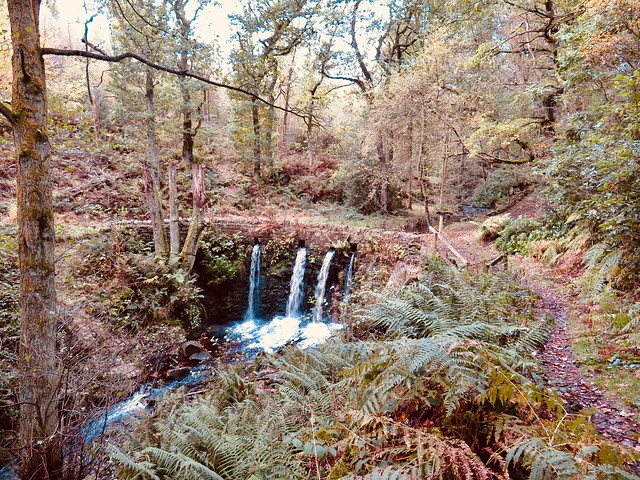
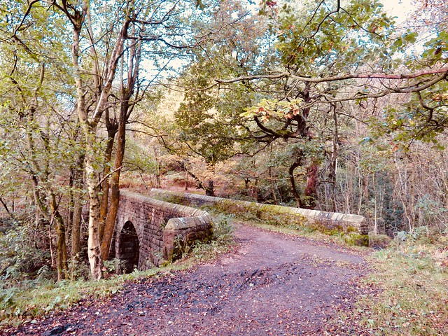
Walk (8½ miles; easy; field paths, walled lanes; OS Explorer OL2): Up B6478; cross A65 into Church Street; left at church. In 200m, right (836583, ‘Langber Lane’) up Scalehaw Lane. In 700m cross Long Preston Beck (842586); left beside beck. Pass New Pasture Plantation; cross Bookil Gill Beck (840592). Don’t cross next footbridge, but fork right through gate and uphill, heading to right of skyline barn. In ¾ mile ford Bookil Gill Beck (847600); left on Langber Lane track for 1½ miles to road (841623). Left; in 200m, left at Scaleber Bridge through wicket gate (841626, ‘Scaleber Wood’) to view Scaleber Force. Back to road; left; in ½ mile, left (835630, ‘Pennine Bridleway’/PB, ‘Lambert Lane’). In ⅔ mile, left at road (828625, ‘PB Long Preston’). In 150m fork left beside wood (828624); follow Edge Lane for 2¾ miles to road in Long Preston (834583). Right; at A65, left. Right down Greenbank Terrace; left on footpath (834581) to B6478; right to station.

Lunch/Accommodation: Golden Lion, Duke Street, Settle BD24 9DU (01729-822203, goldenlionsettle.co.uk)

Info: Settle TIC (01729-825192, visityorkshire.com); satmap.com; ramblers.org.uk

 Posted by at 01:52
Jan 252020


First published in: The Times Click here to view a map for this walk in a new window
picture picture picture picture picture picture picture picture picture picture picture picture picture picture picture picture
Facebook Link:

A still cold day in South Yorkshire, with a crack of blue over the western moors. From the graveyard of St Nicholas Church at High Bradfield we looked across the cleft of Dale Dike, up pasture slopes squared with black gritstone field walls.

Sheep cropped the churchyard grass and lay on the old inscribed gravestones that flagged the path. High on a bank stood a tall stone commemorating the deaths of James and Elizabeth Trickett and their four children on 12 March 1864. The Tricketts died, along with some 270 others, when the Dale Dike dam just up the valley burst in the middle of the night and released a roaring tsunami higher than the tallest mill building.

Gold tear-shaped leaves of silver birch lay underfoot as we followed a steep path downhill to Agden Reservoir. In the 19th century the city of Sheffield, a few miles down the dale, swelled like a frog in a fable as its steel and cutlery production rocketed. The population had quadrupled by mid-century, when a string of reservoirs was built in Bradfield Dale to cater for over 200,000 thirsty souls.

Today Agden Reservoir lay as flat and gleaming as Sheffield stainless steel, picture-pretty with hills and trees mirrored in the still water. We passed the sphagnum tuffets of Agden Bog, crossed the head of the reservoir and dropped down the fields to where Dale Dike Reservoir curved southwest among its trees.

The great sloping wall of the dam was flanked by a gracefully curved spillway, down whose steps white water came dancing. We followed a path, seamed with sinewy roots of ash and oak, along the north bank, until it turned across a footbridge at the head of the reservoir.

The homeward path ran along the southern slopes through pastures with tumbledown walls of dark gritstone. Looking down on Annet Bridge, we pictured the scene on that awful winter’s night when 700 million gallons of water came thundering through the dale.

Survivor Joseph Ibbotson of Bradfield reported: ‘It seemed as if … some unheard-of monster were rushing down the valley, lashing the hillsides with his scaly folds, crunching up buildings between his jaws, and filling all the air with his wrathful hiss. Trees snapped like pistols, mills and houses stood and staggered for a moment, and then disappeared in the boiling torrent.’

Start: Sands car park, Low Bradfield, near Sheffield S6 6LB (OS ref SK 262920)

Getting there: Bus 61, 62 from Sheffield
Road: Low Bradfield is signed off B6077 Loxley Road (A61, A6101 from Sheffield)

Walk (7¼ miles, field paths, OS Explorer OL1): From car park entrance, right along walled lane. At footbridge follow ‘High Bradfield’, keeping stream on right. At 2nd bridge, cross stream (262921); up steps, across road (264923, gate); on up (‘Sheffield Country Walk’/SCW). Through wicket gate (yellow arrow/YA); fork right on path, up to High Bradfield church (267926).

At church tower, left (west) on path with wall on right. In 200m, left downhill (265926) with wall on left to Smallfield Lane (262925). Right; in 350m, left (262928, ‘Permissive Path’/PP, ‘Run Routes’) along north bank of Agden Reservoir. In 1 mile at bench and bird feeders (250929), ahead on path (‘Windy Bank Wood’) to road at Wilkin Hill (249928). Right to Mortimer Road (245927). Left for 80m; left (‘bridleway’) down to Dale Road (247920). Right; in 100m, left (‘footpath’) on path. In 350m near dam, fork right (244919, PP); in 100m through 2 kissing gates by dam. Follow path along north bank of Dale Dike Reservoir for 1 mile.

At top of reservoir, left across footbridge (234906); left beside stream. In 150m fork right across wall stile (PP, green arrow); left along wall (SCW, stone stiles), then through plantation, for ¾ mile to Blindside Lane (244912). Left; in ¾ mile, just before Annet Bridge, right (255918, wall stile, SCW) on field path to Mill Lee Road (263916); left into Low Bradfield).

Lunch: Plough Inn, Low Bradfield (0114-285-1280, theploughinnlowbradfield.co.uk); Schoolrooms Café, Low Bradfield (0114-285-1920, theschoolrooms.co.uk)

Accommodation: Royal Hotel, Dungworth, Sheffield S6 6HF (0114-286-1213, royalhotel-dungworth.com)

Info: welcometosheffield.co.uk; satmap.com; ramblers.org.uk

 Posted by at 03:58
Jul 272019


First published in: The Times Click here to view a map for this walk in a new window
picture picture picture picture picture picture picture picture picture picture
Facebook Link:

Flamborough Head, a great chalk thumb poking out from the Yorkshire coast into the North Sea, is a windy and lonely place. The resident seabirds don’t mind; they swoop and wheel around the narrow cliff ledges of the headland, bringing food back to their precarious roosts and contributing a certain metallic fishy whiff to this walk.

St Oswald’s Church stands in the fishing village of Flamborough at the heart of the headland. It contains several memorials to fishermen and lifeboat men, and a wonderful carousel of paintings by local amateur artist Alfred Cracroft honouring the men and women of Flamborough whose work in services from the Home Guard and the WAAF to the Royal Observer Corps and nursing helped to win the Second World War.

Church Lane leads to a grassy path running to the southern cliffs of the headland. The view curved away south past Bridlington’s chalk cliffs and the fast-eroding East Yorkshire coastline to the faint double hummock of Spurn Head on the horizon.

We followed the cliff path past cornfields where skylarks spiralled and sang, through forests of grasses and thistles, with fishing boats cutting the glittering sea to our right. At South Landing the Flamborough lifeboat, a big orange rib, was away from its home shed for repairs. ‘Scraped its bottom rescuing a fellow stuck in a cave,’ explained the volunteer on duty.

Flamborough Head is a treacherous place, a magnet for swirling tides and cross currents that eat caves and arches out of the chalk cliffs. As we rounded the easterly nose of the headland a great shrieking and gibbering of seabirds, along with a fishy stench, arose from their favoured nesting cliffs on the north side.

It’s a staggering sight and sound, so many seabirds in one place. Cormorants and gulls occupied the lower rocks; sharp-billed guillemots and black-coated razorbills with smart white markings lined the middle ledges, and kittiwakes wheeled round the upper storeys of the cliffs with their incessant ‘ee-wake! ee-wake!’

Along at North Landing lay the cobles Prosperity and Summer Rose, fishing boats with pointed bows and stems, a designed unchanged for over 1,000 years. Just beyond we turned inland for Flamborough, blown by wind, burned by sun and with the echoing calls of the kittiwakes still in our ears.

Start: Two Brothers memorial, Tower Street, Flamborough, Nr Bridlington, N. Yorks YO15 1PD (OS ref TA 227706)

Getting there: Bus 14 from Bridlington
Road – Flamborough (B1255) is signposted from A165/A1038 in Bridlington.

Walk (9¼ miles, easy, OS Explorer 301): South down Tower Street to St Oswald’s Church (226702). Through churchyard to south gate; right along Church Lane; in 150m, round right bend. In 100m, left (226700) down Beacon Farm drive to cliffs (225693). Left, and follow cliff path/’Headland Way’ for 500m to South Landing (231693). At lighthouse sculpture 200m beyond (233693), fork right (‘Flamborough Head’, yellow arrow/YA) for 2½ miles to Flamborough Head. Pass in front of lighthouse (255706); pass green with benches; at cresset, follow path (YA) along cliff-tops. In 2½ miles pass Thornwick Bay café (232723); in another ½ mile, left on North Cliff (224726, fingerpost, YA) on path south for 1 mile to T-junction (226710). Left (‘Flamborough’) to road at Craikwell (227708); right to Two Brothers memorial.

Conditions: Several flights of uneven steps; unguarded cliff edges.

Lunch: Seabirds Inn, Tower Street, Flamborough (01262-850242, theseabirds.com)

Accommodation: Premier Inn, Albion Terrace, Bridlington YO15 2PJ (01262-411642; premierinn.com)

Info: Bridlington TIC (01482-391634); yorkshire.com; satmap.com; ramblers.org.uk

Yorkshire Coast Path by Andrew Vine (safehavenbooks.co.uk)

 Posted by at 01:01
May 042019


First published in: The Times Click here to view a map for this walk in a new window
picture picture picture picture picture picture picture picture picture picture picture picture picture picture picture picture
Facebook Link:

This year is the 50th anniversary of the Cleveland Way, the National Trail that runs round the rim of the North York Moors with vast, spectacular views from the great escarpment.

Early on a cold morning I followed the Cleveland Way north out of Osmotherley. Vague shapes of Pennine ranges lay out to the west on the edge of sight, under a sky ribbed with cloud that stretched in parallel bars from horizon to horizon, a remarkable sight.

A short detour through the trees of fetchingly named Summer Game Hill, on a path lined with simple wooden Stations of the Cross. This rustic via dolorosa led up to a lonely Lady Chapel, object of pilgrimage and still used for worship.

Back on the Cleveland Way I took another sidetrack down through the trees of Mount Grace wood among bluebells and wild garlic, to where the remarkably well-preserved Mount Grace Priory lay sheltered below the escarpment. In these two-storey cells the Carthusian monks of the priory led lives of prayer and contemplation, solitary and utterly silent.

I climbed back up to the Cleveland Way and resumed the walk, up through South Wood to where larch and firs gave way to silver birch and young green bilberries. The upland sheep pastures were divided by beautifully maintained stone walls. On the eastern skyline ran the hummocky dark spine of Osmotherley Moor, the sombre-coloured escarpment edge trending north to where the sharp breaking-wave profile of Roseberry Topping stood up against the sky.

Out on Scarth Wood Moor a paved path wound palely over the heather. Suddenly an intent dark shape scuttled across – a handsome male black grouse, his bright scarlet crest erect, his legs strutting like clockwork.

Here I left the Cleveland Way, cutting back south by way of Cod Beck Reservoir, as cold and still as a sheet of tin among its trees. Above the lake I found High Lane, a track perhaps dating back to Neolithic times, down which Scottish drovers in former days would drive trains of up to 300 cattle to markets in Thirsk and York. It was a great way to head towards Osmotherley, staring out over 50 miles of lowland country, picturing those hardy men and their charges slowly plodding south across these moody northern moors.
Start: North End, Osmotherley, N. Yorks DL6 3AA (OS ref SE 456972). More car parking at Cod Beck Reservoir, 1½ miles north.

Getting there: Bus 80, 89 (Stokesley-Northallerton); X89 (Northallerton-Middlesbrough)
Road – Osmotherley is signed off A19 (Thirsk-Middlesbrough)

Walk (6¾ miles; 8 miles including Mount Grace Priory detour; moderate, OS Explorer OL26): Cleveland Way (CW, white acorn & fingerpost waymarks) north out of Osmotherley. After ½ mile, at 453977, signposted detour loop on right to Lady Chapel (454982. Returning to CW at Chapel Wood Farm (452980), right along CW.

NB For Mount Grace Priory detour, cross CW at Chapel Wood Farm, left past farm buildings, through gate (yellow arrow/YA); follow YAs down field edges, to corner of wood (448980) then through wood to Priory (448985) and return.

Main walk: from Chapel Wood Farm, north on CW via South Wood and Scarth Wood Moor for 1¾ miles to road (473003). Right on path beside road for nearly 1 mile to 2nd of 2 car parks at head of Cod Beck Reservoir (468992). Left (kissing gate, footbridge) into trees. In 50m, left up left bank of stream; at edge of trees, left (470990, ladder stile, YA). Ahead on grass path curving right; in 200m, right along High Lane trackway (472991).

In nearly 1 mile, trees end (472978); in another 400m, right across chain (473974) on grassy track. In ½ mile cross horse gallop (465973); left down path; in 300m, right (465970, CW) on CW to Osmotherley.

Lunch/dinner: Golden Lion, Osmotherley (01609-883526, goldenlionosmotherley.co.uk) – superb cooking in pub setting

Accommodation: Woodlands Farm, Thimbleby DL6 3PY (01609-883524, woodlandsfarmthimbleby.com) – really delightful B&B; pickups and drop-offs part of the service.

Info: Cleveland Way 50th Anniversary, May 24th – many events planned all year.
(northyorkmoors.org.uk/clevelandway)
Mount Grace Priory: nationaltrust.org.uk/mount-grace-priory

satmap.com; ramblers.org.uk

 Posted by at 09:45
Apr 272019


First published in: The Times Click here to view a map for this walk in a new window
picture picture picture picture picture picture picture picture picture picture picture
Facebook Link:

Walsden lies in a hollow of the hills in bleak moorland country where Yorkshire meets Lancashire. Strong sunlight and a cold wind greeted us as we climbed the stony trod of Long Causeway. Below, swathes of blanket bog cradled the reservoir of Cranberry Dam in cushions of pale brown velvet.

For all its upland wildness, this is a landscape of industrial endeavour, past and present. Sheer-sided scoops in the sides of the steep little cloughs or stream valleys showed evidence of lead and coal mining. Pylons like skeleton trees strode across the country. And high on Noon Hill and Ramsden Hill, tall white wind turbines lazily turned their three-blades apiece with a gentle, greasy whine and whoosh.

Among these ghostly giants we found an old track that rose past the gritty spoil banks of long-gone lead mines in the flanks of Rough Hill. Far in the south, beyond the million diamond sparkles of Watergrove Reservoir, the towers and factory chimneys of Manchester lay hazed with distance.

A confusion of ill-marked paths had us scratching our heads at the junction with the Rossendale Way, but soon we were heading north over squelchy black peat, through sedgy fields where sheep grazed. A pair of baths, complete with shiny chrome taps, stood beside the fence half-full of scummy green water, waiting for a walker too hot and sweaty to resist their allure.

On the heights of Trough Edge End the broad walled track of the Rossendale Way met the old trodden track now styled the Todmorden Centenary Way. It dropped down a bank among mine ridges to the ruin of Coolam Farm, and followed the old road past Pot Oven, once a beer-house for travellers in these lonely wastes. ‘Deaf old Sam’ Jackson, farmer, fustian weaver and tenant here in 1784, raised ten children with his wife Martha Woodhead. Foulclough Mine opened in the 1790s, and Sam and Martha’s sons became colliers and left the fustian trade forever.

A final descent into Ramsden Wood’s narrow clough, and a teetering path through bluebell woods high above waterfalls and cascades, back to the lake where stolid fishermen with twenty-foot roach poles were patiently sitting the evening out.

Start: Ramsden Wood fishing lake, Ramsden Lane, Walsden, W. Yorks OL14 7UN approx (OS ref SD 928213).

Getting there: Bus 589, 590 (Todmorden – Rochdale)
Road – A6033 (Todmorden – Littleborough) to Walsden; Ramsden Wood Road (next to Border Rose Inn); in 600m, left up Ramsden Lane to car park. Also parking in Ramsden Wood Road.

Walk (6 miles, moderate, OS Explorer OL21): On up lane. At Plantation Barn fork left (924213) over cattle grid. In 200m, right through gate (‘Long Causeway’). In 1 mile cross wind turbine service roadway (918199); in 200m, right at marker stone on moor track. In 400m, left across stream spring (914200, yellow arrow/YA). Track rises through mine heaps. 100m beyond last heap, fork left on rutted track (910201). In 200m wall comes in on left; follow it for 600m to turn right along gravel road (903198).

In 200m, at post with red reflectors, left (904199); turn left to follow enclosure fence, keeping it on your right. At northwest corner, keep ahead on track over Hades Hill. In 450m through gate (906203); left along fence; in 300m, left (904207, stile) across field to ladder stile (903206). Don’t cross it, but turn right/north with wall on left, on Rossendale Way. In nearly 1 mile right (901221) along Todmorden Centenary Way/TC.

In 350m, cross stile (904218); left along fence to trig pillar (906219). Half right on path down hillside towards Coolam Farm ruin. Near ruin, left through gate (911215, TC); follow rocky lane downhill. In 200m left along walled lane (913215, TC). In ⅔ mile, pass Pot Oven (920219); in another 200m, right (922220, TC) across farmyard. On down green lane. 50m before it turns left across Ragby Bridge, left through gate (923216, YA), on path (see below) above river to car park. Alternative: follow TC up past Inchfield to meet outward route (923212); left to car park.

Conditions: Rough moor paths. Riverside path to car park – steep drops, narrow path.

Lunch: Border Rose Inn, Walsden OL14 7UA (01706-812142)

Accommodation: Moorcock Inn, Halifax Road, Blackstone Edge, Littleborough OL15 0LD (01706-378156, themoorcockinn.co.uk)

Info: Hebden Bridge TIC (01422-843831)
satmap.com; ramblers.org.uk

Ships of Heaven – The Private Life of Britain’s Cathedrals by Christopher Somerville (Transworld) was published on 11 April

 Posted by at 02:54
Jan 052019


First published in: The Times Click here to view a map for this walk in a new window
picture picture picture picture picture picture picture picture picture picture picture
Facebook Link:

On a cool bright morning we followed Water Lane out of Welburn and headed for the Howardian Hills. The jewel of the landscape hereabouts is the stately pile of Castle Howard, but from the cobbled field path leading north towards the hills we could only glimpse the tip of its crowning dome.

There were plenty of follies and architectural fancies to admire as we walked the parkland tracks – pyramids and obelisks, a wonderfully ornate Temple of the Four Winds high on an aeolian ridge, and peeping over the trees of Kirk Hill the tall colonnaded mausoleum of the Howards, Earls of Carlisle.

In an overgrown paddock beside the rusty barns of Low Gaterly a grey mare and her tiny companion horse, only as big as a dog, were browsing their thistle patch, delicately nipping off the remnant flower heads with lips curled back out of the way of the prickles.

Up on the ridge of the Howardian Hills an ancient earthwork shadowed the escarpment, a bank and ditch perhaps 4,000 years old. From here there were great open views to the smoothly flowing outline of the North York Moors, sombre and dark under a lively silver sky.

A mile along the ancient bank under quietly whispering larch and sycamores, and we descended a holloway into the parkland of Castle Howard. The great house stood on its ridge, a dream realised by the talented and bold amateur architect Sir John Vanbrugh at the turn of the 18th century. We found the parkland turf still corrugated by what underlay it – the ridge-and-furrow fields of the medieval village of Henderskelfe, swept away by command of the 3rd Earl of Carlisle in favour of the artful curves of his landscaped park.

The homeward path led across a steeply arched Palladian bridge over the New River lake. I glanced down as I crossed, to see a stone carving of a bearded river god, reeds in his hair, staring with bulging eyes and mouth agape along the artificial waterway at the giant house on the hill – whether in awe or horror was hard to say.
Start: Crown & Cushion PH, Welburn YO60 7DZ (OS ref SE 721680)

Getting there: Bus 183 (Malton-Castle Howard)
Road – Welburn is signed from A64 (York-Malton) at Whitwell on the Hill

Walk (9 miles, easy, OS Explorer 300): Left from Crown & Cushion; left down Water Lane. ‘Public Bridleway’ north for ¾ mile to turn right along Centenary Way/CW beyond East Moor Banks wood (723693). In ⅔ mile, left (732694, ‘Coneysthorpe, yellow arrow/YA); in 150m, left opposite Low Gaterly barn (YA). At Bog Hall dogleg left/right, then right on track (725709, ‘Easthorpe’). In 900m keep ahead (734713, ‘Park House’), zigzagging up to cross road (733715). Up Park House drive; in 50m left (gate, BA); follow wooded escarpment edge and ‘Slingsby Bank’ (BA). In 1¼ mile, left (714729, ‘Coneysthorpe’), for 1 mile to Coneysthorpe. Left along road; in 100m, right through wall (713713); follow drive (‘Welburn’). In ½ mile, at corner of Great Lake, fork left by gates; in 100m, right (719706, ‘Welburn’) through scrub to track (722705). Right into parkland; right (‘Welburn’) to Temple of Four Winds, New River Bridge (724698) and return path to Welburn.

Lunch: Crown & Cushion PH (01653-618777, thecrownandcushionwelburn.com); Leaf & Loaf Café (01653-618352), Welburn.

Accommodation: Talbot Hotel, Malton, N Yorks YO17 7AJ (01653-639096, talbotmalton.co.uk). Friendly, comfortable, long-established hotel.

Info: castlehoward.co.uk; howardianhills.org.uk; yorkshire.com
Ramblers Festival of Winter Walks, 21 December – 6 January:
ramblers.org.uk/winterwalks
visitengland.com; satmap.com; ramblers.org.uk

 Posted by at 01:51
Jun 022018


First published in: The Times Click here to view a map for this walk in a new window
picture picture picture picture picture picture picture picture picture picture picture picture picture picture picture picture
Facebook Link:

A heavenly morning of warm sun and cooling breezes over the Yorkshire Dales. The soft blue sky was streaked with mare’s tails of cloud, betokening a change in the weather. But just now, setting out along the shores of Malham Tarn, we were living in the moment and the day.

The wind-rippled tarn was exactly the colour of blued steel. Beyond the water, Malham Tarn house sat handsomely among its trees under the long grey-white cliffs of Highfolds Scar. This is all prime limestone country, weathered into rugged cliffs or scars that fall to pastures of rough grazing.

The wide pastures of West Great Close and East Great Close were the site of a great fair in times past, where thousands of Scottish cattle would be sold and driven on south to be fattened for the markets of southern England. The old drover’s vocation is long gone, but black cattle still fatten in these grassy pastures.

Above Middle House Farm we came into an upland of eroded limestone pavement where the wind blustered and the sun picked out brilliant blobs of colour in the wind-bitten grasses – buttery yellow mountain pansies, stout early purple orchids, spatters of mountain violets, and the intense pink flowers of bird’s-eye primroses. Tucked down in the grykes or hollows of the limestone was a woodland flora, bizarrely flourishing in this open, treeless terrain – wood anemones, dog’s mercury and lush ferns.

From the watershed we dropped down a long hillside, looking forward to a grand sweep of fellside – Malham Moor and Fountains Fell cradling the long valley of Darnbrook Dale. Down at Darnbrook House the farmer and his son were busy in a farmyard loud with the yammering of ewes and lambs.

We followed the sinuating dale road past barns and pastures until the straight track of the Pennine Way cut across, leading us along a fellside of wide slopes, lonely barns, and a tangle of stone walls. Round the shore of Malham Tarn once more, through pastures where slow-moving cattle browsed the lake margins in the last of the afternoon’s sunshine.

Start: Water Sinks car park, Malham Tarn, N. Yorks BD23 4DJ (OS ref SD 894658)

Getting there: Malham Tarn Shuttle Bus 881 (dalesbus.org/malhamshuttle)
Road – Malham Tarn is signed from Malham (follow ‘Airton’, ‘Kirkby Malham’ from Gargrave on A65 Skipton-Settle road).

Walk (8½ miles, moderate, OS Explorer OL2): From car park follow Pennine Way/PW (signed) north, skirting shore of Malham Tarn. In 700m meet white stone track (897663); don’t go through gate, but bear right with a wall on left and a round walled plantation up on right. Pass Great Close Plantation, then left (904663, ‘Arncliffe’) up farm track. At entrance to Middle House Farm, left over stile (907676, ‘Arncliffe’), up to skyline gate. Follow stony track to pass Middle House ruin; fork left at fingerpost (907684); on for 1 mile over Middle House Hill, descending to go through wall gap (900696). Right to ruined wall; left along it, down to cross Cowside Beck (899701). Field path to road at Darnbrook House (898705); left along road; in 1¼ miles meet PW (884691). Left on well way-marked PW for 1¼ miles to road (888673); left on PW, clockwise round Malham Tarn to car park.

Lunch: Picnic

Accommodation: Malham Youth Hostel, Malham BD23 4DB (0345-371-9529, yha.org.uk/hostel/malham); also Lister Arms, Malham (01729-830444, thwaites.co.uk) and Buck Inn, Malham (01729-830317, thebuckmalham.co.uk)

Info: Malham National Park Centre (01729-833200; yorkshiredales.org.uk); yorkshire.com; satmap.com; ramblers.org.uk

The Times Britain’s Best Walks by Christopher Somerville (£16.99, HarperCollins) is now out in paperback

 Posted by at 01:26
Feb 172018


First published in: The Times Click here to view a map for this walk in a new window
picture picture picture picture picture picture picture picture picture picture picture picture picture picture picture picture
Facebook Link:

Mighty clouds of elephant grey came sailing over the high slopes of Black Edge and Binn Moor, and on across the Colne Valley. Among them, blue streaks gave promise of a better, if brisker, afternoon.

It’s a long time since the buzzer at Bank Bottom Mill summoned half the working population of Marsden to its carding machines and looms. The weather-stained old mill stands redundant at the bottom of the town, as big as a cathedral, acres of windows and grey slate roofs round a central tower and a slender octagonal chimney.

We followed a laneway among these haunting ruins, then on to where a great grass bank filled half the skyline. The dam of Butterley Reservoir is a really impressive sight, even when floodwater is not cascading in white ripples down its spillway.

Blakeley Reservoir, high above, is smaller and wilder. Local volunteers were planting young oaks along the banks of Wessenden Brook. Here we stood and looked back along the twisting valley with its man-made lakes, insinuated among the hills at the turn of the 20th century to feed the mills and wells of industrial Huddersfield.

Walking the Pennine Way across these moors used to be a purgatorial flounder among bogs and peat hags. Nowadays, thousands of old mill flagstones give dry passage across the morass. This afternoon’s westward walk beside Blakeley Clough was a pure pleasure, striding firm-footed as the sun burst from behind the clouds and turned the moor grass to a sea of wind-ruffled gold.

The moor top reservoirs of Black Moss and Swellands lay side by side in modest beds, their water the polished indigo of a lobster’s shell. On the shore of Redbrook Reservoir the Pennine Way met the Standedge Trail, whose stony path we followed, chased by an icy wind. It carried us down from the hills and back to Marsden by way of a narrow old walled lane, from which we looked down over the terraced houses along the valley, and the tall black chimney of the great mill complex still standing silent at the foot of the town.
Start: Marsden railway station, Marsden, W. Yorks HD7 6AX (OS ref SE 047118)

Getting there: Bus 185 from Huddersfield. Road – Marsden is on A62 (Huddersfield-Oldham)

Walk (7 miles, moderate, OS Explorers OL21, OL1): Cross canal, walk downhill. At left bend, right across river, past church. Cross Towngate; along weir side. Cross Mount Road; up Binn Road. In 100m, fork left by Marsden Industrial Society between Bank Bottom Mill buildings (048111); on along lane to Butterley Reservoir dam. Up steps on left (049106); at top, right on Kirklees Way (fingerpost) for 1 mile to top of Blakeley Reservoir. Right on Pennine Way (054091, fingerpost) over Marsden Moor for 2 miles. Just before Redbrook Reservoir, right (027094) along Standedge Trail (unmarked, broad track). In ¾ mile cross Mount Road (037101). Up Old Mount Road; in 50m fork left (‘Hades Farm’). In 900m, right (042110, ‘Marsden Heritage Trail’, Point 15) down walled lane to track (044111). Left past house; walled lane for 300m to gate on left of farmhouse (044113). Right along house wall; ahead through 2 gates (yellow arrow); down sloping field, following gully to bottom left corner (046115). Cross stile; right down lane to road; left across A62; return to station.

Conditions: Some short, steep ascents/descents; some muddy parts

Lunch: The Railway, Marsden (01484-841541, railwaymarsdenhuddersfield.co.uk)

Accommodation: The Carriage House, Manchester Rd, Standedge, Marsden HD7 6NL (01484-844419, thecarriage-house.co.uk)

Info: yorkshire.com/places/west-yorkshire; satmap.com; ramblers.org.uk

 Posted by at 01:59
Dec 022017


First published in: The Times Click here to view a map for this walk in a new window
picture picture picture picture picture picture picture picture picture picture picture picture picture picture picture picture
Facebook Link:

Half a dozen red kites were wheeling over the village hall car park at Harewood. They swooped down on their crooked wings, seeming almost close enough to touch, wailing as they showed off their colours of russet and cream. ‘Lady in the village feeds them,’ said Keith at the Muddy Boots café. ‘They know it’s nearly lunchtime.’

It was an auspicious start to our walk through the broad acres of Harewood Park, landscaped in the 1770s with a sculptor’s eye by Capability Brown.

‘The pleasure grounds and gardens rare
Laid out, by Mr Brown, with utmost care…
Though both, which now such beauty yield,
Were lately but a furrow’d field.’

Thus the author of ‘The Tourist’s Companion,’ surveying Harewood Park fifty years after Brown first started work. On this cold afternoon, two centuries later, we saw the great landscaper’s vision matured to perfection – magnificent oaks, Spanish chestnuts and limes shading the artful slopes and folds of ground where red stags grazed together like contented clubmen.

Beyond Harewood the manipulated landscape gave way to a ridged countryside of pastures where weather-stained sheep cropped the grass. Birds flocked together, obedient to the winter imperative to keep close and survive – giant clouds of pigeons across the sky, rooks in the stubble, and a marvellous congregation of 200 lapwings, stabbing for worms in the rain-softened furrows of a field among imperturbable ewes.

We climbed a zigzag lane to a ridge with a northward view towards the far distant fells of the Yorkshire Dales. At our feet rolled the River Wharfe – not the noisy young river familiar to us from walks in Upper Wharfedale, skittish over a shallow stony bed, but a slow-flowing adult river through these lowland fields. Uprooted willows and tangles of twigs caught in the bankside branches told of the Wharfe’s capacity for springtime flooding even here, far down the dale.

We turned west towards Harewood along the Wharfe, past Netherby Deep with its hidden whirlpool and reputed thirty foot drop in the river bed. On the bronze-brown surface there was no hint of such subaqueous drama – just the eddy of a turning fish, and the patter of the last willow leaves of the year as they dropped into the river.

Start: Village Hall car park, Church Lane, Harewood, W Yorks LS17 9LJ (OS ref SE 321453) – £2 all day

Getting there: Bus 36 (Leeds-Harrogate)
Road – A1(M), Jct 45; A 659 Otley road, west to Harewood.

Walk: (10¼ miles, parkland, green lanes, field paths; Explorer 289). From car park, right past lodge (fingerpost), following Ebor Way. In nearly 1 mile, left at 4-finger post (307450). Pass Home Farm (306447). Beyond brick garden wall and cattle grid, right (307441), ‘bridleway’). Pass Carr House; into woods; in 250m, by telegraph pole on right, left (303438) up sunken trackway (unmarked) to join waymarked Leeds Country Way/LCW. Follow LCW for 1½ miles to cross A61 (325431). Follow road (‘Wike’); in 650m, left (331428, fingerpost) on green lane. Follow LCW for 1½ miles, passing Biggin Farm (342430). Pass Gateon House Farm; in another 200m, left (352436, ‘bridleway’ fingerpost) off LCW. Green lane north to road (353442); left to cross A659 (346451); driveway past Fairfield Farm house and barns, then field path descending to River Wharfe (346462). Left on Ebor Way for 2¼ miles back to Harewood.

Lunch: Muddy Boots Café, Harewood Village Hall (07742-248916) – open daily.

Accommodation: Wood Hall Hotel and Spa, Trip Lane, Linton, Wetherby, W Yorks LS22 4JA (01937-587271, handpickedhotels.co.uk) – The setting of this hotel, in broad grounds and with a fabulous view, makes it ideal for a winter weekend break. It’s warm and welcoming, a touch of luxury for a special occasion. Plenty of walks nearby to sharpen an appetite for some excellent cooking, too.

Info: harewood.org; visitengland.com; satmap.com; ramblers.org.uk

 Posted by at 01:24
Apr 012017


First published in: The Times Click here to view a map for this walk in a new window
picture picture picture picture picture picture picture picture picture picture picture picture picture picture picture
Facebook Link:

Daffodils were out along the zigzag road through North Grimston. From the cellar of the Middleton Arms, a hollow clanging announced the racking of a fresh consignment of good Yorkshire ale – a nice promise to myself for the end of the walk. Just now I was for the wolds, those deep valleys seamed into the chalky landscape of East Yorkshire that you never suspect are there at all until you suddenly come on them.

The farm track of the Centenary Way carried me away from North Grimston, up a green cleft whose curves and sinuations held unemphatic colours on this early spring morning – milky greens and greys against the dark stripes of leafless woodland. The slopes around Wood House Farm and High Bellmanear called for the bold palette of David Hockney, who cut his landscape teeth among the geometric shapes and quarter-tones of the Yorkshire Wolds.

Curlew cries came up from the sedgy meadows below, along with cock crows and the pop! pop! of shotguns from the woods. The white chalk and flint track led north through fields of spring wheat to Settrington Beacon where the Romans once maintained a signal station, one in a line of warning flares between their harbour at Filey Brigg and the garrison town of Eboracum/York.

A hare leaped up and pelted away as I trudged the ridge road towards Settrington. Folded fields and old orchards, a plopping frog pond, and then the steep lane that separates Settrington House from its lake. A final wriggle of road, and I was walking south beside the extravagantly snaking Settrington Beck in sodden fields where a flock of greylag geese waddled away from the stranger, piping hoarsely in their anxiety.

Watching the wold ridges sliding by, listening to the trumpeting of the geese and the quiet gurgle of the beck, I almost forgot to peep into St Nicholas’s Church when I got back to North Grimston. I’d have kicked myself if I hadn’t, because the church contains a rare treasure, a massive Norman tub font carved with tableaux in a remarkable naïve style.

In the most striking scene a wide-eyed Christ with a broad grin presides over the Last Supper. There are fish and hot-cross buns on the table. The disciples bless themselves and smile out at the world. Some nameless carver made this work of art and faith, perhaps in the 12th century AD, or maybe earlier still.

Start: Middleton Arms, North Grimston, Nr Malton, E. Yorks YO17 8AX (OS ref SE 844677)

Getting there: Bus 190 (Foxholes-Malton)
Road – From A64 (York-Malton) follow Kirkham Abbey, Langton, North Grimston.

Walk (7½ miles, easy, OS Explorer 300): Left along road; on first right bend, left across cattle grid and follow farm track (soon marked ‘Centenary Way’) for 2¾ miles to road at Settrington Beacon (867706). Left; in ¾ of a mile, left (856709, ‘Wold House’). Just before house, right over stile (yellow arrow/YA). Ahead down field; through gate (855705, YA); down to go through gate (YA). Left by pond; follow fence by trees (YA) to stile (YA), then Wardale drive (850702). Ahead to road (846703); left downhill past lake. At T-junction, left (838700, ‘North Grimston’); in a ¼ of a mile, left (‘Kirkhill’). Right at Kirk Hill farm (841697, YA) and follow YAs south across Settrington Beck and on for 1¼ miles to North Grimston.

Lunch: Middleton Arms, North Grimston (01944-768255)

Accommodation: Talbot Hotel, Yorkersgate, Malton YO17 7AJ (01653-639096, talbotmalton.co.uk) – very comfortable, stylish hotel.

Info: visitryedale.co.uk; yorkshire.com

Yorkshire Wolds Walking Festival: 9-17 September (the yorkshirewolds.com)
satmap.com, ramblers.org.uk

The January Man – A Year of Walking Britain by Christopher Somerville (Doubleday, £14.99).

 Posted by at 01:04