Search Results : powys

Apr 022011
 

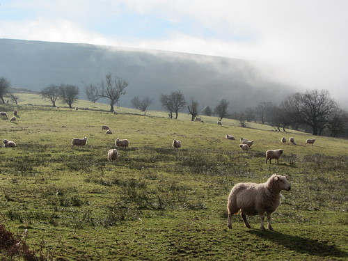
Lord, what a beautiful Welsh Borders day; one of those fabulous cold winter afternoons when the sky is untroubled blue, the air’s as clean as a whistle, and you just know that from the heights of the Shropshire/Powys border you could see for a hundred miles.
First published in: The Times Click here to view a map for this walk in a new window
picture picture picture picture picture picture picture picture
Photo’s: Andy Harrison
Facebook Link:
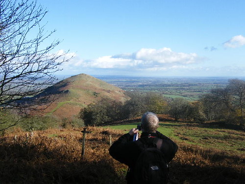
Absolutely the day to explore the three peaks of the Breidden Hills, then, with my godson Andy Harrison, enthusiastic walker and geologist.

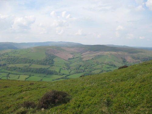
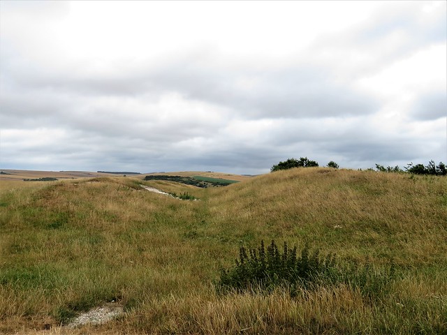
‘It’s always amazed me,’ mused Andy at the summit of Moel y Golfa, ‘how you can have three hills so close, but so totally different in geology. Where we’re standing is what’s left of a huge volcanic body that erupted about 450 million years ago. Then Middletown Hill,’ – he pointed across to a smooth rounded dome – ‘is the tuff, the ashes and waste, chucked out by the volcano. And that rough crumpled hill to the north, Breidden Hill itself – it’s dolerite, a tongue of magma that pushed out from the volcanic chamber and cooled.’

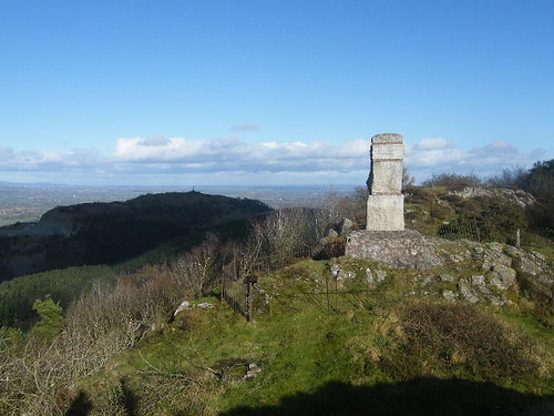
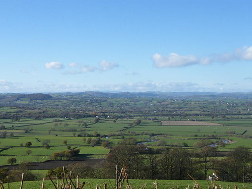
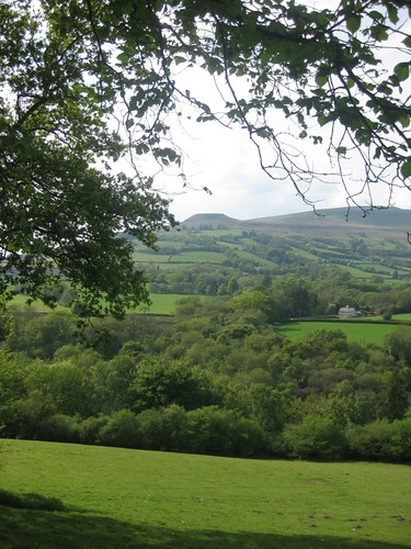
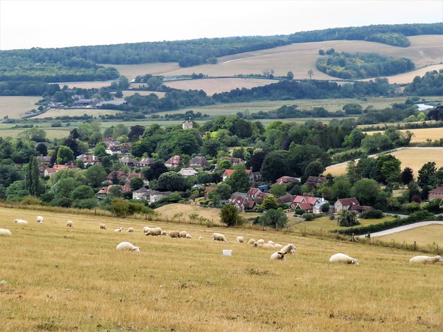
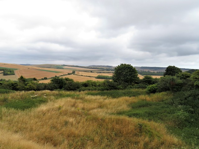
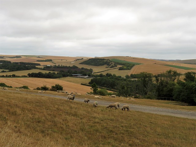
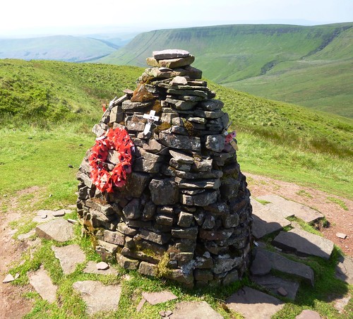
We gazed across the green plain where the River Severn lay in meanders and oxbows of brilliant enamelled blue, out to Cadair Idris nearly 40 miles off on the coast of west Wales, to the whaleback of the Wrekin, to the minuscule bump of Helsby Hill forty miles to the north and the shallow ridge of the Long Mynd and Wenlock Edge to the south. Here was my hundred-mile view, and food for speculation, too, in the blocky stone pillar on the summit of Moel y Golfa. Its inscription eulogised the Romany Chell or leader Uriah Burton, (‘Big Hughie’) – ‘a fighter for the weak, good to the poor, never beaten in fisty cuffs, a man who led his people into the twentieth century’. What more fulsome obituary could anyone want?

We dipped and swooped up to the Rodney pillar on Breidden Hill, ‘erected by subscription of the Gentlemen of Montgomeryshire’ in 1787 to honour Sir George Brydges Rodney, Admiral of the White. What on earth might Admiral Rodney and Big Hughie have found to say to each other, supposing they had ever met? Maybe they’d have blacked one another’s eye and then shared a glass of something convivial – so we speculated, anyway.

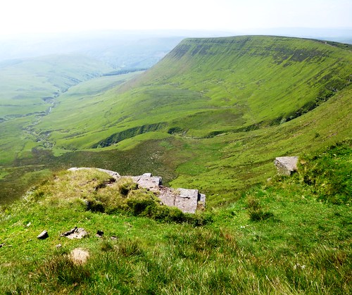
Whether anyone of note is buried in the Iron Age fort on Middletown Hill, neither history nor grand monuments relate. But the third of the Breidden summits gave Andy and me a last prospect over the Midlands and Welsh Borders, bathed in evening sunlight and looking good enough to eat.

Start & finish: Middletown car park, near Breidden Hotel, Middletown, Powys SY21 8EL (OS ref SJ 301125).

Getting there:

Train (www.thetrainline.com; www.railcard.co.uk) to Welshpool (5 miles)
Bus: X75 (www.tanat.co.uk) Welshpool-Shrewsbury
Road: M50, M54, A5 to Shrewsbury; Middletown is on A458 Welshpool road. Car park beyond Breidden Hotel.

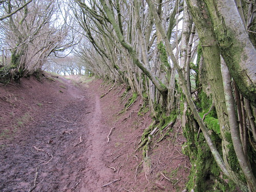
Walk (6½ miles, hard, OS Explorer 240): From car park turn left along A458. In 100 yards take tarmac track on left of road. In 100 yards, cross road (298123); up path to right of house; in 70 yards left through gate (yellow arrow/YA) and up slope of field to cross stile (296124). Path hairpins to right and climbs. In 200 yards, sharp left (297125, YA), steeply up through trees, aiming for ridge (occasional YAs). Once there (293127 approx), bear left along ridge to Romany monument (291125) on Moel y Golfa. Continue along crest of ridge, then scramble down rocks; on down through trees, soon following white arrows, for a good half-mile. Where track steepens and bends left on Golfa Bank, look for cairn of stones on right, turn right here (285117) on level path through trees. In 200 yards fork right (fingerpost) to house and road (284121). Left along road for ¾ mile; then left (292130), following bridleway up to crossing of paths at New Pieces (293134). Continue on bridleway; in ¼ mile, at footpath crossing, left (295137, YA), up and over saddle to T-junction of paths. Right to forest road (296141). Left; in 250 yards fork right; through gate, and zigzag left and right up to Rodney’s Pillar (295144).

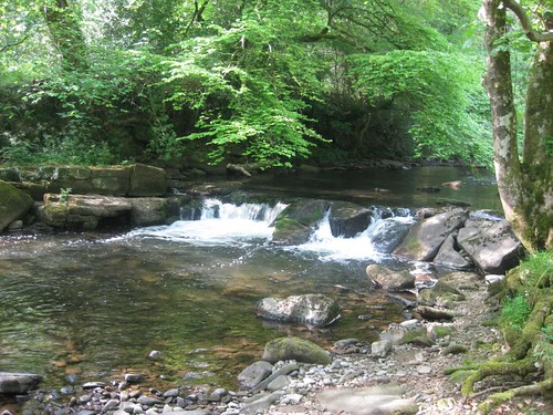
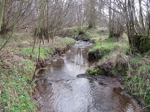
Bear right off summit from pillar, steeply down grass path (YA), through fence in dip (297143); on east (YA). In a couple of hundred yards, through kissing gate; on down into valley. At saddle under Brimford Wood (303144) bear right (YAs) down to cross track (blue arrows); on down to cross stream (305142 – very muddy!). In 30 yards right through gateway; on with hedge on left, to follow lane to Belle Eisle Farm (307137). Right along road; in 50 yards, left to skirt Belle Isle Cottage; fork right (YAs) up very steep path to saddle between Bulthy Hill and Middleton Hill (308135). Right to summit of Middletown Hill (305133). On down to saddle between Middletown Hill and Moel y Golfa (301131). Ignore YA pointing ahead, and turn sharp left, steeply down to A458 and Breidden Hotel.

Conditions: steep, muddy; not waymarked throughout; for confident map and GPS/compass walkers

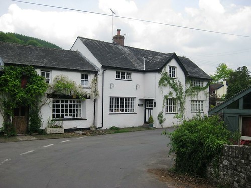
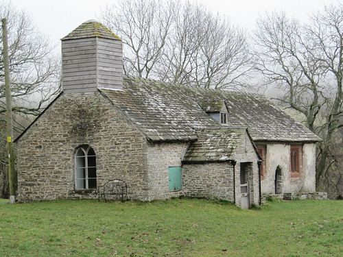
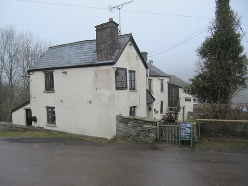
Lunch: Breidden Hotel (01938-570250; http://www.ukpubfinder.com/pub/35028)
– Chinese, Thai and English cooking

Accommodation::
Old Hand & Diamond Coedway (01743-884379;
www.oldhandanddiamond.co.uk
More info: Welshpool TIC (01938-552043); www.visitmidwales.co.uk
www.ramblers.org.uk;
www.satmap.com
www.LogMyTrip.co.uk

 Posted by at 01:24
Dec 112010
 

First published in: The Times Click here to view a map for this walk in a new window
picture picture picture picture picture picture picture
Facebook Link:
A still afternoon over the Brecon Beacons. The Grwyne Fawr river ran dark and noisy after rain under the single arch of Llangenny bridge, the landlady of the Dragon’s Head Inn worked on her flowerbeds in the sunshine, and all seemed right with the little world folded into its valley in the eastern skirts of the mountains.

It was a stiff old pull up the hill out of Llangenny, following a wet green lane full of cress and pennywort. Lost lambs scampered in front of us, calling ‘Ma-a-aaa!’ as their mothers answered gruffly from beyond the hedges. A buzzard went mewing in wobbly circles, its steady flight pattern shaken up by a pair of divebombing and furiously croaking ravens. Soon the Sugar Loaf stood ahead, a green hill rising to a broad domed top, the kind of mountain that beckons rather than threatens.

Up above Cwm-cegyr, ‘hemlock valley’, a wide green cart track left the shelter of the larch groves and headed for the craggy summit of the Sugar Loaf. What a fabulous view from the top – the upturned longboat shapes of the Black Mountains along the northern skyline, the whaleback of Ysgyryd Fawr rising on the east, the rippling spines of the Valleys hills in the south-west, and further in the west the ground climbing towards the Brecon Beacons proper. Two centuries of hill walkers have climbed here to admire the prospect, and many carved their names and the date of their ascent into the grey crags that pepper the summit of the Sugar Loaf.

A bunch of beautiful semi-wild horses with wind-tossed manes and tails followed us off the Sugar Loaf, one cheeky fellow nibbling at Jane’s hat and hair. Soon they rollicked off to a water hole, plunging their muzzles in with loud sighs of satisfaction, while we went on down through fields honeyed by the declining sun.

What the hell is a sugar loaf? Well, children, if you’re sitting comfortably … that’s how Granny used to buy her sugar, in tall conical blocks with rounded tops. They came out of the moulds in the sugar factory that way; it was easier to slide the crystallised lump out of a cone than a cylinder or cube. Bingo! That simple!


Start & finish: Dragon’s Head Inn, Llangenny, near Crickhowell, Powys NP8 1HD (OS ref SO 240180)

Getting there: Train (www.thetrainline.com; www.railcard.co.uk) to Abergavenny (6 miles). Crickhowell Taxi Express (01873-811764; service on demand, Tuesdays only; free fare bus pass can be used), Llanbedr-Llangenny-Crickhowell. Road: Llangenny signposted off A40 (Abergavenny-Crickhowell).

Walk (6½ miles, moderate/hard, OS Explorer OL13): Cross bridge; left uphill past Pendarren gatehouse. In 150 yards, right (‘Castell Corryn’). Ahead for 100 yards, over stile, left uphill to cross stile. Right (yellow arrow/YA) to stile into road (244179). Cross road; follow green lane (fingerpost, then YAs) for ¾ mile, first along lane, then with fence on left. By Cwm-cegyr, track come in on right (254175); follow it, rising for 200 yards, then bearing right along fence and on uphill for ½ mile to corner of larch grove (260183). Bear right into dip; steeply uphill for 500 yards to where main track to Sugar Loaf crosses path (265182). Left to summit (272188). Left along ridge to end; follow broad path off ridge. In ¾ mile keep ahead (right) at fork (260190). In another 300 yards, fork right again. At foot of slope, follow wall to right. At bottom right corner, through gate above Gob-pwllau (blue arrow); follow stony lane through wood and on to Pengilfach (246190). Right along lane; in 50 yards, ahead (right) down to road (242191). Right for 350 yards to Ty-canol (244194). Left here (fingerpost); cross 2 stiles; follow path downhill through orchard and on (YAs), taking right forks downhill to Grwyne Fawr river (238190). Left for ¾ mile to Llangenny.

NB –Online maps, more walks: www.christophersomerville.co.uk

Lunch: Dragon’s Head Inn (01873-810350) – delightful, welcoming country pub. Accommodation details available. Ring first for opening times (generally lunchtime and evening at weekends, evening only on weekdays).

More info: Crickhowell TIC, Beaufort Street (01873-812105) www.visitcrickhowell.com; www.crickhowellinfo.org.uk

www.ramblers.org.uk; www.satmap.com

 Posted by at 00:00
Dec 242022


First published in: The Times Click here to view a map for this walk in a new window
Burpham from the downs Downland view near Upper Barpham farm 2 Downland view near Upper Barpham farm 3 Downland view near Upper Barpham farm 1 Downland view near Norfolk Clump Downland view near Norfolk Clump Downland view near Norfolk Clump 3 earthworks on Wepham Down

Writers love Burpham. Hawk-faced poet and novelist John Cowper Powys lived here early in the 20th century; Mervyn Peake, author of bizarre fantasy Gormenghast, between the wars. Their Gothic imaginings ran free over the green ramparts of the Saxon burh or fortified settlement beside the River Arun, the leper’s squint in the ancient church of St Mary, and the place high on The Knell beyond where a highwayman’s corpse was gibbeted in 1771.

The reedy sound of the church organ followed us away from St Mary’s on this cloudy Sunday morning. We found the old track that led over a rise towards The Knoll with a fine view westward towards Arundel Castle, huge and solid against its trees.

Handsome beechwoods have grown on the downs since Jack Upperton met his comeuppance. This wretched man, a landless labourer well into his sixties, robbed the local postman, but made two stupid mistakes – he was recognised through his disguise, and he spent the proceeds conspicuously. The total take? One pound. For this paltry sum Upperton was hanged, his body tarred and displayed in chains on the down till it rotted away.

Among the beeches of Upper Wepham Wood two youngsters were playing chase round an Eeyore house of sticks. A brace of well-seasoned riders went trotting by with ramrod backs and leathery weather-beaten faces. Conifers scented the cold air with a bracing pinch of resin as we turned along the track to Upper Barpham farm with its large old thatched barn.

In the neighbouring pasture donkeys cropped the grass over the furrows and bumps of the medieval manor and church that once stood here. From the track beyond there was a beautiful view into a deep downland cleft where the farmstead of Lower Barpham lay beside its own field of lumps and hollows. Dispossessed by the change from arable to sheep farming in Plantagenet times, most of the villagers of Barpham had already quit the settlement when the Black Death arrived in 1348 and wiped out those that remained.

A high ridge track, creamy white with chalk, brought us back towards Burpham with superb views towards Arundel Castle and the sea. A pair of red kites scoured the downs, and goldfinches flitted before us through the hedge along the way.

How hard is it? 5½ miles; easy; woodland, downland tracks.

Start: Burpham car park, near Arundel BN18 9RR (OS ref TQ 040088)

Getting there: Rail to Arundel (2 miles)
Road – Burpham is signed off A27 at Arundel railway station. Car park behind George Inn.

Walk (OS Explorer 121): Left past village hall; along fenced path; in 200m left across field, steps to road (040086); right. Right at road (044085); in 40m left (blue arrow/BA) up track. In 500m ahead at junction (048082, gates). In dip, left (049077, fingerpost); in 25m right (BA, Monarch’s Way/MW) uphill. At top over track crossing; on to road (051077); left (BA, MW) through woodland. In ¾ mile, left in dip (062081, BA); in ⅔ mile pass Upper Barpham (067088) to cattle grid (view over Lower Barpham to right). Left at cattle grid(BA); fork right through gate on broad stony track across downs. In ¾ mile at crossroads, right pass metal post (062012) on track which bends left. In ⅔ mile beside Norfolk Clump, ahead (055093, yellow arrow) for 1 mile down to road (044085). Right; in 100m, left (‘Wepham Green’). At West Barn, right to stile; left to gate, steps and road (041088). Right to car park.

Lunch: George Inn, Burpham BN18 9RR (01903-883131, georgeatburpham.co.uk)

Accommodation: The Town House, High Street, Arundel BN18 9AJ (01903-883847, thetownhouse.co.uk)

Info: burphamvillage.co.uk

 Posted by at 00:38
Aug 232014
 

The Nant Bwrefwr came sparkling down from the heights of Craig y Fan Ddu, chuckling over its gleaming black and red rocks as though at the folly of walkers who’d bust a sweat climbing the Brecon Beacons on a glorious summer morning as hot and sunny as this.
First published in: The Times Click here to view a map for this walk in a new window
picture picture picture picture picture picture picture picture
Facebook Link:
Wild thyme and tiny white flowers of heath bedstraw jewelled the sedgy grass as we went slowly up towards the ridge. Up there a wonderfully welcome breeze was blowing from the precipitous valley of the Afon Caerfanell. We circled the rim to where the infant river tipped over the edge and cascaded down through a clutter of dry boulders. Bog cotton trembled like trapped swansdown over the surface of a pool framed in sphagnum moss as green and cool as a freshly cut lime.

The flat high heads of Fan y Big and Cribyn looked over the moorland to the north-west. We went on along the cliffs, past shaggy hill ponies and newly shorn sheep, to the far side of the valley. Here two jumbles of weather-pitted aluminium and a memorial cairn marked the site of a wartime aeroplane crash. Five Canadian airmen – Sergeants Beatty, Hayes, Mittle and Yuill, and their skipper, Flight-Sergeant JB Kemp – died on 6 July 1942 when their Wellington bomber lost direction on a training flight in low cloud and slammed into this hillside. It couldn’t be a more peaceful place, looking south through the jaws of the cleft to the blue ridges of the South Wales valleys, one behind another till they merge into the sky.

From the cairn at the end of the ridge we dropped steeply off the promontory, making across a grassy upland to descend beside the Afon Caerfanell. Following it down the valley and back to the car in clear hot sunlight we found orchids in the bogs, brilliant blue butterwort under the rocks, and a whole rake of families splashing and swimming and making the most of the cold waterfalls of the hastening, beautiful Caerfanell.

Start: Upper Blaen-y-glyn car park, near Pontstycill, Powys CF48 2UT approx. (OS ref SO 056176)

Getting there: From Merthyr Tydfil (A465, A470), follow ‘Pontstycill’ and ‘Talybont-on-Usk’. After 7 miles, just beyond road summit, left (signed) into car park.

Walk (5½ miles, moderate/hard, OS Explorer OL12. NB: online map, more walks at christophersomerville.co.uk): Return across cattle grid, immediately right on stepped path, steeply up to ridge (054183). Where path flattens, bear right; follow rim of valley clockwise for 1½ miles to saddle at head of valley where Blaen y Glyn cleft descends (057206). Right on path to aeroplane crash memorial (062200). Steep path ascends on left of stream gully; right along top of Cwar y Gigfran crags to cairn (067192) Bear half right, steeply down; on across upland plateau to wall; right down to Afon Caerfanell (062183). Left over stile; follow riverside path. In ½ mile, just before valley bends left (east), turn right by footpath fingerpost across footbridge (061174). On through kissing gate; in 50m, left at junction; in another 50m, just before concrete footbridge, right up steep path between 2 streams. At top, where trees open to left, turn left on wider track, which bends right to car park.

Conditions: Several steep climbs and descents; boggy path by Afon Caerfanell.

Lunch: Red Cow, Pontstycill (01685-384828). Several pubs/tearoom in Talybont-on-Usk. Nearest tearoom (March-Oct): Old Barn, Ystradgynwyn (01685-363358), 1½ miles south of car park on Merthyr Tydfil road.

Info: Brecon Beacons National Park (01874-623366; breconbeacons.org)

visitwales.com; ramblers.org.uk; theaa.com/walks;
www.satmap.com; www.LogMyTrip.co.uk

 Posted by at 01:40
Apr 072012
 

Two tiny terriers came barking to the fence of the Bull’s Head Inn at Craswall as we pulled on our boots in the lane.
First published in: The Times Click here to view a map for this walk in a new window
picture picture picture picture picture picture picture picture
Facebook Link:
The Bull’s Head is a little gem, a lost-and-gone pub full of character in a remote cleft of the hilly border country where Powys frowns down on Herefordshire.

A pale sun was trying its best to draw aside the blankets of mist that the Black Mountains had pulled across their shoulders overnight. Celandines and daffodils were struggling out in the roadside verges, chaffinches burbled, catkins hung long and yellow from the hazels – everything spoke of spring just around the corner.

Craswall’s modest Church of St Mary crouched in its ring of trees. Inside, everything was plain and simple – a tiny gallery, beams shaped and bevelled by some nameless medieval village carpenter, hard upright pews. The sunken grassy hollow on the north side was an arena for cockfights not so long ago, and Craswall boys would play fives against the church wall.

We followed a bridleway through sheep pastures, heading north to cross the infant River Monnow in a dell under alders and low-growing oaks. The dogs of Abbey Farm barked us in and out of the farmyard. Down in the cleft beyond, sunk deep into grassy turf banks, lay the silent and time-shattered ruins of Craswall Priory. The Order of Grandmont monks ran it in medieval times with a severe rule and harsh discipline. They could not have chosen a bleaker or more remote spot to build their refuge, or a more beautiful one to a modern walker’s eyes. The curved apse still holds its rough altar, sandstone sedilia and triple piscina complete with stone bowls and drain holes. Over all is a profound sense of peace, and an echo of melancholy.

Up on the ridge we strode out. Suddenly the mist curtain shredded away and a stunning view lay ahead – the great steep prow of Hay Bluff and the upturned boat keel of its long south-going ridge, towering 700 feet above us but completely hidden until now. We stood and stared, entranced, before turning back to follow old green lanes that led down to Craswall over a succession of rushing mountain fords.

START: Bull’s Head PH, Craswall, near Hay-on-Wye, Herefordshire HR2 0PN (OS ref SO 278360).

GETTING THERE: A438, B4351 to Hay-on-Wye. Follow B4350 west out of town; on outskirts, left up Forest Road (‘Capel-y-ffin’). In 2½ miles fork left (‘Craswall 4’). Park at Bull’s Head, Craswall.

WALK (6 miles, moderate, OS Explorer OL13):
With phone box behind you, descend road with Bull’s Head on your right. Just beyond Craswall Church (281363), right off road; immediately left (blue arrow/BA; ‘Monnow Valley Walk’/MVW). Follow BAs along hillside for nearly 1 mile; ford River Monnow (276375); aim across field to far top corner (275378); on through gates to Abbey Farm (274379). Left down drive to Craswall Abbey ruins (273377); on up drive to road (268373). Left; in 300 m, right (271370; ‘bridleway’ fingerpost/BFP). Follow BA and MVW through fields for nearly 1 mile. Through gates, over stile at caravans (257374; BA); on through gate on skyline (255373). On for ¼ mile through 2 gates; at 2nd one (251373, at Brecon Beacons National Park boundary) turn left up end of larch plantation. At top of wood, left along its south side. Pass Coed Major on left (256371), down to cross stream (257369), and follow green lane/path through gates. In ⅔ mile it becomes metalled lane. At gate (268363), right (BFP) for 50 m; left (BFP) on bridleway through gates. In ¾ mile, at post with 2 BAs (278357), left to road; left to Bull’s Head.

REFRESHMENTS: Picnic; or Bull’s Head, Craswall (01981-510616; thebullsheadcraswall.co.uk) – characterful old pub; open Fri+Sat, 12-3, 7-late; Sun 12-3. Parties of 10+ at other times by arrangement.

ACCOMMODATION: Pandy Inn, Dorstone HR3 6AN (01981-550273; pandyinn.co.uk) – lovely friendly pub, fabulous wooden chalet for B&B.

HAY-ON-WYE FESTIVAL: 31 May-10 June (hayfestival.com)

INFORMATION: Hay-on-Wye TIC (01497-820144; visitherefordshire.co.uk)

Readers’ Walks: Come and enjoy a country walk with our experts! Dates, info etc.: http://www.mytimesplus.co.uk/travel/uk/1867/times-walks. Next walks – Lake District, 8 April; Holy Island, Northumberland, 13 May
www.ramblers.org.uk www.satmap.com www.LogMyTrip.co.uk

 Posted by at 02:24
Mar 142009
 

First published in: The Times Click here to view a map for this walk in a new window
picture picture picture picture picture picture
Facebook Link:

Around the church tower at Yarpole the fading snowdrops and swelling daffodils made contrasting notes in the tentative chorus of spring just commencing along the lanes of north Herefordshire. It was hard to picture the raw mayhem of border warfare here, the bitter atmosphere of bloodshed and anger between Welsh and English neighbours that caused the medieval builders to raise the tower of St Leonard’s as a separate structure from the body of the church, a refuge for besieged villagers as much as a belfry to call the faithful to worship.

Under the oaks at the bottom of Fishpool Valley lay a string of medieval fishponds, their water sluggish and petrol-blue from the chemicals exuded by the rotting leaves that lined them. Jane and I strolled slowly through the valley and on up a side dingle, sniffing damp air richly scented with leaf-mould and moss. Out at the top a sentinel avenue of ancient, weather-blasted sweet chestnuts fell away with the lie of the land towards 14th-century Croft Castle, tucked away on its saddle of ground below. Crofts have lived here since the Norman Conquest in a succession broken only once. King Edward IV sent Thomas Croft off across the western ocean on a secret mission in the early 1480s, to confirm the existence of rich fishing grounds at the edge of the world. Did the Herefordshire man beat Christopher Columbus to the discovery of the New World? The family believe he did, at all events.

We left Croft Castle to its mysteries, and turned north through Croft Wood where a flock of redpolls with chestnut wings and scarlet caps was flirting and swinging in the bare birch branches. From the high ramparts of the Iron Age hillfort of Croft Ambrey, exhilarated by the cold wind and the climb, we gazed over thirty miles of tumbled border hills from sharp-prowed Titterstone Clee in the north-east to the Powys mountains out west. The bones of this wonderful panorama can hardly have changed in the two thousand years since the last native British inhabitants quit Croft Ambrey after 600 years of occupation. Perhaps they were forced out by the invading Romans, or maybe they simply thought it safe at last, under Pax Romanus, to colonise the lower and easier lands.

Through Oaker Coppice and across Bircher Common we tramped, revelling in the freedom of picking our own path across this large swathe of Access Land. Since the revolutionary CROW (Countryside and Rights Of Way) Act passed into law in 2000, nearly 2 million acres of upland, moor and mountain in England and Wales have been opened to walkers to wander where they will – a right and privilege to be treasured. Then it was on down the field slopes towards Yarpole, looking south over lowlands washed with muted blues and greys under the heavy cold afternoon light of a late winter’s day.


Start & finish: Bell Inn, Yarpole, Herefordshire HR6 0BD (OS ref SO 467649)

Getting there: A49 to Leominster, B4361 to Luston, minor road to Yarpole.

Walk (5 miles, easy/moderate grade, OS Explorer 203):

Bell Inn – footpath crossing B4362 (459653) – pond (458656) – up Fishpool Valley for 2/3 mile. Left (450662 – post marked ‘8’) – Keeper’s Lodge (446661) – Croft Wood – forward along Mortimer Trail (443666). Croft Ambrey hillfort (444668) – Whiteway Head (457675) – through Oaker Coppice (459672-462667). Across Bircher Common past cottages (462663) – left to Beechall Cottage (464661) – right up bank – recross B4362 (466655). Left for 50 yards (take care!); right through garden gate (‘shut gate’ sign); left along stream – stiles and waymark arrows to Yarpole.

Lunch: Bell Inn (01569-780359; www.thebellinnyarpole.co.uk) – stylish, wonderful food

Croft Castle (NT): www.nationaltrust.org

More info: Leominster TIC (01568-616460; www.visitherefordshire.co.uk)

Detailed map and walk directions: www.christophersomerville.co.uk

 Posted by at 00:00