Feb 032024


First published in: The Times Click here to view a map for this walk in a new window
view near Chinnor Barrows as mist clears across the Vale of Aylesbury 1 view near Chinnor Barrows as mist clears across the Vale of Aylesbury 2 view over Chinnor as mist clears across the Vale of Aylesbury Icknield Way near Bledlow 1 Icknield Way near Bledlow 2 Wain Hill from Icknield Way Icknield Way near Bledlow 3 winter evening at Church End, Bledlow Lions of Bledlow PH view near Chinnor Barrows as mist clears across the Vale of Aylesbury 3

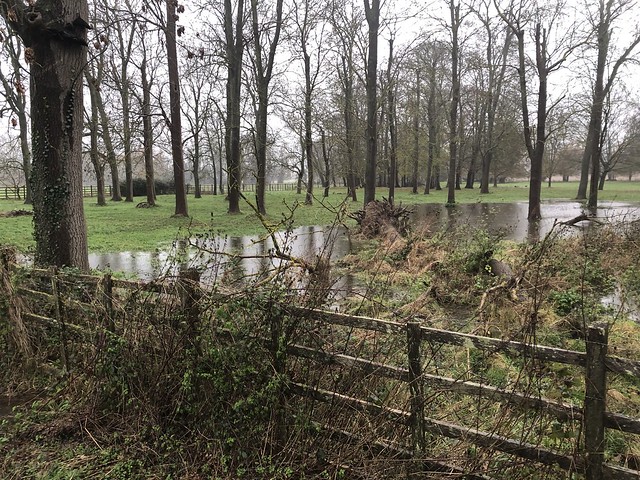
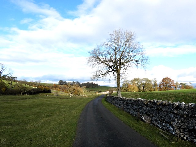
An ice-cold breeze coming east off the Chiltern Hills stung my eyes with wind tears as I followed the puddled track of the Icknield Way out of Bledlow. The low winter sun topped the trees on the crest of Wain Hill and threw the medieval ridge-and-furrow of the fields below the slope into sharp relief.

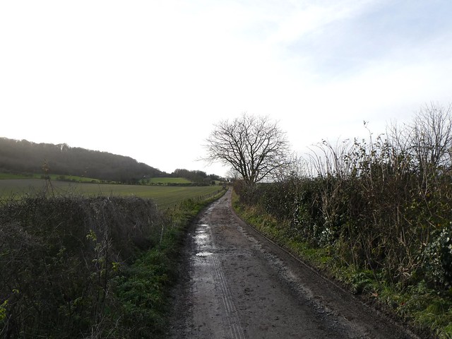
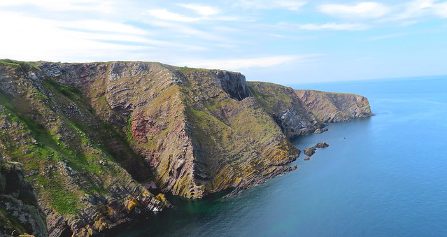
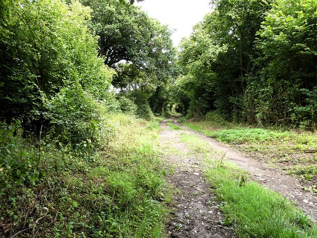
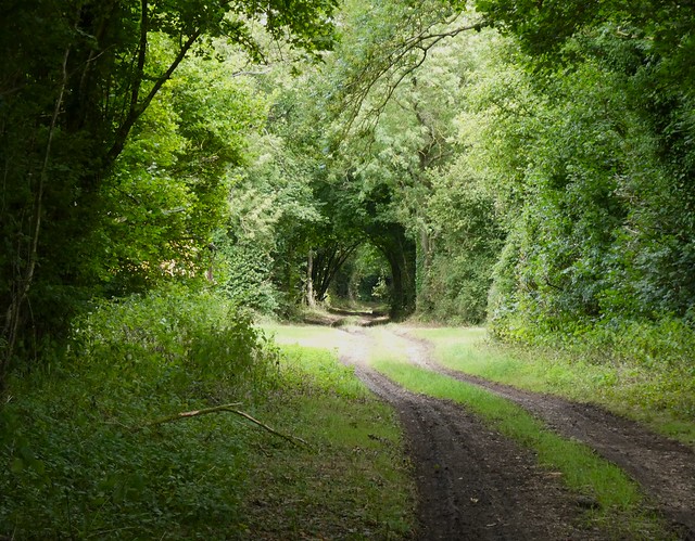
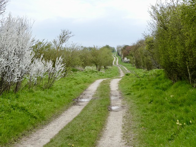
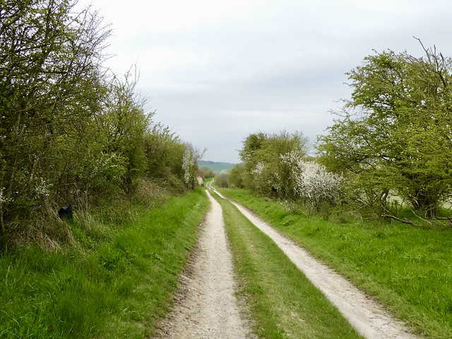
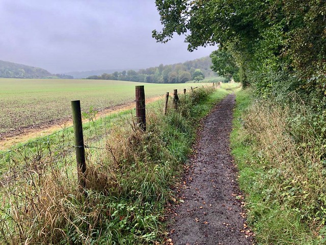
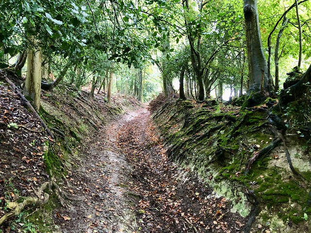
The Icknield Way, ancient thoroughfare across these chalk lands, ran at the feet of the hills. Soon I turned off on a carpet of wind-blown beech and oak leaves, into a steep holloway that rose up the escarpment in the chilly shade of a yew grove.

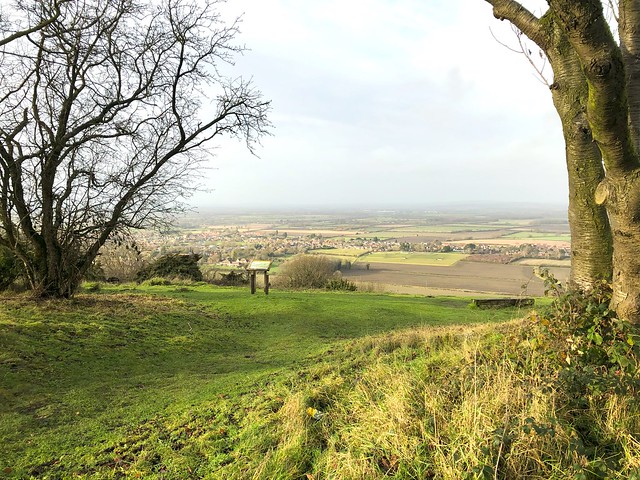
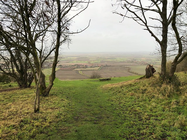
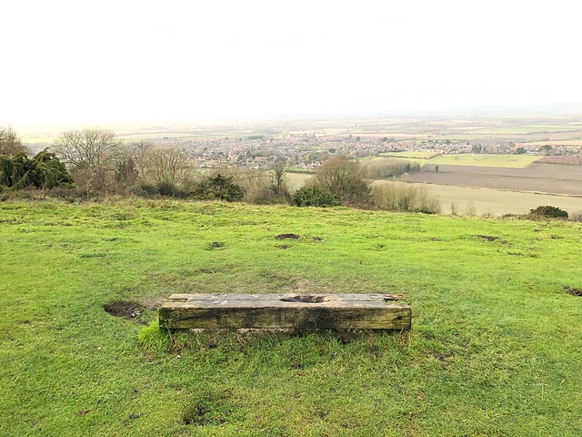
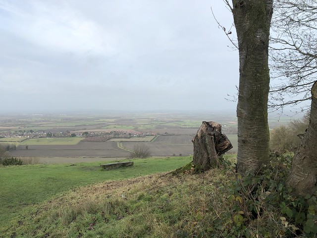
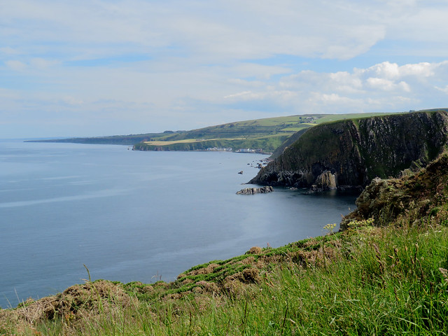
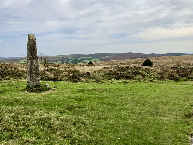
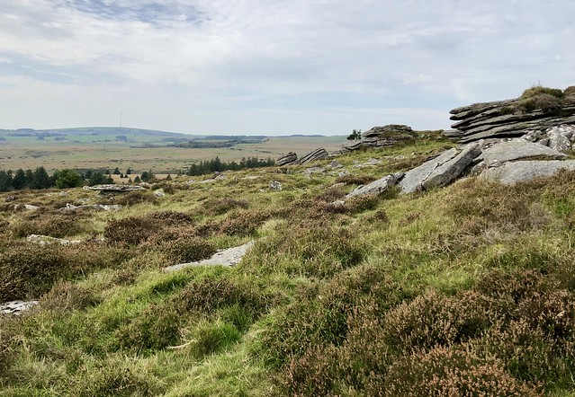
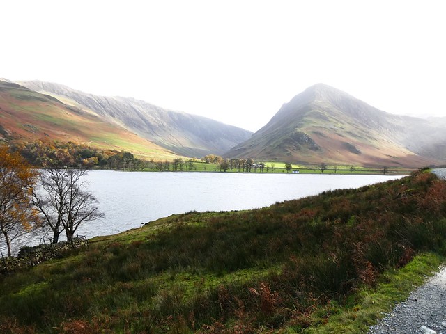
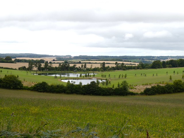
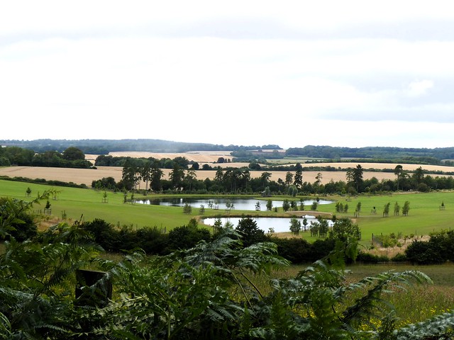
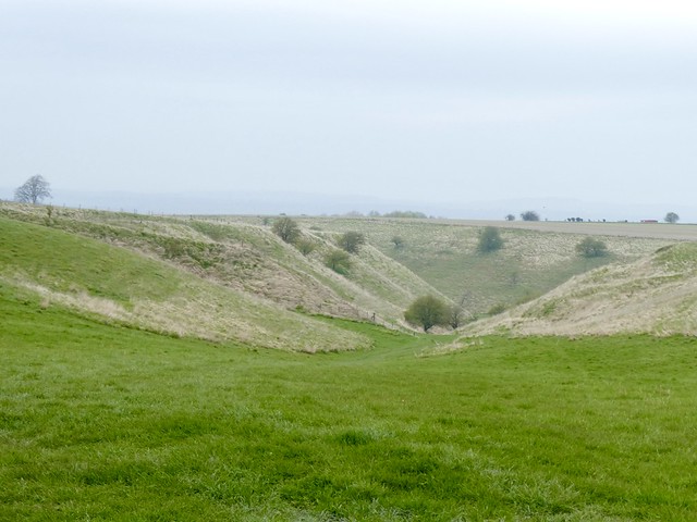
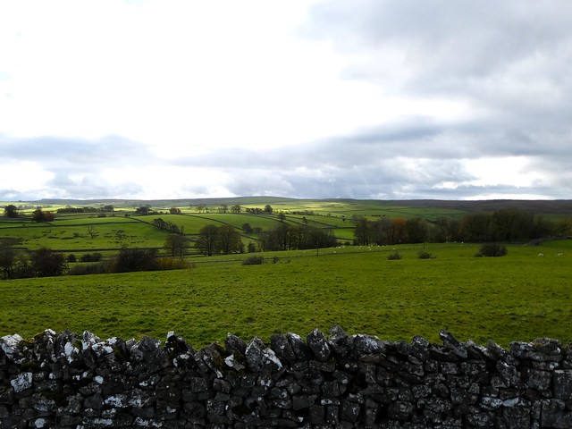
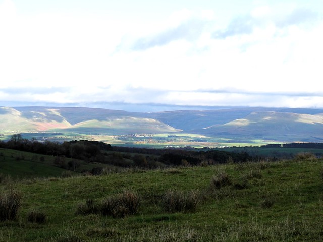
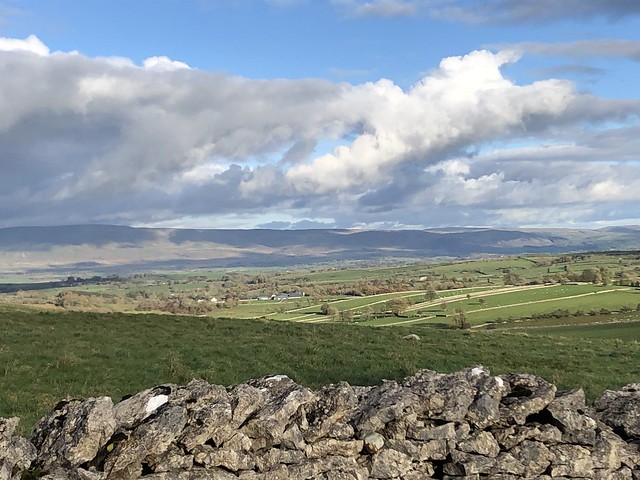
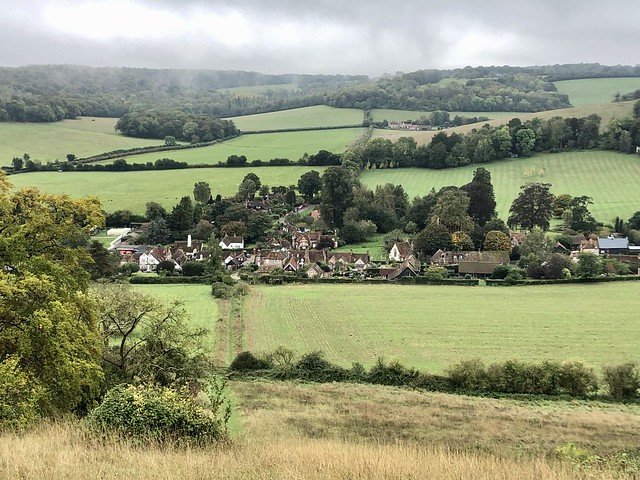
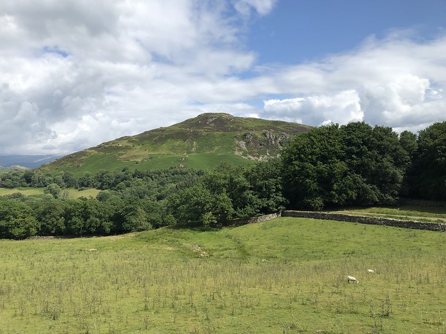
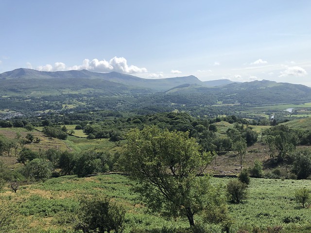
Near the top a fat ginger tomcat on a cold tin roof yawned massively as he watched me go by with supreme indifference. A path at the crest of the ridge brought me to a wonderful viewpoint over the Vale of Aylesbury where the sun was sweeping up the last of the morning mist and spreading golden light like butter over thirty miles of low-lying country.

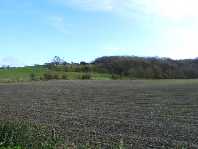
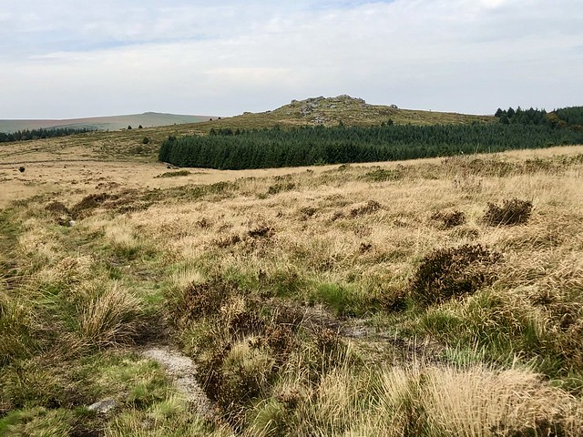
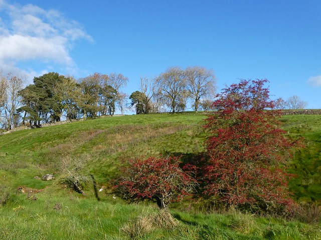
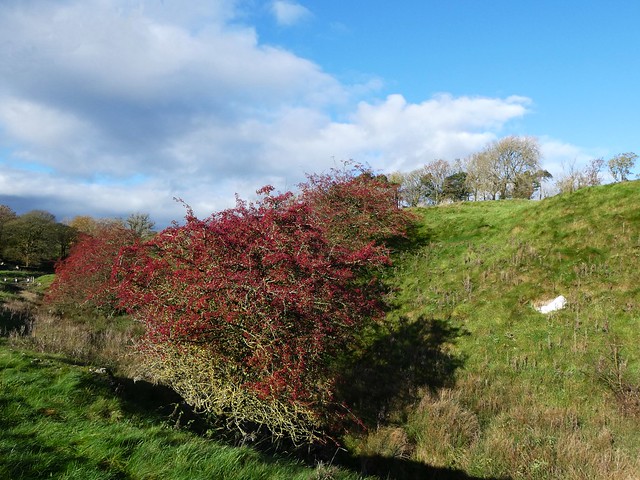
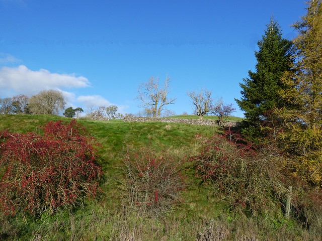
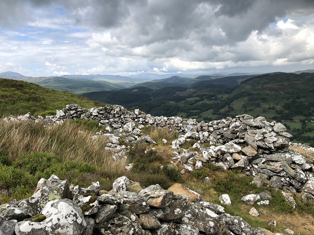
A flock of goldfinches, softly twittering, flitted away from the thistle heads where they had been feasting. I passed the Bronze Age burial mounds of Chinnor Barrows, smothered under juniper and bramble, and dipped down another slippery hollow to the feet of the scarp once more.

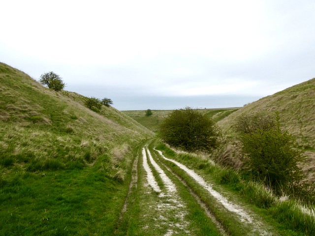
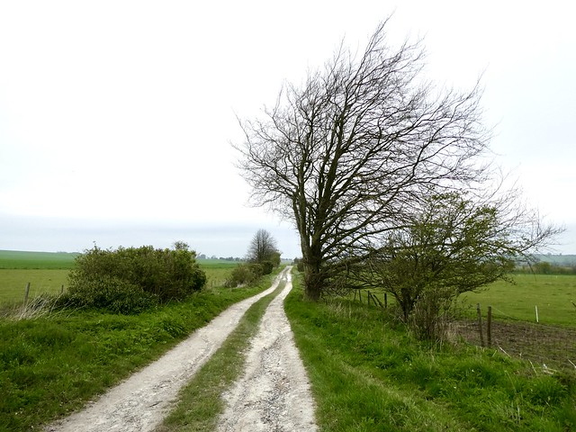
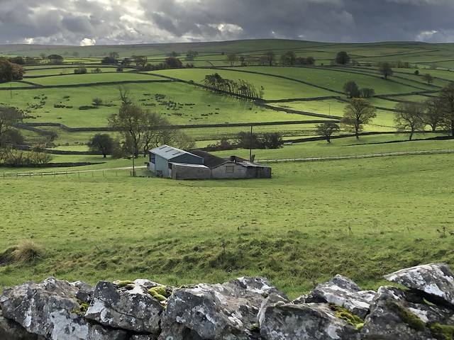
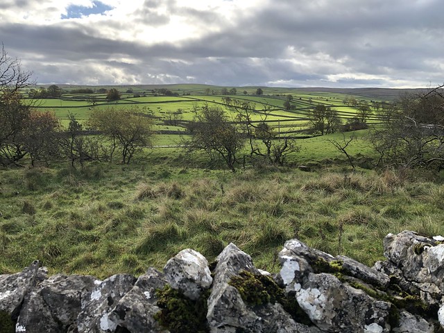
The Ridgeway, companion to the Icknield Way, ran here in a succession of snaky curves under beech and ash. Silver birch trunks, their heartwood rotted where they lay, were no more than empty cylinders of bark where spiders and tiny beetles lay in their winter inertia.

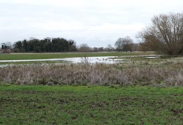
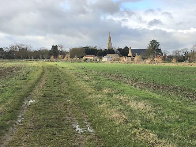
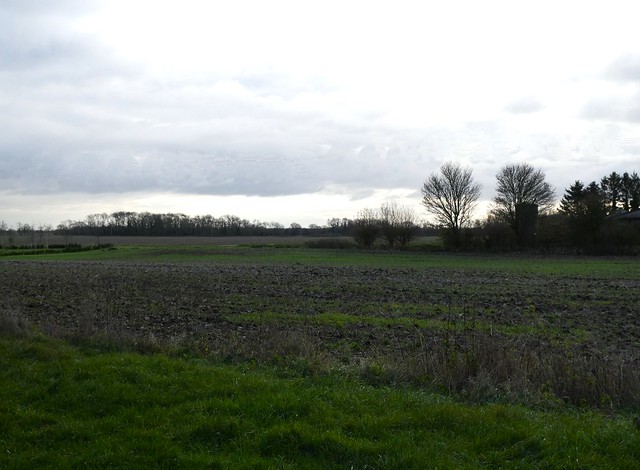
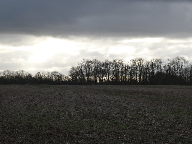
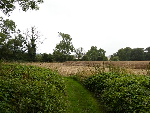
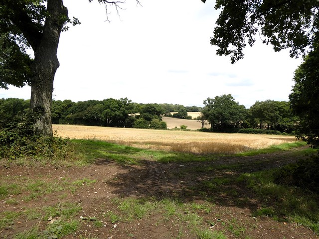
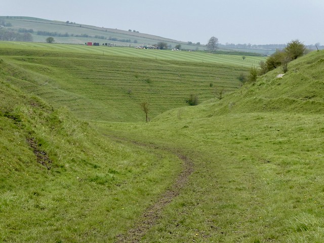
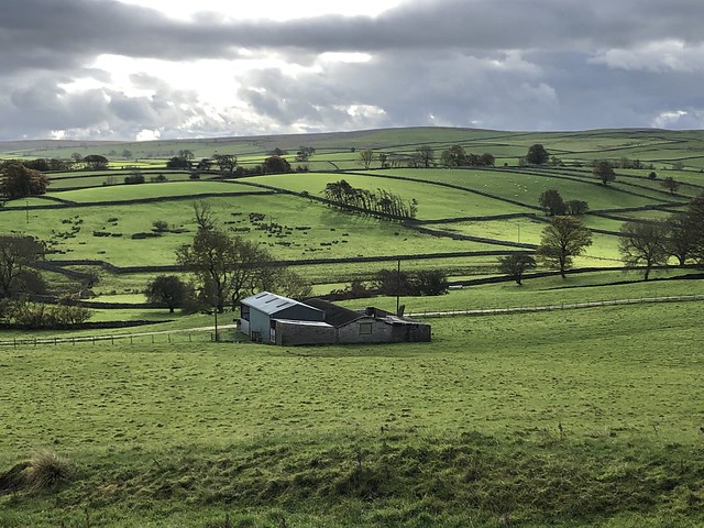
The pearlescent sun swam down between the bare treetops of Thickthorne Wood. I followed a footpath over the grassy billows of the lower slopes before setting back across bare, silent stubble fields. A red kite wheeled down to land nearby and pick up a worm, short commons in the hungry months of the year.

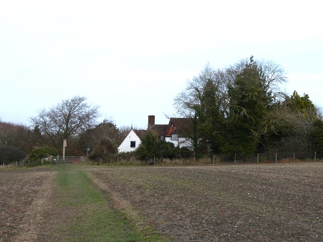
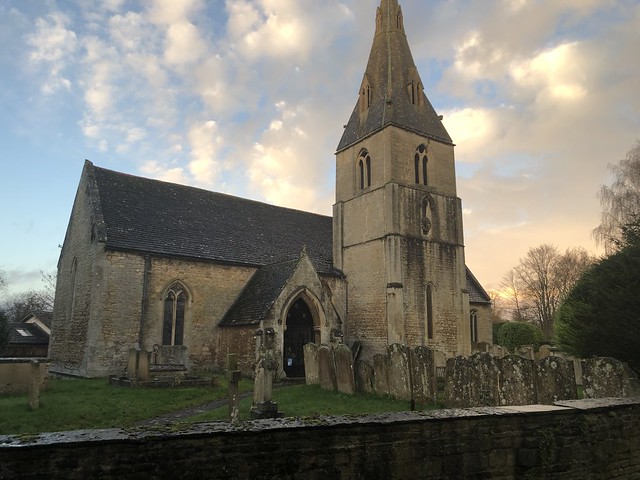
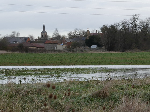
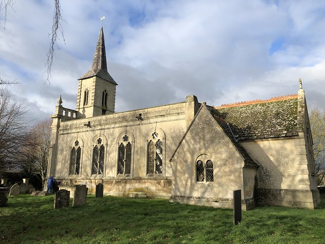
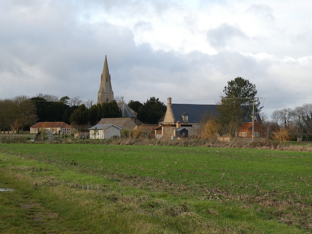
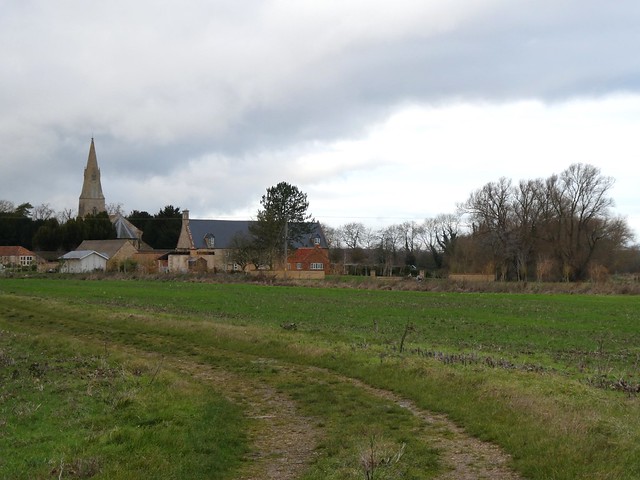
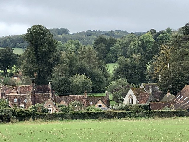
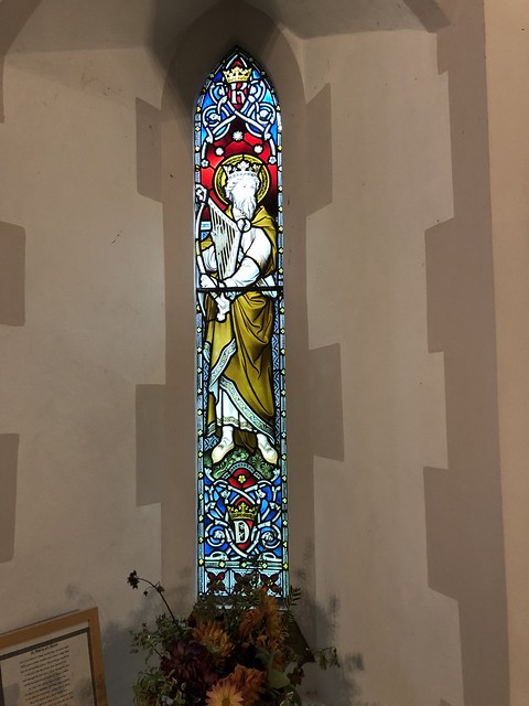
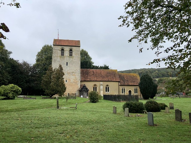
Back in Bledlow with its beautiful old Church of the Holy Trinity and charming cottages of brick and timber framing, I ducked into the Lions of Bledlow pub. Literally ducked – the place was full of scalp-scraping beams, a properly cosy pub for sitting and replaying this perfect winter walk.

How hard is it? 5 miles; easy, but muddy, sticky and slippery in places!

Start: Church End, Bledlow HP27 9PD (OS ref SP 778021)

Getting there: Bus 320 (Chinnor – Princes Risborough)
Road: Bledlow (NB – not Bledlow Ridge!) is signed off B4009 between Chinnor and Princes Risborough (A4129/A4010)

Walk (OS Explorer 171): Beside Lions of Bledlow PH, through gate (‘Footpath only’), across field, right along Icknield Way/IW (775017). In ½ mile at Hempton Wainhill, follow IW/Ridgeway between two houses and on (770012). In 600m fork left uphill (767009, ‘Bridleway, Wildlife Walk’). At top of rise, left over barrier (767002, ‘Chinnor Barrows’) and on. In ⅔ mile, back at Hempton Wainhill, right (IW). In 100m in front of house, fork right (770012, ‘Ridgeway/IW/Bridleway’). In ½ mile, just past track crossing, right (778011, gate, ‘Footpath’) across fields, soon with trees/fence on left. In ½ mile, just before crossing hedge, left (782006, gate). Right; in 20m, right (gate, ‘footpath’); cross field; cross Wigan’s Lane (784004). Down driveway; in 400m on right bend, left (787001, blue, yellow arrows). In 100m path bends left; in 300m, before waymark post (787004), left through hedge; recross Wigan’s Lane (785005). Follow fence; in 300m pass ‘Footpath’ gate; in 20m left (782006, gate); right along hedge. In 200m fork right through trees (781008); cross IW (781011); path by hedge to Bledlow.

Lunch: Lions of Bledlow PH (01844-343345, thelionsofbledlow.co.uk)

Accommodation: Inn at Emmington, Sydenham OX39 4LD (01844-351367, theinnatemmington.co.uk)

Info: chilternsaonb.org

 Posted by at 02:09
Jan 272024


First published in: The Times Click here to view a map for this walk in a new window
Greatford Hall Church of St Thomas of Canterbury, Greatford Greatford Church and West Glen River Floods on East Glen River 1 Floods on East Glen River 2 Floods on East Glen River 3 Floods on East Glen River 4 Floods on East Glen River, looking to Wilsthorpe St Faith's Church, Wilsthorpe Worried crusader knight, St Faith's Church, Wilsthorpe Braceborough 1 Braceborough 2 Braceborough 3 Braceborough 4 landscape between Braceborough and Shillingthorpe Park 1 landscape between Braceborough and Shillingthorpe Park 2 Road between Shillingthorpe Park and Greatford 1 Road between Shillingthorpe Park and Greatford 2 Road between Shillingthorpe Park and Greatford 3

Greatford Hall lies beyond its boundary wall, a handsome rebuild in pale Lincolnshire limestone of the old country house where during the 18th century Dr Francis Willis practised pioneering forms of psychiatric treatment. His patients were misfortunate gentlemen of quality, the most illustrious of whom was the occasionally demented King George III.

In the village church alongside we found a bust of Dr Willis, bald and benign. The memorial eulogised the good doctor, ‘happily the chief agent in removing the malady which affected the present majesty in the year 1789’. The physician’s kindliness and benevolence were attested ‘by the tears and lamentations which followed him to the grave.’

With this touching image in mind we left Greatford and struck out north across the flat South Lincolnshire landscape, following the twisty Macmillan Way under a sky of grey and pink clouds. A proper midwinter afternoon, with floods gleaming in the fields beside the East Glen River and bushy-headed willows leaning over their reflections in the streaky water.

This is a countryside where church steeples have only the skeletal pylons as rivals for skyline prominence. The slender tower and spire of St Faith’s at Wilsthorpe beckoned us from afar. Inside, a dusty stone knight, perhaps a Mortimer, lay recumbent in a corner of the sanctuary, legs crossed at the knee to commemorate his two crusades, a purse and sword at his elaborate belt. The sculptor had furrowed the warrior’s brow with deeply incised lines, giving him a curiously worried expression.

Down the lane in Braceborough, little fierce stone lions guarded the label stops of the church windows. A mistle thrush was stabbing slots in a pile of apples that had fallen across the fence into the graveyard.

The homeward path led south over big fields of winter wheat, the slithery mud pocked with deer slots. In Shillingthorpe Park lumps and bumps in the wide grassland showed where immaculate parkland had superseded a medieval settlement. Trees had swallowed what little remains of Shillingthorpe Hall, a fine mansion which once housed a group of Dr Willis’s psychiatric patients.

Beyond the woods the West Glen River ran swift and swollen, stained bright yellow with floody mud. Towards nightfall we followed a quiet country road back into Greatford as a band of rooks flew chuckling and chattering overhead towards some distant roost.

How hard is it? 5½ miles, easy; field paths and country roads. NB can be wet around West and East Glen Rivers – take wellingtons in case!

Start: Church of St Thomas of Canterbury, Greatford, near Stamford PE9 4PX (OS ref TF 086119). Park near Hare & Hounds PH.

Getting there: Bus 45 from Stamford (Call Connect, 0345-263-8253))
Road – Greatford is signed off A6121 (Stamford-Bourne) at Carlby, between Essendine and Toft.

Walk (OS Explorer 234): From NE corner of churchyard, path to road. Left; in 150m pass Ash Lodge on right; on next left bend, fork right on Macmillan Way/MW (086122, fingerpost). Follow MW through fields (fingerposts, yellow arrows) for 1¼ miles, crossing East Glen River (089131), to road opposite St Faith’s Church, Wilsthorpe (092136). Left; in 150m, left (091138, ‘Braceborough’). Follow road for 1 mile to Braceborough. Left at Village Hall (081131) to visit St Margaret’s Church and return to Village Hall; right for 600m to cross Greatford road (079126). Follow path through fields for nearly 1 mile to join MW in Shillingthorpe Park. Left (072116, fingerpost) on MW to road (075111); left for 1 mile to Greatford.

Lunch: Hare & Hounds, Greatford PE9 4QA (01778-560332) – open Mon-Fri, 2-9; Sat, Sun, 12-10.

Accommodation: Crown Hotel, Stamford PE9 2AG (01780-763136, kneadpubs.co.uk)

Info: Stamford TIC (01780-755611); visitlincolnshire.com

 Posted by at 03:57
Jan 202024


First published in: The Times Click here to view a map for this walk in a new window
Trawlers at Eyemouth 1 Trawlers at Eyemouth 2 Trawlers at Eyemouth 3 Eyemouth 1881 fishing disaster memorial Looking back past Eyemouth to St Abbs Head Tilted greywacke cliffs near Eyemouth 1 Tilted greywacke cliffs near Eyemouth 2 Greywacke folds in the cliffs near Eyemouth 1 Looking south over Burnmouth and Ross 1 Greywacke folds in the cliffs near Eyemouth 2 Looking south over Burnmouth and Ross 2 Looking south over Burnmouth and Ross 3 Burnmouth harbour

Nearing the border where Scotland hands over to England, the cliffs of the south Berwickshire coast form a spectacularly folded and tilted rampart, partly ancient volcanic outpourings, partly sedimentary rock some 430 million years old with the curiously pleasing name of greywacke. Tucked away at the back of a sea-sculpted hollow lies the old fishing and smuggling town of Eyemouth, pungent with a whiff of fish and a smack of salt.

On the cliff path south of Eyemouth I stopped to watch the waves dashing in white foam on the Hurkers, jagged black teeth of rock at the entrance to the bay. On that reef and adjacent cliffs the Eyemouth fishing fleet was wrecked in a vicious autumn squall in 1881 that claimed the lives of nearly two hundred local fishermen in the space of a few hours. A devastating toll for the little town, and the stumpy, storm-proof build of the modern trawlers sheltering in the harbour today told of a sea that has lost none of its deadly power.

On a ledge of rock high above the waves a solitary figure in a yellow oilskin was wedged for a gull’s-eye view of the dramatic pull and suck exerted by the sea on its timeless mission to whittle away the land grain by grain. A last northward glimpse of Eyemouth sprawling down its cliffs and the lighthouse on St Abbs Head beyond, and I faced into a strong southeast wind laden with salt spray.

At Hurker’s Haven the sea has taken a great bite out of the cliffs, exposing green, red and yellow layers of rock scrunched up together by ancient subterranean upheavals like a Danish pastry squashed in a giant’s fist. Near the crest stood a wartime lookout, a plain concrete hut transformed into a child’s dream eyrie with fun-size table and chairs, a couple of pictures and a toy boat.

Beyond Hurker’s Haven the path ran between the cliff edge and fields stretching inland. The sea murk cleared to reveal the English coastline running away south. A tiny blob some fifteen miles off was Lindisfarne Castle, with an even tinier Bamburgh Castle beyond, both strongholds apparently floating far out at sea.

Now the long pincers of Burnmouth Harbour came into view with the houses of Ross beyond, twin fishing settlements clinging to the base of the cliffs where the waves rolled and retreated. The bent-up cliffs and solid breakwaters made a striking contrast with the diffuse energy and hunger of the sea, and I gazed my fill before turning for home with wind and spray at my back.

How hard is it? 9 miles there and back; easy; clifftop paths

Start: Eyemouth Seafront car park, High Street, Eyemouth TD14 5EY (OS ref NT 944644) – free

Getting there: Bus 235 (Berwick-upon-Tweed to Eyemouth)
Road: Eyemouth is on A1107 (signposted off A1 between Berwick-upon-Tweed and St Abbs)

Walk: (OS Explorer 346): Facing sea, bear right along harbour. At corner, right. In 500m, beside Quayside Chandlery (945641), left up causeway; left along fishing boat moorings. In 600m road curves right; on this bend keep ahead (948645) to post with arrow, and follow cliff path (posts with arrows) round edge of golf course. Follow ‘Coastal Path’ signs along cliff edge for 3¾ miles to road at Burnmouth (955610). Bear left (‘Coastal Path’) down road to Burnmouth Harbour and on along shore road to Ross community at far end (963604). Return to Eyemouth by outward route, or by bus from Burnmouth.

Lunch: Oblò Bar and Restaurant, 18-20, Harbour Road, Eyemouth TD14 5HU (01890-752527, oblobar.com)

Accommodation: The Ship’s Quarters, Harbour Road, Eyemouth TD14 5HT (01890-769515, theshipsquarters.com)

Info: visitscotland.com

 Posted by at 01:54
Jan 132024


First published in: The Times Click here to view a map for this walk in a new window
Deckless clapper bridge at Bellever 1 Bellever Tor Laughter Man standing stone Granite rocks of Bellever Tor 1 Granite rocks of Bellever Tor 2 Granite rocks of Bellever Tor 3 Deckless clapper bridge at Bellever 2 Stone circle on Lakehead Hill Kraps Ring ancient settlement Granite rocks of Bellever Tor 4 Deckless clapper bridge at Bellever 3 Deckless clapper bridge at Bellever 5 Deckless clapper bridge at Bellever 4

Postbridge lies more or less in the middle of Dartmoor, its main attraction the medieval clapper bridge that crosses the East Dart River. Early on this brisk morning I had the bridge with its great granite slabs and piled supports to myself.

Out on the open moor a broad grassy bridlepath ran south through pale wiry grass. All round the long skyline of the moor swelled, its smooth undulations broken by the hard outlines of granite tors.

Down in a sheltered hollow the white cottages of Bellever lay cradled in dark forestry. The village has its own clapper bridge; the central slab is missing, and it would be a brave leaper who dared the jump.

A gravel roadway led through the conifers of Bellever forest to where Laughter Hole Farm lay silent and derelict among ancient trees trailing long green beards of usnea lichen. Beyond the farm the track headed on across the moor, wide open country all round, low ridges and hidden valleys, stunted thorns and willows dotting the coarse grass.

I turned off along a green track to pass the Laughter Man, a 10-ft tall standing stone on the slope of Laughter Tor. From here Bellever Tor stood tall on the western skyline, a jumble of granite that resolved itself as I got nearer into piles of flat wind-sculpted rocks stacked like grey pancakes. Near the top Dartmoor ponies grazed, glancing at me from under their rock star fringes.

It might have been the arresting profile of Bellever Tor that caused our ancient ancestors to construct their sacred sites across the slopes of Lakehead Hill. I followed a rough path through the tussocks, stumbling upon stone circles, a cist burial under a flat capstone, and a row of twelve tooth-like stones carefully aligned with the rising and setting of the sun.

There was something about these obscure monuments half buried in the moor grass that made me linger in their presence far longer than I’d intended to. Walking on at last, I thought of Tom White of Postbridge, a lovelorn suitor who dallied too long with his girlfriend. The pixies of Bellever Tor caught him on the way home and taught him a lesson by making him dance from midnight till dawn.

How hard is it? 5¾ miles; moderate; rough moorland paths. No recommended in mist.

Start: Bellever Forest car park, Postbridge PL20 6TH (OS ref SX 647786)

Getting there: Bus 98 (Tavistock-Yelverton)
Road – Postbridge is on B3212 between Moretonhampstead and Two Bridges

Walk (OS Explorer OL28): From car park, follow signs to clapper bridge (649788). Just before bridge, turn south off road (‘Bridleway’); up steps onto moor. In ⅔ mile at gate (652778) cross track; bridleway descends into Bellever. At road, left (656773) to clapper bridge (659773). Return along road; left through forest car park; follow track past Laughter Hole Farm (659759). On up hill (‘Country Road B3157’ fingerpost). At gate leave trees (658755); ahead (‘Dunnabridge Pound’). In 500m at cross-tracks (654752), right past Laughter Man standing stone (653753); on towards Bellever Tor. In ½ mile through/over gate (646758); right on grassy track to Bellever Tor summit (645764). Down broad path towards forest; in 400m, fork left (646767) on path up right flank of tussocky Lakehead Hill between forestry blocks. Follow it for 1 mile past cairn circle and cist (644774), stone row (644776) and stone circle (644777) to Kraps Ring settlement (645781). Path through trees beyond (post ‘5A’); in 200m, right on track, then left to Postbridge.

Lunch/Accommodation: East Dart Inn, Postbridge PL20 6TJ (01822-880213)

Info: Visitor Centre, Postbridge (01822-880272, dartmoor.gov.uk)

 Posted by at 03:34
Jan 062024


First published in: The Times Click here to view a map for this walk in a new window
Looking north from the head of Buttermere around Gatesgarth St James's Church, Buttermere Herdwick sheep in foreground; Fleetwith Pike and Haystacks beyond Buttermere lake foot looking across Buttermere toward Robinson looking across Buttermere to Hassnesshow Beck and Robinson Fleetwith Pike at the head of Buttermere Misty light on Fleetwith Pike and Hindscarth Edge Looking south across Buttermere towards High Crag and High Stile Looking south across Buttermere towards High Stile and Red Pike

A cold morning in midwinter after a night of wild weather across the Lake District fells and valleys. The weatherman said all was set to clear to sunshine by midday, but it was still blowing a hooley on the tops as we dipped down the narrow mountain road to Buttermere village.

From the tiny settlement on its isthmus between Buttermere and Crummock Water, tough guys and gals wrapped in cocoons of winter clothing were heading for the heights. We were after something more modest today, the low-level circuit of Buttermere that’s one of the peachiest short winter walks in the Lakes.

We ducked into the diminutive Church of St James at the entrance to the village to gaze out of the window dedicated to supreme guidebook writer and illustrator Alfred Wainwright. The glass is perfectly blank; no need for any coloured image when the window frames a perfect view of Haystacks, the Master’s favourite peak where his ashes were scattered.

Broad-faced Herdwick sheep in the valley-bottom pastures saw us off around the lake, staring as though they’d never seen a human being before. At the far end of Buttermere, Fleetwith Pike rose magnificently, a sharp angle of fell running up to a peak with the knobbly spine of Haystacks alongside.

Soon these easterly fells were hidden by the lemon-yellow larches and wind-tattered silver birches and sycamores of Burtness Wood. Sourmilk Gill came rushing down its rocky cleft with tremendous noise and presence, a tumble of multiple strings of white water issuing from invisible Bleaberry Tarn high overhead. Up there the crumpled peaks marched southeast along the flanks of the valley – Red Pike and High Stile beside us, Grasmoor and Robinson opposite, two thousand feet above.

Every hillside stream was a torrent today, sluicing over mats of moss and liverworts in miniature waterfalls, coursing across the path. But as we reached the lake head the promised sun materialised over the shoulder of High Crag, flooding the fells with brilliant gold light.

From Gatesgarth Farm and the hump-backed valley road we took the homeward path along the northern shore. A flock of Canada geese with white chinstraps and shirt fronts bobbed on the lake, discussing our passing with hen-like clucks and coos. A rock scramble and a short splashy tunnel through an outcrop, and we descended to Wilkinsyke Farm at Buttermere village, as eager for tea and stickies as though we’d truly been storming the heights.


How hard is it? 5 miles; easy gradients, but rough underfoot; lakeside tracks.
sz
Start: Buttermere village car park, CA13 9UZ (OS ref NY 174169)

Getting there: Bus 77A from Keswick.
Road – Buttermere is signed from Borrowdale (B5289) and from B5292 at Braithwaite (A66 Keswick – Cockermouth).

Walk (OS Explorer OL4): From car park, through kissing gate; right along path (‘Lake’, then ‘Buttermere’). In 600m at gate with NT contribution box (174164), right; continue on track along south side of Buttermere for 2 miles to Gatesgarth Farm at lake head (195149). Left along B5289 (take care! narrow road with bends); in 600m, left off road (192154, fingerpost ‘Buttermere village’). Follow north side path. In 700m, short rock scramble at 187158 approx; short tunnel follows. At foot of lake, keep ahead at fork (178164, fingerposts) to Wilkinsyke Farm and road (176169). Left to car park.

Lunch: Syke Farm Tea Room, Wilkinsyke, Buttermere (01768-770277)

Accommodation: Bridge Hotel, Buttermere (01768-770252, thebridgehotel.uk); Buttermere Court Hotel, Buttermere (01768-770253, buttermerecourthotel.co.uk).

Info:
South side path, through rough and rocky in places, is recommended for wheelchair users in ‘Accessible Walks in the Lake District & Cumbria’ by Mike Routledge (Pathfinder Guides; pathfinderwalks.co.uk)

 Posted by at 01:08
Dec 232023


First published in: The Times Click here to view a map for this walk in a new window
lakes at Armsworth Park 1 lakes at Armsworth Park 2 In the fields near Godsfield Farm 1 In the fields near Godsfield Farm 2 The ancient Ox Drove and its tangled hedges 1 The ancient Ox Drove and its tangled hedges 2

A pigeon was performing its soft and melancholy dirge as we left Upper Wield on a quiet morning. Thatched roofs peeped over immaculately kept hedges around the village green. Everything was neat and orderly – even the fingerpost pointing the way was handsomely carved in wood.

Out in the fields the Three Castles Path, dinted with horseshoe prints in the sticky mud, made west in the skirts of Barton Copse and Wield Wood. The still sky overhead was packed with heavy-bellied clouds, and soon a mizzly drizzle came our way – not honest rain, but a wetting miasma that blurred all views.

In the shallow valley to the south below Armsworth House a couple of recently created lakes winked like steely eyes in a wide sweep of shaven grass. Beside the path lay carefully seeded meadows and a plantation of young oak, cherry and field maple, each sapling in its swaddling band of biodegradable tree guard. Everything in view spoke of thought and money, plenty of both, invested judiciously with the future health of the countryside in mind.

The shower passed, and blackbirds and thrushes struck up. I began to hum the ‘after-the-storm’ bit from the Pastoral Symphony. A green woodpecker shot out of Godsfield Copse like a bolt from a crossbow, cackling manically as it sped away across the maize stubbles.

The name of Godsfield holds a clue. In the 12th century the Knights Hospitallers founded a preceptory or monastery here, and around two centuries later a chapel (now in private hands) was built at Godsfield. We saw its pitched roof rising beyond a garden wall as we passed Godsfield Farm and headed south for the ancient trackway of the Ox Drove.

Cattle and sheep were driven for many centuries along this wide highway between Old Sarum and its junction with the Harroway, oldest road in Britain, at Five Lanes End near Basingstoke. Evocative names, and there is another style for the old drove road too – the Lunway, from the Scandinavian ‘lundr’ or sacred wood.

No sacred forests surround the Ox Drove today – just thick hedges enclosing the flint-floored trackway, twenty metres from edge to edge, as it carried us through the gently swelling landscape towards journey’s end.

How hard is it? 7 miles; easy; field paths and trackways.

Start: Upper Wield, near Alresford SO24 9RU approx (OS ref SU 630387)

Getting there: Bus 41 (Basingstoke-Alresford), Wed and Fri
Road – Upper Wield is signed from B3046 (Basingstoke-Alresford) at Preston Candover.

Walk (OS Explorer OL32): From phone box, follow ‘Preston Candover’. In 100m left (‘Church’); then follow bridleway fingerposts/FPs (Three Castles Path). In 2¼ miles, 250m beyond end of Godsfield Copse, left along farm drive (598374). In ⅓ mile pass Godsfield Cottage (601371); follow drive past chapel (605370) to road (606367). Right; in ⅓ mile on right bend, left (604361) up drive (‘Lower Lanham’). In 50m, right (FP) through kissing gate/KG. Up field to KG; half left across field. At far side (607356), left along field edge; in 100m, dogleg right/left to join broad Ox Drove Way track between hedges. In 1¼ miles pass Upper Lanham Farm (620368); in ½ mile fork left through gate (627373) on track bending left to road (627377). Left to junction; left (‘Armsworth’); in 300m right (624378, stile, FP). Through KG; on beside Barton Copse. In 300m, cross stile (626380), then left through hedge. Half right across 2 fields to Three Castles Path (628386); right to Upper Wield.

Lunch: Yew Tree, Lower Wield SO24 9RX (01256-389224, theyewtreelowerwield.co.uk)

Accommodation: Swan Hotel, West Street, New Alresford SO24 9AD (01962-732302, swanhotelalresford.com)

Info: visit-hampshire.co.uk

 Posted by at 01:14
Dec 162023


First published in: The Times Click here to view a map for this walk in a new window
chalk track to the Ridgeway dry valley with cultivation and erosion terraces on the way to the Ridgeway The Ridgeway above Bishopstone 2 The Ridgeway above Bishopstone 1 The Ridgeway above Bishopstone 3 The Ridgeway above Bishopstone 4 The Ridgeway near Ridgeway Farm permissive path through Eastbrook Valley tower of Ashdown House Ashdown House in its misty valley

It was scarf and frozen fingers weather over the Wiltshire Downs on a murky, muted morning. As we left Bishopstone the village children were prancing to school past the thatched houses with their walls of clunch or chalk blocks. ‘David Beal, Master of Thatch’ proclaimed a board outside a cottage, with the proof of the pudding on show all through the twisty byways of Bishopstone.

Chaffinches sang us off along an ivy-tangled lane that led to a dry valley with medieval strip lynchets lying in parallel ledges along the slopes. We threaded our way among a flock of recumbent sheep, the gently rising track turning from grass green to chalky white as it reached the Ridgeway on the crest ahead.

The ancient ridge track, a dozen paces wide, was potholed and puddled. A blackbird sang with piercing sweetness from a hawthorn twig just above our heads, so close and unafraid that we could see the working of its throat and the trembling of its bright orange beak with every phrase.

A line of leafless beeches kept the wind from the sheds at Ridgeway Farm. Here we turned south past a pig farm, the pink incumbents scampering away as though stung simultaneously into flight. Solitary crows stalked the plough furrows around the dishearteningly named Starveall Farm, and a shaggy-legged horse with a white nose blaze came up to accept a handful of grass from the greener side of the fence.

At the top of the track we turned east with red kites cutting circles overhead. There were big views to far downland ridges north and south, and as we descended the slope of Idstone Down a fine prospect ahead to the tall white shape of Ashdown House, a grand hunting lodge built in the 17th century for Elizabeth Stuart, elder sister of King Charles I and sometime Queen of Bohemia.

Elizabeth had a curious life, targeted by the Gunpowder Plotters at nine years old to be a hostage and puppet Catholic monarch, then in her teenage years as marriage fodder for the European monarchies. She was nobody’s stooge, however, but a highly educated and accomplished person with a passion for literature and language.

We passed the clamorous rookery in Swinley Copse and followed a wide valley track up to turn for home along the Ridgeway. A permissive path led us aside down a steep, twisting valley, quiet and beautiful, and we beat the rain into Bishopstone by a very short head.

How hard is it? 7¼ miles; easy; downland tracks

Start: Royal Oak, Bishopstone, Swindon SN6 8PP (OS ref SU 247837)

Getting there: Bus 47 (Lambourn–Swindon)
Road: signed from A419, Swindon-Cricklade (M4, Jct 15)

Walk: Between Bishopstone Stores and Village Hall, take pathway (‘Ridgeway’) to road (247836). Right; right up Nell Hill. In 150m fork right (‘Ridgeway’). Follow ‘Ridgeway’ signs up valley to The Ridgeway (249823). Left; in ⅓ mile at Ridgeway Farm, right (253827, ‘Public Right of Way’) along track. In ¾ mile climb slope; at top, left at track crossing (259810); in 100m, fork left (260809, arrows). In ¼ mile through gate (265809, blue arrow); on along fence. In ½ mile bear half left (273810, ‘Ashdown’) to cross stile. Keep same direction downhill, pass Swinley Copse (276816); in 100m in valley bottom, left on grassy track (277818). In 1⅓ mile, left along The Ridgeway (264835). In ⅓ mile, right over stile (260832, ‘Permissive Path’). After next stile, bear left down Eastbrook Valley. At bottom, through squeeze stile (251834); down track to road (249837); left (take care!) into Bishopstone.

Lunch/Accommodation: Royal Oak, Bishopstone (01793-790481, helenbrowningsorganic.co.uk) – superb throughout.

Info: bishopstoneandhintonparva.org

 Posted by at 01:34
Dec 092023


First published in: The Times Click here to view a map for this walk in a new window
Stone barn near Great Asby sheep pasture near Great Asby 1 sheep pasture near Great Asby 2 rough pasture near Great Asby hawthorn berries in profusion 1 hawthorn berries in profusion 2 hawthorn berries in profusion 3 bridge on outskirts of Great Asby lane to Gaythorne Cottages looking towards North Pennines and High Cup stone wall striping the pastures near Great Asby looking south from the lane to Halligill 1 looking south from the lane to Halligill 2 looking south from the lane to Halligill 3 Great Asby church Stone wall and limestone pavement looking south towards Great Asby Scar Ash tree splitting the limestone on the lane to Halligill

Pied wagtails were pattering sidelong up the slate roofs of the cottages along the straggling lane through Great Asby. ‘Three Greyhounds?’ said the cheerful lady near the bus shelter. ‘Just over the packhorse bridge, can’t miss it.’

At the southern outskirts of the village we turned along a farm road that wound into open country. A flight of several dozen wintering fieldfares swooped into an ash tree, bounced and chattered amongst themselves, then fled downwind, their grey heads and dark tails showing out against a streaky blue sky.

A stone barn, sturdily buttressed, stood by the lane. Here the roadway roughened as it rose through rushy fields. Away south sombre moor tops lay under rolling cloud, and behind us in the east the rampart of the North Pennine hills climbed into a slate-grey murk. But here in this rolling countryside between the hills, sunlight lay thick and gold across pasture that was squared and striped with carefully maintained stone walls.

Beyond Halligill we left the track and plodged across rain-sodden fields, scrambling over a muddy beck and trudging down the grassy track to Gaythorne Hall. The farmer came puttering up on a quad as his ewes scampered away in communal panic. ‘Lambing from January on’, he told us.

Gaythorne Hall in its dell looked magnificent even in the steely embrace of scaffolding – a three-storey Tudor house, gabled and handsomely porched. We squeezed through an obstacle course of gates and a cattle crush to gain the farm lane that wound through sheep pastures up to the moor road back to Great Asby.

By the road lay the Bronze Age burial mound of Hollin Stump, where Victorian antiquarians unearthed three skeletons and a horse skull. What religious or magic connotation that had had was anyone’s guess. Walking on, we wondered what those remote ancestors would have made of the enormous rainbow that arced down from a black stormy sky towards the distant Pennine heights.

Nearing Great Asby we passed an exhausted ram lying prone in a field, smeared from head to tail with blue raddle. You might think that all rams lead the apolaustic life. But this one, surrounded by a hundred grazing ewes whose rumps he had ‘painted’ blue, bore a grim expression that said a ram’s lot at tupping time is not all beer and skittles.

How hard is it? 6 miles; easy/moderate; moorland roads and field paths, some boggy.

Start: Three Greyhounds PH, Great Asby, Appleby-in-Westmorland CA16 6EX (OS ref NY 681132)

Getting there: Great Asby is signed from B6260 (Appleby-Orton)

Walk (OS Explorer OL19): Right across bridge; left; at junction by post box, right on farm road (679129). In ½ mile pass barn; fork right (672128), In ⅓ mile track bends right towards Halligill (663128), but keep ahead over stile (yellow arrow/YA). In 50m, stile over wall on right (arrow). Half right towards left/south end of Halligill Wood. Cross beck and stile (659129, YA); up bank to step stile. Follow direction of arrow, slightly right; plantation soon in sight to right; just beyond it, double stile (656130, YA). Slight right across field to gates/stile (YA). Cross beck; follow cart track to Gaythorne Hall (650132), hidden in dip. In front of house, right (‘Drybeck’). In 50m, left (‘Gaythorne Cottages’) through walled paddock, then heavy gate, then wooden gate on right, to farm road (649131). Ahead; in ⅓ mile at Gaythorne Cottages, left (644123, ‘Great Asby’) on moor for 3 miles to Great Asby.

Lunch: Picnic; or Three Greyhounds, Great Asby (01768-351428, asbyparish.org.uk – contact for opening times).

Accommodation: George Hotel, Orton CA10 3RJ (01539-624071)

Info: asbyparish.org.uk; Appleby TIC (01768-351177)

 Posted by at 01:43
Dec 022023


First published in: The Times Click here to view a map for this walk in a new window
Turville in its valley bottom 1 Path near Harecramp Cobstone Windmill 1 Turville in its valley bottom 2 King David harps in the Church of St Mary le Moor at Cadmore End St Bartholomew's Church, Fingest Cobstone Windmill 2 the holloway through Hanger Wood approaching Cadmore End

A misty, moisty morning in the Chiltern Hills, with a wintry nip in the air. A group of hikers were enjoying thermos coffee and tupperware cake in the porch of the Church of St Mary le Moor at Cadmore End. Inside, strong colours glowed from the Victorian glass in the lancet windows, and a statuette on the font cover depicted a mother offering up her baby to the country in its hour of need – a very poignant memorial to First World War patriotic sentiment.

Mist hung in the trees and puddles made obstacle courses of the chalk and gravel tracks through the hills. A flock of starlings skimmed round in close formation before settling on a field to pick insects and worms from the sodden furrows. The countryside was a palette of washy greens, oranges and browns, pale and insubstantial in the moisture-thickened air.

In the margins of Hanger Wood a squirrel leaped overhead, knocking raindrops down to rattle among the hazel leaves. Acorns carpeted the path, none so much as nibbled. Maybe squirrels dine on caviar in the Chilterns.

Down in the valley by Harecramp Cottages a fleet of Land Rovers bounced towards their day’s shooting. I followed an old green lane among hips and haws, then climbed a steep little path to emerge at the crest of Turville Hill beside the white smock and skeletal sails of Cobstone Windmill, cleverly sited to catch every available wind.

Down below, Turville stretched along the valley bottom, picture perfect in mellow red brick. Here played out the extraordinary story of farmhand’s daughter Ellen Sadler, who fell asleep at home in Turville in 1871, aged 11, and could not be woken. Doctors, clerics, newspaper reporters and nosy celebrities attended her bedside, expecting to catch her out as a fraud, but nothing disturbed her Sleeping Beauty slumber until she awoke naturally some nine years later at the age of twenty.

There’s a gruesome fascination in the village inn’s name, the Bull & Butcher. The signboard displays a manically grinning butcher, cleaver in hand, with an apprehensive bull looking on. The pub itself proved warm, beamy, brick-floored and full of dogs – just the place for a nice pint of Brakspear’s golden nectar before the homeward plod by way of charming Fingest and the hollow bridleway through Hanger Wood.

How hard is it? 5 miles; easy; one short steep descent.

Start: Cadmore End car park, HP14 3PE (OS ref SU 786926)

Getting there: Car park is off B482 just east of Cadmore End school, between Stokenchurch and High Wycombe.

Walk (OS Explorer 171): cross road and green; left along lane. Opposite church (784925), right on track (‘Bridleway’). In 250m fork right by spinney (782925). In 450m at foot of slope, fork left into trees (778926, white arrow). In 700m cross road (773923); cross field to style (770925); left down lane. In valley bottom, left on green lane (767924). In ⅔ mile, nearing road, hairpin right (774917, yellow arrow/YA); in 50m fork left uphill to road (770915). Dogleg right/left past Cobstone Windmill; steeply down to Turville. 50m before road, left (769917), kissing gate/KG); half left to KG (771911); on to cross road (774910, ‘Chiltern Way’/CW). In 100m fork right (775911, YA, CW) to road (777910). Left; left up Chequers Lane; right by Sundawn * house (777911, fingerpost). In 100m fork right. In 250m, KG (780913); ahead up lane; in 300m fork left uphill (783914, blue arrow) to Cadmore End.

Lunch: Bull & Butcher, Turville RG9 6QU (01491-638283, thebullandbutcher.com) or Chequers PH, Fingest RG9 6QD (01491-756330, chequersfingest.co.uk)

Accommodation: Chilterns Fox, Ibstone Rd, HP14 3XT (01494-504264, thechilternsfox.co.uk)

Info: chilternsaonb.org

 Posted by at 03:58
Nov 252023


First published in: The Times Click here to view a map for this walk in a new window
Llyn Cynwch Cadair Idris from the Precipice Walk Foel Offrwm Iron Age fort wall at summit of Foel Offrwm resting bench looking west towards Afon Mawddach, on path to Foel Offrwm summit Precipice Walk, with Afon Mawddach below 1 Cadair Idris from the Precipice Walk 2 Llyn Cynwch 2 Precipice Walk, with Afon Mawddach below 2

The thrush seemed completely unafraid. It stood its ground under the silver birches on the forest path, its beak full of grubs, as I approached. It wasn’t until we were almost in touching distance of one another that it flew off among the trees. I watched it go, then moved on to where the steely flat waters of Llyn Cynwch made a dull mirror of the upland valley.

This portion of woodland, fellside and upland grazing a few miles north of Dolgellau belongs to the Nannau Estate. Since Victorian times the public has enjoyed the estate’s permission to wander a network of paths. I was setting out on this brisk day to explore the Precipice Walk high above the steep, glacier-scoured valley where the Afon Mawddach widens towards what George Borrow in his classic 1862 travel book Wild Wales termed its ‘disemboguement’ in Barmouth Bay.

A rocky path, clear on the ground but tricky to find footing on, led round the northern nose of a tall ridge before edging back along the brink of the precipice. The slope down to the river 700 feet below was steep and tree-hung, vertiginous in a couple of spots. But the views were quite sensational, out to the estuary below its headland, south to where Cadair Idris sprawled in full majesty of ridges, cliffs, corries and peaks against the clouds.

The Precipice Walk rounded the southern end of the ridge and fell away to the lake shore and a level stroll back to the car park. But I wasn’t quite satisfied. On the other side of the road rose Foel Offrwm, the ‘Hill of Sacrifice’, a tall knobbly eminence crowned with an Iron Age hill fort. The views from up there ought to be sensational too.

And so they were, once I had slogged up the zigzag path, past a tempting resting bench and on up to the tumble of stones that once formed a strong defensive wall for the ancient stronghold at the summit. By the curious square cairn I revolved slowly, taking in one of Snowdonia’s finest prospects – the lumpy Rhinogs and the serpentine Mawddach to the west, the Arans and Arennig to the east where I had climbed last year, the long tented back of Cadair Idris capturing the whole of the southern skyline, and away to the north a hint of the tall mountains that form the roof of Snowdonia.

How hard is it? 5½ miles in total. (Precipice Walk 3½ miles; Foel Offrwm 2 miles up-and-down). Precipice Walk mostly level, but rocky, stumbly path; Foel Offrwm a strenuous hill climb.

Start: Precipice Walk car park, near Dolgellau, LL40 2NG (OS ref SH 745211)

Getting there: Bus 33 (Dolgellau – Llanfachreth)
Road – On Llanfachreth road, signed off A494 between Dolgellau and Rhydymain.

Walk (OS Explorer OL23): Turn right along marked path at top of car park. In ½ mile through gate marked ‘Danger; Deep Drops’ (741212); in 100m uphill along wall. Follow it to right, then follow the obvious ‘Precipice Walk’ circuit. Watch your feet on this rocky path!
Back at car park, cross road and follow lower track parallel with road. In 250m, before gate, fork right (748212, ‘Foel Offrwm’ on marker stone) up side path, through gate and on. In 250m fork right up path (‘Copa Foel Offrwm’). In 100m bend right with the path, and keep climbing in same direction. At bench, fork back left (750213 approx) on path to summit cairn (750209). Return same way.

Lunch: Picnic

Accommodation: Afon Rhaiadr Country House, Rhaiadr Wnion, Dolgellau LL40 2AH (01341-450777, afonrhaiadr.co.uk) – very comfortable and welcoming B&B.

Info: snowdonia.gov.wales/walk/precipicewalk
visitwales.com

Walking the Bones of Britain – a 3 Billion Year Journey by Christopher Somerville is published by Doubleday.

 Posted by at 01:14