Search Results : “Quantock Hills”

Aug 152015


First published in: The Times Click here to view a map for this walk in a new window
picture picture picture picture picture picture picture picture
Facebook Link:

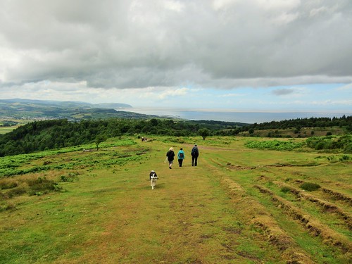
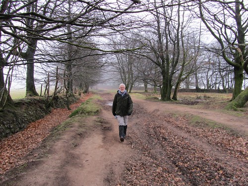
It’s not every day you celebrate your 300th ‘A Good Walk’ for The Times, and Jane and I wanted to make it something really special. Our good friend Alan came up with a tempting-looking route through the deep leafy combes and over the brackeny brows of the Quantock Hills – Wordsworth and Coleridge country. A sight of the sea, a proper draught of moorland air. That was just the ticket.

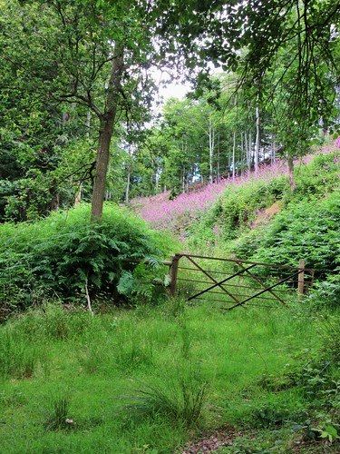
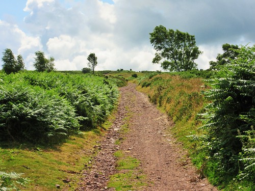
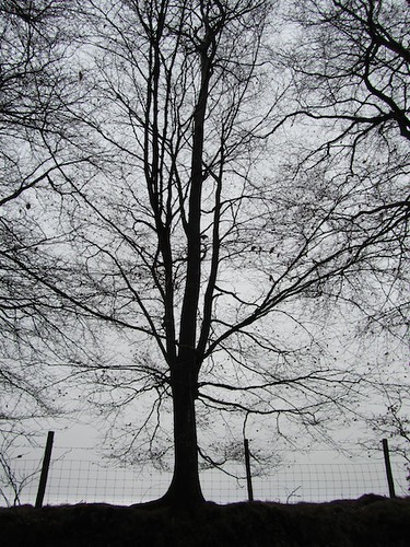
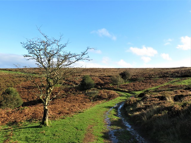
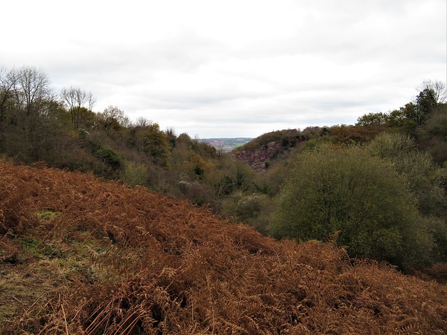
We set off from Beacon Hill, nine walking buddies talking nineteen to the dozen as we dropped steeply down under sweet chestnut trees to Weacombe. From there a long track led south under scrubby banks flushed purple by the overnight emergence of thousands of foxgloves. From the depths of Bicknoller Combe we looked up to see the western sky a slaty blur of rain. Soon it hit, and soon it passed, leaving us shaking off water like so many dogs in a pond.

Up on Black Ball Hill a faint sharp hooting carried to us on the wind. A steam train on the West Somerset Railway was panting its way down the valley towards Minehead, but locomotive and carriages stayed hidden from sight in the steep green countryside.

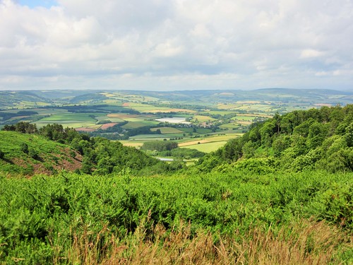
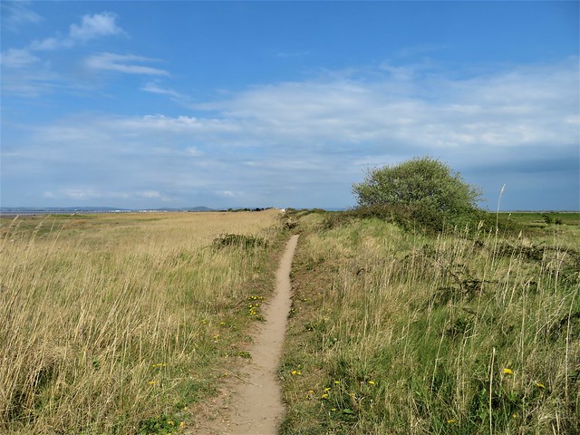
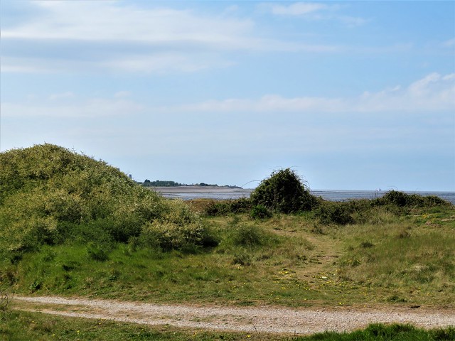
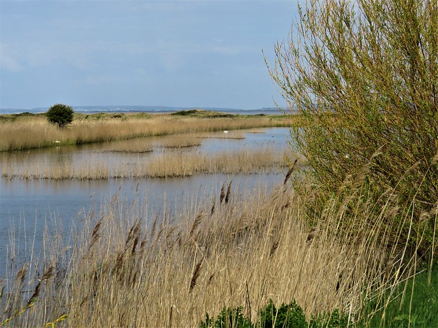
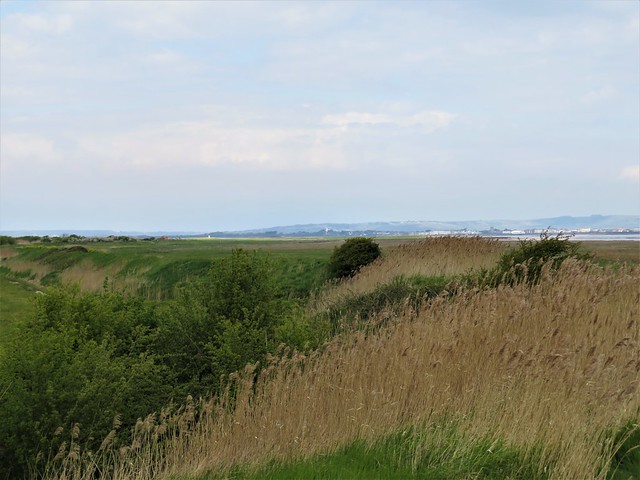
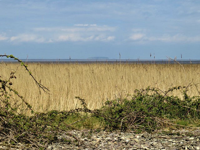
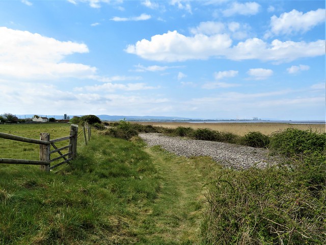
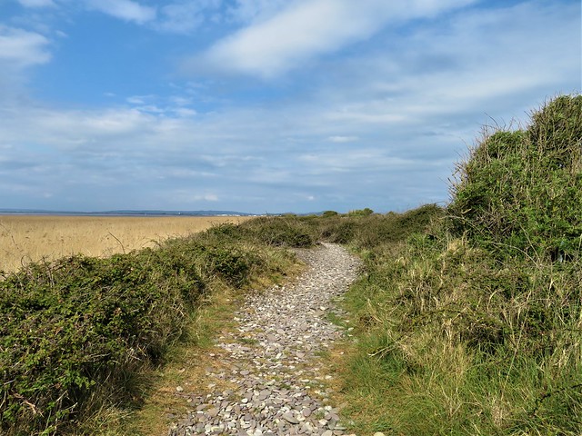
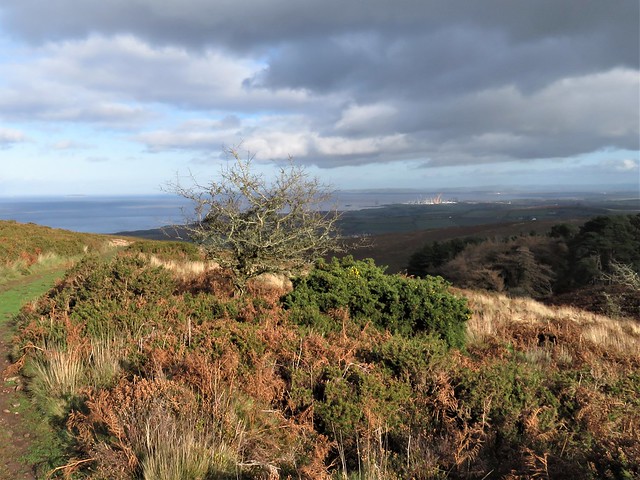
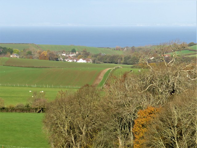
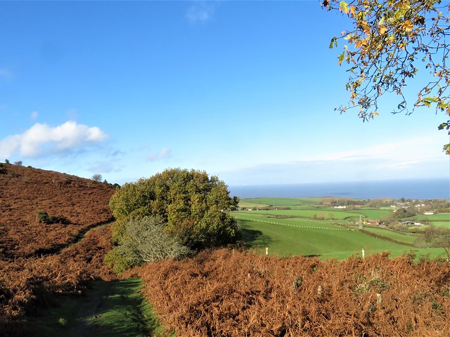
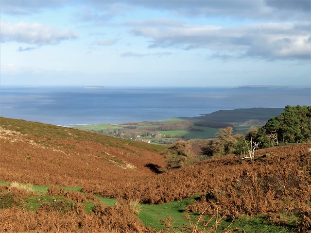
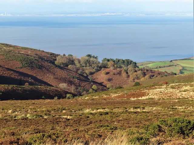
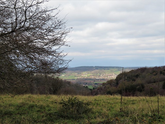
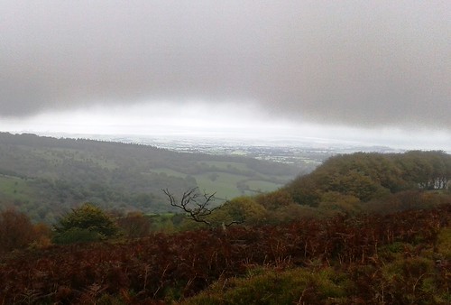
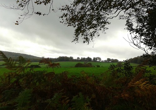
We sat on the heather among Bronze Age burial mounds to eat our sandwiches with an imperial view all round, north over the Severn Sea to Wales, east to the camel hump of Brent Knoll, west into Exmoor’s heights. By the time we’d brushed away the crumbs, serenaded the skylarks with mouth organ tunes and descended among the trees of Slaughterhouse Combe, the sun was backlighting oak leaves and pooling on bracken banks where bilberries and star mosses winked with raindrops.

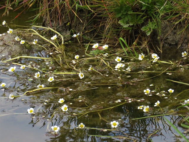
Thunder ripped across the sky, a last sulk of the weather gods, as we walked west up Shepherd’s Combe – a favourite ramble of William and Dorothy Wordsworth and their friend and fellow poet Samuel Coleridge. A bank of sundews lay pearled with rain, their tiny pale flowers upraised on long stalks above sticky scarlet leaves. One minuscule blob of a sundew’s insect-trapping mucilage is capable of stretching up to a million times its own length. Biomedical researchers are looking for ways to exploit that remarkable property as a platform for healthy cells in the regrowth of damaged human tissue. This is the sort of thing Jane knows.

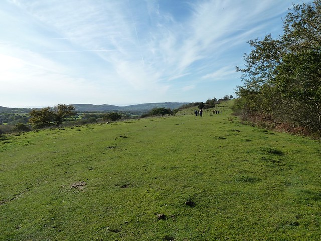
We climbed to Bicknoller Post on its wide upland with a wonderful prospect north-west to the stepped flank of Porlock Hill and a sea full of shadows and streaks of light. Our steps quickened along the homeward path – not to unload nine souls full of immortal verse, but to beat the clock into Holcombe for the cream tea we suddenly knew we’d earned.

Start: Beacon Hill car park, Staple Plain, Hill Lane, West Quantoxhead, Somerset TA4 4DQ approx. (ST 117411)

Getting there: Jct 27; A39 (Bridgwater-Minehead); at West Quantoxhead, just past Windmill Inn, left (‘Bicknoller’). In 350m, left up Hill Lane (‘Staple Plain’). Continue for ⅔ mile to car park at end of track.

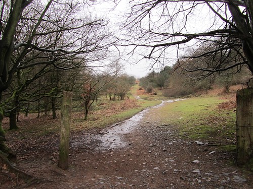
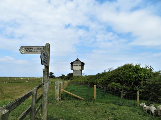
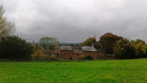
Walk (5½ miles, moderate, OS Explorer 140): From NT Staple Plain info board walk back through car park. Don’t go through gate of left-hand fork of tracks, but turn left downhill beside it (green NT arrow), steeply down through trees. At bottom (117408), right on grassy track. Continue to descend, keeping downhill at junctions, for 500m to cottage beside track (111408). Left (‘Quantock Greenway’, arrow with quill), through gate and up track. In 200m, through gate; in another 150m, go over cross-track (113404) and continue SSE beside Haslett Plantation.

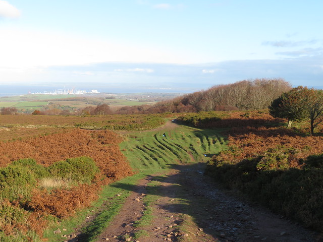
In 500m, arrow post points right (115399); but go left here (east) and continue up Bicknoller Combe, keeping ahead over all crossing tracks. In 1 mile, reach top of ascent at crossing of tracks from Bicknoller Post, Paradise Combe, Bicknoller Combe and Slaughterhouse Combe (130398 – just west of ‘302’ on map). Keep ahead on stony track towards Slaughterhouse Combe. In 200m, just past low wooden post on left, fork left onto less obvious grassy track with some ‘kerb’ stones at its entrance (131397) – as a marker, look half right to see two trees, one on either side of the stony track you have just left.

Follow this grassy track east over brow of Black Ball Hill, past tumulus (134396) and descend. After 600m, look for fork; take right-hand path. In 100m it swings 180o to the right (138397), descends SW for 250m to meet stream (137395) and bends left to descend for ½ mile to bottom of Slaughterhouse Combe (143401). Left along bridleway WNW under Lady’s Edge and up Sheppard’s Combe for 1 mile, ascending to Bicknoller Post (128403). Right (north) along broad stony track; in 200m, fork left; in 50m, left again to meet The Great Road track (126407). Left, descending to car park.

Lunch: Picnic

Accommodation: Rising Sun, West Bagborough, TA4 3EF (01823-432575, risingsuninn.info) – excellent, well-run pub

Info: Taunton TIC (01823-336344)

satmap.com; ramblers.org.uk; visitengland.com

 Posted by at 01:19
Feb 122011
 

Mist on the Quantock Hills, the gentle clop of hooves on a bridleway, and a trickle of birdsong among the big old oaks and the cathedral-high firs of Great Wood.
First published in: The Times Click here to view a map for this walk in a new window
picture picture picture picture picture picture picture picture
Facebook Link:
In Ramscombe car park, deep in the heart of the wood, I got my bearings and a bit of background information from the pictorial notice-board. I didn’t need a pee, as it happened, but if I had done so there was a public convenience not too far away; also a picnic table, and a place for a football kickabout. Nothing out of the ordinary for a wood managed by the Forestry Commission; just an excellent example of it.

The broad, hard-surfaced track, waymarked and well-drained, led away up Rams Combe and out onto the moor where sheep were grazing and a pair of Exmoor ponies with winter-shaggy manes and tails cropped the icy grass. Along the ridge I followed the broad old packhorse way called The Drove, looking out on heavy cloud billowing like smoke over far sunlit pastures. At pink-faced Quantock Farm horses with steaming nostrils trotted excitedly after a little quad bike, from whose tray the farmer shovelled out bundles of hay.

Down into Great Wood again with one eye on the map, following signposted bridleways and waymarked footpaths, dipping into the forest along unmarked permissive paths here and there. Out at Adscombe into open country; back among the trees at Friarn Cottage on a mossy bridleway fragrant with pine resin that brought me curling down the slope to Ramscombe once more.

Nothing about the atmosphere of Great Wood scowls, ‘You’re here on sufferance, so watch your step.’ Nowhere growls, ‘Keep out!’ On the contrary – the public facilities tell you you’re welcome, and the rest of the forest says it’s fine if you’re there, no-one’s going to bother you, walk or bike or ride at your pleasure. That’s what we expect from our Forestry Commission woodland, and that – by and large – is what we get. Public loos, car parks, picnic tables, cleared paths and bridleways, waymarks, good information on site and online; can their continuation really be guaranteed to the same high standard under private management? One thing’s for sure: any new lessee neglecting that tradition of maintenance for the public good, or curtailing the public access we all enjoy, is likely to reap a pretty impressive whirlwind.

Start & finish: Ramscombe car park, Great Wood, Nether Stowey (OS
ref ST 166378)
Getting there: M5 Jct 24, A39 towards Minehead. Ramscombe signposted 1½
miles before Nether Stowey. Forest road starts at Adscombe Farm. In ⅓
mile pass Great Wood Camp (178375); in another mile, sharp right
bend; Ramscombe car park in 100m on right.
Walk
(5 miles, easy grade, OS Explorer 22): Walk back to bend; ahead (‘No
Vehicles’) on track for ⅔ miles to gate; ahead to road at
Crowcombe Combe Gate (150375). Left for 200m; left (‘Triscombe
Stone’) along The Drove. In ½ mile, in dip, left through gate
(166369; bridleway). 100m before Quantock Farm, right through gate
(blue arrow/BA). Up field hedge; through gate (BA); down to drive
(160369); right for ⅓ mile to re-enter woods. In another ¼ mile,
ahead off drive on right bend (166365, BA) on grass ride to
T-junction (168365). Descend left; in 200m, ahead across track, down
to bottom (169370). Right (Red Trail marker post) to valley road by
house (173373); right for ⅓ mile. Opposite Great Wood Camp Activity
Centre, left off road up slope (BA; ‘Quantock Greenway’/QG). In
50m take lower footpath for 250m to cross track (179378, QG). Follow
wood edge; through gate (QG); left up field edge to road (180381).
Left for 400m; by Friarn Cottage, left up track (178383; bridleway).
In 100m fork left at gate. Follow this track for ⅔ mile. At top of
long rise, right through gate (168380); immediately left on track
with hedgebank on left. Descend for 200m to go through gate (166380);
follow track down to car park.
NB –
Online map, more walks: www.christophersomerville.co.uk
Lunch:
Rose & Crown Inn, Nether Stowey (01278-732265);
www.roseandcrown-netherstowey.co.uk
More
info
: www.forestry.gov.uk;
tel 01278-732319
www.ramblers.org.uk;
www.satmap.com

 Posted by at 05:25
Apr 092022


First published in: The Times Click here to view a map for this walk in a new window
shore path to Steart Point scrub full of birdsong coastal reedbeds 1 coastal reedbeds 2 brackish water-crowfoot view across the reedbeds to the Severn Estuary signpost at the Tower Hide Tower Hide at Steart Point Tower Hide at Steart Point 2 coastal scrub and reedbeds, looking to Mendip Hills misty shape of Steep Holm island in mid-estuary looking west along the coastal path from Steart Point coastal path towards Steart Point

Where the Severn Estuary merges with the Bristol Channel is a moot point, but the tidal water is always full of energy, swirling in purple and chocolate at high tide, then retreating with the ebb to expose vast sand and mud flats.

Off Steart Point the turbid River Parrett enters the tideway. At low tide the mud flats here stretch two miles out into the estuary, a haven for feeding birds. But flood tides are another story. The mud and sand are swallowed up, the Bristol Channel brims, and inundation can threaten the farmland and small settlements along the coast and far inland.

We set off at low tide along the coast path from the scattered hamlet of Steart. The dimpled miles of mud flats gleamed. The distant island of Steep Holm appeared marooned in mud and sand. In the southwest the Quantock Hills stood beyond the giant cranescape of half-finished Hinkley Point nuclear power station, while in the east rose the green whaleback of Brent Knoll and the long spine of the Mendip Hills.

The shoreline path ran on rabbit-riddled sands, turf and crunchy pebbles. A pale yellow bloom on one of the coastal fields turned out to be a solid mass of cowslips. Wild birds were everywhere – greenfinches and linnets on the bramble stems, shelduck assiduously hoovering the mud for crustaceans with sideways sweeps of their bright red bills, and a reed warbler complaining with unending chittering in the reedbeds.

At Steart Point a tall hide looked out across this remote landscape of flat fields, far hills, upstart knolls and tidal flats. From here the River Parrett Trail led back inland, the mud-slimed banks of the Parrett shining silver in the sun and wind. Here the Wildfowl & Wetland Trust had been working with Environment Agency to create anti-flooding buffer zones with flood banks built to encourage new saltmarsh to grow to the seaward – a bold initiative that works with nature rather than trying to strongarm it into submission.

We followed the trail down to where a breach has been cut in the Parrett’s defences. New mud, marsh, reedbeds and creeks show the effectiveness of the work. Pochard cruised a big pool where three herons stood on one leg apiece and regarded us with grave suspicion.

A grassy path led back to the shore. The morning mist shredded away to reveal the hills of South Wales far across the rising tide, and a flight of golden plover flickered low over the rapidly vanishing mudflats where the Parrett met the sea.
How hard is it? 6 miles; easy; shore paths

Start: Steart car park, Steart, Bridgwater TA5 2PX (OS ref ST 276459)

Getting there: A39 (Bridgwater-Minehead); at Cannington, right (‘Hinkley Point’, then ‘Steart Marsh’). Pass Steart church; car park in 500m on left (gate).

Walk (OS Explorer 140): From car park follow green lane north to sea wall (274460). Right (‘Steart Point’) for ⅔ mile. At Steart Point, right past tall hide (283467); right (‘Wall Common’). In 150m, left (kissing gate/KG); follow River Parrett Trail/RPT. In 700m at Manor Farm, ahead along road (278462); by Dowells Farm, left (276458, KG, RPT) to river wall; left to breach and hide (280454). Return to KG; dogleg left/right along river wall (‘Steart Gate, Polden Hide’), following RPT. Pass turning to Steart Gate car park (267454); in ½ mile, signpost ‘Polden Hide 0.71’ points left (261449), but keep ahead to cross road. On between 2 marker stones on grassy path to shore (254451); right (‘Steart’) to car park.

Lunch: Picnic

Accommodation: Malt Shovel Inn, Cannington TA5 2NE (01278-653880, themaltshovelinn.com)

Info: wwt.org.uk/steart-marshes (01278-651090)

 Posted by at 01:01
Dec 192020


First published in: The Times Click here to view a map for this walk in a new window
picture picture picture picture picture picture picture picture picture picture
Facebook Link:

One dark night long ago the huntsman at Alfoxton Manor was eaten by his own hounds, so says the tale. He got up from his bed to quell a dogfight in the kennels, and they didn’t recognise him in his nightshirt.

Setting off from Holford on a glorious winter day of blue sky above the Quantock Hills, we stopped to admire the old dog pound beside the path to Alfoxton. What a pity those hungry hounds hadn’t been safely penned up behind its stout stone walls.

William and Dorothy Wordsworth came to roost at Alfoxton (then ‘Alfoxden’) in the summer of 1797. Nearby lived their new best friend, Samuel Taylor Coleridge.
We passed the manor house, solid and white among beautiful beech and oak woods. Coleridge and the Wordsworths walked daily over the hills and through the deep wooded combes of Quantock, ‘three people, but one soul’, as Coleridge put it. Rumours spread that the three strangers were spies for Napoleon, and the Wordsworths had to leave their Eden in the Quantocks, never to return.

Along the drive missel thrushes with spotted throats were busy raiding the cherry trees whose scarlet fruits dangled at the end of long stalks. The birds darted from tree to tree with their characteristic muscular wing thrusts and direct, purposeful flight.

Red deer hinds went trotting springily across the paddocks among the horses. The Quantock Greenway path wound at the foot of the hills, with breathtaking views opening northwards over the Bristol Channel, its tides stained a milky mulberry hue by the mud of many estuaries. As we gained height we made out the upturned hull shape of Steep Holm island, the white lighthouse on neighbouring Flat Holm, the long spine of Mendip running inland, the far coast of Wales in a blur of distance – and on the shore below, the giant’s geometry set of Hinkley Point C nuclear power station, still laboriously a-building.

Up on the top the wind blew cold. We followed wide grassy bridleways where hill ponies with ground-sweeping tails cropped the verges. A fantastically exhilarating ramble, east along the ancient green trackway evocatively titled The Great Road, then slanting steeply down to join the homeward path in the depths of Hodder’s Combe with its skein of rustling brooks and springs.

‘Upon smooth Quantock’s airy ridge we roved
Unchecked, or loitered ’mid her sylvan coombs*.’
*Wordsworth’s spelling.

That’s how Wordsworth remembered those happy Quantock days in ‘The Prelude’, and it neatly summed up our day, too.
How hard is it? 6 miles; moderate, some short climbs; moorland and valley tracks, some muddy; streams to ford
Start: Holford Bowling Green car park, Holford, Bridgwater TA5 1SA (OS ref ST 154410)
Getting there: At Holford (A39, Bridgwater-Minehead) follow lane by Plough Inn (brown sign ‘Combe House Hotel’) to car park.

Walk: Left along valley road. Follow ‘Quantock Greenway’/QG (green arrows), and ‘Coleridge Way’/CW (quill symbol) for 2 miles. Cross Smith’s Combe stream (132422, signposted); continue on QG, CW. Pass conifer plantation; in 150m, sharp left (129423, fingerpost, blue arrow/BA) up bridleway. In 450m at top of slope, left at track crossing (127420). Follow broad green bridleway south for 1 mile, keeping ahead over all track crossings, to Great Road trackway (132407, fire beaters). Left; in ⅔ mile, descend across widespread track crossing (141410); in 150m, fork right beside trees (BA, ‘No Vehicles’). In 300m cross track (145408); descend into Hodder’s Combe. Ford streams (144403); left along far bank for ¾ mile to car park.
Lunch: Plough Inn, Holford (01278-741652, holfordvillage.com)
Accommodation: Combe House Hotel, Holford TA5 1RZ (01278-741382, combehouse.co.uk)
Info: quantocks.com; satmap.com; ramblers.org.uk

 Posted by at 01:27
Jan 182020


First published in: The Times Click here to view a map for this walk in a new window
picture picture picture picture picture picture picture picture picture picture picture picture
Facebook Link:

A perfect Somerset winter’s day of sharp blue sky. Sunlight gilded the roofs of Rowberrow, nowadays a quiet little village, but in times past a rough mining centre where men dug calamine for the brass-making industry. Martha More, visiting in 1790, judged the locals ‘savage and depraved, brutal and ferocious.’

The long shape of Blackdown, highest point of Mendip, looms on the southern skyline. Today its slopes were trickling with water. With a hollow gushing a stream tumbled into the chilly depths of Read’s Cavern, one of dozens of water-burrowed caves in Mendip’s limestone massif. When Read’s was excavated in the 1920s, a set of Iron Age slave manacles was unearthed, their story untold but ripe for imagining.

A broad track rises up the flank of Blackdown. We climbed through fox-brown bracken where cattle grazed and thirty-five semi-wild ponies snorted and cantered away in a bunch. From the ridge the view was enormous, from the Quantock Hills and Exmoor down in the southwest to the steely grey Bristol Channel with its twin islands, pudding-shaped Steep Holm and sleeping-dog Flat Holm.

Along the foot of Blackdown the muddy Limestone Link footpath took us sliding and squelching past Burrington Combe. Wild goats were grazing the grey striped cliffs of the gorge, their white coats contrasting with the scarlet berries of cotoneaster.

On the slopes opposite the combe the Reverend Dr Thomas Sedgwick Whalley, rich through a ‘good marriage’ in mid-Georgian times, developed a humble cottage into the Italianate extravaganza of Mendip Lodge, a massive country house with a state bedroom, mile-long terraces and a verandah nearly a hundred feet wide.

Mendip Lodge, like the good doctor’s wealth, eventually fell into decline. All we found of the grand design was a huddle of ruins behind an archway in Mendip Lodge Woods, beside the winding path that was once a fine carriage drive.

High above on the limestone upland of Dolebury Warren the sloping ramparts of a massive Iron Age hill fort encircle the western end of the ridge. Here we sat to catch our breath and gaze across the channel to the far-off hills of Wales.
Start: Swan Inn, Rowberrow, Winscombe, Somerset BS25 1QL (OS ref ST451583)
Parking: please ask, and give pub your custom.

Getting there: Rowberrow is signed off A38 between Churchill and Winscombe

Walk (8 miles, easy, OS Explorer 141): Left down School Lane. Just after right bend, left down track (453583); in 300m at T-junction, right (454586). In ¾ mile, right (465586, ‘Bridleway, Ride’, waymark post); in 100m, left on path through bracken. In 250m detour left to Read’s Cavern (468584). Resume bracken path, uphill to ‘Rowberrow Warren’ sign (469581); left through gate; right uphill. In 200m fork left (469579), upwards for ¾ mile to track on Blackdown ridge (477573); left to Beacon Batch trig pillar (485573). Left downhill to foot of slope; left (490577, waymark post, Limestone Link /LL) for 1¼ miles. On open ground 350m after crossing West Twin Brook, at crossing of broad grassy tracks, right downhill (473583). In 700m, near Link hamlet, left (475590, fingerpost) on path through Mendip Lodge Wood. In ⅔ mile pass Mendip Lodge ruin (466591); in 150m, left up bridleway. Pass gate/’Dolebury Warren’ sign on right; in 100m right (gate, blue arrow, ‘National Trust’) across Dolebury Warren (LL) for 1¼ miles, down to T-junction by Walnut House (446591). Left (LL) for ¾ mile; right (454586) to Rowberrow.

Conditions: Can be very muddy.

Lunch: Swan Inn, Rowberrow (01934-852371, butcombe.com)

Accommodation: Woodborough Inn, Winscombe BS25 HD (01934-844167, woodborough-inn.co.uk)

Info: mendiphillsaonb.org.uk; satmap.com; ramblers.org.uk

 Posted by at 03:00
Nov 082014


First published in: The Times Click here to view a map for this walk in a new window
picture picture picture picture picture picture picture picture
Facebook Link:
A grey cool day had hung low cloud over the Somerset coast and capped the Quantock Hills with mist. A stodge of red mud sucked at our boots in the ferny old lane that rose from West Bagborough up the steep south face of Lydeard Hill. A ghostly hoot and a frantic heartbeat of chuffing from far below tracked the progress of a train, rattling along the West Somerset Railway and leaving fat white gouts of smoke to dissolve in the breeze.

Up on the brackeny back of Lydeard Hill we found ourselves just under the mist line. A giant view opened northwards over the coastal plain to the silver coils of the River Parrett snaking into the low-tide mud flats of the Severn Estuary. Steep Holm and Flat Holm islands lay black and two-dimensional, as though cut from slate. The Welsh shore ran away westward, the grey whaleback of the Mendip Hills barred the northward horizon twenty miles off, and at our feet opened a steep, nameless little valley, a Quantock combe full of golden treetops.

A pink horse came ambling past. ‘Oh,’ laughed his rider, ‘he should be white, but he loves rolling in all this red mud!’ We followed a ridge path down to Bishpool Farm, richly scented with applewood smoke and lying in a red and green valley. A little girl came out among barking dogs at Lambridge Farm to watch us go by. We rounded Gib Hill and followed a bridleway up through the woods to the summit of Cothelstone Hill. Some British chieftain lies here under a round barrow, lord of a hundred-mile prospect – Blackdown, Quantock, Mendip, Exmoor, Cotswold and Wales.

We stood to savour it all, then plunged down the mucky bridleway through Paradise woods to Cothelstone where the red sandstone church, model farm and Elizabethan manor house huddled together in a beautiful cluster under the hill. St Agnes Well lay under a corbelled cap by the road, its dimpling water efficacious in curing infertility and vouchsafing virgins a glimpse of their future husbands. We trailed our fingers in the spring, and then made west across handsome parkland where black cattle stared stolidly from under the trees.

A high-banked lane, a last glimpse of broad Taunton Vale from a bridleway, and we were back in West Bagborough in time for tea at the Rising Sun.

Start: Rising Sun Inn, West Bagborough, Taunton, Somerset TA4 3EF (OS ref ST 171334)

Getting there: West Bagborough is signed off A358 Taunton-Williton road between Combe Florey and Crowcombe.

Walk (7½ miles, moderate with some ups and downs, OS Explorer 140): Up lane beside Rising Sun, through gate; on uphill for ⅔ mile. At top of hill, path forks; right here (174344; ‘Restricted Byway’) through gate. Three paths diverge; follow left-hand one. In 100m go over path crossing and on east over Lydeard Hill for ½ mile. Into woods (183343, yellow arrow/YA). In 200m, track curves right; left here (185341); in 100m, right through kissing gate. Keep ahead along ridge with hedge on right; in ½ mile, right through gate (194344, no waymark); follow hedge down to road (197342). Right past Bishpool Farm; in 50m, left through kissing gate (YA) and farmyard. Left through gate; right over stile (fingerpost); aim half-right down field to cross stream (200339). Track to road.

Right past Lambridge Farm; steeply up through gate (199337); pass to right of cottage. Up through gate (blue arrow/BA); up through next gate; follow hedge on left for ⅓ mile to go through gate into wood (195333, BA). In 100m track bends right; follow it up to road (193331). Right along road (take care! Left side is best!) for 300m. Just before road on right, turn left up bridleway through wood (190330, BA, ‘The Rap’ fingerpost). In 150m, at T-junction, left (189330); in 200m, fork left through gate (188328, ‘footpath’ arrow). Up through trees for 250m to fenced tumulus on ridge (188326). Left to stony knoll and viewpoint at summit of Cothelstone Hill (190327)

Bear right downhill on broad grass path. In 100m ignore fork to left. Down to pass animal pens on your right. In 200m, 2 gates on right (193324). Go through kissing gate beside left-hand one; turn right and immediately left to post with 2 waymark arrows. Right here; in 100m, at crossing of tracks (192323), bear left downhill on bridleway through Paradise Wood, keeping ahead over various track crossings (occasional BAs) for ¾ mile to road (185319). Ahead downhill in Cothelstone. In 150m, right (fingerpost) across footbridge (optional detour, signed right, to St Agnes Well). Follow path past back of Cothelstone Farm. Left through gate (182319, YA); through gate at churchyard corner; across parkland field. In ¼ mile, over stile in dip (178321); ahead to gate into woodland strip; cross road (175322, YA). Half right across field to stile (174325, YA) and fenced path to road. Ahead up road; in 200m, pass Pilgrim’s Cottages; in 150m, left (175329, ‘bridleway’) on bridleway for ¼ mile to road (171331). Right into West Bagborough.

Lunch: Rising Sun, West Bagborough (01823-432575, risingsuninn.info) – very cheerful, friendly pub with rooms

Accommodation: Rising Sun (see above), or Cothelstone Manor (01823-433480; cothelstonemanor.co.uk)

Info: Taunton TIC (01823-336344)

www.LogMyTrip.co.uk; www.satmap.com; www.LogMyTrip.co.uk

 Posted by at 01:22