Search Results : “new forest”

Feb 132021


First published in: The Times Click here to view a map for this walk in a new window
picture picture picture picture picture picture picture picture picture picture picture
Facebook Link:

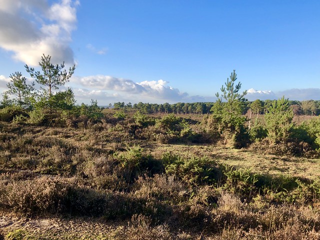
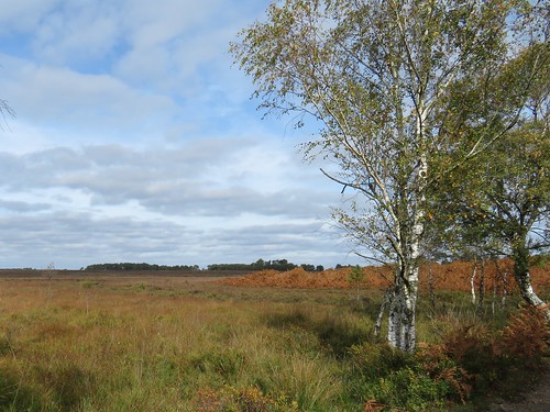
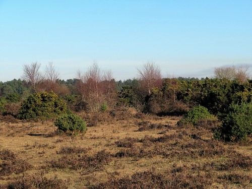
Notwithstanding its name, the New Forest is not a monolithic block of trees. These 150 square miles of ancient royal hunting ground comprise woodland, wetland, heathland, water and farmland, a wonderful patchwork of accessible countryside from which to tease out a walk for a short winter’s day.

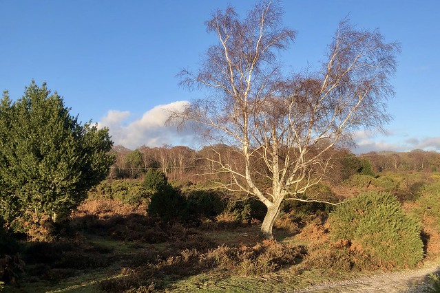
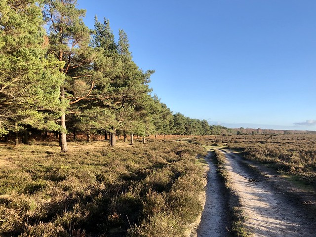
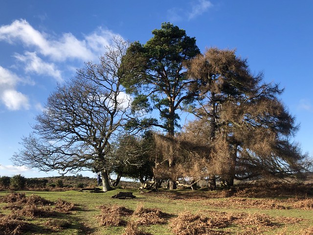
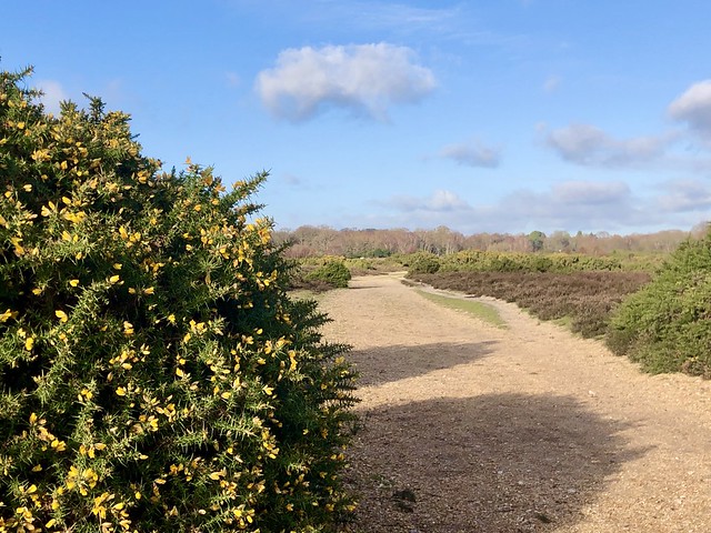
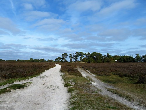
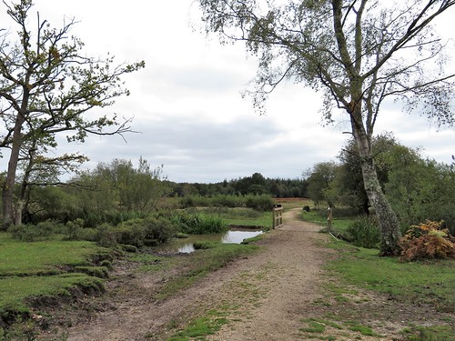
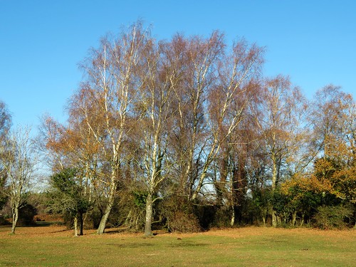
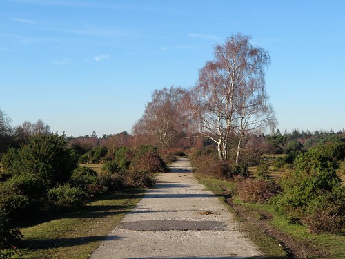
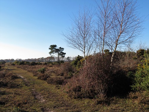
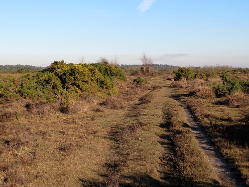
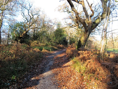
Waymarks are thin on the ground in the New Forest, but the patch of open heath that stretches south of Burley is crisscrossed with good clear paths. We set out on a cold sunny morning along a gravelly track that ran between flowering gorse, sombre winter-dark heather and individual silver birch trees whose slim trunks and dusky red twigs glowed in the clear light.

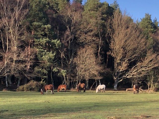
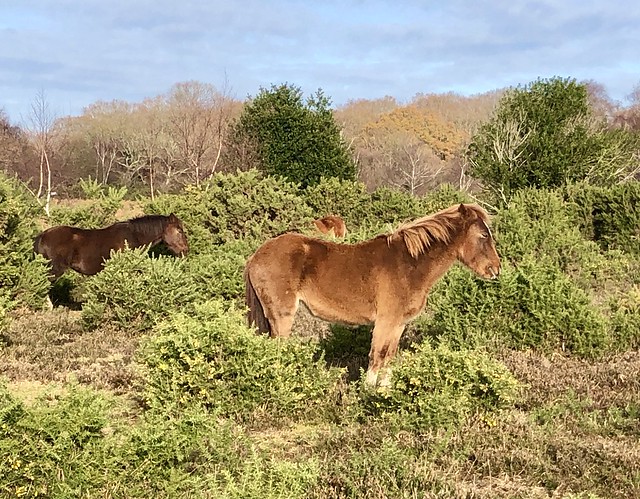
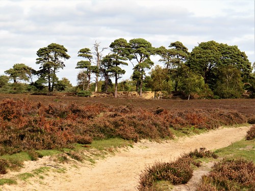
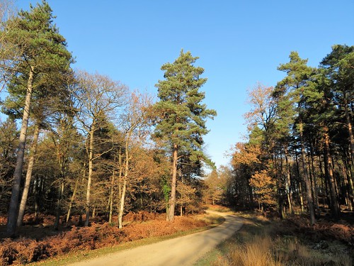
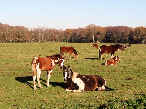
New Forest ponies cropped the grass by the path, delicately snipping off precise bites with their strong grey teeth. From Turf Hill the southern skyline was spiky with ranks of conifers. We caught a glimpse of a pale blue whaleback hill on the distant Isle of Wight. Between hill and trees rose the slender rocket shape of Sway Tower, a Victorian folly 218 feet tall, built entirely of concrete and still standing proud in the landscape.

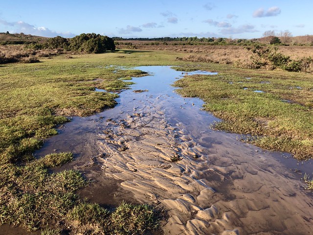
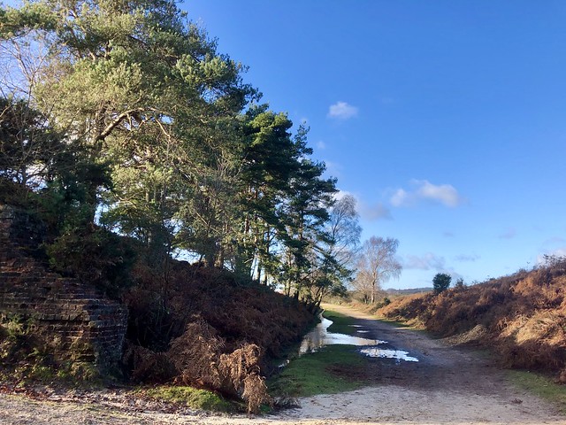
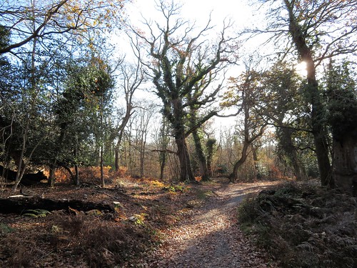
It’s easy to get the impression that these heaths form a flat tableland, but in fact they are burrowed with surprisingly steep valleys known as ‘bottoms’. We dropped down into Shappen Bottom past the tufted mire of Holmsley Bog, and crossed the long disused track of the Southampton-Dorchester railway, savouring the smell of bog myrtle cones that we pinched and rubbed to release their spicy fragrance.

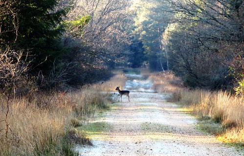
Up on Holmsley Ridge beyond we strode west into the sun and wind, buoyed up on exercise and exhilaration. Three ponies had caught the same mood; they came cantering across the path, hooves drumming, tails flying, the leading pony neighing wildly and kicking up his heels as he frisked along.

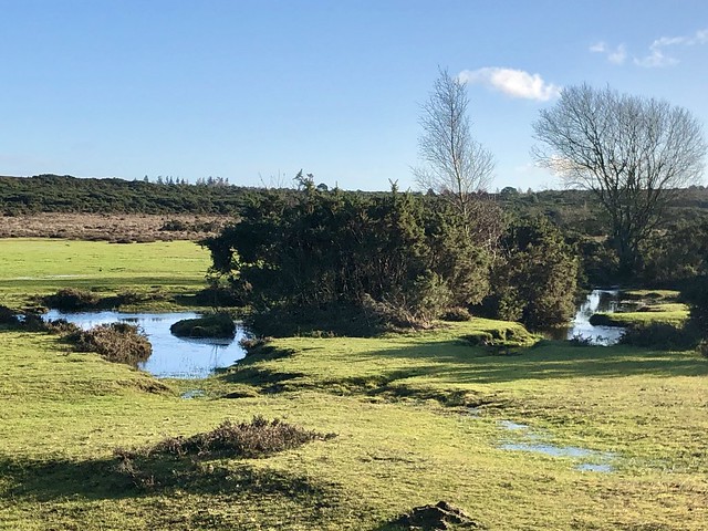
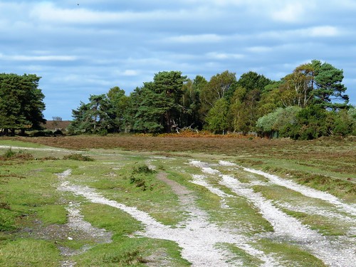
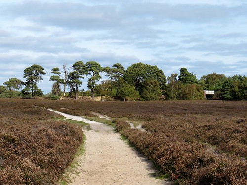
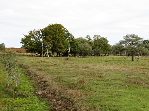
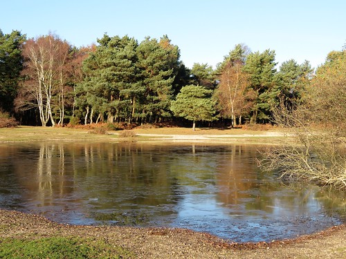
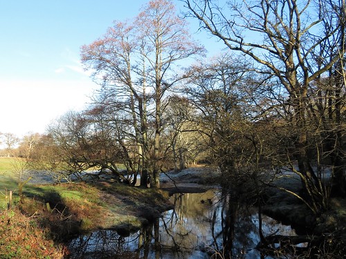
Down in the hollow of Whitten Bottom streams, pools and flooded ruts led to Whitten Pond, the wind-ruffled water steel blue, the grassy margins a brilliant green in the low afternoon sun. A broad track beyond climbed the gently domed nape of Dur Hill Down, before looping off across the heath towards the old railway.

It’s a shame that Slap Bottom signifies nothing more exciting than ‘sloping valley’. There we steered around a group of ponies grazing the bank of a stream, and sauntered back to Burley in the cold bright sunlight.

How hard is it? 5¼ miles; easy; heathland tracks, wet in parts.

Start: Burley Cricket car park, Cott Lane, Burley, Ringwood BH24 4AP (OS ref SU 214029)

Getting there: Bus 125 (Ringwood)
Road – Burley is signed off A35 (Christchurch-Lyndhurst) and A31 (Ringwood-Southampton)

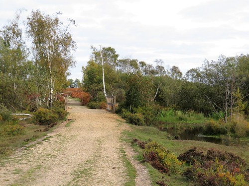
Walk (OS Explorer OL22): Cross road; down track (‘Forestry Commission Burley’). In 50m left on gravel track. In nearly 1 mile cross old railway (219015); in 200m fork right (219013). In ¾ mile keep ahead (right) at fork (209010) to Whitten Bottom. Cross stream by outlet at Whitten Pond (203012); ahead to cross road at barrier (201013). On along track over Dur Hill Down. In ½ mile at post, right (194013) along line of trees, on track curving right across heath to road (201017). Left across old railway; right into Burbush car park. Aim left towards power lines; in 50m, right on path between trees, across stream into open. Ahead up slope; in 500m, left (206018) on clear track. In ½ mile at Goat’s Pen Cottage join gravel drive (212025); at tarred road, right to car park.

Info: Ringwood Gateway (01425-473883, thenewforest.co.uk); satmap.com; ramblers.org.uk

 Posted by at 01:25
Jan 122019


First published in: The Times Click here to view a map for this walk in a new window
picture picture picture picture picture picture picture picture picture picture picture
Facebook Link:

A crisp winter’s morning in the heart of the New Forest. A crowd of semi-wild ponies cropped a hoard of fallen crab apples with a snick and crunch of their strong teeth. We walked briskly north from Beaulieu Road station, then struck out west over a wide swathe of heather, the grey sky pressing down on the dark pines along the flat horizon.

Looking over the bridge rails of a gloopy stream at King’s Passage, we spied sprigs of bog myrtle. Plucked and rubbed between the fingers, they brought a spicy tang to the chilly air. All was as quiet as could be on this still wintry day, with only the clickety calls of stonechats and occasional snort of a pony for a soundtrack. Other walkers with scampering dogs passed on diverging tracks, without disturbing the illusion of solitude and silence so characteristic of the New Forest’s back country.

The lush grasslands of Longwater Lawn border the winding Beaulieu River, their herbage enriched by silt from winter floods. Five pones stood by the footbridge with an air of contemplating profundities. Their presence beside the slow flowing stream through the grassland would have graced the most delicate of Chinese silk paintings.

A wriggling track of pale flinty gravel is all that’s left of the ancient Salt Way, by which the precious commodity was brought inland on pack ponies from the salt pans on the Hampshire coast. The old track led on to the second half of this walk of contrasts, a network of forest rides among the trees of Denny Inclosure – ancient oaks, tall pines as straight as guardsmen, and beeches with enormously elongated limbs.

A glimpse of red-tiled Denny Lodge, once the residence of Groom Keeper and Head Forester, and we took the homeward path among bracken fronds so richly gold that we were tempted to stuff our pockets with them.

Start: Beaulieu Road Station, near Lyndhurst SO42 7YQ (OS ref SU 349063)

Getting there: Rail to Beaulieu Road station.
Road – M27 Jct 1, A337 to Lyndhurst, B3056 (‘Beaulieu’) to Shatterford car park, just before station.

Walk (8 miles; easy underfoot, but no waymarks; OS Explorer OL 22):
Rail – Platform 1, up steps, left along road; Platform 2, up steps, left across bridge. Opposite Shatterford car park, right.
Road: cross B3056.
Then: Follow gravel track north beside railway. In 300m, pass bridge on right (348067); in another 400m, fork left in dip (347071). In 50m, fork right; keep parallel with railway. In 500m, with Fulliford Passage bridge on right (345076), left along grass path. In 350m, right to cross King’s Passage bridge (342076). At 3-way fork beyond, take middle path ahead across grassland. In ½ mile, cross ridge (336084); aim to cross footbridge among trees (334086) and keep ahead.

In 300m, path bends right towards wooden fence (333088). Left here (west) on grassy, then gravel track, heading for distant Lyndhurst Church spire. In ¼ mile cross a track (329088); ahead for 500m to cross footbridge over Beaulieu River (323087). Ahead through line of trees; left (southwest) along track. Keep to left of line of trees, then aim for distant Lime Wood Hotel. In nearly 1 mile cross B3056 (317075); follow ‘Pondhead Farm’. In 350m, pass farm sheds/barns on left (318072); aim past telephone pole to cross footbridge (317070). Fork left on path into trees; bear left for 30m, then right to gate into wood (319067).

Ahead along forest ride. In 500m, left at T-junction on gravel track (324065); in 30m, right along grassy ride for ½ mile, across Little Holm Hill to go through gate (330060). Right to cycle track; left to barrier (334059); right (‘Access to Private Properties’). In 250m, at ‘Upper holding’ notice, fork left. Pass Denny Lodge on right; in 80m, just before Denny Cottage on left, turn left (334055) on woodland path with fence on right, then on in same southeast direction.

In 300m, leave trees; ahead across bridge (336053); fork left and ahead for 400m across next 2 bridges. After 2nd of these (340051), ahead and bear left on gravel path, then grass through trees. In 350m look for hollow on right beside path (344050); at cross tracks beyond with gate to right, go left. Cross bridge at Woodfidley Passage (346051); ahead, soon bearing north parallel with railway to return to car park/station.

NB: No waymarks – map, compass, Satmap very helpful!

Lunch: Drift Inn, Beaulieu Road station (02380-292342, thedrift.newforesthotels.co.uk)

Accommodation: Beaulieu Hotel, Beaulieu Road station SO42 7YQ
(0800-444441, newforesthotels.co.uk)

Info: New Forest Centre, Lyndhurst (023-8028-3444)
visitengland.com; satmap.com; ramblers.org.uk

 Posted by at 01:32
Feb 182017


First published in: The Times Click here to view a map for this walk in a new window
picture picture picture picture picture picture picture picture picture picture picture picture picture picture picture
Facebook Link:

Blue sky overhead, and a hard frost gripping the trees and paths of the New Forest. We crunched the frozen lanes away from Brockenhurst, blowing on our fingers and shattering milky panes of ice in the puddles underfoot. Two forest ponies stood under the trees, their breath shooting in smoky columns from their nostrils. Every blade of the grasses they were champing glinted as though made of glass.

Big oak trees stood solo in the broad acres of Brockenhurst Park. When Edward Morant bought the estate in the 1770s with money from his Jamaican sugar plantations, he created an instant park by having all the field margins grubbed out, leaving only the well-grown hedge oaks to look like parkland specimens. Today the old oaks sheltered roe deer, half hidden in the sun dazzle, their presence betrayed by the flicking vees of their upstanding ears.

Beech leaves fringed with delicate frost lace gave out a peppery smell as our boots crushed them. We turned east beside handsome old Roydon Manor, walking under beech and oak whose fissured bark concealed hibernating insects – not well hidden enough, though, to escape the probing, down-curved beak of a treecreeper as it scuttled up an oak trunk, picking and swallowing.

Lapwings dug for worms in the fields around Dilton Farm as the sun softened the frozen ground. Beyond the farmyard lay the broad expanse of Beaulieu Heath, a great waste of gorse and heather where a rutted track led us past a herd of semi-wild ponies and out across the moor.

Somewhere under the scrub lay the runways of Beaulieu aerodrome, where young pioneers dared the skies in box-kite craft before the First World War. Now the old airfield lay as obscure as the Bronze Age burial mounds of the heath under a camouflage of bracken and gorse.

A cycle path crossed our track, and we followed it up to Lodge Heath where a cow had broken the skin of ice on the pond and was sipping the freezing cold water. We skimmed a stone across the ice for luck, and followed the tangled cycle paths back towards Brockenhurst through a forest stained brilliant orange by a wintry sun dipping towards the western skyline.

Start: Brockenhurst station, Hants SO42 7TW (OS ref SU 301020)

Getting there: Train to Brockenhurst.
Road – Brockenhurst is on A337 between Lyndhurst and Lymington.

Walk (8¾ miles, easy, OS Explorer OL22): Beside level crossing, turn into Mill Lane. On left bend, go right by Mulberry Cottage along lane. At St Nicholas’s Church, left (306017). In 200m, left opposite old stables (306015, ‘Bridleway’) for 1 mile. Opposite Roydon Manor, left through gates (316002, blue arrow) for 1 mile to Dilton Farm. Opposite first barn on left, turn right (331008, ‘bridleway’) on fenced path. Left round barn end; on through gate; head east (blue arrows) for 400m to gate onto heath (336008).

Right for 200m; angle back sharp left (335006) on grassy track at edge of gorse, heading NE across heath for ¾ mile to meet cycle path (344012). Left for ½ mile to Hedge Corner (338018). Through barrier; left along cycleway (signed). In 500m, right (332017) up roadway; at pond, left (333020) past info boards, along roadway to cross B3055 (329025). Ahead for ½ mile to pass New Copse Cottage (328033), then across railway (327034).

In 400m, left at crossroads (326037, cycleway ‘305’). In ⅔ mile, opposite Victoria Tilery Cottage (317035), ahead (‘306’) through gate. Left to car park (315036); left (‘291’, then ‘292’) on cycleway for 900m to B3055 (307032). Ahead to A337 (303032); left along pavement for ⅔ mile to Brockenhurst Station.

Lunch/Accommodation: Pig Hotel, Brockenhurst SO42 7QL (01590-622354, thepighotel.com) – quirky, stylish, fun

New Forest Visitor Information Centre – 02380-282269
visitengland.com; satmap.com; ramblers.org.uk

The January Man – A Year of Walking Britain by Christopher Somerville (Doubleday, £14.99). For 30% off, call 01206 255 777, quoting TIMES302017.

 Posted by at 01:13
Jun 272009
 

First published in: The Times Click here to view a map for this walk in a new window
picture picture picture picture picture
Facebook Link:

A quarter to six on a cool, drizzly morning and Andy Page was there, smack on time outside the New Forest Inn – a man so in love with his native patch that, despite the duties and responsibilities of his post as Head Keeper of the northern sector of the Forest, he’d got himself out of bed before five o’clock just to show me around.

‘I left school and didn’t know what to do,’ he told me as we strolled the banks of the Dockens Water in slowly broadening daylight. ‘But I knew it had to be something out of doors, something to do with the Forest. I wanted to look forward to going to work every day, and that’s just what I’ve done ever since. So I’m a lucky man – I know that!’

The New Forest, one of our most ancient forests, is a complicated mosaic of woodland, water, bog, wetland, scrub and open heath. Everything meshes in with everything else, so that the health of the whole organism is a finely balanced affair. And the pieces of the jigsaw are not fixed – they swap places and character through the centuries.

Above the Dockens Water Andy and I traversed patches of open scrub which had once been dense woodland, as attested by sprays of wood anemone leaves. Delicate yellow flowerheads of petty whin nodded on their thorny stalks among spider webs thickly pearled with raindrops. We slipped and slid through patches of bog where pink heads of lousewort contested the breeze with feathery strands of cotton grass. The holly was properly in flower just now, its pink and cream blooms cupped in the prickly green hands of the leaves.

New Forest ponies have been around here since time out of mind. A month-old foal, so well camouflaged I hadn’t spotted him, got up from his bracken bed on long legs and skittered off to join his mother. We glimpsed a female redstart zapping between the trees, too quick for me but not for my companion. Out in the open heath of Rakes Brakes Bottom we heard the clicking calls of stonechats, the ‘chupa-chup’ of snipe, and the sweet falling cadence of a willow warbler. Among the trees of Sloden Inclosure I stood enchanted by a wood warbler on a twig, reeling out his chittering, wren-like song, the early light showing off the lemon yellow sheen of his belly.

‘There’s a cuckoo – see him flying?’ Andy’s finger pointed up into the cloudy sky. A sparrowhawk shape with a long tail and rapidly beating wings was passing over the trees. How many cuckoos have I heard calling in the spring? But I’d never in a million years have recognised one on the wing. Such was the magic of this rainy early morning in the Forest.

Start & finish: Royal Oak PH, Fritham SO43 7HJ (OS ref SU 232141)

Getting there: M27 to Jct 1; B3079, B3078 towards North Charford; Fritham signposted.

Walk (5 and a half miles, easy grade, OS Explorer OL22): The New Forest is for wandering, so precise instructions are hard to give. General directions for map readers: Royal Oak; north bank of Dockens Water – Rakes Brakes Bottom – right (north) at 220124 approx; left (218131) through Sloden Wood – right at Watergreen Bottom (206125). Sloden Inclosure – left (209128) – right (207132) between Sloden and Amberwood Inclosures – Hiscocks Hill – Fritham.

NB: Detailed instructions, online map, more walks: www.christophersomerville.co.uk

Lunch: Royal Oak PH, Fritham (023-8081-2606).

Accommodation: The New Forest Inn, Emery Down, Lyndhurst (023-8028-4690; www.thenewforestinn.co.uk) – £75-85 dble.

More info: Lyndhurst TIC (023-8028-2269; www.thenewforest.co.uk)

Walks led by keepers/rangers: tel 023-8028-6840; www.forestry.gov.uk


 Posted by at 00:00