Search Results : Co Down

Mar 022024


First published in: The Times Click here to view a map for this walk in a new window
Eas Mor waterfall above Glenbrittle, looking to the Black Cuillin Black Cuillin from Glenbrittle 1 Black Cuillin from Glenbrittle 2 mountain view from Glenbrittle Black Cuillin from Glenbrittle 3 Loch Brittle Approaching Corrie Lagan, Black Cuillins Eas Mor waterfall above Glenbrittle, backed by the Black Cuillin

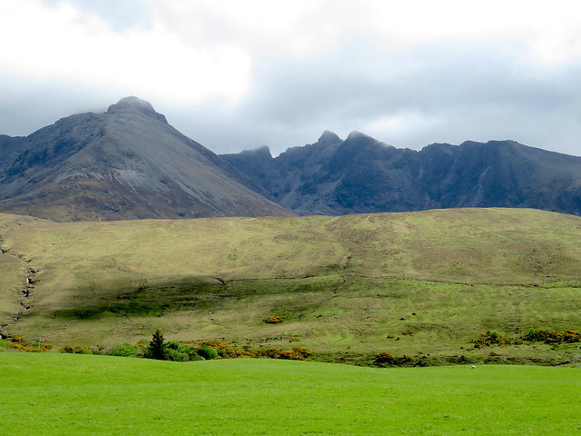
As we drove the narrow twisty road down Glenbrittle after a stormy night, it was a relief and a thrill to see the sharp silhouettes of the Black Cuillin mountains stamped against the sky.

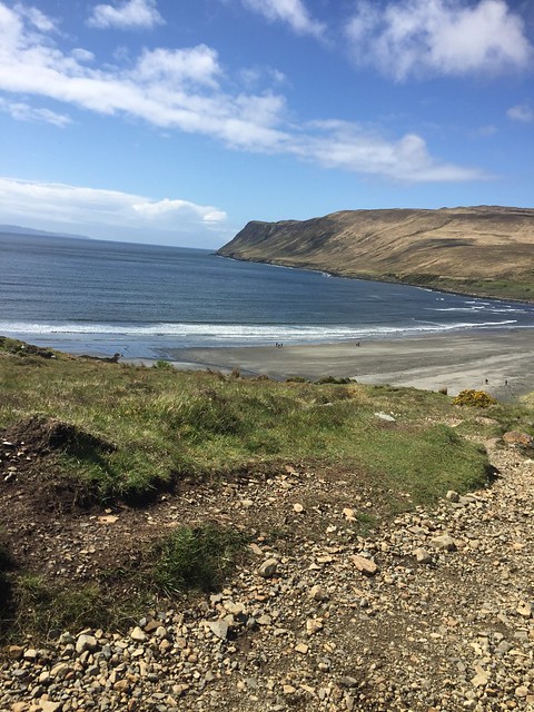
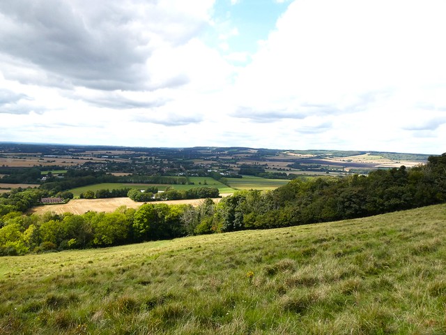
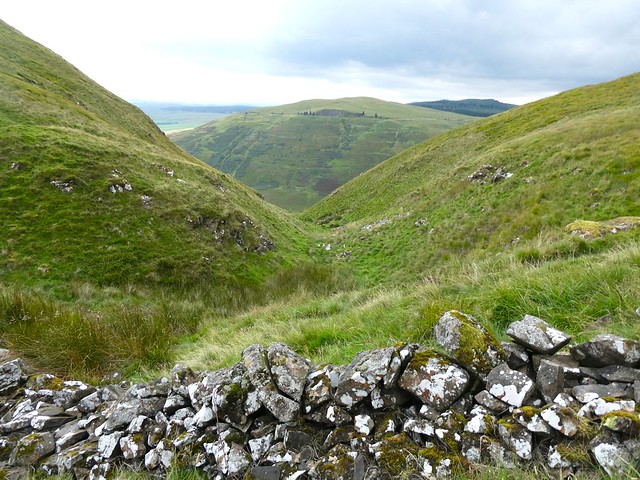
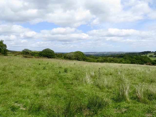
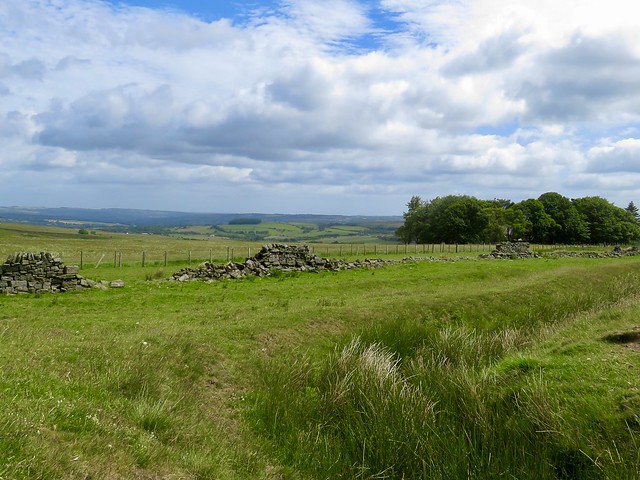
We started up a broad steep grass slope towards Skye’s most magnificent backdrop, the Cuillin Ridge, standing dark and dramatic with clouds drifting among its razor-toothed peaks. The view back south was of dark blue waves riding in from Loch Brittle to cream on a long sandy beach.

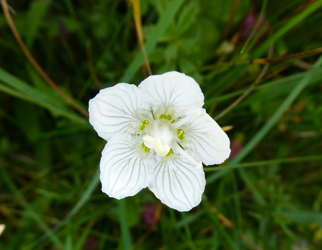
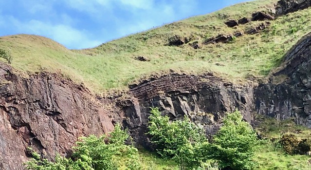
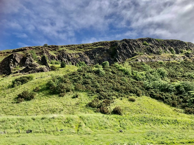
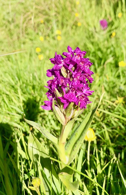
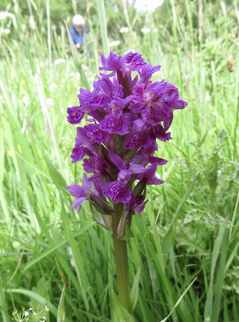
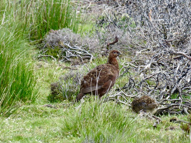
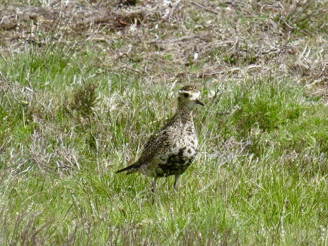
Heather, moor grass and white crustose lichen clung to the peat that covered the underlying rock, grey knobbly gabbro from which the sun struck a cheerful sparkle. Violets were rebeginning to struggle out among the clumps, and curlews had already begun their haunting territorial calls.

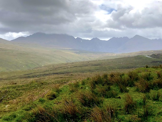
The well-made path trickled with runnels as the rain-sodden slopes disgorged their surfeit of water. We paused for a breather and a look back over Loch Brittle to where the Cocktail Isles had slid into view – flat-backed Canna, mountainous Rhum and the volcanic prow of Eigg.

A posse of climbers heading for the ridge swung past us, belts a-clink with multicoloured clips. I felt my customary twinge of envy for their careless athleticism and daring, then bent my efforts once more to the upward climb.

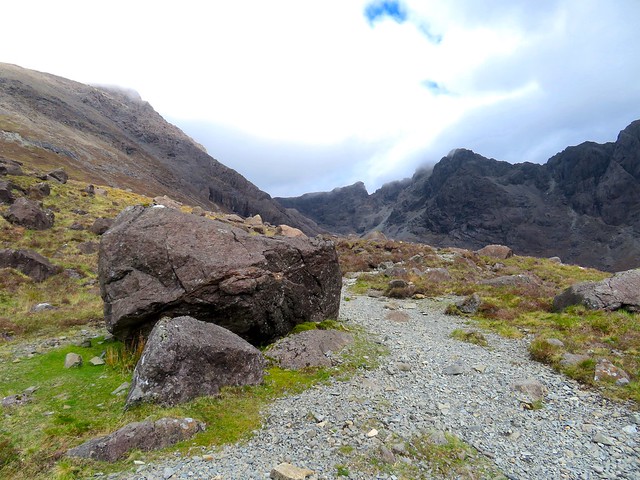
Now the sunshine fell behind and we were forging up the cleft of Coire Lagan in the shadow of the Cuillin ridge. A short sharp scramble up a jumbled staircase of rocks with a stream hissing down beside the path. Then the reward at the top of the climb, the still black pool of Loch Coire Lagan under tremendous upthrusts of black gabbro, with the shark fin of Sgùrr Thearlaich rising dramatically to the 992-metre pyramid of Sgùrr Alasdair, highest peak in the islands.

Descending past Loch an Fhir-bhallaich towards Eas Mòr’s horse-tail plume of falling water, we stopped for a last look at the high black rock spires of the Cuillin Ridge. The clouds were already drifting back, and against their grey backdrop a magnificent golden eagle, monarch of the range, was slowly wheeling away.

How hard is it? 5¼ miles; strenuous; mountain paths; one short, steep ascent with a little scrambling. For experienced, sure-footed walkers. Wear hill-walking gear; take map/GPS; consult weather forecast (mwis.org.uk)

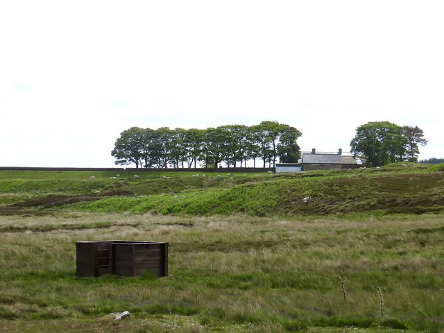
Start: Car parking area near Glen Brittle campsite, IV47 8TA (OS ref NG 410205)

Getting there: From Skye Bridge, A87 north to Sligachan. Left on A863 (‘Dunvegan’). In 5 miles, left on B8009 (‘Glenbrittle, Carbost’). In 1.6 miles, sharp left at Merkadale for 8 miles (narrow road) to Glenbrittle.

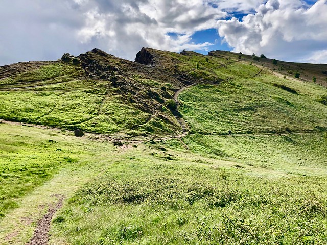
Walk (OS Explorer 411): From car park area at end of road, continue along track. Pass to left of campsite toilet block (pitched corrugated roof); through kissing gate; up path. In a few metres fork left on path. In 600m ignore path that heads to right (421203) across small burn and waterfall; keep ahead uphill here. In ¾ mile ignore a left fork (434206), and another in 400m with a big cairn (438206), both these paths leading past Loch an Fhir-bhallaich; instead, keep ahead up main path. In another 200m path steepens beside Coire Lagan burn on your right, leading up a rocky ‘staircase’ to Loch Coire Lagan (444209). Return down same path; in ½ mile, near large boulder on right (438206), fork right at big cairn on path for 2 miles, passing Loch an Fhir-bhallaich (432208) and later Eas Mòr waterfall (420214) to descend to road at Glenbrittle House (412214). Left along road for ⅔ mile to car park.

Lunch: Picnic

Accommodation: Sligachan Hotel, IV47 8SW (01478-650204, sligachan.co.uk)

Info: walkhighlands.co.uk; visitscotland.com

 Posted by at 02:41
Jan 272024


First published in: The Times Click here to view a map for this walk in a new window
Greatford Hall Church of St Thomas of Canterbury, Greatford Greatford Church and West Glen River Floods on East Glen River 1 Floods on East Glen River 2 Floods on East Glen River 3 Floods on East Glen River 4 Floods on East Glen River, looking to Wilsthorpe St Faith's Church, Wilsthorpe Worried crusader knight, St Faith's Church, Wilsthorpe Braceborough 1 Braceborough 2 Braceborough 3 Braceborough 4 landscape between Braceborough and Shillingthorpe Park 1 landscape between Braceborough and Shillingthorpe Park 2 Road between Shillingthorpe Park and Greatford 1 Road between Shillingthorpe Park and Greatford 2 Road between Shillingthorpe Park and Greatford 3

Greatford Hall lies beyond its boundary wall, a handsome rebuild in pale Lincolnshire limestone of the old country house where during the 18th century Dr Francis Willis practised pioneering forms of psychiatric treatment. His patients were misfortunate gentlemen of quality, the most illustrious of whom was the occasionally demented King George III.

In the village church alongside we found a bust of Dr Willis, bald and benign. The memorial eulogised the good doctor, ‘happily the chief agent in removing the malady which affected the present majesty in the year 1789’. The physician’s kindliness and benevolence were attested ‘by the tears and lamentations which followed him to the grave.’

With this touching image in mind we left Greatford and struck out north across the flat South Lincolnshire landscape, following the twisty Macmillan Way under a sky of grey and pink clouds. A proper midwinter afternoon, with floods gleaming in the fields beside the East Glen River and bushy-headed willows leaning over their reflections in the streaky water.

This is a countryside where church steeples have only the skeletal pylons as rivals for skyline prominence. The slender tower and spire of St Faith’s at Wilsthorpe beckoned us from afar. Inside, a dusty stone knight, perhaps a Mortimer, lay recumbent in a corner of the sanctuary, legs crossed at the knee to commemorate his two crusades, a purse and sword at his elaborate belt. The sculptor had furrowed the warrior’s brow with deeply incised lines, giving him a curiously worried expression.

Down the lane in Braceborough, little fierce stone lions guarded the label stops of the church windows. A mistle thrush was stabbing slots in a pile of apples that had fallen across the fence into the graveyard.

The homeward path led south over big fields of winter wheat, the slithery mud pocked with deer slots. In Shillingthorpe Park lumps and bumps in the wide grassland showed where immaculate parkland had superseded a medieval settlement. Trees had swallowed what little remains of Shillingthorpe Hall, a fine mansion which once housed a group of Dr Willis’s psychiatric patients.

Beyond the woods the West Glen River ran swift and swollen, stained bright yellow with floody mud. Towards nightfall we followed a quiet country road back into Greatford as a band of rooks flew chuckling and chattering overhead towards some distant roost.

How hard is it? 5½ miles, easy; field paths and country roads. NB can be wet around West and East Glen Rivers – take wellingtons in case!

Start: Church of St Thomas of Canterbury, Greatford, near Stamford PE9 4PX (OS ref TF 086119). Park near Hare & Hounds PH.

Getting there: Bus 45 from Stamford (Call Connect, 0345-263-8253))
Road – Greatford is signed off A6121 (Stamford-Bourne) at Carlby, between Essendine and Toft.

Walk (OS Explorer 234): From NE corner of churchyard, path to road. Left; in 150m pass Ash Lodge on right; on next left bend, fork right on Macmillan Way/MW (086122, fingerpost). Follow MW through fields (fingerposts, yellow arrows) for 1¼ miles, crossing East Glen River (089131), to road opposite St Faith’s Church, Wilsthorpe (092136). Left; in 150m, left (091138, ‘Braceborough’). Follow road for 1 mile to Braceborough. Left at Village Hall (081131) to visit St Margaret’s Church and return to Village Hall; right for 600m to cross Greatford road (079126). Follow path through fields for nearly 1 mile to join MW in Shillingthorpe Park. Left (072116, fingerpost) on MW to road (075111); left for 1 mile to Greatford.

Lunch: Hare & Hounds, Greatford PE9 4QA (01778-560332) – open Mon-Fri, 2-9; Sat, Sun, 12-10.

Accommodation: Crown Hotel, Stamford PE9 2AG (01780-763136, kneadpubs.co.uk)

Info: Stamford TIC (01780-755611); visitlincolnshire.com

 Posted by at 03:57
Jan 202024


First published in: The Times Click here to view a map for this walk in a new window
Trawlers at Eyemouth 1 Trawlers at Eyemouth 2 Trawlers at Eyemouth 3 Eyemouth 1881 fishing disaster memorial Looking back past Eyemouth to St Abbs Head Tilted greywacke cliffs near Eyemouth 1 Tilted greywacke cliffs near Eyemouth 2 Greywacke folds in the cliffs near Eyemouth 1 Looking south over Burnmouth and Ross 1 Greywacke folds in the cliffs near Eyemouth 2 Looking south over Burnmouth and Ross 2 Looking south over Burnmouth and Ross 3 Burnmouth harbour

Nearing the border where Scotland hands over to England, the cliffs of the south Berwickshire coast form a spectacularly folded and tilted rampart, partly ancient volcanic outpourings, partly sedimentary rock some 430 million years old with the curiously pleasing name of greywacke. Tucked away at the back of a sea-sculpted hollow lies the old fishing and smuggling town of Eyemouth, pungent with a whiff of fish and a smack of salt.

On the cliff path south of Eyemouth I stopped to watch the waves dashing in white foam on the Hurkers, jagged black teeth of rock at the entrance to the bay. On that reef and adjacent cliffs the Eyemouth fishing fleet was wrecked in a vicious autumn squall in 1881 that claimed the lives of nearly two hundred local fishermen in the space of a few hours. A devastating toll for the little town, and the stumpy, storm-proof build of the modern trawlers sheltering in the harbour today told of a sea that has lost none of its deadly power.

On a ledge of rock high above the waves a solitary figure in a yellow oilskin was wedged for a gull’s-eye view of the dramatic pull and suck exerted by the sea on its timeless mission to whittle away the land grain by grain. A last northward glimpse of Eyemouth sprawling down its cliffs and the lighthouse on St Abbs Head beyond, and I faced into a strong southeast wind laden with salt spray.

At Hurker’s Haven the sea has taken a great bite out of the cliffs, exposing green, red and yellow layers of rock scrunched up together by ancient subterranean upheavals like a Danish pastry squashed in a giant’s fist. Near the crest stood a wartime lookout, a plain concrete hut transformed into a child’s dream eyrie with fun-size table and chairs, a couple of pictures and a toy boat.

Beyond Hurker’s Haven the path ran between the cliff edge and fields stretching inland. The sea murk cleared to reveal the English coastline running away south. A tiny blob some fifteen miles off was Lindisfarne Castle, with an even tinier Bamburgh Castle beyond, both strongholds apparently floating far out at sea.

Now the long pincers of Burnmouth Harbour came into view with the houses of Ross beyond, twin fishing settlements clinging to the base of the cliffs where the waves rolled and retreated. The bent-up cliffs and solid breakwaters made a striking contrast with the diffuse energy and hunger of the sea, and I gazed my fill before turning for home with wind and spray at my back.

How hard is it? 9 miles there and back; easy; clifftop paths

Start: Eyemouth Seafront car park, High Street, Eyemouth TD14 5EY (OS ref NT 944644) – free

Getting there: Bus 235 (Berwick-upon-Tweed to Eyemouth)
Road: Eyemouth is on A1107 (signposted off A1 between Berwick-upon-Tweed and St Abbs)

Walk: (OS Explorer 346): Facing sea, bear right along harbour. At corner, right. In 500m, beside Quayside Chandlery (945641), left up causeway; left along fishing boat moorings. In 600m road curves right; on this bend keep ahead (948645) to post with arrow, and follow cliff path (posts with arrows) round edge of golf course. Follow ‘Coastal Path’ signs along cliff edge for 3¾ miles to road at Burnmouth (955610). Bear left (‘Coastal Path’) down road to Burnmouth Harbour and on along shore road to Ross community at far end (963604). Return to Eyemouth by outward route, or by bus from Burnmouth.

Lunch: Oblò Bar and Restaurant, 18-20, Harbour Road, Eyemouth TD14 5HU (01890-752527, oblobar.com)

Accommodation: The Ship’s Quarters, Harbour Road, Eyemouth TD14 5HT (01890-769515, theshipsquarters.com)

Info: visitscotland.com

 Posted by at 01:54
Nov 042023


First published in: The Times Click here to view a map for this walk in a new window
rustic waymark on the lane to Fishpond Bottom old crab apple tree, Lambert's Castle view over the Vale of Marshwood The Vale of Marshwood 1 The Vale of Marshwood 2 Holloway from Roughmoor ford Beechmast crunchers at Roughmoor

A grey and blowy day across the Dorset coast and the deep-sunk Vale of Marshwood. Up at Lambert’s Castle the beeches thrashed and hissed, shedding their leaves downwind like flocks of birds.

A steep path took me down the fields to Roughmoor, where a sow and her three pink-and-black piglets were blissfully crunching up the beechmast fallen from the trees. They snorted and grunted and raised their snouts hopefully as I leaned on their fence, but I had nothing in my pockets to add relish to their feast.

Marshwood gives the impression of great depth and remoteness, a green mosaic of woodland and sloping pastures that Thomas Hardy would recognise today. At Roughmoor Cottage a splashy ford led to a holloway rustling with bracken and hart’s tongue ferns.

Up at Higher Stonebarrow the wind roared in the beeches that held the hedge-banks together with the grip of their root tangles. A basso profundo moan came from the high tension cables that crossed the valley. But once down in the squelchy green lane beyond Sheepwash Farm I was walking far beneath the rumpus of the gale. At the ford below Little Coombe the swollen stream gushed freely among horsetails and filled my boots, one of the myriad waters that once filled the carp pools dug by medieval monks at Fishpond Bottom.

A network of old cart tracks threads through Marshwood Vale. I saw no-one as I followed the sunken path to Little Combe and Great Combe, isolated farmsteads on green slopes under the grey sky. A glimpse of the roofs of Charmouth lining their cliff gap to the south with a wedge of wind-whitened sea beyond. Then I turned up straggling Long Lane to cross the earthworks of Coney’s Castle.

Two Iron Age hill forts, orientated south-north, dominate the eastern flank of Fishpond Bottom – the modest rise of Coney’s Castle, and to the north the bigger stronghold of Lambert’s Castle on its long slim promontory.

I’d just finished re-reading Bernard Cornwell’s sword-slashing King Arthur trilogy, ‘The Warlord Chronicles’. Romantic fantasy was irresistible here on the windy ramparts. I strode them like a warrior, wolfskin cloak flying free, sword in hand, as I prepared to repel the Saxon hordes massing in Marshwood Vale below.

How hard is it? 5¼ miles; moderate. Some boggy green lanes, fords.

Start: Lambert’s Castle car park, near Lyme Regis EX13 5XL (OS ref SY 367987)

Getting there: Off B3165 between Marshwood and Raymond’s Hill (A35)

Walk (OS Explorer 116): Back along drive. In 100m, opposite gate on left, right down path. Cross B3165 (366988); down steps; kissing gate; half left down to gate (365989). Right down drive. At Roughmoor Cottage cross ford (363991); up holloway to Higher Stonebarrow. Left up drive; at start of road, left (357990; gate with red dog notice). Bridleway bounded by hedge, then walls to cross B3165 (360987). Stile. Down right edge of field to cables; follow them left to green lane (363983). Right; in 50m, left (stile); right along upper edge of woodland on right. In 250m at telephone pole (363980), sharp left down through trees to road (364981); right. 50m past Sheepwash Cottage, left (364977) along wet green lane to Little Coombe Farm. 100m beyond, right (369975) for ⅔ mile past Higher Coombe and Great Coombe farms to Long Lane road (373968). Left for ¾ mile to Peter’s Gore crossroads (371981). Ahead (‘Marshwood’); in 20m, right past Lambert’s Castle/Wessex Ridgeway signs. North across Lambert’s Castle for ½ mile; at northern edge (372991) turn back along western rim to car park.

Lunch/Accommodation: Hunter’s Lodge, Raymond’s Hill EX13 5SZ (01297-33286, hunterslodgeinn.co.uk)

Info: marshwoodvale.com

 Posted by at 02:53
Oct 282023


First published in: The Times Click here to view a map for this walk in a new window
Looking west from the foot of the North Downs 1 Looking west from the foot of the North Downs 2 Looking west from the foot of the North Downs 3 Looking west from the foot of the North Downs 4 Looking west from the foot of the North Downs 5 Looking west from the foot of the North Downs 6 chalk crown commemorates 1902 coronation of King Edward VII homeward path through the stubble fields near Withersdane The Devil's Kneading Trough view from the North Downs Way over the Kentish Weald

What a perfect ideal of a village Wye encapsulates, with its charming red brick and whitewashed houses round the village green, its post office, sports field, pubs, shops, surgery and public conveniences, all tucked under a beautiful corner of the North Downs.

The Church of St Gregory and St Martin is a building of shreds and patches, odd corners and uneven walls that reflect its many collapses and rebuildings over the centuries. Beyond the church we found the North Downs Way arrowing through the fields towards the steep, tree-topped rampart of the Downs, where a huge chalk crown was cut high in the downland turf in 1902 by Wye College students to commemorate the coronation of King Edward VII.

Hops still hung like pale green lanterns in the hedges, sticky to the fingers. A jay swore among the tangled hazels and clattered off, leaving one sky-blue feather to float gently to earth. We climbed a chalky path up through the trees to emerge at the top of the downs with a remarkable prospect spread out across the flat wooded Weald of Kent. To the south, distant views of Romney Marsh, Dungeness power station buildings and the tiny shapes of cargo ships in the English Channel; to the north a silver-grey strip of the Thames, with the Essex shore a knobbled blue line beyond.

We strolled the upland path, absorbed in this South Country panorama. A handily placed bench gave a vantage point over the steep sides and narrow flat bottom of the Devil’s Kneading Trough, a coombe carved out of the chalk downs by Ice Age freezing and melting of water.

The Devil seems to have taken quite a fancy to this part of the world. Following the homeward path through the stubble fields at the foot of the downs, we passed near the cottage at Withersdane where the holy well of St Eustace still whelms. A local woman swollen by an evil dropsy once drank its waters in hope of a cure. She immediately vomited forth a pair of black toads that changed into hellhounds, then demonic asses. When sprinkled with holy water from the well, they shot into the sky and disappeared.

How hard is it? 5½ miles; easy; downland tracks and field paths.

Start: Wye village car park, Gregory Court, Wye TN25 5EG (OS ref TR 053468); or Wye railway station, Bridge Street TN25 5LB (048469)

Getting there: Train to Wye
Road: Wye is signposted from A28 (Canterbury – Ashford)

Walk (OS Explorer 137): Left along Bridge Street; in 100m, left along Churchfield Way. In 500m left through churchyard to NE corner (055469); up path by allotments. Cross road (056470), up Occupation Road (‘North Downs Way’/NDW). Follow NDW (road, then path) across road (066468), up hill into woods (069469). At top of climb (blue arrow on post points ahead) (070469), but fork right here. In 500m cross Crown Field (072466), then road (077457). Follow NDW through trees, then at edge of open downs. In ¼ mile pass Devil’s Kneading Trough coombe (078454); in 600m reach waymarked post with 2 arrows (081450). NDW keeps ahead, but go sharp right downhill through kissing gate. At bottom, right along road (072449); right at fork (075450, ‘Wye’); in 200m, left through hedge (074451, fingerpost) on path across fields. Cross road at Silks Farm (065460); at road near Withersdane Hall, ahead (060462); at next bend, ahead on path (060463). At road in Wye, ahead (055466, New Flying Horse inn to right), to station, or next right to car park.

Lunch/Accommodation: King’s Head, Church Street, Wye TN25 5BN (01233-812418, kingsheadwye.co.uk)

Info: wyeheritage.org.uk

 Posted by at 01:10
Oct 142023


First published in: The Times Click here to view a map for this walk in a new window
Corehead Farm with the Devil's Beef Tub beyond 1. rolling hills around the rim of the Devil's Beef Tub Grass of Parnassus in the damp woodland on the way up to the Devil's Beef Tub rim trees newly planted by the Borders Forest Trust Scotch argus butterfly Corehead Farm with the Devil's Beef Tub beyond 2 view down the Devil's Beef Tub steep billows of hill above the Devil's Beef Tub

From the car park at the end of the bumpy farm road from Moffat, a group of young volunteers from the Borders Forest Trust were setting out with spades and crowbars to plant trees on the slopes above Corehead. Young rowans, alders and silver birch are already flourishing on these steep lumpy hills, part of a drive to regenerate the native forest that once flourished here. The blackface sheep have already been banned from the slopes, so the saplings can grow ungrazed.

It was a long, steady climb through bracken and heather, then among the young trees along the Tweedhope Burn. Rowan berries glowed a deep burnt orange, and the indigo berries on recently planted juniper bushes gave a spicy tang of gin when crushed and sniffed.

Near at the top we heard the chink-chink of a hammer and glimpsed the youngsters hard at work on a new plantation. At the watershed, soggy and boggy, a neat elliptical cairn stood at the turning point of the Annandale Way, a rollercoaster path along the backs of Chalk Rig Edge, Great Hill and Annanhead Hill. Here we perched on a handily placed bench, looking down into the plum-coloured shadows of the Devil’s Beef Tub, source of the River Annan.

A stranger to the area three hundred years ago would never have happened upon this remote, tight and formidably steep-sided hollow, some five hundred feet deep, nearly sheer from rim to bottom. Here the cattle-raiding Johnstone family would graze the beasts they had stolen, confident that no-one would ever find them.

The secluded hideaway was also a refuge for the 17th-century religious dissenters known as Covenanters. One of them, John Hunter, was chased up the slopes by dragoons in August 1686 and shot like a dog when caught. In 1745 a Jacobite prisoner managed to get free from his captors while crossing the rim of the Devil’s Beef Tub, and escaped by rolling like a barrel down the plunging braeside while wrapped in his plaid.

We descended from Annanhead Hill and crossed the rushy bump of Ericstane Hill. Following the homeward path in bright evening sunshine, we looked back toward the darkly shadowed Devil’s Beef Tub, picturing the tumbling Jacobite – and, a more contemporary story from 2002, the woman who swerved her van off the road and all the way down into the hollow to crash land at the bottom. She survived, with a broken arm; the van still lies where it fell, wheels in the air, landmark and legend in one.

How hard is it? 7½ miles; strenuous moorland walk, boggy in places.

Start: Car parking space (OS ref NT 073117) on farm road between Ericstane (077116) and Corehead (073124).

Getting there: North through Moffat on A701; fork right along Beechgrove, then follow Old Edinburgh Road (‘No Through Road’). In 3½ miles at Ericstane, left across river (073109). Rough farm road towards Corehead; in ⅔ mile, car parking space on right (072118) by Borders Forest Trust sign.

Walk (OS Explorer 330): Bear right along grassy track. Follow Annandale Way (AW waymarks) for 1⅔ miles, gaining height beside Tweedhope Burn to reach cairn at watershed (084138). AW turns left with fence; follow it over hills for 2 miles to descend to A701 (056127). Left; in 400m, right (059124, AW) across Ericstane Hill to cross A701 (061115). Follow field track; in ½ mile on right bend, left off AW through gateway (065110). Follow track down to Ericstane (072109); left to car.

Lunch: Hugo’s Restaurant, 4 Bath Place, Moffat DG10 9HJ (01683-221606, hugosmoffat.uk)

Accommodation: Annandale Arms Hotel, High Street, Moffat DG10 9HF (01683-220013, annandalearmshotel.co.uk)

Info: bordersforesttrust.org

 Posted by at 01:01
Sep 162023


First published in: The Times Click here to view a map for this walk in a new window
view north from top of Warningore Bostal 1 the ridgeway track 1 the ridgeway track 2 looking back from the top of Plumpton Bostal 1 looking back from the top of Plumpton Bostal 2 curves of the downs from Warningore Bostal looking back from the top of Plumpton Bostal 3 near Warningore Farm scene near Warningore Farm

The white rails of Plumpton Racecourse curved away, pointing southward like skeletal fingers towards the olive-coloured rampart of the South Downs. A brisk cold wind blew from those hills, with a hint of silver underbelly on the clouds beyond from the gleam of the invisible sea.

A long straight path led between pasture and crops, crossing rain-swollen brooks in tangled dells, drawing ever nearer to the downs. This is horse country. A white mare poked her nose over a fence to have it stroked by a couple of passing girls. Suddenly she took a sly nip, provoking shrieks and cascades of giggles.

Cheerful chatter and tempting cooking smells came wafting from the Half Moon Inn as I crossed the Ditchling road and started up the steep downland track called Plumpton Bostal – a name reminiscent of fictional correspondents to Private Eye. The rubbly old track curved and climbed to the ridgeway along the crest of the hills. Wonderful views opened out, northwards across the wooded Sussex Weald toward the loom of the far-off North Downs, south across deep chalk valleys to the snub-nosed Seven Sisters cliffs and the ice-blue sea.

A kestrel rode the wind, head down, eyes fixed, sideslipping along above the almost imperceptible hummocks of Bronze Age bowl barrows. Soon another old holloway, Warningore Bostal, left the ridge track and slalomed down the hillside. The steady push of the south wind, now blocked by the wall of downland at my back, vanished as though a fan had been clicked off. I skittered down the rain-glazed chalk that floored the bostal, and set out north across pasture and arable ground once more.

At Warningore Farm the farmer was digging silage out of the clamp for his cattle. I passed the shed where they stood patiently in an emanation of sweet breath and a gentle rustle of movement.

On across the fields where horses in heavy tarpaulin raincoats were cropping the grass. A pint of delicious dark Bluebell Best in the Jolly Sportsman at East Chiltington, and then the homeward stretch by the hamlet’s ancient flint church, beautiful in its simplicity, too obscure even to have a dedication to its name.

How hard is it? 7¾ miles starting at station, 6½ miles starting at Plumpton; moderate.

Start: Train – Plumpton Station (NB no parking)
Road: Half Moon PH, Ditchling Road, Plumpton BN7 3AF (364132). Please ask permission, and give pub your custom! In addition, parking for 6-7 cars in lane above car park.

Getting there: Bus: 166 (Lewes-Haywards Heath)
Road: Plumpton is on B2116

Walk (OS Explorer 122): From station, path south besides racecourse. At south end, right (362153); in 40m, left down lane. In 1¼ miles, pass Agricultural College; 150m past last buildings, left (360133, gates); half right over field into trees. At B2116, left past Half Moon PH (364132). (NB Directions starting from PH begin here). Cross B2116; Plumpton Bostal (‘Bridleway’), steeply up. At top (357126), left; in 1 mile, through gate (370125); left down holloway. In ½ mile at path crossing, left (376127, arrow post). Cross B2116 (374130); bridleway opposite. Keep right of Warningore Farm Cottages (376137); on (north) along bridleway. In ¾ mile, gate into green lane (381147); in 50m, left (fingerpost, yellow arrow/YA) across 2 fields to lane (378150). Left; cross road by postbox (375150, stile, YA). Fork right across field to lane (373152). Left past Jolly Sportsman. At church, right down stony bridleway (371151). Cross Plumpton Lane (364153); in 150m, at racecourse entrance, right (362153) to Plumpton station.

Lunch: Half Moon, Plumpton (01273-890253, thehalfmoonplumpton.co.uk)

Accommodation: Jolly Sportsman, East Chiltington BN7 3BA (01273-890400, thejollysportsman.com)

Info: visitsoutheastengland.com

Walking the Bones of Britain – a 3 Billion Year Journey by Christopher Somerville is published by Doubleday.

 Posted by at 04:27
Aug 052023


First published in: The Times Click here to view a map for this walk in a new window
Salisbury Crags and Arthur's Seat Salisbury Crags - sandstone layers squashed by intrusive dolerite rim of Salisbury Crags dolerite rampart of Salisbury Crags Northern marsh orchid growing in the wet ground below Whinny Hill looking from Whinny Hill to Leith, Firth of Forth and the Fife hills volcanic summit of Arthur's Seat

A spatter of rain and a good strong wind over Edinburgh, but that wasn’t going to spoil our fun. Nor was the closure of Radical Road below the iconic ramparts of Salisbury Crags. ‘There’ll be another route up Arthur’s Seat,’ said Dave Richardson, botanist, musician and long-time friend. We put away the mandolins on which we’d been bashing through ‘The Steamboat’ hornpipe at his kitchen table, donned the boots and set out for Holyrood Park.

Lucky citizens of Edinburgh, to have this great wild upthrust in their midst, more of a wedge of unspoiled highland and wildlife than anything resembling a city park. Rock falls in 2018 saw Radical Road closed off to the public, and it hasn’t reopened since. But we found a stony path that led up along the rim of Salisbury Crags and gave memorable if head-spinning views down and along this volcanic curtain of dolerite that was squeezed up and out of the depths some 325 million year ago.

‘Wood sage, heath bedstraw, bloody cranesbill,’ enumerated Dave as we passed scatters of wild flowers in white and purple. At the apex of the crags the main spectacle of the park rose ahead, a double hump of high ground composing the striking miniature mountain of Arthur’s Seat. We dipped down into a saddle of ground where many paths met, then set our faces and feet to the steep and rocky climb. Greenfinches gave out their sneezy calls from scrub bushes beside the path, whose slippery rock steps had been polished green and red by countless footfalls.

Arthur’s Seat itself is a pluton, the top of a column of basalt that punched up from below into the crater of a massive volcano, long eroded away. Standing up there in the blasting wind we were lords of one of the world’s most remarkable cityscapes – Edinburgh Castle and the jumble of monuments on Calton Hill riding their volcanic crags, petrified lava flows shaping the nearby slopes. the Pentland Hills away to the south, and northwards a glimpse of the red cantilevers of the famous railway bridge stepping across the Firth of Forth towards the hills of Fife.

How we ended up sliding on our backsides down Whinny Hill’s prickly slopes is another tale entirely. But we landed back at Dave’s in time to give ‘The Steamboat’ another run-around.

How hard is it? 3½ miles; strenuous; cliff-top path, some slippery rock underfoot, short steep climb.

Start: Holyrood car park, Queen’s Drive, Edinburgh EH8 8AZ (OS ref NT 271737)

Getting there: Train to Waverley Station; right on Princes Street; first right (Calton Road); in 800m, right on Horse Wynd, then Queen’s Drive.

Walk (OS Explorer 350; many route maps online, e.g. travelswithakilt.com/arthurs-seat-walk-map): From roundabout next to car park, left along Queen’s Drive. In 50m, fork right uphill; in 100m, right again up stony path along top of Salisbury Crags (unguarded edge). In ¾ mile, opposite Arthur’s Seat, descend to meeting of paths in valley on left (273728). Bear left uphill under Arthur’s Seat; steeply up rock steps to saddle below peak (276731). Sharp right and follow path to foot of stone steps (277730) up to summit. Return to foot of steps; ahead, down and then up across Whinny Hill, bearing north for ⅔ mile, down to Queen’s Drive (279740). Left to St Margaret’s Loch (277739); clockwise along shore to south end (275737), then path along Queen’s Drive to car park.

Lunch: The Pakora Bar, 111 Holyrood Road EH8 8AU (0131-202-5200, thepakorabar.co.uk)

Accommodation: The Scott, 18 Holyrood Park Road EH16 5AY (0131-651-2007, uoecollection.com)

Info: ‘Discovering Edinburgh’s Volcano’ (edinburghgeolsoc.org);
geowalks.co.uk/arthurs-seat/arthurs-seat-self-guided-walks;
visitscotland.com

Walking the Bones of Britain – A 3 Billion Year Journey from Outer Hebrides to Thames Estuary by Christopher Somerville (£25, Doubleday) is out on 24 August

 Posted by at 02:53
Jun 242023


First published in: The Times Click here to view a map for this walk in a new window
view from lane near Birthorpe, over the fields to the tower of Folkingham church 1 view from lane near Birthorpe, over the fields to the tower of Folkingham church 2 House of Correction, Folkingham humps and bumps of Sempringham Priory site memorial at Sempringham Priory to Gwenllian, last native Princess of Wales St Andrew's Church, Sempringham 1 castle earthworks, Folkingham guineafowl on the track near Folkingham St Andrew's Church, Sempringham 2 view from lane near Birthorpe, over the fields to the tower of Folkingham church 3 St Andrew's Church, Folkingham

Folkingham lies squarely across the A15 road from Lincoln towards London. In the great days of coaching it was a major stopover. But the coaching trade dwindled and the railways never arrived. Nowadays, this little Lincolnshire village has the air of a pleasant backwater, its mellow old houses of brick and stone marshalled round a very wide and gently sloping market place, with the tower of St Andrew’s Church peeping between their shoulders.

We found a path that left the square and passed beside the green earthworks where Folkingham Castle once stood. Now the castle mound is occupied by a lofty stone gateway, its pediment inscribed ‘House of Correction, AD 1825’.

The great gateway was designed to look massive and heavy, a forbidding portal to overawe the local drunks, thieves and homeless wretches incarcerated here. The regime of oakum picking, stone breaking and the treadmill, the diet of gruel and the separation of wives from husbands and parents from children was reckoned just the thing to teach wrongdoers a thundering good lesson.

Good clear paths led us through the enormous cornfields. The very slightly rolling landscape looked at first to be an unbroken, intensive blanket of wheat, but we found the ditches and surviving hedges brimming with wild flowers – white froths of cow parsley, buttercups, great willowherb and pink bramble blooms, bristly teasel heads and fruity-scented pineapple mayweed.

Beside the path feathery wild grasses made a silky border to draw the fingers through, one of those perennial sensual pleasures of summer walking. A cuckoo called from the sunlit trees of Little Gorse; a yellowhammer chittered in the hedges. A tractor tyre seat at the crest of Beacon Hill offered a perching place and an admonition in stick-on letters: ‘Rest awhile, look around, be thankful.’

The buildings of Sempringham Priory, founded in 1131, lay under mounds of grass, but the old restored church stood high and lonely beyond, its pinnacled tower beckoning across an immense cornfield. The south doorway was spectacularly decorated with strapwork and dogtooth carving.

In a far corner of the churchyard a circular wooden cover lay in a sunken dell. I lifted it off, to find the Holy Well of St Gilbert, founder of the priory, bubbling quietly beneath, brimful and as clear as glass.

How hard is it? 6½ miles; easy; clear field paths

Start: Folkingham market place, near Sleaford NG34 0TG (OS ref TF 072337)

Getting there: Folkingham is on A15 (Sleaford-Bourne)

Walk (OS Explorer 248): Down hill; in 150m left on fenced path between Orchard Cottage and Bradley House. Cross path (stile); ahead to stile onto Billingborough Rd (075334). Left; in 50m, right (fingerpost/FP); left on field edge path (occasional yellow arrows) for ¾ mile to path junction (082331, 3-finger post). Left (‘Restricted Byway’); in 150m right (3-finger post). In 400m, left by reservoir (085326) along Beacon Lane. In ½ mile cross road (093329); on across big fields; in trees at far side, right (103326). In 100m left (FP); in 200m fork left on fenced path to church (107329). NB – Holy Well in SE corner of churchyard. From NE corner, north along field edge path (3-finger post) to cross road (103337). Down right side of field; in 100m, left on path (unsigned) west across fields. In ⅔ mile cross road (094336); on (FP) to rejoin outward route.

Lunch: Folkingham Shop café, open 9-2 weekdays; New Inn, West St, Folkingham NG34 0SW (01529-497211) – open daily, ring for meal times.

Accommodation: Whichcote Arms, Osbournby, NG34 0DG (01529-455295, whichcotearms.co.uk) – welcoming, dog-friendly village pub.

Folkingham House of Correction: landmarktrust.org.uk

Info: visitlincolnshire.com

 Posted by at 01:10
Jun 102023


First published in: The Times Click here to view a map for this walk in a new window
Hisehope Reservoir Cushat Leazes farm Hisehope Reservoir 2 feeder channel between Hisehope and Smiddy Shaw reservoirs Grouse butt between Hisehope and Smiddy Shaw reservoirs faint track of the path above Hisehope Burn path across the moor Waskerley Way old railway path open moor near Hisehope Reservoir grouse butt near Hisehope Reservoir southern marsh orchid along the Waskerley Way red grouse shelters among old heather golden plover near the Waskerley Way Smiddy Shaw Reservoir

Cyclists on the Waskerley Way railway path pedalled into a strong cold blow from the west. The rest of the UK was sweltering in 30º of heat, but not up here on this brisk day of sun and cloud over the Durham moors.

The old railway rose gently to the west between bushes of gorse and young juniper. The wind carried lamb cries and the liquid territorial calls of nesting curlew, cur-leek! cur-leek! I almost trod on a curlew egg, a long olive-green oval camouflaged with tarry scribbles. A lapwing flapped above us, whistling in agitation, then landed to run parallel to us, crested head raised, before taking off for another agitated circuit above the human intruders.

Lumpy mounds of spoil bore witness to lead mining in the not so distant past. Nowadays the moors are managed patchwork-style for grouse, with coarse grey patches of old heather left for shelter and bright green young shoots for food. It was wonderfully exhilarating to be walking these uplands with their long views and sombre colours under a racing sky.

We left the Waskerley Way and followed a stony track down to the long dam wall and wind-rippled water of Hisehope Reservoir. A feeder channel paved with stone led away east across the moor. Fenn traps had been placed on poles that crossed the channel to catch four-legged predators on grouse. Snipe and golden plover flew up with piping cries, then settled to their nesting once more.

A side path ran off north across the moor, soon descending to cross the deep-sunk Backstone and Hisehope burns in a steep little gully. From here the landscape changed to thistly meadows crossed by the faintest of cart tracks. The lonely farmhouse of Cushat Leazes drooped sadly, slate roof falling in, walls patchy where handily shaped stones had been robbed for wall-mending, a reminder of just how tough life is for the upland sheep farmers.

We followed a green path over rough pasture to climb the steps to the brink of Smiddy Shaw Reservoir. The wind drove the water in whitecaps, and the view back across the moors we’d tramped disclosed a big dark marsh harrier sailing close to the heather, a lapwing rising to scold it away with urgent, creaking cries.

How hard is it? 6 miles; easy (but GPS helpful); moorland tracks

Start: Waskerley Farm car park, Consett DH8 9DZ approx (OS ref NZ 051453)

Getting there: A692 Consett to Castleside; cross A68; minor road past Horsleyhope; in 3 miles, left (brown sign ‘Waskerley Station’).

Walk (OS Explorer 307): Right along Waskerley Way/WW. In 1¼ miles at next car park (033453), right; left beside road. In 250m right on track to Hisehope Reservoir. Just beyond house, right (025462) along channel. In ⅔ mile round right bend to footbridge (037464). Left here on moor path for ⅓ mile to Backstone Burn. Follow right bank; cross burn at confluence with Hisehope Burn (040473). Left to cross Hisehope Burn. Up bank; in 150m, right over ladder stile (039474). Ahead across grass on track. In 100m edge left to raised bank; follow it to ford (039476); on to reach wall on left. Follow it to house (041479). In dip, right on grassy drive. Cross footbridge (042477); in 200m pass Cushat Leazes ruin; bear right (044475) on green path. In ⅓ mile through wall gate (043470); ahead on moor track; steps up to Smiddy Shaw Reservoir (044464). Left; at car park (047462) left to road; right to corner (048457); left (‘WW’) to car park.

Lunch: Picnic

Accommodation: Derwent Manor Boutique Hotel, Allensford DH8 9BB (01207-592000; derwentmanorhotel.com)

Info: thisisdurham.com

 Posted by at 01:25