Search Results : Oxfordshire Oxon

Feb 102024


First published in: The Times Click here to view a map for this walk in a new window
near Aston Tirrold looking back down Access Land dry valley 1 Access Land dry valley Access Land dry valley with juniper bushes fields above Aston Tirrold on the way down from Lowbury Hill, a linnet (I think!) braided ridge path on Aston Upthorpe Downs looking back down Access Land dry valley 2

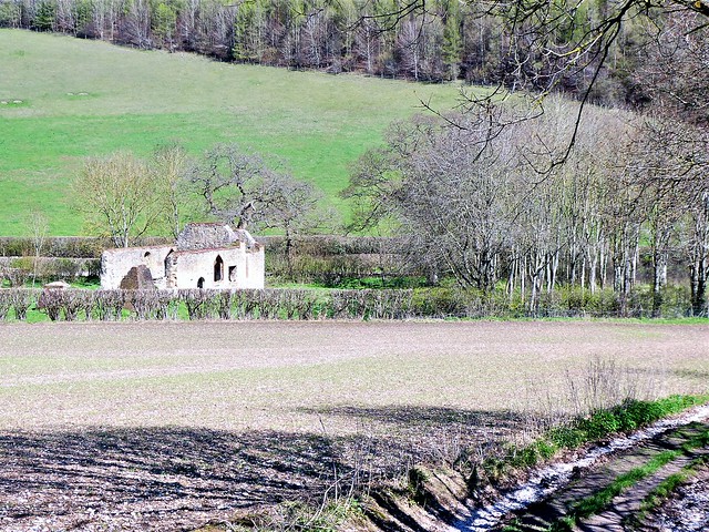
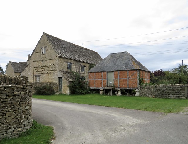
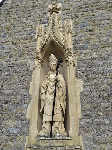
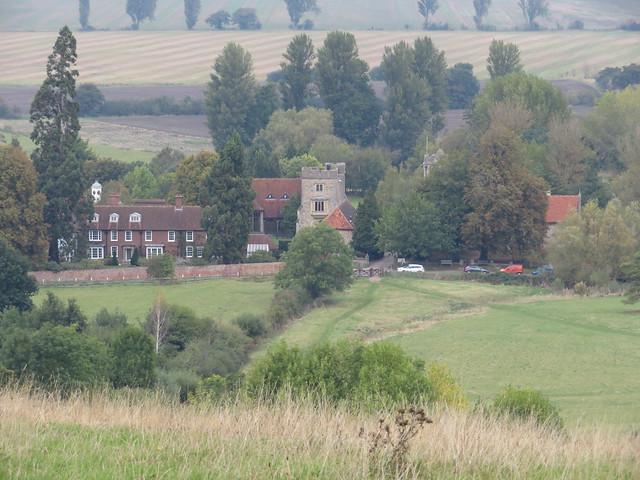
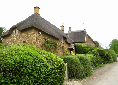
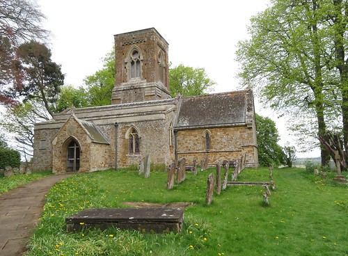
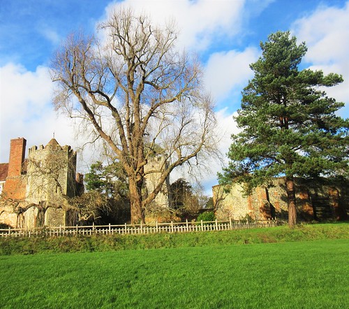
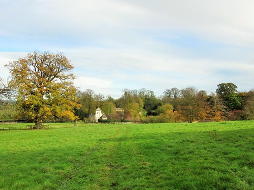
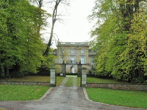
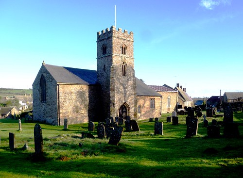
A sunny winter sky over the Oxfordshire downs. We sauntered a circuit of the back lanes of Aston Tirrold – St Michael’s Church with its ancient doorways, the weathered brick and flint of the Manor House and street walls, the great weatherboarded barn, and round the corner in the twin village of Aston Upthorpe more handsome houses.

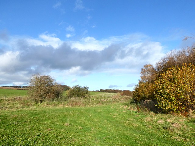
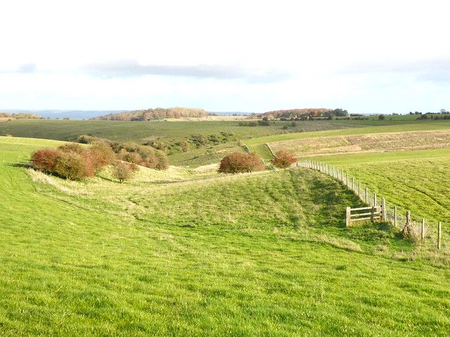
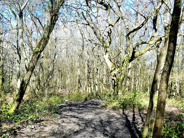
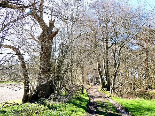
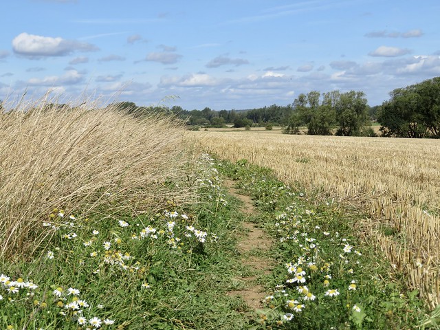
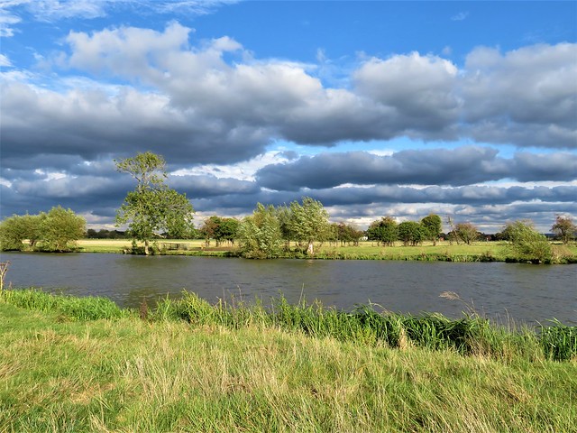
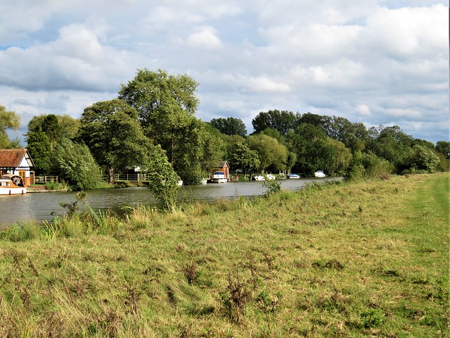
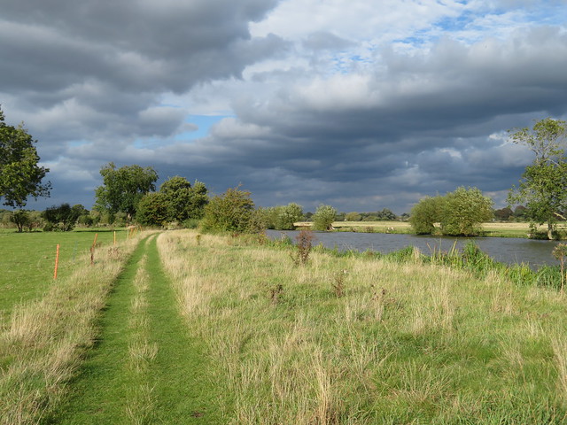
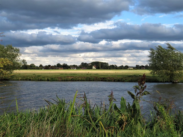
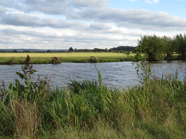
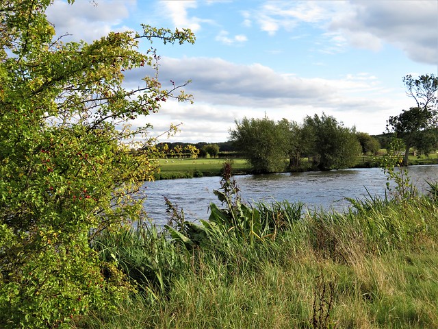
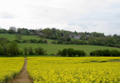
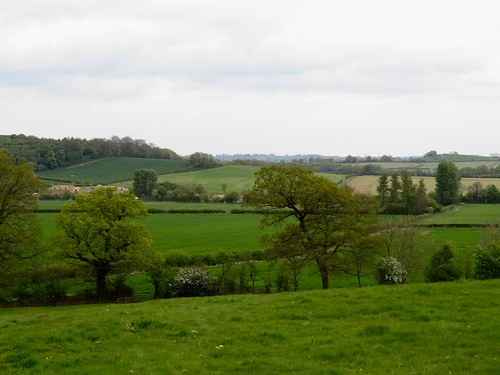
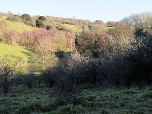
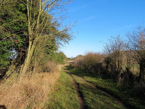
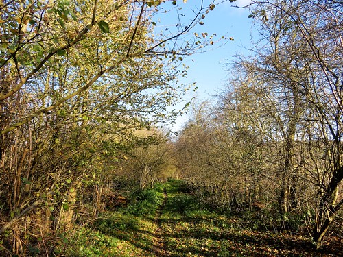
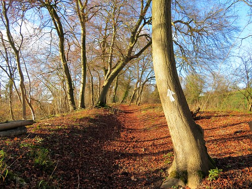
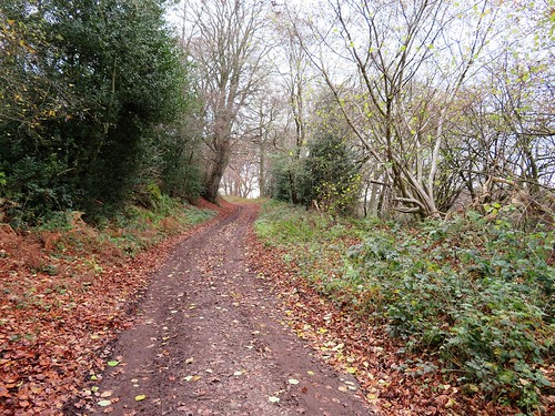
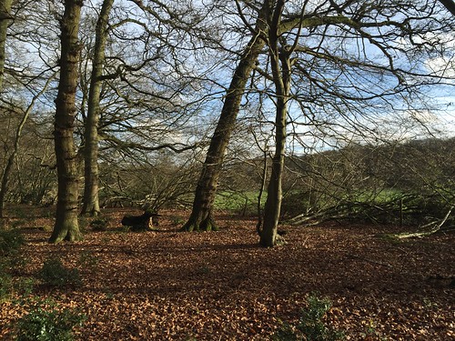
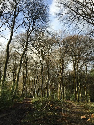
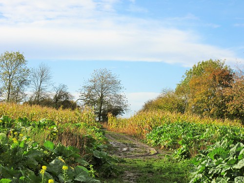
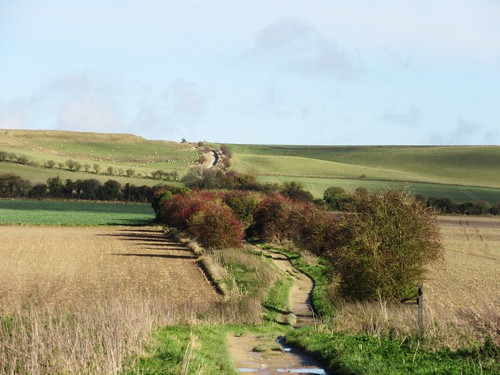
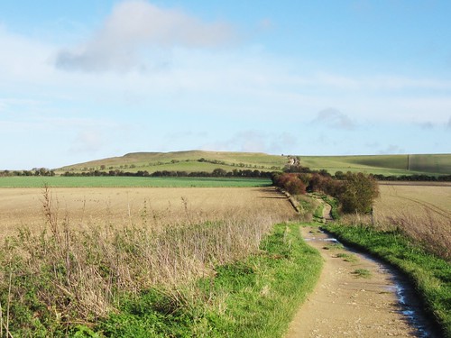
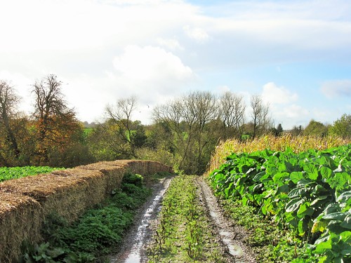
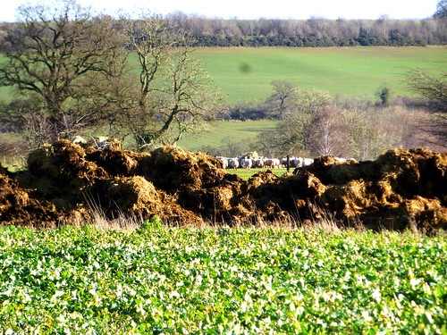
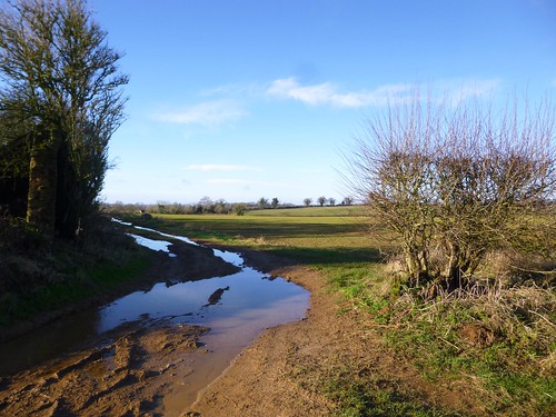
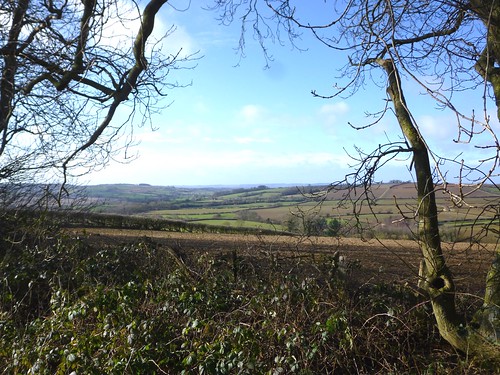
Once across the rush and swish of the A417 we followed an old mossy byway towards the low-lying downs south of the village, with cold wind and dazzling winter sun in our faces. The sky above the downs was bathed in a nacreous sheen. Partridges scuttled away among green beet leaves, a robin trickled out a dribble of song from the scrub of nettle and elder along the lane, and there was a feeling of being deep in agricultural countryside, far from any city.

In the spring of 1967 the youthful members of psychedelic folk-rock group Traffic installed themselves at Sheepcote Farm in this peaceful cleft in the hills to ‘get it together in the country’. Jamming night and day with only the hares and pheasants as audience, they soon nailed the songs for their debut album ‘Mr Fantasy’. Traffic didn’t last long, but their rustic sojourn fixed the name of Aston Tirrold in rock history.

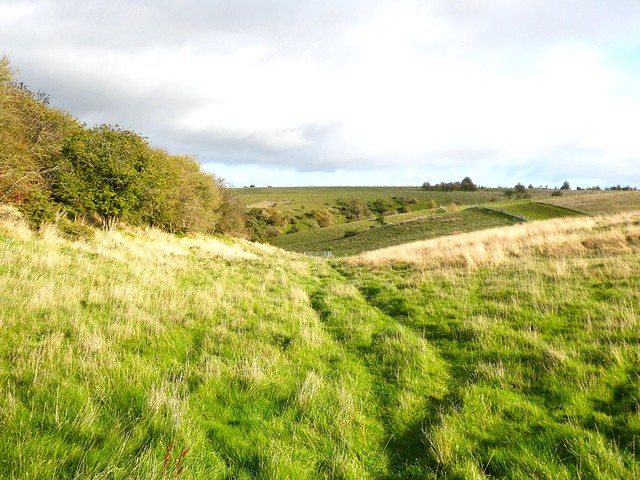
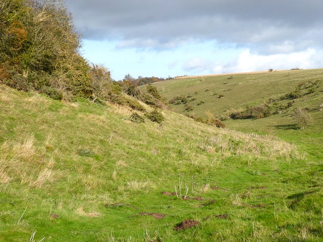
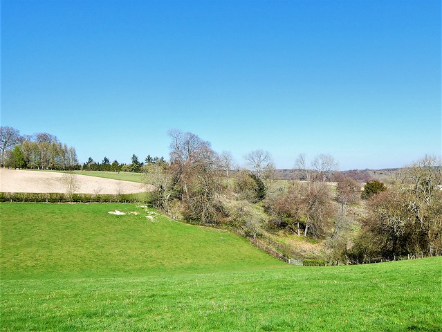
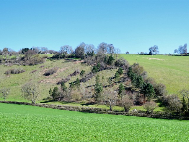
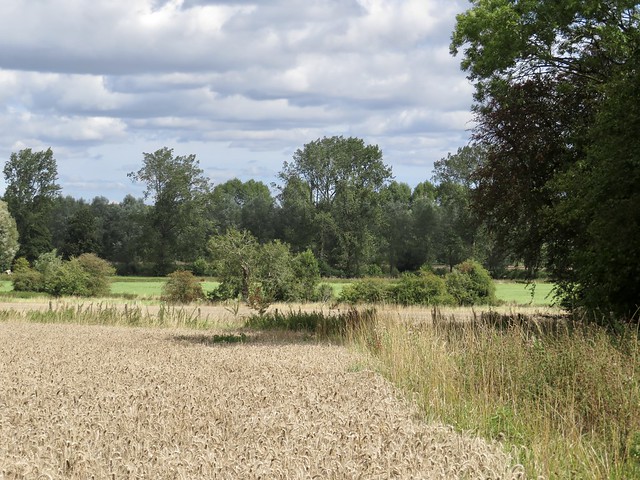
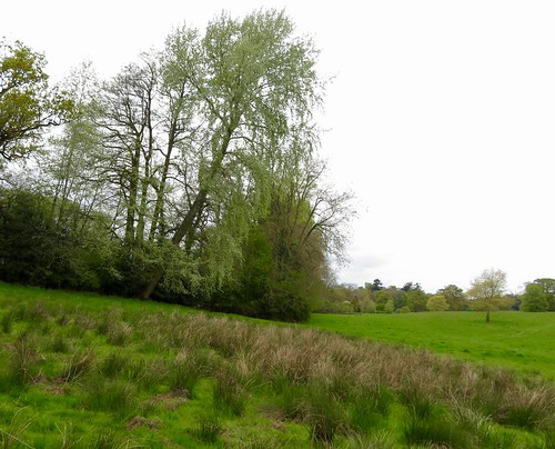
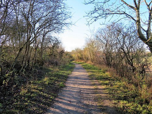
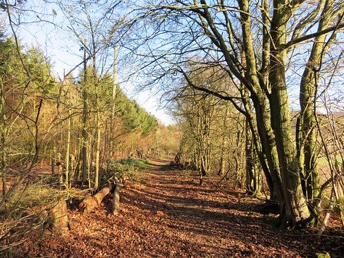
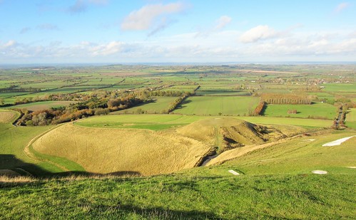
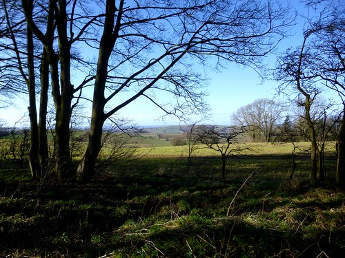
The muted sun cast a bristly halo behind each teasel head along the byway. Soon we turned off the track to thread a lonely dry valley in Access Land. Juniper bushes prickled the slopes among heaps of white flints kicked out by burrowing rabbits. A couple of red kites came to circle overhead and issue high-pitched whistles as we climbed to the braided ridge track at the top of Aston Upthorpe Downs.

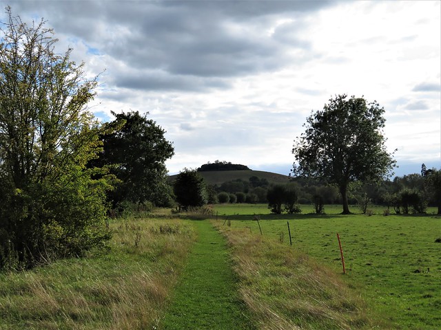
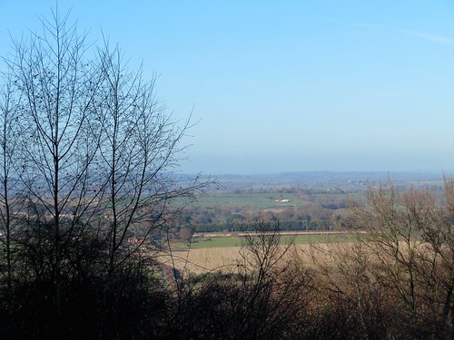
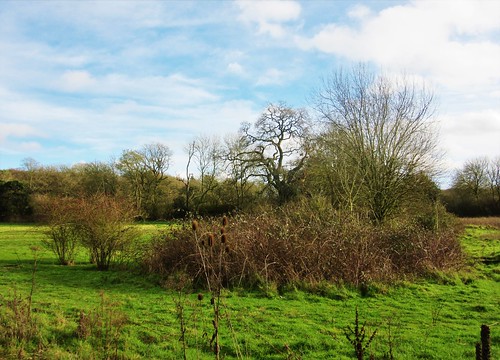
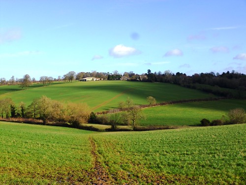
The shapely hump of Lowbury Hill rose alongside, site of a splendid Saxon warrior’s burial. Archaeologists found him interred with sword, shield, spear, a comb in a leather sheath, and under his back a tiny pair of shears.

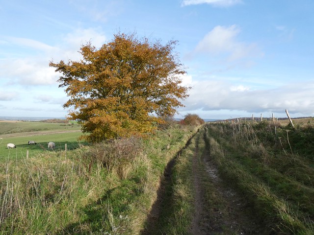
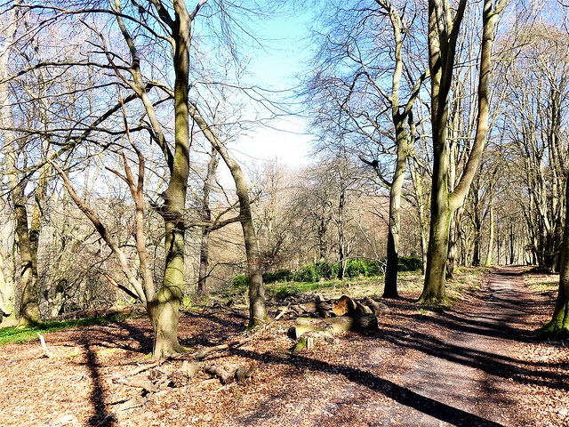
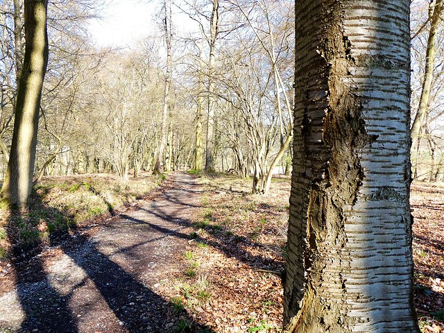
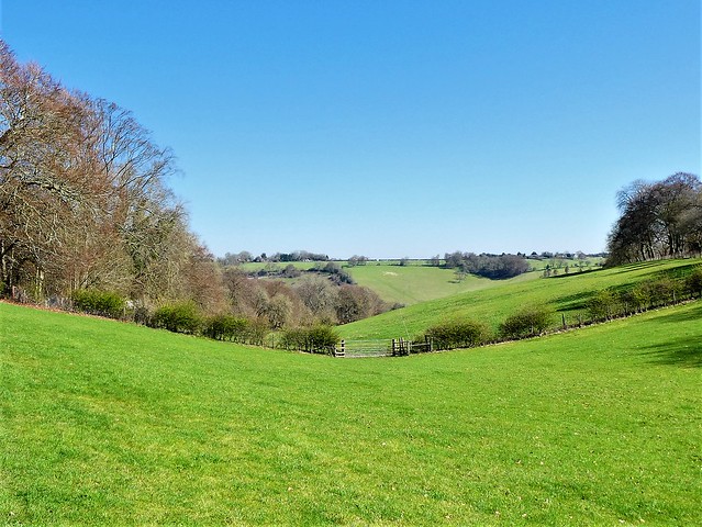
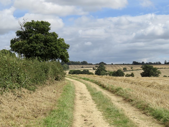
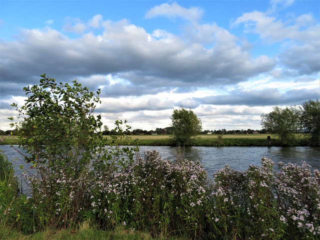
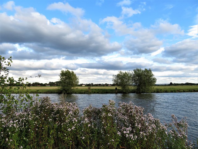
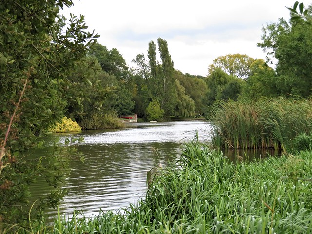
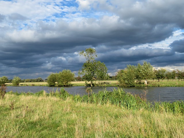
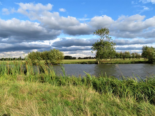
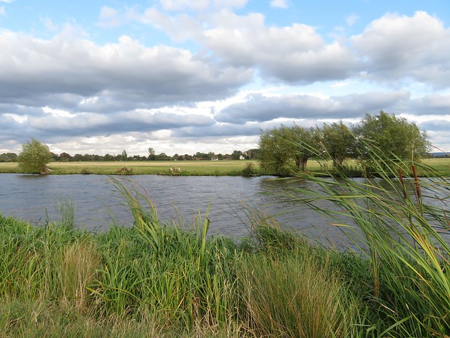
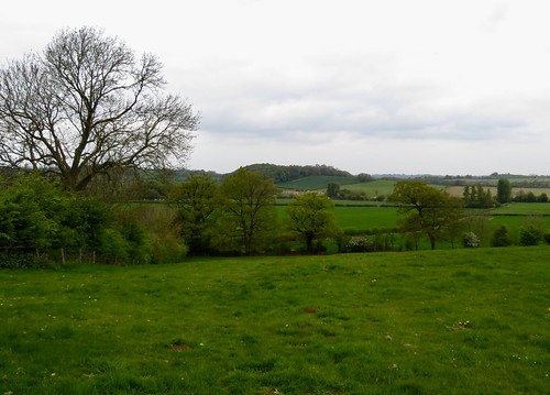
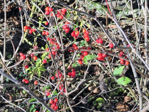
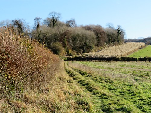
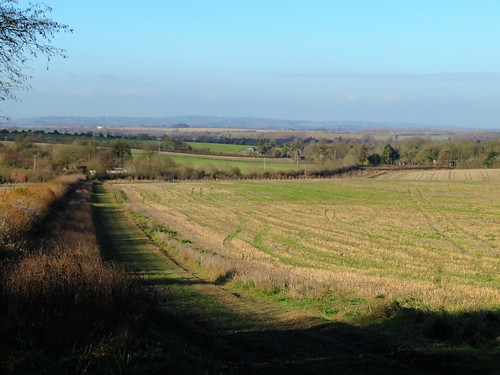
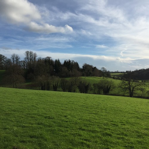
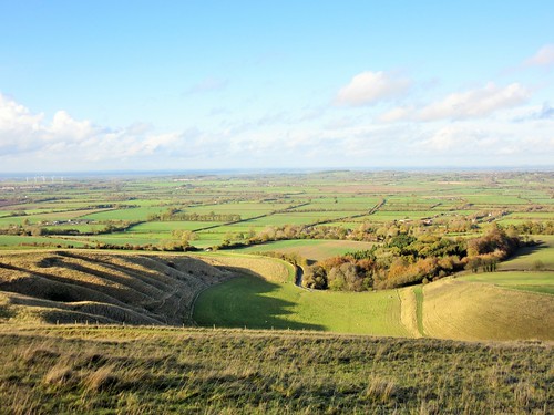
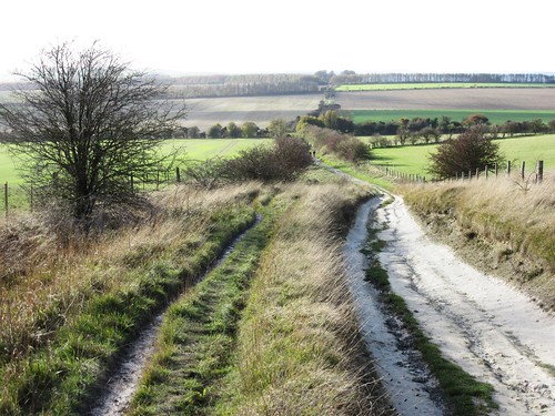
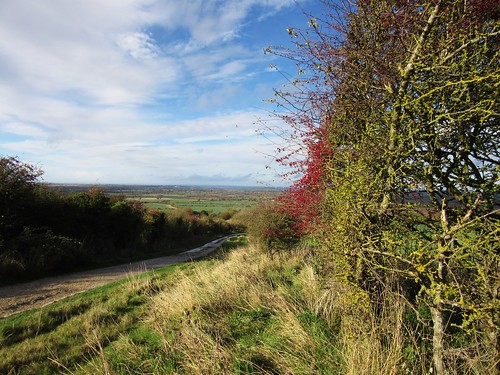
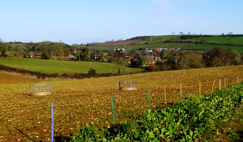
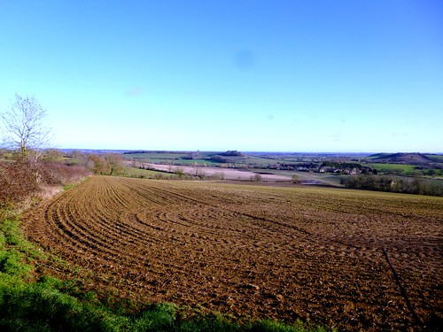
Irresistible to speculate that it was for the enormous views north that the warrior’s tomb was sited on the eminence of Lowbury Hill. Descending the homeward track between hedges where linnets bounced among the dried elder and haw berries, we savoured the prospect over the wide valley of the Thames and thanked our lucky stars for this beautiful winter’s day as the sun set slowly behind us.

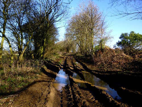
How hard is it? 6 miles; easy; downland tracks (some slippery).

Start: St Michael’s Church, Aston Tirrold OX11 9DJ (OS ref SU 558860)

Getting there: Aston Tirrold is signed off A417 between Wantage and Streatley.

Walk (OS Explorer 170): From church, left along Aston Street, then The Croft. At junction (556863, ‘Aston Upthorpe’) round left bend; follow road past ‘Olivier at Chequers’ and on (Spring Lane) to cross A417 (553853, ‘Byway’). Up byway; in ⅔ mile at corrugated shed, fork right (551844; ‘Byway leading to Restricted Byway’). In ⅔ mile fork left past square tank to gate into Access Land (545836, sign). Up valley. In ½ mile through gate and on (543829). At top of valley, through kissing gate (539827); left along byway. In 350m, left along ridge trackway (538824). In ½ mile at multiple arrow post, left down byway (545826, orange arrow). In 1 mile fork right off byway (549840, blue arrow) and follow hedge. In ⅓ mile left along farm drive (556848). Cross A417 (556852); along Chalk Hill; in 500m, right (556857, ‘Aston Street’) to church.

Lunch: Olivier at the Chequers, Aston Tirrold (01235-850800, olivieratthechequers.co.uk) – a restaurant, but you can have starters and sides. Book in advance.

Accommodation: Beetle & Wedge, Moulsford OX10 9JF (01491-651381, beetleandwedge.co.uk)

Info: theastons.net

 Posted by at 05:25
Apr 292023


First published in: The Times Click here to view a map for this walk in a new window
ruin of St James's Church, Bix Bottom 1 ruin of St James's Church, Bix Bottom 2 ruin of St James's Church, Bix Bottom 3 ruin of St James's Church, Bix Bottom 4 ruin of St James's Church, Bix Bottom 5 Nettlebed Common path to Nettlebed through Wellgrove Wood 1 path to Nettlebed through Wellgrove Wood 2 path to Nettlebed through Wellgrove Wood 3 pond at Magpies on the edge of Nettlebed Common Berrick Trench Little Cookley Hill view down Berrick Trench

It was a glorious sunny morning in the Oxfordshire Chilterns, with a slight nip in the air and the prospect of a day’s unbroken blue sky. A green woodpecker’s cackle followed us down the lane.

Behind a screen of trees stood the ruin of St James’s Church, its narrow Romanesque windows blank and open to the wind, Saxon doorway arches rising from a nave strewn with nettles. Fat 18th-century brick buttresses bore witness to the centuries-old struggle to prevent the church collapsing before its final closure in 1874.

From the church the rutted track of the Chiltern Way Extension bore away west between flinty fields and among the beech trees of Wellgrove Wood. Strong sunlight silvered the beech trunks and cast a green glow on box bushes, but nothing could penetrate the pink-grey gloom of the yew grove on the slope before Nettlebed.

A lively place, Nettlebed, a village of immaculate houses and gardens, with a famous folk club whose fixture list reads like a Who’s Who of musical heroes.

This area of the Chilterns is a patchwork of farmland and woods interspersed with old stretches of common land, some still carefully tended by people who enjoy common rights, others neglected and run wild. Primroses and cowslips grew in the mossy verges of Nettlebed Common, where a tree creeper scuttled up a beech tree with bowed back and bent head, intent on levering insects out of hiding with its sharp hooked beak.

There were bluebells under the trees of Berrick Trench, and a dark-edged bee-fly, like a bee with a long sharp proboscis, busy pollinating the primroses. Steeply up to the grassy saddle of Russell’s Water Common, and then down through the quiet glades and flowering slopes of Warburg Nature Reserve.

Warburg is an absolute jewel in the Chiltern crown, a clutch of sheltered chalk valleys where orchids flourish, rare gentians bloom in autumn, and herb paris with its sinister black whiskers grows under the trees in spring. The three Wildlife Trust members we met were installing deer fencing; they had been coppicing and weaving hazel hedges earlier in the week. Such voluntary labour and skill safeguards and enhances this wonderful remote spot.

How hard is it? 6 miles; easy; field and woodland paths

Start: Warburg Nature Reserve car park, Bix Bottom, RG9 6BL (OS ref SU 721878)

Getting there: From A4130 (Wallingford-Henley) to Bix village (signed). Left along Rectory Lane; follow ‘Bix Bottom’, then ‘Warburg Reserve’.

Walk: Back along road to pass St James’s Church ruin (727869); right (‘Crocker End’) for 1 mile to Crocker End (711868). Ahead along road, then left side of green for ⅓ mile to road (706868). Ahead into Nettlebed. Right along Watlington Street (702867); in 100m fork right (Mill Road). At electricity substation (703872) left into trees. Follow white arrows to 2 houses (703876). Right before first one (yellow arrow/YA). In field beyond pond, half left to gate (704880, YA). Ahead through trees. At Westwood Manor Farm, cross byway (708883, YAs); across hill to metal gate (708887, YA). Through trees; across byway (708889); right up hill (kissing gate/KG, YA) to road (711890). Right past 5 Horseshoes, then Russell’s Water Common. At left bend, ahead (718886) beside hedge, then along track. Opposite Lodge Farm Cottage, right on track (723882, unmarked). In 25m, left (KG, YA, ‘Nature Reserve’). In 400m at gate, ahead (722881) downhill to car park.

Lunch: 5 Horseshoes, Maidensgrove RG9 6EX (01491-641282, thefivehorseshoes.co.uk) – closed Mon, Tue.

Accommodation: White Hart, Nettlebed RG9 5DD (01491-641245, thewh.co.uk)

Info: Warburg Nature Reserve (01491-642001, bbowt.org.uk); nettlebedfolkclub.co.uk

 Posted by at 04:28
Aug 212021


First published in: The Times Click here to view a map for this walk in a new window
picture picture picture picture picture picture picture picture picture
Facebook Link:

A peaceful morning in Ascott-under-Wychwood. ‘Walking round the village?’ panted the runner as she passed us. ‘Do go into the church and see the Martyrs’ Tapestry – wonderful piece of work – ‘ and she sped purposefully away.

Against the north wall of Holy Trinity a beautifully embroidered tapestry depicted the labours of 19th-century rural women – harvesting, corn stooking, hay forking, glove making. Not just any females, but the ‘Ascott Martyrs,’ sixteen women from this village sentenced to prison with hard labour (two with tiny children) in 1873 for the crime of dissuading local men from breaking a strike called by the newly formed National Union of Agricultural Workers.

The Martyrs were exonerated by Royal Pardon. Queen Victoria sent each woman five shillings and a red flannel petticoat; and the NUAW, not to be outdone, topped up the largesse with £5 and enough blue silk to make a dress apiece.

The Oxfordshire Way headed west out of the village, an old country lane that passed a low green castle motte on the banks of the River Evenlode before reaching Shipton-under-Wychwood, bright with morning sunshine beside the river.

Beyond Shipton the Oxfordshire Way ran among cornfields, golden wheat stubbles and silver barley as yet unharvested. Crows bounced among the furrows, snapping up leatherjackets, worms and spilt grain.

We passed the paddocks at Heath Farm where the horses twitched up their ears and flared their nostrils to see and scent us go by.

Bruerne Wood, a scrap of ancient woodland, lay cool and dark under the blowy blue sky. A chiffchaff, not yet departed for winter in west Africa, gave out its two-tone call. A muntjac stag was barking like a cross old dog among the trees as we followed a ride north towards the handsome 18th-century country house of Bruerne Abbey.

Beyond the house we picked up the D’Arcy Dalton Way, another of the proliferation of long distance paths in these parts. The route ghosted across a golf course, then rose to the roof of the countryside at the Iron Age hillfort of The Roundabout.

Before descending to the river and the homeward path, we sat savouring the view across the Evenlode Valley. Reaped fields, plough and stubble made a 21st century rural tapestry under the last of the afternoon sunshine.

How hard is it? 9½ miles; easy; waymarked trails across farmland

Start: Ascott-under-Wychwood village green, Oxon OX7 6AA (OS ref SP 301187)

Getting there Bus 210 from Witney
Road – Ascott-under-Wychwood signed from A361 (Burford to Shipton-under-Wychwood)

Walk (OS Explorers 180, OL45, 191): Left along main street. At T-junction, right (297183, ‘Oxfordshire Way’/OW). In 500m, OW crosses railway, but keep ahead (291184, ‘Circular Route’). In ½ mile, just before house, left (285184, kissing gate); half left across field to A361 (282182). Left across river; in 300m, right (279182, OW).

In 550m, just past Crown Nurseries, left (278187) along field edge. In 150m, right (276187); follow OW for 1¼ miles to road at Bruerne Abbey (264204). Right to cross railway (268206). In 50m, right (kissing gate, ‘D’Arcy Dalton Way/DDW’) across golf course (DDW waymarked); on to cross road in Lyneham (280205); on for 1¼ miles. At top of rise DDW goes left (296212); but keep ahead to cross A361 (299213). Down Pudlicote Lane; in 1 mile pass Pudlicote House (313205); in another 200m, right (316203) on OW. After ½ mile OW sign points left, but keep straight ahead to gate on far side of field; follow OW back to Ascott-under-Wychwood.

Lunch/Accommodation: Swan Inn, Ascott-under-Wychwood OX7 6AY (01993-832332, countrycreatures.com)

Info: Witney TIC (01993-775802)

 Posted by at 03:42
Feb 012020


First published in: The Times Click here to view a map for this walk in a new window
picture picture picture picture picture picture picture picture picture picture picture picture picture picture picture picture picture picture picture picture
Facebook Link:

A cold Oxfordshire day under a billowing sky. St Birinus looked pinched and chilly in his niche in the chapel wall at Dorchester-on-Thames. The folds of his carved stone face seemed full of disapproval as we passed him on our way down to the river.

It was Birinus, a missionary from Rome, who ducked King Cynegils of Wessex in the River Thames nearby in token of baptism in 634 AD. This act paid dividends; the newly christened king gave his baptist land on which to found a bishopric, a vast one that eventually stretched from Thames to Humber.

Beyond the neat houses and gardens of Dorchester we crossed the Dyke Hills, a curious Iron Age earthwork that raises a double seam across the fields. It was built to defend a settlement established by the river here long before the Romans came to Britain.

From Little Wittenham we climbed the short, steep path up the face of the Sinodun Hills, a double bulge of tree-topped chalk known locally as Wittenham Clumps. They draw the eye for many miles in the flat Thames-side country. On Round Hill a handy topograph picked out landmarks far and near, from the long ridge of the Chiltern Hills to Dorchester’s abbey church, the chimneys of Didcot power station, a glimpse of dreaming spires in far-off Oxford, and nearer at hand the tower and red brick frontage of Little Wittingham’s manor house below.

Among its many excellent ecological ventures, the locally based Earth Trust has established a wild flower sward on the Wittenham Clumps, and a network of permitted footpaths all round the area. We followed the paths across the hill fort ramparts on Castle Hill, then down towards Long Wittenham and the Thames through Earth Trust meadows and woodland.

The walk wheeled slowly around the fixed hub of Wittenham Clumps, away to our right across the fields. Paul Nash painted these hills again and again between the wars, trying to catch the movement of the crowning trees in the wind, the moods and changing colours of the chalk and turf.

‘A beautiful legendary country haunted by old gods long forgotten,’ was the artist’s perception of this understated but captivating corner of the Thames, and that’s as good an encapsulation as any.

Start: Bridge End car park, Dorchester-on-Thames OX10 7JT (OS ref 579940)

Getting there: Car park is signed off Henley Road by bridge at south end of town (off A4074, Wallingford-Oxford)

Walk (9 miles, easy, OS Explorer 170): Ahead past chapel; south down Wittenham Lane to Thames (578932). Right; in ¾ mile, left across 3 bridges (568935); opposite Little Wittenham church, left (566934, gate). Up hill path ahead to summit of Round Hill (566928). Around clump; on to summit of Castle Hill (569926). From poem stone on far side, descend grass path through ditch. In 150m, left (572926, gate) across valley. In 250m fork right (570928) through trees. In 250m at T-junction, left (570930); downhill to Little Wittenham. Left along road; in ¼ mile, right (564931, ‘Long Wittenham’). In 250m, left through gate; follow permitted path parallel to road for 1 mile to road in Long Wittenham (551940). Right by thatched house (‘No Through Road’). In ⅔ mile at Northfield Farm entrance (555949), left along green lane to Thames (553958). Right. In 2 miles, left across weir/Day’s Lock (568936). Half left on fenced path; cross Dyke Hills (572937); on to Dorchester.

Lunch/Accommodation: White Hart, High St, Dorchester OX10 7HN (01865-340074, white-hart-hotel-dorchester.co.uk)

Info: Wallingford TIC (01491-826972)

Earth Trust: earthtrust.org.uk; satmap.com; ramblers.org.uk

 Posted by at 02:13
Dec 222018


First published in: The Times Click here to view a map for this walk in a new window
picture picture picture picture picture picture picture picture picture picture picture
Facebook Link:

Set in a north Cotswold landscape of iron-rich stone the colour of dark honeycomb, Great Tew is a dream hive of mullioned cottages under thatch. It’s hard to credit this immaculate place as the tumbledown village it became in the 1970s, its houses neglected to the point of collapse, their roofs in holes.

The scandal of Great Tew’s decay had complex roots, and its recovery to picture postcard appearance has been a long process. All seemed right with the world on this brisk afternoon, though. We glanced in the open door of the Falkland Arms where cheerful county couples and horse whisperers crowded the dark bar under a canopy of beer mugs swinging by their handles from the ceiling.

Behind the pub a bridleway ran east away across the open pastures of Great Tew Park. A red kite skimmed the trees and circled the grassland, steadying itself a few inches above the ground before dropping to snatch at some morsel among the tussocks.

The park was dotted with fine old specimen trees – cedars and pines, oaks and chestnuts. Five horses at a gate nodded their long noses and accepted a handful of grass apiece. Away to the north the hills rolled like a breaking wave, more sharply defined than the pale limestone wolds of classic Cotswold country.

At Ledwell we found a dimpling well, the old cast-iron village pump standing alongside. The mossy roofs of Over Worton huddled in the trees near a tall war memorial. In the church lay Edmund Meese, who died ‘pious, chaste and sober’ in the reign of King James I. His effigy was discovered in 1967 under the church floor, minus toes, nose and hands – they had been cut off so that the sculpture could be squeezed into its hiding place. Edmund’s extremities were restored, but in darker stone than the rest of the effigy, giving him the appearance of being severe frostbitten.

On over the fields to Nether Worton, where church, schoolroom and cottage leaned companionably together in the shade of a large apple tree. On with a cold wind slapping our cheeks, to join Groveash Lane where it wound at the feet of the hills.

A broad old trackway led us back to Great Tew through damp woodland of willow and alder. The bare branches scratched at a sky growing ever greyer and more wintry, and the thought of the log fire at the Falkland Arms put springs in our boot heels.

Start: Great Tew village car park, Oxon OX7 4DB (OS ref SP 395293)

Getting there:
Road – Great Tew is signed off B4022 (A361, between Banbury and Chipping Norton)

Walk (6½ miles, easy, OS Explorer 191): Left from car park; left into village. Just past Falkland Arms, left (‘Bridleway, Ledwell 2’), following broad track of bridleway east through fields. In ¾ mile it bends right (408293); ahead here through gates (blue arrows) on fenced bridleway, forking right past Hobbshole Farm to road (413284). Left, then over crossroads (418283, ‘Ledwell’). At Manor Farmhouse bear left; left by well (‘Over Worton’, yellow arrow/YA). Keep left of fence over lawn; right at wall along path. In 150m, through gate (421282); half left (YA) to gateway; half right to footbridge (424284) and up field beyond to road (426285). Right; in 100m, left (‘Over Worton’) up drive. At house, right (arrow) across stile; half right across 2 fields to cross lane at Over Worton by war memorial (430291).

Up church path; past church; through gate at east end of churchyard. Follow fence on left down to gate (430295); cut corner and go through hedge; follow path north-west, then north across fields for ½ mile to road opposite Nether Worton church (426301). Left; at junction, left (‘Ledwell’); in 400m, round sharp left bend; in 50m, right through gate (421300). Fork right on bridleway.

In 250m fork right at gate gap (418300, arrow), across field. Cross footbridge (416302); aim half left for distant track going uphill on left of wood. Before you reach it, left on broad bridleway of Groveash Lane (415305). In 1 mile at T-junction (402302) left for ¾ mile to Great Tew.

Lunch/Accommodation: Falkland Arms, Great Tew OX7 4DB (01608-683653, falklandarms.co.uk) – warm, firelit, thriving village pub

Info: Banbury TIC (01295-753752)
visitengland.com; satmap.com; ramblers.org.uk

 Posted by at 01:51
Dec 232017


First published in: The Times Click here to view a map for this walk in a new window
picture picture picture picture picture picture picture picture picture picture picture picture picture picture picture
Facebook Link:

A jaunt to Christmas Common with the festive season just around the corner, on the coldest and brightest morning of the year. Ice in the puddles, our breath like smoke on the still air, and a high-flying jet soundless ploughing quadruple furrows of pure white across the blue field of the sky.

From the edge of the escarpment we got one of those views that makes you want to come and live right here, right now – the steep wooded slope dropping away to run out into mile after mile of sunlit Oxfordshire plain, a wide world dressed in the pale colours of winter.

A green woodpecker emitted its sharp, quacking alarm call as it saw off two unwanted intruders, a buzzard and a red kite. The buzzard dived sulkily back into the trees, but the kite sideslipped and climbed to resume its graceful balancing on the cold air above the hills.

At the foot of the escarpment we turned along the stony track known variously as Ridgeway, or Icknield Way, or simply and accurately, the Old Road. Old man’s beard and scarlet bryony berries made witches necklaces in its hedges, fieldfares and mistle thrushes flew straight and level out of the scrubby trees, and the low sun laid stripes of green and gold across the ancient ruts and flints.

By Dame Alice Farm (named after Alice de la Pole, Duchess of Suffolk and Geoffrey Chaucer’s grand-daughter) and Dumble Dore (possibly not named after the Hogwarts headmaster) we made our way into the Chiltern woods that so thickly blanket these chalky hills. Fallen leaves of poplar and beech made a silver and gold carpet to shuffle through.

A winter silence fell over the afternoon. The chill air in the damp hollows of the woods nipped our fingers and noses. Long-tailed tits swung and squeaked from tree to tree, the only singers in these sunlit woods.

As the day began to darken into dusk we turned along Hollandridge Lane, an ancient packhorse route across the Chilterns, for a last brisk mile to Christmas Common, with thoughts of a Christmas noggin at the Fox and Hounds to spur us on.

Start: NT car park, Christmas Common, Watlington, Oxon OX49 5HS (OS ref SU710936)

Getting there: Car park is on Hill Road, 2 miles east of Watlington.

Walk: (8¼ miles, easy with some short steep climbs, OS Explorer 171): Right along Hill Road (please take care). At junction turn left; in 50m, left (‘Oxfordshire Way’/OW). In 2nd field, don’t turn left through kissing gate (712937); keep ahead downhill to turn left on OW. In ¾ mile, left along Ridgeway (703945). In 1¼ miles left off Ridgeway at Lys Farmhouse (690929) up driveway. Pass Dame Alice Farm; in another 250m, left (692922); ‘W11’ and white arrow/WA on tree) to B480 at Dumble Dore (698926).

Right; in 50m, left (stile) on field path with hedge on right. In 500m through gate (702923, WA, yellow arrow/YA); on through woods. In 500m ahead through 2 gates (705920, blue arrow/BA). In 100m fork left (‘W15, No Riding’). In 400m cross road at Greenfield (711919). Pass barn (BA) and on. Follow BA for 700m to valley bottom. Left here (713911, ‘W19’, WA). In 400m, left at path crossing onto Chiltern Way/CW (717910, BA).

In 150m fork right (bent WA) and follow WA and CW through trees. In 550m cross valley floor (722913); climb far slope (‘PS8’, CW, WA), keeping gully close on left, to leave wood by stile (725915). Forward to Hollandridge Lane (726916); left for 1 mile. At houses on left opposite Prior’s Grove, left (717929, Oxfordshire Way). In 30m fork right just inside wood (OW); follow WAs to road (714930). Right past Fox and Hounds PH; in 300m, left (714934, ‘Watlington’) along Hill Road to car park.

Lunch: Fox and Hounds, Christmas Common (01491-612599, topfoxpub.co.uk)

Accommodation: Fat Fox Inn, 13 Shirburn Street, Watlington OX49 5BU
(01491-613040; thefatfoxinn.co.uk)

Info: Henley-on-Thames TIC (01491-578034); chilternsaonb.org, chilternsociety.org.uk
visitengland.com; satmap.com; ramblers.org.uk

 Posted by at 01:57
Feb 062016


First published in: The Times Click here to view a map for this walk in a new window
picture picture picture picture picture picture picture picture
Facebook Link:

The sweet, rich scent of log fires came wafting from the Rising Sun as we set off from the green at Witheridge Hill. A cold and sunny afternoon lay across the south-eastern corner of Oxfordshire where the Chiltern Hills make their last southward dip towards the River Thames.

It’s all about the woods here, and we were soon in among them – Holly Grove Wood where the sun silvered the oak trunks, Padnell’s Wood where the first bluebell leaves, ridiculously early, were poking their green spearheads up among the beech roots. This is well-kept, well-walked country, the woodland tracks carpeted with leaves blackened and trodden flat, the field paths sticky with mud where flint chips and water-smoothed glacial pebbles rolled under our boots.

We threaded the village greens of Shepherd’s Green and Grey’s Green, delectable villages of mellow brick and flint. Volunteers from the admirable Chiltern Society have built kissing gates and waymarked the paths, and have also compiled a new book, ’50 Great Walks in the Chilterns’. Its instructions led us unerringly to Grey’s Court and the remarkable old house there, where the rather naughty Knollys family held sway and misbehaved in Tudor and Jacobean times.

Adultery, multiple illegitimacies, and rumours of murder swirled around Grey’s Court and its inhabitants. Sir William Knollys’s sister-in-law Frances Howard was clapped into the Tower of London in 1615 for poisoning a friend of her husband’s. But the most outré stories concern the previous occupants of the great house, the Lovell family. One Lovell lady, playing hide-and-seek at her marriage celebration, locked herself by mistake into a trunk and was discovered there years later, a skeleton in a wedding dress.

Heads a-buzz with these macabre tales, we took the homeward path through the woods. Red kites swung and swept over the meadows, the rooks of Tartary Wood cawed the day to a close, Be-aaar! Be-aaar!, and a pearlescent cloud crept slowly west to blur the sunset in scarlet and gold.

Start: Rising Sun PH, Witheridge Hill, Highmoor Cross, near Henley-on-Thames, Oxon RG9 5PF (OS ref SU 697841)

Getting there: Rising Sun is signposted off B481 just south of Highmoor Cross

Walk (8 miles, easy, OS Explorer 171): From Rising Sun, right through car park; path through trees to road. Path beside house opposite (fingerpost/FP). Up field edge (kissing gate/KG, yellow arrow/YA), then track. At left bend (700841), ahead (KG/YA) past shed end and on along field edge. Half left across sports field to cross B481 (703840, KG, FP) onto path through trees. In 200m pass waymark post; in another 100m, right (705842, YA) into field. Take right fork across field to cross Rocky Lane (707840, FP) and on through Padnell’s Wood.

In 200m, left (707838, YA) out of wood (KG). Across pasture, through another wood, on along field edges (KG, YA) for ½ mile. Along left edge of village green at Shepherd’s Green; on (KG) along fenced path. Entering Sam’s Wood (716832), take right fork along wood edge, then left edge of village green at Grey’s Green. Pass pavilion and bear left (720830, ‘Chiltern Way Extension’/CW) into trees, with wall, then laurel hedge on right. Through wood; down across valley (CW) and across road (723832) into Grey’s Court estate.

Follow roadway for 400m past house to entrance kiosk (727834). Half left (YA) along edge of car park; in 100m, through gate; on with iron fence on left. Through Johnnie’s Gate (named); in 40m, left through gate; across footbridge, and left (728837, YA) through trees, across pasture and driveway (729839, CW, KG) into Famous Copse (728841). Bear left (red arrow/RA) and follow RAs and white arrows on trees through wood. In a little over ½ mile, RA route turns left through gate (720839); but keep ahead downhill (blue arrow/BA). At foot of slope, right (BA) on fenced bridleway. In 300m, left (719841, YA) within edge of Tartary Wood.

In ½ mile cross stile to leave wood (711845, YA). Cross field with deep hollow on right, then cross drive into wood (711846, KG, YA). Bear left on path. In 400m, at path crossing (707847), YA points ahead; but turn right here on bridleway. In 350m pass cottage on left; in 100m, at crossroads (704851), keep ahead on tarmac driveway which curves to right through Highmoor Common Wood. In ½ mile cross B481 (702857) into Deadman’s Lane (‘Nuffield 3’, ‘Merrimoles Farm’). In 50m, with gates on right, keep ahead on bridleway along edge of trees (BAs). In ⅔ mile, left (693860) along tarmac lane up Devil’s Hill. In 500m, left at T-junction (690856) on track through Notts Wood (BAs). In ½ mile, out of wood (691850) and on along lane for 600m, descending to road at Newnhamhill Bottom (690843). Left; in 400m, at crossroads, left (693842, ‘Witheridge Hill’) to Rising Sun.

Conditions: Can be very muddy in fields and woods

Lunch: Rising Sun, Witheridge Hill (01491-640856, risingsunwitheridgehill.com) – cosy, welcoming village pub

Accommodation: Cherry Tree Inn, Stoke Row, Oxon RG9 5QA (01491-680430, thecherrytreeinn.co.uk)

50 Great Walks in the Chilterns (£14.95, Chiltern Society, 01494-771250, chilternsociety.org.uk) features this walk with full directions.
visitengland.com; satmap.com; ramblers.org.uk

 Posted by at 01:04
Feb 142015


First published in: The Times Click here to view a map for this walk in a new window
picture picture picture picture picture picture picture picture picture picture picture picture picture picture picture picture
Facebook Link:
A clear morning after a night of steady rain, with the sun diffusing a pearly light over the Vale of White Horse. Crossing the sodden paddocks on the outskirts of Woolstone, we caught a glimpse of the chalk-cut Horse herself, cavorting with dismembered limbs across her hilltop above the vale at full and gleeful tilt as she has done for 3,000 years or more.

By Compton Beauchamp church a pot-bellied Shetland pony tried to squeeze through the paddock gate behind us to join his long-legged cousins in the next field. From Odstone Farm – another tremendously handsome house of brick and chalk clunch – an old road took us south up the steep face of the downs to join the Ridgeway. The ancient track ran broad and pale along the crest between hedges of lipstick-pink spindle berries where scarlet bryony fruit hung tangled in long necklaces.

The great Neolithic tomb of Wayland’s Smithy lay beside the Ridgeway in a ring of tall beeches, its southern portal guarded by four immense, roughly-shaped boulders. The gold and silver trees, the weighty stones and the sigh of the wind made this a solemn place. Here the blacksmith Wayland would shoe the horses of travellers if they left a silver coin along with their steeds. Wayland, a figure from Norse mythology, was a murderer, rapist and drinker of blood from his enemies’ skulls, and something of his dark spirit seems to cling to the old tomb in the trees.

The Ridgeway forged on east, hollowed and slick with trodden chalk as it rose to the crest of Whitehorse Hill and the ramparts of the Iron Age camp built up here to command a 50-mile view north over the Vale. We stopped to stare at the enormous prospect, with the chalky squiggles that compose the White Horse entrenched in the turf at our feet. Once every hundred years, old tales say, the Horse leaps up and gallops across the sky to Wayland’s Smithy to be shod by the bloodthirsty blacksmith. Now that would be something to see.

Start: White Horse PH, Woolstone, Oxon SN7 7QL (OS ref SU 293878)

Getting there: Bus X47 (Swindon-Wantage)
Road – M4 to Jct 15; A419 towards Swindon; in 1 mile, right on minor road via Bishopstone to Ashbury; B4507 towards Wantage; in 2½ miles, left to Woolstone.

Walk (6 miles, moderate, OS Explorer 170. NB: online maps, more walks at christophersomerville.co.uk): Leaving White Horse PH, left for 150m; at right bend, ahead (‘Knighton’) across 2 fields. Dogleg left/right across Hardwell Lane (289875); on across fields (yellow arrows/YA) to cross road at Knighton (283873). On (‘Darcy Dalton Way’) to road at Compton Beauchamp (281871). Follow ‘To the Church’ past barns and church; across 2 paddocks (YA, red discs), then field edges (276876) towards Odstone Farm. Just short of farm, left (270863) up track; across B4507 (273860); up for ⅔ mile to the Ridgeway (280851). Left, following Ridgeway east past Wayland’s Smithy (281854) for 1½ miles to Whitehorse Hill. At summit, left through gate (301862, ‘Bridleway’) past NT sign to trig pillar. Fork right beyond on grass path to White Horse (301866). Left above Horse on path, down to cross Dragonhill Road at map board (298865, gate). Half left down to gate; over left-hand of 2 stiles; downhill with fence on right. At bottom, left to gate into road (294871); right across B4507, down to Woolstone.

Lunch/Accommodation: White Horse, Woolstone (01367-820726, whitehorsewoolstone.co.uk)

Info: Abingdon TIC (01235-522711)
visitengland.com; www.satmap.com; ramblers.org.uk; LogMyTrip.co.uk

 Posted by at 01:21
Mar 012014
 

A beautiful winter morning, piercingly cold, under a blue porcelain sky spread across the gently undulating landscape where northernmost Oxfordshire runs hand-in-hand with Warwickshire. First published in: The Times Click here to view a map for this walk in a new window
picture picture picture picture picture picture picture picture picture picture picture picture picture picture picture picture
Facebook Link:
This is ironstone country, reflected in the burnt orange hue of the cottage walls in Sibford Gower. As we left the village, the low wintry sun washed the fields. Every leafless tree stood footed in a giant shadow. It was a morning to savour, and we felt more than ready for it – incessant rainstorms had been drowning the country for the past month, and another was forecast for this afternoon.

Green ranks of winter wheat squelched underfoot, and a stodge of puddles flanked every stile and gateway. We strode out with all the energy that a brisk wind lends, across stubble gleaming with sunlight in gold and cream. A flock of sheep lay at ease in a turnip field, slicing and chewing the sweet white flesh of the roots with their strong yellow teeth. Down in Epwell we leaned on the churchyard gate and admired the scene, everyone’s dream of an English village setting, the mellow stone church with centrally placed tower leading the eye along to a row of sunlit cottages.

Little hard green crab apples spattered the hedged path that took us on from Epwell over the fields to find the rutted thoroughfare of Beggar’s Lane. This ancient trackway runs under many names – Ditchedge Lane and Traitor’s Ford Lane are two more – connecting with other old green roads oriented from north-east to south-west, reputedly linking York and the west country at its extremities. Hereabouts it runs as a snaking lane 18 yards broad between hedges of oak and sycamore, devoid of leaves in this cold season, but with tiny scarlet buds on every twig as a promise of spring.

A horse came dashing by with a clatter of hooves and a splatter of divots, its rider’s crab-claw profile reddened with wind and weather. ‘Hope you don’t mind us cantering past,’ he called, ‘only it’s nice to give him practice at not shying at everyone he meets!’ We didn’t mind at all – it seemed a timeless image, the muddy horse and rider pelting along the ancient greenway, a moment snatched from any winter’s day in the past five thousand years.
Start: Wykham Arms, Sibford Gower, Banbury, Oxon, OX15 5RX (OS ref SP 352378). Park at pub – please give them your custom.

Getting there: Bus – Service 55A (www.stagecoachbus.com/), Stratford-upon-Avon to Chipping Norton
Road – Sibford Gower is signposted from B4035 between Lower Brailes and Swalcliffe

Walk (6 miles, easy, OS Explorer 191): From Sibford Gower follow road to Burdrop. Left (‘Swalcliffe’); in 100m, take footpath by Cubbs Cottage (358379); follow well-marked D’Arcy Dalton Way (DDW) north via B4035 for 1½ miles to road in Epwell (354403). Left past Chandlers Arms PH; on left bend, right (DDW) to road by church (352405). Left round right bend; left (‘Macmillan Way’/MW; fingerpost) up path. Through gate (MW); right to another gate (350404); don’t go through, but bear left up field edge to road (348401). Right for 50m; left (‘Beggar’s Lane’) across field, aiming for stile to right of communications tower (345401). Left (MW) along Beggar’s Lane to B4035 (344394). Right for 250m; left (MW) along Ditchedge Lane for 1¼ miles. Where lane begins to descend towards Traitor’s Ford, turn left (339373, yellow-top post, blue arrow) across field. 50m beyond Haynes’s Barn, left through hedge (342372, fingerpost); follow path (yellow arrows/YA) down to cross stream (345376), up far side to top of field (349378). Bear left along field edge; in 100m, right over stile (YA) into lane. Left; immediately right through gateway; follow lane into Sibford Gower.

Lunch: Wykham Arms, Sibford Gower (01295-788808; wykhamarms.co.uk) – well-kept, friendly pub.

Accommodation: Gate Hangs High Inn, Hook Norton (01608-737387; gatehangshigh.co.uk)

Information: Banbury TIC (01295-753752; visitnorthoxfordshire.com)
Crickhowell Walking Festival, Wales, 1-9 March: www.crickhowellfestival.com

www.ramblers.org.uk www.satmap.com www.LogMyTrip.co.uk visitengland.com

 Posted by at 01:11
Aug 072010
 

A cold sunny morning among the peerless estate villages of south Oxfordshire. If you’re looking for red tiles, spreading chestnut trees, gravelled drives and leafy lanes, here’s the spot. On our way out of Ardington, Jane and I passed cottages sunk in fabulously pretty gardens.
First published in: The Times Click here to view a map for this walk in a new window
picture picture picture picture picture picture picture
Facebook Link:
From the field track we looked back to admire the mellow brick frontage of Ardington House among its trees, with the stumpy spire of the church crouched alongside like a curate at the elbow of a squire.

Glossy horses galloped the trackways, and hares chased each other in circles over the milky grey ploughlands. We crossed the shallow, chalk-bedded Ginge Brook, and followed the deep canyon it had cut for itself between the thatched and whitewashed cottages of East and West Ginge. A sunken track climbed south to the roof of the downs, crossing the puckered green scar of Grim’s Ditch. Iron Age folk dug the ditch and mounded its rampart around 300 BC, but what for is anyone’s guess. Anglo-Saxon settlers took it to be the work of giants and named it after their god Grim.

The ancient downland track of the Ridgeway could predate Grim’s Ditch by three thousand years or more. We followed its rutted course along the crest of the downs, looking out over many miles of sunlit Oxfordshire, to reach the tall stone cross that commemorates Robert Loyd Lindsay, Lord Wantage. A Crimean War hero (he won the first VC of the campaign in 1854), Lindsay was a founder of the British Red Cross and a great local benefactor.

If the woods on Lord Wantage’s Lockinge estate hereabouts were laid out, as stories say, in the formation employed by his troops at the Battle of the Alma, it’s hard to make out on the ground. But there’s no mistaking the order, neatness and good taste he brought to the building of the estate village of East Lockinge below the downs. On the immaculately kept village green stands a beautiful bronze statue of Best Mate, winner of the Cheltenham Gold Cup in three successive years, who was trained in the village and on the gallops nearby.

On the duckpond near Ardington, coot were feeding their crimson-faced chicks beak to beak. A blackbird sang in a horse chestnut tree, and all really did seem right with this particular corner of the world.

Start & finish: Boar’s Head Inn, Ardington, Wantage, Oxon OX12 8QA (OS ref SU 432883)

Getting there: Train (www.thetrainline.com; www.railcard.co.uk) to Didcot (8 miles); Bus service 32 Wantage-Didcot (www.thames-travel.co.uk). Road: Ardington signposted off A417 Wantage-Didcot road

Walk (7 miles, moderate, OS Explorer 170): From Boar’s Head Inn, right; past Ardington House entrance, right through arch; path to road. Right; cross brook; ahead past barns (437879). At gate, left (437875; blue arrow) to cross Ginge Brook (444875). Right by brook for 2/3mile to road in East Ginge (446866). Dogleg right and left (‘bridleway’); track for 1 mile, past Upper Farm, to Ridgeway (445851). Right for 1 1/3miles to monument (424844). Right downhill on footpath to track crossing (424846). Take track to right of one marked ‘No Public Right of Way’, down right side of field; follow it for 1¾miles past Chalkhill Barn and Bitham Farm to road (425873). Left through East Lockinge, passing West Lockinge turn; by ‘Lockinge’ village nameplate, right (425878; yellow arrow) across bridge; follow path. Where it forks, left (‘permissive path’) to road; left, then right to Boar’s Head.

NB – Detailed directions, online map, more walks: www.christophersomerville.co.uk

Lunch and accommodation: Boar’s Head Inn (friendly and comfortable): 01235-833254; www.boarsheadardington.co.uk

More info: Wantage TIC, Vale & Downland Museum, Church Street (01235-760176); www.visitsouthoxfordshire.co.uk

www.ramblers.org.uk; www.satmap.com

 Posted by at 00:00