Search Results : carmarthenshire

May 102014
 

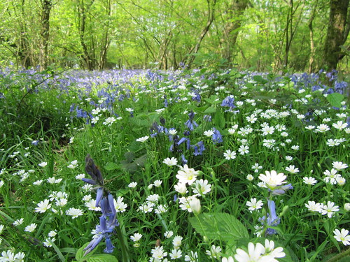
A most beautiful morning of blue sky and crisp spring weather over Laugharne. First published in: The Times Click here to view a map for this walk in a new window
picture picture picture picture picture picture picture picture picture picture picture picture picture picture picture picture
Facebook Link:

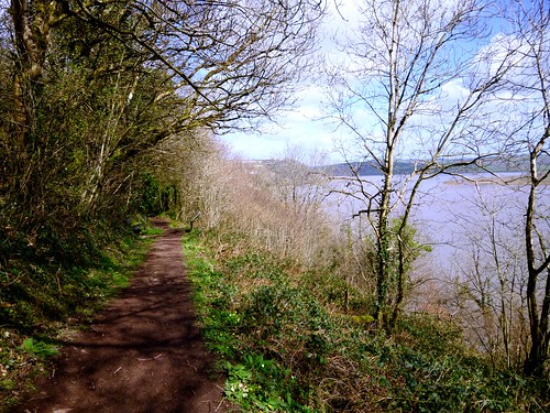
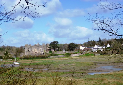
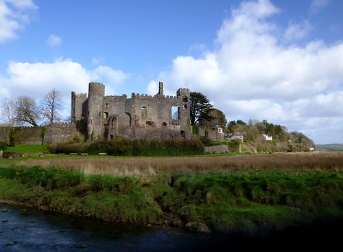
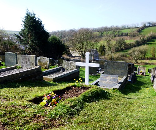
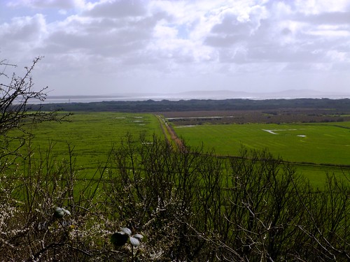
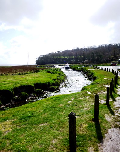
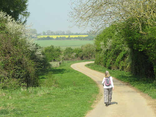
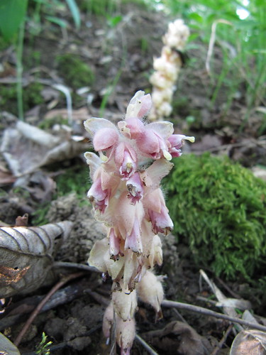
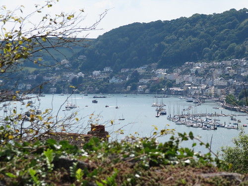
Fresh flowers had been laid on Dylan Thomas’s grave in the sloping churchyard. Following the town trail map along the village street, we picked out the everyday waymarks of the poet’s life here in the 1930s and 40s – Brown’s Hotel where he drank (and drank), the green-faced Pelican house where his parents lived, the baker’s where Thomas came for bread each morning. Here we filled the backpack with welsh cakes and went our way, down past the big jagged ruin of Laugharne Castle and up Sir John’s Hill along a cliff path above the great dun apron of salt marsh that separates the village from the sea.

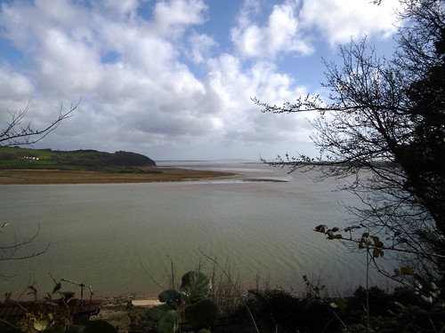
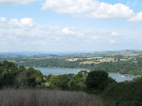
On his 30th birthday, Thomas said in ‘Poem in October’, he felt himself summoned out and over Sir John’s Hill by ‘water praying and call of seagull and rook / And the knock of sailing boats on the net webbed wall’. He had a rainy view that October morning in 1944, but ours today was laid out in sunlight – marsh, dunes, a crawling silver sea rough with surf, and Worm’s Head promontory a string of grey islets at the edge of sight.

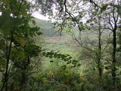
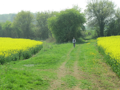
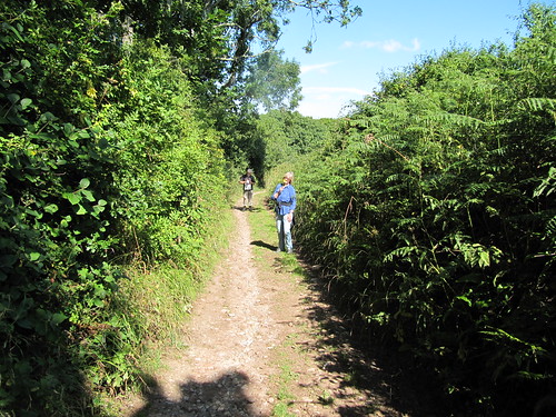
The path soon swung inland, up and over a ridge of pastures, down into a green valley. A holloway stodgy with red mud brought us to the back lanes of Laugharne, from where stony byways led via the Wales Coast Path to the lonely farm of Delacorse.

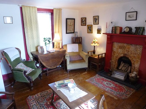
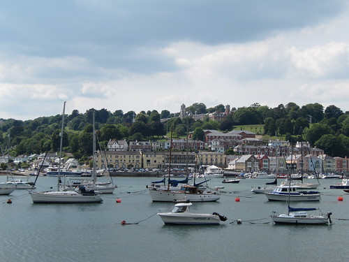
Back along the edge of the Taf estuary we found the Boathouse where Dylan and Caitlin Thomas and their three children lived for the last four years of the poet’s life, and the tiny shed where he sat and wrote and looked out on a sublime estuary view.

Some have suggested that Dylan Thomas was not a great poet, just a brilliant wordsmith. You have only to sit on the Boathouse terrace, looking out over the estuary towards St John’s Hill, and read ‘Poem in October’ to give the lie to such nonsense. That’s why Wales is so fervently celebrating the Centenary this year of its national poet in all his wayward genius.

Start: Church car park, Laugharne, SA33 4QD (OS ref SN 301114)

Getting there: Bus Service 222 (tafvalleycoaches.co.uk), Carmarthen-Pendine
Road – Laugharne is on A4066 (signed from St Clears on A40)

Walk (6½ miles, easy, OS Explorer 177): From car park, left along A4066 through Laugharne (Dylan Thomas Town Trail map downloadable at discovercarmarthenshire.com/dylan-thomas). Past Brown’s Hotel, left by Three Mariners restaurant (302109) up Victoria Street past the bakery. Right at bend past Sea View (another Thomas dwelling); straight ahead at corner to waterfront. Right past Laugharne Castle (302107). Follow Wales Coast Path/WCP and Dylan’s Birthday Walk/DBW along shore; right uphill (303104). In ½ mile, by Salt House Farm bench (306100), WCP and DBW fork left; but keep ahead here (‘To Laugharne over Sir John’s Hill’).

In ⅓ mile, at a fork (301097), go right uphill (WCP, yellow arrow/YA). In 50m, at top of steps, YA points ahead over one stile and on uphill towards another. But you turn left here from the top of the steps through a fence gap (unmarked). In 350m, cross stile into field (297098); ahead up hedge and down to lane in Broadway (295101). Left to A4066; right to pass Carpenter’s Arms PH; left here (296102) down lane. At end, over stile by garage (294103); right (YA) along hedge. At corner, right (YA) along path that becomes lane. In 700m, right at road (297108). At 30 mph sign fork left (299108). On right bend, left up Holloway Lane. In 50m fork right past cottages and on. Through gate at lane end; on across 2 fields to Horsepool Road; right to A4066 (301114).

Right; left up cobbled lane beside church car park. In 150m, pass entrance to the Long Lanes (302114) in ⅓ mile, pass entrance to Delacorse Uchaf, and at next T-junction right (302120, fingerpost) up stony lane. In 100m, ahead (WCP) for ½ mile to Delacorse (308122). Follow WCP markers through yard and fields, then along cliff path. In 1 mile, pass Boathouse and Writing Shed (306110). At road, right (304109) at gates of The Furlongs, up bridlepath. In 100m, at kissing gate (304110), bear left along lane to church and car park.

Lunch: The Boathouse (01994-427420) – snack with a view, exhibition; open 10.30-3.00

Accommodation: Brown’s Hotel, Laugharne (01994-427688; browns-hotel.co.uk)

Dylan Thomas Festival of Walks: 24-26 May (llanelliramblers.org.uk)

Info: Laugharne TIC at Corran Books (01994-427444); dylanthomasbirthdaywalk.co.uk

discovercarmarthenshire.com;
www.satmap.com www.LogMyTrip.co.uk

 Posted by at 01:30
Jun 162012
 

It pelted down overnight – not that we cared, snug in one of the most welcoming guesthouses in West Wales. First published in: The Times Click here to view a map for this walk in a new window
picture picture picture picture picture picture picture picture
Facebook Link:
Glangwili Mansion lies tucked into a cleft of the wooded hills north of Carmarthen. If you’re going walking – or biking, or kayaking, or just exploring the hills and forests – the gentle and humorous guidance of owners George and Linda Reid is just the ticket. ‘Alltwalis, that’ll be great on a day like this,’ said George on his doorstep, looking heavenward at grey skies. ‘Plenty of shelter, and great views down in the Aeron Valley.’

A green lane rose from Alltwalis, its mossy banks trickling with flood streams, under a canopy of oak and hazel leaves where the last of the rain was pattering. Up at the crest of the hill it was all green folds and wooded slopes, running away into a thin grey haze on all sides. One of those mornings to be either in by the fire, or out among the elements. At Cefn-maes the farmer went haring over his wet pastures on a quad, his sheepdog frisking before him. Beyond the farm we skirted a stretch of rushy ground, half heather moor, half black peat bog, hedged with wild cherry bushes whose dark red fruits hung heavy with glassy raindrops.

The woodland path we followed into the Nant Aeron’s secret valley was edged with straw-filled droppings the size of croquet balls, far larger than anything a native British animal could possibly produce. Oval footprints eighteen inches across were dinted deep into the narrow track. We looked at each other. It couldn’t be … could it?

The path descended past little wooden cabins perched among the trees, down to where there were glimpses of another world in the valley bottom – lily pools, gardens and lawns, an open-topped meeting place, flags with the ‘Om’ symbol. ‘Subramanium Temple, Sri Ranganatha Temple,’ said the notice on the gate. A big scarlet shed by the track marked the terminus of both droppings and dish-sized footprints. Who would have guessed it? Elephants in Cwm Aeron, and Hindu prayers arising under Pengraigygigfran.

A single-track lane led out of the valley. We picked wild strawberries from the hedge and savoured their sweet tang as we climbed past Llwyncrychyddod. On the hill above Alltwalis we stopped to watch three ravens mobbing a kestrel. Barking harshly, tumbling and feinting, they drove it north and out of sight down into the valley of the elephants.

Start & finish: Mason’s Arms PH, Alltwalis, Nr Carmarthen, SA32 7EB (OS ref SN 445318)

Getting there: Bus (www.arrivabus.co.uk) service 41 (Llandysul-Carmarthen)
Road: M4, A48 to Carmarthen; A485 towards Lampeter passes through Alltwalis

Walk (5½ miles, moderate, OS Landranger 185):
From Mason’s Arms, right along A485; in 50 m, first right. Past houses, fork right through gate (444318; yellow arrow/YA); bear left up grassy incline, through gates (YA) and on up for ½ mile. At top, through gates (YA) at Gwarcwm (441323). Ahead along road for 100 m; right (fingerpost) on track to Cefn-maes (436326). Ahead through farmyard; at barn bear right; in 20 m left over stile; along fence, then over field to gate (YA). Across next field, over stile (432329, YA); on with hedge on right and moor on left, over stiles (YA) for ⅓ mile to cross stile with left and right YAs (426329). Left along forest track.

In 150 m, don’t go through gate, but bear right (‘Coach Park’). In 30 m at gate (425327), fork right off track (YA) on woodland path (YAs) to reach stony forest road crossing (424326). Left; in 200 m, bear right (YA) down path for ½ mile to tarmac road (420321). Fork right downhill, then left at temple entrance along valley road. In a little over a mile, left beside field gate up lane (423306). In 250 m, beside entrance to Llwyncrychyddod (424307), keep ahead on tarmac lane (bending left), not stony lane (ahead). Follow lane (tarmac, then rough) up for ½ mile to barn by gate (428313). On with hedge/fence on left, over crest of hill for ½ mile. Cross gate (434317); on down overgrown green lane, skirting obstructions to reach Pant-y-llyn (436318). On along road to Gwarcwm; return down green lane to Alltwalis.

Lunch: Mason’s Arms, Alltwalis (01559-384044)

Accommodation: Glangwili Mansion, Llanllawddog, Carmarthenshire (01267-253735; www.glangwilimansion.co.uk) – wonderful secluded location, really comfortable; very helpful hosts.

Information: Carmarthen TIC (01267-231557); www.visitwales.co.uk
www.ramblers.org.uk www.satmap.com www.LogMyTrip.co.uk

 Posted by at 04:31
Jul 172010
 

First published in: The Times Click here to view a map for this walk in a new window
picture picture picture picture picture picture picture
Facebook Link:

Sometimes you just have to go with the flow. Jane and I arrived in Carmarthenshire determined to puzzle out an original walk around Carreg Cennen Castle. But then we found that Carreg Cennen was infuriatingly positioned at the junction of three OS Explorer maps. And once we’d visited the café-shop and picked up the county council’s superb leaflet of walks based on the castle itself, we simply thanked our lucky stars and set out into the day, a gloriously sunny one under a full blue summer sky spread all across the southern hills of Wales.

Among green waves of lowland slopes, the jagged walls of Carreg Cennen Castle rose like a dark island. We walked down the path through the oakwood of Coed y Cennen in a bubble of birdsong, crossed the shallow brown river, and climbed southward up a stony track with a most magnificent view of the castle clinging to the very lip of its 300-ft crags. Out at the top into a wide, sedgy upland, with a prospect to the distant humps of the Preseli Hills forty miles off in the west.

A flock of sheep lay panting like woolly steam engines under a rowan tree. From the moorland road we turned back towards the castle, dipping into dells formed by the collapse of underground caverns. Whole trees grew in the depths, their canopies on a level with the rim of the hollows. Down there under a bank of orchids we found a shadowy cave mouth spewing forth a broad gush of water – the infant Loughor river, destined for greatness in its broad estuary twenty miles away. On we went through damp bogland, bright with pink beaks of lousewort and the trembling blue flowers of insect-digesting butterwort, a beautiful wetland full of frogs and spiders.

Back at Carreg Cennen we roamed over the castle, its towers and baileys. Steps led to a sinister twist of a passage, rough-floored and pitch black. By the light of Jane’s torch we followed its course below the castle, bending and slithering until we crouched at the very heart of the crag. Not a lamb’s cry or child’s shout penetrated the rock. The original purpose of this black chamber in Carreg Cennen is obscure. But one couldn’t help picturing a desperate man of the garrison crouching there, waiting with beating heart for a victorious enemy, screwing up his courage in the dark to kill or be killed.

Start & finish: Carreg Cennen Castle car park, Trapp, Llandeilo, Carmarthenshire, Wales SA19 6UA (OS ref SN 666193)

Getting there: Train (www.thetrainline.com; www.railcard.co.uk) to Ffairfach (3½ miles). Road: From Llandeilo, A483 (‘Ammanford’); left at crossroads in Ffairfach; right after bridge to Trapp; don’t cross bridge, but keep ahead to Carreg Cennen.

Walk (3½ miles, moderate, OS Explorers OL12, 178, 186; NB Excellent map leaflet at castle): From shop/café follow Carreg Cennen Circular/CCC fingerposts (red castle symbols) past castle, through wood, across Afon Cennen (675193). Follow CCC and Beacons Way/BW up stony path for 3/4 mile to road (673180). Right to cross cattle grid; in 200 yards, right across stile (671177; CCC); follow CCC and yellow arrows (YA) to pass source of Loughor River (668178). Continue (YA, CCC) to Llwyn-bedw; down field to cross Afon Cennen (666188); stile and steep path (YA) to road at Pantyffynont. Left; in 300 yards, right (665191; CCC) across field to car park.

NB – Online map, more walks: www.christophersomerville.co.uk

Lunch: Carreg Cennen café (01558-822291); Cennen Arms, Trapp (01558-822330)

Accommodation: Cawdor Hotel, Llandeilo (01558-823500; www.thecawdor.com) – friendly boutique hotel

More info: TICs at Llandeilo (01558-824226), Carmarthen (01267-231557);

www.discovercarmarthenshire.com; www.ramblers.org.uk

National Parks Week: 26 July-1 August (www.nationalparks.gov.uk)

 Posted by at 00:00
May 072011
 

The rolling landscape where Gloucestershire shades into Oxfordshire is thickly woven with footpaths and studded with villages of mellow gold stone.
First published in: The Times Click here to view a map for this walk in a new window
picture picture picture picture picture picture picture picture
Facebook Link:
In this north-east corner of these delectable hills you can walk in classic Cotswold countryside, but without those camera-clicking Cotswold crowds. However, if you would like to hook up with a merry bunch of fellow-walkers … then 21 May is the date for your diary. That’s when thousands will be converging on Blenheim Palace for the Breast Cancer Care charity’s annual Pink Ribbon Walk – 10 or 20 miles (you choose) through gorgeous countryside to raise money and awareness, to hear and share stories, and to have a damn good party into the bargain.

On a brilliant day of blue sky and balmy weather Jane and I set out to explore this overlooked corner of the Cotswolds. From Stonesfield, as pretty as a picture among its trees, the Oxfordshire Way took us up among big yellow fields of oilseed rape where yellowhammers in the hedges wheedled for a-little-bit-of-bread-and-no-cheeeeese. An invisible lark poured out song like the trickle of a brook. Views were big and broad, with a heat haze softening the dark green of spinneys and windbreak woods.

Down in the valley of the River Evenlode, swallows skimmed the stone-tiled roofs of Fawler. Dark Lane led us between hedges carefully tended by the Friends of Wychwood Hedge-laying Group, up a cowslip-spattered valley to Finstock. On through the environmentally-friendly farmland of Wilcote Farm with its generous field headlands and vigorous patches of yellow archangel. All around lay evidence of a countryside loved and cared for, its wildflowers and birds given the elbow-room they’re so often denied in more rapaciously farmed regions.

At North Leigh we went into St Mary’s Church to admire the north chapel with its fan vaulting and richly carved 15th-century alabaster tomb of Sir William Wilcote and his wife Elizabeth. Over the chancel arch hung a splendid medieval Doom painting, the Saved and the Damned all naked and prayerful, with a coal-black Devil and his red-faced acolytes jeering the Damned into eternal fire. Outside, all seemed a dream of peace – horses cropping the meadows near Holly Court Farm, the smooth gurgle of the Evenlode round its meandering bends, and the splashing and laughter of picnicking families by the river as we made our way back up the old cart track to Stonesfield.

These Oxfordshire Cotswolds really are beautiful country. I wish I could be a fly on someone’s trainers on 21 May. The Pink Ribbon walkers are going to have the most amazing day of it.

Start & finish: near St James’s Church, Stonesfield OX29 8PT (OS ref SP 394171)

Getting there: Train (www.thetrainline.com; www.railcard.co.uk) to Charlbury.
Bus (www.stagecoachbus.com) service S3 (Charlbury-Oxford).
Road: Stonesfield is signed off A44 Woodstock-Chipping Norton.

Walk (8½ miles, easy, OS Explorer 180): Park in ‘square’ (actually a triangle!) by St James’s Church, Stonesfield. With your back to church, bear left along High Street. Opposite Methodist chapel, left down walled lane (‘bridleway’). At bottom, cross road and go up stony bridleway (390173; ‘Oxfordshire Way/OW’). In 400m, ahead over crossroads along tarmac lane. In another 400m pass end of woodland belt. Road bends right by Hall Barn Farm Cottages, but keep ahead here (383177; blue arrow/BA) through gate (OW) and on down right side of hedge. In ½ mile, at crossing of bridleways, left off OW (375180) on bridleway (BA) descending to Fawler. Left along road. Opposite bus stop, right down lane (372170; ‘Finstock 1’ fingerpost). Cross under railway and over River Evenlode. Follow path on far bank and through shallow valley. Keep ahead at ‘Right of Way’ arrow among trees (368166); on up Dark Lane to Finstock.
Right past Plough Inn (362161); left up side of Plough (fingerpost) on path on right side of pub car park. On (yellow arrow/YA) through kissing gate, up field edge. At far end, through kissing gate (362159); don’t turn right here, but keep ahead with hedge on left. Path doglegs left and right, then crosses field; through Ramsden Mill Longcut woodland strip (364156); on along wide field paths to road (367151). Left for 20m; right (‘Wychwood Way’/WW fingerpost) through Holly Grove wood. At end of wood (372143), on along hedgeside track (YA) for 2 fields to turn left along North Leigh Lane. In 300m pass footpath diverging to left (374136; fingerpost); on next bend, bear left (‘WW’ YA) along path in tunnel of trees. In 400m, right along End Farm drive (379134); in 20m, left (‘Church ½’ fingerpost) across fields (kissing gates, YAs) to St Mary’s Church, North Leigh. (NB For Woodman Inn or Mason’s Arms, turn right from church to top of hill, then right to pubs).
Continuing walk from church – left along road; in 20m, left (‘bridleway’ fingerpost) along farm drive. In 400m, right over stile and down hedge; cross brook (385140), through gate and up fence to road (386143). Left for 50m; right down Holly Court drive (‘Bridleway, Ashford Bridge 1’). At buildings bear right to T-junction (386147); left and continue, following BAs by brook for ½ mile to road near Ashford Bridge (385154). Right to crossroads by bridge; right (‘East End, Hanborough’), following path on right bank of Evenlode (‘Stonesfield 1½’ fingerpost). Under railway; on to kissing gate; aim across meadow to cross footbridge (383164). Up cart track opposite; at road, forward to Stonesfield ‘square’

Walk as described covers only part of Pink Ribbon Walk.
Lunch: Plough Inn, Finstock (01993-868333; www.theplough-inn.co.uk); Woodman PH (01993-881790) or Mason’s Arms (01993-882005), North Leigh.

Breast Cancer Care (www.breastcancercare.org.uk) Pink Ribbon Walks 2011 at Scone Palace, Perthshire (14 May); Blenheim Palace, Oxfordshire (21 May); Cholmondeley Castle, Cheshire (4 June); Petworth House, West Sussex (11 June). Info: 0870 145 0101 or www.pinkribbonwalk.org.uk

Isle of Man Walking Festival 2011: 15-20 May (01624-664460; www.visitisleofman.com)
Llanelli Festival of Walks, Carmarthenshire: 27–30 May 2011, www.llanelliramblers.org.uk

www.ramblers.org.uk www.satmap.com www.LogMyTrip.co.uk

 Posted by at 02:11
Apr 162011
 

Goliath lay at ease in Churston station, lazily jetting steam and curls of smoke into the cloudless blue South Devon sky.
First published in: The Times Click here to view a map for this walk in a new window
picture picture picture picture picture picture picture picture
Facebook Link:
We stood watching – Jane, her sister Susan and I – mesmerised by the sounds and smells of childhood. ‘She’ll stay there till she’s ready to go,’ was the Zen-like observation of the man on the bridge. When the little black tank engine finally moved off, chuffing and clanking, her place at the platform was taken by Lydham Manor, resplendent in Great Western Railway green, simmering like a kettle and emitting mournful hoots like an owl on the boil.

Out beyond the village we found stony Combe Lane rising gently, a hollow way through unseen fields. Buildings, cars and the trains of the Dart Valley Railway had all been whisked out of sight and earshot in a fold of the landscape, and we walked in a tunnel of blackthorn bushes and coarse-leaved elm suckers bursting with finch song. It wasn’t until we were standing tiptoe on the fence at the crest of the hill like inquisitive kids (it must have been the Goliath effect) that we caught our first glimpse of the Dart estuary, a blue gleam between wooded hills, a scatter of yachts, a sprinkle of civilisation around Torbay, and the jagged granite vertebrae of Haytor sticking out of the back of Dartmoor on the northern horizon a dozen miles off.

Beyond Higher Greenway and tree-cloaked Oakham Hill we followed a permissive path near the narrow estuary, south along a hillside where Long Wood clung steeply above the river. A hoot and a rapid panting from down by the Dart betrayed Goliath’s progress along the waterside line. A gap in the trees allowed a peep over the river, a jade-green snake between dark woods and fields of deep red Devon soil. ‘I-think-I-can, I-think-I-can!’ fussed invisible Goliath.

Down and out of the woods, descending paths to emerge on the River Dart opposite the Royal Naval College, huge in red brick, all towers and ranks of windows on its hill. Trundling ferries churned the estuary between Kingswear and Dartmouth, opposing nests of tight-packed houses, blue, pink, white, yellow on the steep, as pretty as a picture. As we walked between river and railway towards Kingswear, Lydham Manor came hissing past in a cloud of pungent coal smoke, every carriage window filled with faces, an escapist grin across every one.

Start: Churston station, Dart Valley Railway TQ5 0LL (OS ref. SX 894563)
Finish: Kingswear station TQ6 0AA (OS ref SX 881510)
Getting there: Train (www.thetrainline.com; www.railcard.co.uk) to Paignton; Dart Valley Railway (01803-555872; www.dartmouthrailriver.co.uk) to Churston.
Road: A379 Paignton-Dartmouth; Churston station signed in Galmpton.
Walk (5 miles, moderate, OS Explorer OL20): Leaving Churston station, left across railway; left down Greenway Road. In ⅓ mile, left past Manor Inn. Up hill; left along Kennel Lane; cross railway; right along Combe Lane (‘Greenway Walk’/GW). In ⅔ mile at top of rise among trees, right (blue arrow, GW) along hedged lane. Cross stile; follow hedge/fence for ⅓ mile. Just before gate of Higher Greenway, left (‘permissive path’; Dart Valley Trail/DVT) into Long Wood. Steeply downhill; follow track (white, blue arrows). Where DVT turns steeply downhill to right by wooden frame, keep ahead. In 1 mile path hairpins right; descend to bear left across stream (DVT). Follow DVT for ½ mile to cross A379; on along roadway; in 400m, right (DVT) down path; cross road and railway; left along estuary to Kingswear station.
NB – Online maps, more walks: www.christophersomerville.co.uk
Lunch: Royal Dart Inn (01803-752213), Ship Inn (01803-752348; www.shipinnforecast.com), Kingswear
More info: Dartmouth TIC (01803-834224; www.discoverdartmouth.com)
www.ramblers.org.uk www.satmap.com www.LogMyTrip.co.uk
Llanelli Festival of Walks, Carmarthenshire: 27–30 May 2011

 Posted by at 05:00