Search Results : cotswold

Oct 262019


First published in: The Times Click here to view a map for this walk in a new window
picture picture picture picture picture picture picture picture picture picture picture picture picture picture picture picture
Facebook Link:

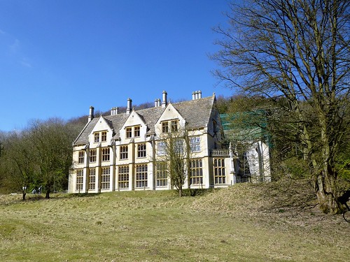
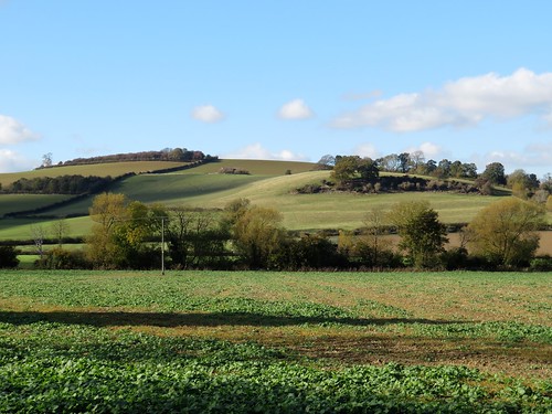
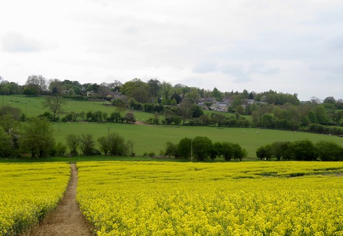
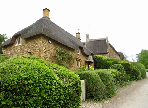
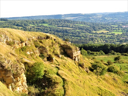
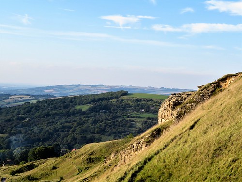
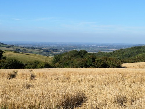
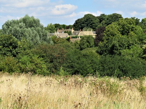
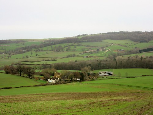
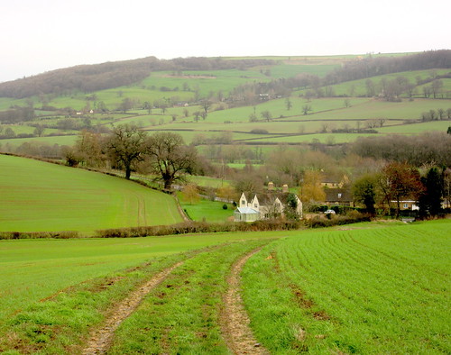
The Royal Oak in Leighterton, all mellow pale gold stone, looked like the snuggest village pub in the world. The savour of roasting beef hung in the air like a promise. But first there was a walk to tackle on this sunny autumn morning – one of the most beautiful walks in the south Cotswold hills, but with a spice of poignancy at the outset.

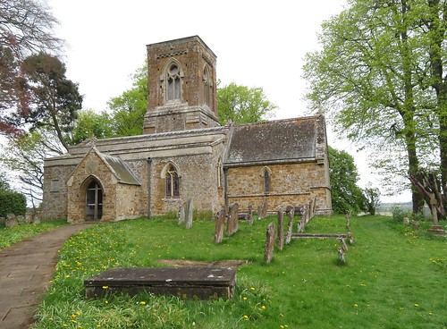
The cemetery on the outskirts of Leighterton holds a cluster of Commonwealth War Graves. The two dozen young Australian trainee flyers of Leighterton aerodrome who lie beneath the neat white headstones all died in 1918 or 1919 – most of them the victims of crashes as they tried to master the volatile controls of their Sopwith Camel biplanes.

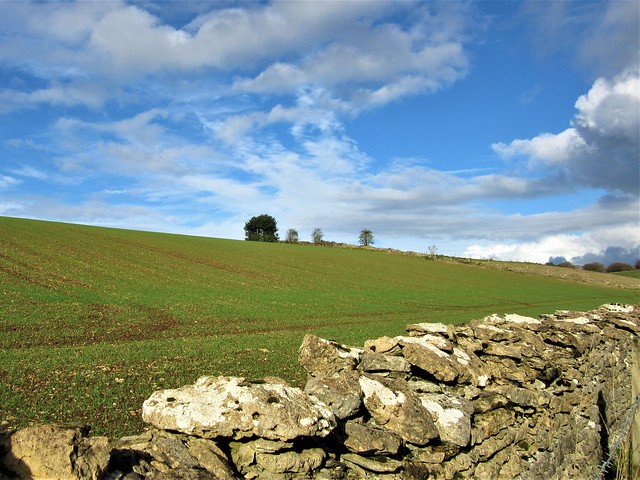
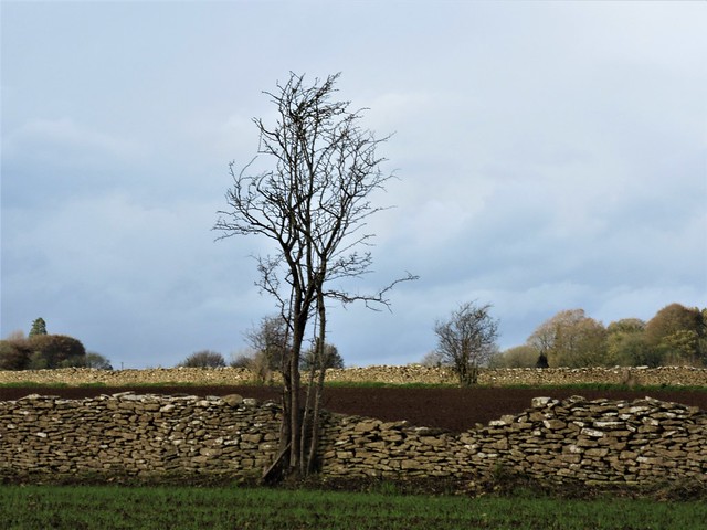
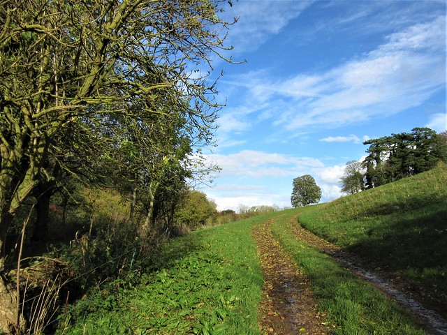
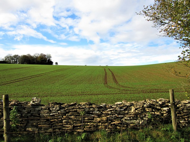
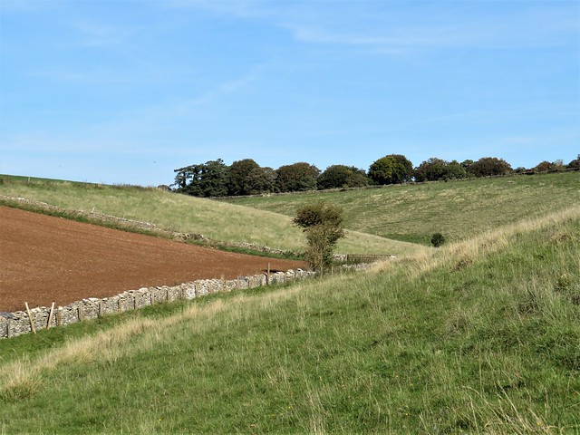
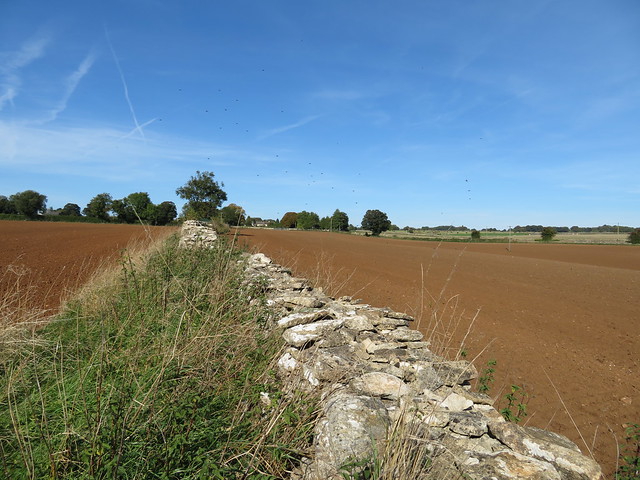
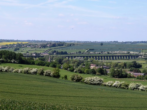
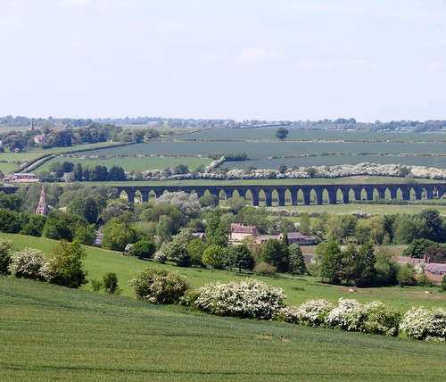
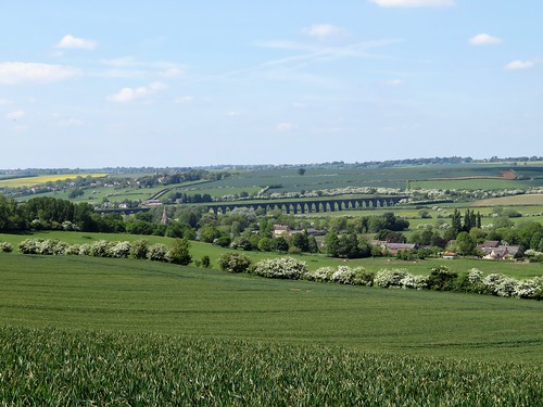
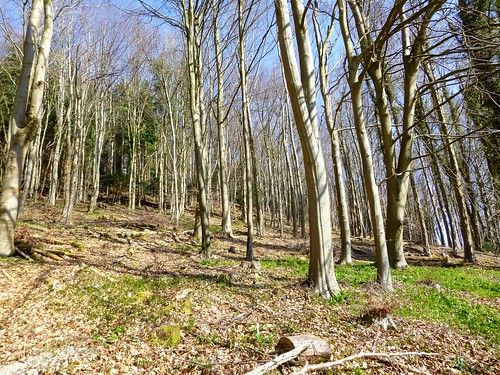
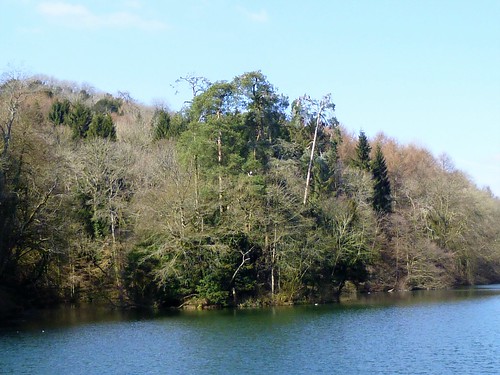
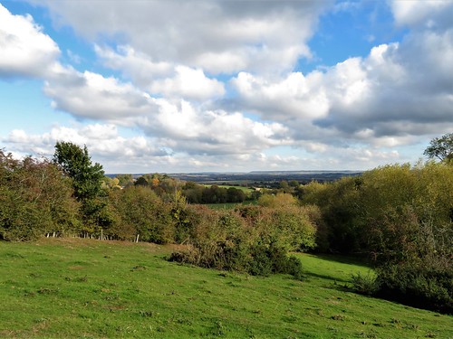
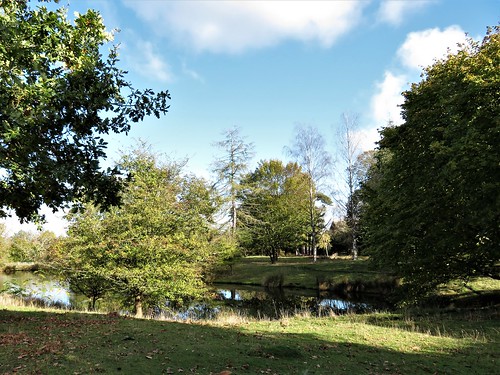
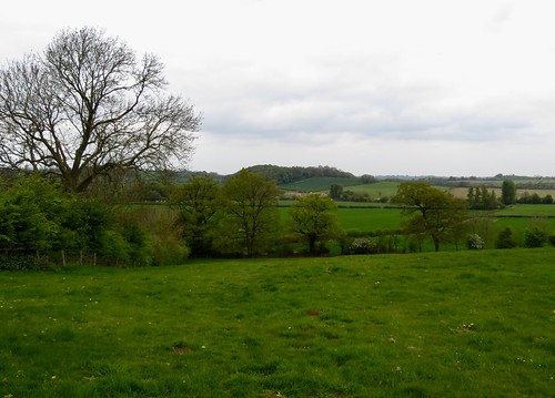
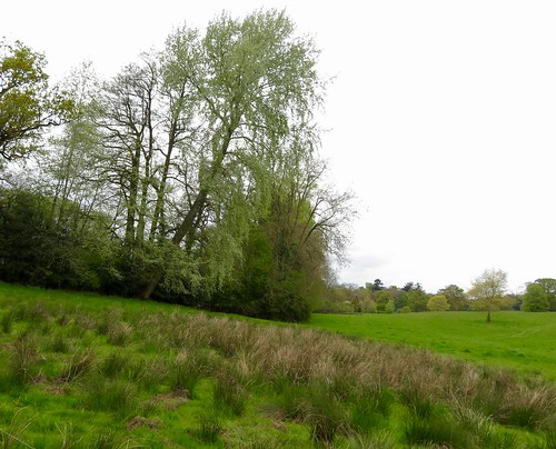
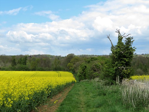
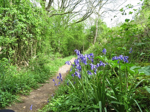
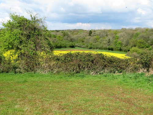
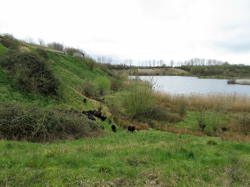
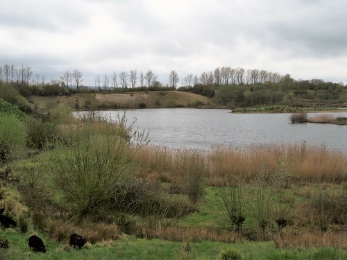
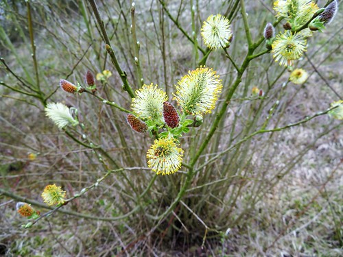
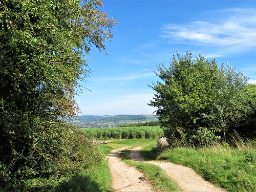
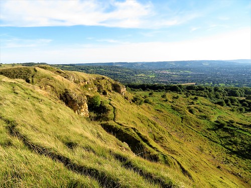
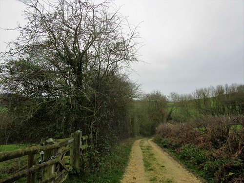
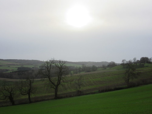
Beyond the cemetery the path led across stony ploughlands and sloping pastures, down into Hawkesbury Spinney where frills of bracket fungus clung to the trees. We climbed a bank and opened a gate into the arboreal heaven of Westonbirt Arboretum.

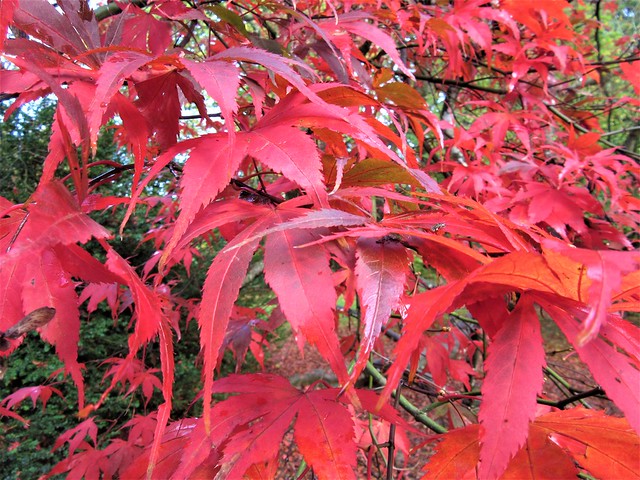
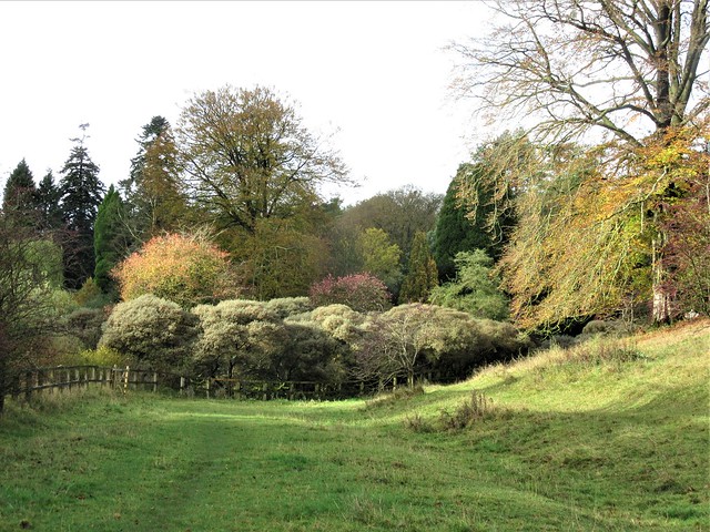
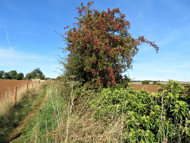
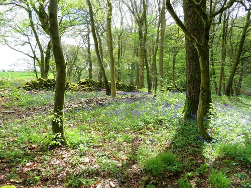
Squirrels scuffed up rustling drifts of leaves, looking for nuts to hoard against the winter. Families strolled, dogs yapped and photographers clicked away, entranced by the stained-glass effects of the acer leaves as the sun shone through them in liquid reds and acid yellows.

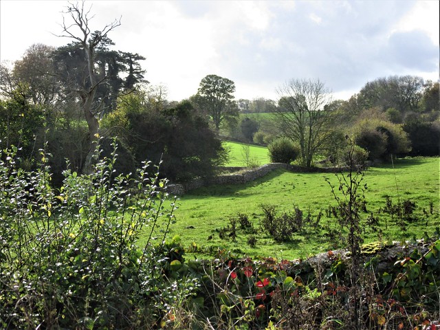
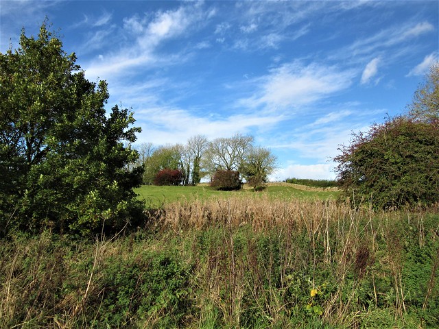
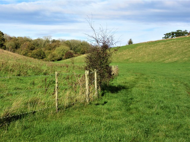
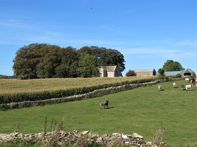
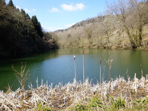
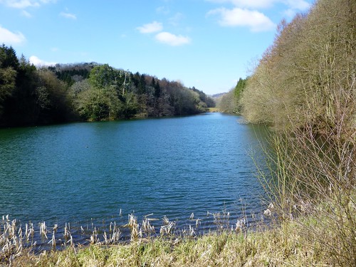
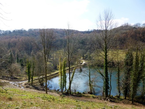
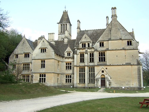
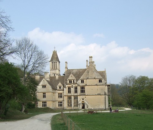
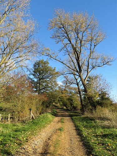
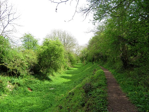
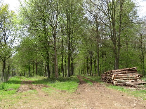
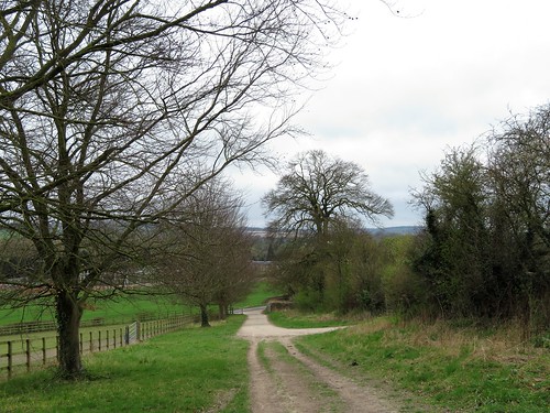
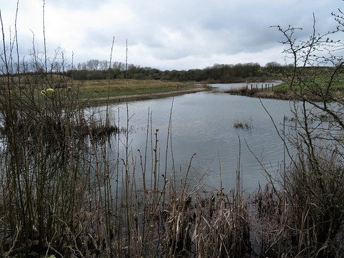
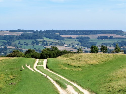
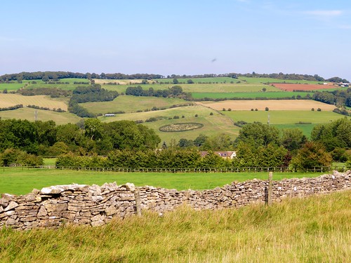
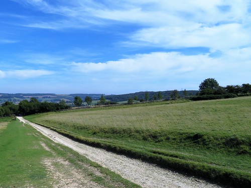
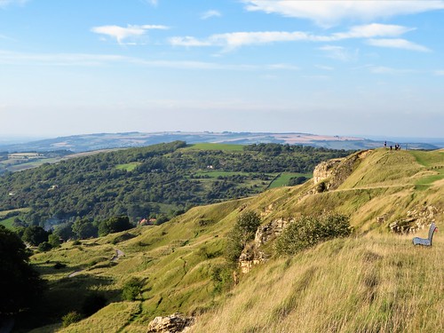
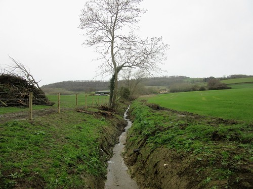
Beyond the Arboretum we looped through Willesley, whose neat lanes were edged with immaculately kept walls of Cotswold stone. Then back along Westonbirt’s valley bottom, where a track led away into a steep-sided little cleft that wound this way and that as it climbed gently to Bowldown Road and a whizz of traffic.

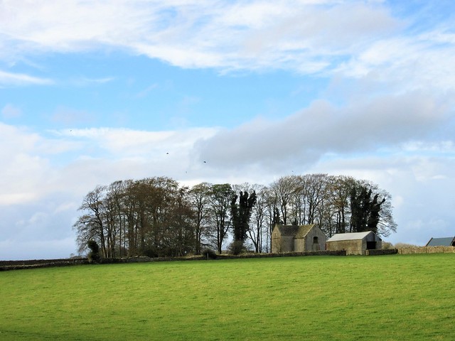
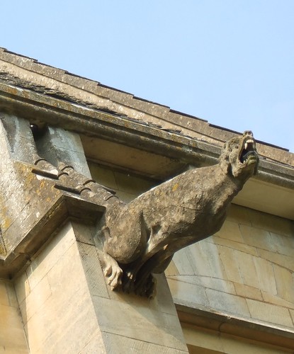
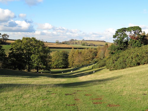
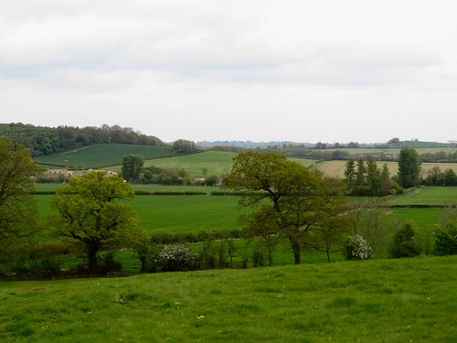
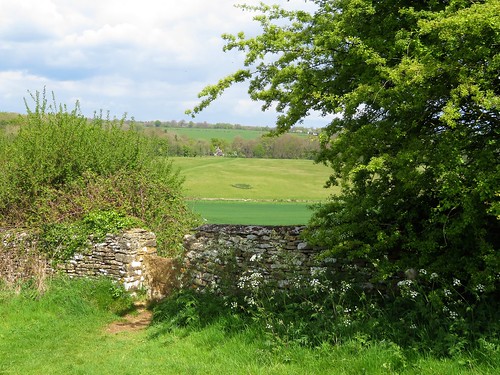
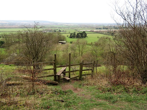
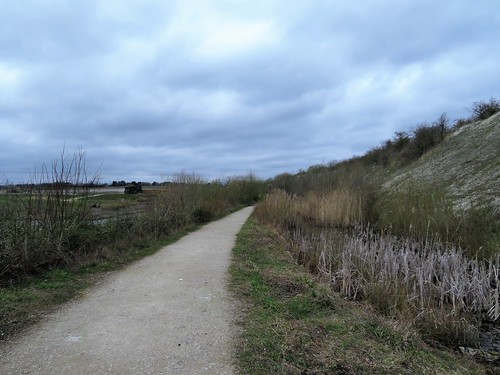
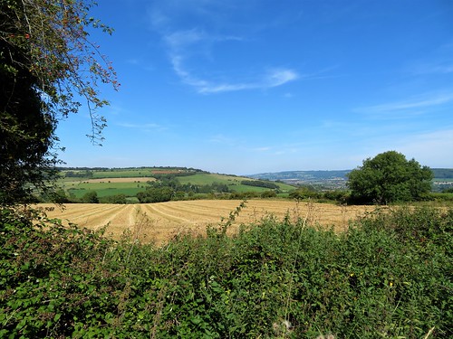
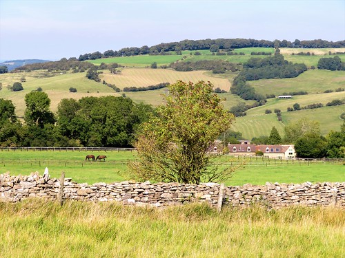
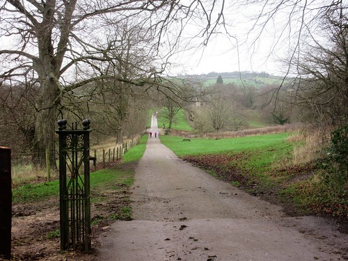
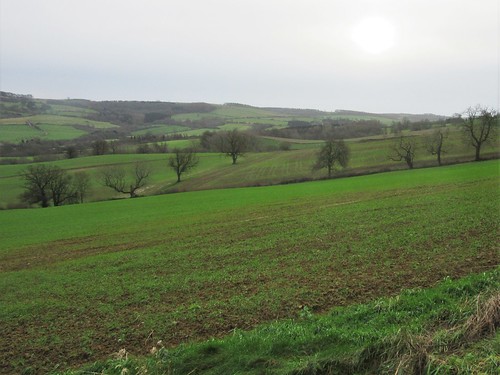
A short stretch along the verge and we were on the homeward path through broad sheep pastures where ewes with tender feet went hobbling away, dot-and-carry-one. Past the handsome stone walls and window arches of Slait Barn, and on over stone stiles towards Leighterton and the Royal Oak.

At the bar table by the fire we stretched out our legs, boots off. I opened my notebook and from between the pages shook out a shower of lemon and scarlet leaves, harvested under the trees of Westonbirt, now pressed and flattened to perfection.

Start: Royal Oak PH, Leighterton, Glos GL8 8UN (OS ref ST 823912)

Getting there: Leighterton is signed off A46 (Bath – Stroud) between Dunkirk and Nailsworth.

Walk (7 miles, easy, OS Explorer 168):
From pub, left through car park; ahead along road; in 400m pass cemetery; on left bend, ahead (827910) on Monarch’s Way, southeast across fields to gate into Hawkesbury Spinney (839902). In 150m, right up broad woodland track (unwaymarked; labelled ‘Macmillan Way’ on map); gate at top (841900) into Westonbirt Arboretum. Ahead along Broad Drive. At southern boundary of Arboretum, through gate (844887). Left (field path) to cross A433 (849888, kissing gate). Lane opposite; left at junction; in 200m, left (852887, stone stile, ‘Westonbirt’). Path (stiles, yellow arrows) across paddocks, then by field edges for ½ mile to stile/steps into road (858893). Left; in 100m, left to cross A433 (855894). Follow bridleway opposite along valley bottom for 1 mile to gate into Bennett’s Spinney (844901). Ignore Monarch’s Way ahead; instead, fork right (blue arrow on gate), north for ¾ mile up valley bottom past Ellick’s Wood to road (846913). Right to Bowldown Road; left on verge; in 400m, left (fingerpost) on path west, then southwest across fields for 1¾ miles, past Bowldown Wood, then between Sheephouse Covert and Slait Barn, to Leighterton.

Lunch: Royal Oak, Leighterton (01666-890250, royaloakleighterton.co.uk) – proper characterful village pub; excellent food.

Accommodation: King’s Arms, Didmarton (01454-238245, kingsarmsdidmarton.co.uk)

Westonbirt Arboretum: (0300-067-4890; forestryengland.uk/westonbirt; satmap.com; ramblers.org.uk
NB Please keep to public rights-of-way as described; all other Arboretum paths are for ticket-holders only. If you want to enjoy the best of Autumn at the Arboretum, the entrance is on A433 opposite Westonbirt village. Entrance: £10 adult, £4 child, March-November; £7/£3 December-February.

 Posted by at 01:59
Jun 082019


First published in: The Times Click here to view a map for this walk in a new window
picture picture picture picture picture picture
Facebook Link:

It’s always a pleasure to walk with a dog, especially one as full of fizz as Ozzy the black retriever. Our friends Carry and Gordon had brought him along to enliven our 10-mile circuit of the woods and fields along the borders of Rutland and Northamptonshire, and Ozzy more than did his bit.

A hot, cloudless day, last in a brilliant spell of walking weather, had us setting out in good time from Barrowden, a village of creamy oolitic limestone, like a segment of the Cotswolds dropped by a benevolent djinn on the uplands of the River Welland’s wide, fertile valley.

Soon the pale stone spire of Barrowden church sank behind, and we were following the Jurassic Way long distance path through the cool rides and sun-splashed glades of Wakerley Great Wood. This swathe of ancient woodlands is now a playground for Sunday cyclists, rovers and family groups. In the meadows on the far side of the wood we found a golden road spread before us, a path strewn thickly with buttercups.

Inquisitive little black Dexter cattle snuffed cautiously at Ozzy, and he rolled off their scent in the half-grown hay meadows around Laxton Hall. A Polish picnic party was in full swing in the grounds of the hall, the chatter and laughter soon falling away under blackcap song in Town Wood.

Beyond Laxton we rejoined the Jurassic Way and headed north through green cornfields where Ozzy breasted the tides of leaves, only his head showing, like a cross-channel swimmer. Ahead opened a memorable view, the wide Welland Valley with may bushes laden white, church spires poking up among the fields, and the 80 arches of the Welland Viaduct striding majestically from one side to the other. It took 400-odd navvies three years to build this fantastic structure, opened in 1878 – they used thirty million bricks, camped out in the fields, and caused local consternation.

Our way home lay along the snaky curves of the River Welland. Ozzy swam after sticks, the buttercup fields were flooded with gold, and the slim silvery needle of Barrowden spire beckoned us on like a harbour light beyond the green seas of wheat.

Start: Exeter Arms, Main St, Barrowden, Rutland LE15 8EQ (01572-747365, exeterarmsbarrowden.co.uk) (OS ref SK 946001)

Getting there: Bus 47 (Uppingham-Peterborough); 12 (Stamford-Uppingham)
Road – Barrowden is signed off A43 (Corby-Stamford) and A47 (Peterborough-Leicester)

Walk (9½ miles, field and woodland paths, OS Explorer 224): From Exeter Arms cross green; left along road. At corner with 2 fingerposts/FPs (950000), fork right downhill, over field, under railway bridge to road in Wakerley (951996). Left; just beyond road on left, right up path on right of Exeter House (955994, ‘Jurassic Way’/JW). Follow JW to road (958991); right for 700m, then right (962986) onto JW with car park on right.

Follow JW waymarks through Great Wakerley Wood. In 700m past Post No 6 (965979, green with red ring). Right along ride; in 20m, left uphill into St Mary’s Wood. In 250m, leave wood; on over meadows. In 2nd meadow JW goes left through gate, but bear right here (968974) on bridleway (black arrows/BLA). In ½ mile arrive opposite Laxton Hall (959972); bear a little right to far corner of wood on your right. Into wood here (955971, gate, BLA).

Keep ahead; in 500m, left at ‘No Horse Riding’ notice (950970, BLAs) through Town Wood for 500m to leave wood (950968). Cross field and stile to track by house (951962); right to road; right through Laxton. In ½ mile, left (942961, stile, FP); half right across field; half left across next field (BLA) to gate and road (937958). Left; in 100m, right (FP) on track; after 3 fields, right on JW (930956) with wall on right, for ½ mile to road (928964).

Left; in 30m, right (stile, JW); left through hedge gap; half right across field and down to lane into road in Shotley. Forward to cross road (924974, FP); cross field to River Welland (923978); right on Jurassic Way. In ½ mile cross Turtle Bridge (928985); in 150m, just before old railway bridge, right through hedge (YA, JW). Half left to hedge beside old railway line; right along it. In ¾ mile, left across line (937993, stile, CPRE yellow arrow); right along far side of old railway. In 400m, half left (940995, CPRE arrow) across 3 fields to road (943001); right to crossroads; right down Main Street to Exeter Arms.

Lunch/Accommodation: Exeter Arms, Barrowden (01572-747365, exeterarmsbarrowden.co.uk) – friendly village pub with rooms.

Info: discover-rutland.co.uk; northamptonshiresurprise.com; satmap.com; ramblers.org.uk

 Posted by at 01:34
Mar 022019


First published in: The Times Click here to view a map for this walk in a new window
picture picture picture picture picture picture picture picture picture picture picture picture picture picture picture picture picture picture picture picture picture picture picture
Facebook Link:

Our first glimpse of Woodchester Mansion, hunched away behind trees in the depths of its sequestered Gloucestershire valley, seemed to confirm all the rumours – hauntings, murders, madness and ruin. We could have gone straight down to it. But circling the woods and lakes of Woodchester Valley in clockwise fashion allows the full face of the great house to stay hidden until the last moment, providing a satisfyingly strange full stop to the walk.

Woodchester Park is a singular place in itself, a landscaped cleft in the southern Cotswold Hills that had slipped into a state of overgrown wildness until bought by the National Trust in 1994. Good broad tracks led us east through oak and beech woods pungent with the green stink of wild garlic, skirting steep grassy banks and dense conifer plantations. Primroses were struggling out, and the carpet of dog’s mercury showed tiny green flowers, but the mulleins and bluebells of the park were still shut tight against the winter.

A forester was burning trimmings in a dingle below, his crackling fire glowing orange and sending up drifts of blue smoke. We could hear the trees roaring at the rim of the valley, but down here there was no more than a stir of cold breeze. It was a dream-like walk over landscaped banks and planted folds of ground, looking down on the string of lakes – Brick Kiln Pond, Old Pond, Middle Pond, Kennel Pond, Parkmill Pond – dug and dammed two hundred years ago to fulfil the vision of the landowning Ducie family.

At the foot of Parkmill Pond we crossed the grassy dam and set back along the south side of the lakes. A boardwalk trail in a wet mossy wood, an ornate old boathouse colonised by lesser horseshoe bats – and then the great empty house in its damp curve of valley, its blank windows staring from the Cotswold stone walls like so many black eyes in a pale face, Gothic beasts howling in stone above the gutter pipes.

Liverpool ship owner William Leigh bought the estate in 1845. But he never finished the mansion he started in 1850, and it was too damp, dark and menacing for his family to cope with. So it stands with its marvellous carvings, its empty chapel and floorless levels and stairs that go nowhere, the wonder of visitors on open days, collecting legends and gathering mystery, the house that never was.
Start: Woodchester Park car park (National Trust – members free), near Nympsfield, Glos GL10 3TS (OS ref for car park entrance: SO 795014)

Getting there: Bus (Nympsfield, ½ mile) – Service 35 (Cotswold Green, 01453-835153)
Road: Car park signed off B4066 Dursley-Nailsworth road near Nympsfield (M5 Jct 13; A419, A46)

Walk (6½ miles, easy, OS Explorer 168): From car park descend steps; follow trail downhill. Follow red and orange arrows (RA, OA), forking to left of mansion (807013); then follow RA with lakes on right. At end of Parkmill Pond (last lake), cross dam (831008); return on south side of lakes. In ⅔ mile, above Middle Pond dam, bear right downhill (822010, RA). Pass long shed; before dam, left through gate (822011, OA). Along meadow, then woodland duckboard trail. At Boathouse (818014), cross dam; left along north bank of Old Pond, then track (RA, OA), passing to left of mansion; up drive to car park.

Lunch: Rose & Crown, Nympsfield, Glos GL10 3TU (01453-860612; therosecrownnympsfields.com)

Accommodation: Hunters Hall, Kingscote, Glos GL8 8XZ (01453-860393, greenekinginns.co.uk)

Woodchester Park: 01452-814213; nationaltrust.org.uk/woodchester-park

Woodchester Mansion: 01453-861541; woodchestermansion.org.uk

Info: Stroud TIC (01453-760960); cotswolds.com
visitengland.com; satmap.com; ramblers.org.uk

 Posted by at 02:30
Feb 092019


First published in: The Times Click here to view a map for this walk in a new window

picture picture picture picture picture picture picture picture picture picture picture

Facebook Link:

A crisp winter’s day, the sun in a clear sky over Warwickshire picking out the gold in the Cotswold stone houses of Ilmington. A whiff of applewood smoke came down on the breeze as we followed the footway of Middle Street past medieval fishponds to the cruciform Church of St Mary.

Among the oak pews of this beautiful Norman building scurry Arts & Crafts mice, the signature speciality of Yorkshire master carver Robert Thomson. The carpenter set these humorous little rodents in the pews and pulpit of St Mary’s in the 1930s, and they still raise a smile today.

In the nave hangs a wonderful embroidered map of the orchards of Ilmington, its hem sewn with the names of apple varieties found here – Howgate Wonder, Laxton Superb, Siberian Crab. A green lane took us up the hill from Ilmington between the orchards, our boots wobbling among cookers and eaters long fallen to ground.

From the crest of the hill a glorious view opened, down slopes deeply indented with the ridge and furrow of Middle Ages strip farming, away over a low-lying vale of lush green meadows to the prominent hump of Meon Hill. The Devil created the hill when he missed his aim while chucking a sod of earth at Worcester Cathedral, and it’s well known that at the darkest hour of night you can catch the howling of the red-eared hounds of King Arawyn, Lord of the Dead, as he conducts his wild hunt around Meon Hill.

A stretch of road between hedges hung with scarlet necklaces of bryony, and we swung off south-west along the well-marked Monarch’s Way. Fat white sheep cropped the pastures around Hidcote Combe, the low winter sun backlighting their fleeces into spun gold and making dark trenches of the medieval furrows in the land.

At the foot of the lane to Hidcote Bartrim we turned east for home, leaving the wonders of Hidcote Gardens – ‘outdoor rooms’ of rare beauty – for a spring visit some other day.

An ancient trackway climbs the slopes to the crest of the hills and a view west as far as the Malverns, Bredon, the Caradoc Hills and far into Wales. We follow this classic ridgeway, then descended through ribbed pastures to Ilmington, sunlit and sleepy in its cradle of trees below.

Start: Howard Arms, Ilmington, Warwicks CV36 4LT (OS ref SP 213437)

Getting there: Bus 3A (Banbury – Stratford-on-Avon)
Road – Ilmington is signed off A3400 between Shipston-on-Stour and Newbold-on-Stour.

Walk (7 miles, field paths, slippery in places, OS Explorer 205): From Howard Arms, right along Middle Street. At black-and-white cottage, right, passing church to road (209435). Right; in 30m, left and follow yellow arrows/YAs. Near top of rise (207436, stile on left), bear right; follow Centenary Way (yellow-topped posts). In 450m, at top of slope, through kissing gate/KG (204438); left along hedge to next KG, then YAs along field edges for 600m to road (197440).

Right to road (198442, ‘Park Lane’ on map); left along road (walkable grass verge). In 500m pass lane to Admington on right (195446); in another ½ mile, left off road (187447, fingerpost, ‘Monarch’s Way’/MW). Immediately left over stile (MW); right along MW with stream on right. In 700m, right across ditch, to gate into wood (184440, MW). Through wood, then another (MWs); follow waymark posts up valley (180436) and on for ½ mile to foot of road to Hidcote (177430).

Left up lane (‘Restricted Byway’). In ¾ mile cross road at radar station (187426); on (‘Bridleway’) to cross next road (194426) and pass tall masts. In another ½ mile, at gate (204425), left off byway, downhill beside hedge. At foot of slope, right across stream (207431, KGs, YAs); left along stream, keeping straight ahead (YAs). At tarmac lane (208432), ahead to road (210433). Right, in 75m, left on path past church to Howard Arms.

Lunch/tea: Ilmington Community shop, Grump Street (café closed Mondays)

Dinner/Accommodation: Howard Arms, Ilmington (01608-682226, howardarms.com) – cheerful, characterful village inn; excellent food.

Hidcote Gardens: 01386-438333; nationaltrust.org.uk/hidcote Info: shakespeares-england.co.uk; ramblers.org.uk; satmap.com

 Posted by at 01:32
Dec 222018


First published in: The Times Click here to view a map for this walk in a new window
picture picture picture picture picture picture picture picture picture picture picture
Facebook Link:

Set in a north Cotswold landscape of iron-rich stone the colour of dark honeycomb, Great Tew is a dream hive of mullioned cottages under thatch. It’s hard to credit this immaculate place as the tumbledown village it became in the 1970s, its houses neglected to the point of collapse, their roofs in holes.

The scandal of Great Tew’s decay had complex roots, and its recovery to picture postcard appearance has been a long process. All seemed right with the world on this brisk afternoon, though. We glanced in the open door of the Falkland Arms where cheerful county couples and horse whisperers crowded the dark bar under a canopy of beer mugs swinging by their handles from the ceiling.

Behind the pub a bridleway ran east away across the open pastures of Great Tew Park. A red kite skimmed the trees and circled the grassland, steadying itself a few inches above the ground before dropping to snatch at some morsel among the tussocks.

The park was dotted with fine old specimen trees – cedars and pines, oaks and chestnuts. Five horses at a gate nodded their long noses and accepted a handful of grass apiece. Away to the north the hills rolled like a breaking wave, more sharply defined than the pale limestone wolds of classic Cotswold country.

At Ledwell we found a dimpling well, the old cast-iron village pump standing alongside. The mossy roofs of Over Worton huddled in the trees near a tall war memorial. In the church lay Edmund Meese, who died ‘pious, chaste and sober’ in the reign of King James I. His effigy was discovered in 1967 under the church floor, minus toes, nose and hands – they had been cut off so that the sculpture could be squeezed into its hiding place. Edmund’s extremities were restored, but in darker stone than the rest of the effigy, giving him the appearance of being severe frostbitten.

On over the fields to Nether Worton, where church, schoolroom and cottage leaned companionably together in the shade of a large apple tree. On with a cold wind slapping our cheeks, to join Groveash Lane where it wound at the feet of the hills.

A broad old trackway led us back to Great Tew through damp woodland of willow and alder. The bare branches scratched at a sky growing ever greyer and more wintry, and the thought of the log fire at the Falkland Arms put springs in our boot heels.

Start: Great Tew village car park, Oxon OX7 4DB (OS ref SP 395293)

Getting there:
Road – Great Tew is signed off B4022 (A361, between Banbury and Chipping Norton)

Walk (6½ miles, easy, OS Explorer 191): Left from car park; left into village. Just past Falkland Arms, left (‘Bridleway, Ledwell 2’), following broad track of bridleway east through fields. In ¾ mile it bends right (408293); ahead here through gates (blue arrows) on fenced bridleway, forking right past Hobbshole Farm to road (413284). Left, then over crossroads (418283, ‘Ledwell’). At Manor Farmhouse bear left; left by well (‘Over Worton’, yellow arrow/YA). Keep left of fence over lawn; right at wall along path. In 150m, through gate (421282); half left (YA) to gateway; half right to footbridge (424284) and up field beyond to road (426285). Right; in 100m, left (‘Over Worton’) up drive. At house, right (arrow) across stile; half right across 2 fields to cross lane at Over Worton by war memorial (430291).

Up church path; past church; through gate at east end of churchyard. Follow fence on left down to gate (430295); cut corner and go through hedge; follow path north-west, then north across fields for ½ mile to road opposite Nether Worton church (426301). Left; at junction, left (‘Ledwell’); in 400m, round sharp left bend; in 50m, right through gate (421300). Fork right on bridleway.

In 250m fork right at gate gap (418300, arrow), across field. Cross footbridge (416302); aim half left for distant track going uphill on left of wood. Before you reach it, left on broad bridleway of Groveash Lane (415305). In 1 mile at T-junction (402302) left for ¾ mile to Great Tew.

Lunch/Accommodation: Falkland Arms, Great Tew OX7 4DB (01608-683653, falklandarms.co.uk) – warm, firelit, thriving village pub

Info: Banbury TIC (01295-753752)
visitengland.com; satmap.com; ramblers.org.uk

 Posted by at 01:51
May 052018


First published in: The Times Click here to view a map for this walk in a new window
picture picture picture picture picture picture picture picture picture picture picture picture picture
Facebook Link:

CS Forester once had his fictitious naval hero, Captain Horatio Hornblower, RN, legging a canal barge through the Sapperton Tunnel. Even Hornblower, victor of a dozen desperate sea battles in Nelson’s navy, would be hard put to force passage today – roof falls have blocked the tunnel and severed the Thames & Severn Canal, a through route between London and the west coast of Britain in former times.

These days the wonderfully ornate southern portal of the Sapperton Tunnel looks out on a silent waterway, weed-grown and melancholy in its shadowy cutting. We passed a strange little round stone tower, once the abode of a canal maintenance man, and turned down a side path fringed with cowslips to Trewsbury Mead and the source of the River Thames.

Old Father Thames in infant form whelms from a little circle of greenish stones near an ancient ash tree. At least he does in wet seasons – today in Trewsbury Mead not a trickle disturbed the grass. Strange to think that, 180 miles to the east, this modest nothing of a river would be coursing through London before broadening out to meet the North Sea.

St Matthew’s Church in nearby Coates lay quiet and cool. From a memorial display a rather severe face looked out under a military cap. Lt Col Bernard Vann, raised as a boy in Coates Rectory, was the only C of E clergyman to win a VC as a combatant in the Great War. His decoration, for leading a charge against German positions under heavy fire, was a posthumous one. His wife was one month pregnant at the time of the attack, but neither she nor Bernard was aware of that, when a sniper killed him four days later – five short weeks before the end of the war.

A flood of bluebells splashed the floor of Hailey Wood. We turned down a broad ride between log stacks. Badger highways had been beaten out by leathery pads through the undergrowth.

Beyond the wood we climbed through a bright gold sea of oilseed rape to the great barn and chapel at Tarlton Manor, a dream of mellow perfection in Cotswold stone, before dropping down across a green and gold valley to the Tunnel House Inn and the ornate portal on the old canal once more.

Start: Tunnel House Inn, near Coates, Glos GL7 6PW (OS ref SD 966006)

Getting there: Coates is signed from A419 (Stroud-Cirencester). In village, 1st left (‘Canal Tunnel & Inn’). In ½ mile, right to Tunnel House Inn.

Walk (6 miles, easy, OS Explorer 168): Down steps into cutting; right along canal for 1 mile. At 3rd bridge (979000) right through gate; right (‘Thames & Severn’) for 500m to source of Thames (980995). Return to cross canal; ahead to road (979005). Left; first right; just before war memorial, left (978008). Go through gate; across fields to cross road (975011); on to pass church. In 50m, right up green lane (972010) for 700m to gate into Hailey Wood (966014).

Right (Country Landowners Association/CLA arrow) up path. In 100m, left (CLA); in 200m, right at junction (CLA) to turn left (south-west) just before sawmill on right (965015). Follow broad track for 450m to cross railway (961013); fork right on track for ½ mile to The Star junction (954009). Counting from left, take 3rd exit, with fence and young forestry on left.

In 100m, left (CLA) on public right of way. In 450m cross track in valley bottom (956005, CLA) and in 200m leave wood by gate (957004). Ahead along field edge; through successive gates on ridge; at Manor Farm, left along stony road (956999) between buildings. At T-junction, left (959999); right through gate (‘Macmillan Way’).

Follow Macmillan Way/Monarch’s Way; through gate on left, and half right across field to cross stone stile. Down to gate at wood edge (962002); fork right out of trees and up across fields to Tunnel House Inn.

Lunch: Tunnel House Inn, Coates (01285-770280, tunnelhouse.com)

Accommodation: Crown Inn, Frampton Mansell, Stroud GL6 8JG (01285-760601, thecrowninn-cotswolds.co.uk) – pretty Cotswold village pub-with-rooms

Info: Stroud TIC (01453-760992); cotswolds.com; visitengland.com; satmap.com; ramblers.org.uk

 Posted by at 01:21
Mar 032018


First published in: The Times Click here to view a map for this walk in a new window
picture picture picture picture picture picture picture picture picture picture picture picture
Facebook Link:

As soon as we walked out of Tring station, the Chilterns beckoned us on and upward – the humpbacked green downland of Aldbury Nowers looking down on the railway, studded with beechwoods and lined with ancient earthworks and trackways.
 
It’s not until you’re up there with your boots in the crumbly white clay of the 5,000-year-old Ridgeway that you properly appreciate the wildlife treasures of these chalk grassland slopes. The wild marjoram and thyme, the harebells and rockroses that carpet the steep grassy banks from spring onwards are carefully nurtured by the Berks, Bucks and Oxon Wildlife Trust (BBOWT), not least for the sake of the butterflies that are drawn to such delicate and increasingly uncommon plants – marbled whites and small blues, grizzled and dingy skippers (rather more beautiful than their names suggest), the brown argus and the green hairstreak with its strikingly leaf-green underwings.
 
We followed the Ridgeway as it undulated north along the hillsides in company with the old Saxon earthwork of Grim’s Ditch. Gaps between the trees gave a far prospect north and west over the green wooded plains of outer Buckinghamshire to a dip of distant blue hills that might have been the north-easternmost Cotswolds. Deep in the trees wrens chattered in full flow, and a black-and-white great spotted woodpecker cocked his red-capped head as he prepared to give a beech crown a good hammering.
 
High on Pitstone Hill we left the Ridgeway for a bridleway that tipped back down into the valley. Here the navvies dug deep to carve out great cuttings for the railway and the Grand Union Canal. Well-tended paths led us through horse pastures to the flooded chalk quarry of College Lake.
 
This very family-friendly and well-run nature reserve is looked after by BBOWT. Dawn chorus strolls, workshops, bird-watching, kids’ activities, guided walks – you’ll find them all here. We walked a long circuit of the lake, looking for nesting redshank and lapwing, while birdwatchers passed tantalising news of a visiting osprey that might be in the vicinity.
 
We saw neither hide nor hair of the osprey. That didn’t matter – not with the sun deciding to put in an afternoon appearance. We walked slowly back to Tring in the depths of the cutting beside the motionless, olive-green waters of the Grand Union Canal.
Start: Tring station, Herts, HP23 5QR (OS ref SP 951122)
 
Getting there: Rail to Tring; bus service 387 (Aldbury-Tring).
Road – Tring station is 1 mile east of Tring on Aldbury road.
 
Walk (7½ miles, easy underfoot, OS Explorer 181): Cross road; right; 100m beyond right bend, left (953124, ‘Ridgeway’/RW) up driveway. In 50m, ahead, to turn left along RW. In 600m fork right (951129, ‘RW footpath’, yellow arrows/YA, acorn waymarks). In ¾ mile, left at kissing gate (950139, ‘Bridleway’) down to road (945137). Left for 250m; right (946134, fingerpost) past Park Hill and Marshcroft farms to Grand Union Canal (939129). Right (YA) on path along east bank of canal, then past Bulbourne Farm (938135). At railway, left to B488 (938140). Left for 250m; right into College Lake Nature Reserve (935139). Walk Reserve Trail circuit. Back at Visitor Centre, right along path parallel to B488. In 250m (934137), right along road. Cross canal bridge; left along towpath for 1¼ miles to road at 2nd bridge (948121); left to Tring station.
 
Lunch: Badger Café, College Lake Visitor Centre
 
Accommodation: Pendley Manor, Cow Lane, Tring HP23 5QY (01442-891891, pendley-manor.co.uk)
 
College Lake Visitor Centre: (01442-826774, bbowt.org.uk) – open 9.30 – 5.00

visitengland.com; satmap.com; ramblers.org.uk

 Posted by at 01:41
Sep 302017


First published in: The Times Click here to view a map for this walk in a new window
picture picture picture picture picture picture picture picture picture picture picture picture picture picture
Facebook Link:

A hot afternoon of streaky blue sky over Cleeve Hill, with Cheltenham spread out 800 feet below like a town in a scale model. The sleek horses of the Wickland Stud champed their grassy paddocks as we followed the Cotswold Way, a powdery white track, along the northern edge of the great swath of common land that caps Cleeve Hill.

Golfers, walkers, joggers and kite flyers disport themselves on Cleeve Common these days, but this dome of flower-rich calcareous grassland has traditionally been a scene of hard work for graziers, arable farmers and quarrymen. Through a tumbled landscape of old quarry scoops and ledges we dropped down to the delectable dell where Postlip Hall raises its Jacobean gables on a wooded slope above a handsome medieval tithe barn.

There was a sleepy Mediterranean feel to Postlip, house and path simmering in the sunshine, only the crowing of a cock behind the high garden wall disturbing the soporific afternoon air. Sheep panted in the pastures, too sun-dazed to get up as we went by.

In a green dingle beyond Postlip a stream tinkled seductively under a footbridge. From here the Cotswold Way rose in stages – some of them pretty steep – through the intriguingly named Breakheart Plantation, with glimpse out north-east across the valley where the huddled houses of Winchcombe and the pale walls of Sudeley Castle lay and baked in the sun.

Out again on the wide Cotswold uplands we came to the sad ruin of Wontley Farm, barn roof in holes, buddleia sprouting from windows and doors, all silent and crumbling in a sea of nettles.

From Wontley a grassy track led back west to Cleeve Common. Along the rim of the escarpment young kestrels were playing chase in the updrafts. The Cotswold Way ran north through the ramparts of an Iron Age hillfort to reach the topograph on Cleeve Hill. We stood and stared out west, over Cheltenham and May Hill, way beyond the Forest of Dean, across the Welsh border to where the Sugar Loaf raised a tiny peak nearly 50 miles away. A breath-taking panorama in the peachy light of evening.

Start: Quarry car park, Cleeve Hill, Cheltenham, Glos GL52 3PW (OS ref SO 989272)

Getting there: Bus service 606 (Cheltenham-Winchcombe) to Rising Sun Hotel (footpath links with walk).
Road: – Quarry car park is just beyond Cleeve Hill Golf Club clubhouse (signed from B4632 Cheltenham-Winchcombe road.

Walk (6½ miles, moderate, OS Explorer 179): From car park, right along stony track. Follow well-waymarked Cotswold Way/CW clockwise for 2¾ miles via Postlip Hall (998267), footbridge below The Paddocks (006265), steep ascent in Breakheart Plantation (007255) and under power lines (009251) to farm track NE of Wontley Farm (011245). CW goes left here; but turn right to ruined Wontley Farm (008247). Right on Winchcombe Way. In ½ mile descend to gate (001247); ahead on grass path to radio masts (994248). Left along road; in 200m, right (993246, fingerpost). Don’t cross stile; fork left down edge of wood to reach CW (991246). Right along CW for 2 miles, following escarpment to Quarry car park.

Conditions: Steep paths in Breakheart Plantation; can be muddy, slippery.

Lunch: Cleeve Hill Golf Club (01242-672025, cleevehillgolfclub.co.uk)

Accommodation: Rising Sun, Cleeve Hill GL52 3PX (01242-676281, oldenglishinns.co.uk)

Info: cleevecommon.org.uk
More directions, maps and walks at christophersomerville.co.uk
visitengland.com; satmap.com; ramblers.org.uk

Walk with Christopher: Christopher is appearing at Cheltenham Literature Festival (cheltenhamfestivals.com/literature) on 10 October, and will be walking on Cleeve Hill that afternoon with audience members. Please book walk places with Ramblers Worldwide Holidays at ramblersholidays.co.uk.

 Posted by at 09:15
Sep 092017


First published in: The Times Click here to view a map for this walk in a new window
picture picture picture picture picture picture picture picture
Facebook Link:

A hot day, and the north-eastern corner of the Cotswolds lay in glorious sunshine. On the grass verge in Chadlington a girl in a red T-shirt patiently sat a stout white pony as it lifted its dripping muzzle from the brook and smacked its hairy lips over the savour of cool water.

Chadlington is a sprawling village, a place of rills and springs. In one of the brook meadows an old man went blithely singing through the docks and thistles, and we followed him down towards the fishing lake at Greenend. The fields beyond the shallow dip of the River Evenlode’s valley shone dull gold under the sun, mown and harvested, but not yet gathered. The woods on the ridge lay black and impenetrable in the dark dress of late summer.

Trout plopped in the olive-green lake under weeping willows. We followed a broad stony lane, thick with the scent of new-mown hay, west to Pudlicote and the banks of the Evenlode. The river wriggled like an agitated centipede between pale meadows freshly cut, and rustling fields of elephant grass destined for immolation in some green power station.

Swallows were fuelling up for their imminent southward flights. They flicked and zoomed like miniature fighter planes low over the stubbles, picking off insects by the thousand, snatching and swallowing as many as possible before the long, improbable journey to their African wintering grounds. We couldn’t help but admire their panache, while feeling a shiver of anxiety for their vulnerability and a pang of sadness at these last rites of summer.

We chose a crumbly seat of earth under an enormous old oak and sat for a gulp of water, looking out over the green and gold valley of the Evenlode and up overhead at a jigsaw tessellation of oak leaves against the blue and white sky. Then we took the homeward path across Dean Common, where the Wychwood Project is turning old gravel pits and worked-out ground into flowery wetland and butterfly-friendly grassland.

Back in Chadlington, high on the outside of St Nicholas’s Church, I spotted my old chum the Green Man, carved a-gape with jovial menace, his knotted brow crowned with leaves in all the vigour of summer.

Start: Tite Inn, Chadlington, Oxfordshire OX7 3NY (OS ref SP 324225)

Getting there: Bus X9, Witney-Chipping Norton.
Road – Chadlington is signed off A361, 2 miles south of Chipping Norton.

Walk (6¼ miles, easy, OS Explorer 191): From Tite PH car park, left up road. In 15m, right (kissing gate/KG, ‘Brook End’) on path beside brook. In 200m, through gate (324222); bear right up bank (YA) across field. Over stile; left (YA) along hedge. Across Cross’s Lane (322219, fingerpost/FP) and on (YAs) to cross road (324214) at Greenend. Down ‘No Through Road’ opposite.

Just before Lower Court Farm, right (‘Bridleway, Pudlicote’); follow farm track west for 1 mile to Pudlicote House. At road, left (314205); in 200m, left (‘Oxfordshire Way’/OW). Follow OW east for 1 mile to cross Catsham Lane (331208) and on. In 700m, at NE corner of Greenhill Copse (337212), don’t turn right, but keep ahead for 100m into trees. At Wychwood Project info board, OW turns right; but keep ahead (east) on path across Dean Common. In 350m cross Grove Lane (341213); on down slope. At bottom, before entering woodland, left/north (344214) along fence. At field end, dogleg left over stile (343216); continue north beside Coldron Brook for 3 fields to road (343220).

Right (take care – nasty bend!); in 50m, left along Dean Mill drive (there is a right of way for walkers). In 30m, left across footbridge (YA on far end); follow path between paddock and hedge, then across field to stile into road (341222). Right, in 100m, sharp left (FP) past No.1, Dean Bank. Right round end of house, through gate ahead; pass stables and cross stile (340224). Half left across field, sloping down to bottom right corner (339223). Cross stream (2 gates) and follow hedge (now on unmarked Wychwood Way). Over stile at top; on along lane to road (336221).

Right, soon on pavement, through Eastend. Pass St Nicholas’s Church, cross Church Road, and just before right bend, go right (332219, KG, FP), clockwise around recreation field. At top left corner, through gateway (330221); half right across field to road (327222). Right; opposite Church Road, go left over stile (326224, FP). At path end, through gate; left along fence. In 100m, through gate into garden. Aim just left of house to cross stone stile; right beside wall to road and Tite Inn.

Lunch: Tite Inn, Chadlington (01608-676910, thetiteinn.co.uk)

Accommodation: Bull Inn, Charlbury OX7 3RR (01608-810689, bullinn-charlbury.com)

Info: Banbury TIC (01295-753752)
visitengland.com; satmap.com; ramblers.org.uk

 Posted by at 01:22
Jan 232016


First published in: The Times Click here to view a map for this walk in a new window
picture picture picture picture picture picture picture picture picture picture picture picture picture
Facebook Link:

A church bell was ringing nine in the morning as we set out from Winchcombe, one of Gloucestershire’s nicest towns to linger in with its chic little shops and golden houses of oolitic Cotswold limestone. It’s a good place to walk out of, too, dropping down between the pretty estate cottages of Vineyard Street with a green ridge of hills in prospect to the south.

We passed the tall gatehouse of Sudeley Castle and struck out across squelchy fields of medieval ridge-and-furrow, the mud under our boots as pale and thick as batter. The view eastward opened over the deep valley where Sudeley Castle lay set with towers like a cathedral among well-kept pastures and woods of pale wintry mauve and brown.

The sun was a greasy button of silver in a thick grey cloak of cloud as we passed Wadfield Farm, whose hedge of holly and beech whistled in the wind. A track flecked with dull gold stone led up past Humblebee Cottage, and from the road above we followed the well-trodden path up to Belas Knap at the crown of the hill.

Belas Knap is truly impressive, a magnificent long barrow nearly 200 feet in length, lying north-south along its ridge. Its northern portal, deliberately blocked with an enormous chockstone, lies between walls that curve outwards like the flippers of a giant turtle. What those who built the great tomb some 5,000 years ago intended when they constructed the dummy entrance is unclear – perhaps to deter robbers, or maybe as a spirit door to allow the dead free passage.

We walked a circuit of Belas Knap. Then it was back down to Humblebee Cottage and a slippery grass track to Newmeadow Farm where they were shifting loads of dung and straw from the cattle shed to the steaming muck heap in the yard.

A muddy path led on north past the intriguingly named wood of No Man’s Patch towards the broad green parkland around Sudeley Castle. King Henry VIII’s sixth and final wife, Katherine Parr, remarried and lived here after his death. Sometimes she’s seen at one of the castle windows, a wan figure in a green dress, gazing out and watching the world go by.

Start: Back Lane car park, Winchcombe, GL20 5RX (OS ref SP 024284)

Getting there: Bus 606 or W1 from Cheltenham
Road – M5 Jct 11, A40 to Cheltenham, B4632 via Prestbury and Cleeve Hill to Winchcombe.

Walk (6 miles, easy, OS Explorer OL45): Follow ‘Town Centre’ to High Street. Right; in 150m, left down Vineyard Street (‘Sudeley Castle’). Follow road past castle gates and on; in 300m, right (025278, ‘Winchcombe Way’/WcW) off road. Follow WcW across fields (kissing gates/KG, footbridge, yellow arrows/YA) for 1¼ miles, up past Wadfield Farm (026264) and Humblebee Cottages (023259) to road. Right for 600m; at car park left (020262, ‘Belas Knap’) on well-trodden path for ½ mile to Belas Knap long barrow (021255).

Return to Humblebee Cottages. Just below cottages, right (waymark post with YA on left) past cottages. In 300m, through gate and turn left (025257, ‘Gustav Holst Way’/GHW) along fence, down to Newmeadow Farm (029261). Right along track (YA, GHW); in 700m, left at fingerpost (035259, ‘Windrush Way’/WdW). Follow WdW north through succession of gates/stiles, some unwaymarked. In 600m, at north end of No Man’s Patch wood (032265), half right across two fields (directional posts). At WW fingerpost just short of a road, right (031271) across brook; at far side, left (KG), then half right up grass slope past post. Aim left of Sudeley Castle. Opposite castle, through double gates (030276); bear half left (not ahead, as KG and YA suggest!) past playground to drive (028278). Left to gatehouse, return to Winchcombe.

Conditions: Can be very wet and muddy in fields

Lunch: Plaisterer’s Arms, Abbey Terrace, Winchcombe (01242-602358, plaisterersarms.co.uk) – friendly pub

Sudeley Castle: 01242-604357, sudeleycastle.co.uk. Open early March – end Oct

Info: Cheltenham TIC (01242-522878)
visitengland.com; satmap.com; ramblers.org.uk

 Posted by at 02:42