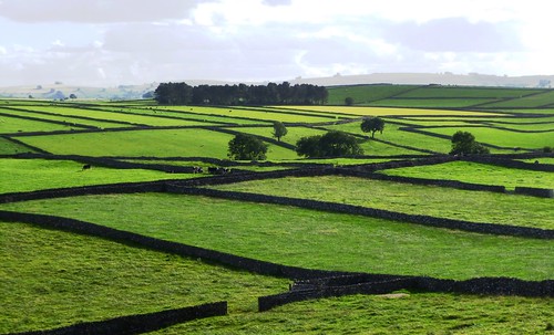
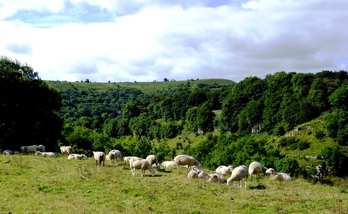
Litton lay stretched like a sleepy cat along its lanes; a grey stone village, typical of the Derbyshire uplands, in the embrace of green pastures and loosely knit stone walls. First published in: The Times Click here to view a map for this walk in a new window


Facebook Link:
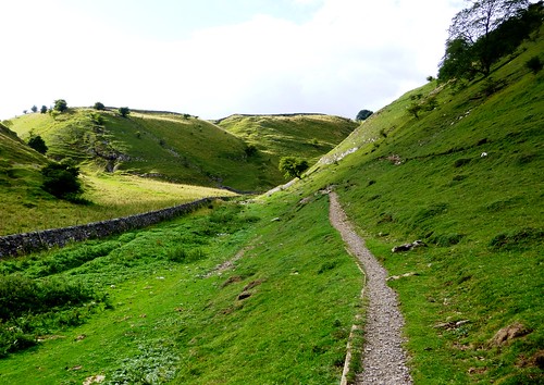
It had been too long since I’d had a good day’s walking with my London-based daughter Ruth. Crossing the fields and dropping south into the curving cleft of Tideswell Dale, we chatted away nineteen to the dozen, catching up on each other’s lives.
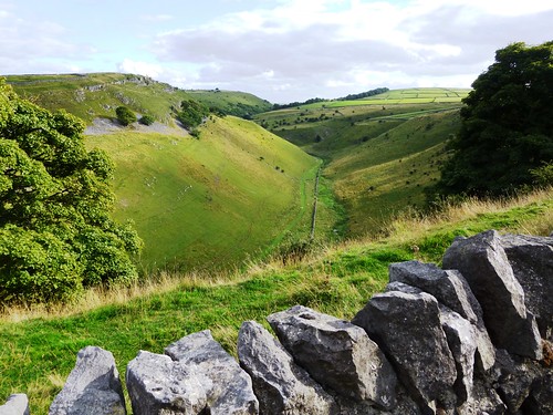
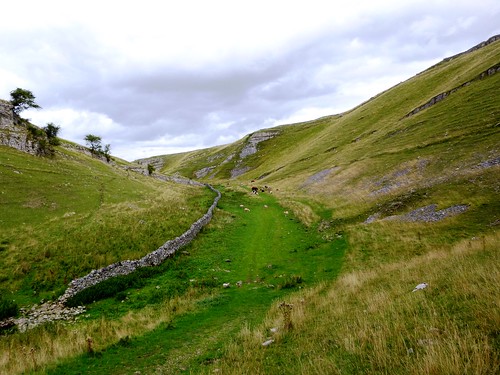
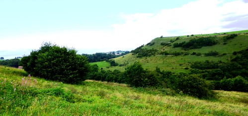
It’s small wonder that the Peak District is so tremendously popular with walkers, especially the very beautiful and spectacular dales or water-sculpted canyons that burrow their way through the pale grey limestone of the White Peak district. History doesn’t relate whether these strikingly beautiful surroundings were of any comfort to the 19th-century workers – some of them small children – who slaved away in the textile mills in the dank and cold dale bottoms.
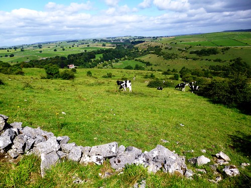
In Miller’s Dale we crossed the River Wye beside the mill-workers’ terrace cottages and climbed the steep bank of Priestcliffe Lees, where young Friesian heifers put their rubbery noses over the wall to sandpaper our fingers with glutinous yellow tongues. At Brushfield the old farm-children’s school stood high among stone cottages with massive lintels, looking down into the tree-choked canyon of Taddington Dale.
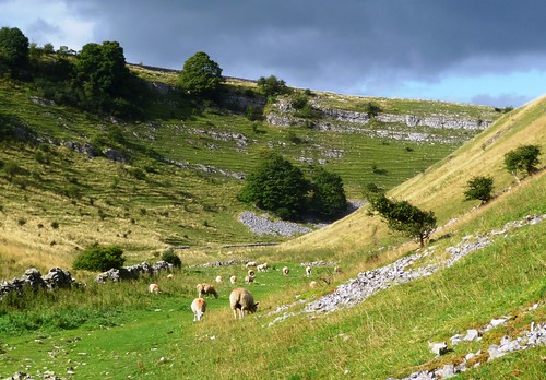
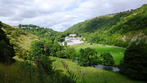
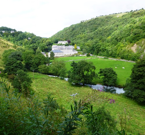
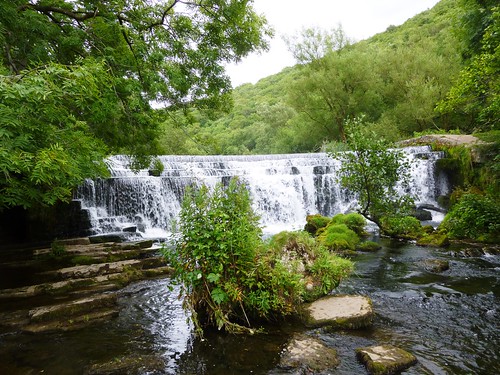
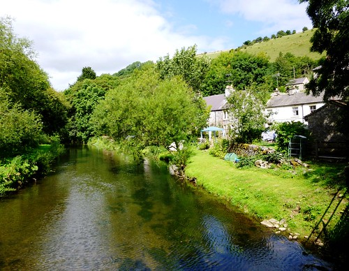
Down in Monsal Dale we picnicked on a grassy shelf by the gurgling Wye, and then followed the old Buxton-Matlock railway line – now a superb cycleway – into Miller’s Dale, where Cressbrook Mill stood huge and handsome in the throat of the valley. The Brewstop Café behind the mill is run by three siblings (the oldest is 14), and their tea and cakes are a walker’s dream.
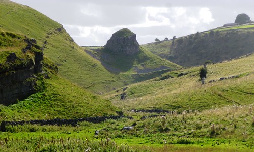
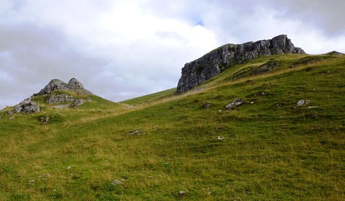
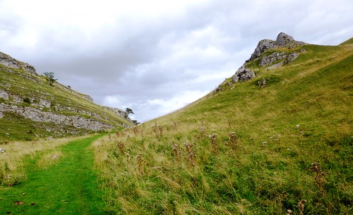
In Cressbrook Dale, up where the cleft opens grey rocky lips to the sky high overhead, a great outcrop of limestone hangs over the path – Peter’s Stone, where the bodies of executed felons were once hung in a gibbet as a terrible warning to all. Today, as we turned back along the rim of the dale towards Litton, the dark stain of the past seemed cleaned away by the low evening sun that washed the rock in a flood of gold.
Start: Red Lion, Litton, near Tideswell, Derbyshire, SK17 8QU (OS ref SK 164752)
Getting there: Bus – 173, 65, 66 (Buxton – Tideswell). Road – Litton is signed off A623 Peak Forest – Baslow road at Wardlow Mires near Tideswell
Walk (12 miles, moderate, OS Explorer OL24): From Red Lion, left along village street. Pass ‘Cressbrook’ turning; in 50m, right, then left over stone stile (166751). To far left corner of field; right along lane to road (165749). Ahead to left bend; over stile (fingerpost); follow field path/stiles to cross road (161748). On down to road (160749); left to B6049 (155748). Left for 20m; left through gate; follow wall beside road, past car park (154742) and on along Tideswell Dale. Left at ‘Quarry’ sign (154740) to quarry (155738); follow ‘Concession Path’ to steps back into dale bottom (155736). Left for ½ mile to road in Miller’s Dale (157731).
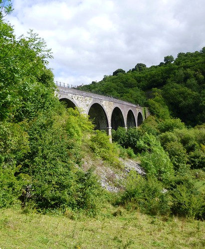
Left to cottages at Litton Mill; right (159730, ‘Monsal Trail to Miller’s Dale’) across river and up dale side. Cross Monsal Trail (158730); up steps by bridge, left over stile; up path (‘Priestcliffe Lees’), following yellow arrows/YAs. At top, through lumpy mining ground, following left-hand wall to turn left over stile (154725, YA). Right to stile into stony lane (153723). Left for ¾ mile to Middle Farm. At T-junction, left (159715, ‘Monsal Dale’). In ½ mile pass fingerpost (167717, ‘Upper Dale’), in 100m, right (‘Lees Bottom, White Lodge’) to farm track; follow it to farm (167712). Follow ‘path’ sign/YAs onto stony track beyond barn. In 200m, left (168710; fingerpost) over stile; follow stepped path down into Monsal Dale. At bottom, left (171708, ‘Monsal Head’) for 1¼ miles to viaduct (181716).
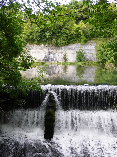
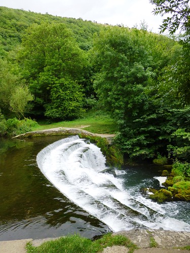
Left along Monsal Trail for nearly 1 mile. At mouth of Cressbrook Tunnel, right through gate (172724, ‘Cressbrook’) on path descending to cross river beside weir (172728). Bear right on path past Brewstop Café and Cressbrook Mill. At road, left; fork right (‘Cressbrook, Litton’); in ¼ mile, fork right (171732, ‘Ravensdale’). Pass Ravensdale Cottages (172737); in ¼ mile go through gate marked ‘Cressbrook Dale’ (172741); in 100m fork left and follow dale bottom for 1½ miles past Peter’s Rock to A623 (180756) at Wardlow Mires (NB 3 Stags’ Head PH to right). Left along A623 for 100m; left (stile, ‘public footpath’) up field wall to cross stile (177756); across field to cross stile; right up wall to road (173754); left into Litton.
Lunch: Brewstop Café, Cressbrook (weekends, school holidays); 3 Stags’ Heads, Wardlow Mires (01298-872268); Red Lion, Litton (01298-871458).
Accommodation: Cheshire Cheese Inn, Castleton, S33 8WJ (01433-620330; cheshirecheeseinn.co.uk) – bustling, cheerful place.
Info: Bakewell TIC (01629-816558); visitpeakdistrict.com;
www.ramblers.org.uk www.satmap.com www.LogMyTrip.co.uk visitengland.com