Search Results : “south downs”

Jul 252015


First published in: The Times Click here to view a map for this walk in a new window
picture picture picture picture picture picture picture picture
Facebook Link:

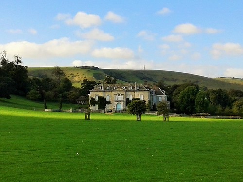
In 1913 Vanessa Bell and Duncan Grant came to live at Charleston farmhouse in the shadow of the Sussex downs. This bohemian London couple (well, scarcely a couple, my dear – it’s said that he prefers men!) decorated the farmhouse walls and furniture with primitive designs. Charleston soon became a magnet for such Bloomsbury Group illuminati as Virginia Woolf, David Garnett, Maynard Keynes and E.M. Forster.

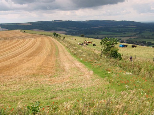
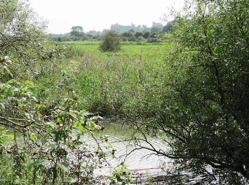
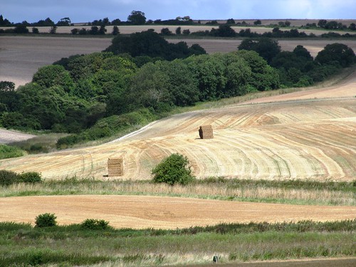
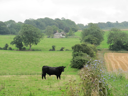
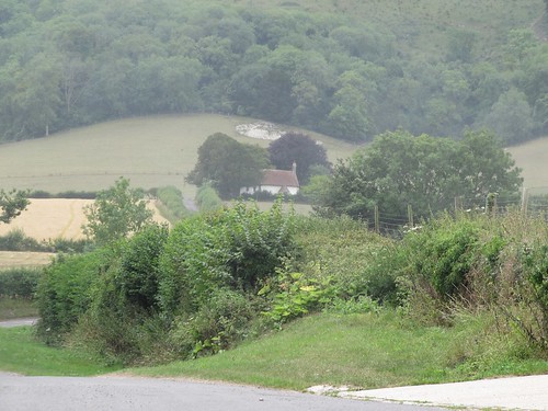
Walking over to Charleston, I was expecting a chocolate-box house in a picture-book setting. Instead there were grunting tractors, workaday sheds, and ordure-spattered dung spreaders busy in the fields around what is still a working farm. It was strange to be guided around the little rooms with their vividly daubed walls and tables, Grant’s nudes and acrobats, Bell’s drooping flowers and dotted circle motifs, and then to step out into such a practical farming landscape.

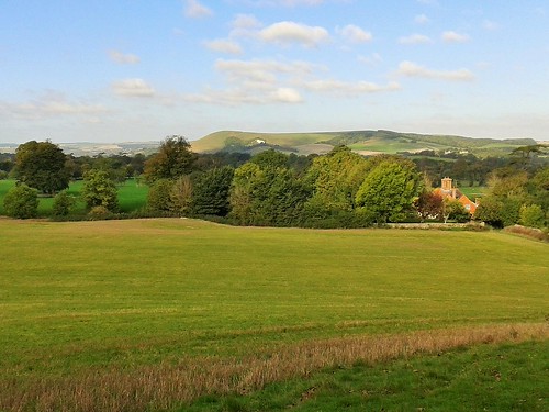
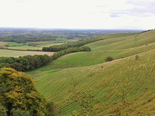
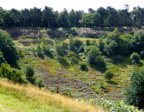
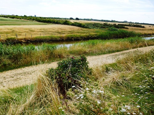
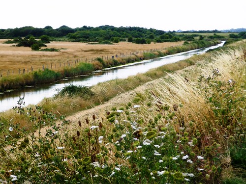
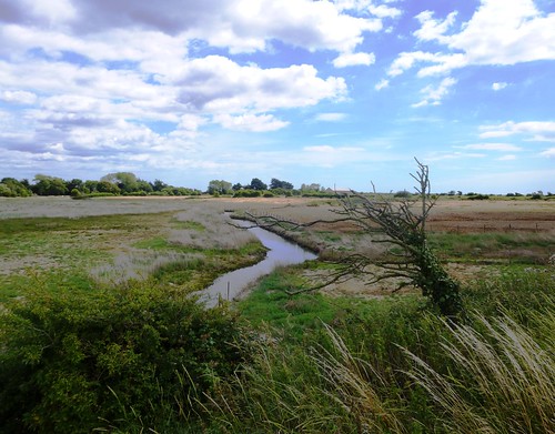
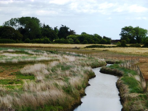
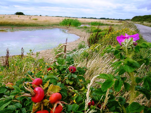
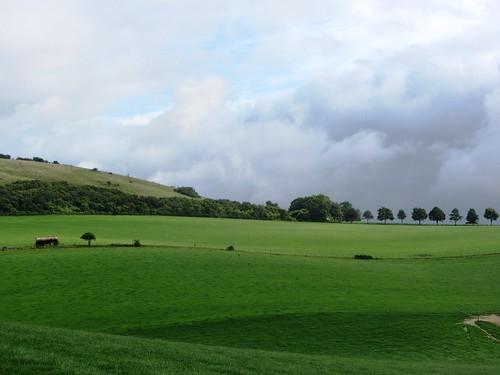
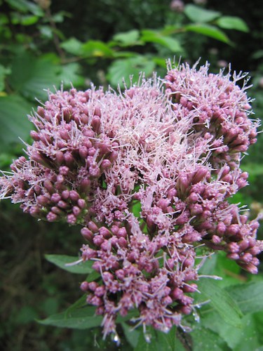
What shapes the scene is the long green arm of the downs behind, enclosing the southern skyline in a simple and perfect undulation. Two young buzzards were riding low across the slopes, to pull up and hang with cat-like cries a couple of feet above the turf as they scanned for small life cowering there.

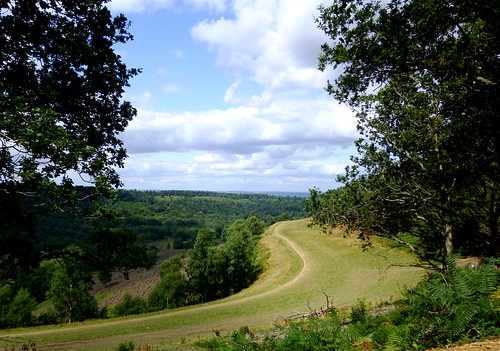
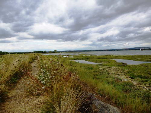
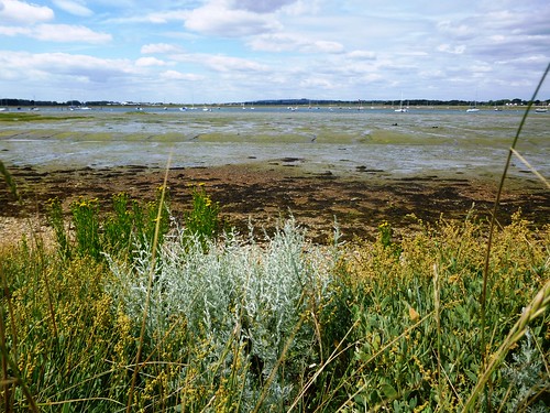
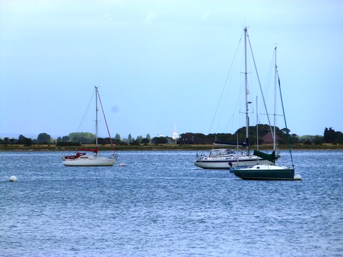
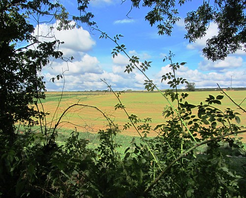
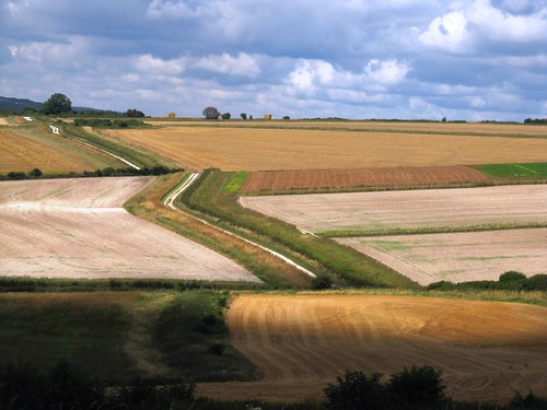
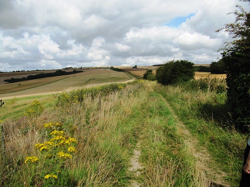
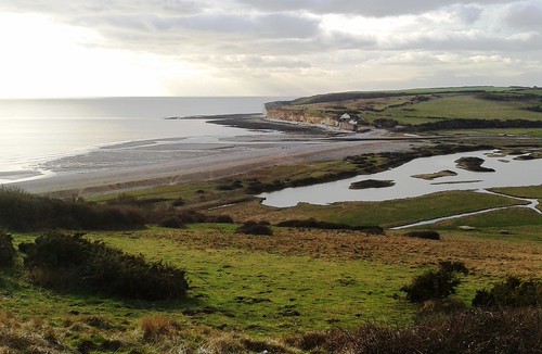
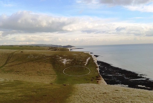
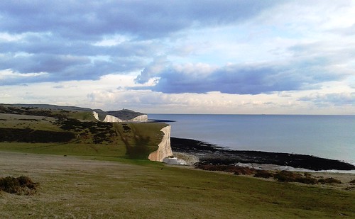
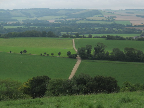
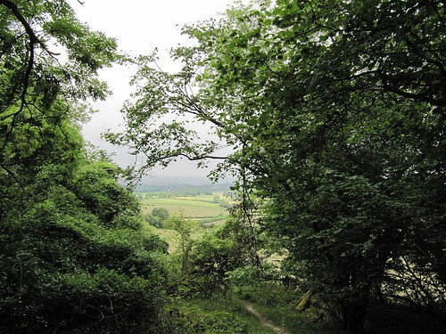
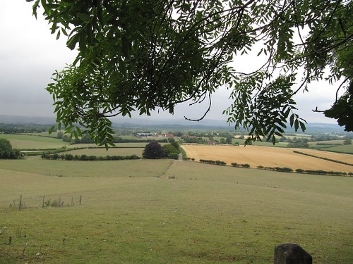
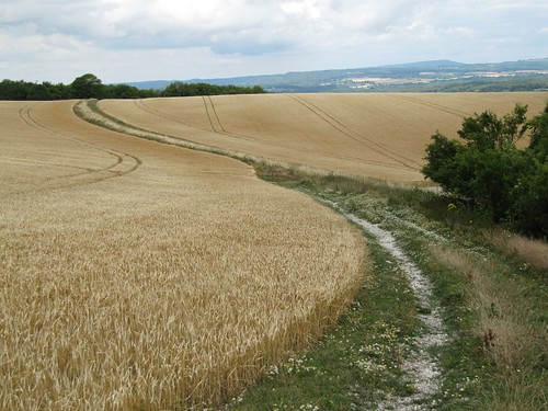
Up on the spine of the downs a cold wind came rushing in from the north, hammering at my face and tugging my beard like an impatient child. It was quite a prospect, north for many miles over the wooded hollows of the Sussex Weald, south to the spindly arms of Newhaven Harbour embracing the sea.

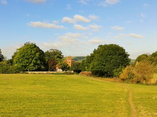
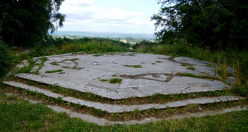
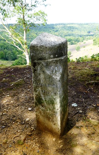
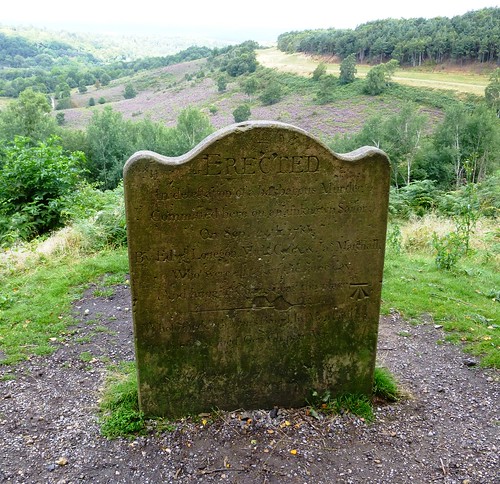
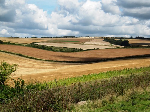
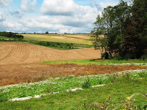
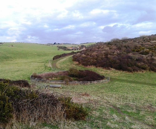
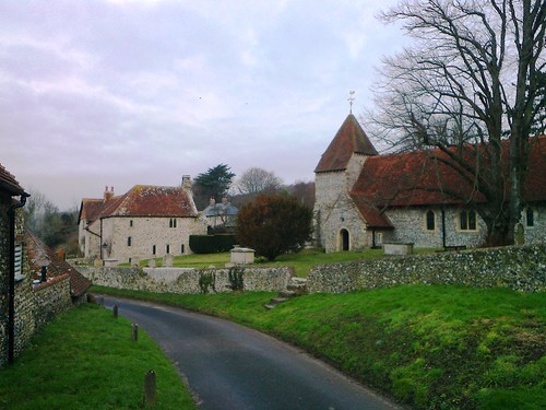
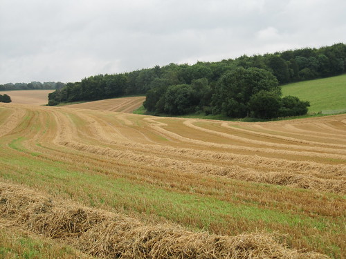
I pushed on into the wind to the dimpled hummock of the long barrow on Firle Beacon, and then found a steep chalk track that descended a slope seamed with pale wrinkles of erosion lines like the forehead of an old elephant. A fine flint wall accompanied me back to Firle, one of those well-kept estate villages where all seems right with the world.

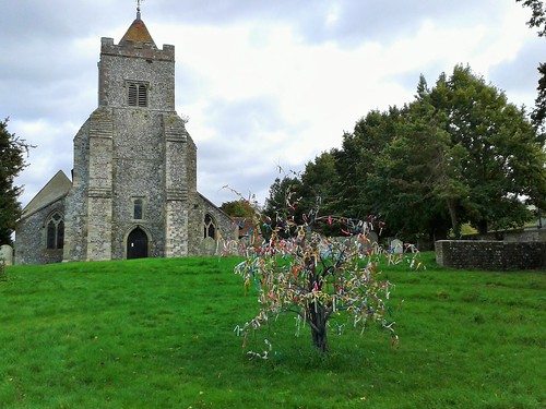
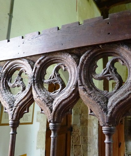
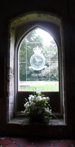
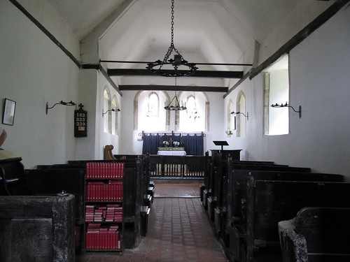
Peter Owen Jones, Vicar of Firle, writes lyrically of his downland walks. Outside St Peter’s Church I found a tree festooned in prayer ribbons; inside, a Tree of Life window by John Piper. Its vivid pinks and yellows lit the cloud-shadowed vestry more brightly than any painted room in the Bloomsbury farmhouse across the fields.

Start: Firle village car park, East Sussex, BN8 6NS approx. (OS ref TQ 469074)

Getting there: Bus service 125 (compass-travel.co.uk), Lewes-Alfriston
Road – Firle is signposted off A27 between Lewes and Eastbourne.

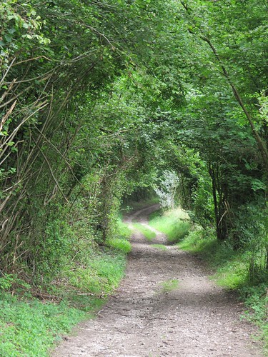
Walk (5 miles, moderate, OS Explorer 123. NB: online map, more walks at christophersomerville.co.uk): From car park walk through to Ram Inn. Left along street; left at post office (470071) down lane, through gate. Follow track across parkland. In 200m, right up tarmac roadway; in 50m, left at post, aiming for flint house halfway along edge of wood ahead. Cross road at cottage (478073); through iron gate opposite; follow bridleway through shank of wood (480071), on over fields to pass Charleston Farm (491069). In 200m, right (493068) along concrete track. At barns (494067), bear right, following track towards downs. In 550m, cross track (492062); on in tunnel of trees; through gate (490060, BA). Bear left up rising track to top of downs. Right (490054) along South Downs Way to trig pillar on Firle Beacon (485059). In 300m, through gate (482059); in 150m, fork right off SDW, descending path for ¾ mile to T-junction (475068); left beside wall to Firle.

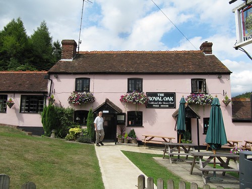
Lunch/Accommodation: Ram Inn, Firle (01273-858222; raminn.co.uk)

Charleston Farmhouse: 01323-811626; charleston.org.uk; open till 1 November; book your tour!

Peter Owen Jones: Pathlands – Tranquil Walks through Britain (Rider Publishing)
satmap.com; ramblers.org.uk; visitengland.com

 Posted by at 08:00
Aug 302014
 

Geologists say the Devil’s Punch Bowl is the sandstone roof of a giant cavern that collapsed after springs had hollowed it out; folklorists that it’s the imprint of the Prince of Evil’s arse when he landed there after a mighty jump from the Devil’s Dyke near Brighton.
First published in: The Times Click here to view a map for this walk in a new window
picture picture picture picture picture picture picture picture
Facebook Link:
Whatever its origin, this great green hollow in the Surrey Hills is packed with wildlife – slow-worms and lizards, butterflies and beetles, flowers and trees. We followed a path down under silver birches, through a boggy green dell and on across heathland of ling and bell heather gleaming purple in the strong midday sunlight.

A short climb to the tip of the Punch Bowl and we were walking the A3 London-Portsmouth trunk road – not the modern version, which has been buried far underground in twin tunnels since 2011, but the old road that was left abandoned. Where single-file traffic once queued and fumed, a wide green pathway now sweeps round the rim of the Devil’s Punch Bowl, subtly landscaped, edged with silvery grasses and wild flowers. Common blue butterflies opened their gorgeous wings to the sun, and a pair of clouded yellows enacted a crazy chase as we strolled the grass-grown track.

Just above the abandoned road runs another, an ancient highway that once linked the capital with the Royal Navy’s home port of Portsmouth. On a September day in 1786 three ruthless rogues murdered a sailor here for the price of his clothes. We found a memorial stone beside the track ‘erected in detestation of a barbarous Murder’, its reverse face bearing a faded inscription calling down a curse on anyone ‘who injureth or removeth this Stone.’

On Gibbet Hill nearby the three malefactors were hung in chains for all to see. It’s a haunted place, and a sensationally beautiful one, with a view that stretches out across the Sussex Weald from the South Downs to the ghostly towers of London 40 miles off. We sat to take it all in, then followed the National Trust’s ‘Hidden Hindhead’ walk through woods of oak and sweet chestnut coppice, up hollow chalk ways under bulbous pollarded beeches filtering green light, and back across an open heath where the wind was sweetened with pine resin and our finger ends grew purple with the juice of ripe little bilberries.

Start: Devil’s Punch Bowl car park, Hindhead, Surrey, GU26 6AG (OS ref SU 890358)

Getting there: Bus – Stagecoach (stagecoachbus.com) service 18, 19 (Aldershot-Haslemere)
Road – A3 or A287 to Hindhead; car park signed in village

Walk (5 miles, easy, OS Explorer 133. NB: Online map, more walks at christophersomerville.co.uk): From car park walk to viewpoint; right (‘Hidden Hindhead’/HH fingerpost). In 150m fork left through gate; immediately left (892358) down track into Devil’s Punch Bowl. In 350m, right (891361, yellow arrow/YA on post) down to cross stream (892363). Up slope, follow YAs across heath. In 250m go over path crossing (894364). In 400m, through kissing gate beside road on left (895367); right on gravel path to former A3; right along old road (896366) at lip of Devil’s Punch Bowl.

In 650m, on right bend, left (898360) up track through trees to cycle track; right for 300m to Sailor’s Stone (897358) on right. Return for 100m; right (‘Sailor’s Stroll’); follow cross symbol to Gibbet Hill viewpoint (900359). From here follow HH for 2½ miles back to car park.

Lunch: NT café, Devil’s Punch Bowl

Hidden Hindhead Walk and local info downloadable at nationaltrust.org.uk

Accommodation: Devil’s Punch Bowl Hotel, Hindhead GU26 6AG (01428-606565; devilspunchbowlhotel.co.uk)

Information: Guildford TIC (014983-444333);
visitsurrey.com; visitengland.com;
www.satmap.com; www.LogMyTrip.co.uk

 Posted by at 01:33
Oct 122013
 

Wild plums, green and purple, hung heavy above the path as Jane and I began our circuit of Thorney Island, a narrow-necked peninsula suspended like a bulbous fruit from the inner shoreline of Chichester Harbour.
First published in: The Times Click here to view a map for this walk in a new window
picture picture picture picture picture picture picture picture picture picture picture picture picture picture picture picture
Facebook Link:
A memorable feature of my wife’s childhood in this low-lying coastal country had been the vee-shaped bomber planes from Thorney Island’s RAF base – long since closed – that would rumble overhead, low and dark in the sky.

Black-headed gulls screamed peevishly from the mud banks exposed at low water; oystercatchers piped, and curlews made their melancholy bubbling cry. Salt, mud, seaweed – the smells were of tidal country under a drying wind. As for the views, they widened over mud flats green with algae and weed, seamed with wriggling creeks known locally as rithes, out west to the low wooded coastline of Hayling Island. Inland, hissing beds of reeds lined the waters of the broad ditch romantically named Great Deep.

Sea lavender lay in purple mats on the salt marshes. Leopard-spotted comma butterflies alighted on fleabane flowers and opened their scalloped wings to the sun. From the seawall path, the army establishment that replaced Thorney’s RAF base in 1984 was so well hidden among the trees it might not have been there. The only clue as to where those great triangular bombers had taken to the skies was a grey smear of runway tarmac, long disused.

We watched a lovely old wooden sailing boat scudding down Sweare Deep under a white bulge of jib, the mainsail rattling up as the boat heeled into Emsworth Channel. By the time we had reached Longmere Point at the nethermost tip of Thorney, the tide had crept in to cover mud flats, shell banks and rithes in a rippling world of water that spread south towards the open mouth of Chichester Harbour.

St Nicholas’s Church at West Thorney, ‘the least known and altogether uttermost church in Sussex’, has stood here on the remote eastern coast of the island for 800 years. Wartime Allied and German servicemen share the graveyard, foes in life, brothers in death.

Under the seawall an unseen fish hunted the flood-tide shallows, dorsal fin and tail cutting the surface. Far to the east the spire of Chichester Cathedral glowed ghostly white in the evening sun, the South Downs ran in black and gold along the northern skyline, and from the marina moorings came the music of halyards blown by the wind against yacht masts, chinking and chiming like miniature bells.

Start: Sussex Brewers PH, 36 Main Rd, Hermitage, West Sussex PO10 8AU (OS ref SU 755057)

Getting there: A27/A259 to Emsworth. Park in village; follow A259 to Sussex Brewery PH

Walk (9 miles, easy, OS Explorer 120. NB: Online maps, more walks at christophersomerville.co.uk): Follow footpath down side of pub (fingerpost), then field edges south to boatyard. Right (755053, fingerpost) through Emsworth Yacht Harbour to sea wall. Left (753052, fingerpost) anti-clockwise round Thorney Island for 7 miles, passing Little Deep (752047), Great Deep (749040), Marker Point (746023), Longmere Point (768011), West Thorney Church (770025), Stanbury Point (770031) and Prinsted Point (766042). At foot of road above Thornham Marina (766051), turn left inland along Sussex Border Path past Thornham Farm for half a mile to cross Thorney Road (756051). Over stile (fingerpost), across field and opposite stile. Right (fingerpost) past stilt houses, and retrace path to Sussex Brewery PH.

Lunch: Sussex Brewery PH, Hermitage (01243-371533; sussexbrewery.com) – a really friendly, clean and welcoming pub.

Chichester Harbour Conservancy (01243-512301; conservancy.co.uk) – walks, information and much more.

Information: Chichester TIC (01243-775888; visitsussex.org)
yorkshire.com visitengland.com www.ramblers.org.uk www.satmap.com www.LogMyTrip.co.uk

 Posted by at 01:33
Aug 102013
 

A perfect summer’s morning over West Sussex – blue heavens with huge white cumulonimbus clouds reaching up from the South Downs skyline, warm sunshine spreading across the countryside like butter, and wood pigeons sleepily cooing in the beech trees around Burpham.
First published in: The Times Click here to view a map for this walk in a new window
picture picture picture picture picture picture picture picture picture picture picture picture picture picture picture picture
Facebook Link:
‘Good morning!’ quoth a man in a pink and white striped shirt, with that very British crispness that means, ‘Glad to see you in our beautiful village, but don’t drop any sweet papers, will you? Thank you so much!’

The old valley track of Coombe Lane brought us up from the village to the downs, its elder bushes and guelder rose and spindle all beginning to come into fruit. The sun released warm, spicy wafts from tuffets of wild marjoram where meadow brown butterflies staggered, half drunk on the smell. A clump of thistles seethed with hungry goldfinches. Glimmering chalkhill blue butterflies clung to the nettles that grew along the chalky banks of pale grey soil, burrowed into a powdery tissue by rabbits. Two marsh harriers had come up from the marshy banks of the River Arun, and we watched them making long slow passes through the valley on their long dark wings.

The downland slopes were a maze of pale gold stubble fields where big straw bales lay doubled over like blankets in a giant’s linen cupboard. The view widened back south from Wepham Down to a flat gleam of the distant sea, the Isle of Wight lying long in a grey haze on the south-west horizon. Up on the roof of the downs the ramparts of Rackham Banks – a Bronze Age cross dyke, probably a boundary marker, and a hill settlement in a hollow – were spattered with scabious, knapweed and poppies. We sat idling there, the chalk-white South Downs Way ribboning east and west, the ground plunging away north to the Arun snaking through the Sussex lowlands among woods and pastures.

The ancient ridge track dipped to Downs Farm, a pretty old farmhouse marooned in a monstrous muddle of harsh modern barns and silos. Here we turn off south, dropping into a steep, silent and nameless valley where sheep nibbled the turf and red kites turned on the thermals with crooked wings and subtly balancing tails. Then a last stretch beside the Arun, past an old tree-grown moated site that might well be part of the burh or fortified village established here by Alfred the Great eleven hundred years ago. A timeless walk, where now and then join hands seamlessly.

Start & finish: Burpham village car park, West Sussex, BN18 9RR approx. (OS ref TQ 039089)
Getting there: Train (thetrainline.com; railcard.co.uk) to Arundel (2½ miles). Road: Burpham is signed off A27 just east of Arundel station
Walk (7 miles, moderate, OS Explorer 121): From car park pass George & Dragon Inn; right along village street. Follow it out of Burpham for ⅓ mile, round right bend; left up Coombe Lane (044090; fingerpost, blue arrow/BA). Keep to bridleway along valley bottom, climbing gently for 1½ miles to T-junction of tracks (061106). Two tracks diverge to left; take right-hand one of these, at right-angles to direction you’ve been walking, heading north. In just over 1 mile, at T-junction of tracks (056122, ‘Restricted Bridleway’), right for 20m, then left (‘bridleway’ fingerpost in right-hand hedge) on chalk track between hedges. In 300m, at 3-finger post (053123) fork right (BA) to South Downs Way at Rackham Banks (051125).

Left for ¾ mile. Just before Downs Farm, left (038125, ‘Restricted Byway’). In 100m fork right (‘bridleway’ fingerpost, BA). Keep fence on right. In ⅓ mile, through gate (041119, BA) and on, with fence on right, into valley. At bottom, right through gate (BA); bear left up path, climbing slope; through gate at top and on over track crossing (044114, yellow arrow/YA). Ahead through corner of wood (044110, YA), then right (BA) down track with wood on right, and on for ½ mile. Look out for gateway with BAs on right (040102), and take footpath just to right of it (YA) between fences, then steeply down to bottom of steps (039103). Left (BA). In ⅓ mile pass old quarry on left; in another 50m, right over stile (035099, YA); turn left, and follow fence on your left (stiles, YAs). In ¼ mile skirt right of old moat with trees (033094, YA). Ahead along river; in ⅓ mile climb left up bank (038089) into Burpham.
Click on Facebook “Like” link to share this walk with Facebook friends.

Lunch: George Inn, Burpham (01903-883131; gdinn.co.uk)
Info: Arundel TIC (01903-737838)

visitsussex.org; visitengland.com; www.ramblers.org.uk www.satmap.com www.LogMyTrip.co.uk

 Posted by at 06:22
Mar 162013
 

It’s a rare pleasure to find a place as well set up for four-seasons walking as East Dean. First published in: The Times Click here to view a map for this walk in a new window
picture picture picture picture picture picture picture picture
Facebook Link:
The immaculately kept East Sussex village lies just inland of the Seven Sisters cliffs at the heart of superb coast-and-countryside landscape. Walkers know they’ll be welcome at the cosy old Tiger Inn and the Hiker’s Rest teashop on the village green, the hub of a network of footpaths. I chose a circuit that would thread woodland, downs and cliffs together, and set out early from the Tiger into a red dawn.

‘Morning!’ said a woman by Friston duckpond, her breath smoking in the cold air. ‘Saw you yesterday up on the downs, didn’t I? Hope you enjoy your walk.’ Down in the valley below, ancient Friston Place lay low, pink-faced and many-gabled among beech trees where rooks were cawing lustily. Building low, I noticed, portent of a rainy summer.

Friston Forest sighed gently in the morning wind. A great spotted woodpecker rattled a hollow tree, a pair of racehorses went drumming by like ghosts in the mist on Friston Hill. Sunk in the woods, the medieval rectory and church at West Dean gleamed in dew-wet flint. A long flight of steps, the crest of a hill, and I was looking down over one of England’s classic views – the extravagant snake bends of the Cuckmere River sinuating its way seaward through a dead flat littoral between great curves of downland. Coastguard cottages stood isolated at the brink of the Cuckmere Haven cliffs, their tall chimneys silhouetted against a pale wintry sea.

Foxhole Farm, all flint walls and brick-red roofs, lay tucked into a fold of the downs. Beyond the farm the South Downs Way ribboned east along the furrowed brows of the Seven Sisters. Far ahead, the promontory cliff of Belle Tout displayed an elliptical grimace of white chalk like the baleen plates in the mouth of a right whale. At the feet of the cliffs fresh falls of chalk lay scattered, staining the shallows a milky white.

It was hard to tear myself away from this captivating stretch of coast, but my way lay inland, funnelling up Gap Bottom past the old farming hamlet of Crowlink. A last trudge over the downs through a stolid crowd of curly-faced sheep, and I was dipping down the steep slope towards East Dean with a pint of Tiger’s Claw in my sights and a head full of wonders to sort through.

Start: Tiger Inn, East Dean, near Eastbourne, East Sussex BN20 0DA (OS ref TV 556978).

Getting there: Bus 12, 12A (buses.co.uk), Eastbourne-Brighton.
Road: East Dean village is signposted off A259 Eastbourne-Seaford.

Walk (8 miles, easy/moderate, OS Explorer 123):
From Tiger Inn, right up side of village green; cross road, up path opposite (556979, fingerpost). At Friston church (551982) cross A259; take path just to left of Jevington road (yellow arrow); cross stile; right (‘footpath’ post) along woodland edge. Cross field (551985); cross lane by stile and gate (550987); cross next field, into woodland (550989). Left on path parallel to lane (‘West Dean’ post). Follow lane where it bends left around Friston Place (548990). In 100m, opposite entrance to Friston Place, right (547989; blue arrow; ‘West Dean’) on bridleway through woods. Keep straight ahead, following red arrow posts for a while, then cycleway signs, but always in same direction, ignoring all side tracks. In just over a mile, cycleway turns left (531996), but keep ahead down slope, past white house and on to West Dean. Right past church (525997) to T-junction; left along South Downs Way (SDW), over track, up 200+ steps to cross wall stile at top (521996; superb view over Cuckmere Haven!). Follow SDW down to cross A259 by Visitor Centre (520995).

Through gate (SDW); bear left up slope through another gate (SDW). Follow SDW for 2½ miles along cliffs. By National Trust sign ‘Crowlink’ (538968) bear inland to pass Crowlink hamlet. Opposite laneway on left, go right through open gateway (545975). Up to cross stile; keep same line up to brow of hill; pass clump of thorn trees, then on (car park 200m on your left) to go through kissing gate (551976). Aim down right side of triangular woodland; keep ahead (not right!) across stone wall stile (554977); down field slope to path by wall; left down to field; right through gate by NT ‘Crowlink’ sign into East Dean.

Lunch: Tiger Inn, East Dean; Golden Galleon, Exceat (01323-892247)

Accommodation: Tiger Inn B&B, (01323-423209; beachyhead.org.uk) or Beachy Head Cottages (01323-423878; beachyhead.org.uk). Superb country pub; classy self-catering

Information: Eastbourne TIC (01323-415450); visitsussex.org
www.ramblers.org.uk www.satmap.com www.LogMyTrip.co.uk
Click on Facebook “Like” link to share this walk with Facebook friends.

 Posted by at 01:18
Nov 242012
 

It was one of those close, steamy mornings when the chalk down country of Hampshire sits very still under a cap of grey vapour, the downs themselves muted into pale hummocks against a leached-out sky. First published in: The Times Click here to view a map for this walk in a new window
picture picture picture picture picture picture picture picture
Facebook Link:
Someone was pruning a fruit tree behind one of Exton’s garden walls; the snip-snip of secateurs followed us out of the silent little village like the chipping of two flints.

The South Downs Way took us gradually up between blackberry hedges towards the wooded promontory height of Beacon Hill, the chalk grassland of its steep flanks a pale washy green that suddenly shone a rich olive colour as the hidden sun lowered a beam through the murk. The clouds shredded like mist, exposing a painter’s palette sky of forget-me-not blue and mackerel streaks of black and silver. The Beacon itself, a stark iron cresset on a pole with a plaque commemorating the Diamond Jubilee, commanded a wonderful view east over the woods and fields of the Meon Valley.

A potholed country road squirmed along the ridge between the whaleback of Beacon Hill, a National Nature Reserve famous for its summer flowers and butterflies, and the open hull of the Punch Bowl, a steep and secluded dry chalk valley. Tarmac soon gave way to flint and clay in the green lane that carried us by the humps and bumps where the medieval village of Lomer once stood. The creation of fenced-off sheepwalks in Tudor times caused many a downland village to lose its corn-growing and cattle fields, and Lomer was probably one of these.

A big black bull stood in the field beyond Lomer Farm, staring into space and chewing on unfathomable thoughts. Along the shallow valley charmingly called Betty Mundy’s Bottom the stubbles ran in parallel zigs and zags. Pungent, lung-clearing wafts came from the freshly creosoted gates around Betty Mundy’s Cottage where, peering through the hedge, I glimpsed an enormous bronze horse’s head balanced delicately on its muzzle in the grass.

Further along, near St Clair’s Farm, we passed through a plantation of young Northdown Clawnuts, walnut trees not yet mature enough to produce the sweet-tasting nuts that grow twice the size of a conventional walnut. We put in a mental marker to come back in an autumn ten years from now, and bring a good-sized basket with us.

In Corhampton Forest two roe deer leaped before us across a clearing in three or four graceful bounds. We found a flinty lane and followed it past black sheep bleating at the foot of the Punch Bowl, through a quiet valley and back to Exton.

Start & finish: Exton village, Southampton, Hants SO32 3NT (OS ref SU 612208). NB Please don’t park in Shoe Inn’s tiny car park!
Getting there: Exton is signposted off A32 Fareham-Alton road at Meonstoke/Corhampton
Walk (7 miles, moderate, OS Explorer 132): Leaving Shoe Inn, turn right to corner; right (‘South Downs Way’/SDW) past Exton House; in 200m, right (611209) along Church lane. In 100m, left (SDW); follow SDW across fields for nearly a mile to road (603220). Right (SDW) to junction (598226). Ahead and round sharp right bend; then left past entrance to Beacon Hill NNR (598227). Follow road for 250m; at right bend (597230) keep ahead along stony track. At Lomer Farm, left on SDW between buildings (591237); in100m, left (‘Wayfarer’s Walk’/WW). Pass ‘Footpath Only’ sign, and on. In ¼ mile, go through field entrance; left here (YA) down hedge, then right (586232) along bottom of field with Rabbit Copse on left. At end of field (583228), keep ahead up stony track (WW, YA). At T-junction, left (WW); in 100m, left over stile (WW); half-left across field to gate (580224, WW) and through shank of woodland. Right (WW) to go through gates; left to bottom of field; right (580222) along Betty Mundy’s Bottom. Pass Betty Mundy’s Cottage (578221) following WWs, and on along valley. In ⅓ mile at crossroads of tracks, turn left off WW up field edge (578214, YA). Ahead for 300m to cross Sailor’s Lane (582213); ahead into tunnel of trees of Corhampton Forest. In ½ mile path diverges to right (589210), but keep ahead up open slope. In 100m, left (‘Footpath’, YA); in 150m, right (591211, YA). In 500m cross Beacon Hill Lane (595209); ahead down stony lane into Exton. In ¾ mile at T-junction (608207), keep ahead; round left bend, and follow road to Shoe Inn.
Click on Facebook “Like” link to share this walk with Facebook friends.

Lunch: Shoe Inn (01489-877526; theshoeinn.moonfruit.com) – lovely riverside pub
More info: Alton TIC (01420-88448); visit-hampshire.co.uk
www.ramblers.org.uk www.satmap.com www.LogMyTrip.co.uk

 Posted by at 01:53
Apr 092011
 

The Royal Oak sits snug, tucked down out of sight in a steep cleft of the Sussex Downs a few miles north of Chichester.
First published in: The Times Click here to view a map for this walk in a new window
picture picture picture picture picture picture picture picture
Facebook Link:
It’s hard to prise the regulars out of this delightful walker-friendly pub, especially Shagger Shepherd. Old Shagger hasn’t left the place since 1680, when he was shot dead in the bar for stealing sheep. He’s been seen by many since then, and photographed by landlord Dave Jeffery. If you should meet Shagger, don’t offer your hand – it’ll go straight through him.

On a steamy, showery morning we set out from the Royal Oak up a broad flinty track through woods of yew and fern beech on Philliswood Down. The pale sun struck gold out of the grass hummocks of the Devil’s Jumps – five Bronze Age bell barrows in a row, lined up with the rising sun at midsummer solstice. Out of the trees on the open downs, the ancient track of the South Downs Way stretched into the distance along the ridge, a ribbon of pale grass and rutted chalk. The view opened out dramatically, pastoral lowlands stretching away north from the foot of the downs escarpment, and a southward prospect of snaky cornfields and woods dipping to a hazy hint of sea.

We turned off the South Downs Way with its hurtling cyclists, and dipped steeply down a woodland path through the yews on Didling Hill. There are still enough sheep in the pastures below to get Shagger Shepherd shot all over again, but long gone are the great days of Sussex Downs sheep farming. Back then the shepherds in broad-brimmed hats and thick cloaks would give thanks in the little chapel of St Andrew, known far and wide as the Shepherds’ Church, in its lonely stance by the lane to Didling.

In one of the diminutive, iron-hard oak pews we sat out a quiet ten minutes, overseen by the fiercely moustached Green Man carved on the pulpit. Then we walked on through timeless farming landscape, from mellow, red-tiled Didling to neat little Treyford. Back up a stiff old track round Mount Sinai to the roof of the downs under clearing skies, and on through rolling barley fields. Obliterated by the green and gold corn lies the herb-rich sward where Sussex Downs shepherds once stood in all weathers, solitary men with their chins on their crooks, ever alert for bloat and scab, rough winds and rustlers.

Start & finish: Royal Oak Inn, Hooksway, near Chichester PO18 9JZ (OS ref SU 815162)
Getting there: Hooksway is signed off B2141 between Petersfield and Chichester. Park at Royal Oak – but please ask permission, and give them your custom!
Walk (6 miles, moderate grade, OS Explorer 120): From Royal Oak turn north-east up broad track, the middle one of 3 (red arrow/RA, ‘Restricted Byway’). At crossing of tracks on Philliswood Down, keep ahead on South Downs Way (824169). In ¾ mile, leave the trees; in 300m turn left (837174; ‘bridleway’, blue arrow/BA) to descend Didling Hill. In ¼ mile, on left curve, turn right up bank (833177; yellow arrow/YA on post) to descend steep woodland path. On down road to pass Didling church (835181). In Didling, keep ahead (‘Ingrams Green’); in 150m, left (837185; YA, fingerpost) through Manor Farm farmyard. Cross stile; follow YAs through hunting gates and along hedges for ½ mile. Cross stile; down through trees, over stream (827187); keep ahead (fingerpost, YA) to road on bend in Treyford. Right (ahead) to T-junction (824188). Left; on left bend, ahead through farmyard (fingerpost). Follow stiles and YAs into field with earthworks. At bottom left corner, cross stile; right (823185; ‘bridleway, BA) along bridleway between fences for ½ mile. At crossing of bridleways, ahead (BA); at next hedge crossing, left (815188; ‘Public right of way’; purple arrow/PA on fingerpost in bush); up trackway between hedges. In 150m, left (PA) up steep track through Mount Sinai wood. In 250m, ahead across track (PA); at top of incline, ahead (816183; ‘Restricted Byway’, PA). In 350m, at junction of paths, cross wide chalk track (815179) and keep ahead on grassy path through trees. In 600m, descend to trackway (816173). Ahead (‘Public right of way’, fingerpost). In 50m, ahead through gate (‘bridleway’, BA); cross field and follow bridleway to Hooksway.

Lunch: Royal Oak, Hooksway (roaring fires, resident spectre, good beer and food): 01243-535257; www.royaloakhooksway.co.uk
More info: Tourist Information Centre, 29a South Street, Chichester (01243-775888, www.visitchichester.org);
www.ramblers.org.uk www.satmap.com www.LogMyTrip.co.uk

 Posted by at 05:12
Jan 232010
 

A sad-faced mermaid adorns the sign outside The Juggs at Kingston-near-Lewes. Inside this tile-hung, low-beamed and horse-brassy village inn under the South Downs, a typical Sussex pub, the bars were alive with chatter and rumbling with cheerful laughter.
First published in: The Times Click here to view a map for this walk in a new window
picture picture picture picture picture picture picture
Facebook Link:
I sat finishing my sandwich, watching two near-identical kinsmen entirely absorbed in their conversation opposite one another at the window table. The fire was hot on my cheeks, the beer fruity in the glass. Could I brace myself to shift out into the nipping afternoon air? Hmmm …

Along the lane in the Church of St Pancras, stained glass glowed in two modern windows. One, a joyful memorial to artist Betty Dora Leney, showed her among the local birds and beasts, intently sketching the elastic skyline of the hills. The other, a fiery smear of red and blue, commemorated anti-apartheid priest Michael Scott and his ecstatic poetry:

‘Praise be to Thee O Lord for these mighty mountains …

For these diamonds on the cobwebs in the first light of morning,

For the four winds of heaven and the stars which cannot come down …’

I was too late for the diamonds and too early for the stars. But up on the crest of the downs above Kingston after a steep climb, the four winds blew exhilaration clean through me. The racing sky, the cold air, the downs riding out to sharp prows and the wide view down across billowing ploughlands struck headier than any ale. I followed the ridgetop track of the South Downs Way until my path branched off and plummeted away through Castle Hill National Nature Reserve into the hidden cleft of Falmer Bottom. That was a blissful mile, the air almost still, the sparrowhawks hanging like paper kites over the scrub slopes, and no-one to meet, greet or take cognizance of.

Up on Pickers Hill, striding along in sight of the sea and thinking of nothing high or mighty, I spotted treasure lying in a plough furrow – a roughly-shaped lozenge of flint, some Neolithic hunter’s arrowhead that never made it to the final shaping. What had prevented him completing the deadly little weapon? Disease, distraction, or a pounce by death?

Hidden nearby among elder bushes stood a lonely marble cross commemorating John Harvey, a Bedfordshire man who ‘died suddenly upon this spot on the 20th day of June, 1819’. I weighed the flint diamond of the arrowhead in my palm, picturing ancient hunter and Industrial Revolution man linked by their manner of departure, snatched without warning from the roof of these downs under a windy heaven: a Michael Scott moment.

Start & finish: The Juggs PH, Kingston-near-Lewes BN7 3NT (OS ref TQ 393083)

Getting there: Train (www.thetrainline.com; www.railcard.co.uk) to Lewes (2 miles). Bus: 123 from Lewes, 130 from Brighton. Road: Kingston-near-Lewes is signposted from A27 Brighton-Lewes road.

Walk (7 miles, moderate grade, OS Explorer 122): Leaving The Juggs, right past church. Tarmac becomes stony track. In 100 yards, left up steps (389079; yellow arrow/YA), then path to top of down (387075). Ignore Breach Road descending to left; instead, right for 30 yards, then follow South Downs Way/SDW through gate (blue arrow/BA, SDW acorns). In 50 yards (385076) ignore right fork; ahead along SDW for 1¼ miles. Through gate by Pressure Reading Station (370074); SDW forks right, but keep ahead for 300 yards; left through gate by Castle Hill NNR notice-board (367073). Follow track down for ½ mile into Falmer Bottom; through gate by NNR notice (371068); left along field track with fence on left for ¾ mile to pass barns (379061).

On along valley bottom. In ¼ mile, at 3-way fork (378058), follow main track to left. In ½ mile, where track bends right just before barns, left through gate (378050; ‘South Downs Circular Walks’ BA). Follow bridleway down, then up; through gate; on for 200 yards to BA (383052). Forward for 200 yards to John Harvey’s monument (385052); return to BA; right up path for 1 mile, passing barns (387065), to SDW (392067). Left; in 200 yards, right (391069; BA) down Dencher Road for ¾ mile past West Drove and Coombe Barn into Swanborough. 100 yards before road, hairpin back to left (401077) into farmyard; right along side of brick barn (footpath notice/YA). Pass between Dutch barn and silos (400078); through gate, over following stile (YAs); follow hedged path to road (397082); left to The Juggs.

Lunch: The Juggs, Kingston-near-Lewes (01273-472523) – dark, characterful village pub

More info: Lewes TIC (01273-483448; www.visitsussex.org); www.ramblers.org.uk

 Posted by at 00:00
Aug 152009
 

First published in: The Times Click here to view a map for this walk in a new window
picture picture picture picture picture picture picture
Facebook Link:

Squirrels had been harvesting the green hazelnuts along Woodlands Lane; the split shells went crunching under our boots as we set out from Berwick St John on a cloudy morning. Beyond the gabled old house of Woodlands there was a bit of a pull up the breast of the hill, and then the exhilaration of a good old step-out along one of the ancient ridgeways that ride the nape of these south Wiltshire downs. Jane, a South Downs girl born and bred, strode out with a big smile on her face, delighting in the poppies along the cornfield headlands, the nodding harebells and powder-blue buttons of scabious in the trackway verges, and the sense of being high up among the swooping hills of proper chalk-and-flint country.

Steep hill slopes whose sheep-nibbled turf had never been disturbed by any plough plunged away to flat and sinuous valley bottoms, where the pale coffee colour of the newly harrowed earth lay streaked with darker chocolate, sign of watercourses still active under the soil. It was like walking on a relief map, a fabulous one. Full of exultation, we came down through Norrington Farm to reach Alvediston’s little Church of St Mary, where a group of recondite ramblers on a church crawl were discoursing in the churchyard.

Blink and you’ll miss Alvediston. The thatched Crown Inn stood locked up tight, in a state of suspended animation between owners. Walking on, we found sparrowhawks clattering from the ash trees in Elcombe Hollow, fat sheep cropping the vale under Pincombe Down, and wonderful views along the sweep of the north-facing hills.

The Ox Drove is another ancient trackway of the Wiltshire Downs, broad and tree-lined between wide grazing verges, a drove road and pedlar’s highway since time out of mind. We followed it along the crest of the downs as cloud thickened in the north, looking out to the mounded ramparts of Winkelbury hillfort. The golden coffin buried at the summit, the lucky thorn tree that grows there, the devil who grants wishes to those who march round the hill while cursing and swearing … All yarns the drovers swapped and the pedlars spun to drive away the demons of the old hard roads across the downs.

Start & finish: Talbot Inn, Berwick St John, Wiltshire SP7 0HA (OS ref ST 947223)

Getting there: Berwick St John is signed off A30, 3½ miles east of Shaftesbury

Walk (8 miles, moderate grade, OS Explorer 118): Leaving Talbot Inn, round right bend; up Church Street. Round left bend by Old Rectory; in 20 yd, right (946224) along Woodlands Lane. Just past Woodlands House (951232), track splits 3 ways. Ignore yellow arrow; take middle way, diagonally left uphill for 600 yd. Through gate in fence (948237; blue arrow/BA); aim half left across down to gate in far left corner (BA). On through next wooden gate; follow path to turn right along stony trackway (948245). In 1 mile, right (961248) down green path to Norrington Farm. Ahead through farmyard; past last barn, left (967238) over stiles through 4 fields to road (976238 – St Mary’s Church opposite). Right to T-junction in Alvediston (976234 – Crown Inn opposite). Right; in 50 yd, left (‘Elcombe Farm’). Follow road, then track up Elcombe Hollow for 1¼ miles to Bigley Barn (977216). Right along Ox Drove trackway for 1½ miles. 250 yd before road, right (954208) along path for 1¼ miles below Winkelbury hillfort to road (953223); left to Berwick St John,

NB – Online map, more walks: www.christophersomerville.co.uk

Lunch: Talbot Inn, Berwick St John (01747-828222); Crown Inn, Alvediston (NB closed at time of writing).

More info: Salisbury TIC (01722-334956; www.visitwiltshire.co.uk); www.ramblers.org.uk

 Posted by at 00:00