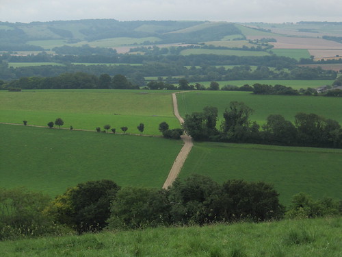
It was one of those close, steamy mornings when the chalk down country of Hampshire sits very still under a cap of grey vapour, the downs themselves muted into pale hummocks against a leached-out sky. First published in: The Times Click here to view a map for this walk in a new window

Facebook Link:
Someone was pruning a fruit tree behind one of Exton’s garden walls; the snip-snip of secateurs followed us out of the silent little village like the chipping of two flints.
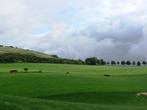
The South Downs Way took us gradually up between blackberry hedges towards the wooded promontory height of Beacon Hill, the chalk grassland of its steep flanks a pale washy green that suddenly shone a rich olive colour as the hidden sun lowered a beam through the murk. The clouds shredded like mist, exposing a painter’s palette sky of forget-me-not blue and mackerel streaks of black and silver. The Beacon itself, a stark iron cresset on a pole with a plaque commemorating the Diamond Jubilee, commanded a wonderful view east over the woods and fields of the Meon Valley.
A potholed country road squirmed along the ridge between the whaleback of Beacon Hill, a National Nature Reserve famous for its summer flowers and butterflies, and the open hull of the Punch Bowl, a steep and secluded dry chalk valley. Tarmac soon gave way to flint and clay in the green lane that carried us by the humps and bumps where the medieval village of Lomer once stood. The creation of fenced-off sheepwalks in Tudor times caused many a downland village to lose its corn-growing and cattle fields, and Lomer was probably one of these.
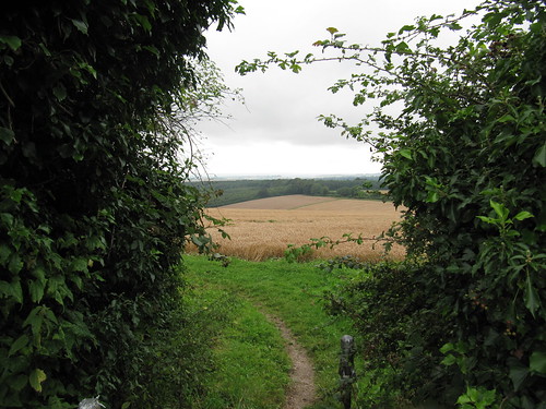
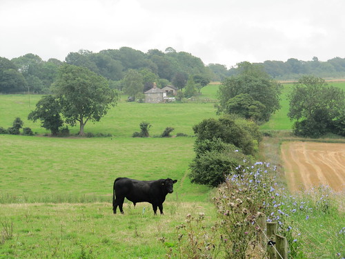
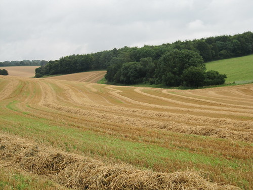
A big black bull stood in the field beyond Lomer Farm, staring into space and chewing on unfathomable thoughts. Along the shallow valley charmingly called Betty Mundy’s Bottom the stubbles ran in parallel zigs and zags. Pungent, lung-clearing wafts came from the freshly creosoted gates around Betty Mundy’s Cottage where, peering through the hedge, I glimpsed an enormous bronze horse’s head balanced delicately on its muzzle in the grass.
Further along, near St Clair’s Farm, we passed through a plantation of young Northdown Clawnuts, walnut trees not yet mature enough to produce the sweet-tasting nuts that grow twice the size of a conventional walnut. We put in a mental marker to come back in an autumn ten years from now, and bring a good-sized basket with us.
In Corhampton Forest two roe deer leaped before us across a clearing in three or four graceful bounds. We found a flinty lane and followed it past black sheep bleating at the foot of the Punch Bowl, through a quiet valley and back to Exton.
Start & finish: Exton village, Southampton, Hants SO32 3NT (OS ref SU 612208). NB Please don’t park in Shoe Inn’s tiny car park!
Getting there: Exton is signposted off A32 Fareham-Alton road at Meonstoke/Corhampton
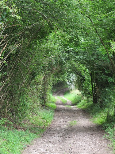
Walk (7 miles, moderate, OS Explorer 132): Leaving Shoe Inn, turn right to corner; right (‘South Downs Way’/SDW) past Exton House; in 200m, right (611209) along Church lane. In 100m, left (SDW); follow SDW across fields for nearly a mile to road (603220). Right (SDW) to junction (598226). Ahead and round sharp right bend; then left past entrance to Beacon Hill NNR (598227). Follow road for 250m; at right bend (597230) keep ahead along stony track. At Lomer Farm, left on SDW between buildings (591237); in100m, left (‘Wayfarer’s Walk’/WW). Pass ‘Footpath Only’ sign, and on. In ¼ mile, go through field entrance; left here (YA) down hedge, then right (586232) along bottom of field with Rabbit Copse on left. At end of field (583228), keep ahead up stony track (WW, YA). At T-junction, left (WW); in 100m, left over stile (WW); half-left across field to gate (580224, WW) and through shank of woodland. Right (WW) to go through gates; left to bottom of field; right (580222) along Betty Mundy’s Bottom. Pass Betty Mundy’s Cottage (578221) following WWs, and on along valley. In ⅓ mile at crossroads of tracks, turn left off WW up field edge (578214, YA). Ahead for 300m to cross Sailor’s Lane (582213); ahead into tunnel of trees of Corhampton Forest. In ½ mile path diverges to right (589210), but keep ahead up open slope. In 100m, left (‘Footpath’, YA); in 150m, right (591211, YA). In 500m cross Beacon Hill Lane (595209); ahead down stony lane into Exton. In ¾ mile at T-junction (608207), keep ahead; round left bend, and follow road to Shoe Inn.
Click on Facebook “Like” link to share this walk with Facebook friends.
Lunch: Shoe Inn (01489-877526; theshoeinn.moonfruit.com) – lovely riverside pub
More info: Alton TIC (01420-88448); visit-hampshire.co.uk
www.ramblers.org.uk www.satmap.com www.LogMyTrip.co.uk
Top walk – I used to live in the area and have walked the betty munday’s bottom part but from the west. Have also walked from exton to beacon hill this walk connects the two and should be very good. An alternative is exton to beacon hill and then loop east back over the mighty meon to old winchester hill (an iron age hill fort). Last time I went to the Shoe Inn it was trying to hard to be a restaurant rather than a great pub, but hopefully that has changed.