On a still morning of clearing skies over east Cumbria, the fields around Lupton lay quiet and green, soaked in overnight rain.First published in: The Times Click here to view a map for this walk in a new window


Facebook Link:
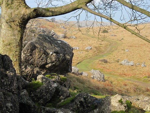
A shepherd was calling a high-pitched summons from Newbiggin Crags. We watched his flock with their nosebands of white wool scampering towards him up the dark gorsy flank of the big limestone hill that overlooks the valley.
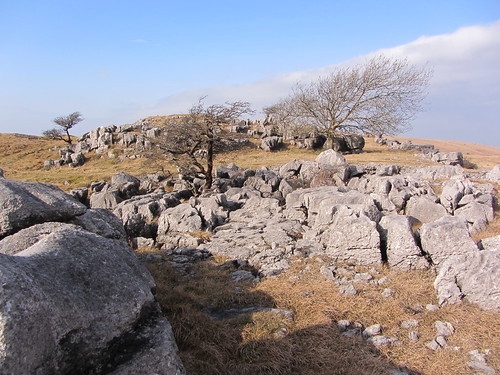
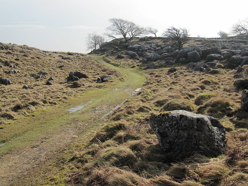
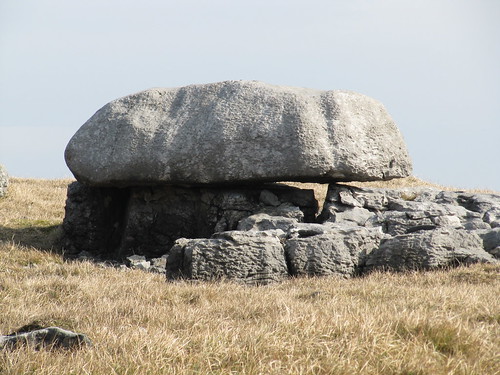
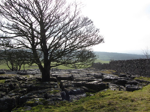
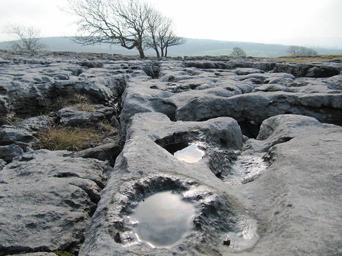
Beyond the chattering ford of Lupton Beck we climbed a steep track into the Access Land of Newbiggin Crags. The limestone pavement of this gently domed upland is cracked into deep grykes or channels, interspersed with naked clints of palely grey rock as rough to the touch as elephant hide. We followed an old quarry track up beside a stone wall with grand views spreading on all sides – north to the green shoulder of Scout Hill, west to Whitbarrow and the fells of south Lakeland, east towards the bulky hills of the north Pennines, and south-west to a gleam of Morecambe Bay with Black Combe hanging over it like a recumbent giant.
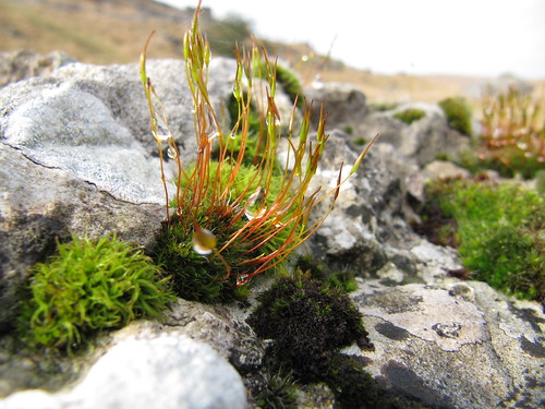
You’re a bit of a fool if you rush past a prospect like this. We sat to admire it under a misshapen holly in a rock garden of pin mosses and crusty, pale green lichens. Then we followed a flock of meadow pipits, swooping ahead with thin little squeaks, down into a broad, breezy upland of grass where a pair of shepherds fed their sheep as their dogs circled warily – a scene from the Hungarian plains rather than anything particularly English in character.
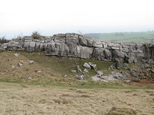
Newbiggin Crags form one of a pair of limestone domes. Hutton Roof Crags rise immediately to the south, a sprawling hill with a dwarf forest of juniper bushes clothing its northern flank. We pinched the hard green juniper berries as we climbed, but they were holding back their gin-and-tonic scent for a summer season.
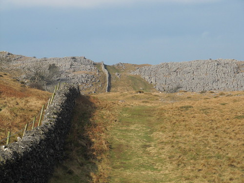
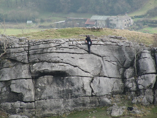
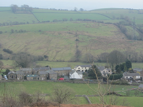
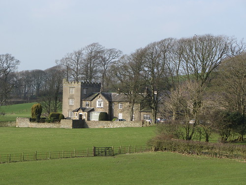
Two free-climbers were scaling the block-like cliffs of The Rakes as we went past and down through Blasterfoot Gap towards the neat grey line of Hutton Roof village. The homeward path led through a bluebell wood, past Pickle and Sealford farms, and back by square-built old Lupton Tower and across the Lupton Beck meadows, where tiny black-legged lambs in plastic thermal macs went tottering and bleating after their newly-delivered mothers.
START: Plough Inn, Lupton, Nr Kirkby Lonsdale LA6 1PJ (OS ref SD 554812)
GETTING THERE: M6, Jct 36; A65 towards Kirkby Lonsdale; Plough Inn on A65 in 1½ miles.
WALK (7 miles, moderate, OS Explorer OL7. NB: Detailed directions (highly recommended!), online maps, more walks: christophersomerville.co.uk):
From Plough Inn, right (Kirkby Lonsdale direction) for 50m; right (‘Lupton Beck’) down track to cross beck (552809). Stony lane to Puddlemire Lane (547809). Cross road; diagonally right up track by stone wall. In 150m, stony lane hairpins back to left from track (546809); climb steep path that bisects these two, to meet old quarry track (545809). Left for ½ mile to meet stone wall (548803); right uphill by wall for 300m to meet crossing wall; left through gate (546800). Follow grassy track south, then SW, keeping crags on your right, for ⅔ mile to meet wall again (548793). Bear left downhill with wall on right for ⅓ mile to meet Limestone Link (LL) footpath just before road, at gate on right (549789).
Left along LL to cross road (552789; ‘Hutton Roof’ fingerpost). Follow path (it diverges to right from LL) up over Hutton Roof Crags for 1¼ miles, descending Blasterfoot Crags to rejoin LL on outskirts of Hutton Roof village at crossing of tracks beside house marked ‘1874’ over the door (569784). Turn left uphill on LL, along wall past house. In 250m, right over stile (568785; yellow arrow/YA), through wood to lane by church (569788). Right to crossroads with road sign.
Through gate opposite; bear half left across field to Pickle farmhouse (571791). Left through gates (YAs); right along drive. Through gate by house, on over ladder stile (YA). Descend to Sealford Lane at Sealford Farm (573794). Over stile opposite (‘Lupton Bridge’ fingerpost; YA); bear left across field parallel to stream at bottom (crossing sheep wire halfway if in place). Keep curving left to cross stile by tree in far top corner of field (571798; YA). Cross next field, aiming for Badger Gate Farm; on by stiles and gates (YAs) to road by farm (565801). Right across bridge, follow road to Greenlane End. At sharp right bend (561806), left for 100m; right through stile (fingerpost) and follow YAs across fields to footbridge over Lupton Beck (552809). Right up lane to Plough Inn.
CONDITIONS: Paths can be muddy/slippery, especially on limestone pavement of crags.
REFRESHMENTS/ACCOMMODATION: Plough Inn, Lupton (01539-567700; theploughatlupton.co.uk) – comfortable, relaxed and welcoming.
INFORMATION: Kendal TIC (01539-735891); golakes.co.uk
www.ramblers.org.uk www.satmap.com www.LogMyTrip.co.uk