Setting out from Beaminster to climb Lewesdon Hill, the highest point in Dorset at 279 metres, is a baffling task. Which hill is which?First published in: The Times Click here to view a map for this walk in a new window


Facebook Link:
There are so many knolls, hillocks and knobbles in the billowing green countryside that enfolds snug little Beaminster. The Wessex Ridgeway Trail connects most of the best, though, and so we entrusted ourselves to its steep and muddy course.
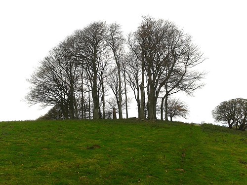
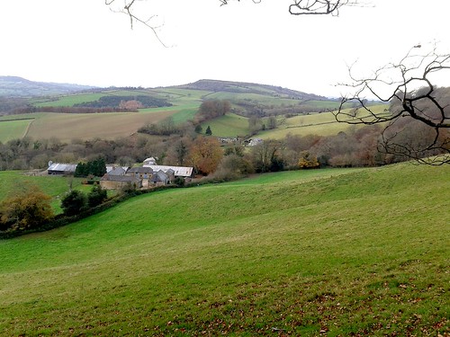
With the deliciously rich smell of decomposing beech leaves coming from underfoot, and a blowy sky of silver and blue-grey overhead, we climbed away west along the Wessex Ridgeway up the green tump of Gerrard’s Hill to the windwhistle spinney of storm-battered beeches at the summit. Chart Knolle farmhouse lay below, perfectly positioned and beautifully maintained on its saddle of ground between two deep valleys. Stoke Knapp’s farmhouse a little further on was a sad contrast, silent and empty at the roadside with windows blank and slates beginning to slip.
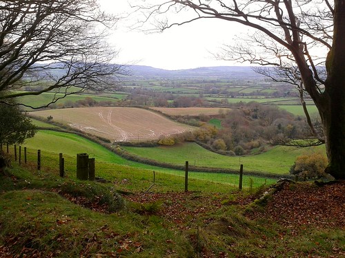
A green lane skirts the flank of Lewesdon Hill, rising gently and running between huge old beeches in mossy hedgebanks. From the lane we followed a leaf-smothered cartway up through the woods to Lewesdon’s top. Here we sat and gazed south to folded hills cradling a long slip of tarnished-silver sea. Iron Age folk ramparted Lewesdon’s summit, Romans fortified neighbouring Waddon Hill, and looking from the roof-tree of Dorset, the sense is of an ancient landscape with a history that any imaginative watcher could unfold.
A steep path brought us down from the peak of Lewesdon through the beechwoods, with glimpses between the silvery trunks out west to the top of Pilsdon Hill, flattened and spectacularly embanked by the Durotriges tribe more than 2,000 years ago.
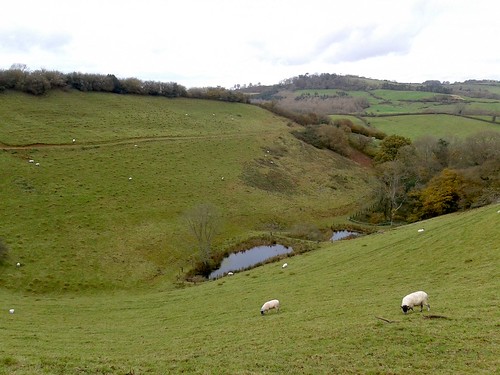
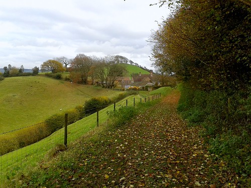
Stoke Abbot was a maze of dark gold hamstone houses under thatch. Beyond the village we took to the ancient green road of Long Barrow Lane, slanting down across the fields to a puzzle of paths in the boggy stream bottom of Little Giant Wood. Nearing Beaminster, we walked under an evening sky dramatically smeared with a fiery glow of scarlet and gold. As we came through a meadow I glanced up and saw a dozen horses blackly outlined on a ridge, grazing companionably in the last light of day – a sight essentially unchanged since the Durotriges rode this land.
Start: Beaminster Square, Dorset DT8 3AW (OS ref ST 481014)
Travel: Bus Service 47 (firstgroup.com), Bridport-Yeovil
Road: Beaminster is on A3066 between Crewkerne and Bridport
Walk: Down Church Street past Beaminster church (479013), on along Shorts Lane. In 400m cross lane end (475014); across next field to Stoke Road (473014); left, then right in 30m (fingerpost) along Halfacre Lane. In 100m, left (472014 ‘Wessex Ridgeway Trail’/WRT) through stile; half-right across field to barn (470014). Through gate; left (WRT) around field edge. Through gate (‘Beaminster Ramblers Millennium Walk’/BRMW); down through woodland (‘Chart Knolle’). Cross footbridge (467012; BRMW); steeply up to stile on skyline. On over stiles (WRT) to top of Gerrard’s Hill (460012).
Down to Chart Knolle farmhouse (456014); on west (‘Stoke Knapp’, WRT) through fields to Stoke Knapp farm (445015). Cross B3162 (fingerpost); on along Lewesdon Hill Lane (green lane). In 600m pass National Trust sign on left (439014); in another 250m, just before blue arrow, turn left (437014) past National Trust sign and information board up broad woodland track to Lewesdon Hill summit (438012). Follow track steeply downhill southwards off summit. In 600m it descends as a bridleway to T-junction of tracks; right to gate into roadway (437005). Left for 50m; right through gate (yellow arrow); half-left across 2 fields, then left to cross B3162 (440003).
Follow lane (‘New Inn’). At Brimley Cottage lane bends left (445003); keep right of cottage (fingerpost) down path and through gate (‘Jubilee Trail’/JT). Follow hedge on right for 200m; where it bends right towards a field gate (447003) keep ahead down slope, through kissing gate (448003, JT). Along boardwalk, through kissing gate (JT). Half left up field slope, passing to left side of house (449003). Cross 2 fields to sunken lane (451003), left to road, right into Stoke Abbott.
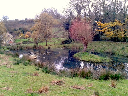
Follow road through village, past New Inn; in 100m, right (454008, fingerpost) along fenced path. Through gate (JT); on down slope. Left through gate (JT); cross stream; left along stream to recross it (JT). Bear left with stream on left, passing Horsehill Farm to descend and bear right through gateway (459005, JT). In 50m, left to cross stream (JT); follow path with stream on right to gate (JT); across field to shed where you cross farm track (463005). Ahead through wicket gate (JT); right along grassy Long Barrow Lane.
In 550m, dogleg left (466002, JT), then right in field (fingerpost). Descend to cross stream (469000). In 100m, DON’T turn right to cross another footbridge, but keep stream on right, bearing away from it half-left to gate from wood into field (470000, JT on reverse side). Half left across field to far top corner; cross stony lane (472001, JT) and next field. Through gate; left (473002, JT, blue arrow) along lane. In 350m, on through gate’ in another 100m, lane ends at gate (475006). Continue ahead (ignore lower path that forks right towards cottage). Cross field on upper path; through 2 gates in succession (477009). Follow fence to gate (479010, BRMW) and lane into Beaminster. At T-junction, right to town centre.
Walk: (7 miles, moderate, OS Explorer 116 – NB: Detailed directions (essential!), online map, more walks: christophersomerville.co.uk).
Church Street past Beaminster church (479013); Shorts Lane, then well-waymarked Wessex Ridgeway Trail and Beaminster Ramblers Millennium Walk west for 3 miles via Stoke Road (473014), Higher Barrowfield Farm (470014), Gerrard’s Hill (460012), Chart Knolle farmhouse (456014), Stoke Knapp farmhouse/B3162 (445015), and Lewesdon Hill Lane. At 2nd National Trust sign, left up track to Lewesdon Hill summit (438012). South for 600m to farm roadway (437005); field path to cross B3162 (440003). Follow waymarked Jubilee Trail for 3½ miles back to Beaminster via Brimley Cottage (445003), stream crossing (448003), road (451003) through Stoke Abbott. 100m past New Inn, right (454008, fingerpost); follow Jubilee Trail past Horsehill Farm (459005); on via Long Barrow Lane (463005-466002) and stream crossing (469000). Gate into field (470000); across field, lane (472001), field to lane (473002), left and follow JT to Beaminster.
NB: Mudproof and waterproof footwear!
Lunch: New Inn, Stoke Abbott (winter hours: closed Sunday evening, all Monday). Tel: 01308-868333
Accommodation: Bridge House Hotel, Beaminster DT8 3AY (01308-862200; bridge-house.co.uk)
Information: Bridport TIC (01308-424901)
www.ramblers.org.uk www.satmap.com www.LogMyTrip.co.uk
We’ve just walked your Beaminster and Lewesdon Hill walk which was great, though there are certainly some steep hills in that area! We got lost looking for Stoke Knapp Farm so will have to do it all again to try and find it. However we cut down past Chart Knolle Farmhouse and managed to find the New Inn in Stoke Abbott and pick up the rest of the walk. We have previously done some of your Kent walks and as frequent visitors to Dorset will now work through your Dorset suggestions. Thank you for providing us with a thoroughly enjoyable afternoon’s walking. Sarah and Mike Fletcher