Search Results : Aberdeenshire

Jul 012017


First published in: The Times Click here to view a map for this walk in a new window
picture picture picture picture picture picture picture picture picture picture picture picture picture picture picture
Facebook Link:

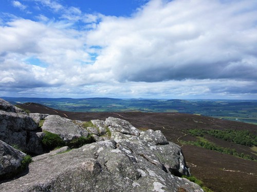
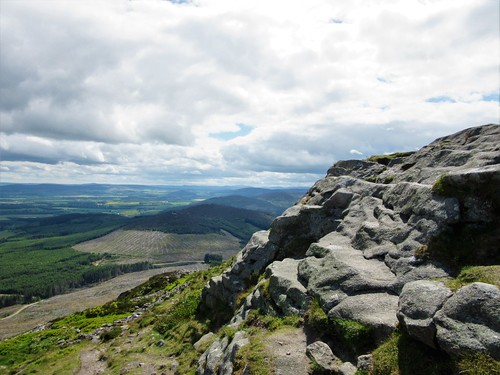
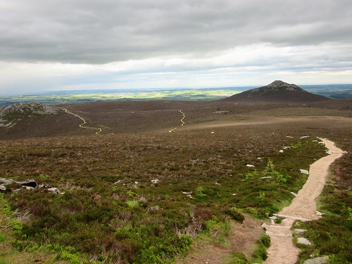
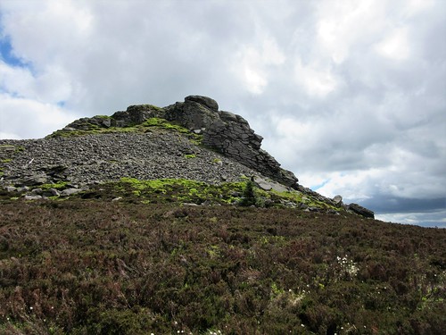
Mither Tap draws the eye for many miles around. The 1,700-ft peak with its steep flanks and bare granite crown rises high over the low-rolling landscape inland of Aberdeen. It isn’t the highest point of its parent ridge of Bennachie – that honour belongs to the dome of Oxen Craig, a mile to the west and ten metres taller. But it’s the distinctive shape of Mither Tap which entices ramblers to walk the hilly circuit connecting these twin peaks.

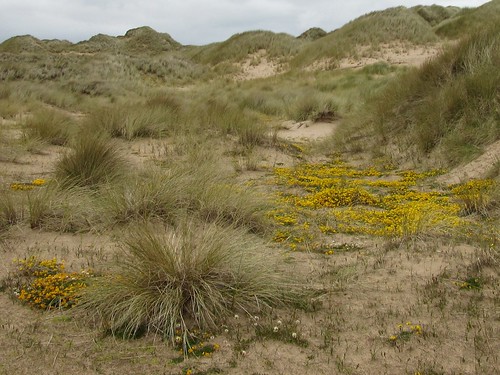
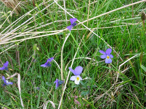
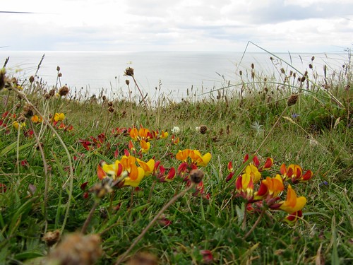
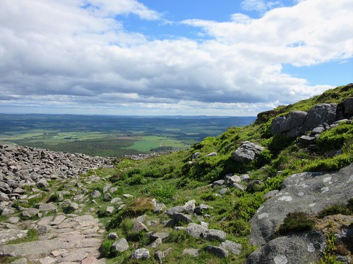
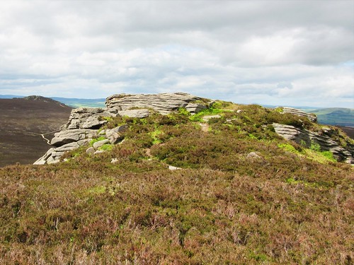
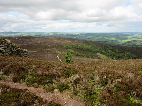
We started up the forest path from Back o’ Bennachie on a breezy afternoon, and were soon up above the pines and mossy gullies. The tor-like peak of Craigshannoch, the Hill of the Foxes, rose on the skyline, its back against rushing grey clouds. A path of crunchy granite led up to the top of Oxen Craig through heather, bilberry and starry white flowers of chickweed wintergreen.

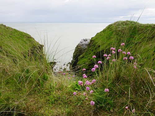
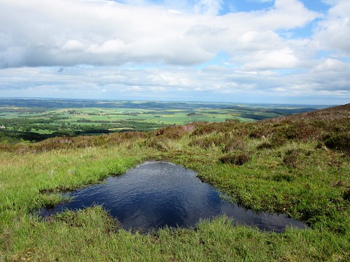
There was ominous howling from the stone shelter at the summit. It came from two dogs trying to blackmail biscuits from the picnickers there. The view encompassed at least 100 miles, from far out across the North Sea in the east to Lochnagar standing tall in the Cairngorm range, and the flanks of Cairngorm mountain itself, blurred and gleaming with snow some seventy miles to the west.

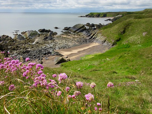
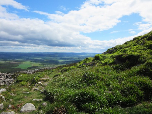
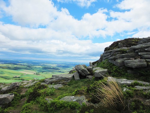
From Oxen Craig we turned eastward across the heathery ridge of Bennachie. Mountain hares feasting on young heather shoots had left round balls of dung among the bilberries, and foxes feasting on mountain hares had added their own pointed billets. The square grey crown of Mither Tap sank out of sight below the skyline, then rose dramatically as we drew near.

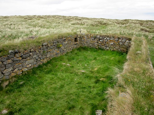
Just below the peak we found the tumbled walls of a Pictish fort 2,500 years old. Looking back to the slopes of Oxen Craig, we pictured the mighty force of 30,000 ‘Caledonians’ who opposed a Roman army of similar size at the Battle of Mons Graupius in 83AD. The Caledonians had the high ground – but the Romans wiped the floor with them, slaughtering one in three.

The north-west wind soon blasted us off the peak of Mither Tap. We followed the homeward path to the tors that crown Craigshannoch, and dropped down through Bennachie forest with ravens riding the wind above us like a cohort of ragged black witches.

Start: Back o’ Bennachie car park, near Pitcaple, Inverurie, Aberdeenshire AB52 6RH approx (OS ref NJ 662246)

Getting there: A96 from Inverurie towards Huntly; in 6 miles, left at Bridge of Carden on B9002. Half a mile beyond Oyne, left (‘Back o’ Bennachie’) to car park.

Walk (6 miles, strenuous, OS Explorer 421): From pay machine furthest from road, follow ‘Mither Tap Quarry Trail/MTQT’ signs south on steepening path. Follow MTQT for 3 miles via Little Oxen Craig (663232) and Oxen Craig (663227). Approaching Mither Tap, just beyond ‘Mither Tap’ sign immediately below crags, fork left (682224) and follow path clockwise to summit. Return through fort gateway to path junction (683225). Follow ‘Bennachie Rowan Tree’/BRT, ahead. In ½ a mile, in a hollow, left off BRT path (681231, ‘Craigshannoch’) uphill. Pass cairn on right; at next T-junction, right (MTQT, ‘Back o’ Bennachie’/BB). In 350m, fork right to summit of Craigshannoch (672232). Return to main route, turn right and follow MTQT, then BB, back to car park.

Lunch: Picnic

Accommodation: Meldrum House Hotel, Oldmeldrum AB51 0EA (01651-872294, meldrumhouse.com) – large, comfortable country house hotel.

Info: Bennachie Centre, Chapel of Garioch, Inverurie AB51 5HX (01467-681470, bennachievisitorcentre.org.uk); bailiesofbennachie.co.uk

visitaberdeen.com; satmap.com, visitscotland.com

The January Man – A Year of Walking Britain by Christopher Somerville (Doubleday, £14.99).

 Posted by at 01:27
Jul 162016


First published in: The Times Click here to view a map for this walk in a new window
picture picture picture picture picture picture picture picture picture picture picture picture picture picture picture picture picture picture picture picture picture picture picture picture
Facebook Link:

Forvie National Nature Reserve lies on the Scottish coast north of Aberdeen. This spectacular reserve contains nearly two thousand acres of sandy beaches, open moorland, estuarine mudflats and a great wilderness of ancient green sandhills that stretch away south from the Visitor Centre at Collieston.

On a brisk, windy day with a cloudy sky hurrying rain showers out to sea, the dunes looked dun and drab as we followed the coast path among their shaggy camel humps. But that first dull impression gave way to astonishment at the richness of their flora – spatters of white heath bedstraw, stout northern marsh orchids with richly purple flower heads, pink streamers of ragged robin, wild pansies with lower lips of cream and yellow. Lichens, mosses and heather combined to lay a subtly-coloured foundation for these floral glories of the sandhills.

At North Broad Haven a sour fishy whiff heralded a teeming colony of kittiwakes. We lay on the cliff edge above a guano-whitened sea stack where a row of cormorants sat on a line of untidy nests. The nestlings craned their heads up to rub the throats of their parents, stimulating them to regurgitate the fish they’d brought back in their crops.

Down on the beach at Rockend we strode south on firm sand to the boundary of the ternery. Here sandwich, common and little terns have their summer breeding ground; and once we had crossed the dunes and were perched looking down on the Ythan Estuary, we could see them lined up head to wind in hundreds on the mud flats. Beside our homeward path along the river a great congregation of eider ducks lay moulting, the males with green neck flashes and black toupés with centre-partings like 1920s cabaret cads.

Eiders flock to Forvie in their thousands in spring to nest on the moors behind the dunes. These handsome, bulky birds gobble the estuary’s mussels whole, grinding them small in their gizzards. Forvie NNR offers the eider a place of safety, as it does the terns, the wild flowers and the dunes that have been growing and shifting along this coast since Stone Age man came hunting here.

Start: Forvie NNR Visitor Centre, Collieston AB41 8RU (OS ref NK 034289)

Getting there: Bus 63 (Aberdeen-Peterhead) to Collieston Cross (1½ miles).
Road: Forvie NNR is signed off B9003 Collieston road (from A975 between Newburgh and Cruden Bay).

Walk (8½ miles, easy, OS Explorer 421. Online maps, more walks at christophersomerville.co.uk): From Visitor Centre follow ‘To The Reserve.’ Through gate; turn left along gravel track towards line of cottages (Red Route or Heath Trail, with occasional waymark posts). Along right side of Sand Loch to coast (036281); right along dune path above sea. In 1½ miles, descend to beach at Rockend (023265). Continue along beach for ¾ of a mile to rope barrier at ternery (014253). Turn right into dunes past tern sign on pole; follow Dune Trail to Ythan Estuary (009254). Right up estuary path for 1 mile. Opposite info shelter, turn right (005269). Follow Dune Trail posts for 1 mile to Forvie Kirk ruin (021266); then follow ‘Hackley Bay’ to coast (023265). Left up coast for 1¼ miles. At Red Route post (033276), left inland on Heath Trail. At marker post at far side of small loch, don’t turn right; keep ahead. At ‘Shortcut’ post bear left; at next post, fork left (032284) to return to Visitor Centre.

Lunch: Picnic

Accommodation: Thistle Aberdeen Airport, AB21 0AF (01224-725252; thistle.com)

Forvie NNR: Visitor Centre, 01358-751330, nnr-scotland.org.uk

visitscotland.com; satmap.com; visitaberdeen.com

 Posted by at 01:39