Search Results : Bristol

Walks near Bristol


Chapter 17. Wallasea Island, Essex (extract)


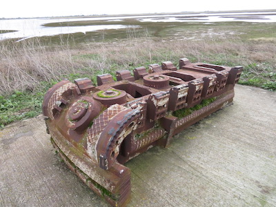
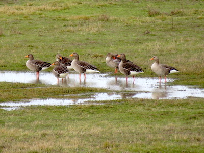
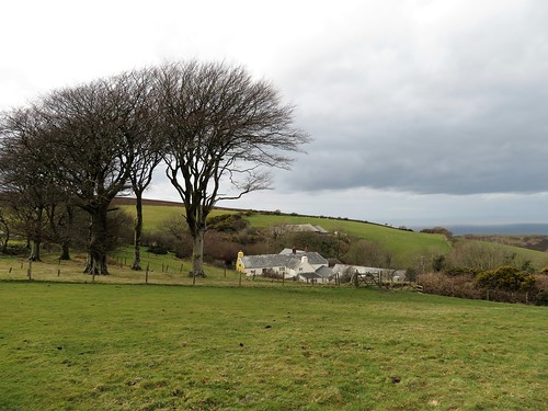
(a) Cutting head of Crossrail tunnel boring machine         (b) Greylag geese on Wallasea’s new grazing marshes

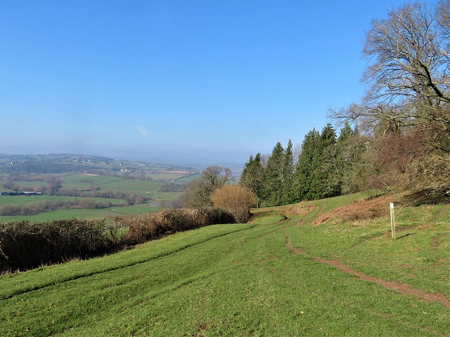
When I first ventured to Wallasea Island in the 1980s, it was a dead flat, dead green crop factory in a remote corner of the Essex coast. The one public footpath petered out halfway round the crumbling sea wall of the island, and there was no particular welcome for wildlife or the walker. Then lonely Wallasea was chosen by DEFRA, the Department for Environment, Food & Rural Affairs, for the innovative experiment of ‘managed realignment’ – in other words, breaking the walls to let in the sea, an attempt to work with natural forces rather than continue with the futile policy of trying to outface them. Between 2007 and 2015 Wallasea saw the arrival of three million tons of ‘arisings’ or spoil, excavated during the building of tunnels and ventilation shafts for the Crossrail rapid transit railway across London. The spoil was loaded into dumper trucks and carted off to form the islets, banks and foundations of Jubilee Marsh, and to reinvent the cornfields as saline lagoons with their own creeks and grazing marshes.

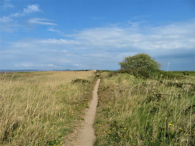
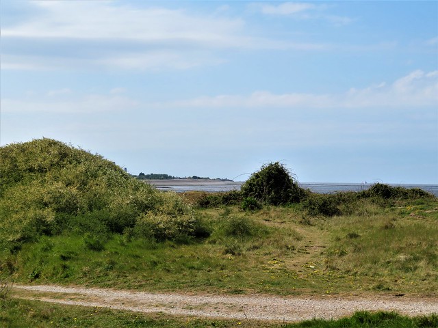
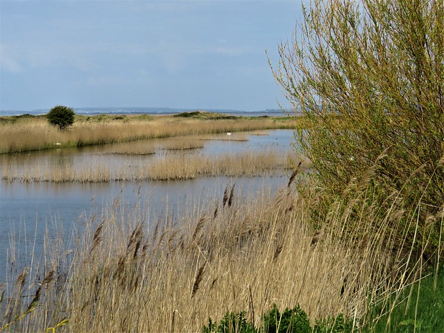
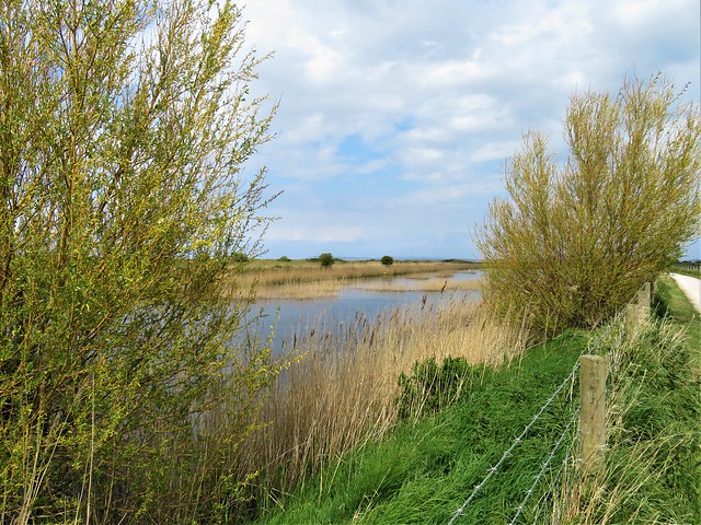
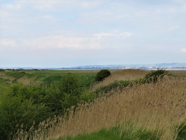
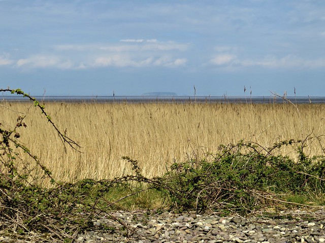
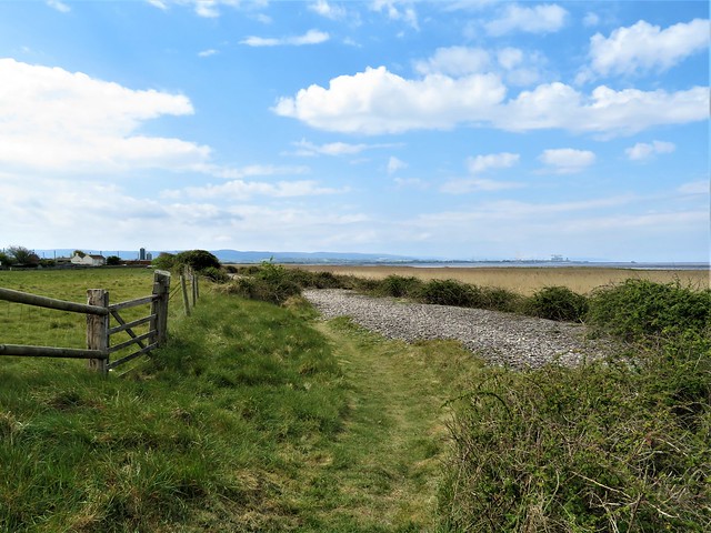
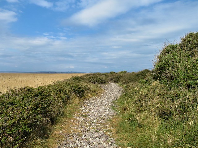
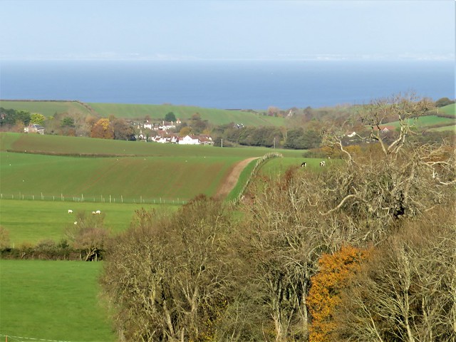
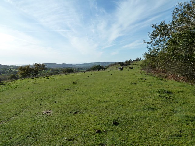
Looking from the new sea wall today, I really could not believe it was the same place. Where were the wall-to-wall fields of corn and beans? Staring south across the island, I saw the whole regimented prairie had gone. In its place lay pools and lagoons, coarse grasslands and marshes, as far as I could see. And on this bitter winter day the island was alive with the movements and noises of birds. Curlews bubbled, oystercatchers piped, pik-pik! Redshank and shelduck patrolled the shore. Brent geese with white rumps and black heads came in to land on the grass with hoarse hound-like yelping, their wings held stiffly up and behind them at the moment of landing.

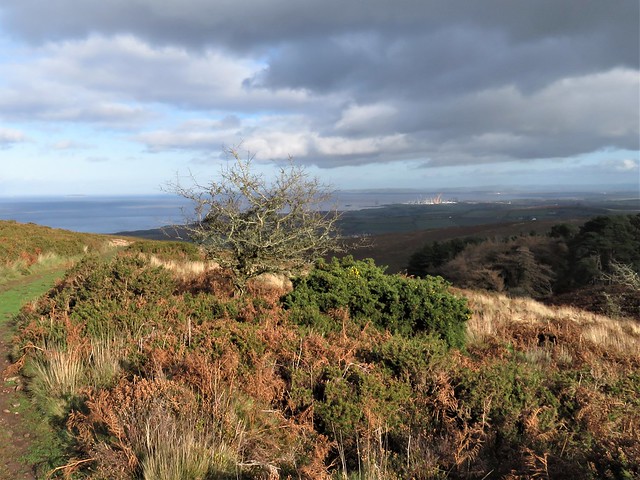
… Over on Foulness Island someone had lit a monstrous fire. Black smoke rose from a red glowing point and billowed into the sky. 
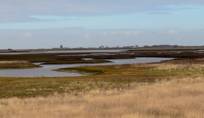
The volcanic look of the fire sent me back through the bones of Britain, back up the long road past the glittering city and the gently settling chalk, the Great Dying and the miracle of life on land and in the sea, past gritstone and limestone, coal and shale and the metamorphic mountains, all the way back to the fire and fury at the beginning of the world. There was a tingle in my feet and my head seemed full to bursting. What a hell of a journey I’d been on.
                                                                                            (c) Jubilee Marsh, Wallasea – created in 2015

 Posted by at 22:25
Jul 142008
 

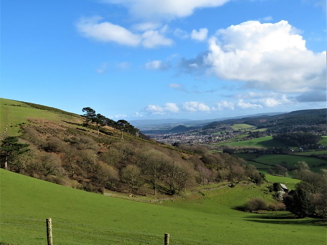
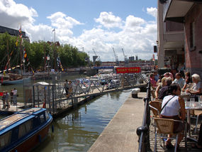
MY WIFE Jane and I have lived in Bristol for 20 years. We’ve made a home, raised four children and forged good friendships here. But we’d never actually stepped back and had an appreciative look at the city.

Bristol is not just the vibrant capital of the West Country, and it’s not simply a handsome old city with a salty, seafaring history. It’s the sort of place you land in as a youngster, to go to college or take up that first job, and then somehow never leave.

The heart and soul of Bristol is the magnificent Floating Harbour, a sinuous stretch of water lined with ships and waterfront bars at the core of the city, and that’s where we decided to base ourselves for our non-travel mini-break.

MORNING EXCURSION

On a brisk but sunny morning we hopped aboard one of the Floating Harbour’s busy water taxis (0117 927 3416/www.bristolferry.com) that buzz between a dozen embarkation points along the city’s waterfront.

As the boat plied the water between old warehouses and eyecatching new apartments, the fascinating history of Bristol – merchant harbour, slaving port, transatlantic money market, wartime target and revitalised leisure waterfront – passed before us like a living pageant.

Up on the cobbled quay of Welsh Back we headed off to explore St Nicholas Market – a charming scramble of wooden kiosks and booths selling everything from second-hand books and bike tyres to Bristol Blue Glass and ancient Dinky toys, all under a classic glass roof on elaborate Corinthian pillars.

GRAB A BITE

I could have fossicked in St Nick’s Market all day, nibbling Smokey Joe pies from Pieminster’s stall, but Jane had other ideas for lunch – namely a glass of sancerre and a bowl of hot and piquant fish soup at the River Station (0117 914 4434/www.riverstation.co.uk) on The Grove.

This former river police station with its picture windows and cool but friendly service is a firm favourite with Bristolian lunchers à deux. We got a table looking out over the Floating Harbour, and watched the gulls drift by for a blissful hour.

AFTERNOON ATTRACTION

In the city forever associated with the greatest of all Victorian engineers, Isambard Kingdom Brunel, it would be sacrilege not to pay a call to SS Great Britain (0117 926 0680/www.ssgreatbritain.org) the iron-hulled ship that lies in the very dock from which she was launched in 1843.

Jane and I had visited the ship before, but not since her great overhaul. You can hire her saloon for a private wedding feast or join historical tours of the ship. Better still, simply wander at will; from grand saloon to engine room, from first-class cabins to steerage passenger hellholes.

It has also been fitted out with life-size waxworks of crew. Admission: £10.95 adults, £5.65 children.

SUNDOWNER

Back on the Floating Harbour we made time for a quick pint outside the Cottage Inn (0117 921 5256). Why hadn’t we ever visited this friendly watering hole on Baltic Wharf, with its Bristol-brewed beers and views of scudding dinghies? Never mind – we were on to it now and would return.

DINNER DATE

We might have chosen any one of dozens of excellent eateries in the city. But one glance into the Bistro restaurant of our night’s stopover, the Hotel Du Vin on Narrow Lewins Mead, and we agreed we could hardly do better anywhere else.

The subtly lit room looked rosy and intimate; lamplight glowed on musky walls and regiments of old green and brown bottles stood cheerfully guard on sills. Jane’s haddock was a smoky dream, she reported; my pink-roast duck ditto.
Room for spiced plums or some of that homemade coconut ice cream? Yes, but no time if we wanted to catch some music.

ON THE TOWN

We hared over to the Old Duke (0117 927 7137/www.theoldduke.com) on the cobbles of Welsh Back for a drop of “filthy jazz”, courtesy of Cass Caswell and his almighty Allstars. Through Dixieland to bebop, Mr Caswell and chums drove our head-pumping crowd, a sweaty and steamy triumph of music over elbow-room.

The Old Duke is a seven-nights-a-week, cheek-by-jowl jazzer’s paradise where blues and rock are also smuggled in from time to time.

SLEEP EASY

It felt strange to be staying in a hotel only 10 minutes’ walk from our house. Bristol’s Hotel Du Vin is a highly imaginative conversion of an 18th-century sugar refinery and you just couldn’t ask for a friendlier stopover.

A home from home, in fact – if our home happened to have a 7ft-wide bed, a bath big enough to accommodate three close friends, and cheery faces saying “Certainly!” to every request.

Proper job, as they say down here.

INFORMATION: Hotel Du Vin, The Sugar House, Narrow Lewins Mead (0117 925 5577/www.hotelduvin.com) offers
doubles from £140 per night (two sharing), room only. Bristol Tourist Information Centre: 0906 711 2191/www.visitbristol.co.uk


 Posted by at 00:00
Apr 202024


First published in: The Times Click here to view a map for this walk in a new window
Sand dune path, Merthyr-Mawr 2 Ogmore River 1 Portobello House by the Ogmore River Sand dune path, Merthyr-Mawr 3 Sand dune path, Merthyr-Mawr 4 Sand dune path, Merthyr-Mawr 1 Sand dune path, Merthyr-Mawr 5

A hazy, breezy day on the Glamorgan Coast, and a Sunday buzz in the car park at Candleston Castle.

Merthyr-Mawr National Nature Reserve lies at the mouth of the Ogmore River. It boasts the tallest dunes in Wales, a great spread of sandhills that covers 840 acres of coast. The dunes sit on top of a shelf of limestone, hence their great height and also their remarkable fertility. Here you can find a dozen species of orchid, rare liverworts in damp patches, and delicately beautiful dune pansies from spring into autumn.

We climbed a slope of naked sand speckled with fragments of shell, past deep valleys dotted with sulphur-yellow hawkbit and bushy hollows where strawberry flowers spattered white across the mossy turf.

Down beside the ebbing Ogmore River, a flat littoral of saltmarsh lay strewn with the whitened trunks of trees washed out of the river banks in winter floods. We climbed a dune through scratchy marram grass to where the seaward view opened – galloping horses on the wide beach, and the pale rise of the Exmoor hills far across the grey-green Bristol Channel.

Between a shingle bar and the sandhills someone had built a charming little hut into a dune, its driftwood roof and carefully laid stone walls so seductive to the inner child that we were sorely tempted to play houses there all afternoon.

Soon the path ran up into the dunes again, crossing swards of violets and tiny pink cranesbills. We stopped to listen to an invisible bird singing with a silvery little trill, then headed east on sandy paths through an enchanting coppice of wind-stunted hazel where bluebells and wood anemones splashed the undergrowth with colour.

Late afternoon sunshine lay on distant hills, inland and across the sea. Our homeward path lay along a rubbly lane where an ivied angle of stone wall was all that remained of Candleston Castle, a fortified house 700 years old. Most of the strongholds along this coast were buried or choked out of existence by catastrophic sandstorms late in the 14th century – but Candleston on its limestone ledge had been built just high enough to escape that deadly tsunami of sand.

How hard is it? 5 miles; easy; sand dunes, beach and woodland paths.

Start: Candleston Castle car park, near Bridgend CF32 0LR (OS ref SS 872771) – 
£5 all day.

Getting there: Merthyr-Mawr signposted from A48 Bypass Road between Bridgend and Porthcawl. In ½ mile dogleg right/left; follow road to car park at end.

Walk (OS Explorer 151): With your back to road, take downhill path (red, yellow arrows); cross stream; ahead up dune slope. At prominent tree stump bear left. In hollow, pass blue arrow, ‘To The Beach’. When you reach a fence, follow it to go through gate. With fence on right, head for beach. Right along beach for ¾ mile. Opposite Black Rocks, Wales Coast Path/WCP sign points to dune path along fence (855767). In 200m fence bends inland, but keep ahead here. In 250m, at 2nd WCP post beyond fence, turn right inland (850770) on wide sandy track. Follow path inland for 400m to junction (851774); right on broad path. At fork, left (post with both waymarks missing); follow path for 1 mile, passing four gates with ‘Newton & Candleston Circular Walk’ signs. At stone wall, right on farm road (866778). In ⅓ mile drive bends left, then right to Candleston Farm. Hairpin right here (870779) down stony lane for ½ mile to car park.

Lunch: Picnic

Accommodation: Ewenny Farm Guesthouse, St Brides Road, Bridgend CF35 5AX (01656-658438, ewennyfarmguesthouse.co.uk)

Info: visitwales.com; first-nature.com/waleswildlife

 Posted by at 04:45
Apr 092022


First published in: The Times Click here to view a map for this walk in a new window
shore path to Steart Point scrub full of birdsong coastal reedbeds 1 coastal reedbeds 2 brackish water-crowfoot view across the reedbeds to the Severn Estuary signpost at the Tower Hide Tower Hide at Steart Point Tower Hide at Steart Point 2 coastal scrub and reedbeds, looking to Mendip Hills misty shape of Steep Holm island in mid-estuary looking west along the coastal path from Steart Point coastal path towards Steart Point

Where the Severn Estuary merges with the Bristol Channel is a moot point, but the tidal water is always full of energy, swirling in purple and chocolate at high tide, then retreating with the ebb to expose vast sand and mud flats.

Off Steart Point the turbid River Parrett enters the tideway. At low tide the mud flats here stretch two miles out into the estuary, a haven for feeding birds. But flood tides are another story. The mud and sand are swallowed up, the Bristol Channel brims, and inundation can threaten the farmland and small settlements along the coast and far inland.

We set off at low tide along the coast path from the scattered hamlet of Steart. The dimpled miles of mud flats gleamed. The distant island of Steep Holm appeared marooned in mud and sand. In the southwest the Quantock Hills stood beyond the giant cranescape of half-finished Hinkley Point nuclear power station, while in the east rose the green whaleback of Brent Knoll and the long spine of the Mendip Hills.

The shoreline path ran on rabbit-riddled sands, turf and crunchy pebbles. A pale yellow bloom on one of the coastal fields turned out to be a solid mass of cowslips. Wild birds were everywhere – greenfinches and linnets on the bramble stems, shelduck assiduously hoovering the mud for crustaceans with sideways sweeps of their bright red bills, and a reed warbler complaining with unending chittering in the reedbeds.

At Steart Point a tall hide looked out across this remote landscape of flat fields, far hills, upstart knolls and tidal flats. From here the River Parrett Trail led back inland, the mud-slimed banks of the Parrett shining silver in the sun and wind. Here the Wildfowl & Wetland Trust had been working with Environment Agency to create anti-flooding buffer zones with flood banks built to encourage new saltmarsh to grow to the seaward – a bold initiative that works with nature rather than trying to strongarm it into submission.

We followed the trail down to where a breach has been cut in the Parrett’s defences. New mud, marsh, reedbeds and creeks show the effectiveness of the work. Pochard cruised a big pool where three herons stood on one leg apiece and regarded us with grave suspicion.

A grassy path led back to the shore. The morning mist shredded away to reveal the hills of South Wales far across the rising tide, and a flight of golden plover flickered low over the rapidly vanishing mudflats where the Parrett met the sea.
How hard is it? 6 miles; easy; shore paths

Start: Steart car park, Steart, Bridgwater TA5 2PX (OS ref ST 276459)

Getting there: A39 (Bridgwater-Minehead); at Cannington, right (‘Hinkley Point’, then ‘Steart Marsh’). Pass Steart church; car park in 500m on left (gate).

Walk (OS Explorer 140): From car park follow green lane north to sea wall (274460). Right (‘Steart Point’) for ⅔ mile. At Steart Point, right past tall hide (283467); right (‘Wall Common’). In 150m, left (kissing gate/KG); follow River Parrett Trail/RPT. In 700m at Manor Farm, ahead along road (278462); by Dowells Farm, left (276458, KG, RPT) to river wall; left to breach and hide (280454). Return to KG; dogleg left/right along river wall (‘Steart Gate, Polden Hide’), following RPT. Pass turning to Steart Gate car park (267454); in ½ mile, signpost ‘Polden Hide 0.71’ points left (261449), but keep ahead to cross road. On between 2 marker stones on grassy path to shore (254451); right (‘Steart’) to car park.

Lunch: Picnic

Accommodation: Malt Shovel Inn, Cannington TA5 2NE (01278-653880, themaltshovelinn.com)

Info: wwt.org.uk/steart-marshes (01278-651090)

 Posted by at 01:01
Dec 252021


First published in: The Times Click here to view a map for this walk in a new window
view above Wydon Farm view from Selworthy towards Exmoor view from Selworthy towards Exmoor 2 gorse by the moor track above Selworthy Combe trig pillar and cairn on Selworthy Beacon cairn on Selworthy Beacon 1 cairn on Selworthy Beacon 2 looking seaward from Selworthy Beacon easterly view from the South West Coast Path easterly view from the South West Coast Path 2 path near Wydon Farm homeward path maize mud moor pony homeward path towards Selworthy

Above the thatched cottages of Selworthy, the whitewashed tower of All Saints Church looked out across a wide green valley to the high undulating skyline of the Exmoor hills. A perfect view for a perfect winter’s day of blue sky and brisk wind.

A buzz like that of an angry wasp showed where someone was busy cutting wood in Selworthy Combe. The path rose through the trees between banks of tiny trumpet-shaped mosses. A robin perched on a post, puffing out his red breast and trilling a silvery call, quite unafraid as we passed within touching distance.

A brook came rustling down over neat little log spillways, its soft rich chuckle accompanying us all the way up through the oak and holly groves to the moor above. A contrast as abrupt as a knife cut, abandoning the shelter of the woods for the open moor where a biting wind ruffled the seas of heather and gorse running away to the horizon.

The National Trust and Holnicote Estate take great care and trouble over these 12,000 acres of upland, moor and combes. The woods are sensitively managed, the farms well run, and the hundreds of miles of footpath properly signposted.

We followed a broad bridleway through the gorse to the cairn on Selworthy Beacon. From here the view was mighty, over the rolling Exmoor hills, east and west along the curved cliffs of the Somerset coast, and out north across a Bristol Channel as pale as ice to the misty shores of South Wales under a long triple bar of cloud.

Above us only sky, as blue as delicate porcelain. We skirted a harras of Exmoor ponies, long tails billowing in the wind, and struck east along the South West Coast Path with the sea at our left elbow. A long cattle train of belted Galloway heifers went gadding and lurching along the skyline at a clumsy canter, delighted to be out in the open air.

The coast path led between sheep pastures through wind-stunted gorse bushes as stout as trees. A solitary bee buzzed among the gold gorse flowers, first raider of the year.

We turned inland and dropped down to Wydon Farm, hidden in a cleft so steep that, like Lucy in ‘The Tale of Mrs Tiggy Winkle,’ it looked ‘as though we could have dropped a pebble down the chimney.’

The homeward path lay along high-banked farm lanes. Tiny lambs bleated in quavering voices for their mothers, and a little egret stepped fastidiously along a streamlet, searching with gimlet eyes for any morsel to assuage its winter hunger.

How hard is it? 5½ miles; moderate hill walk, very well waymarked

Start: All Saints Church car park (£1 donation), Selworthy, Minehead, Somerset TA24 8TR (OS ref SS 920468)

Getting there: Selworthy is signed off A39 (Minehead to Porlock)

Walk (OS Explorer OL9): Left along road; right by church and follow ‘Selworthy Beacon’ fingerposts for 1 mile to Selworthy Beacon (919480). At cairn/trig pillar, left for 100m; right down to South West Coast Path (917481). Right along SWCP; in 1½ miles, right (938476, ‘Wydon ½’ fingerpost). In ½ mile at Wydon Farm, right (938470) on road. In 400m fork right (939466, ‘Hindon’). At Hindon Farm, left (933466) up track to road (931464). Ahead; in 300m, right (932461, ‘Selworthy Beacon’). At East Lynch Farm fork right (929462, ‘bridleway’). In 100m fork right again; in 50m, left (927463, stile, ‘public footpath’). Along fence to stile (935464); half right to road (923466); left into Selworthy.

Lunch/accommodation: Ship Inn, Porlock TA24 8QD (01643-862507, shipinnporlock.co.uk)

Info: nationaltrust.org/selworthy

 Posted by at 01:57

News


Christopher’s new book ‘The View from the Hill – four seasons in a walker’s Britain’ (Haus Publishing) is out now! Upcoming talks so far:Picture of CS and book cover

21 Oct, 7pm – Waterstones Cirencester, live
www.waterstones.com/events/christopher-somerville-returns-to-cirencester/cirencester

19 Nov, 7pm – The Collection theatre, Lincoln, live www.thecollectionmuseum.com/exhibitions-and-events/view/author-event-christopher-somerville-talk-signing

23 Nov, 6.30pm – Waterstones, Clifton, Bristol, live – tel 0117-363-4087, https://www.waterstones.com/bookshops/waterstones-clifton, email:Clifton@Waterstones.com

10 Dec, 12pm – National Army Museum, Chelsea – ‘Our War’, the remarkable personal stories of British Commonwealth volunteers in the Second World War, live tickets.nam.ac.uk/listprices.php?performanceId=413:11445

22 Feb, 7pm – Portsmouth LitFest by Zoom @PompeyBookFest

17 March, 7pm – Runnymede LitFest by Zoom

Last week in May – Derby LitFest, live www.derbybookfestival.co.uk

Click here to go to my Facebook page

 Posted by at 15:36
Dec 192020


First published in: The Times Click here to view a map for this walk in a new window
picture picture picture picture picture picture picture picture picture picture
Facebook Link:

One dark night long ago the huntsman at Alfoxton Manor was eaten by his own hounds, so says the tale. He got up from his bed to quell a dogfight in the kennels, and they didn’t recognise him in his nightshirt.

Setting off from Holford on a glorious winter day of blue sky above the Quantock Hills, we stopped to admire the old dog pound beside the path to Alfoxton. What a pity those hungry hounds hadn’t been safely penned up behind its stout stone walls.

William and Dorothy Wordsworth came to roost at Alfoxton (then ‘Alfoxden’) in the summer of 1797. Nearby lived their new best friend, Samuel Taylor Coleridge.
We passed the manor house, solid and white among beautiful beech and oak woods. Coleridge and the Wordsworths walked daily over the hills and through the deep wooded combes of Quantock, ‘three people, but one soul’, as Coleridge put it. Rumours spread that the three strangers were spies for Napoleon, and the Wordsworths had to leave their Eden in the Quantocks, never to return.

Along the drive missel thrushes with spotted throats were busy raiding the cherry trees whose scarlet fruits dangled at the end of long stalks. The birds darted from tree to tree with their characteristic muscular wing thrusts and direct, purposeful flight.

Red deer hinds went trotting springily across the paddocks among the horses. The Quantock Greenway path wound at the foot of the hills, with breathtaking views opening northwards over the Bristol Channel, its tides stained a milky mulberry hue by the mud of many estuaries. As we gained height we made out the upturned hull shape of Steep Holm island, the white lighthouse on neighbouring Flat Holm, the long spine of Mendip running inland, the far coast of Wales in a blur of distance – and on the shore below, the giant’s geometry set of Hinkley Point C nuclear power station, still laboriously a-building.

Up on the top the wind blew cold. We followed wide grassy bridleways where hill ponies with ground-sweeping tails cropped the verges. A fantastically exhilarating ramble, east along the ancient green trackway evocatively titled The Great Road, then slanting steeply down to join the homeward path in the depths of Hodder’s Combe with its skein of rustling brooks and springs.

‘Upon smooth Quantock’s airy ridge we roved
Unchecked, or loitered ’mid her sylvan coombs*.’
*Wordsworth’s spelling.

That’s how Wordsworth remembered those happy Quantock days in ‘The Prelude’, and it neatly summed up our day, too.
How hard is it? 6 miles; moderate, some short climbs; moorland and valley tracks, some muddy; streams to ford
Start: Holford Bowling Green car park, Holford, Bridgwater TA5 1SA (OS ref ST 154410)
Getting there: At Holford (A39, Bridgwater-Minehead) follow lane by Plough Inn (brown sign ‘Combe House Hotel’) to car park.

Walk: Left along valley road. Follow ‘Quantock Greenway’/QG (green arrows), and ‘Coleridge Way’/CW (quill symbol) for 2 miles. Cross Smith’s Combe stream (132422, signposted); continue on QG, CW. Pass conifer plantation; in 150m, sharp left (129423, fingerpost, blue arrow/BA) up bridleway. In 450m at top of slope, left at track crossing (127420). Follow broad green bridleway south for 1 mile, keeping ahead over all track crossings, to Great Road trackway (132407, fire beaters). Left; in ⅔ mile, descend across widespread track crossing (141410); in 150m, fork right beside trees (BA, ‘No Vehicles’). In 300m cross track (145408); descend into Hodder’s Combe. Ford streams (144403); left along far bank for ¾ mile to car park.
Lunch: Plough Inn, Holford (01278-741652, holfordvillage.com)
Accommodation: Combe House Hotel, Holford TA5 1RZ (01278-741382, combehouse.co.uk)
Info: quantocks.com; satmap.com; ramblers.org.uk

 Posted by at 01:27
Jan 182020


First published in: The Times Click here to view a map for this walk in a new window
picture picture picture picture picture picture picture picture picture picture picture picture
Facebook Link:

A perfect Somerset winter’s day of sharp blue sky. Sunlight gilded the roofs of Rowberrow, nowadays a quiet little village, but in times past a rough mining centre where men dug calamine for the brass-making industry. Martha More, visiting in 1790, judged the locals ‘savage and depraved, brutal and ferocious.’

The long shape of Blackdown, highest point of Mendip, looms on the southern skyline. Today its slopes were trickling with water. With a hollow gushing a stream tumbled into the chilly depths of Read’s Cavern, one of dozens of water-burrowed caves in Mendip’s limestone massif. When Read’s was excavated in the 1920s, a set of Iron Age slave manacles was unearthed, their story untold but ripe for imagining.

A broad track rises up the flank of Blackdown. We climbed through fox-brown bracken where cattle grazed and thirty-five semi-wild ponies snorted and cantered away in a bunch. From the ridge the view was enormous, from the Quantock Hills and Exmoor down in the southwest to the steely grey Bristol Channel with its twin islands, pudding-shaped Steep Holm and sleeping-dog Flat Holm.

Along the foot of Blackdown the muddy Limestone Link footpath took us sliding and squelching past Burrington Combe. Wild goats were grazing the grey striped cliffs of the gorge, their white coats contrasting with the scarlet berries of cotoneaster.

On the slopes opposite the combe the Reverend Dr Thomas Sedgwick Whalley, rich through a ‘good marriage’ in mid-Georgian times, developed a humble cottage into the Italianate extravaganza of Mendip Lodge, a massive country house with a state bedroom, mile-long terraces and a verandah nearly a hundred feet wide.

Mendip Lodge, like the good doctor’s wealth, eventually fell into decline. All we found of the grand design was a huddle of ruins behind an archway in Mendip Lodge Woods, beside the winding path that was once a fine carriage drive.

High above on the limestone upland of Dolebury Warren the sloping ramparts of a massive Iron Age hill fort encircle the western end of the ridge. Here we sat to catch our breath and gaze across the channel to the far-off hills of Wales.
Start: Swan Inn, Rowberrow, Winscombe, Somerset BS25 1QL (OS ref ST451583)
Parking: please ask, and give pub your custom.

Getting there: Rowberrow is signed off A38 between Churchill and Winscombe

Walk (8 miles, easy, OS Explorer 141): Left down School Lane. Just after right bend, left down track (453583); in 300m at T-junction, right (454586). In ¾ mile, right (465586, ‘Bridleway, Ride’, waymark post); in 100m, left on path through bracken. In 250m detour left to Read’s Cavern (468584). Resume bracken path, uphill to ‘Rowberrow Warren’ sign (469581); left through gate; right uphill. In 200m fork left (469579), upwards for ¾ mile to track on Blackdown ridge (477573); left to Beacon Batch trig pillar (485573). Left downhill to foot of slope; left (490577, waymark post, Limestone Link /LL) for 1¼ miles. On open ground 350m after crossing West Twin Brook, at crossing of broad grassy tracks, right downhill (473583). In 700m, near Link hamlet, left (475590, fingerpost) on path through Mendip Lodge Wood. In ⅔ mile pass Mendip Lodge ruin (466591); in 150m, left up bridleway. Pass gate/’Dolebury Warren’ sign on right; in 100m right (gate, blue arrow, ‘National Trust’) across Dolebury Warren (LL) for 1¼ miles, down to T-junction by Walnut House (446591). Left (LL) for ¾ mile; right (454586) to Rowberrow.

Conditions: Can be very muddy.

Lunch: Swan Inn, Rowberrow (01934-852371, butcombe.com)

Accommodation: Woodborough Inn, Winscombe BS25 HD (01934-844167, woodborough-inn.co.uk)

Info: mendiphillsaonb.org.uk; satmap.com; ramblers.org.uk

 Posted by at 03:00
Mar 232019


First published in: The Times Click here to view a map for this walk in a new window
picture picture picture picture picture picture picture picture picture picture picture
Facebook Link:

A windy cold noon on the Foreland promontory outside Lynmouth. Moor ponies chewed the gorse on the slopes above Countisbury church, drawing back their lips as though seized with private laughter as they delicately snipped off the yellow flowers with their pale green teeth.

We walked north along the cliff path, treading warily above steep drops where the sea creamed in lace-edged waves on black pebble beaches eight hundred feet below. A milky sky stretched over land and sea. A big blue and white freighter idled in the Bristol Channel, and fifteen miles away the dunes and low hills of the south Wales coast rose under a white surf of cloud.

A teetering path descended over skiddy scree to Foreland lighthouse. But we favoured the wider South West Coast Path and the narrow service road to the lookout eyrie above the stumpy tower, where great curved scimitar blades of shaped glass flashed a continuous message of danger to shipping.

This is a wicked coast in winter, all unforgiving tides, cross currents, hidden reefs and a lack of safe havens. In a January storm in 1899, the lifeboatmen of Lynmouth hauled, shoved and cajoled their vessel up and over these cliffs by night. Heavy seas had rendered their home harbour inoperable; there was a ship in distress requiring their attendance. So they dragged the boat for fifteen precipitous miles to the next harbour of Porlock, and rowed to the rescue from there – an extraordinary feat.

The coast path ribboned eastward through oak and birch woods, up and down along the cliffs. Glimpses forward showed the plunge of slit-thin combes to dark narrow beaches.

In the cleft of Glenthorne Cliffs we passed a walkers’ honesty café – tea, coffee, mugs, milk, a thermos of hot water and some chocolate bars on a picnic table. ‘What a treat to find in the middle of nowhere!’ Colin and Adrian had written in the comments book. ‘It made us laugh and smile! Thank you!’

The sense of height, space and freedom up here in the cold winter wind set my head spinning. At last we turned inland below the unseen farm called Desolate and followed the field path back past Kipscombe. The grey and white house lay quiet below its sheltering beech trees, looking out across a wooded combe to a misty grey and white sea that lisped and murmured at the edge of sight and sound.
Start: Barna Barrow car park, Countisbury Hill, Lynmouth EX35 6ND (OS ref SS 753496))

Getting there: A39 (Lynmouth-Porlock); car park is at top of Countisbury Hill, beyond Blue Ball Inn.

Walk (5¾ miles, moderate, OS Explorer OL9): From car park walk seaward; left along wall; in 500m, right on Coast Path/CP beyond bench (747499). In 600m bear left downhill at 3-finger post; right at 2-finger post below (‘Porlock’), descending to road (756505). Left to lighthouse viewpoint (754511); return up road. At sharp right bend (758503) keep ahead on CP. In 200m CP zigzags right (759503, YA). In 1 mile CP rises up steps; at top, right off CP (775498, ‘Countisbury 2’). At top of rise, right at 2-finger post (770498); in 50m, left (YA) up path to Desolate farm drive. Right to gate (770496); right (‘Countisbury 1¾’) across fields (fingerposts, YAs) past Kipscombe Farm, back to car park.

Conditions: Careful on coast path – unguarded edges, steep slopes.

Lunch: Blue Ball, Countisbury EX35 6NE (01598-741263, blueballinn.com)

Accommodation: Rising Sun Inn, Lynmouth EX35 6EG (01598-753223, risingsunlynmouth.co.uk) – comfortable, cheerful, full of character, wonderful food.

Info: Lynton & Lynmouth TIC (01598-752225)
satmap.com; ramblers.org.uk

Ships of Heaven – The Private Life of Britain’s Cathedrals by Christopher Somerville (Transworld) is published on 11 April

 Posted by at 15:30

Ships of Heaven – talks and events coming up round the country


2020 Dates:

23 January, 6.45 pm – Henleaze Library, 30 Northumbria Drive, Bristol BS9 4HP

30 January, 1pm – Stanfords Travel Writers Festival, Olympia, Hammersmith Rd, Hammersmith, London W14 8UX – www.stanfords.co.uk/Destinations-Show-Travel-Writers-Festival

17 March, 7.00pm – Southwark Cathedral, London – cathedral.southwark.anglican.org

28 March, 2pm – Balliol Hall, Church Rd, West Huntspill, Highbridge, Somerset TA9 3RN

10 May, 11am – Chiddingstone Castle Literary Festival, Kent – chiddingstonecastle.org.uk

12 May, 4pm – Stratford-on-Avon Literary Festival, Warwickshire – stratfordliteraryfestival.co.uk

29 May-6 June (date TBC) – Derby Book Festival – derbybookfestival.co.uk

25 June – Reform Club, Pall Mall, London

5 September, 3pm – Friends Day, Salisbury Cathedral – salisburycathedralfriends.co.uk

 Posted by at 08:15