Search Results : Buckinghamshire Bucks

Jan 282023


First published in: The Times Click here to view a map for this walk in a new window
River Great Ouse near Stantonbury Wharf Great Linford Manor Great Linford Manor Park River Great Ouse near Stantonbury Wharf 2 Grand Union Canal near St Peter's Church 1 ruins of St Peter's Church 1 ruins of St Peter's Church 2 Grand Union Canal near St Peter's Church 2

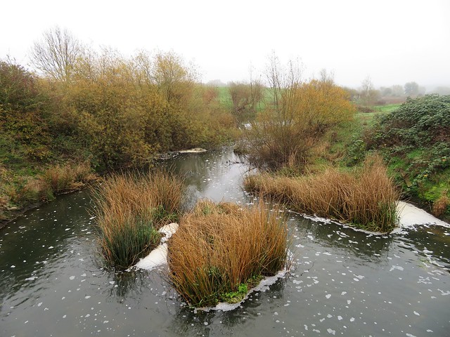
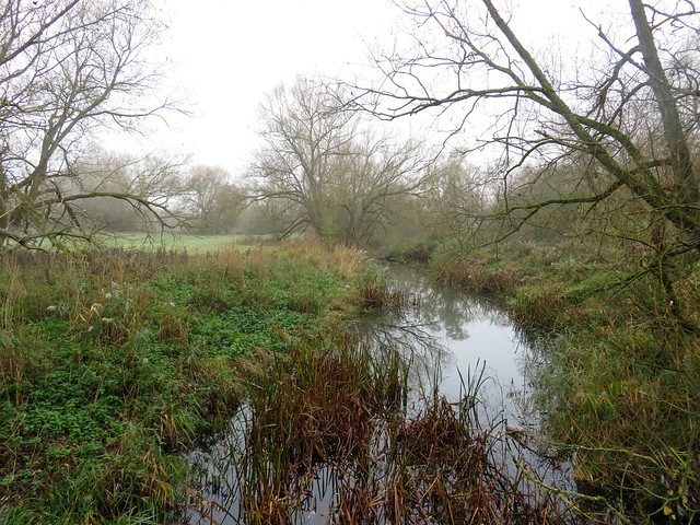
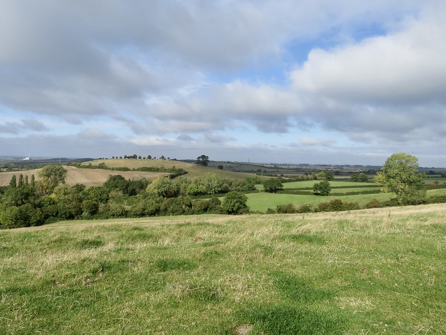
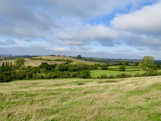
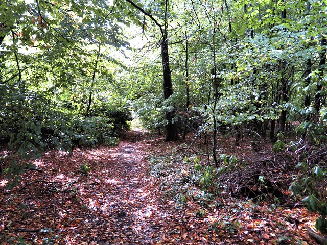
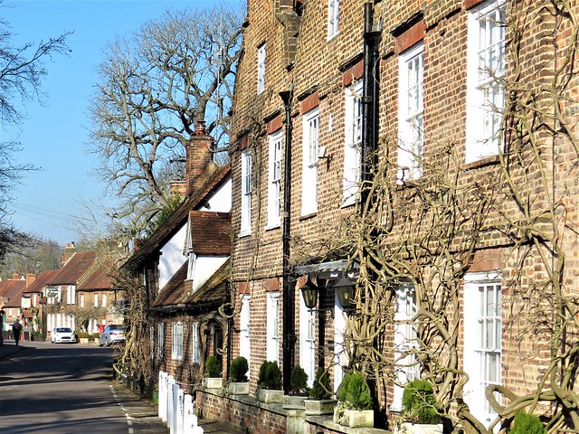
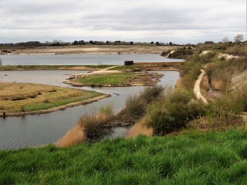
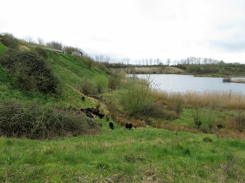
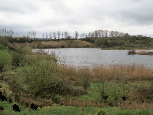
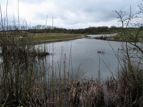
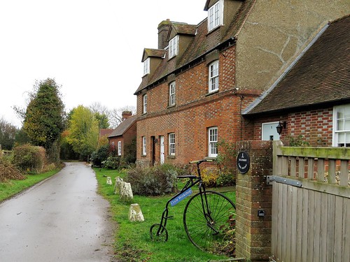
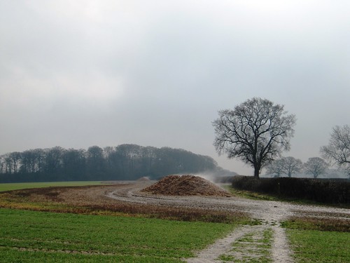
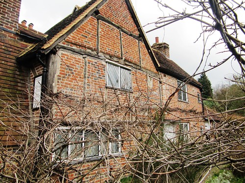
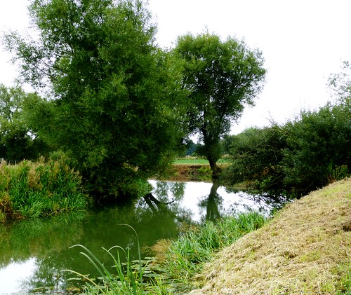
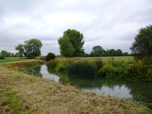
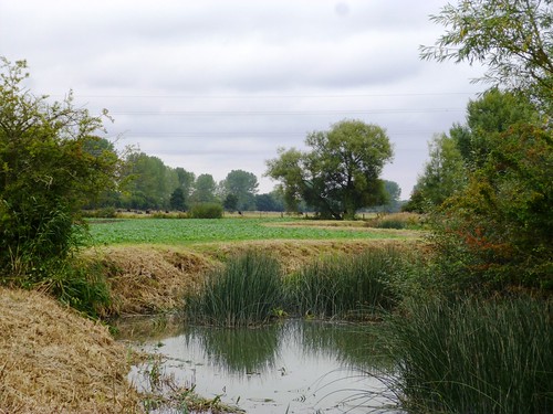
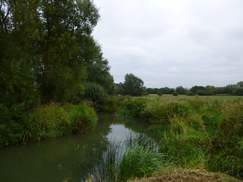
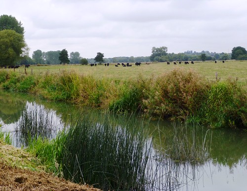
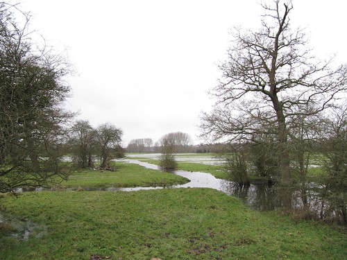
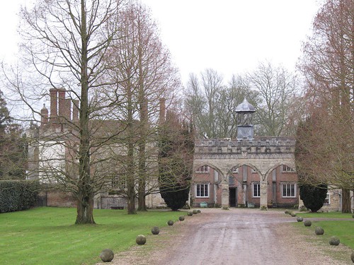
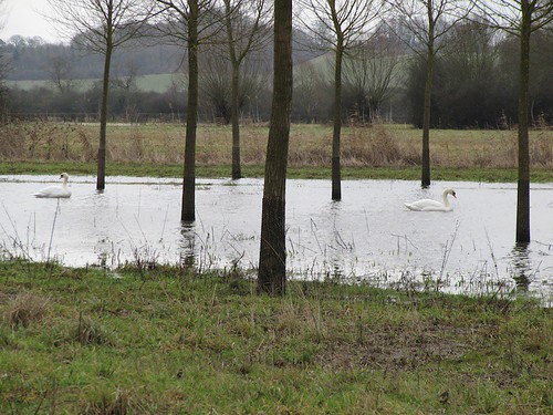
A misty winter morning in north Buckinghamshire, with white wraiths rising from the many waters of the Ouse Valley – the Grand Union Canal, a mosaic of gravel pit lakes, and the River Great Ouse itself, fatly curling through its meadows. The cold seething air lent a feeling of insubstantiality to the creamy limestone pavilions of square-built Great Linford Manor in its landscaped park. We headed across the dewy grass to the Grand Union Canal and turned west along the leaf-strewn towpath.

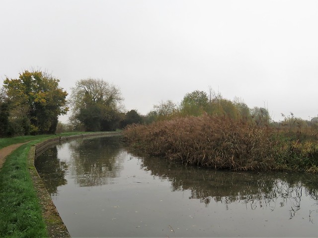
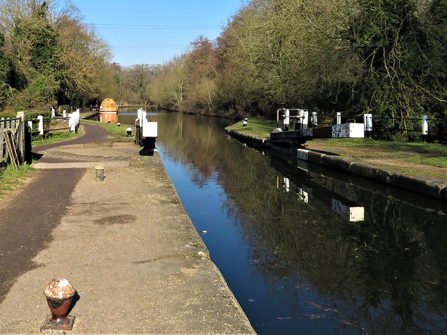
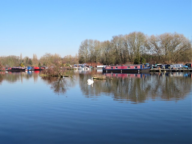
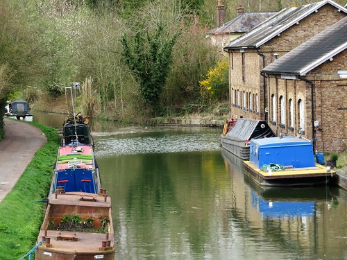
Ripples, Dancing Ducks, and Eye of Horus lay moored to the bank, snugged down for winter. The narrowboats that chugged by were helmed by neatly bearded men of responsible demeanour, a world away from the randy rapscallions that skippered the working boats in the Grand Union’s Victorian heyday.

Such was their reputation, anyway. Rogues or respectable folks, they carried Britain’s commerce up and down the country. Today the canal is all about leisure cruising, the brightly painted narrowboats lending a splash of colour to this morning’s wintry shades of olive green water and ashy grey willows.

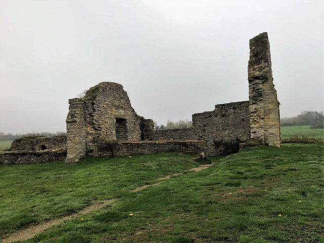
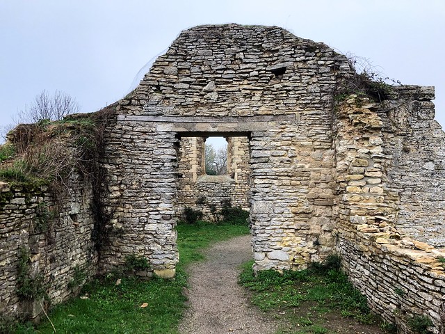
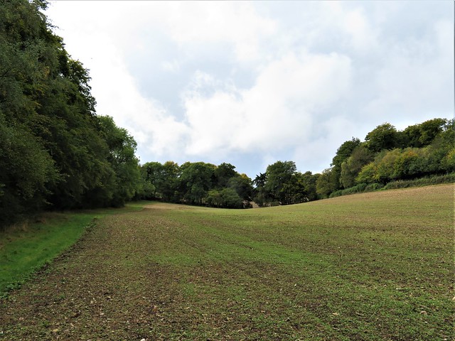
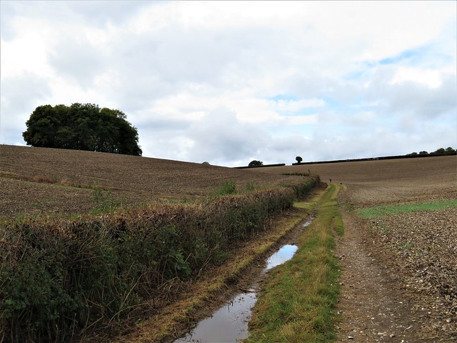
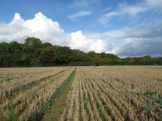
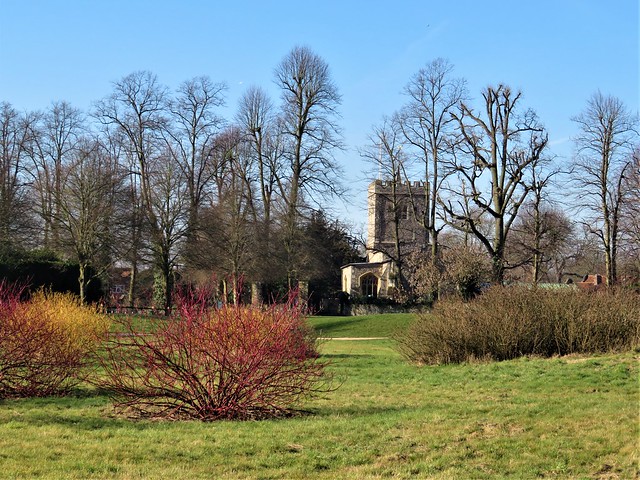
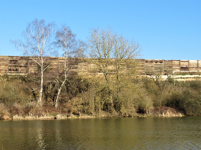
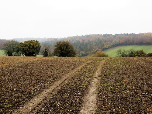
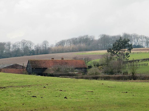
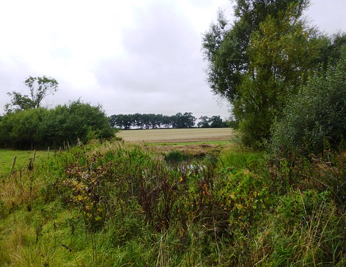
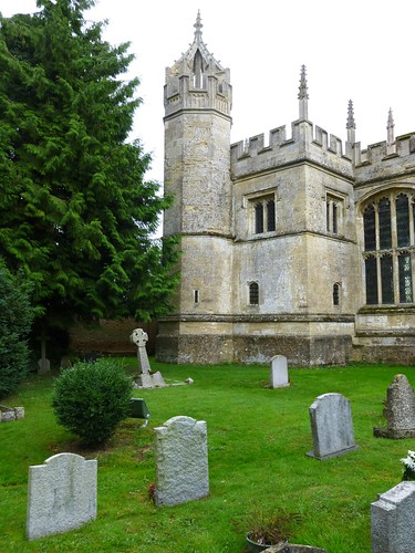
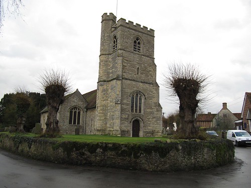
At Stantonbury Wharf gravel barges used to load up for the journey down the canal to London. From here we headed across the fields to where the ruins of the Norman Church of St Peter stood above the humps and bumps of the abandoned medieval village of Stantonbury. Rustic rumour had it that village and church had been cursed to ruin by a werewolf. The true cause was more prosaic but just as definite – the local lord replaced his tenants with sheep in Tudor times, and the peasants of Stantonbury were ejected from their homes.

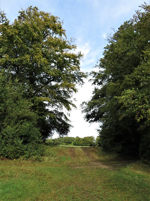
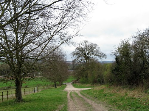
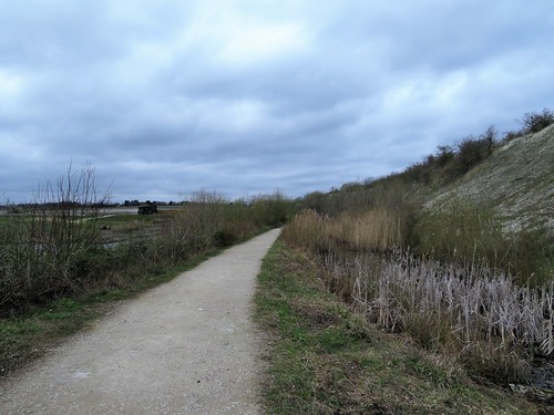
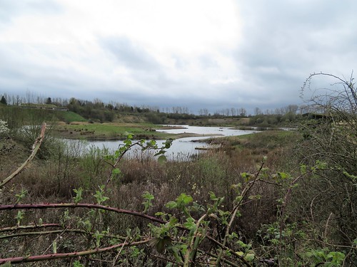
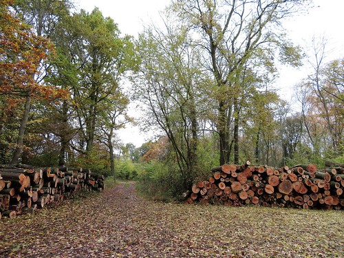
Beyond the church and the hollows where the manor house once stood, we rejoined the Grand Union Canal and followed it down to the new estate of Stantonbury Park before setting back along an old railway path.

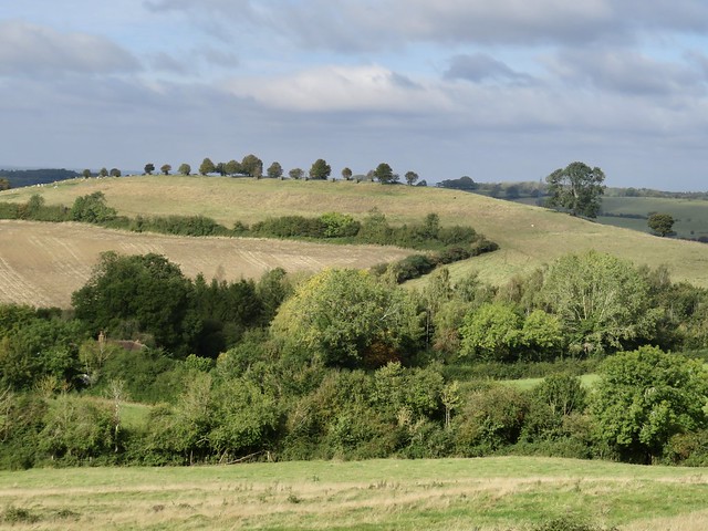
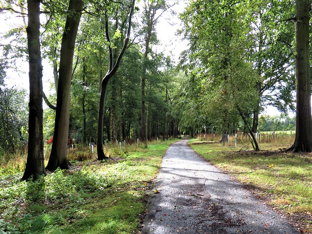
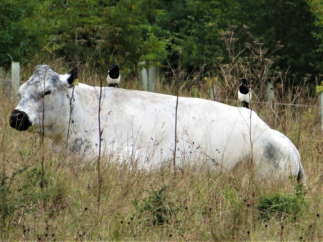
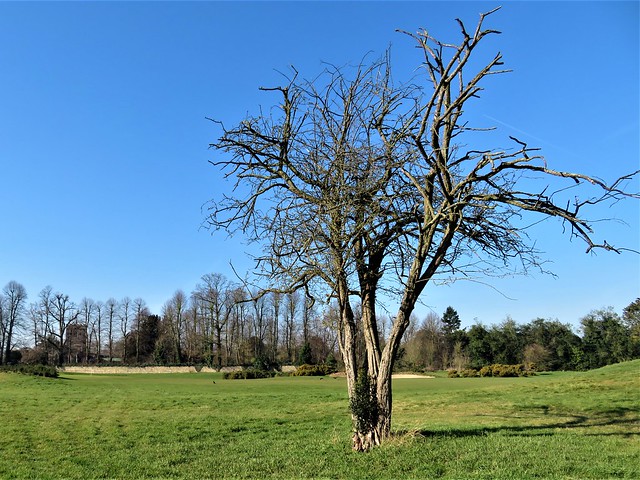
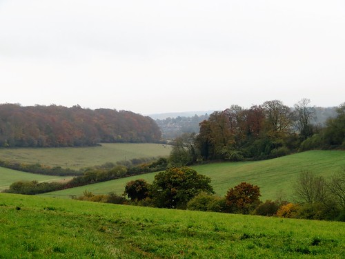
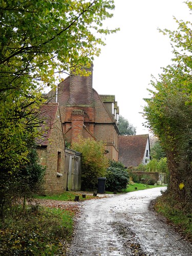
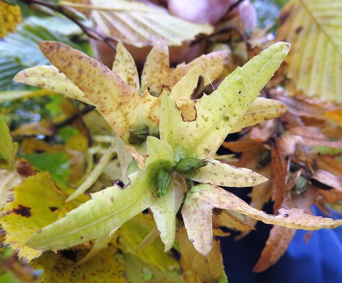
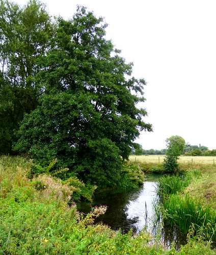
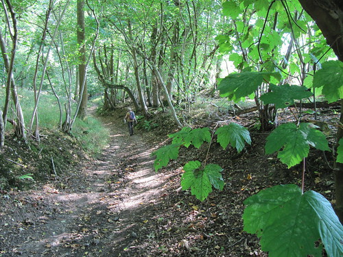
Squirrels dashed among the bare branches and a slender grey heron stood as still as a statue as we went by. All was very quiet in the winter afternoon. It was hard to believe that the city of Milton Keynes with its quarter-million people lay just beyond the ash trees and willows that lined our homeward path.

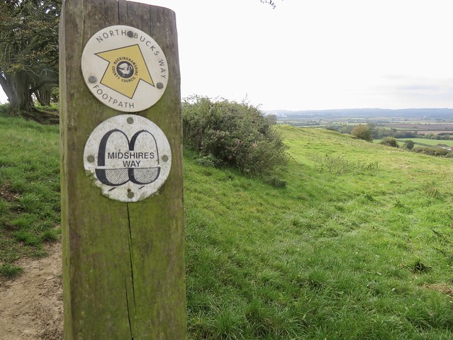
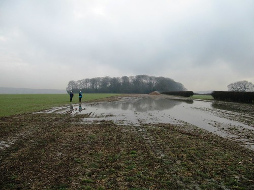
How hard is it? 4½ miles; easy; field paths, canal towpath

Start: Milton Keynes Arts Centre car park, Great Linford Manor Park, Milton Keynes MK14 5DZ (OS ref SP 851422)

Getting there: Bus 21 CMK (Newport Pagnell–Lavendon)
Road: Great Linford is signed off St Leger Drive (off V8 Marlborough Street)

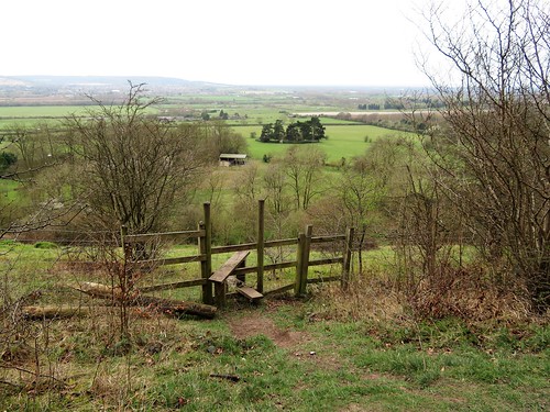
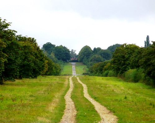
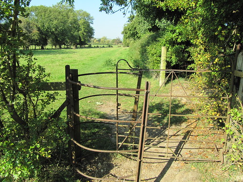
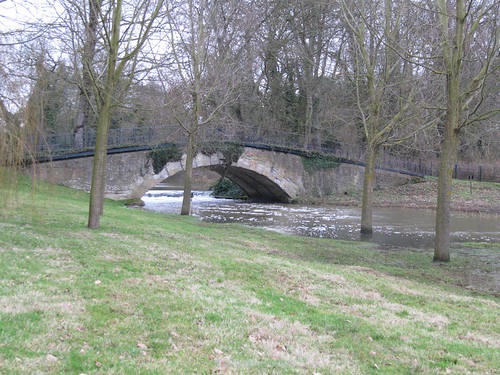
Walk: From car park, pass between pavilions. Bear left of Manor House in front of you, then right to pass Manor House. Follow parkland paths to right, parallel with Grand Union Canal, to bridge (854425). Cross canal; left down steps to towpath; right along towpath. In 1¼ miles at Stantonbury Wharf, under bridge (846424); in 200m bear right on cycle path through fields. In 500m, at St Peter’s Church ruin (836427), left through gate at southwest corner, past information board. Follow grass path up open ground to canal (836424). Right along towpath for nearly 1 mile to go under Bridge 72 (832413). Right up steps, right across canal, past New Inn. In 100m cross road; down steps; along Swan Way multi-user path. In 1¼ miles, just before bridge over canal, right (847422, ‘Great Linford’ fingerpost) down to path through park; back to Arts Centre car park.

Lunch: Nag’s Head, 30 High Street, Great Linford MK14 5AX (01908-607449, nagsheadmk.com)

Accommodation: Swan Revived Hotel, High St, Newport Pagnell MK16 8AR (01908-610565, swanrevived.co.uk)

Info: destinationmiltonkeynes.co.uk

 Posted by at 07:50
Nov 272021


First published in: The Times Click here to view a map for this walk in a new window
Quainton windmill and village, looking to the Chilterns from Simber Hill Somnolent cattle on Simber Hill view from Simber Hill Oving church from Matthew's Way On Quainton Hill Descending Conduit Hill towards Fulbrook deserted medieval village Top of Quainton Hill view from Simber Hill 2 view from Simber Hill 3 Sir Richard Winwood (d. 1688) and wife Anne (d. 1694), in Quainton church view from Simber Hill 5 Quainton Mill and village, looking to the Chiltern Hills

At Quainton in the Buckinghamshire lowlands, the sails and white cap of a windmill overlook the sloping village green. On a cold cloudy afternoon, jolly chat and laughter came spilling from the George & Dragon.

Leaving the village on the North Bucks Way, we climbed the nape of Simber Hill. Somnolent cattle lay chewing the cud with eyes half closed in what looked like a state of transcendental bliss.

From Quainton Hill beyond, the views were remarkable, south to the long dark barrier of the Chiltern Hills, west and north over lower ground where whaleback hills rose from pasture striped with hedges. These green undulations looked beautiful from up here.

Down at the foot of Conduit Hill we passed between the shallow hummocks of Fulbrook, one of several deserted medieval villages hereabouts. Fulbrook probably lost most of its population during the Black Death pandemic of 1349, and the Duke of Bedford finished the job eighty years later when he converted the land into a deer park.

We followed a path across tussocky pasture and fields of dark grey plough to reach the road to North Marston. In a lane below the church we found a covered well with an old-fashioned pump. A sculpture of a boot stood attached to the stone trough.

Towards the end of the 13th century the rector of North Marston was Sir John Schorne, a renowned healer and miracle worker famed for capturing the Devil and imprisoning him in a boot. Sir John discovered the holy well during a deadly drought, and its water was said to cure gout and toothache. Judging by the agonised expression and contorted body of the rector’s icon at the well, he himself might have suffered from both afflictions.

The homeward path followed Matthew’s Way, a rural route dedicated to the memory of ‘a very special little boy’. His round infant face looked out of a photo placed beside the way, and we carried that image in our heads across the sheep pastures.

Under the grey cloud cap the western sky showed a crack of silver. As we approached Quainton a brown hare sprang up and darted away over the corrugations of medieval ridge and furrow, a lithe wild shape in this well-ordered landscape.
How hard is it? 7½ miles; easy; well marked field paths

Start: Village green, Quainton, Bucks HP22 4AR (OS ref SP 747201)

Getting there: Bus 16 (Aylesbury – Marsh Gibbon)
Road: Quainton is signed from A41 (Aylesbury – Bicester) at Waddesdon

Walk (OS Explorer 192): At top of green, left. By playground, right (745202); follow North Bucks Way north towards Quainton Hill. In ¾ mile, at top of rise with gate and blue arrow on right (750215), left to skyline gate; fork right down Conduit Hill. Cross road (752225); half right, following Outer Aylesbury Ring/OAR) across fields. In ½ mile, under power lines, right (761228, kissing gate/KG); aim for shed and stile to road (764228, OAR). Left into North Marston. In ¾ mile, right at T-junction (774228); fork left in front of Pilgrim PH; follow lane to church (777227). From south gate, right; left along Schorne Lane; fork left by well (777225). In 30m, right (KG),;follow well-marked Matthew’s Way for 2¼ miles across fields to Carter’s Lane (765202). Right; in 400m at Quainton Dairy, left (764205) on farm drive, passing Denham Hill Farm (759204), gates of Ladymead Farm (758202) and Denham Lodge (753204). Cross cattle grid; in 100m, left to road (751202); right into Quainton.

Lunch: George & Dragon, Quainton HP22 4AR (01296-655436, georgeanddragonquainton.co.uk)

Accommodation: The Lion, Waddesdon HP18 0JB (01296-651227, thelionwaddesdon.co.uk)

Info: visitbuckinghamshire.org

 Posted by at 03:31
Oct 242020


First published in: The Times Click here to view a map for this walk in a new window
picture picture picture picture picture picture picture picture picture picture
Facebook Link:

After a morning of downpours, rags of blue sky and great anvil-topped thunderheads of cloud were contesting the heavens over the Chiltern Hills.

This part of south Buckinghamshire is gloriously rich in woodland, perfect for a walk among autumn scents and colours especially after rain, when the black earth of the forest floor smells rich and every turning leaf gleams as though polished up for parade.

Horses flicked raindrops from their tails in paddocks still wet and glistening. Green lanes and hedge paths led us through the beech woods where squirrels leaped among the twigs, shaking down showers of raindrops. We walked pathways paved with fallen beech leaves, gold and lemon.

Two big woods, Common Wood and Penn Wood, are the particular pride of the neighbourhood. These are ancient woodlands, where Roman ironmakers collected wood for their furnaces, Saxons and medieval Londoners hunted deer, and Georgian chair-makers and wheelwrights harvested the beech-wood for their specialist trades.

Now they lie open for walkers, crisscrossed with permissive paths dedicated by Penn Estate. In Common Wood hornbeam and hazel, holly and oak made variegated patterns among the predominant beech, against a sky where thunder grumbled and rain showers came pattering by. We found tiny creamy fungi on stout black stalks, with gills as delicate and transparent as mother of pearl.

The path branched north towards Penn Wood past the rough pasture of Farther Barn Field, where a bunch of British White cattle with shiny black noses lay chewing the cud on the dry patches of ground they had reserved when the rain began. One cow had a pair of magpies perched on her back; she seemed entirely at ease with them.

Up in Penn Wood a patchy blue sky was breaking overhead as we turned for home. By the path a purple leaf beech, encased in a stout tree guard, carried a plaque. It had been donated by Prince Charles and planted in 2000 by Earl Howe, to commemorate the successful campaign waged by determined locals to prevent the wood being ‘developed’ as a golf course.

A strange and welcome irony, since it was Earl Howe’s ancestor who had enclosed the common here in 1855 and deprived the local commoners of their immemorial rights.

Start: Winchmore Hill, Bucks HP7 0PH (OS ref SU 933949)

Getting there: Bus 73 (Amersham)
Road: Winchmore Hill is signed off A404 between High Wycombe and Amersham

Walk (5½ miles, woodland paths, OS Explorer 172): From left corner of playground on village green, follow ‘Chiltern Way’/CW. In 300m cross road (929949); follow CW among trees. In 500m, left along tarmac road (927945); in 300m, on left bend (926942), CW forks right. Leave trees; anticlockwise round field edge, down to road (923939). Right; left up Noaks Lane; in 40m, right (922939, CW) along Penn Bottom. In 300m, right off CW up field (918940); through Brook Wood; cross road (919946) into Common Wood. Left along wide ride, forking right in 250m (‘Penn & Common Wood Long Trai). In 1 mile, in clearing with slatted ‘Common Wood’ notice board 50m on left, right downhill (904953, red stripe post) through Gravelly Way Plantation. Cross road (906959) into Penn Wood past gate (info board on right). Follow broad ride east for 1 mile to junction (921959); right to road; left into Penn Street. At junction, ahead (‘Amersham’); in 30m, left by The Cottages (923957, fingerpost); follow yellow arrows for ¾ mile across fields, through Priestlands Wood to Winchmore Hill.

Lunch/Accommodation: Potters Arms, Winchmore Hill HP7 0PH (01494-726222, pottersarms.co.uk) – lunch booking advisable

Info: High Wycombe TIC (01296-382415); satmap.com; ramblers.org.uk

 Posted by at 01:19
Feb 082020


First published in: The Times Click here to view a map for this walk in a new window
picture picture picture picture picture picture picture picture picture picture picture picture picture
Facebook Link:

A cold blue morning over South Buckinghamshire, the train rattling away from Denham station, and the path across Bucks Golf Course frosted between its wooden fences. Clever landscaping of fairways and bunkers made the surroundings look like an undulating grassland, through which the golfers trundled their carts obediently from lie to lie.

Beyond the clubhouse lay the tangle of rivers and canal that forms the backbone of the Colne Valley Country Park. We crossed the River Colne and headed north from Denham Lock up the broad, quiet waterway of the Grand Union Canal.

Walkers, runners, gongoozlers and strollers lapped up the winter sunshine like thirsty camels at an oasis well. ‘So lucky, aren’t we?’ was the greeting of the Hillingdon Heath Walkers who were stumping along thirty strong and very cheerful.

Moorhens flew across the canal, patting the dark water into sparkles with their long green toes. A swan came in from the flooded gravel pits alongside, skimming low, as white and dramatic as a Sunderland flying boat, with great clapping beats as its wingtips smacked the surface of the canal.

We passed below the flattened skew arches of Denham railway viaduct, a workaday structure, yet beautifully patterned by its Victorian designers, light brick contrasting with dark, a lip of raised beading emphasising the graceful shape of each arch.

Up at Widenwater Lock we crossed the Grand Union and set back along a parallel path beside gravel-pit lakes where a pair of great crested grebes flirted beak to beak, shaking their heads at each other in a dream of courtship still a couple of months off.

Back at Denham Lock we followed a grassy path towards Denham village. A couple of dogs dug enthusiastically for treasure in the bed of the shallow River Misbourne. In the village street, every prospect pleased. Curly Dutch gables, mellow brick walls, red pantiles, immaculate gardens – it was as though the judges for ‘Prettiest Village In Buckinghamshire’ were due at any moment.

We followed the narrow lane intriguingly named The Pyghtle back to Denham Station. Green snowdrop spears were already pushing up along the verges, and under the flaky bark of sycamores a secret world slept the winter away – tiny beetles, immovable flies, and silk purses of spider eggs in waiting.

Start: Denham station, UB9 5ES (OS ref TQ 042877) or Colne Valley Country Park, UB9 5PG (048864)

Getting there: Rail to Denham. Road: Colne Valley/Denham Country Park is signed from A40, Jct 1.

Walk (7 miles, easy, OS Explorer 172): Down steps by station ticket office; right through tunnel; in 100m ahead through kissing gate. Follow fenced path across golf course. Opposite church, left (045870) to club house (050868). Right down drive; through gates; left (049860, ‘Grand Union Canal’ fingerpost). In 400m cross footbridge (052862); left up canal for 1½ miles to Widenwater Lock (050887). Right across bridge; in 250m, right (051888, ‘Colne Valley Trail’/CVT, ‘London Loop’/LL), In 20m ignore barrier/path to right; ahead to turn right along CVT. In ¼ mile, right along road (054884); in 50m don’t fork left along LL, but follow road/CVT to right. In just over a mile, right across canal (053867); retrace steps to golf club drive near gates (049864). Ahead (‘Circular Walk’ fingerpost) past Colne Valley Country Park visitor centre, following ‘Denham Village’ and ‘South Bucks Way’ to road (043869). Right through Denham; at left bend, right (040871) along The Pyghtle to station.

Lunch/Accommodation: Falcon Inn, Denham UB9 5BE (01895-832125, falcondenham.com)

Info: Colne Valley Country Park (01895-833375, colnevalleypark.org.uk); satmap.com; ramblers.org.uk

 Posted by at 02:16
Mar 032018


First published in: The Times Click here to view a map for this walk in a new window
picture picture picture picture picture picture picture picture picture picture picture picture
Facebook Link:

As soon as we walked out of Tring station, the Chilterns beckoned us on and upward – the humpbacked green downland of Aldbury Nowers looking down on the railway, studded with beechwoods and lined with ancient earthworks and trackways.
 
It’s not until you’re up there with your boots in the crumbly white clay of the 5,000-year-old Ridgeway that you properly appreciate the wildlife treasures of these chalk grassland slopes. The wild marjoram and thyme, the harebells and rockroses that carpet the steep grassy banks from spring onwards are carefully nurtured by the Berks, Bucks and Oxon Wildlife Trust (BBOWT), not least for the sake of the butterflies that are drawn to such delicate and increasingly uncommon plants – marbled whites and small blues, grizzled and dingy skippers (rather more beautiful than their names suggest), the brown argus and the green hairstreak with its strikingly leaf-green underwings.
 
We followed the Ridgeway as it undulated north along the hillsides in company with the old Saxon earthwork of Grim’s Ditch. Gaps between the trees gave a far prospect north and west over the green wooded plains of outer Buckinghamshire to a dip of distant blue hills that might have been the north-easternmost Cotswolds. Deep in the trees wrens chattered in full flow, and a black-and-white great spotted woodpecker cocked his red-capped head as he prepared to give a beech crown a good hammering.
 
High on Pitstone Hill we left the Ridgeway for a bridleway that tipped back down into the valley. Here the navvies dug deep to carve out great cuttings for the railway and the Grand Union Canal. Well-tended paths led us through horse pastures to the flooded chalk quarry of College Lake.
 
This very family-friendly and well-run nature reserve is looked after by BBOWT. Dawn chorus strolls, workshops, bird-watching, kids’ activities, guided walks – you’ll find them all here. We walked a long circuit of the lake, looking for nesting redshank and lapwing, while birdwatchers passed tantalising news of a visiting osprey that might be in the vicinity.
 
We saw neither hide nor hair of the osprey. That didn’t matter – not with the sun deciding to put in an afternoon appearance. We walked slowly back to Tring in the depths of the cutting beside the motionless, olive-green waters of the Grand Union Canal.
Start: Tring station, Herts, HP23 5QR (OS ref SP 951122)
 
Getting there: Rail to Tring; bus service 387 (Aldbury-Tring).
Road – Tring station is 1 mile east of Tring on Aldbury road.
 
Walk (7½ miles, easy underfoot, OS Explorer 181): Cross road; right; 100m beyond right bend, left (953124, ‘Ridgeway’/RW) up driveway. In 50m, ahead, to turn left along RW. In 600m fork right (951129, ‘RW footpath’, yellow arrows/YA, acorn waymarks). In ¾ mile, left at kissing gate (950139, ‘Bridleway’) down to road (945137). Left for 250m; right (946134, fingerpost) past Park Hill and Marshcroft farms to Grand Union Canal (939129). Right (YA) on path along east bank of canal, then past Bulbourne Farm (938135). At railway, left to B488 (938140). Left for 250m; right into College Lake Nature Reserve (935139). Walk Reserve Trail circuit. Back at Visitor Centre, right along path parallel to B488. In 250m (934137), right along road. Cross canal bridge; left along towpath for 1¼ miles to road at 2nd bridge (948121); left to Tring station.
 
Lunch: Badger Café, College Lake Visitor Centre
 
Accommodation: Pendley Manor, Cow Lane, Tring HP23 5QY (01442-891891, pendley-manor.co.uk)
 
College Lake Visitor Centre: (01442-826774, bbowt.org.uk) – open 9.30 – 5.00

visitengland.com; satmap.com; ramblers.org.uk

 Posted by at 01:41
Feb 112017


First published in: The Times Click here to view a map for this walk in a new window
picture picture picture picture picture picture picture picture picture picture picture picture
Facebook Link:

None of the Chiltern counties north-west of London is richer in beechwoods, chalky hollows and flinty ridges than Buckinghamshire. On a cold dank day in town you can feel those misty valleys beckoning you away from what you ought to be doing. We didn’t even try to fight it. We got our walking boots on, and set out before the clock struck midday from the Black Horse Inn, just outside Chesham where the Metropolitan tube runs out of line.

This is horse country, a land of paddocks and hay mangers. At Bower Farm the wind-vane figure was a polo player in mid-chukka. Nags caparisoned in thick winter blankets came to the field gates to see what we were up to. Up on the ridge above White Hawridge Bottom we trod heavy clay fields seeded with millions of flints. The rough nuggety soil had been the ruin of many Victorian ploughshares, whose snapped-off fragments lay rusting in the furrows.

The fine 18th-century farmhouse of Hawridge Court stands on the site of an early medieval manor, itself built inside an oval earthen bank that might date back a thousand years or more. The hedges in the valley bottom are thick and venerable, the beech woods ancient.

There’s a sense of long continuity in these Chiltern hills and hollows. The local clay has gone to make good bricks for hundreds of years, and the craft still flourishes at the brickworks of HG Matthews on its saddle of ground above the woods. There were stacks of red bricks in the yard, and a good sour smell of baking brick from the wood-fired kiln beyond the sheds.

We passed the cottages at Bellingdon Farm where DH Lawrence lived briefly in 1914 while writing ‘The Rainbow.’ Compton Mackenzie paid him a visit there, and was amused to find the great writer on his knees scrubbing the kitchen floor.

The homeward path lay along a beautiful hillside and up between the blackly twisted beech roots of Captain’s Wood, where goldfinches flirted from tree to tree and a ghostly silver sun slipped briefly out between one drifting cloud and the next.

Start: Black Horse Inn, Chesham Vale, Bucks, HP5 3NS (OS ref SP 963045)

Getting there: Chesham is signed from A41 between Hemel Hempstead and Tring. At Chesham, follow ‘Hawridge’ for 1 mile to Black Horse.

Walk (6½ miles, easy underfoot, OS Explorer 181): From Black Horse, right along road. In 150m, right (fingerpost/FP, stile) up path. At gate at top of rise, right (961045, stile, arrow). Bear right along hedge, following yellow arrows/YAs; then through 2 large fields for ¾ mile. Opposite Hawridge Court, go through kissing gate/KG (950058); immediately left downhill (YAs, KGs) to valley bottom (948056). Right (KGs, YAs); in 400m cross Hawridge Lane (945059); on through 2 fields (YAs) and into woodland (941064).

In 300m, left at waymark post (939066, YA); cross valley bottom; up through woods to pass brickyard. At building across path, left (937062, YA) along field edge with hedge on right. In 250m, right past house (939061); in 100m, left (‘bridleway’ fingerpost). In ¼ mile, right down Hawridge Lane (942057) past Bellingdon Farm to road (940055).

Left; in 100m, right (fingerpost) down Two Gates Lane. In ¼ mile, left (940051, KG, YA) across 2 fields. Go through 5-barred gate under large oak (942051, YA) and on with hedge on left (gates, YAs). In ¼ mile, at end of 3rd field, through KG (946048); right along lane. At left bend, ahead (KG, YA) on fenced path. At field, left (YA) along hedge above valley.

In ½ mile enter Captain’s Wood (949040). Keep ahead. In 200m, left (950038, stile, YA) through paddocks (gates, YAs) into drive; ahead to cross road (952039). Through KG (fingerpost); left along track. In 300m track bends right (952042), then snakes left/right over stile (954043, YA) into Ramscourt Wood. Follow YAs through wood and down slope to bear right in valley bottom (958045) along track. In 250m, left by house (960043, YA, stile) up fenced path. Right over stile at top (961045); retrace steps to Black Horse.

Conditions: Some slippery stiles.

Lunch: Black Horse Inn (01494-784656; theblackhorsechesham.co.uk)

Info: High Wycombe TIC (01494-421892)
visitengland.com; satmap.com; ramblers.org.uk

The January Man – A Year of Walking Britain by Christopher Somerville (Doubleday, £14.99). For 30% off, call 01206 255 777, quoting TIMES302017.

 Posted by at 01:09
Mar 212015


First published in: The Times Click here to view a map for this walk in a new window
picture picture picture picture picture picture picture picture
Facebook Link:
Parsonage Wood in the last throes of winter. Chiff-chaffs were sending out their two-tone spring call sign from beech trees as yet innocent of leaves. There were hard green buds at the finger-ends of the branches, however, and violets tightly coiled out of the chilly air among the tree roots. It was hard to believe that, ten minutes before, I’d stepped out of a tube train. Nothing here in the Buckinghamshire woods and fields at the end of the Metropolitan Underground line held even a breath of London.

Below the wood, Amersham Old Town lay along the River Misbourne’s shallow valley, a handsome old market town in red brick and terracotta tiling. My cheerful cousins Vicky and Tone were waiting for me there, along with my long-striding sister Lou. We climbed away up the far slope of the valley, through the corner of mossy Rodger’s Wood, and on by Quarrendon Farm where a sky-blue tractor made the only splash of colour in a muted palette of greys, reds and olive greens.

At Upper Bottom House Farm a horse came to sniff us over, nodding his long head sagely as though to say: Yes, I thought so, not an apple between you. ‘Apples?’ said Lou. ‘Listen, that’s a Buckinghamshire horse. He won’t accept anything less than a tarte tatin au coulis de calvados.’

Down in Chalfont St Giles we found the modest brick-and-timber cottage where in 1665 John Milton came in flight from the Great Plague of London. Here, blind and infirm, he finished his masterpiece Paradise Lost, while keeping his head down and his mouth shut – King Charles II had not long been restored to the throne, and Milton had been an enthusiastic supporter of the much-despised Commonwealth and its instigator Oliver Cromwell. What would the poet have made of the great juggernauts that now thunder past his front door? Doubtless he’d have consigned them with the fallen angels to the fiery lake of pitch.

The church of St Giles holds wonderful 14th-century frescoes of Creation, Eden and the Crucifixion, but they lay – frustratingly – behind locked doors. So we turned back along the South Bucks way, a muddy path through willow groves and along the gin-clear waters of the River Misbourne. Rain-pearled pussy willow buds, bluebell shoots and the ecstatic trilling of larks over the flint-strewn fields told us that spring was not stillborn, only temporarily suspended.

Start: Amersham station, Amersham-on-the-Hill, Bucks HP6 5AZ (OS ref SU 964982)

Getting there: Rail (Metropolitan tube or main line).
Road: M25, Jct 18; A404

Walk (9 miles, easy, OS Explorer 172): From station, left to main road; left under 2 bridges; immediately right (footpath fingerpost) along path beside railway. At road, left (962982); in 50m, left on path along upper edge of Parsonage Wood. Leave trees (960977); on down field path to St Mary’s Church and Old Amersham High Street (958973). Left to cross A355 (961972); in 50m, right (fingerpost) past Bury Farm, then under A413 (963969). Follow yellow arrows/YA, up through corner of Rodger’s Wood (968962). Half right across field to hedge corner (969961); on with Quarrendon Farm to your right; on along ridge edge of Day’s Wood. From waymark pole (974955), diagonally across field, through gate (974951); descend beside fence, through farmyard to Bottom House Farm Lane (976948). Right for 50m; left (fingerpost) up track; in 250m, left to road at Hill Farm House (978943). Forward (‘Chalfont St Giles’); follow road for ½ mile to crossroads (984938). Go over, and on for ½ mile to road in Chalfont St Giles (990935). (NB to visit Milton’s Cottage and avoid busy road – 50m before reaching village road, turn sharp right uphill (‘footpath’ fingerpost) past Scout Hut, then school, to descend to road opposite Milton’s Cottage – 989934).

From village road (St Giles’ Church opposite), turn left along lane (‘South Bucks Way’/SBW). In 300m pass gate; in 50m fork right (989938; YA). In 300m at Chalfont Mill (987941) dogleg left and right across lane, and on for ¾ mile (‘SBW’) to cross Bottom House Farm Lane (983953). In another mile, at waymark post (973964), bear right to cross River Misbourne (972965, YA), then left along river bank. In ½ mile, go under A413 (966969), then cross A355 (964971). Pass down right side of ‘Ambers’, through car park and up path to cross A416 (964972). On along field path beside river to end of field (961974). Right here, diagonally up across field (‘Martyr’s Memorial’). At far side, through hedge beside fingerpost (963975); left to Martyr’s Memorial. Back to fingerpost; right up field edge, into Parsonage Wood (963979). Keep same direction past waymark post (YAs), on through wood. At road (962982), right along path to return to Amersham station.

Click Facebook link to ‘like’ this walk

Lunch/accommodation: Saracen’s Head, Amersham HP7 0HU (01494-721958)

Information: High Wycombe TIC (01494-421892)
www.satmap.com; ramblers.org.uk; LogMyTrip.co.uk

 Posted by at 01:41
Oct 252014


First published in: The Times Click here to view a map for this walk in a new window
picture picture picture picture picture picture picture picture picture picture picture picture picture picture picture picture
Facebook Link:
It was a murky old afternoon, with just one window of opportunity between two solid slabs of eastward-drifting rain. We pulled on our raingear and set out north from Steeple Claydon. A black hen, escaped from her pen, ran madly away across the furrows – good solid furrows several feet wide, remnants of medieval strip farming still imprinted on the land. This is low-rolling, cattle grazing country of modest ridges topped by trees, quintessentially Middle England, an unemphatic landscape whose subtleties unfold only slowly.

The stubble lay scattered with wheat grains, millions of them. The Victorian women and children who gleaned these fields after the harvest, scouring each row with beady eyes for the precious seeds, would have gathered almost every grain. As we walked along hedges bowed with little green crab apples and blackberries, I wondered when gleaners were last seen in the Buckinghamshire fields.

Kingsbridge Farm lay ahead, an angle of red tiled roof and a dark square of barn framed between a crab apple and a hawthorn either side of a five-barred gate – a view John Constable would have loved. We followed the green-grey Padbury Brook as it wound along field margins where the leaves of burdock hung in leathery sheaves like roosting bats. Suddenly a grinding roar filled the air. Looking up, we saw a Lancaster bomber trundling majestically across the cloudy sky like a plane in a dream.

A green lane and a wonderful formal avenue, broad and tree-lined, brought us past immaculate gardens to Hillesden church, a building whose dignified beauty inspired the young George Gilbert Scott to become an architect. The pale oak of the ancient church door was bored deep with bullet holes. This quiet hamlet was the scene of a desperate confrontation in March 1644, when 2,000 Roundhead soldiers laid siege to the Royalist stronghold of Hillesden House. It ended with the owner, Sir Alexander Denton, clapped into the Tower of London (where he soon died), his lands confiscated, his family ruined and his house levelled.

Out across the fields we followed a well-found farm track towards the red roofs and slender spire of Steeple Claydon, with rainclouds thickening overhead to hurry our homeward steps.

Start: Fountain Inn, West Street, Steeple Claydon, Bucks MK18 2NT (OS ref SP 698271)

Getting there: Bus – Service 18 (buckscc.gov.uk/transport), Bicester-Buckingham.
Road – Steeple Claydon is signposted from Padbury, off A413 (Winslow-Buckingham).

Walk (6 miles, easy, OS Explorer 192): From Fountain Inn, left along West Street. On right bend by Co-op, ahead along Meadoway; on beside recreation ground (fingerpost), past school and on for ⅓ mile (stiles, yellow arrows/YA) to cross road (702275, ‘Bernwood Jubilee Way’/BJW). Follow BJW across fields. In ¾ mile cross stream (705287); bear right to enter green lane; left across Padbury Brook at King’s Bridge (704288). Right over stile (BJW); follow left bank of Padbury Brook.

In 250m, right across brook (703290, BJW); continue along its bank. In ¼ mile go under power cables; in 100m, left (703295) away from brook. Don’t go right across ditch; keep ahead with hedge on right for 400m to junction of paths near lone tree standing apart from hedge (699296). Angle back left across field, then along green lane. In 700m, leave trees (701290); in another 200m, right across stile (702289, YA). Follow hedge on right; in 100m, right over stile along broad grassy avenue west for 1 mile. At end, pass Hillesden House gardens, then church (686288).

Just beyond church, left (‘Cross Bucks Way’); follow road, then farm track to Church-hill Farm. At first barn bear left (686283, waymark arrow); follow track for ⅓ mile to T-junction; right here (690282). In ⅓ mile, at T-junction with 3 gateways (693279), right along hedge, following YAs to cross Padbury Brook at Claydon Plank by 2 footbridges (694274). Ahead for 100m past pumping house; left through hedge; 2 kissing gates, then path to road (697272). Right to Fountain PH.

Refreshments: Fountain PH, Steeple Claydon (01296-730286) – friendly local; no food, but you can eat own picnic there. Also Phoenix Inn, Queen Catherine Road, Steeple Claydon (01296-738919).

Accommodation: Villiers Hotel, 3 Castle Street, Buckingham MK18 1BS (01280-822444; oxfordshire-hotels.co.uk) – smart, welcoming town centre hotel.

Information: Buckingham TIC (01280-823020)
www.LogMyTrip.co.uk; www.satmap.com;

 Posted by at 08:35
May 052012
 

The sun had just risen over Hatchet Wood as we left the Frog Inn, pursued by the raucous ‘Get-up-and-at-’em!’ of Skirmett’s alarm-cock.
First published in: The Times Click here to view a map for this walk in a new window
picture picture picture picture picture picture picture picture
Facebook Link:
Blackthorn and field maple, bramble bushes and wayfaring trees edged the track that climbed Elmdown to reach the skirts of Great Wood. Here we sat on a fallen beech, its trunk rotted and eaten by insects into bare sinews of black and brown, to watch two red kites circling and talking to each other with staccato, kitten-like mews.

The long, narrow valley of the Hamble Brook, running north-to-south to meet the River Thames near Marlow, is thick with beautiful mature Buckinghamshire woodland, easy to get lost in if you don’t keep your wits (and your Satmap GPS device) about you. Roe deer haunted the trackways of Great Wood, slipping away into the shadows as soon as glimpsed. Between beech trunks streaming with dusty sunlight we caught glimpses of the crossed sails of Turville Windmill, high and mighty on a sharp-cut ridge. Great tits went chasing through the pines, and at the edge of the wood a burst of feathers edged with blue and black showed where a jay had come to a sudden full stop – fox, peregrine or shotgun.

We emerged at last from the woods to a superb prospect over Hambleden and its valley – pale chalky green-and-white of ploughed fields, green pasture in squares and lozenges, the hanging woods above, and the red brick walls and tiled roofs of the village clustered round the grey church half hidden among its trees. If you ever have to illustrate ‘essence of rural England’ to a Martian, here’s the view.

Down among the half-timbered Arts & Crafts gables, terracotta chimneys and flint cobble walls of the village, a herd of pedigree cattle stood under a massive beech. I put my hand over the fence, and one of them licked it with a pale muscular tongue as abrasive as sandpaper. Out along the Hamble valley, red kites had gathered over the pastures; we counted 18 in the air at the same time, their red, white and chocolate forms brilliantly lit in strong sunlight. Under these fork-tailed guardian angels we followed the field paths back to Skirmett.

Start & finish: Frog Inn, Skirmett, Nr High Wycombe, Bucks RG9 6TG (OS ref SU775902)
NB: Alternative start: Hambleden (more parking). If starting from Frog Inn, please ask permission, and please give inn your custom!

Getting there: M40 Jct 5, and minor roads via Ibstone; or A4155 (Henley-on-Thames to Marlow) to Mill End, then minor road.

Walk (9 miles, moderate, OS Explorer 171) NB: Many unmarked paths in woods. Use these detailed instructions, and take Explorer map/GPS/Satmap to help you!:
From Frog PH, right along road (take care!). Round right bend (776899; ‘Hambleden’), then left bend. In 30 m, right (775898) over stile, up hill path. At top of rise, follow path to right along ridge. In ¾ mile it curves right to top of ridge (766897), then begins to descend (footpath sign on tree). In 200 m, at fork with footpath sign, keep downhill. In 200 m path forks (766900); keep ahead, (not left downhill). In 150 m, where track bends sharp left along bottom of wood (766901) keep ahead, forking immediately left (yellow arrow/YA) across open field. Through woodland to road (765905). Left for 100 m to bend, left (‘bridleway’) along wood bottom.

In 1¼ miles, just before green ‘Bridleway Users’ notice and wooden railings (757891), left uphill (YA) through Gussetts Wood. Cross stile (758889) and field to road junction (758887). Ahead downhill for ¼ mile. At Upper Woodend Farm, left (578883; bridleway fingerpost) up driveway (ignore ‘Private Road’ notices). In 150 m, before gate, right (759882; bridleway blue arrow/BA) down hedged green lane between fields. In 150 m cross footpath (760881); continue on bridleway. In ¼ mile it re-enters wood (762878); follow it as a hollow way, then a path, close to wood edge. Follow path and hollow way down to major track crossing in wood bottom (767877). Go over crossing (uphill) on path which bends right.

Now follow ‘Shakespeare’s Way’/SW arrows. In 500 m pass a yew grove and fork right (772875; white arrow/WA on tree). In 100 m fork left (SW). In 300 m, reach track crossing (773872); turn left out of wood, on path across field and down left side of wood (SW) to track at bottom (778871). SW crosses it, but you turn right (WA on tree) on bridleway which bends immediately left to run inside wood edge. Follow BAs. In ¾ mile path bends right (782860); go left here (bent BA) on bridleway. In 50 m, left (YA) on path. Descend to cross road (783864) into Hambleden.

Cross churchyard; leave by far left (NW) corner; follow road. In 100 m, right through kissing gate/KG (783867; fingerpost). Cross 3 fields (KGs), then hedged path past Pheasant’s Hill, then 4 fields (KGs) to road at Colstrope Farm (782881). Forward to bend; forward here along Chiltern Way/CW (782882; ‘bridleway’). Cross road at The Hyde (781887); forward on CW (YA) for 5 fields (KGs) to road (777899). Left, then right to Frog Inn.

Lunch: Stag & Huntsman Inn, Hambleden (01491-571227; www.thestagandhuntsman.co.uk)
Lunch/accommodation: Frog Inn, Skirmett (01491-638996; www.thefrogatskirmett.co.uk) – friendly, cheerful and helpful place

Information: Henley-on-Thames TIC (01491-412703)
Readers’ Walks: Come and enjoy a country walk with our experts! Dates, info etc.: http://www.mytimesplus.co.uk/travel/uk/1867/times-walks.
Next walks: Lindisfarne, Northumberland, 13 May; Scottish Borders, 10 June; Northern Ireland, 8 July

Breast Cancer Care’s Pink Ribbon Walks:
0870-145-0101; www.pinkribbonwalk.org.uk. Next walk: Scone Palace, Perthshire, 12 May.
www.ramblers.org.uk www.satmap.com www.LogMyTrip.co.uk

 Posted by at 03:52
Feb 192011
 

It was a bleak and blowy winter’s day over north-west Berkshire, with a sky full of those bruised-looking clouds that foretell a hell of a lot of rain before you’re much older.
First published in: The Times Click here to view a map for this walk in a new window
picture picture picture picture picture picture picture picture
Facebook Link:
Even the charms of Cuddington – thatched houses of silver-gold stone, an excellent village shop and a gorgeous church on a knoll – couldn’t hold us. We longed to be out in the subtle, low-rolling landscape, walking off sloth, that insidious old enemy, before the Clerk of the Weather should spy us.

The River Thame was bubbling full of snowmelt floods. It raced under its flimsy footbridge and lapped into the fields around Old Mill. Out along the Thame Valley path swans paddled in the flooded aspen groves, and a big red kite went balancing over them, adjusting crooked wings and forked tail to each nuance of the wind.

The whole land lay muted, still and beautiful. This was a countryside swept and sailed through by winter. Giant old oaks stood stark and bare in the fields of winter wheat. The close-shaven hedges guarded ditches brimming with brown water. The field paths clogged and bogged us so that we wore two pairs of boots apiece, our Brasher Supalites encased in huge clown boots of mud and flood-scattered straw.

Up at Eythrope Park the river surged with a soft roar under the bridge beside a fabulous fantasy house of carved wood, fishtail tiles and Tudor chimneys. The splendidly individualistic Alice de Rothschild had it built in the 1870s as the lodge for her nearby country house, The Pavilion. She laid her hand decisively on the stable block along the drive, too, with lashings of half-timbering, bright red brick and candlesnuffer roofs.

Long paths through parkland and fields brought us up to the church and manor house at Upper Winchendon, down again over ridges and silent little dells to church and manor at Nether Winchendon. What a contrast to the garish gloriosities of Eythrope, these settled and graceful old compositions of house, church, gardens and trees. If you wanted to show visitors from Xiaoquandong the essence of England, you’d probably show them Nether Winchendon.

Back across the eddying, still rising Thame; back over the fields to beat the rain into Cuddington by a short head, with the lights of the Crown shining through the dusk like welcoming beacons at the harbour mouth.

Fact File

Start: Crown Inn, Cuddington, Bucks HP18 0BB (OS ref SP 738111)

Travel: Rail (www.thetrainline.com;www.railcard.co.uk) to Haddenham (2 miles)

Bus: Service 110 (www.arrivabus.co.uk), Aylesbury-Thame

Road: Cuddington is signed off A418 between Aylesbury and Thame

Walk (9 miles, easy grade, OS Explorer 181): From Crown Inn,
down Upper Church Street. By church, left down Tibby’s Lane. Past
cottage, left (yellow arrow/YA), then right along hedge. Cross River
Thame (737120). Right by Old Mill; follow Thame Valley Walk for 2
miles to Bridge Lodge (767135). Left up drive (‘Bernwood Jubilee
Way/BJW’; blue arrow/BA). Right by Beachendon Cottages (‘Swan’s
Way’); left by Eythrope Park gate (770140; fingerpost). Follow
Swan’s Way for 1 mile to North Lodge (760151). Left (BA) for ½
mile. At post 100 m before drive, right (754148; no arrow) up bank;
YAs to cross road (752150; fingerpost). Though trees; right along
drive, and follow it for ½ mile. On right bend, left through gate
(745156); YAs across 3 fields, heading south for ⅓ mile to newly
planted avenue (744150). Left up avenue. Pass pond on right; in 50 m,
aim right of church to bottom right corner of wood (745145). Through
gate; left and over stile; right across field (YA) to cross road in
Upper Winchendon (744141; fingerpost). Pass to right of cottage; over
stile; along top of bank to stile/YA (746139); bear half right across
field; follow stiles/YAs for 1¼ miles across fields (743133 –
742129 – 741125) to Old Mill. Right along drive (BJW) to road
opposite church in Nether Winchendon (733122). Left past Manor Farm;
in 50 m, left (731120; fingerpost) on paved footpath for ¾ mile to
Cuddington.

NB: Online maps, more walks: www.christophersomerville.co.uk.

Refreshments: Crown Inn, Cuddington (01844-292222;
www.thecrowncuddington.co.uk) – warm, friendly, welcoming.

Information: Aylesbury TIC, off Market Square (01296-330559);
www.visitbuckinghamshire.org

www.ramblers.org.uk;
www.satmap.co.uk.

 Posted by at 05:31