Search Results : Co Down

Sep 032022


First published in: The Times Click here to view a map for this walk in a new window
golden wheatfields leading to Cold Kitchen Hill speckled wood butterfly looking back from the path to Cold Kitchen Hill path towards Cold Kitchen Hill Woodcombe Bottom from Cold Kitchen Hill looking from Cold Kitchen Hill towards Bushcombe Bottom and Woodcombe Bottom pheasant crop on Cold Kitchen Hill wheatear on the path ridge track on Cold Kitchen Hill 1 ridge track on Cold Kitchen Hill 2 ridge track on Cold Kitchen Hill 3 looking east from Whitecliff Down east from the foot of Whitecliff Down green lane back to Longbridge Deverill

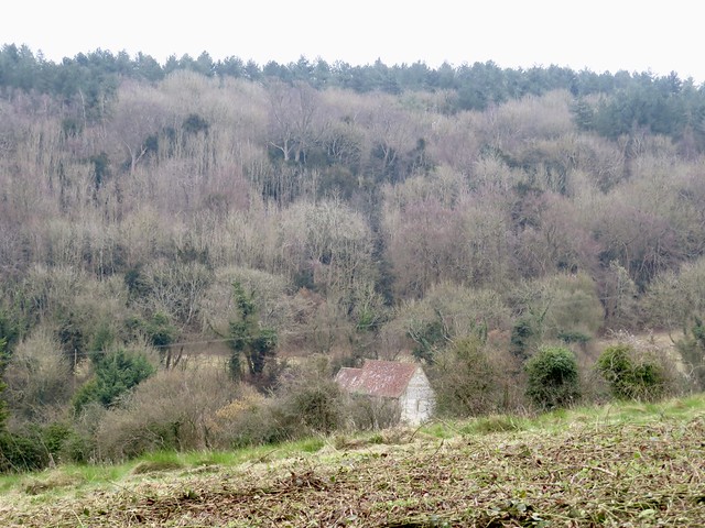
Strong morning sunlight threw into prominence the lumpy shapes of house foundations and sunken lanes, all that remains of the medieval village of Hill Deverill.

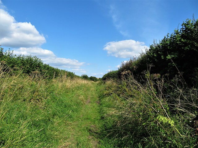
In the green lane that led west towards the Wiltshire downs, a bench had been placed in the shade of a field maple. ‘Bob Hembury,’ said the memorial plaque. ‘He loved to walk this lane every day with his dog’. A man and a place summed up with perfect simplicity.

At the roots of a coppiced hazel badgers had dug out the multiple entrances to their subterranean city, throwing back the pale chalky earth in showers as though miniature shells had exploded there.

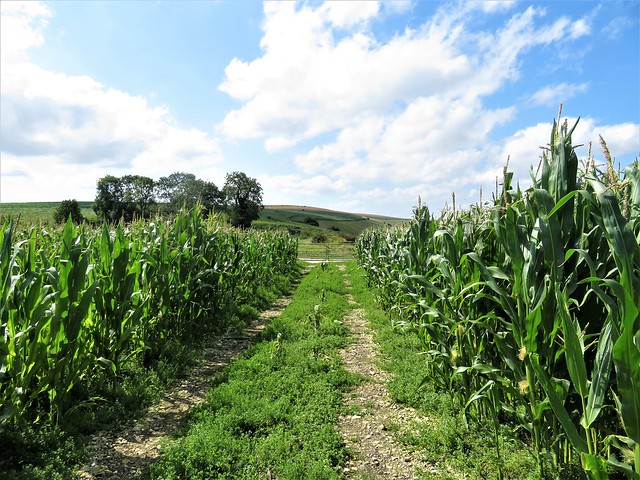
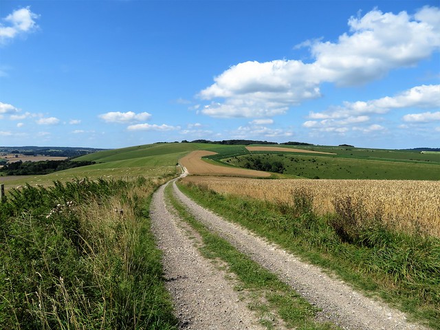
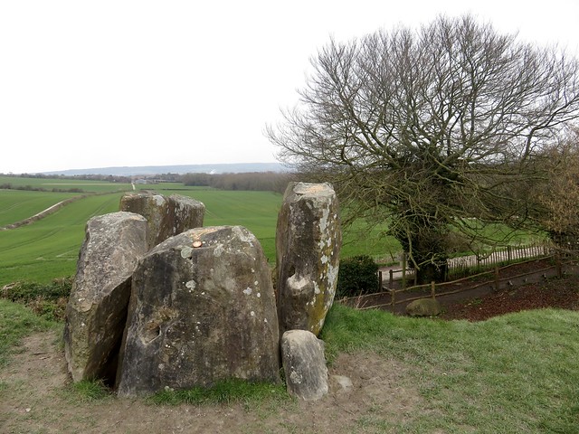
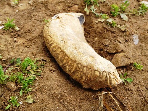
A side lane led up between wheat and barley fields onto the rolling back of Cold Kitchen Hill. In pre-Roman times it was Col Cruachan, the ‘wizard’s hill’, perhaps in deference to the spirits of the Neolithic long barrow that lies at the crest of the down. A wonderful bronze brooch was unearthed here, a rider on a capering horse, his clubbed hair bouncing behind him.

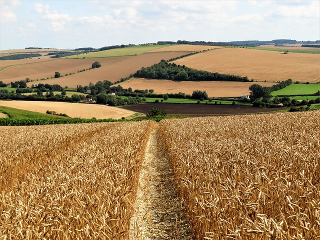
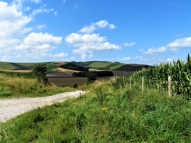
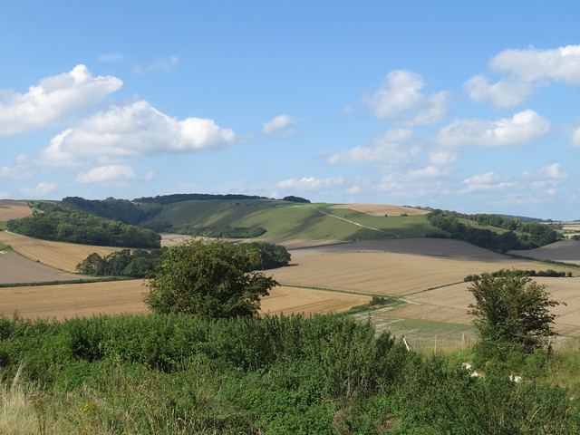
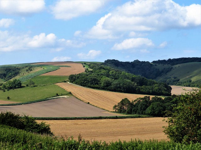
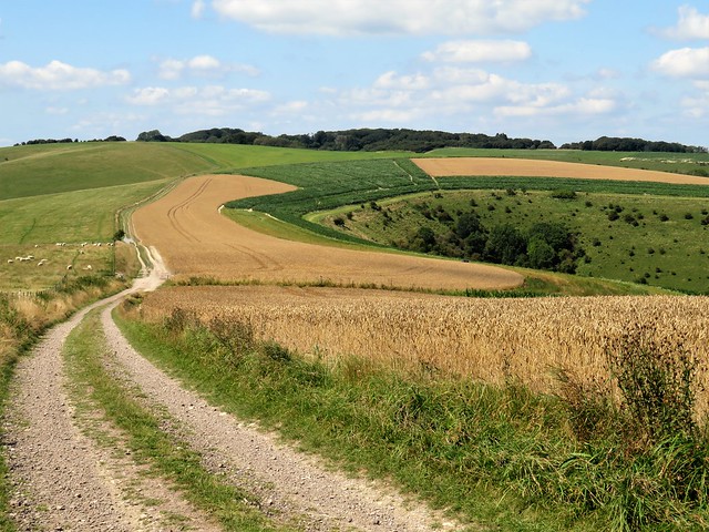
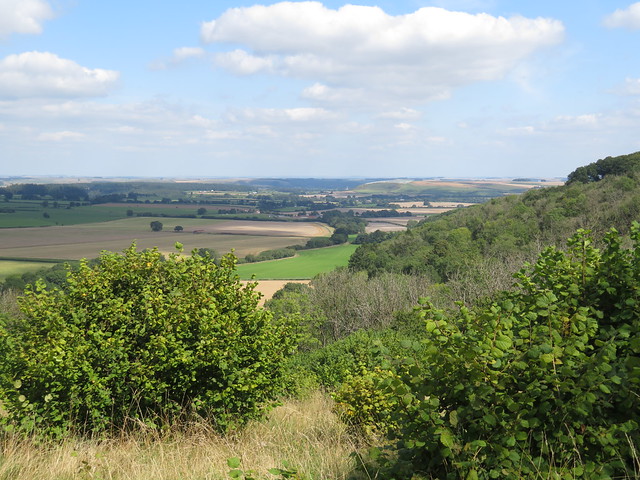
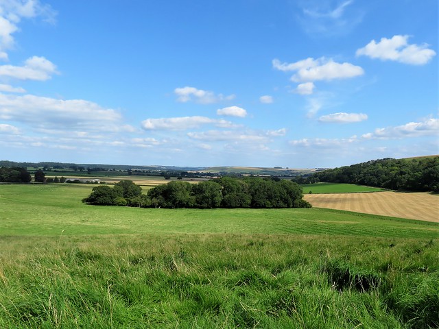
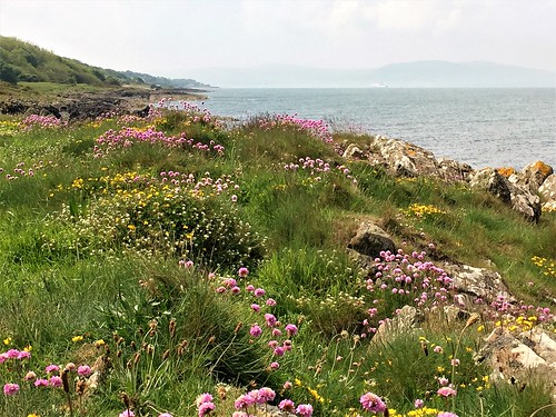
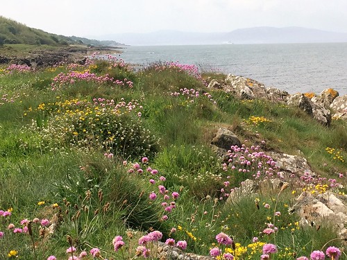
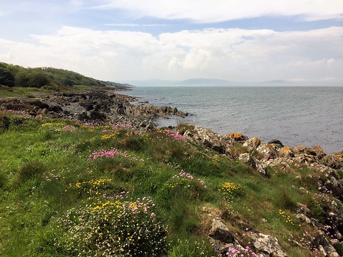
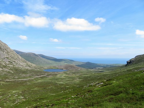
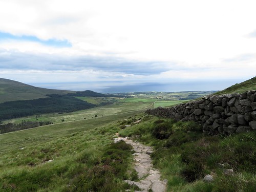
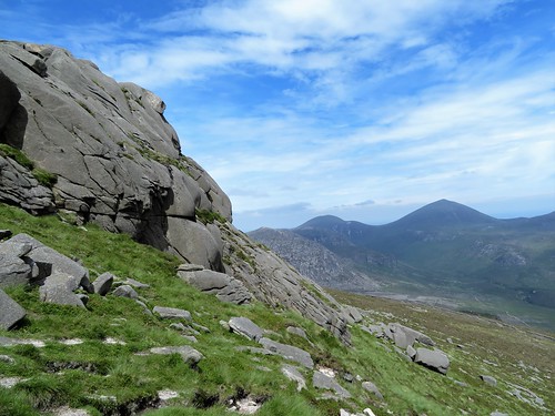
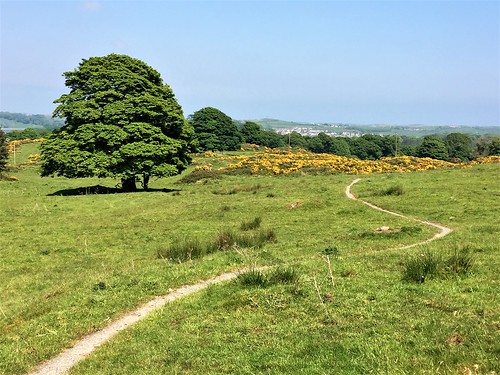
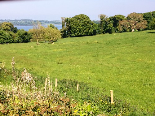
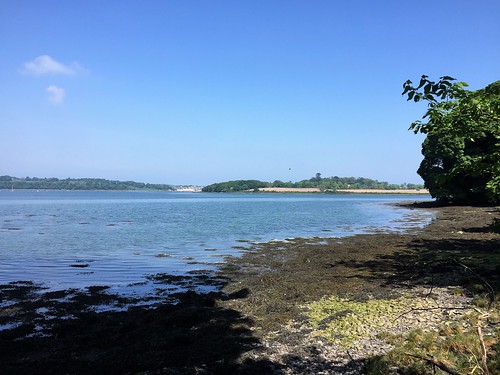
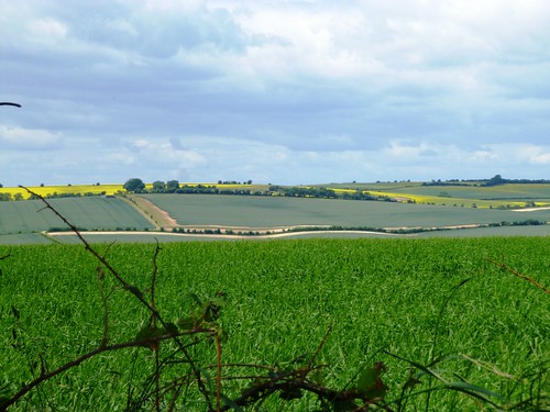
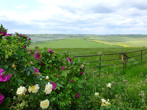
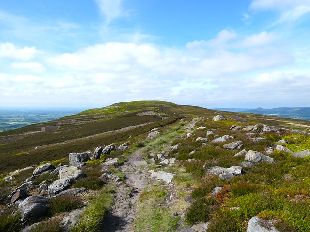
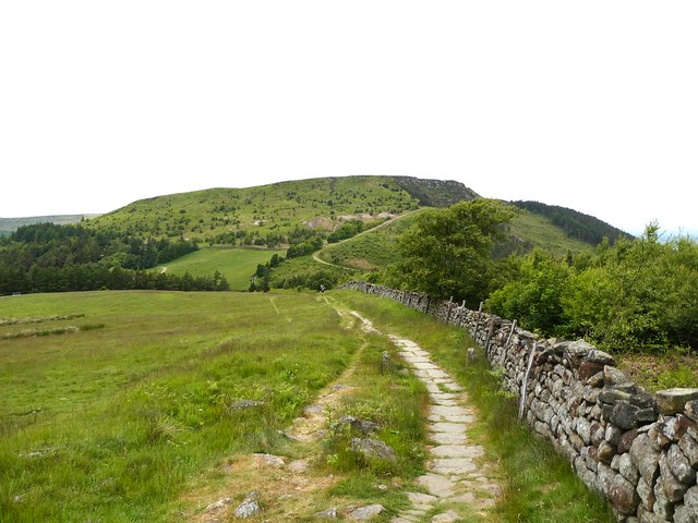
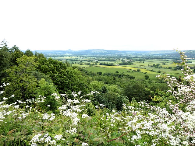
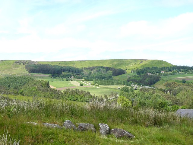
At the crest of Cold Kitchen Hill a magnificent view unfolded, a great semi-circle of undulating downs patterned in green, tan and grey, folding in steep hollows to the level farmland below. The ridge track ran west, a white streak ribboning away through dull gold wheatfields past the iron cresset of a Jubilee beacon, with King Alfred’s Tower at Stourhead a pointed finger raised on the distant skyline.

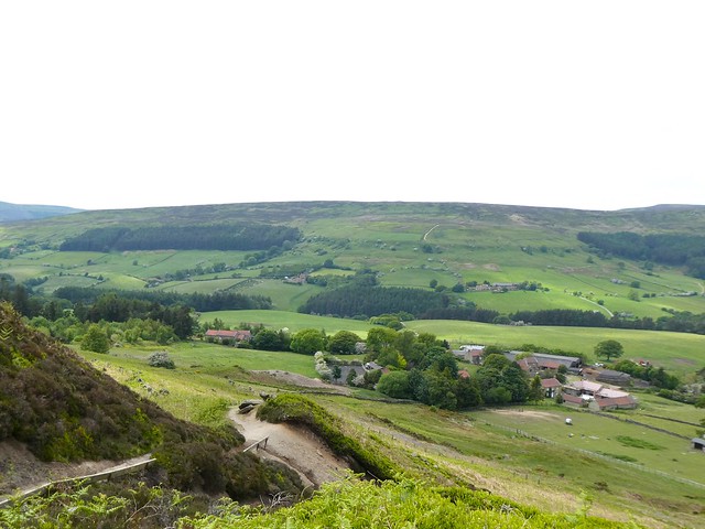
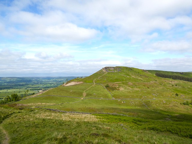
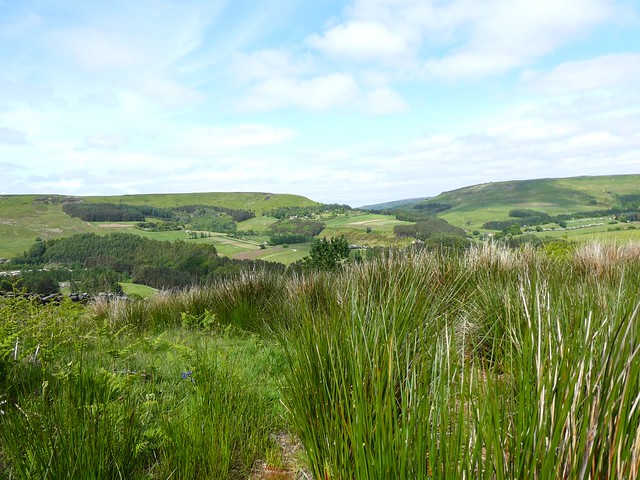
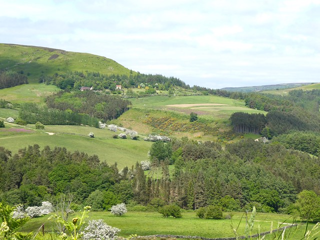
Steep-sided Bushcombe Bottom sank out of view, a green basin down whose flanks the bushes and trees appeared to be sliding towards an invisible plughole. We followed the track through grasses awash with the pale purple fronds of bartsia, looking down into the horseshoe of Woodcombe Bottom three hundred feet below.

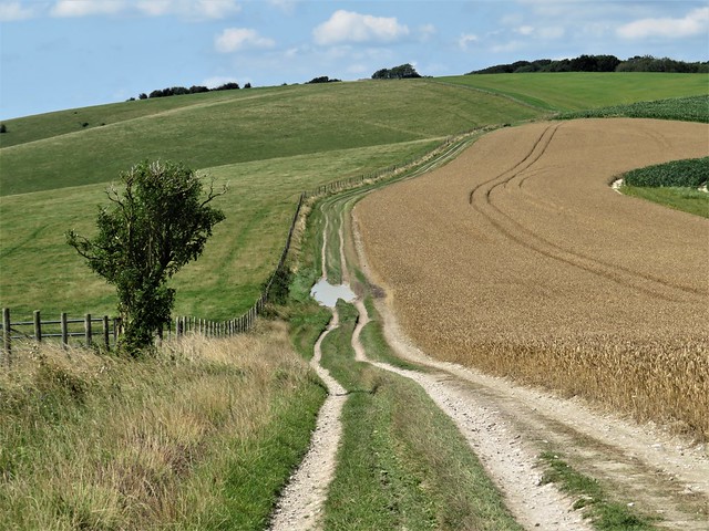
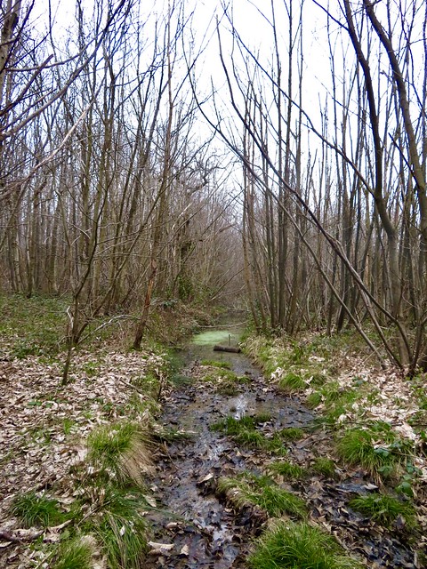
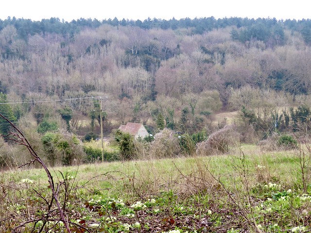
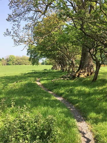
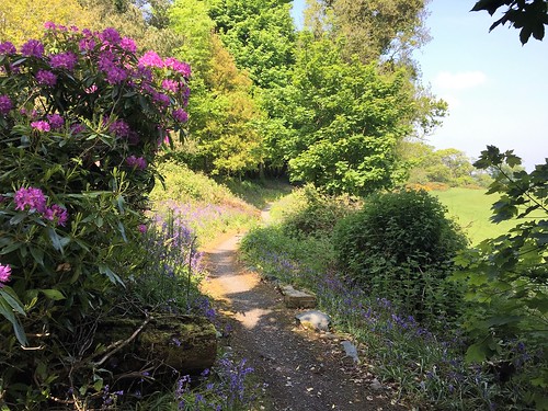
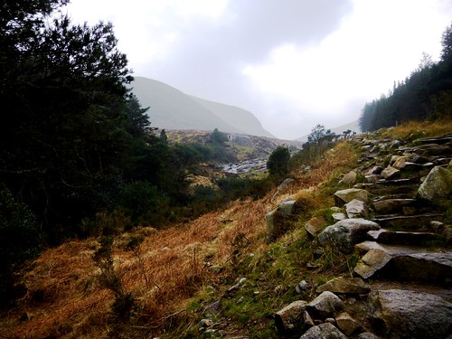
Down through a nameless wood of old oak and beech, its floor thick with the dried-up seed heads of last spring’s bluebells, and out at the bottom to turn along the homeward track at the foot of the downs.

In a grassy meadow by the path a rough square block of stone carried the names and dates of Joan and Bernard Russell. No other clues about them, but they, like Bob Hembury and his dog, must have loved this beautiful corner of countryside.

How hard is it? 6¾ miles; easy; green lanes, downland tracks, muddy in parts.

Start: George Inn, Longbridge Deverill, Warminster BA12 7DG (OS ref ST 869408). Please ask parking permission, and give them your custom.

Getting there: Bus 57 (Warminster-Mere)
Road: Longbridge Deverill is on A350 (Warminster-Shaftesbury)

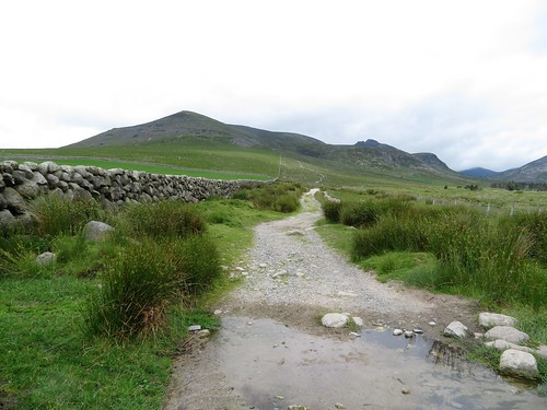
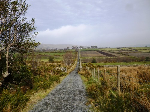
Walk (OS Explorer 143): Right along A350, in 100m, right (‘The Deverills’). In 500m, past ‘Stonewold’, right (868403, fingerpost/FP) up field. At top, 2 opposing gates (865404); through right-hand gate along lane. In 700m at crossroads, left (859402, ‘Restricted Byway’, bridleway FP) up hedged lane. In ½ mile, right through gate (860395); in 100m, over rusted-up gate; fork left (ignore ‘Permissive Path’) up to gate (858395, yellow arrow). Up field to FP (858394); on past tree clump. In 300m, successive gates (854391, FP); on past barrow mound (847383), Cold Kitchen Hill trig pillar (846382) and beacon cresset (841391). In another 900m on Whitecliff Down, keep ahead (834386), following fence on left. In ½ mile, track curves sharp right away from fence (827389), round top of Woodcombe Wood. In 250m fork left (828391, gate, FP, ‘Mid Wilts Way) through trees. At bottom of slope, through gate (828399); right (orange arrow, ‘Byway’) along path/lane at foot of downs for 3¼ miles back to Hill Deverill, then Longbridge Deverill.

Lunch/Accommodation: George Inn, Longbridge Deverill (01985-840396, the-georgeinn.co.uk)

Info: visitwiltshire.co.uk

 Posted by at 02:05
Mar 122022


First published in: The Times Click here to view a map for this walk in a new window
Stones of Coldrum Long Barrow Boggy course of the old Pilgrim's Way ancient yew overhangs the Pilgrim's Way 1,000-year-old Church of Our Lady of the Meadows, remnant of depopulated village of Dode bare ploughland along the Weald Way primrose path above the 1,000-year-old Church of Our Lady of the Meadows Horses at Great Buckland Farm, shaggy for winter chanting at the Coldrum Stones Daphne laurel, spurge laurel, in White Horse Wood

A cold day over the North Downs of Kent at the cusp of the seasons, with winter proving reluctant to move over in favour of spring. Along the lane on Holly Hill snow drops still hunt their heads, grubby at the end stage of their flowering. But dog’s mercury had spread its green leaves and tiny blooms all over the floor of Greatpark Wood, and among the silver birch and pines we heard a familiar introit to spring, the tentative tsip-tsap, tsip-tsap of a newly arrived chiffchaff.

Sweet chestnut coppice forms a large part of these woods on the chalk and greensand escarpment, the long-unattended shoots grown house-high and as thick as individual tree trunks. The toothed spearblade leaves of last autumn, crisp and grey, shuffled underfoot as we dropped down to the valley road and hop fields at Great Buckland.

From the Weald Way path in Tranquil Wood we looked down on the red tiled roof and flint walls of the thousand-year-old Church of Our Lady of the Meadows. The village of Dode was depopulated and abandoned during the Black Death plague of 1349, but its humble little church still stands under the wooded hillside.

The Weald Way, doughy with dark mud, forged south through hazel and chestnut coppiced tangled with lianas like thickets in a fairy tale. Fat green buds were bursting from hawthorn twigs, and sheaves of green shoots showed where bluebells would soon be carpeting these woods.

At the southern edge of White Horse Wood we crossed the wet ditch of an ancient ridgeway and dipped sharply down the face of the escarpment among yew trees. At the foot of the slope ran another ancient route, the Pilgrim’s Way path that brought penitents and not-so-penitents (Chaucer’s adventurers among them) to the shrine of St Thomas Becket at Canterbury.

A pilgrim shrine that predates Becket’s by perhaps four thousand years stood on a knoll in the field beyond. The great uprights of Coldrum Long Barrow form the centrepiece of a circle of recumbent standing stones. Joss sticks were smouldering in the turf, and a pagan celebrant stood singing to the stones, a stick in either upraised hand.

We left her to her devotions and went quietly away to join the Pilgrim Way and the homeward path.

How hard is it? 7 miles; easy; one short climb with steps; muddy in woods.

Start: Holly Hill car park, Meopham, Gravesend DA13 0UB (TQ 670629). NB Closes at 5 pm.

Getting there: M20, Jct 3; A227 Gravesend road; car park signed from White Horse Road, 1 mile east of Vigo Village.

Walk (OS Explorer 148): From Holly Hill car park, left along road. Beyond Holly Hill House, fork right (670634) past metal barrier. In ⅔ mile, left (673643, blue arrow/BA). At road, right (670642); in 150m, left (670644, ‘Vigo, Harvel’). 150m past Great Buckland Farm, left (668641, ‘Tranquil Wood’, ‘Weald Way’/WW). In ⅔ mile, at gate on right (662634) don’t go right (WW), but keep ahead (WW, ‘BA NS 246’). At road, left (659632). In 350m, on right bend, left (658629, WW) along field edge, then follow YA 235. At road (656623) dogleg right/left (WW) into Whitehorse Wood. In ½ mile (654616), descend escarpment. At Pilgrim’s Way/North Down Way/NDW, right (653613); in 50m left (’Coldrum Long Barrow’). Follow path to Coldrum Long Barrow (654607). Return to NDW; right for 1½ miles to road (671624); ahead to car park.

Lunch: The Villager Inn, Vigo Village DA13 0TD (01732-822305, villagervigo.com)

Accommodation: Bull Hotel, Wrotham TN15 7RF (01732-789800, thebullhotel.com)

Info: Sevenoaks TIC (01732-450305)

 Posted by at 06:06
Jun 232018


First published in: The Times Click here to view a map for this walk in a new window
picture picture picture picture picture picture picture picture picture picture picture
Facebook Link:

The little train from Belfast came clacking into Cultra station, not more than five minutes late. On such a beautiful sunny morning as this, though, we didn’t give a hoot about the railway timetable.

At Carnalea we disembarked along with dozens of Sunday folk intent on walking, picnicking and just mucking about beside the sea on the outer shore of Belfast Lough. The coast of County Down is built up with leafy estates of fine houses hereabouts, but there was hardly a sign of them as we followed the North Down Coastal Path west towards Belfast.

The city lay hidden round the curve of the coast ahead, and a thick sea fret veiled the hills across the lough. Nearer at hand were rocky little bays floored with flat grey pebbles where we crunched across cockles and limpets and streamers of green and white seaweed. The coast path was busy with dog walkers, cyclists and earnest runners. A semicircle of rocks and pale gold sand enclosed Swineley Bay, where a black dog leaped joyfully in the shallows while another rolled and wriggled on its back in the bladderwrack with lolling tongue and grinning jaws, the very picture of abandon.

Most of the day visitors had congregated around Helen’s Bay, a good stretch of swimming beach. Here we watched three dark-haired sisters holding hands at the edge of the sea and jumping over each wave as it came ashore – an old-school image of seaside frolics from a railway poster. Families played cricket and shuttlecock on a sward spattered with daisies, and toddlers staggered about on the sands.

Beyond Grey Point the crowds thinned, and we had the coastal path almost to ourselves. Bird’s foot trefoil, scurvy grass, sea campion, scarlet pimpernel and thrift made a yellow, white, red and pink palette of the foreshore. A big Stena Line ferry slid free of the sea fret with a last moan of its foghorn. Within ten minutes the mist had dispersed, and we were staring across Belfast Lough at the grey block of Carrickfergus Castle and an undulating line of hills running south-west towards the city.

The gleaming black heads of two seals broke the surface of the lough. They touched their muzzles and rolled their gleaming bodies together in a private ecstasy. Rounding the last corner, we saw the cranes of Belfast’s docks ahead, and the sharply cut profiles of Divis Mountain and Cave Hill on guard above the city.
Start: Carnalea railway station, Bangor, Co. Down, BT19 1EZ (OS NI ref J 481823)

Finish: Cultra station, BT18 0BP (OS NI ref J 417805)

Getting there: Train from Belfast to Carnalea
Road: Cultra station and Ulster Folk & Transport Museum both signed from A2 Belfast-Bangor road.
Park at Transport Museum (NB: closes at 5 pm); signed footpath to Cultra station; train to Carnalea.

Walk (7 miles, easy, OS NI 1:50,000 Discoverer 15): From Carnalea station, right along lane; left down path between Springcarrie and Carnalea Golf Club; left/west along North Down Coastal Path/Ulster Way. In 6½ miles, at ‘Seafront Road’ sign on right where path joins road (413802), turn left uphill. At junction, left up Circular Road East to Cultra Station.

Lunch: Cultra Inn, next to Cultra station (028-9042-1066, hastingshotels.com)

Accommodation: Clayton Hotel, 22 Ormeau Avenue, Belfast BT2 8HS (028-9032-8511, claytonhotelbelfast.com) – large, comfortable city centre hotel.

Info: Bangor TIC (028-9127-0069)

discovernorthernireland.com; walkni.com; satmap.com

The Times Britain’s Best Walks by Christopher Somerville (£16.99, HarperCollins) is now out in paperback

 Posted by at 01:55
Mar 172018


First published in: The Times Click here to view a map for this walk in a new window
picture picture picture picture picture picture picture picture picture picture picture picture picture picture picture picture
Facebook Link:

A cool, blowy morning on the coast of County Down, with the clouds rolling back off the Mourne Mountains and skylarks beginning to sing out their claims to territory in the stony fields at the feet of Slieve Binnian. From an ancient droving route in the Annalong Valley, bounded by walls of giant granite stones, we looked up to see Binnian’s rocky head outlined against a dark sky.

The old track forged north to its crossing place through the granite barrier of the Mourne Wall. The local men who built this great 22-mile ring early last century around the catchment area of the Mourne reservoirs certainly knew their business. The Mourne Wall hurdles the highest mountain tops as though they are of no account. Today it made a fine trustworthy companion as we turned west and followed it up the mountainside.

The climb soon steepened, and there were plenty of pauses to look back around the bowl of hills that centres on rocky-faced Slievelamagan and the tall cone of Slieve Donard, daddy of the Mourne range at 853m.

Up ahead a line of granite tors crowned Slieve Binnian’s ridge, black and jagged like the turrets of a bad man’s castle. ‘Bit windy up there,’ grinned a pair of girls leaping lightly down the rocks. They were right about that, but the view that burst on us from the top was worth climbing the tors for – the long steel-blue triangle of Silent Valley reservoir two thousand feet below, the coires* of Slieve Muck beyond, and in the distance the hills of the Cooley Peninsula and the broad spread of Dublin Bay towards the distant Wicklow Mountains.

A path of skiddy granite rubble led us north past the Back Castles, wind-smoothed tors of elephantine grey, to drop steeply down to a saddle of ground under Slievelamagan. A last look across Ben Crom reservoir’s dark waters, northwards to the steeples of rock that crown Slieve Bernagh. Then we followed the rubbly old drove road back down the Annalong Valley, past the shores of Blue Lough where whitecaps ruffled the water, on down to Carrick Cottage Café and a thoroughly earned pot of tea to toast St Patrick’s Day.

* Sub-editor: coire = Irish term for the Scottish ‘corrie’ – bowl-shaped hollow in a mountainside

Start: Carrick Little car park, Head Road, near Annalong, BT34 4RW approx. (OS ref 345259)

Getting there: Bus – Mournes Shuttle Service (peter.magowan@hotmail.co.uk, 07516-4712076).
Road – Moneydarragh Road, then Oldtown Road from Annalong (on A2 Newcastle-Kilkeel road)

Walk (7 miles, strenuous, OSN1 1:25,000 Activity Map ‘The Mournes’): From car park, left up stony lane. In 900m go through gate (345228); in 300m fork left and climb path with Mourne Wall on left, soon steepening. Near top, pass (but don’t cross) ladder stile on left at wall; aim a little right between two tors to reach ridge (321235) and Slieve Binnian summit. Right on ridge path past the Back Castles for ¾ mile to pass to left of North Tor (319246). Path descends, soon steeply, for ⅔ mile to path crossing on saddle between North Tor and Slievelamagan (321256). Right on rubbly path for 3¼ miles, passing Blue Lough, then along right side of Annalong Wood, back to car park.

Conditions: Mountain walk – dress appropriately. Steep, rough ascent to Slieve Binnian. Ridge path, descent and valley track are stony and slippery. Watch your step!

Tea: Carrick Cottage Café, near car park (07595-929-307)

Dinner: Brunels Restaurant, Newcastle (028-4372-3951, brunelsrestaurant.co.uk)

Accommodation: Slieve Donard Resort, Downs Road, Newcastle BT33 0AH (028-4372-1066, hastingshotels.com/slieve-donard-resort-and-spa)

Info: Newcastle TIC (028-4372-2222, mourne-mountains.com)

walkni.com; visitmournemountains.co.uk; www.discovernorthernireland.com

 Posted by at 01:29
Jun 032017


First published in: The Times Click here to view a map for this walk in a new window
picture picture picture picture picture picture picture picture picture picture picture
Facebook Link:

When the Ward family from Cheshire bought an estate on Strangford Lough in 1570, Ireland was a rough and dangerous place for English settlers. The fortified tower the newcomers built and named after themselves, Castle Ward, was fit for the times. But the house that their descendant Bernard Ward built two centuries later in his beautifully landscaped park was a luxury home, better suited to easier times.

Bernard and his wife Anne could not agree on an architectural style, so they settled for a pragmatic, his-and-hers solution – the south frontage conforming to Bernard’s severely classical design, the north half that faced onto Strangford Lough in Anne’s exuberant Strawberry Hill-inspired Gothic. Inside, the décor carries on the inharmonious theme: Bernard’s rooms are of plain and perfect proportion, Anne’s a riot of onion-dome plasterwork ceilings and Turkish windows.

The National Trust have laid out several colour-coded and waymarked trails through the Castle Ward woods and parkland, and we chose the Boundary Trail that skirts the demesne. There was a bizarre start to the walk, as a silhouette familiar from TV hove in view – the grim stronghold tower of Winterfell, ancestral hall of the Stark clan from Game of Thrones. Remembered as a blackened and smoking ruin full of corpses, there was a curious frisson in finding the real thing standing tall and unblemished – the original fortified tower of the Wards, commanding a really superb prospect of the silky blue waters of Strangford Lough.

Beyond the forbidding old tower the trail led away north along the lough shore, where green and orange seaweed wafted a pungent iodine whiff across the path. An old crowstepped boathouse stood out in the water on a low promontory. Across the inlet the harbour town of Portaferry lay under its hummock of a hill, guarding the narrows where Strangford Lough’s tidal waters meet the sea.

Soon we turned our backs on the lough and followed the path under a clearing sky through sycamore and oak woods carpeted thickly with bluebells. The green parkland of Castle Ward lay in sunshine, gleaming with gorse bushes and buttercup drifts. Coot chicks meandered across a rushy pond, their fuzzy scarlet heads frantically bobbing. Goldcrests twittered sweetly high in the treetops of Mallard Plantation, where bell-like white flowers of wood sorrel still nodded among their trefoil leaves.

From a viewpoint on the demesne wall we looked out west across gold and green lowlands to where Slieve Croob and the neighbouring Mourne Mountains stood veiled in warm grey haze. Then we turned back towards Castle Ward through quiet pastures where the cows and calves gazed stolidly at us before resuming their steady munching.

Start: Castle Ward car park, near Strangford, Co. Down BT30 7LS (OSNI ref J572493) – moderate charge, NT members free

Getting there: Castle Ward is signed off A25, 1½ miles west of Strangford

Walk (8 miles, easy, OSNI 1:50,000 Discoverer 21; Castle Ward Trails map available from Visitor Centre; online map, more walks at christophersomerville.co.uk): From main car park, right towards Visitor Centre. Before archway, take path on left (‘Trails, Winterfell’). Follow ‘Winterfell’ to Old Tower and gateway beyond. Left along shore, and follow ‘Boundary Trail’ and red arrow waymarks for 8 miles, back to car park.

Conditions: Very well waymarked throughout. Path is shared with cyclists. No dogs between March and October (livestock in fields).

Lunch/tea: Castle Ward teashop

Accommodation: The Cuan, Strangford BT30 7ND (028-4488-1222, thecuan.com) – friendly, family-run hotel

Castle Ward (National Trust): 028-4488-1204, nationaltrust.org.uk/castle-ward

Info: Downpatrick TIC (028-4461-2233); discovernorthernireland.com

satmap.com, walkni.com

The January Man – A Year of Walking Britain by Christopher Somerville (Doubleday, £14.99).

 Posted by at 01:56
Nov 152014


First published in: The Times Click here to view a map for this walk in a new window
picture picture picture picture picture picture picture picture
Facebook Link:
The shapely hummocks of the Mourne Mountains stood muted and insubstantial under a cloud-blotched sky and a pale sun. Wrens sang in the flowering gorse bushes along the lane from Meelmore Lodge. The western face of the Mournes rose before us, the jagged profile of Slieve Meelmore and the rounder bulk of Slievenaglogh framing the hollow where the Trassey Track snaked in its long climb to the Hare’s Gap. Generations of quarrymen forged the track and its tributary paths to the granite quarries that floored and walled the industrial north of England in the 19th century.

The zigzag path rose steeply to where the flat saddle of the Hare’s Gap was seamed by the long dark line of the Mourne Wall. This remarkable construction of roughly squared granite blocks, built by hungry men in the early 20th century to earn themselves a crust, circles the high top of the Mourne Mountains for 22 miles, swooping up and down all the major peaks. Once across the wall we got a breathtaking prospect of the heart of the range, from the castellated crags of Slieve Bearnagh and the knobbed peak of Ben Crom overhanging its namesake reservoir to the long graceful nape of Slieve Donard, tallest of all.

Smugglers, ne’er-do-wells and travellers in a hurry used to cut across the high Mournes from the sea by way of a rough path known as the Brandy Pad. We followed it towards Slieve Donard along the slopes of Slieve Commedagh, through a high bleak landscape where meadow pipits fluttered and cheeped, and a solitary raven croaked a warning ark-ark-ark-ark to his mate invisible among the rocks.

Clouds built and melted, rain spat and subsided, and Slieve Donard pulled a shawl of thick mist over her head. Under the mountain we recrossed the Mourne Wall and went stumbling and splashing down towards Newcastle in the company of the Glen River, a noisy little chute of rapids and cascades. A walk in a Mourne heaven – nothing soft or accommodating about it, everything stark, hard and beautifully wild.

Start: Meelmore Lodge, Trassey Road, near Bryansford, Co Down, BT33 0QB (OSNI ref SB 305307).

Getting there: Mourne Rambler bus service in the summer (mourne-mountains.com).
Meelmore Lodge is signed off B180 Newcastle-Hilltown road. Car park: £4/day (coins)

Walk (7 miles, moderate/strenuous, OSNI 1:25,000 Activity Map ‘The Mournes’. NB: online map, more walks at christophersomerville.co.uk): From car park, left up stony lane (‘Mountain Walk’ sign on wall). Through right-hand of 2 gates; follow lane to cross field wall (308302). Left (‘Mourne Way’) for 500m; right up stony Trassey Track. In 1 mile track crosses river and bears right; but keep ahead here, steeply up to cross Mourne Wall at Hare’s Gap (323287). Left at cairn along Brandy Pad path for 1½ miles to cairn on saddle between Slieve Commedagh and Slieve Beg (342278). Bear left at cairn, under The Castles crags. At end of crags (348277), fork left, up to cross Mourne Wall (350279). Descend beside Glen River. In 1½ miles, pass Ice House (364295). In 200m at dirt road/concrete bridge, descend left bank of river. In 400m, right across bridge (379299); descend right bank. In 350m, left across Donard Bridge (372302). Descend left bank; through Donard Park into Newcastle.

Conditions: Some steep parts; slippery underfoot in woods. Walking stick advisable. Dogs on leads.

Refreshments: Meelmore Lodge café (028-4372-5949); Villa Vinci, Newcastle (028-4372-3080).

Accommodation: Slieve Donard Hotel, Newcastle BT33 0AH (028-4372-1066; hastingshotels.com); Meelmore Lodge hostel/camping, 52a Trassey Road, Bryansford BT33 0QB (028-4372-6657; meelmorelodge.co.uk)

Information: Newcastle TIC (028-4372-2222); walkni.com; discovernorthernireland.com; walksireland.com;

 Posted by at 01:33
Feb 012014
 

The Norman invasion of 1066 must have been a devastating blow to the Saxon landowner who lent his name to today’s downland village of East Garston. First published in: The Times Click here to view a map for this walk in a new window
picture picture picture picture picture picture picture picture
Facebook Link:
Not only was Asgar – ‘Spear of God’ – severely wounded at the Battle of Hastings; he also lost his extensive estates on the Berkshire downs and his prestigious position as procurer of horses for King Harold, slain in the battle.

Asgar’s tradition, though, lives on hereabouts. These wide, rolling downs with their lush grass are still prime horse-training country. Strangely enough, though jumps and grass courses and railed gallops seemed everywhere, we saw not one actual horse all day as we tramped the downland tracks. Maybe they were indoors, taking it easy or in light training for the Cheltenham Gold Cup.

The first creature we saw was more exotic and certainly more unexpected than any horse – a marsh harrier, dark and enormous against the cloudy sky, balancing on long-wings as it quartered the Lambourn valley looking for unwary mice. Two red kites wheeled not far away, forked tails spread on the wind. When we were able to tear our gaze away from these dramatic sailors of the sky, it was to find ourselves in a dappling landscape of valleys whose farmhouses lay sunk in shelter trees among fields crisp with stubbles.

From Maidencourt Farm a gravelly track rose between thick hedges, climbing the face of the downs before dipping over to run down through the meadows to Whatcombe. A few humps and hollows showed where a medieval village had stood close to Whatcombe monastery, before history cleared both away. Now a beautifully-appointed stables stands in the hidden valley – stalls, barns, sheds and a great covered exercise ring.

Beyond Whatcombe it was ploughland and big skies all the way to South Fawley, another famous racing establishment. We went west under gently stirring shawls of cloud, ambling along a quiet road to nowhere. On Washmore Hill there was time to picnic and watch a sparrow pretending to be a stone in the furrows, so well camouflaged it was hard to distinguish bird from soil. Then we headed for home, south across a grassy gallop and down past lonely Winterdown Barn in its roadless hollow, down to the old thatched and timbered cottages of Asgar’s settlement once more.

Start: Queen’s Arms, East Garston, Berks, RG17 7ET (OS ref SU 366764)

Getting there: Bus service 4 (newburyanddistrict.co.uk), Newbury-Swindon
Road – M4 Jct 14, A338 to Great Shefford, left (‘Lambourn’) to East Garston.

Walk (8½ miles, easy/moderate, OS Explorer 158 and170): From Queen’s Arms, left along road, first left into East Garston, cross River Lambourn, and turn right along Lambourn Valley Way (fingerpost). In 50m, left up fence (368765) and follow ‘Permitted Path, Shefford’. At Maidencourt Farm (373761), left up stony track for 1 mile. Just beyond Furze Border thicket, fork right (376777, fingerpost) for three quarters of a mile to signal mast on Kite Hill. Ahead through hedge (388783, fingerpost); follow BAs for ½ mile down to Whatcombe (393789).

Right (BA) for 150m. Just past house, left before horseshoe-shaped pond (394789) up hedge. Left at top of garden (yellow arrow/YA); right up path in hedge (YA) and on with hedge on right. Nearing South Fawley, cross 2 paddocks (391799, stiles, YAs); cross stile on right into lane; left to T-junction (390802). Left (‘Eastbury, Warren Farm’) on tarmac lane, then stony track for 1½ miles to junction of tracks on Washmore Hill (367804). Pass a line of conifers on your right; just before a waymark pole on left, turn left along the side of a thicket.

In 700m, at T-junction of tracks (366797, ‘Restricted Byway’), turn left for 30m; then right on grassy path/track with bank and gallops on your left. In ⅓ mile, track bends right; in 150m, go left (363792, fingerpost) across field. Pass through wooden fence (364790, YA); keep same line ahead, crossing gallop (365788 – take care!) and grassland, aiming for left-hand of three trees on skyline. Recross gallop (366784 – take care!); descend to fingerpost (365783). Down across field, then through grassland down to track (365778). Left into East Garston. Just before first buildings, left (363772, fingerpost). At field end, right (365771, fingerpost) down fenced path to road. Left into village.

Conditions: Please look out and take care crossing gallops!

Lunch/Accommodation: Queen’s Arms Hotel, East Garston, Berks RG17 7EE (01488-648757, queensarmshotel.co.uk).

www.ramblers.org.uk www.satmap.com www.LogMyTrip.co.uk visitengland.com

 Posted by at 01:28
Jun 232012
 

A beautiful day of blue sky and cold wind over County Down. ‘OK, what we’ll do,’ offered Fiona Mullan of Mountain Sojourns, ‘is head up Doan.
First published in: The Times Click here to view a map for this walk in a new window
picture picture picture picture picture picture picture picture
Facebook Link:
That’s a good wee scramble, and it’s right in the heart of the Mournes so there’s brilliant views of all the main peaks.’
The Mournes are manageable mountains; they extend an invitation rather than a threat. We were lucky to have Fiona as a companion. She’s been in outdoor activities all her life, she’s cheerful and funny, and she knows these famous but under-walked mountains as well as anyone.
The stone-rubbled path led gently up a slope of short grass spattered with heath bedstraw, heading for the Mourne Wall, a 22-mile long monument to the hungry men of the 1900s. They built it across the main summit to demarcate the Mourne catchment area, and it stands as a guide for anyone roaming here. At the Wall stile we stopped to stare over the crescent of Lough Shannagh lying low, the long back of Slieve Binnian looming over Silent Valley Reservoir, the ragged granite castle of Bearnagh’s summit, and mighty Donard in the east with a pimple of cairn on top, looking out on a broad sweep of sea. In the foreground rose the horse’s neck and craggy head of Doan, our aiming point.
Down into the hollow of the hills, a slog among eroded peat hags and a climb up the nape of Doan. A scramble by boot and finger tip up a rough granite outcrop and we were sitting pretty with our sandwiches at the peak, absorbed in a great cartwheel panorama of mountains, lakes, sea and sky.
Back at the Mourne Wall once more and looking down on Lough Shannagh, we made out a slip of sandy beach and a pair of tiny figures swimming out from shore. ‘Hmm,’ said Jane, ‘I envy them. What a gorgeous place to cool off!’
Back beyond the Wall we struck up the broad green flank of Ott Mountain, walking the grass with a soft swish of boots. A trackless uphill pull under lark song up to the summit cairn, a heap of chunks of striped and contorted shale and quartz. A quick glance back to the rugged head of Doan, and we were bowling downhill on the homeward stretch.

Start & finish: Ott/Blue Quarry car park, Mourne Mountains (OSNI ref J280278).
Getting there: Bus – Mourne Rambler (http://www.mourne-mountains.com/mournes/information/), May-August
Road: A2 to Newcastle; A50 towards Castlewellan; left on B180 (‘Bryansford, Hilltown’). In 3 miles (5 km), left (‘Kilkeel, Silent Valley, The Rock’). In 3½ miles (5.5 km) park in Ott/Blue Quarry car park on right
Walk (5 miles, moderate/hard grade. OS of Ireland 1:50,000 Discovery Sheet 29; 1:25,000 Activity Map ‘The Mournes’): Cross road, over stile, follow stony path. In 200 m fork right, uphill to Mourne Wall in saddle on skyline (OS ref 290265). Stile across wall; left of 2 paths, aiming for Doan ahead. In ½ mile pass white stone heap; fork right into dip; up spine of Doan. At top, pass left of first craggy outcrop; bear right up to second outcrop. Keep to left side of it; scramble to top (302262). Return to Mourne Wall stile; recross; aim half left up rough ground to Ott Mountain summit cairn (284270); descend to car park.

Lunch: Picnic; or Meelmore Lodge, signposted off B180 (028-4372-5949; www.meelmorelodge.com)
More info: Newcastle Tourist Office (028-4372-2222); www.mournelive.com
www.discovernorthernireland.com

Subscriber Walks: Enjoy a country walk with our experts. Mourne Mountains, Co. Down, N. Ireland, 8 July. Email timespluspartners@newsint.co.uk to book. Tickets £10.
www.ramblers.org.uk www.satmap.com www.LogMyTrip.co.uk

 Posted by at 01:44
Jul 042009
 

First published in: The Times Click here to view a map for this walk in a new window
picture picture picture picture picture picture picture
Facebook Link:
Frederick Hervey, 4th Earl of Bristol, Bishop of Londonderry from 1768-1803, was a remarkably broad-minded man. In that intolerant era of Penal Laws against Catholics, the Bishop allowed the local priest to celebrate Mass in the Mussenden Temple, one of the follies he erected around his preposterously extravagant Downhill Estate on the cliffs outside Castlerock. Hervey was also fabulously red-blooded and eccentric, fond of his wine and the ladies, addicted to foreign travel and art collecting, apt to have himself borne around in a palanquin and to drop spaghetti on the heads of pilgrims passing below his balcony in Rome.

Jane and I entered Downhill on a brisk windy morning under the knowing grins of the ounces or mythic lynx-like beasts that guard the estate’s so-called ‘Lion Gate’. Beyond lay the Bishop’s enormous Palace of Downhill in poignant ruin, its grand fireplaces hollow and stark, its windows blank, state rooms carpeted with grass and open to the sky. In the heyday of Downhill this incredible centre of luxury high on the cliffs had an entrance facade flanked by Corinthian pilasters, with a double stair leading to the door. There was a State Dining Room, a State Drawing Room, and a two-storey gallery for the Bishop’s superb art collection, all covered by a magnificent dome. Facade and double stair still stand, but now the interior walls, once beautified with exquisite plasterwork, are sealed with functional Ministry-of-Works concrete, the elaborate mosaics are gone from the chimney breasts, and buttercups and clover have taken the place of Wilton and Axminster. It’s a strange, uncanny and altogether haunting atmosphere in the empty shell of the Palace of Downhill.

Down on the brink of the basalt cliffs beside the domed Mussenden Temple, we looked out on a most sensational view: the sea shallows creaming on seven clear miles of sand that ran west in a gentle curve towards the mouth of Lough Foyle, with the clouded hills of ‘dark Inishowen’ beckoning from far-off Donegal.

That proved a quite irresistible call. Down on the strand we pushed into the wind. Waves hissed on the tideline, sand particles scudded by. Surfers rode the waves like water demons. The black and green rampart of the cliffs was cut vertically by white strings of waterfalls, the falling cascades blown to rags in mid-plummet. All this vigour and movement whipped us onwards to where the preserved sand dunes of Umbra rose between strand and cliff foot. A complete change of tempo here, sheltered among the sandhills, down on our hands and knees among pyramidal orchids of blazing crimson, yellow kidney vetch, lady’s bedstraw sacred to the Virgin Mary, and tall spikes of common spotted orchids of such a seductive milky pink and blue it was all I could do not to take a surreptitious lick at them.

Lying prone in the dunes, looking back through a screen of marram grass and clovers, we saw the dark pepperpot shape of the temple on the brink of Downhill cliff. Had the bold Bishop of Londonderry kept a mistress in there, as stories say? I rather hope he had, and his palanquin and spaghetti-tureen, too.

Start & finish: Lion Gate car park, Downhill Estate, Castlerock BT51 4RP (OS of NI ref C 757357)

Getting there (www.nirailways.co.uk): rail to Castlerock (½ mile), Ulsterbus service 134. Road: On A2 between Castlerock and Downhill Strand

Walk (6 miles, easy grade, OS of NI Discoverer 04): From Lion Gate car park explore Walled Garden, then Downhill Palace ruin, then Mussenden Temple (758362). Return anti-clockwise along cliff. From Lion Gate cross A2 (take care!); right downhill beside road on pavement. Short stretch with no pavement leads to foot of hill. Right under railway; left along Downhill Strand. After 1 ¼ miles, where river leaves dunes, look left for Ulster Wildlife Trust’s Umbra Dunes notice (732359). Follow fence through dunes to descend on Benone Strand. Continue to Benone (717362 – lavatories, Visitor Centre, sometimes ice cream vans). Return along beach and A2 to Lion gate car park.

NB – Online map, more walks: www.christophersomerville.co.uk

Lunch: Pretty Crafty Studio (signed across A2 from Lion Gate) for a cuppa and cakes

Accommodation: Downhill Hostel (028-7084-9077; www.downhillhostel.com) at foot of hill – dormitory (from £12) or private (from £35 dble, £60 for 4 adults). Whole hostel bookable.

More info:

Downhill (NT): 028-2073-1582; www.nationaltrust.org.uk

Coleraine TIC: 028-7034-4723; www.discovernorthernireland.com

 Posted by at 00:00
Mar 232024


First published in: The Times Click here to view a map for this walk in a new window
on Cold Moor Urra Farm old mine tips above Urra Farm paved course of Cleveland Way from Carr Ridge looking across Vale of Mowbray to Roseberry Topping Wain Stones Looking towards Wain Stones from Garfit Gap looking towards Cold Moor from Urra 4 looking towards Cold Moor from Urra 3 looking towards Cold Moor from Urra 2 looking towards Cold Moor from Urra 1

Bikers were out for a burn-up on the bendy road to Stokesley. We soon left them behind as we climbed to Carr Ridge up the Cleveland Way. This long-distance path, paved and pitched with stone, loops round the outlying hills of the North York Moors with grandstand views all the way.

Up on top it was cold and cloudy over the moors. The sharp shark-fin of Roseberry Topping stood out to the north, its western face a concave scoop showing where half the hill had once slid away in a massive landslip.

The flat flagstones of the Cleveland Way carried us dry-shod over bog and slutch. The stone slabs had once floored textile mills, and were brought here after the factories closed – a fine example of recycling. Blackfaced sheep dashed away and drew up to swivel round and stare madly at us before resuming their precise, selective nibbling among the bracken and sedge.

A side path left the Cleveland Way and headed across the moor to where pale heaps of spoil marked the sites of long-abandoned jet and alum mines. We picked our way between them, dropping down the hillside towards the red roofs of the farming hamlet of Urra in broad green Bilsdale below.

Here the landscape changed to cattle pastures and plentiful trees. We followed field paths down and up again, heading out of the sheltered valley and up a gritty track towards the aptly named Cold Moor. It was exhilarating to stride the northward ridge with a sharp wind in the face and a good firm track underfoot.

Down in the pass of Garfit Gap we met the Cleveland Way again and turned east for the stepped climb up to the sandstone outcrop of the Wain Stones. Blackened and sculpted by weathering, they stood proud of the ridge end, their Easter Island profiles and tall faces packed tight in a jumble of rocks.

We sat on a fallen boulder and took in the view under a clearing sky. Skeletal cranes and smoking chimneys of Teesside, the great patchwork lowland of Mowbray Vale, a distant suggestion of the Pennine hills against the clouds in the southwest. And sailing high in the north the outline of Roseberry Topping once more, less of a shark fin from this perspective and more like a giant ploughshare abandoned on the ridge by some mythical tiller of the moors, perhaps one of the giants of the Wain Stones themselves.

How hard is it? 7 miles; moderate/strenuous; cobbled/paved moorland paths; a little scrambling at Wain Stones.

Start: Clay Bank car park, near Great Broughton (NZ 573035)

Getting there:
Road: Car park on B1257 between Great Broughton and Chop Gate

Walk (OS Explorer OL26): Left up road. In 200m pass ‘Bilsdale’ sign; left up stone flagged path (‘Cleveland Way’). Follow CW; at top of climb, fork right (579030, ‘Bridleway’). In ⅓ mile (occasional posts), path bears right across slab bridge (583021). In ½ mile right (576018, ‘Bridleway’) to road in Urra (572018). Right; in 100m, left (‘Urra Farm’); then stile (yellow arrow/YA), gate, stile; field path down to footbridge and road (564018). Dogleg right/left (stile); up bank to gate at Broadfield Farm (562019). Left (fingerpost, gate); right (fingerpost, wall gap); up field to gate (560019); up to track. Right; in 100m, left up steep path. Follow it for ⅔ mile to meet Cleveland Way at Garfit Gap (554034). Right up to Wain Stones (559035); round them or scramble up through them to flagged path; CW to road (513033). Left to car park.

Lunch/Accommodation: Wainstones Hotel, Great Broughton TS9 7EW (01642-712268, wainstoneshotel.co.uk)

Info: nationaltrail.co.uk; northyorkmoors.org.uk

 Posted by at 01:09